Embed Size (px)
Citation preview
OKLAHOMA WATER RESOURCES BOARD
REPORT OF 1980 ACTIVITIES
Publication 105 June 1981

2
Gary Glover, Photographer James Leewright, Designer Mary Whitlow, Editor
OKLAHOMA WATER RESOURCES BOARD
George Nigh, Governor
Gerald E. Borelli Earl Walker L. L. Males Chairman Vice Chairman Secretary Kingfisher Okemah Cheyenne
Ernest R. "Jack" Tucker R. G. Johnson Ralph G. McPherson Member Member Member Idabel Clinton Altus
Boyd Steveson John B. Jarboe James H. Norick Member Member Member Fort Gibson Tulsa Oklahoma City
James R. Barnett Executive Director
Michael R. Melton Assistant Director
R. Thomas Lay General Counsel
3
4
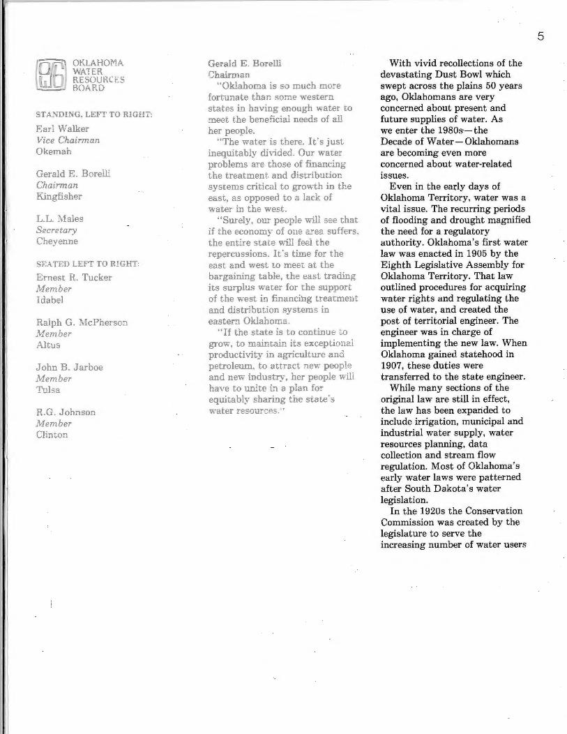
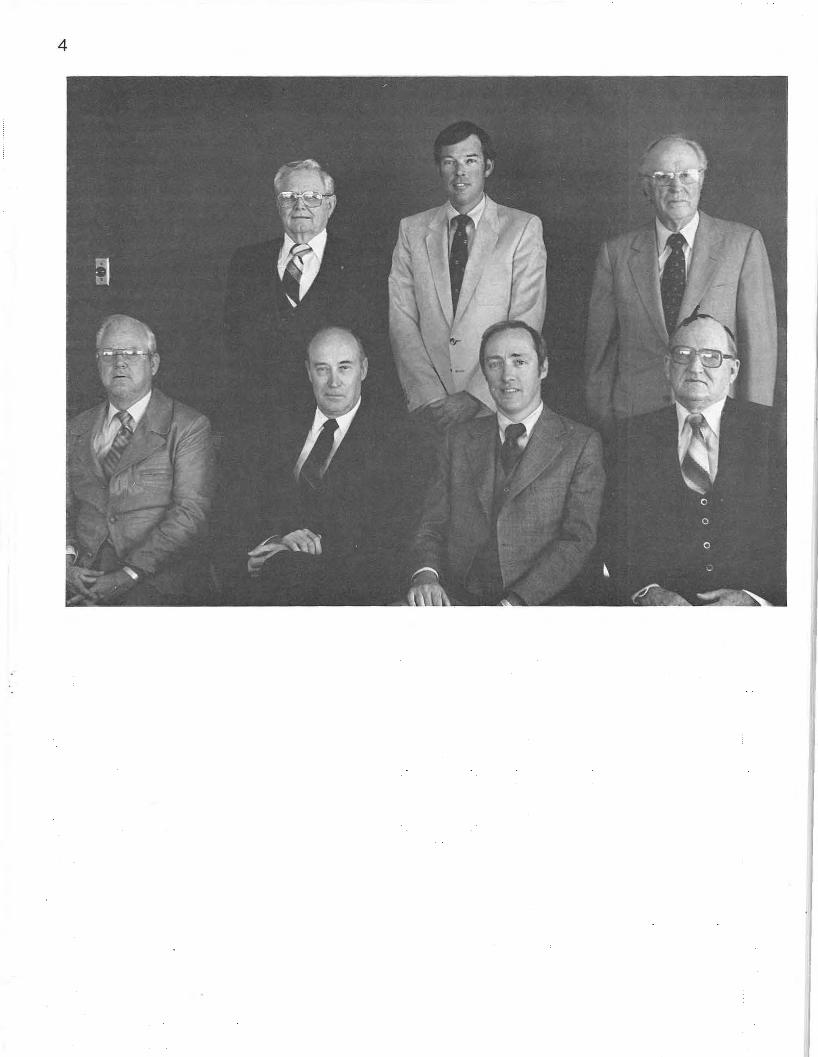
m OKLAHOMA WATER RESOURCES BOARD
STANDING, LEFT TO RIGHT:
Earl Walker Vice Chairman Okemah
Gerald E. Borelli Chairman Kingfisher
L.L. Males Secretary Cheyenne
SEATED LEFT TO RIGHT.
Emest R. Tucker Member Idabel
Ralph G. McPherson Member Altus
John B. Jarboe Member Tulsa
R.G. Johnson Member Clinton
Gerald E. Borelli Chairman
"Oklahoma is so much more fortunate than some western states in having enough water to meet the beneficial needs of all her people.
"The water is there. It's just inequitably divided. Our water problems are those of financing the treatment and distribution systems critical to growth in the east, as opposed to a lack of water in the west.
"Surely, our people will see that if the economy of one area suffers, the entire state will feel the repercussions. It's time for the east and west to meet at the bargaining table, the east trading its surplus water for the support of the west in financing treatment and distribution systems in eastern Oklahoma.
·'If the state is to continue ... grow, to maintain its exceptiona1
productivity in agriculture and petroleum, to attract new peopl" and new industry, her people w"' have to unite in a plan for equitably sharing the st.ate"s water resources.•·
With vivid recollections of the devastating Dust Bowl which swept across the plains 50 years ago, Oklahomans are very concerned about present and future supplies of water. As we enter the 1980s-- the Decade of Water - Oklahomans are becoming even more concerned about water-related issues.
Even in the early days of Oklahoma Territory, water was a vital issue. The recurring periods of flooding and drought magnified the need for a regulatory authority. Oklahoma's first water law was enacted in 1905 by the Eighth Legislative Assembly for Oklahoma Territory. That law outlined procedures for acquiring water rights and regulating the use of water, and created the post of territorial engineer. The engineer was in charge of implementing the new law. When Oklahoma gained statehood in 1907, these duties were transferred to the state engineer.
While many sections of the original law are still in effect, the law has been expanded to include irrigation, municipal and industrial water supply, water resources planning, data collection and stream flow regulation. Most of Oklahoma's early water laws were patterned after South Dakota's water legislation.
In the 1920s the Conservation Commission was created by the legislature to serve the increasing number of water users
5
6
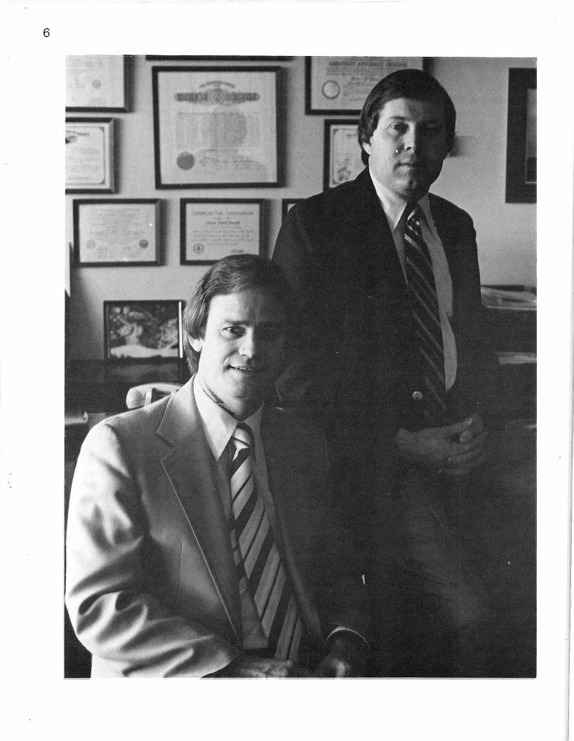
James R. Barnett Executive Director
"There's not a person at the Water Resources Board who does just one job. Everyone has had to tackle a job·and·a·half in order to remain responsive to the public and to accomplish all the new programs and expanded services madated by the Legislature and the Congress. .
"It's simply dedication to the mission of the agency that has allowed our people to achieve the results they have.
"Water is a bigger issue in Oklahoma and the nation than ever before. New awareness of the environment fosters countless new efforts in water quality protection and pollution abate· ment every day. A new attitude recognizing water as a priceless and finite natural resource demands accelerated planning and management strategies.
"At the same time, state financial restrictions, inflation and federal budget cuts tie our hands in accomplishing the increased workload. We continue to work toward our goals with the same number of people we had in 1974.
"It's frustrating. Our staff people are the best there are, but how can I ask them to do more than a job-and-a-half?"
and related problems. In the 1930s the Planning and Resources Board was formed. Water, parks ~nd forestry were included in the jurisdiction of this agency.
House Joint Resolution 520 in 1955 provided for a water study committee. The committee, comprised of legislators and citizens representing agriculture, industry, municipalities and recreation and wildlife, studied Oklahoma's water problems and recommended the establishment of a separate agency. Such an agency would be responsible for administering water rights, negotiating federal contracts and development of state and local projects to ensure the most effective use of Oklahoma's water resources.
The Twenty-Sixth Oklahoma Legislature, under Senate Bill 138, created the Oklahoma Water Resources Board in 1957. The bill declared that the Oklahoma Water Resources Board would include seven members, one from each of the six 1950 Congressional districts and one at-large member.
The statutes stated, "Each shall serve seven years, one appointed each year. The Board shall have represented on it a t least one member well versed in each of the following major types of water use: recreational, indust rial, municipal, agricultural and soil conservation work ... "
The Board's first meeting was held June 14, 1957. The original Board members were L.L. Males, Cheyenne; Dr. Lloyd E. Church,
Wilburton; Joe Sykora, Stroud; George R. Benz, Bartlesville; Glade R. Kirkpatrick, Tulsa; John R. Curry, Antlers, and Guy James, Oklahoma City. James served as first Board chairman.
In 1972, two additional at-large seats were added to the Board, bringing the total number to nine. Currently the Board is represented by one member from each of the six Congressional districts as they existed in 1957 and three members·at·large, equitably representing recreation, industry, agricultural, irrigation, municipal and soil conservation interests.
The first executive director of the Oklahoma Water Resources Board was Francis J . Borelli of Okarche. Borelli served from the Board's inception until1959.
Frank Raab assumed the directorship in September 1959, and held the post until1967. Raab was assistant director of the Planning and Resources Board, the predecessor to the Oklahoma Water Resources Board, from 1955 to 1957.
Forrest Nelson served as acting executive director and executive director from 1968 until his retirement in 1976. He had previously served as assistant director since 1957.
J ames R. Barnet t is currently executive director of the Oklahoma Water Resources Board.
7
8
li Epie p 'onist
I enjoy bem the fir t voice t people hear hen hey call Oklahoma Wa r Re ources rd. I ry very har to I our
I r he r my nule and to dir ct e>v ery call r to the person who can answer lus question or help with a problem.
' In a state agency it's very impor ant to let every member of
public who call or comes to office know h t we re king very hard to represent
him f rrly in conducting the water bu mess of the state.
'I like to greet visitors in the OWRB reception area with the
e friendlines I'd receive them n y own home.
I en1oy being 'on the front hne t.t the Oklahoma Water Re ources Board '
The present Board members and the area of interest each represents are Gerald E. Borelli, agriculture; Earl Walker, municipal; L.L. Males, soil conservation; Ernest R. Tucker, industry; R.G. Johnson, irrigation; Ralph G. McPherson, industry; Boyd Steveson, recreation; John B. Jarboe, agriculture, and James H. Norick, municipal.
Gerald Borelli is the current Board chairman and is the nephew of the first executive director of the Oklahoma Water Resources Board, Francis Borelli.
The Oklahoma Water Resources Board functions with two complementary parts. The 9-member Board sets the policy and acts as the final authority for the agency, while the staff carries out the day-to-day business of maintaining and protecting the state's water supplies.
Within the agency, five specialized Divisions- Ground Water, Stream Water, Water Quality, Engineering and Planning and Development-plus an administrative section, conduct the state's water business under the supervision of an executive director, assistant director and five division chiefs.
The mission of the Oklahoma Water Resources Board is to: -Establish and promote water quality standards, and to
classify the waters according to their best present and future use. - Inspect dams to insure their safety and to require correction of any deficiencies. -Record and administer stream water and ground water rights. -Make hydrologic surveys and investigations of stream systems and ground water basins. -Compile all available water resources data. -Negotiate agreements with the federal government for water resources development and for the storage and distribution of water. -Develop statewide and local plans for the most effective use and control of water. -Coordinate its activities with all other agencies in the use and development of water resources. -Administer the Weather Modification Act. -License water well drillers. -Participate in the negotiation of interstate stream compacts and their administration. -Coordinate the Federal Flood Insurance Program in Oklahoma. -Prepare and update the Oklahoma Comprehensive Water Plan, which was published in 1980.
9
10
Joan Wilkerson Administrative Assistant to the Board's Legal Counsel
"It's interesting to trace the origin of our water law. For instance, Oklahoma probably has the California Gold Rush to thank for the appropriative water laws still recognized in principle by Oklahoma statutes 131 years later.
"The exhuberant cry of 'Gold!' at Sutter's Mill rang through the hills and valleys of California, its seductive call luring thousands of prospectors. To create order from the chaos in the ungoverned public domain, the miners adopted rules to resolve competing mining claims and rights to the use of water for washing the gold from the graveL
"Under these rules, the discoverer of the mine was protected against claim jumpers, with the first user of the water being protected against later takers. Since there were no precedents, the rough-and-tumble customs of the miners became firmly fixed in the law of the west.
"Whert the 'gold fever' cooled and the rich lodes dwindled, many stayed on to farm, expanding the useful appropriative doctrine to protect the first settler's right to use water for farming his lar.d."
In conducting the state's dayto-day business of water resources planning, development, administration, management and regulation, the Oklahoma Water Resources Board could not achieve its goals without the cooperation of many state and federal agencies.
The Water Resources Council provides Title III funds for state planning projects. The U.S. Geological Survey assists the Board in geologic and hydrologic surveys and data collection. The Environmental Protection Agency works with the Board in enforcement of pollution control and water quality monitoring.
Among the principal c.onstruction agencies, the Corps of Engineers of the Department of the Army, the Water and Power Resources Service of the Department of the Interior· and the Soil Conservation Service of the Department of Agriculture have worked closely with the Board in many areas, including preparation of the Oklahoma Comprehensive Water Plan.
The Oklahoma Water Resources Board represents Oklahoma on the Arkansas-White-Red Basins Inter-Agency Committee (A WRBIAC), which was created to facilitate the coordination of water and land resources investigations, planning, construction, operation and maintenance.
Among the state agencies working with the Oklahoma Water
Resources Board are the Oklahoma Geological Survey assisting in data collection and hydrologic and geologic studies and the Oklahoma Department of Wildlife Conservation working with the Board in fish and game protection. In water quality control, the Board works with the Corporation Commission in abatement of pollution related to oil and gas activities and the Oklahoma State Department of Health in municipal water, waste and sewage disposal problems.
The Department of Pollution Control works with the Oklahoma Water Resources Board in coordinating, monitoring, enforcement and investigation procedures. The Board consults with the Department of Tourism and Recreation on new projects to ensure sufficient water-related recreational facilities are provided.
The Oklahoma Water Resources Board also assists the Grand River Dam Authority in the collection of water resources data.
Other state agencies cooperating with the Oklahoma Water Resources Board are the Department of Agriculture, the Department of Civil Defense, the Conservation Commission, the University of Oklahoma and Oklahoma State University.
11
12
Oklahoma Comprehensive Water Plan
Completion of the Oklahoma Comprehensive Water Plan was the major accomplishment of the Planning and Development Division during 1980. The Plan is a flexible guide for the management and development of Oklahoma's water resources through the year 2040. It shows Oklahoma has sufficient water to meet future needs, but its unequal distribution is a serious problem. The Plan includes a statewide water conveyance system consisting of two independent water distribution systems carrying sqrplus water from southeastern and east central Oklahoma to waterdeficient areas in the western and central parts of the state.
A 24-page synopsis of the Plan was submitted to the state Legislature in January 1980 for consideration and approval. The synopsis provides an overview of Oklahoma's water resources and problems, and a proposed strategy for their management.
The extensive, 248-page Oklahoma Comprehensive Water Plan was published in April1980. The document contains supporting economic and engineering data, an overview of Oklahoma water law, water conservation and a proposed plan to develop water supplies capable of meeting our future water requirements.
The Plan was authorized by the state Legislature in 1974, with the passage of Senate Bill 510. The agencies which assisted the Board in preparation of the Plan include the U.S. Geological Survey, Water and Power Resources Service, U.S. Army Corps of Engineers, U.S. Fish and
Wildlife Service and other state and local agencies.
Statewide Economic Impact Study
Federal agencies identify only direct benefits when evaluating water development projects. However, secondary and tertiary benefits should also be available to decision makers in assessing the final value of a project such as the statewide water distribution system. To identify these indirect effects, the Board contracted with the University of Oklahoma and Oklahoma State University to develop several computer models designed to evaluate total economic benefits under "with" and " without" water transfer assumptions.
Results of the two-year study, which is scheduled for publication in 1981, will show the economic benefits of a statewide water distribution system to the state's eight water planning districts and to areas outside Oklahoma.
Rural Water Survey "Rural Water Systems in
Oklahoma" was published by the Board in September 1980. The publication identifies water problems encountered by Oklahoma's largely rural population and assesses the current status of rural water districts throughout Oklahoma.
Field work on the survey was completed in August 1979. It consists of county-by-county surveys compiled through personal interviews with rural water district opertors and managers. The survey results show 398 operational rural water systems in Oklahoma.
13
14
The tremendous task of mapping each district's water distribution lines and facilities, indicating location and size of lines, pumping plants and storage facilities, was completed by the division's Drafting Department.
Six-State High Plains-Ogallala Aquifer Area Study
Work has begun on Oklahoma's portion of the Six-State High Plains-Ogallala Aquifer Area Study. Oklahoma is participating in the study along with Colorado, Kansas, Nebraska, New Mexico and Texas to assess the economic, social and environmental consequences of the depletion of the Ogallala aquifer underlying the 225,000-square mile region. The Study, being conducted under the provisions of Public Law 94-587, is being funded by the Economic Development Admini· stration of the Department of Commerce.
The Oklahoma Water Resources Board was designated by Gov. Nigh as the lead state agency in accomplishing Oklahoma's portion of the study. The Board has subcontracted with the Department of Agricultural Economics at Oklahoma State University to conduct agricultural and farm-level research. The Center for Economic and Management Research at the University of Oklahoma will handle the energy production impact research. Oklahoma Water Resources Board staff will evaluate the state's water
resources and general economic, social and environmental impacts required by the Study.
Completion of the Study is expected in July 1982.
Weather Modification In a cooperative agreement with
the Water and Power Resources Service, the Oklahoma Water Resources Board is working to identify cloud seeding potential during periods of drought in Oklahoma.
The Board has a contract with the Oklahoma Climatological Survey of the University of Oklahoma to carry out climatological and cloud seeding feasibility studies. Aeromet, Inc. of Tulsa will be designing an operational program tailored to Oklahoma's precipitation needs and the characteristics of weather systems in Oklahoma. Oklahoma Water Resources Board staff is responsible for a comprehensive review of state organizational arrangements and regulations affecting the use of cloud seeding should a drought occur.
The program's goal is to prepare ourselves with technology and procedures to combat drought before it strikes. The final plan, to be completed in February 1982, will enable Oklahoma to make decisions and implement cloud seeding on a timely and effective basis.
Federal Water Projects Under Construction
During 1980 construction continued on four federal projects in Oklahoma, and construction was initiated on two additional projects. Water supply storage is provided in all these structures and may be used upon proper application to the Board and completion of a repayment contract with the appropriate federal agency. Members of the Oklahoma Water Resources Board staff review and comment on the planning, feasibility and environmental impacts of these projects.
The following projects are currently being built under the authority of the Corps of Engineers, except McGee Creek Reservoir, which is being built by the Water and Power Resources Service.
Candy Lake, on Candy Creek in Osage County, located one mile northeast of Avant and 25 miles northwest of Tulsa, is a unit of the plan for control of floods in the Caney River· Bird Creek Basin. It will provide water supply and recreat ion facilities. At the conservation pool elevation of 720 feet above sea level, the lake will have an area of 2,170 acres when completed in 1982. By the end of 1980 it was two percent complete.
Clayton Lake, located on Jackfork Creek, is part of a threelake system for flood control and water supply in the Kiamichi River Basin. Located three miles north of Clayton and five miles northwest of Tuskahoma in
Pushmataha and Latimer Counties, Clayton Lake was 73 percent completed by June 1980. At the conservation pool elevation of 599 feet above sea level,on completion in 1981, the lake will cover 14, 360 acres.
Copan Lake, on Little Caney River in Washington County, is another unit in the flood control plan for the Caney River-Bird Creek Basin. The lake will provide recreational facilities and water supply when completed in 1981. Located two miles west of Copan and nine miles north of Bartlesville, the normal pool will have a surface area of 4,850 acres at 710 feet above sea level. The lake was 76 percent complete at the end of 1980.
Skiatook Lake is one of five projects in the Bird Creek Basin plan recommended to meet the comprehensive water resources needs of the area. Already 55 percent complete, the lake is located on Hominy Creek, five miles west of Skiatook in Osage County. On completion, the lake will provide flood control, water supply, recreational facilities and fish and wildlife management. The lake will have an area of 10,540 acres at 714 feet above sea level.
Arcadia Lake, located on Deep Fork Creek, 1 Y2 miles west of Arcadia in Oklahoma County, will provide 12,100 acre-feet of water to the city of Edmond. The
ground was broken for Arcadia Lake on July 19, 1980, and when completed in 1986 the lake will also provide flood control and recreational benefits to the area. The lake will cover 2,470 acres at 1,013 feet above sea level.
McGee Creek Lake will provide 71,800 acre-feet of water to the local area as well as to Oklahoma City upon completion in 1985. Water allocated to Oklahoma City will be transported to Lake Stanley Draper from Lake Atoka through the existing Atoka pipeline. Located 12 miles east of Atoka, the lake will cover 3,350 surface acres at 574 feet above sea level. Acquisition of land for the project was begun in 1980 by the Water and Power Resources Service.
Federal and State Review The Oklahoma Water Resources
Board reviews all local development projects, all proposed federal and state highways, and oil, gas and water pipelines to determine if they will interfere with future development of Oklahoma's water resources. Reports submitted for federal authorization and construction of water projects are also reviewed to make optimal use of Oklahoma's water resources.
Financial Assistance Program During 1980, the Division of
Planning was expanded to the Division of Planning and Development, to reflect the new Financial Assistance Program's purpose and intent. Because many entities in Oklahoma have been deprived of adequate water supplies due to a lack of an appropriate state funding mechanism, a program of financial assistance is now available with passage of Senate Bill 215 by the first session of the Thirty-Seventh Legislature. The bill became effective Oct. 1, 1979, and authorizes the Oklahoma Water Resources Board to issue investment certificates in the form of revenue bonds and to establish a Water Resources Fund from the bond proceeds. The Board may then loan money from this fund to cities, towns, counties, rural water districts and other qualified entities for the development or expansion of local water resource projects.
Although a limit was not placed on the amount of bonds to be issued, a $1.5 million ceiling was placed on each project loan. The second session of the legislature amended Senate Bill 215 to extend financial assistance to include sewage treatment facilities as projects eligible for loans. It also authorized the Oklahoma
15

16
Water Resources Board to administer a grant program. A ceiling of $50,000 per eligible entity and criteria for its use were approved, although no grant monies are yet available.
Oklahoma Water Use Data System
Throughout the year, work continued on development and implementation of the Oklahoma Water Use Data System, a cooperative program with the U.S. Geological Survey, Water Resources Division.
A work plan was completed for the collection, storage and retrieval of water use data. Upon completion in 1982 it will make accessible for the first time detailed information on type of use, location, quantity and quality of water. It will centralize timely information required in resolving critical water use problems and promote understanding of the present and projected demands on water supplies, the design and operation of water projects and the development of alternative water management strategies.
Photographic Processing Photographs taken and
processed by the Oklahoma Water Resources Board provide documentation of protests, complaints and field investigations for presentation to the Board or other authorities monitoring or mediating controversial water activities.
During 1980 approximately 10,224 frames of film were processed, with 2,300 of them mounted for slide projection and 9,276 printed for use in reports, exhibits for hearings and documenting complaint investigations.
Publications and Public Information
The Oklahoma Water Resources Board has a variety of printed materials to keep Oklahomans informed about water resources availability, quality, management and development.
During 1980 the Board completed eight new publications: " Survey of Physical Water Quality in Lake Texoma with Emphasis on Chemical and Thermal Stratification-1975," "Oklahoma Comprehensive Water Plan," "Synopsis of the Oklahoma Comprehensive Water Plan," "Thermal Monitoring on the Arkansas River, Oklahoma: Maximum Water Quality Temperature Standard Development Evaluation," "The Effects of Thermal Heating in Comanche Reservoir, A Public Service Company of Oklahoma Cooling Lake," "Rural Water Systems in Oklahoma," "Oklahoma's Water Quality Standards-1979" and "Reported Water Use in Oklahoma" and reprinted one, "Rules, Regulations and Modes of Procedure-1979. ''
A complete list of publications is available upon request. Printed materials produced by the Board are made available to schools and libraries throughout Oklahoma.
17

18
Gladys Haywood Cartographic Drafter
"It's very satisfying to have a part in a 'first-time-ever' project for Oklahoma. It's really rewarding when the project is accepted and appreciated as much as OWRB's 1980 publication, 'Rural Water Systems in Oklahoma.'
"Two men spent 18 months in the field gathering data, then three of us spent most of our time for 18 months mapping every water line, boundary, well, o::torage reservoir, treatment plant, water tower, standpipe storage tank and booster pump utilized by 398 rural water systems in the state.
' All the water supply linesranging from two inches or smaller to 10 inches or largerwere plotted in a different color, which required eight separate col· or overlays for each county map.
"It was a giant job, but well worth the effort when rural water officials tell the Board what a valuable tool our book is in their planning for future growth.''
In order to foster water awareness, inform Oklahomans on water resource issues of national, regional and local importance, and to promote an understanding of the mission of the Oklahoma Water Resources Board, a monthly newsletter was introduced in June 1980. "Oklahoma Water News" is mailed without charge to approximately 10,000 water rights holders, legislators, state and federal agencies and concerned citizens.
To encourage greater understanding of the state's water supply problems and to solicit public participation in water resources planning, the Board's public information staff produced two slide shows: "The Oklahoma Comprehensive Water Plan" and "The High Plains Study, an Alternative of Hope."
Mapping and Drafting Members of the Drafting
Department of the Planning and Development Division prepare graphic materials used by all divisions of the Oklahoma Water Resources Board, and by other state agencies upon request.
Drafting assignments include plotting stream water and ground water rights; mapping surface waters, ground water basins and water supply facilities; calculating drainage areas; apportioning Soil Conservation Service lakes;
preparing hydrologic cross sections, mapping natural pollution and industrial discharges; identifying stream sampling points and producing graphic materials to illustrate all OWRB publications and to accompany speeches and presentations.
19
20
m STREAM WATER DlVlSlON
Harold Springer Chief
"Oklahoma's climate and history of drought challenge us to explore all means of managing and augmenting our water supplies.
"One way we could add to our water supplies significantly and at critical times is by cloud seeding. Weather modification technology has grown so fast and results of field experiments are so encouraging that it excites my imagination.
"I'm convinced it's a viable technology and deserves a place in Oklahoma's comprehensive water resources planning.
"Seeding warm-weather cumulus clouds has great potential for producing beneficial, widespread rains where only cattered showers might have occurred. Incre sing normal rainfall by 20 p rcent could be of imm n e b nefit to crops, ranges and urf c w supplies.
I ' app op i e th t the ter Re ourc Board has taken
he I d m w a her modification
The summer of 1980 was one of the driest ever for the state of Oklahoma. It was followed by even drier fall and winter months, prompting Oklahomans to compare the 1980 drought with the Dust Bowl days of the 1930s. As the drought continued, the Stream Water Division received a significant increase in stream water applications, objections to present allocations, complaints and inquiries concerning weather modification.
Oil well drilling all across Oklahoma created an additional strain on streams and reservoirs normally used for irrigation and domestic use.
Throughout 1980, Oklahomans became painfully aware of the value of an adequate water supply and the importance of having water available for irrigation.
Stream Water Rights Administration
During 1980 a total of 207 new permit applications were processed, allocating 142,172 acrefeet of stream water. Allocations included 102,298 acre-feet for municipal and industrial uses; 39,850 acre-feet appropriated for irrigation, and 24 acre-feet allocated for recreation, fish and wildlife. Five protest hearings were conducted during 1980, and 40 complaints involving stream water were investigated.
A permit is required by persons, firms, corporations or state and federal agencies intending to use stream water for beneficial uses other than domestic purposes. The permit applications are date-stamped as they are received at the Oklahoma Water Resources Board, reviewed by the staff and scheduled for hearing. After consideration of all
pertinent information, the Board approves or denies the application.
Existing water rights in each stream system are regularly reviewed for compliance, and permits adjusted or cancelled if necessary. Water allocated by the Board normally must be used within seven years from the date the permit was issued.
During 1980, 561 permits in 20 stream systems were scheduled for hearings to review compliance, and 618,063 acre-feet per year of stream water reverted back to the public.
Interstate Stream Compacts Because each state bordering
Oklahoma has an interest in the stream waters that originate or flow through Oklahoma, Congress has authorized the states to enter into compacts to apportion these waters, preventing costly litigation and allowing each state to retain its share for development.
The Stream Water Division provides Oklahoma's representatives to interstate stream compact commissions with background information and water data necessary to negotiate and administer the agreements.
Oklahoma is involved in four interstate stream compacts, the most recent one completed being the Red River Compact between Oklahoma, Texas, Arkansas and Louisiana, which was signed by President Jimmy Carter on Dec. 22, 1980. With the signing of this final compact Oklahoma is assured of the right to develop and use its share of all the major streams flowing into and out of the state.
The Canadian River Compact Commission did not meet in 1980, due to the death of its chairman, Leon W. Hill.
The Kansas-Oklahoma Arkansas River Compact
21
22
Tesfai Ghermazien Water Resources Engineer
"Managing the state's stream water resources during a drought such as last summer's can be very difficult. The most water is needed when the least is available.
"In other words, when an irrigator needs his full allocation of water, it is likely that his neighbors in the watershed will have similar needs, and that the demand for municipal water will increase in a nearby town supplied by the same stream.
"Streamflow diminished by drought can work an extreme hardship on water users who depend on it. We try to help when we can by encouraging upstream users to share with those downstream.
"If there's a federal reservoir upstream, we often request an emergency release from the reservoir's water quality storage. We'd like it if Oklahoma's farmers never had to lose a crop to drought or any city, town or rural water district be deprived of adequate water."
Commission met in Fort Smith, Ark., on Sept. 25, 1980, but the meeting was unofficial due to a lack of a quorum.
Hydrological Studies The Stream Water Division
conducts appraisal types of hydrological studies to make sure Oklahoma utilizes its stream water resources in the best interests of its inhabitants.
The increased demand for water by cities, towns, irrigators and industries urges the Oklahoma Water Resources Board, and in particular the Stream Water Division, to devote more attention to refined hydrological studies. To monitor available water and to ease stream water rights admi.nistration, the Stream Water Division divided seven of the existing stream systems into different substream systems.
Four hydrological studies were conducted during 1980. The study of the North Canadian River Basin involving substream systems 2·5·1, 2-5-2, 2·5-3 and 2·5·4, has been completed and published.
The study of the North Fork of the Red River Basin, which includes substream systems 1-15·1 and 1-15-2, is awaiting a draft report.
Data acquisition has been completed and the draft report is pending on a study of the Salt Fork of the Red River, involving substream system 1·16.
A study of the Verdigris River Basin is complete, with the report draft pending. This study includes substream systems 2-15-1 and 2-15-2.
The North Canadian River Basin was just one of the basins previously considered to have no more water available for appropriation upstream from Oklahoma City. The recent
hydrologic study, after reduction or cancellation of stream water rights due to non-use in a given 7-year period, indicated there is some water available for appropriation, although not a substantial amount.
The study also indicated that an adequate water appropriation for the irrigation of alfalfa would vary from two acre-feet per acre in the western part of Oklahoma to 1.2 acre-feet per acre in eastern Oklahoma, instead of two acrefeet per acre previously allocated throughout the basin. This is just one step toward efficiently managing water resources in the best economic interests of the State by releasing water that may be unnecessarily tied up at present.
National Flood Insurance Program
The Oklahoma Water Resources Board is the coordinating agency between the Federal Government and Oklahoma communities for implementation of the National Flood Insurance Program. The program makes flood insurance available to property owners in areas where such insurance was previously unavailable through private companies. In return, state and local governments are required to adopt and enforce land use and control measures to guide development in flood-prone areas in order to mitigate future flood damage.
Flood hazard boundary maps identifying flood-prone areas are prepared and estimates of the likelihood of flood damage and flood insurance rates are established. The Federal Insurance Administration allows a flood-prone community one year from the date identified on its flood hazard boundary map to
23
24
Marc Pulley Engineering Aide
"To administer water rights fairly, the Board relies on hydrologic studies of each stream system. Long-term data collected at gaging stations all over the state tell us how much water is available and how dependably.
"We ask only that an applicant put his allocation of water to beneficial use. When the Board grants a permit to use water from a stream, river or reservoir, we carefully determine that the ad · 10nal water right will not
· 'ni h he supply available for do e 1c u e or infringe on the
ht of an other p rmitt d
qualify for the program. Federal financial assistance in the floodprone areas is unavailable unless a community is qualified.
Gov. George Nigh signed the Oklahoma Floodplain Management Act on May 13, 1980. It affords those Oklahoma communities desiring to, participate in the National Flood Insurance Program the oppor· tunity to participate and make flood insurance available to its citizens. The Act also authorizes the Oklahoma Water Resources Board to adopt and publish criteria and regulations which will aid municipal and county flood· plain boards in implementing sound floodplain management practices.
The Board entered into agreement with the Federal Emergency Management Agency (FEMA) on Sept. 17, 1980, to participate in t he State Assistance Program of the National Flood Insurance Program. A total of $62,500 was funded for this project.
" Emergency Rules and Regulations for Building and Construction on State-Owned or State-Operated Property Within Floodplains" were approved by the Board on Nov. 12, 1980.
At the close of 1980 there were 194 Oklahoma communities participating in the National Flood Insurance Program. Application for state participation in the program was made on Dec. 1, 1980.
Weather Modification Weather modification means
attempting to change or control by artificial means t he natural development of atmospheric cloud forms or precipitation forms which occur in the troposphere.
The 1972 Weather Modification Act was amended in 1973, assigning the Oklahoma Water Resources Board the respon· sibilities of administering the act,
approving all weather modification permits and the licensing of all operators. During 1980 the Board issued one license to operate and two permits to operate under the license.
A 10-member Weather Modification Advisory Committee assists the Board in matters of policy, administration, research and legislation. The Board, in cooperation with private and public agencies, promotes and encourages research and develop· ment in the field of weather modification.
Operators of generators in Oklahoma and surrounding states affecting Oklahoma submit monthly reports to the Board concerning t he weather modifica· t ion activities on each project . These reports include t he number of hours operated, locations, type of modificat ion agent used and type of cloud phenomenon modified.
The Oklahoma Water Resources Board has embarked on an effort to expand weather modification activities in the state by means of a unique and comprehensive evaluative program designed to benefit diverse groups of water users in Oklahoma. During a December 1979 meeting of the Weather Modification Advisory Committee, the findings of a contract study evaluating the future actions were presented by its principal author, Dr. John McCarthy of MCS Inc., Norman, Okla. The final report of these findings, ent itled "The Expansion of Weather Modificat ion in Oklahoma-A Time for Act ion," was accept~d by the Committee.
On Aug. 1, 1980, the Board and the Water and Power Resources Service entered into an agreement for the purpose of developing a contingency plan and performing background studies to apply weather modification during drought periods in Oklahoma.
25
_,_~-------------------------
26
rn ENGINEERING \!!!Qj DIVISION
Paul Wilson Chief
"One of the ways we located dams for our inventory was with Landsat Satellite Imagery.
"Some of the small dams in Oklahoma were built by the Civilian Conservation Corps or the Works Progress Administration back in the 1930s. Since those days the areas in which some of these dams are located have changed, and it's hard to find each one. The satellite helped us locate man: mall dams.
"The only drawback to using the satellite was it<: fine perception. It would pick up cooling systems located on large buildings, while entirely missing a body of water such as Lake Atoka, because of its muddy appearance. The satellite just completely missed several big lakes that are muddy.
"The Landsat Satellite Imagery did the job that could have taken a team of engineers months or even an entire year to do.''
Dam safety is a very complex and continuing problem for Oklahoma. New dams are constructed every month, and each has a potential for creating a hazardous situation to downstream inhabitants.
When the Engineering Division was formed in 1978, it assumed the responsibility for all matters of dam safety in Oklahoma. The Division staff, with expertise in engineering, hydrology and geology, carries out the dam inspections where a hazard potential exists, updates the inventory of non-federal dams 25 or more feet in height and/or impounding 50 acre-feet or more of water, and reviews construction sites and plans for proposed impoundment structures.
Most dams in Oklahoma are earthfill, designed by a state-oft he-art method at the time of construction. Such construction means there is a potential for seepage and possible failure that could threaten life and property downstream. The Oklahoma Water Resources Board dam safety program strives to reduce dam failures and attain mitigation of such failures in relation to life and property. Authority for the Board's dam safety program is provided in 82 Oklahoma Statutes Annotated, Section 105.27, Stream Water Act.
Darn Safety Inspections Dam-related disasters in West
Virginia and South Dakota
brought about passage of the National Dam Safety Act in 1972.
As the state agency responsible for dam safety, the Board entered into contractual agreement with the U.S. Army Corps of Engineers to carry out this legislation. From January through December of 1980, the Engineering Division and the Corps of Engineers inspected and issued reports on almost 45 dams, and presented recommendations to ensure the safety of those living downstream.
Evaluating an existing dam includes reviewing the records; a field inspection; studies of hydrology, hydraulics, geology and seismology; seepage; monitoring systems; structural stability, history of maintenance and records of rehabilitation performed. Since the program was instituted, the Board has issued nearly 170 dam safety reports.
Through this dam safety program, the Oklahoma Water Resources Board will help ensure that the state's dams and lakes are safe for all Oklahomans to enjoy.
Non-Federal Dam Inventory A sound dam safety program
includes a complete and accurate
27
28
I y ..
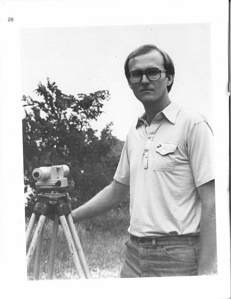
Mike Mathis Hydrologist
"When the Oklahoma Water Resources Board inspects a dam for safety, there are usually three Engineering Division staff members at the site, as well as representatives of the Corps of Engineers. Generally, an inspec· tion takes a full day to complete.
"The inspection involves assembling a profile of the dam, including its characteristics, drainage, slopes and evaluating its suitability for the purpose for which it was designed.
"It's a question of checking all these things carefully and making sure the dam owner and the people downstream are aware of any problem with a dam."
inventory of all jurisdictional size dams in the state. The Corps of Engineers, working in conjunction with the Board, undertook a program to inventory all such dams. Using Landsat Satellite Imagery along with field in· vestigations and other means, dams were located and identified for inclusion in the Board's inventory. Each dam was categorized according to physical characteristics and downstream hazards.
The inventory, completed on Sept. 30, 1980, showed Oklahoma has 4,123 dams of jurisdictional size.
Surveillance of Existing Structures
The Engineering Division responds to all complaints and inquiries concerning the safety of existing dams and investigates all reports of dam failure. It is part of the Division's responsibilities to supervise compliance with safety recommendations and if an inspection reveals a hazard which poses an immediate threat, the Board will move promptly to have the necessary corrections made.
Review of Proposed Dam and Reservoir Sites
During 1980, 32 Soil Conserva· tion Service watershed sites and 21 private sites were approved by the Oklahoma Water Resources Board Engineering Division. Plans for construction or
modification of impoundment structures were reviewed and coordinated with other state agencies for conflict with other improvements. Plans were also assessed for compliance with Board rules and regulations pertaining to reservoir requirements and safety of dams.
29
30
GROUND WATER DlVlSlON
J.A. Wood Chief
" The most important work of this Division is to help each landowner or legitimate lessee who has a beneficial need for ground water- for uses other than domes tic- to establish a claim to his rightful share of the water under his land.
"Oklahoma's water is her most precious natural resource. I believe the day will come when a barrel of good water will bring the price of a barrel of oil. Maybe we lived too long believing the supplies of water and oil were infinite. We know better now-and we know that there's no more water now than at the beginning of time.
"Other energy sources could possibly relax our dependence on oil, but our needs for water will continue to grow. There's no substitute for good clean water."
Ground Water Rights Administration
Processing of new ground water applications and maintaining the existing ground water rights are handled by the Ground Water Division. The staff assists individuals in filing ground water applications both in the office and in the field. Each application is reviewed and assigned to the proper ground water basin according to its legal description.
If the application meets the requirements of the statutes and the Board's Rules and Regulations, the Board begins public hearing procedures, which are required on all applications except 60-day permit applications. After the permit is approved, a copy is sent to .the applicant, a copy is filed at the Oklahoma Water Resources Board, and the information is coded and entered on a master computer tape. The permit file material is also microfilmed and filed at the State Library.
During 1980 there were 64 7 temporary, special, provisional temporary and regular permits approved, allocating 65,230.4 acre-feet of ground water.
A file of approximately 10,000 existing long-term use ground water rights is maintained at the Oklahoma Water Resources Board.
Permits issued as of July 1, 1973 include special permits which expire six months after issuance, provisional temporary permits which expire two months after issuance and temporary permits which require revalidation each year. Temporary permits approved for long-term use require annual revalidation and are changed to regular permits only after the ground
water basin study for that area is complete and the maximum annual yield determined. Then each holder is allowed his proportionate share of the water.
The Board issued its first regular ground water permits in 1978 in the Alluvium and Terrace Ground Water Basin in Tillman County and ha1'l continued to do so for all new long-term ground water uses in Tillman County.
In March 1980 the Board mailed approximately 10,000 water use report forms to holders of ground water rights for longterm use. The completed forms show 1980 ground water use and any changes in ownership during the year. Information from each returned report is individually coded, entered on master computer tape, used in the printing of the Oklahoma Water Resources Board's annual water use reports and filed in the ground water rights file. According to information submitted on water use reports in 1980, there were 79 transfers of ground water rights to new owners.
Prior Ground Water Rights Title 82 (O.S. Section 1020.14)
gives any individual who used ground water under the requirements of the law before June 1, 1973, the opportunity to establish a prior right for such uses.
To accomplish this, the Board makes a thorough review of all ground water use files in the area, and holds a public hearing and work sessions in the area to gather information. The staff then re-evaluates all files and information on record, compiles a list of applicants and claimants and designates those, who in the staff's opinion, are entitled to a prior right. The Board members then consider all the information, and determine
31
32
Walid Maher Engineer
''Hydrologic surveys of Oklahoma's ground water basins are essential to responsible management of the state's water resources. Information collected in the basin studies provide the guidelines for all ground water allocation.
"So many factors must be considered in fairly dividing the water among all the people with legitimate claims. How much land area overlies the basin? How much water is available for use? At what rate is nature replenishing the aquifer? What are the demands on the ground water basin? What arc the possibilities of pollution? How many have a prior right to use the basin's water?
"There's so much to learn about each basin. Usually, the studies require two years or more. But we must have all those answers before we can apportion the ground waters equitably."
and approve all prior rights in each county. The final order approved by the Board lists those who have established a prior right, the amount of water, the parcel of land connected, and the location of prior rights wells.
The total amount of ground water that can be withdrawn from each basin under the present law is called the maximum annual yield. Before a determination of the maximum annual yield can be made, prior rights must be determined and approved by the Board and those rights considered in fixing the maximum annual yield.
The prior rights program is important in determining the amount of ground water available for allocation to those water users issued permits after July 1, 1973, the effective date of the present ground water law. The law also assigns the Oklahoma Water Resources Board responsibility for determining each applicant's proportionate share of the ground water stored within the basin beneath his land. The proportionate share is based on the amount of land owned or leased (with specific rights to withdraw ground water), or in the case of a municipality, the platted land overlying the basin. Equal proportionate shares are determined on the basis of the maximum annual yield, which is the amount of ground water that can be withdrawn annually to allow a basin a minimum life of 20 years.
In 1980 the Board worked on prior ground water rights determination in 10 counties. In the past few years the Board has determined prior rights in 19 central and western Oklahoma counties.
The Board has completed some work in other counties and is now
in the process of determining prior rights for the remaining counties in Oklahoma.
Hydrologic Surveys of Ground Water Basins
Hydrologic surveys produce information concerning the amount of fresh ground water available in each basin for allocation under the requirements of the law, taking into account the total amount in storage on July 1, 1973; recharge and discharge for at least the next 20 years; transmissibility; total land overlying the basin and possibility of pollution of the basin's water.
The Ground Water Division assisted with studies contracted to Oklahoma State University concerning the North Fork of the Red River Alluvium and Terrace Basins in parts of Beckham, Greer, Kiowa and Jackson Counties; Elk City Sandstone Basin in Beckham, Roger Mills, Custer and Washita Counties; Isolated Terrace Basins in the Enid area of Garfield County and the Alluvial and Terrace Basins along the Washita River reach from the western edge of Oklahoma through Roger Mills, Washita, Custer and Caddo Counties to Alex, Oklahoma in Grady County.
During 1980 the Board assisted the Association of Central Oklahoma Government~/GarberWellington Association with a study of the Garber-Wellington Ground Water Basin in Oklahoma, Cleveland, Pottawatomie, Logan, Lincoln, Canadian, Kingfisher and Payne Counties. The study was funded by the Environmental Protection Agency.
The Board also assisted the United States Geological Survey
33
34
Dannie Spiser Geologist
"While we monitor wells all over the state through our annual well measurement program, we're most concerned about the regions of high pumpage like the Panhandle. Wells we've measured in the area show water levels are declining.
"Droughts like last summer's increase irrigation, and wind and heat steal water in evaporation. But drought's not new to this country.
"Every year there are new wells and deeper wells- new demands on the ground water basin all the time.
"Measuring the same wells year after year leads us to believe that some areas of the Ogallala may go dry in 20 years. What will become of the irrigation farmers and cattlemen when the land's lifeblood is gone?
"Then who will we look to for the nation's food?"
with a study of the alluvium and terrace basin of the North Canadian River. Phase I consists of a detailed hydrologic investigation from the HarperBeaver County line through Harper, Woodward, Dewey, Major and Blaine Counties. Phase II reaches from Canton Reservoir in Blaine County through Blaine, Canadian and Oklahoma Counties to Lake Overholser.
Also under contract with the USGS, the Board assisted with data collection for the Oklahoma portion of the Regional Aquifer Study Analysis (RASA) for a 5-year computer model study on the entire Ogallala aquifer.
Water Level Data Collection Program
In cooperation with the USGS the Oklahoma Water Resources Board hand-measured 1046 water wells during 1980 to determine water level below the land surface. There were 623 wells in western Oklahoma, 269 in the Panhandle and 154 in eastern Oklahoma.
The wells are measured annually to monitor changes in the water table in counties where ground water resources have been developed for municipal, industrial, agricultural, domestic and other purposes.
The Oklahoma Water Resources Board also monitored four continuous water level recording devices and the USGS monitored 3 7, for a total of 1077 wells monitored during 1980.
After the data are collected, the information is computer coded and submitted to the USGS for publishing.
These measurements help to determine the amount of ground water available, its location and its potential for further development. The Board also utilizes the data to estimate life of the ground water supply, to identify areas of depletion and to monitor depletion problems.
Enforcement and Licensing Of Water Well Drillers
All individuals, partnerships, firms and corporations drilling wells in fresh ground water basins in Oklahoma (with the exception of domestic water well drillers) must be licensed by the Oklahoma Water Resources Board. Further, they must comply with the Board's standards for new water well construction, proper plugging of abandoned water wells and test holes, proper capping of water wells not is use and proper filing of information logs at the Board within 30 days of completion of work.
An applicant is required to file a bond of at least $5,000 with the state and pass a water well driller's examination prepared and administered by the Board before being eligible for licensure.
The Board approved licenses in 1980 for 13 new water well drilling firms and water well drilling operators for these companies. Since 1973, the Board has received 142 applications for licenses, of which 87 applicants currently hold valid licenses.
There are licensed water well drillers with business locations in 45 Oklahoma counties and two adjacent states.
During 1980, 779 new water well, test hole or plugging forms completed by the licensed drillers were received at the Oklahoma Water Resources Board
35
36
WATER QUALITY DIVlSlON
Ron Jarman Chief
"By far the most important work of the Division is developing and maintaining water quality standards for the state. After all, the standards a::-e the base upon which we build all our water quality managem~nt programs. They touch everyone in Oklahoma. The standards are the bottom line.
"Refining the standards is a job that's never finished Populations shift, needs and uses for water change, so protection of our waters requires constant rigilance.
"Through the standards we advance the Boards goal of maintaining the quality of the water throughout the state and improving it where we can.
''Oklahoma is a 'water' state, richly endowed with natural rivers and streams and man-made reservoirs. If the C1Uality of our water is not adequate for all beneficial uses, we're guilty of waste of a precious natural resource.''
Water Quality Standards The Oklahoma Water Resources
Board determines water quality standards for the state and classifies all Oklahoma waters with respect to their present and future uses.
The standards for water quality were revised and upgraded in 1979 and published in 1980. Stricter standards for pollutants such as poly· chlorinated biphenyls (PCBs), radioactive materials and pesticides were adopted for the 1979 Water Quality Standards.
The Standards were organized into separate sections for narrative and numerical standards, and the readability was simplified and improved.
Other standards revisions were due to changes in laboratory ar.alytical techniques and the acidition of certain streams.
Additional revisions of the · standards will be considered in
1982. Such revisions might include stricter standards for toxic pollutants, establishment of standards for ground water, improving the mixing zone standard, standards for defined or selected regional areas or hydrologic basins, identifying National Resource Waters deserving additional protection ar..d revising standards for water supplies.
Other revisions which may be considered include adjustments to beneficial use designations, development of sediment standards, addition of historical dnta for mineral components for solected streams, integrating water quantity goals with water q·.1ality objectives and recommendations based on state and 208 planning efforts and development of water quality goals.
Waste Discharge Permits and Monitoring
The Board issues permits to totally retain industrial wastewater in treatment lagoons, and to discharge industrial wastewater into the state's waters.
An industry's permit specifies the nature and amount of pollutants it may discharge into a stream. This information is reviewed and amended as necessary.
Self-monitoring analyses performed on a predetermined schedule by a Board-certified laboratory are submitted to the Oklahoma Water Resources Board to assure compliance with permit limits. In 1980 there were 1,136 discharge monitoring reports reviewed and this information is being computerized to provide a compliance history on each permitted industry.
To do this more effectively, the Division has accelerated its inspection program of industries which hold permits. During 1980, 527 active permits were on file and 50 applications for permits were received.
National Pollutant Discharge Elimination System Permits
In cooperation with the EPA, the Board drafts and certifies National Pollutant Discharge Elimination System (NPDES) permits. A total of 31 permits were certified and 27 permits drafted during 1980. Certification of t he NPDES permit ensures that discharges are compatible with Oklahoma's Water Quality Standards.
Laboratory Certification Program To achieve certification, a
laboratory must meet certain criteria established by the Board. Further, the laboratory must demonstrate its ability to accurately analyze various parameters of interest in
37
38
)
. / .. _,...
,.
I ·
-)~~
Ken Morris Limnologist
''The federal Clean Lakes program and state funds allowed us to identify publicly owned lakes where poor water quality threatened or diminished the lakes· recreational potential.
"An interesting lake that qualified for diagnostic studies is Northeast Lake- or 'Zoo Lake' in Oklahoma City's Lincoln Park. Natural erosion and sedimentation choke the lake, runoff from animal enclosures and trash pollute its waters and the blemishes of neglect spoil its former beauty.
"Old timers can remember when the first warm weather of the season brought crowds to its banks and summer lured hundreds of swimmers to its sandy beaches. They tell me a trolley brought families from town to enjoy afternoons on the lake.
''Water sampling and other studies at ·zoo Lake' will determine the costs of cleanup. If the Jake could be restored, it again could be a source of pleasure to hundreds of thousands of visitors to the park each year."
"New austerity in Washington and cuts in the federal budget may jeopardize the funds Oklahoma and other states expect to be available for the 'Clean Lakes' program in FY 82.
"That would be a shame because there are a lot of Oklahomans enthusiastic about these projects."
unknown samples provided by the Board twice each year. There are currently 86 Board certified laboratories, a list of which is available from the Board.
Water Quality Data Base Management
Computer-based systems are being developed for the storage, analysis and retrieval of industrial point source discharge data including location, type and volume of waste treatment methods and self-monitoring information.
The system design aids Division personnel in water quality planning, permit development, compliance monitoring and investigating pollution incidents.
Compliance and Enforcement When the Oklahoma Water
Resources Board has reason to believe an industry has violated the terms of its permit, the water quality standards, the Pollution Remedies Act or any Board order, a written notice is issued specifying the cause of the complaint. This notice requires the alleged violation to be corrected or charges answered by the company at a violation hearing. The Board conducted 85 public hearings and seven violation hearings during 1980.
Industrial dischargers are classified as major or minor, depending on the volume of discharge and/or the type and number of the pollutants in the discharge. Thirty-two major and approximately 200 minor industries hold permits for the discharge of wastes into state waters. Industries are periodically subject to a compliance evaluation or a 24-hour compliance sampling inspection.
Compliance is measured by how conscientiously industry is following the requirements of its permit. Checks are made of the
methods of sample collection and preservation, flow monitoring practices, laboratory procedures, spill prevention and count~rmeasure plans, facilities, effluent quality and quality control practices in general.
Regulated activities of primary concern are wastewater treatment efficiency and the quality of the industries' selfmonitoring reports .
Among the 16 sampling inspections conducted by the Board in 1980, 12 were performed on major industries. A total of 109 inspections were made in 1980.
An additional 78 special inspections were conducted as a result of the investigation of PCBs in Pryor Creek.
When the Board receives a complaint from any citizen concerning pollution or a report of a fishkill or chemical or oil spill, investigation of such complaints takes priority over all other Division activities.
In 1980 the staff responded to 147 complaints, an increase of 44 over 1979.
208 Areawide Waste Treatment Management Program
As part of ongoing Environmental Protection Agency 208 Planning, the Oklahoma Water Resources Board continues studies in areas not completely addressed in the initial waste treatment management plan adopted by the state.
One such area involves a method for allocating waste to a receiving stream. A technique is being devised to estimate the maximum allowable wasteload a stream can assimilate at a given point. This information will be used in determining the permit limits for the discharge of conservative parameters (nondegrading chemicals) such as heavy metals.
39
40
Another area involves identifying toxic metals and polychlorinated biphenyls in. specific locations, a project which has brought Oklahoma Water Quality Standards under review. Beneficial uses for individual stream segments are being examined, and new approaches to developing standards for certain bio-accumulating taxies are under study.
Ground water quality is being examined in a study underway in Woodward in western Oklahoma where high nitrate levels are being investigated.
Certification of 404 Permits and A-95 Projects
Section 404 of the Federal Water Pollution Control Act, as amended by the Clean Water Act of 1977, allows the Corps of Engineers to issue permits for certain dredge-and-fill activities which may adversely affect the state's navigable waters. The Board reviews these projects to assess their effects on water quality. Thirty such permits were certified during 1980, for an accumulated total of 270 certifications issued by the Oklahoma Water Resources Board.
The State Clearinghouse implements the federal Office of Management and Budget (OMB) Circular No. A-95 and the Oklahoma Executive Order 9-8-76, by administering the Review and Comment System on Applications for federallnonfederal funding and technical assistance. The Oklahoma Water Resources Board reviews municipal sewage treatment systems and certain construction projects to assess their effects on the quality of surface and ground water.
During 1980, there were 94 A-95 projects examined, achieving a total of 581 such reviews since January 1976.
Tar Creek Investigations A 1978 U. S. Geological Survey
study revealed that abandoned mines in Ottawa County would begin discharging highly mineralized water into the drainage basins of the Neosho River and Grand Lake.
After reports of such discharges the Oklahoma Water Resources Board investigated and confirmed the discharges in the Tar Creek basin in February 1980. During the investigation, high levels of zinc, iron, sulfates, dissolved solids and low pH values were discovered in and around Tar Creek, which flows into the Neosho River. By April, mine discharges erupted in the form of artesian wells and from leaky and open mine shafts.
Gov. George Nigh formed the Tar Creek Task Force, consisting of 23 state and federal agencies. Representatives from each agency will continue to assess the extent of contamination in the waters of the state, search for possible solutions, then direct reclamation efforts recommended by contract consultants.
A technical committee of the Tar Creek Task Force consisting of 10 agencies has initiated sampling to pinpoint pollution and determine the extent of the contamination.
Clean Lake Program The Clean Lakes Program was
recently implemented with assistance from the Environ· mental Protection Agency. The program includes three phases: classification, diagnostic/ feasibility and restoration.
The Oklahoma Water Resources Board cooperated with the Oklahoma Pollution Control Coordinating Board in classifying and ranking publicly owned lakes in the state according to their
41
42
James Adams Limnologist
''The Tar Creek basin was the site of many lead and zinc mines which were operated between 1920 and 1970. There are about 435 mines under the surface, with 1 00 miles of underground roads and 80· foot. t.all caverns.
''When the mines were in operation, they were prevented from flooding by pumping out the waters of the Boone Aquifer. When the mining operations ceased, so did the pumping, and the water that filled the mines eventually took toxic metals into solution.
"In the peak period in the 1940s, the mines produced approximately 15,000 tons of ore each day. A total of 60 billion tons of ore were extracted from the mines during their existence.
"Citizens of the Picher area have a very real interest in the work of the Tar Creek Task Force. Many of them were raised in mining families. They know about the location and size of the mines, and they're very cooperative in providing information.
·'They take an interest be..:ause their homes are in the area. They are the ones who will suffer most from the effects of the pollution."
need to be cleaned up and/or protected. In 1980 the Oklahoma Water Resources Board received four additional grants for diagnostic studies of Lake Overholser, Lake Atoka, Lake Carl Blackwell and Northeast Lake.
During the next 2Y2 years, the emphasis will be on diagnosing problems or potential problems that could limit the lakes' recreational uses and to develop a plan to restore or protect the recreational benefits of each lake.
A total of 72 Oklahoma lakes were examined and classified according to trophic conditions. Forty-three qualified as publicly owned and were ranked for future study. LANDSAT satellite te;:hnology allowed these 43 lakes to be examined while sampling only nine lakes each J?Jonth from June through October.
Water samples were collected s:multaneously with satellite pr.sses aJ:ld were analyzed for color, nitrate, nitrite, ammonia, dissolved and particulate orthophosphate, total dissolved solids, chlorophylls a, b, and c, pheophytin, turbidity (NTU), carbonate, bicarbonate and total alkalinity. In situ data were gathered for temperature, pH, dissolved oxygen, conductivity, wind speed and secchi disk transparency.
Completion of this classification makes Oklahoma eligible for future EPA funding for lake diagnostic studies and restoration. This study also evaluated the satellite remote sensing technology in providing Oklahoma with a low-cost statewide reservoir water quality monitoring program.
The final report, "Classification of Oklahoma Reservoirs Using LANDSAT Multi-Spectral Scanner Data" will be submitted to EPA in 1981.
Overall goal of the Clean Lakes Program is to protect or restore at least one publicly owned lake within a 25-mile radius of every metropolitan area in the U.S.
Arkansas River Temperature Study
A 38-mile section of river below Kaw Reservoir was evaluated during the summer for development of a temperature standard. Three continuous recording temperature sites were established in a pertinent section of the Arkansas River. Sites were selected to include tributary and industrial discharge effects on the overall temperature profile of the river and their effects on temperature extremes. Results of this study will provide baseline data to establish a maximum temperature standard to provide allowable limits for discharges.
ENVIRO-POD Coal Mine Study This project was undertaken to
assist in monitoring discharges from active coal mines in Oklahoma. Selection of the Lightning Creek basin was based on water quality problems reported in the watershed and the large number of active mines, abandoned strip mines and reclaimed areas.
Aerial photography was used to generate a series of maps depicting changes in land use from 1971 through 1979. ENVIRO-POD imagery was obtained in November 1979 to identify and. delineate active strip mines, areas of recent reclamatio:\ abandoned mines and drainage patterns. Using the ENVIRO-POD imagery and topographic maps, tentative sampling sites were selected
43
44
Hutcheson Hydrologist
"Since one maj o · responsibility of the Division is issuing permits for the disposal f ndustrial
astes into state's .vaters it'<> cr tical to mow tasteload capacity o •ece1v s <.-
to HV pollutants ead m1 ated
certain h ogic con
then field surveys were conducted to confirm final selections.
When sampling begins, it is hoped a determination can be made as to which land use contributes most to pollution and if permitted discharges from the active mines meet water quality standards.
Aquatic Plant Control Program Oklahoma Water Resources
Board has been cooperating with the Tulsa District Corps of Engineers in controlling aquatic plant infestations in Oklahoma waters. The Board's main role has been to evaluate the impact of herbicide applications on RobertS. Kerr Reservoir.
Washita River Salinity Study The impact of discharges
from the Foss Demineralization Plant and Foss Reservoir on the chemical, physical and biological aspects of the Washita River were evaluated in this Study.
These discharges significantly increased the brine level in the river, which impacted the benthic organisms and lowered their diversity by one unit. The Washita River is designated for eight beneficial uses, including irrigation which can be adversely affected by the brine levels.
Recommendations from this study could aid in the management of water resources in western Oklahoma and prevent further water quality violations. The final report will be published in 1981.
Lake Texoma In 1975, 28 sites were sampled
for temperature, physical characteristics and chemical quality by depth profile. The Oklahoma Department of Wildlife Conservation had stated the need for a thermal maximum standard of 90° F rather than a temperature of 93 ° F for protection of least resistant fish species. Analyses of collected data showed temperatures were not above 90 o F and thus a 93 o F standard was not justified.
Industrial and municipal discharge permit limits are based on state standards derived from such data. Baseline monitoring allows for maintaining water quality by limiting discharges to any activities using the state waters for a waste disposal. With the knowledge of basic water quality in Lake Texoma, the beneficial uses such as recreation and municipal water supplies can be maintained
A report of study findings was published in 1980, and a copy of that document may be obtained from the Oklahoma Water Resources Board offices.
45

46
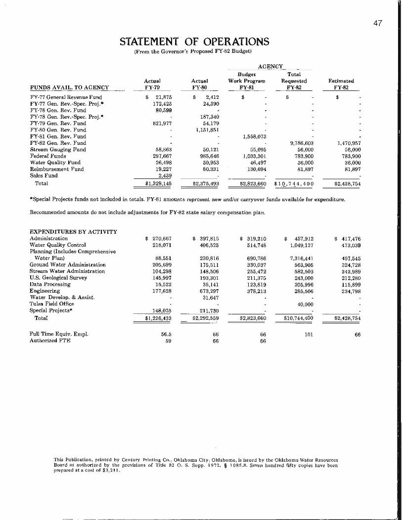
FUNDS A VAIL. TO AGENCY
FY -77 General Revenue Fund FY-77 Gen. Rev.·Spec. Proj.* FY-78 Gen. Rev. Fund FY-78 Gen. Rev.-Spec. Proj.* FY-79 Gen. Rev. Fund FY-80 Gen. Rev. Fund FY-81 Gen. Rev. Fund FY-82 Gen. Rev. Fund Stream Gauging Fund Federal Funds Water Quality Fund Reimbursement Fund Sales Fund
Total
STATEMENT OF OPERATIONS (From the Governor'~ Proposed FY-82 Budget)
AGENCY
Budget Total Actual Actual Work Program Requested FY-79 FY-80 FY-81 FY-82
$ 21,875 $ 2,412 $ $ 172,425 24,390 80,599
187,340 821,977 54,179
1,151,851 1,558,073
9,786,603 58,863 50,121 55,095 56,000
297,667 985,646 1,033,301 783,900 26,498 50,953 46,497 36,000 19,227 80,331 130,694 81,897 2,439
$1,329,145 $2,375,493 $2,823,660 $10,744,400
Estimated FY-82
$
1,470,957 56,000
783,900 36,000 81,897
$2,428,754
*Special Projects funds not included in totals. FY-81 amounts represent new and/or carryover funds available for expenditure.
Recommended amounts do not include adjustments for FY-82 state salary compensation plan.
EXPENDITURES BY ACTIVITY Administration Water Quality Control Planning (Includes Comprehensive
Water Plan) Ground Water Administration Stream Water Administration U.S. Geological Survey Data Processing Engineering Water Develop. & Assist. Tulsa Field Office Special Projects*
Total
Full Time Equiv. Empl. Authorized FTE
$ 270,667 218,071
88,551 205,699 104,298 145,997
15,522 177,628
148,035
$1,226,433
56.5 59
$ 397,815 406,525
230,816 175,511 148,506 193,301
35,141 673,297
31,647
211,730 $2,292,559
66 66
$ 319,210 514,748
690,786 330,037 255,472 211,375 123,819 378,213
$2,823,660
66 66
$ 457,912 1,049,137
7,316,441 563,905 582,503 243,000 205,996 285,506
40,000
$10,7 44,400
101
$ 417,476 473,039
407,545 324,728 242,989 212,280 115,899 234,798
$2,428,754
66
This Publication, printed by Century Printing Co. , Oklahoma City, Oklahoma, is issued by the Oklahoma Water Resources Board as authorized by the provisions of Title 82 0. S. Supp. 1972, § 1085.8. Seven hundred fifty copies have been prepared at a cost of $3,211.
47
-~----------~----------------------------------------------------------------------------~-