Embed Size (px)
Citation preview
Oklahoma’s Large River Sampling Program Oklahoma Clean Lakes and Watersheds Association April 9, 2014, Stillwater, OK
Monty Porter, Data and Quality Manager
Josh Bailey, Biological Team Leader
OWRB Water Quality Programs Division
Oklahoma’s Diversity
Large Rivers in Context of Small Rivers
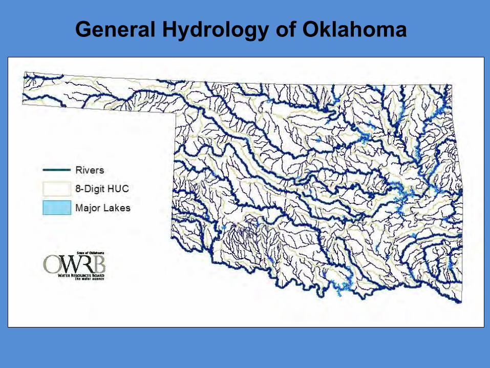
General Hydrology of Oklahoma

Ecological Diversity (12 Omernik III Ecoregions)
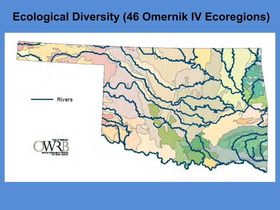
Ecological Diversity (46 Omernik IV Ecoregions)
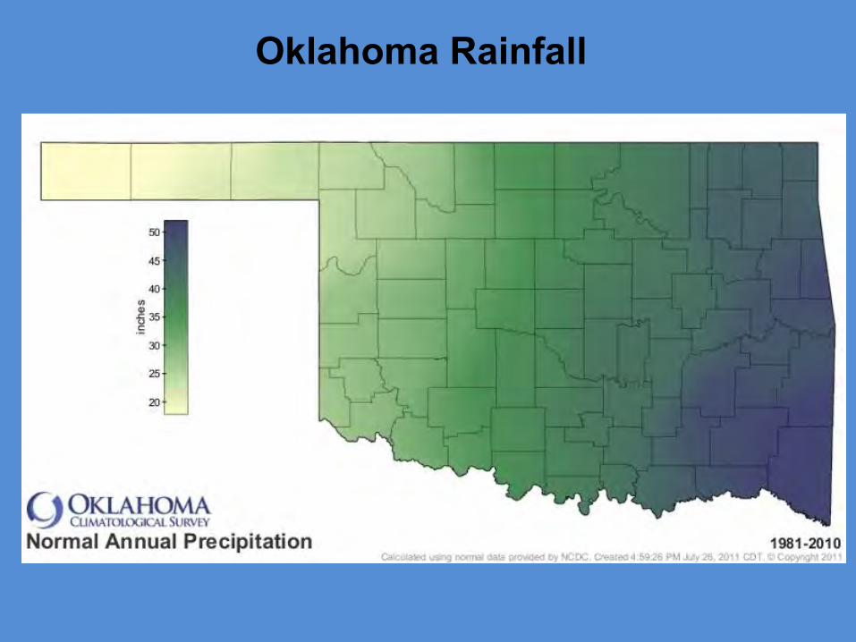
Oklahoma Rainfall
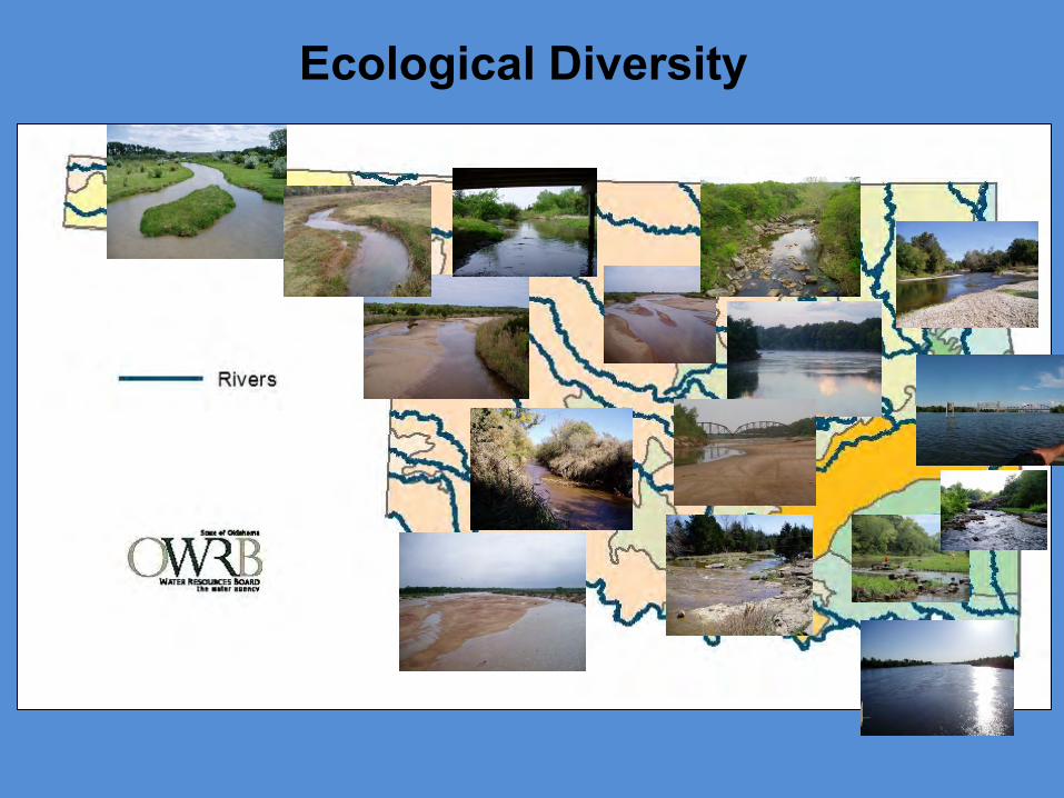
Ecological Diversity
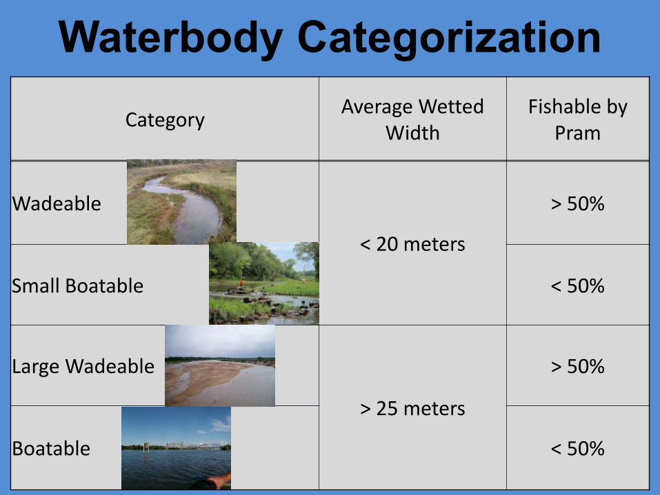
Waterbody Categorization Category
Average Wetted Width
Fishable by Pram
Wadeable
< 20 meters
> 50%
Small Boatable < 50%
Large Wadeable
> 25 meters
> 50%
Boatable < 50%
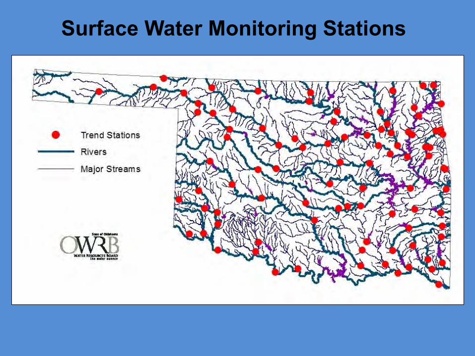
Surface Water Monitoring Stations
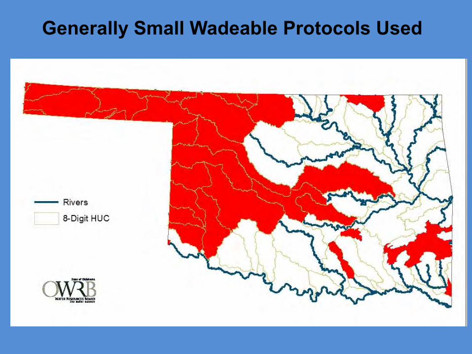
Generally Small Wadeable Protocols Used
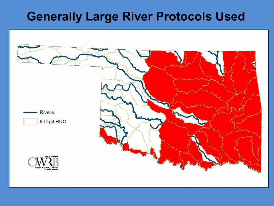
Generally Large River Protocols Used
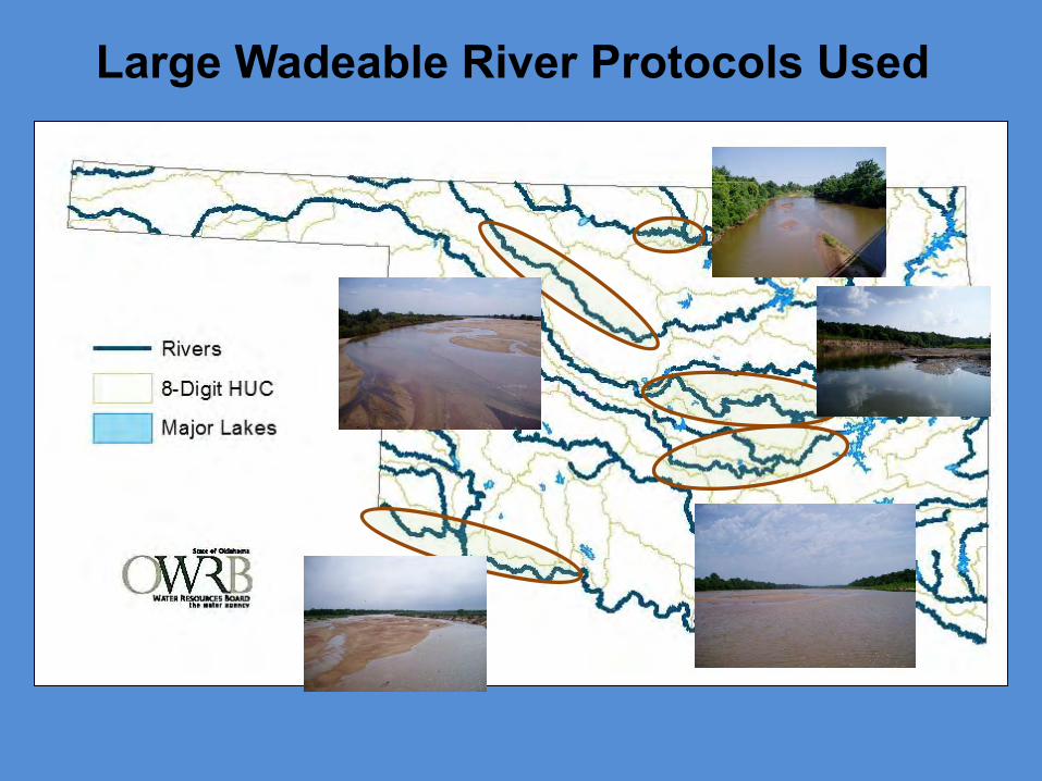
Large Wadeable River Protocols Used

General Considerations
Wadeable Small Boatable Large Wadeable Boatable
Reach Length--General 40x Average Wetted Width
Wadeable vs. Boatable = Major Electrofishing Method (Pram vs. Boat)
Reach Length--Minimum > 150 m > 150 m > 800 m (BPJ) > 800 m (BPJ)
Reach Length--Maximum < 1000 m (BPJ) < 1000 m (BPJ) < 2000 m < 4000 m
Habitat--Quantitative (EMAP)
Yes (Wadeable) Yes (Wadeable) Yes (Wadeable) Yes (Boatable)
Habitat--Qualitative (OK RBP) Yes Yes Yes No
Have Integrated Habitat Assessment Forms to Avoid Collecting Duplicate Data
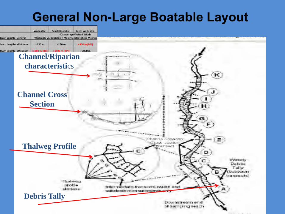
General Non-Large Boatable Layout
Channel/Riparian
characteristics
Thalweg Profile
Channel Cross
Section
Debris Tally
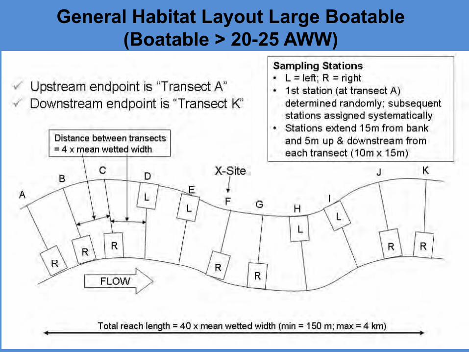
General Habitat Layout Large Boatable (Boatable > 20-25 AWW)
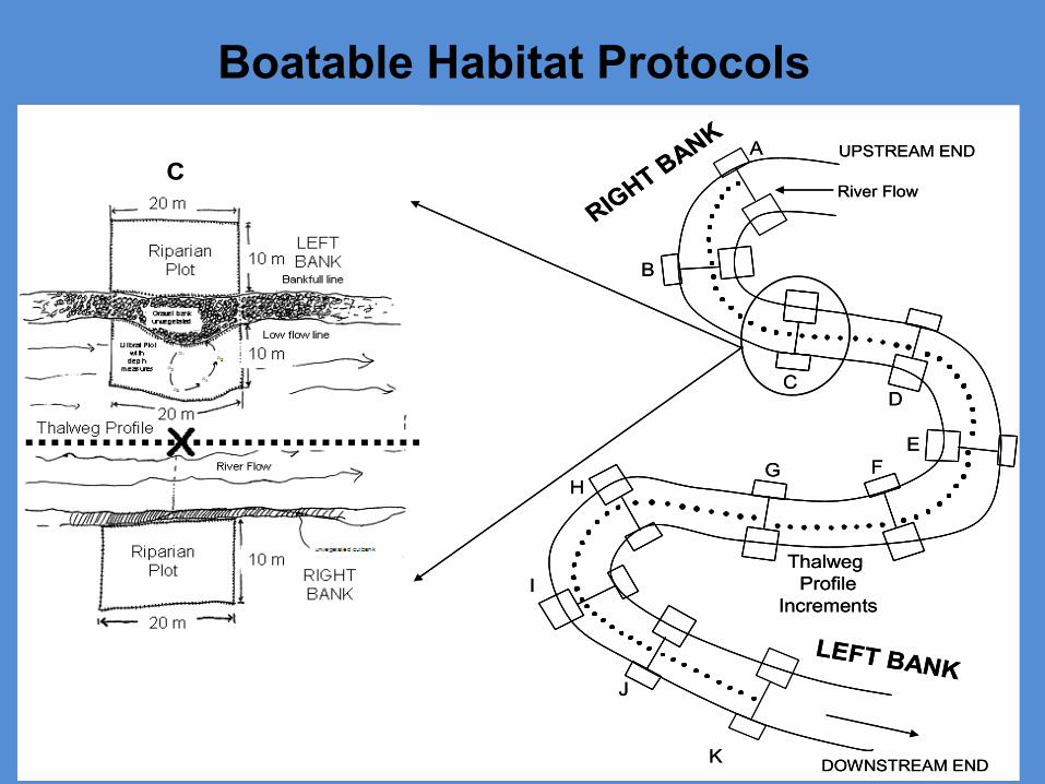
Boatable Habitat Protocols
RIGHT BANK
LEFT BANK
UPSTREAM END
DOWNSTREAM END
River Flow
A
B
CD
H
EG F
I
J
K
Thalweg Profile
Increments
C
RIGHT BANK
LEFT BANK
UPSTREAM END
DOWNSTREAM END
River Flow
A
B
CD
H
EG F
I
J
K
Thalweg Profile
Increments
C

Fish Indicator Collection
Wadeable @ 150 m RL (minimum) All Other Wadeables Boatable
Equipment – Primary
Backpack Electrofisher 2.5 GPP Pram Electrofisher 9.0 GPP Boat Electrofisher
Equipment – Alternate
Seine • as primary in conductivity > 4500 uS • as secondary for inaccessible deep pools
• 2.5 GPP Pram Electrofisher in shallow or inaccessible areas
• Seine when conductivity precludes electrofishing
Effort – Electrofishing Generally work Entire reach Minimum Units of Effort are 150 meters and 500 seconds Site fished until one of the following occurs:
End of pre-designated reach Expend 4000 units for wadeable/7500 units for boatable
Total Units Expended Should Positively Correlate Reach Length and Habitat Diversity Care should be taken not to over or under fish a reach or sub-
reach Document occurrences of digression
Deep Pools May be Re-fished by Working Concentric Circles
Effort – Seining Work reach as if electrofishing using various seine techniques
depending on habitat structure and complexity BPJ should be used to determine if community is adequately
characterized Generally lower natural diversity
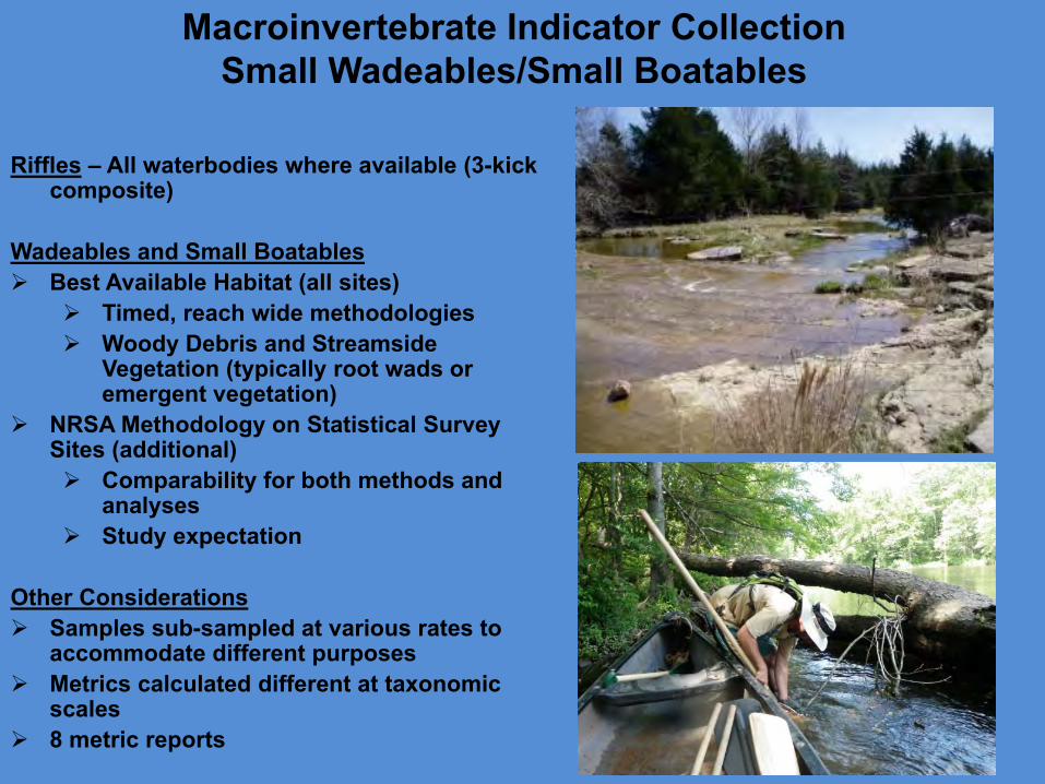
Macroinvertebrate Indicator Collection Small Wadeables/Small Boatables
Riffles – All waterbodies where available (3-kick composite)
Wadeables and Small Boatables Best Available Habitat (all sites)
Timed, reach wide methodologies Woody Debris and Streamside
Vegetation (typically root wads or emergent vegetation)
NRSA Methodology on Statistical Survey Sites (additional) Comparability for both methods and
analyses Study expectation
Other Considerations Samples sub-sampled at various rates to
accommodate different purposes Metrics calculated different at taxonomic
scales 8 metric reports
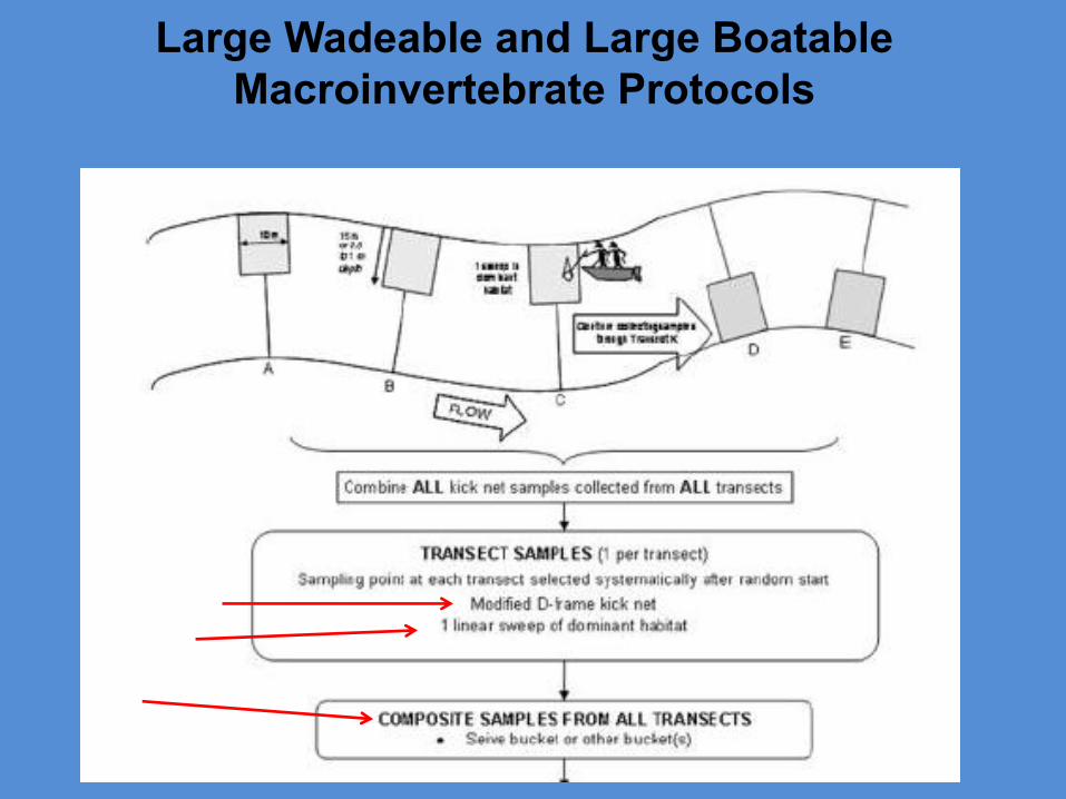
Large Wadeable and Large Boatable Macroinvertebrate Protocols
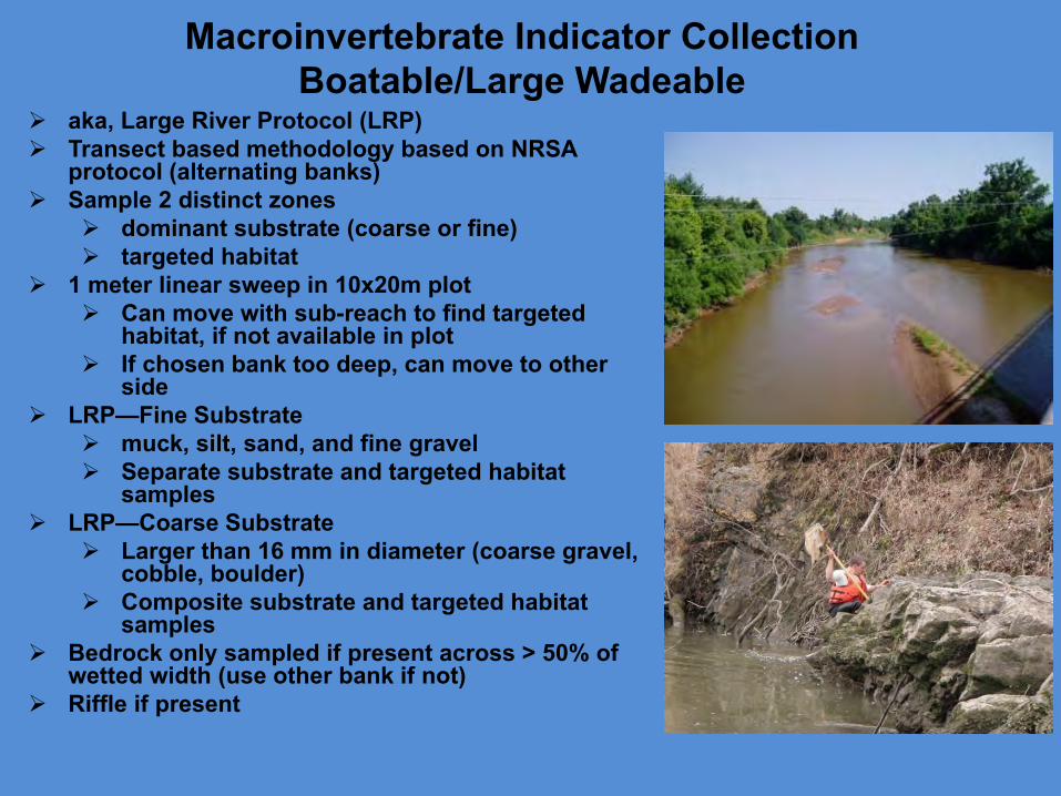
Macroinvertebrate Indicator Collection Boatable/Large Wadeable
aka, Large River Protocol (LRP) Transect based methodology based on NRSA
protocol (alternating banks) Sample 2 distinct zones
dominant substrate (coarse or fine) targeted habitat
1 meter linear sweep in 10x20m plot Can move with sub-reach to find targeted
habitat, if not available in plot If chosen bank too deep, can move to other
side LRP—Fine Substrate
muck, silt, sand, and fine gravel Separate substrate and targeted habitat
samples LRP—Coarse Substrate
Larger than 16 mm in diameter (coarse gravel, cobble, boulder)
Composite substrate and targeted habitat samples
Bedrock only sampled if present across > 50% of wetted width (use other bank if not)
Riffle if present
Macroinvertebrate Indicator Analysis Use different indices for size
categories
Must have multiple samples for assessment of wadeables
For boatables and some large wadeables use NRSA index and reference conditions
Developing Oklahoma Boatable/Large River Indices
OK BENTHIC IBI
OK Benthic IBI CLASSIFICATION
B-IBI Metrics 6 4 2 0 Taxa Richness >80% 60-80% 40-60% <40% Modified HBI >85% 70-85% 50-70% <50% EPT/Total >30% 20-30% 10-20% <10% EPT Taxa >90% 80-90% 70-80% <70% % Dominant 2 Taxa <20% 20-30% 30-40% >40% Shannon-Weaver Diversity Index >3.5 2.5-3.5 1.5-2.5 <1.5
% Comparison to the Reference Score
Biological Condition Characteristics
>83% Non-impaired
Comparable to the best situation expected in that ecoregion; balanced trophic and community structure for stream size
54 - 79% Slightly
Impaired
Community structure and species richness less than expected; percent contribution of tolerant forms increased and loss of some intolerant species
21 - 50% Moderately Impaired
Fewer species due to loss of most intolerant forms; reduction in EPT index
<17% Severely Impaired
Few species present; may have high densities of 1 or 2 taxa
Fish Indicator Analysis
Metric Value Scoring
Score 5 3 1 Total # of species fig 1 fig 1 fig 1 Shannon's Diversity based upon numbers >2.50 2.49-1.50 <1.50 # of sunfish species >3 2 to 3 <2 # of species comprising 75% of sample >5 3 to 4 <3 Number of intolerant species fig 2 fig 2 fig 2 Percentage of tolerant species fig 3 fig 3 fig 3
TOTAL SCORE FOR SAMPLE COMPOSITION 0 Percentage of lithophils >36 18 to 36 <18 Percentage of DELT anomalies <0.1 0.1-1.3 >1.3 Total individuals >200 75 to 200 <75
TOTAL SCORE FOR FISH CONDITION 0 TOTAL SCORE 0
Metrics 5 3 1
Number of species >67% 33-67% <33% Number of sensitive benthic species >67% 33-67% <33% Number of sunfish species >67% 33-67% <33% Number of intolerant species >67% 33-67% <33%
Proportion tolerant individuals <10% 10-25% >25% Proportion insectivorous cyprinid individuals >45% 20-45% <20% Proportion individuals as lithophilic spawners >36% 18-36% <18%
% Comparison to the Reference Score
Integrity Class Characteristics
>97% Excellen
t Comparable to pristine conditions, exceptional species assemblage
80 - 87% Good Decreased species richness, especially intolerant species 67 - 73% Fair Intolerant and sensitive species rare or absent
47 - 57% Poor Top carnivores and many expected species absent or rare;
omnivores and tolerant species dominant
26 - 37% Very Poor
Few species and individuals present; tolerant species dominant; diseased fish frequent
Use multiple Indices
For Large Rivers, NRSA Analysis
Methods/Classifications Currently Used (developing comparable methods for Oklahoma)
For condition, use a weight of evidence assessment
For Impairment status use biocriteria unless unavailable or scored as undetermined
BIOCRITERIA
OK FISH IBI ALT IBI CLASSIFICATION
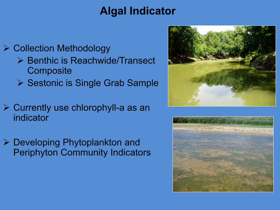
Algal Indicator
Collection Methodology Benthic is Reachwide/Transect
Composite Sestonic is Single Grab Sample
Currently use chlorophyll-a as an
indicator
Developing Phytoplankton and Periphyton Community Indicators
Questions?