Embed Size (px)
Citation preview
North York MoorsNational Park Authority
Local Development Framework
Design GuidePart 1: General PrinciplesSupplementary Planning Document
PARTONE
North York MoorsNational Park Authority
Design GuidePart 1: General PrinciplesSupplementary Planning Document
Adopted June 2008
CONTENTS
Contents Page
Foreword 3
Section 1: Introducing Design1.1 Background 41.2 Policy Context 41.3 Design Guide Supplementary Planning Documents 71.4 Aims and Objectives 81.5 Why do we need a Design Guide? 9
Section 2: Design in Context2.1 Background 102.2 Landscape Character 112.3 Settlement Pattern 192.4 Building Characteristics 22
Section 3: General Design Principles3.1 Approaching Design 253.2 Landscape Setting 263.3 Settlement Form 273.4 Built Form 283.5 Sustainable Design 33
Section 4: Other Statutory Considerations4.1 Conservation Areas 374.2 Listed Buildings 374.3 Public Rights of Way 384.4 Trees and Landscape 384.5 Wildlife Conservation 394.6 Archaeology 394.7 Building Regulations 40
Section 5: Application Submission Requirements5.1 Design and Access Statements 425.2 Design Negotiations 455.3 Submission Documents 45
Appendix A: Key Core Strategy and Development Policies 47Appendix B: Further Advice and Information 49Appendix C: Glossary 55
Map 1: Landscape Character Types and Areas 13Table 1: Landscape Character Type Descriptors 14
• This document can be made available in Braille, large print, audio and can be translated. Please contact the Planning Policy team on 01439 770657, email [email protected] or call in at The Old Vicarage, Bondgate, Helmsley YO62 5BP if you require copies in another format.
3
FOREWORD
ForewordThe North York Moors is famed for its stunning landscape and scenic beauty, anintegral part of which are the many picturesque villages and attractive buildings thatthey contain. Together, these qualities create a character that is unique to theNational Park and one that we, as an Authority, have been charged with protectingfor the enjoyment of residents and visitors alike, both now and into the future.
It is therefore with great pleasure that I am able to introduce the North York MoorsNational Park Authority’s Design Guide Supplementary Planning Document (SPD)that will help to shape future development within the National Park.
The purpose of this Design Guide is to help protect the intrinsic qualities of the Parkbut not to the extent that it unreasonably restricts the development process that isvital to the future viability and prosperity of our communities. However, we do wishto ensure that new development sits comfortably and adds to the quality of theexisting built and natural environment and does not erode the very qualities thatmake it such a special place to begin with.
Building on the key principles of the National Park Management Plan, this guidesets out general information and practical advice to help inform and promotecreative, high quality, contemporary design whilst being sensitive to the historicbuilt environment.
The Design Guide has been produced to provide information and advice to owners,developers, professional agents and builders on the design standards appropriateto the special character of the National Park. It will also be used by AuthorityMembers and planning officers in deciding planning applications and giving adviceon the design of new development.
In the fullness of time, the document will be supplemented by additional topic-specific components to produce a full range of design information for the mostcommon types of development found within the National Park.
In the meantime, we trust that you find the information and advice contained in theDesign Guide useful in providing a basis to ensure that any development that youare involved in inspires excellence in design that contributes to the special qualitiesof the National Park.
Finally, I would urge all those involved in the design process, whether theirproposals require the Authority’s approval or not, to use the Guide.
Cllr John FletcherChairman, National Park Authority
1
1.1
1.2
INTRODUCING DESIGN
4
SECTION 1
Introducing Design
Background
‘General Principles’ is the first of a series of Supplementary Planning Documentsthat collectively, form the North York Moors National Park Authority’s Design Guide.
Part 1 provides a historical context to design and describes the fundamental designprinciples that should be considered in the development of a successful proposal.Part 1 also offers guidance on the components of design that need to be consideredto inform any proposal, from a house extension to a small 'infill' scheme.
As the Design Guide expands, it will cover the most common types of newdevelopment occurring in the National Park and include more detailed advice onthe following topics:
Part 2: Extensions and Alterations to Dwellings Part 3: Trees and Landscape Part 4: The Re-use of Existing Agricultural Buildings Part 5: New Agricultural Buildings
Part 1 – ‘General Principles’ should be read in conjunction with other relevant parts of the Design Guide.
The advice contained in the Design Guide is not intended to be exhaustive norprescriptive. Similarly, it is not intended to stifle innovative design that is bothsympathetic and sensitive to its surroundings. Design in the built environment is anevolving process. Good design can help bridge the gap between the traditional andcontemporary in a way which respects and interprets the historical character in adifferent way.
Each planning application submitted to the Authority will be judged on its ownparticular merits and against the policies of the North York Moors Core Strategy andDevelopment Policies (2008) document and having regard to the design advicecontained in Parts 2 and 3 of the Design Guide.
Policy Context
The role of good design is advocated in a number of national, regional and localplanning documents, together with the North York Moors National ParkManagement Plan (1998).
National Policy
Government policy for design in the planning system is contained in Planning PolicyStatement 1, ‘Delivering Sustainable Development’ and expanded in other PlanningPolicy Guidance/Statements. The challenge in PPS1 is clear:
‘High quality and inclusive design should be the aim of all thoseinvolved in the development process’.
5
INTRODUCING DESIGN
Further design advice is also contained in Planning Policy Statement 7, ‘SustainableDevelopment in Rural Areas’, which states that:
‘… planning authorities should ensure that development… contributes toa sense of local identity and regional diversity and be of an appropriate design and scale for its location having regard to the policies on designcontained in PPS1… ’.
National planning policy also strongly encourages design which reduces the needfor energy and incorporates low carbon energy generating technologies, minimiseswaste and reduces the risk of flooding.
Regional Spatial Strategy
Regional planning guidance is set out in the ‘Yorkshire and Humber Plan’, which isthe Regional Spatial Strategy for Yorkshire and the Humber (RSS). The draftRegional Spatial Strategy was issued in December 2004 and is based on a selectivereview of Regional Planning Guidance 12, which itself was issued in 2001. TheStrategy seeks to promote well designed and attractive places which respect theircharacter and landscape setting. It also recognises the importance of maintaininglocal distinctiveness and promoting local styles and features whilst encouraginginnovative new design. It particularly encourages sustainable design including betterenergy and water efficient buildings.
The draft Yorkshire and Humber Plan was submitted to Government in December2005. Public consultation took place on the draft Plan between January and April2006 and an Examination In Public was held to test the Plan between Septemberand October 2006. The main findings and recommendations from the Examinationwere used by the Government Office for Yorkshire and Humber to inform thepreparation of proposed changes to the Draft Plan. The approved Yorkshire andHumber Plan was formerly published in May 2008.
North York Moors National Park Management Plan
The North York Moors was designated as a National Park in 1952. The 1995Environment Act sets out two purposes for National Park Authorities:
• To conserve and enhance the natural beauty, wildlife and cultural heritage of the National Parks; and
• To promote opportunities for the understanding and enjoyment of the special qualities of the Parks by the public.
The Act goes on to place a duty on National Park Authorities in pursuing the twopurposes, ‘to seek to foster the economic and social well being of localcommunities’. Section 62 of the 1995 Act also requires all relevant authorities to‘have regard to the statutory purposes in exercising or performing any functions inthe National Park and; if it appears that there is a conflict between those purposes,to attach greater weight to the purpose of conserving and enhancing the naturalbeauty, wildlife and cultural heritage of the area.’
SECTION 1

The North York Moors National Park Management Plan recognises that the builtenvironment is a significant part of the natural beauty and cultural heritage of theNational Park and that design has an important role to play in ensuring that newdevelopment does not jeopardise the integrity of its landscape. To this extent, allproposals must be consistent with and help to achieve the following design relatedobjectives of the Management Plan:
• To ensure that new building and development compliments the local character, buildings and sense of place1.
• To ensure that new development is of a high quality which enhances the character and special qualities of the national park and respects local distinctiveness2.
North York Moors Local Development Framework
Core Strategy and Development Policies Development Plan Document (2008)
The Core Strategy and Development Policies document sets out the planningpolicies against which proposals for new development within the National Park areassessed. The document is the ‘Development Plan’ for the Park (along with nationalpolicy and the Regional Spatial Strategy). Of most significance to this particular SPDis Development Policy 3 – Design.
INTRODUCING DESIGNSECTION 1
6
DEVELOPMENT POLICY 3Design
To maintain and enhance the distinctive character of the National Park,development will be permitted where:
■ The siting, orientation, layout and density preserves or enhances views into and out of the site, spaces about and between buildings and otherfeatures that contribute to the character and quality of the environmentand will not result in the loss of an open space which contributes to theamenity, character and setting of a settlement.
■ The scale, height, massing, proportion, form, size, materials and design features of the proposal are compatible with surrounding buildings, andwill not have an adverse effect upon the amenities of adjoining occupiers.
■ A high standard of design detailing is used whether traditional or contemporary, which reflects or complements that of the local vernacular.
■ Provision is made for adequate storage and waste management facilities.
■ Good quality sustainable design and construction techniques are incorporated in the development including measures to minimise energy use and where possible use energy from renewable sources.
■ A satisfactory landscaping scheme forms an integral part of the proposal.
■ The design takes account of the safety, security and access needs for all potential users of the development and provides car parking provision inline with the standards adopted by the Authority.
1
2
3
4
6
7
5
Footnotes:1 North York Moors National
Park Management Plan:
Built Environment Objective 42 North York Moors National
Park Management Plan:
Planning and Sustainable
Development Objective 2
INTRODUCING DESIGN
1.3
SECTION 1
Other Core Strategy and Development Policies with a direct relevance to this SPDinclude:
CP A: Delivering National Park Purposes and Sustainable DevelopmentCP G: Landscape and Historic AssetsDP 4: Conservation AreasDP 5: Listed Buildings
(Copies of the key Policies are reproduced in full in Appendix A).
Nationally designated areas comprising National Parks… have been confirmed by the Government as having the highest status of protection in relation to landscape and scenic beauty. The conservation of the natural beauty of the landscape and countryside should therefore be given great weight in planning policies and development control decisions in these areas.
Planning Policy Statement 1: Delivering Sustainable Design (February 2005) DCLG
Design Guide Supplementary Planning Documents
Purpose
This Supplementary Planning Document provides further detailed guidance to thedesign-related policies that are contained within the North York Moors CoreStrategy and Development Policies document (2008).
The purpose of the Design Guide is:
• to provide a framework for understanding the landscape setting, settlement form and building characteristics of different areas across theNational Park, which should be taken into account in the design of newdevelopment;
• to supplement the relevant objectives in the National Park Management Plan and policies contained in the North York Moors Core Strategy andDevelopment Policies document (2008);
• to raise the quality of new development and move away from ‘standardised’ approaches; and
• ensure that sustainability principles are incorporated into the design of new development where possible.
Development of the Document
Organisations and individuals with a particular interest in design were initiallyconsulted on a Discussion Paper which outlined the aims of the SupplementaryPlanning Document and the types of issues that could be covered. The DiscussionPaper also included a number of questions seeking feedback from consultees onwhat information the document should contain. The Discussion Paper was alsodiscussed at Planning Committee in April 2007. The feedback from this consultationformed the basis of the draft Supplementary Planning Document. Publicconsultation, including an exhibition, was carried out on the draft SupplementaryPlanning Document in March and April 2008. The comments received haveinformed the final document.
7
INTRODUCING DESIGNSECTION 1
Status
The Design Guide Supplementary Planning Document forms part of the LocalDevelopment Framework and therefore has statutory weight and is a materialconsideration in the determination of planning applications.
The adopted SPD is accompanied by:
• A Sustainability Statement: setting out how sustainability considerations have informed the SPD;
• Statement of Consultation: detailing the consultation undertaken in producing the SPD.
In some instances, Village Design Statement Supplementary Planning Documentsand Conservation Area Assessment and Management Plan SupplementaryPlanning Documents may contain more detailed, local guidance on design mattersand these should be referred to alongside the Design Guide SupplementaryPlanning Document.
Aims and Objectives
The Design Guide aims to promote higher standards in design throughout theNational Park by:
i. Ensuring that the design of all development is consistent with the statutory purposes of the National Park.
ii. Ensuring that all new development is of a high quality that respects local distinctiveness and conserves and where possible, enhances the character and special qualities of the area.
iii. Encouraging good contemporary design where appropriate.iv. Minimising the unsustainable use of resources and the production of
waste in the construction of new development.v. Minimising the requirement for resource use during the operation of the
development.vi. Ensuring that conditions for wildlife and natural habitats are maintained
or enhanced. vii. Protecting the residential amenity of others.viii. Promoting design that reduces both the causes and effects of climate
change.
The planning system provides the means to encourage good design, which iscentral to good planning. The impact and appearance of proposed developmentand its surroundings are relevant and material considerations in the assessment ofa planning application.
1.4
8
INTRODUCING DESIGN
1.5
SECTION 1
Why do we need a design guide?
As planning authority for the National Park, the Authority deals with all applicationsfor planning permission, Listed Building Consent and Conservation Area Consent.This mechanism of approvals allows the Authority the opportunity to work withapplicants to ensure that new development proposals respect the distinctivecharacter of the National Park and are consistent with the policy objectives set outin the Core Strategy and Development Policies document.
There is concern that a standardised approach is being adopted in the design ofnew development within the National Park. The use of a limited range of traditionalbuilding features and techniques is creating a ubiquitous ‘style’, which does notnecessarily reflect the subtle variations in the landscape and building characteristicsthat exist across the Park. This results in relatively few proposals that arecontemporary in their design approach, the consequence of which is a potentialdeficit in the built heritage for future generations.
The Design Guide has been produced to help define the qualities andcharacteristics that make the North York Moors National Park special – the localdistinctiveness of the landscape, settlement patterns and building characteristics,and to describe the ways in which good design can protect and enhance it. Withthis in mind, the Guide is intended to encourage a high standard of design and topromote new development which respects and fits in with the character of theNational Park.
Good design also takes account of the impact on the local and global environment.The Guide provides information on design measures which can help to reduceenergy use, integrate the generation of low carbon/renewable energy, reduce floodrisk and reduce the use of resources and creation of waste.
9
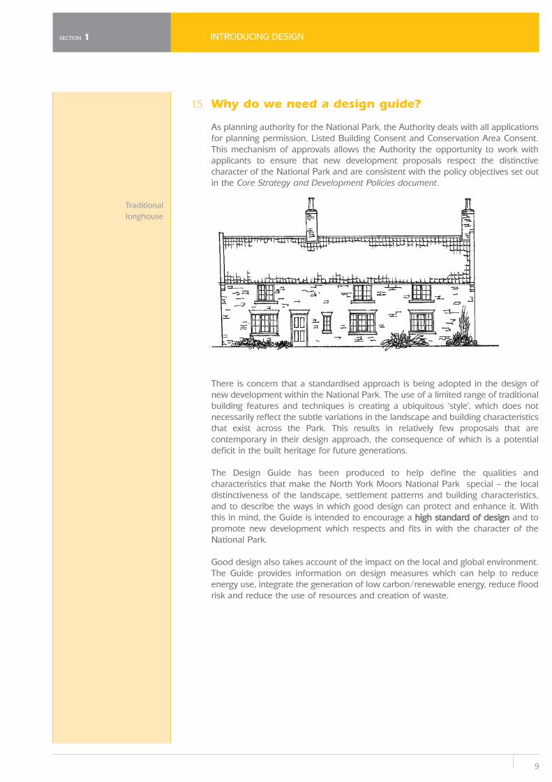
Traditionallonghouse
2
2.1
DESIGN IN CONTEXT
10
SECTION 2
Design in Context
Background
The buildings and villages of the National Park are as much a part of its appeal tovisitors and residents as its natural environment. The North York Moors has aconsiderable man-made heritage with a vernacular building style that contributessignificantly to the overall character of the landscape. It is this interaction betweenhuman activity and the landscape that has helped to shape the locally distinctivesettlements and buildings that we see in the Park today.
Much of the distinctive character relates closely to the underlying Jurassic geologyof the moors, which has created a landscape that is visibly different from thePennines or the Yorkshire Wolds. The upland areas are separated by dales, whichform the heartland of the area; to the west and north are steep scarp slopes whichafford views over surrounding areas; to the east there is dramatic coastal sceneryand to the south the hills slope gently down to the Vale of Pickering.
Whether a small residential extension or a large new building, the extent to whichnew development successfully responds to the landscape relies on an understandingof its context. Context refers to the character and setting of a development andrequires an appreciation of the natural and human history of the landscape, thelayout of settlements, its buildings and location. Considering the context is a crucialstarting point in the design of new development and is a combination of three mainelements:
Context
Landscape Character+
Settlement Pattern+
Building Characteristics
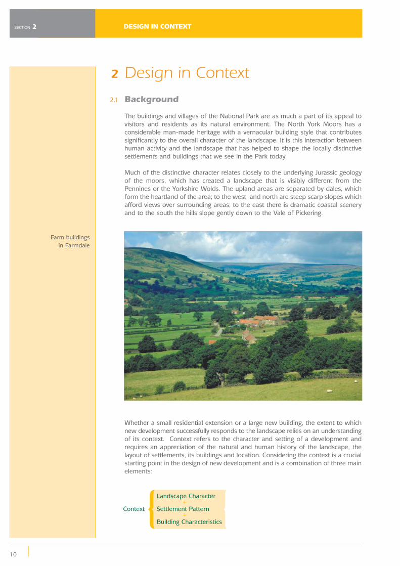
Farm buildings in Farmdale
11
DESIGN IN CONTEXT
2.2
It is the relationship between these elements that has created the distinctive anddiverse landscape character types of the North York Moors.
‘Design which is inappropriate in its context, or which fails to take the opportunities available for improving the character and quality of anarea and the way it functions, should not be accepted’.
Planning Policy Statement 1: DeliveringSustainable Design (February 2005) DCLG
Landscape Character
Landscape character is the recognisable pattern of elements that occurs in aparticular landscape. Variations in geology and soils, landform, land use andvegetation, settlement patterns and building styles, give rise to different landscapes,each with its own distinctive character and unique sense of place.
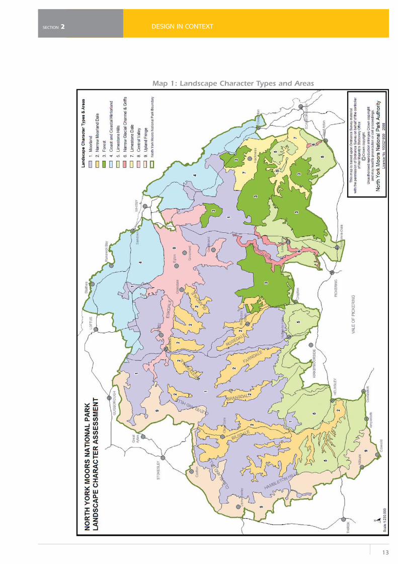
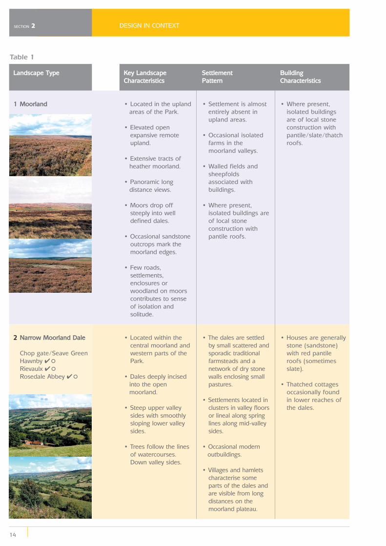
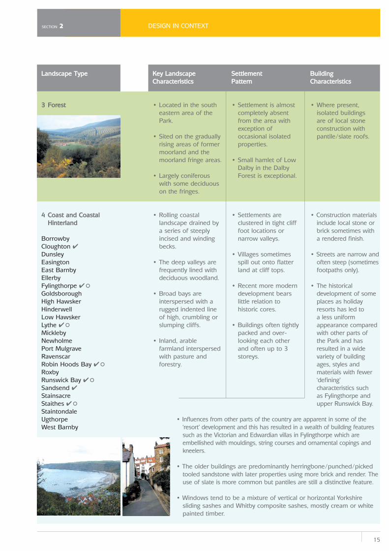
The diversity of landscape character across the National Park has been mapped in a ‘Landscape Character Assessment Study’3 undertaken in 2003. As a result, nine different landscape character types and thirty one Landscape Character Areaswere identified across the Park – the location, key landscape characteristics,settlement pattern and building characteristics of which, are detailed in Map 1 andTable 1 below.
SECTION 2
Footnotes:3 White Young Green (2003)
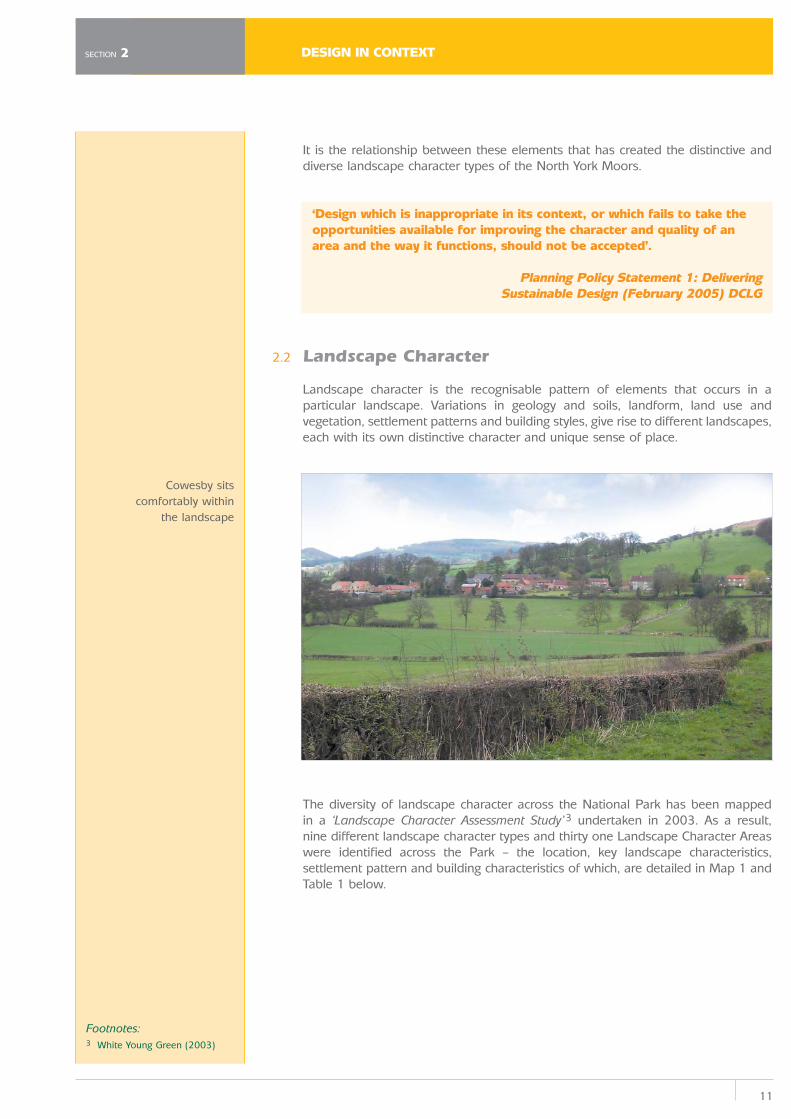
Cowesby sitscomfortably within
the landscape
DESIGN IN CONTEXT
12
SECTION 2
Character Overview
The North York Moors and Cleveland Hills are a very clearly demarcated block ofhigh land in the north east of Yorkshire and southern Cleveland. To the north eastthe boundary is the North Sea, while to the north and west there is a steep scarpslope rising above the Tees valley and the Vale of Mowbray. The Cleveland Hills arethe highest area, but they merge into the Hambleton Hills in the south west, whichin turn drop sharply down to the Vale of York. Along the south margin the TabularHills dip gently to the south and east, but there is still a distinct change in slopewhere the land drops down to the Vale of Pickering.
The most notable feature of the Park is the expansive sweep of unenclosed,predominantly heather moorland with long and panoramic views in all directions.This creates a strong feeling of space, expansiveness, openness and, sometimes,solitude and wilderness.
The sense of remoteness is enhanced by the relatively few roads and settlementswhich are visible on the moorland plateaus. The upland plateaus contrast with thedales with their scattered farmsteads and patterns of drystone walls enclosingsmall pastures.
The dales running south tend to be broad and sweeping in their upper reaches, butare narrow and twisting where the rivers cut through the Tabular Hills; these includeNewtondale and Forge Valley, which were cut by glacial meltwater. Other dales arenarrower, with fields and settlements contained by the moors. Eskdale, whichseparates the North York Moors from the Cleveland Hills, is a much broader valleyand lacks the sense of enclosure of many of the other valleys. It has fine stonevillages (such as Egton, Egton Bridge and Lealholm) and extensive woodland butthe limestone which influences some of the other dales is missing and the flora isnot as rich.
The upland extends eastwards to one of the highest stretches of cliff alongEngland's North Sea coast. The close proximity of the sea to the high moors andthe sheltered dales adds greatly to the character of the area. The coastline itself isdramatic, with high precipitous cliffs dipping down, in places, to sandy or rockybays. Small fishing villages such as Staithes, cling to the steep valley sides insheltered locations. The highest land, on the moorland plateaus, lacks any treecover, so the wooded areas that do exist are often particularly prominent. In thesouth and east extensive conifer plantations cloak stretches of moorland and valleysides. Elsewhere there are small broadleaved woodlands on the side slopes of thedales, many of these have been replanted as mixed woodland in the Hambletonand Tabular Hills.
The scale of the landscape is generally large and sweeping and dramaticallycontrasts with some intimate views within the dales and wooded areas. The scaleof the landform, the extensive views, and the lack of boundaries, other thanoccasional fences, nevertheless continue the feeling of openness from themoorlands down these lower slopes. The arable landscape also extends along thecoastal strip, where glacial deposits create better quality soils; here there is a starkcontrast as the farmed landscape extends right up to the edge of the high cliffs,which then drop suddenly straight down to the sea. This coastal strip widens outin the north, until it meets the East Cleveland Hills, an area of rough pasture andmoorland.
13
DESIGN IN CONTEXT
Map 1: Landscape Character Types and Areas
SECTION 2
DESIGN IN CONTEXT
14
SECTION 2
Landscape Type
1 Moorland
2 Narrow Moorland Dale
Chop gate/Seave GreenHawnby ✔°Rievaulx ✔°Rosedale Abbey ✔°
Key LandscapeCharacteristics
• Located in the upland areas of the Park.
• Elevated open expansive remoteupland.
• Extensive tracts of heather moorland.
• Panoramic long distance views.
• Moors drop off steeply into welldefined dales.
• Occasional sandstone outcrops mark themoorland edges.
• Few roads, settlements,enclosures orwoodland on moorscontributes to senseof isolation andsolitude.
• Located within the central moorland andwestern parts of thePark.
• Dales deeply incised into the open moorland.
• Steep upper valley sides with smoothlysloping lower valleysides.
• Trees follow the lines of watercourses.Down valley sides.
Settlement Pattern
• Settlement is almost entirely absent inupland areas.
• Occasional isolated farms in themoorland valleys.
• Walled fields and sheepfoldsassociated withbuildings.
• Where present, isolated buildings areof local stoneconstruction withpantile roofs.
• The dales are settled by small scattered andsporadic traditionalfarmsteads and anetwork of dry stonewalls enclosing smallpastures.
• Settlements located in clusters in valley floorsor lineal along springlines along mid-valleysides.
• Occasional modern outbuildings.
• Villages and hamlets characterise someparts of the dales andare visible from longdistances on themoorland plateau.
Building Characteristics
• Where present, isolated buildings are of local stoneconstruction withpantile/slate/thatchroofs.
• Houses are generally stone (sandstone)with red pantile roofs (sometimesslate).
• Thatched cottages occasionally found in lower reaches ofthe dales.
Table 1
15
DESIGN IN CONTEXTSECTION 2
Landscape Type
3 Forest
4 Coast and Coastal Hinterland
Borrowby Cloughton ✔DunsleyEasingtonEast BarnbyEllerbyFylingthorpe ✔°GoldsboroughHigh HawskerHinderwellLow HawskerLythe ✔°MicklebyNewholmePort MulgraveRavenscarRobin Hoods Bay ✔°RoxbyRunswick Bay ✔°Sandsend ✔StainsacreStaithes ✔°StaintondaleUgthorpeWest Barnby
Key LandscapeCharacteristics
• Located in the south eastern area of thePark.
• Sited on the gradually rising areas of formermoorland and themoorland fringe areas.
• Largely coniferous with some deciduouson the fringes.
• Rolling coastal landscape drained bya series of steeplyincised and windingbecks.
• The deep valleys are frequently lined withdeciduous woodland.
• Broad bays are interspersed with arugged indented lineof high, crumbling orslumping cliffs.
• Inland, arable farmland interspersedwith pasture andforestry.
Settlement Pattern
• Settlement is almost completely absentfrom the area withexception ofoccasional isolatedproperties.
• Small hamlet of Low Dalby in the DalbyForest is exceptional.
• Settlements are clustered in tight clifffoot locations ornarrow valleys.
• Villages sometimes spill out onto flatterland at cliff tops.
• Recent more modern development bearslittle relation tohistoric cores.
• Buildings often tightly packed and over-looking each otherand often up to 3storeys.
Building Characteristics
• Where present, isolated buildings are of local stoneconstruction withpantile/slate roofs.
• Construction materials include local stone orbrick sometimes witha rendered finish.
• Streets are narrow and often steep (sometimesfootpaths only).
• The historical development of someplaces as holidayresorts has led to a less uniformappearance comparedwith other parts of the Park and hasresulted in a widevariety of buildingages, styles andmaterials with fewer‘defining’characteristics such as Fylingthorpe andupper Runswick Bay.
• Influences from other parts of the country are apparent in some of the ‘resort’ development and this has resulted in a wealth of building featuressuch as the Victorian and Edwardian villas in Fylingthorpe which areembellished with mouldings, string courses and ornamental copings andkneelers.
• The older buildings are predominantly herringbone/punched/picked tooled sandstone with later properties using more brick and render. Theuse of slate is more common but pantiles are still a distinctive feature.
• Windows tend to be a mixture of vertical or horizontal Yorkshire sliding sashes and Whitby composite sashes, mostly cream or whitepainted timber.
DESIGN IN CONTEXT
16
SECTION 2
Landscape Type
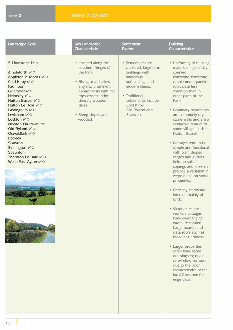
5 Limestone Hills
Ampleforth ✔°Appleton le Moors ✔°Cold Kirby ✔°Fadmoor Gillamoor ✔°Helmsley ✔°Hutton Buscel ✔°Hutton Le Hole ✔°Lastingham ✔°Levisham ✔°Lockton ✔°Newton On RawcliffeOld Byland ✔°Oswaldkirk ✔°PockleyScawtonSinnington ✔°SpauntonThornton Le Dale ✔°West/East Ayton ✔°
Key LandscapeCharacteristics
• Located along the southern fringes ofthe Park.
• Rising at a shallow angle to prominentescarpments with flattops dissected bydensely woodeddales.
• Steep slopes are wooded.
Settlement Pattern
• Settlements are clustered, large farmbuildings withnumerousoutbuildings andmodern sheds.
• Traditional settlements includeCold Kirby, Old Byland andScawton.
Building Characteristics
• Uniformity of building materials – generallycoursedlimestone/limestonerubble under pantileroof, slate lesscommon than inother parts of thePark.
• Boundary treatments are commonly drystone walls and are adistinctive feature ofsome villages such asHutton Buscel.
• Cottages tend to be simple and functionalwith plain dippedverges and guttersheld on spikes,copings and kneelersprovide a variation inverge detail on someproperties.
• Chimney stacks are internal, mainly ofbrick.
• Victorian estate workers cottageshave overhangingeaves, decoratedbarge boards andslate roofs such asthose at Hackness.
• Larger properties often have stonedressings eg quoinsor window surroundsdue to the poorcharacteristics of thelocal limestone foredge detail.
17
DESIGN IN CONTEXTSECTION 2
Landscape Type
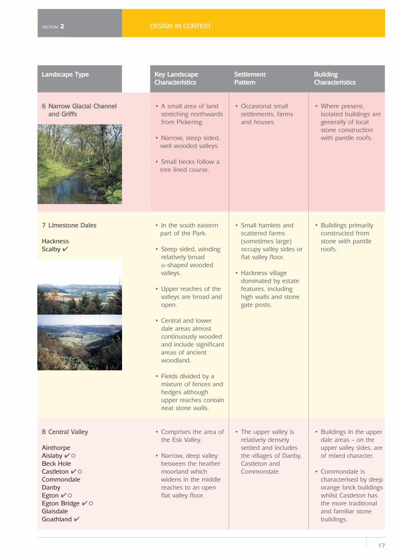
6 Narrow Glacial Channel and Griffs
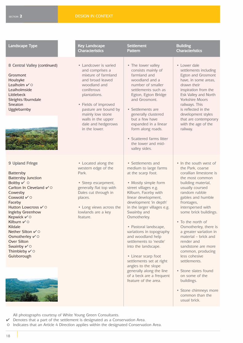
7 Limestone Dales
Hackness Scalby ✔
8 Central Valley
AinthorpeAislaby ✔°Beck HoleCastleton ✔°CommondaleDanbyEgton ✔°Egton Bridge ✔°GlaisdaleGoathland ✔
Key LandscapeCharacteristics
• A small area of land stretching northwardsfrom Pickering.
• Narrow, steep sided, well wooded valleys.
• Small becks follow a tree lined course.
• In the south eastern part of the Park.
• Steep sided, winding relatively broad u-shaped woodedvalleys.
• Upper reaches of the valleys are broad andopen.
• Central and lower dale areas almostcontinuously woodedand include significantareas of ancientwoodland.
• Fields divided by a mixture of fences andhedges althoughupper reaches containneat stone walls.
• Comprises the area of the Esk Valley.
• Narrow, deep valley between the heathermoorland whichwidens in the middlereaches to an openflat valley floor.
Settlement Pattern
• Occasional small settlements, farmsand houses.
• Small hamlets and scattered farms(sometimes large)occupy valley sides orflat valley floor.
• Hackness village dominated by estatefeatures, includinghigh walls and stonegate posts.
• The upper valley is relatively denselysettled and includesthe villages of Danby,Castleton andCommondale.
Building Characteristics
• Where present, isolated buildings aregenerally of localstone constructionwith pantile roofs.
• Buildings primarily constructed fromstone with pantileroofs.
• Buildings in the upper dale areas – on theupper valley sides, areof mixed character.
• Commondale is characterised by deeporange brick buildingswhilst Castleton hasthe more traditionaland familiar stonebuildings.
DESIGN IN CONTEXT
18
SECTION 2
Landscape Type
8 Central Valley (continued)
GrosmontHoulsykeLealholm ✔°LealholmsideLittlebeckSleights/IburndaleSneatonUgglebarnby
9 Upland Fringe
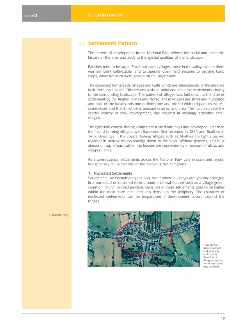
BattersbyBattersby JunctionBoltby ✔ °Carlton In Cleveland ✔°CowesbyCoxwold ✔°FacebyHutton Lowcross ✔°Ingleby GreenhowKepwick ✔°Kilburn ✔°KildaleNether Silton ✔°Osmotherley ✔°Over SiltonSwainby ✔°Thimbleby ✔°Guisborough
Key LandscapeCharacteristics
• Landcover is varied and comprises amixture of farmlandand broad leavedwoodland andconiferousplantations.
• Fields of improved pasture are bound bymainly low stonewalls in the upperdale and hedgerowsin the lower.
• Located along thewestern edge of thePark.
• Steep escarpment,generally flat top withDales cut through inplaces.
• Long views across thelowlands are a keyfeature.
Settlement Pattern
• The lower valley consists mainly offarmland andwoodland and anumber of smallersettlements such asEgton, Egton Bridgeand Grosmont.
• Settlements are generally clusteredbut a few haveexpanded in a linearform along roads.
• Scattered farms litter the lower and mid-valley sides.
• Settlements andmedium to large farmsat the scarp foot.
• Mostly simple formstreet villages e.g.Kilburn, Faceby withlinear development,development ‘in depth’in the larger villages e.g.Swainby andOsmotherley.
• Pastoral landscape,variations in topographyand woodland helpsettlements to ‘nestle’into the landscape.
• Linear scarp footsettlements set at rightangles to the slopegenerally along the lineof a beck are a frequentfeature of the area.
Building Characteristics
• Lower dale settlements includingEgton and Grosmonthave, in some areas,drawn theirinspiration from theEsk Valley and NorthYorkshire Moorsrailways. This is reflected in thedevelopment stylesthat are contemporarywith the age of therailway.
• In the south west of the Park, coarsecorallian limestone isthe most commonbuilding material,usually coursedrandom rubblegables and humblefrontages,interspersed withsome brick buildings.
• To the north of Osmotherley, there isa greater variation inmaterial – brick andrender andsandstone are morecommon, producingless cohesivesettlements.
• Stone slates found on some of thebuildings.
• Stone chimneys more common than theusual brick.
All photographs courtesy of White Young Green Consultants.✔ Denotes that a part of the settlement is designated as a Conservation Area.
° Indicates that an Article 4 Direction applies within the designated Conservation Area.
19
DESIGN IN CONTEXT
2.3 Settlement Pattern
The pattern of development in the National Park reflects the social and economichistory of the area and adds to the special qualities of the landscape.
Parishes tend to be large. Small nucleated villages arose in the valleys where therewas sufficient cultivatable land to operate open field systems to provide basiccrops, while livestock were grazed on the higher land.
The dispersed farmsteads, villages and walls which are characteristic of the area arebuilt from local stone. This creates a visual unity and links the settlements closelyto the surrounding landscape. The pattern of villages was laid down at the time ofsettlement by the Angles, Danes and Norse. These villages are small and nucleatedand built of the local sandstone or limestone and roofed with red pantiles, slates,stone slates and thatch, which is unusual in an upland area. This, coupled with thecareful control of new development, has resulted in strikingly attractive smallvillages.
The tight-knit coastal fishing villages are tucked into bays and developed later thanthe inland farming villages, with Sandsend first recorded in 1254 and Staithes in1415. Dwellings in the coastal fishing villages such as Staithes are tightly packedtogether in narrow valleys leading down to the bays. Without gardens, and builtalmost on top of each other, the houses are connected by a network of alleys andstepped lanes.
As a consequence, settlements across the National Park vary in scale and layout,but generally fall within one of the following five categories.
1. Nucleated Settlements Settlements like Osmotherley (below), occur where buildings are typically arrangedin a nucleated or clustered form around a central feature such as a village green,common, church or road junction. Densities in these settlements tend to be higherwithin the main ‘core’ area and less dense on the periphery. The character ofnucleated settlements can be jeopardised if development occurs beyond thefringes.
SECTION 2
© North YorkMoors NationalPark Authority and HuntingAerofilms Ltd. All rights reserved. No further copiesmay be made.
Osmotherley
DESIGN IN CONTEXT
20
SECTION 2
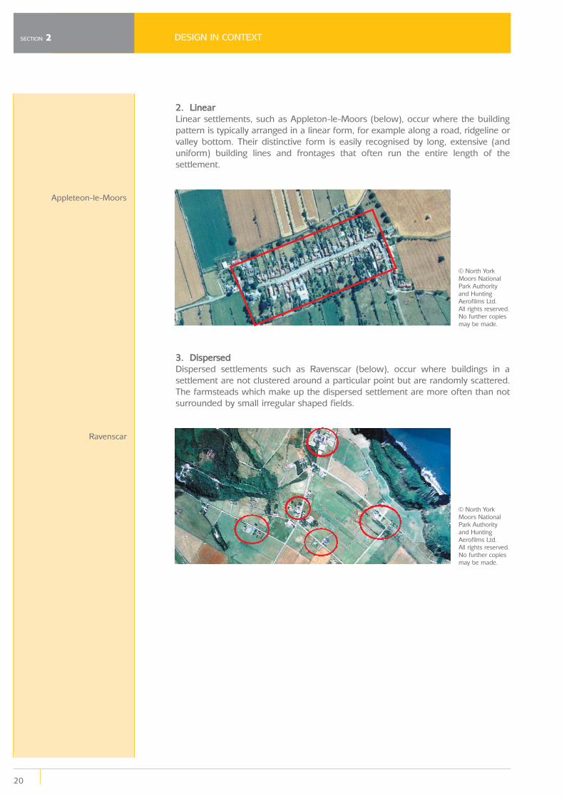
2. LinearLinear settlements, such as Appleton-le-Moors (below), occur where the buildingpattern is typically arranged in a linear form, for example along a road, ridgeline orvalley bottom. Their distinctive form is easily recognised by long, extensive (anduniform) building lines and frontages that often run the entire length of thesettlement.
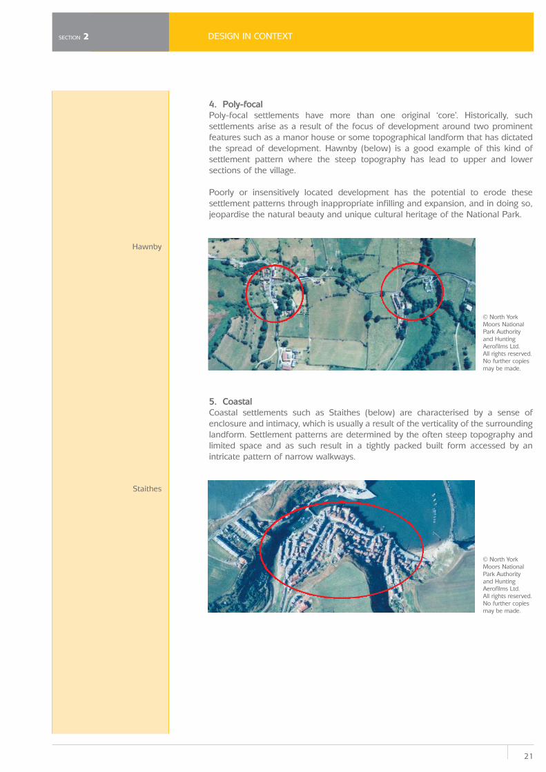
3. Dispersed Dispersed settlements such as Ravenscar (below), occur where buildings in asettlement are not clustered around a particular point but are randomly scattered.The farmsteads which make up the dispersed settlement are more often than notsurrounded by small irregular shaped fields.
Appleteon-le-Moors
Ravenscar
© North YorkMoors NationalPark Authority and HuntingAerofilms Ltd. All rights reserved. No further copiesmay be made.
© North YorkMoors NationalPark Authority and HuntingAerofilms Ltd. All rights reserved. No further copiesmay be made.
21
DESIGN IN CONTEXT
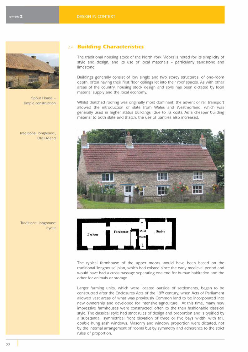
4. Poly-focal Poly-focal settlements have more than one original ‘core’. Historically, suchsettlements arise as a result of the focus of development around two prominentfeatures such as a manor house or some topographical landform that has dictatedthe spread of development. Hawnby (below) is a good example of this kind ofsettlement pattern where the steep topography has lead to upper and lowersections of the village.
Poorly or insensitively located development has the potential to erode thesesettlement patterns through inappropriate infilling and expansion, and in doing so,jeopardise the natural beauty and unique cultural heritage of the National Park.
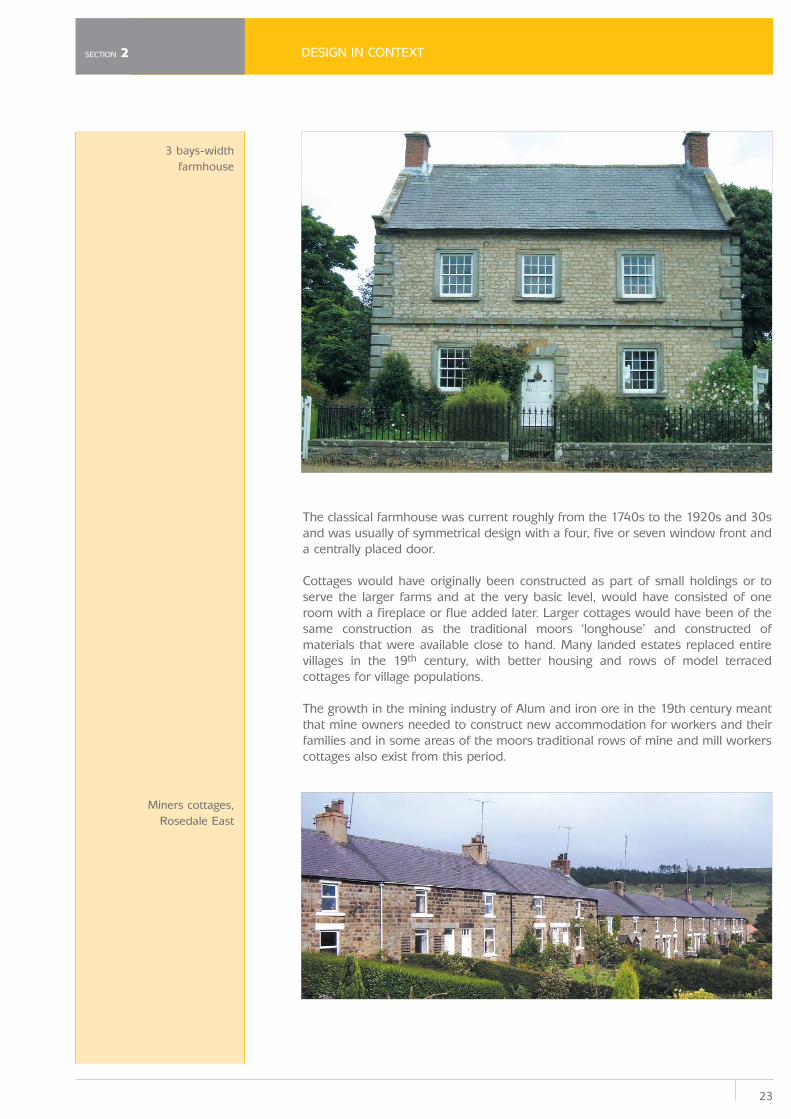
5. CoastalCoastal settlements such as Staithes (below) are characterised by a sense ofenclosure and intimacy, which is usually a result of the verticality of the surroundinglandform. Settlement patterns are determined by the often steep topography andlimited space and as such result in a tightly packed built form accessed by anintricate pattern of narrow walkways.
SECTION 2
Hawnby
Staithes
© North YorkMoors NationalPark Authority and HuntingAerofilms Ltd. All rights reserved. No further copiesmay be made.
© North YorkMoors NationalPark Authority and HuntingAerofilms Ltd. All rights reserved. No further copiesmay be made.
2.4
DESIGN IN CONTEXT
22
SECTION 2
Building Characteristics
The traditional housing stock of the North York Moors is noted for its simplicity ofstyle and design, and its use of local materials – particularly sandstone andlimestone.
Buildings generally consist of low single and two storey structures, of one-roomdepth, often having their first floor ceilings let into their roof spaces. As with otherareas of the country, housing stock design and style has been dictated by localmaterial supply and the local economy.
Whilst thatched roofing was originally most dominant, the advent of rail transportallowed the introduction of slate from Wales and Westmorland, which wasgenerally used in higher status buildings (due to its cost). As a cheaper buildingmaterial to both slate and thatch, the use of pantiles also increased.
The typical farmhouse of the upper moors would have been based on thetraditional ‘longhouse’ plan, which had existed since the early medieval period andwould have had a cross passage separating one end for human habitation and theother for animals or storage.
Larger farming units, which were located outside of settlements, began to beconstructed after the Enclosures Acts of the 18th century, when Acts of Parliamentallowed vast areas of what was previously Common land to be incorporated intonew ownership and developed for intensive agriculture. At this time, many newimpressive farmhouses were constructed, often to the then fashionable classicalstyle. The classical style had strict rules of design and proportion and is typified bya substantial, symmetrical front elevation of three or five bays width, with tall,double hung sash windows. Masonry and window proportion were dictated, notby the internal arrangement of rooms but by symmetry and adherence to the strictrules of proportion.
Spout House –simple construction
Traditional longhouse,Old Byland
Traditional longhouselayout
23
DESIGN IN CONTEXT
The classical farmhouse was current roughly from the 1740s to the 1920s and 30sand was usually of symmetrical design with a four, five or seven window front anda centrally placed door.
Cottages would have originally been constructed as part of small holdings or toserve the larger farms and at the very basic level, would have consisted of oneroom with a fireplace or flue added later. Larger cottages would have been of thesame construction as the traditional moors ‘longhouse’ and constructed ofmaterials that were available close to hand. Many landed estates replaced entirevillages in the 19th century, with better housing and rows of model terracedcottages for village populations.
The growth in the mining industry of Alum and iron ore in the 19th century meantthat mine owners needed to construct new accommodation for workers and theirfamilies and in some areas of the moors traditional rows of mine and mill workerscottages also exist from this period.
SECTION 2
3 bays-widthfarmhouse
Miners cottages,Rosedale East
DESIGN IN CONTEXT
24
SECTION 2
Construction of houses in the 20th century was emphasized by a move towardsnational and international fashionable styles and not the local styles that had beenprevalent in the moors area previously. Standardisation of building materials andthe ease of moving materials from one part of the country to another more cheaplybegan to erode the distinct local style.
House design in the 1920s and 1930s, became influenced by a distinct ‘English’style, which had more to do with design influences from the south east countiessuch as Kent and Sussex and popular features of housing from this time includetimber framing, rendering, hipped roofs and leaded windows. Materials weredistributed throughout the country and a house in a London suburb could haveeasily been of the same design as a house in a North Yorkshire village.
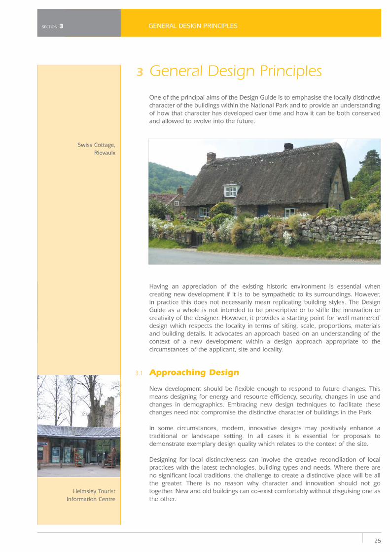
Post-war housing has continued to spread a homogeny throughout the country,with factory produced components being very popular in new construction. As aconsequence there is concern that a standardised approach to the design of newdevelopment is being adopted in the National Park. The incorporation of a standardrange of building features is increasingly resulting in a ubiquitous and eclectic ‘style’of development which is failing to reflect the variations in the landscape andbuilding characteristics. There is concern that, over time, this will dilute thedistinctive qualities of the built form of the National Park.
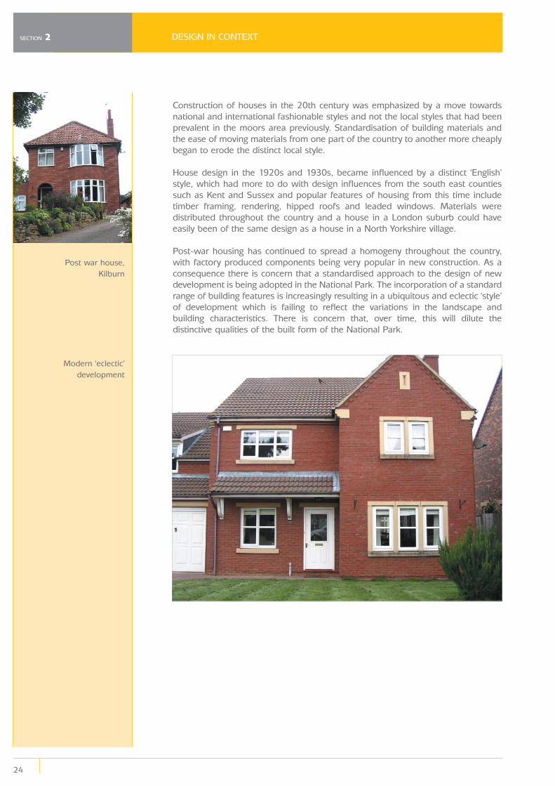
Post war house,Kilburn
Modern ‘eclectic’development
25
GENERAL DESIGN PRINCIPLES
3
3.1
General Design Principles
One of the principal aims of the Design Guide is to emphasise the locally distinctivecharacter of the buildings within the National Park and to provide an understandingof how that character has developed over time and how it can be both conservedand allowed to evolve into the future.
Having an appreciation of the existing historic environment is essential whencreating new development if it is to be sympathetic to its surroundings. However,in practice this does not necessarily mean replicating building styles. The DesignGuide as a whole is not intended to be prescriptive or to stifle the innovation orcreativity of the designer. However, it provides a starting point for ‘well mannered’design which respects the locality in terms of siting, scale, proportions, materialsand building details. It advocates an approach based on an understanding of thecontext of a new development within a design approach appropriate to thecircumstances of the applicant, site and locality.
Approaching Design
New development should be flexible enough to respond to future changes. Thismeans designing for energy and resource efficiency, security, changes in use andchanges in demographics. Embracing new design techniques to facilitate thesechanges need not compromise the distinctive character of buildings in the Park.
In some circumstances, modern, innovative designs may positively enhance atraditional or landscape setting. In all cases it is essential for proposals todemonstrate exemplary design quality which relates to the context of the site.
Designing for local distinctiveness can involve the creative reconciliation of localpractices with the latest technologies, building types and needs. Where there areno significant local traditions, the challenge to create a distinctive place will be allthe greater. There is no reason why character and innovation should not gotogether. New and old buildings can co-exist comfortably without disguising one asthe other.
SECTION 3
Helmsley TouristInformation Centre
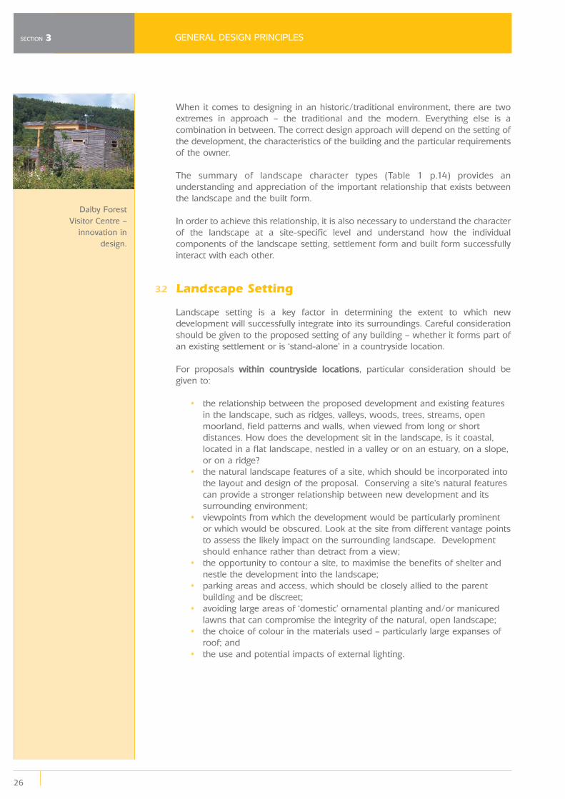
Swiss Cottage,Rievaulx
3.2
GENERAL DESIGN PRINCIPLES
26
SECTION 3
When it comes to designing in an historic/traditional environment, there are twoextremes in approach – the traditional and the modern. Everything else is acombination in between. The correct design approach will depend on the setting ofthe development, the characteristics of the building and the particular requirementsof the owner.
The summary of landscape character types (Table 1 p.14) provides anunderstanding and appreciation of the important relationship that exists betweenthe landscape and the built form.
In order to achieve this relationship, it is also necessary to understand the characterof the landscape at a site-specific level and understand how the individualcomponents of the landscape setting, settlement form and built form successfullyinteract with each other.
Landscape Setting
Landscape setting is a key factor in determining the extent to which newdevelopment will successfully integrate into its surroundings. Careful considerationshould be given to the proposed setting of any building – whether it forms part ofan existing settlement or is ‘stand-alone’ in a countryside location.
For proposals within countryside locations, particular consideration should be given to:
• the relationship between the proposed development and existing features in the landscape, such as ridges, valleys, woods, trees, streams, openmoorland, field patterns and walls, when viewed from long or shortdistances. How does the development sit in the landscape, is it coastal,located in a flat landscape, nestled in a valley or on an estuary, on a slope,or on a ridge?
• the natural landscape features of a site, which should be incorporated into the layout and design of the proposal. Conserving a site’s natural featurescan provide a stronger relationship between new development and itssurrounding environment;
• viewpoints from which the development would be particularly prominent or which would be obscured. Look at the site from different vantage pointsto assess the likely impact on the surrounding landscape. Developmentshould enhance rather than detract from a view;
• the opportunity to contour a site, to maximise the benefits of shelter and nestle the development into the landscape;
• parking areas and access, which should be closely allied to the parent building and be discreet;
• avoiding large areas of ‘domestic’ ornamental planting and/or manicured lawns that can compromise the integrity of the natural, open landscape;
• the choice of colour in the materials used – particularly large expanses of roof; and
• the use and potential impacts of external lighting.
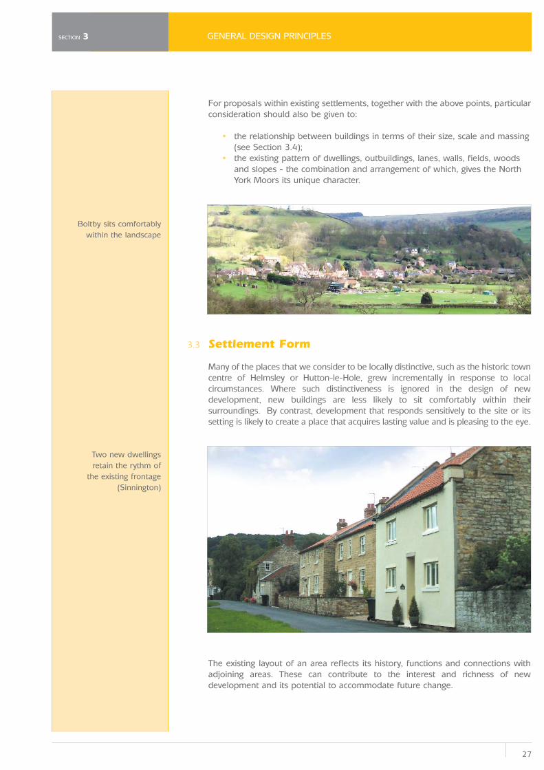
Dalby ForestVisitor Centre –
innovation indesign.
27
GENERAL DESIGN PRINCIPLES
3.3
For proposals within existing settlements, together with the above points, particularconsideration should also be given to:
• the relationship between buildings in terms of their size, scale and massing (see Section 3.4);
• the existing pattern of dwellings, outbuildings, lanes, walls, fields, woods and slopes - the combination and arrangement of which, gives the NorthYork Moors its unique character.
Settlement Form
Many of the places that we consider to be locally distinctive, such as the historic towncentre of Helmsley or Hutton-le-Hole, grew incrementally in response to localcircumstances. Where such distinctiveness is ignored in the design of newdevelopment, new buildings are less likely to sit comfortably within theirsurroundings. By contrast, development that responds sensitively to the site or itssetting is likely to create a place that acquires lasting value and is pleasing to the eye.
The existing layout of an area reflects its history, functions and connections withadjoining areas. These can contribute to the interest and richness of newdevelopment and its potential to accommodate future change.
SECTION 3
Boltby sits comfortablywithin the landscape
Two new dwellingsretain the rythm of
the existing frontage(Sinnington)
3.4
GENERAL DESIGN PRINCIPLES
28
SECTION 3
To this extent:
• Existing buildings and structures should be retained and integrated into new development where they contribute to the character and appearanceof the landscape as well as retaining buildings of local distinctiveness,historic or townscape merit.
• Local building forms and details that contribute to the distinctive qualities of a place should be interpreted in new development without undulyrestricting the scope of the designer.
• In historic and established areas, plot size is usually an important determinant of visual character, and the existing rhythm of these plotsshould influence the design of new development.
• Generally, infill development should relate to existing surrounding development in terms of scale, density, massing, space between buildings,building form and design detail.
When considering the siting of your proposal, ask yourself the following:
• What is the predominant form of the settlement? Is it linear, nucleated or dispersed?
• Are existing buildings predominantly single detached, semi-detached,terraced or single storey?
• Does the proposal respect the position and character of existing development – are buildings set back from the highway and in a random pattern or do they directly front the pavement edge in a terraced form?
• Does the development affect the relationship between the edge of the village and the wider countryside beyond?
• Does the development respect the privacy and amenity of adjacent orneighbouring properties?
• How does the property relate to other existing structures on the site?• Does the proposed position necessitate the removal of a part of the
boundary (whether it be a hedge, stone wall or fence)?
Built Form
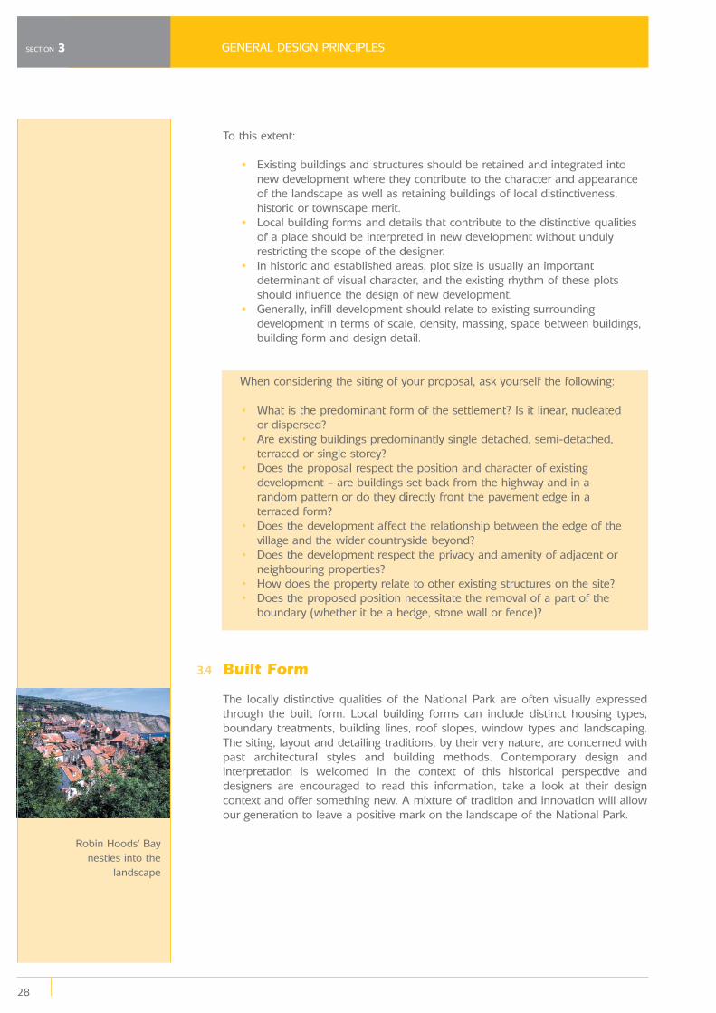
The locally distinctive qualities of the National Park are often visually expressedthrough the built form. Local building forms can include distinct housing types,boundary treatments, building lines, roof slopes, window types and landscaping.The siting, layout and detailing traditions, by their very nature, are concerned withpast architectural styles and building methods. Contemporary design andinterpretation is welcomed in the context of this historical perspective anddesigners are encouraged to read this information, take a look at their designcontext and offer something new. A mixture of tradition and innovation will allowour generation to leave a positive mark on the landscape of the National Park.
Robin Hoods’ Baynestles into the
landscape
29
GENERAL DESIGN PRINCIPLES
The key components of the ‘built form’4 include:
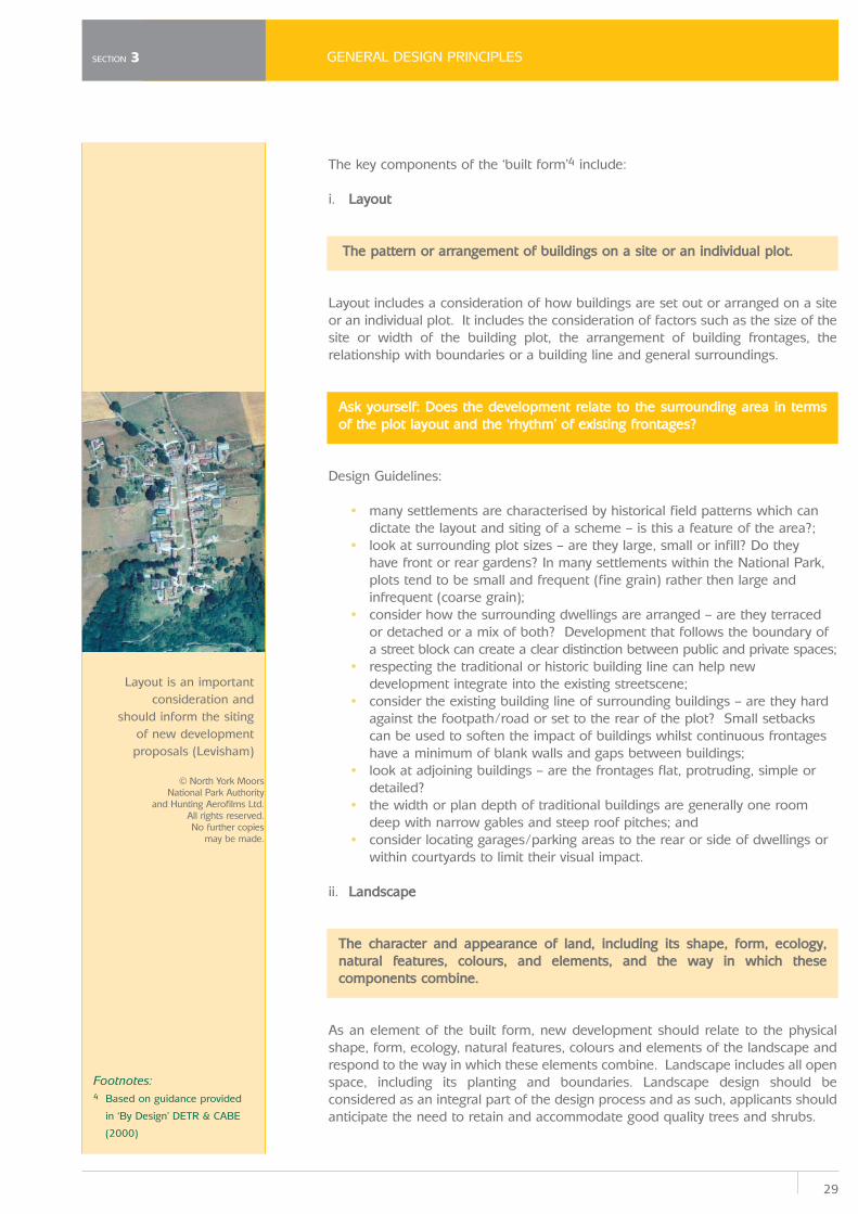
i. Layout
The pattern or arrangement of buildings on a site or an individual plot.
Layout includes a consideration of how buildings are set out or arranged on a siteor an individual plot. It includes the consideration of factors such as the size of thesite or width of the building plot, the arrangement of building frontages, therelationship with boundaries or a building line and general surroundings.
Ask yourself: Does the development relate to the surrounding area in termsof the plot layout and the ‘rhythm’ of existing frontages?
Design Guidelines:
• many settlements are characterised by historical field patterns which can dictate the layout and siting of a scheme – is this a feature of the area?;
• look at surrounding plot sizes – are they large, small or infill? Do they have front or rear gardens? In many settlements within the National Park,plots tend to be small and frequent (fine grain) rather then large andinfrequent (coarse grain);
• consider how the surrounding dwellings are arranged – are they terraced or detached or a mix of both? Development that follows the boundary ofa street block can create a clear distinction between public and private spaces;
• respecting the traditional or historic building line can help new development integrate into the existing streetscene;
• consider the existing building line of surrounding buildings – are they hard against the footpath/road or set to the rear of the plot? Small setbackscan be used to soften the impact of buildings whilst continuous frontageshave a minimum of blank walls and gaps between buildings;
• look at adjoining buildings – are the frontages flat, protruding, simple or detailed?
• the width or plan depth of traditional buildings are generally one room deep with narrow gables and steep roof pitches; and
• consider locating garages/parking areas to the rear or side of dwellings or within courtyards to limit their visual impact.
ii. Landscape
The character and appearance of land, including its shape, form, ecology,natural features, colours, and elements, and the way in which thesecomponents combine.
As an element of the built form, new development should relate to the physicalshape, form, ecology, natural features, colours and elements of the landscape andrespond to the way in which these elements combine. Landscape includes all openspace, including its planting and boundaries. Landscape design should beconsidered as an integral part of the design process and as such, applicants shouldanticipate the need to retain and accommodate good quality trees and shrubs.
SECTION 3
Layout is an importantconsideration and
should inform the sitingof new developmentproposals (Levisham)
© North York Moors National Park Authority
and Hunting Aerofilms Ltd. All rights reserved. No further copies
may be made.
Footnotes:4 Based on guidance provided
in ‘By Design’ DETR & CABE
(2000)
GENERAL DESIGN PRINCIPLES
30
SECTION 3
Landscape design is an integral part of the planning and development process. Itsearly consideration in the design process is essential if development is tosuccessfully integrate with and blend into its surroundings.
Ask yourself: Has the design of the landscaping, within and surrounding thedevelopment been carefully considered to create a successful environmentthat is attractive and easy to understand?
Design Guidelines:
• through appropriate siting and landscaping techniques such as planting, new development should blend into the surrounding landscape;
• development should respond to or take account of the physical features of a site i.e. the contours; landforms, ridges, screening and shelter opportunities; and
• the choice of plant used for landscaping should reflect its function, purpose and location – as well as be attractive.
Further detailed advice on landscape matters can be found in Part 3 of the DesignGuide (Trees and Landscape).
iii. Scale, Height & Massing
Scale is the size of a building in relation to its surroundings (particularlyneighbouring buildings). Scale is a product of both the height and bulk of abuilding.
Height determines the impact of development on views, vistas and skylines. Heightand bulk combine to form the massing of a building. Massing is the three-dimensional expression of the amount of development on a given piece of land.The scale, height and massing of a building can also have implications on itscapacity to be energy efficient and sustainable for example through maximisingexposure to sunlight or retaining heat (refer to Section 3.5 for more details).
Ask yourself: Does the development relate to the surrounding builtenvironment in terms of its height and massing? Do the features of thebuildings' frontage relate to human scale?
Design Guidelines:
• ensure that the development respects the existing overall scale of the settlement;
• consider the scale, massing and height of a building in relation to adjoining or adjacent buildings and their respective dimensions;
• building heights including eaves and ridge heights should be determined by the character and function of the individual buildings and theirrelationship to the street or public spaces. Buildings are, for the most part,one or two storey in height, although three storey dwellings are morecommon in the coastal settlements of the Park;
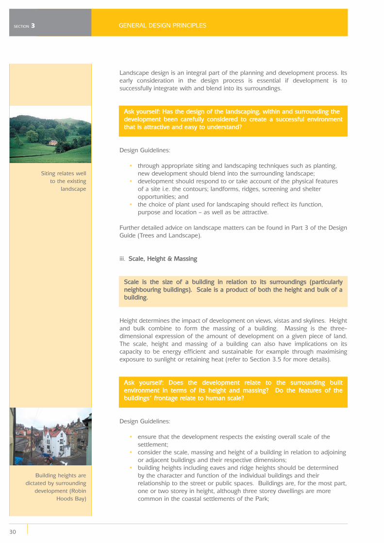
Siting relates wellto the existing
landscape
Building heights aredictated by surrounding
development (RobinHoods Bay)
31
GENERAL DESIGN PRINCIPLES
• where appropriate, buildings should be arranged to assist in the variation of building height, creating visual interest and breaking up the overall massof the development;
• consider the degree of enclosure or the proportion of buildings, the design of the windows and any other features/elements within a developmentand their likely impact on people;
• building silhouettes and profiles are also important so careful consideration should be given to secondary elements such as chimneys; and
• look at the roof form, in particular its pitch (which is dependent on the use of available roofing materials) – is it consistent with others in the area?
iv. Appearance (Details)
Detailing is the result of the craftsmanship, the building techniques employedin construction and the design styles incorporated into a building or structure.
The way in which individual elements of design detail combine within a building canseparate the good from the bad. Detailing can include openings such as windowsand doors, roofing detail (chimneys, dormers, pitch and eaves) and material typesand the ways in which they are used to reflect the traditional vernacular.
Ask yourself: Does the development exhibit a high quality of architecturaldetail that has been developed having regard to its relationship with itssurroundings?
Design Guidelines:
• windows and doors are critical to the success of any building. Clumsy, poorly detailed windows can let schemes down and can erode the qualityof the wider context. When thinking of replacing windows in an existingproperty, extreme care should be taken to ensure that the new fittingsreflect the original character of the property;
• windows in properties within the National Park are traditionally constructed of timber and are mainly of Yorkshire horizontally sliding sashor some vertical double hung sash construction. Fixed mullion windows orsliding casements are also common, whilst Whitby composite windowsfeature in coastal areas. Choose a window design appropriate to theoriginal period of the house;
• use simple vertically boarded or panelled timber doors, with or without partial glazing and avoid the use of over elaborate doors particularly insimple, smaller properties;
• roof pitches are typically between 30° and 45° – but detailing should relate to the material used. The choice of material will be dependent onthe character of the area;
• consider different styles of dormer windows;• dormers should not dominate the elevation;• the use of dormers on front elevations will generally be inappropriate
unless the street or area is characterised by similar features;• features such as chimneys tend to be internal and of brick on stone houses;• care must always be taken to ensure that the craftsmanship employed is
of a high standard and is carried out by a person experienced in workingwith the relevant material;
SECTION 3
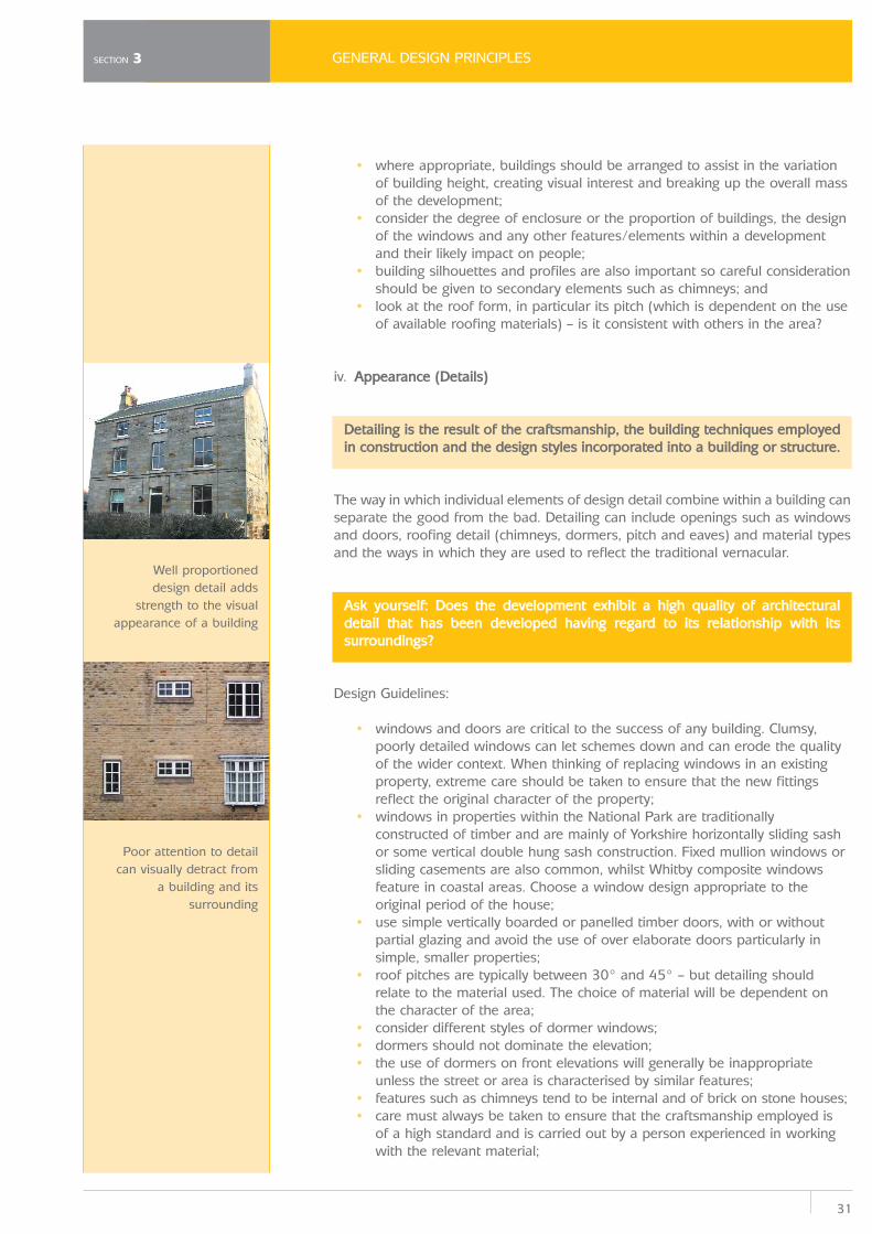
Well proportioneddesign detail adds
strength to the visualappearance of a building
Poor attention to detailcan visually detract from
a building and itssurrounding
GENERAL DESIGN PRINCIPLES
32
SECTION 3
• careful attention should be paid to detailing such as mortar joints, brick bonding, corbelling, the eaves and recessed windows – all of which areimportant details and should be used where appropriate; and
• if other elements are added to a dwelling (e.g. extensions), they should be subservient to the dominant element.
Further advice on building detail can be found in Part 2 of the Design Guide(Extensions and Alterations to Dwellings).
v. Appearance (Materials)
The texture, colour, pattern and durability of materials.
The texture and colour of materials reflects an area’s special function and character.The long-term appearance of buildings and their impact on the character of the areais greatly influenced by the type of materials used. It is not the just the choice ofsuitable materials that is important, but also their effective use to ensure newbuildings are sympathetic to their setting. Therefore, the choice of the right materialsand their correct use are a paramount consideration in the design process andshould be treated with equal status to the siting, form and design of a new building.
Ask yourself: Does the development use a palette of materials which relate to its context?
Design Guidelines:
• consider the visual impact of the materials chosen on the architectural features (windows, doors) and built form;
• consider the quality, fixing methods, colour, texture and profile which should reflect the local vernacular. Unlike natural materials, artificial materials tendto be less responsive to weathering, which can impact on the visualappearance of a building and how it ‘settles’ into the wider streetscape;
• original stone or brickwork should not be rendered, clad or painted as this changes the character of the existing building and can damage originalfabric and may lead to damp related problems;
• match or complement the range of materials that are characteristic of the area. There is greater opportunity to introduce innovative materials inindividual stand-alone buildings of size and quality;
• avoid the use of uPVC and anodised aluminium replacement windows; timber is a more sustainable and traditional material;
• roof pitches and detailing should relate to the material used. The choice of material is dependent on the character of the area;
• use natural, non-interlocking clay pantiles rather than composite or concrete tiles which can appear thick and heavy, or artificially coloured tilesthat can appear stark;
• avoid white or brown uPVC, aluminium or varnished hardwood (reproduction) doors;
• use a limited palette of materials to ensure coherence, particularly on small or infill developments or in sensitive locations such as Conservation Areas;
• use good quality materials for an attractive yet enduring appearance; and• where appropriate, consider the use of innovative materials and
construction, especially where there are sustainability and energy efficiencybenefits associated with them.
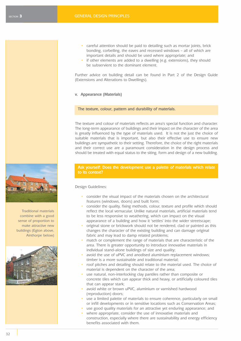
Traditional materialscombine with a good
sense of proportion tomake attractive new
buildings (Egton above,Ainthorpe below)
33
GENERAL DESIGN PRINCIPLES
3.5 Sustainable Design
The principle of sustainability applies equally to small scale building projects as tolarger developments. Good design embodies sustainable practice including choiceof materials, construction techniques, building features and flexibility for re-use.
In relation to new developments or re-using existing buildings, some generalprinciples can be followed. In the National Park careful consideration has to begiven to the visual impact of development and therefore a compromise may benecessary and not all of the techniques set out below will be appropriate in alllocations. Many of the measures will be straightforward to apply, particularly whenconsidered in the early stages of the design process.
Siting and Design
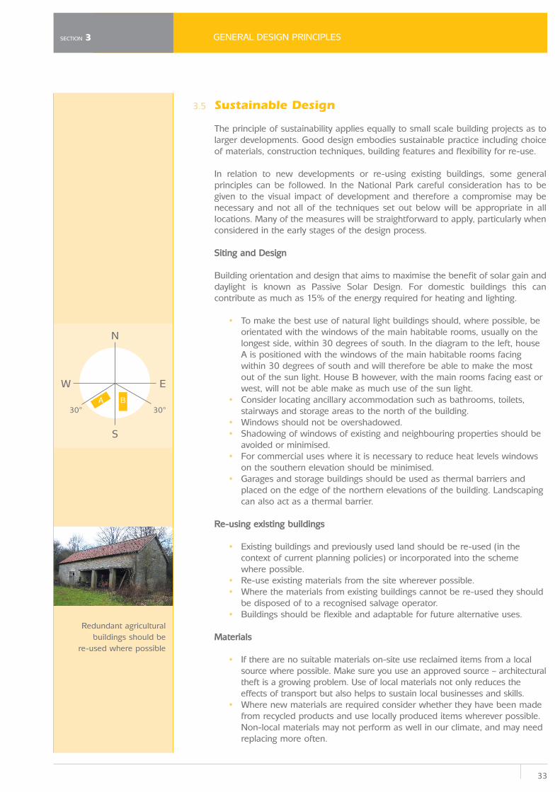
Building orientation and design that aims to maximise the benefit of solar gain anddaylight is known as Passive Solar Design. For domestic buildings this cancontribute as much as 15% of the energy required for heating and lighting.
• To make the best use of natural light buildings should, where possible, be orientated with the windows of the main habitable rooms, usually on thelongest side, within 30 degrees of south. In the diagram to the left, houseA is positioned with the windows of the main habitable rooms facingwithin 30 degrees of south and will therefore be able to make the mostout of the sun light. House B however, with the main rooms facing east orwest, will not be able make as much use of the sun light.
• Consider locating ancillary accommodation such as bathrooms, toilets, stairways and storage areas to the north of the building.
• Windows should not be overshadowed.• Shadowing of windows of existing and neighbouring properties should be
avoided or minimised.• For commercial uses where it is necessary to reduce heat levels windows
on the southern elevation should be minimised. • Garages and storage buildings should be used as thermal barriers and
placed on the edge of the northern elevations of the building. Landscapingcan also act as a thermal barrier.
Re-using existing buildings
• Existing buildings and previously used land should be re-used (in the context of current planning policies) or incorporated into the schemewhere possible.
• Re-use existing materials from the site wherever possible. • Where the materials from existing buildings cannot be re-used they should
be disposed of to a recognised salvage operator. • Buildings should be flexible and adaptable for future alternative uses.
Materials
• If there are no suitable materials on-site use reclaimed items from a local source where possible. Make sure you use an approved source – architecturaltheft is a growing problem. Use of local materials not only reduces theeffects of transport but also helps to sustain local businesses and skills.
• Where new materials are required consider whether they have been made from recycled products and use locally produced items wherever possible.Non-local materials may not perform as well in our climate, and may needreplacing more often.
SECTION 3
N
S
W E
30°30°A B
Redundant agriculturalbuildings should be
re-used where possible
GENERAL DESIGN PRINCIPLES
34
SECTION 3
• Use native hardwoods and softwoods from sustainable sources wherever possible. Look for the Forest Stewardship Council symbol. Furtherinformation can be obtained from www.fsc.org.
• Materials should be considered in terms of their whole life cost including their ability to be repaired and re-used.
• Use materials that can be re-used or recycled, that require low levels of maintenance and that have a long life.
• Avoid the use of uPVC. It is not a traditional material and maintenance free often means ‘not possible to maintain’ or repair. Windows or doors withonly minor damage often have to be wholly replaced.
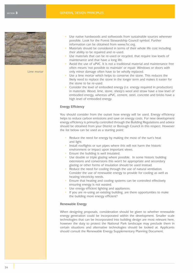
• Use a lime mortar which helps to conserve the stone. This reduces the likely need to replace the stone in the longer term and makes it easier forthe stone to be re-used.
• Consider the level of embodied energy (i.e. energy required in production) in materials. Wood, lime, stone, sheep’s wool and straw have a low level ofembodied energy, whereas uPVC, cement, steel, concrete and bricks have ahigh level of embodied energy.
Energy Efficiency
You should consider from the outset how energy will be used. Energy efficiencyhelps to reduce carbon emissions and save on energy costs. For new developmentenergy efficiency is primarily controlled through the Building Regulations and adviceshould be obtained from your District or Borough Council in this respect. Howeverthe list below can be used as a starting point:
• Reduce the need for energy by making the most of the sun’s heat and light.
• Install rooflights or sun pipes where this will not harm the historic environment or impact upon important views.
• Ensure the building is well insulated.• Use double or triple glazing where possible. In some historic building
extensions and conversions this won’t be appropriate and secondaryglazing or other forms of insulation should be used instead.
• Reduce the need for cooling through the use of natural ventilation. Consider the use of renewable energy to provide for cooling as well asheating/electricity needs.
• Ensure that heating and cooling systems can be controlled effectively ensuring energy is not wasted.
• Use energy efficient lighting and appliances.• If you are re-using an existing building, are there opportunities to make
the building more energy efficient?
Renewable Energy
When designing proposals, consideration should be given to whether renewableenergy generation could be incorporated within the development. Smaller scaletechnologies that can be incorporated into building design are most relevant here,however the duty to protect the National Park landscape may preclude them incertain situations and alternative technologies should be looked at. Applicantsshould consult the Renewable Energy Supplementary Planning Document.
Lime mortar
35
GENERAL DESIGN PRINCIPLES
Water and Drainage
The process of supplying water to homes and businesses uses significant amountsof energy. Furthermore, a lot of rainwater is unnecessarily wasted and much of thiscan contribute to the problems of flooding.
The design of the development should make good use of water by:
• Incorporating methods of collecting rain water, such as water butts, for use on site.
• Consider the use of greywater recycling systems which take used water for use elsewhere (for example, using bathwater to water the garden).
• Incorporate installations which reduce the use of water (the Building Control department of your local Council will be able to advise).
Sustainable drainage can be presented as a hierarchy:
Prevention should be the first priority with draining water off site considered as alast resort. In reality a combination of these solutions may be appropriate but asmuch water as possible should be dealt with at the higher levels.
The need for drainage and the impact of run-off should be reduced by:
• Minimising the area of hard surfaces.• Using gravel instead of paved surfaces – this enables the water to drain
away more naturally.• Installing water butts to enable the collection of rainwater for use on-site.• Ensuring that potential contaminants can be protected from washing into
water courses for example through the use of canopies and internal storage.• Incorporating filters so that contaminants can be removed before
reaching the water course.• Minimising directly connected areas – avoid draining roofs onto paved areas.
SECTION 3
Prevention(reduce the need for drainage)
Drain water within site(avoid run-off from the site)
Drain water off site
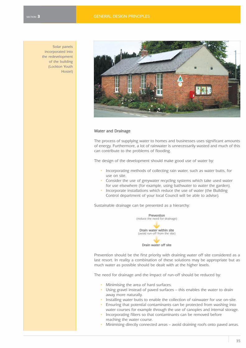
Solar panelsincorporated into
the redevelopmentof the building(Lockton Youth
Hostel)
GENERAL DESIGN PRINCIPLES
36
SECTION 3
Filter strips are gently sloping areas of vegetated land which drainwater evenly from impermeable areas. Swales are long vegetatedshallow channels which drain water in a similar way. Local wildgrass and flower species can be introduced to filter strips andswales for visual interest and to provide a wildlife habitat.
Filter drains and permeable surfaces store water undergroundletting it drain evenly into the water course. A permeable surfacecould be a grassed area, gravelled area, reinforced grass, orpaving blocks or continuous surfaces with gaps or holes (possiblyfilled with gravel) to allow water to drain away. A filter drain is anunderground pipe which takes the water away.
Infiltration devices drain water directly into the ground. Theprinciple is that run-off is stored and then evenly released into theground. They may be used at source or the run-off can be takento the infiltration area via a pipe. There are various types includingsoakaways, infiltration trenches, infiltration basins, swales, filterdrains and ponds.
Infiltration systems can be used as playing fields, recreationalareas or public open space. Infiltration basins can be planted withtrees, shrubs and other plants, improving their visual appearanceand providing habitats for wildlife.
Basins are areas for storage of surface runoff that are free fromwater in dry conditions. The basin can be a natural flood plain ora vegetated basin. Ponds contain water in dry weather and canhold more in wet weather. Basins and ponds can also act asamenity features through planting.
Sustainable Drainage Systems seek to manage water in as natural a way as possible.Sustainable Drainage Systems manage run-off from development reducing the riskof flooding on-site and elsewhere, reducing impacts on water quality and can alsoact to provide amenity features. Sustainable Drainage Systems should beincorporated within the design of all new developments wherever appropriate. Typesof sustainable drainage systems that can be incorporated on site include:
Swales and filter strips
Permeable areas
Infiltration
Basins and ponds
Waste
Construction• Waste produced during the construction process should be re-used or recycled.• For larger schemes, you may be asked to produce a waste management plan.
OperationThere should be adequate space for the storage of recycling and waste bins,including compost bins. This applies equally to residential and commercialdevelopments. The storage space should be of sufficient size and shape to containand where possible screen the bins and containers provided by the District orBorough Council. This should be designed and sited with sensitivity to ensure thatthe bins and storage area are not obtrusive in views into the site. Considerationmust be given to the moving of facilities to the roadside for collection.
(For further information on sustainable design matters refer to Appendix B)
Simple but discreet andconvenient bin storage
37
OTHER STATUTORY CONSIDERATIONS
4
4.1
4.2
Other Statutory Considerations
There are areas and buildings within the National Park that have additional specificdesignations, which must be taken into account in the design of new development.In some instances additional approvals might be required for certain developmentproposals so it is important to satisfy yourself as to whether or not any of thefollowing situations are applicable to your proposal.
Conservation Areas
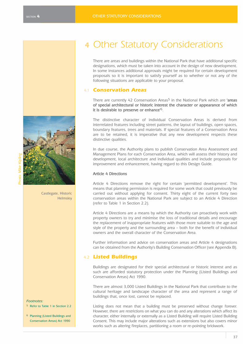
There are currently 42 Conservation Areas5 in the National Park which are ‘areasof special architectural or historic interest the character or appearance of whichit is desirable to preserve or enhance’6.
The distinctive character of individual Conservation Areas is derived frominterrelated features including street patterns, the layout of buildings, open spaces,boundary features, trees and materials. If special features of a Conservation Areaare to be retained, it is imperative that any new development respects thesedistinctive qualities.
In due course, the Authority plans to publish Conservation Area Assessment andManagement Plans for each Conservation Area, which will assess their history anddevelopment, local architecture and individual qualities and include proposals forimprovement and enhancement, having regard to this Design Guide.
Article 4 Directions
Article 4 Directions remove the right for certain ‘permitted development’. Thismeans that planning permission is required for some work that could previously becarried out without applying for consent. Thirty eight of the current forty twoconservation areas within the National Park are subject to an Article 4 Direction(refer to Table 1 in Section 2.2).
Article 4 Directions are a means by which the Authority can proactively work withproperty owners to try and minimise the loss of traditional details and encouragethe replacement of inappropriate features with those more suitable to the age andstyle of the property and the surrounding area – both for the benefit of individualowners and the overall character of the Conservation Area.
Further information and advice on conservation areas and Article 4 designationscan be obtained from the Authority’s Building Conservation Officer (see Appendix B).
Listed Buildings
Buildings are designated for their special architectural or historic interest and assuch are afforded statutory protection under the Planning (Listed Buildings andConservation Areas) Act 1990.
There are almost 3,000 Listed Buildings in the National Park that contribute to thecultural heritage and landscape character of the area and represent a range ofbuildings that, once lost, cannot be replaced.
Listing does not mean that a building must be preserved without change forever.However, there are restrictions on what you can do and any alterations which affect itscharacter, either internally or externally as a Listed Building will require Listed BuildingConsent. This may include major alterations such as extensions but also covers minorworks such as altering fireplaces, partitioning a room or re-pointing brickwork.
SECTION 4
Castlegate, HistoricHelmsley
Pho
to: M
ike
Kip
ling
Footnotes:5 Refer to Table 1 in Section 2.2
6 Planning (Listed Buildings and
Conservation Areas) Act 1990
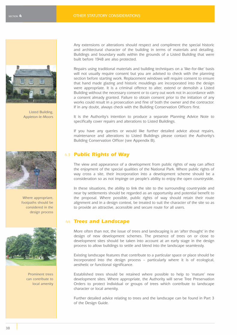
4.3
4.4
OTHER STATUTORY CONSIDERATIONS
38
SECTION 4
Any extensions or alterations should respect and compliment the special historicand architectural character of the building in terms of materials and detailing.Buildings and boundary walls within the grounds of a Listed Building that werebuilt before 1948 are also protected.
Repairs using traditional materials and building techniques on a ‘like-for-like’ basiswill not usually require consent but you are advised to check with the planningsection before starting work. Replacement windows will require consent to ensurethat hand made glazing and historic mouldings are incorporated into the designwere appropriate. It is a criminal offence to alter, extend or demolish a ListedBuilding without the necessary consent or to carry out work not in accordance witha consent already granted. Failure to obtain consent prior to the initiation of anyworks could result in a prosecution and fine of both the owner and the contractor.If in any doubt, always check with the Building Conservation Officers first.
It is the Authority’s intention to produce a separate Planning Advice Note tospecifically cover repairs and alterations to Listed Buildings.
If you have any queries or would like further detailed advice about repairs,maintenance and alterations to Listed Buildings please contact the Authority’sBuilding Conservation Officer (see Appendix B).
Public Rights of Way
The view and appearance of a development from public rights of way can affectthe enjoyment of the special qualities of the National Park. Where public rights ofway cross a site, their incorporation into a development scheme should be aconsideration so as not impinge on people’s ability to enjoy the open countryside.
In these situations, the ability to link the site to the surrounding countryside andnear by settlements should be regarded as an opportunity and potential benefit tothe proposal. Where possible, public rights of way should retain their routealignment and in a design context, be treated to suit the character of the site so asto provide an attractive, accessible and secure route for all users.
Trees and Landscape
More often than not, the issue of trees and landscaping is an ‘after thought’ in thedesign of new development schemes. The presence of trees on or close todevelopment sites should be taken into account at an early stage in the designprocess to allow buildings to settle and blend into the landscape seamlessly.
Existing landscape features that contribute to a particular space or place should beincorporated into the design process – particularly where it is of ecological,aesthetic or functional significance.
Established trees should be retained where possible to help to ‘mature’ newdevelopment sites. Where appropriate, the Authority will serve Tree PreservationOrders to protect individual or groups of trees which contribute to landscapecharacter or local amenity.
Further detailed advice relating to trees and the landscape can be found in Part 3of the Design Guide.
Listed Building,Appleton-le-Moors
Where appropriare,footpaths should be
considered in thedesign process
Prominent trees can contribute to
local amenity
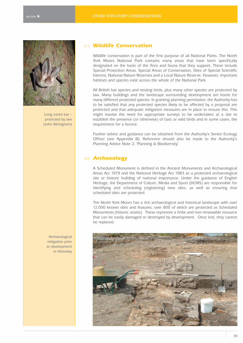
39
OTHER STATUTORY CONSIDERATIONS
4.5
4.6
Wildlife Conservation
Wildlife conservation is part of the first purpose of all National Parks. The NorthYork Moors National Park contains many areas that have been specificallydesignated on the basis of the flora and fauna that they support. These includeSpecial Protection Areas, Special Areas of Conservation, Sites of Special ScientificInterest, National Nature Reserves and a Local Nature Reserve. However, importanthabitats and species exist across the whole of the National Park.
All British bat species and nesting birds, plus many other species are protected bylaw. Many buildings and the landscape surrounding development are home formany different protected species. In granting planning permission, the Authority hasto be satisfied that any protected species likely to be affected by a proposal areprotected and that adequate mitigation measures are in place to ensure this. Thismight involve the need for appropriate surveys to be undertaken at a site toestablish the presence (or otherwise) of bats or wild birds and in some cases, therequirement for a licence.
Further advice and guidance can be obtained from the Authority’s Senior EcologyOfficer (see Appendix B). Reference should also be made to the Authority’sPlanning Advice Note 2, ‘Planning & Biodiversity’.
Archaeology
A Scheduled Monument is defined in the Ancient Monuments and ArchaeologicalAreas Act 1979 and the National Heritage Act 1983 as a protected archaeologicalsite or historic building of national importance. Under the guidance of EnglishHeritage, the Department of Culture, Media and Sport (DCMS) are responsible foridentifying and scheduling (registering) new sites, as well as ensuring thatscheduled sites are protected.
The North York Moors has a rich archaeological and historical landscape with over12,000 known sites and features, over 800 of which are protected as ScheduledMonuments (historic assets). These represent a finite and non-renewable resourcethat can be easily damaged or destroyed by development. Once lost, they cannotbe replaced.
SECTION 4
Long eared bat –protected by law
(John Altringham)
Archaeologicalmitigation priorto development
in Helmsley
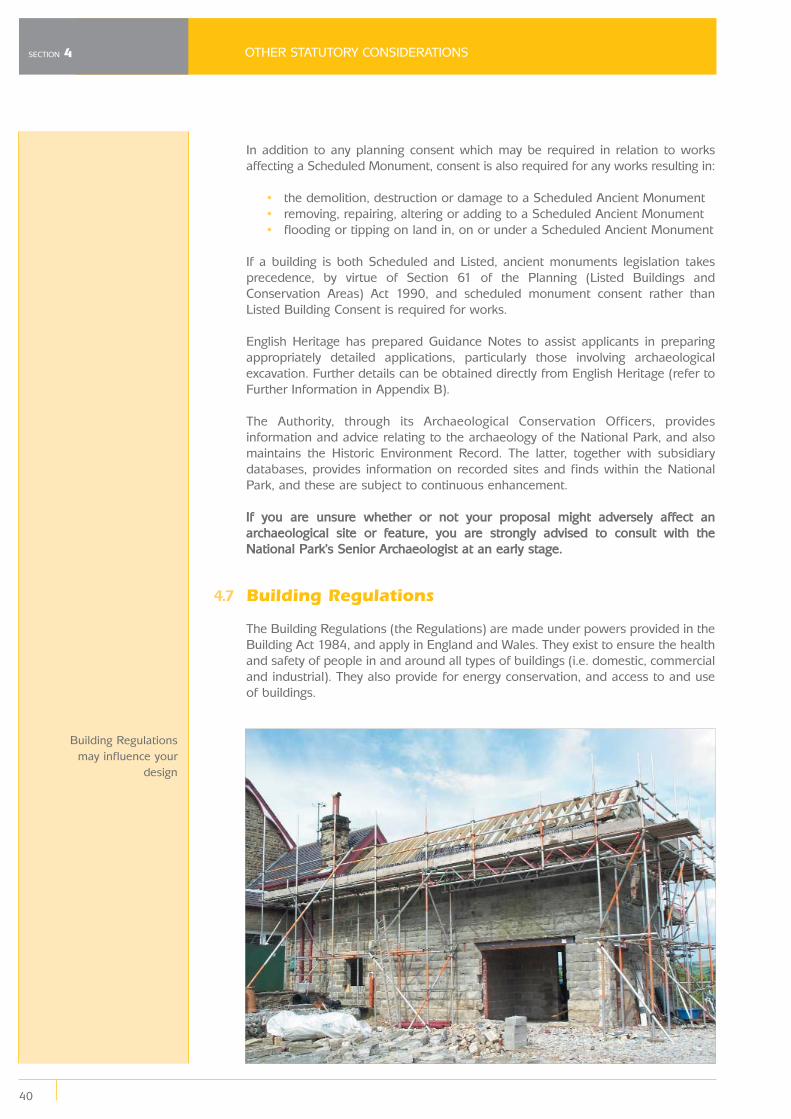
4.7
OTHER STATUTORY CONSIDERATIONS
40
SECTION 4
In addition to any planning consent which may be required in relation to worksaffecting a Scheduled Monument, consent is also required for any works resulting in:
• the demolition, destruction or damage to a Scheduled Ancient Monument• removing, repairing, altering or adding to a Scheduled Ancient Monument• flooding or tipping on land in, on or under a Scheduled Ancient Monument
If a building is both Scheduled and Listed, ancient monuments legislation takesprecedence, by virtue of Section 61 of the Planning (Listed Buildings andConservation Areas) Act 1990, and scheduled monument consent rather thanListed Building Consent is required for works.
English Heritage has prepared Guidance Notes to assist applicants in preparingappropriately detailed applications, particularly those involving archaeologicalexcavation. Further details can be obtained directly from English Heritage (refer toFurther Information in Appendix B).
The Authority, through its Archaeological Conservation Officers, providesinformation and advice relating to the archaeology of the National Park, and alsomaintains the Historic Environment Record. The latter, together with subsidiarydatabases, provides information on recorded sites and finds within the NationalPark, and these are subject to continuous enhancement.
If you are unsure whether or not your proposal might adversely affect anarchaeological site or feature, you are strongly advised to consult with theNational Park’s Senior Archaeologist at an early stage.
Building Regulations
The Building Regulations (the Regulations) are made under powers provided in theBuilding Act 1984, and apply in England and Wales. They exist to ensure the healthand safety of people in and around all types of buildings (i.e. domestic, commercialand industrial). They also provide for energy conservation, and access to and useof buildings.
Building Regulationsmay influence your
design
41
OTHER STATUTORY CONSIDERATIONS
Matters relating to the Building Regulations are dealt with by the relevant DistrictCouncil and not the National Park Authority.
The various ‘parts’ of the Regulations deal with individual aspects of building designand construction ranging from structural matters, fire safety, and energyconservation to hygiene, sound insulation, and access to and use of buildings.
The requirements within each part set out the broad objectives or functions whichthe individual aspects of the building design and construction must set out toachieve. They are therefore often referred to as ‘functional requirements’ and areexpressed in terms of what is ‘reasonable’, ‘adequate’, or ‘appropriate’. Not all thefunctional requirements may apply to your building work, but all those which doapply must be complied with as part of the overall process of complying with theBuilding Regulations.
Of particular significance is ‘Part M’ of the Regulations, which encompasses theneeds and requirements of disabled people in terms of accessing public buildings.The requirements of Part M apply to:
• Newly erected non-domestic buildings or dwellings. • Existing non-domestic buildings extended or undergoing a ‘material
alteration’ (i.e. where works affect the structure, means of escape and firespread, fire fighting access, and access to and use of the building).
• Where an existing building (or part of) undergoes a ‘material change of use’ to a hotel/boarding house, an institution, a public building or a shop.
It is important to remember that Building Regulations may influence whether ornot particular aspects of your proposed design, particularly those of a moreinnovative nature, are feasible as part of a development.
Building Regulations approval is a separate matter from obtaining planningpermission for your work. Similarly, receiving any planning permission7 which yourwork may require is not the same as taking action to ensure that it complies withthe Building Regulations.
For further detailed advice on Building Control matters you are strongly encouragedto contact the Building Inspector at your local authority (see Appendix B).
SECTION 4
Footnotes:7 If you receive Listed Building
consent for your development
and you are asked to change
the design or materials by your
Building Control Officer, you
may need to re-apply for a
variation to your original
consent. In this instance you
are advised to speak to the
Building Conservation Officers
prior to any submitted
changes.
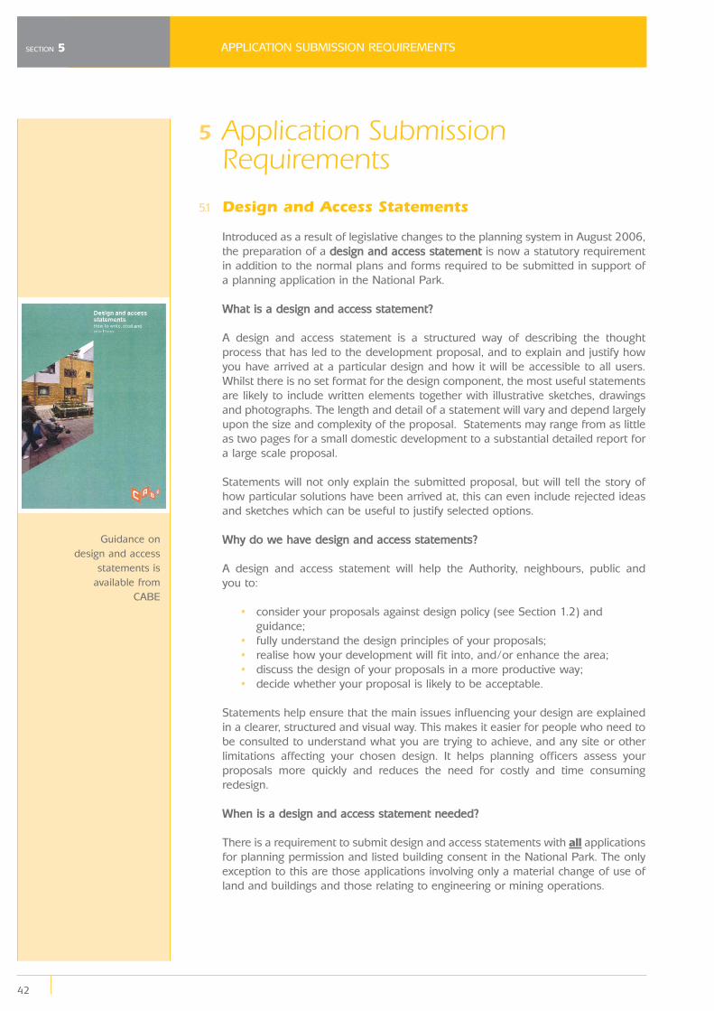
5
5.1
APPLICATION SUBMISSION REQUIREMENTS
42
SECTION 5
Application SubmissionRequirements
Design and Access Statements
Introduced as a result of legislative changes to the planning system in August 2006,the preparation of a design and access statement is now a statutory requirementin addition to the normal plans and forms required to be submitted in support ofa planning application in the National Park.
What is a design and access statement?
A design and access statement is a structured way of describing the thoughtprocess that has led to the development proposal, and to explain and justify howyou have arrived at a particular design and how it will be accessible to all users.Whilst there is no set format for the design component, the most useful statementsare likely to include written elements together with illustrative sketches, drawingsand photographs. The length and detail of a statement will vary and depend largelyupon the size and complexity of the proposal. Statements may range from as littleas two pages for a small domestic development to a substantial detailed report fora large scale proposal.
Statements will not only explain the submitted proposal, but will tell the story ofhow particular solutions have been arrived at, this can even include rejected ideasand sketches which can be useful to justify selected options.
Why do we have design and access statements?
A design and access statement will help the Authority, neighbours, public and you to:
• consider your proposals against design policy (see Section 1.2) and guidance;
• fully understand the design principles of your proposals;• realise how your development will fit into, and/or enhance the area;• discuss the design of your proposals in a more productive way;• decide whether your proposal is likely to be acceptable.
Statements help ensure that the main issues influencing your design are explainedin a clearer, structured and visual way. This makes it easier for people who need tobe consulted to understand what you are trying to achieve, and any site or otherlimitations affecting your chosen design. It helps planning officers assess yourproposals more quickly and reduces the need for costly and time consumingredesign.
When is a design and access statement needed?
There is a requirement to submit design and access statements with all applicationsfor planning permission and listed building consent in the National Park. The onlyexception to this are those applications involving only a material change of use ofland and buildings and those relating to engineering or mining operations.
Guidance ondesign and access
statements isavailable from
CABE
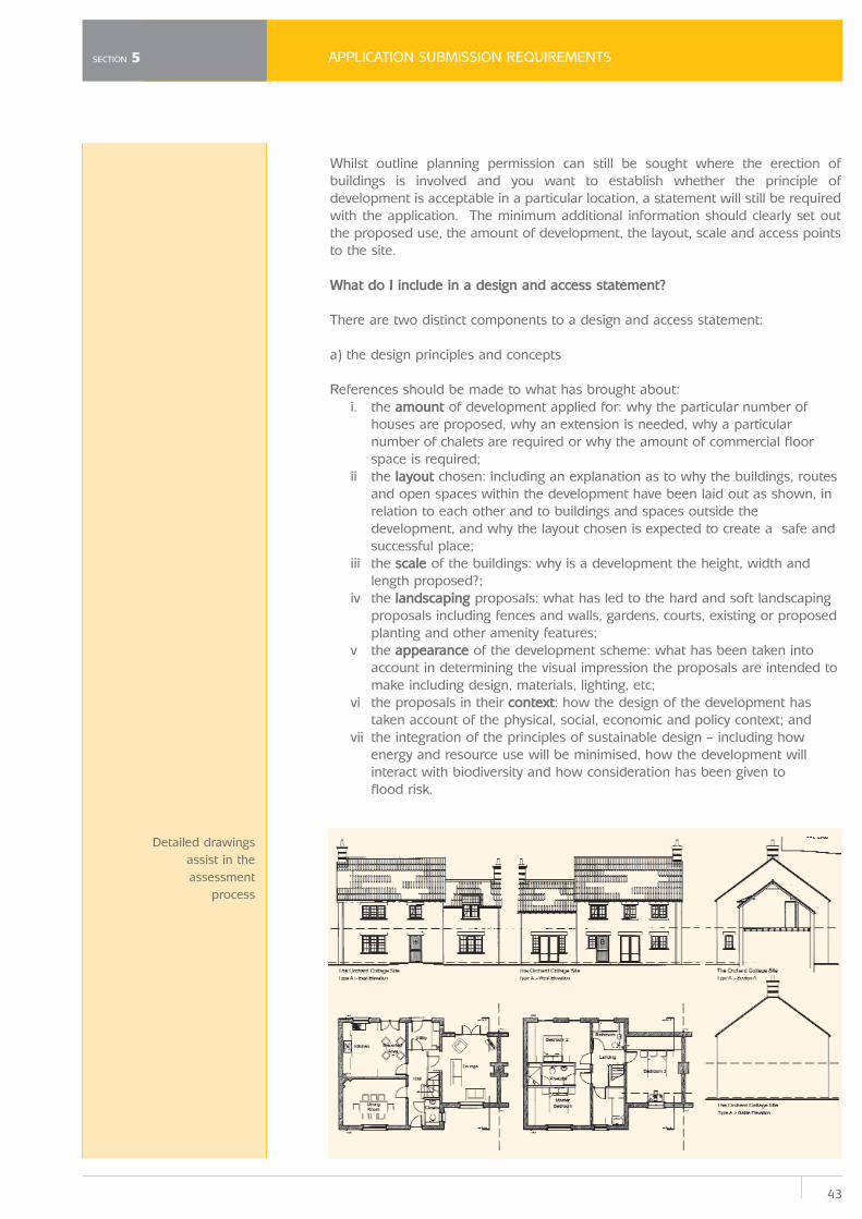
43
APPLICATION SUBMISSION REQUIREMENTS
Whilst outline planning permission can still be sought where the erection ofbuildings is involved and you want to establish whether the principle ofdevelopment is acceptable in a particular location, a statement will still be requiredwith the application. The minimum additional information should clearly set outthe proposed use, the amount of development, the layout, scale and access pointsto the site.
What do I include in a design and access statement?
There are two distinct components to a design and access statement:
a) the design principles and concepts
References should be made to what has brought about:i. the amount of development applied for: why the particular number of
houses are proposed, why an extension is needed, why a particularnumber of chalets are required or why the amount of commercial floorspace is required;
ii the layout chosen: including an explanation as to why the buildings, routes and open spaces within the development have been laid out as shown, inrelation to each other and to buildings and spaces outside thedevelopment, and why the layout chosen is expected to create a safe andsuccessful place;
iii the scale of the buildings: why is a development the height, width andlength proposed?;
iv the landscaping proposals: what has led to the hard and soft landscaping proposals including fences and walls, gardens, courts, existing or proposedplanting and other amenity features;
v the appearance of the development scheme: what has been taken into account in determining the visual impression the proposals are intended tomake including design, materials, lighting, etc;
vi the proposals in their context: how the design of the development has taken account of the physical, social, economic and policy context; and
vii the integration of the principles of sustainable design – including how energy and resource use will be minimised, how the development willinteract with biodiversity and how consideration has been given to flood risk.
SECTION 5
Detailed drawingsassist in theassessment
process
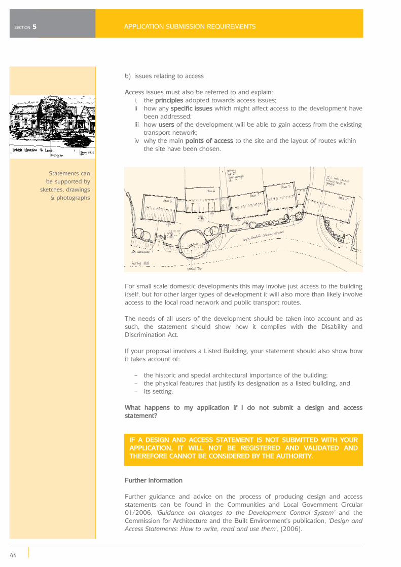
APPLICATION SUBMISSION REQUIREMENTS
44
SECTION 5
b) issues relating to access
Access issues must also be referred to and explain:i. the principles adopted towards access issues;ii how any specific issues which might affect access to the development have
been addressed;iii how users of the development will be able to gain access from the existing
transport network;iv why the main points of access to the site and the layout of routes within
the site have been chosen.
For small scale domestic developments this may involve just access to the buildingitself, but for other larger types of development it will also more than likely involveaccess to the local road network and public transport routes.
The needs of all users of the development should be taken into account and assuch, the statement should show how it complies with the Disability andDiscrimination Act.
If your proposal involves a Listed Building, your statement should also show howit takes account of:
– the historic and special architectural importance of the building;– the physical features that justify its designation as a listed building, and– its setting.
What happens to my application if I do not submit a design and accessstatement?
IF A DESIGN AND ACCESS STATEMENT IS NOT SUBMITTED WITH YOURAPPLICATION, IT WILL NOT BE REGISTERED AND VALIDATED ANDTHEREFORE CANNOT BE CONSIDERED BY THE AUTHORITY.
Further information
Further guidance and advice on the process of producing design and accessstatements can be found in the Communities and Local Government Circular01/2006, ‘Guidance on changes to the Development Control System’ and theCommission for Architecture and the Built Environment’s publication, ‘Design andAccess Statements: How to write, read and use them’, (2006).
Statements can be supported by
sketches, drawings& photographs
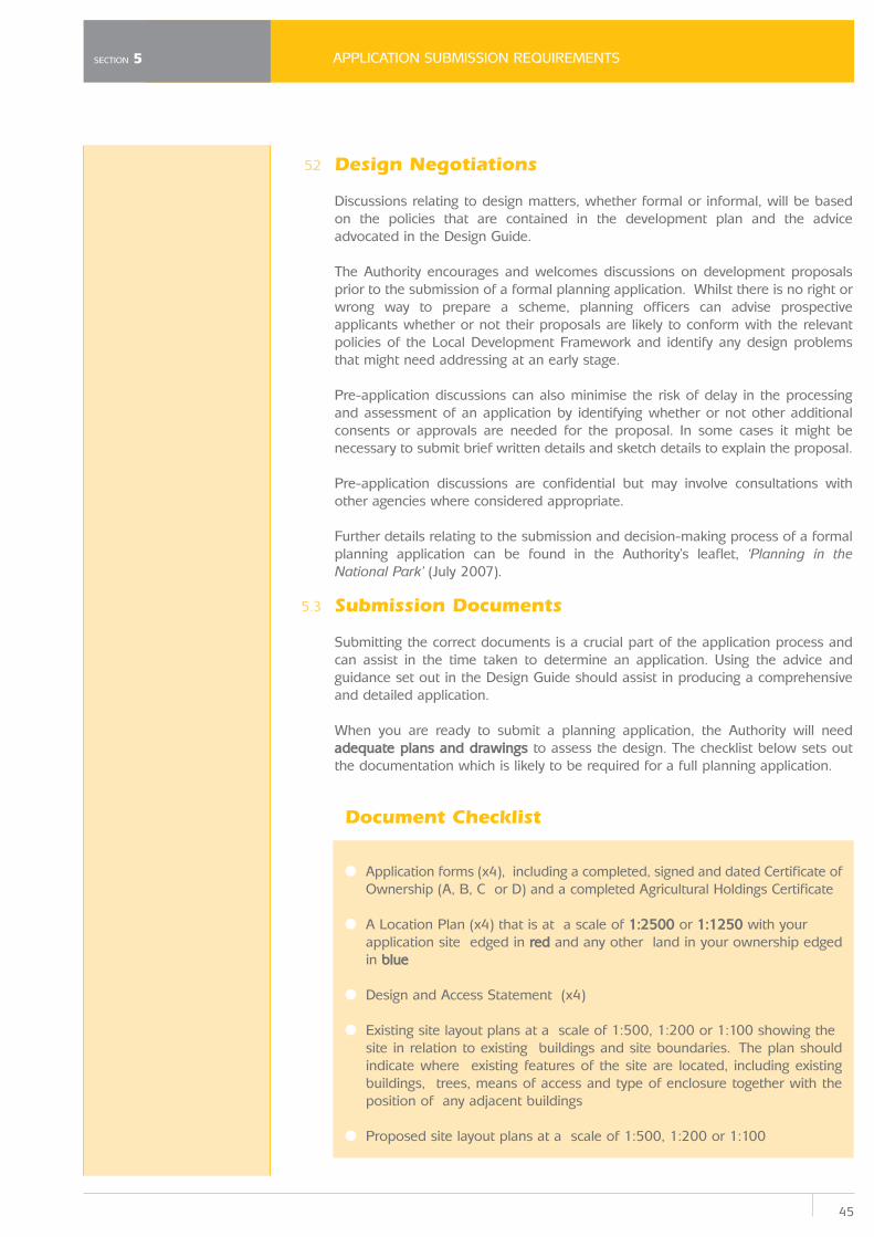
45
APPLICATION SUBMISSION REQUIREMENTS
5.2
5.3
Design Negotiations
Discussions relating to design matters, whether formal or informal, will be basedon the policies that are contained in the development plan and the adviceadvocated in the Design Guide.
The Authority encourages and welcomes discussions on development proposalsprior to the submission of a formal planning application. Whilst there is no right orwrong way to prepare a scheme, planning officers can advise prospectiveapplicants whether or not their proposals are likely to conform with the relevantpolicies of the Local Development Framework and identify any design problemsthat might need addressing at an early stage.
Pre-application discussions can also minimise the risk of delay in the processingand assessment of an application by identifying whether or not other additionalconsents or approvals are needed for the proposal. In some cases it might benecessary to submit brief written details and sketch details to explain the proposal.
Pre-application discussions are confidential but may involve consultations withother agencies where considered appropriate.
Further details relating to the submission and decision-making process of a formalplanning application can be found in the Authority’s leaflet, ‘Planning in theNational Park’ (July 2007).
Submission Documents
Submitting the correct documents is a crucial part of the application process andcan assist in the time taken to determine an application. Using the advice andguidance set out in the Design Guide should assist in producing a comprehensiveand detailed application.
When you are ready to submit a planning application, the Authority will needadequate plans and drawings to assess the design. The checklist below sets outthe documentation which is likely to be required for a full planning application.
Document Checklist
● Application forms (x4), including a completed, signed and dated Certificate of Ownership (A, B, C or D) and a completed Agricultural Holdings Certificate
● A Location Plan (x4) that is at a scale of 1:2500 or 1:1250 with your application site edged in red and any other land in your ownership edgedin blue
● Design and Access Statement (x4)
● Existing site layout plans at a scale of 1:500, 1:200 or 1:100 showing the site in relation to existing buildings and site boundaries. The plan shouldindicate where existing features of the site are located, including existingbuildings, trees, means of access and type of enclosure together with theposition of any adjacent buildings
● Proposed site layout plans at a scale of 1:500, 1:200 or 1:100
SECTION 5
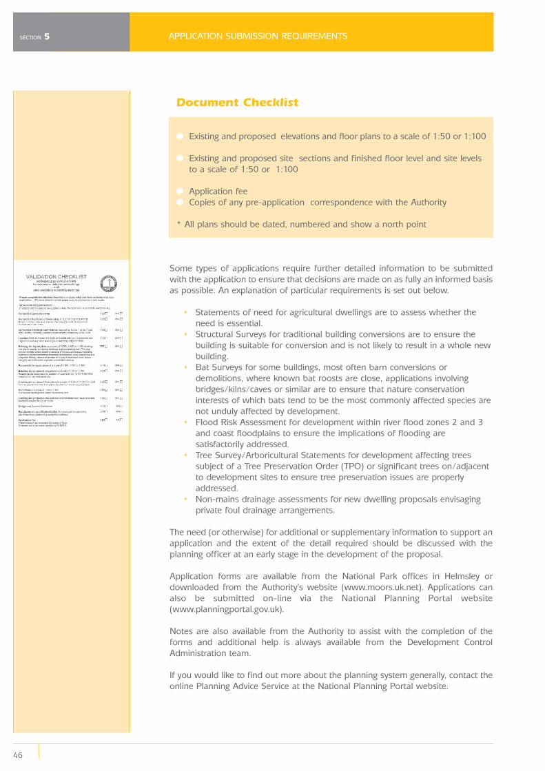
APPLICATION SUBMISSION REQUIREMENTS
46
SECTION 5
Document Checklist
● Existing and proposed elevations and floor plans to a scale of 1:50 or 1:100
● Existing and proposed site sections and finished floor level and site levels to a scale of 1:50 or 1:100
● Application fee● Copies of any pre-application correspondence with the Authority
* All plans should be dated, numbered and show a north point
Some types of applications require further detailed information to be submittedwith the application to ensure that decisions are made on as fully an informed basisas possible. An explanation of particular requirements is set out below.
• Statements of need for agricultural dwellings are to assess whether the need is essential.
• Structural Surveys for traditional building conversions are to ensure the building is suitable for conversion and is not likely to result in a whole newbuilding.
• Bat Surveys for some buildings, most often barn conversions or demolitions, where known bat roosts are close, applications involvingbridges/kilns/caves or similar are to ensure that nature conservationinterests of which bats tend to be the most commonly affected species arenot unduly affected by development.
• Flood Risk Assessment for development within river flood zones 2 and 3 and coast floodplains to ensure the implications of flooding aresatisfactorily addressed.
• Tree Survey/Arboricultural Statements for development affecting trees subject of a Tree Preservation Order (TPO) or significant trees on/adjacentto development sites to ensure tree preservation issues are properlyaddressed.
• Non-mains drainage assessments for new dwelling proposals envisaging private foul drainage arrangements.
The need (or otherwise) for additional or supplementary information to support anapplication and the extent of the detail required should be discussed with theplanning officer at an early stage in the development of the proposal.
Application forms are available from the National Park offices in Helmsley ordownloaded from the Authority’s website (www.moors.uk.net). Applications canalso be submitted on-line via the National Planning Portal website(www.planningportal.gov.uk).
Notes are also available from the Authority to assist with the completion of theforms and additional help is always available from the Development ControlAdministration team.
If you would like to find out more about the planning system generally, contact theonline Planning Advice Service at the National Planning Portal website.
47
KEY CORE STRATEGY AND DEVELOPMENT POLICIES
Appendix A:Key Core Strategy andDevelopment Policies
CORE POLICY ADelivering National Park Purposes and Sustainable Development
The Local Development Framework seeks to further the National Park purposes andduty by encouraging a more sustainable future for the Park and its communitieswhilst conserving and enhancing the Park’s special qualities. Priority will be given to:
1. Providing a scale of development and level of activity that will not have an unacceptable impact on the wider landscape or the quiet enjoyment, peaceand tranquillity of the Park, nor detract from the quality of life of localresidents or the experience of visitors.
2. Providing for development in locations and of a scale which will support the character and function of individual settlements.
3. Maintaining and enhancing the natural environment and conditions for biodiversity and geodiversity.
4. Conserving and enhancing the landscape, settlement, building features and historic assets of the landscape character areas.
5. Applying the principles of sustainable design and energy use to new development.
6. Enabling the provision of a choice of housing that will meet the needs of local communities in terms of type, tenure and affordability.
7. Strengthening and diversifying the rural economy and providing tourism based opportunities for the enjoyment and understanding of the Park’sspecial qualities.
8. Enabling access to services, facilities, jobs and technology whilst minimising the environmental impacts of transport.
CORE POLICY GLandscape, Design and Historic Assets
The landscape, historic assets and cultural heritage of the North York Moors will beconserved and enhanced. High quality sustainable design will be sought whichconserves or enhances the landscape setting, settlement layout and buildingcharacteristics of the landscape character areas identified in the North York MoorsLandscape Character Assessment. Particular protection will be given to thoseelements which contribute to the character and setting of:
1. Conservation Areas
2. Listed Buildings
3. Historic Parks and Gardens
4. Scheduled Monuments and other sites of archaeological importance
The re-use of buildings of architectural and historic importance which make apositive contribution to the landscape and character of the National Park will beencouraged.
APPENDIX A
KEY CORE STRATEGY AND DEVELOPMENT POLICIES
48
APPENDIX A
DEVELOPMENT POLICY 4Conservation Areas
Proposals for development within or immediately adjacent to a Conservation Areawill only be permitted where they preserve or enhance the character andappearance or setting of the area and where:
1. Buildings and features, including open spaces, water courses, trees, hedges, walls and railings that make a significant contribution to thecharacter and appearance of the Conservation Area are retained andrespected.
2. The scale, proportions, design detailing and materials of the development respect the existing architectural and historic context with reference to:
a. the form, scale, proportions, design detailing and materials of traditional buildings.
b. historic plot boundaries and layouts.c. traditional street patterns.d. the relationship between buildings and spaces.e. views into and out of the area.
3. In cases where the demolition of a feature or building that makes a positive contribution to the character and appearance of the ConservationArea is proposed, there is an overriding justification for the proposal.
DEVELOPMENT POLICY 5Listed Buildings
Proposals for the alteration, extension or change of use of a Listed Building or theconstruction of any structure within its curtilage will only be permitted where theywill not have an unacceptable impact on the special historic or architectural interestof the building.
Any development which would have an unacceptable impact on the setting of aListed Building will not be permitted.
Proposals for the demolition of a Listed Building will not be permitted unless thereis overriding justification to warrant this.
49
FURTHER ADVICE AND INFORMATION
Appendix BFurther Advice and Information
Further advice and information on the various matters discussed in the Design Guide can be obtained from the following sources.
North York Moors National Park Authority:
North York Moors National Park AuthorityThe Old VicarageBondgateHelmsleyYorkYO62 5BP
Tel: 01439 770657Fax: 01439 770691
Email: [email protected]: www.moors.uk.net
Senior Archaeological Conservation OfficerContact: [email protected]
Building Conservation OfficerContact: [email protected]
Senior Ecology OfficerContact: [email protected]
Trees and Woodland OfficerContact: [email protected]
Development Control Contact: [email protected]
Planning PolicyContact: [email protected]
Other General Statutory Bodies:
English HeritageYorkshire Region 37 Tanner Row York, YO1 6WP
Tel: 01904 601901Email: [email protected]: www.english-heritage.org.uk
Useful Publications:• Building in context: New development in historic areas, 2001 published
with the Commission for Architecture and the Built Environment (CABE)• Building Regulations and Historic Buildings, May 2002.
APPENDIX B

FURTHER ADVICE AND INFORMATION
50
APPENDIX B
• Window comparisons, October 1994.• Climate Change and the Historic Environment, January 2006.• Door and window furniture, February 1997.• Easy Access to Historic Buildings, July 2004.• Easy Access to Historic Landscapes, October 2005.• Enabling Development and the Conservation of Historic Assets, June 1999.• Timber sash windows, February 1997.
Environment AgencyRivers House21 Park Square South Leeds LS1 2QG
Tel: 08708 506 506
Email: [email protected]: www.environment-agency.gov.uk
Natural England Yorkshire & Humber RegionGovernment Buildings, Otley Road, Lawnswood, Leeds, LS16 5QT
Tel: 0113 230 3750Fax: 0113 230 3790
Email: [email protected]: www.naturalengland.org.uk
Sustainable Design:
Sustainable Homeshttp://www.sustainablehomes.co.uk/
Code for Sustainable Homeswww.planningportal.gov.uk/uploads/code_for_sust_homes.pdf
Sustainable Designwww.breeam.org/
Energy Efficiency and Renewable Energy:www.est.org.ukwww.lowcarbonbuildings.org.uk
Water and Drainage:www.environment-agency.gov.uk www.ciria.org/suds.
Biodiversity:Planning Advice Note 2 – ‘Planning and Biodiversity’ (NYMNPA)
51
FURTHER ADVICE AND INFORMATION
Yorkshire Wildlife Trust: www.yorkshire-wildlife-trust.org.uk
Tees Valley Wildlife Trust: www.wildlifetrust.org.uk/teesvalley
North and East Yorkshire Ecological Data Centre: www.neyedc.co.uk
Biodiversity information is also available at: www.ukbap.org.
Waste: www.rethinkrubbish-northyorkshire.comwww.redcar-cleveland.gov.uk/recycling
Further Design Guidance:
Commission for Architecture and the Built Environment (CABE)www.cabe.org.uk
Secured by Designwww.securedbydesign.com
Design for Homeswww.designforhomes.org/
RUDI (Resource for Urban Design Information)www.rudi.net/
Design and Access Statements:Further guidance and advice on the process of producing design and accessstatements can be found in the Department for Communities and LocalGovernment Circular 01/2006, ‘Guidance on changes to the Development ControlSystem’ and the Commission for Architecture and the Built Environment’spublication, ‘Design and access statements: How to write, read and use them’,(2006).
Useful Publications:• ‘By Design – Urban Design in the Planning System: Towards Better
Practice’, DETR / CABE (2000) London: Thomas Telford.• Design Bulletin 32: Residential Roads and Footpaths’, DOE / DTp (1992)
London: HMSO.• ‘Safer Places. The Planning System and Crime Prevention’, DTLR (2004)
Planning General:
Department for Communities and Local Governmentwww.communities.gov.uk
The Planning Portal: The Governments ‘gateway’ to planning informationwww.planningportal.gov.uk/
Useful Publications:• Planning Policy Guidance Notes (PPGs) and Planning Policy Statements (PPS)
Available at: http://www.communities.gov.uk/index.asp?id=1143802• ‘Places, Streets & Movement’, (1998) London: DETR.
APPENDIX B
FURTHER ADVICE AND INFORMATION
52
APPENDIX B
Historic Buildings Advice:
Institute of Historic Building ConservationJubilee House High StreetTisbury, Wiltshire SP3 6HA
Tel 01747 873133 Fax 01747 871718
Email: [email protected] Website: www.ihbc.org.uk
The Society for the Protection of Ancient Buildings (SPAB)37 Spital Square London E1 6DY
Tel: 020 7377 1644Fax: 020 7247 5296
Email: [email protected]
Useful Publications:• Technical Pamphlet 5: Re-pointing stone and brick walling, 2002.• Technical Pamphlet 8: The Control of Damp in Old Buildings, 1992.• Technical Pamphlet 13: Repair of Wood Windows, 1998.• Information sheet 4: The Need for Old Buildings to “Breathe”, 1986.• A Stitch in Time: Maintaining Your Property Makes Good Sense and
Saves Money published 2002 with the Institute of Historic BuildingConservation (IHBC).
The Georgian Group, 6 Fitzroy Square, London W1T 5DX
Tel: 087 1750 2936 Fax: 087 1750 2937
Email: [email protected]
Useful Publications:• Guide No. 1: Windows, August 2004.• Guide No. 8: Metal and Ironwork, August 2005.
53
FURTHER ADVICE AND INFORMATION
Victorian Society 1 Priory Gardens, Bedford Park, London W4 1TT
Tel: 020 8994 1019Fax: 020 8747 5899
Email: [email protected]
Useful Publications:• Leaflet No.1: ‘Doors’ 1992.• Leaflet No.6: ‘Cast Iron’ 2002.• Leaflet No.9: ‘Timber windows’ 1999.
The Ancient Monuments SocietySt Ann’s Vestry Hall2, Church EntryLondonEC4V 5HB
Tel: 020 7236 3934
Email: [email protected] 7236 3934
Building Control:
Local Authority Offices
For Building Control matters in Ryedale and Hambleton Districts contact:
North Yorkshire Building Control PartnershipSuite 2Coxwold HouseEasingwold Business ParkEasingwoldYorkYO61 3FBTel: 01347 822703Fax: 01347 824279Email: [email protected]
Building Standards ConsultancyScarborough Borough CouncilTown HallSt. Nicholas StreetScarboroughYO11 2HGTel: 01723 232441Fax: 01723 506210Email: [email protected]: www.scarborough.gov.uk
APPENDIX B
FURTHER ADVICE AND INFORMATION
54
APPENDIX B
Redcar and Cleveland Borough CouncilBuilding Control SectionBelmont HouseRectory LaneGuisboroughTS14 7FD
Telephone: (01287) 612358Fax No: (01287) 612367
E-mail: [email protected]: www.redcar-cleveland.gov.uk
Other Building Control Related Websites:
Building for Lifewww.buildingforlife.org
Building Research Establishmentwww.bre.co.uk
Useful Publications:
• Building Regulations: The full set of current Building Regulations Approved Documents can be found at:
www.communities.gov.uk
Archaeology:
Council for British ArchaeologySt Mary's House66 Bootham, York YO30 7BZ
tel: (0)1904 671417fax: (0)1904 671384
Landscape:
Landscape Institute33 Great Portland StreetLondonW1W 8QG
Tel: 020 7299 4500 Fax: 020 7299 4501
Email: [email protected]
Useful publications:
• ‘Guidelines for Landscape and Visual Impact Assessment’ (2nd edition). Landscape Institute/IEMA, (2002) London: Spoon Press.
55
GLOSSARY
Appendix C:GlossaryWherever possible this document has sought to avoid the use of specialistterminology and jargon. However, it is inevitable that certain phrases and terms areused whose meaning may not be immediately clear. This glossary seeks to defineand clarify the meaning of a number of references in the Design Guide. Pleasecontact the Planning Policy Team should any further guidance be required.
A
Accessibility The ability of people to move round an area and to reach places and facilities, including elderly and disabled people,those with young children and those encumbered withluggage or shopping.
Amenity A positive element or elements that contribute to the overall character or enjoyment of an area. For example, open land,trees, historic buildings and the inter-relationship betweenthem, or less tangible factors such as tranquillity.
Article 4 Direction Direction removing some or all permitted development rights,for example within a Conservation Area or curtilage of aListed Building. Article 4 directions are issued by localplanning authorities.
B
Barge Board Wide board (on older properties often carved) fitted below tiles of overhanging verge to gable. Sometimes known as averge board.
Building Control Control exercised through local authorities over the & Regulation details and means of construction to secure health, safety,
energy conservation and access.
Building Form The layout (structure and urban grain), density, scale (height and massing), appearance (materials and details) andlandscaping of development.
Building Line The line formed by frontages of buildings along a street.
Bulk The combined effect of the arrangement, volume and shape of a building or group of buildings. Also called massing.
C
Character An area appraisal emphasising historical and cultural Assessment associations.
Cill Sloping area below a window or door opening to facilitate rainwater run-off.
APPENDIX C
GLOSSARY
56
APPENDIX C
Conservation Area An area designated by a local authority under the Town and Country Planning (Listed Buildings and Conservation Areas)Act 1990 as possessing special architectural or historicalinterest. The Authority will seek to preserve or enhance thecharacter and appearance of such areas.
Context The setting of a site or area, including factors such as land use, landscape and built form.
Corbell Projection of stone, brick, timber or metal jutting out from a wall to support a weight – usually guttering.
D
DCLG Department for Communities and Local Government (now CLG).
DEFRA Department for Environment, Food and Rural Affairs.
Design Guide A document providing guidance on how development can be carried out in accordance with the design policies of a localauthority often with a view to retaining local distinctiveness.
Design Policy Relates to the form and appearance of development, rather than the land use.
Development The legal definition of development is “the carrying out of building, mining, engineering or other operations in, on, underor over land, and the making of any material change in theuse of buildings or other land” (Section 55 of 1990 Act); thiscovers virtually all construction activities and changes of use.
Development Sets out a local planning authority's policies and proposals Plan for the development and use of land and buildings in local
planning authority area. The Development Plan consists of theRSS and development plan documents prepared by districtcouncils, unitary authorities, national park authorities andminerals and waste development plan documents preparedby city councils.
Development Spatial planning documents that are subject to Plan Documents independent examination. Prepared by a local planning
authority as part of the Local Development Framework. Theyinclude the Core Strategy and Development Policies, AdoptedProposals Map, Site Area Action Plans, together with theRegional Spatial Strategy.
Downpipes Round or square cast iron or plastic tubing to take water from the gutters to the drainage system.
57
GLOSSARY
E
Eaves Projecting edge of a roof.
Energy Efficiency The result of minimising the use of energy through the way in which buildings are constructed and arranged on site.
F
Fascia Vertical board at eaves level to which guttering is often attached.
G
Gable Triangular upper part of the wall at the end of a pitched roof.
Gutters Open piping at lowest point of roof for the collections of rain water and formed in plastic or cast iron in older properties.
Grain See ‘Urban Grain’.
H
Hip External angle formed by roof instead of ending in a gable.
Human Scale The use within development of elements that relate well in size to an individual human being and their assembly in a waythat makes people feel comfortable rather than overwhelmed.
L
Landscape The appearance of land, including its shape, form, colours and elements, the way these (including those of streets)components combine in a way that is distinctive to particularlocalities, the way they are perceived, and an area’s culturaland historical associations.
Lintel Horizontal beam of timber, stone, etc. bridging an opening across the top of a door or window.
Listed Building A building designated by the Secretary of State for Culture, Media and Sport under the Planning (Listed Buildings andConservation Areas) Act 1990, as amended, as being abuilding of special architectural or historic interest.
Local These include Development Plan Documents (whichDevelopment form part of the statutory development plan) andDocument Supplementary Planning Documents (which do not form
part of the statutory development plan). LDDs collectivelydeliver the spatial planning strategy for the local planningauthority's area.
APPENDIX C
GLOSSARY
58
APPENDIX C
Local The name for the collection or folder of documentsDevelopment prepared by the local planning authority. It consists ofFramework Development Plan Documents, Supplementary Planning
Documents, the Statement of Community Involvement. The Local Development Scheme and the Annual MonitoringReport also form part of the local development framework.
Local This is a project plan for the planning department,Development providing the programme for updating policy documents,Scheme creating new policy documents, and outlining the main
stages in production, including the opportunities for public involvement.
Local The particular positive features of a locality that contribute to Distinctiveness its special character and sense of place and distinguishes one
local area from another.
M
Massing The combined effect of the arrangement, volume and shape of a building or group of buildings. Also called bulk.
Material A matter that should be taken into account in deciding a Consideration planning application or on an appeal against a planning
decision.
Mortar Mixture of sand, cement, lime and water, used to join stones or bricks.
Mullion Vertical post or upright between a window sill and a window lintel. Usually of stone or pre-cast reinforced concrete.
N
National Park Designated under the National Parks and Access to the Countryside Acts to conserve and enhance their naturalbeauty, wildlife and cultural heritage; and to promoteopportunities for public understanding and enjoyment of theirspecial qualities.
P
Pantile Tile having a curved ‘S’ shaped profile.
Parapet Sections of wall protruding above the external wallheads, usually with internal parapet gutters behind. In olderproperties, these are commonly of lead in good quality work.Normally only found in Victorian or older properties.
Permitted Permission to carry out certain limited forms of development Development without the need to make an application to a local planning
authority, as granted under the terms of the Town andCountry Planning (General Permitted Development) Order.
59
GLOSSARY
Planning Policy Issued by central government setting out its national Guidance (PPG) land use policies for England on different areas of planning.
These are gradually being replaced by Planning Policy Statements.
Planning Policy Issued by central government to replace the existingStatement (PPS) Planning Policy Guidance notes in order to provide greater
clarity and to remove from national policy advice on practicalimplementation, which is better expressed as guidance ratherthan policy.
Pointing The mortar filling between stones and bricks in a wall, which has an adhesive and weatherproofing function.
Public Right Routes over which, even where in private ownership, the of Way public has a right of passage. They comprise byways, which
are open to any user; restricted byways, open to any userother than mechanically propelled vehicles; bridleways, whichcan be used by those on foot, horse or bicycle; and footpathswhich are open to those on foot only.
R
Regional Spatial The broad region-wide strategic part of the development Strategy plan.
Rendering Vertical covering of a wall either plaster (internally) or cement (externally), sometimes with pebbledash or stucco finish.
Reveal The part of the side of a window or door opening that is between the outer surface of a wall and the window or door frame.
Ridgeline The apex of the roof continued along the length of the roof span.
Roof pitch Angle at which rafters form an apex from the supporting walls.
Roofscape A view resulting from a blend of roof pitches, sizes and heights within the built environment.
Rhythm The line formed by the frontages of buildings along a street, which can be continuous, broken or interrupted.
S
Sash window Window frames that slide one in front of the other, usually vertically, although horizontal sashes are a vernacular detail.
Scale The impression of a building when seen in relation to its surroundings, or the size of parts of a building or its details,particularly as experienced in relation to the size of a person.
Setts Stone paving blocks, usually granite.
APPENDIX C
GLOSSARY
60
APPENDIX C
Soffit The projecting underside of the eaves of a roof.
Supplementary A Supplementary Planning Document is a Local Planning Development Document that may cover a range of issues,Document thematic or site specific, and provides further detail of
policies contained in the Core Strategy and DevelopmentPolicies document.
Sustainable A widely used definition drawn up by the WorldDevelopment Commission on Environment and Development in 1987:
Development that meets present needs withoutcompromising the ability of future generations to achieve their own needs and aspirations.
T
Tree Preservation A mechanism for securing the preservation of single or Order (TPO) groups of trees of acknowledged amenity value. A tree
subject to a tree preservation order may not normally betopped, lopped or felled without the consent of the localplanning authority.
Topography The physical shape of the land.
U
Urban Grain The pattern of the arrangement and size of buildings and their plots in a settlement and the size of street blocks andjunctions. The layout.
V
Verge Edge of a roof which runs from eaves to ridge at a gable (usually cement pointed).
Verge Board See ‘Barge Board’.
Vernacular The way in which ordinary buildings were built in a particular place, making use of local styles, techniques and materials.
Vernacular A building built without being designed by an architect or Building engineer or someone with similar formal training, often
based on traditional or regional forms.
View What is visible from a particular point. (Compare to 'Vista').
Village Design Document produced by a community to identify Statement local character and set out design guidance to help guide
new development.
Vista An enclosed view, usually a long and narrow one.

North York Moors National Park AuthorityThe Old Vicarage, Bondgate, Helmsley, York YO62 5BP
Tel: 01439 770657 Fax: 01439 770691email: [email protected]
www.moors.uk.net