Embed Size (px)
Citation preview
Bar Pool, Cornwall
Record ID 369
Authors Year
Whitley, N. 1872
Location description Deposit location General location: SW 808 328
(Johnson and David, 1982).
Deposit description Deposit stratigraphy
Associated artefacts Early work
Sample method
Depth of deposit 14C ages available
No
Notes Referred to in Johnson and David (1982) Pg 96.
Bibliographic reference Whitley, N. 1872 'Note on a submarine forest at Market Strand, Falmouth', Journal of the Royal Institute of Cornwall, 4, 77.
Coastal peat resource database (Hazell, 2008) Page 1 of 58
Crooklets Beach, Cornwall
Record ID 272
Authors Year ADS NONE
Location description Deposit location SS 20 07
Deposit description Deposit stratigraphy Site of known submerged forest. Peat deposits containing timber fragments found on beach.
Associated artefacts Early work
Sample method
Depth of deposit 14C ages available No
Notes Record EHNMR-1319721 in ADS.
Bibliographic reference ADS NONE 'Archaeology Dataservice', http://ads.ahds.ac.uk/.
Coastal peat resource database (Hazell, 2008) Page 2 of 58
Daymer Bay/Doom Bar, Cornwall
Record ID 381
Authors Year Henwood, W. 1858
Location description Deposit location General location: SW 925 775 (Johnson and David, 1982).
Deposit description Deposit stratigraphy Submerged forest
Associated artefacts Early work
Sample method
Depth of deposit 14C ages available No
Notes Also, Ussher (1887). Referred to in Johnson and David (1982) Pg 96.
Bibliographic reference Henwood, W. 1858 'Notice of the submarine forest near Padstow', Reps Roy Inst Cornwall, 3, 17-19.
Coastal peat resource database (Hazell, 2008) Page 3 of 58
Daymer Bay/Doom Bar, Cornwall
Record ID 554
Authors Year Wessex Archaeology 1999 (Sept)
Location description Deposit location Daymer Bay, general area SW 925 775
Deposit description Deposit stratigraphy Submerged forest.
Associated artefacts Early work
Sample method
Depth of deposit 14C ages available No
Notes Referred to on OS 1st edition 1881.
Bibliographic reference Wessex Archaeology 1999 (Sept) 'Camel Estuary historic audit. Report 43091.3'.
Coastal peat resource database (Hazell, 2008) Page 4 of 58

Duckpool, Cornwall
Record ID 521
Authors Year McDouall, A. XXXX
Location description Deposit location
Deposit description Deposit stratigraphy Submerged forest.
Associated artefacts Early work
Sample method
Depth of deposit 14C ages available No
Notes
Bibliographic reference McDouall, A. XXXX 'Land's End to Minehead maritime natural area; a nature conservation profile', English Nature.
Coastal peat resource database (Hazell, 2008) Page 5 of 58
Falmouth, Cornwall
Record ID 56
Authors Year Ashton, W. 1920
Location description Deposit location
Deposit description Deposit stratigraphy Ancient forest and peat remains
Associated artefacts Early work
Sample method
Depth of deposit 14C ages available As deep as 67 ft [20.42 m] below high water mark.
No
Notes [Pengelly, referred to in Ashton (1920)]
Bibliographic reference Ashton, W. 1920 'Evolution of a coastline', London.
Coastal peat resource database (Hazell, 2008) Page 6 of 58
Falmouth, Cornwall Record ID 58
Authors Year Flett, J. and Hill, J. 1912
Location description Deposit location Falmouth Estuary
Deposit description Deposit stratigraphy Branches, roots of trees and other plant remains, in situ, exposed after storms
Associated artefacts Early work
Sample method
Depth of deposit 14C ages available No
Notes
Bibliographic reference Flett, J. and Hill, J. 1912 'Geology of the Lizard and Meneage. Explanation of one-inch geological sheet 359, New Series', London, HMSo (1989 reprint).
Coastal peat resource database (Hazell, 2008) Page 7 of 58
Falmouth, Cornwall Record ID 190
Authors Year Leveridge, B., Holder, M. and Goode, A. 1990
Location description Deposit location
Deposit description Deposit stratigraphy Submerged forests exposed during
exceptional low tide.
Associated artefacts Early work
Sample method
Depth of deposit 14C ages available No
Notes Referred to in Leveridge et al. (1990)
Bibliographic reference Leveridge, B., Holder, M. and Goode, A. 1990 'Geology of the country around Falmouth (memoir of the 1:50,000 geological sheet 352 (England and Wales))', London, HMSO.
Coastal peat resource database (Hazell, 2008) Page 8 of 58
Falmouth, Cornwall
Record ID 195
Authors Year Fulford, M., Champion, T. and Long, A. (ed.s)
1997
Location description Deposit location
Deposit description Deposit stratigraphy Submerged forests.
Associated artefacts Early work No associated artefacts.
Sample method
Depth of deposit 14C ages available No
Notes Mentioned in Fulford et al. (1997) (Pg 172).
Bibliographic reference Fulford, M., Champion, T. and Long, A. (ed.s) 1997 'England's coastal heritage', RCHME and English Heritage Archaeological Report 15, London.
Coastal peat resource database (Hazell, 2008) Page 9 of 58
Falmouth, Cornwall Record ID 522
Authors Year Kirkham, G. 2005
Location description Deposit location
Deposit description Deposit stratigraphy Submerged forest - well preserved remains.
Associated artefacts Early work
Sample method
Depth of deposit 14C ages available No
Notes
Subsite details
ID 152
Location Depth At Market Strand
Description
ID 153
Location Depth Bar area.
Description
Bibliographic reference Kirkham, G. 2005 'Cornwall and Scilly urban survey; historic characterisation for regeneration: Falmouth', Historic Environment Service, Cornwall County Council. Report 2005R003.
Coastal peat resource database (Hazell, 2008) Page 10 of 58
Falmouth, Cornwall
Record ID 556
Authors Year Ratcliffe, J. 1992
Location description Deposit location Market Strand Quay SW 8079 3301
Deposit description Deposit stratigraphy
Associated artefacts Early work
Sample method
Depth of deposit 14C ages available No
Notes Also mention of a "palaeoenvironmental deposit" in Restronguet Creek at SW 810 380.
Bibliographic reference Ratcliffe, J. 1992 'Fal Estuary historic audit', Cornwall Archaeological Unit, Cornwall County Council.
Coastal peat resource database (Hazell, 2008) Page 11 of 58
Fowey, Cornwall
Record ID 193
Authors Year Ussher, W., Barrow, G. and MacAllister, D. 1909
Location description Deposit location Fowey Harbour General location: SX 118 510
(Johnson and David, 1982).
Deposit description Deposit stratigraphy Submerged forests.
Associated artefacts Early work No associated artefacts.
Sample method
Depth of deposit 14C ages available No
Notes Also, Peach (1848). Mentioned in Fulford et al. (1997) (Pg 172). Referred to in Johnson and David (1982) Pg 96.
Bibliographic reference Ussher, W., Barrow, G. and MacAllister, D. 1909 'Geology of the county around Bodmin and St Austell', Memoirs of the Geological Survey, England and Wales, 120-130.
Coastal peat resource database (Hazell, 2008) Page 12 of 58
Gillan Cove, Cornwall
Record ID 374
Authors Year Flett, J. and Hill, J. 1912
Location description Deposit location General location: SW 786 252 (Johnson
and David, 1982).
Deposit description Deposit stratigraphy
Associated artefacts Early work
Sample method
Depth of deposit 14C ages available No
Notes Referred to in Johnson and David (1982) Pg 96.
Bibliographic reference Flett, J. and Hill, J. 1912 'Geology of the Lizard and Meneage. Explanation of one-inch geological sheet 359, New Series', London, HMSo (1989 reprint).
Coastal peat resource database (Hazell, 2008) Page 13 of 58
Gulwal Forest, Cornwall
Record ID 443
Authors Year Harkness, D. and Wilson, H. 1979
Location description Deposit location 900 m south of St Gulwal's church.
Deposit description Deposit stratigraphy Submerged forest exposure, containing tree remains (probably birch), fallen and rooted on peat.
Rests on head.
Associated artefacts Early work
Sample method
Depth of deposit 14C ages available Yes
Notes Collected 1974 and submitted by AJJ Goode. Age matches that of Westward Ho!
14C details
ID 307 Laboratory code SRR-714
Sample location Depth of sample Dated sample description SW 4837 3092 -1.6 m OD
from upper surface of peat. Cellulose fraction from wood
Age (uncal) Age (cal) Delta 13C 4280 ± 50 -24.7
Notes
Bibliographic reference Harkness, D. and Wilson, H. 1979 'Scottish Universities Research and Reactor Centre radiocarbon measurements III', Radiocarbon, 21, 203-256.
Coastal peat resource database (Hazell, 2008) Page 14 of 58
Harbour Cove, Cornwall
Record ID 380
Authors Year Henwood, W. 1858
Location description Deposit location General location: SW 912 770
(Johnson and David, 1982).
Deposit description Deposit stratigraphy
Associated artefacts Early work
Sample method
Depth of deposit 14C ages available No
Notes Referred to in Johnson and David (1982) Pg 96.
Bibliographic reference Henwood, W. 1858 'Notice of the submarine forest near Padstow', Reps Roy Inst Cornwall, 3, 17-19.
Coastal peat resource database (Hazell, 2008) Page 15 of 58
Hawker's Cove, Cornwall Record ID 555
Authors Year Wessex Archaeology 1999 (Sept)
Location description Deposit location General area SW 9132 7700
Deposit description Deposit stratigraphy Submerged forest.
Associated artefacts Early work
Sample method
Depth of deposit 14C ages available No
Notes Referred to on OS 1st edition 1881.
Bibliographic reference Wessex Archaeology 1999 (Sept) 'Camel Estuary historic audit. Report 43091.3'.
Coastal peat resource database (Hazell, 2008) Page 16 of 58
Little Petherick Creek, Cornwall Record ID 382
Authors Year Clarke, B. 1961
Location description Deposit location General location: SW 925 741
(Johnson and David, 1982).
Deposit description Deposit stratigraphy
Associated artefacts Early work
Sample method
Depth of deposit 14C ages available No
Notes Referred to in Johnson and David (1982) Pg 96.
Bibliographic reference Clarke, B. 1961 'The superficial deposits of the Camel Estuary', Transactions of the Royal Geological Society of Cornwall, 20(4), 278.
Coastal peat resource database (Hazell, 2008) Page 17 of 58
Long Rock, Cornwall Record ID 289
Authors Year Goode, A. and Taylor, R. 1988
Location description Deposit location
Deposit description Deposit stratigraphy Submerged forest.
Associated artefacts Early work
Sample method
Depth of deposit 14C ages available Yes
Notes
14C details
ID 196 Laboratory code
Sample location Depth of sample Dated sample description Wood
Age (uncal) Age (cal) Delta 13C 4278 ± 50 BP
Notes
Bibliographic reference Goode, A. and Taylor, R. 1988 'Geology of the of the country around Penzance', Memoir of the British Geological Survey, sheets 351 and 358 (England and Wales), , 52pp.
Coastal peat resource database (Hazell, 2008) Page 18 of 58
Long Rock, Cornwall Record ID 485
Authors Year NMR NONE
Location description Deposit location SW 496 309 (centre)
Deposit description Deposit stratigraphy
Associated artefacts Early work
Sample method
Depth of deposit 14C ages available No
Notes Peat often exposed at various points throughout the harbour. Ref to William Worcestre (1478) and Leland (16thC). NMR no. SW 43 SW 141 (1157919).
Bibliographic reference NMR NONE 'National Monuments Record'.
Coastal peat resource database (Hazell, 2008) Page 19 of 58
Longrock, Cornwall
Record ID 197
Authors Year Borlase, W. 1757
Location description Deposit location 300 yards [274.32 m] below [seaward from] full-sea-
mark
Deposit description Deposit stratigraphy Submerged forest in the sandy beach between the Mount and Penzanze. Trunks of several large trees in their natural position - oak, willow and hazel. Earth in which roots were growing contained Juncus remains
10" [25.4 cm] of sand on top of the marsh-earth in which the trees were situated.
Associated artefacts Early work
Sample method
Depth of deposit 14C ages available Under 12 ft [3.66 m] of water at full tide. Extend further offshore (30 ft [9.14 m]).
No
Notes
Bibliographic reference Borlase, W. 1757 'An account of some trees discovered underground on the shore at Mount's Bay in Cornwall', Philosophical Transactions of the Royal Society of London, 50, 51-53.
Coastal peat resource database (Hazell, 2008) Page 20 of 58
Longrock, Cornwall
Record ID 288
Authors Year Carne, J. 1846
Location description Deposit location Between Long Rock and Chyandour SW 499 309 to SW 471 309
Deposit description Deposit stratigraphy Submerged forest - exhumed during low tide. Includes fallen trunks, stumps rooted in peat, extensive 1.7 m thick peat bed. Incl oak, hazel, birch, alder.
Associated artefacts Early work
Sample method
Depth of deposit 14C ages available No
Notes Referred to in Goode and Taylor (1988).
Bibliographic reference Carne, J. 1846 'Notice on the remains of a submarine forest in the north-eastern part of Mount's Bay', Transactions of the Royal Geological Society of Cornwall, 6, 230-235.
Coastal peat resource database (Hazell, 2008) Page 21 of 58
Looe, Cornwall
Record ID 194
Authors Year Fulford, M., Champion, T. and Long, A. (ed.s)
1997
Location description Deposit location
Deposit description Deposit stratigraphy Submerged forests.
Associated artefacts Early work No associated artefacts.
Sample method
Depth of deposit 14C ages available No
Notes Mentioned in Fulford et al. (1997) (Pg 172).
Bibliographic reference Fulford, M., Champion, T. and Long, A. (ed.s) 1997 'England's coastal heritage', RCHME and English Heritage Archaeological Report 15, London.
Coastal peat resource database (Hazell, 2008) Page 22 of 58
Maenporth, Cornwall
Record ID 368
Authors Year Rogers, J. 1832
Location description Deposit location General location: SW 791 296
(Johnson and David, 1982).
Deposit description Deposit stratigraphy
Associated artefacts Early work
Sample method
Depth of deposit 14C ages available No
Notes Also, Robert (1897). Referred to in Johnson and David (1982) Pg 96. Also Ratcliffe (1992).
Bibliographic reference Rogers, J. 1832 'Notice of wood and peat found below high-water mark on the beach at Mainporth, in Cornwall', Transactions of the Royal Geological Society of Cornwall, 4, 481-483.
Coastal peat resource database (Hazell, 2008) Page 23 of 58
Maer Lake, Cornwall
Record ID 367
Authors Year Pattison, S. 1848
Location description Deposit location General location: SS 202 072 (Johnson
and David, 1982).
Deposit description Deposit stratigraphy
Associated artefacts Early work
Sample methodble
No
Depth of deposit 14C ages available
Notes Referred to in Johnson and David (1982) Pg 96.
Bibliographic reference Pattison, S. 1848 'On some post-Tertiary deposits in Cornwall'.
Coastal peat resource database (Hazell, 2008) Page 24 of 58
Mawgan Porth, Cornwall
Record ID 379
Authors Year De la Beche, H. 1839
Location description Deposit location General location: SW 848 673
(Johnson and David, 1982).
Deposit description Deposit stratigraphy
Associated artefacts Early work
Sample method
Depth of deposit 14C ages available No
Notes Referred to in Johnson and David (1982) Pg 96.
Bibliographic reference De la Beche, H. 1839 'Report on the geology of Cornwall, Devon and west Somerset', Memoirs of the Geological Survey, , 417-419.
Coastal peat resource database (Hazell, 2008) Page 25 of 58
Millendreath, Cornwall
Record ID 371
Authors Year Box, W. 1844
Location description Deposit location General location: SX 268 540
(Johnson and David, 1982).
Deposit description Deposit stratigraphy
Associated artefacts Early work
Sample method
Depth of deposit 14C ages available No
Notes Referred to in Johnson and David (1982) Pg 96.
Bibliographic reference Box, W. 1844 'Notice of a sub-marine forest near Looe', Reps Roy Inst Cornwall, 26, 36-37.
Coastal peat resource database (Hazell, 2008) Page 26 of 58
Mount's Bay, Cornwall
Record ID 198
Authors Year Flett, J. and Hill, J. 1912
Location description Deposit location
Deposit description Deposit stratigraphy Buried forest sometimes exposed when sandy shore deposits are removed in storms - branches, roots and other plant remains, in situ.
Associated artefacts Early work
Sample method
Depth of deposit 14C ages available No
Notes Also reference to buried tree trunks on land in Cober Valley (Helston).
Bibliographic reference Flett, J. and Hill, J. 1912 'Geology of the Lizard and Meneage. Explanation of one-inch geological sheet 359, New Series', London, HMSo (1989 reprint).
Coastal peat resource database (Hazell, 2008) Page 27 of 58

Mount's Bay, Cornwall
Record ID 199
Authors Year Godwin, H. 1943
Location description Deposit location
Deposit description Deposit stratigraphy Submerged peat bed.
Associated artefacts Early work
Sample method
Depth of deposit 14C ages available No
Notes Mentioned in Godwin (1943).
Bibliographic reference Godwin, H. 1943 'Coastal peat beds of the British Isles and North Sea', Journal of Ecology, 31, 199-247.
Coastal peat resource database (Hazell, 2008) Page 28 of 58
Mount's Bay, Cornwall
Record ID 623
Authors Year Carew, R. 1602
Location description Deposit location Two miles east of St Michael's Mount
Deposit description Deposit stratigraphy Turfs visible at low water containing tree roots and nuts.
Covered by sand.
Associated artefacts Early work
Sample method
Depth of deposit 14C ages available No
Notes Pg 94.
Bibliographic reference Carew, R. 1602 'The Survey of Cornwall', Reprinted: Andrew Melrose, London.
Coastal peat resource database (Hazell, 2008) Page 29 of 58
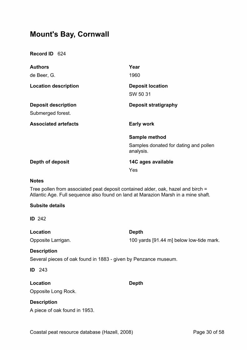
Mount's Bay, Cornwall
Record ID 624
Authors Year de Beer, G. 1960
Location description Deposit location SW 50 31
Deposit description Deposit stratigraphy Submerged forest.
Associated artefacts Early work
Sample method Samples donated for dating and pollen
analysis.
Depth of deposit 14C ages available Yes
Notes Tree pollen from associated peat deposit contained alder, oak, hazel and birch = Atlantic Age. Full sequence also found on land at Marazion Marsh in a mine shaft.
Subsite details
ID 242
Location Depth Opposite Larrigan. 100 yards [91.44 m] below low-tide mark.
Description Several pieces of oak found in 1883 - given by Penzance museum.
ID 243
Location Depth Opposite Long Rock.
Description A piece of oak found in 1953.
Coastal peat resource database (Hazell, 2008) Page 30 of 58

ID 244
Location Depth 15 yards [13.72 m] from the seawall between Lariggan and the Wherry.
Description Peat sample that trees were embedded in was obtained in 1956 and given by Penzance museum. Exposed after a heavy storm and a spring tide. Pollen analysed.
14C details
ID 471 Laboratory code BM-29
Sample location Depth of sample Dated sample description Opposite Larrigan. 100 yards below low-tide
mark [91.44 m] Oak wood from submerged forest.
Age (uncal) Age (cal) Delta 13C 3656 ± 150 BP 2520-1700 BC (2sd)
Notes [Not clear if this piece of oak, or another from opposite Long Rock, was sampled].
Bibliographic reference de Beer, G. 1960 'Iktin', Geographical Journal, 126, 160-167.
Coastal peat resource database (Hazell, 2008) Page 31 of 58
Pendower, Cornwall
Record ID 192
Authors Year Hill, J. and MacAlister, D. 1906
Location description Deposit location Pendower Beach, Gerrans Bay General location: SW 900 381 (Johnson
and David, 1982).
Deposit description Deposit stratigraphy Submerged forests exposed during exceptional low tide.
Associated artefacts Early work
Sample method
Depth of deposit 14C ages available No
Notes Mentioned in Leveridge et al. (1990). Referred to in Johnson and David (1982) Pg 96.
Bibliographic reference Hill, J. and MacAlister, D. 1906 'The geology of Falmouth and Camborne and of the mining district of Camborne and Redruth', Memoir of the Geological Survey of Great Britain, , 99-103.
Coastal peat resource database (Hazell, 2008) Page 32 of 58

Pentewan, Cornwall
Record ID 655
Authors Year Dunn, M. 1887
Location description Deposit location [c. SX 021 469]
Deposit description Deposit stratigraphy Remains of intertidal forest.
Associated artefacts Early work
Sample method
Depth of deposit 14C ages available No
Notes
Bibliographic reference Dunn, M. 1887 'A submerged forest near Mevagissey', West Briton, .
Coastal peat resource database (Hazell, 2008) Page 33 of 58

Penzance, Cornwall
Record ID 657
Authors Year Hyder Consulting 2005
Location description Deposit location
Deposit description Deposit stratigraphy Peat deposits found in intertidal and offshore zones.
Associated artefacts Early work
Sample method
Depth of deposit 14C ages available No
Notes [Document publically available online].
Subsite details
ID 264
Location Depth SW 47760 30750 Intertidal
Description Evidence of peat in worm casts; areas of sand flecked with dark material.
ID 265
Location Depth SW 46637 29361 [Wherry Rocks, Larrigan]
Intertidal, foreshore.
Description Peat bed (from local reports and documentary sources). Exposed in 1990s during pipe laying.
Coastal peat resource database (Hazell, 2008) Page 34 of 58
ID 266
Location Depth SW 47760 30750 On beach, intertidal
Description Submerged forest - exposed timbers identified from historic photo. Last exposed in 1950s. (See de Beer (1960) for dendro age).
ID 267
Location Depth SW 47937 30160 (off end of Lighthouse Pier)
-7.08 to -7.93 m OD
Description Borehole PM3 - brown peat layer with woody fragments. On top of stiff grey sandy gravelly clay.
Bibliographic reference Hyder Consulting 2005 'Penzance Harbour environmental statement: volume 1, main text and appendices', Unpublished report prepared for Penwith District Council, no. DV01104/RT/70/03.
Coastal peat resource database (Hazell, 2008) Page 35 of 58

Perranporth, Cornwall
Record ID 366
Authors Year De la Beche, H. 1839
Location description Deposit location General location: SW 756 544 (Johnson
and David, 1982).
Deposit description Deposit stratigraphy
Associated artefacts Early work
Sample method
Depth of deposit 14C ages available No
Notes Referred to in Johnson and David (1982) Pg 96.
Bibliographic reference De la Beche, H. 1839 'Report on the geology of Cornwall, Devon and west Somerset', Memoirs of the Geological Survey, , 417-419.
Coastal peat resource database (Hazell, 2008) Page 36 of 58
Porthcurnick, Cornwall
Record ID 191
Authors Year Leveridge, B., Holder, M. and Goode, A. 1990
Location description Deposit location
Deposit description Deposit stratigraphy Submerged forests exposed during exceptional low tide.
Associated artefacts Early work
Sample method
Depth of deposit 14C ages available No
Notes Mentioned in Leveridge et al. (1990)
Bibliographic reference Leveridge, B., Holder, M. and Goode, A. 1990 'Geology of the country around Falmouth (memoir of the 1:50,000 geological sheet 352 (England and Wales))', London, HMSO.
Coastal peat resource database (Hazell, 2008) Page 37 of 58
Porthcurnick, Cornwall
Record ID 625
Authors Year Maxwell, I. 1965
Location description Deposit location SW 879 359
Deposit description Deposit stratigraphy
Submerged forest containing lots of wood from twigs to large timber. Numerous hazelnuts and acorns. A few large tree stumps in growth position.
Associated artefacts Early work Probable iron age pottery sherd. Found 1963.
Sample method
Depth of deposit 14C ages available No
Notes
Bibliographic reference Maxwell, I. 1965 'A Sherd from the Submerged Forest at Porthcurnick Beach', Cornish Archaeology, 4, 90-91.
Coastal peat resource database (Hazell, 2008) Page 38 of 58
Porthleven, Cornwall
Record ID 189
Authors Year Rogers, J. 1818
Location description Deposit location General location: SW 628 256 (Johnson
and David, 1982).
Deposit description Deposit stratigraphy Stumps of oak and willow seen below low water mark.
Associated artefacts Early work
Sample method
Depth of deposit 14C ages available No
Notes Rogers (1818) referred to in Flett and Hill (1946)
Bibliographic reference Rogers, J. 1818 'Vegetable remains in the basin at Porthleven', Roy Geol Soc Corn, 1, 236-237.
Coastal peat resource database (Hazell, 2008) Page 39 of 58
Porthleven, Cornwall
Record ID 196
Authors Year Fulford, M., Champion, T. and Long, A. (ed.s)
1997
Location description Deposit location
Deposit description Deposit stratigraphy Submerged forests.
Associated artefacts Early work No associated artefacts.
Sample method
Depth of deposit 14C ages available No
Notes Mentioned in Fulford et al. (1997) (Pg 172).
Bibliographic reference Fulford, M., Champion, T. and Long, A. (ed.s) 1997 'England's coastal heritage', RCHME and English Heritage Archaeological Report 15, London.
Coastal peat resource database (Hazell, 2008) Page 40 of 58
Porthmear, Cornwall
Record ID 377
Authors Year Lamb, C. 1909
Location description Deposit location General location: SW 848 717 (Johnson
and David, 1982).
Deposit description Deposit stratigraphy
Associated artefacts Early work
Sample method
Depth of deposit 14C ages available No
Notes Referred to in Johnson and David (1982) Pg 96.
Bibliographic reference Lamb, C. 1909 'Note on the occurrence of a fossil tree at Porthmeor, St Eval', Transactions of the Royal Geological Society of Cornwall, 13, 299-300.
Coastal peat resource database (Hazell, 2008) Page 41 of 58
Porthmissen Beach, Cornwall
Record ID 383
Authors Year Clarke, B. 1961
Location description Deposit location General location: SW 890 761 (Johnson
and David, 1982).
Deposit description Deposit stratigraphy
Associated artefacts Early work
Sample method
Depth of deposit 14C ages available No
Notes Referred to in Johnson and David (1982) Pg 96.
Bibliographic reference Clarke, B. 1961 'The superficial deposits of the Camel Estuary', Transactions of the Royal Geological Society of Cornwall, 20(4), 278.
Coastal peat resource database (Hazell, 2008) Page 42 of 58
Porthpean, Cornwall
Record ID 656
Authors Year Dunn, M. 1887
Location description Deposit location [c. SX 032 506]
Deposit description Deposit stratigraphy Remains of intertidal forest.
Associated artefacts Early work
Sample method
Depth of deposit 14C ages available No
Notes
Bibliographic reference Dunn, M. 1887 'A submerged forest near Mevagissey', West Briton, .
Coastal peat resource database (Hazell, 2008) Page 43 of 58

Porthtowan, Cornwall
Record ID 375
Authors Year Henwood, W. 1858
Location description Deposit location General location: SW 691 481
(Johnson and David, 1982).
Deposit description Deposit stratigraphy
Associated artefacts Early work
Sample method
Depth of deposit 14C ages available No
Notes Referred to in Johnson and David (1982) Pg 96.
Bibliographic reference Henwood, W. 1858 'Notice of the submarine forest near Padstow', Reps Roy Inst Cornwall, 3, 17-19.
Coastal peat resource database (Hazell, 2008) Page 44 of 58
Portmellon/in, Cornwall
Record ID 372
Authors Year Whitley, N. 1887
Location description Deposit location General location: SX 016 438
(Johnson and David, 1982).
Deposit description Deposit stratigraphy
Associated artefacts Early work
Sample method
Depth of deposit 14C ages available No
Notes Also, Kidson (1977). Referred to in Johnson and David (1982) Pg 96.
Bibliographic reference Whitley, N. 1887 'The submarine forest bed at Portmellin near Mevagissey', Journal of the Royal Institute of Cornwall, 9, 309-312.
Coastal peat resource database (Hazell, 2008) Page 45 of 58
Portmellon/in, Cornwall
Record ID 547
Authors Year Heyworth, A. and Kidson, C. 1982
Location description Deposit location SX 0160 4395
Deposit description Deposit stratigraphy
Associated artefacts Early work
Sample method
Depth of deposit 14C ages available Yes
Notes Referred to in Heyworth and Kidson (1982).
14C details
ID 376 Laboratory code St-3692 (IGS C14/72)
Sample location Depth of sample Dated sample description SX 0160 4395 -0.3 m OD
Age (uncal) Age (cal) Delta 13C 2345 ± 100
Notes
Bibliographic reference Heyworth, A. and Kidson, C. 1982 'Sea-level changes in south-west England and Wales', Proceedings of the Geologists Association, 93, 91-111.
Coastal peat resource database (Hazell, 2008) Page 46 of 58
Portreath, Cornwall
Record ID 57
Authors Year Hill, J. and MacAlister, D. 1906
Location description Deposit location
Deposit description Deposit stratigraphy Submerged forest
Associated artefacts Early work
Sample method Seen during harbour construction
Depth of deposit 14C ages available No
Notes
Bibliographic reference Hill, J. and MacAlister, D. 1906 'The geology of Falmouth and Camborne and of the mining district of Camborne and Redruth', Memoir of the Geological Survey of Great Britain, , 99-103.
Coastal peat resource database (Hazell, 2008) Page 47 of 58
Portreath, Cornwall
Record ID 370
Authors Year Hill, J. and MacAlister, D. 1906
Location description Deposit location General location: SW 655 454 (Johnson
and David, 1982).
Deposit description Deposit stratigraphy
Associated artefacts Early work
Sample method
Depth of deposit 14C ages available No
Notes Referred to in Johnson and David (1982) Pg 96.
Bibliographic reference Hill, J. and MacAlister, D. 1906 'The geology of Falmouth and Camborne and of the mining district of Camborne and Redruth', Memoir of the Geological Survey of Great Britain, , 99-103.
Coastal peat resource database (Hazell, 2008) Page 48 of 58
Praa Sands, Cornwall
Record ID 207
Authors Year Goode, A. and Taylor, R. 1988
Location description Deposit location SW 5730 2811
Deposit description Deposit stratigraphy Patch of small trees, possibly hazel, beneath the beach.
Associated artefacts Early work
Sample method
Depth of deposit 14C ages available No
Notes
Bibliographic reference Goode, A. and Taylor, R. 1988 'Geology of the of the country around Penzance', Memoir of the British Geological Survey, sheets 351 and 358 (England and Wales), , 52pp.
Coastal peat resource database (Hazell, 2008) Page 49 of 58

Praa Sands, Cornwall
Record ID 384
Authors Year Kidson, C. 1977
Location description Deposit location General location: SW 580 279 (Johnson
and David, 1982).
Deposit description Deposit stratigraphy
Associated artefacts Early work
Sample method
Depth of deposit 14C ages available No
Notes Referred to in Johnson and David (1982) Pg 96.
Bibliographic reference Kidson, C. 1977 'The coast of south west England' in 'The Quaternary history of the Irish Sea', (ed.s) Kidson, C. and Tooley, M., 257-298.
Coastal peat resource database (Hazell, 2008) Page 50 of 58
Praa Sands, Cornwall
Record ID 546
Authors Year Heyworth, A. and Kidson, C. 1982
Location description Deposit location SW 578 280
Deposit description Deposit stratigraphy
Associated artefacts Early work
Sample method
Depth of deposit 14C ages available Yes
Notes Referred to in Heyworth and Kidson (1982).
14C details
ID 375 Laboratory code St-3694 (IGS C14/71)
Sample location Depth of sample Dated sample description SW 578 280 +2 m OD
Age (uncal) Age (cal) Delta 13C 1805 ± 100
Notes
Bibliographic reference Heyworth, A. and Kidson, C. 1982 'Sea-level changes in south-west England and Wales', Proceedings of the Geologists Association, 93, 91-111.
Coastal peat resource database (Hazell, 2008) Page 51 of 58
Restronguet, Cornwall
Record ID 376
Authors Year Barton, R. 1964
Location description Deposit location General location: SW 810 380 (Johnson
and David, 1982).
Deposit description Deposit stratigraphy
Associated artefacts Early work
Sample method
Depth of deposit 14C ages available No
Notes Referred to in Johnson and David (1982) Pg 96.
Bibliographic reference Barton, R. 1964 'An introduction to the geology of Cornwall', Pitman Press, Bath.
Coastal peat resource database (Hazell, 2008) Page 52 of 58
St Austell Bay, Cornwall
Record ID 278
Authors Year Godwin, H. 1943
Location description Deposit location
Deposit description Deposit stratigraphy Submerged peat bed.
Associated artefacts Early work
Sample method
Depth of deposit 14C ages available No
Notes mentioned in Godwin (1943)
Bibliographic reference Godwin, H. 1943 'Coastal peat beds of the British Isles and North Sea', Journal of Ecology, 31, 199-247.
Coastal peat resource database (Hazell, 2008) Page 53 of 58

St Columb Porth, Cornwall
Record ID 378
Authors Year De la Beche, H. 1839
Location description Deposit location General location: SW 830 628 (Johnson and David, 1982).
Deposit description Deposit stratigraphy
Associated artefacts Early work
Sample method
Depth of deposit 14C ages available No
Notes Referred to in Johnson and David (1982) Pg 96.
Bibliographic reference De la Beche, H. 1839 'Report on the geology of Cornwall, Devon and west Somerset', Memoirs of the Geological Survey, , 417-419.
Coastal peat resource database (Hazell, 2008) Page 54 of 58
The Rancy, Cornwall
Record ID 310
Authors Year ADS NONE
Location description Deposit location SX 2120 5075
Deposit description Deposit stratigraphy Submarine forest at The Rancy.
Associated artefacts Early work
Sample method
Depth of deposit 14C ages available No
Notes Record NMR_NATINV-434955 in ADS. ['The Rancy' is a rock named 'Peak Rock' on OS 1978 1:10,000 at SX 2112 5079].
Bibliographic reference ADS NONE 'Archaeology Dataservice', http://ads.ahds.ac.uk/.
Coastal peat resource database (Hazell, 2008) Page 55 of 58
Trewinnard, Cornwall
Record ID 520
Authors Year Halcrow Group Limited 2006, June
Location description Deposit location
Deposit description Deposit stratigraphy Submerged forest.
Associated artefacts Early work
Sample method
Depth of deposit 14C ages available No
Notes [Page 226]. [Document publicly available online].
Bibliographic reference Halcrow Group Limited 2006, June 'South west of England regional development agency; wave hub environmental statement'.
Coastal peat resource database (Hazell, 2008) Page 56 of 58
Wherry Town, Cornwall
Record ID 303
Authors Year Carne, J. 1846
Location description Deposit location Between Wherry Rocks and Larrigan Rocks
SW 470 294 to SW 467 293 [c. SW 46880 29400]
Deposit description Deposit stratigraphy Submerged forest - exhumed during low tide. Includes fallen trunks, stumps rooted in peat, extensive 1.7 m thick peat bed. Incl oak, hazel, birch, alder.
Associated artefacts Early work
Sample method
Depth of deposit 14C ages available No
Notes Carne (1846) referred to in Goode and Taylor (1988).
Bibliographic reference Carne, J. 1846 'Notice on the remains of a submarine forest in the north-eastern part of Mount's Bay', Transactions of the Royal Geological Society of Cornwall, 6, 230-235.
Coastal peat resource database (Hazell, 2008) Page 57 of 58
Coastal peat resource database (Hazell, 2008) Page 58 of 58
Widemouth Sand, Cornwall
Record ID 373
Authors Year Freshney, E., McKeowyn, M. and Williams, M.
1972
Location description Deposit location General location: SS 198 024 (Johnson
and David, 1982).
Deposit description Deposit stratigraphy
Associated artefacts Early work
Sample method
Depth of deposit 14C ages available No
Notes Referred to in Johnson and David (1982) Pg 96.
Bibliographic reference Freshney, E., McKeowyn, M. and Williams, M. 1972 'Geology of the coast between Tintagel and Bude', Memoirs of the Geological Survey, England and Wales, , 70-1.

If you would like this document in a different format, please contact our Customer Services department: Telephone: 0870 333 1181 Fax: 01793 414926 Textphone: 01793 414878 E-mail: [email protected]