Embed Size (px)
Citation preview

SM
Performance Tuning in ArcGISEditing Tips and Tricks
ArcGIS Desktop Extensions2009 Mid-West ESRIUtility Users Group

SM
Background• Kandiyohi Power Cooperative
• Worked two years on their GIS system and field verification.
• United Services Group (USG)• I have been with USG for 17 years where I have worked
with several different cooperatives and municipals on GIS and field collection projects.
• I am currently the Leader of GIS Development for USG.• I am in my third term on the Minnesota Governor’s
Council for GIS
SM
Topics of Discussion• Performance Tuning in ArcGIS Desktop
– Tips for ArcMap– Tips for ArcCatalog– Hardware and operating systems settings
• Editing Tips and Tricks in ArcGIS Desktop–Productive Editing Techniques
• ESRI extensions to ArcGIS Desktop– Useful ESRI desktop extensions for utilities
SM
Performance Tuning
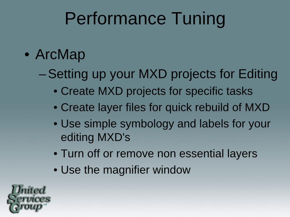
• ArcMap– Setting up your MXD projects for Editing
• Create MXD projects for specific tasks• Create layer files for quick rebuild of MXD• Use simple symbology and labels for your
editing MXD's• Turn off or remove non essential layers• Use the magnifier window
SM
Performance Tuning
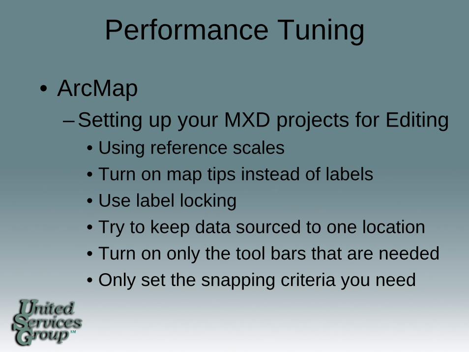
• ArcMap– Setting up your MXD projects for Editing
• Using reference scales• Turn on map tips instead of labels• Use label locking• Try to keep data sourced to one location• Turn on only the tool bars that are needed• Only set the snapping criteria you need
SM
Performance Tuning
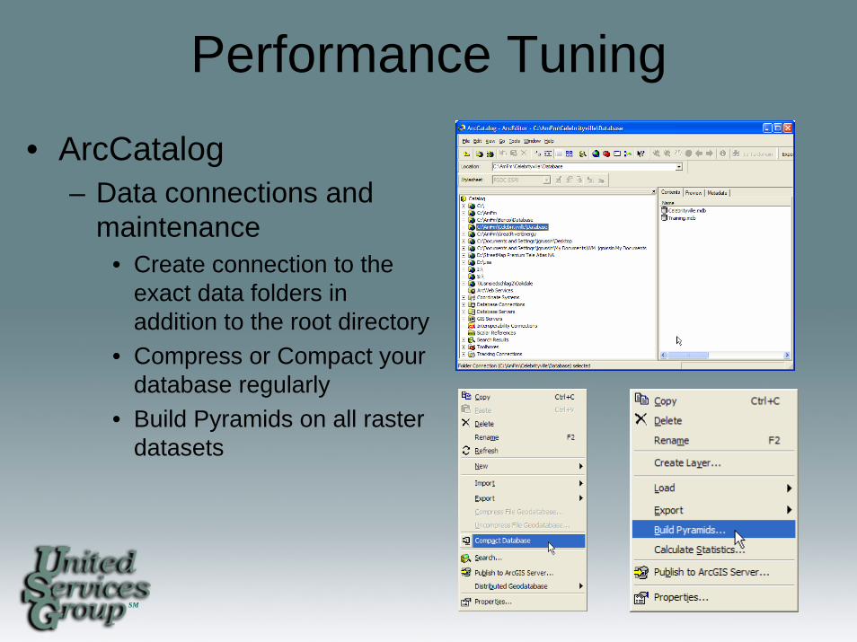
• ArcCatalog– Data connections and
maintenance• Create connection to the
exact data folders in addition to the root directory
• Compress or Compact your database regularly
• Build Pyramids on all raster datasets

SM
Performance Tuning
• Hardware and operating systems– Make sure your hardware is adequate
• Memory• Video memory• Hard drive space• Processor speed• Dual Monitors
– Operating system settings• Page memory or virtual memory file size• Hardware acceleration settings
SM
Productive Editing Techniques
Typical challenges when editing features– Controlling Feature Snapping– Editing/Sketching Efficiently– Assuring Coincidence and Accuracy– Managing Feature Selection– Bulk Editing
SM
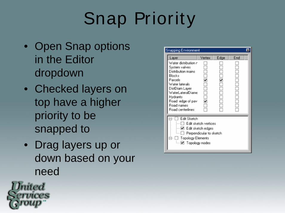
Snap Priority• Open Snap options
in the Editor dropdown
• Checked layers on top have a higher priority to be snapped to
• Drag layers up or down based on your need
SM
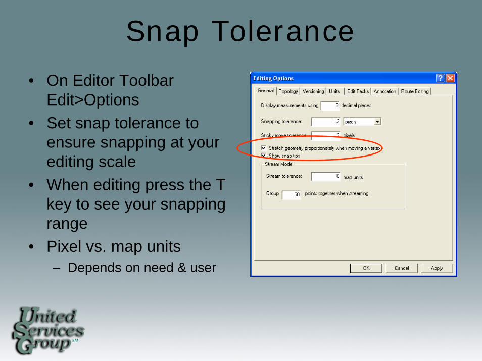
Snap Tolerance
• On Editor Toolbar Edit>Options
• Set snap tolerance to ensure snapping at your editing scale
• When editing press the T key to see your snapping range
• Pixel vs. map units– Depends on need & user

SM
Snap Tolerance Tool
• Set the tolerance as you edit or based on the features you are editing
• Tool located in the editor group
SM
Snap Overriding
• Quick – Override snaps at any time by holding onto
the spacebar while editing• Time Consuming
– Uncheck all features in the snapping dialog
SM
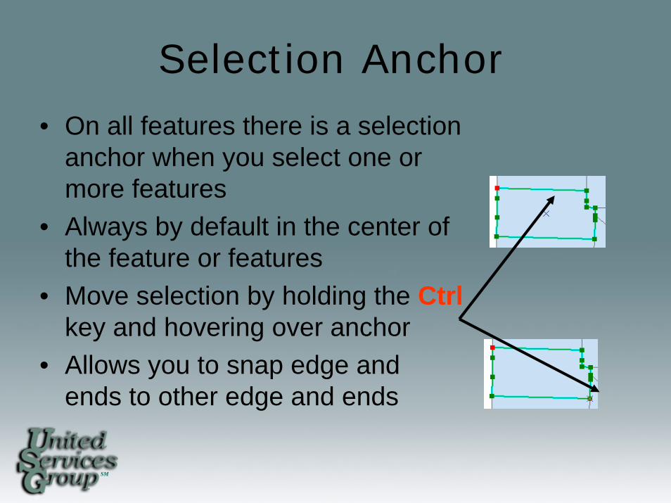
Selection Anchor• On all features there is a selection
anchor when you select one or more features
• Always by default in the center of the feature or features
• Move selection by holding the Ctrlkey and hovering over anchor
• Allows you to snap edge and ends to other edge and ends
SM
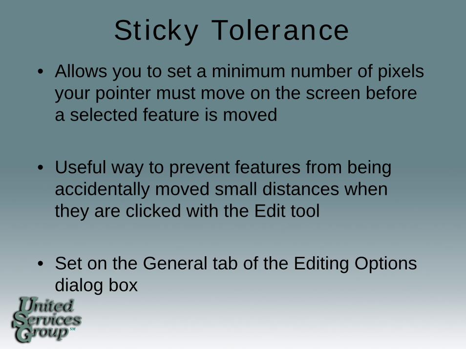
Sticky Tolerance• Allows you to set a minimum number of pixels
your pointer must move on the screen before a selected feature is moved
• Useful way to prevent features from being accidentally moved small distances when they are clicked with the Edit tool
• Set on the General tab of the Editing Options dialog box
SM
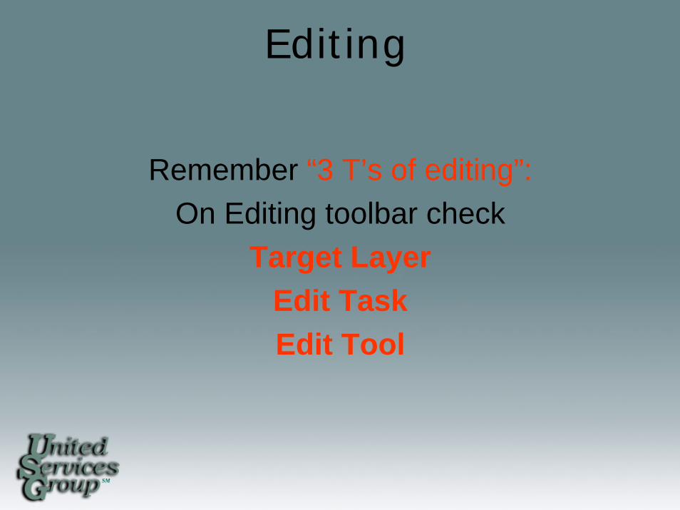
Editing
Remember “3 T’s of editing”:On Editing toolbar check
Target LayerEdit Task Edit Tool
SM
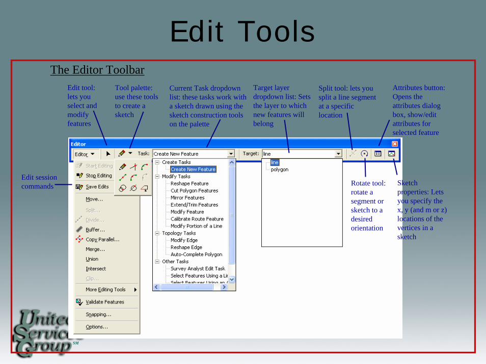
Edit ToolsThe Editor Toolbar
Edit session commands
Edit tool: lets you select and modify features
Tool palette: use these tools to create a sketch
Current Task dropdown list: these tasks work with a sketch drawn using the sketch construction tools on the palette
Target layer dropdown list: Sets the layer to which new features will belong
Split tool: lets you split a line segment at a specific location
Attributes button: Opens the attributes dialog box, show/edit attributes for selected feature
Rotate tool: rotate a segment or sketch to a desired orientation
Sketch properties: Lets you specify the x, y (and m or z) locations of the vertices in a sketch
SM
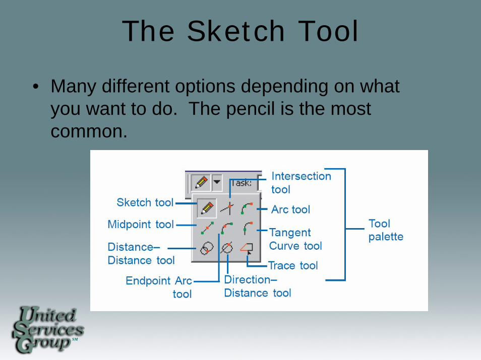
The Sketch Tool
• Many different options depending on what you want to do. The pencil is the most common.
SM
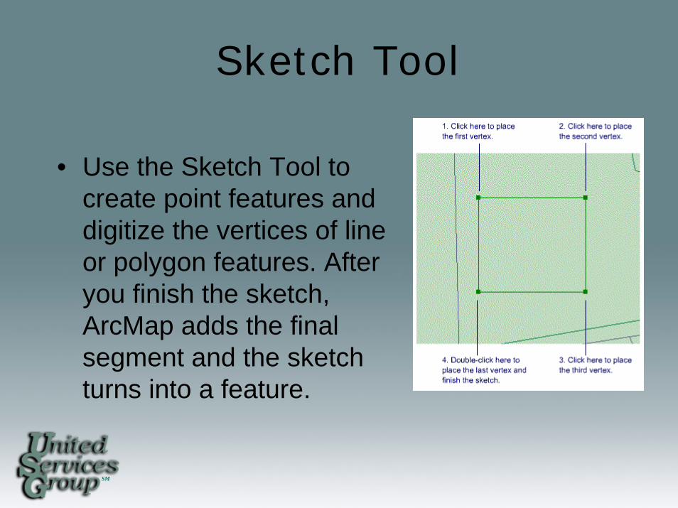
Sketch Tool
• Use the Sketch Tool to create point features and digitize the vertices of line or polygon features. After you finish the sketch, ArcMap adds the final segment and the sketch turns into a feature.
SM
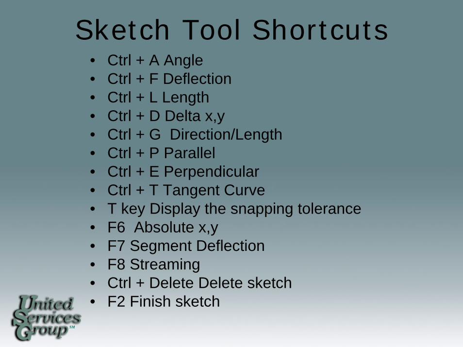
Sketch Tool Shortcuts• Ctrl + A Angle • Ctrl + F Deflection • Ctrl + L Length • Ctrl + D Delta x,y • Ctrl + G Direction/Length • Ctrl + P Parallel • Ctrl + E Perpendicular • Ctrl + T Tangent Curve • T key Display the snapping tolerance• F6 Absolute x,y • F7 Segment Deflection • F8 Streaming • Ctrl + Delete Delete sketch • F2 Finish sketch
SM
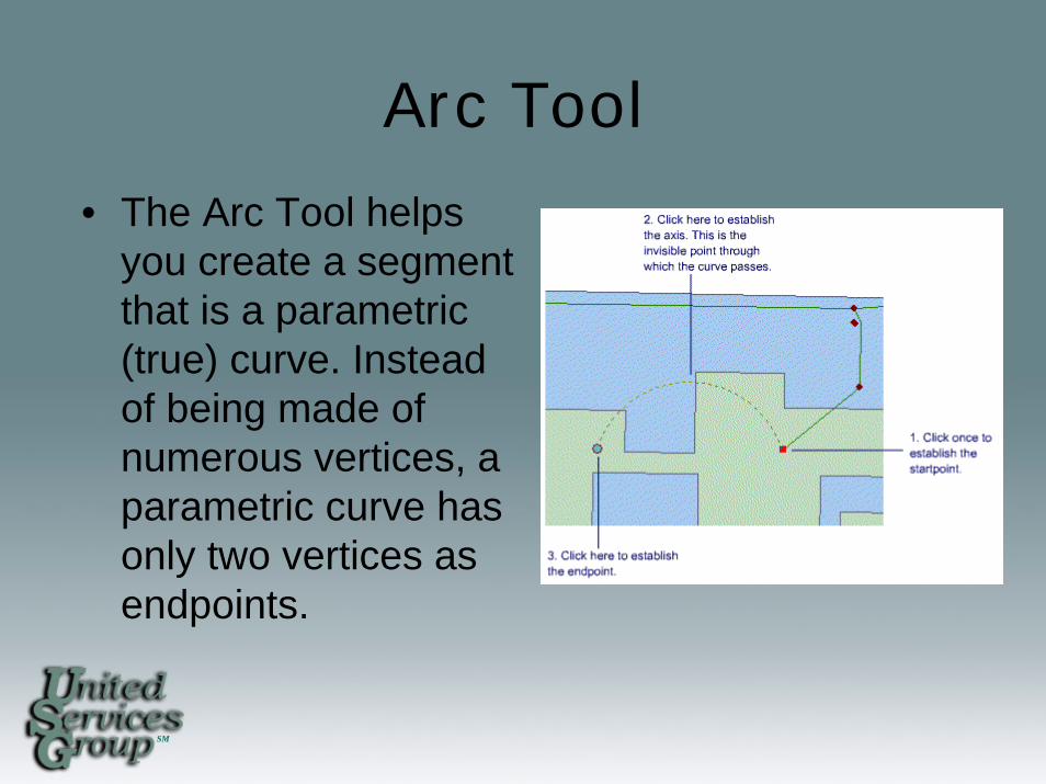
Arc Tool
• The Arc Tool helps you create a segment that is a parametric (true) curve. Instead of being made of numerous vertices, a parametric curve has only two vertices as endpoints.
SM
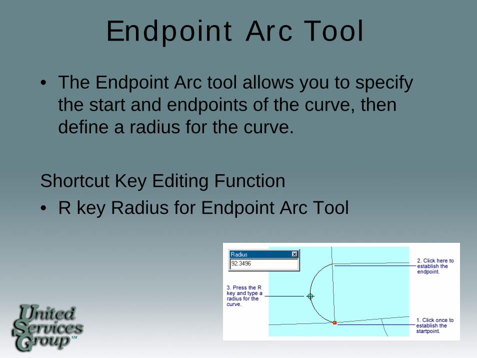
Endpoint Arc Tool
• The Endpoint Arc tool allows you to specify the start and endpoints of the curve, then define a radius for the curve.
Shortcut Key Editing Function • R key Radius for Endpoint Arc Tool
SM
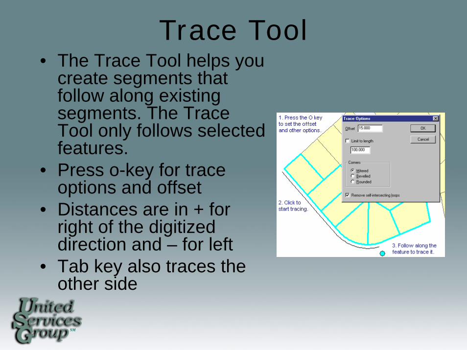
Trace Tool• The Trace Tool helps you
create segments that follow along existing segments. The Trace Tool only follows selected features.
• Press o-key for trace options and offset
• Distances are in + for right of the digitized direction and – for left
• Tab key also traces the other side
SM
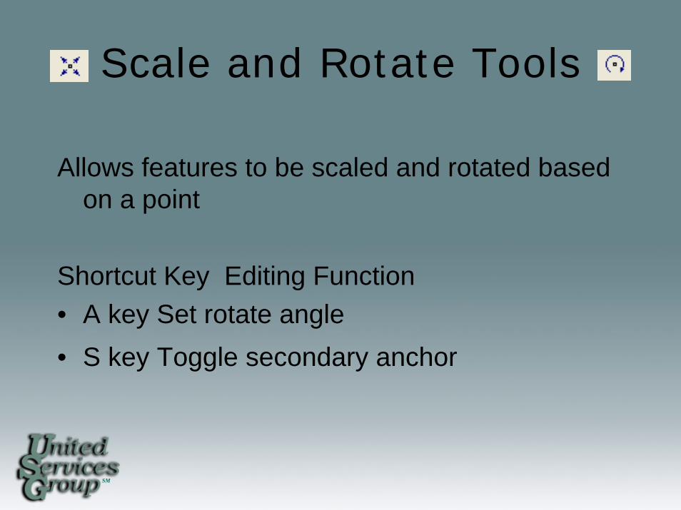
Scale and Rotate Tools
Allows features to be scaled and rotated based on a point
Shortcut Key Editing Function • A key Set rotate angle • S key Toggle secondary anchor
SM
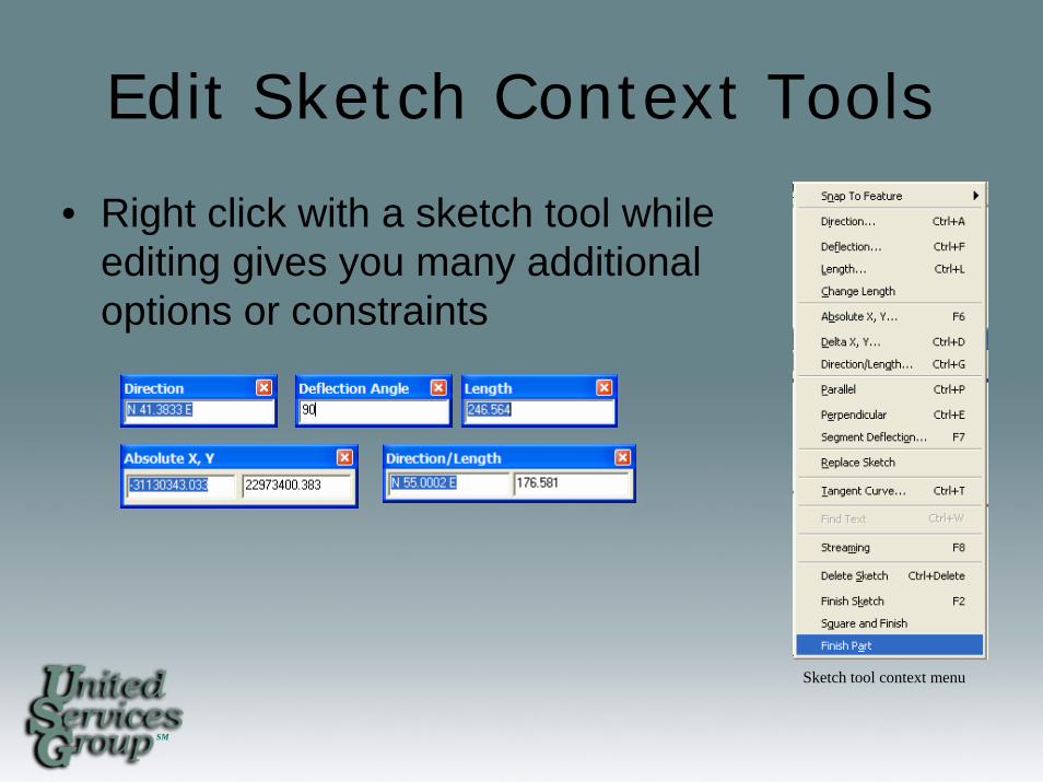
Edit Sketch Context Tools
• Right click with a sketch tool while editing gives you many additional options or constraints
Sketch tool context menu
SM
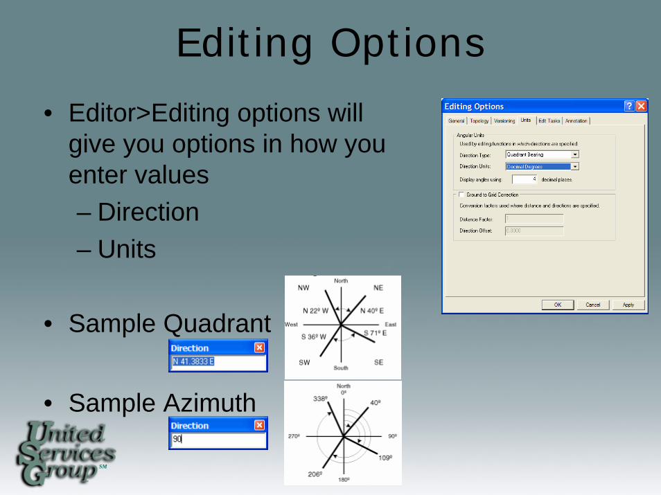
Editing Options
• Editor>Editing options will give you options in how you enter values– Direction– Units
• Sample Quadrant
• Sample Azimuth
SM
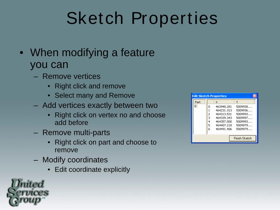
Sketch Properties
• When modifying a feature you can– Remove vertices
• Right click and remove• Select many and Remove
– Add vertices exactly between two• Right click on vertex no and choose
add before– Remove multi-parts
• Right click on part and choose to remove
– Modify coordinates• Edit coordinate explicitly
SM
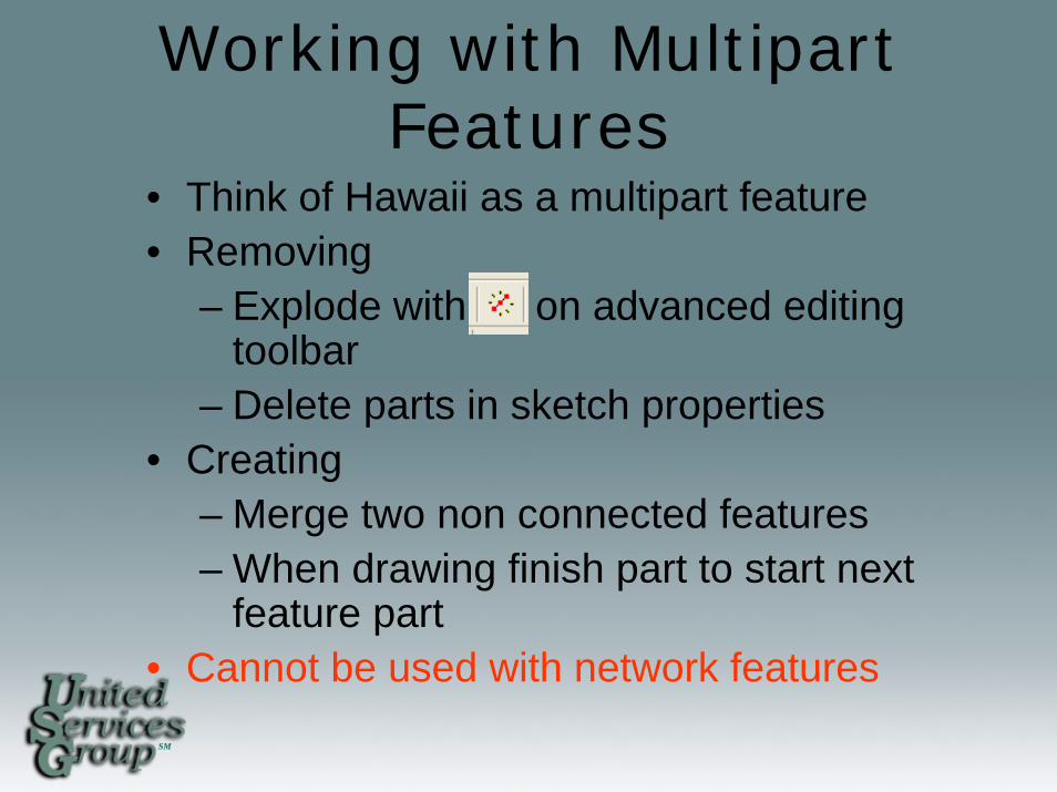
Working with Multipart Features
• Think of Hawaii as a multipart feature• Removing
– Explode with on advanced editing toolbar
– Delete parts in sketch properties• Creating
– Merge two non connected features– When drawing finish part to start next
feature part• Cannot be used with network features
SM
Copying and Pasting Features
• Use standard copy/paste for like geometry or lower geometry feature type
• Ensure target layer is correct
• Like attributes will copy as well
SM
Copying and Pasting Attributes
• Select the feature in the attributes window you want to copy
• Right click and choose copy
• Choose the feature you want to copy to and right click and choose paste
SM
Edit Tasks
• Create Tasks• Modify Tasks
– Reshaping – modify portion of the line– Cut Polygon – split a polygon into two features– Mirror features – Create a mirror image of a
feature– Extend/Trim – fix under and overshoots– Modify – reshape a feature
• Topology– Auto Complete polygon – Use existing polygons to
finish sketch against
SM
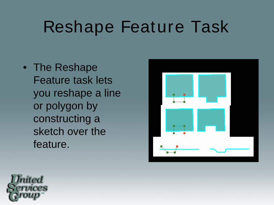
Reshape Feature Task
• The Reshape Feature task lets you reshape a line or polygon by constructing a sketch over the feature.
SM
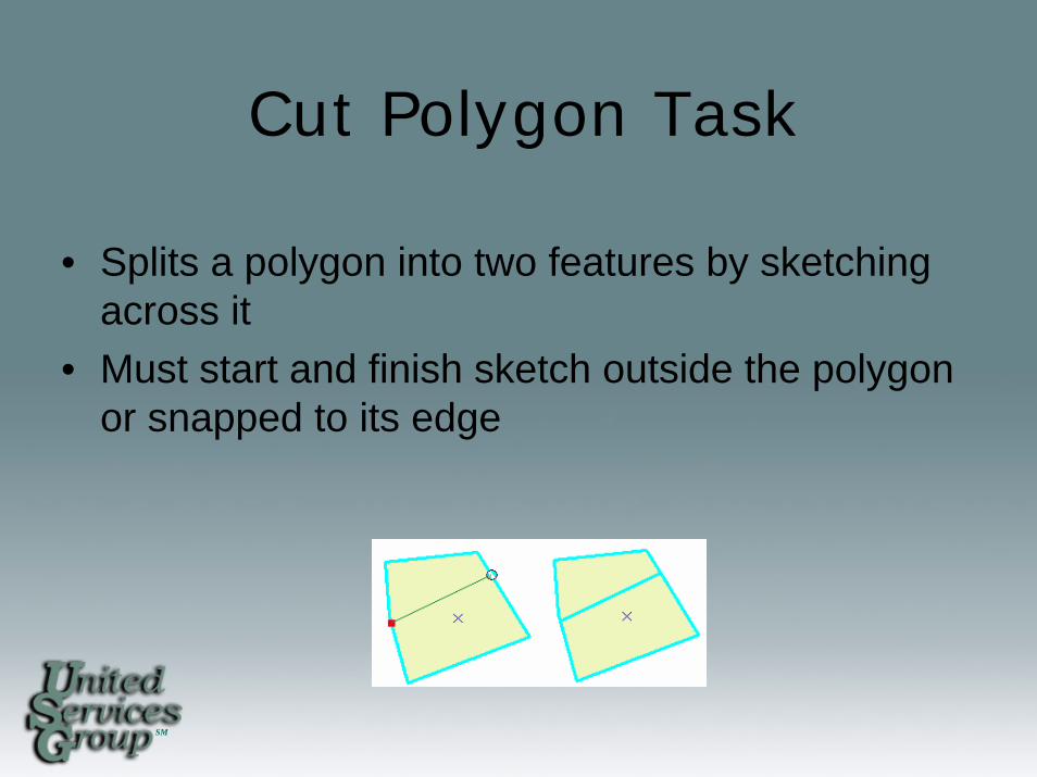
Cut Polygon Task
• Splits a polygon into two features by sketching across it
• Must start and finish sketch outside the polygon or snapped to its edge
SM
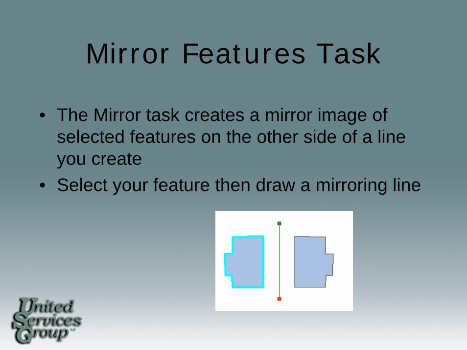
Mirror Features Task
• The Mirror task creates a mirror image of selected features on the other side of a line you create
• Select your feature then draw a mirroring line
SM
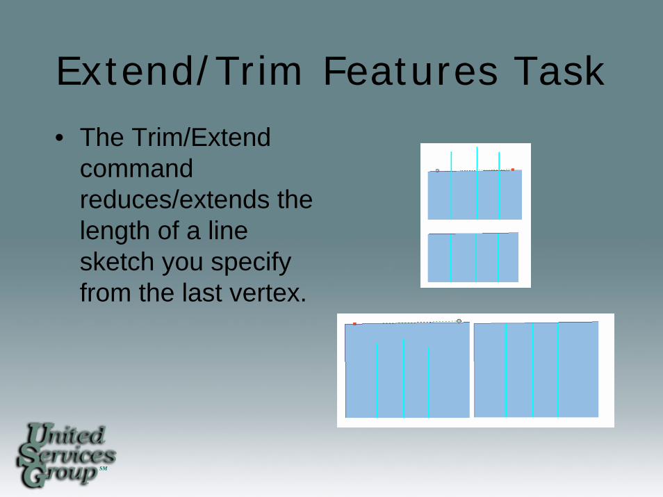
Extend/Trim Features Task• The Trim/Extend
command reduces/extends the length of a line sketch you specify from the last vertex.
SM
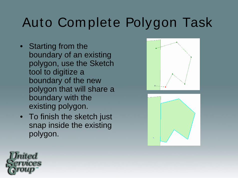
Auto Complete Polygon Task
• Starting from the boundary of an existing polygon, use the Sketch tool to digitize a boundary of the new polygon that will share a boundary with the existing polygon.
• To finish the sketch just snap inside the existing polygon.
SM
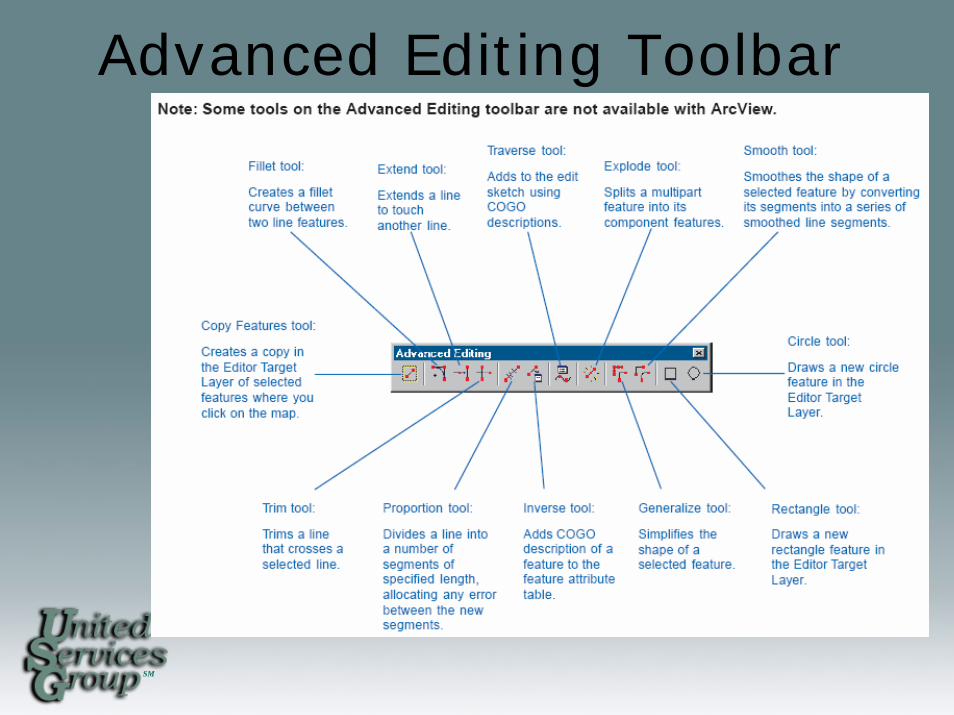
Advanced Editing Toolbar
SM
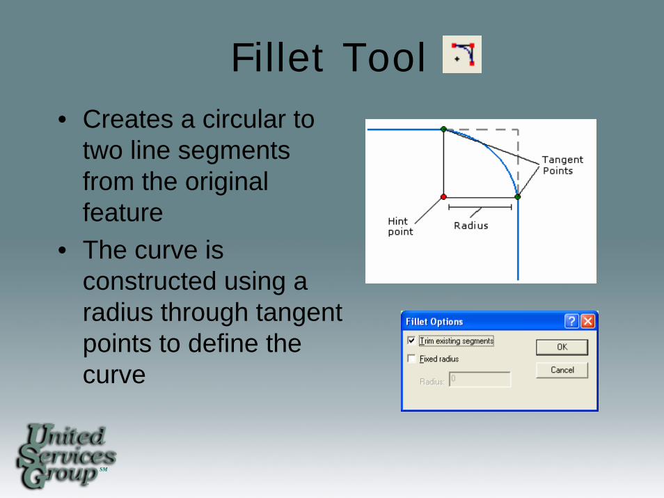
Fillet Tool• Creates a circular to
two line segments from the original feature
• The curve is constructed using a radius through tangent points to define the curve
SM
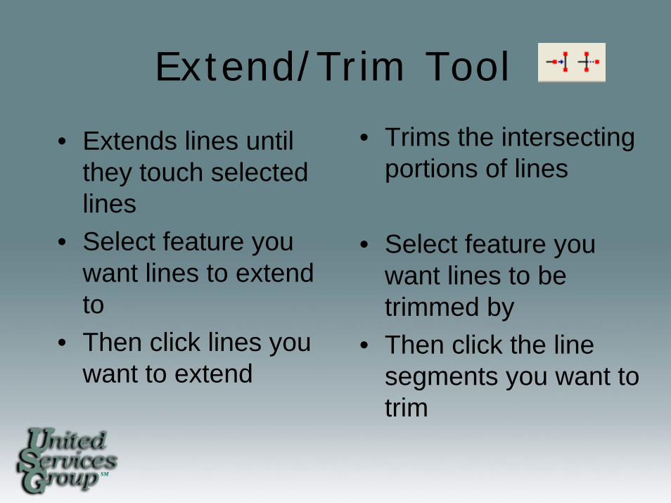
Extend/Trim Tool
• Trims the intersecting portions of lines
• Select feature you want lines to be trimmed by
• Then click the line segments you want to trim
• Extends lines until they touch selected lines
• Select feature you want lines to extend to
• Then click lines you want to extend
SM
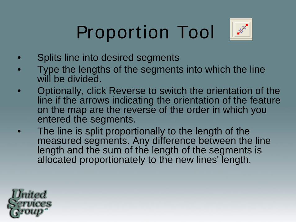
Proportion Tool• Splits line into desired segments • Type the lengths of the segments into which the line
will be divided. • Optionally, click Reverse to switch the orientation of the
line if the arrows indicating the orientation of the feature on the map are the reverse of the order in which you entered the segments.
• The line is split proportionally to the length of the measured segments. Any difference between the line length and the sum of the length of the segments is allocated proportionately to the new lines' length.
SM
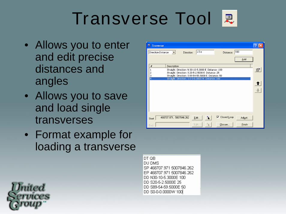
Transverse Tool• Allows you to enter
and edit precise distances and angles
• Allows you to save and load single transverses
• Format example for loading a transverse
SM
Generalize Tool
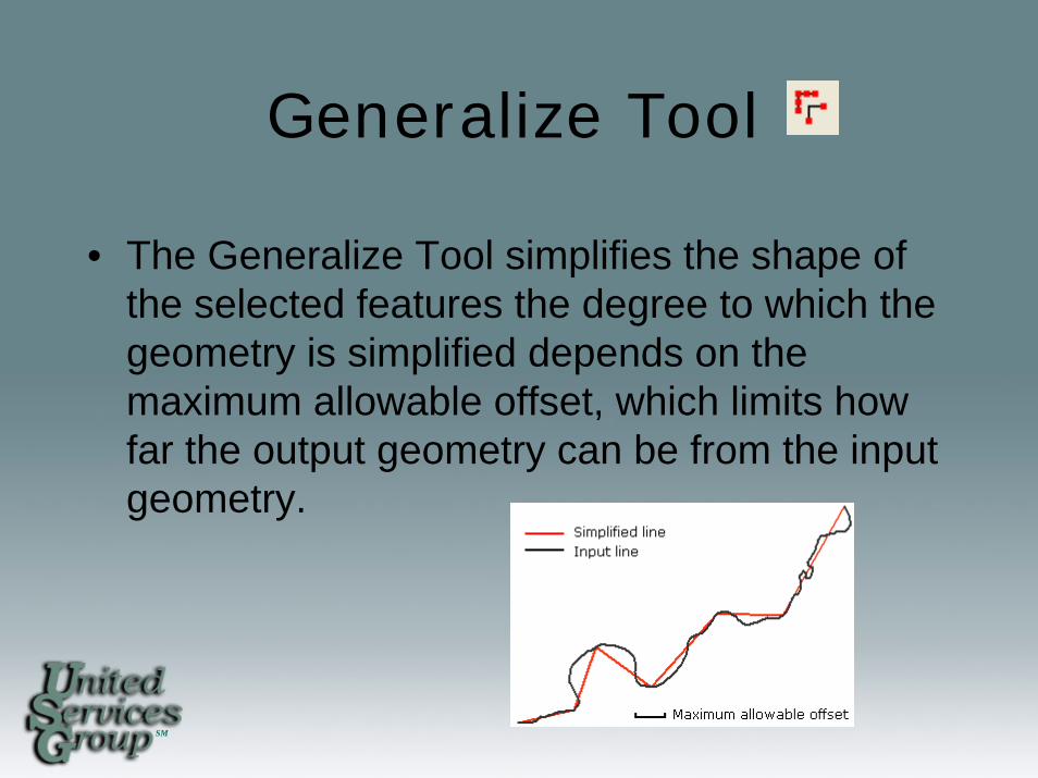
• The Generalize Tool simplifies the shape of the selected features the degree to which the geometry is simplified depends on the maximum allowable offset, which limits how far the output geometry can be from the input geometry.
SM
Smooth Tool
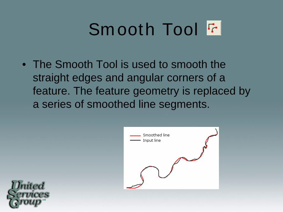
• The Smooth Tool is used to smooth the straight edges and angular corners of a feature. The feature geometry is replaced by a series of smoothed line segments.
SM
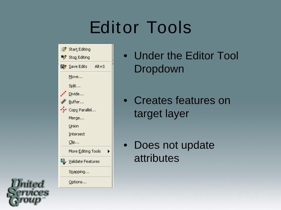
Editor Tools
• Under the Editor Tool Dropdown
• Creates features on target layer
• Does not update attributes
SM
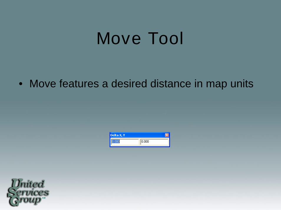
Move Tool
• Move features a desired distance in map units
SM
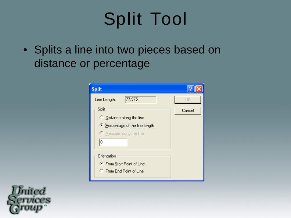
Split Tool
• Splits a line into two pieces based on distance or percentage
SM
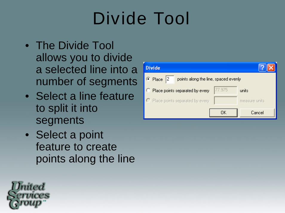
Divide Tool • The Divide Tool
allows you to divide a selected line into a number of segments
• Select a line feature to split it into segments
• Select a point feature to create points along the line
SM
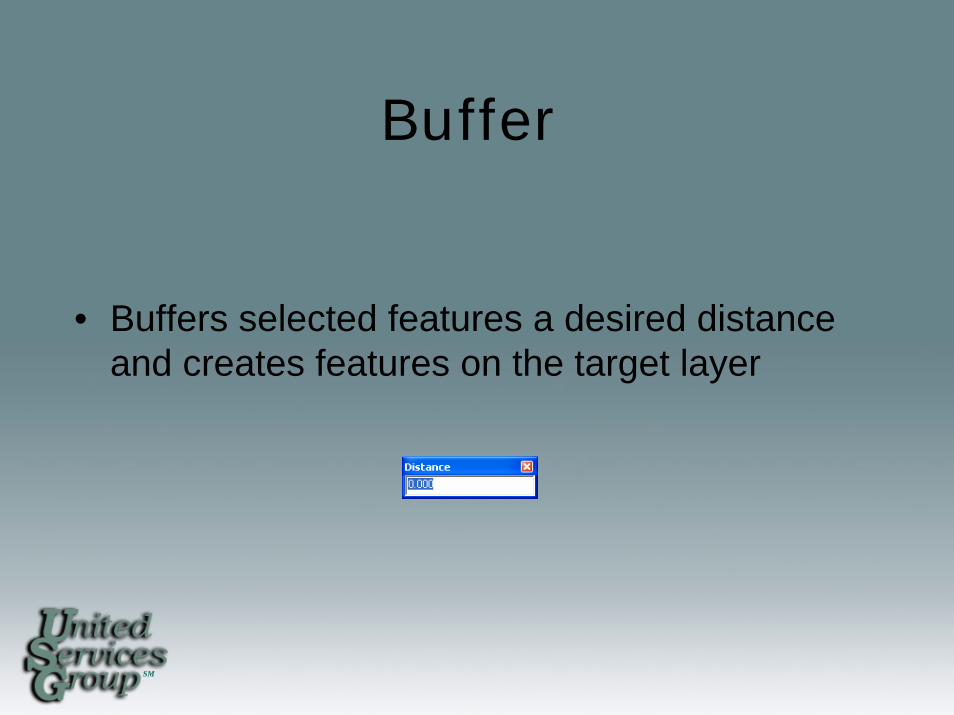
Buffer
• Buffers selected features a desired distance and creates features on the target layer
SM
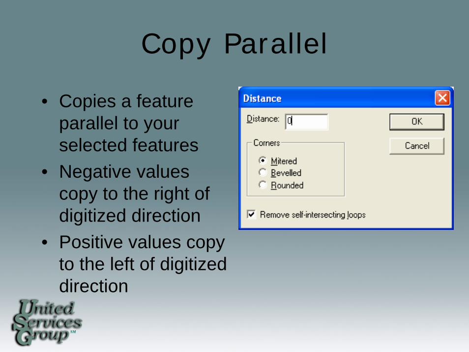
Copy Parallel
• Copies a feature parallel to your selected features
• Negative values copy to the right of digitized direction
• Positive values copy to the left of digitized direction
SM
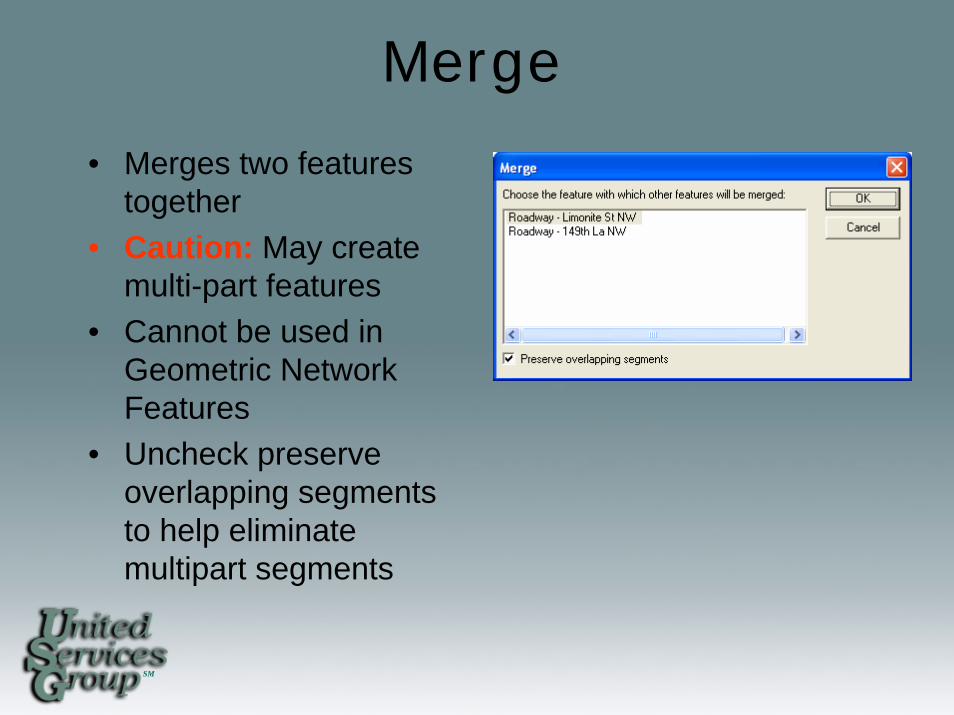
Merge
• Merges two features together
• Caution: May create multi-part features
• Cannot be used in Geometric Network Features
• Uncheck preserve overlapping segments to help eliminate multipart segments
SM
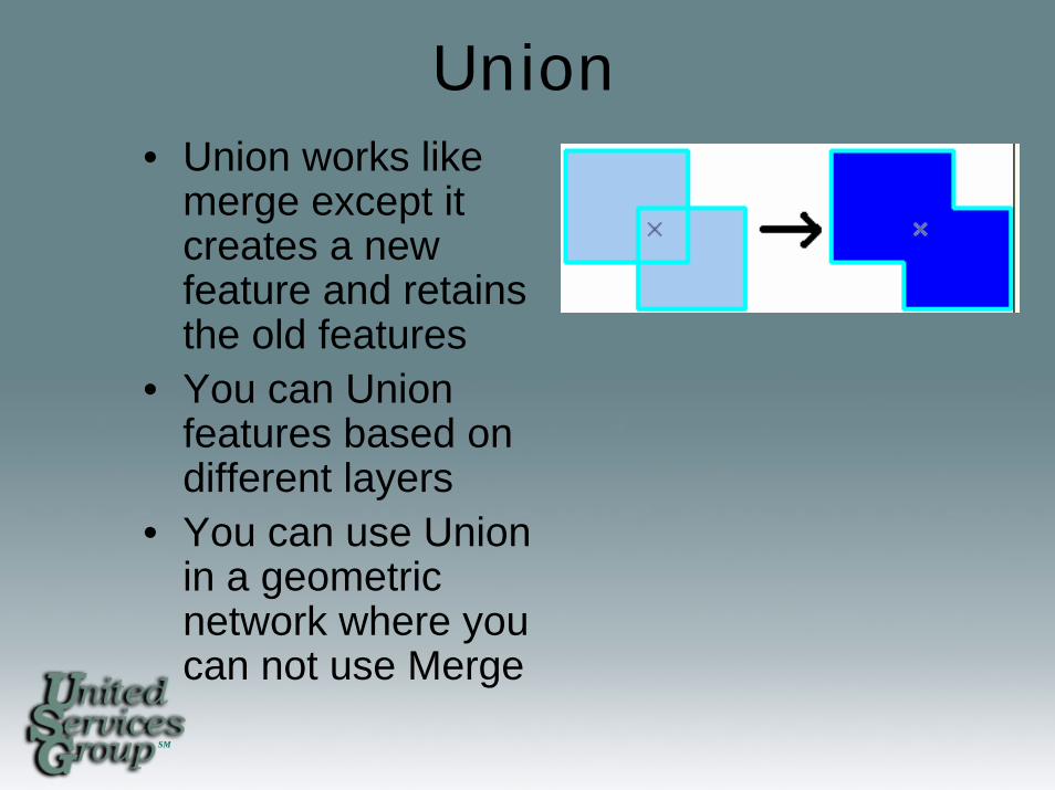
Union• Union works like
merge except it creates a new feature and retains the old features
• You can Union features based on different layers
• You can use Union in a geometric network where you can not use Merge
SM
Intersect
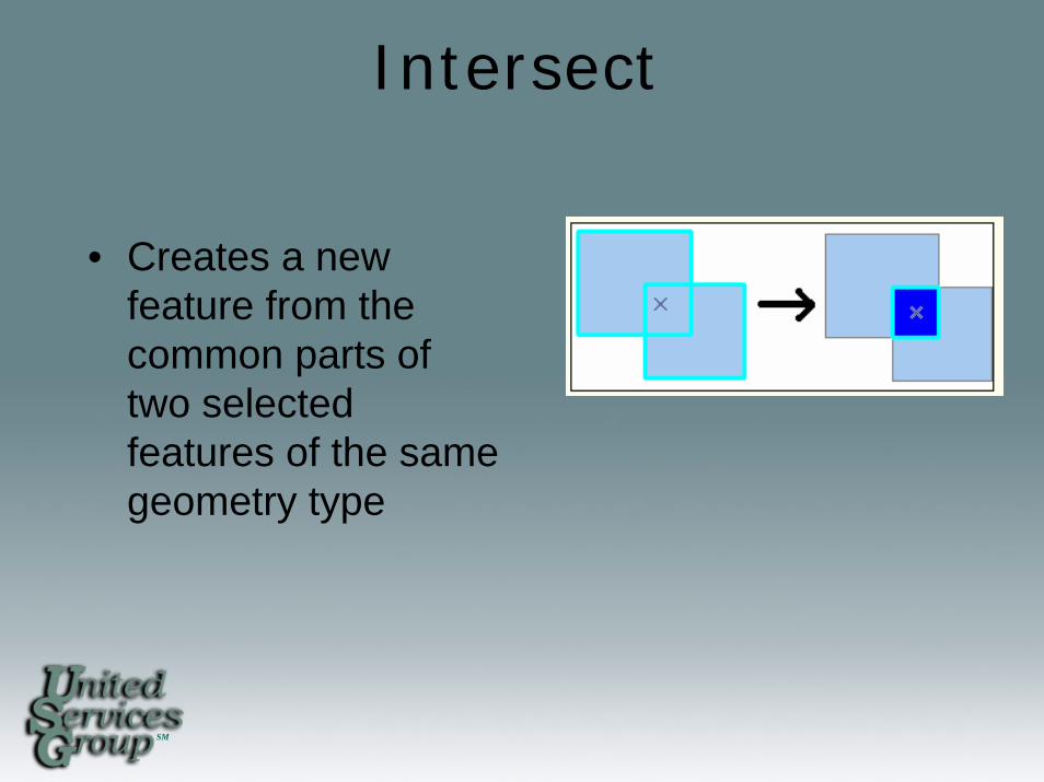
• Creates a new feature from the common parts of two selected features of the same geometry type
SM
Clip
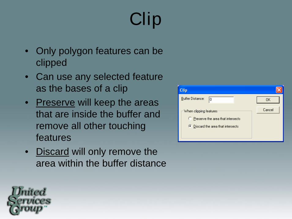
• Only polygon features can be clipped
• Can use any selected feature as the bases of a clip
• Preserve will keep the areas that are inside the buffer and remove all other touching features
• Discard will only remove the area within the buffer distance
SM
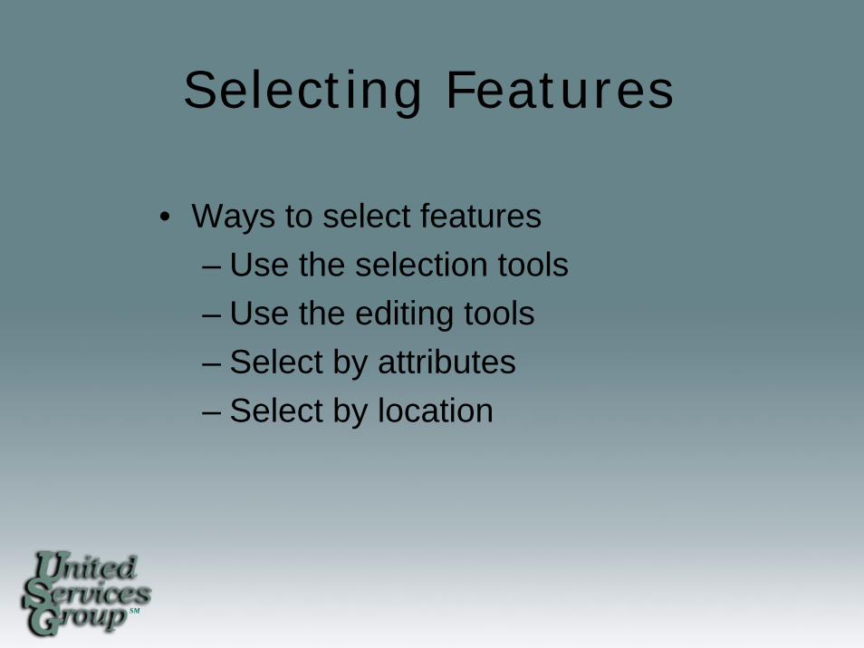
Selecting Features
• Ways to select features– Use the selection tools– Use the editing tools– Select by attributes– Select by location
SM
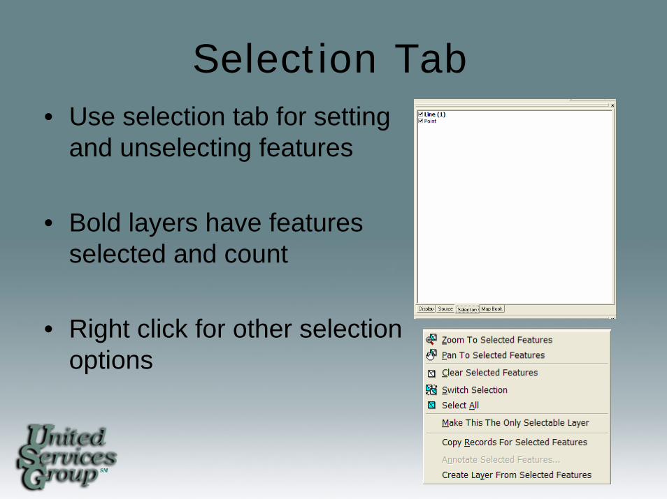
Selection Tab• Use selection tab for setting
and unselecting features
• Bold layers have features selected and count
• Right click for other selection options
SM
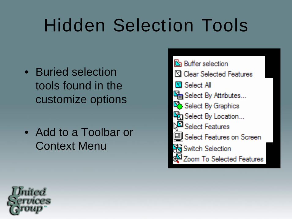
Hidden Selection Tools
• Buried selection tools found in the customize options
• Add to a Toolbar or Context Menu
SM
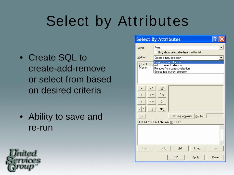
Select by Attributes
• Create SQL to create-add-remove or select from based on desired criteria
• Ability to save and re-run
SM
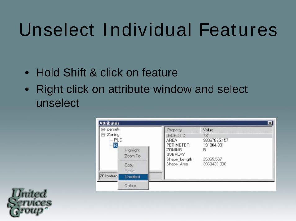
Unselect Individual Features
• Hold Shift & click on feature• Right click on attribute window and select
unselect
SM
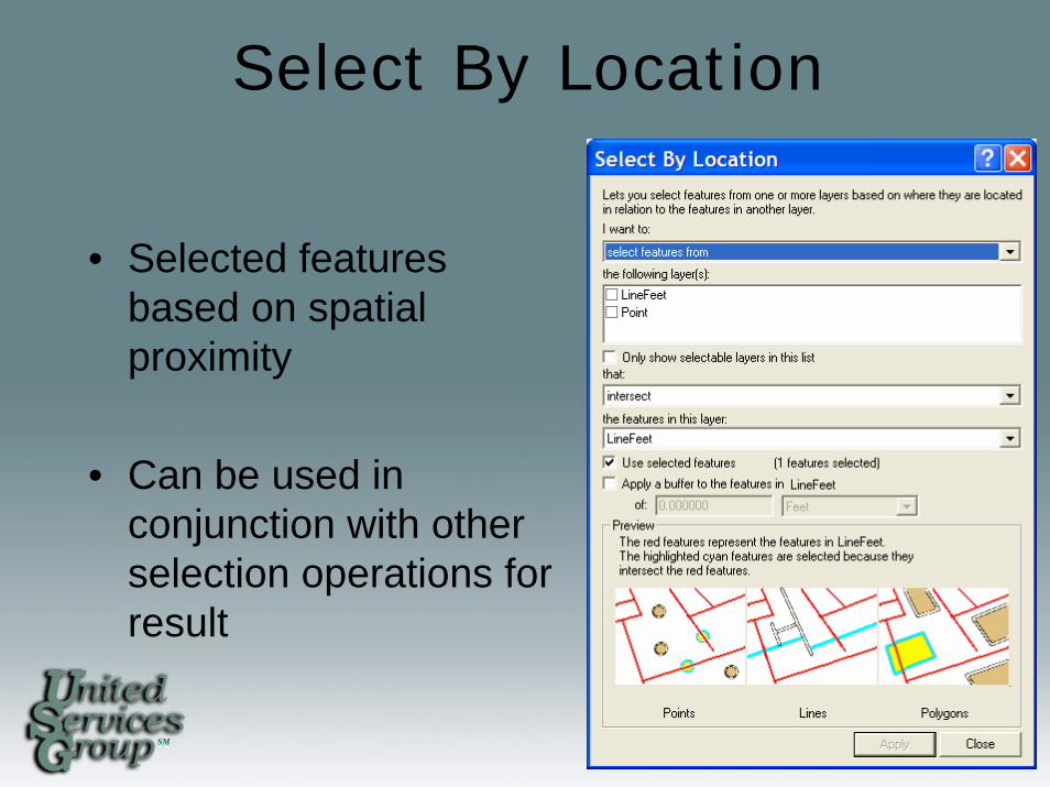
Select By Location
• Selected features based on spatial proximity
• Can be used in conjunction with other selection operations for result
SM
Bulk Editing
• Ways to update multiple features quickly and accurately
SM
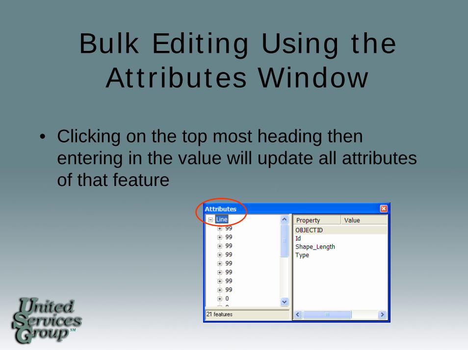
Bulk Editing Using the Attributes Window
• Clicking on the top most heading then entering in the value will update all attributes of that feature
SM
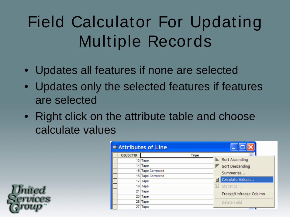
Field Calculator For Updating Multiple Records
• Updates all features if none are selected• Updates only the selected features if features
are selected• Right click on the attribute table and choose
calculate values
SM
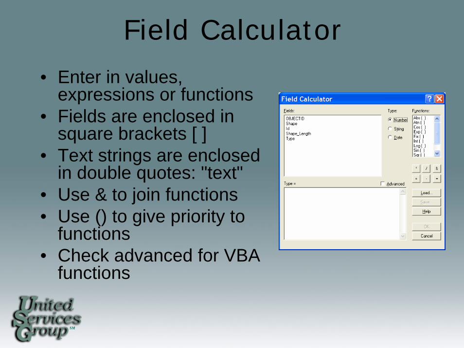
Field Calculator
• Enter in values, expressions or functions
• Fields are enclosed in square brackets [ ]
• Text strings are enclosed in double quotes: "text"
• Use & to join functions• Use () to give priority to
functions• Check advanced for VBA
functions

SM
Field Calculator Utilizing Joins• When joining features based on a one-to-one
or many-to-one join you can pass values from the join table to the feature table by calculating features
• You cannot calculate based on relationships or create joins on one-to- many or many-to-many cardinality

SM
Common Field Calculations
• [Field1] & [Field2] = Field1Field2• [Field1] &” “& [Field2] = Field1 Field2• [Field1] &”TEXT“& [Field2] =
Field1TEXTField2• [Number] * .5 = Resultant Answer
SM
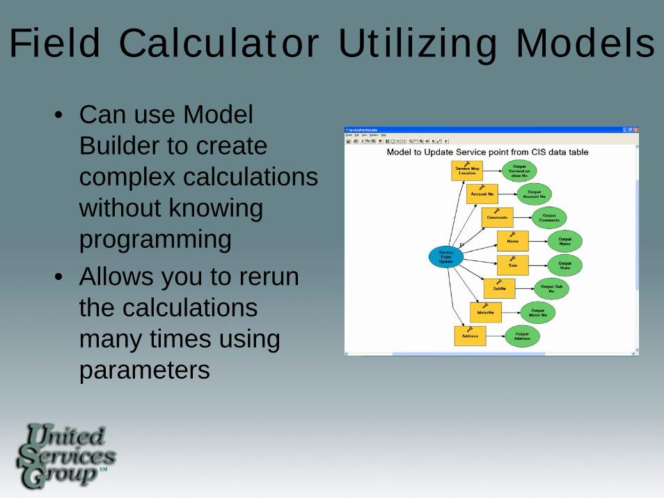
Field Calculator Utilizing Models
• Can use Model Builder to create complex calculations without knowing programming
• Allows you to rerun the calculations many times using parameters
SM
Useful ESRI Desktop Extensionsfor Utilities
• ArcPublisher• ArcSchematics• ESRI Job Tracking Extension JTX• Network Analyst• Spatial Analyst• Tracking Analyst• Maplex

SM
Useful ESRI Desktop Extensionsfor Utilities
• ArcPublisher– Creates ArcReader PMF documents– Creates data packages for mobile
viewing– Used to set up security and
fuctionallity settings for ArcReader
SM
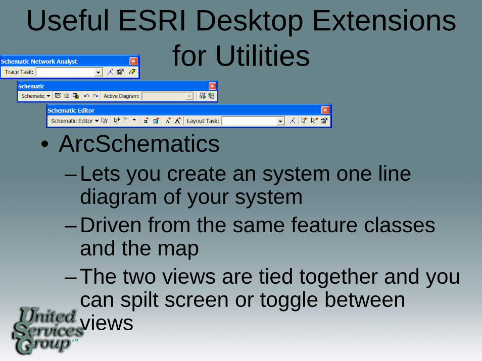
Useful ESRI Desktop Extensionsfor Utilities
• ArcSchematics– Lets you create an system one line
diagram of your system– Driven from the same feature classes
and the map– The two views are tied together and you
can spilt screen or toggle between views

SM
Useful ESRI Desktop Extensionsfor Utilities
• ESRI Job Tracking Extension JTX– Used for work flow management– Using Job Tracking for ArcGIS (JTX), you can
define, organize, and standardize the individual tasks within a workflow. You can allocate staffing resources, automate tasks, and track the status and progress of jobs from beginning to end.
SM
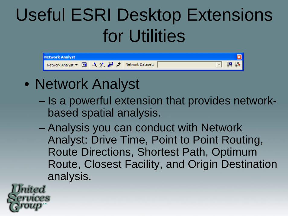
Useful ESRI Desktop Extensionsfor Utilities
• Network Analyst– Is a powerful extension that provides network-
based spatial analysis.– Analysis you can conduct with Network
Analyst: Drive Time, Point to Point Routing, Route Directions, Shortest Path, Optimum Route, Closest Facility, and Origin Destination analysis.
SM
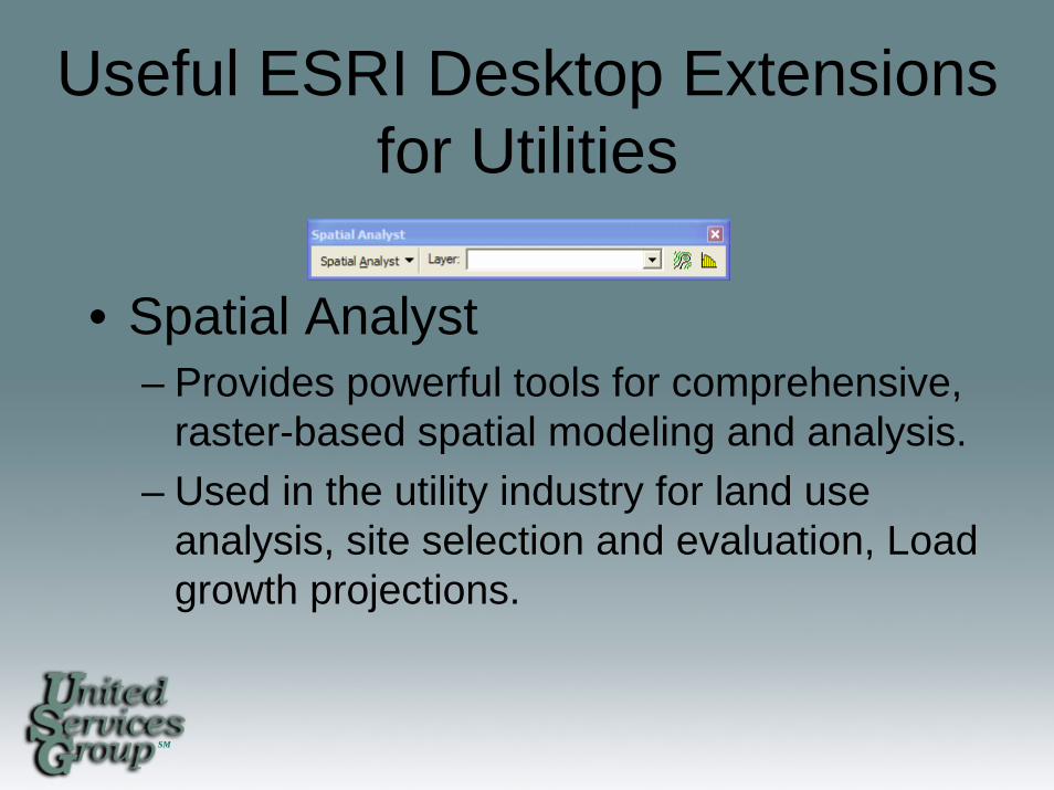
Useful ESRI Desktop Extensionsfor Utilities
• Spatial Analyst– Provides powerful tools for comprehensive,
raster-based spatial modeling and analysis. – Used in the utility industry for land use
analysis, site selection and evaluation, Load growth projections.
SM
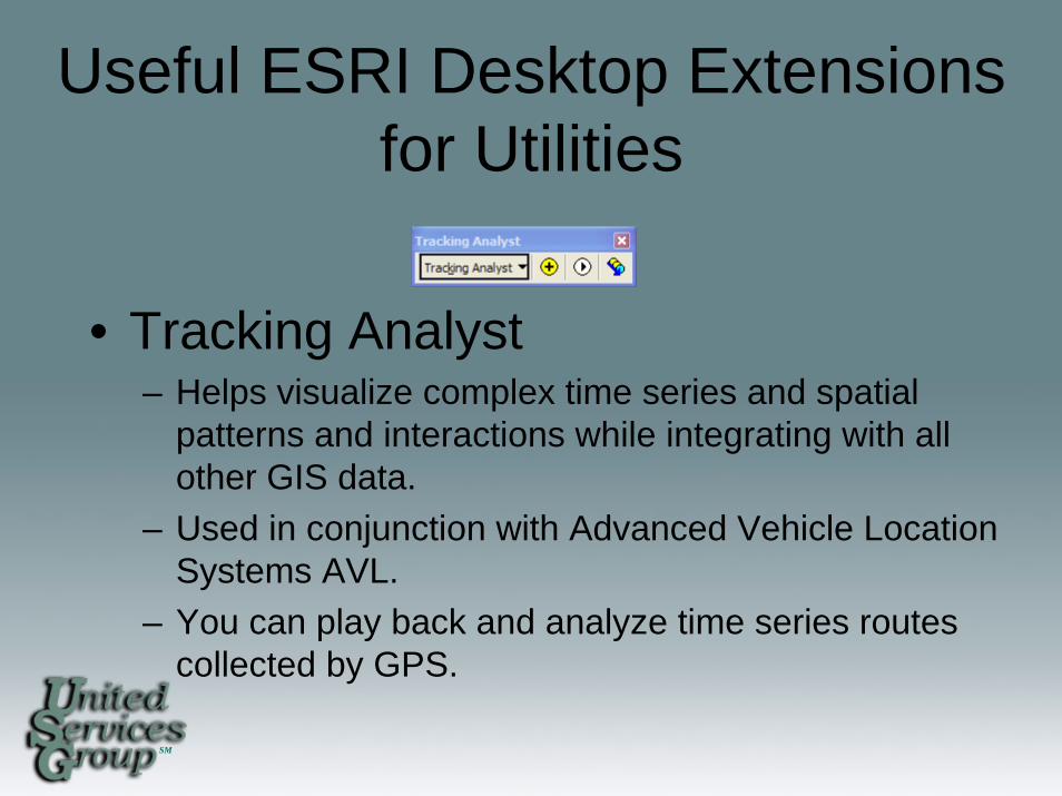
Useful ESRI Desktop Extensionsfor Utilities
• Tracking Analyst– Helps visualize complex time series and spatial
patterns and interactions while integrating with all other GIS data.
– Used in conjunction with Advanced Vehicle Location Systems AVL.
– You can play back and analyze time series routes collected by GPS.
SM
Useful ESRI Desktop Extensionsfor Utilities
• Maplex– Is an automated high-quality cartographic text
placement and labeling extension for ArcGIS Desktop.
– Cut the time needed to create and move annotation from weeks to days.
– Comes with ArcInfo only but can be purchased as an add on extension to ArcEditor and ArcView.

SM
Help TipsFind ArcGIS Desktop Help Online • Application Help http://webhelp.esri.com/• ArcScripts http://arcscripts.esri.com• ESRI Support Center: http://support.esri.com
• Forums• Knowledge Base • Technical Articles
• EDN – ESRI Developer Network: http://edn.esri.com• Other GIS User Groups• United Services Group http://www.usgweb.com
Jeffrey Grussing [email protected]
763-241-2336


![Tuning Tips Ppt[1]](https://img.pdfslide.net/doc/110x75/55cf9a8a550346d033a23d39/tuning-tips-ppt1.jpg)