Embed Size (px)
Citation preview
1
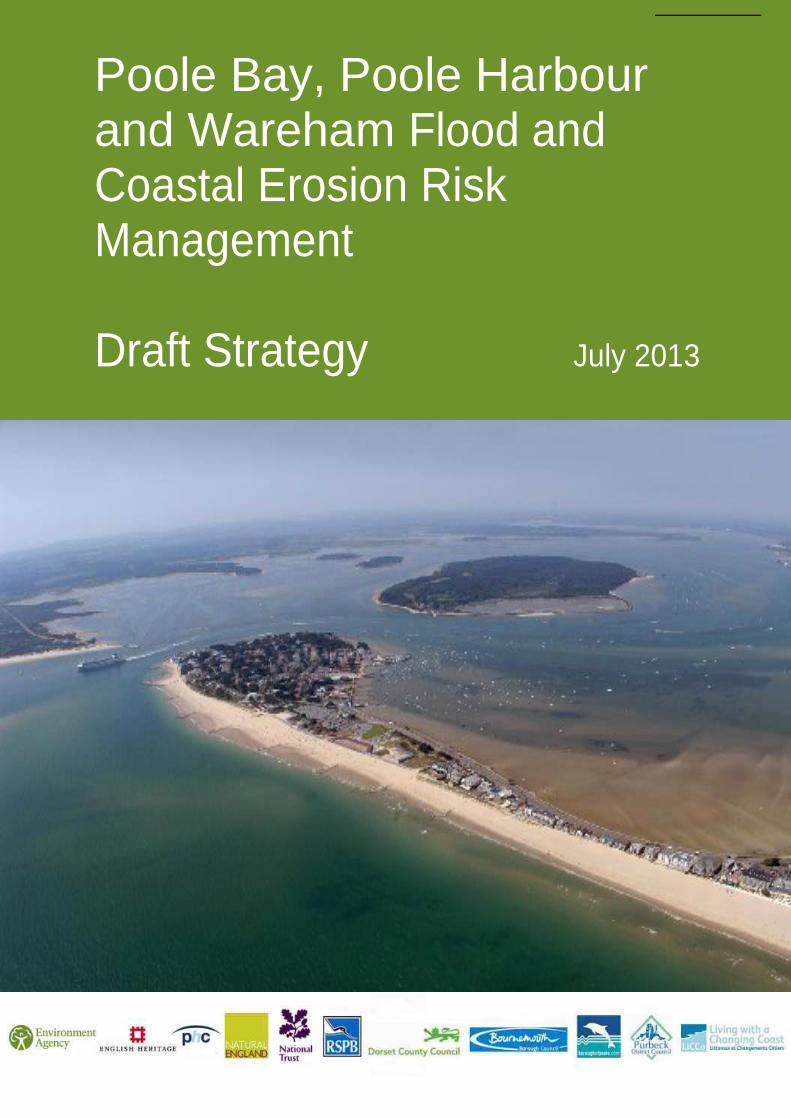
Poole Bay, Poole Harbour and Wareham Flood and Coastal Erosion Risk Management Draft Strategy July 2013
2
Foreword ‘The Poole and Wareham Strategy area is one of the most vibrant and diverse sections of coast in England. The range of cultural, social, archaeological, biodiversity and landscape features leads to high value and high sensitivity when considering potential changes. The Flood and Coastal Erosion Risk Management Strategy is progressing towards formal adoption under the stewardship of a Steering Group which includes the Local Authorities, Port Authority and Conservation Groups, representing the different interests and ensuring that the future of the Wareham and Poole area is sustainable for the next 20, 50 and 100 years. The Strategy has built on the existing Catchment Flood Management Plans, Shoreline Management Plans and the comments from organisations and members of the public.’ Alan Lovell Chair Wessex Regional Flood and Coastal Committee
‘I am pleased to be able to support this Flood and Coastal Erosion Risk Management Strategy, and to thoroughly recommend that all members of our coastal communities make themselves aware of the issues that we face going into the future. The effects of climate change are challenging to predict, but the best way for us to protect the things we value as a society is to engage with the issues and add our voices to the strategic decisions. The comments that have been received strengthen this Strategy which will shape the future of our coast.’ Andy Bradbury Chair Southern Coastal Group
3
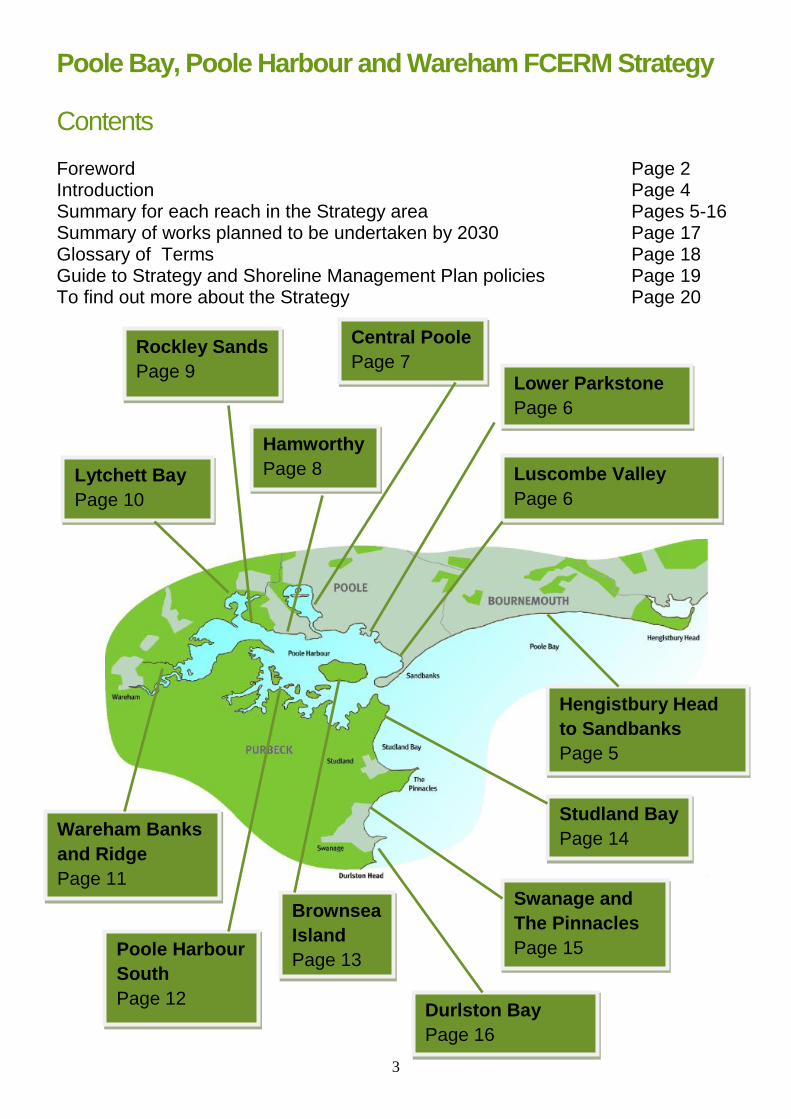
Poole Bay, Poole Harbour and Wareham FCERM Strategy
Contents Foreword Page 2 Introduction Page 4 Summary for each reach in the Strategy area Pages 5-16 Summary of works planned to be undertaken by 2030 Page 17 Glossary of Terms Page 18 Guide to Strategy and Shoreline Management Plan policies Page 19 To find out more about the Strategy Page 20
Hengistbury Head
to Sandbanks
Page 5
Luscombe Valley
Page 6
Central Poole
Page 7
Hamworthy
Page 8
Rockley Sands
Page 9
Lytchett Bay
Page 10
Wareham Banks
and Ridge
Page 11
Lower Parkstone
Page 6
Poole Harbour
South
Page 12
Swanage and
The Pinnacles
Page 15
Brownsea
Island
Page 13
Studland Bay
Page 14
Durlston Bay
Page 16
4
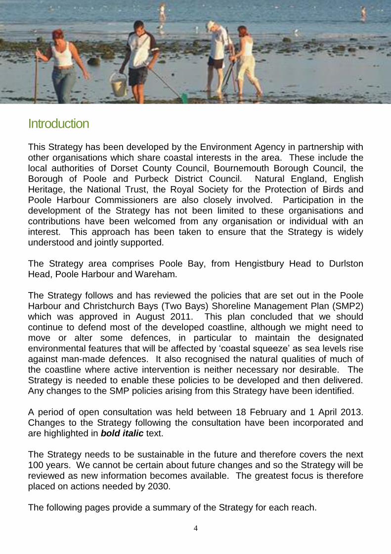
Introduction This Strategy has been developed by the Environment Agency in partnership with other organisations which share coastal interests in the area. These include the local authorities of Dorset County Council, Bournemouth Borough Council, the Borough of Poole and Purbeck District Council. Natural England, English Heritage, the National Trust, the Royal Society for the Protection of Birds and Poole Harbour Commissioners are also closely involved. Participation in the development of the Strategy has not been limited to these organisations and contributions have been welcomed from any organisation or individual with an interest. This approach has been taken to ensure that the Strategy is widely understood and jointly supported. The Strategy area comprises Poole Bay, from Hengistbury Head to Durlston Head, Poole Harbour and Wareham. The Strategy follows and has reviewed the policies that are set out in the Poole Harbour and Christchurch Bays (Two Bays) Shoreline Management Plan (SMP2) which was approved in August 2011. This plan concluded that we should continue to defend most of the developed coastline, although we might need to move or alter some defences, in particular to maintain the designated environmental features that will be affected by ‘coastal squeeze’ as sea levels rise against man-made defences. It also recognised the natural qualities of much of the coastline where active intervention is neither necessary nor desirable. The Strategy is needed to enable these policies to be developed and then delivered. Any changes to the SMP policies arising from this Strategy have been identified. A period of open consultation was held between 18 February and 1 April 2013. Changes to the Strategy following the consultation have been incorporated and are highlighted in bold italic text. The Strategy needs to be sustainable in the future and therefore covers the next 100 years. We cannot be certain about future changes and so the Strategy will be reviewed as new information becomes available. The greatest focus is therefore placed on actions needed by 2030. The following pages provide a summary of the Strategy for each reach.
5
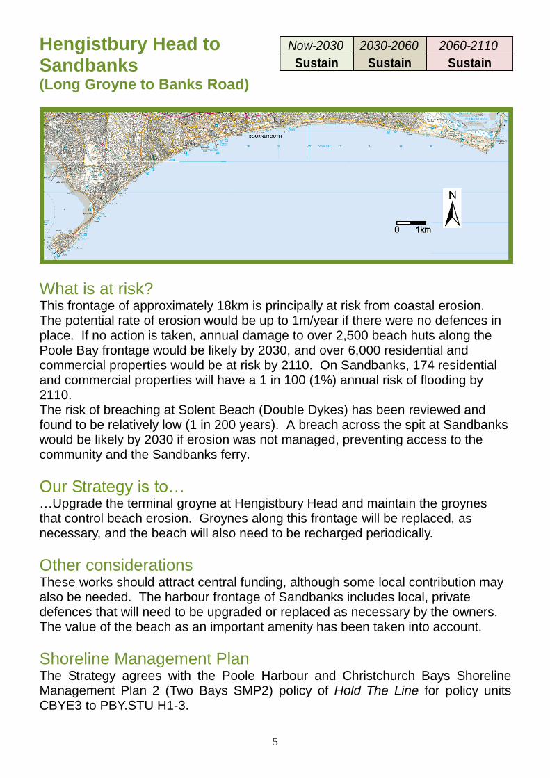
Hengistbury Head to Sandbanks (Long Groyne to Banks Road)
What is at risk? This frontage of approximately 18km is principally at risk from coastal erosion. The potential rate of erosion would be up to 1m/year if there were no defences in place. If no action is taken, annual damage to over 2,500 beach huts along the Poole Bay frontage would be likely by 2030, and over 6,000 residential and commercial properties would be at risk by 2110. On Sandbanks, 174 residential and commercial properties will have a 1 in 100 (1%) annual risk of flooding by 2110. The risk of breaching at Solent Beach (Double Dykes) has been reviewed and found to be relatively low (1 in 200 years). A breach across the spit at Sandbanks would be likely by 2030 if erosion was not managed, preventing access to the community and the Sandbanks ferry.
Our Strategy is to… …Upgrade the terminal groyne at Hengistbury Head and maintain the groynes that control beach erosion. Groynes along this frontage will be replaced, as necessary, and the beach will also need to be recharged periodically.
Other considerations These works should attract central funding, although some local contribution may also be needed. The harbour frontage of Sandbanks includes local, private defences that will need to be upgraded or replaced as necessary by the owners. The value of the beach as an important amenity has been taken into account.
Shoreline Management Plan The Strategy agrees with the Poole Harbour and Christchurch Bays Shoreline Management Plan 2 (Two Bays SMP2) policy of Hold The Line for policy units CBYE3 to PBY.STU H1-3.
Now-2030 2030-2060 2060-2110
Sustain Sustain Sustain
6
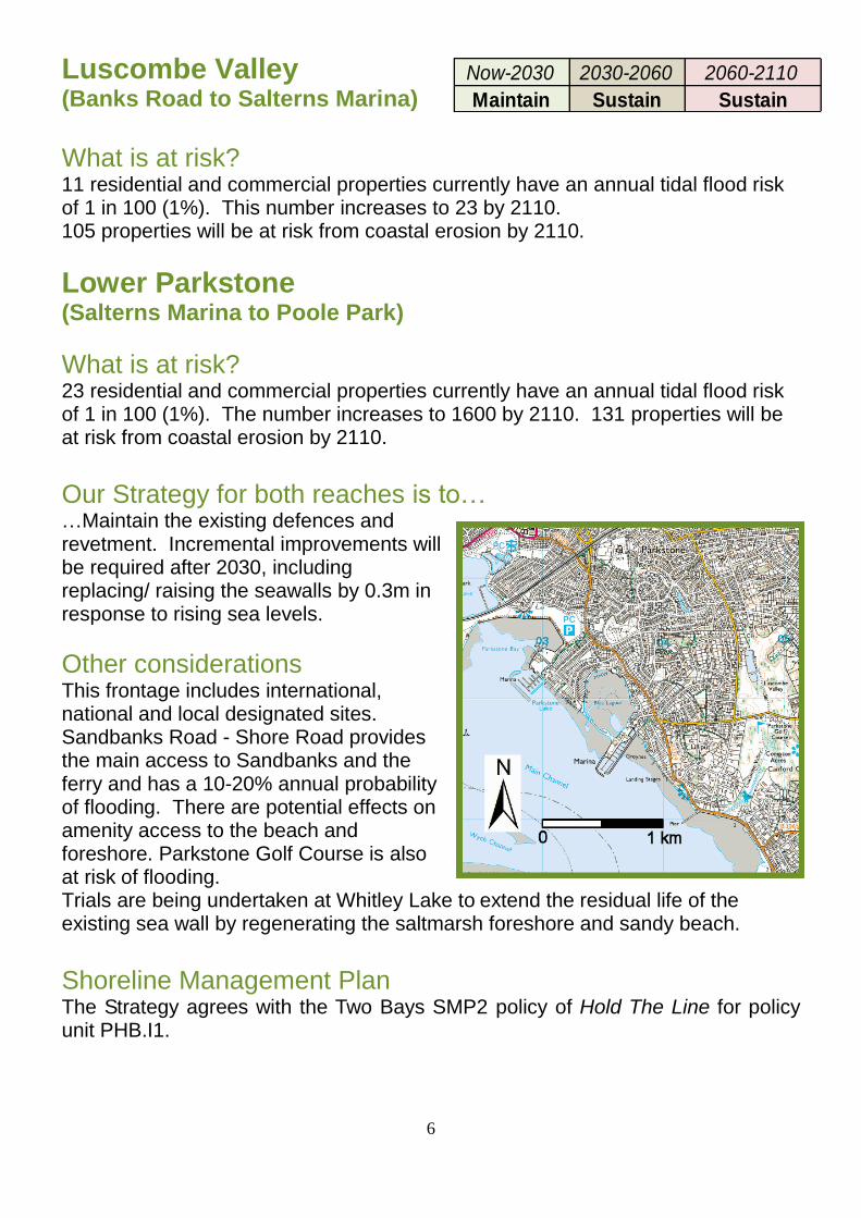
Luscombe Valley
(Banks Road to Salterns Marina)
What is at risk? 11 residential and commercial properties currently have an annual tidal flood risk of 1 in 100 (1%). This number increases to 23 by 2110. 105 properties will be at risk from coastal erosion by 2110.
Lower Parkstone (Salterns Marina to Poole Park)
What is at risk? 23 residential and commercial properties currently have an annual tidal flood risk of 1 in 100 (1%). The number increases to 1600 by 2110. 131 properties will be at risk from coastal erosion by 2110.
Our Strategy for both reaches is to… …Maintain the existing defences and revetment. Incremental improvements will be required after 2030, including replacing/ raising the seawalls by 0.3m in response to rising sea levels.
Other considerations This frontage includes international, national and local designated sites. Sandbanks Road - Shore Road provides the main access to Sandbanks and the ferry and has a 10-20% annual probability of flooding. There are potential effects on amenity access to the beach and foreshore. Parkstone Golf Course is also at risk of flooding. Trials are being undertaken at Whitley Lake to extend the residual life of the existing sea wall by regenerating the saltmarsh foreshore and sandy beach.
Shoreline Management Plan The Strategy agrees with the Two Bays SMP2 policy of Hold The Line for policy unit PHB.I1.
Now-2030 2030-2060 2060-2110
Maintain Sustain Sustain
7
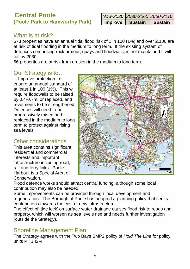
Central Poole
(Poole Park to Hamworthy Park)
What is at risk? 573 properties have an annual tidal flood risk of 1 in 100 (1%) and over 2,100 are at risk of tidal flooding in the medium to long term. If the existing system of defences comprising rock armour, quays and floodwalls, is not maintained it will fail by 2030. 66 properties are at risk from erosion in the medium to long term.
Our Strategy is to… …Improve protection, to ensure an annual standard of at least 1 in 100 (1%). This will require floodwalls to be raised by 0.4-0.7m, or replaced, and revetments to be strengthened. Defences will need to be progressively raised and replaced in the medium to long term to protect against rising sea levels.
Other considerations This area contains significant residential and commercial interests and important infrastructure including road, rail and ferry links. Poole Harbour is a Special Area of Conservation. Flood defence works should attract central funding, although some local contribution may also be needed. Some improvements can be provided through local development and regeneration. The Borough of Poole has adopted a planning policy that seeks contributions towards the cost of new infrastructure. The effect of ‘tide lock’ on surface water drainage causes flood risk to roads and property, which will worsen as sea levels rise and needs further investigation (outside the Strategy).
Shoreline Management Plan The Strategy agrees with the Two Bays SMP2 policy of Hold The Line for policy units PHB.I2-4.
Now-2030 2030-2060 2060-2110
Improve Sustain Sustain
8
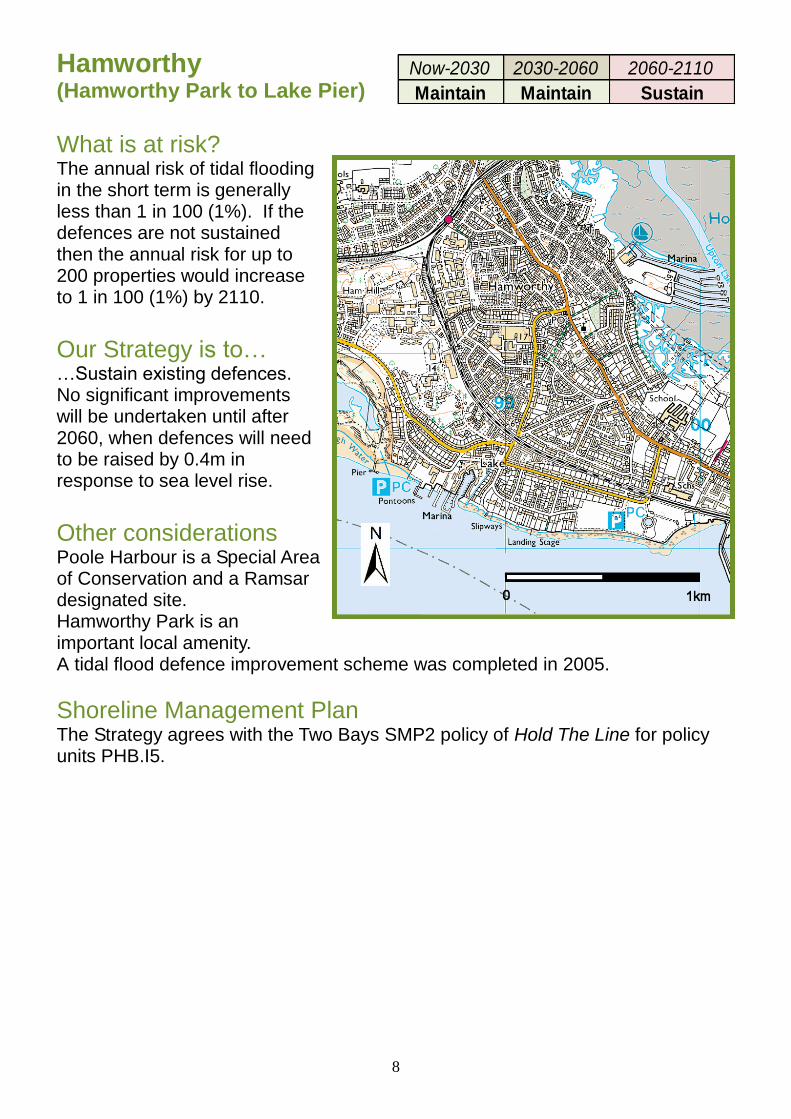
Hamworthy (Hamworthy Park to Lake Pier)
What is at risk? The annual risk of tidal flooding in the short term is generally less than 1 in 100 (1%). If the defences are not sustained then the annual risk for up to 200 properties would increase to 1 in 100 (1%) by 2110.
Our Strategy is to… …Sustain existing defences. No significant improvements will be undertaken until after 2060, when defences will need to be raised by 0.4m in response to sea level rise.
Other considerations Poole Harbour is a Special Area of Conservation and a Ramsar designated site. Hamworthy Park is an important local amenity. A tidal flood defence improvement scheme was completed in 2005.
Shoreline Management Plan The Strategy agrees with the Two Bays SMP2 policy of Hold The Line for policy units PHB.I5.
Now-2030 2030-2060 2060-2110
Maintain Maintain Sustain
9
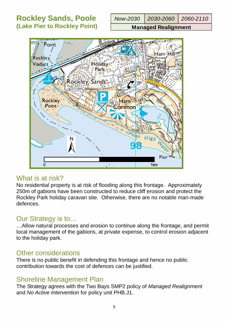
Rockley Sands, Poole (Lake Pier to Rockley Point)
What is at risk? No residential property is at risk of flooding along this frontage. Approximately 250m of gabions have been constructed to reduce cliff erosion and protect the Rockley Park holiday caravan site. Otherwise, there are no notable man-made defences.
Our Strategy is to… …Allow natural processes and erosion to continue along the frontage, and permit local management of the gabions, at private expense, to control erosion adjacent to the holiday park.
Other considerations
There is no public benefit in defending this frontage and hence no public contribution towards the cost of defences can be justified.
Shoreline Management Plan The Strategy agrees with the Two Bays SMP2 policy of Managed Realignment and No Active Intervention for policy unit PHB.J1.
Now-2030 2030-2060 2060-2110
Managed Realignment
10
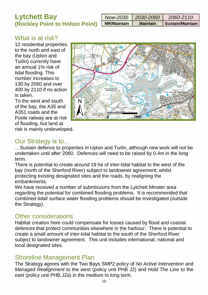
Lytchett Bay (Rockley Point to Holton Point) What is at risk? 12 residential properties to the north and east of the bay (Upton and Turlin) currently have an annual 1% risk of tidal flooding. This number increases to 130 by 2060 and over 400 by 2110 if no action is taken. To the west and south of the bay, the A35 and A351 roads and the Poole railway are at risk of flooding, but land at risk is mainly undeveloped.
Our Strategy is to… …Sustain defence to properties in Upton and Turlin, although new work will not be undertaken until after 2060. Defences will need to be raised by 0.4m in the long term. There is potential to create around 19 ha of inter-tidal habitat to the west of the bay (north of the Sherford River) subject to landowner agreement, whilst protecting existing designated sites and the roads, by realigning the embankments. We have received a number of submissions from the Lytchett Minster area regarding the potential for combined flooding problems. It is recommended that combined tidal/ surface water flooding problems should be investigated (outside the Strategy).
Other considerations Habitat creation here could compensate for losses caused by flood and coastal defences that protect communities elsewhere in the harbour. There is potential to create a small amount of inter-tidal habitat to the south of the Sherford River subject to landowner agreement. This unit includes international, national and local designated sites.
Shoreline Management Plan The Strategy agrees with the Two Bays SMP2 policy of No Active Intervention and Managed Realignment to the west (policy unit PHB J2) and Hold The Line to the east (policy unit PHB.J2a) in the medium to long term.
Now-2030 2030-2060 2060-2110MR/Maintain Maintain Sustain/Maintain
11
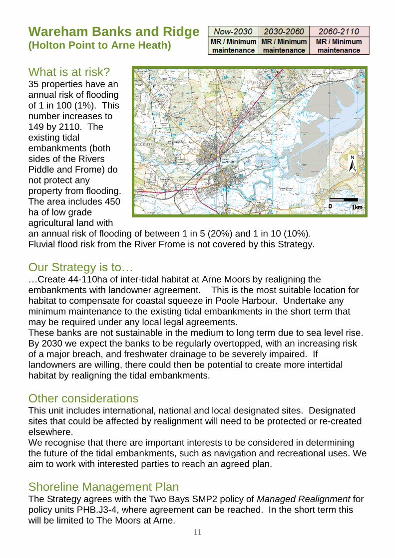
Wareham Banks and Ridge
(Holton Point to Arne Heath)
What is at risk? 35 properties have an annual risk of flooding of 1 in 100 (1%). This number increases to 149 by 2110. The existing tidal embankments (both sides of the Rivers Piddle and Frome) do not protect any property from flooding. The area includes 450 ha of low grade agricultural land with an annual risk of flooding of between 1 in 5 (20%) and 1 in 10 (10%). Fluvial flood risk from the River Frome is not covered by this Strategy.
Our Strategy is to… …Create 44-110ha of inter-tidal habitat at Arne Moors by realigning the embankments with landowner agreement. This is the most suitable location for habitat to compensate for coastal squeeze in Poole Harbour. Undertake any minimum maintenance to the existing tidal embankments in the short term that may be required under any local legal agreements. These banks are not sustainable in the medium to long term due to sea level rise. By 2030 we expect the banks to be regularly overtopped, with an increasing risk of a major breach, and freshwater drainage to be severely impaired. If landowners are willing, there could then be potential to create more intertidal habitat by realigning the tidal embankments.
Other considerations This unit includes international, national and local designated sites. Designated sites that could be affected by realignment will need to be protected or re-created elsewhere. We recognise that there are important interests to be considered in determining the future of the tidal embankments, such as navigation and recreational uses. We aim to work with interested parties to reach an agreed plan.
Shoreline Management Plan The Strategy agrees with the Two Bays SMP2 policy of Managed Realignment for policy units PHB.J3-4, where agreement can be reached. In the short term this will be limited to The Moors at Arne.
12
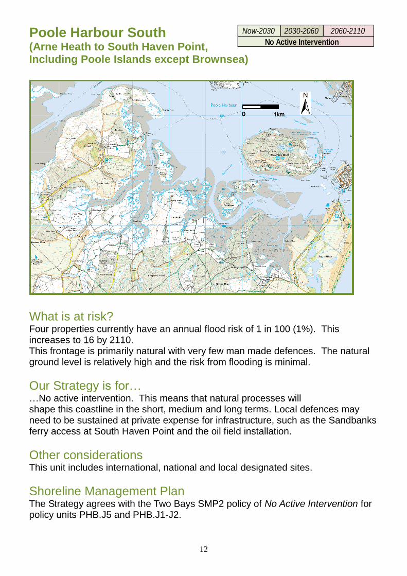
Poole Harbour South (Arne Heath to South Haven Point, Including Poole Islands except Brownsea)
What is at risk? Four properties currently have an annual flood risk of 1 in 100 (1%). This increases to 16 by 2110. This frontage is primarily natural with very few man made defences. The natural ground level is relatively high and the risk from flooding is minimal.
Our Strategy is for… …No active intervention. This means that natural processes will shape this coastline in the short, medium and long terms. Local defences may need to be sustained at private expense for infrastructure, such as the Sandbanks ferry access at South Haven Point and the oil field installation.
Other considerations This unit includes international, national and local designated sites.
Shoreline Management Plan The Strategy agrees with the Two Bays SMP2 policy of No Active Intervention for policy units PHB.J5 and PHB.J1-J2.
Now-2030 2030-2060 2060-2110
No Active Intervention
13
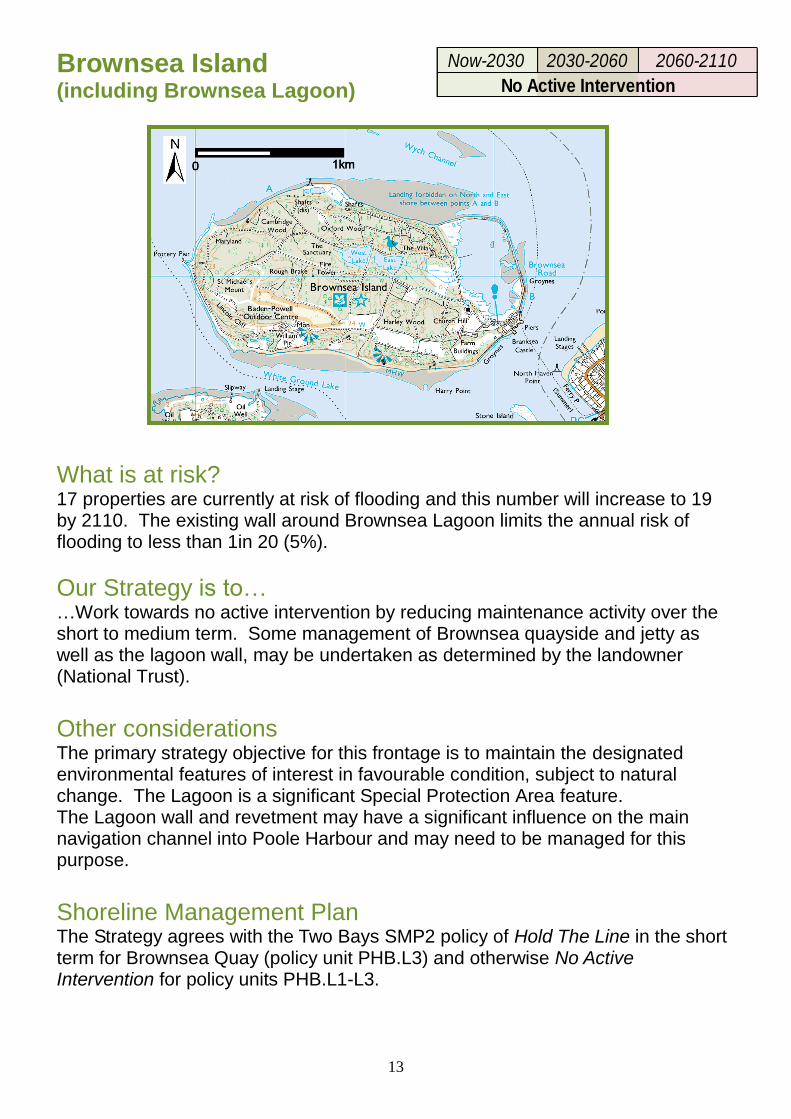
Brownsea Island (including Brownsea Lagoon)
What is at risk? 17 properties are currently at risk of flooding and this number will increase to 19 by 2110. The existing wall around Brownsea Lagoon limits the annual risk of flooding to less than 1in 20 (5%).
Our Strategy is to… …Work towards no active intervention by reducing maintenance activity over the short to medium term. Some management of Brownsea quayside and jetty as well as the lagoon wall, may be undertaken as determined by the landowner (National Trust).
Other considerations
The primary strategy objective for this frontage is to maintain the designated environmental features of interest in favourable condition, subject to natural change. The Lagoon is a significant Special Protection Area feature. The Lagoon wall and revetment may have a significant influence on the main navigation channel into Poole Harbour and may need to be managed for this purpose.
Shoreline Management Plan The Strategy agrees with the Two Bays SMP2 policy of Hold The Line in the short term for Brownsea Quay (policy unit PHB.L3) and otherwise No Active Intervention for policy units PHB.L1-L3.
Now-2030 2030-2060 2060-2110
No Active Intervention
14
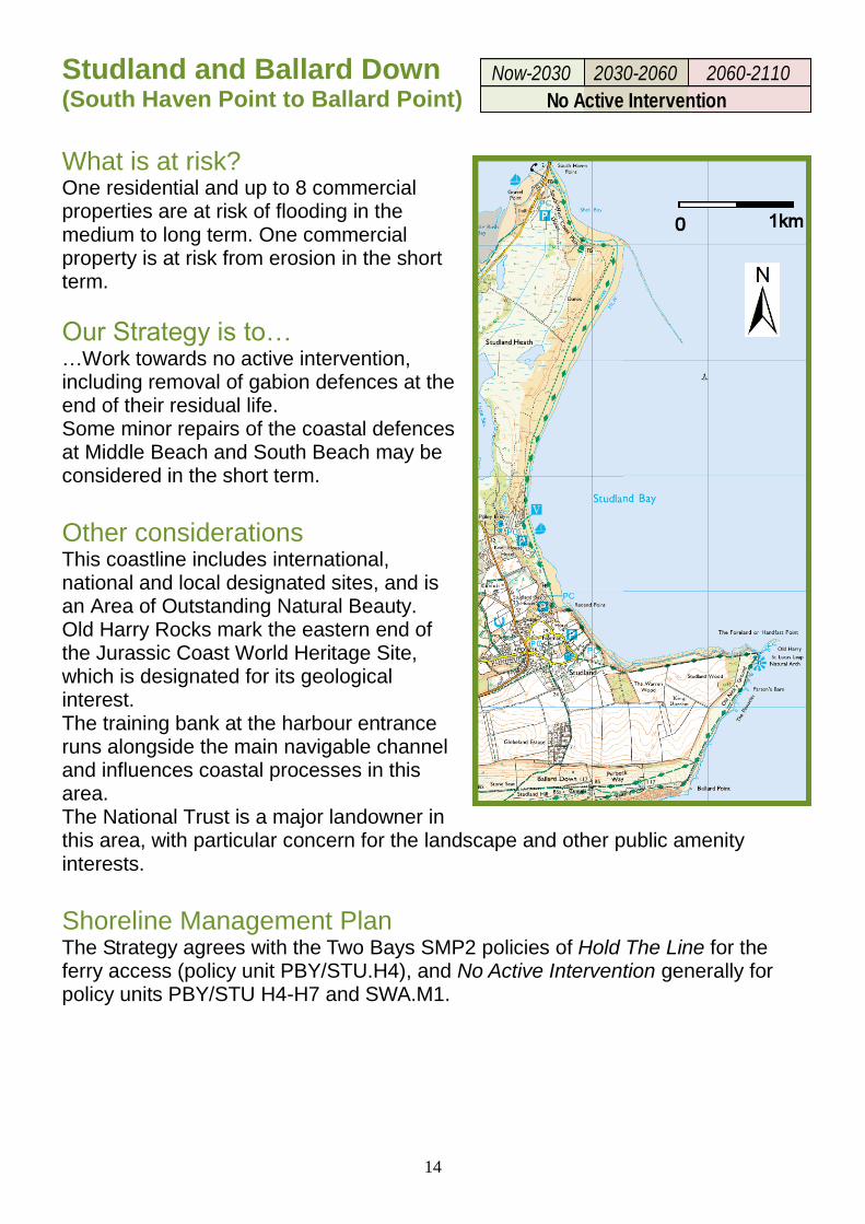
Studland and Ballard Down (South Haven Point to Ballard Point)
What is at risk? One residential and up to 8 commercial properties are at risk of flooding in the medium to long term. One commercial property is at risk from erosion in the short term.
Our Strategy is to… …Work towards no active intervention, including removal of gabion defences at the end of their residual life. Some minor repairs of the coastal defences at Middle Beach and South Beach may be considered in the short term. Other considerations This coastline includes international, national and local designated sites, and is an Area of Outstanding Natural Beauty. Old Harry Rocks mark the eastern end of the Jurassic Coast World Heritage Site, which is designated for its geological interest. The training bank at the harbour entrance runs alongside the main navigable channel and influences coastal processes in this area. The National Trust is a major landowner in this area, with particular concern for the landscape and other public amenity interests.
Shoreline Management Plan The Strategy agrees with the Two Bays SMP2 policies of Hold The Line for the ferry access (policy unit PBY/STU.H4), and No Active Intervention generally for policy units PBY/STU H4-H7 and SWA.M1.
Now-2030 2030-2060 2060-2110
No Active Intervention
15
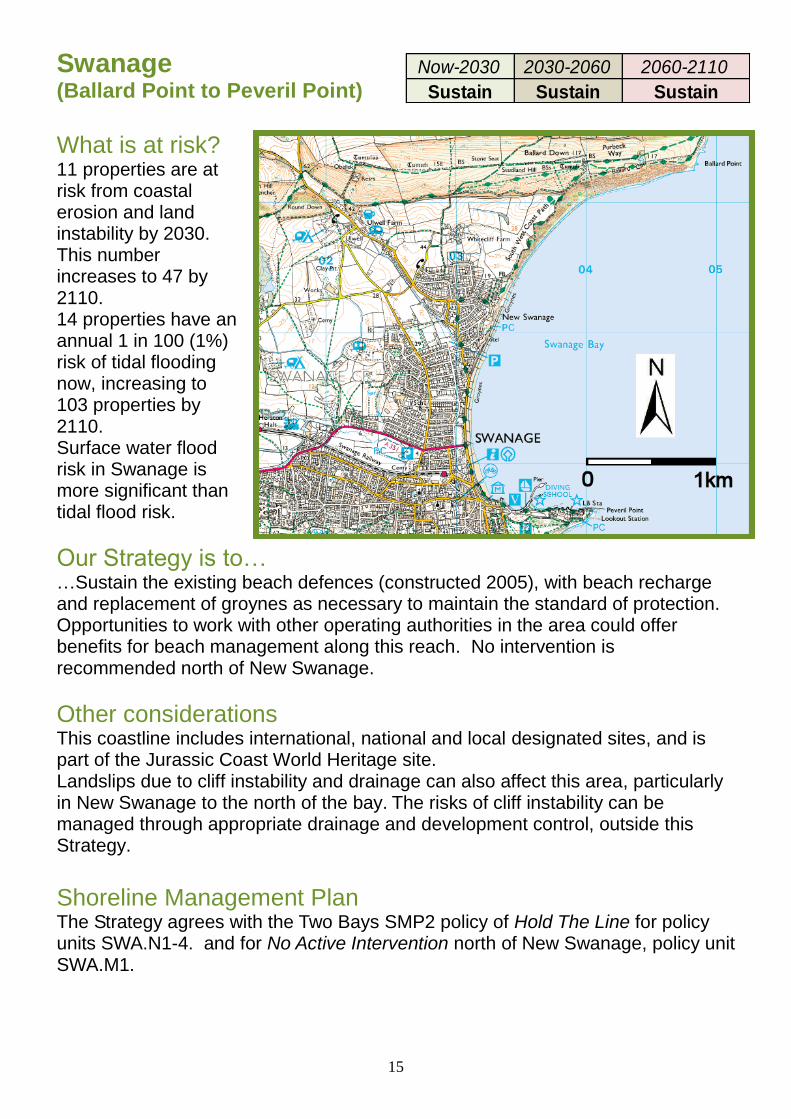
Swanage (Ballard Point to Peveril Point) What is at risk? 11 properties are at risk from coastal erosion and land instability by 2030. This number increases to 47 by 2110. 14 properties have an annual 1 in 100 (1%) risk of tidal flooding now, increasing to 103 properties by 2110. Surface water flood risk in Swanage is more significant than tidal flood risk.
Our Strategy is to… …Sustain the existing beach defences (constructed 2005), with beach recharge and replacement of groynes as necessary to maintain the standard of protection. Opportunities to work with other operating authorities in the area could offer benefits for beach management along this reach. No intervention is recommended north of New Swanage.
Other considerations This coastline includes international, national and local designated sites, and is part of the Jurassic Coast World Heritage site. Landslips due to cliff instability and drainage can also affect this area, particularly in New Swanage to the north of the bay. The risks of cliff instability can be managed through appropriate drainage and development control, outside this Strategy. Shoreline Management Plan The Strategy agrees with the Two Bays SMP2 policy of Hold The Line for policy units SWA.N1-4. and for No Active Intervention north of New Swanage, policy unit SWA.M1.
Now-2030 2030-2060 2060-2110
Sustain Sustain Sustain
16
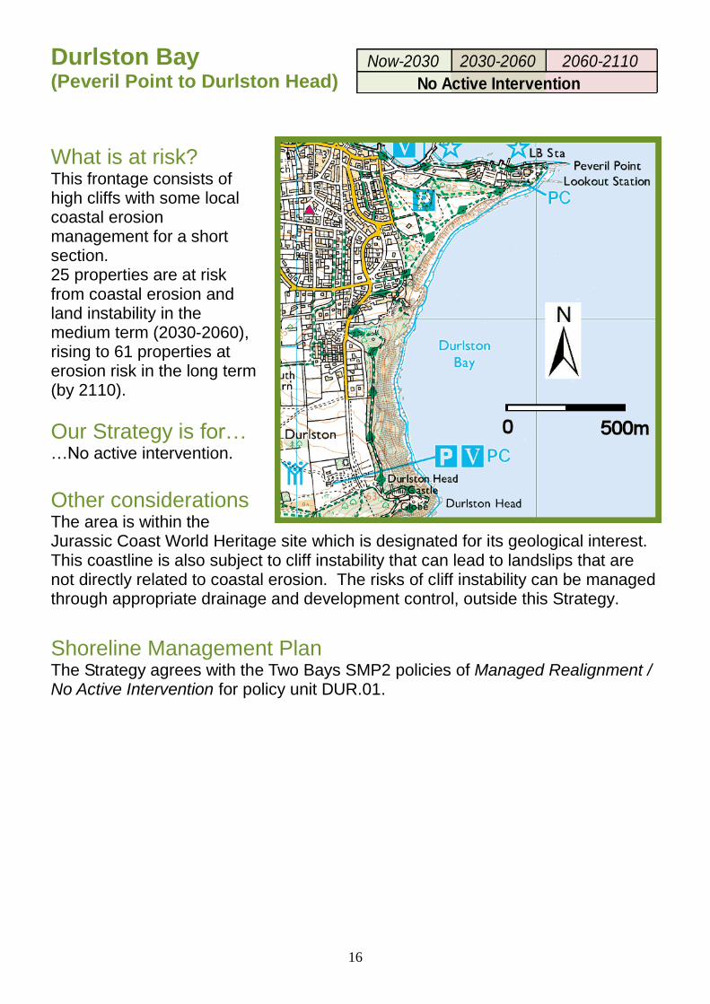
Durlston Bay (Peveril Point to Durlston Head) What is at risk? This frontage consists of high cliffs with some local coastal erosion management for a short section. 25 properties are at risk from coastal erosion and land instability in the medium term (2030-2060), rising to 61 properties at erosion risk in the long term (by 2110).
Our Strategy is for… …No active intervention.
Other considerations The area is within the Jurassic Coast World Heritage site which is designated for its geological interest. This coastline is also subject to cliff instability that can lead to landslips that are not directly related to coastal erosion. The risks of cliff instability can be managed through appropriate drainage and development control, outside this Strategy. Shoreline Management Plan The Strategy agrees with the Two Bays SMP2 policies of Managed Realignment / No Active Intervention for policy unit DUR.01.
Now-2030 2030-2060 2060-2110
No Active Intervention
17
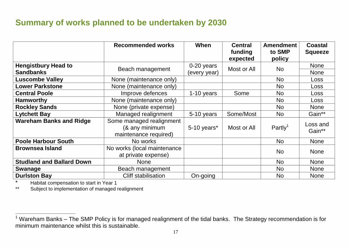
Summary of works planned to be undertaken by 2030
Recommended works When Central funding
expected
Amendment to SMP policy
Coastal Squeeze
Hengistbury Head to Sandbanks
Beach management 0-20 years
(every year) Most or All No
None
None
Luscombe Valley None (maintenance only) No Loss
Lower Parkstone None (maintenance only) No Loss
Central Poole Improve defences 1-10 years Some No Loss
Hamworthy None (maintenance only) No Loss
Rockley Sands None (private expense) No None
Lytchett Bay Managed realignment 5-10 years Some/Most No Gain**
Wareham Banks and Ridge Some managed realignment (& any minimum
maintenance required) 5-10 years* Most or All Partly1
Loss and Gain**
Poole Harbour South No works No None
Brownsea Island No works (local maintenance at private expense)
No None
Studland and Ballard Down None No None
Swanage Beach management No None
Durlston Bay Cliff stabilisation On-going No None
* Habitat compensation to start in Year 1
** Subject to implementation of managed realignment
1 Wareham Banks – The SMP Policy is for managed realignment of the tidal banks. The Strategy recommendation is for minimum maintenance whilst this is sustainable.
18
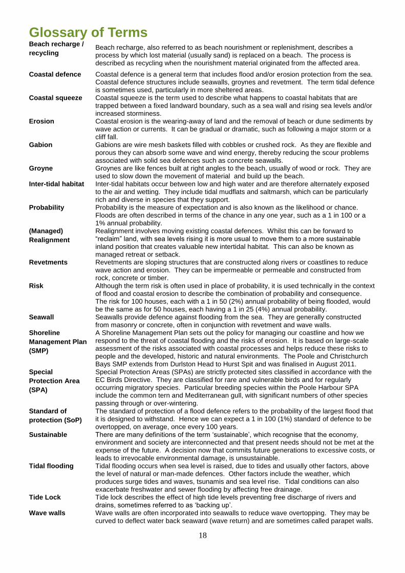
Glossary of Terms Beach recharge /
recycling Beach recharge, also referred to as beach nourishment or replenishment, describes a process by which lost material (usually sand) is replaced on a beach. The process is described as recycling when the nourishment material originated from the affected area.
Coastal defence Coastal defence is a general term that includes flood and/or erosion protection from the sea. Coastal defence structures include seawalls, groynes and revetment. The term tidal defence is sometimes used, particularly in more sheltered areas.
Coastal squeeze Coastal squeeze is the term used to describe what happens to coastal habitats that are trapped between a fixed landward boundary, such as a sea wall and rising sea levels and/or increased storminess.
Erosion Coastal erosion is the wearing-away of land and the removal of beach or dune sediments by wave action or currents. It can be gradual or dramatic, such as following a major storm or a cliff fall.
Gabion Gabions are wire mesh baskets filled with cobbles or crushed rock. As they are flexible and porous they can absorb some wave and wind energy, thereby reducing the scour problems associated with solid sea defences such as concrete seawalls.
Groyne Groynes are like fences built at right angles to the beach, usually of wood or rock. They are used to slow down the movement of material and build up the beach.
Inter-tidal habitat Inter-tidal habitats occur between low and high water and are therefore alternately exposed to the air and wetting. They include tidal mudflats and saltmarsh, which can be particularly rich and diverse in species that they support.
Probability Probability is the measure of expectation and is also known as the likelihood or chance. Floods are often described in terms of the chance in any one year, such as a 1 in 100 or a 1% annual probability.
(Managed)
Realignment
Realignment involves moving existing coastal defences. Whilst this can be forward to “reclaim” land, with sea levels rising it is more usual to move them to a more sustainable inland position that creates valuable new intertidal habitat. This can also be known as managed retreat or setback.
Revetments Revetments are sloping structures that are constructed along rivers or coastlines to reduce wave action and erosion. They can be impermeable or permeable and constructed from rock, concrete or timber.
Risk Although the term risk is often used in place of probability, it is used technically in the context of flood and coastal erosion to describe the combination of probability and consequence. The risk for 100 houses, each with a 1 in 50 (2%) annual probability of being flooded, would be the same as for 50 houses, each having a 1 in 25 (4%) annual probability.
Seawall Seawalls provide defence against flooding from the sea. They are generally constructed from masonry or concrete, often in conjunction with revetment and wave walls.
Shoreline
Management Plan
(SMP)
A Shoreline Management Plan sets out the policy for managing our coastline and how we respond to the threat of coastal flooding and the risks of erosion. It is based on large-scale assessment of the risks associated with coastal processes and helps reduce these risks to people and the developed, historic and natural environments. The Poole and Christchurch Bays SMP extends from Durlston Head to Hurst Spit and was finalised in August 2011.
Special
Protection Area
(SPA)
Special Protection Areas (SPAs) are strictly protected sites classified in accordance with the EC Birds Directive. They are classified for rare and vulnerable birds and for regularly occurring migratory species. Particular breeding species within the Poole Harbour SPA include the common tern and Mediterranean gull, with significant numbers of other species passing through or over-wintering.
Standard of
protection (SoP)
The standard of protection of a flood defence refers to the probability of the largest flood that it is designed to withstand. Hence we can expect a 1 in 100 (1%) standard of defence to be overtopped, on average, once every 100 years.
Sustainable There are many definitions of the term ‘sustainable’, which recognise that the economy, environment and society are interconnected and that present needs should not be met at the expense of the future. A decision now that commits future generations to excessive costs, or leads to irrevocable environmental damage, is unsustainable.
Tidal flooding Tidal flooding occurs when sea level is raised, due to tides and usually other factors, above the level of natural or man-made defences. Other factors include the weather, which produces surge tides and waves, tsunamis and sea level rise. Tidal conditions can also exacerbate freshwater and sewer flooding by affecting free drainage.
Tide Lock Tide lock describes the effect of high tide levels preventing free discharge of rivers and drains, sometimes referred to as ‘backing up’.
Wave walls Wave walls are often incorporated into seawalls to reduce wave overtopping. They may be curved to deflect water back seaward (wave return) and are sometimes called parapet walls.
19
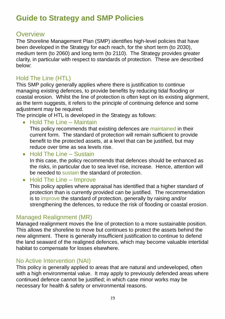
Guide to Strategy and SMP Policies Overview
The Shoreline Management Plan (SMP) identifies high-level policies that have been developed in the Strategy for each reach, for the short term (to 2030), medium term (to 2060) and long term (to 2110). The Strategy provides greater clarity, in particular with respect to standards of protection. These are described below:
Hold The Line (HTL) This SMP policy generally applies where there is justification to continue managing existing defences, to provide benefits by reducing tidal flooding or coastal erosion. Whilst the line of protection is often kept on its existing alignment, as the term suggests, it refers to the principle of continuing defence and some adjustment may be required. The principle of HTL is developed in the Strategy as follows:
Hold The Line – Maintain This policy recommends that existing defences are maintained in their current form. The standard of protection will remain sufficient to provide benefit to the protected assets, at a level that can be justified, but may reduce over time as sea levels rise.
Hold The Line – Sustain In this case, the policy recommends that defences should be enhanced as the risks, in particular due to sea level rise, increase. Hence, attention will be needed to sustain the standard of protection.
Hold The Line – Improve This policy applies where appraisal has identified that a higher standard of protection than is currently provided can be justified. The recommendation is to improve the standard of protection, generally by raising and/or strengthening the defences, to reduce the risk of flooding or coastal erosion.
Managed Realignment (MR)
Managed realignment moves the line of protection to a more sustainable position. This allows the shoreline to move but continues to protect the assets behind the new alignment. There is generally insufficient justification to continue to defend the land seaward of the realigned defences, which may become valuable intertidal habitat to compensate for losses elsewhere.
No Active Intervention (NAI) This policy is generally applied to areas that are natural and undeveloped, often with a high environmental value. It may apply to previously defended areas where continued defence cannot be justified; in which case minor works may be necessary for health & safety or environmental reasons.
20
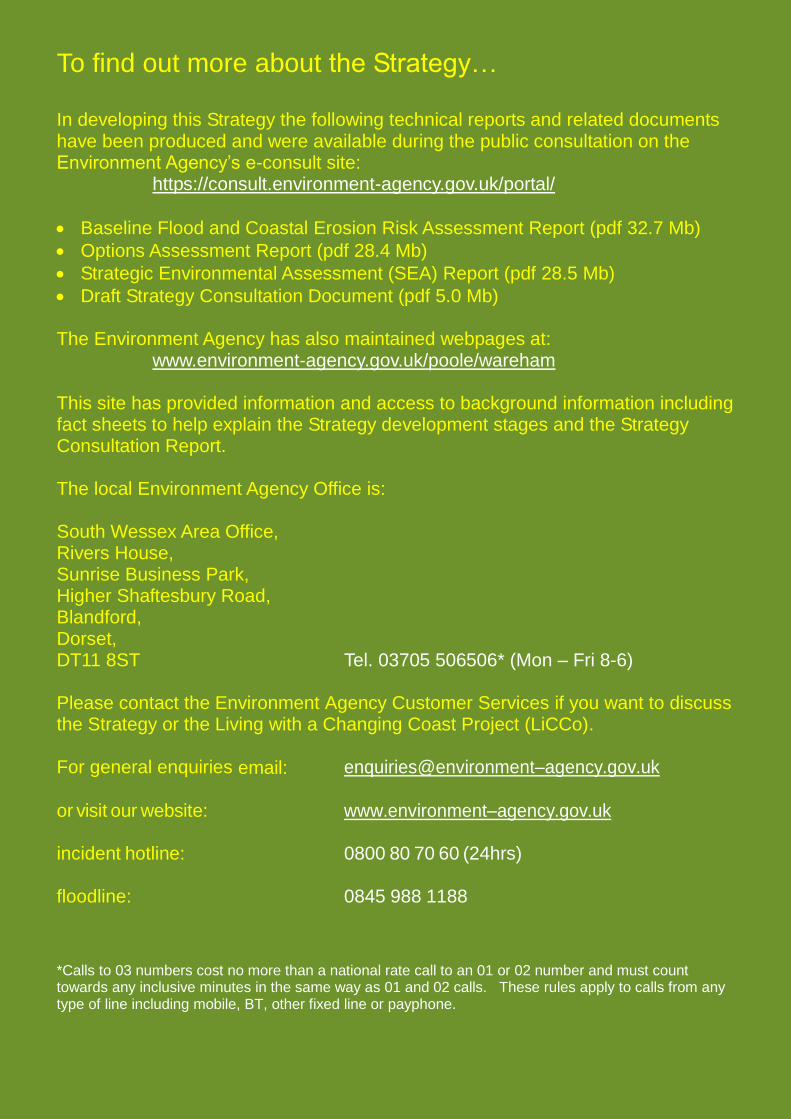
To find out more about the Strategy…
In developing this Strategy the following technical reports and related documents have been produced and were available during the public consultation on the Environment Agency’s e-consult site: https://consult.environment-agency.gov.uk/portal/
Baseline Flood and Coastal Erosion Risk Assessment Report (pdf 32.7 Mb)
Options Assessment Report (pdf 28.4 Mb)
Strategic Environmental Assessment (SEA) Report (pdf 28.5 Mb)
Draft Strategy Consultation Document (pdf 5.0 Mb) The Environment Agency has also maintained webpages at: www.environment-agency.gov.uk/poole/wareham This site has provided information and access to background information including fact sheets to help explain the Strategy development stages and the Strategy Consultation Report. The local Environment Agency Office is: South Wessex Area Office, Rivers House, Sunrise Business Park, Higher Shaftesbury Road, Blandford, Dorset, DT11 8ST Tel. 03705 506506* (Mon – Fri 8-6) Please contact the Environment Agency Customer Services if you want to discuss the Strategy or the Living with a Changing Coast Project (LiCCo). For general enquiries email: enquiries@environment–agency.gov.uk or visit our website: www.environment–agency.gov.uk incident hotline: 0800 80 70 60 (24hrs) floodline: 0845 988 1188 *Calls to 03 numbers cost no more than a national rate call to an 01 or 02 number and must count towards any inclusive minutes in the same way as 01 and 02 calls. These rules apply to calls from any type of line including mobile, BT, other fixed line or payphone.