Embed Size (px)
Citation preview
PostGIS Introduction and Case Studies
1
W W W . R E F R A C T I O N S . N E T
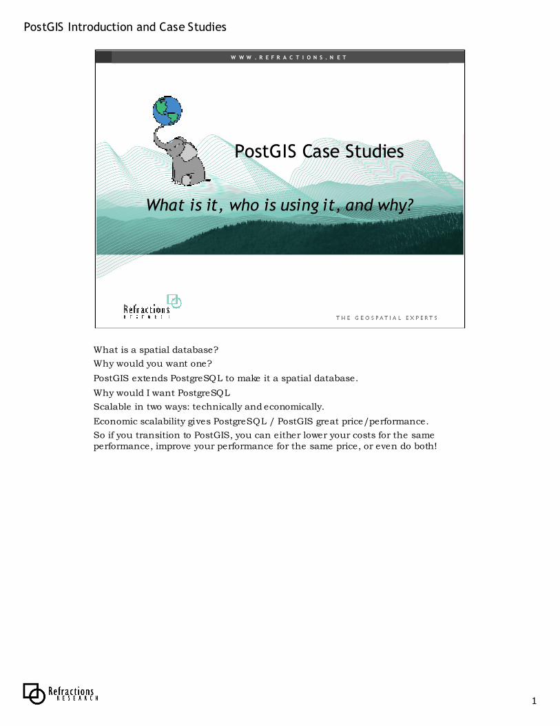
PostGIS PostGIS Case StudiesCase Studies
What is it, who is using it, and why?What is it, who is using it, and why?
What is a spatial database?
Why would you want one?
PostGIS extends PostgreSQL to make it a spatial database.
Why would I want PostgreSQL
Scalable in two ways: technically and economically.
Economic scalability gives PostgreSQL / PostGIS great price/performance.
So if you transition to PostGIS, you can either lower your costs for the same performance, improve your performance for the same price, or even do both!
PostGIS Introduction and Case Studies
2
W W W . R E F R A C T I O N S . N E T
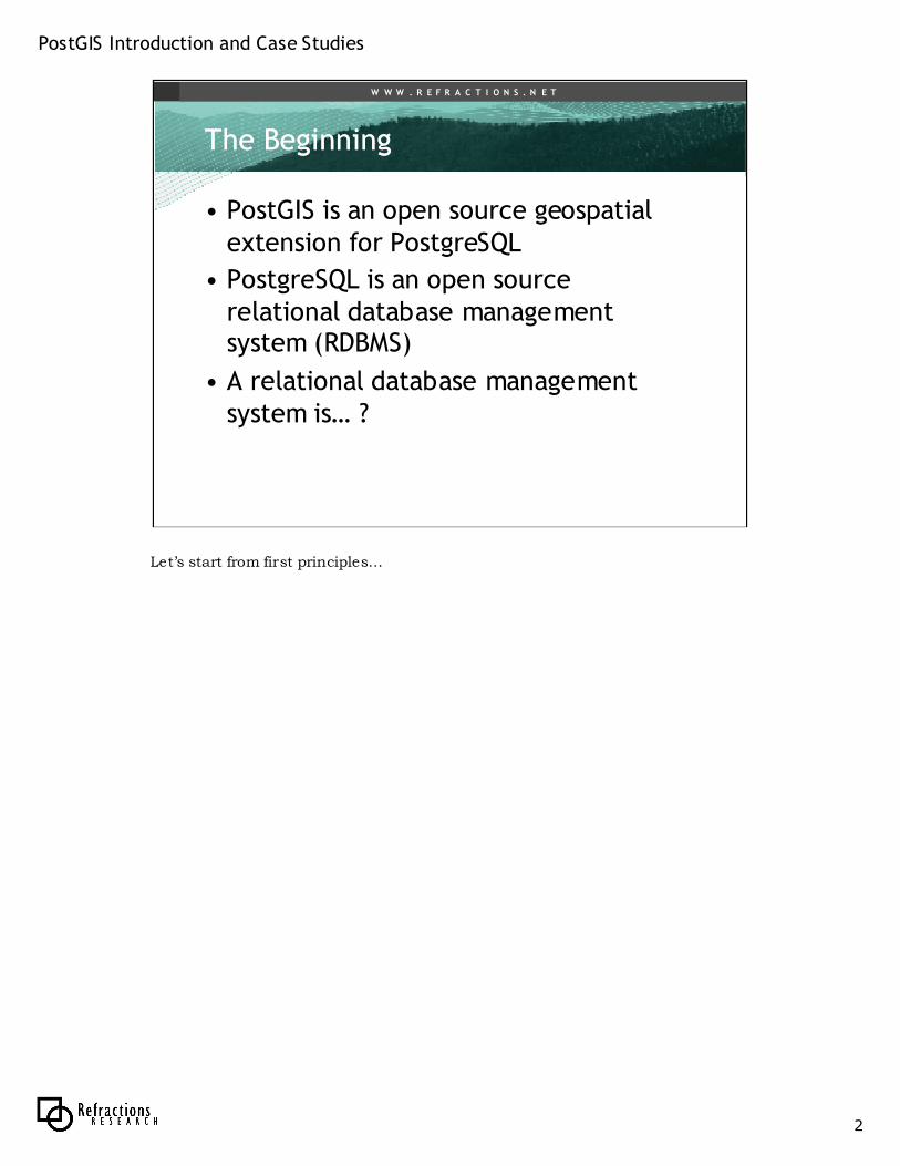
The BeginningThe Beginning
• PostGIS is an open source geospatial extension for PostgreSQL
• PostgreSQL is an open source relational database management system (RDBMS)
• A relational database management system is… ?
Let’s start from first principles…
PostGIS Introduction and Case Studies
3
W W W . R E F R A C T I O N S . N E T
DatabasesDatabases
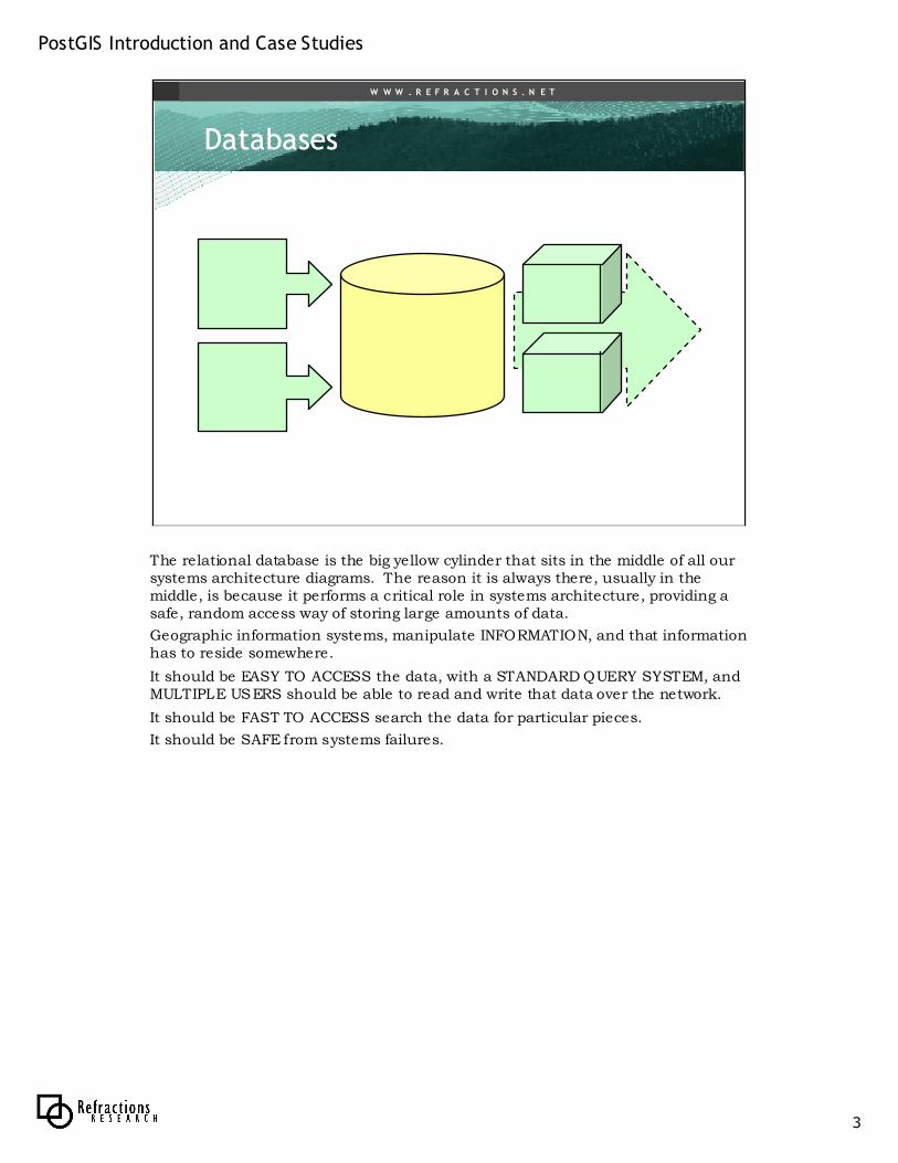
The relational database is the big yellow cylinder that sits in the middle of all our systems architecture diagrams. The reason it is always there, usually in the middle, is because it performs a critical role in systems architecture, providing a safe, random access way of storing large amounts of data.
Geographic information systems, manipulate INFORMATION, and that information has to reside somewhere.
It should be EASY TO ACCESS the data, with a STANDARD QUERY SYSTEM, and MULTIPLE USERS should be able to read and write that data over the network.
It should be FAST TO ACCESS search the data for particular pieces.
It should be SAFE from systems failures.
PostGIS Introduction and Case Studies
4
W W W . R E F R A C T I O N S . N E T
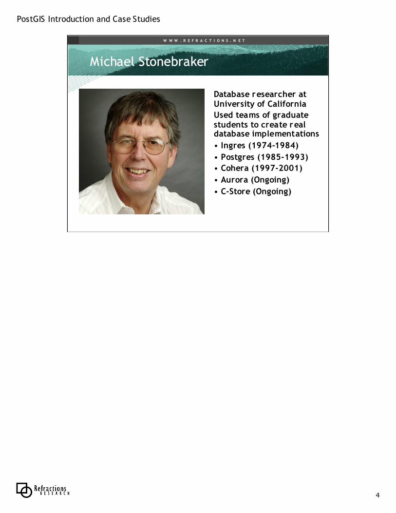
Michael Michael StonebrakerStonebraker
Database researcher at University of California
Used teams of graduate students to create real database implementations
• Ingres (1974-1984)
• Postgres (1985-1993)
• Cohera (1997-2001)
• Aurora (Ongoing)
• C-Store (Ongoing)
PostGIS Introduction and Case Studies
5
W W W . R E F R A C T I O N S . N E T
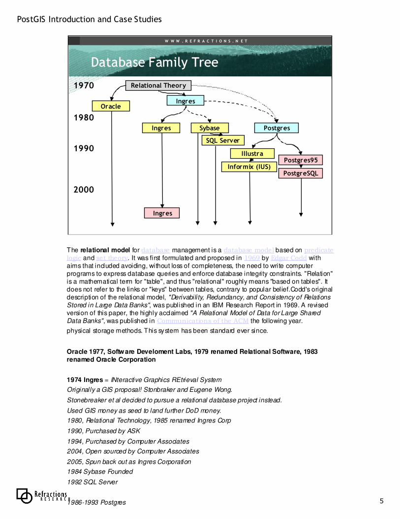
Database Family TreeDatabase Family Tree
OracleIngres
PostgresSybaseIngres
IllustraPostgres95
SQL Server
Relational Theory
Ingres
Informix (IUS)
1980
1970
1990
2000
PostgreSQL
The relational model for database management is a database model based on predicate logic and set theory. It was first formulated and proposed in 1969 by Edgar Codd with
aims that included avoiding, without loss of completeness, the need to write computer
programs to express database queries and enforce database integrity constraints. "Relation"
is a mathematical term for "table", and thus "relational" roughly means "based on tables". It
does not refer to the links or "keys" between tables, contrary to popular belief.Codd's original
description of the relational model, "Derivability, Redundancy, and Consistency of Relations
Stored in Large Data Banks", was published in an IBM Research Report in 1969. A revised
version of this paper, the highly acclaimed "A Relational Model of Data for Large Shared
Data Banks", was published in Communications of the ACM the following year.
physical storage methods. This system has been standard ever since.
Oracle 1977, Software Develoment Labs, 1979 renamed Relational Software, 1983
renamed Oracle Corporation
1974 Ingres = INteractive Graphics REtrieval System
Originally a GIS proposal! Stonbraker and Eugene Wong.
Stonebreaker et al decided to pursue a relational database project instead.
Used GIS money as seed to land further DoD money.
1980, Relational Technology, 1985 renamed Ingres Corp
1990, Purchased by ASK
1994, Purchased by Computer Associates
2004, Open sourced by Computer Associates
2005, Spun back out as Ingres Corporation
1984 Sybase Founded
1992 SQL Server
1986-1993 Postgres
PostGIS Introduction and Case Studies
6
W W W . R E F R A C T I O N S . N E T
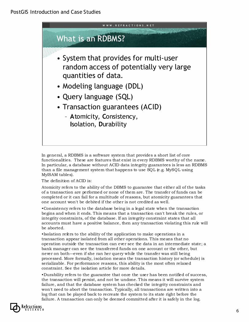
What is an RDBMS?What is an RDBMS?
• System that provides for multi-user random access of potentially very large quantities of data.
• Modeling language (DDL)
• Query language (SQL)
• Transaction guarantees (ACID)
– Atomicity, Consistency, Isolation, Durability
In general, a RDBMS is a software system that provides a short list of core functionalities. These are features that exist in every RDBMS worthy of the name. In particular, a database without ACID data integrity guarantees is less an RDBMS than a file management system that happens to use SQL (e.g. MySQL using MyISAM tables).
The definition of ACID is:
Atomicity refers to the ability of the DBMS to guarantee that either all of the tasks of a transaction are performed or none of them are. The transfer of funds can be completed or it can fail for a multitude of reasons, but atomicity guarantees that one account won't be debited if the other is not credited as well.
•Consistency refers to the database being in a legal state when the transaction begins and when it ends. This means that a transaction can't break the rules, or integrity constraints, of the database. If an integrity constraint states that all accounts must have a positive balance, then any transaction violating this rule will be aborted.
•Isolation refers to the ability of the application to make operations in a transaction appear isolated from all other operations. This means that no operation outside the transaction can ever see the data in an intermediate state; a bank manager can see the transferred funds on one account or the other, but never on both—even if she ran her query while the transfer was still being processed. More formally, isolation means the transaction history (or schedule) is serializable. For performance reasons, this ability is the most often relaxed constraint. See the isolation article for more details.
•Durability refers to the guarantee that once the user has been notified of success, the transaction will persist, and not be undone. This means it will survive system failure, and that the database system has checked the integrity constraints and won't need to abort the transaction. Typically, all transactions are written into a log that can be played back to recreate the system to its state right before the failure. A transaction can only be deemed committed after it is safely in the log.
PostGIS Introduction and Case Studies
7
W W W . R E F R A C T I O N S . N E T
What is an RDBMS?What is an RDBMS?
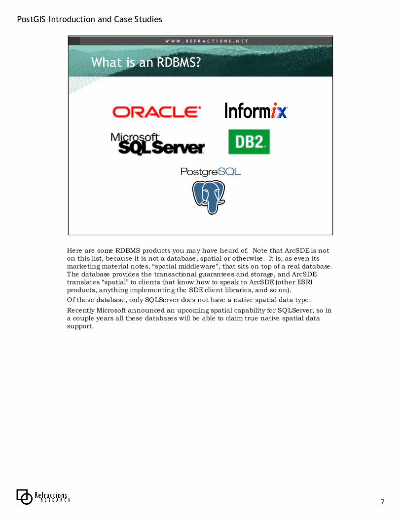
Here are some RDBMS products you may have heard of. Note that ArcSDE is not on this list, because it is not a database, spatial or otherwise. It is, as even its marketing material notes, “spatial middleware”, that sits on top of a real database. The database provides the transactional guarantees and storage, and ArcSDEtranslates “spatial” to clients that know how to speak to ArcSDE (other ESRI products, anything implementing the SDE client libraries, and so on).
Of these database, only SQLServer does not have a native spatial data type.
Recently Microsoft announced an upcoming spatial capability for SQLServer, so in a couple years all these databases will be able to claim true native spatial data support.
PostGIS Introduction and Case Studies
8
W W W . R E F R A C T I O N S . N E T
What is What is PostgreSQLPostgreSQL??
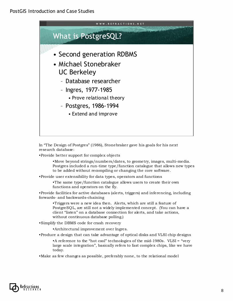
• Second generation RDBMS
• Michael StonebrakerUC Berkeley
– Database researcher
– Ingres, 1977-1985• Prove relational theory
– Postgres, 1986-1994• Extend and improve
In “The Design of Postgres” (1986), Stonebraker gave his goals for his next research database:
•Provide better support for complex objects
•Move beyond strings/numbers/dates, to geometry, images, multi-media. Postgres included a run-time type/function catalogue that allows new types to be added without recompiling or changing the core software.
•Provide user extensibility for data types, operators and functions
•The same type/function catalogue allows users to create their own functions and operators on the fly.
•Provide facilities for active databases (alerts, triggers) and inferencing, including forwards- and backwards-chaining
•Triggers were a new idea then. Alerts, which are still a feature of PostgreSQL, are still not a widely implemented concept. (You can have a client “listen” on a database connection for alerts, and take actions, without continuous database polling.)
•Simplify the DBMS code for crash recovery
•Architectural improvement over Ingres.
•Produce a design that can take advantage of optical disks and VLSI chip designs
•A reference to the “hot cool” technologies of the mid-1980s. VLSI = “very large scale integration”, basically refers to fast complex chips, like we have today.
•Make as few changes as possible, preferably none, to the relational model
PostGIS Introduction and Case Studies
9
W W W . R E F R A C T I O N S . N E T
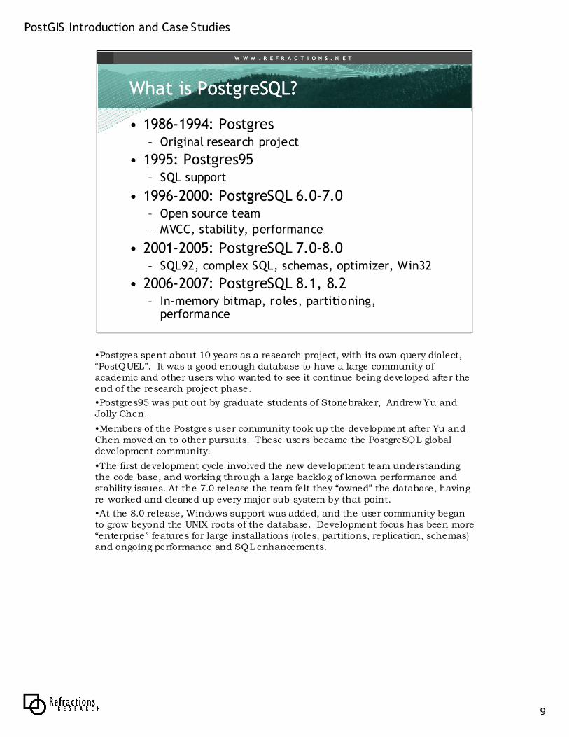
What is What is PostgreSQLPostgreSQL??
• 1986-1994: Postgres– Original research project
• 1995: Postgres95– SQL support
• 1996-2000: PostgreSQL 6.0-7.0– Open source team
– MVCC, stability, performance
• 2001-2005: PostgreSQL 7.0-8.0– SQL92, complex SQL, schemas, optimizer, Win32
• 2006-2007: PostgreSQL 8.1, 8.2– In-memory bitmap, roles, partitioning,
performance
•Postgres spent about 10 years as a research project, with its own query dialect, “PostQUEL”. It was a good enough database to have a large community of academic and other users who wanted to see it continue being developed after the end of the research project phase.
•Postgres95 was put out by graduate students of Stonebraker, Andrew Yu and Jolly Chen.
•Members of the Postgres user community took up the development after Yu and Chen moved on to other pursuits. These users became the PostgreSQL global development community.
•The first development cycle involved the new development team understanding the code base, and working through a large backlog of known performance and stability issues. At the 7.0 release the team felt they “owned” the database, having re-worked and cleaned up every major sub-system by that point.
•At the 8.0 release, Windows support was added, and the user community began to grow beyond the UNIX roots of the database. Development focus has been more “enterprise” features for large installations (roles, partitions, replication, schemas) and ongoing performance and SQL enhancements.
PostGIS Introduction and Case Studies
10
W W W . R E F R A C T I O N S . N E T
Why Why PostgreSQLPostgreSQL??
• I need a database!
• How about MySQL, everyone loves
it!
• I need transactions, triggers, procedural languages, data integrity!
MySQL is “The World’s Most Popular Open Source Database”.
That’s actually their slogan.
Popular for a reason: it is fast at doing the kinds of simple SQL that web developers like.
But it lacks the features of a real database system.
It mangles data inputs it doesn’t understand.
It does not have triggers or a procedural language for server-side programming.
It does not have full transactional guarantees.
But! (I can hear the MySQL proponents chiming in…) It has transactional table types that give you many of those things!
Sure, but to use those types, you have to give up the thing you chose MySQL for in the first place: the speed.
Non-transactional MySQL is faster than every other transactional database. Transactional MySQL is much slower than every other transactional database.
PostGIS Introduction and Case Studies
11
W W W . R E F R A C T I O N S . N E T
Why Why PostgreSQLPostgreSQL??
• Oh. How about Oracle, everyone buys it!
• I don’t have $500K.
If someone asked me to build a system on MySQL, I would balk for technical reasons: there are so many places where data integrity is important in a system, do we really want to give that up?
If someone asked my to build a system on Oracle, I would not balk for technical reasons, but I would quite pointedly, are you sure you can afford it? Really, really sure? How far do you think you’ll scale it up? Are you really really sure? Are you certainly you won’t need the functions you are not paying for? Really, really sure?
Because Oracle’s price point ranges from free (as in beer) for XE to unbelievably expensive (for Enterprise) and most real system require the size that XE does not allow and multiple CPUs and failovers, which Enterprise makes very expensive indeed.
PostGIS Introduction and Case Studies
12
W W W . R E F R A C T I O N S . N E T
Why Why PostgreSQLPostgreSQL??
• Oh. How about SQL Server, everyone tolerates it.
• I don’t have $100K. Besides, it doesn’t do spatial (until 2008…?)
SQL Server is the default database of the Microsoft developer set, it’s also perfectly good from a technical level, except for being bound to only one deployment platform.
For real deployment, though, it has the same issue as Oracle, just with slightly smaller numbers.
PostGIS Introduction and Case Studies
13
W W W . R E F R A C T I O N S . N E T
Why Why PostgreSQLPostgreSQL??
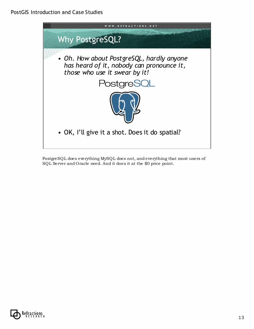
• Oh. How about PostgreSQL, hardly anyone has heard of it, nobody can pronounce it, those who use it swear by it!
• OK, I’ll give it a shot. Does it do spatial?
PostgreSQL does everything MySQL does not, and everything that most users of SQL Server and Oracle need. And it does it at the $0 price point.

PostGIS Introduction and Case Studies
14
W W W . R E F R A C T I O N S . N E T
Why Why PostgreSQLPostgreSQL??
• Feature parity– ACID guarantees
– SQL 92, advanced query optimizer
– Full text searching
– Replication
– Triggers, procedural languages (PL/PgSQL, PL/R)
– Hot backup, write-ahead logs / PITR
• Better than MySQL
• As good as proprietary– Better in some respects
Why not another database? PostgreSQL has all the enterprise features, MySQL does not. PostgreSQL has great spatial, MySQL does not. Proprietary has serious financial scaling problems, and some serious deployment complexity (SQL Server is the exception there). PostgreSQL is functionally as good as proprietary, and better in crucial openness and financial terms.
PostGIS Introduction and Case Studies
15
W W W . R E F R A C T I O N S . N E T
Why Why PostgreSQLPostgreSQL
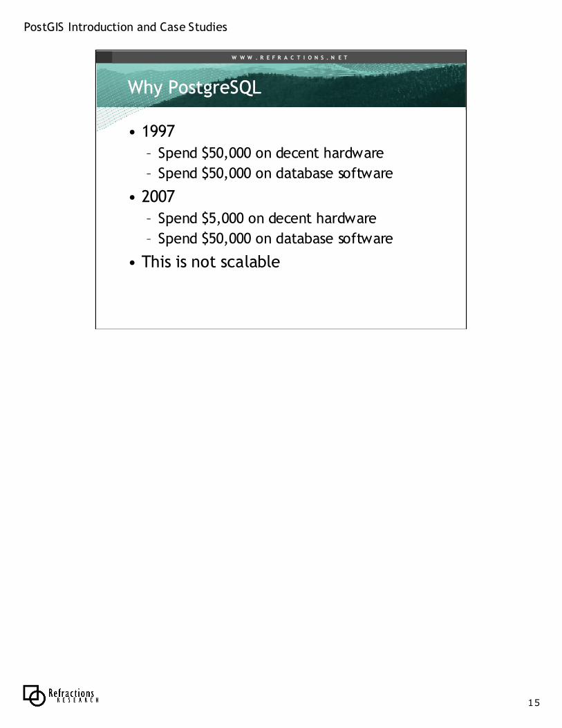
• 1997
– Spend $50,000 on decent hardware
– Spend $50,000 on database software
• 2007
– Spend $5,000 on decent hardware
– Spend $50,000 on database software
• This is not scalable
PostGIS Introduction and Case Studies
16
W W W . R E F R A C T I O N S . N E T
Why Why PostgreSQLPostgreSQL??
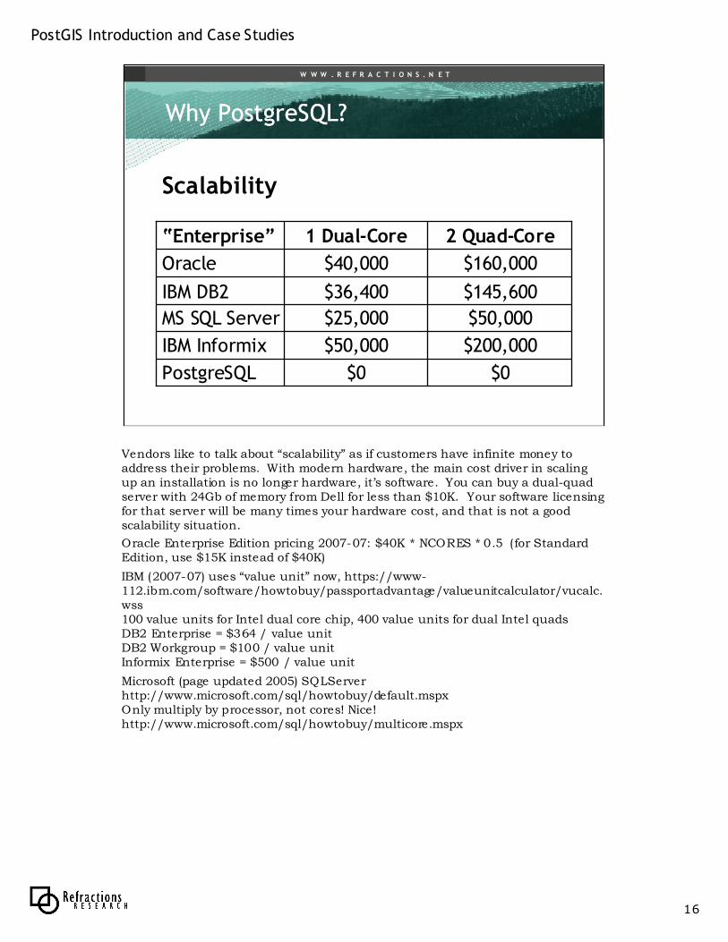
$50,000$25,000MS SQL Server
$0$0PostgreSQL
$200,000$50,000IBM Informix
$145,600$36,400IBM DB2
$160,000$40,000Oracle
2 Quad-Core1 Dual-Core“Enterprise”
Scalability
Vendors like to talk about “scalability” as if customers have infinite money to address their problems. With modern hardware, the main cost driver in scaling up an installation is no longer hardware, it’s software. You can buy a dual-quad server with 24Gb of memory from Dell for less than $10K. Your software licensing for that server will be many times your hardware cost, and that is not a good scalability situation.
Oracle Enterprise Edition pricing 2007-07: $40K * NCORES * 0.5 ( for Standard Edition, use $15K instead of $40K)
IBM (2007-07) uses “value unit” now, https://www-112.ibm.com/software/howtobuy/passportadvantage/valueunitcalculator/vucalc.wss100 value units for Intel dual core chip, 400 value units for dual Intel quadsDB2 Enterprise = $364 / value unit DB2 Workgroup = $100 / value unitInformix Enterprise = $500 / value unit
Microsoft (page updated 2005) SQLServer http://www.microsoft.com/sql/howtobuy/default.mspxOnly multiply by processor, not cores! Nice! http://www.microsoft.com/sql/howtobuy/multicore.mspx
PostGIS Introduction and Case Studies
17
W W W . R E F R A C T I O N S . N E T
What is What is PostGISPostGIS??
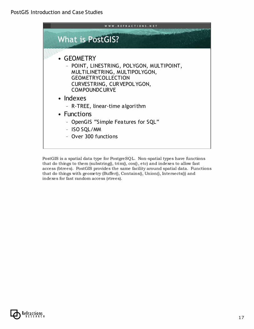
• GEOMETRY– POINT, LINESTRING, POLYGON, MULTIPOINT,
MULTILINETRING, MULTIPOLYGON, GEOMETRYCOLLECTIONCURVESTRING, CURVEPOLYGON, COMPOUNDCURVE
• Indexes– R-TREE, linear-time algorithm
• Functions– OpenGIS “Simple Features for SQL”
– ISO SQL/MM
– Over 300 functions
PostGIS is a spatial data type for PostgreSQL. Non-spatial types have functions that do things to them (substring(), trim(), cos() , etc) and indexes to allow fast access (btrees). PostGIS provides the same facility around spatial data. Functions that do things with geometry (Buffer(), Contains(), Union(), Intersects()) and indexes for fast random access (rtrees).
PostGIS Introduction and Case Studies
18
W W W . R E F R A C T I O N S . N E T
What is What is PostGISPostGIS??
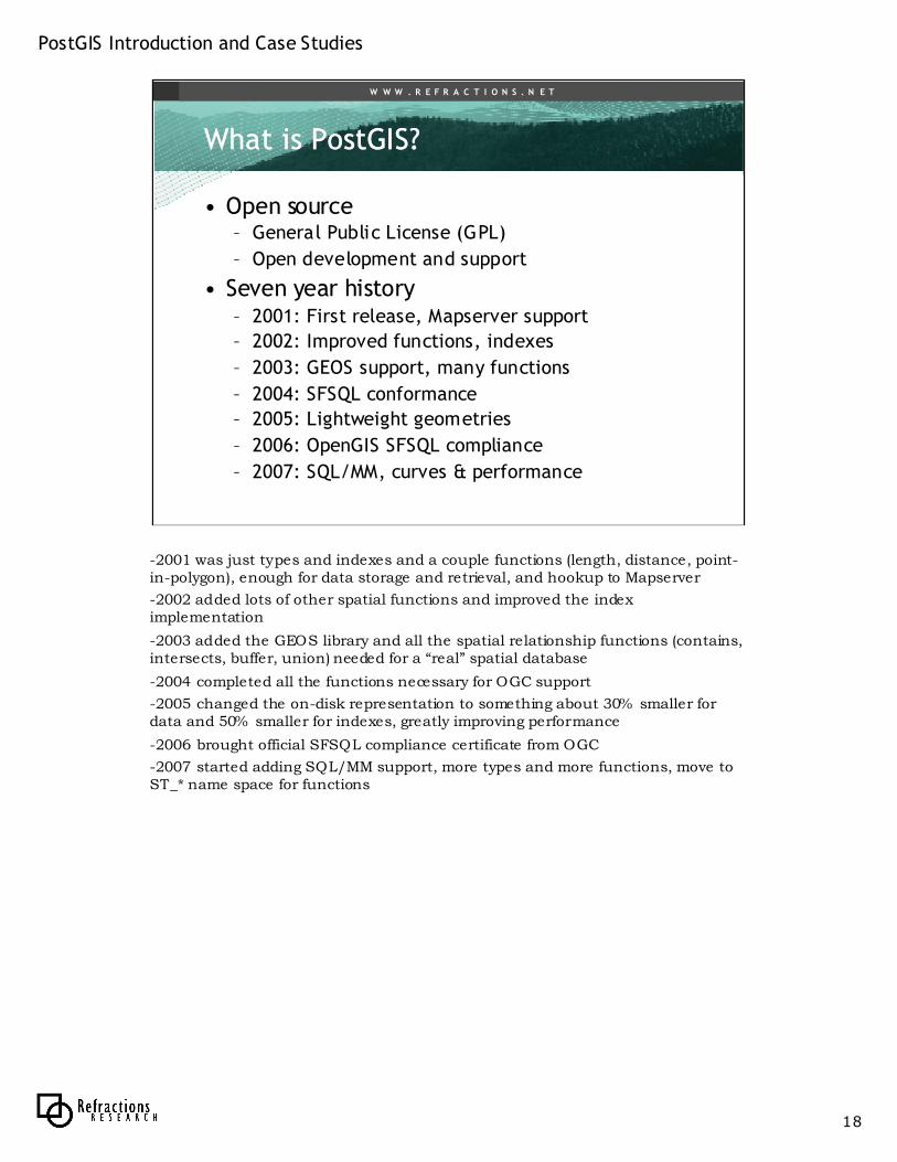
• Open source– General Public License (GPL)
– Open development and support
• Seven year history– 2001: First release, Mapserver support
– 2002: Improved functions, indexes
– 2003: GEOS support, many functions
– 2004: SFSQL conformance
– 2005: Lightweight geometries
– 2006: OpenGIS SFSQL compliance
– 2007: SQL/MM, curves & performance
-2001 was just types and indexes and a couple functions (length, distance, point-in-polygon), enough for data storage and retrieval, and hookup to Mapserver
-2002 added lots of other spatial functions and improved the index implementation
-2003 added the GEOS library and all the spatial relationship functions (contains, intersects, buffer, union) needed for a “real” spatial database
-2004 completed all the functions necessary for OGC support
-2005 changed the on-disk representation to something about 30% smaller for data and 50% smaller for indexes, greatly improving performance
-2006 brought official SFSQL compliance certificate from OGC
-2007 started adding SQL/MM support, more types and more functions, move to ST_* name space for functions
PostGIS Introduction and Case Studies
19
W W W . R E F R A C T I O N S . N E T
Why Why PostGISPostGIS??
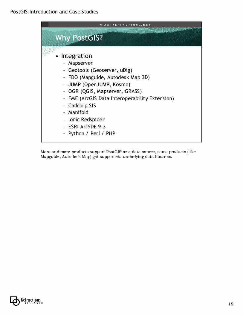
• Integration– Mapserver
– Geotools (Geoserver, uDig)
– FDO (Mapguide, Autodesk Map 3D)
– JUMP (OpenJUMP, Kosmo)
– OGR (QGIS, Mapserver, GRASS)
– FME (ArcGIS Data Interoperability Extension)
– Cadcorp SIS
– Manifold
– Ionic Redspider
– ESRI ArcSDE 9.3
– Python / Perl / PHP
More and more products support PostGIS as a data source, some products (likeMapguide, Autodesk Map) get support via underlying data libraries.
PostGIS Introduction and Case Studies
20
W W W . R E F R A C T I O N S . N E T
Why Why PostGISPostGIS??
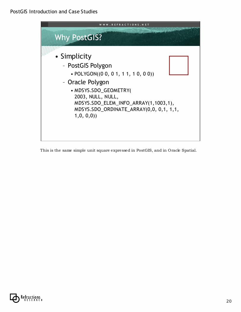
• Simplicity
– PostGIS Polygon• POLYGON((0 0, 0 1, 1 1, 1 0, 0 0))
– Oracle Polygon• MDSYS.SDO_GEOMETRY(
2003, NULL, NULL, MDSYS.SDO_ELEM_INFO_ARRAY(1,1003,1), MDSYS.SDO_ORDINATE_ARRAY(0,0, 0,1, 1,1, 1,0, 0,0))
This is the same simple unit square expressed in PostGIS, and in Oracle Spatial.
PostGIS Introduction and Case Studies
21
W W W . R E F R A C T I O N S . N E T
Why Why PostGISPostGIS??
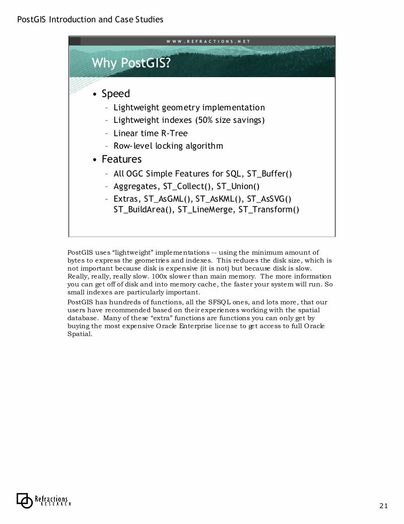
• Speed– Lightweight geometry implementation
– Lightweight indexes (50% size savings)
– Linear time R-Tree
– Row-level locking algorithm
• Features
– All OGC Simple Features for SQL, ST_Buffer()
– Aggregates, ST_Collect(), ST_Union()
– Extras, ST_AsGML(), ST_AsKML(), ST_AsSVG() ST_BuildArea(), ST_LineMerge, ST_Transform()
PostGIS uses “lightweight” implementations -- using the minimum amount of bytes to express the geometries and indexes. This reduces the disk size, which is not important because disk is expensive (it is not) but because disk is slow. Really, really, really slow. 100x slower than main memory. The more information you can get off of disk and into memory cache, the faster your system will run. So small indexes are particularly important.
PostGIS has hundreds of functions, all the SFSQL ones, and lots more, that our users have recommended based on their experiences working with the spatial database. Many of these “extra” functions are functions you can only get by buying the most expensive Oracle Enterprise license to get access to full Oracle Spatial.
PostGIS Introduction and Case Studies
22
W W W . R E F R A C T I O N S . N E T
Why Why PostGISPostGIS??
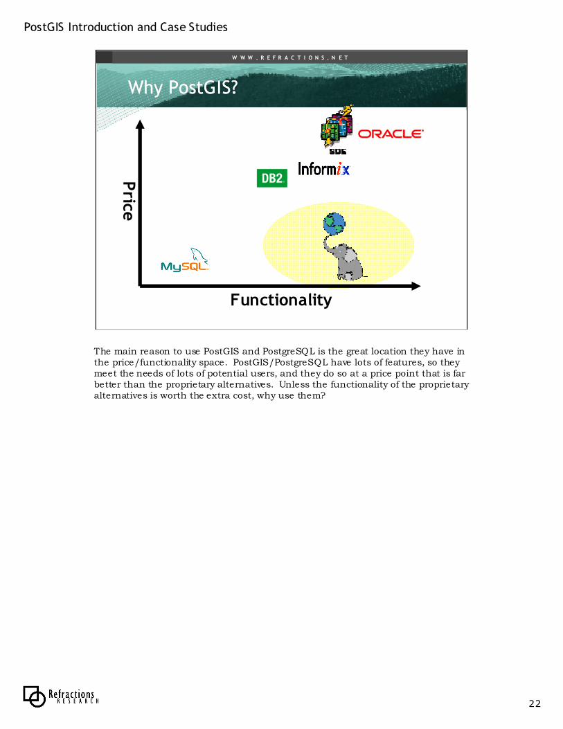
Price
Functionality
The main reason to use PostGIS and PostgreSQL is the great location they have in the price/functionality space. PostGIS/PostgreSQL have lots of features, so they meet the needs of lots of potential users, and they do so at a price point that is far better than the proprietary alternatives. Unless the functionality of the proprietary alternatives is worth the extra cost, why use them?
PostGIS Introduction and Case Studies
23
W W W . R E F R A C T I O N S . N E T
Case StudiesCase Studies
• GlobeXplorer– High performance, good value
• North Dakota State Water Commission– Good value, legacy integration
• Institut Geographique National– Good value, better functionality
• Fleet Management Company– Better performance, same price
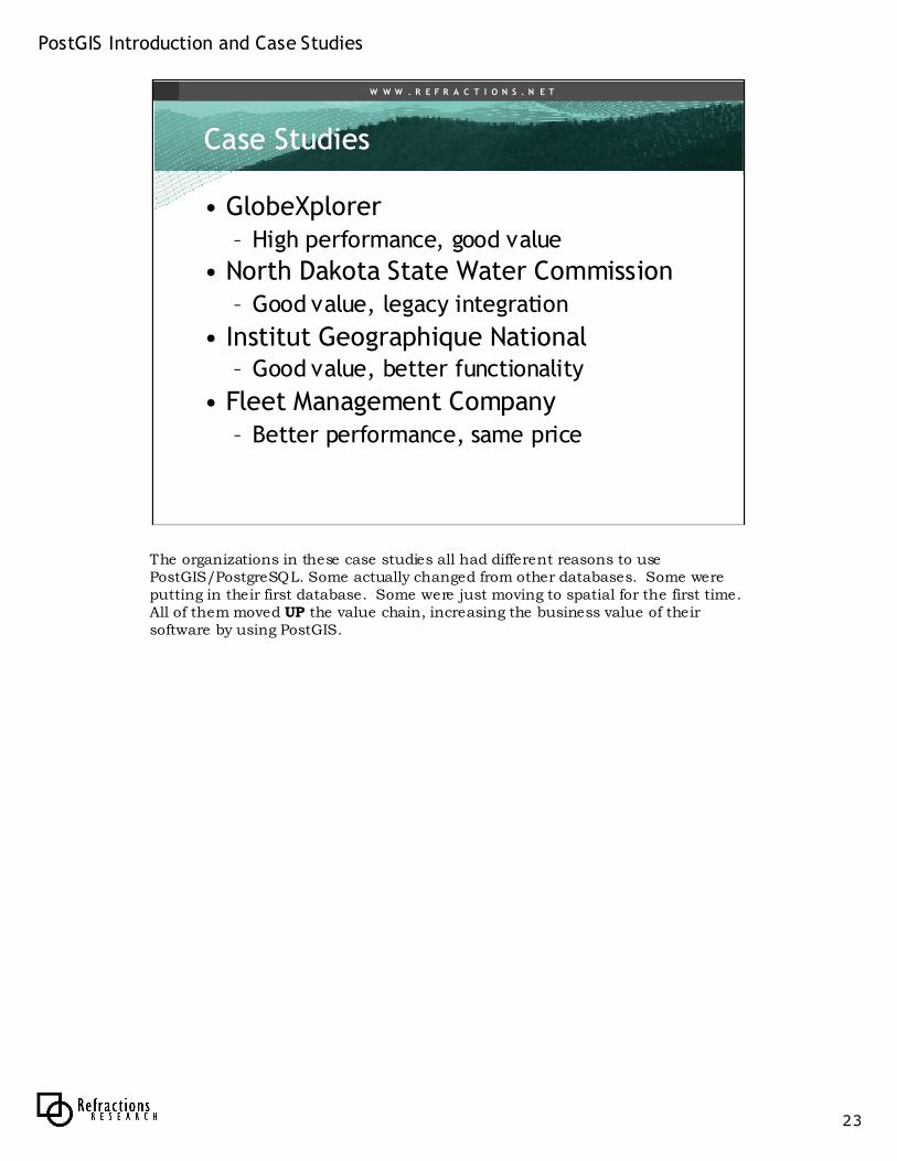
The organizations in these case studies all had different reasons to usePostGIS/PostgreSQL. Some actually changed from other databases. Some were putting in their first database. Some were just moving to spatial for the first time. All of them moved UP the value chain, increasing the business value of their software by using PostGIS.
PostGIS Introduction and Case Studies
24
W W W . R E F R A C T I O N S . N E T
GlobeXplorerGlobeXplorer
• www.globexplorer.com
• Consumer and end-user oriented image distribution service (1M-5M requests / day)
• Manage archive of images (multi-terabyte) and vectors (32M parcels and growing)
• Provide access via web services– WMS
– Own web services
– Desktop extensions
GlobeXplorer is a division of Digital Globe (acquired fairly recently), devoted to pushing imagery out to consumers. Service is based on metered access to data, with most of the money going to the image provider and GX taking a small transaction fee for managing the process. The archive is huge, and the customer base is always growing.
PostGIS Introduction and Case Studies
25
W W W . R E F R A C T I O N S . N E T
GlobeXplorerGlobeXplorer
Image Files
Image Metadata
Find
Imagery
Return
Imagery
Request
Response
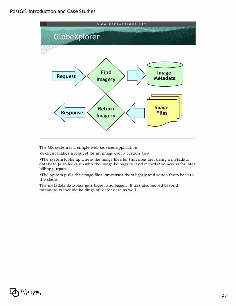
The GX system is a simple web-services application:
•A client makes a request for an image over a certain area.
•The system looks up where the image files for that area are, using a metadata database (also looks up who the image belongs to, and records the access for later billing purposes).
•The system pulls the image files, processes them lightly and sends them back to the client.
The metadata database gets bigger and bigger. It has also moved beyond metadata to include holdings of vector data as well.
PostGIS Introduction and Case Studies
26
W W W . R E F R A C T I O N S . N E T
GlobeXplorerGlobeXplorer
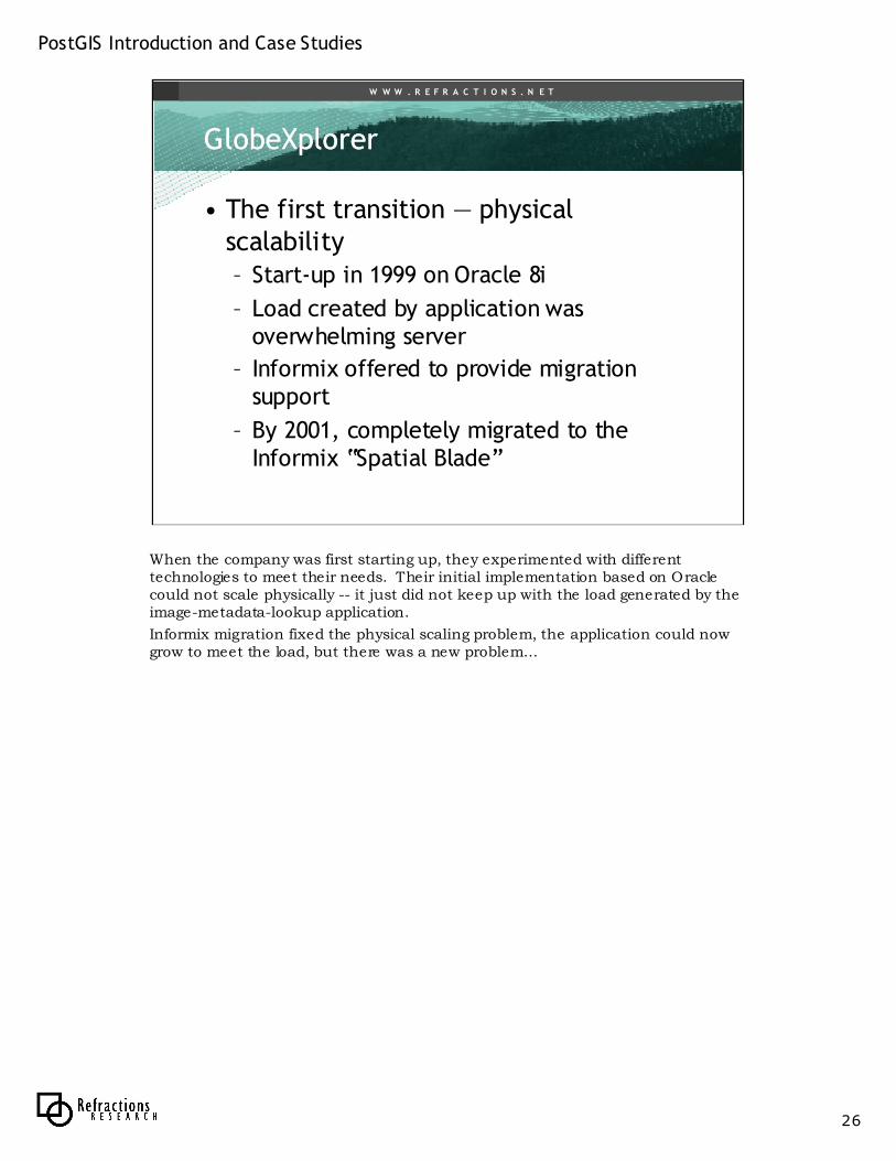
• The first transition — physical scalability– Start-up in 1999 on Oracle 8i
– Load created by application was overwhelming server
– Informix offered to provide migration support
– By 2001, completely migrated to the Informix “Spatial Blade”
When the company was first starting up, they experimented with different technologies to meet their needs. Their initial implementation based on Oracle could not scale physically -- it just did not keep up with the load generated by the image-metadata-lookup application.
Informix migration fixed the physical scaling problem, the application could now grow to meet the load, but there was a new problem…
PostGIS Introduction and Case Studies
27
W W W . R E F R A C T I O N S . N E T
GlobeXplorerGlobeXplorer
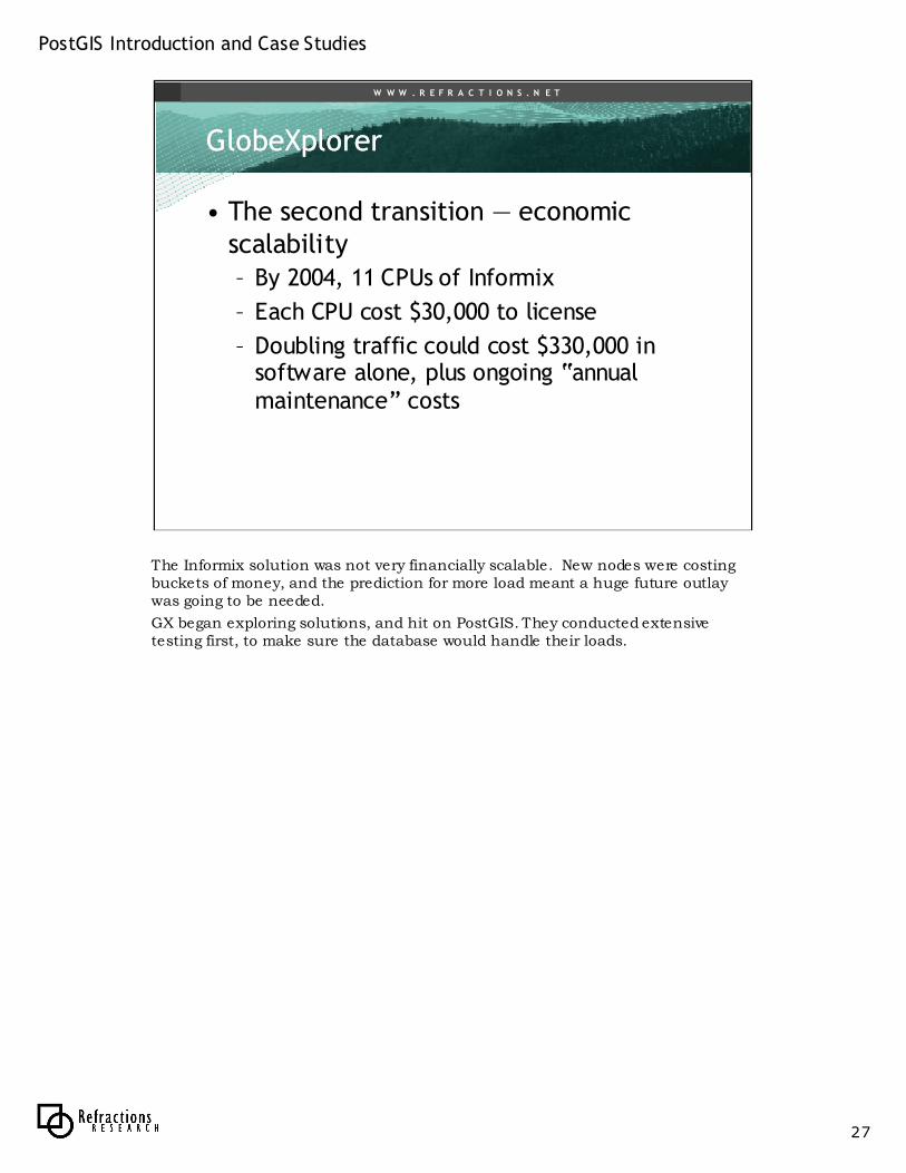
• The second transition — economic scalability– By 2004, 11 CPUs of Informix
– Each CPU cost $30,000 to license
– Doubling traffic could cost $330,000 in software alone, plus ongoing “annual maintenance” costs
The Informix solution was not very financially scalable. New nodes were costing buckets of money, and the prediction for more load meant a huge future outlay was going to be needed.
GX began exploring solutions, and hit on PostGIS. They conducted extensive testing first, to make sure the database would handle their loads.
PostGIS Introduction and Case Studies
28
W W W . R E F R A C T I O N S . N E T
GlobeXplorerGlobeXplorer
Image Files
Informix
Return
Imagery
Request
Response
PostGISFind
Imagery
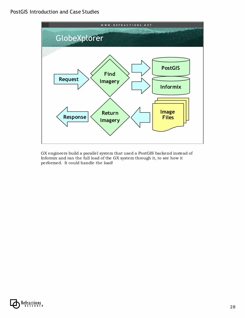
GX engineers build a parallel system that used a PostGIS backend instead of Informix and ran the full load of the GX system through it, to see how it performed. It could handle the load!
PostGIS Introduction and Case Studies
29
W W W . R E F R A C T I O N S . N E T
GlobeXplorerGlobeXplorer
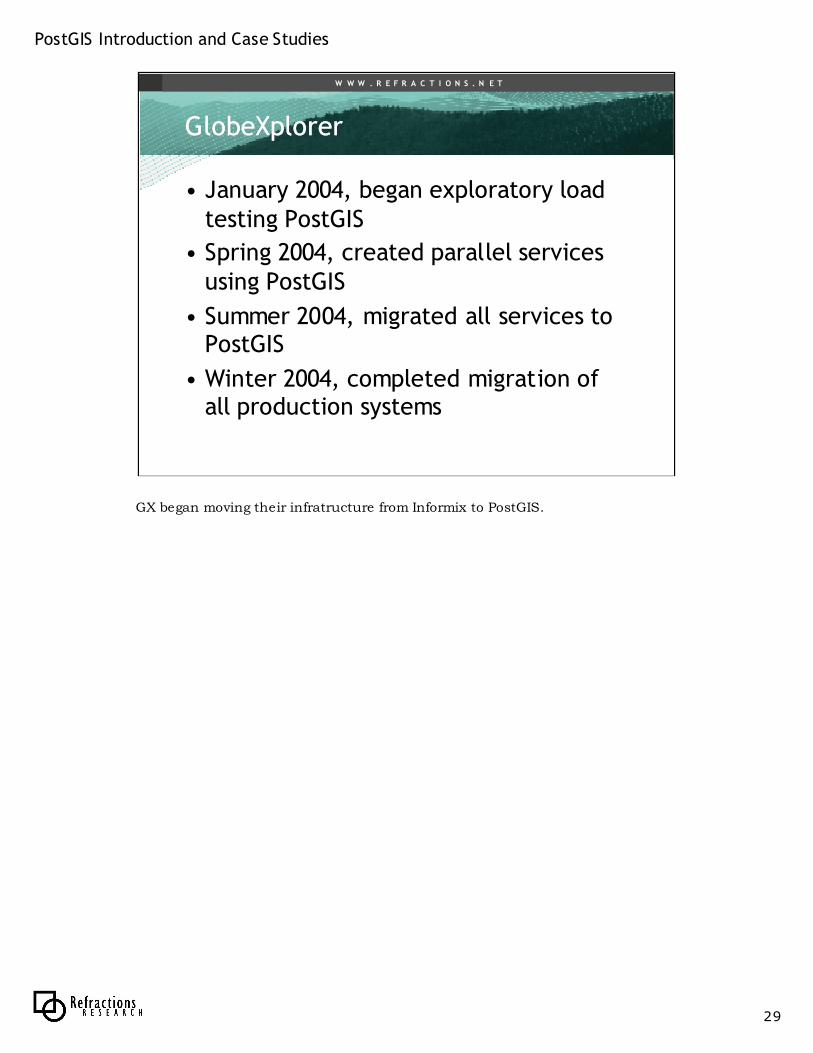
• January 2004, began exploratory load testing PostGIS
• Spring 2004, created parallel services using PostGIS
• Summer 2004, migrated all services to PostGIS
• Winter 2004, completed migration of all production systems
GX began moving their infratructure from Informix to PostGIS.
PostGIS Introduction and Case Studies
30
W W W . R E F R A C T I O N S . N E T
GlobeXplorerGlobeXplorer
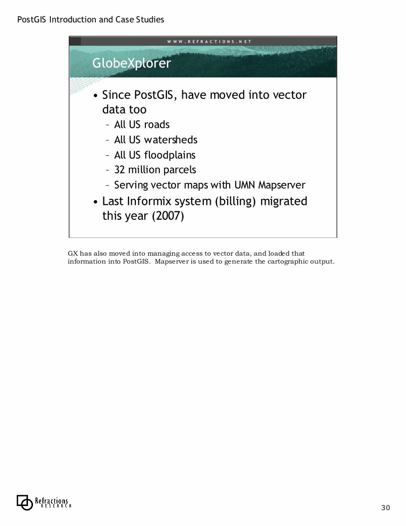
• Since PostGIS, have moved into vector data too– All US roads
– All US watersheds
– All US floodplains
– 32 million parcels
– Serving vector maps with UMN Mapserver
• Last Informix system (billing) migrated this year (2007)
GX has also moved into managing access to vector data, and loaded that information into PostGIS. Mapserver is used to generate the cartographic output.
PostGIS Introduction and Case Studies
31
W W W . R E F R A C T I O N S . N E T
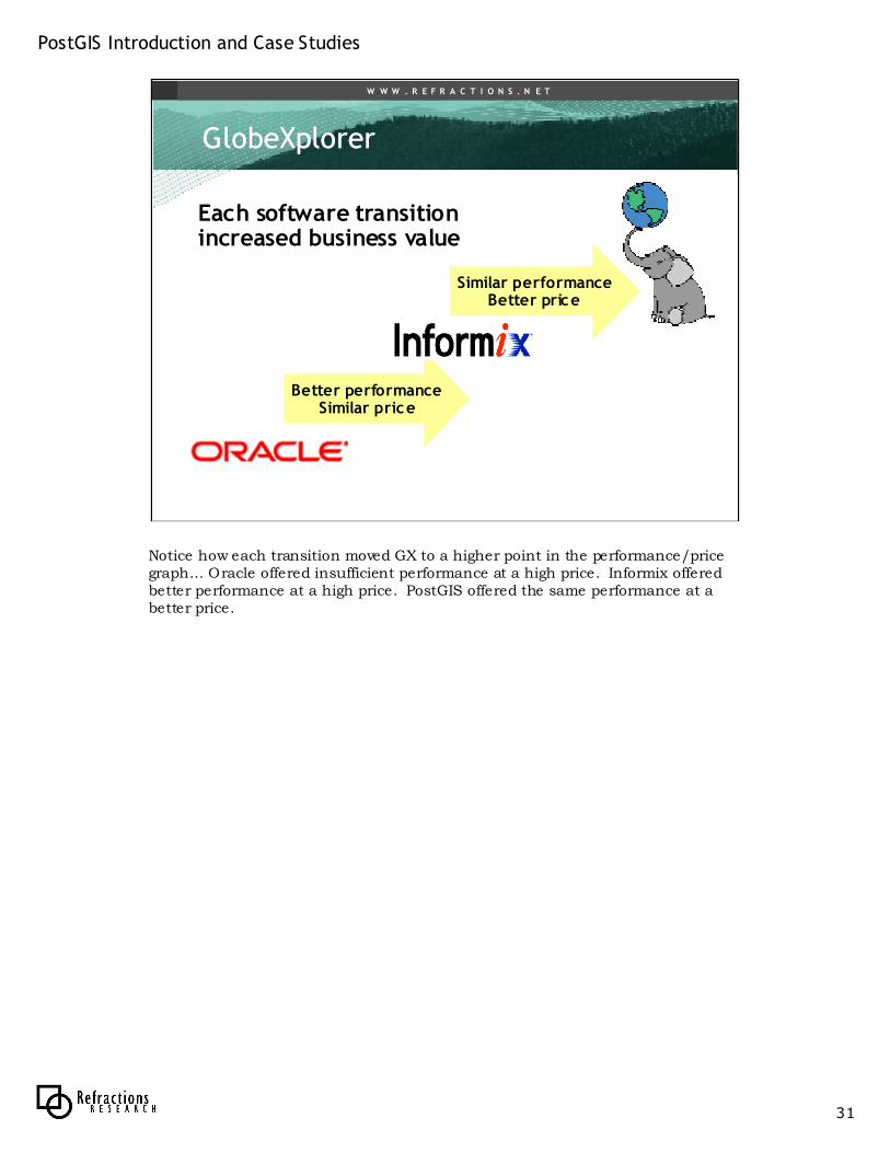
Better performanceSimilar price
GlobeXplorerGlobeXplorer
Each software transition increased business value
Similar performanceBetter price
Notice how each transition moved GX to a higher point in the performance/price graph… Oracle offered insufficient performance at a high price. Informix offered better performance at a high price. PostGIS offered the same performance at a better price.
PostGIS Introduction and Case Studies
32
W W W . R E F R A C T I O N S . N E T
North Dakota Water CommissionNorth Dakota Water Commission
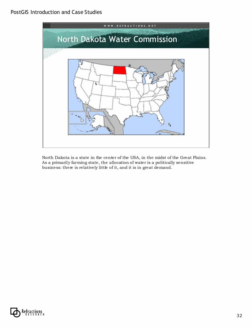
North Dakota is a state in the center of the USA, in the midst of the Great Plains. As a primarily farming state, the allocation of water is a politically sensitive business: there is relatively little of it, and it is in great demand.
PostGIS Introduction and Case Studies
33
W W W . R E F R A C T I O N S . N E T
North Dakota Water CommissionNorth Dakota Water Commission
• Regulates use of water resources
• Employs scientific experts (hydrologists) and decision makers
• Monitor water levels, water quality, and water usage– Generate a great deal of data
– Water meters, water samples, etc
Water commission is in charge of producing information about water use, and regulating the use of water. The water system, rivers and wells, are extensively metered, producing a large quantity of hydrological data.

PostGIS Introduction and Case Studies
34
W W W . R E F R A C T I O N S . N E T
North Dakota Water CommissionNorth Dakota Water Commission
• 2001 plan to migrate to ESRI
– ArcIMS, ArcSDE, ArcMap
• 2003 state budget cut back– Migration stopped
– $500,000 less than originally planned
• New options needed– Mapserver
– PostGIS / PostgreSQL
The legacy system in the Water Commission was built in the “4D” database on Apple Macintosh computers (a Windows analogue might be FoxPro). In 2001, the commission planned to start providing more spatial mapping and analysis by migrating so a new spatial data system based on ESRI software. However, budget cutbacks drastically reduced the amount of money available for capital expenditures. Staff began exploring alternatives.
PostGIS Introduction and Case Studies
35
W W W . R E F R A C T I O N S . N E T
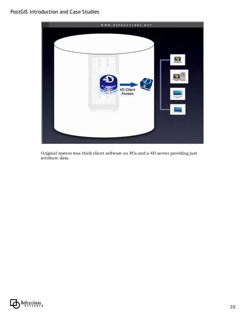
Original system was thick client software on PCs and a 4D server providing just attribute data.
PostGIS Introduction and Case Studies
36
W W W . R E F R A C T I O N S . N E T
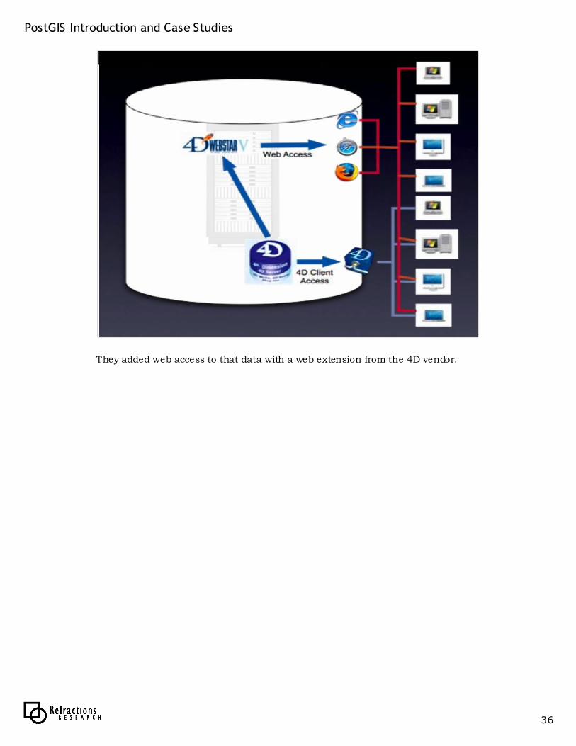
They added web access to that data with a web extension from the 4D vendor.
PostGIS Introduction and Case Studies
37
W W W . R E F R A C T I O N S . N E T
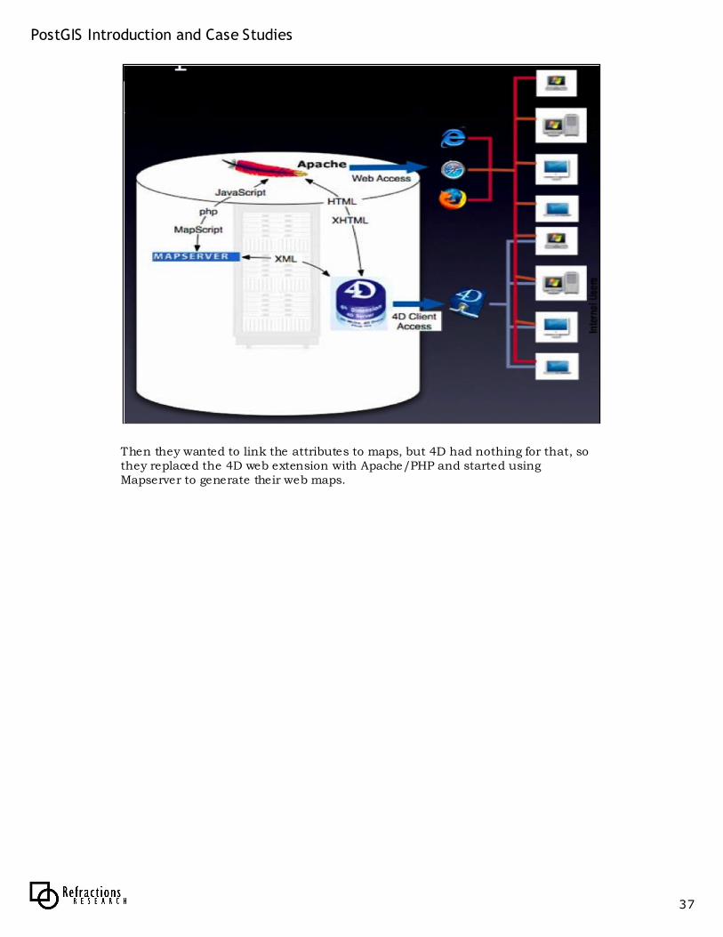
Then they wanted to link the attributes to maps, but 4D had nothing for that, so they replaced the 4D web extension with Apache/PHP and started using Mapserver to generate their web maps.
PostGIS Introduction and Case Studies
38
W W W . R E F R A C T I O N S . N E T
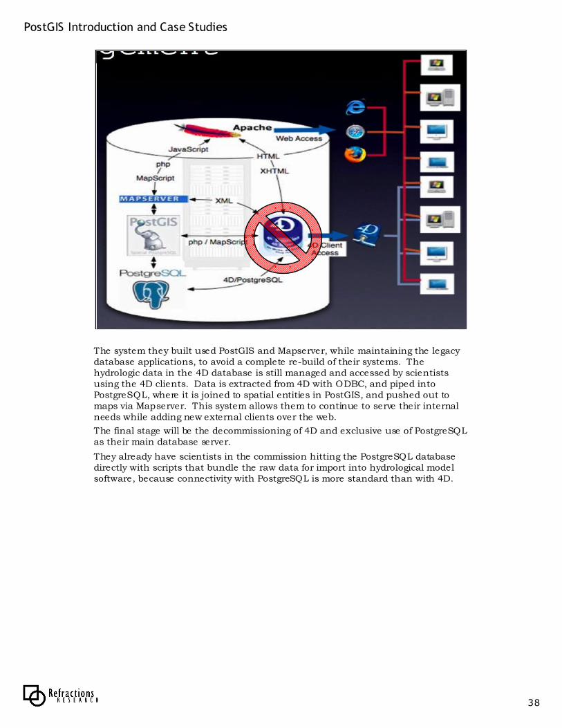
The system they built used PostGIS and Mapserver, while maintaining the legacy database applications, to avoid a complete re-build of their systems. The hydrologic data in the 4D database is still managed and accessed by scientists using the 4D clients. Data is extracted from 4D with ODBC, and piped into PostgreSQL, where it is joined to spatial entities in PostGIS, and pushed out to maps via Mapserver. This system allows them to continue to serve their internal needs while adding new external clients over the web.
The final stage will be the decommissioning of 4D and exclusive use of PostgreSQLas their main database server.
They already have scientists in the commission hitting the PostgreSQL database directly with scripts that bundle the raw data for import into hydrological model software, because connectivity with PostgreSQL is more standard than with 4D.
PostGIS Introduction and Case Studies
39
W W W . R E F R A C T I O N S . N E T
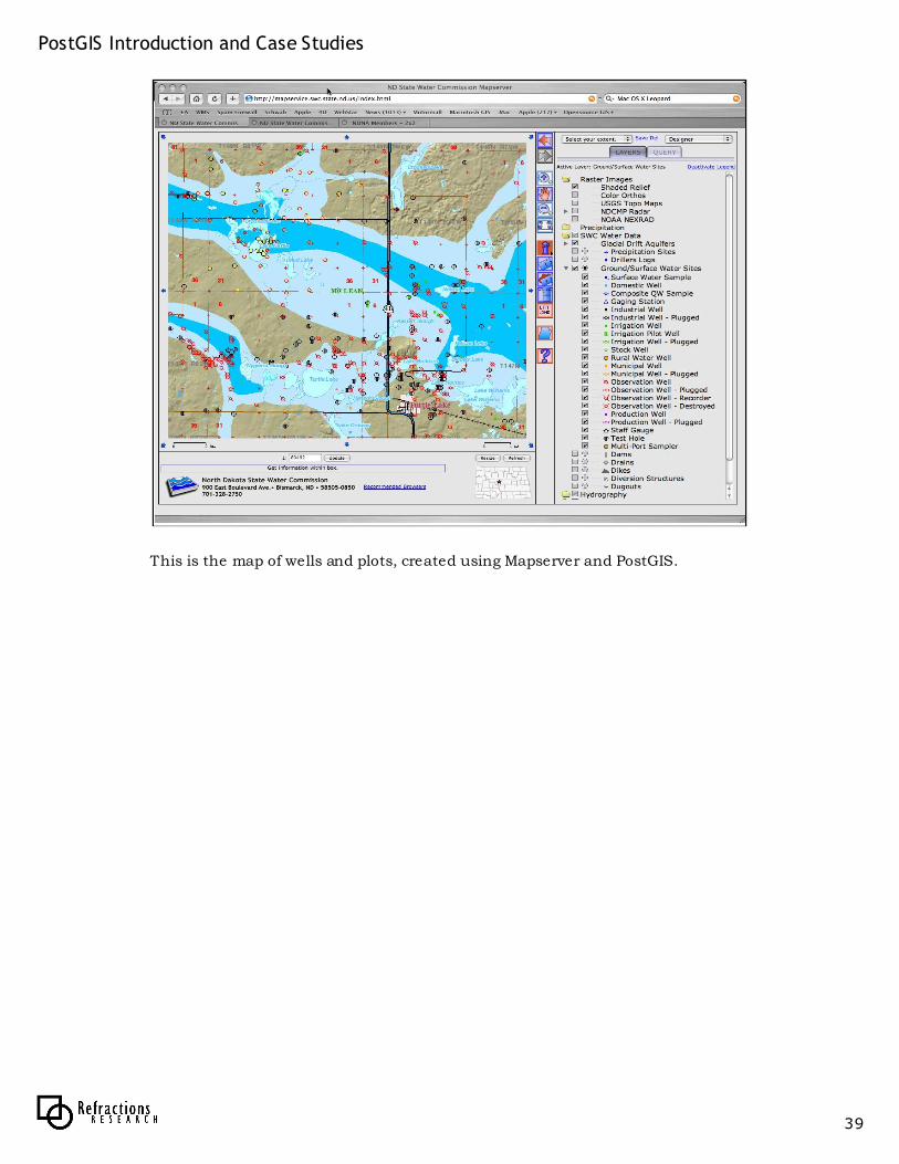
This is the map of wells and plots, created using Mapserver and PostGIS.
PostGIS Introduction and Case Studies
40
W W W . R E F R A C T I O N S . N E T
North Dakota Water CommissionNorth Dakota Water Commission
• Data integrated
– 2,000,000 water level records
– 31,000 well sites
– 54,000 chemistry analyses
• Bonuses– Open source was easier to install and
maintain
– Spatial / attribute integration opening up analysis possibilities for hydrologists
Moving to PostGIS has allowed the IT folks to start to provide direct access to scientists who are extracting and analyzing data directly from the database using scripting languages to pull out observations and feed them into hydrologic models. The plan is to eventually shut down the 4D database and manage all the data in PostgreSQL / PostGIS exclusively.
PostGIS Introduction and Case Studies
41
W W W . R E F R A C T I O N S . N E T
North Dakota Water CommissionNorth Dakota Water Commission
More flexibilityBetter manageability
Better price
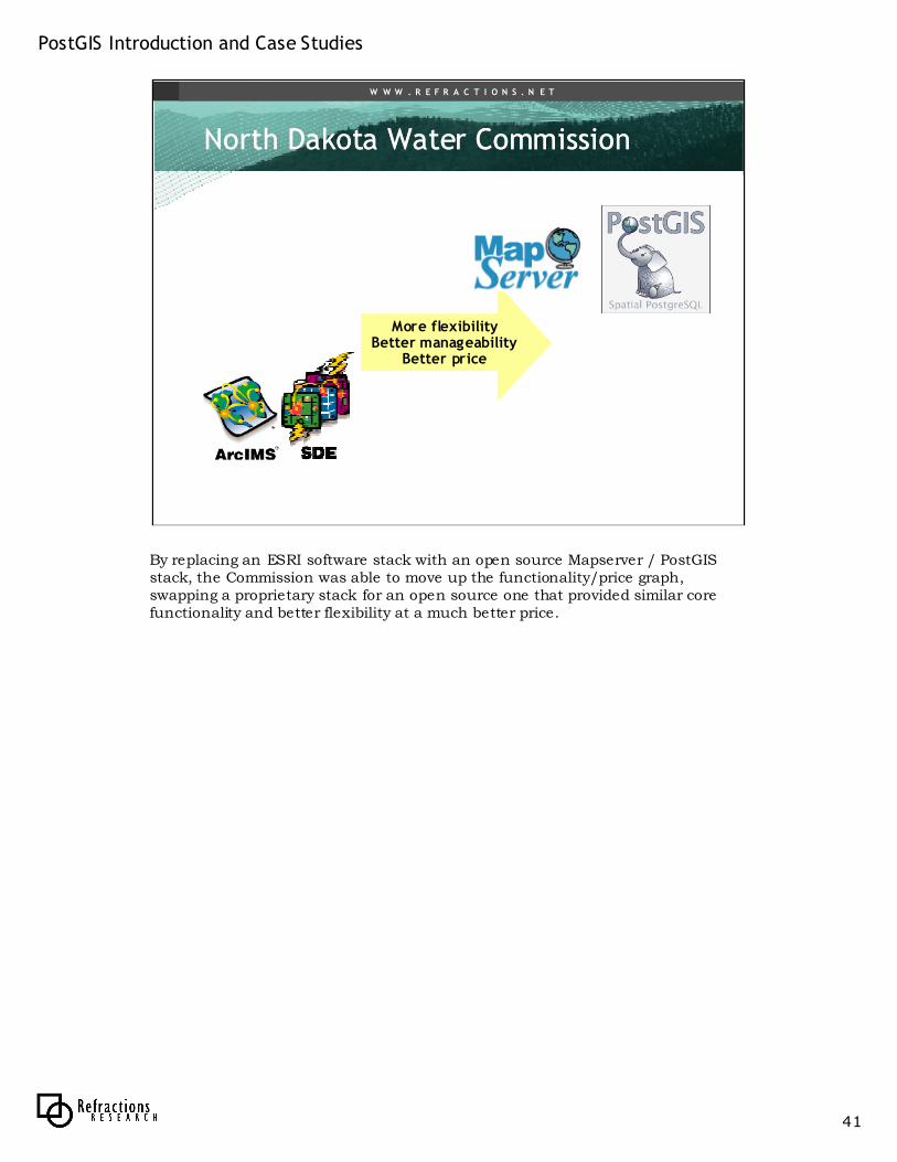
By replacing an ESRI software stack with an open source Mapserver / PostGIS stack, the Commission was able to move up the functionality/price graph, swapping a proprietary stack for an open source one that provided similar core functionality and better flexibility at a much better price.
PostGIS Introduction and Case Studies
42
W W W . R E F R A C T I O N S . N E T
Institut GInstitut Gééographique ographique NationalNational
• www.ign.fr
• National mapping agency of France
• Manage topographic database of 100M features
• Provide multiple data collectors read/write access to the central archive
http://postgis.refractions.net/documentation/casestudies/ign/
The Institut Géographique National (IGN) is the national mapping agency for France, with 1800 employees and a mandate to collect, integrate, manage and distribute reference geographical information for the whole country.
PostGIS Introduction and Case Studies
43
W W W . R E F R A C T I O N S . N E T
Institut GInstitut Gééographique ographique NationalNational
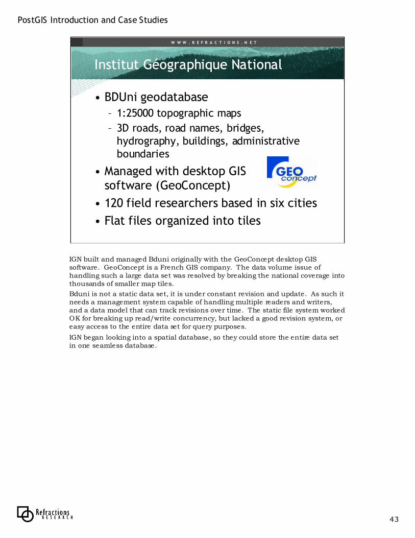
• BDUni geodatabase
– 1:25000 topographic maps
– 3D roads, road names, bridges, hydrography, buildings, administrative boundaries
• Managed with desktop GIS software (GeoConcept)
• 120 field researchers based in six cities
• Flat files organized into tiles
IGN built and managed Bduni originally with the GeoConcept desktop GIS software. GeoConcept is a French GIS company. The data volume issue of handling such a large data set was resolved by breaking the national coverage into thousands of smaller map tiles.
Bduni is not a static data set, it is under constant revision and update. As such it needs a management system capable of handling multiple readers and writers, and a data model that can track revisions over time. The static file system worked OK for breaking up read/write concurrency, but lacked a good revision system, or easy access to the entire data set for query purposes.
IGN began looking into a spatial database, so they could store the entire data set in one seamless database.
PostGIS Introduction and Case Studies
44
W W W . R E F R A C T I O N S . N E T
Institut GInstitut Gééographique ographique NationalNational
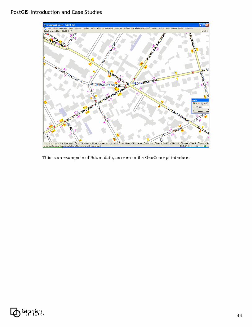
This is an exampmle of Bduni data, as seen in the GeoConcept interface.
PostGIS Introduction and Case Studies
45
W W W . R E F R A C T I O N S . N E T
Institut GInstitut Gééographique ographique NationalNational
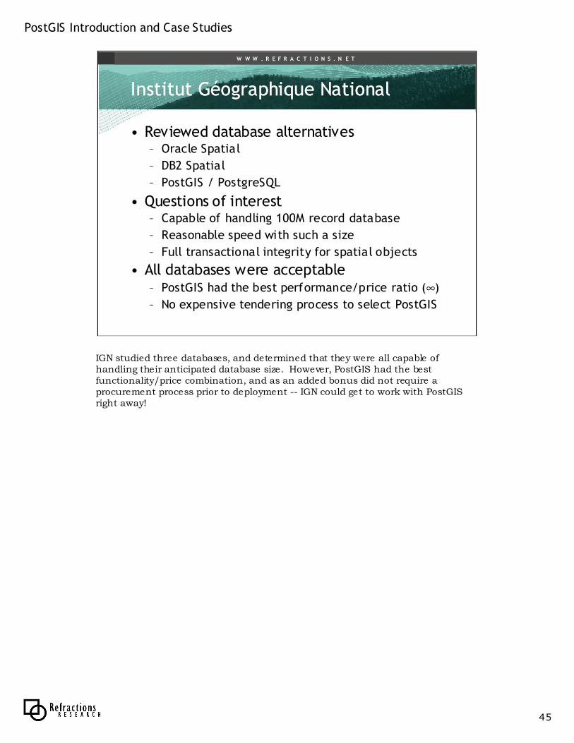
• Reviewed database alternatives– Oracle Spatial
– DB2 Spatial
– PostGIS / PostgreSQL
• Questions of interest– Capable of handling 100M record database
– Reasonable speed with such a size
– Full transactional integrity for spatial objects
• All databases were acceptable– PostGIS had the best performance/price ratio (∞)
– No expensive tendering process to select PostGIS
IGN studied three databases, and determined that they were all capable of handling their anticipated database size. However, PostGIS had the best functionality/price combination, and as an added bonus did not require a procurement process prior to deployment -- IGN could get to work with PostGISright away!
PostGIS Introduction and Case Studies
46
W W W . R E F R A C T I O N S . N E T
Institut GInstitut Gééographique ographique NationalNational
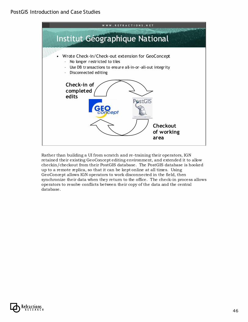
• Wrote Check-in/Check-out extension for GeoConcept– No longer restr icted to tiles
– Use DB transactions to ensure all-in-or-all-out integr ity
– Disconnected editing
Checkout of working area
Check-in of completed edits
Rather than building a UI from scratch and re-training their operators, IGN retained their existing GeoConcept editing environment, and extended it to allow checkin/checkout from their PostGIS database. The PostGIS database is hooked up to a remote replica, so that it can be kept online at all times. Using GeoConcept allows IGN operators to work disconnected in the field, then synchronize their data when they return to the office. The check-in process allows operators to resolve conflicts between their copy of the data and the central database.
PostGIS Introduction and Case Studies
47
W W W . R E F R A C T I O N S . N E T
Institut GInstitut Gééographique ographique NationalNational
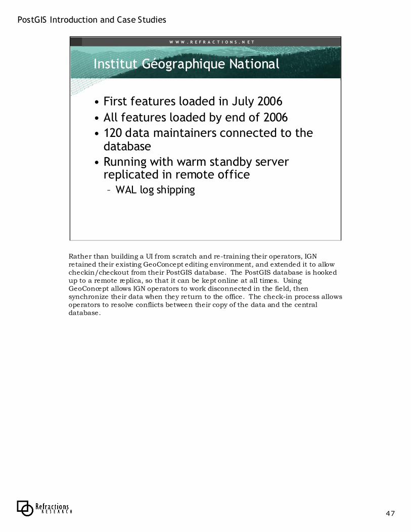
• First features loaded in July 2006
• All features loaded by end of 2006
• 120 data maintainers connected to the database
• Running with warm standby server replicated in remote office– WAL log shipping
Rather than building a UI from scratch and re-training their operators, IGN retained their existing GeoConcept editing environment, and extended it to allow checkin/checkout from their PostGIS database. The PostGIS database is hooked up to a remote replica, so that it can be kept online at all times. Using GeoConcept allows IGN operators to work disconnected in the field, then synchronize their data when they return to the office. The check-in process allows operators to resolve conflicts between their copy of the data and the central database.
PostGIS Introduction and Case Studies
48
W W W . R E F R A C T I O N S . N E T
Institut GInstitut Gééographique ographique NationalNational
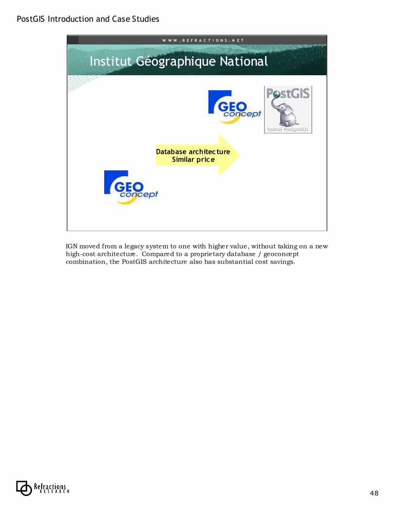
Database architectureSimilar price
IGN moved from a legacy system to one with higher value, without taking on a new high-cost architecture. Compared to a proprietary database / geoconcept combination, the PostGIS architecture also has substantial cost savings.

PostGIS Introduction and Case Studies
49
W W W . R E F R A C T I O N S . N E T
Fleet Management CompanyFleet Management Company
• Refractions Research client
• Start-up company
– Selected PostgreSQL early
• Started with fleet maintenance application– Download inspection and engine details to
central PostgreSQL database daily
– Popular with school bus fleets, stringent safety tracking requirement
PostGIS Introduction and Case Studies
50
W W W . R E F R A C T I O N S . N E T
Fleet Management CompanyFleet Management Company
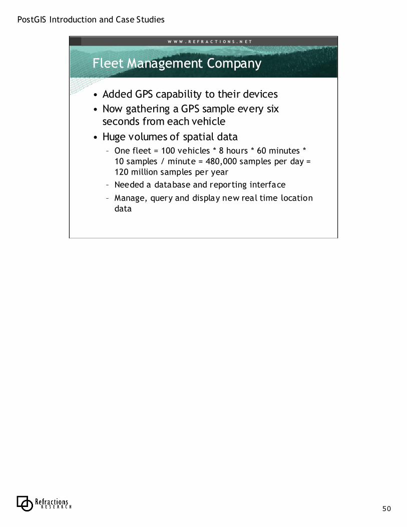
• Added GPS capability to their devices
• Now gathering a GPS sample every six seconds from each vehicle
• Huge volumes of spatial data– One fleet = 100 vehicles * 8 hours * 60 minutes *
10 samples / minute = 480,000 samples per day =120 million samples per year
– Needed a database and reporting interface
– Manage, query and display new real time location data
PostGIS Introduction and Case Studies
51
W W W . R E F R A C T I O N S . N E T
Fleet Management CompanyFleet Management Company
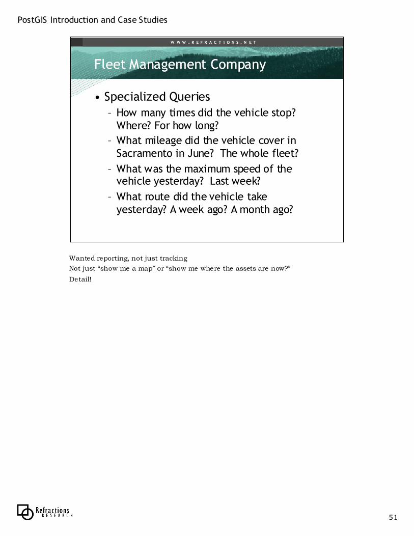
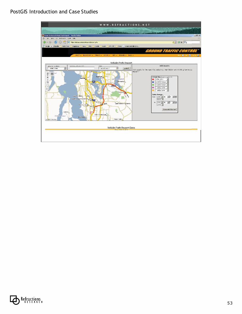
• Specialized Queries
– How many times did the vehicle stop? Where? For how long?
– What mileage did the vehicle cover in Sacramento in June? The whole fleet?
– What was the maximum speed of the vehicle yesterday? Last week?
– What route did the vehicle take yesterday? A week ago? A month ago?
Wanted reporting, not just tracking
Not just “show me a map” or “show me where the assets are now?”
Detail!
PostGIS Introduction and Case Studies
52
W W W . R E F R A C T I O N S . N E T
Fleet Management CompanyFleet Management Company
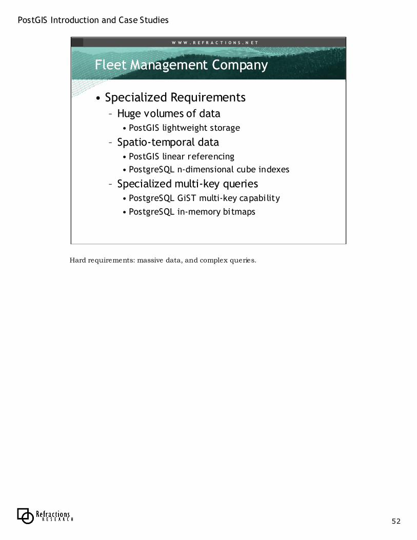
• Specialized Requirements
– Huge volumes of data• PostGIS lightweight storage
– Spatio-temporal data• PostGIS linear referencing
• PostgreSQL n-dimensional cube indexes
– Specialized multi-key queries• PostgreSQL GiST multi-key capability
• PostgreSQL in-memory bitmaps
Hard requirements: massive data, and complex queries.
PostGIS Introduction and Case Studies
53
W W W . R E F R A C T I O N S . N E T
PostGIS Introduction and Case Studies
54
W W W . R E F R A C T I O N S . N E T
Fleet Management CompanyFleet Management Company
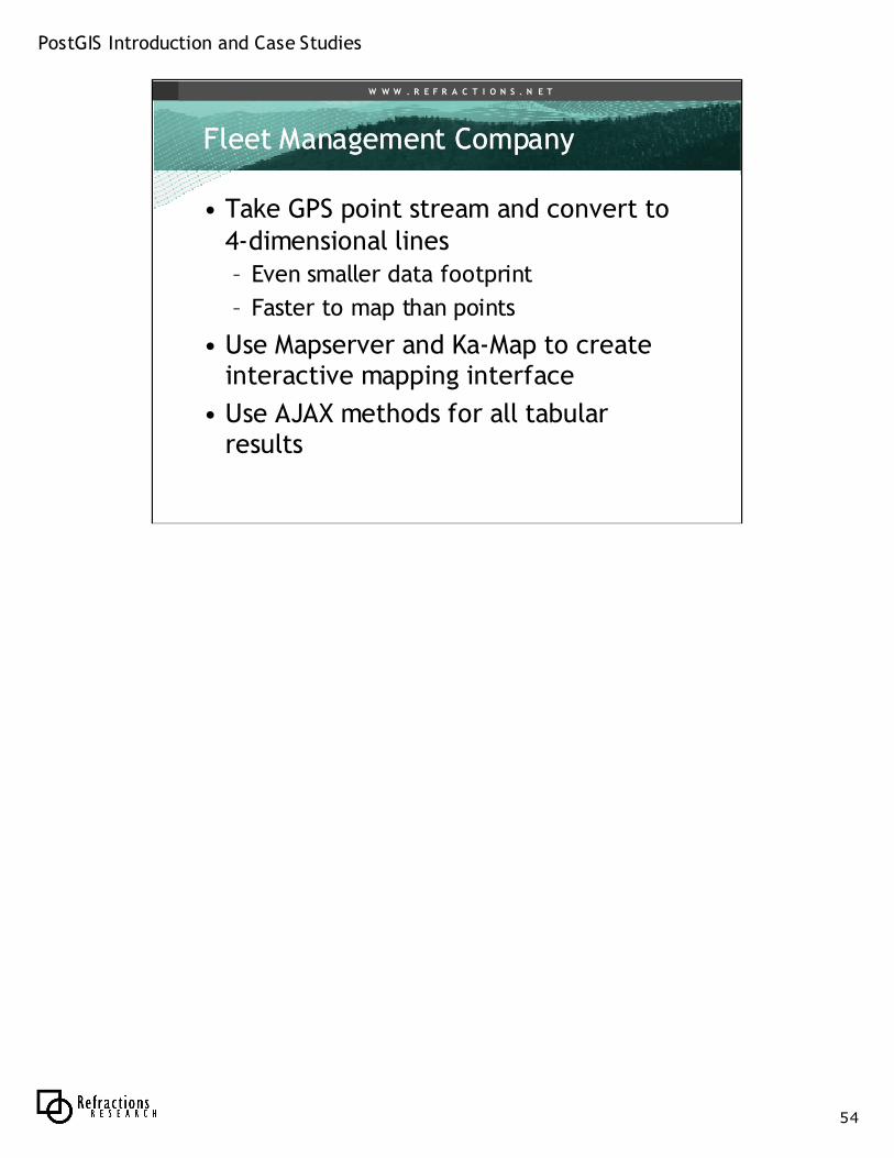
• Take GPS point stream and convert to 4-dimensional lines– Even smaller data footprint
– Faster to map than points
• Use Mapserver and Ka-Map to create interactive mapping interface
• Use AJAX methods for all tabular results
PostGIS Introduction and Case Studies
55
W W W . R E F R A C T I O N S . N E T
Fleet Management CompanyFleet Management Company
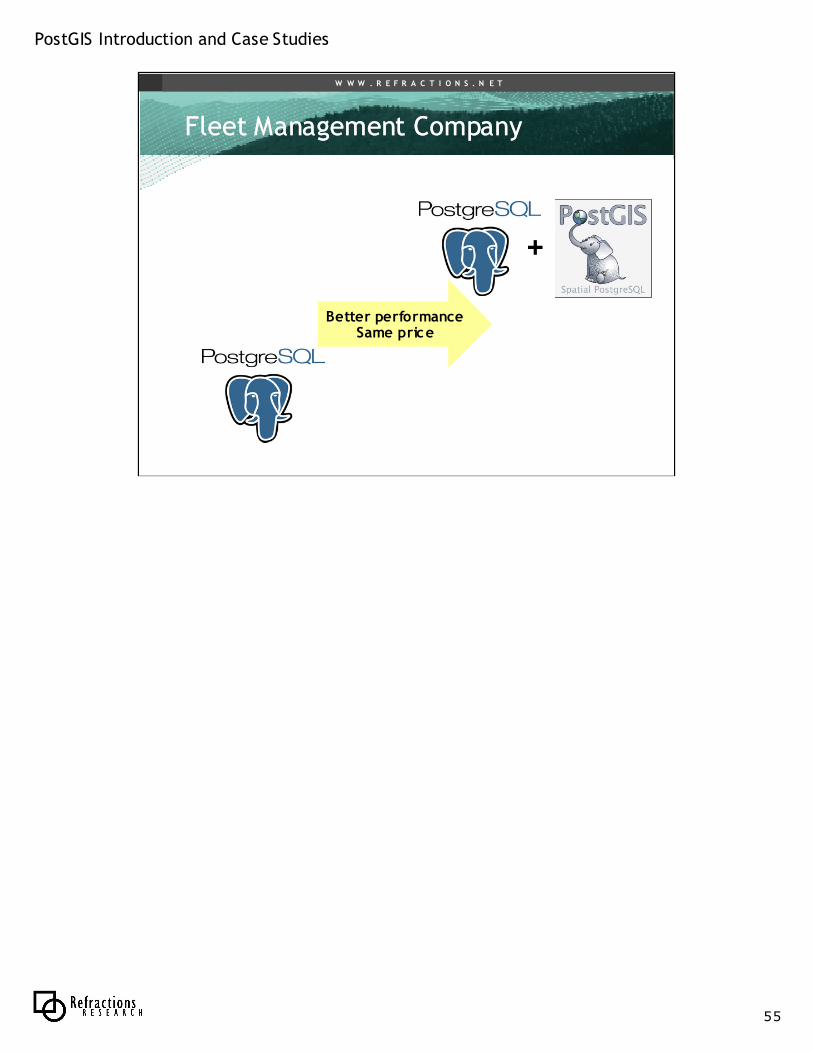
Better performanceSame price
+
PostGIS Introduction and Case Studies
56
W W W . R E F R A C T I O N S . N E T
ConclusionConclusion
• PostGIS is an essential part of a wide range of spatial systems use cases
– High performance, simple query
– Complex integration, legacy systems
– High performance, complex query
• For many applications, moving to open source will be a move that increases business value– Either by lowering costs
– Or by increasing functionality
We are seeing PostGIS put into deployment in all sorts of environments, academic, business, government. Folks doing so are reaping the benefit of database management systems: uniform access via SQL, data integrity guarantees, large data set handling. They are also reaping the benefit of open source: a responsive community, transparent source code, no software cost for scaling their systems out to more machines. Moving to PostgreSQL/PostGIS is saving folks money and time.
PostGIS Introduction and Case Studies
57
W W W . R E F R A C T I O N S . N E T
Questions?Questions?
PostGISA spatial database for the rest of us