Embed Size (px)
Citation preview

U.S. DEPARTMENT OF THE INTERIOR
U.S. GEOLOGICAL SURVEY
Preliminary Geologic Map of the Lunenburg and Fort Mitchell7.5' Quadrangles, Virginia
by
William C. Burtoni
Open-File Report 95-4
This report is preliminary and has not been reviewed for conformity with U.S. Geological Survey editorial standards (or with the North American Stratigraphic Code). Any use of trade, product or firm names is for descriptive purposes only and does not imply endorsement by the U.S. Government.
U.S. Geological Survey, Reston, VA 22092
TABLE OF CONTENTS
Introduction................................................................................. 1
Lithology....................................................................................... 1
Structure and Metamorphism............................................... 3
References Cited....................................................................... 4
Description of Map Units........................................................ 7
Explanation of Map Symbols.................................................11
LIST OF FIGURES
Figure 1. Index map................................................................. 6
Figure 2. Map showing pre-cleavage structures........ 6
INTRODUCTION
The Lunenburg and Fort Mitchell 7.5' quadrangles have been mapped as part of the Geology of the South-Central Virginia Piedmont Project, a regional geologic mapping project of the U.S. Geological Survey. The two quadrangles include parts of Lunenburg, Mecklenburg, and Charlotte counties, and are located in the east-central part of the South Boston 30'x60' quadrangle (Figure 1). A preliminary geologic map of this quadrangle has been published (Norton and others, 1993), and a reconnaissance map by Laney (1917) includes the western Fort Mitchell quadrangle. Aeromagnetic and aeroradioactivity maps that include the field area have been published by the U.S. Geological Survey (1978a, 1978b). The Lunenburg and Fort Mitchell quadrangles are adjacent to the north and northwest, respectively, to the previously mapped Wightman 7.5' quadrangle (Burton, 1993; Figure 1).
With respect to geologic provinces, the Lunenburg and Fort Mitchell quadrangles are located within the Carolina slate belt of the Carolina Terrane (Figure 1) and have not been previously mapped in detail. The Carolina slate belt in this area consists of volcanic and sedimentary rocks and associated intrusive igneous rocks that possess a regional slatey cleavage and have been subjected to lower greenschist- facies metamorphism. An earlier, pre-cleavage deformation and low-grade metamorphism may have occurred in the Late Proterozoic (Glover and Sinha, 1973). The rocks are locally poorly dated but probably are Late Proterozoic and Early Cambrian in age (Butler and Secor, 1991, and references therein). The Carolina slate belt may represent a subduction-related volcanic arc (Butler and Secor, 1991), or rifted- arc complex (Feiss and others, 1993). Geochemical analysis and radioisotopic dating (U-Pb and 40Ar/39Ar) of slate belt rocks in the South Boston 30 x 60' quadrangle by the U.S.G.S. are in progress.
LITHOLOGY
The rocks of the Lunenburg and Fort Mitchell quadrangles consist of both stratified and intrusive rocks that have been subjected to mild deformation and lower greenschist-facies metamorphism. The stratified rocks are mostly phyllitic pyroclastic and epiclastic rocks and lesser volcanic flows of felsic to mafic composition, with felsic rocks predominant. Primary sedimentary and volcanic structures have been largely obliterated by a regional northeast-trending cleavage. The rock units within this sequence strike mostly northeast and dip steeply northwest or southeast. The most continuously mappable units in these two quadrangles are greenstone (Zm) and layered metavolcanic and metasedimentary rock (Zvl). The latter unit contains tuffaceous (?) metasiltstones with millimeter-scale laminae and weakly graded beds that reflect quiet-water conditions or a distal volcanic source. At one locality in the western Fort Mitchell quadrangle, conglomerate (Zc) was found interbedded with a
fine-grained metasiltstone mapped as part of the layered metasedimentary and metavolcanic rocks (Zvl).
Correlation of the stratified rocks mapped in this study with the slate belt stratigraphy of Laney (1917) and Harris and Glover (1988) is as yet uncertain, and consequently the Hyco, Aaron, and Virgilina Formations are not used as names here. However the preliminary map of Horton and others (1993) show a northeast-trending contact between Hyco Formation to the southeast and Aaron Formation to the northwest that corresponds closely to the contact mapped in this study between felsite (Zf) and mixed phyllite (Zph) and layered metavolcanic and metasedimentary rock (Zvl) in the western Fort Mitchell quadrangle, which was intruded by biotite granodiorite (gd). The felsite (Zf) is commonly fine-grained, massive, and quartz- and plagioclase-phyric and thus resembles the Hyco Formation of Harris and Glover (1988). The fine-grained metasiltstone (Zvl) and conglomerate (Zc) are lithologies found in the Aaron Formation of Harris and Glover (1988). The contact here that correlates with the Hyco-Aaron contact of Horton and others (1993) lies east of the Hyco-Aaron contact of Laney (1917). A small area of Virgilina Formation greenstone in the extreme northwest corner of the Fort Mitchell quadrangle shown by Horton and others (1993) could not be substantiated here.
Most of the pre-Alleghanian intrusive rocks form plutons of varying sizes and with a range of compositions which are, from mafic to felsic: hornblende diorite and gabbro (dg), hornblende-biotite quartz diorite ortonalite (ht), biotite tonalite (to), biotite granodiorite (gd) and biotite granite (bg), with biotite tonalite areally the most abundant. Cross-cutting relationships consistently demonstrate that the more felsic plutons intruded after the more mafic ones. On a regional aeromagnetic map (U.S. Geological Survey, 1978b) the more felsic plutons form lows, while an aeromagnetic high is associated with the diorite body near Lunenburg. Small dikes that cut plutonic rocks and are shown only by strike and dip symbol include felsic or aplite dikes (A) and mafic dikes (M). The genetic relationship of these dikes to the plutons is uncertain. Thin, continuous, NE- and NW-trending Jurassic diabase dikes (Jd) cut all other rocks. A long NW-trending dike mapped in the Lunenburg quadrangle is associated with a prominent aeromagnetic lineament that extends another 10 km northwest of the map area (U.S. Geological Survey, 1978b).
Another dike composition that has not previously been described in this region of the Carolina slate belt is two-mica granodiorite (bmg). These felsic dikes are rusty- weathering, fine-grained, and massive and resemble Jurassic diabase dikes in the field. The granodiorite is light gray on the fresh surface and has a fine-grained igneous texture with quartz and plagioclase and randomly-oriented, primary igneous muscovite and biotite. Potassium feldspar content ranges from 0-15% of the rock; normative geochemistry of one sample with no potassium feldspar indicates a granodiorite composition. The dikes are several hundred meters to several kilometers in length, one to several meters wide, and occur in NE-trending swarms. Significantly, they are undeformed and unmetamorphosed, and at one locality on the North Meherrin River in the Lunenburg quadrangle a sharp intrusive contact is exposed between an undeformed granodiorite dike and strongly cleaved phyllite. These dikes
therefore postdate the regional deformation in this part of the slate belt, and their age would provide a minimum for that deformation. The dikes may be similar to the late tonalite dikes of the Martinsville Igneous Complex in the Smith River allochthon described by Beard (1994).
The only surficial deposit recognized in the map area is Quaternary alluvium (Qal), which includes the floodplain deposits of the North and Middle Meherrin rivers and their tributaries. It is possible that some alluvial terrace deposits lie unrecognized within the areas mapped as alluvium, particularly in the larger drainages. Following major storms during the mapping period, freshly deposited sand was observed as much as 15 ft above river level along the North and Middle Meherrin rivers.
STRUCTURE AND METAMORPHISM
Most of the rocks of the Lunenburg and Fort Mitchell quadrangles are mildly deformed, contain a weak to locally strong penetrative cleavage, and have undergone lower-greenschist-facies metamorphism. The regional cleavage strikes northeast and has steep dips. It has penetrated the plutons to a lesser degree than the stratified rocks, so that the plutons commonly retain at least some of their primary igneous fabric. In most of the phyllitic units, outcrop-scale primary depositional structures have been obliterated by the cleavage; however, the contacts bounding these units are primarily northeast-striking and subparallel to regional cleavage. The stratified rocks are generally steeply tilted, with perhaps some, but not all, of this tilting occurring during development of the regional cleavage. Shear zones mapped in the Lunenburg and Fort Mitchell quadrangles weaken and die out to the south, and have not been recognized in the Wightman quadrangle (Burton, 1993; Figure 1) or the Chase City quadrangle south of the Fort Mitchell quadrangle (personal reconnaissance). They are subparallel to the regional cleavage and may be penecontemporaneous, differing only in that the degree of strain is higher. Rare movement striae found on the shear surfaces suggest dip-slip or oblique-slip motion. On one shear zone segment where movement sense could be determined (NW Lunenburg quadrangle) it was southeast-down, or normal. That shear zone joins another where movement sense was determined to be southeast-up (reverse). Later, local minor crenulations and kink folds that deform cleavage and shear fabric have axial planes at moderate to high angles to the regional cleavage trend; these may represent late transverse movement during regional deformation.
The regional metamorphism that accompanied deformation was of the lower greenschist facies. Typical secondary metamorphic minerals include white mica in felsic rocks, and biotite, chlorite, and epidote in mafic rocks, with the micaceous minerals growing parallel to cleavage. Hornblende has been altered to pale green or blue-green amphibole and pyroxene thoroughly uralitized. No metamorphic garnet has been found in the Lunenburg and Fort Mitchell quadrangles. Chloritoid was found in one outcrop of fine-grained felsite (Zf) in the Wightman quadrangle (Burton, 1993),
indicating low grade metamorphism. The metamorphic fabrics indicate only one episode of cleavage formation and metamorphism in this part of the slate belt, although there is evidence of an earlier, non-cleavage-forming deformation, as outlined below.
Structures that predate the regional cleavage and metamorphism include locally preserved sedimentary bedding in layered metasedimentary and metavolcanic rocks (Zvl) and a primary igneous flow foliation in diorite-gabbro (dg), hornblende- biotite quartz diorite (ht), and tonalite (to), formed by the alignment of hornblende and biotite. There are also several lines of evidence for an episode of deformation that predates the formation of the regional cleavage: 1) the stratified rocks in several places, such as the northeast Lunenburg quadrangle, west-central Fort Mitchell quadrangle, and northern Wightman quadrangle (Burton, 1993) have steep northerly or southerly dips that cannot be easily explained by the simple east-west compression implied by the regional cleavage; 2) topping directions in finely bedded rocks where stratigraphic tops have been determined trend both north or northwest and south or southeast, suggesting the existence of large upright east-northeast-trending folds whose axial planes are not parallel to the regional cleavage and which do not themselves have an associated cleavage (Figure 2). These folds would likely have formed prior to intrusion of the voluminous plutons, due to the buttressing effect the plutons would have had on deformation; 3) at two places in the Lunenburg quadrangle in finely bedded metasedimentary rocks (Zvl) minor folds have been found with axial planes at high angles to the regional cleavage (Figure 2). These folds trend east- northeast or west-northwest, lack an associated cleavage, and may be parasitic to the inferred large-scale east-northeast-trending folds. A large-scale folding event that predates the development of regional cleavage in the slate belt is characteristic of the Late Proterozoic Virgilina deformation proposed for the slate belt by Glover and Sinha (1973); perhaps these features are supporting evidence for that deformation.
REFERENCES CITED
Beard, J.S., 1994, Tonalite (adakite?) dikes in the Martinsville Igneous Complex, south-central Virginia: Geological Society of America Abstracts with Programs, vol.26, no. 4, p. 3.
Burton, W.C., 1993, Preliminary bedrock geologic map of the Wightman 7.5' quadrangle, Virginia: U.S. Geological Survey Open-File Report 93-614. 1:24,000-scale map with text.
Butler, J.R., and Secor, D.T., Jr., 1991, The central Piedmont, in Norton, J.W., Jr. and Zullo, V.A., eds., The Geology of the Carolinas: Carolina Geological Society Fiftieth Anniversary Volume, The University of Tennessee Press, Knoxville, p. 59-78.
Feiss, P.G., Vance, R.K., and Wesolowski, D.J., 1993, Volcanic rock-hosted gold and base-metal mineralization associated with Neoproterozoic-Early Paleozoic back-arc extension in the Carolina terrane, southern Appalachian Piedmont: Geology, v. 21, no. 5, p. 439-442.
Glover, L, III, and Sinha, A. K., 1973, The Virgilina deformation, a late Precambrian to early Cambrian (?) orogenic event in the central Piedmont of Virginia and North Carolina: American Journal of Science, Vol. 273-A, p. 234-251.
Harris, C.W., and Glover, L., Ill, 1988, The regional extent of the ca. 600 Ma Virgilina deformation: Implications for stratigraphic correlation in the Carolina terrane: Geological Society of America Bulletin, v. 100, p. 200-217.
Norton, J.W., Jr., Peper, J.D., Marr, J.D., Jr., Burton, W.C., and Sacks, P.E., 1993, Preliminary geologic map of the South Boston 30x60 minute quadrangle, Virginia and North Carolina: U.S. Geological Survey Open-File Report 93-244, 20 p., scale 1:100,000.
Norton, J.W., Jr., Drake, A.A., Jr., Rankin, D.W., and Dallmeyer, R.D., 1991,Preliminary tectonostratigraphic terrane map of the central and southern Appalachians: U.S. Geological Survey Miscellaneous Investigations Series Map 1-2163, scale 1:2,000,000.
Laney, F.B., 1917, The geology and ore deposits of the Virgilina district of Virginia and North Carolina: Virginia Geological Survey Bulletin 14, 176 p.
U.S. Geological Survey, 1978a, Aeroradioactivity map of parts of Prince Edward, Lunenburg, and Mecklenburg counties, Virginia: U.S. Geological Survey Open File Report 78-598, scale 1:250,000.
U.S. Geological Survey, 1978b, Aeromagnetic map of parts of Prince Edward, Lunenburg, and Mecklenburg counties, Virginia: U.S. Geological Survey Open File Report 78-599, scale 1:250,000.
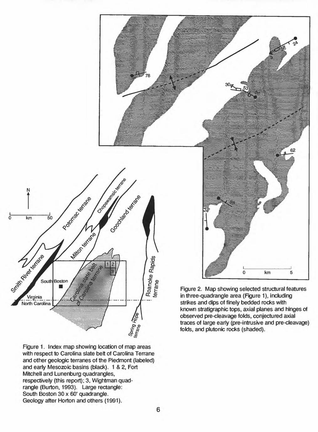
Figure 2. Map showing selected structural features in three-quadrangle area (Figure 1), including strikes and dips of finely bedded rocks with known stratigraphic tops, axial planes and hinges of observed pre-cleavage folds, conjectured axial traces of large early (pre-intrusive and pre-cleavage) folds, and plutonic rocks (shaded).
Figure 1. Index map showing location of map areas with respect to Carolina slate belt of Carolina Terrane and other geologic terranes of the Piedmont (labeled) and early Mesozoic basins (black). 1 & 2, Fort Mitchell and Lunenburg quadrangles, respectively (this report); 3, Wightman quad rangle (Burton, 1993). Large rectangle: South Boston 30 x 60' quadrangle. Geology after Horton and others (1991).
Qa|
Jd
b9
g d
DESCRIPTION OF MAP UNITS
Holocene surficial deposits
Alluvium (Quaternary)
Early Mesozoic intrusive rock
Diabase (Early Jurassic)--Dark gray, medium- to fine-grained diabase in narrow, northeast- to northwest-trending dikes; consists of subequal amounts of plagioclase and clinopyroxene (augite), plus minor olivine phenocrysts
Late Paleozoic(?) intrusive rock
Two-mica granodiorite Gray-weathering, massive, fine-grained potassium feldspar-biotite- muscovite quartz-plagioclase granodiorite. Potassium feldspar content 0-15%. Occurs as narrow (1-5 m wide) northeast-trending unmetamorphosed dikes that cut cleaved and metamorphosed host rock; therefore post-tectonic
Intrusive rocks of probable Late Proterozoic or Early Paleozoic age
Biotite granite-Gray to pink-weathering, massive, medium-fine to medium grained biotite-quartz- plagioclase microcline granite. Microcline content 25-35%, locally as megacrysts
Biotite granodiorite-Gray- to white-weathering, massive, medium to fine-grained, white to pinkish- white biotite granodiorite containing subequal amounts of quartz and plagioclase, nonperthitic microcline (5-20%), and minor (<10%) biotite, sericite, epidote, and chlorite
Biotite tonalite-Gray to orange-gray-weathering, massive, medium to fine-grained white biotite tonalite containing subequal amounts of plagioclase (An2s) and quartz, 10-15% biotite, and minor potassium feldspar, sericite, chlorite, epidote, sphene, and oxide
Hornblende-biotite quartz diorite or tonalite-Gray- weathering, massive, medium-grained biotite-
hornblende-plagioclase (An3 5 )-quartz diorite or ht tonalite. Hornblende and biotite commonly partially altered to chlorite. Distinguished from
tonalite (to) by presence of hornblende, and from diorite (dg) by abundant quartz (up to 30%). May be "core" facies of biotite tonalite (to).
Hornblende diorite and gabbro-Mottled dark green, massive to locally foliated, medium to coarse grained hornblende diorite, hornblende quartz diorite, and minor hornblende-pyroxene gabbro. In
9 diorite, original mineralogy consisted of about 40%mafic minerals, including hornblende and lesser biotite and 60% plagioclase (An45 ) and minor quartz; now partially altered to blue-green amphibole, chlorite, epidote, and sericite. Quartz content typically 5-10% and biotite content 0-10%. In gabbro, pyroxene originally constituted about 50% of rock, now completely altered to amphibole
8
Metasedimentary and metavolcanic rocks of probable Late Proterozoic age (minerals listed in increasing order)
Layered metavolcanic and metasedimentary rocks- Fine grained, buff to dark gray-weathering, finely bedded to well-layered metasiltstone and metatuff. Primary structures include faint, fine
"~^~^ bedding laminae and cross-beds in metasiltstoneand conspicuous, light and dark, millimeter- to centimeter-scale compositional layering in metatuff. Minerals include, in varying abundances, quartz, albite, sericite, biotite, chlorite, and epidote; compositional layering caused by changing abundances of quartzofeldspathic versus ferromagnesian minerals
Phyllitic volcaniclastic rock and mudflow breccia- Bluish-gray-weathering, fine-grained, quartz-
I albite-sericite-chlorite-epidote phyllite with zpv relict plagioclase phenocrysts and flattened ___ pumice clasts 1 to 5 mm in length, and minor, gray-
weathering, unfoliated mudflow breccia consisting of poorly-sorted, matrix-supported angular to subrounded clasts as much as 5 cm in length of felsic to intermediate chlorite-biotite-sericite- epidote-albite metavolcanic rock
Fine-grained felsite White, fine-grained, well- ___ cleaved epidote-albite-quartz-sericite phyllite,
with 0-30% potassium feldspar, interpreted asrhyolitic or dacitic metatuff. Locally contains
medium-fine-grained (1-2 mm) relict phenocrystsof plagioclase and quartz
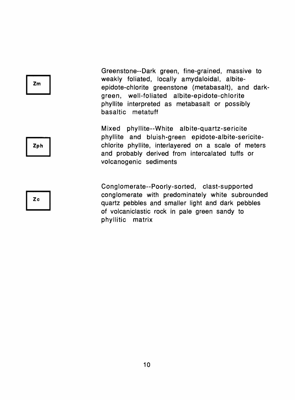
___ Greenstone-Dark green, fine-grained, massive to """" weakly foliated, locally amydaloidal, albite-
epidote-chlorite greenstone (metabasalt), and dark- green, well-foliated albite-epidote-chlorite
phyllite interpreted as metabasalt or possibly basaltic metatuff
Mixed phyllite White albite-quartz-sericite phyllite and bluish-green epidote-albite-sericite- Zph chlorite phyllite, interlayered on a scale of meters __^ and probably derived from intercalated tuffs or
volcanogenic sediments
___ Conglomerate Poorly-sorted, clast-supportedconglomerate with predominately white subrounded quartz pebbles and smaller light and dark pebbles
of volcaniclastic rock in pale green sandy tophyllitic matrix
10
EXPLANATION OF MAP SYMBOLS
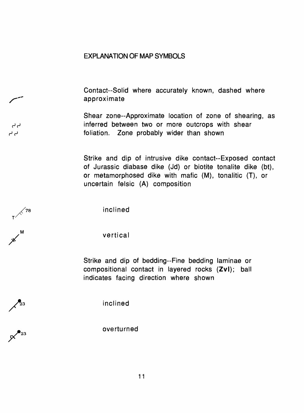
Contact-Solid where accurately known, dashed where approximate
Shear zone-Approximate location of zone of shearing, as inferred between two or more outcrops with shear foliation. Zone probably wider than shown
Strike and dip of intrusive dike contact-Exposed contact of Jurassic diabase dike (Jd) or biotite tonalite dike (bt), or metamorphosed dike with mafic (M), tonalitic (T), or uncertain felsic (A) composition
inclinedT/
M vertical
Strike and dip of bedding-Fine bedding laminae or compositional contact in layered rocks (Zvl); ball indicates facing direction where shown
inclined
overturned23
11
X
X
X
X
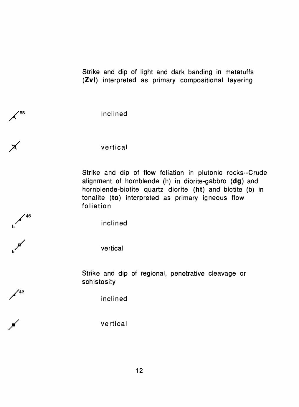
Strike and dip of light and dark banding in metatuffs (Zvl) interpreted as primary compositional layering
55 inclined
vertical
Strike and dip of flow foliation in plutonic rocks-Crude alignment of hornblende (h) in diorite-gabbro (dg) and hornblende-biotite quartz diorite (ht) and biotite (b) in tonalite (to) interpreted as primary igneous flow foliation
inclined
vertical
Strike and dip of regional, penetrative cleavage or schistosity
42
inclined
vertical
12
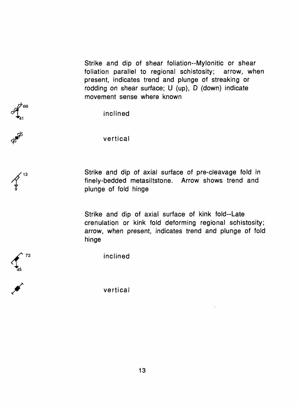
Strike and dip of shear foliation-Mylonitic or shear foliation parallel to regional schistosity; arrow, when present, indicates trend and plunge of streaking or rodding on shear surface; U (up), D (down) indicate movement sense where known
inclined
vertical
Strike and dip of axial surface of pre-cleavage fold in finely-bedded metasiltstone. Arrow shows trend and plunge of fold hinge
Strike and dip of axial surface of kink fold-Late crenulation or kink fold deforming regional schistosity; arrow, when present, indicates trend and plunge of fold hinge
inclined
vertical
13
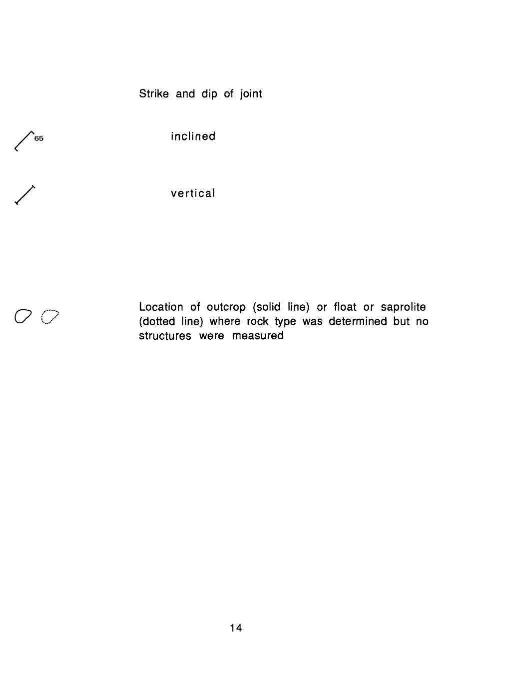
Strike and dip of joint
S65 inclined
vertical
Location of outcrop (solid line) or float or saprolite (dotted line) where rock type was determined but no structures were measured
14