Embed Size (px)
Citation preview
57 X-RAY MAG : 31 : 2009 EDITORIAL FEATURES TRAVEL NEWS EQUIPMENT BOOKS SCIENCE & ECOLOGY EDUCATION PROFILES PORTFOLIO CLASSIFIED
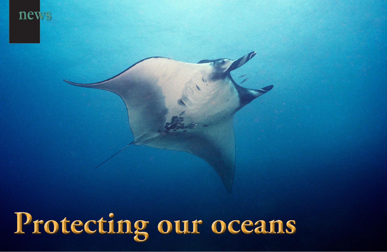
Protecting our oceans
news
58 X-RAY MAG : 31: 2009 EDITORIAL FEATURES TRAVEL NEWS EQUIPMENT BOOKS SCIENCE & ECOLOGY EDUCATION PROFILES PORTFOLIO CLASSIFIED
“Ocean: A body of water occupying two-thirds of a world made for man - who has no gills”. —Ambrose Bierce
Whilst the largest marine park, The Phoenix Islands Protected Area is backed by institutions such as New England Aquarium and Conservation International, to protect some of the last pris-tine coral reefs on the planet, the tiny Brazilian state marine park Laje de Santos, relies mostly on volunteer work done by a small group of divers who run the NGO Instituto Viva Laje. Because of its close vicinity to Santos, one of the busiest ports in South America, this NGO is doing a vital job to edu-cate the world on how to care of this little piece of ocean. Norway and Sweden are no strangers to creating protected areas, but this is the first time they venture out into the ocean. The new transna-tional marine parks are placed on popular tourist areas and near busy shipping lanes, with a rich fauna making them as important to protect as pristine coral reefs in the Pacific. Africa has mostly been known for its safari parks, as a way of protecting the environ-ment. Now the continent may see the benefits of extending their conservation efforts beyond their beaches, in order to save both the marine fauna and the people depending on it. Namibia has launched its first marine park and entered the group of nations who take pride in protecting their marine heritage.
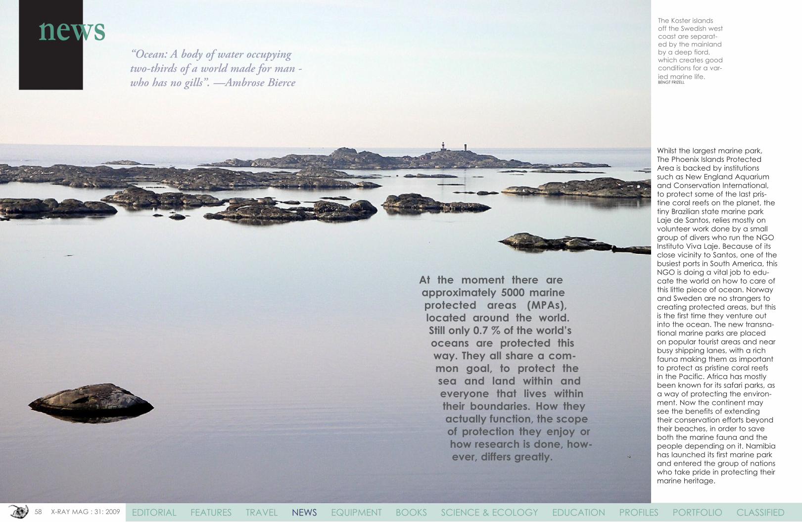
The Koster islands off the Swedish west coast are separat-ed by the mainland by a deep fiord, which creates good conditions for a var-ied marine life.BENGT FRIzELL
At the moment there are approximately 5000 marine protected areas (MPAs), located around the world. Still only 0.7 % of the world’s oceans are protected this way. They all share a com-mon goal, to protect the sea and land within and everyone that lives within their boundaries. How they actually function, the scope of protection they enjoy or how research is done, how-ever, differs greatly.
news
59 X-RAY MAG : 31 : 2009 EDITORIAL FEATURES TRAVEL NEWS EQUIPMENT BOOKS SCIENCE & ECOLOGY EDUCATION PROFILES PORTFOLIO CLASSIFIED
news
DAVID OBURA
The Goliath Amongst the
MPA’sText by Arnold Weisz
The small Pacific Island nation of Kiribati has become a global conservation leader by establish-ing the world’s largest marine pro-tected area – an area the size of the US state of California – within its boundaries.
The Phoenix Islands Protected Area (PIPA) conserves one of the Earth’s last intact oceanic coral archipelago ecosystems, consist-ing of eight coral atolls and two submerged reef systems in a near-ly uninhabited region of abundant marine and bird life. The major concern for this vast ocean wil-derness of pristine coral reefs and rich fish populations is the threat of over-fishing and climate change.
Historic proportionsLocated near the equator in the Central Pacific between Hawaii and Fiji, the nearly uninhabited Phoenix Islands form an archipel-ago several hundred miles long. They are part of the Republic of Kiribati, which comprises three dis-
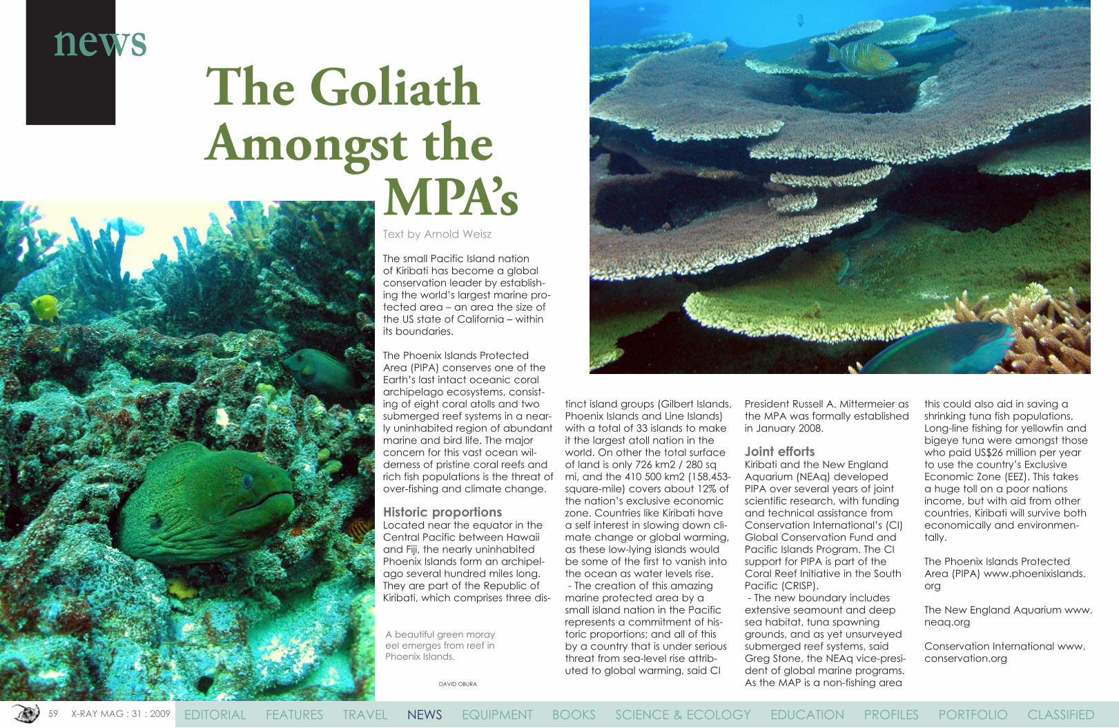
A beautiful green moray eel emerges from reef in Phoenix Islands.
tinct island groups (Gilbert Islands, Phoenix Islands and Line Islands) with a total of 33 islands to make it the largest atoll nation in the world. On other the total surface of land is only 726 km2 / 280 sq mi, and the 410 500 km2 (158,453-square-mile) covers about 12% of the nation’s exclusive economic zone. Countries like Kiribati have a self interest in slowing down cli-mate change or global warming, as these low-lying islands would be some of the first to vanish into the ocean as water levels rise. - The creation of this amazing marine protected area by a small island nation in the Pacific represents a commitment of his-toric proportions; and all of this by a country that is under serious threat from sea-level rise attrib-uted to global warming, said CI
President Russell A. Mittermeier as the MPA was formally established in January 2008.
Joint effortsKiribati and the New England Aquarium (NEAq) developed PIPA over several years of joint scientific research, with funding and technical assistance from Conservation International’s (CI) Global Conservation Fund and Pacific Islands Program. The CI support for PIPA is part of the Coral Reef Initiative in the South Pacific (CRISP). - The new boundary includes extensive seamount and deep sea habitat, tuna spawning grounds, and as yet unsurveyed submerged reef systems, said Greg Stone, the NEAq vice-presi-dent of global marine programs. As the MAP is a non-fishing area
this could also aid in saving a shrinking tuna fish populations. Long-line fishing for yellowfin and bigeye tuna were amongst those who paid US$26 million per year to use the country’s Exclusive Economic zone (EEz). This takes a huge toll on a poor nations income, but with aid from other countries, Kiribati will survive both economically and environmen-tally.
The Phoenix Islands Protected Area (PIPA) www.phoenixislands.org
The New England Aquarium www.neaq.org
Conservation International www.conservation.org
60 X-RAY MAG : 31: 2009 EDITORIAL FEATURES TRAVEL NEWS EQUIPMENT BOOKS SCIENCE & ECOLOGY EDUCATION PROFILES PORTFOLIO CLASSIFIED
Although both these Scandinavian countries have numerous national parks, this is the first time the set aside large areas off their coasts for protec-tion. Both Sweden and Norway have long coastlines but until now most of the environmental efforts have been focused on the inland nature. The new marine parks are set up in populated areas which also are major tourist destinations, but also lie close to very busy shipping lanes. The area
is situated at the north-eastern edge of the Norwegian trench, which connects the Skagerrak with the Atlantic. The major part of the marine area is around 200 meters deep and features a high range of marine biotopes such as soft and hard substrates, kelp beds and shell gravel. The species diversity is considered very high, with more than 6 000 species dis-covered as yet. The Ytre Hvaler and Kostefiorden area is threat-ened by large scale impacts such
as eutrophication. Small scale threats for the areas include ship-ping, infrastructural development and fishing.
Ytre Hvaler National ParkThe Norwegian marine park cov-ers an area of about 354 km2 on the west side of the Hvaler archipelago close to the Swedish border, at the entrance of the Oslofiord. The marine park includes mostly ocean but also strips of cost on the islands. Hvaler
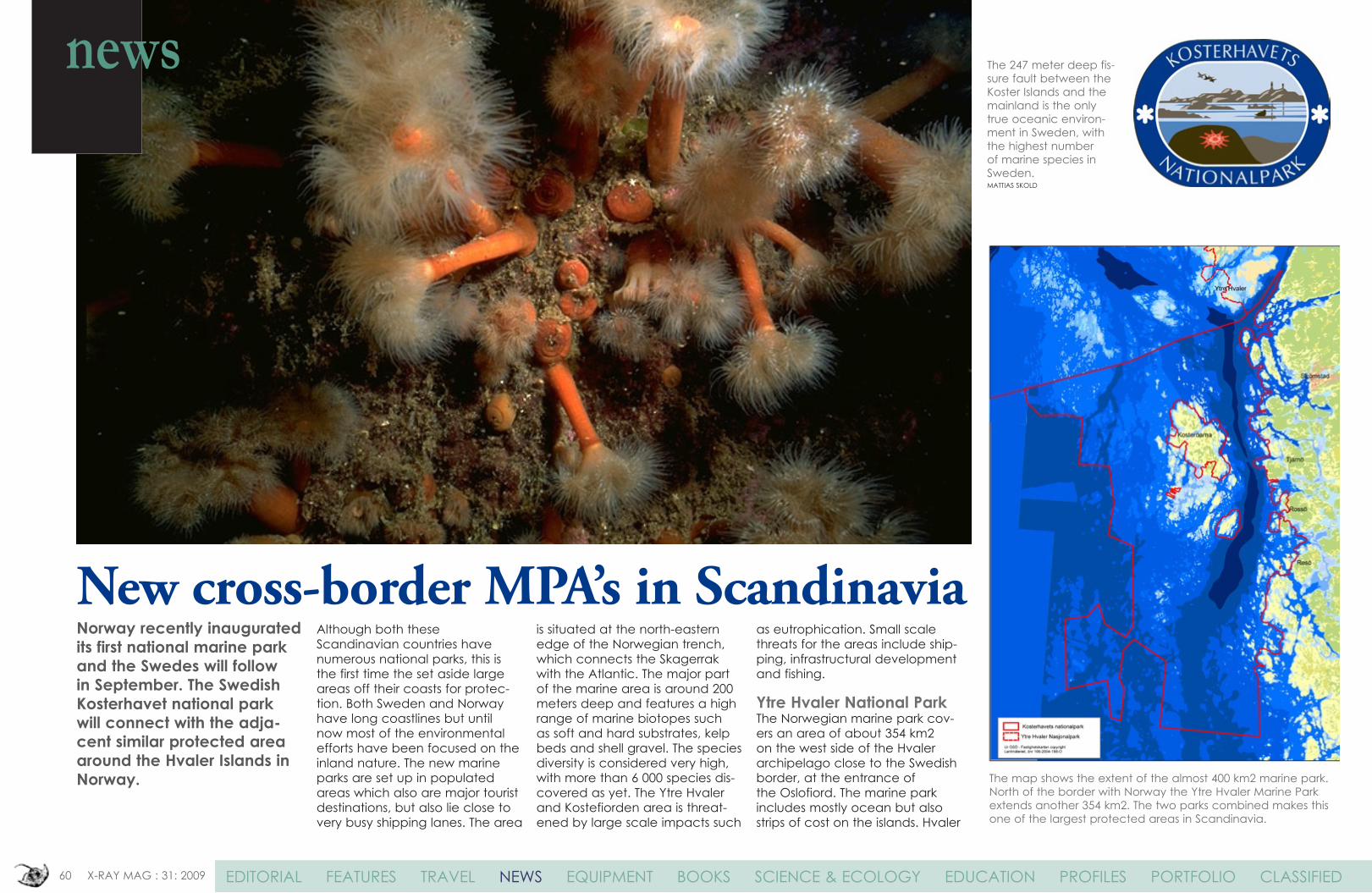
The 247 meter deep fis-sure fault between the Koster Islands and the mainland is the only true oceanic environ-ment in Sweden, with the highest number of marine species in Sweden.MATTIAS SKOLD
The map shows the extent of the almost 400 km2 marine park. North of the border with Norway the Ytre Hvaler Marine Park extends another 354 km2. The two parks combined makes this one of the largest protected areas in Scandinavia.
New cross-border MPA’s in Scandinavia
news
Norway recently inaugurated its first national marine park and the Swedes will follow in September. The Swedish Kosterhavet national park will connect with the adja-cent similar protected area around the Hvaler Islands in Norway.
61 X-RAY MAG : 31: 2009 EDITORIAL FEATURES TRAVEL NEWS EQUIPMENT BOOKS SCIENCE & ECOLOGY EDUCATION PROFILES PORTFOLIO CLASSIFIED
is the sunniest geographical area in Norway and combined with Østfold’s long coastline it results that the population consists of mostly summertime vacationers. About 4 700 summer-houses, an increasing fleet of leisure boats and daily visitors contributes to give Hvaler status as one of the biggest and most popular tourist destinations in the country.
Kosterhavet National ParkThe Koster islands, about 10 km to the west of Strömstad are noted for their beautiful scenery and the center for the new 400km2 MPA. The islands of North and South Koster are Sweden’s most populated westerly islands. About 1 000 people live in or immediately adjacent to the national park. Tourism is a major source of income for the 24 000 people living in the area. They are surrounded by the Koster Archipelago
- a large number of skerries and rocky isles. Kosterhavet (the Koster Sea) is in northern Bohuslän, on the west coast of Sweden bor-dering Norway. It is a valuable recreational resource and one of Sweden’s most popular tourist destinations. Kosterhavet is also home to an important inshore fishery. The marine environment in Kosterhavet is influenced by the Atlantic Ocean and includes habitats and species unique to the area. This has made the archipelago the a very popular destination not only for Swedish divers, but also for divers from Denmark, Norway and Germany. Of the 6000 marine species that have been identified in Kosterhavet, about 200 are found nowhere else in Sweden.
Kosterhavet Marine National Park
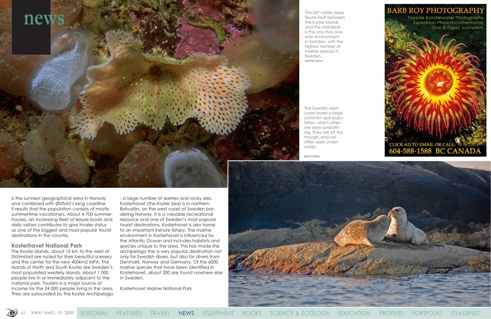
The Swedish west-coast boast a large common seal popu-lation, which often are seen sunbath-ing. They are bit shy though, and not often seen under water.
BENGT FRIzELL
The 247 meter deep fissure fault between the Koster Islands and the mainland is the only true oce-anic environment in Sweden, with the highest number of marine species in Sweden.MATTIAS SKOLD
news
62 X-RAY MAG : 31: 2009 EDITORIAL FEATURES TRAVEL NEWS EQUIPMENT BOOKS SCIENCE & ECOLOGY EDUCATION PROFILES PORTFOLIO CLASSIFIED
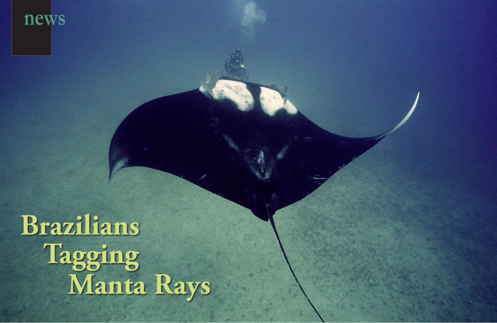
Brazilians Tagging
Manta Rays
news
63 X-RAY MAG : 31: 2009 EDITORIAL FEATURES TRAVEL NEWS EQUIPMENT BOOKS SCIENCE & ECOLOGY EDUCATION PROFILES PORTFOLIO CLASSIFIED
Text by Arnold Weisz
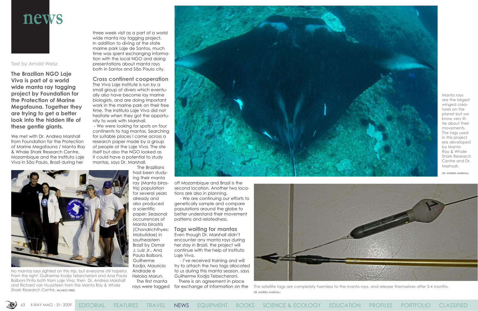
The Brazilian NGO Laje Viva is part of a world wide manta ray tagging project by Foundation for the Protection of Marine Megafauna. Together they are trying to get a better look into the hidden life of these gentle giants.We met with Dr. Andrea Marshall from Foundation for the Protection of Marine Megafauna / Manta Ray & Whale Shark Research Centre, Mozambique and the Instituto Laje Viva in São Paulo, Brazil during her
three week visit as a part of a world wide manta ray tagging project. In addition to diving at the state marine park Laje de Santos, much time was spent exchanging informa-tion with the local NGO and doing presentations about manta rays both in Santos and São Paulo city.
Cross continent cooperationThe Viva Laje Institute is run by a small group of divers which eventu-ally also have become lay marine biologists, and are doing important work in the marine park on their free time. The Instituto Laje Viva did not hesitate when they got the opportu-nity to work with Marshall. - We were looking for spots on four continents to tag mantas. Searching for suitable places I came across a research paper made by a group of people at the Laje Viva. The site itself but also the NGO looked as it could have a potential to study mantas, says Dr. Marshall.
The Brazilians had been study-ing their manta ray (Manta biros-tris) population for several years already and also produced a scientific paper: Seasonal occurrences of Manta birostris (Chondrichthyes: Mobulidae) in southeastern Brazil by Osmar J. Luiz Jr., Ana Paula Balboni, Guilherme Kodja, Mauricio Andrade e Heloisa Marun. The first manta rays were tagged
off Mozambique and Brazil is the second location. Another two loca-tions are also in planning. - We are continuing our efforts to genetically sample and compare populations around the globe to better understand their movement patterns and relatedness.
Tags waiting for mantasEven though Dr. Marshall didn’t encounter any manta rays during her stay in Brazil, the project will continue with the help of Instituto Laje Viva. - I’ve received training and will try to attach the two tags allocated to us during this manta season, says Guilherme Kodja Tebecherani. There is an agreement in place for exchange of information on the
No mantas rays sighted on this trip, but everyone still hopeful. From the right; Guilherme Kodja Tebecherani and Ana Paula Balboni Pinto both from Laje Viva, then Dr. Andrea Marshall and Richard van Huyssteen from the Manta Ray & Whale Shark Research Centre. RICARDO FERES
The satellite tags are completely harmless to the manta rays, and release themselves after 3-4 months.DR. ANDREA MARSHALL
Manta rays are the largest winged crea-tures on the planet but we know very lit-tle about their movements. The tags used in this project ere developed by Manta Ray & Whale Shark Research Centre and Dr. Marhsall.DR. ANDREA MARSHALL
news
64 X-RAY MAG : 31: 2009 EDITORIAL FEATURES TRAVEL NEWS EQUIPMENT BOOKS SCIENCE & ECOLOGY EDUCATION PROFILES PORTFOLIO CLASSIFIED
manta rays between Mozambique and Brazil. The two tags are important in hope they can reveil some important informa-tion about the mantas that visit the small Brazilian marine park. Not only about the local population in general, but also if
these mantas are part of a wider popula-tion structure, and interacting with other manta populations. - This is the first step. If it works well we’ll do more. The tags are programmed to record information from 100 to 110 days. And as soon as they detach from the mantas and return to the surface they will upload info to us, says Dr. Marshall. Tagging is not the only way to study and track manta rays populations. Non-intrusive underwater photography is being used for the majority of the study. Each animal sighted on the local reefs
is identified by a ‘fingerprint’ of mark-ings on their ventral surface as well as by distinctive scars. Once an individual has been identified, their details are logged in a computer database and their re-sightings tracked over time. “We have taken a lot of photos over the years for our photo identification project,” says Guilherme.
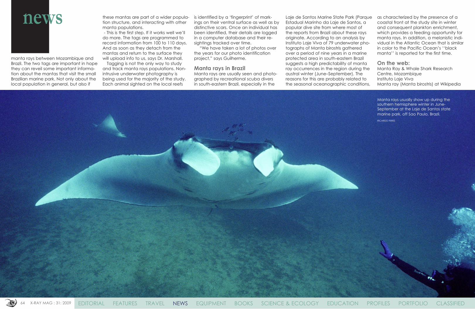
Manta rays in BrazilManta rays are usually seen and photo-graphed by recreational scuba divers in south-eastern Brazil, especially in the
Laje de Santos Marine State Park (Parque Estadual Marinho da Laje de Santos, a popular dive site from where most of the reports from Brazil about these rays originate. According to an analysis by Instituto Laje Viva of 79 underwater pho-tographs of Manta birostris gathered over a period of nine years in a marine protected area in south-eastern Brazil suggests a high predictability of manta ray occurrences in the region during the austral winter (June–September). The reasons for this are probably related to the seasonal oceanographic conditions,
as characterized by the presence of a coastal front at the study site in winter and consequent plankton enrichment, which provides a feeding opportunity formanta rays. In addition, a melanistic indi-vidual in the Atlantic Ocean that is similar in color to the Pacific Ocean’s ‘‘black manta’’ is reported for the first time.
On the web:Manta Ray & Whale Shark Research Centre, MozambiqueInstituto Laje VivaManta ray (Manta birostris) at Wikipedia
Manta rays usually show up during the southern hemisphere winter in June-September at the Laje de Santos state marine park, off Sao Paulo, Brazil.RICARDO FERES
news
65 X-RAY MAG : 31 : 2009 EDITORIAL FEATURES TRAVEL NEWS EQUIPMENT BOOKS SCIENCE & ECOLOGY EDUCATION PROFILES PORTFOLIO CLASSIFIED
Namibia’s first Marine Protected Area launched
Text by Arnold Weisz
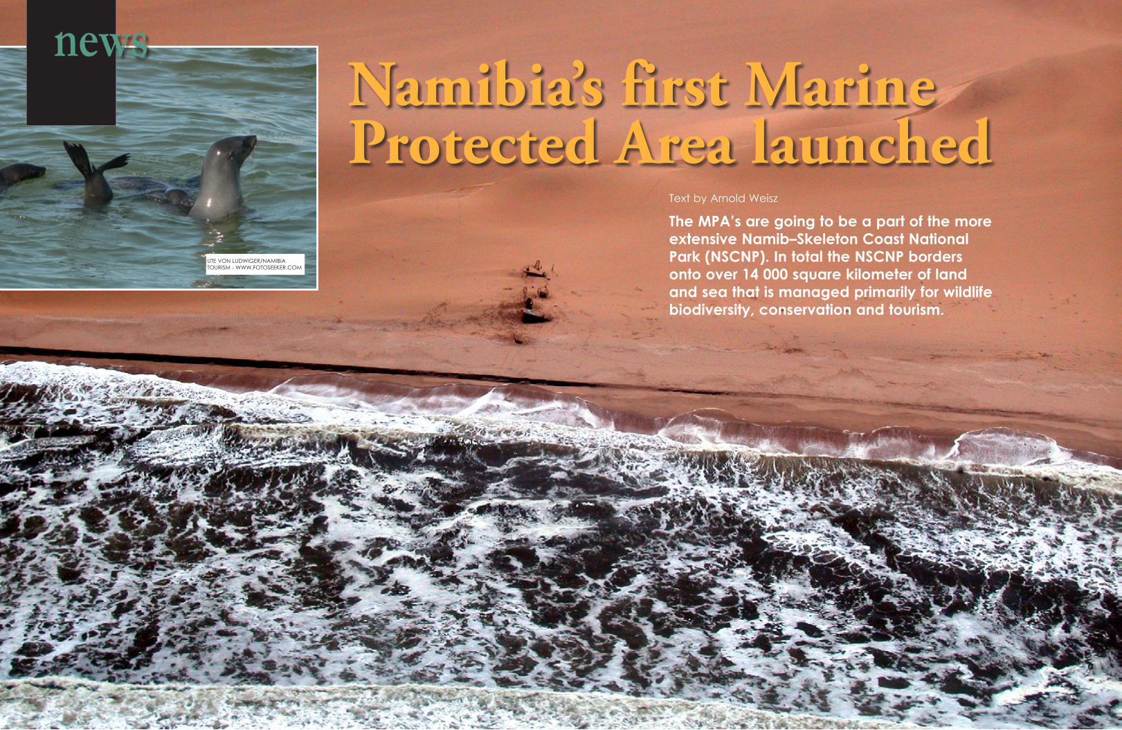
The MPA’s are going to be a part of the more extensive Namib–Skeleton Coast National Park (NSCNP). In total the NSCNP borders onto over 14 000 square kilometer of land and sea that is managed primarily for wildlife biodiversity, conservation and tourism.
UTE VON LUDWIGER/NAMIBIA TOURISM - WWW.FOTOSEEKER.COM
news
66 X-RAY MAG : 31: 2009 EDITORIAL FEATURES TRAVEL NEWS EQUIPMENT BOOKS SCIENCE & ECOLOGY EDUCATION PROFILES PORTFOLIO CLASSIFIED
The Namib–Skeleton Coast National Park (NSCNP) has an extension of about 1 570 km, from the Orange River in the south to the Kunene River in the north. The new Coastal and Marine Protected Area (MPA) off the Sperrgebiet and Namib-Naukluft areas, is run-ning for 400 km up the coast and is about 30 km wide. The MPA will cover an area of 12 000 km2, containing all of Namibia’s 10 islands. These are Hollamsbird, Mercury, Ichaboe, Seal, Penguin, Halifax, Possession, Pomona, Plumpudding and Sinclair. Also included in the MPA are Neglectus islets, Marshall, Boat Bay, Albatross, Staple, Dumfudgeon, and Ladies north and south rocks as well as Long Island north and south. This enigmatic and poignant coast – the Coast of Skeletons – contains many shipwrecks, the bones of early mariners as well as those of whales and seals.
Greatest conservation effortThe protection and regeneration of marine
resources are priority issues for coastal states, in particular Namibia, whose marine resources contribute considerably to the socio-economic welfare of the country. Moreover, the global fish stock collapses and possible negative eco-system effects from mining and fishing activities has resulted in steps taken to establish Marine Protected Areas in Namibia. Besides keeping ecosystems like fishstocks intact there is also the need to protect species which are not part of the commercial marine resources. Breeding in the waters of the Namibian Islands’ Marine Protected Area are the southern right whale and Heaviside’s dolphin (Benguela dolphin), with the humpback whale migrating. Also dusky dolphin, the mink whale and killer whale or orca can be seen here regularly. The proclama-tion of this protected area represents one of Namibia’s greatest conservation achievements since gaining Independence in 1990, and one of the most exciting developments in the history of conservation in this country.
The Namibian coastline is domi-nated by weather worn sandy beaches. Gale force winds and heavy surf are normal.
NAMIBIA TOURISM - WWW.FOTOSEEKER.COM
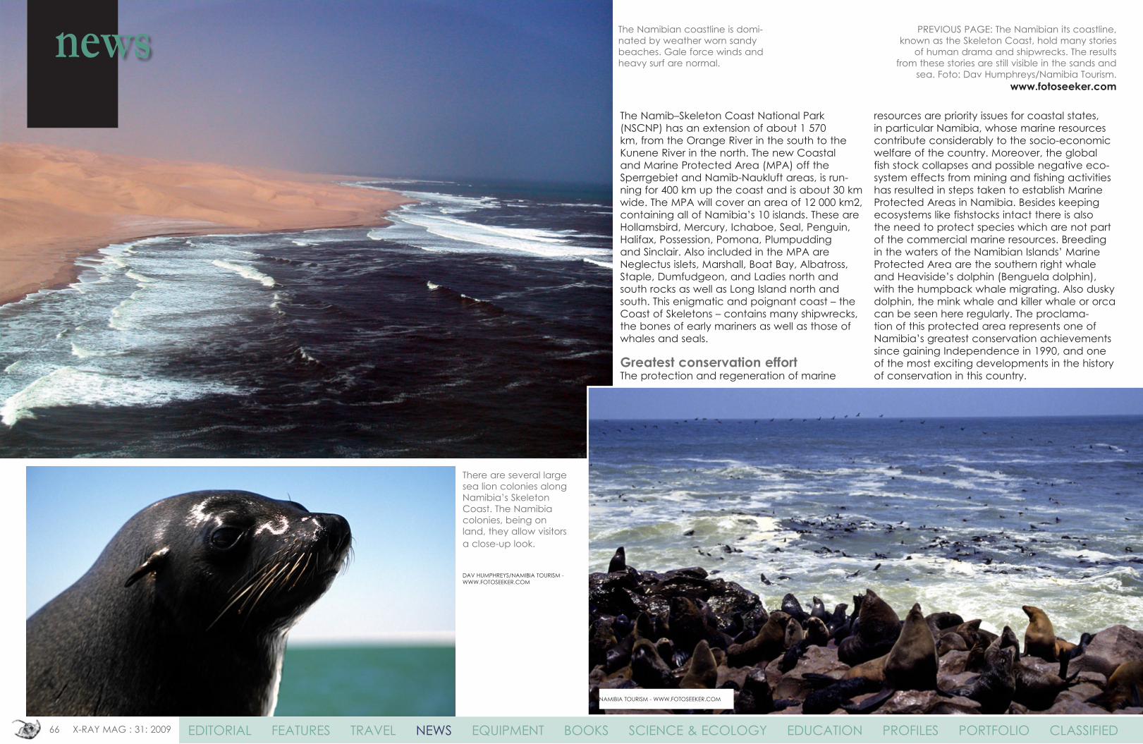
There are several large sea lion colonies along Namibia’s Skeleton Coast. The Namibia colonies, being on land, they allow visitors a close-up look.
DAV HUMPHREYS/NAMIBIA TOURISM - WWW.FOTOSEEKER.COM
PREVIOUS PAGE: The Namibian its coastline, known as the Skeleton Coast, hold many stories
of human drama and shipwrecks. The results from these stories are still visible in the sands and
sea. Foto: Dav Humphreys/Namibia Tourism. www.fotoseeker.com
news