Embed Size (px)
Citation preview
REFERENCE: Introduction to Remote Sensing. James B.
Campbell, 2007, Fourth Edition, The Guilford Press.
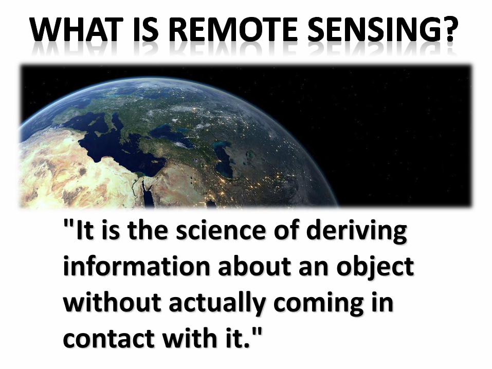
"It is the science of deriving information about an object without actually coming in contact with it."
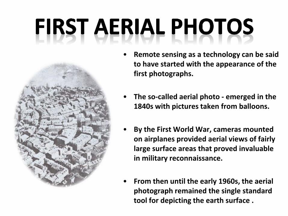
• Remote sensing as a technology can be said to have started with the appearance of the first photographs.
• The so-called aerial photo - emerged in the 1840s with pictures taken from balloons.
• By the First World War, cameras mounted on airplanes provided aerial views of fairly large surface areas that proved invaluable in military reconnaissance.
• From then until the early 1960s, the aerial photograph remained the single standard tool for depicting the earth surface .
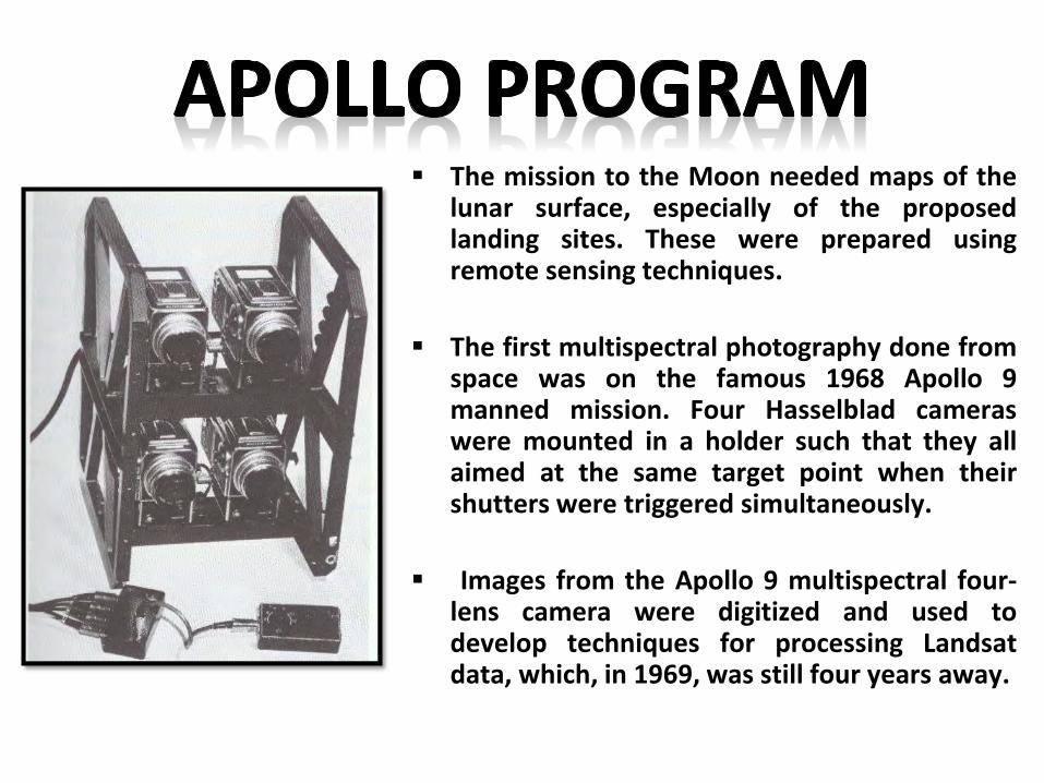
The mission to the Moon needed maps of thelunar surface, especially of the proposedlanding sites. These were prepared usingremote sensing techniques.
The first multispectral photography done fromspace was on the famous 1968 Apollo 9manned mission. Four Hasselblad cameraswere mounted in a holder such that they allaimed at the same target point when theirshutters were triggered simultaneously.
Images from the Apollo 9 multispectral four-lens camera were digitized and used todevelop techniques for processing Landsatdata, which, in 1969, was still four years away.
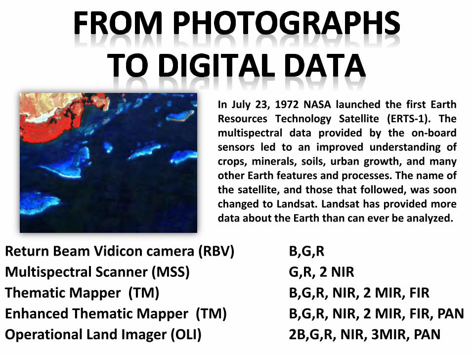
In July 23, 1972 NASA launched the first EarthResources Technology Satellite (ERTS-1). Themultispectral data provided by the on-boardsensors led to an improved understanding ofcrops, minerals, soils, urban growth, and manyother Earth features and processes. The name ofthe satellite, and those that followed, was soonchanged to Landsat. Landsat has provided moredata about the Earth than can ever be analyzed.
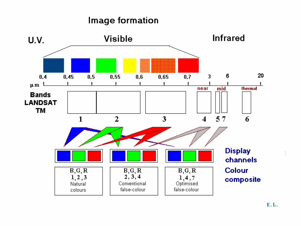
Return Beam Vidicon camera (RBV) B,G,R
Multispectral Scanner (MSS) G,R, 2 NIR
Thematic Mapper (TM) B,G,R, NIR, 2 MIR, FIR
Enhanced Thematic Mapper (TM) B,G,R, NIR, 2 MIR, FIR, PAN
Operational Land Imager (OLI) 2B,G,R, NIR, 3MIR, PAN
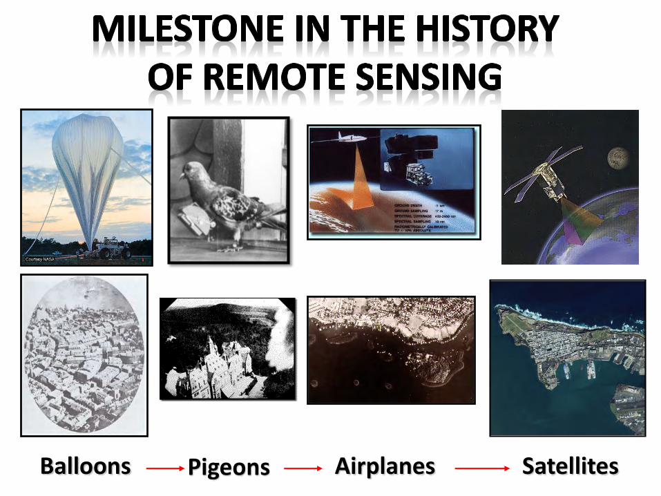
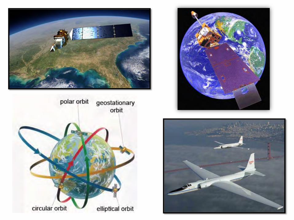
Balloons Pigeons Airplanes Satellites
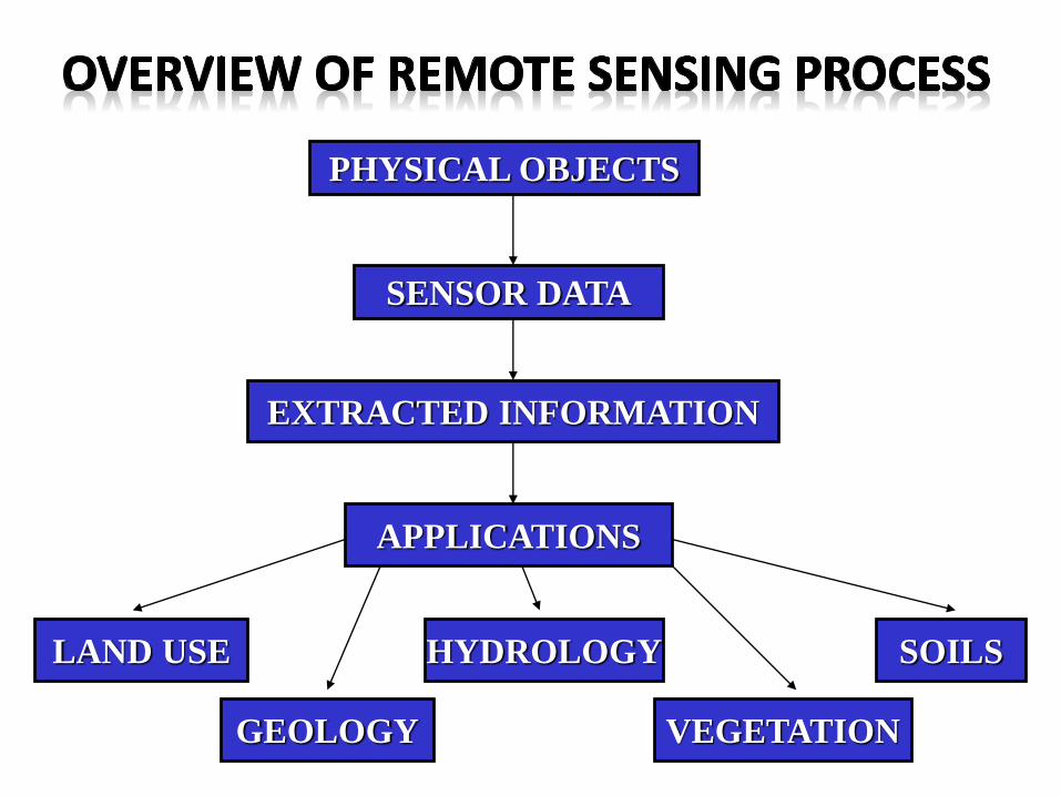
PHYSICAL OBJECTS
SENSOR DATA
EXTRACTED INFORMATION
APPLICATIONS
LAND USE
GEOLOGY
HYDROLOGY
VEGETATION
SOILS
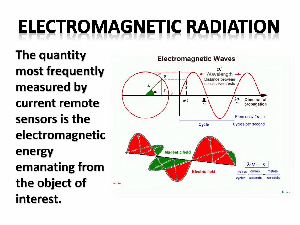
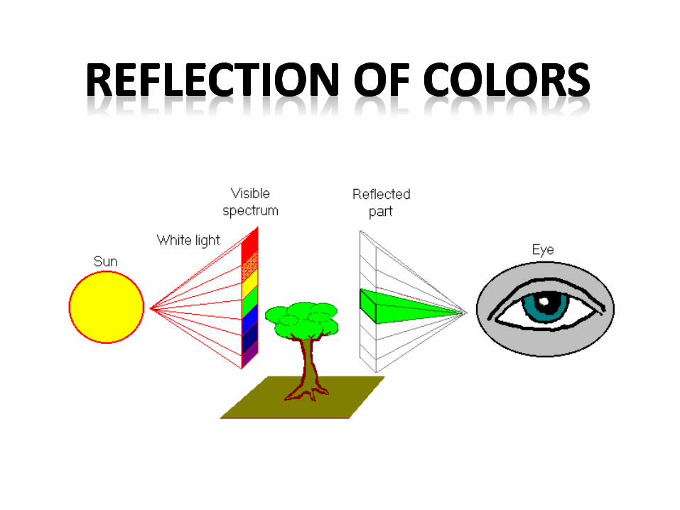
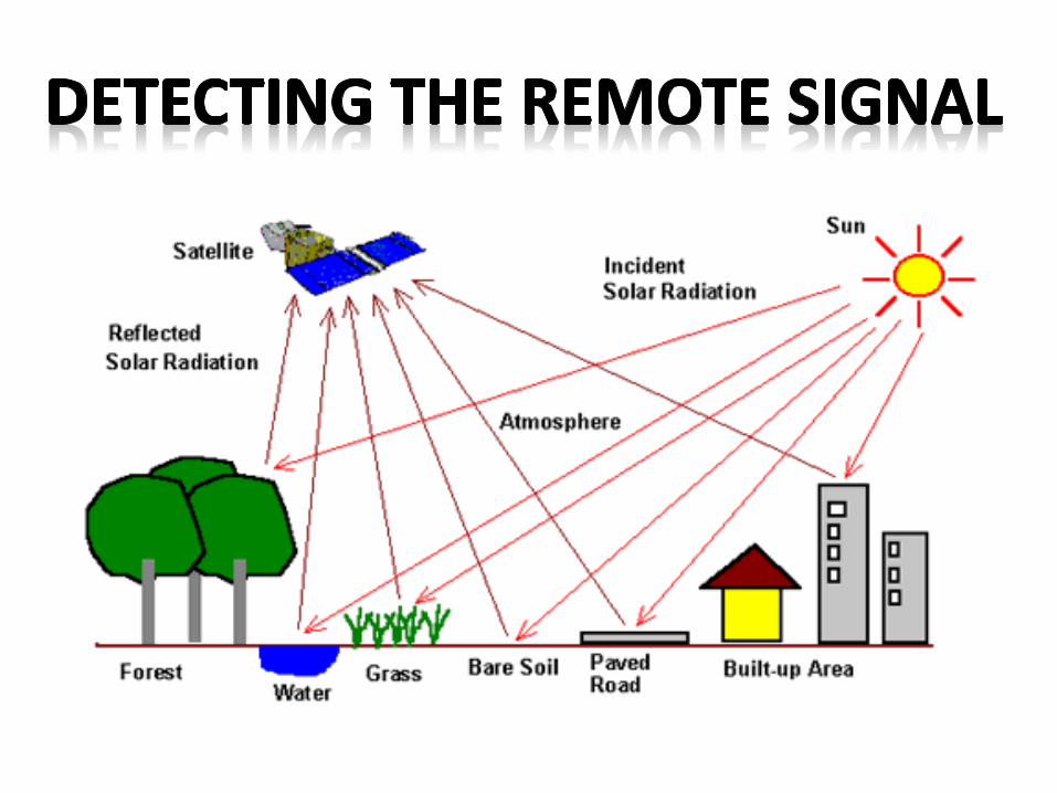
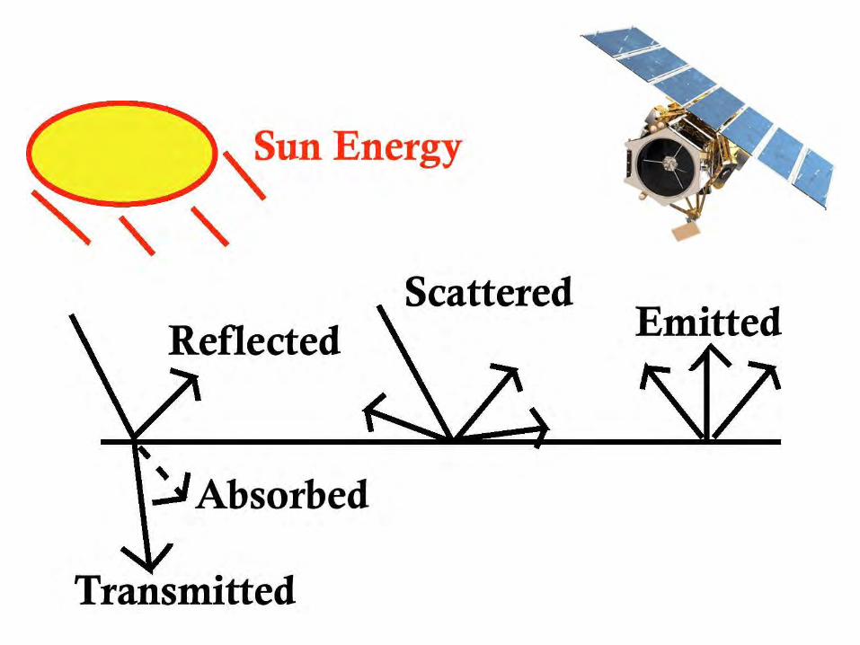
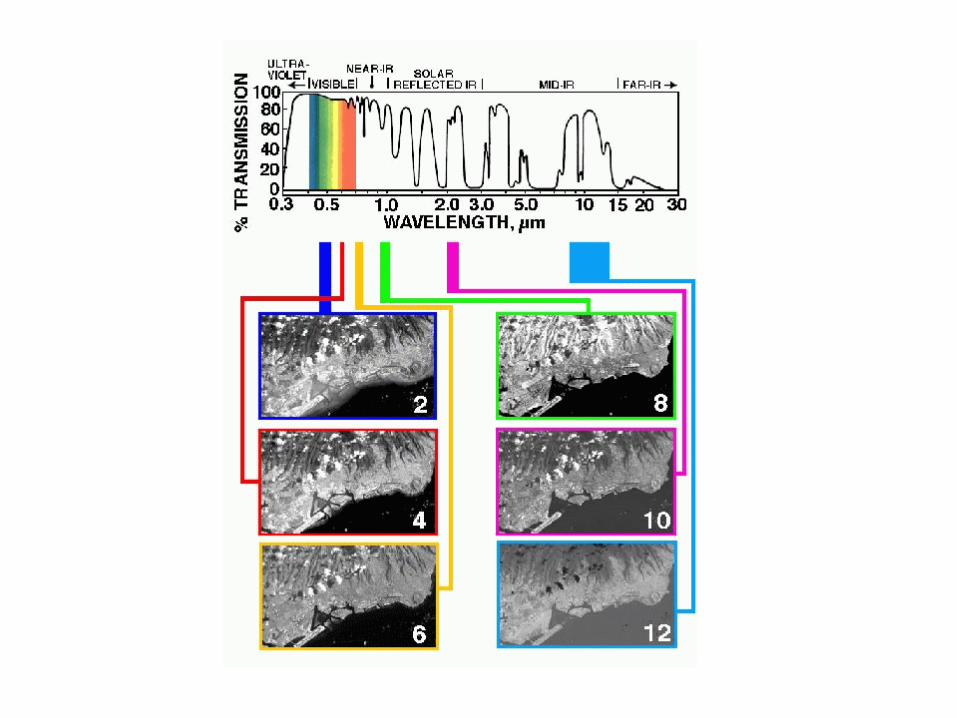
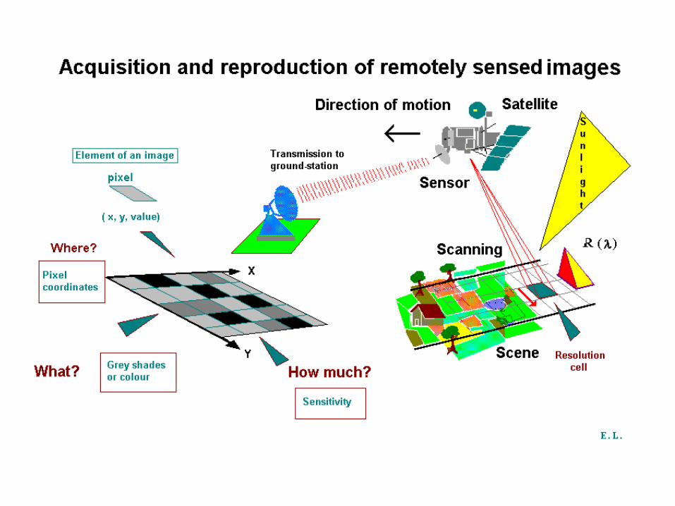
The quantity most frequently measured by current remote sensors is the electromagnetic energy emanating from the object of interest.
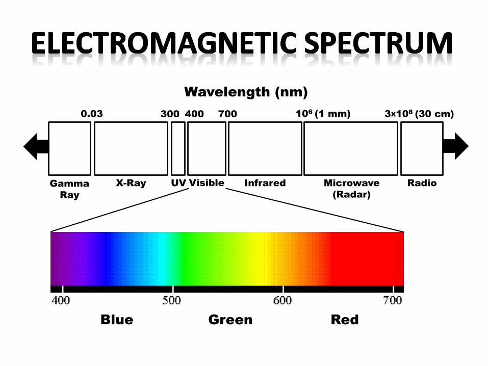
0.03 300 400 700
Gamma
Ray
X-Ray UV Visible
106
(1 mm)
Infrared Microwave
(Radar)
Radio
3X10⁸
(30 cm)
Wavelength (nm)
Blue Green Red

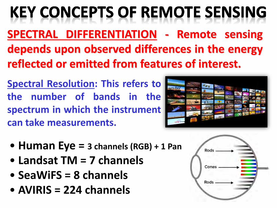
SPECTRAL DIFFERENTIATION - Remote sensingdepends upon observed differences in the energyreflected or emitted from features of interest.
• Human Eye = 3 channels (RGB) + 1 Pan
• Landsat TM = 7 channels• SeaWiFS = 8 channels• AVIRIS = 224 channels
Spectral Resolution: This refers tothe number of bands in thespectrum in which the instrumentcan take measurements.
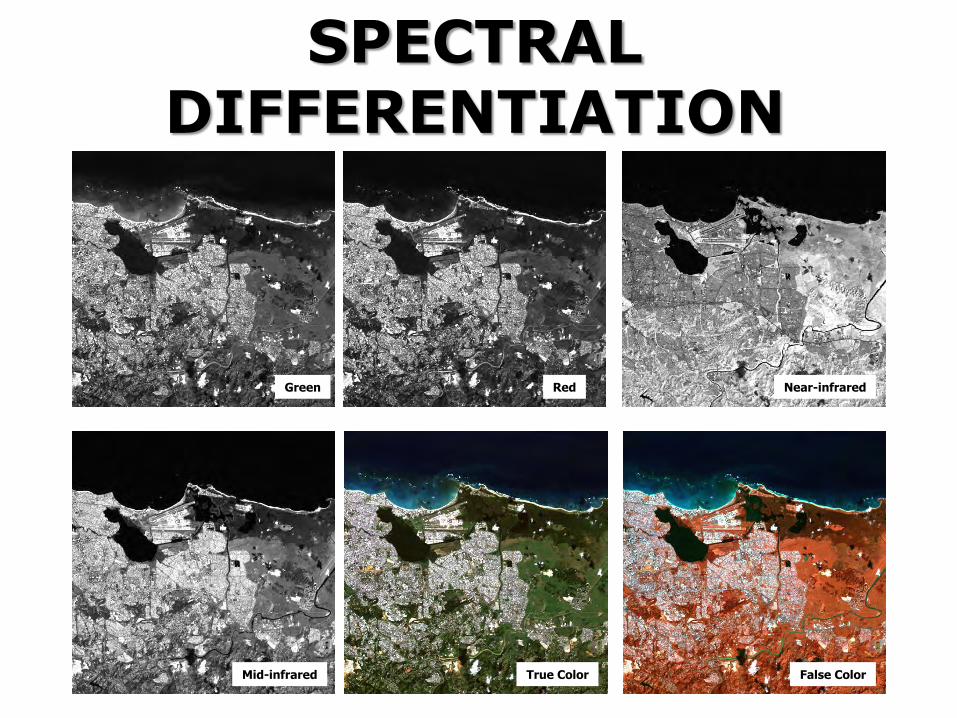
SPECTRAL DIFFERENTIATION
Green Red Near-infrared
Mid-infrared True Color False Color
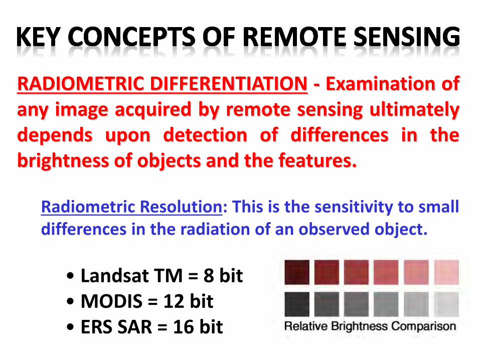
RADIOMETRIC DIFFERENTIATION - Examination ofany image acquired by remote sensing ultimatelydepends upon detection of differences in thebrightness of objects and the features.
Radiometric Resolution: This is the sensitivity to smalldifferences in the radiation of an observed object.
• Landsat TM = 8 bit• MODIS = 12 bit• ERS SAR = 16 bit
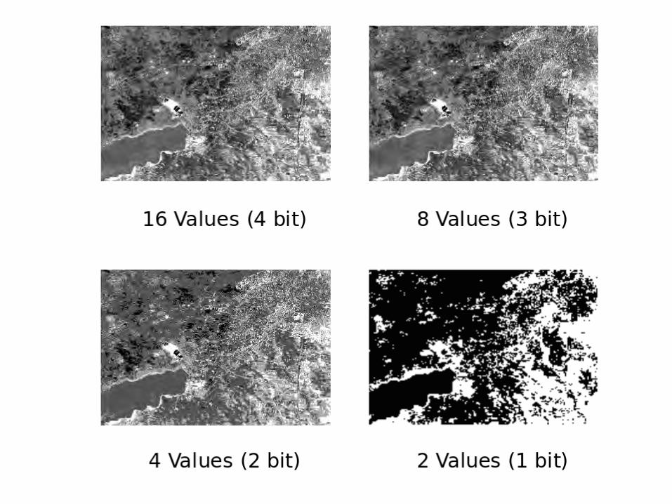
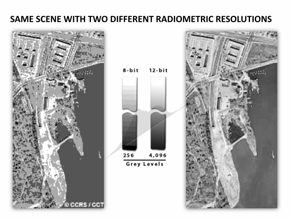
SAME SCENE WITH TWO DIFFERENT RADIOMETRIC RESOLUTIONS
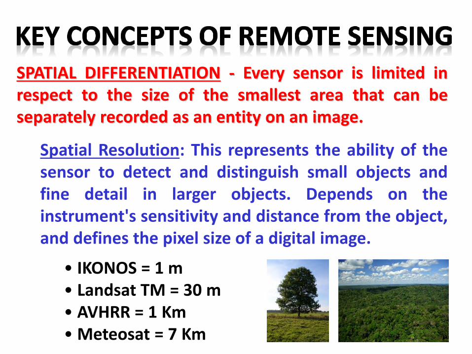
SPATIAL DIFFERENTIATION - Every sensor is limited inrespect to the size of the smallest area that can beseparately recorded as an entity on an image.
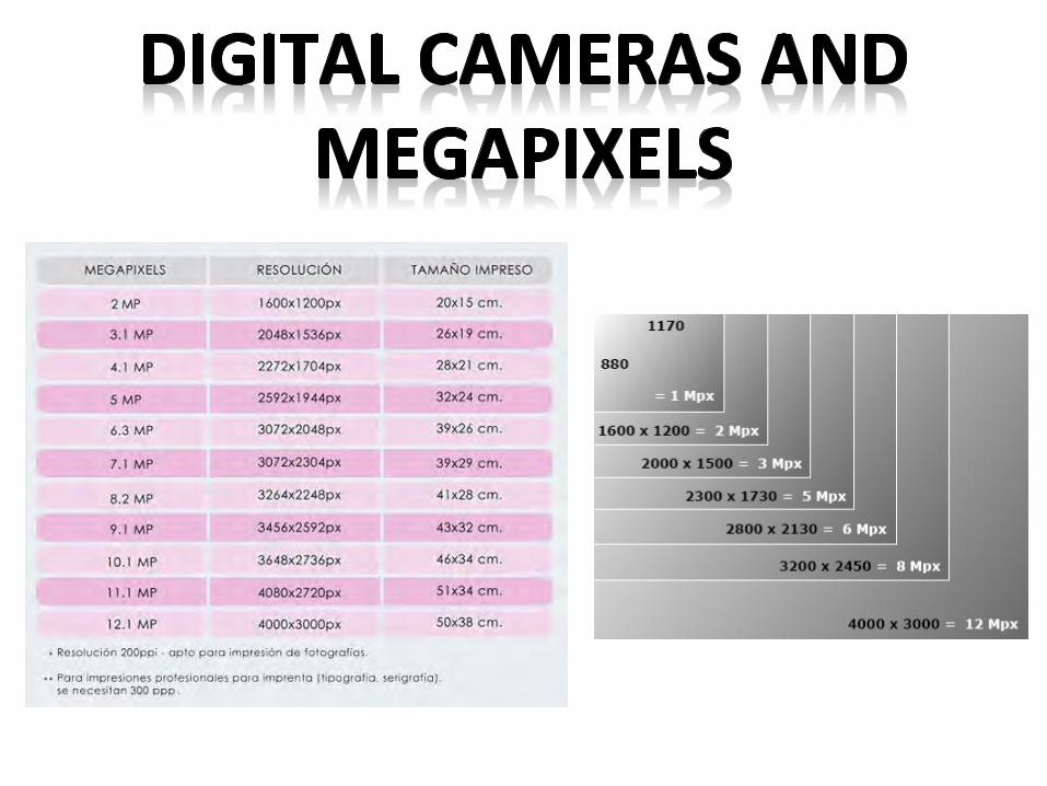
Spatial Resolution: This represents the ability of thesensor to detect and distinguish small objects andfine detail in larger objects. Depends on theinstrument's sensitivity and distance from the object,and defines the pixel size of a digital image.
• IKONOS = 1 m• Landsat TM = 30 m• AVHRR = 1 Km• Meteosat = 7 Km
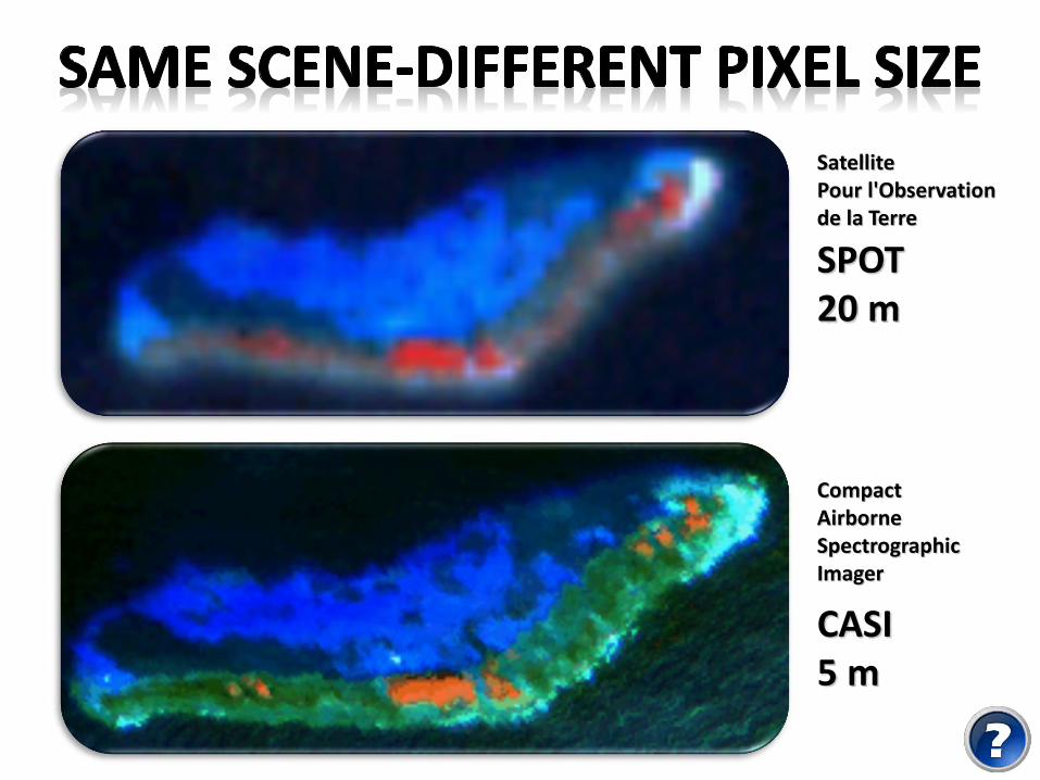
CASI5 m
SPOT20 m
Compact Airborne SpectrographicImager
Satellite Pour l'Observationde la Terre
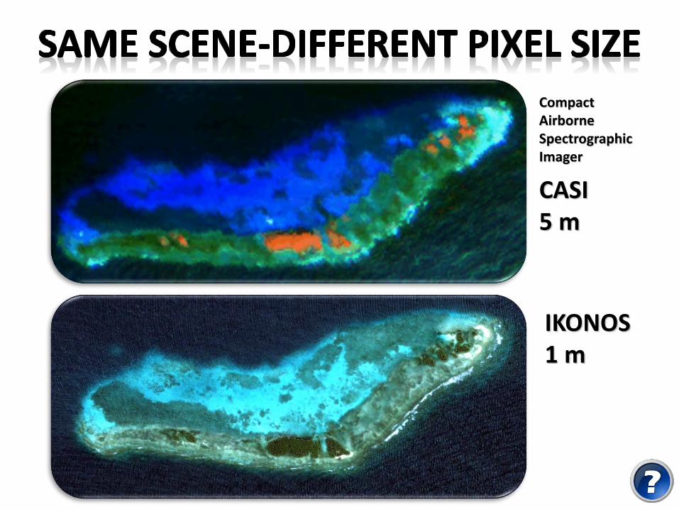
IKONOS1 m
CASI5 m
Compact Airborne SpectrographicImager
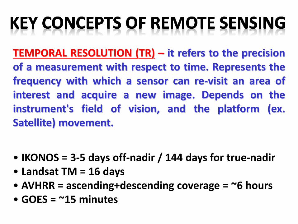
TEMPORAL RESOLUTION (TR) – it refers to the precisionof a measurement with respect to time. Represents thefrequency with which a sensor can re-visit an area ofinterest and acquire a new image. Depends on theinstrument's field of vision, and the platform (ex.Satellite) movement.
• IKONOS = 3-5 days off-nadir / 144 days for true-nadir• Landsat TM = 16 days• AVHRR = ascending+descending coverage = ~6 hours• GOES = ~15 minutes
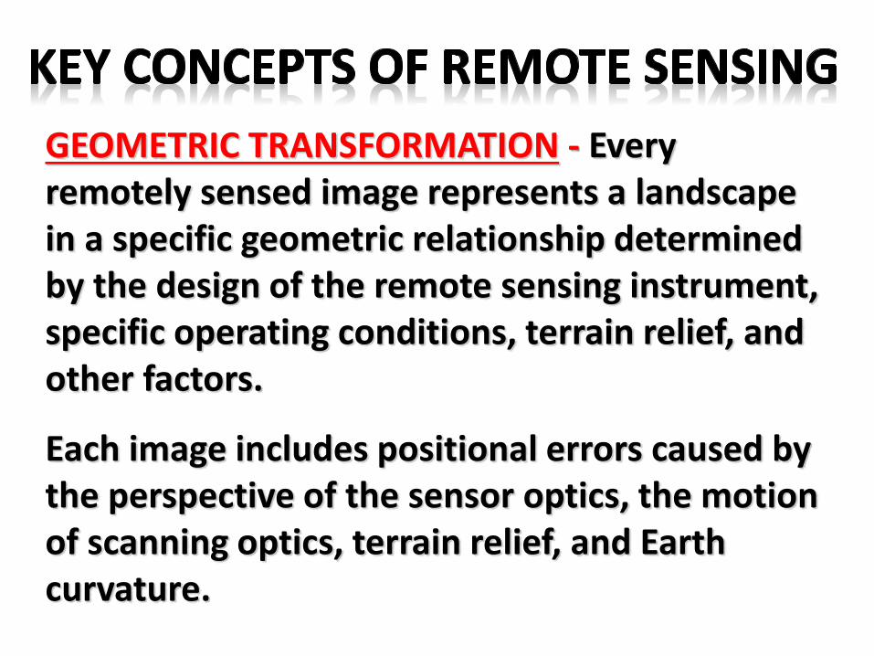
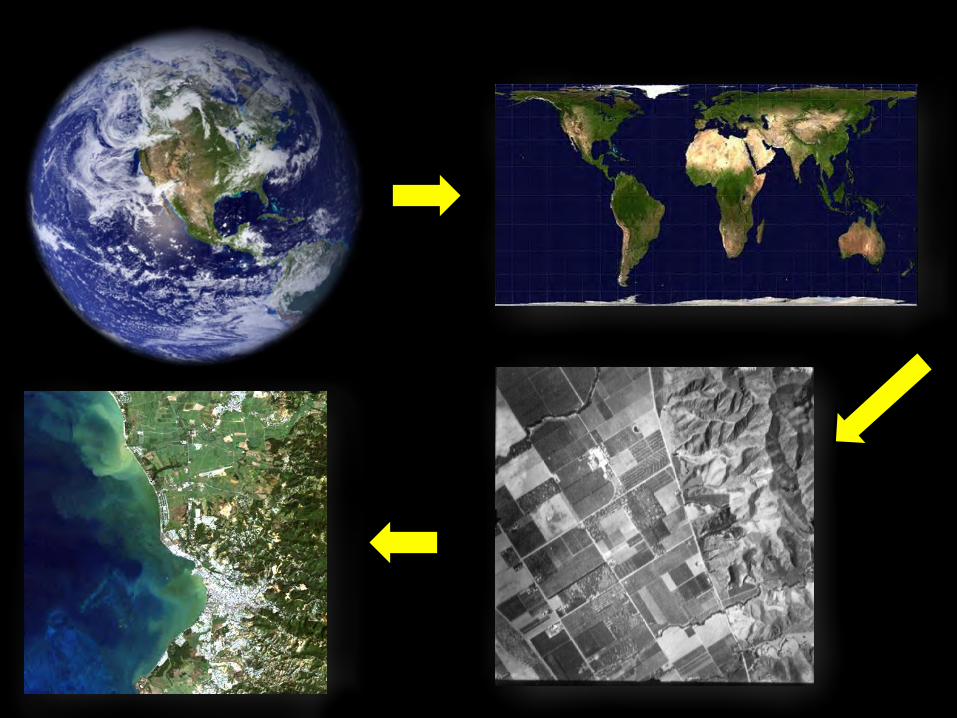
GEOMETRIC TRANSFORMATION - Every remotely sensed image represents a landscape in a specific geometric relationship determined by the design of the remote sensing instrument, specific operating conditions, terrain relief, and other factors.
Each image includes positional errors caused by the perspective of the sensor optics, the motion of scanning optics, terrain relief, and Earth curvature.
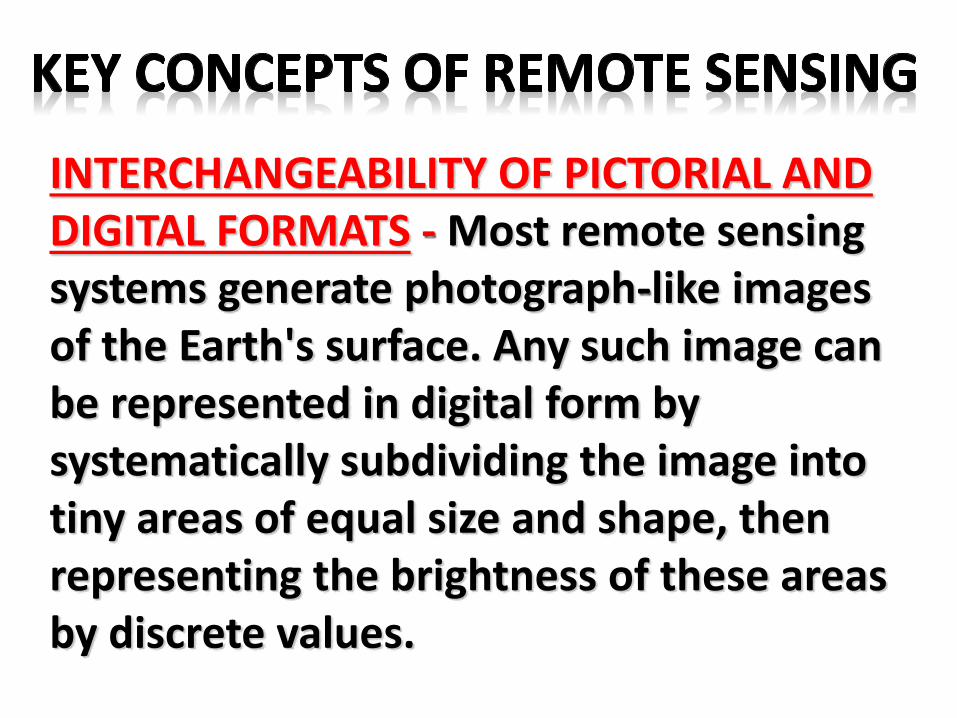
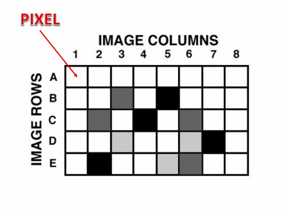
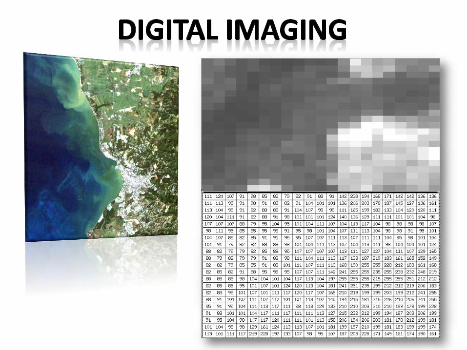
INTERCHANGEABILITY OF PICTORIAL AND DIGITAL FORMATS - Most remote sensing systems generate photograph-like images of the Earth's surface. Any such image can be represented in digital form by systematically subdividing the image into tiny areas of equal size and shape, then representing the brightness of these areas by discrete values.
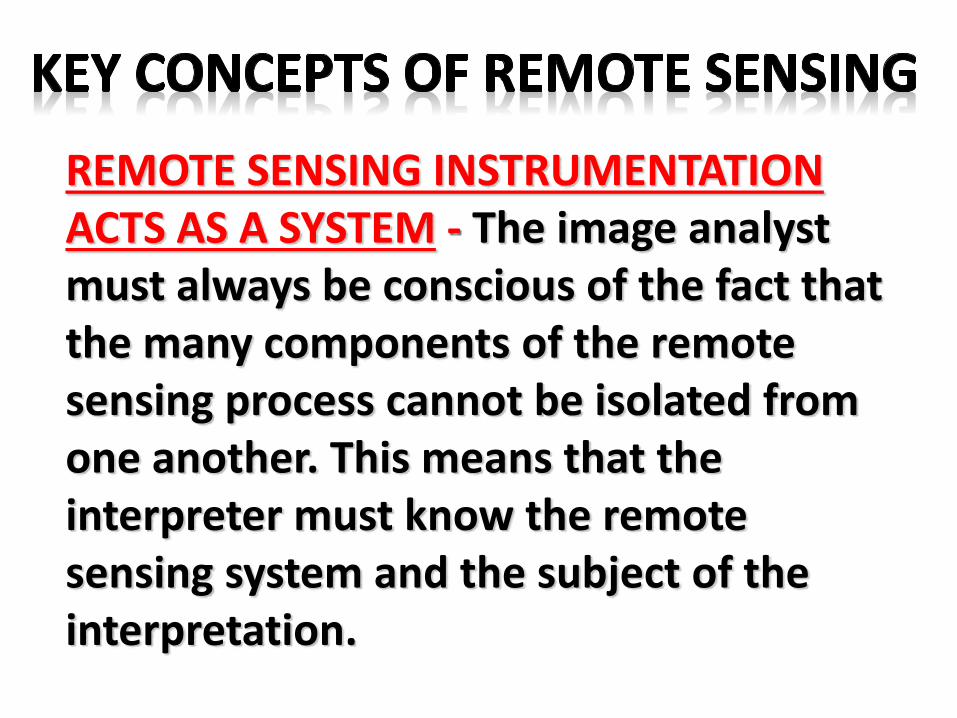
REMOTE SENSING INSTRUMENTATIONACTS AS A SYSTEM - The image analyst must always be conscious of the fact that the many components of the remote sensing process cannot be isolated from one another. This means that the interpreter must know the remote sensing system and the subject of the interpretation.
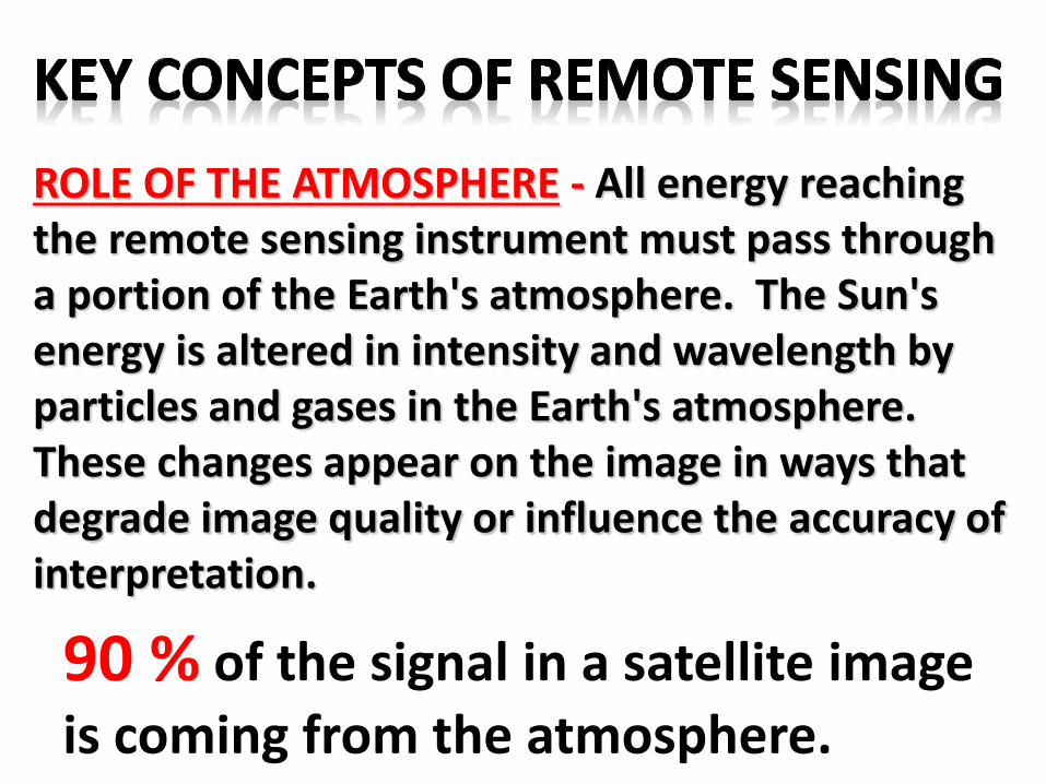
ROLE OF THE ATMOSPHERE - All energy reaching the remote sensing instrument must pass through a portion of the Earth's atmosphere. The Sun's energy is altered in intensity and wavelength by particles and gases in the Earth's atmosphere. These changes appear on the image in ways that degrade image quality or influence the accuracy of interpretation.
90 % of the signal in a satellite image
is coming from the atmosphere.
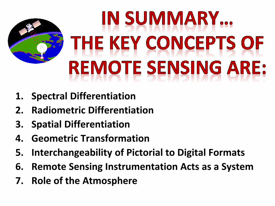
1. Spectral Differentiation
2. Radiometric Differentiation
3. Spatial Differentiation
4. Geometric Transformation
5. Interchangeability of Pictorial to Digital Formats
6. Remote Sensing Instrumentation Acts as a System
7. Role of the Atmosphere
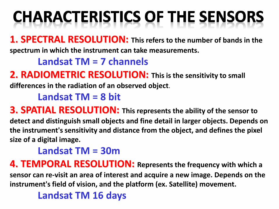
1. SPECTRAL RESOLUTION: This refers to the number of bands in the
spectrum in which the instrument can take measurements.
Landsat TM = 7 channels2. RADIOMETRIC RESOLUTION: This is the sensitivity to small
differences in the radiation of an observed object.
Landsat TM = 8 bit3. SPATIAL RESOLUTION: This represents the ability of the sensor to
detect and distinguish small objects and fine detail in larger objects. Depends on the instrument's sensitivity and distance from the object, and defines the pixel size of a digital image.
Landsat TM = 30m4. TEMPORAL RESOLUTION: Represents the frequency with which a
sensor can re-visit an area of interest and acquire a new image. Depends on the instrument's field of vision, and the platform (ex. Satellite) movement.
Landsat TM 16 days