Embed Size (px)
Citation preview
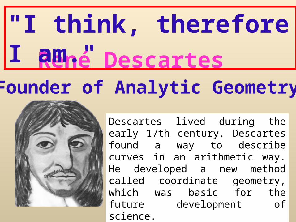
René Descartes
"I think, therefore I am."
Founder of Analytic Geometry
Descartes lived during the early 17th century. Descartes found a way to describe curves in an arithmetic way. He developed a new method called coordinate geometry, which was basic for the future development of science.
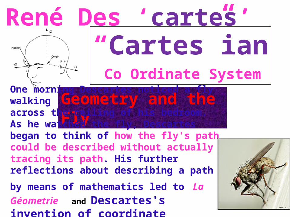
René Des ‘cartes’“Cartes”ian Co Ordinate System
Geometry and the FlyOne morning Descartes noticed a fly walking across the ceiling of his bedroom. As he watched the fly, Descartes began to think of how the fly's path could be described without actually tracing its path. His further reflections about describing a path by means of mathematics
led to La Géometrie and Descartes's invention of coordinate geometry.
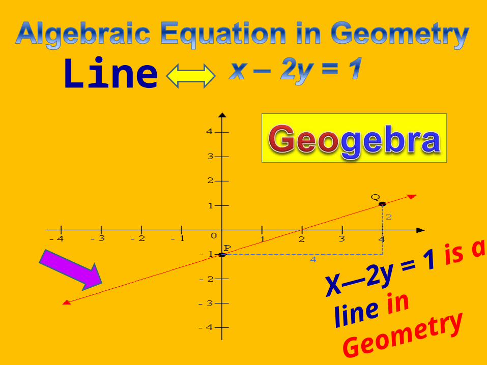
Line
X—2y = 1 is
a line in
Geometry
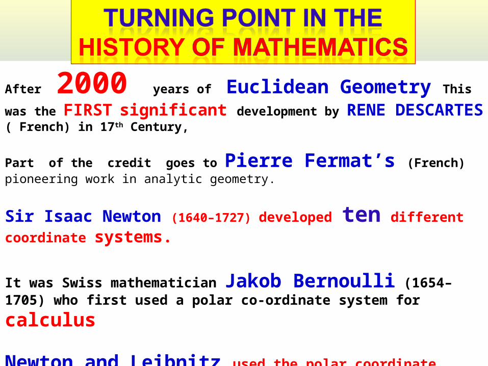
After 2000 years of Euclidean Geometry This was the FIRST
significant development by RENE DESCARTES ( French) in 17th Century,
Part of the credit goes to Pierre Fermat’s (French) pioneering work in analytic geometry.
Sir Isaac Newton (1640–1727) developed ten different coordinate systems.
It was Swiss mathematician Jakob Bernoulli (1654–1705) who first used a
polar co-ordinate system for calculus
Newton and Leibnitz used the polar coordinate system
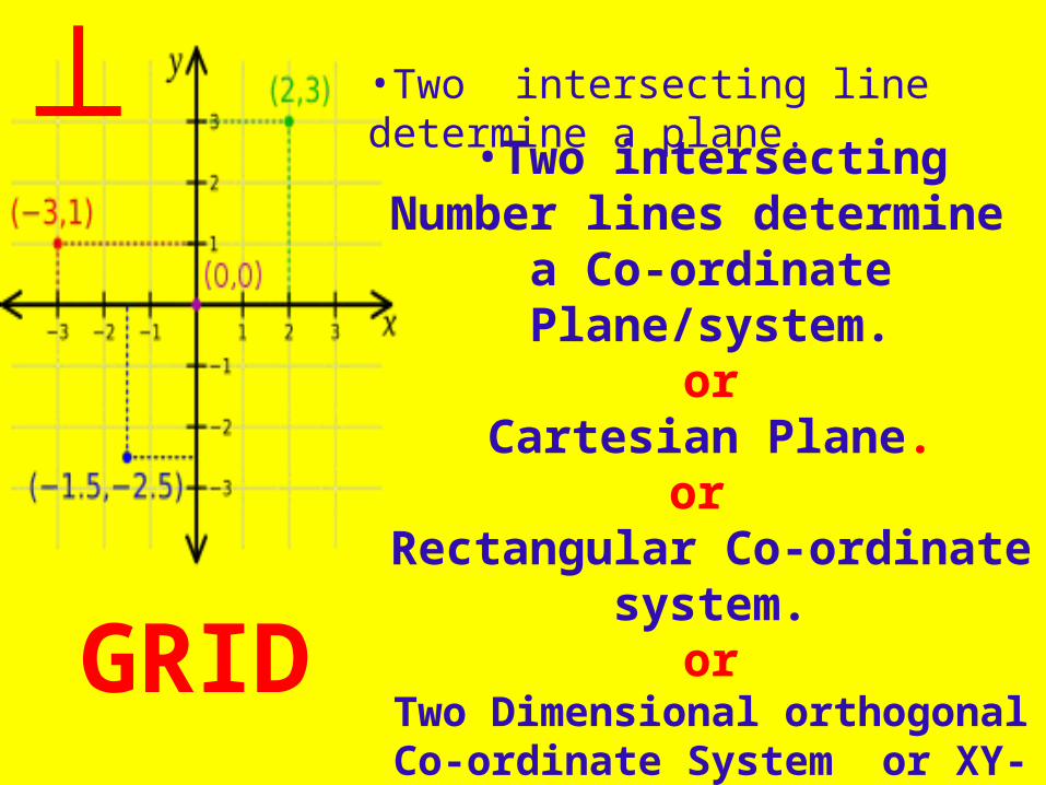
•Two intersecting line determine a plane.
•Two intersecting Number lines determine
a Co-ordinate Plane/system.or
Cartesian Plane.or
Rectangular Co-ordinate system.
orTwo Dimensional orthogonal
Co-ordinate System or XY-Plane
┴
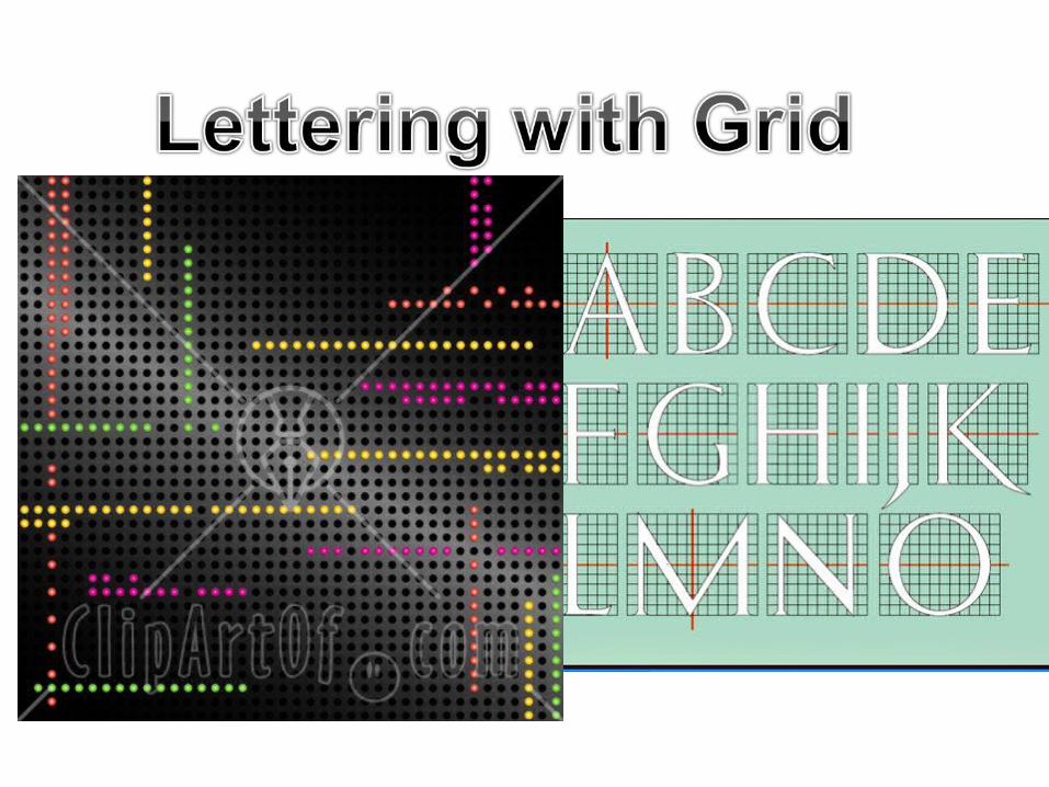
GRID
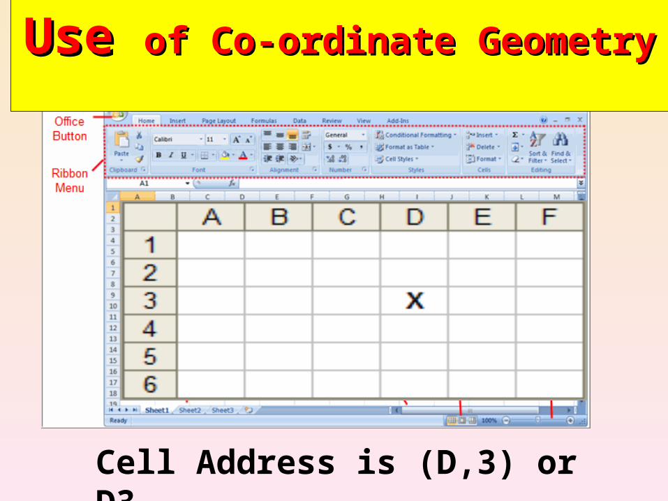
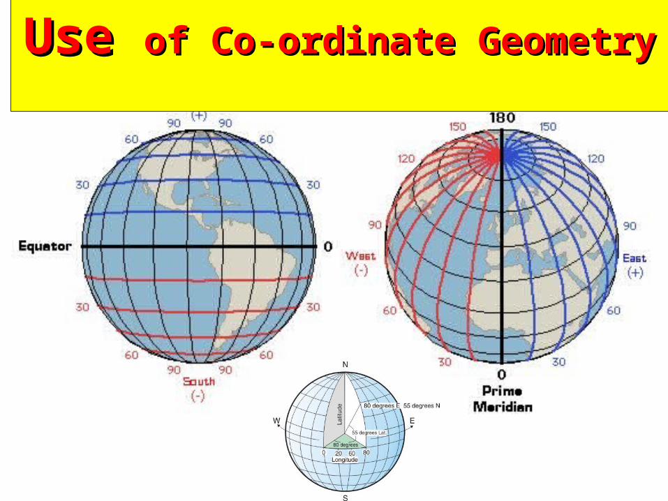
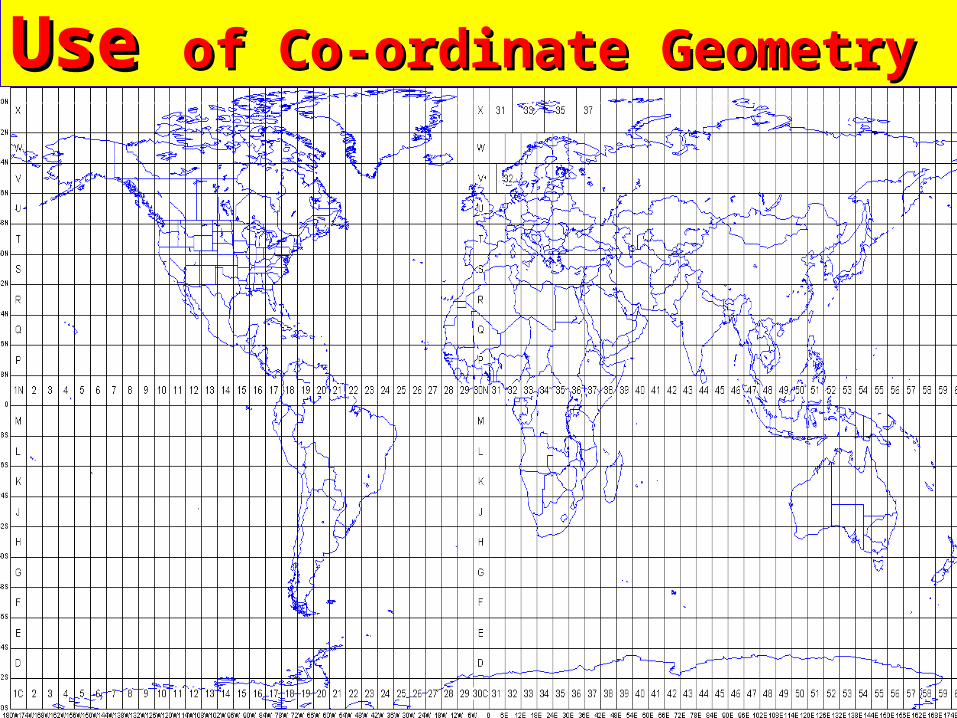
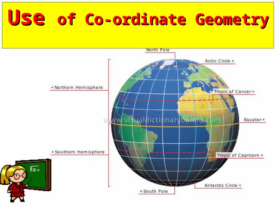
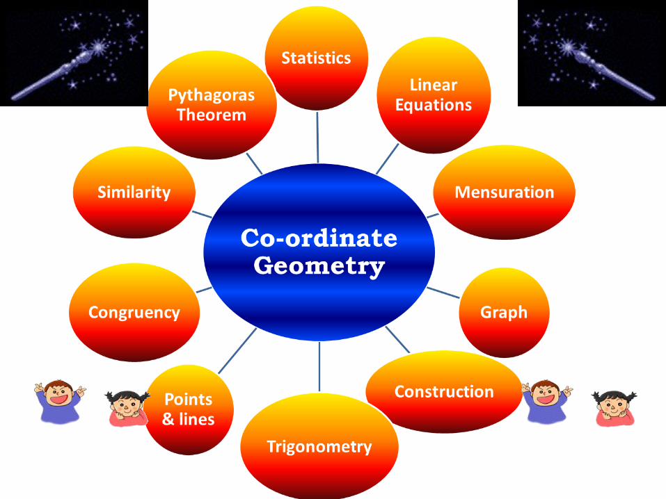
Use Use of Co-ordinate Geometry of Co-ordinate Geometry
Cell Address is (D,3) or D3
Use Use of Co-ordinate Geometry of Co-ordinate Geometry
Use Use of Co-ordinate Geometry of Co-ordinate Geometry
Use Use of Co-ordinate Geometry of Co-ordinate Geometry
Use Use of Co-ordinate Geometry of Co-ordinate Geometry
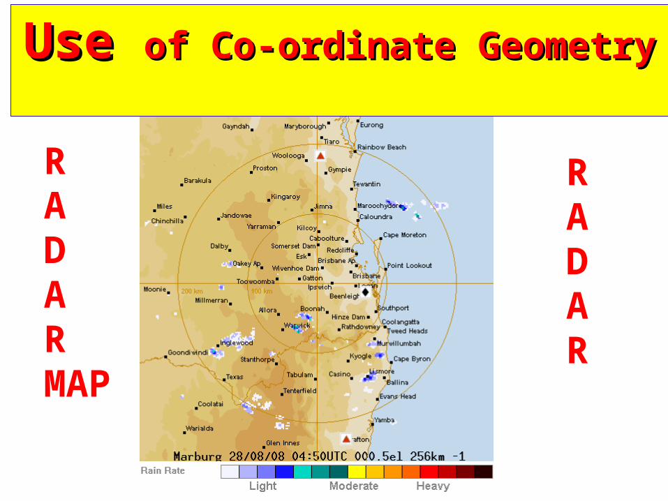
RADARMAP
RADAR
Use Use of Co-ordinate Geometry of Co-ordinate Geometry
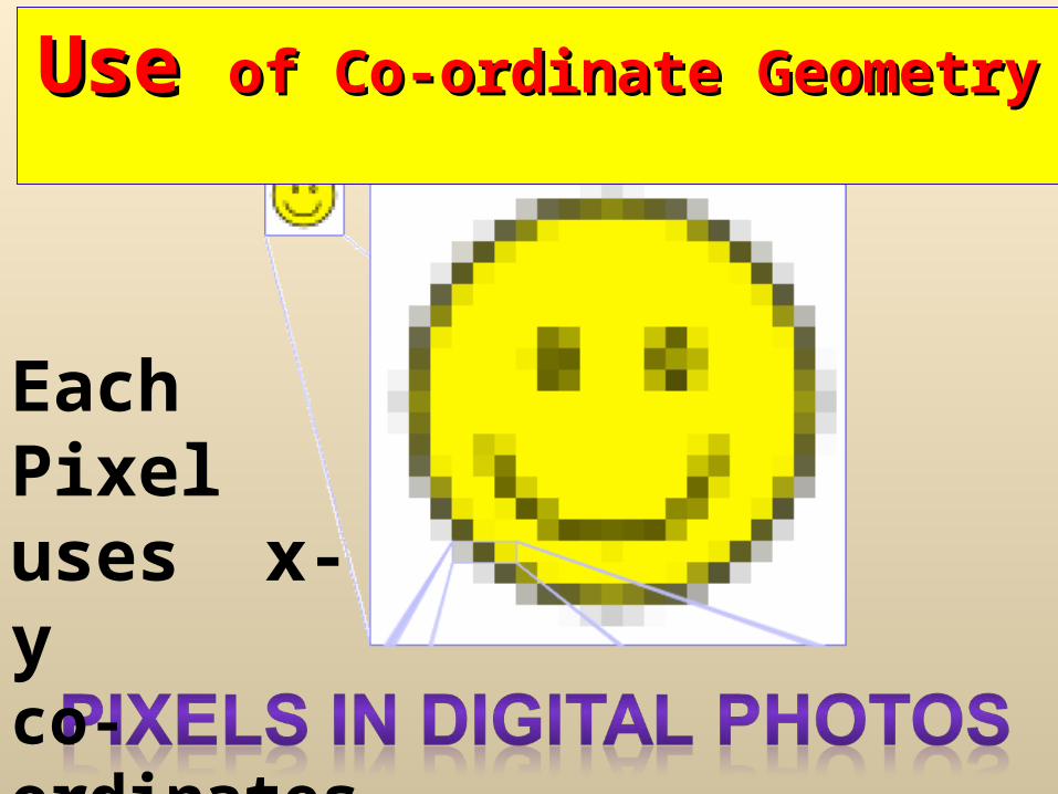
Each Pixel uses x-y co-ordinates
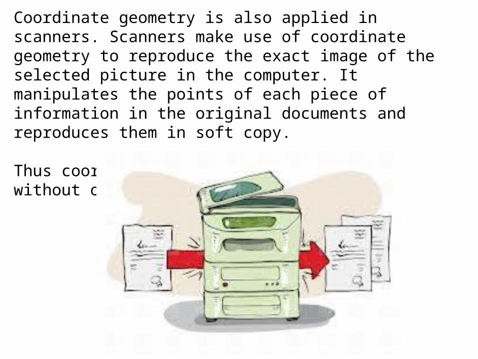
Coordinate geometry is also applied in scanners. Scanners make use of coordinate geometry to reproduce the exact image of the selected picture in the computer. It manipulates the points of each piece of information in the original documents and reproduces them in soft copy.
Thus coordinate geometry is widely used without our knowing..
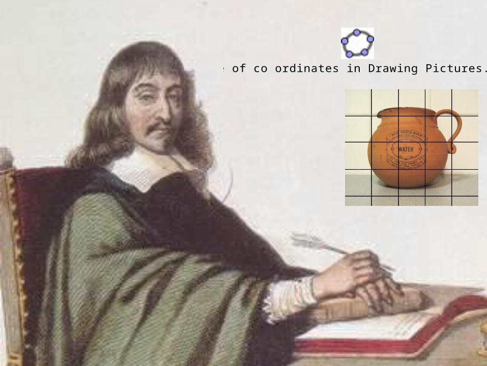
Use of co ordinates in Drawing Pictures.ggb

The screen you are looking at is a grid of thousands of tiny dots called pixels that together make up the image

Practical Application:
All computer programs written in Java language,uses distance between two points.
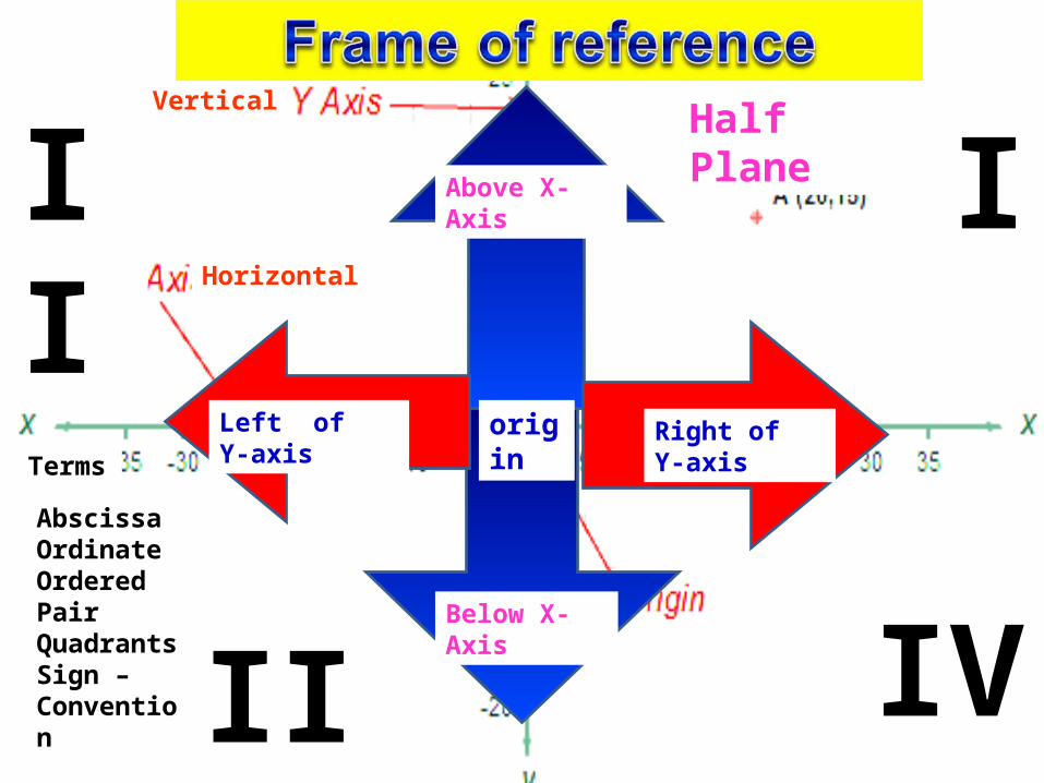
Terms
Horizontal
Vertical
Above X-Axis
Below X-Axis
Right of Y-axisLeft of Y-axis
Half Plane
origin
AbscissaOrdinateOrdered PairQuadrantsSign –Convention
I
IV
II
III

Dimensions
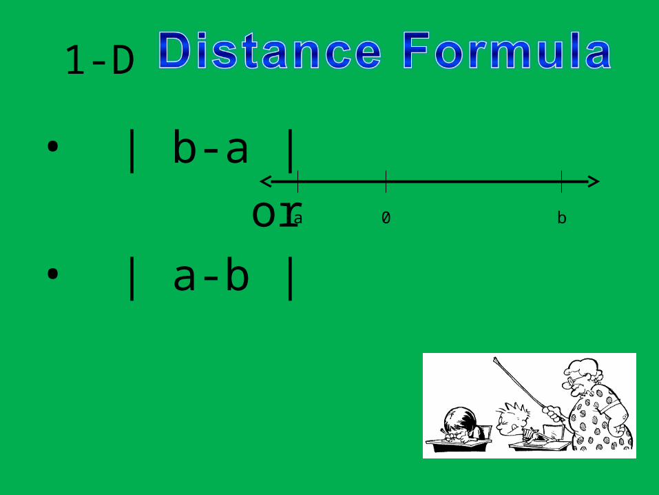
• 1-D
• 2-D
• 3-D
a 0 b
y
x
y
x
z
1-D
• | b-a | or• | a-b |
a 0 b
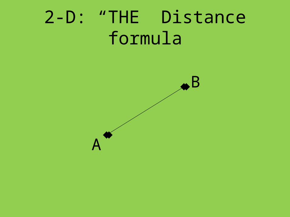
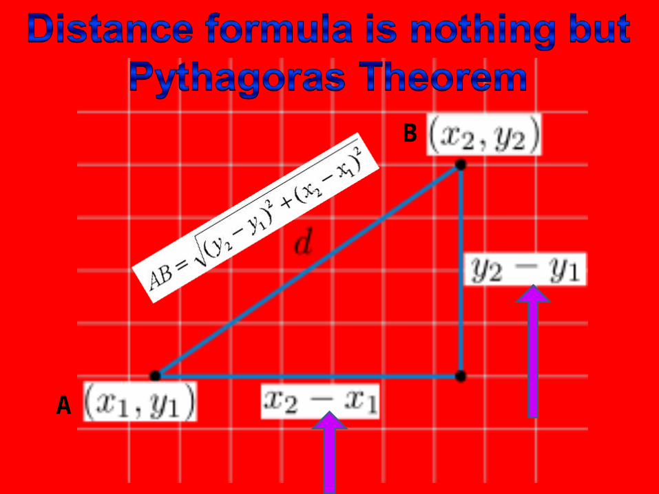
2-D: “THE” Distance formula
A
B
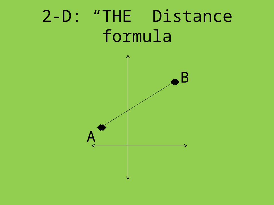
2-D: “THE” Distance formula
A
B
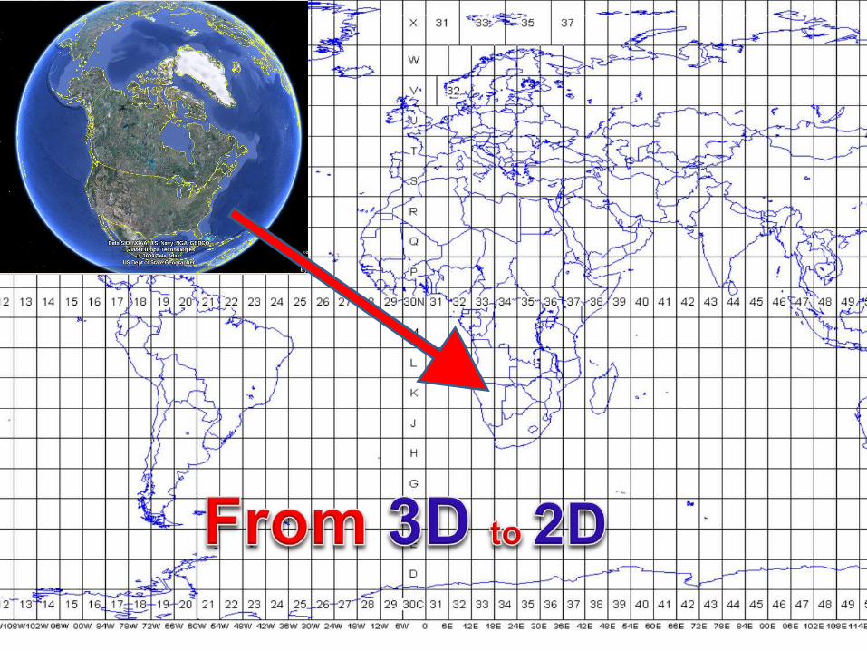
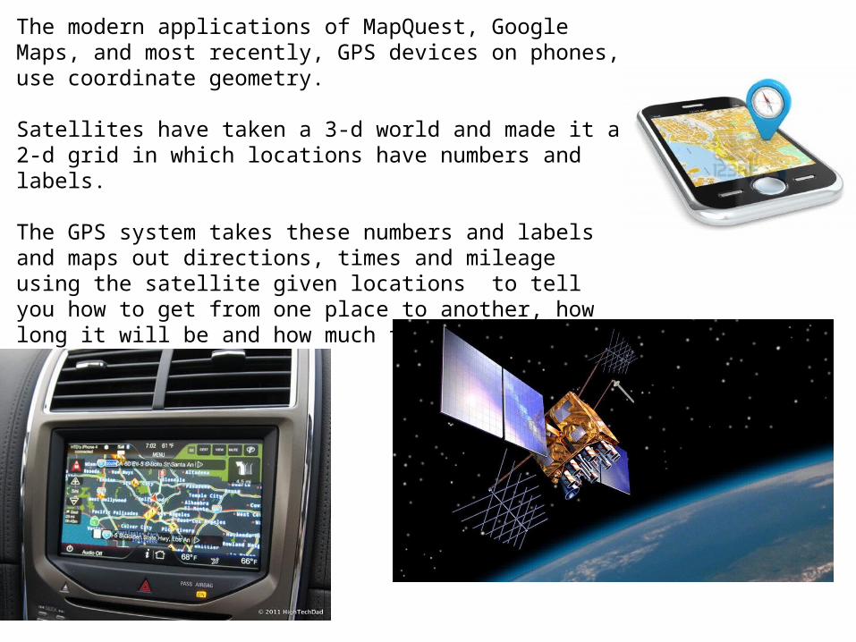
The modern applications of MapQuest, Google Maps, and most recently, GPS devices on phones, use coordinate geometry.
Satellites have taken a 3-d world and made it a 2-d grid in which locations have numbers and labels.
The GPS system takes these numbers and labels and maps out directions, times and mileage using the satellite given locations to tell you how to get from one place to another, how long it will be and how much time it will take!
Amazing!!
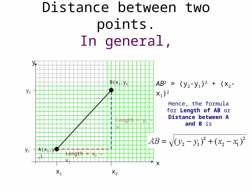
Distance between two points.In general,
x1 x2
y1
y2
A(x1,y1)
B(x2,y2)
Length = x2 – x1
Length = y2 – y1
AB2 = (y2-y1)2 + (x2-x1)2
Hence, the formula for Length of AB or Distance
between A and B is
y
x
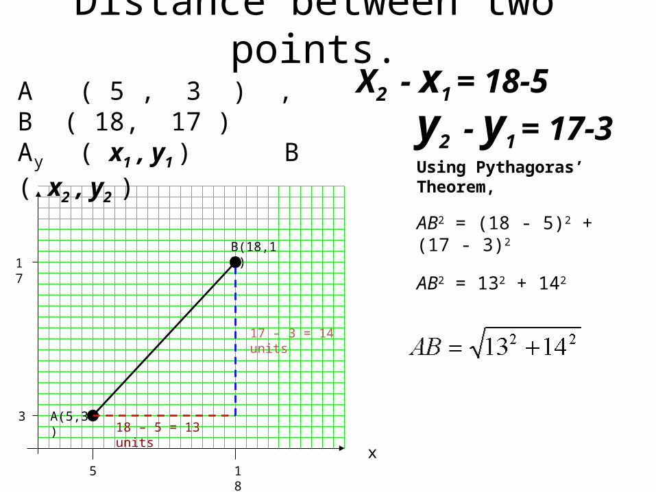
Distance between two points.
5 18
3
17
A(5,3)
B(18,17)
18 – 5 = 13 units
17 – 3 = 14 units
AB2 = 132 + 142
Using Pythagoras’ Theorem,
AB2 = (18 - 5)2 + (17 - 3)2
y
x
A ( 5 , 3 ) , B ( 18, 17 )A ( x1 , y1 ) B ( x2 , y2 )
y2 - y1 = 17-3
X2 - x1 = 18-5
A
B
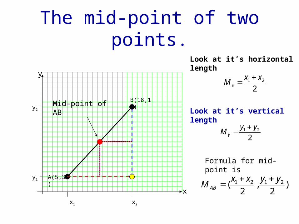
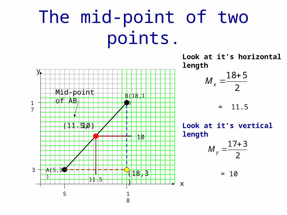
The mid-point of two points.
221 xx
M x
221 yy
M y
x1 x2
y1 A(5,3)
B(18,17)
Look at it’s horizontal length
Look at it’s vertical lengthMid-point of AB
y
x
y2
Formula for mid-point is
)2
,2
( 2121 yyxxM AB
The mid-point of two points.
2
518xM
5 18
3
17
A(5,3)
B(18,17)
Look at it’s horizontal length
= 11.5
11.5
Look at it’s vertical length
2
317 yM
= 10
10
(11.5, 10)
Mid-point of AB
y
x
(18,3)
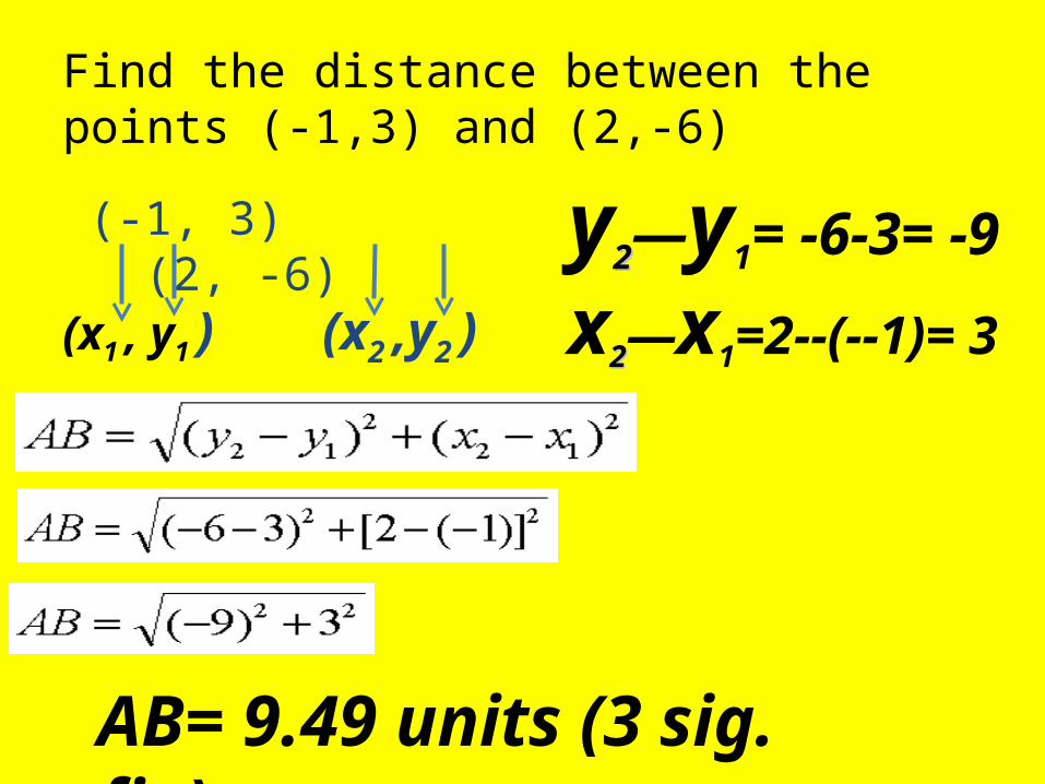
Find the distance between the points (-1,3) and (2,-6)
(-1, 3) (2, -6)
(x1 , y1 ) (x2 ,y2 )
AB= 9.49 units (3 sig. fig)
y22—y1= -6-3= -9
x22—x1=2--(--1)= 3