Embed Size (px)
Citation preview
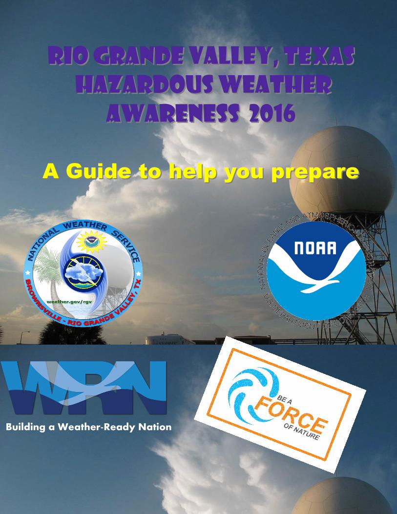
Rio Grande Valley, TexasRio Grande Valley, Texas
Hazardous Weather Hazardous Weather
Awareness 2016Awareness 2016
A Guide to help you prepareA Guide to help you prepare
Building a Weather-Ready Nation
2
Rio Grande Valley, Texas
Hazardous Weather Awareness 2016
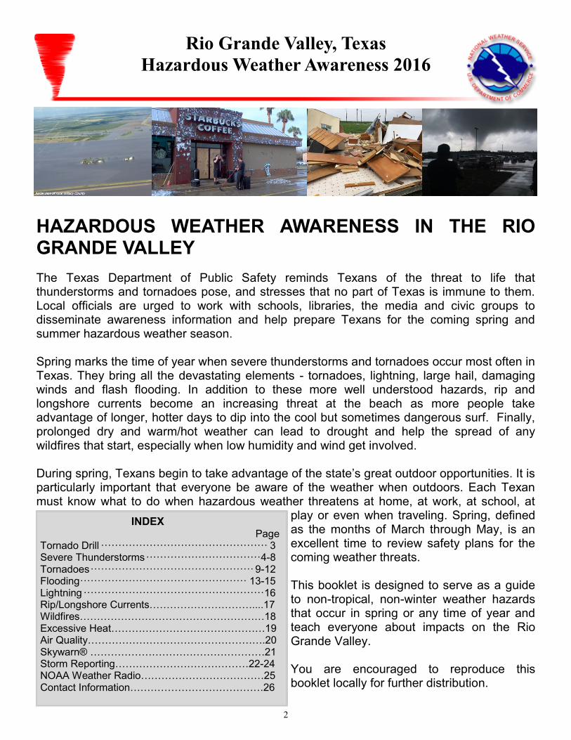
HAZARDOUS WEATHER AWARENESS IN THE RIO GRANDE VALLEY
The Texas Department of Public Safety reminds Texans of the threat to life that thunderstorms and tornadoes pose, and stresses that no part of Texas is immune to them. Local officials are urged to work with schools, libraries, the media and civic groups to disseminate awareness information and help prepare Texans for the coming spring and summer hazardous weather season. Spring marks the time of year when severe thunderstorms and tornadoes occur most often in Texas. They bring all the devastating elements - tornadoes, lightning, large hail, damaging winds and flash flooding. In addition to these more well understood hazards, rip and longshore currents become an increasing threat at the beach as more people take advantage of longer, hotter days to dip into the cool but sometimes dangerous surf. Finally, prolonged dry and warm/hot weather can lead to drought and help the spread of any wildfires that start, especially when low humidity and wind get involved. During spring, Texans begin to take advantage of the state’s great outdoor opportunities. It is particularly important that everyone be aware of the weather when outdoors. Each Texan must know what to do when hazardous weather threatens at home, at work, at school, at
play or even when traveling. Spring, defined as the months of March through May, is an excellent time to review safety plans for the coming weather threats. This booklet is designed to serve as a guide to non-tropical, non-winter weather hazards that occur in spring or any time of year and teach everyone about impacts on the Rio Grande Valley. You are encouraged to reproduce this booklet locally for further distribution.
INDEX
Page Tornado Drill ················································ 3 Severe Thunderstorms ································· 4-8 Tornadoes ··············································· 9-12 Flooding ················································ 13-15 Lightning ···················································· 16 Rip/Longshore Currents…………………………....17 Wildfires………………………………………………18 Excessive Heat………………………………………19 Air Quality…………………………………………….20 Skywarn® ……………………………………………21 Storm Reporting…………………………………22-24 NOAA Weather Radio………………………………25 Contact Information…………………………………26
3
Rio Grande Valley Hazardous Weather Awareness Guide 2016
National Weather Service Brownsville/Rio Grande Valley, Texas
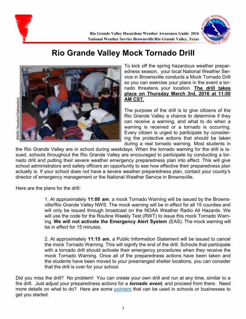
Rio Grande Valley Mock Tornado Drill To kick off the spring hazardous weather prepar-edness season, your local National Weather Ser-vice in Brownsville conducts a Mock Tornado Drill so you can exercise your plans in the event a tor-nado threatens your location. The drill takes place on Thursday March 3rd, 2016 at 11:00 AM CST. The purpose of the drill is to give citizens of the Rio Grande Valley a chance to determine if they can receive a warning, and what to do when a warning is received or a tornado is occurring. Every citizen is urged to participate by consider-ing the protective actions that should be taken during a real tornado warning. Most students in
the Rio Grande Valley are in school during weekdays. When the tornado warning for the drill is is-sued, schools throughout the Rio Grande Valley are encouraged to participate by conducting a tor-nado drill and putting their severe weather emergency preparedness plan into effect. This will give school administrators and safety officers an opportunity to see how effective their preparedness plan actually is. If your school does not have a severe weather preparedness plan, contact your county’s director of emergency management or the National Weather Service in Brownsville. Here are the plans for the drill: 1. At approximately 11:00 am, a mock Tornado Warning will be issued by the Browns-
ville/Rio Grande Valley NWS. The mock warning will be in effect for all 15 counties and will only be issued through broadcast on the NOAA Weather Radio All Hazards. We will use the code for the Routine Weekly Test (RWT) to issue this mock Tornado Warn-ing. We will not activate the Emergency Alert System (EAS). The mock warning will be in effect for 15 minutes.
2. At approximately 11:15 am, a Public Information Statement will be issued to cancel the mock Tornado Warning. This will signify the end of the drill. Schools that participate with a tornado drill should activate their emergency procedures when they receive the mock Tornado Warning. Once all of the preparedness actions have been taken and the students have been moved to your prearranged shelter locations, you can consider that the drill is over for your school.
Did you miss the drill? No problem! You can create your own drill and run at any time, similar to a fire drill. Just adjust your preparedness actions for a tornado event, and proceed from there. Need more details on what to do? Here are some pointers that can be used in schools or businesses to get you started.
4
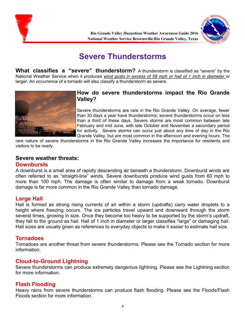
Severe Thunderstorms What classifies a “severe” thunderstorm? A thunderstorm is classified as “severe” by the
National Weather Service when it produces wind gusts in excess of 58 mph or hail of 1 inch in diameter or larger. An occurrence of a tornado will also classify a thunderstorm as severe.
How do severe thunderstorms impact the Rio Grande Valley? Severe thunderstorms are rare in the Rio Grande Valley. On average, fewer than 30 days a year have thunderstorms; severe thunderstorms occur on less than a third of these days. Severe storms are most common between late February and mid June, with late October and November a secondary period for activity. Severe storms can occur just about any time of day in the Rio Grande Valley, but are most common in the afternoon and evening hours. The
rare nature of severe thunderstorms in the Rio Grande Valley increases the importance for residents and visitors to be ready.
Severe weather threats: Downbursts A downburst is a small area of rapidly descending air beneath a thunderstorm. Downburst winds are often referred to as “straight-line” winds. Severe downbursts produce wind gusts from 60 mph to more than 100 mph. The damage is often similar to damage from a weak tornado. Downburst damage is far more common in the Rio Grande Valley than tornado damage.
Large Hail Hail is formed as strong rising currents of air within a storm (updrafts) carry water droplets to a height where freezing occurs. The ice particles travel upward and downward through the storm several times, growing in size. Once they become too heavy to be supported by the storm’s updraft, they fall to the ground as hail. Hail of 1 inch in diameter or larger classifies “large” or damaging hail. Hail sizes are usually given as references to everyday objects to make it easier to estimate hail size.
Tornadoes Tornadoes are another threat from severe thunderstorms. Please see the Tornado section for more information.
Cloud-to-Ground Lightning Severe thunderstorms can produce extremely dangerous lightning. Please see the Lightning section for more information.
Flash Flooding Heavy rains from severe thunderstorms can produce flash flooding. Please see the Floods/Flash Floods section for more information.
(NWS Corpus Christi)
Rio Grande Valley Hazardous Weather Awareness Guide 2016
National Weather Service Brownsville/Rio Grande Valley, Texas

5
2012: “Hail” of a Year in the RGV
Few in the mid Valley will forget the fury of repeated hailstorms during the spring of 2012. During the evening of March 29th, hail the size of golf balls to baseballs was blown by tropical storm to hurricane force wind gusts into manmade and natural infrastructure. Thousands of buildings and vehicles were heavily damaged, and hundreds of trees were completely stripped of their spring growth. Unfortunately, thousands of grackles (birds) on wires were unable to seek safety and were killed. The storm caused an estimated $600 million in insured property damage, which ranked 11th costliest for all Texas hazardous weather events dating back to 1950 . Three weeks later, another round of unusually large hailstones, up to softball size, pelted the same locations. During the week of May 8th through 12th, hail and damaging wind occurred at varying locations across the Rio Grande Valley. A hot, dry summer was punctuated by another blast of severe weather, including hail up to the size of golf balls on October 18th, particularly in Hidalgo County, and to close out the year, more hail fell in Cameron County with a cold front around midnight on December 5th. The dominance of hail bore out in the yearly storm report summary; 58% of all severe weather and tornado events were hail.
Examples of Hail Size
penny sized 0.75 inch
nickel sized 0.88 inch
quarter sized (classifies storm as severe) 1.00 inch
golf ball sized 1.75 inch
baseball sized 2.75 inch
softball sized 4.75 inch
Rio Grande Valley Hazardous Weather Awareness Guide 2016
National Weather Service Brownsville/Rio Grande Valley, Texas
Photo Credit: KRGV-TV-5
6
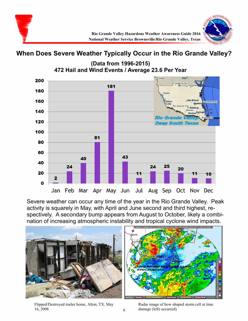
When Does Severe Weather Typically Occur in the Rio Grande Valley? (Data from 1996-2015)
472 Hail and Wind Events / Average 23.6 Per Year
Severe weather can occur any time of the year in the Rio Grande Valley. Peak activity is squarely in May, with April and June second and third highest, re-spectively. A secondary bump appears from August to October, likely a combi-nation of increasing atmospheric instability and tropical cyclone wind impacts.
Flipped/Destroyed trailer home, Alton, TX, May
16, 2008
Radar image of bow-shaped storm cell at time
damage (left) occurred)
Rio Grande Valley Hazardous Weather Awareness Guide 2016
National Weather Service Brownsville/Rio Grande Valley, Texas
7
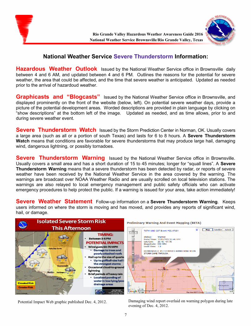
National Weather Service Severe Thunderstorm Information:
Hazardous Weather Outlook Issued by the National Weather Service office in Brownsville daily
between 4 and 6 AM, and updated between 4 and 6 PM. Outlines the reasons for the potential for severe weather, the area that could be affected, and the time that severe weather is anticipated. Updated as needed prior to the arrival of hazardoud weather.
Graphicasts and “Blogcasts” Issued by the National Weather Service office in Brownsville, and
displayed prominently on the front of the website (below, left). On potential severe weather days, provide a picture of the potential development areas. Worded descriptions are provided in plain language by clicking on “show descriptions” at the bottom left of the image. Updated as needed, and as time allows, prior to and during severe weather event.
Severe Thunderstorm Watch Issued by the Storm Prediction Center in Norman, OK. Usually covers
a large area (such as all or a portion of south Texas) and lasts for 6 to 8 hours. A Severe Thunderstorm Watch means that conditions are favorable for severe thunderstorms that may produce large hail, damaging wind, dangerous lightning, or possibly tornadoes.
Severe Thunderstorm Warning Issued by the National Weather Service office in Brownsville.
Usually covers a small area and has a short duration of 15 to 45 minutes; longer for “squall lines”. A Severe Thunderstorm Warning means that a severe thunderstorm has been detected by radar, or reports of severe weather have been received by the National Weather Service in the area covered by the warning. The warnings are broadcast over NOAA Weather Radio and are usually scrolled on local television stations. The warnings are also relayed to local emergency management and public safety officials who can activate emergency procedures to help protect the public. If a warning is issued for your area, take action immediately!
Severe Weather Statement Follow-up information on a Severe Thunderstorm Warning. Keeps
users informed on where the storm is moving and has moved, and provides any reports of significant wind, hail, or damage.
Rio Grande Valley Hazardous Weather Awareness Guide 2016
National Weather Service Brownsville/Rio Grande Valley, Texas
Potential Impact Web graphic published Dec. 4, 2012. Damaging wind report overlaid on warning polygon during late
evening of Dec. 4, 2012.
8
Hail and Windstorm Preparedness Before the Storm: Learn the county that you live in and the names of nearby cities. Severe Thunderstorm Warnings are issued using a polygon based on storm location and track. The message includes the county and names of cities along or near the track. Check our Weather Briefing on your computer, smart device (tablet or phone), or through social media. An overview of the potential for dangerous weather will be provided each morning, with updates through the day and night as conditions evolve. The briefing highlights the expected hazards, in order of potential impact to residents, visitors, and their property. Make sure you are aware of the best spot in your home or workplace to take shelter from severe weather. Not safe at home? Find alternatives. Have a designated location to travel to in 15 minutes or less if you deem your home to be unsafe from strong wind or large hail. Make a plan well ahead of time to be in a safe location before warnings are issued. Have a NOAA Weather Radio in your home and workplace. Most receivers are specially built to alarm any time a severe weather Watch or Warning is issued by the National Weather Service. Be sure to install fresh batteries. Using the instructions provided, program the radio to alert for the warnings you may need; by county or by area.
When you hear a warning: The interior room on the lowest floor of a sturdy building, away from windows, is the safest place to be during dangerous winds, hail, or lightning! A closet or bathroom are best choices; you want to place as many walls between you and the wind or hail as possible.
On the road and can’t reach safety in time? Follow these tips: If hail is expected, get to a carport, garage, or canopy covers at a gas station or car wash. Avoid underpasses which can become clogged with vehicles and increase the possibility of accidents; rainfall can flood these areas as well. If you encounter strong winds, pull over and park, and cover yourself and any passengers with blankets or pillows. Outside on a Farm or Ranch and Unable to Get to Safety? Move away from metal equipment, then crouch down and cover your head with your hands.
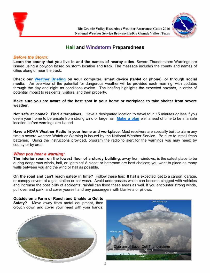
Diagram of Super Cell Thunderstorm
Rio Grande Valley Hazardous Weather Awareness Guide 2016
National Weather Service Brownsville/Rio Grande Valley, Texas
9
Tornadoes
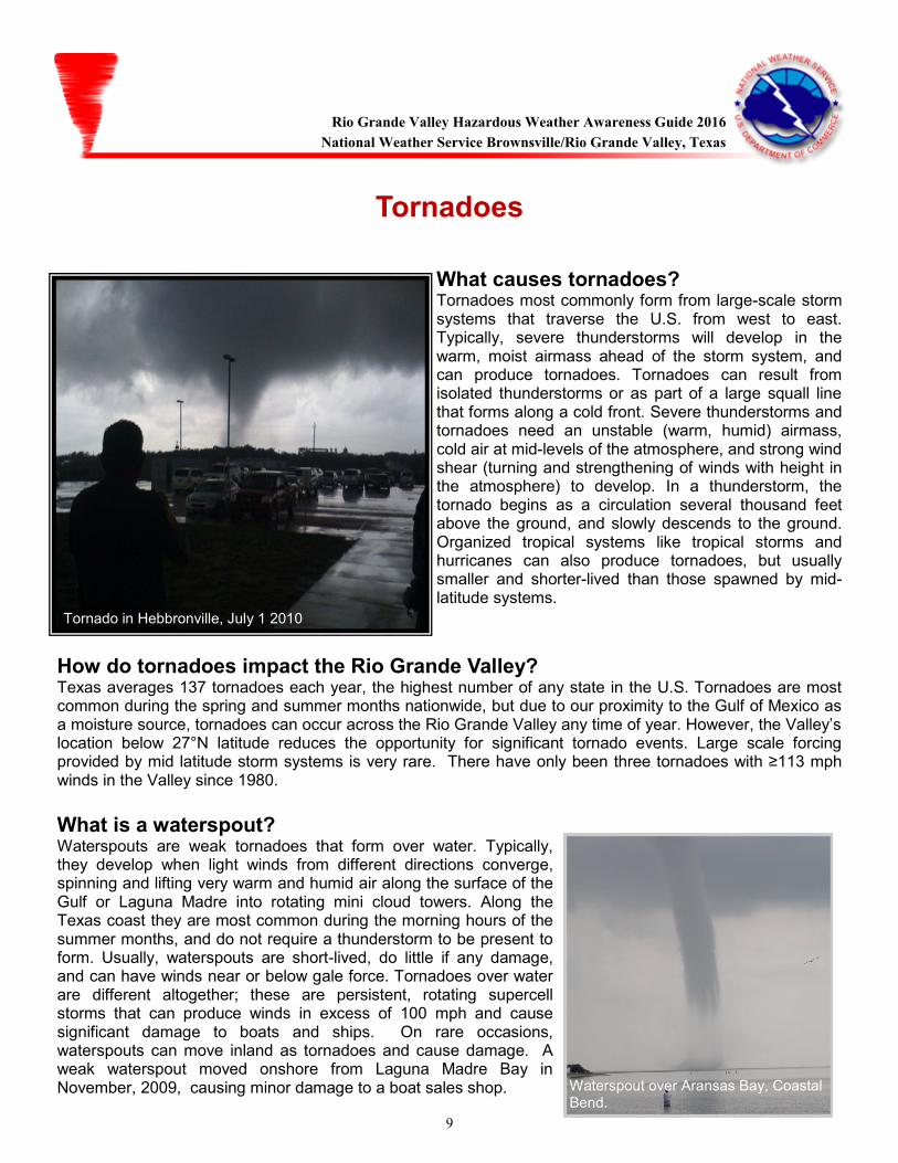
What causes tornadoes? Tornadoes most commonly form from large-scale storm systems that traverse the U.S. from west to east. Typically, severe thunderstorms will develop in the warm, moist airmass ahead of the storm system, and can produce tornadoes. Tornadoes can result from isolated thunderstorms or as part of a large squall line that forms along a cold front. Severe thunderstorms and tornadoes need an unstable (warm, humid) airmass, cold air at mid-levels of the atmosphere, and strong wind shear (turning and strengthening of winds with height in the atmosphere) to develop. In a thunderstorm, the tornado begins as a circulation several thousand feet above the ground, and slowly descends to the ground. Organized tropical systems like tropical storms and hurricanes can also produce tornadoes, but usually smaller and shorter-lived than those spawned by mid-latitude systems.
How do tornadoes impact the Rio Grande Valley? Texas averages 137 tornadoes each year, the highest number of any state in the U.S. Tornadoes are most common during the spring and summer months nationwide, but due to our proximity to the Gulf of Mexico as a moisture source, tornadoes can occur across the Rio Grande Valley any time of year. However, the Valley’s location below 27°N latitude reduces the opportunity for significant tornado events. Large scale forcing provided by mid latitude storm systems is very rare. There have only been three tornadoes with ≥113 mph winds in the Valley since 1980.
What is a waterspout? Waterspouts are weak tornadoes that form over water. Typically, they develop when light winds from different directions converge, spinning and lifting very warm and humid air along the surface of the Gulf or Laguna Madre into rotating mini cloud towers. Along the Texas coast they are most common during the morning hours of the summer months, and do not require a thunderstorm to be present to form. Usually, waterspouts are short-lived, do little if any damage, and can have winds near or below gale force. Tornadoes over water are different altogether; these are persistent, rotating supercell storms that can produce winds in excess of 100 mph and cause significant damage to boats and ships. On rare occasions, waterspouts can move inland as tornadoes and cause damage. A weak waterspout moved onshore from Laguna Madre Bay in November, 2009, causing minor damage to a boat sales shop. Waterspout over Aransas Bay, Coastal
Bend.
Rio Grande Valley Hazardous Weather Awareness Guide 2016
National Weather Service Brownsville/Rio Grande Valley, Texas
(Tornado in Hebbronville, July 1 2010
10
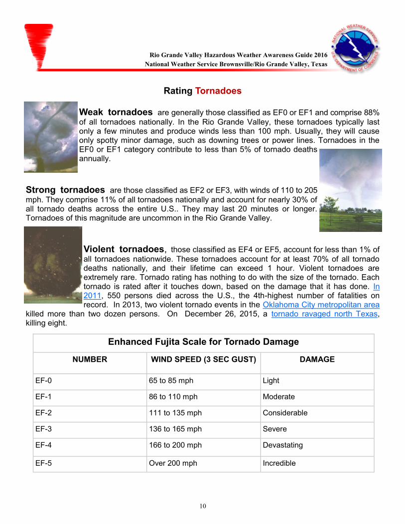
Rating Tornadoes Weak tornadoes are generally those classified as EF0 or EF1 and comprise 88%
of all tornadoes nationally. In the Rio Grande Valley, these tornadoes typically last only a few minutes and produce winds less than 100 mph. Usually, they will cause only spotty minor damage, such as downing trees or power lines. Tornadoes in the EF0 or EF1 category contribute to less than 5% of tornado deaths annually.
Strong tornadoes are those classified as EF2 or EF3, with winds of 110 to 205
mph. They comprise 11% of all tornadoes nationally and account for nearly 30% of all tornado deaths across the entire U.S.. They may last 20 minutes or longer. Tornadoes of this magnitude are uncommon in the Rio Grande Valley.
Violent tornadoes, those classified as EF4 or EF5, account for less than 1% of
all tornadoes nationwide. These tornadoes account for at least 70% of all tornado deaths nationally, and their lifetime can exceed 1 hour. Violent tornadoes are extremely rare. Tornado rating has nothing to do with the size of the tornado. Each tornado is rated after it touches down, based on the damage that it has done. In 2011, 550 persons died across the U.S., the 4th-highest number of fatalities on record. In 2013, two violent tornado events in the Oklahoma City metropolitan area
killed more than two dozen persons. On December 26, 2015, a tornado ravaged north Texas, killing eight.
Enhanced Fujita Scale for Tornado Damage
NUMBER WIND SPEED (3 SEC GUST) DAMAGE
EF-0 65 to 85 mph Light
EF-1 86 to 110 mph Moderate
EF-2 111 to 135 mph Considerable
EF-3 136 to 165 mph Severe
EF-4 166 to 200 mph Devastating
EF-5 Over 200 mph Incredible
Rio Grande Valley Hazardous Weather Awareness Guide 2016
National Weather Service Brownsville/Rio Grande Valley, Texas
11
Tornado Preparedness
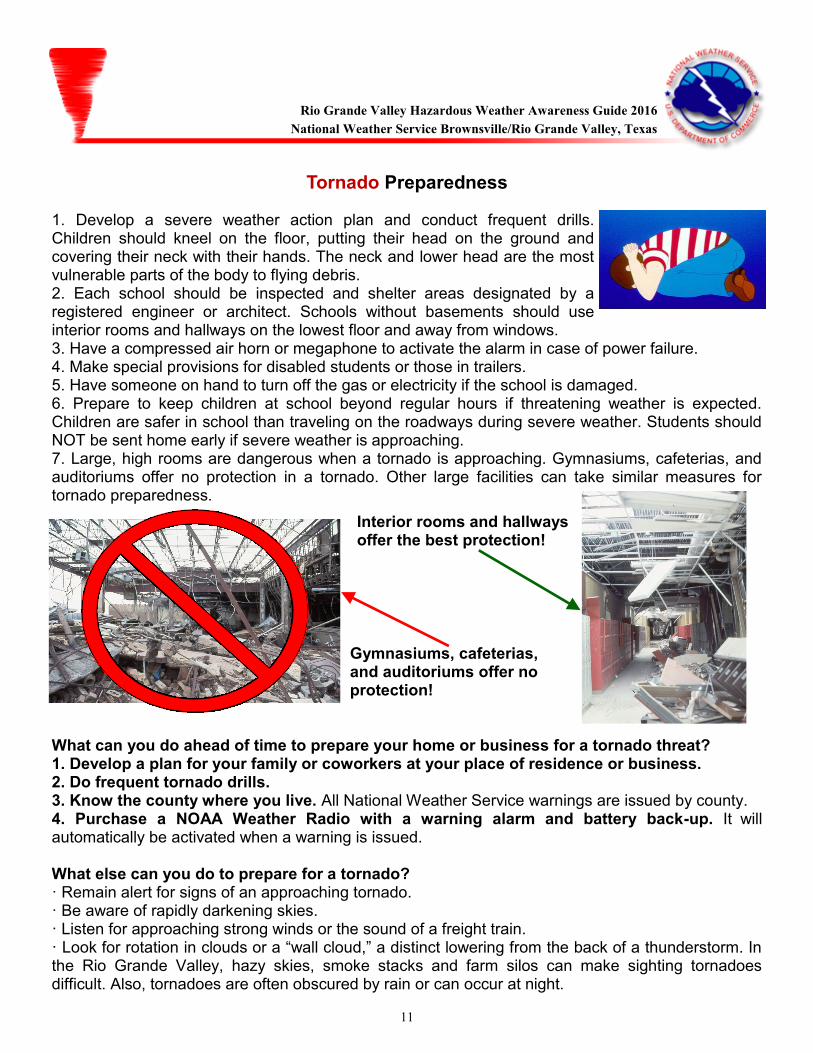
1. Develop a severe weather action plan and conduct frequent drills. Children should kneel on the floor, putting their head on the ground and covering their neck with their hands. The neck and lower head are the most vulnerable parts of the body to flying debris. 2. Each school should be inspected and shelter areas designated by a registered engineer or architect. Schools without basements should use interior rooms and hallways on the lowest floor and away from windows. 3. Have a compressed air horn or megaphone to activate the alarm in case of power failure. 4. Make special provisions for disabled students or those in trailers. 5. Have someone on hand to turn off the gas or electricity if the school is damaged. 6. Prepare to keep children at school beyond regular hours if threatening weather is expected. Children are safer in school than traveling on the roadways during severe weather. Students should NOT be sent home early if severe weather is approaching. 7. Large, high rooms are dangerous when a tornado is approaching. Gymnasiums, cafeterias, and auditoriums offer no protection in a tornado. Other large facilities can take similar measures for tornado preparedness.
What can you do ahead of time to prepare your home or business for a tornado threat? 1. Develop a plan for your family or coworkers at your place of residence or business. 2. Do frequent tornado drills. 3. Know the county where you live. All National Weather Service warnings are issued by county. 4. Purchase a NOAA Weather Radio with a warning alarm and battery back-up. It will automatically be activated when a warning is issued. What else can you do to prepare for a tornado? · Remain alert for signs of an approaching tornado. · Be aware of rapidly darkening skies. · Listen for approaching strong winds or the sound of a freight train. · Look for rotation in clouds or a “wall cloud,” a distinct lowering from the back of a thunderstorm. In the Rio Grande Valley, hazy skies, smoke stacks and farm silos can make sighting tornadoes difficult. Also, tornadoes are often obscured by rain or can occur at night.
Interior rooms and hallways offer the best protection!
Gymnasiums, cafeterias, and auditoriums offer no protection!
Rio Grande Valley Hazardous Weather Awareness Guide 2016
National Weather Service Brownsville/Rio Grande Valley, Texas
12
National Weather Service Tornado Information Tornado Watch Issued by the Storm Prediction Center in Norman, Oklahoma. Usually covers a
fairly large area (such as all or a portion of south Texas) and runs from 6 to 8 hours. A TORNADO WATCH is usually issued a few hours in advance of severe weather, and means conditions are fa-vorable for severe thunderstorm development.
Tornado Warning Issued by your National Weather Service office in the Rio Grande Valley. Typ-
ically runs for a short time span, usually 10 to 45 minutes and covers a small area. Means a tornado has been sighted or a strong circulation has been detected by radar. If a Tornado Warning is is-sued for your area, seek shelter immediately!! Remember, tornadoes can occur even if a Tornado Watch or a Tornado Warning is not in ef-fect!! What do you do when a tornado is approaching or a Tornado Warning is issued? 1) In a home or business, go to the safest place, usually on the lowest floor of the building in a cen-tral room away from windows. Get under a sturdy piece of furniture, and protect your head with a bi-cycle helmet. If you own no helmet, use pillows or a blanket. 2) If driving and cannot avoid an oncoming tornado, pull over and park. Put your head down and cover your head with your hands or soft items. If there’s time, get into a nearby ditch or depression. 3) If caught outside, lie flat in a nearby ditch or depression. 4) Abandon mobile homes. Even if tied down, they will offer no protection in a tornado.
Rio Grande Valley Hazardous Weather Awareness Guide 2016
National Weather Service Brownsville/Rio Grande Valley, Texas
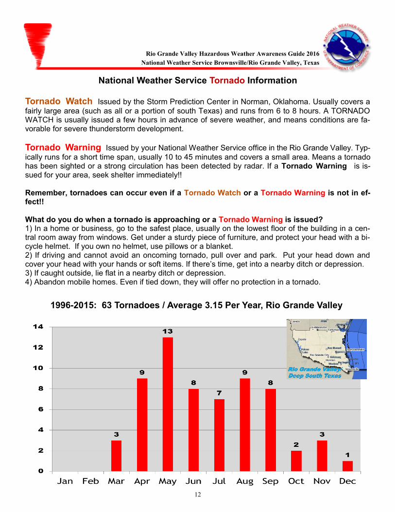
1996-2015: 63 Tornadoes / Average 3.15 Per Year, Rio Grande Valley
13
Floods and Flash Floods What are the different types of floods? Flash Floods Flash floods are short-fuse weather events, typically lasting on the order of 6 hours or less.
Usually, flash floods occur within a few minutes or hours following heavy rainfall. They can also be caused by a man-made event, such as a dam or levee failure. Flash floods cause most of the fatalities associated with flooding events. A flash flood is defined as follows in the Rio Grande Valley: ≥3 feet of standing water; High water entering multiple structures sufficient to cause structural damage; ≥6 inches of fast flowing water across roads; Arroyos/streams overtopping banks sufficient to produce ≥6 inches of fast flowing water.
Urban Floods Nuisance flooding in highly populated areas of the Rio Grande Valley is common
whenever torrential rains fall in a short period of time. Cities generally have 2 to 6 times the runoff potential as pastures, ranchland, and wetlands. Clogged drainage ditches or canals increase the potential for urban flooding, even for rainfall less than an inch. An urban flood is defined as follows in the Rio Grande Valley: <3 feet of standing water, enough to cause minor road flooding <6 inches of fast flowing water across roads; Arroyos/streams nearing bank full, or briefly overtopping banks with <6 inches of fast flowing water.
River Floods Heavy rainfall falling over a widespread area (such as a large portion of a watershed) over
a prolonged period (up to several days) can cause river flooding. Typically, river flooding begins as a high crest on the upper part of a watershed that takes several days to move downstream. Due to the slow nature of river flooding, ample warning is provided to evacuate people or property in the path of the flooding.
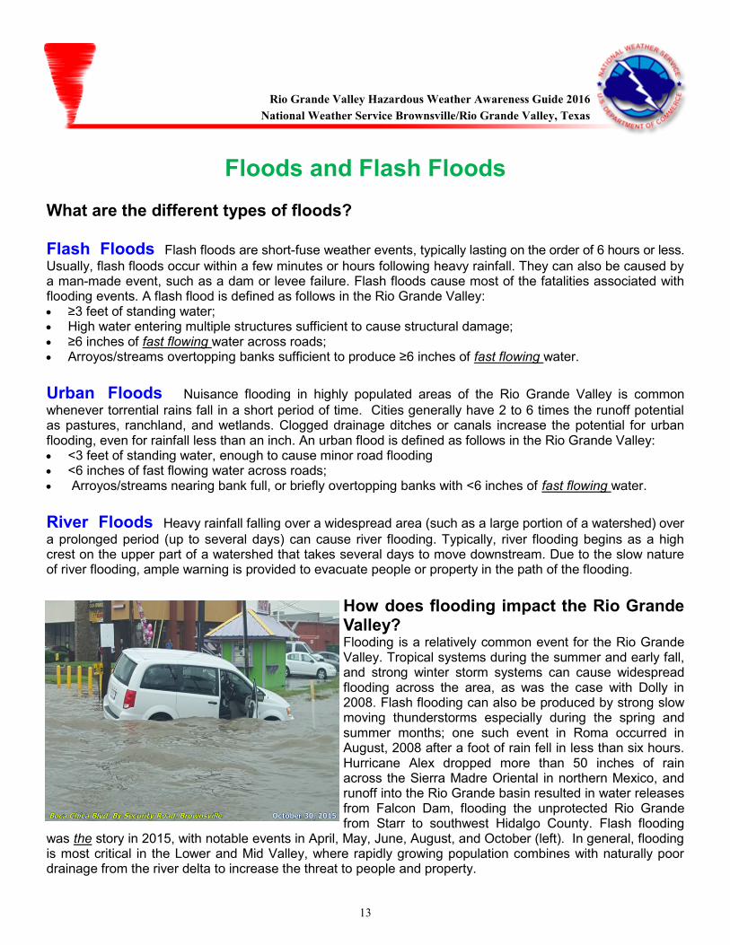
How does flooding impact the Rio Grande Valley? Flooding is a relatively common event for the Rio Grande Valley. Tropical systems during the summer and early fall, and strong winter storm systems can cause widespread flooding across the area, as was the case with Dolly in 2008. Flash flooding can also be produced by strong slow moving thunderstorms especially during the spring and summer months; one such event in Roma occurred in August, 2008 after a foot of rain fell in less than six hours. Hurricane Alex dropped more than 50 inches of rain across the Sierra Madre Oriental in northern Mexico, and runoff into the Rio Grande basin resulted in water releases from Falcon Dam, flooding the unprotected Rio Grande from Starr to southwest Hidalgo County. Flash flooding
was the story in 2015, with notable events in April, May, June, August, and October (left). In general, flooding is most critical in the Lower and Mid Valley, where rapidly growing population combines with naturally poor drainage from the river delta to increase the threat to people and property.
(NWS Corpus Christi)
Rio Grande Valley Hazardous Weather Awareness Guide 2016
National Weather Service Brownsville/Rio Grande Valley, Texas
14
Things you can do ahead of time to prepare for major floods: Know the flood risk at
your place of home or business and its elevation above flood stage. Store drinking water in clean bathtubs or containers. This is very important as flood waters will contaminate the drinking water supply in your area. Stock non-perishable food items requiring little cooking and no refrigeration. Keep first aid supplies on hand. Keep NOAA Weather Radio, battery-powered portable radio, emergency cooking equipment, and flashlights in working order. Install check valves in sewer traps to prevent flood waters from backing into your home. Flood disaster supply kit:
What do you do after the flood has passed? Boil drinking water before using. Do not use tap water without boiling it! Seek necessary medical care at the nearest hospital. Clothing, food, and shelter are available at the nearest Red Cross. Do not visit disaster areas. You may hamper rescue and emergency operations. Electrical equipment should be checked or dried before being returned to service. Make sure to wear rubber gloves and rubber boots when working with electrical equipment. Report broken utility lines to the proper authorities
first aid kit canned food/can opener bottled water
rubber boots NOAA Weather Radio battery-powered radio
flashlight batteries gloves
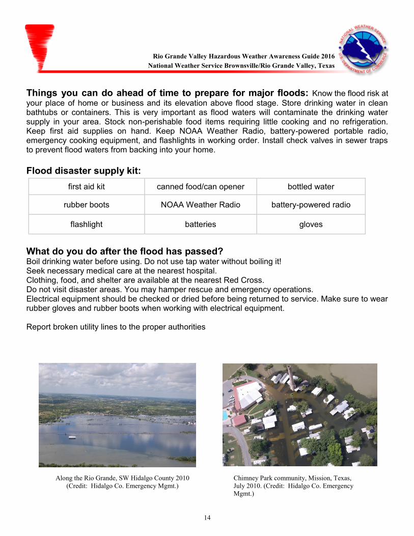
Along the Rio Grande, SW Hidalgo County 2010
(Credit: Hidalgo Co. Emergency Mgmt.)
Chimney Park community, Mission, Texas,
July 2010. (Credit: Hidalgo Co. Emergency
Mgmt.)
Rio Grande Valley Hazardous Weather Awareness Guide 2016
National Weather Service Brownsville/Rio Grande Valley, Texas
15
National Weather Service Flood Information:
Flood Watch Means that conditions in the watch area will be favorable for flooding during the specified
period. Usually heavy rainfall is expected following a long period of wet weather.
Flash Flood Warning Flash flooding is reported or is imminent in the areas specified in the warning. Take immediate precautions. Flood Warning Flooding is continuing in the areas specified in the warning, well after rainfall has ended and
fair weather has returned. Avoid being lulled into a false sense of safety.
Flood (River) Warning River or stream gages have exceeded flood stage. Flooding can range from inconveniences near the river (minor) to significant life and property threats (major).
Flash Flood/Flood Statement Follow-up information on a Flash Flood/Flood Watch or Warning.
Urban/Arroyo Flood Advisory Nuisance Flooding of streets, low-lying areas like underpasses and storm drains, and small streams is expected. Caution should be taken while traveling.
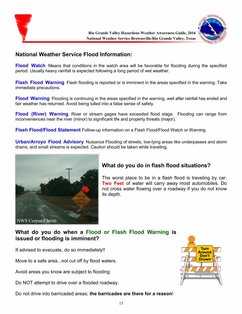
What do you do in flash flood situations? The worst place to be in a flash flood is traveling by car. Two Feet of water will carry away most automobiles. Do not cross water flowing over a roadway if you do not know its depth.
What do you do when a Flood or Flash Flood Warning is issued or flooding is imminent? If advised to evacuate, do so immediately!! Move to a safe area...not cut off by flood waters. Avoid areas you know are subject to flooding. Do NOT attempt to drive over a flooded roadway. Do not drive into barricaded areas; the barricades are there for a reason!
NWS Corpus Christi
Rio Grande Valley Hazardous Weather Awareness Guide, 2016
National Weather Service Brownsville/Rio Grande Valley, Texas
16
Lightning
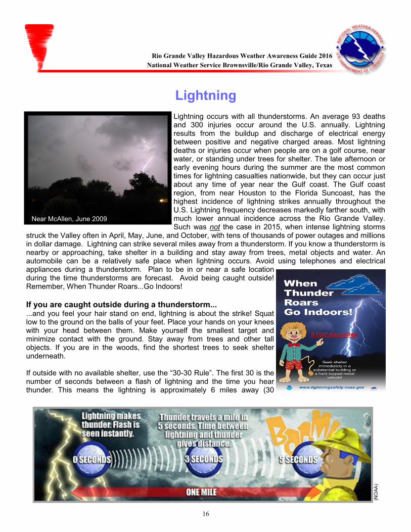
Lightning occurs with all thunderstorms. An average 93 deaths and 300 injuries occur around the U.S. annually. Lightning results from the buildup and discharge of electrical energy between positive and negative charged areas. Most lightning deaths or injuries occur when people are on a golf course, near water, or standing under trees for shelter. The late afternoon or early evening hours during the summer are the most common times for lightning casualties nationwide, but they can occur just about any time of year near the Gulf coast. The Gulf coast region, from near Houston to the Florida Suncoast, has the highest incidence of lightning strikes annually throughout the U.S. Lightning frequency decreases markedly farther south, with much lower annual incidence across the Rio Grande Valley. Such was not the case in 2015, when intense lightning storms
struck the Valley often in April, May, June, and October, with tens of thousands of power outages and millions in dollar damage. Lightning can strike several miles away from a thunderstorm. If you know a thunderstorm is nearby or approaching, take shelter in a building and stay away from trees, metal objects and water. An automobile can be a relatively safe place when lightning occurs. Avoid using telephones and electrical appliances during a thunderstorm. Plan to be in or near a safe location during the time thunderstorms are forecast. Avoid being caught outside! Remember, When Thunder Roars...Go Indoors!
If you are caught outside during a thunderstorm... ...and you feel your hair stand on end, lightning is about the strike! Squat low to the ground on the balls of your feet. Place your hands on your knees with your head between them. Make yourself the smallest target and minimize contact with the ground. Stay away from trees and other tall objects. If you are in the woods, find the shortest trees to seek shelter underneath. If outside with no available shelter, use the “30-30 Rule”. The first 30 is the number of seconds between a flash of lightning and the time you hear thunder. This means the lightning is approximately 6 miles away (30
Near McAllen, June 2009
Rio Grande Valley Hazardous Weather Awareness Guide 2016
National Weather Service Brownsville/Rio Grande Valley, Texas

17
Rip and Longshore Currents
Beaches along the Lower Texas Gulf coast are not immune to rip currents. Since June 2008, fifteen people have drowned at the beaches of South Padre Island and Boca Chica, mainly during the months of May, June, and July. This includes three recent unfortunate deaths, all occurring during the Memorial Day weekend of 2014. Sunny skies, warm air and water temperatures, and light to moderate surface winds can mask rip and longshore currents, which can occur under persistent easterly swell produced by broad high pressure ridges centered north of the border region, or by distant tropical, subtropical, or non tropical disturbances in the Gulf or Caribbean. When these conditions combine with swelled beach populations, such as United States Holidays including Memorial Day, the Fourth of July, and Labor Day, and other favored periods such as Semana Santa (Holy Week, including Good Friday and Easter Sunday) and the last two weeks in July (Mexico summer break), the potential for rip/longshore current danger increases. This is most critical for poor swimmers who venture a bit too far into the surf. Rip/Longshore current injuries and deaths are avoidable! Learning to swim, and knowing the threat for currents before you hit the surf, and understanding how to calmly escape the "grip of the rip" will ensure a safe and fun beach experience.
Rip Currents
A rip current is a narrow channel or river of water moving away from the shore at a fast speed. Speeds may range from 1 to 2 mph to 6 mph. Rip currents usually extend from near the shoreline, through the surf zone, and beyond the line of breaking waves. Rip currents are comprised of three parts: The feeder source, the neck, and the head (above). The feeder source is the area where wave energy is focused and is the point of origin for the rip current. The neck is the most dangerous part of the rip current, where water is flowing quickly away from the beach. The head is where effects of the rip current begin to disperse or spread out as the seaward pull dissipates. A rip current is not the same thing as an undertow. Rip currents carry you rapidly away from shore but do not pull you under the water.
Longshore Currents
Longshore currents are another form of hazardous water conditions that is common from late autumn through late spring along the Lower Texas coast. When waves break on the shoreline, they create currents parallel to the shoreline. Longshore currents occur most often when waves approach the shoreline at an angle. The angle of the incoming wave causes a progressively breaking wave that moves along the shoreline and a longshore current that moves in the
same direction as the breaking wave. The longshore current spans the entire width of the surf zone. It reaches maximum strength in the middle of the surf zone and diminishes in strength as it moves farther offshore.
Rio Grande Valley Hazardous Weather Awareness Guide 2016
National Weather Service Brownsville/Rio Grande Valley, Texas
18
Wildfire Danger
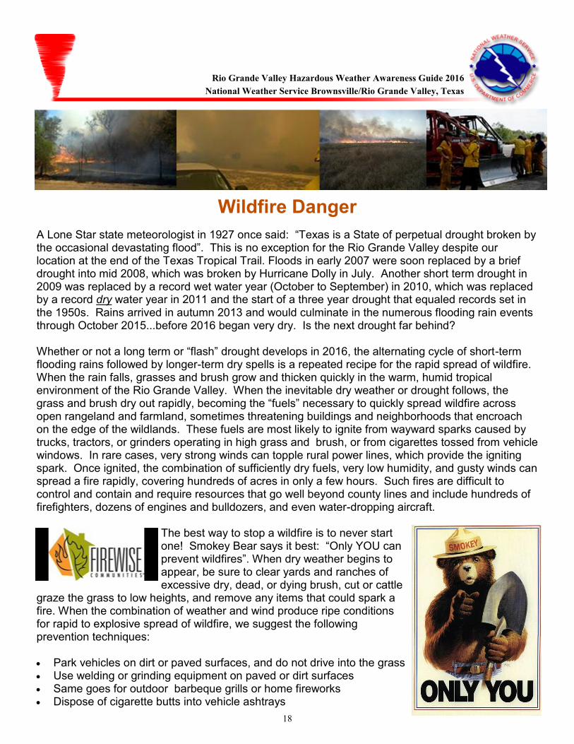
A Lone Star state meteorologist in 1927 once said: “Texas is a State of perpetual drought broken by the occasional devastating flood”. This is no exception for the Rio Grande Valley despite our location at the end of the Texas Tropical Trail. Floods in early 2007 were soon replaced by a brief drought into mid 2008, which was broken by Hurricane Dolly in July. Another short term drought in 2009 was replaced by a record wet water year (October to September) in 2010, which was replaced by a record dry water year in 2011 and the start of a three year drought that equaled records set in the 1950s. Rains arrived in autumn 2013 and would culminate in the numerous flooding rain events through October 2015...before 2016 began very dry. Is the next drought far behind? Whether or not a long term or “flash” drought develops in 2016, the alternating cycle of short-term flooding rains followed by longer-term dry spells is a repeated recipe for the rapid spread of wildfire. When the rain falls, grasses and brush grow and thicken quickly in the warm, humid tropical environment of the Rio Grande Valley. When the inevitable dry weather or drought follows, the grass and brush dry out rapidly, becoming the “fuels” necessary to quickly spread wildfire across open rangeland and farmland, sometimes threatening buildings and neighborhoods that encroach on the edge of the wildlands. These fuels are most likely to ignite from wayward sparks caused by trucks, tractors, or grinders operating in high grass and brush, or from cigarettes tossed from vehicle windows. In rare cases, very strong winds can topple rural power lines, which provide the igniting spark. Once ignited, the combination of sufficiently dry fuels, very low humidity, and gusty winds can spread a fire rapidly, covering hundreds of acres in only a few hours. Such fires are difficult to control and contain and require resources that go well beyond county lines and include hundreds of firefighters, dozens of engines and bulldozers, and even water-dropping aircraft.
The best way to stop a wildfire is to never start one! Smokey Bear says it best: “Only YOU can prevent wildfires”. When dry weather begins to appear, be sure to clear yards and ranches of excessive dry, dead, or dying brush, cut or cattle
graze the grass to low heights, and remove any items that could spark a fire. When the combination of weather and wind produce ripe conditions for rapid to explosive spread of wildfire, we suggest the following prevention techniques: Park vehicles on dirt or paved surfaces, and do not drive into the grass Use welding or grinding equipment on paved or dirt surfaces Same goes for outdoor barbeque grills or home fireworks Dispose of cigarette butts into vehicle ashtrays
Rio Grande Valley Hazardous Weather Awareness Guide 2016
National Weather Service Brownsville/Rio Grande Valley, Texas
19
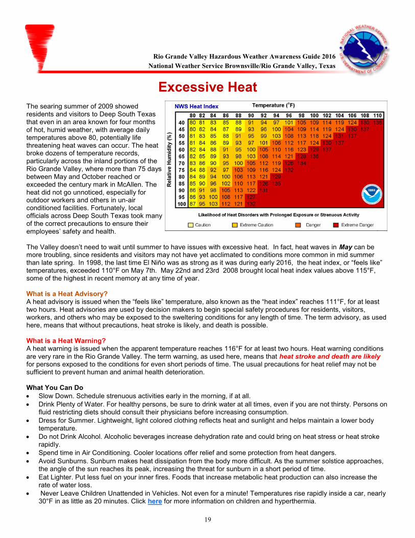
Excessive Heat The searing summer of 2009 showed residents and visitors to Deep South Texas that even in an area known for four months of hot, humid weather, with average daily temperatures above 80, potentially life threatening heat waves can occur. The heat broke dozens of temperature records, particularly across the inland portions of the Rio Grande Valley, where more than 75 days between May and October reached or exceeded the century mark in McAllen. The heat did not go unnoticed, especially for outdoor workers and others in un-air conditioned facilities. Fortunately, local officials across Deep South Texas took many of the correct precautions to ensure their employees’ safety and health. The Valley doesn’t need to wait until summer to have issues with excessive heat. In fact, heat waves in May can be more troubling, since residents and visitors may not have yet acclimated to conditions more common in mid summer than late spring. In 1998, the last time El Niño was as strong as it was during early 2016, the heat index, or “feels like” temperatures, exceeded 110°F on May 7th. May 22nd and 23rd 2008 brought local heat index values above 115°F, some of the highest in recent memory at any time of year. What is a Heat Advisory? A heat advisory is issued when the “feels like” temperature, also known as the “heat index” reaches 111°F, for at least two hours. Heat advisories are used by decision makers to begin special safety procedures for residents, visitors, workers, and others who may be exposed to the sweltering conditions for any length of time. The term advisory, as used here, means that without precautions, heat stroke is likely, and death is possible. What is a Heat Warning? A heat warning is issued when the apparent temperature reaches 116°F for at least two hours. Heat warning conditions are very rare in the Rio Grande Valley. The term warning, as used here, means that heat stroke and death are likely for persons exposed to the conditions for even short periods of time. The usual precautions for heat relief may not be sufficient to prevent human and animal health deterioration. What You Can Do
Slow Down. Schedule strenuous activities early in the morning, if at all.
Drink Plenty of Water. For healthy persons, be sure to drink water at all times, even if you are not thirsty. Persons on fluid restricting diets should consult their physicians before increasing consumption.
Dress for Summer. Lightweight, light colored clothing reflects heat and sunlight and helps maintain a lower body temperature.
Do not Drink Alcohol. Alcoholic beverages increase dehydration rate and could bring on heat stress or heat stroke rapidly.
Spend time in Air Conditioning. Cooler locations offer relief and some protection from heat dangers.
Avoid Sunburns. Sunburn makes heat dissipation from the body more difficult. As the summer solstice approaches, the angle of the sun reaches its peak, increasing the threat for sunburn in a short period of time.
Eat Lighter. Put less fuel on your inner fires. Foods that increase metabolic heat production can also increase the rate of water loss.
Never Leave Children Unattended in Vehicles. Not even for a minute! Temperatures rise rapidly inside a car, nearly 30°F in as little as 20 minutes. Click here for more information on children and hyperthermia.
Rio Grande Valley Hazardous Weather Awareness Guide 2016
National Weather Service Brownsville/Rio Grande Valley, Texas
20
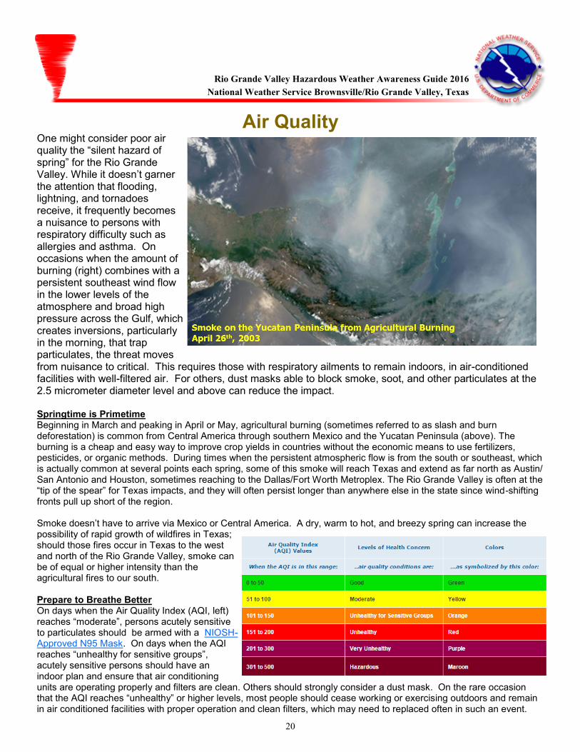
Air Quality One might consider poor air quality the “silent hazard of spring” for the Rio Grande Valley. While it doesn’t garner the attention that flooding, lightning, and tornadoes receive, it frequently becomes a nuisance to persons with respiratory difficulty such as allergies and asthma. On occasions when the amount of burning (right) combines with a persistent southeast wind flow in the lower levels of the atmosphere and broad high pressure across the Gulf, which creates inversions, particularly in the morning, that trap particulates, the threat moves from nuisance to critical. This requires those with respiratory ailments to remain indoors, in air-conditioned facilities with well-filtered air. For others, dust masks able to block smoke, soot, and other particulates at the 2.5 micrometer diameter level and above can reduce the impact. Springtime is Primetime Beginning in March and peaking in April or May, agricultural burning (sometimes referred to as slash and burn deforestation) is common from Central America through southern Mexico and the Yucatan Peninsula (above). The burning is a cheap and easy way to improve crop yields in countries without the economic means to use fertilizers, pesticides, or organic methods. During times when the persistent atmospheric flow is from the south or southeast, which is actually common at several points each spring, some of this smoke will reach Texas and extend as far north as Austin/San Antonio and Houston, sometimes reaching to the Dallas/Fort Worth Metroplex. The Rio Grande Valley is often at the “tip of the spear” for Texas impacts, and they will often persist longer than anywhere else in the state since wind-shifting fronts pull up short of the region. Smoke doesn’t have to arrive via Mexico or Central America. A dry, warm to hot, and breezy spring can increase the possibility of rapid growth of wildfires in Texas; should those fires occur in Texas to the west and north of the Rio Grande Valley, smoke can be of equal or higher intensity than the agricultural fires to our south. Prepare to Breathe Better On days when the Air Quality Index (AQI, left) reaches “moderate”, persons acutely sensitive to particulates should be armed with a NIOSH-Approved N95 Mask. On days when the AQI reaches “unhealthy for sensitive groups”, acutely sensitive persons should have an indoor plan and ensure that air conditioning units are operating properly and filters are clean. Others should strongly consider a dust mask. On the rare occasion that the AQI reaches “unhealthy” or higher levels, most people should cease working or exercising outdoors and remain in air conditioned facilities with proper operation and clean filters, which may need to replaced often in such an event.
Rio Grande Valley Hazardous Weather Awareness Guide 2016
National Weather Service Brownsville/Rio Grande Valley, Texas
21
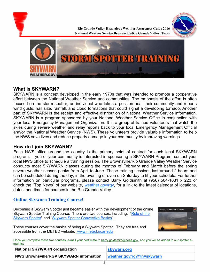
What is SKYWARN? SKYWARN is a concept developed in the early 1970s that was intended to promote a cooperative effort between the National Weather Service and communities. The emphasis of the effort is often focused on the storm spotter, an individual who takes a position near their community and reports wind gusts, hail size, rainfall, and cloud formations that could signal a developing tornado. Another part of SKYWARN is the receipt and effective distribution of National Weather Service information. SKYWARN is a program sponsored by your National Weather Service Office in conjunction with your local Emergency Management Organization. It is a group of trained volunteers that watch the skies during severe weather and relay reports back to your local Emergency Management Official and/or the National Weather Service (NWS). These volunteers provide valuable information to help the NWS save lives and reduce property damage in your community by improving warnings.
How do I join SKYWARN? Each NWS office around the country is the primary point of contact for each local SKYWARN program. If you or your community is interested in sponsoring a SKYWARN Program, contact your local NWS office to schedule a training session. The Brownsville/Rio Grande Valley Weather Service conducts most SKYWARN classes during the months of February and March before the spring severe weather season peaks from April to June. These training sessions last around 2 hours and can be scheduled during the day, in the evening or even on Saturday to fit your schedule. For further information on particular programs, please contact Barry Goldsmith at (956) 504-1631 x 223 or check the “Top News” of our website, weather.gov/rgv, for a link to the latest calendar of locations, dates, and times for courses in the Rio Grande Valley.
Online Skywarn Training Course!
Becoming a Skywarn Spotter just became easier with the development of the online Skywarn Spotter Training Course. There are two courses, including: "Role of the Skywarn Spotter" and "Skywarn Spotter Convective Basics".
These courses cover the basics of being a Skywarn Spotter. They are free and accessible from the METED website. www.meted.ucar.edu
Once you complete these two courses, e-mail your certificate to [email protected], and you will be added to our spotter e-mail list.
National SKYWARN organization skywarn.org
NWS Brownsville/RGV SKYWARN information weather.gov/rgv/?n=skywarn
Rio Grande Valley Hazardous Weather Awareness Guide 2016
National Weather Service Brownsville/Rio Grande Valley, Texas
22
Reporting Severe Weather: Get Social!
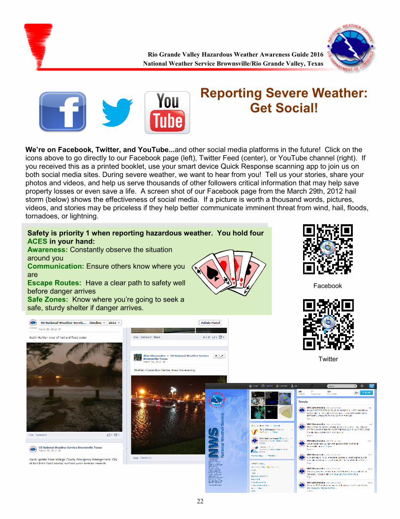
We’re on Facebook, Twitter, and YouTube...and other social media platforms in the future! Click on the icons above to go directly to our Facebook page (left), Twitter Feed (center), or YouTube channel (right). If you received this as a printed booklet, use your smart device Quick Response scanning app to join us on both social media sites. During severe weather, we want to hear from you! Tell us your stories, share your photos and videos, and help us serve thousands of other followers critical information that may help save property losses or even save a life. A screen shot of our Facebook page from the March 29th, 2012 hail storm (below) shows the effectiveness of social media. If a picture is worth a thousand words, pictures, videos, and stories may be priceless if they help better communicate imminent threat from wind, hail, floods, tornadoes, or lightning.
Rio Grande Valley Hazardous Weather Awareness Guide 2016
National Weather Service Brownsville/Rio Grande Valley, Texas
Safety is priority 1 when reporting hazardous weather. You hold four ACES in your hand: Awareness: Constantly observe the situation around you Communication: Ensure others know where you are Escape Routes: Have a clear path to safety well before danger arrives Safe Zones: Know where you’re going to seek a safe, sturdy shelter if danger arrives.
23
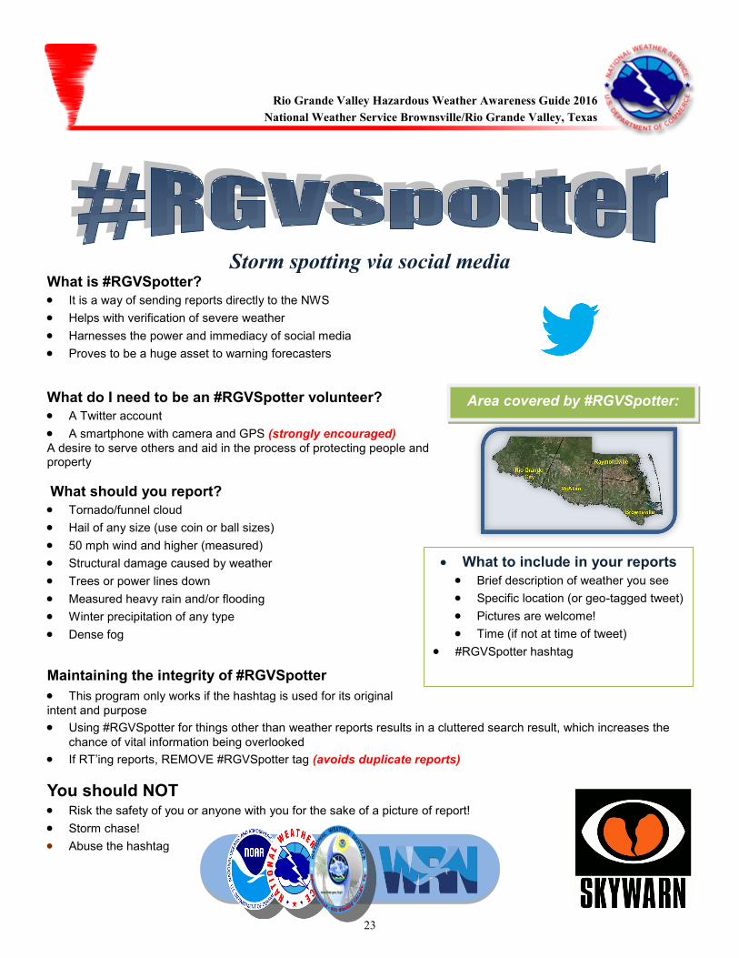
Storm spotting via social media What is #RGVSpotter?
It is a way of sending reports directly to the NWS
Helps with verification of severe weather
Harnesses the power and immediacy of social media
Proves to be a huge asset to warning forecasters
What do I need to be an #RGVSpotter volunteer?
A Twitter account
A smartphone with camera and GPS (strongly encouraged)
A desire to serve others and aid in the process of protecting people and property
What should you report? Tornado/funnel cloud
Hail of any size (use coin or ball sizes)
50 mph wind and higher (measured)
Structural damage caused by weather
Trees or power lines down
Measured heavy rain and/or flooding
Winter precipitation of any type
Dense fog
Maintaining the integrity of #RGVSpotter
This program only works if the hashtag is used for its original
intent and purpose
Using #RGVSpotter for things other than weather reports results in a cluttered search result, which increases the
chance of vital information being overlooked
If RT’ing reports, REMOVE #RGVSpotter tag (avoids duplicate reports)
You should NOT Risk the safety of you or anyone with you for the sake of a picture of report!
Storm chase!
Abuse the hashtag
Rio Grande Valley Hazardous Weather Awareness Guide 2016
National Weather Service Brownsville/Rio Grande Valley, Texas
Area covered by #RGVSpotter:
What to include in your reports
Brief description of weather you see
Specific location (or geo-tagged tweet)
Pictures are welcome!
Time (if not at time of tweet)
#RGVSpotter hashtag
24
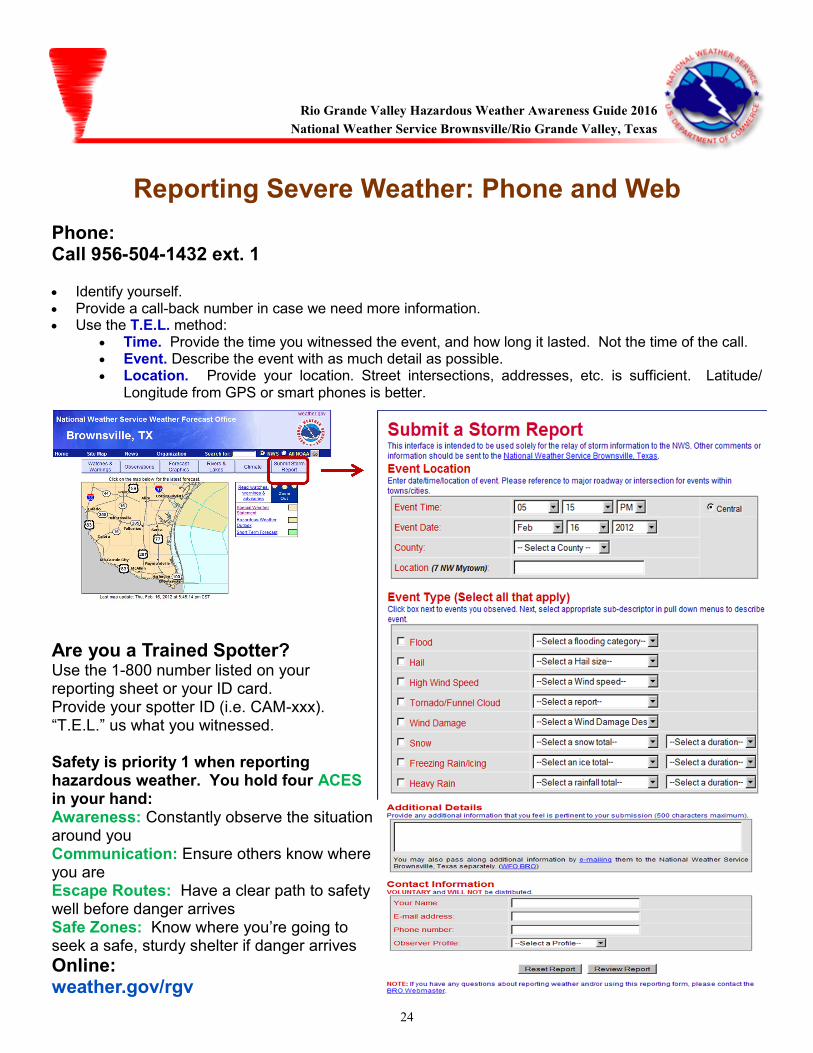
Reporting Severe Weather: Phone and Web
Phone: Call 956-504-1432 ext. 1
Identify yourself. Provide a call-back number in case we need more information. Use the T.E.L. method:
Time. Provide the time you witnessed the event, and how long it lasted. Not the time of the call. Event. Describe the event with as much detail as possible. Location. Provide your location. Street intersections, addresses, etc. is sufficient. Latitude/
Longitude from GPS or smart phones is better.
Are you a Trained Spotter? Use the 1-800 number listed on your reporting sheet or your ID card. Provide your spotter ID (i.e. CAM-xxx). “T.E.L.” us what you witnessed. Safety is priority 1 when reporting hazardous weather. You hold four ACES in your hand: Awareness: Constantly observe the situation around you Communication: Ensure others know where you are Escape Routes: Have a clear path to safety well before danger arrives Safe Zones: Know where you’re going to seek a safe, sturdy shelter if danger arrives
Online: weather.gov/rgv
Rio Grande Valley Hazardous Weather Awareness Guide 2016
National Weather Service Brownsville/Rio Grande Valley, Texas
25
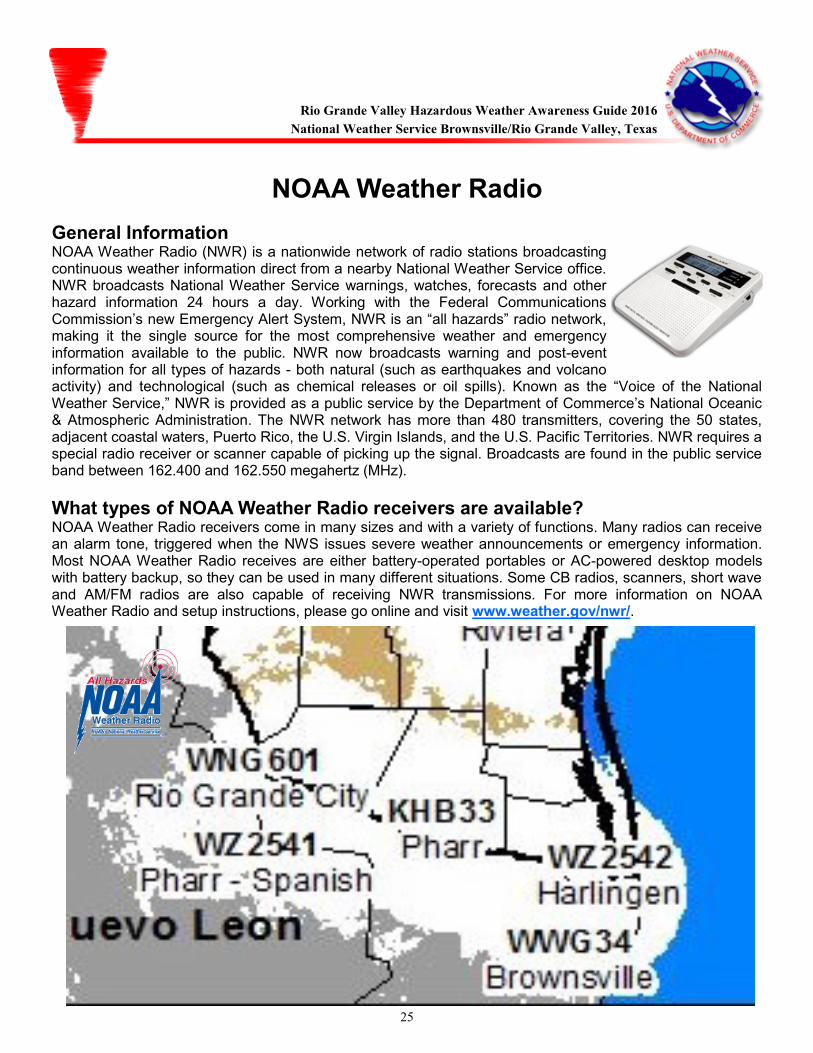
NOAA Weather Radio
General Information NOAA Weather Radio (NWR) is a nationwide network of radio stations broadcasting continuous weather information direct from a nearby National Weather Service office. NWR broadcasts National Weather Service warnings, watches, forecasts and other hazard information 24 hours a day. Working with the Federal Communications Commission’s new Emergency Alert System, NWR is an “all hazards” radio network, making it the single source for the most comprehensive weather and emergency information available to the public. NWR now broadcasts warning and post-event information for all types of hazards - both natural (such as earthquakes and volcano activity) and technological (such as chemical releases or oil spills). Known as the “Voice of the National Weather Service,” NWR is provided as a public service by the Department of Commerce’s National Oceanic & Atmospheric Administration. The NWR network has more than 480 transmitters, covering the 50 states, adjacent coastal waters, Puerto Rico, the U.S. Virgin Islands, and the U.S. Pacific Territories. NWR requires a special radio receiver or scanner capable of picking up the signal. Broadcasts are found in the public service band between 162.400 and 162.550 megahertz (MHz).
What types of NOAA Weather Radio receivers are available? NOAA Weather Radio receivers come in many sizes and with a variety of functions. Many radios can receive an alarm tone, triggered when the NWS issues severe weather announcements or emergency information. Most NOAA Weather Radio receives are either battery-operated portables or AC-powered desktop models with battery backup, so they can be used in many different situations. Some CB radios, scanners, short wave and AM/FM radios are also capable of receiving NWR transmissions. For more information on NOAA Weather Radio and setup instructions, please go online and visit www.weather.gov/nwr/.
Rio Grande Valley Hazardous Weather Awareness Guide 2016
National Weather Service Brownsville/Rio Grande Valley, Texas
26
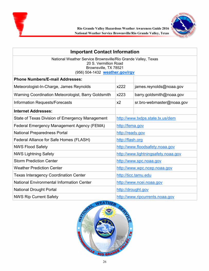
Important Contact Information
National Weather Service Brownsville/Rio Grande Valley, Texas 20 S. Vermillion Road Brownsville, TX 78521
(956) 504-1432 weather.gov/rgv
Phone Numbers/E-mail Addresses:
Meteorologist-In-Charge, James Reynolds x222 [email protected]
Warning Coordination Meteorologist, Barry Goldsmith x223 [email protected]
Information Requests/Forecasts x2 [email protected]
Internet Addresses:
State of Texas Division of Emergency Management http://www.txdps.state.tx.us/dem
Federal Emergency Management Agency (FEMA) http://fema.gov
National Preparedness Portal http://ready.gov
Federal Alliance for Safe Homes (FLASH) http://flash.org
NWS Flood Safety http://www.floodsafety.noaa.gov
NWS Lightning Safety http://www.lightningsafety.noaa.gov
Storm Prediction Center http://www.spc.noaa.gov
Weather Prediction Center http://www.wpc.ncep.noaa.gov
Texas Interagency Coordination Center http://ticc.tamu.edu
National Environmental Information Center http://www.ncei.noaa.gov
National Drought Portal http://drought.gov
NWS Rip Current Safety http://www.ripcurrents.noaa.gov
Rio Grande Valley Hazardous Weather Awareness Guide 2016
National Weather Service Brownsville/Rio Grande Valley, Texas