Embed Size (px)
Citation preview

River proximity bias in Amazon rainfall data: a decade of observations near Santarém
David Fitzjarrald, Ricardo Sakai, Osvaldo Moraes, Raimundo Cosme de Oliveira,Otávio Acevedo, Rodrigo da Silva, Matthew Czikowsky, and Troy Beldini
Jungle Research Group & many other folks too…
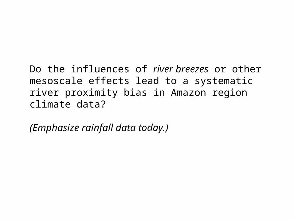
Do the influences of river breezes or other mesoscale effects lead to a systematic river proximity bias in Amazon region climate data?
(Emphasize rainfall data today.)
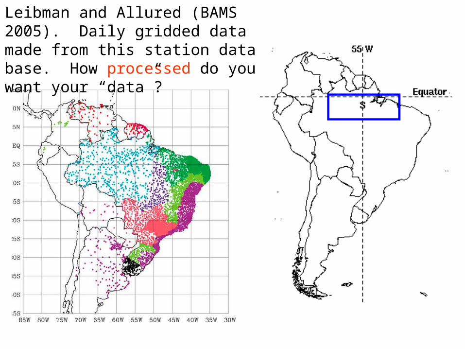
Leibman and Allured (BAMS 2005). Daily gridded data made from this station data base. How processed do you want your “data”?
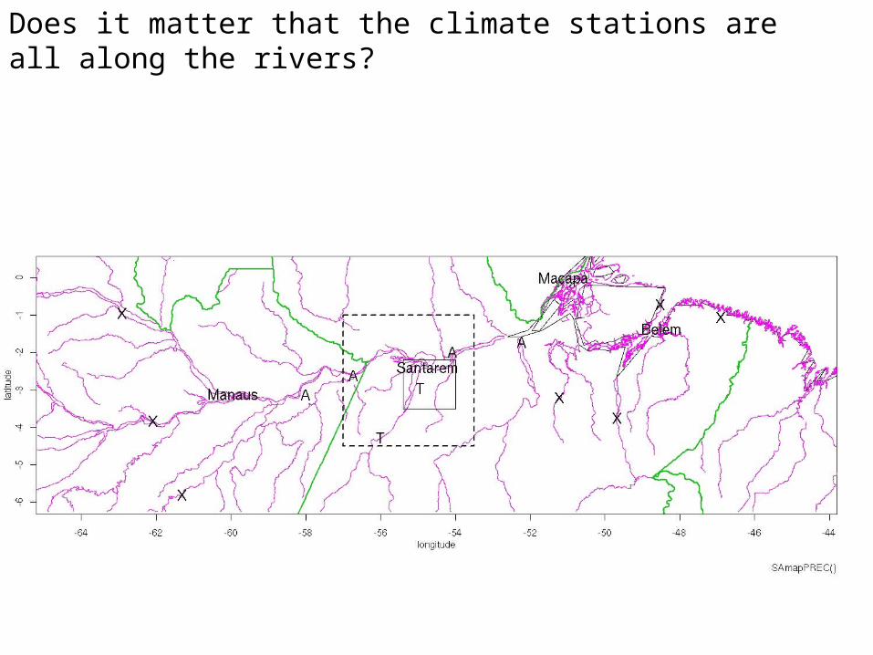
Does it matter that the climate stations are all along the rivers?
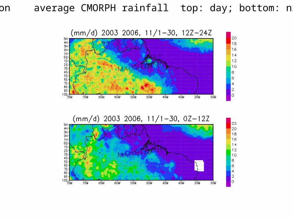
Dry season average CMORPH rainfall top: day; bottom: night
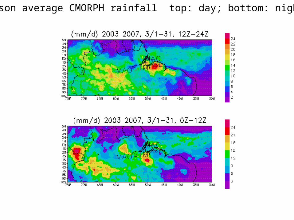
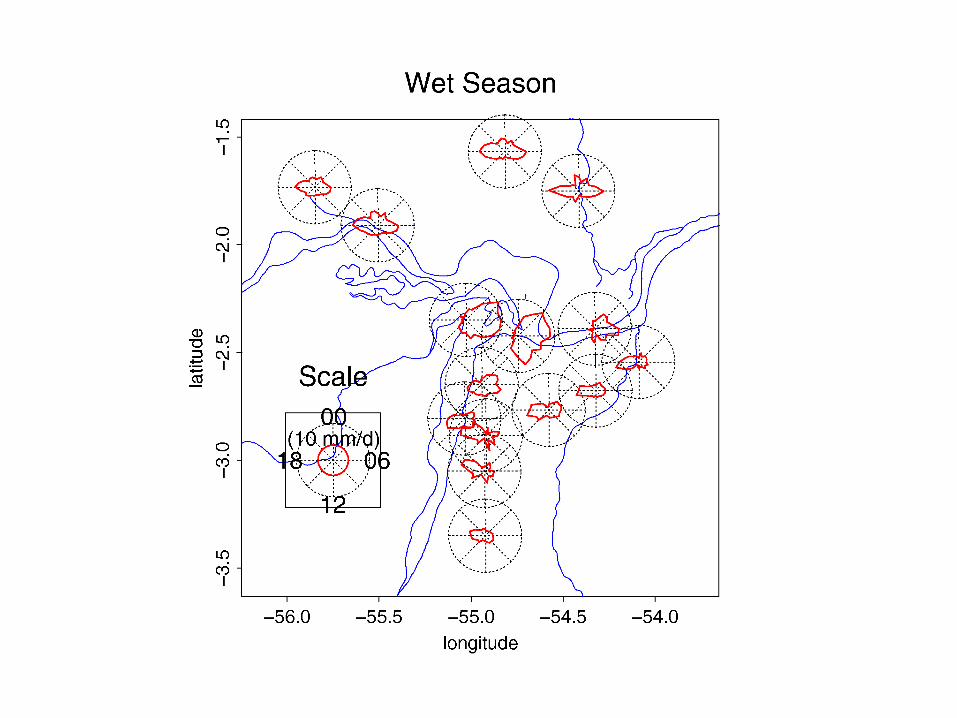
Wet season average CMORPH rainfall top: day; bottom: night
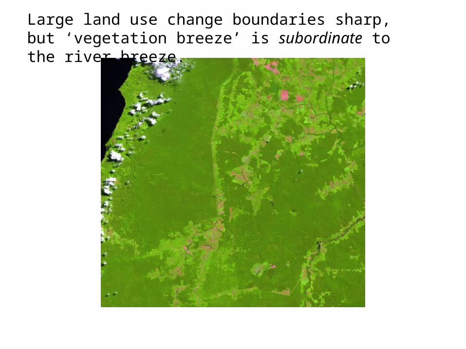
Large land use change boundaries sharp, but ‘vegetation breeze’ is subordinate to the river breeze.
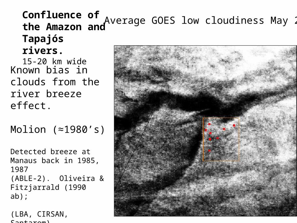
Average GOES low cloudiness May 2001
Known bias in clouds from the river breeze effect.
Molion (≈1980’s)
Detected breeze at Manaus back in 1985, 1987(ABLE-2). Oliveira & Fitzjarrald (1990 ab);
(LBA, CIRSAN, Santarem)Silva Dias et al. (2001)Lu et al. (2005)
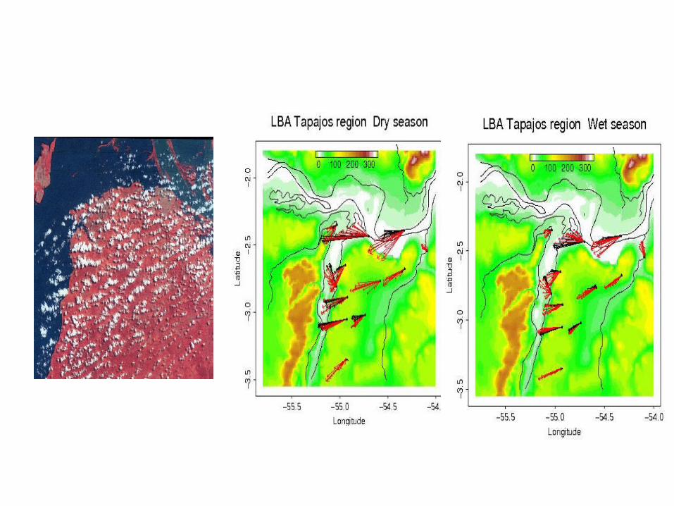
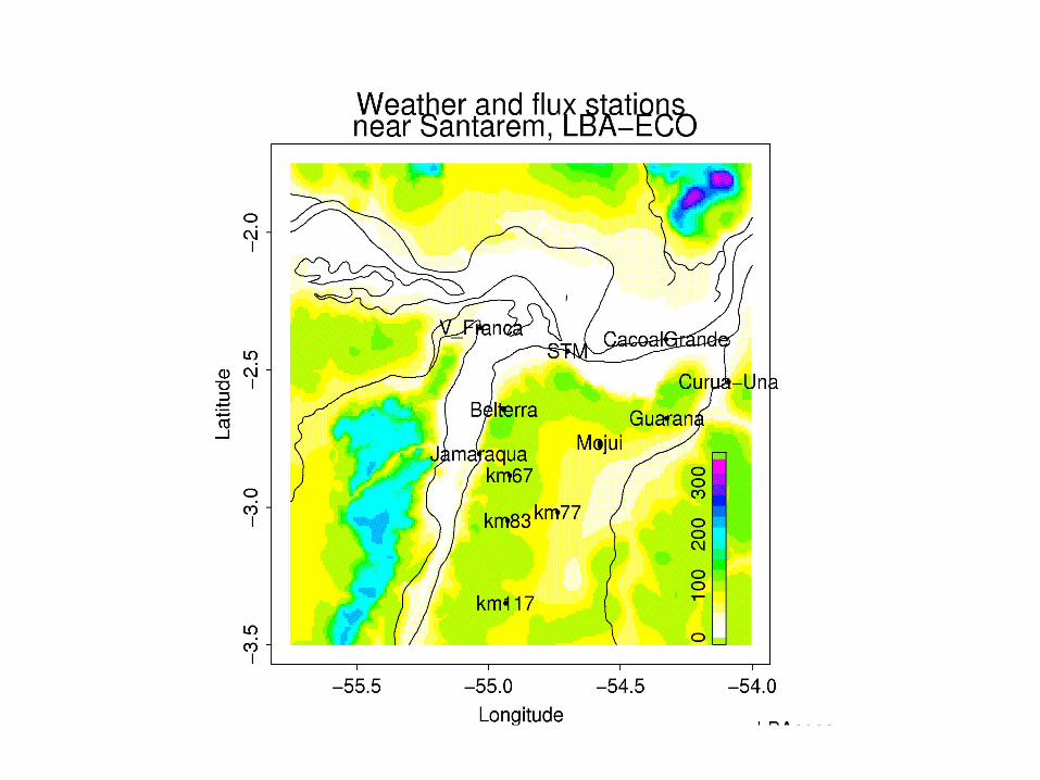
Confluence of the Amazon and Tapajós rivers. 15-20 km wide
Step 1: go out into the field
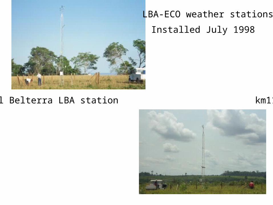
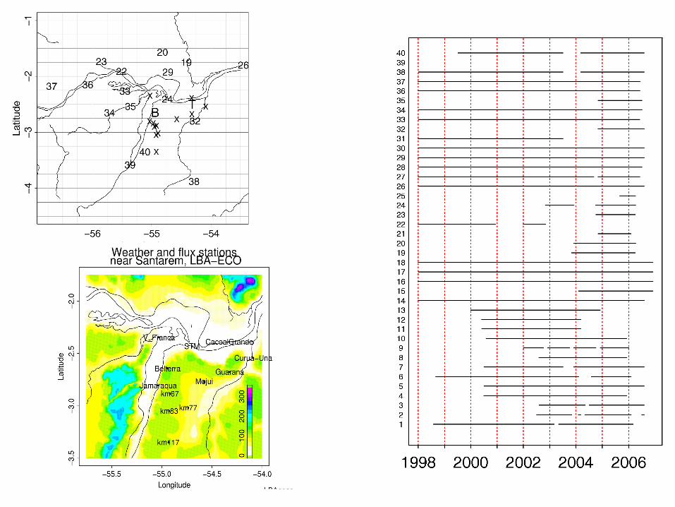
Original Belterra LBA station km117 station
Installed July 1998
LBA-ECO weather stations
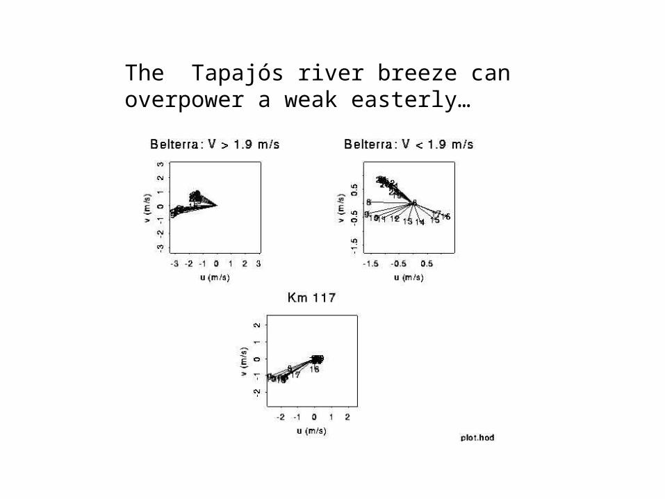
The Tapajós river breeze can overpower a weak easterly…
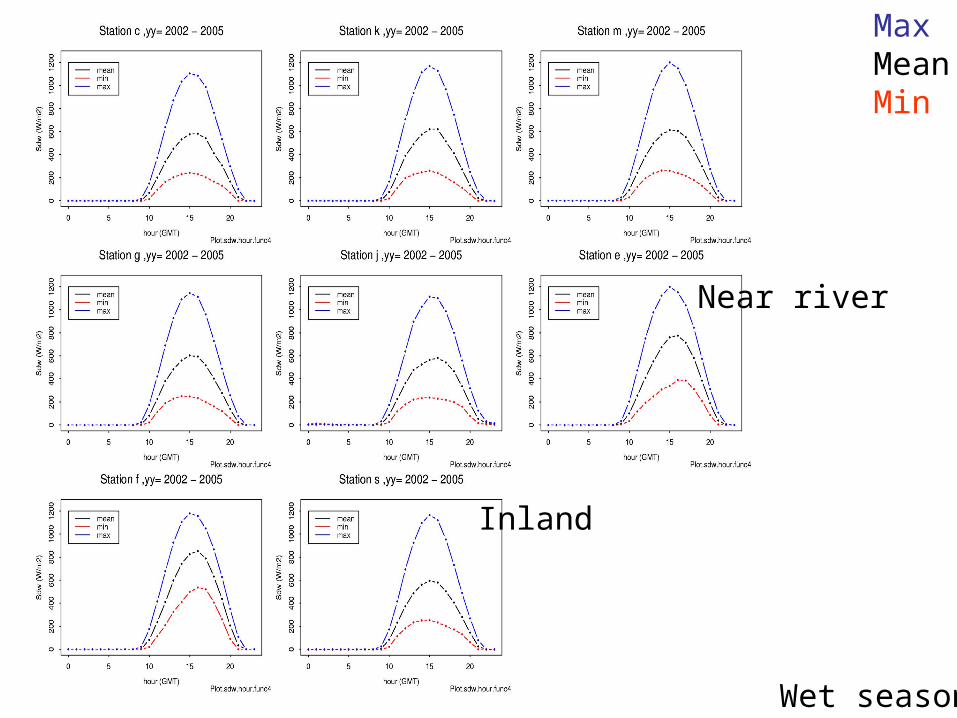
Wet season
MaxMeanMin
Near river
Inland
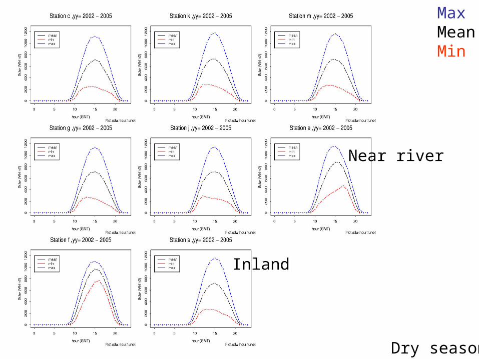
Dry season
MaxMeanMin
Near river
Inland
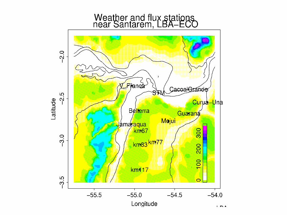
Now focus on precipitation near the rivers’ confluence
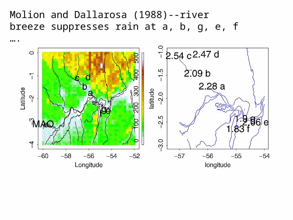
Molion and Dallarosa (1988)--river breeze suppresses rain at a, b, g, e, f ….
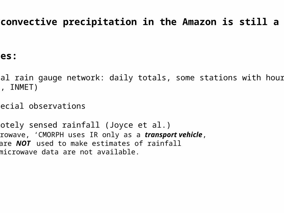
Measuring convective precipitation in the Amazon is still a challenge.
Data sources:
• Conventional rain gauge network: daily totals, some stations with hourly data(Hidro, INMET)
• LBA-ECO special observations
• CMORPH remotely sensed rainfall (Joyce et al.) Passive microwave, ‘CMORPH uses IR only as a transport vehicle, i.e. IR data are NOT used to make estimates of rainfall when passive microwave data are not available.
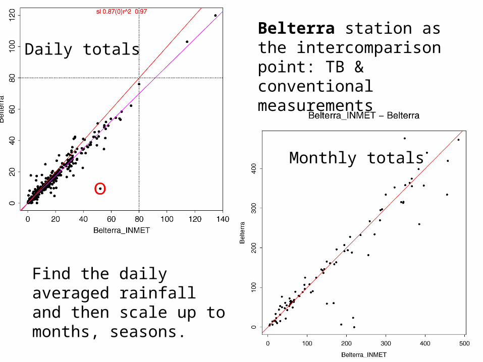
Daily totals
Monthly totals
Belterra station as the intercomparison point: TB & conventional measurements
Find the daily averaged rainfall and then scale up to months, seasons.
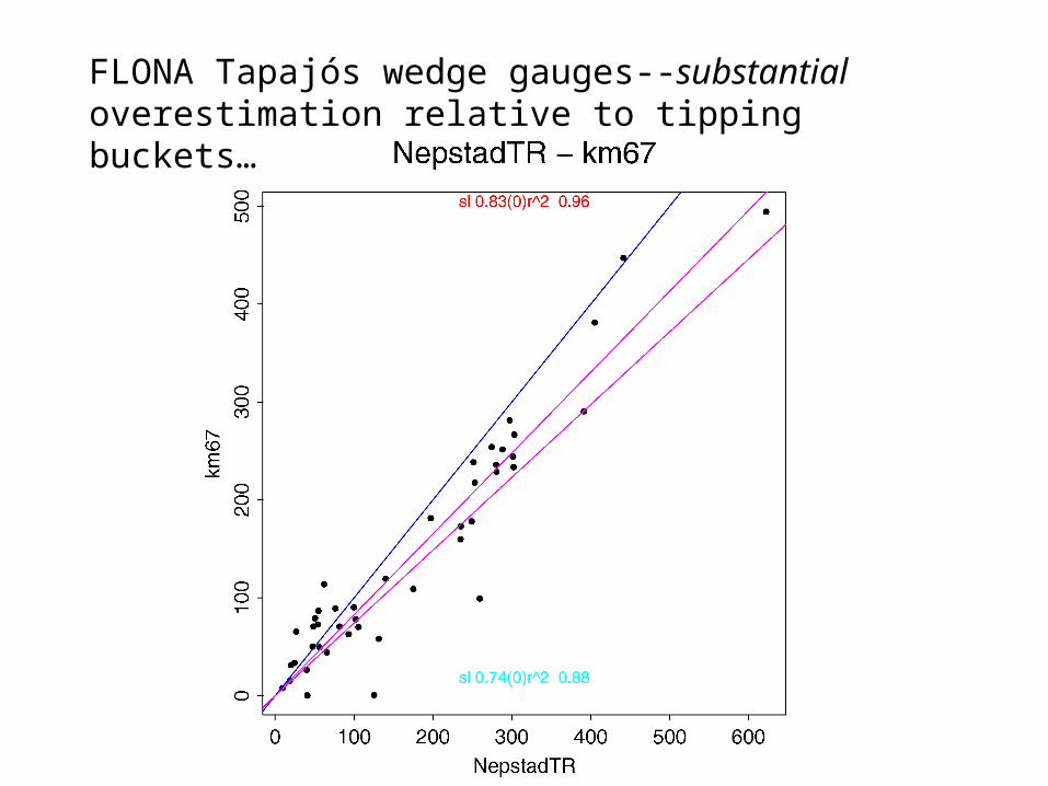
FLONA Tapajós wedge gauges--substantial overestimation relative to tipping buckets…
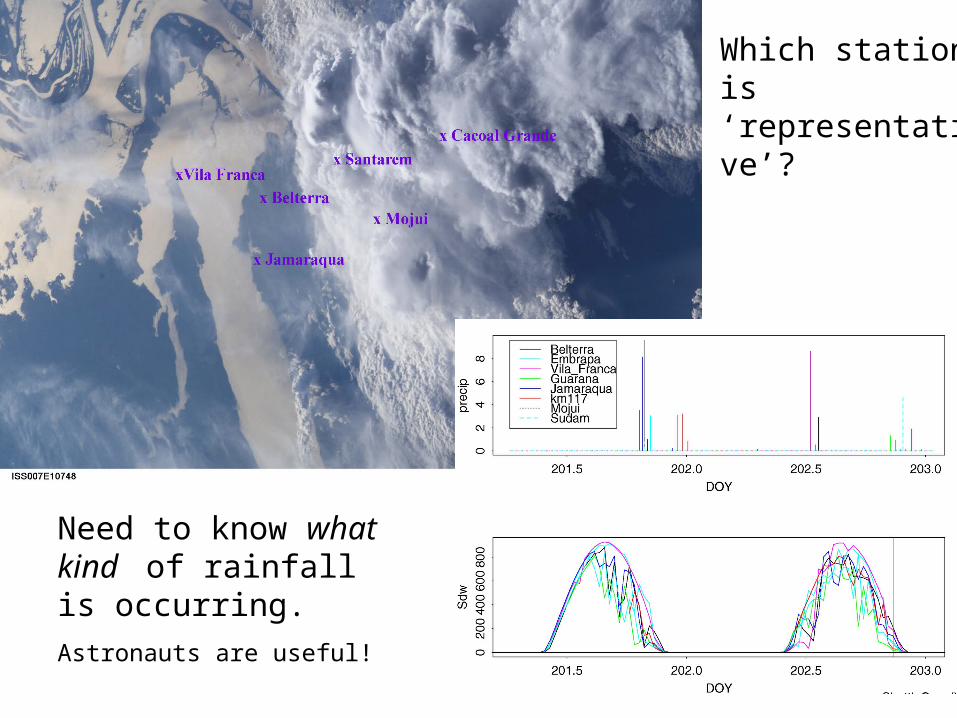
Need to know what kind of rainfall is occurring.
Astronauts are useful!
Which station is ‘representative’?
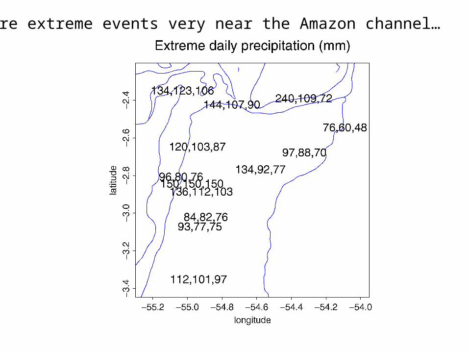
More extreme events very near the Amazon channel…
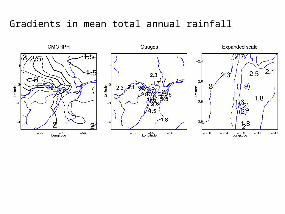
Gradients in mean total annual rainfall
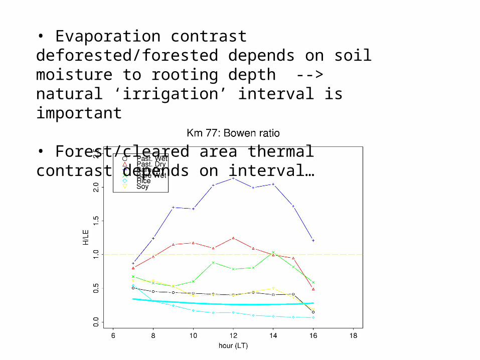
• Evaporation contrast deforested/forested depends on soil moisture to rooting depth --> natural ‘irrigation’ interval is important
• Forest/cleared area thermal contrast depends on interval…
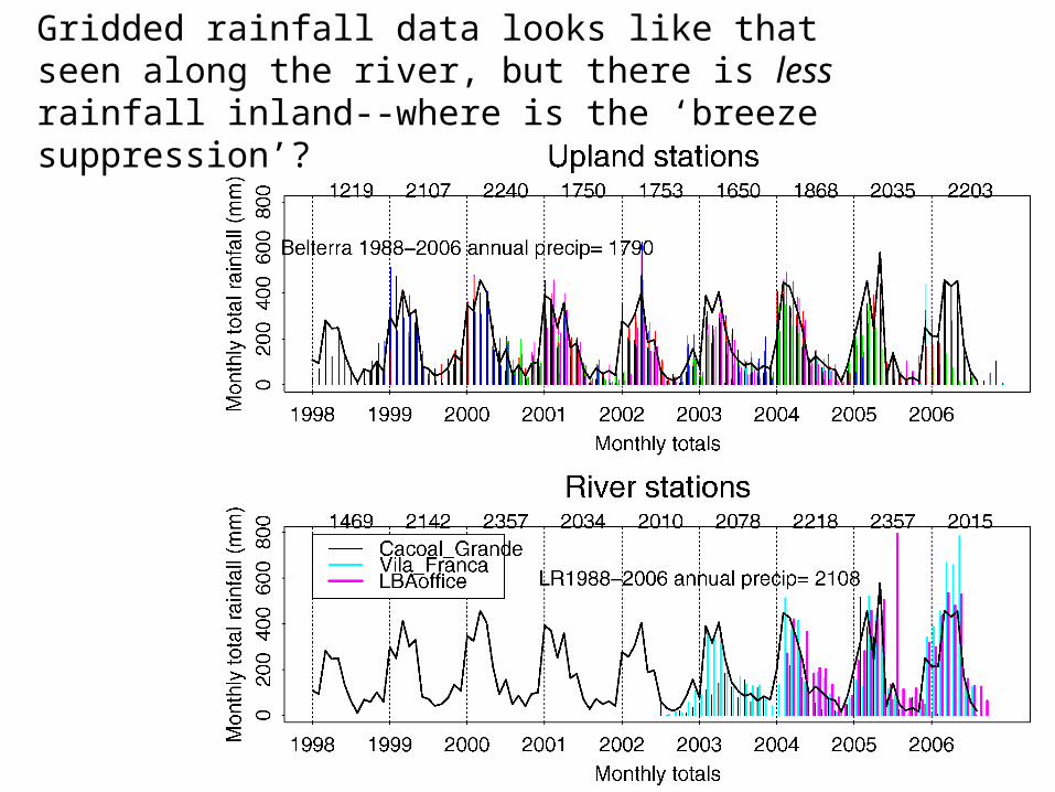
Gridded rainfall data looks like that seen along the river, but there is less rainfall inland--where is the ‘breeze suppression’?
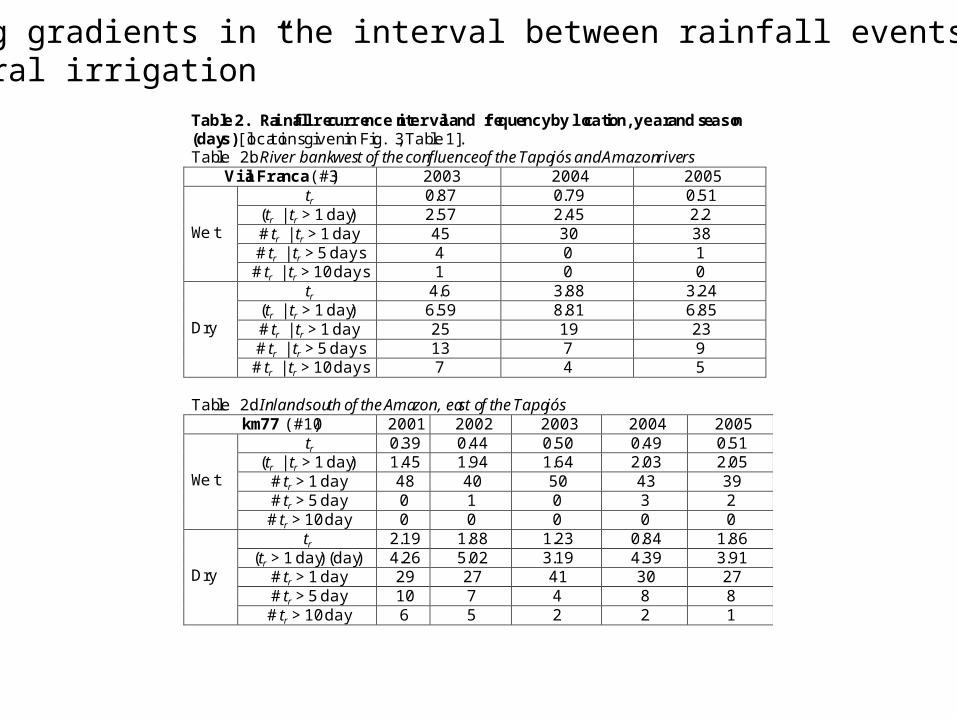
Table 2. Rainfall recurrence interval and frequency by location, year and season(days) [locations given in Fig. 3, Table 1].Table 2b. River bank west of the confluence of the Tapajós and Amazon rivers
Vila Franca (#3) 2003 2004 2005 tr 0.87 0.79 0.51
(tr | tr > 1 day) 2.57 2.45 2.2# tr | tr > 1 day 45 30 38# tr | tr > 5 days 4 0 1
Wet
# tr | tr > 10 days 1 0 0 tr 4.6 3.88 3.24
(tr | tr > 1 day) 6.59 8.81 6.85# tr | tr > 1 day 25 19 23# tr | tr > 5 days 13 7 9
Dry
# tr | tr > 10 days 7 4 5
Table 2d. Inland south of the Amazon, east of the Tapajóskm77 (#10) 2001 2002 2003 2004 2005
tr 0.39 0.44 0.50 0.49 0.51(tr | tr > 1 day) 1.45 1.94 1.64 2.03 2.05
# tr > 1 day 48 40 50 43 39# tr > 5 day 0 1 0 3 2
Wet
# tr > 10 day 0 0 0 0 0tr 2.19 1.88 1.23 0.84 1.86
(tr > 1 day) (day) 4.26 5.02 3.19 4.39 3.91# tr > 1 day 29 27 41 30 27# tr > 5 day 10 7 4 8 8
Dry
# tr > 10 day 6 5 2 2 1
Strong gradients in the interval between rainfall events“Natural irrigation”
00-03 UTC
00-03 UTC
06-09 UTC06-09
UTC 12-15 UTC
12-15 UTC
18-21 UTC
18-21 UTC
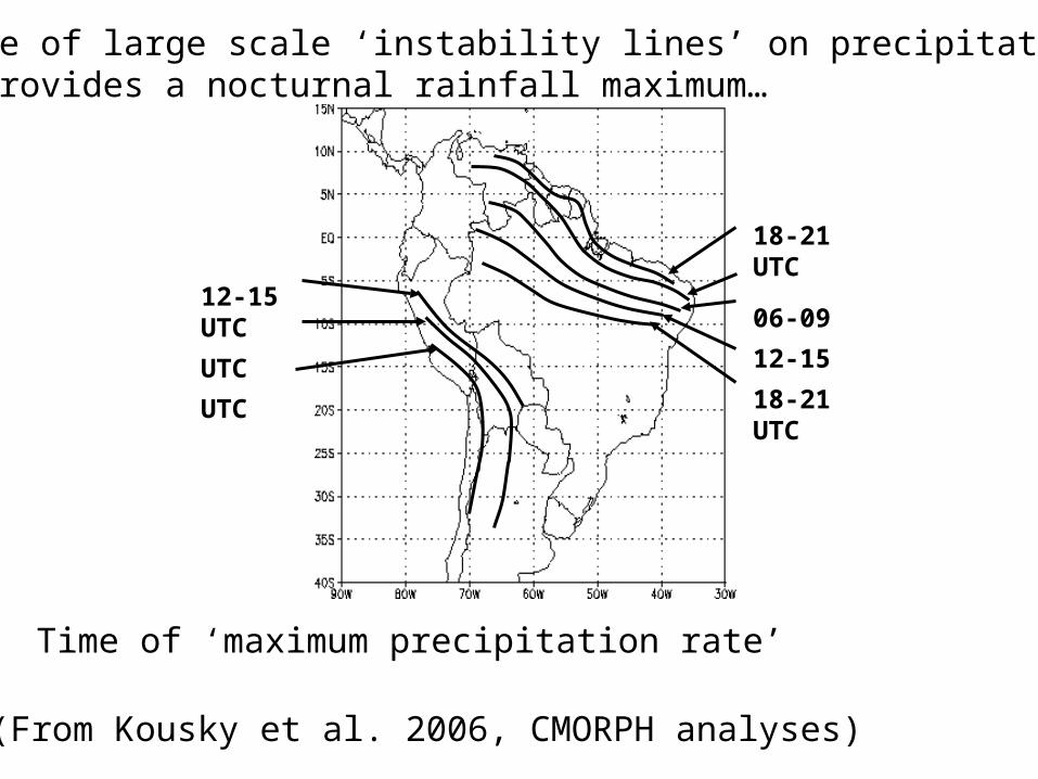
(From Kousky et al. 2006, CMORPH analyses)
Influence of large scale ‘instability lines’ on precipitationat STM provides a nocturnal rainfall maximum…
Time of ‘maximum precipitation rate’
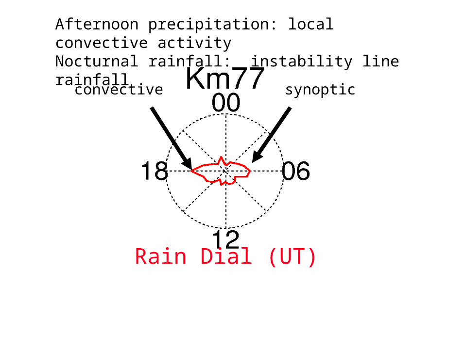
convective synoptic
Rain Dial (UT)
Afternoon precipitation: local convective activityNocturnal rainfall: instability line rainfall
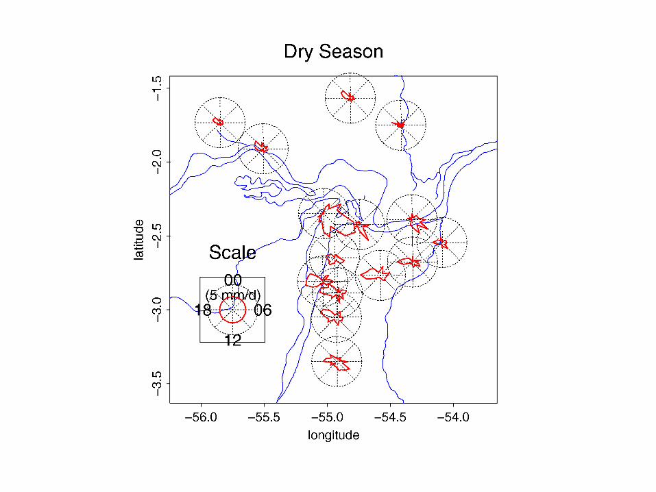
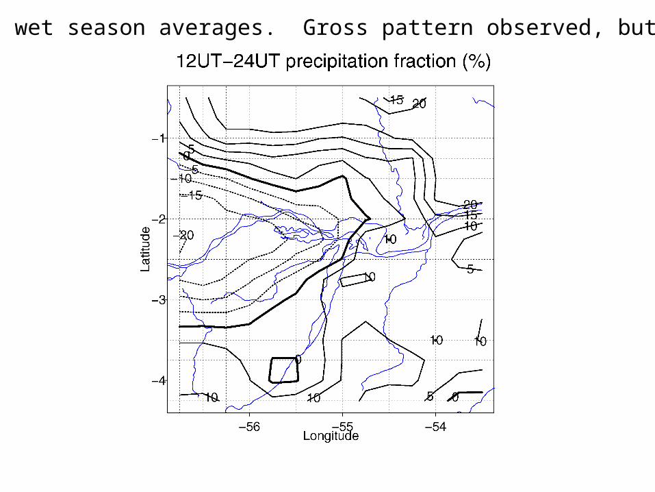
CMORPH wet season averages. Gross pattern observed, but ….
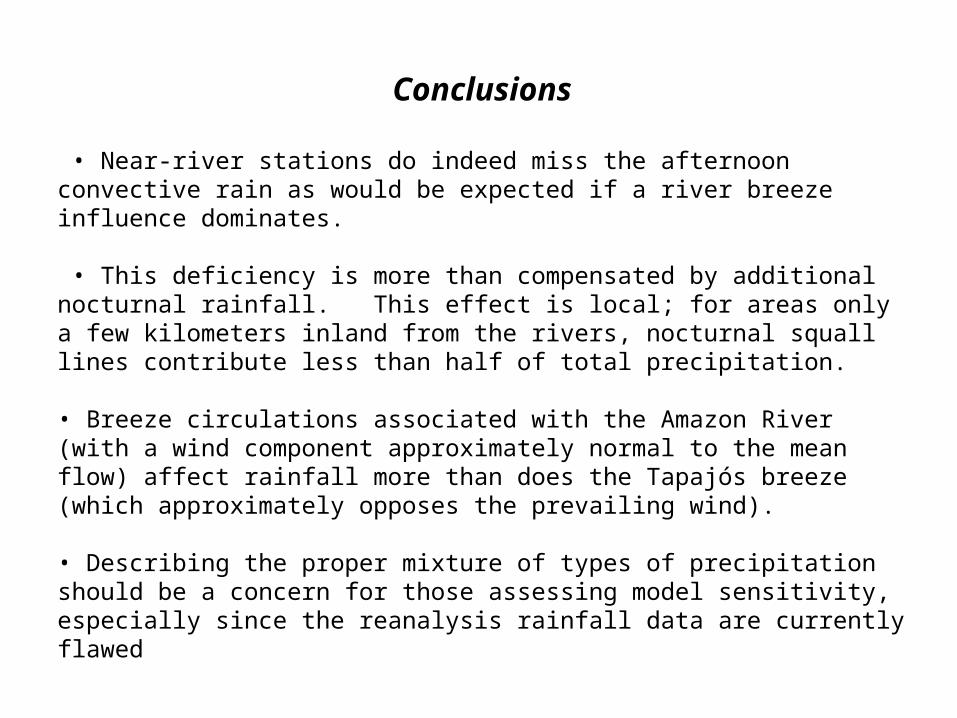
Conclusions
• Near-river stations do indeed miss the afternoon convective rain as would be expected if a river breeze influence dominates.
• This deficiency is more than compensated by additional nocturnal rainfall. This effect is local; for areas only a few kilometers inland from the rivers, nocturnal squall lines contribute less than half of total precipitation.
• Breeze circulations associated with the Amazon River (with a wind component approximately normal to the mean flow) affect rainfall more than does the Tapajós breeze (which approximately opposes the prevailing wind).
• Describing the proper mixture of types of precipitation should be a concern for those assessing model sensitivity, especially since the reanalysis rainfall data are currently flawed
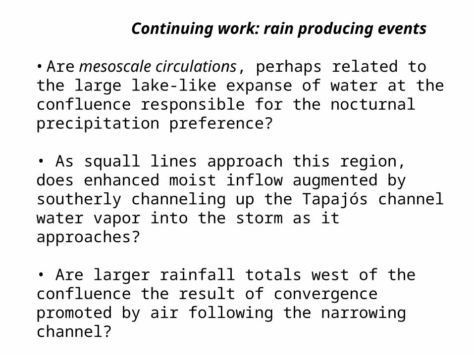
Continuing work: rain producing events
• Are mesoscale circulations, perhaps related to the large lake-like expanse of water at the confluence responsible for the nocturnal precipitation preference?
• As squall lines approach this region, does enhanced moist inflow augmented by southerly channeling up the Tapajós channel water vapor into the storm as it approaches?
• Are larger rainfall totals west of the confluence the result of convergence promoted by air following the narrowing channel? This issue can be addressed using mesoscale modeling case studies of well-documented individual squall line passages.
Júlia Cohen (next presentation) shows the first such results.