Embed Size (px)
Citation preview

Prentice Hall EARTH SCIENCEEARTH SCIENCE
Tarbuck Lutgens
Chapter
66Running Water and Groundwater
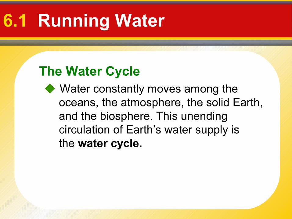
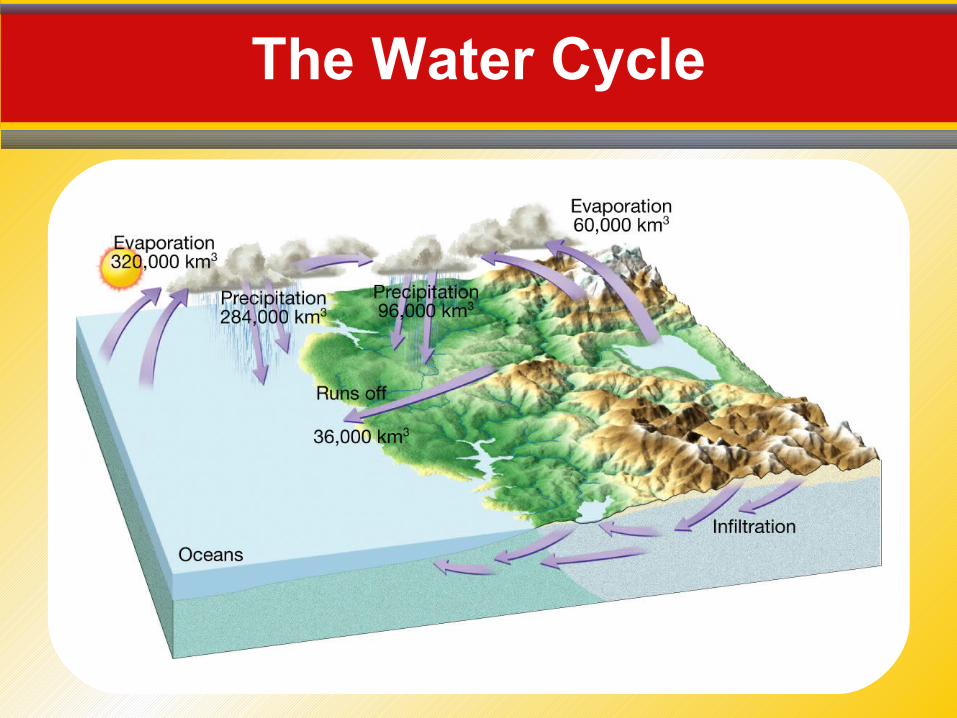
The Water Cycle
6.1 Running Water
Water constantly moves among the oceans, the atmosphere, the solid Earth, and the biosphere. This unending circulation of Earth’s water supply is the water cycle.
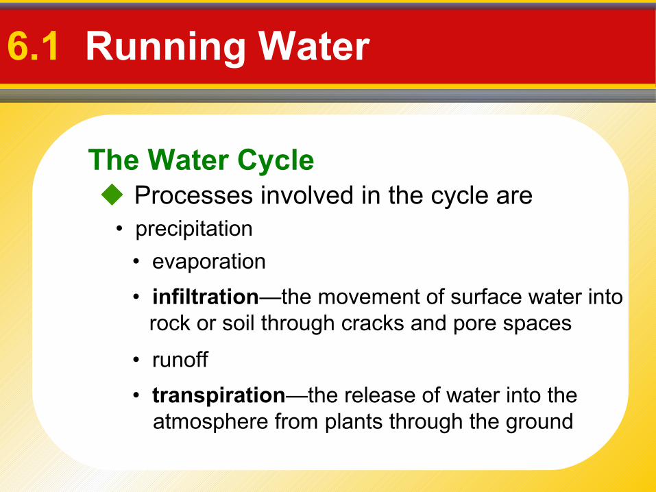
The Water Cycle
6.1 Running Water
Processes involved in the cycle are
• infiltration—the movement of surface water into rock or soil through cracks and pore spaces
• transpiration—the release of water into the atmosphere from plants through the ground
• precipitation
• evaporation
• runoff
Earth’s Water Balance
6.1 Running Water
Balance in the water cycle means the average annual precipitation over Earth equals the amount of water that evaporates.
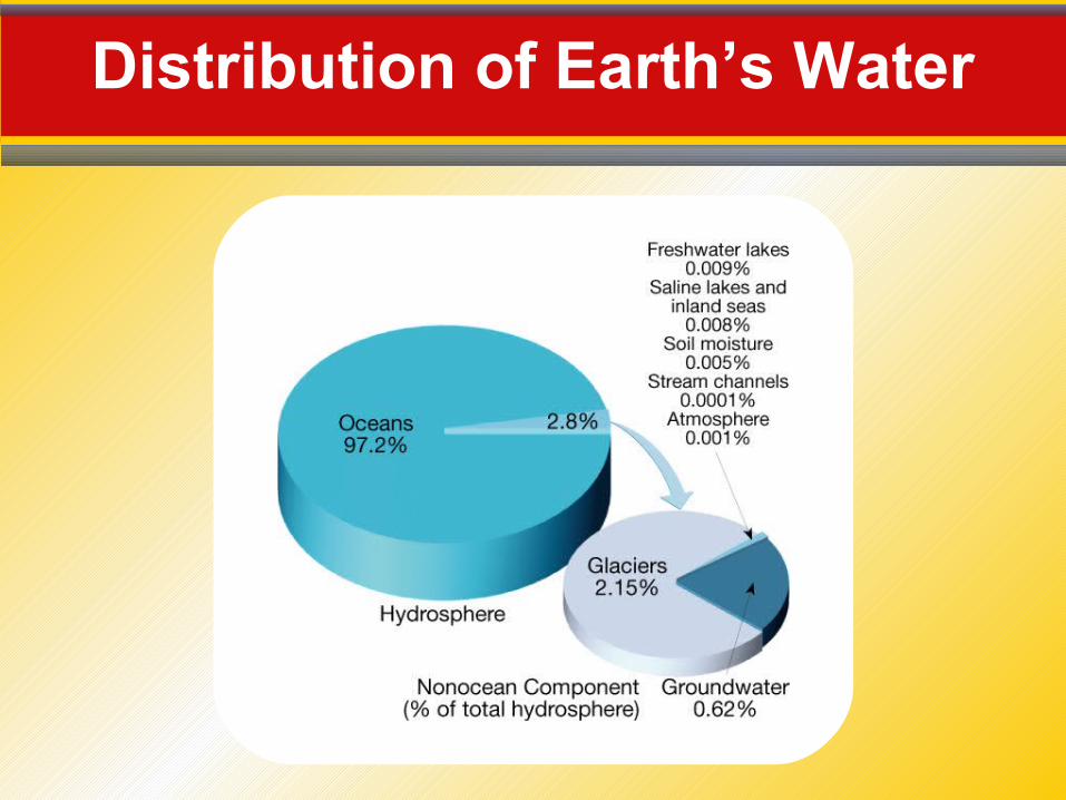
Distribution of Earth’s Water
The Water Cycle
Streamflow
6.1 Running Water
The ability of a stream to erode and transport materials depends largely on its velocity.• Gradient is the slope or steepness of a stream
channel.
Streamflow
6.1 Running Water
• Channel Characteristics
• Discharge of a stream is the volume of water flowing past a certain point in a given unit of time.
- The stream channel is the course the water in a stream follows.
- Shape, size, and roughness
Changes from Upstream to Downstream
6.1 Running Water
• Cross-sectional view of a stream
• From head (source) to mouth
While gradient decreases between a stream’s headwaters and mouth, discharge increases.
Profile
- Profile is a smooth curve
- Gradient decreases from the head to themouth
Changes from Upstream to Downstream
6.1 Running Water
Profile
• Factors that increase downstream - velocity- discharge
• A tributary is a stream that empties into another stream.
- channel size
Sea Level and Streams
Changes from Upstream to Downstream
6.1 Running Water
Profile• Factors that decrease downstream include
- gradient, or slope
- channel roughness
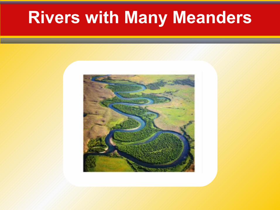
Rivers with Many Meanders
Changes from Upstream to Downstream
6.1 Running Water
• A stream in a broad, flat-bottomed valley that is near its base level often develops a course with many bends called meanders.
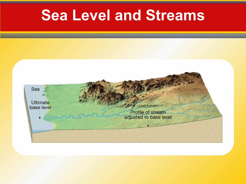
Base Level• Lowest point to which a stream can erode
• Two general types
- ultimate—sea level- temporary, or local
Erosion
6.2 The Work of Streams
Streams generally erode their channels, lifting loose particles by abrasion, grinding, and by dissolving soluble material.
Deposition
6.2 The Work of Streams
Deposition occurs as streamflow drops below the critical settling velocity of a certain particle size. The deposits are called alluvium.
Deltas are an accumulation of sediment formed where a stream enters a lake or ocean.
A natural levee parallels a stream and helps to contain its waters, except during floodstage.
A stream’s bedload is solid material too large to carry in suspension.
The capacity of a stream is the maximum load it can carry.
Stream Valleys
6.2 The Work of Streams
Narrow Valleys• A narrow V-shaped valley shows that the stream’s
primary work has been downcutting toward base level.
• Features often include
- rapids
- waterfalls
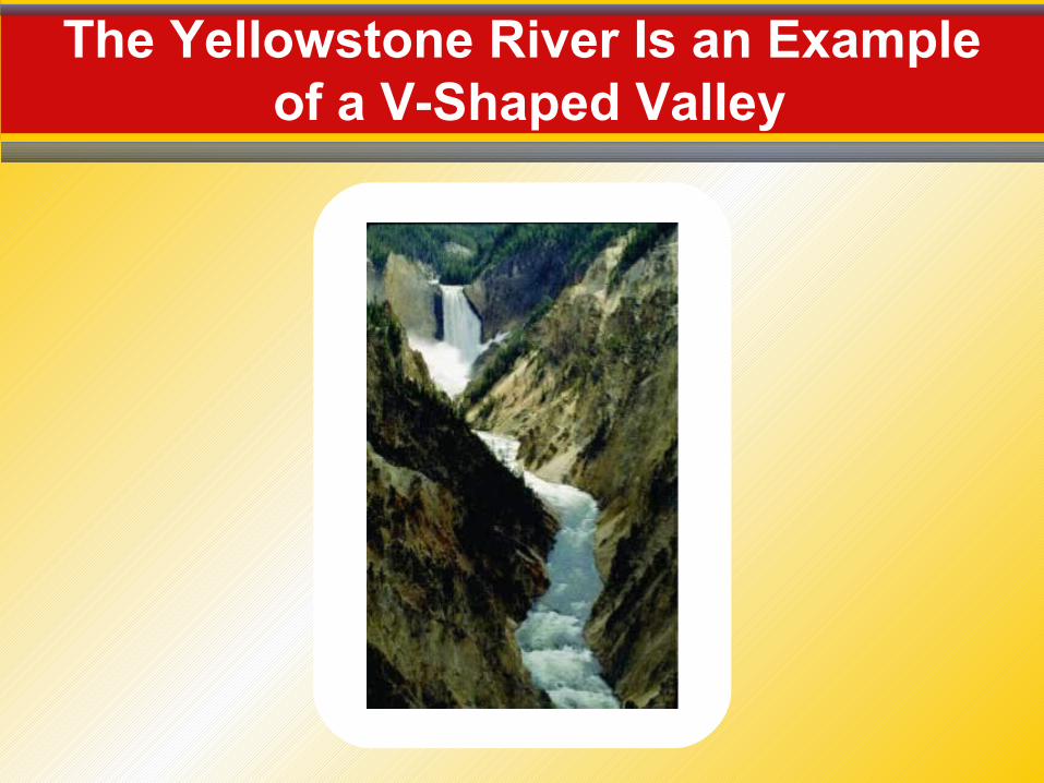
The Yellowstone River Is an Example of a V-Shaped Valley
Stream Valleys
6.2 The Work of Streams
Wide Valleys
• Stream is near base level.
- Downward erosion is less dominant.
- Stream energy is directed from side to side.
• The floodplain is the flat, low-lying portion of a stream valley subject to periodic flooding.
Stream Valleys
6.2 The Work of Streams
Wide Valleys• Features often include
- meanders
- cutoffs
- oxbow lakes
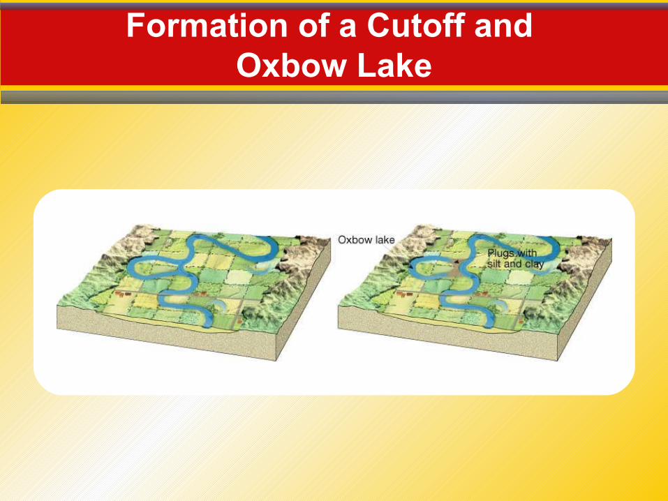
Formation of a Cutoff and Oxbow Lake
Floods and Flood Control
6.2 The Work of Streams
A flood occurs when the discharge of a stream becomes so great that it exceeds the capacity of its channel and overflows its banks.
Measures to control flooding include artificial levees, flood control dams, and placing limits on floodplain development.

Ohio River Flooding

Drainage Basins
6.2 The Work of Streams
A drainage basin is the land area that contributes water to a stream.
A divide is an imaginary line that separates the drainage basins of one stream from another.
Distribution and Movement of Water Underground
6.3 Water Beneath the Surface
Much of the water in soil seeps downward until it reaches the zone of saturation.
The zone of saturation is the area where water fills all of the open spaces in sediment and rock. • Groundwater is the water within this zone.
• The water table is the upper level of the saturation zone of groundwater.
Distribution and Movement of Water Underground
6.3 Water Beneath the Surface
Movement• Groundwater moves by twisting and turning
through interconnected small openings.• The groundwater moves more slowly when the
pore spaces are smaller.
Distribution and Movement of Water Underground
6.3 Water Beneath the Surface
Movement• Porosity
• Permeability
- The percentage of pore spaces- Determines how much groundwater can be
stored
- Ability to transmit water through connected pore spaces
- Aquifers are permeable rock layers or sediments that transmit groundwater freely
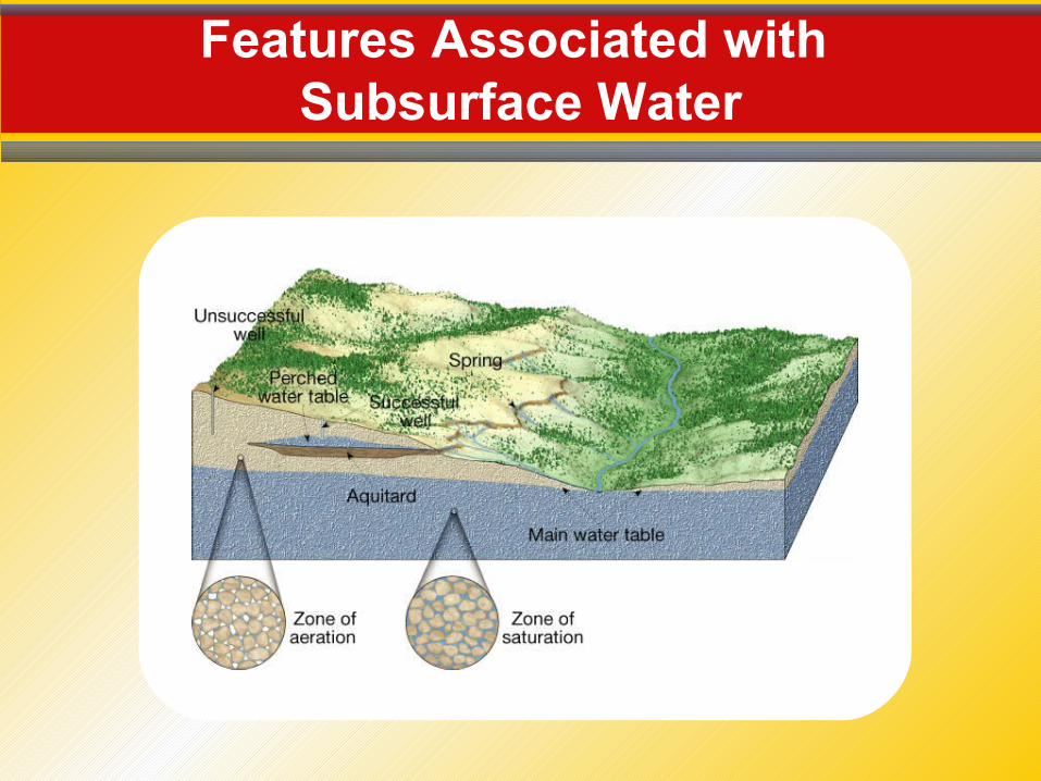
Features Associated with Subsurface Water
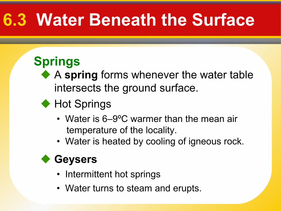
Springs
6.3 Water Beneath the Surface
A spring forms whenever the water table intersects the ground surface.
• Intermittent hot springs
Hot Springs
Geysers
• Water is 6–9ºC warmer than the mean air temperature of the locality.
• Water is heated by cooling of igneous rock.
• Water turns to steam and erupts.
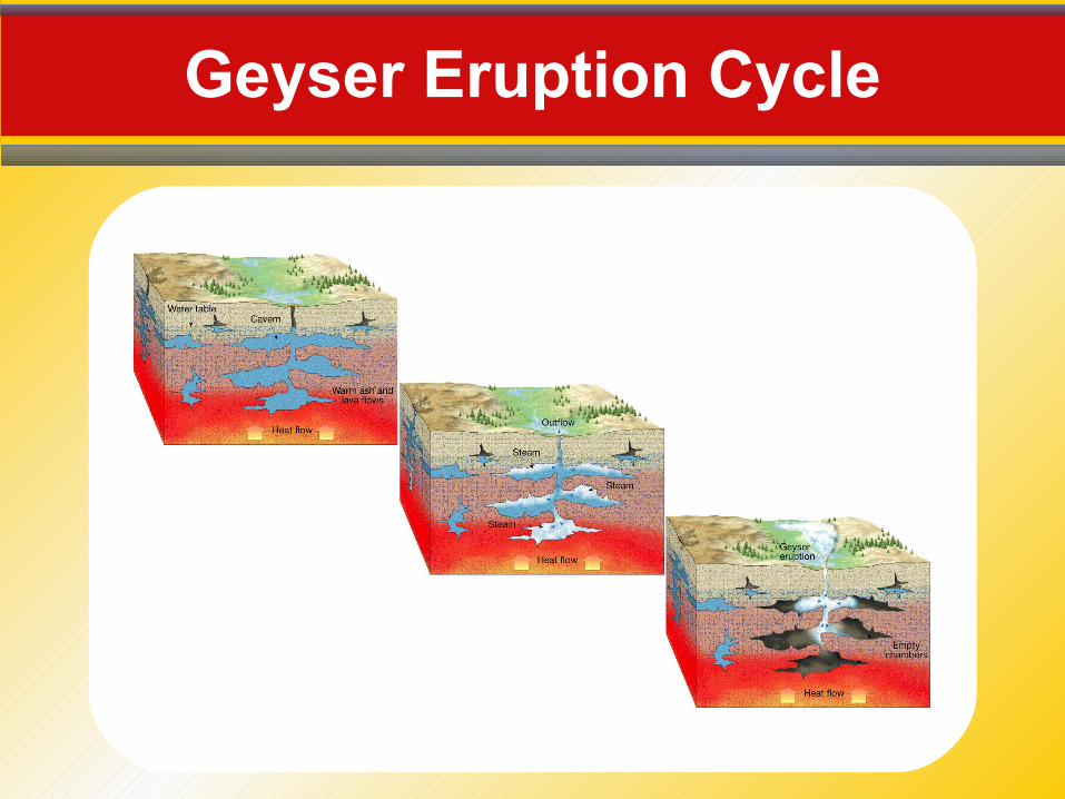
Geyser Eruption Cycle
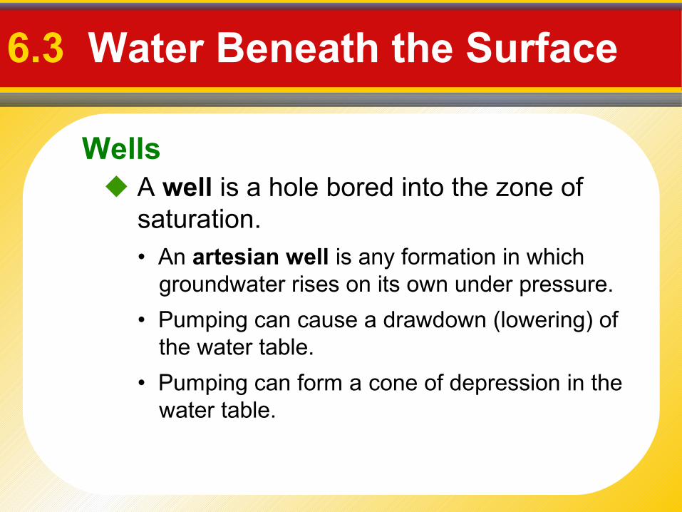
Wells
6.3 Water Beneath the Surface
A well is a hole bored into the zone of saturation.• An artesian well is any formation in which
groundwater rises on its own under pressure.
• Pumping can cause a drawdown (lowering) of the water table.
• Pumping can form a cone of depression in the water table.
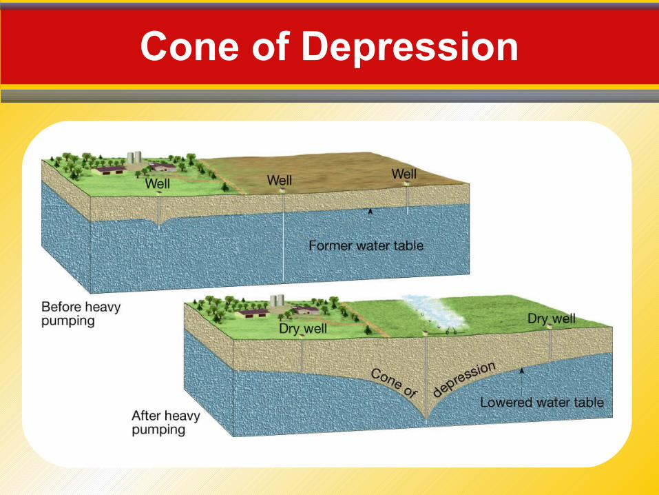
Cone of Depression
Environmental Problems Associated with Groundwater
6.3 Water Beneath the Surface
Overuse and contamination threatens groundwater supplies in some areas.
• Treating it as a nonrenewable resource
• Land subsidence caused by its withdrawal
• Contamination
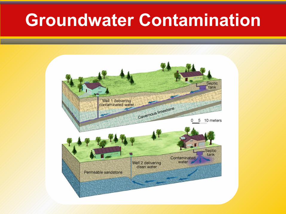
Groundwater Contamination
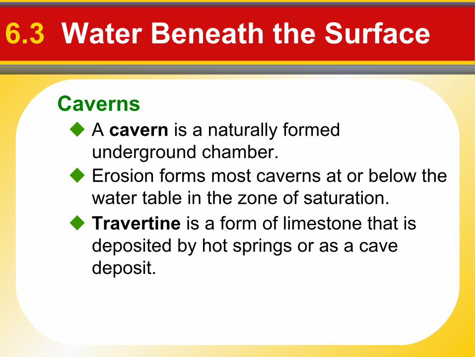
Caverns
6.3 Water Beneath the Surface
Erosion forms most caverns at or below the water table in the zone of saturation.
A cavern is a naturally formed underground chamber.
Travertine is a form of limestone that is deposited by hot springs or as a cave deposit.
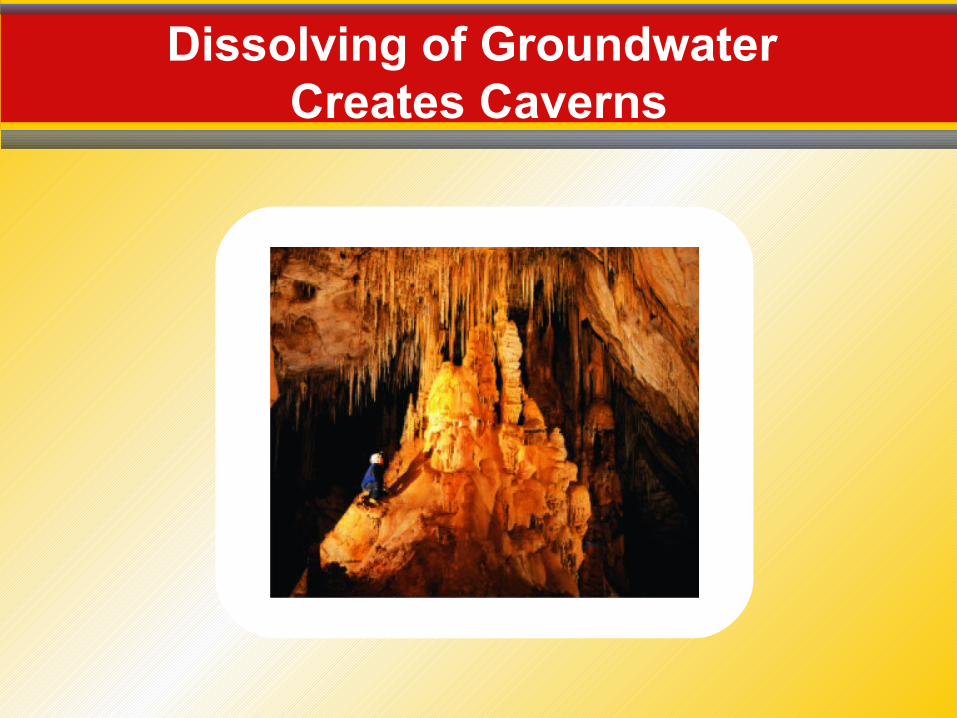
Dissolving of Groundwater Creates Caverns
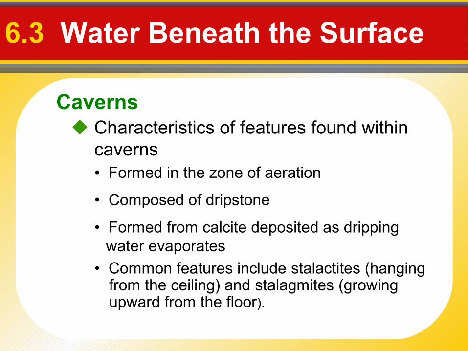
Caverns
6.3 Water Beneath the Surface
Characteristics of features found within caverns • Formed in the zone of aeration
• Composed of dripstone
• Formed from calcite deposited as dripping water evaporates
• Common features include stalactites (hanging from the ceiling) and stalagmites (growing upward from the floor).
Karst Topography
6.3 Water Beneath the Surface
Formed by dissolving rock at, or near, Earth's surface
• Sinkholes—surface depressions
- Sinkholes form when bedrock dissolves and caverns collapse.
• Caves and caverns
Common features
Area lacks good surface drainage.
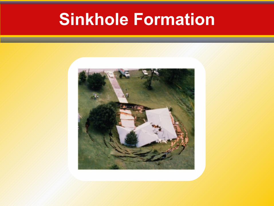
Sinkhole Formation