Embed Size (px)
Citation preview
SCENIC BYWAYSOF IOWA

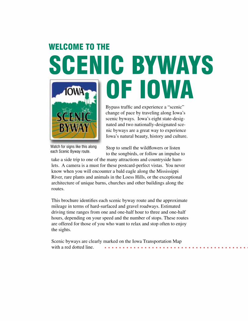
Bypass traffic and experience a “scenic” change of pace by traveling along Iowa’s scenic byways. Iowa’s eight state-desig-nated and two nationally-designated sce-nic byways are a great way to experience Iowa’s natural beauty, history and culture.
Stop to smell the wildflowers or listen to the songbirds, or follow an impulse to
take a side trip to one of the many attractions and countryside ham-lets. A camera is a must for these postcard-perfect vistas. You never know when you will encounter a bald eagle along the Mississippi River, rare plants and animals in the Loess Hills, or the exceptional architecture of unique barns, churches and other buildings along the routes.
This brochure identifies each scenic byway route and the approximate mileage in terms of hard-surfaced and gravel roadways. Estimated driving time ranges from one and one-half hour to three and one-half hours, depending on your speed and the number of stops. These routes are offered for those of you who want to relax and stop often to enjoy the sights.
Scenic byways are clearly marked on the Iowa Transportation Map with a red dotted line.
WELCOME TO THE
SCENIC BYWAYSOF IOWA

The majestic Mississippi River bluffs along Iowa 26
Allamakee County autumn woodland
Gravel roadHard-surfaced road
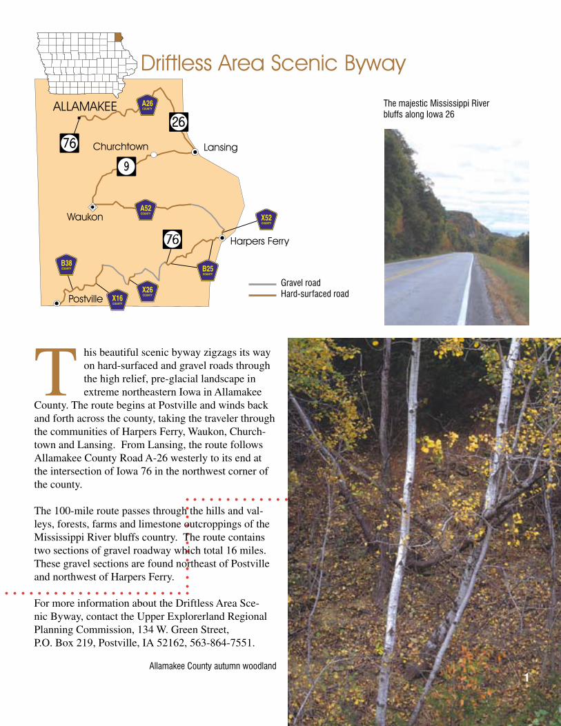
This beautiful scenic byway zigzags its way on hard-surfaced and gravel roads through the high relief, pre-glacial landscape in extreme northeastern Iowa in Allamakee
County. The route begins at Postville and winds back and forth across the county, taking the traveler through the communities of Harpers Ferry, Waukon, Church-town and Lansing. From Lansing, the route follows Allamakee County Road A-26 westerly to its end at the intersection of Iowa 76 in the northwest corner of the county.
The 100-mile route passes through the hills and val-leys, forests, farms and limestone outcroppings of the Mississippi River bluffs country. The route contains two sections of gravel roadway which total 16 miles. These gravel sections are found northeast of Postville and northwest of Harpers Ferry.
For more information about the Driftless Area Sce-nic Byway, contact the Upper Explorerland Regional Planning Commission, 134 W. Green Street, P.O. Box 219, Postville, IA 52162, 563-864-7551.
1
The hallmarks of this byway are its breathtaking bluffs, panoramic hillsides, manicured farmland, secluded caves and rushing streams. Watch for spec-tacular rock formations and rugged limestone outcrop-pings that hug the road. The same stone, mined from rich quarries, lends a unique character to area barns, homes and churches.
For more information about attractions along the River Bluffs Scenic Byways, contact the Osborne Visitor, Welcome and Nature Center, 29862 Osborne Road, Elkader, IA 52043, 563-245-1516.
2
Fayette County’s rolling landscape northwest of Clermont
Hard-surfaced road
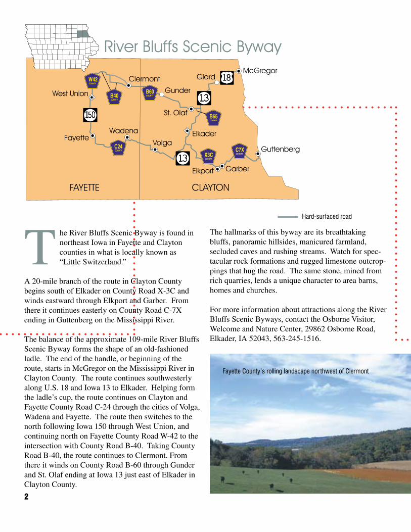
The River Bluffs Scenic Byway is found in northeast Iowa in Fayette and Clayton counties in what is locally known as “Little Switzerland.”
A 20-mile branch of the route in Clayton County begins south of Elkader on County Road X-3C and winds eastward through Elkport and Garber. From there it continues easterly on County Road C-7X ending in Guttenberg on the Mississippi River.
The balance of the approximate 109-mile River Bluffs Scenic Byway forms the shape of an old-fashioned ladle. The end of the handle, or beginning of the route, starts in McGregor on the Mississippi River in Clayton County. The route continues southwesterly along U.S. 18 and Iowa 13 to Elkader. Helping form the ladle’s cup, the route continues on Clayton and Fayette County Road C-24 through the cities of Volga, Wadena and Fayette. The route then switches to the north following Iowa 150 through West Union, and continuing north on Fayette County Road W-42 to the intersection with County Road B-40. Taking County Road B-40, the route continues to Clermont. From there it winds on County Road B-60 through Gunder and St. Olaf ending at Iowa 13 just east of Elkader in Clayton County.
DELAWARE
Delaware
Delhi
Hopkinton
Delaware CrossingScenic Byway
X21
X29
D42
X31
D47
D22
38
38
3
For more information on local attractions along the Delaware Crossing Scenic Byway, contact the following: Delaware County Historical Society, Box 70, Hopkinton, IA 52237, or call 563-926-2639; or the Delaware County Conservation Department, 2379 Jefferson Road, Bailey’s Ford Park, Manchester, IA 52057-8623, or call 563-927-3410.
Gravel roadHard-surfaced road
Turtle Creek Recreation Area
Historic Lenox College in Hopkinton
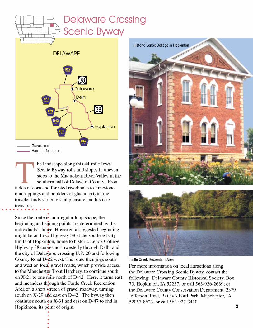
The landscape along this 44-mile Iowa Scenic Byway rolls and slopes in uneven steps to the Maquoketa River Valley in the southern half of Delaware County. From
fields of corn and forested riverbanks to limestone outcroppings and boulders of glacial origin, the traveler finds varied visual pleasure and historic treasures.
Since the route is an irregular loop shape, the beginning and ending points are determined by the individuals’ choice. However, a suggested beginning might be on Iowa Highway 38 at the southeast city limits of Hopkinton, home to historic Lenox College. Highway 38 curves northwesterly through Delhi and the city of Delaware, crossing U.S. 20 and following County Road D-22 west. The route then jogs south and west on local gravel roads, which provide access to the Manchester Trout Hatchery, to continue south on X-21 to one mile north of D-42. Here, it turns east and meanders through the Turtle Creek Recreation Area on a short stretch of gravel roadway, turning south on X-29 and east on D-42. The byway then continues south on X-31 and east on D-47 to end in Hopkinton, its point of origin.
4
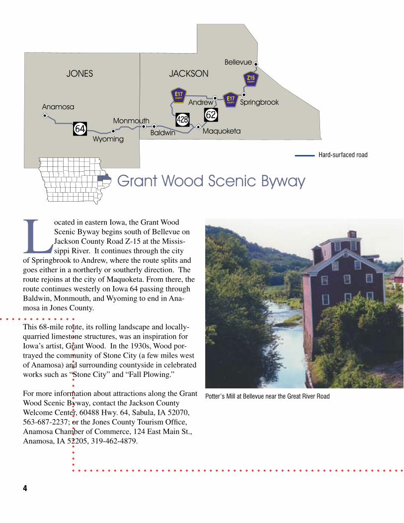
Potter’s Mill at Bellevue near the Great River Road
Hard-surfaced road
Located in eastern Iowa, the Grant Wood Scenic Byway begins south of Bellevue on Jackson County Road Z-15 at the Missis-sippi River. It continues through the city
of Springbrook to Andrew, where the route splits and goes either in a northerly or southerly direction. The route rejoins at the city of Maquoketa. From there, the route continues westerly on Iowa 64 passing through Baldwin, Monmouth, and Wyoming to end in Ana-mosa in Jones County.
This 68-mile route, its rolling landscape and locally-quarried limestone structures, was an inspiration for Iowa’s artist, Grant Wood. In the 1930s, Wood por-trayed the community of Stone City (a few miles west of Anamosa) and surrounding countyside in celebrated works such as “Stone City” and “Fall Plowing.”
For more information about attractions along the Grant Wood Scenic Byway, contact the Jackson County Welcome Center, 60488 Hwy. 64, Sabula, IA 52070, 563-687-2237; or the Jones County Tourism Office, Anamosa Chamber of Commerce, 124 East Main St., Anamosa, IA 52205, 319-462-4879.
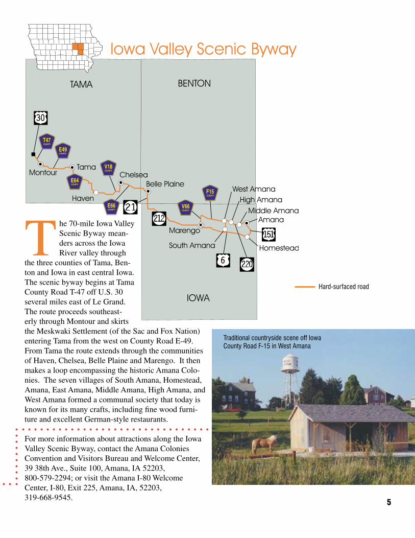
Traditional countryside scene off Iowa County Road F-15 in West Amana
5
Hard-surfaced road
The 70-mile Iowa Valley Scenic Byway mean-ders across the Iowa River valley through
the three counties of Tama, Ben-ton and Iowa in east central Iowa. The scenic byway begins at Tama County Road T-47 off U.S. 30 several miles east of Le Grand. The route proceeds southeast-erly through Montour and skirts the Meskwaki Settlement (of the Sac and Fox Nation) entering Tama from the west on County Road E-49. From Tama the route extends through the communities of Haven, Chelsea, Belle Plaine and Marengo. It then makes a loop encompassing the historic Amana Colo-nies. The seven villages of South Amana, Homestead, Amana, East Amana, Middle Amana, High Amana, and West Amana formed a communal society that today is known for its many crafts, including fine wood furni-ture and excellent German-style restaurants.
For more information about attractions along the Iowa Valley Scenic Byway, contact the Amana Colonies Convention and Visitors Bureau and Welcome Center, 39 38th Ave., Suite 100, Amana, IA 52203, 800-579-2294; or visit the Amana I-80 Welcome Center, I-80, Exit 225, Amana, IA, 52203, 319-668-9545.
6
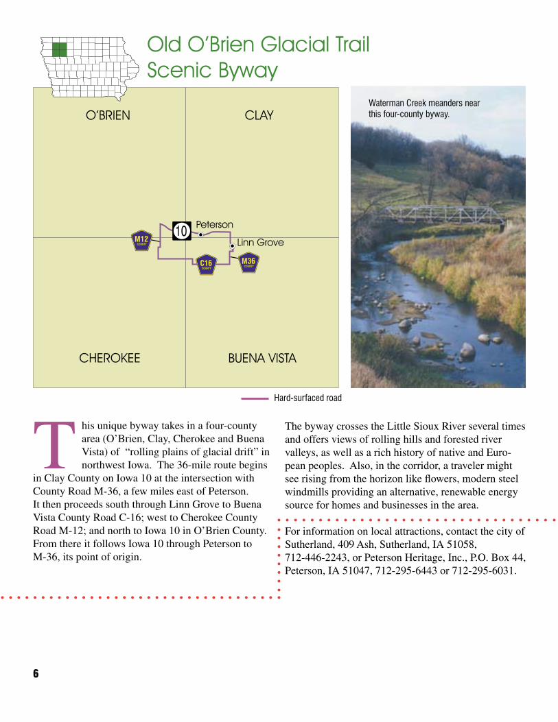
This unique byway takes in a four-county area (O’Brien, Clay, Cherokee and Buena Vista) of “rolling plains of glacial drift” in northwest Iowa. The 36-mile route begins
in Clay County on Iowa 10 at the intersection with County Road M-36, a few miles east of Peterson. It then proceeds south through Linn Grove to Buena Vista County Road C-16; west to Cherokee County Road M-12; and north to Iowa 10 in O’Brien County. From there it follows Iowa 10 through Peterson to M-36, its point of origin.
The byway crosses the Little Sioux River several times and offers views of rolling hills and forested river valleys, as well as a rich history of native and Euro-pean peoples. Also, in the corridor, a traveler might see rising from the horizon like flowers, modern steel windmills providing an alternative, renewable energy source for homes and businesses in the area.
For information on local attractions, contact the city of Sutherland, 409 Ash, Sutherland, IA 51058, 712-446-2243, or Peterson Heritage, Inc., P.O. Box 44, Peterson, IA 51047, 712-295-6443 or 712-295-6031.
Hard-surfaced road
O’BRIEN CLAY
BUENA VISTACHEROKEE
Linn Grove
Peterson
Old O’Brien Glacial TrailScenic Byway
M12
M36C16
10
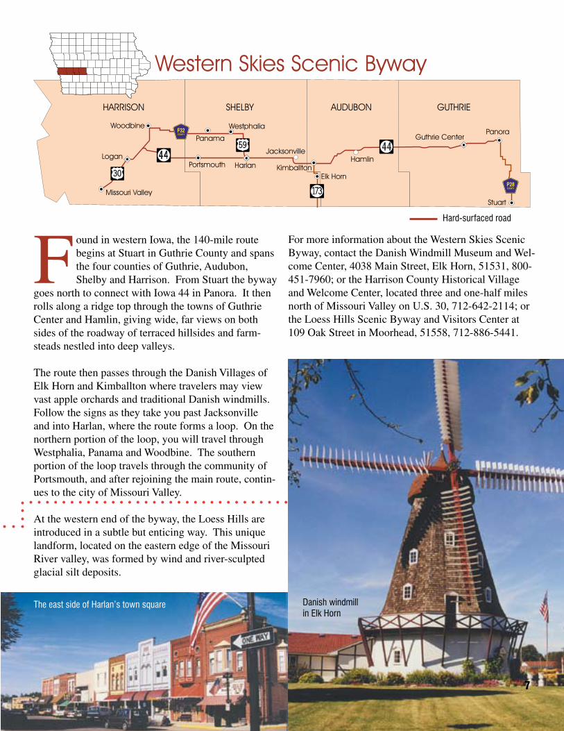
Found in western Iowa, the 140-mile route begins at Stuart in Guthrie County and spans the four counties of Guthrie, Audubon, Shelby and Harrison. From Stuart the byway
goes north to connect with Iowa 44 in Panora. It then rolls along a ridge top through the towns of Guthrie Center and Hamlin, giving wide, far views on both sides of the roadway of terraced hillsides and farm-steads nestled into deep valleys.
The route then passes through the Danish Villages of Elk Horn and Kimballton where travelers may view vast apple orchards and traditional Danish windmills. Follow the signs as they take you past Jacksonville and into Harlan, where the route forms a loop. On the northern portion of the loop, you will travel through Westphalia, Panama and Woodbine. The southern portion of the loop travels through the community of Portsmouth, and after rejoining the main route, contin-ues to the city of Missouri Valley.
At the western end of the byway, the Loess Hills are introduced in a subtle but enticing way. This unique landform, located on the eastern edge of the Missouri River valley, was formed by wind and river-sculpted glacial silt deposits.
For more information about the Western Skies Scenic Byway, contact the Danish Windmill Museum and Wel-come Center, 4038 Main Street, Elk Horn, 51531, 800-451-7960; or the Harrison County Historical Village and Welcome Center, located three and one-half miles north of Missouri Valley on U.S. 30, 712-642-2114; or the Loess Hills Scenic Byway and Visitors Center at 109 Oak Street in Moorhead, 51558, 712-886-5441.
The east side of Harlan’s town square Danish windmill in Elk Horn
7
Hard-surfaced road
8
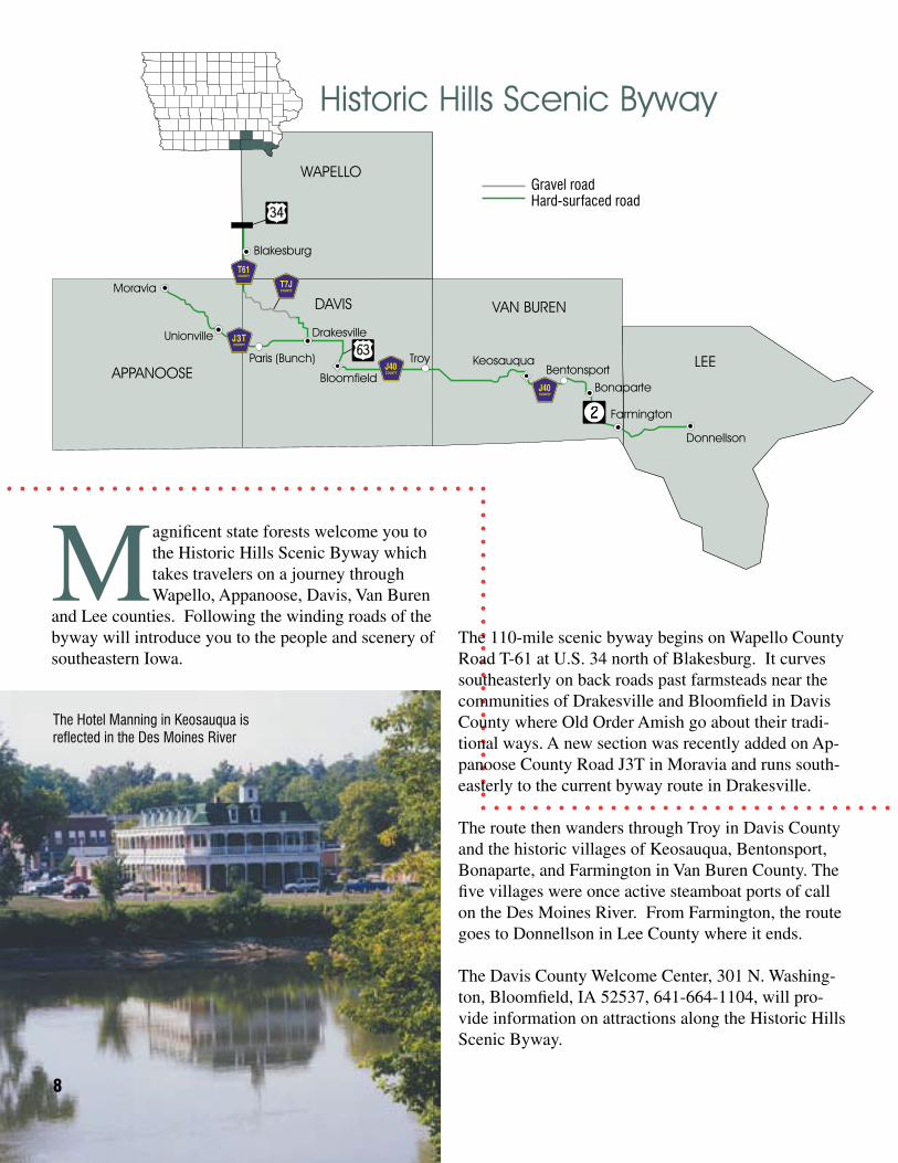
The Hotel Manning in Keosauqua is reflected in the Des Moines River
The 110-mile scenic byway begins on Wapello County Road T-61 at U.S. 34 north of Blakesburg. It curves southeasterly on back roads past farmsteads near the communities of Drakesville and Bloomfield in Davis County where Old Order Amish go about their tradi-tional ways. A new section was recently added on Ap-panoose County Road J3T in Moravia and runs south-easterly to the current byway route in Drakesville.
The route then wanders through Troy in Davis County and the historic villages of Keosauqua, Bentonsport, Bonaparte, and Farmington in Van Buren County. The five villages were once active steamboat ports of call on the Des Moines River. From Farmington, the route goes to Donnellson in Lee County where it ends.
The Davis County Welcome Center, 301 N. Washing-ton, Bloomfield, IA 52537, 641-664-1104, will pro-vide information on attractions along the Historic Hills Scenic Byway.
APPANOOSE
Moravia
Unionville
Paris (Bunch)
Drakesville3
Historic Hills Scenic Byway
Gravel roadHard-surfaced road
Magnificent state forests welcome you to the Historic Hills Scenic Byway which takes travelers on a journey through Wapello, Appanoose, Davis, Van Buren
and Lee counties. Following the winding roads of the byway will introduce you to the people and scenery of southeastern Iowa.
LOESS HILLS SCENIC BYWAY
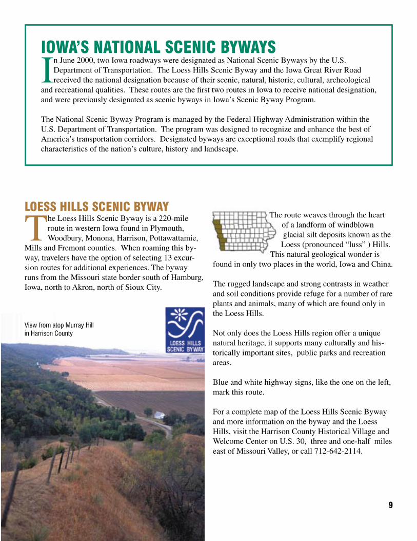
The Loess Hills Scenic Byway is a 220-mile route in western Iowa found in Plymouth, Woodbury, Monona, Harrison, Pottawattamie,
Mills and Fremont counties. When roaming this by-way, travelers have the option of selecting 13 excur-sion routes for additional experiences. The byway runs from the Missouri state border south of Hamburg, Iowa, north to Akron, north of Sioux City.
9
The route weaves through the heart of a landform of windblown glacial silt deposits known as the Loess (pronounced “luss” ) Hills.
This natural geological wonder is found in only two places in the world, Iowa and China.
The rugged landscape and strong contrasts in weather and soil conditions provide refuge for a number of rare plants and animals, many of which are found only in the Loess Hills.
Not only does the Loess Hills region offer a unique natural heritage, it supports many culturally and his-torically important sites, public parks and recreation areas.
Blue and white highway signs, like the one on the left, mark this route.
For a complete map of the Loess Hills Scenic Byway and more information on the byway and the Loess Hills, visit the Harrison County Historical Village and Welcome Center on U.S. 30, three and one-half miles east of Missouri Valley, or call 712-642-2114.
View from atop Murray Hill in Harrison County
IOWA’S NATIONAL SCENIC BYWAYS
In June 2000, two Iowa roadways were designated as National Scenic Byways by the U.S. Department of Transportation. The Loess Hills Scenic Byway and the Iowa Great River Road received the national designation because of their scenic, natural, historic, cultural, archeological
and recreational qualities. These routes are the first two routes in Iowa to receive national designation, and were previously designated as scenic byways in Iowa’s Scenic Byway Program.
The National Scenic Byway Program is managed by the Federal Highway Administration within the U.S. Department of Transportation. The program was designed to recognize and enhance the best of America’s transportation corridors. Designated byways are exceptional roads that exemplify regional characteristics of the nation’s culture, history and landscape.
IOWA GREAT RIVER ROAD
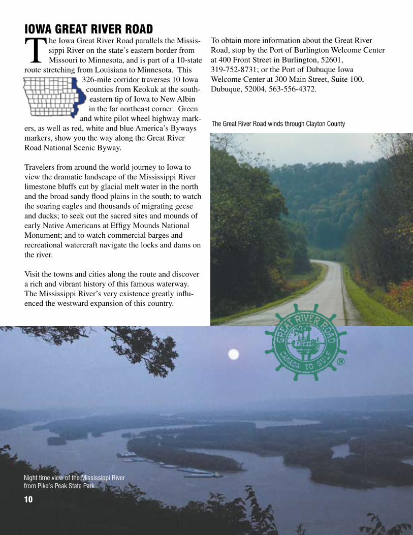
The Iowa Great River Road parallels the Missis-sippi River on the state’s eastern border from Missouri to Minnesota, and is part of a 10-state
route stretching from Louisiana to Minnesota. This 326-mile corridor traverses 10 Iowa counties from Keokuk at the south-eastern tip of Iowa to New Albin in the far northeast corner. Green
and white pilot wheel highway mark-ers, as well as red, white and blue America’s Byways markers, show you the way along the Great River Road National Scenic Byway.
Travelers from around the world journey to Iowa to view the dramatic landscape of the Mississippi River limestone bluffs cut by glacial melt water in the north and the broad sandy flood plains in the south; to watch the soaring eagles and thousands of migrating geese and ducks; to seek out the sacred sites and mounds of early Native Americans at Effigy Mounds National Monument; and to watch commercial barges and recreational watercraft navigate the locks and dams on the river.
Visit the towns and cities along the route and discover a rich and vibrant history of this famous waterway. The Mississippi River’s very existence greatly influ-enced the westward expansion of this country.
Night time view of the Mississippi River from Pike’s Peak State Park
The Great River Road winds through Clayton County
10
To obtain more information about the Great River Road, stop by the Port of Burlington Welcome Center at 400 Front Street in Burlington, 52601, 319-752-8731; or the Port of Dubuque Iowa Welcome Center at 300 Main Street, Suite 100, Dubuque, 52004, 563-556-4372.


For more information on Iowa’s Scenic Byways, contact:
Office of Systems PlanningScenic Byways Program
800 Lincoln WayAmes, IA 50010515-239-1664
PM 818 6-12-07