Embed Size (px)
Citation preview
Seward Park Mixed-Use Development Project Manhattan Community Board 3 Land Use, Zoning, Public & Private Housing Committee Meeting February 15, 2012
NEW YORK CITY ECONOMIC DEVELOPMENT CORPORATION
2
Agenda
§ Project Update § Transportation Information from Draft EIS § Pedestrian Safety (NYCDOT) § Discussion
NEW YORK CITY ECONOMIC DEVELOPMENT CORPORATION
3
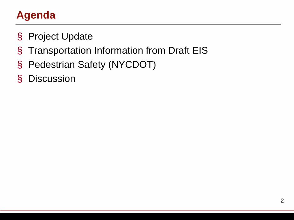
Project Schedule to Date
Community Board 3 passes
guidelines
Urban Design Meetings and Open House
Essex Street Market
Discussions
Spring 2011 Spring 2011 January 2011
Pre-EIS Scoping Discussion at
CB3 Committee
Release Draft Scoping
Document for EIS
Public Scoping Meeting
September 2011 October 2011
Fall 2011 - Winter 2012
July 2011
Develop Final Scoping
Document Prepare Draft EIS
Fall 2011 – Winter 2012
NEW YORK CITY ECONOMIC DEVELOPMENT CORPORATION
4
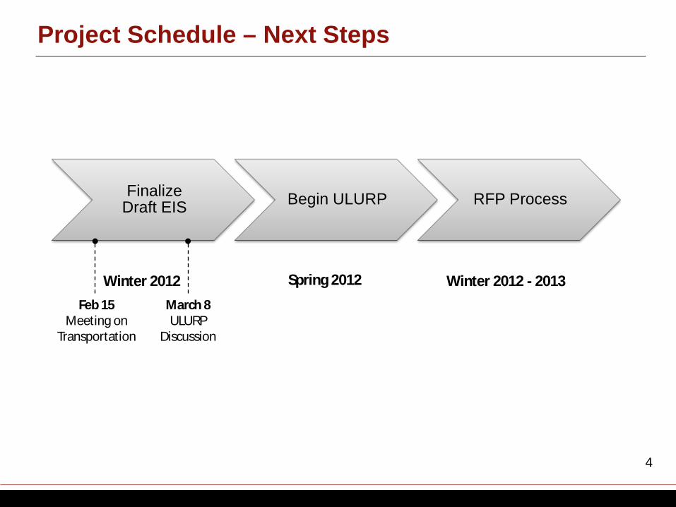
Project Schedule – Next Steps
Finalize Draft EIS Begin ULURP RFP Process
Spring 2012 Winter 2012 - 2013 Winter 2012 Feb 15
Meeting on Transportation
March 8 ULURP
Discussion
NEW YORK CITY ECONOMIC DEVELOPMENT CORPORATION
5
Overview of Public Review Process
Release of Draft Environmental
Impact Statement
Certification of ULURP
Application
Community Board 3 60 days
Borough President 30 days
City Planning Commission
60 days City Council
50 days
Begin RFP Process
Start of ULURP
NEW YORK CITY ECONOMIC DEVELOPMENT CORPORATION
6
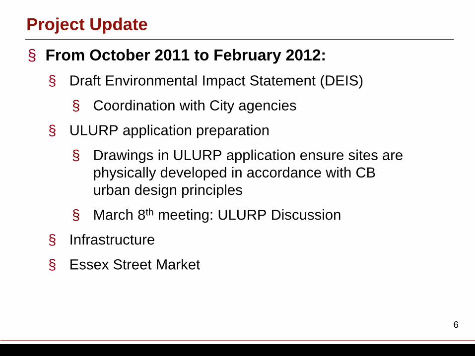
Project Update
§ From October 2011 to February 2012: § Draft Environmental Impact Statement (DEIS)
§ Coordination with City agencies
§ ULURP application preparation
§ Drawings in ULURP application ensure sites are physically developed in accordance with CB urban design principles
§ March 8th meeting: ULURP Discussion
§ Infrastructure
§ Essex Street Market
NEW YORK CITY ECONOMIC DEVELOPMENT CORPORATION
7
§ What is a “Reasonable Worst Case Development Scenario” (RWCDS)? § Scoping document describes the RWCDS and identifies which
environmental areas may be adversely affected.
§ Represents an illustrative development program of uses, size, design massings allowable under proposed ULURP actions.
§ Using the RWCDS, the Draft EIS will show the maximum potential environmental consequences of that program.
Reasonable Worst Case Development Scenario
NEW YORK CITY ECONOMIC DEVELOPMENT CORPORATION
8
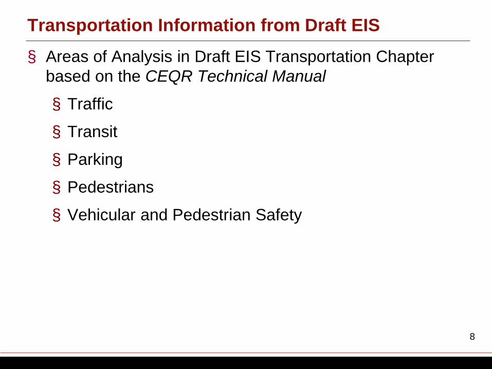
Transportation Information from Draft EIS § Areas of Analysis in Draft EIS Transportation Chapter
based on the CEQR Technical Manual
§ Traffic
§ Transit
§ Parking
§ Pedestrians
§ Vehicular and Pedestrian Safety
NEW YORK CITY ECONOMIC DEVELOPMENT CORPORATION
9
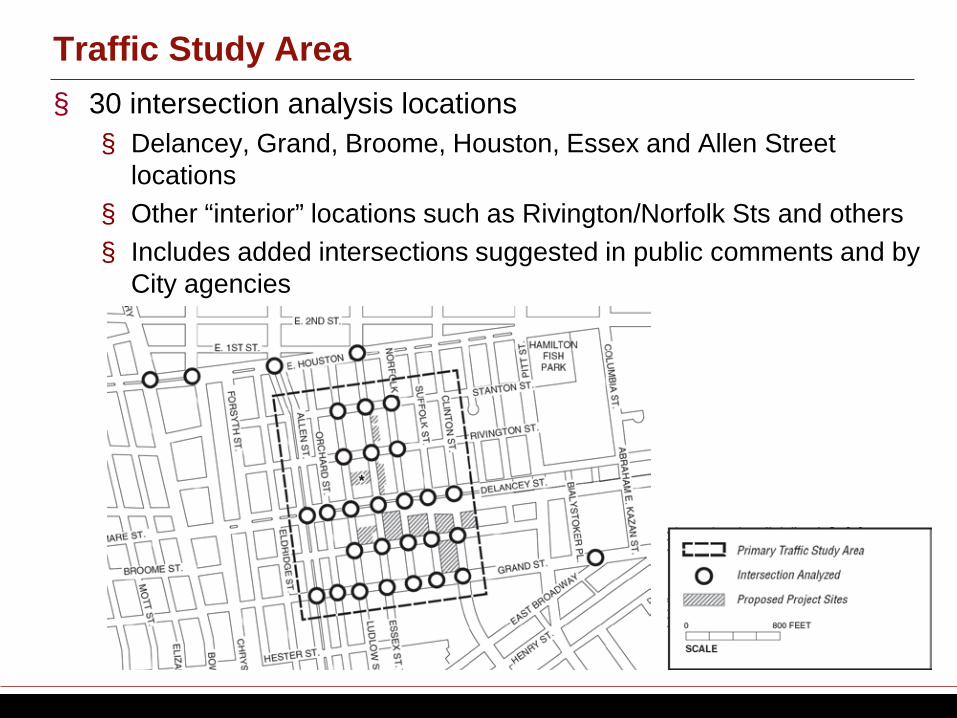
§ 30 intersection analysis locations § Delancey, Grand, Broome, Houston, Essex and Allen Street
locations § Other “interior” locations such as Rivington/Norfolk Sts and others § Includes added intersections suggested in public comments and by
City agencies
Traffic Study Area
NEW YORK CITY ECONOMIC DEVELOPMENT CORPORATION
10
§ Peak hours § Weekday AM, Midday and PM § Saturday
§ All new traffic counts conducted § Manual counts § 24-hour machine counts § Vehicle classification counts
§ Observations § Intersection-by-intersection issues § i.e., queuing, intersection spillback, illegal parking or double parking,
traffic enforcement agents that override signal timings, and others § Congested locations § Illegal maneuvers (i.e., left turns, U-turns)
§ On-street and off-street parking inventories and occupancies
Traffic Data Collection
NEW YORK CITY ECONOMIC DEVELOPMENT CORPORATION
11
§ Level of service is the measurement of operating conditions at intersections
§ Level of Service Definitions § LOS A, B and C are considered acceptable § LOS D is considered marginally acceptable/unacceptable § LOS E and F are considered unacceptable
Traffic Level of Service (LOS)
NEW YORK CITY ECONOMIC DEVELOPMENT CORPORATION
12
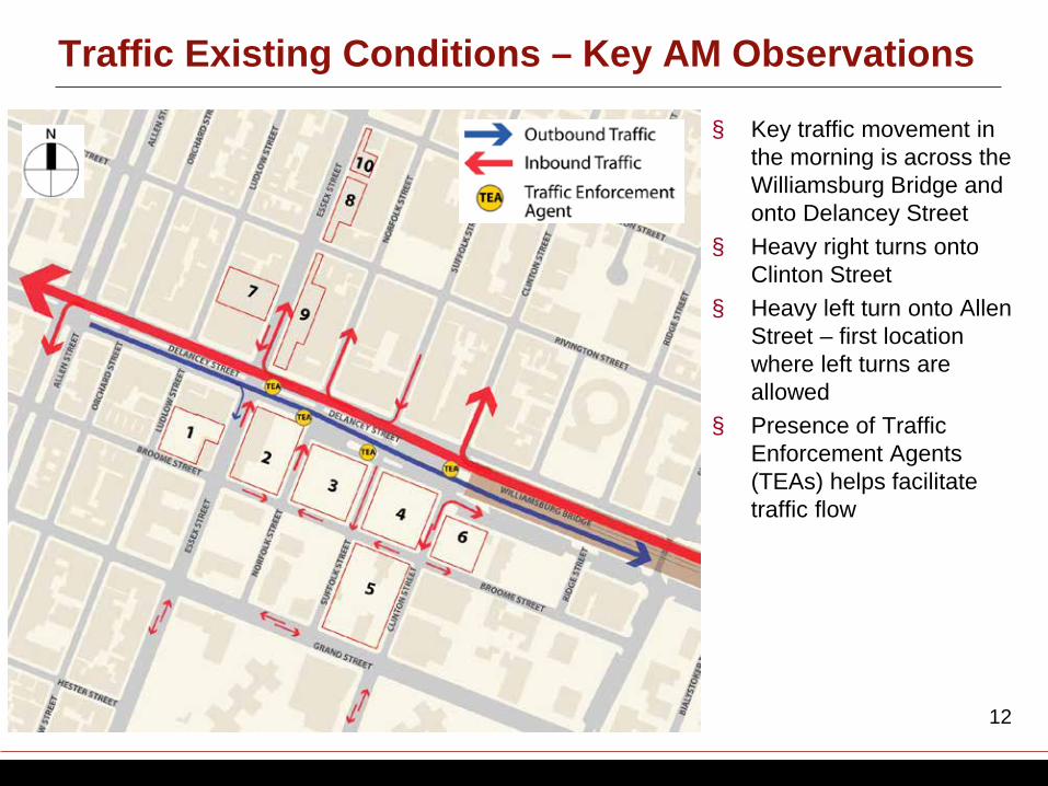
Traffic Existing Conditions – Key AM Observations
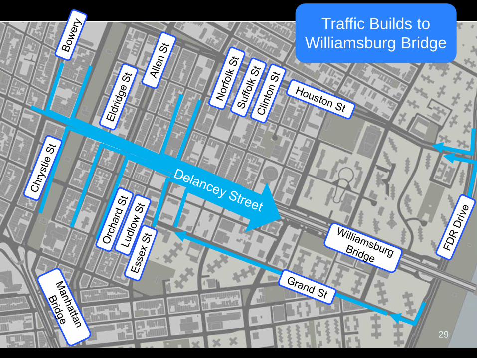
§ Key traffic movement in the morning is across the Williamsburg Bridge and onto Delancey Street
§ Heavy right turns onto Clinton Street
§ Heavy left turn onto Allen Street – first location where left turns are allowed
§ Presence of Traffic Enforcement Agents (TEAs) helps facilitate traffic flow
NEW YORK CITY ECONOMIC DEVELOPMENT CORPORATION
13
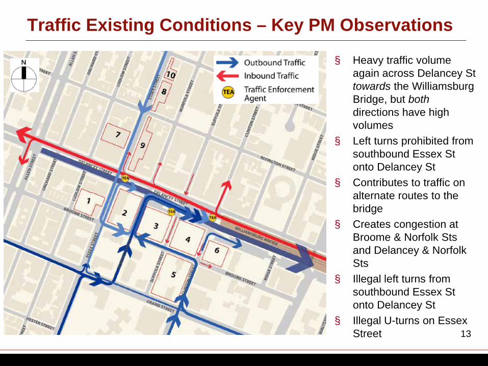
Traffic Existing Conditions – Key PM Observations
§ Heavy traffic volume again across Delancey St towards the Williamsburg Bridge, but both directions have high volumes
§ Left turns prohibited from southbound Essex St onto Delancey St
§ Contributes to traffic on alternate routes to the bridge
§ Creates congestion at Broome & Norfolk Sts and Delancey & Norfolk Sts
§ Illegal left turns from southbound Essex St onto Delancey St
§ Illegal U-turns on Essex Street
NEW YORK CITY ECONOMIC DEVELOPMENT CORPORATION
14
§ Critical movements at several key intersections are problematic (LOS E or F) – Delancey and Essex Streets – Delancey and Norfolk Streets – Delancey and Clinton Streets – Delancey and Allen Streets – Allen and Grand Streets
§ Highly trafficked problem locations were double-checked in the field
§ Illegal turns are reflected in the analysis § Pedestrian safety issues
Traffic Existing Conditions – Level of Service Findings
NEW YORK CITY ECONOMIC DEVELOPMENT CORPORATION
15
§ Serves as the baseline against which impacts of the proposed project can be assessed
§ Studies the future condition without the project being built to determine traffic volumes and levels of service without the project § Assumes 11 years of background traffic growth § Includes traffic expected from significant new unrelated
developments in the study area (i.e. planned residential projects, hotels and others)
Traffic: Future Conditions Without the Project
NEW YORK CITY ECONOMIC DEVELOPMENT CORPORATION
16
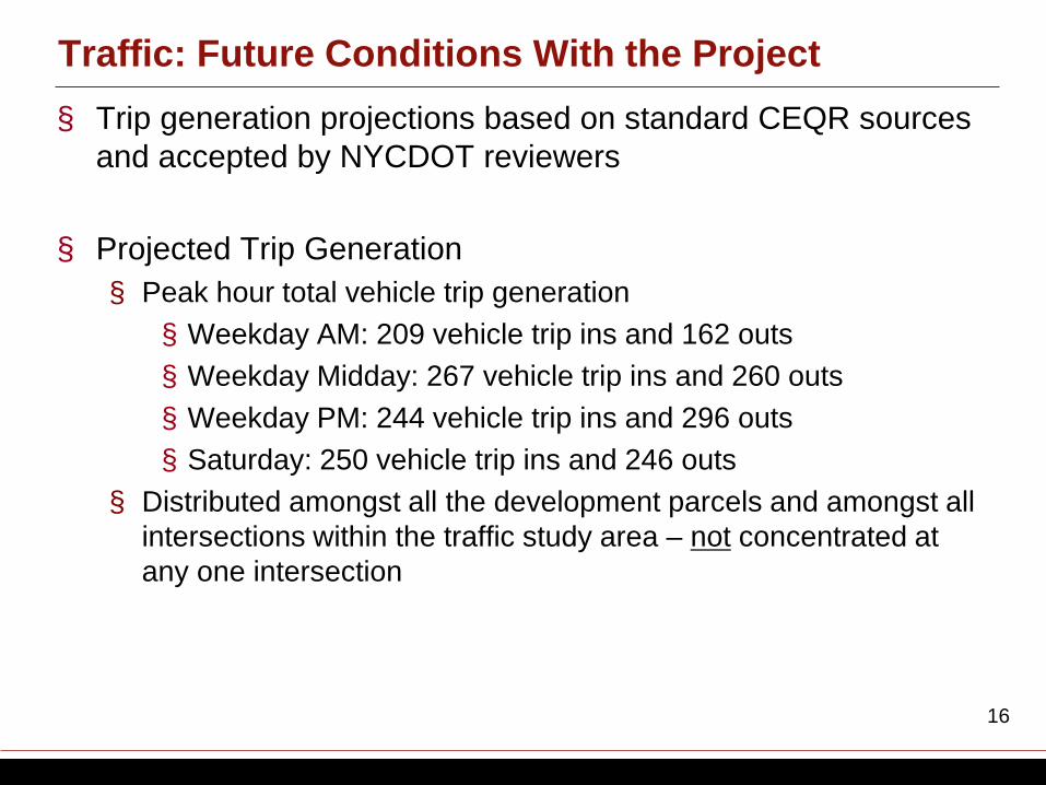
§ Trip generation projections based on standard CEQR sources and accepted by NYCDOT reviewers
§ Projected Trip Generation § Peak hour total vehicle trip generation § Weekday AM: 209 vehicle trip ins and 162 outs § Weekday Midday: 267 vehicle trip ins and 260 outs § Weekday PM: 244 vehicle trip ins and 296 outs § Saturday: 250 vehicle trip ins and 246 outs
§ Distributed amongst all the development parcels and amongst all intersections within the traffic study area – not concentrated at any one intersection
Traffic: Future Conditions With the Project
NEW YORK CITY ECONOMIC DEVELOPMENT CORPORATION
17
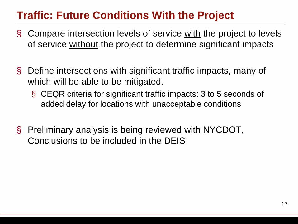
§ Compare intersection levels of service with the project to levels of service without the project to determine significant impacts
§ Define intersections with significant traffic impacts, many of which will be able to be mitigated. § CEQR criteria for significant traffic impacts: 3 to 5 seconds of
added delay for locations with unacceptable conditions
§ Preliminary analysis is being reviewed with NYCDOT, Conclusions to be included in the DEIS
Traffic: Future Conditions With the Project
NEW YORK CITY ECONOMIC DEVELOPMENT CORPORATION
18
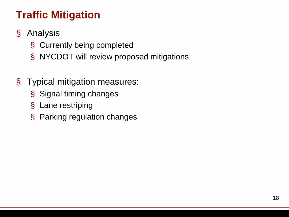
§ Analysis § Currently being completed § NYCDOT will review proposed mitigations
§ Typical mitigation measures: § Signal timing changes § Lane restriping § Parking regulation changes
Traffic Mitigation
NEW YORK CITY ECONOMIC DEVELOPMENT CORPORATION
19
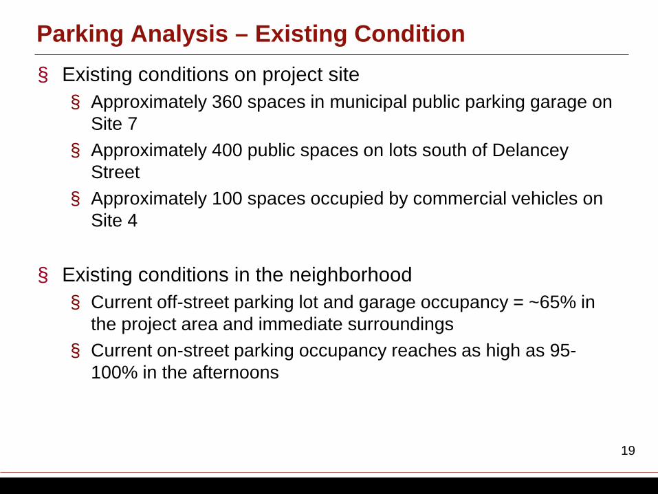
§ Existing conditions on project site § Approximately 360 spaces in municipal public parking garage on
Site 7 § Approximately 400 public spaces on lots south of Delancey
Street § Approximately 100 spaces occupied by commercial vehicles on
Site 4
§ Existing conditions in the neighborhood § Current off-street parking lot and garage occupancy = ~65% in
the project area and immediate surroundings § Current on-street parking occupancy reaches as high as 95-
100% in the afternoons
Parking Analysis – Existing Condition
NEW YORK CITY ECONOMIC DEVELOPMENT CORPORATION
20
§ Future conditions with new development on the project sites § Municipal garage on Site 7 will remain public parking § Up to 500 new spaces in new underground parking garage(s)
south of Delancey Street
§ Projected new parking demand from development on the project sites § Approximately 250-260 spaces
§ Future parking capacity § New underground garages can accommodate majority of cars
currently parked on-site and new parking demand § Cars not accommodated in new garages can be accommodated
within other nearby lots and garages
Parking Analysis – Future with project
NEW YORK CITY ECONOMIC DEVELOPMENT CORPORATION
21
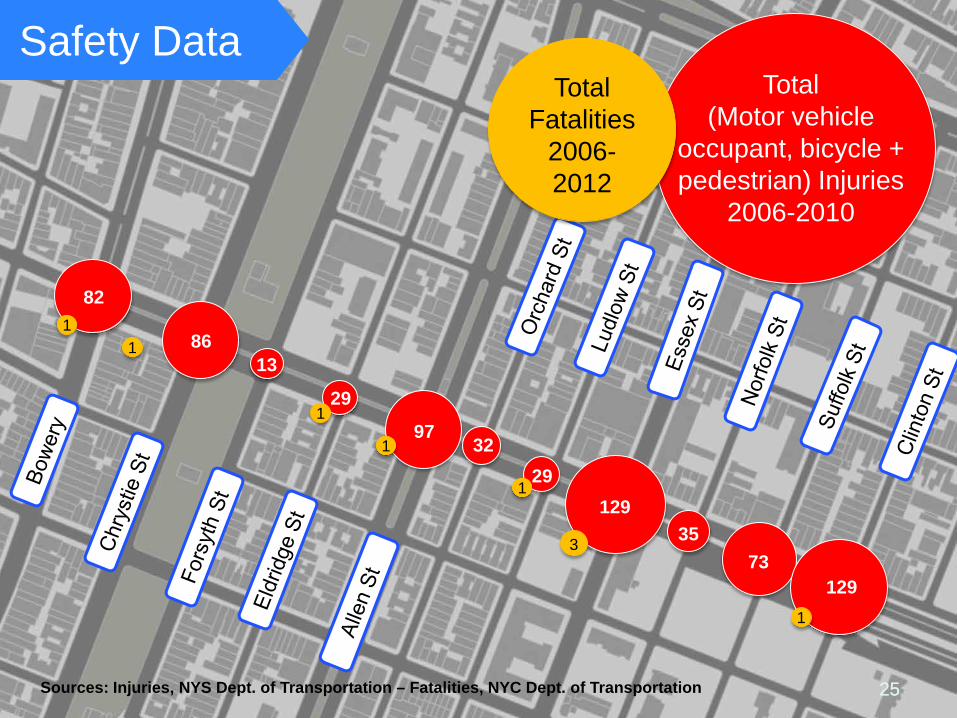
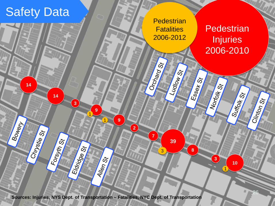
§ Three years of accident data reviewed in detail, as per CEQR Technical Manual guidelines
§ Ten intersections identified as high pedestrian accident locations § Delancey Street at Allen, Essex, Norfolk, Suffolk, and Clinton
Streets § Houston Street at the Bowery and at Avenue A § Grand Street at Allen, Essex, and Clinton Street
§ Safety improvement plan being developed by NYCDOT
Vehicular and Pedestrian Safety Analysis
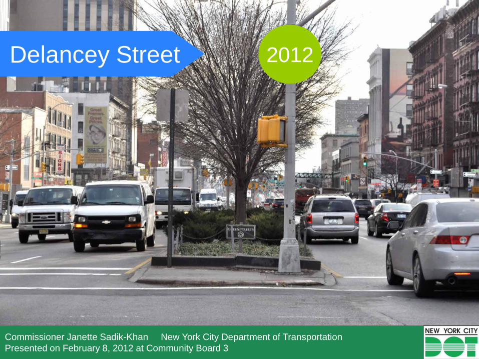
Delancey Street
Commissioner Janette Sadik-Khan New York City Department of Transportation Presented on February 8, 2012 at Community Board 3
2012
23
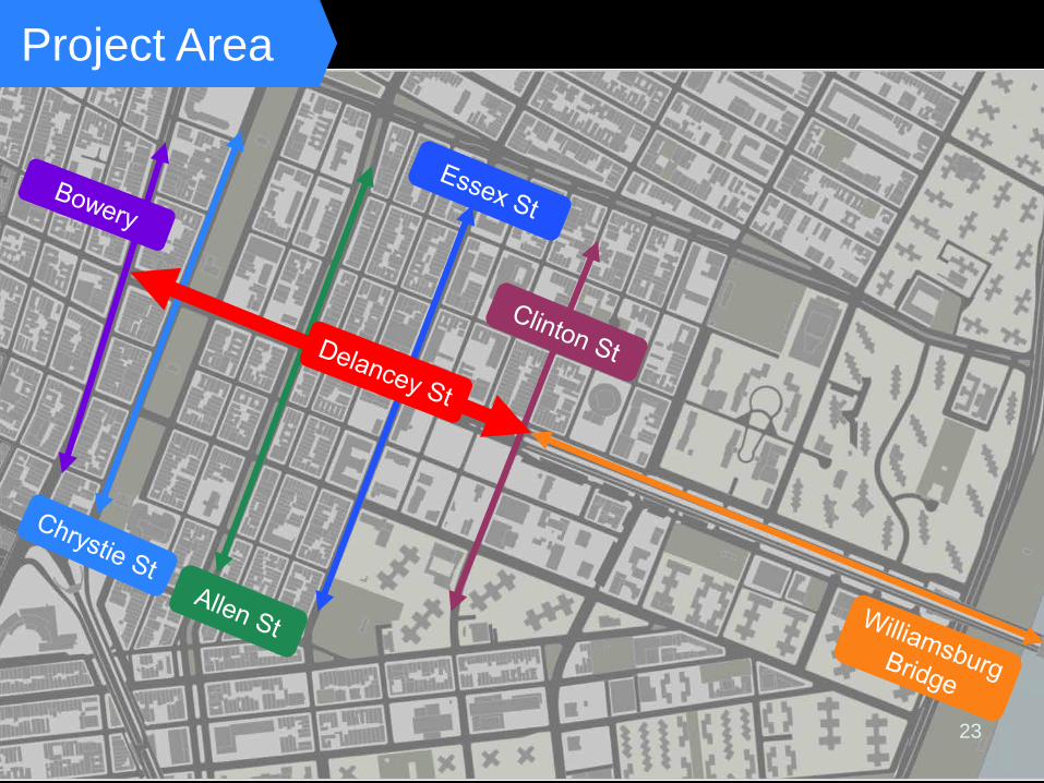
Project Area
24
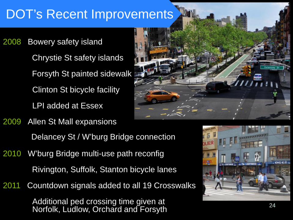
DOT’s Recent Improvements
2008 Bowery safety island
Chrystie St safety islands
Forsyth St painted sidewalk
Clinton St bicycle facility
LPI added at Essex
2009 Allen St Mall expansions
Delancey St / W’burg Bridge connection
2010 W’burg Bridge multi-use path reconfig
Rivington, Suffolk, Stanton bicycle lanes
2011 Countdown signals added to all 19 Crosswalks
Additional ped crossing time given at Norfolk, Ludlow, Orchard and Forsyth
25 25
Safety Data
82
86 13
29
97 32
29 129
35 73
129
1 1
1
1
1
3
Total (Motor vehicle
occupant, bicycle + pedestrian) Injuries
2006-2010
Total
Fatalities 2006-2012
1
Sources: Injuries, NYS Dept. of Transportation – Fatalities, NYC Dept. of Transportation
26
Safety Data
1
14 3
9 1
9 2
7 39
3 8
3 10
1
14
Pedestrian Injuries
2006-2010
Pedestrian Fatalities
2006-2012
Sources: Injuries, NYS Dept. of Transportation – Fatalities, NYC Dept. of Transportation
27
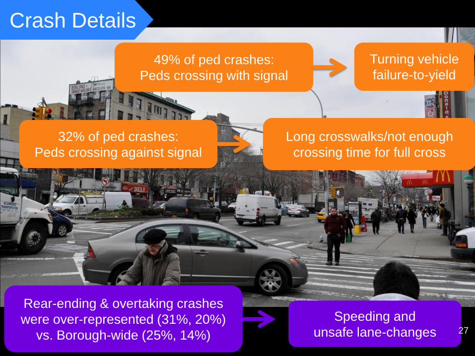
Crash Details
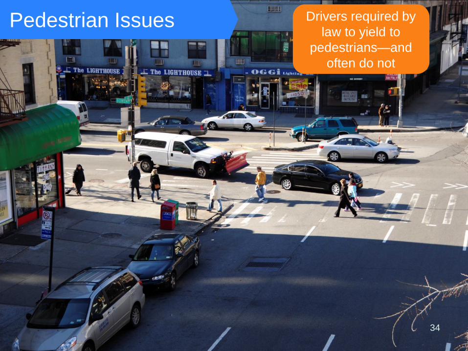
Turning vehicle failure-to-yield
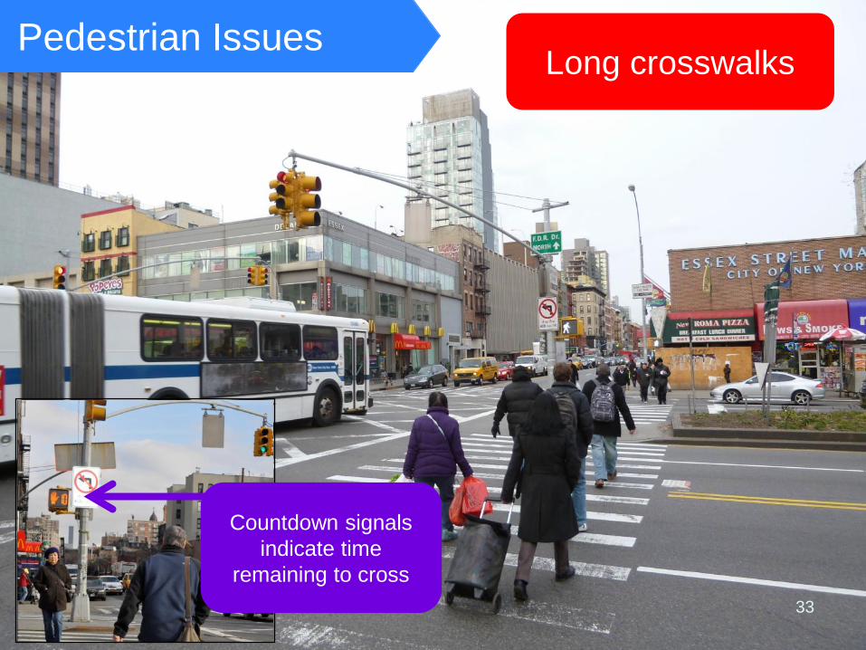
Long crosswalks/not enough crossing time for full cross
Speeding and unsafe lane-changes
49% of ped crashes: Peds crossing with signal
32% of ped crashes: Peds crossing against signal
Rear-ending & overtaking crashes were over-represented (31%, 20%)
vs. Borough-wide (25%, 14%) 27
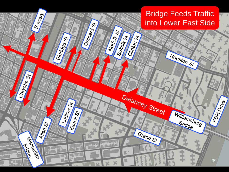
Bridge Feeds Traffic into Lower East Side
28
`
Traffic Builds to Williamsburg Bridge
29
30
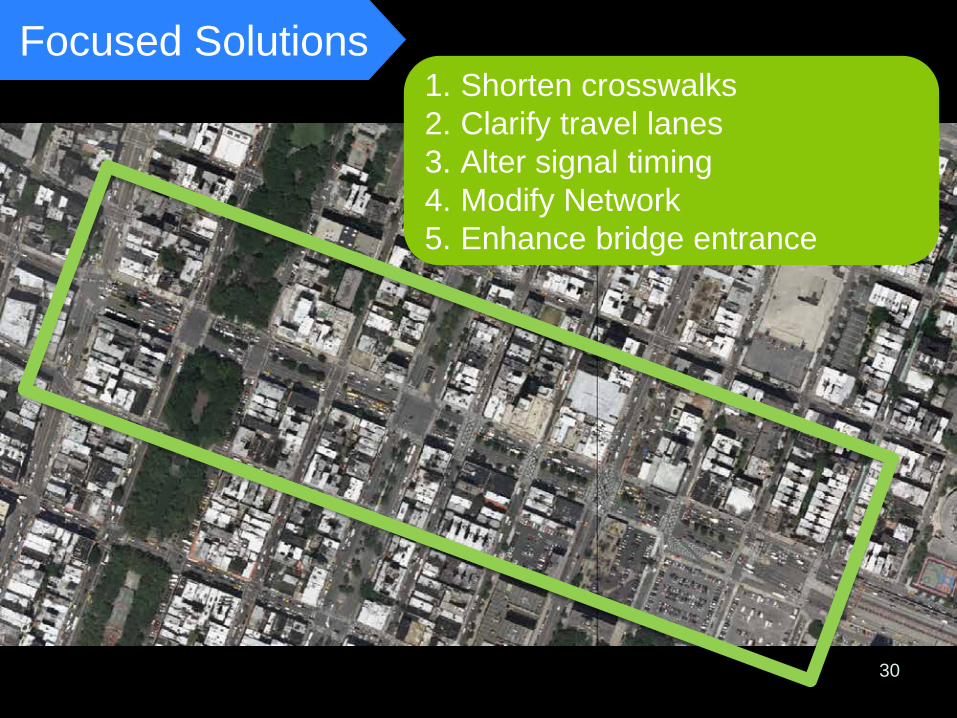
Focused Solutions 1. Shorten crosswalks 2. Clarify travel lanes 3. Alter signal timing 4. Modify Network 5. Enhance bridge entrance
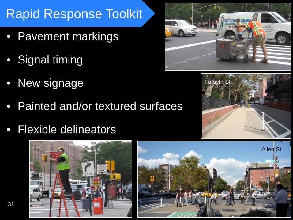
• Pavement markings
• Signal timing
• New signage
• Painted and/or textured surfaces
• Flexible delineators
Rapid Response Toolkit
31
Forsyth St
Allen St
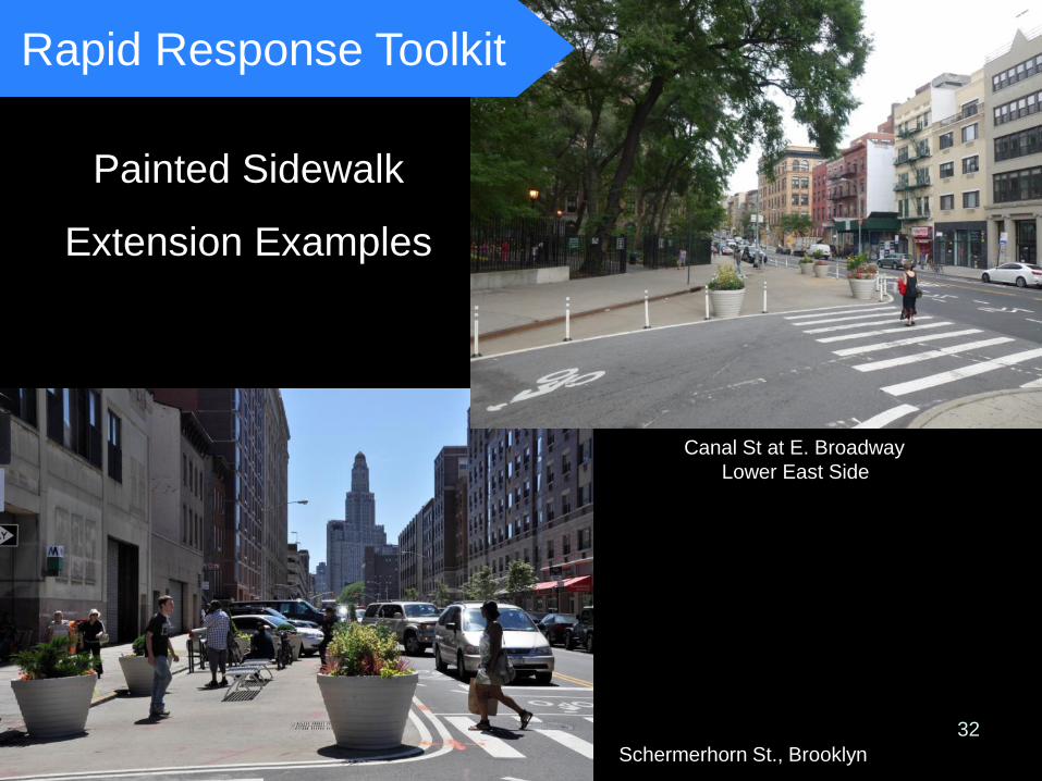
Painted Sidewalk
Extension Examples
Canal St at E. Broadway Lower East Side
Schermerhorn St., Brooklyn 32
Rapid Response Toolkit
33
Pedestrian Issues
Countdown signals indicate time
remaining to cross
Long crosswalks
34
Pedestrian Issues Drivers required by law to yield to
pedestrians—and often do not
36
Forsyth St Orchard
Existing
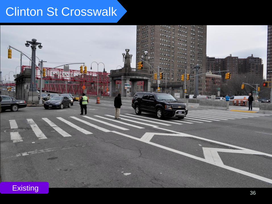
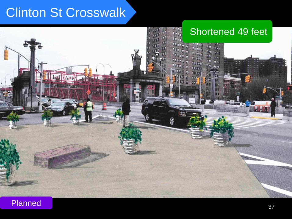
Clinton St Crosswalk
37
Shortened 49 feet
Planned
Clinton St Crosswalk
38
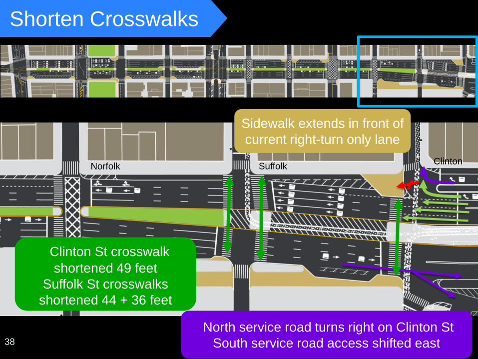
Shorten Crosswalks
Forsyth St Orchard
North service road turns right on Clinton St South service road access shifted east
Sidewalk extends in front of current right-turn only lane
Clinton St crosswalk shortened 49 feet
Suffolk St crosswalks shortened 44 + 36 feet
Norfolk Suffolk Clinton
38
39
Forsyth St Orchard
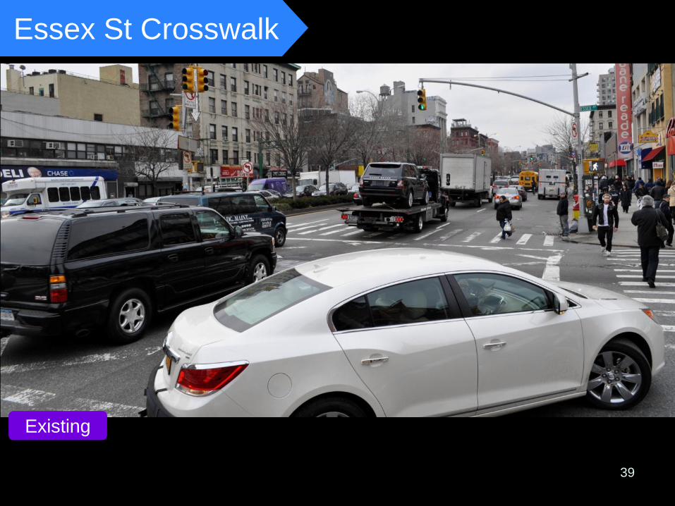
Essex St Crosswalk
Existing
40
Forsyth St Orchard
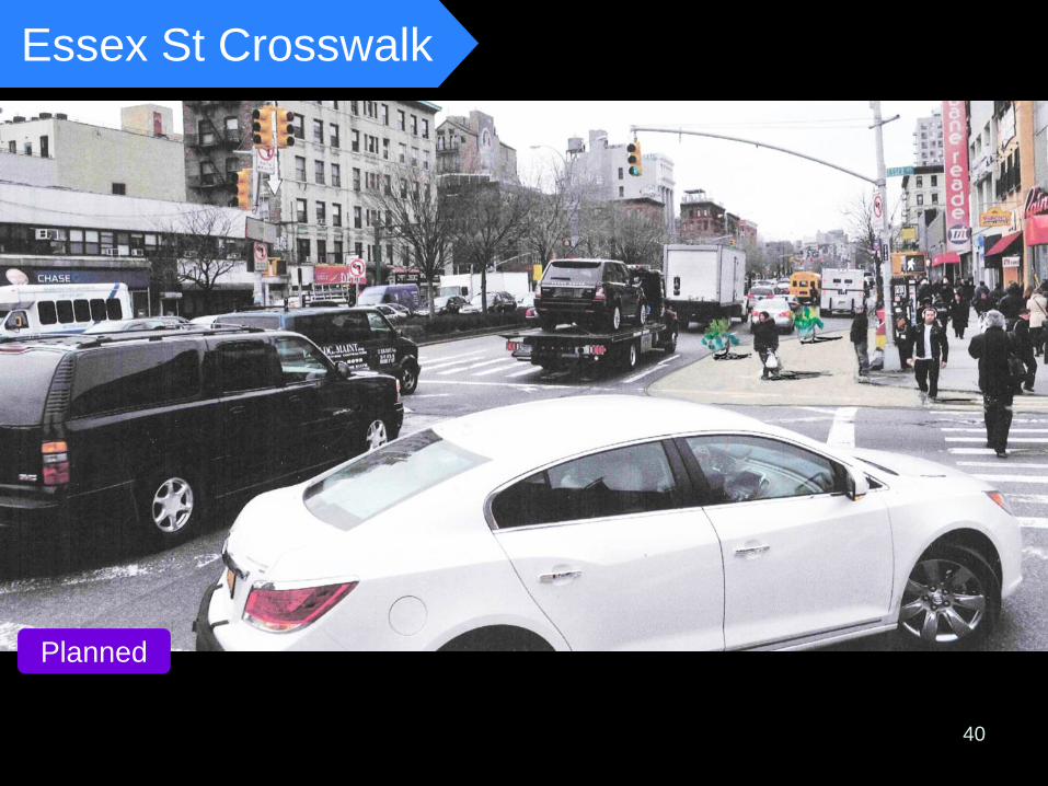
Clinton St crosswalk shortened 49 feet
Insert Raisa AFTER same photo Before
Essex St Crosswalk
Planned
41
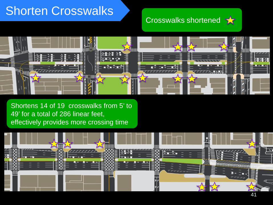
Crosswalks shortened Shorten Crosswalks
Shortens 14 of 19 crosswalks from 5’ to 49’ for a total of 286 linear feet, effectively provides more crossing time
42
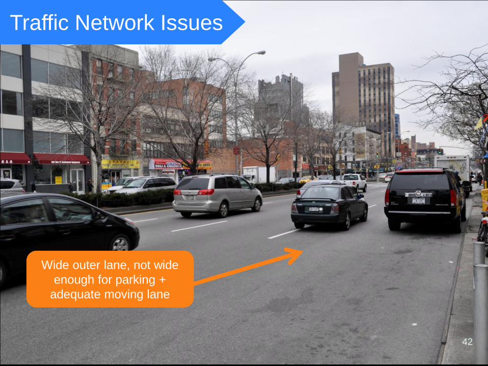
Wide outer lane, not wide enough for parking +
adequate moving lane
Traffic Network Issues
43
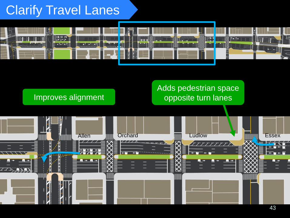
Orchard
Bowery
Allen St
Essex St
Forsyth St
Ludlow
Orchard
Orchard
Allen Essex
Ludlow
Adds pedestrian space opposite turn lanes
Clarify Travel Lanes
Allen Orchard Ludlow Essex
Improves alignment
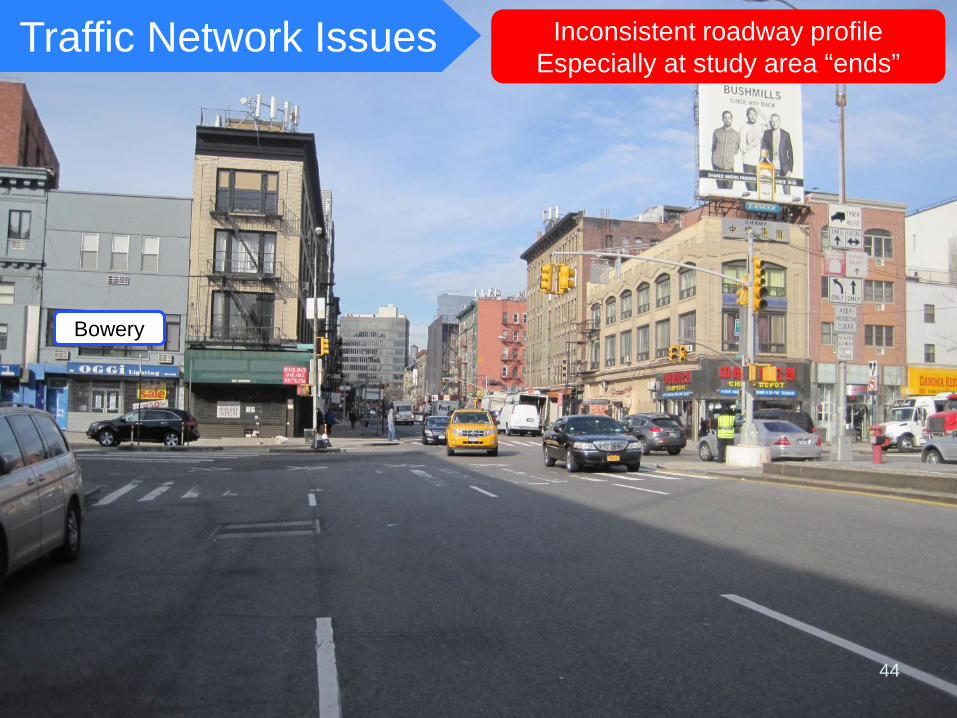
Inconsistent roadway profile Especially at study area “ends”
44
Traffic Network Issues
Bowery
45
Orchard
Allen St
Essex St
Suffolk
Forsyth St
Ludlow
Norfolk
Orchard
Clinton
Orchard
Allen Essex
Suffolk
Ludlow
Norfolk
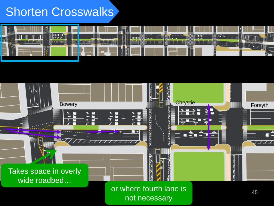
Shorten Crosswalks
or where fourth lane is not necessary
Takes space in overly wide roadbed…
Bowery Chrystie Forsyth
48
Traffic Network Issues
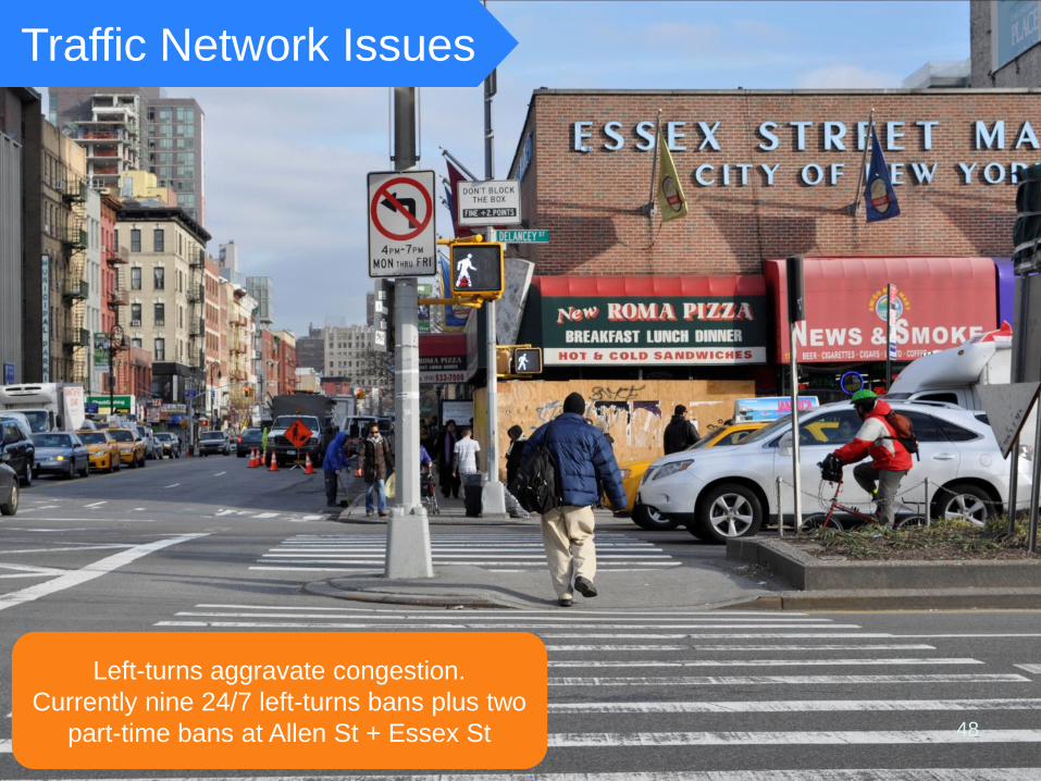
Left-turns aggravate congestion. Currently nine 24/7 left-turns bans plus two
part-time bans at Allen St + Essex St
49
Orchard
Bowery
Forsyth St
Ludlow
Orchard
Allen Essex
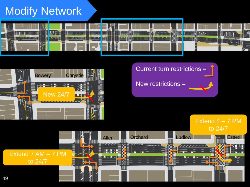
Modify Network
Extend 7 AM – 7 PM to 24/7
New 24/7
Extend 4 – 7 PM to 24/7
Current turn restrictions = New restrictions =
Chrystie
50
Traffic Network Issues
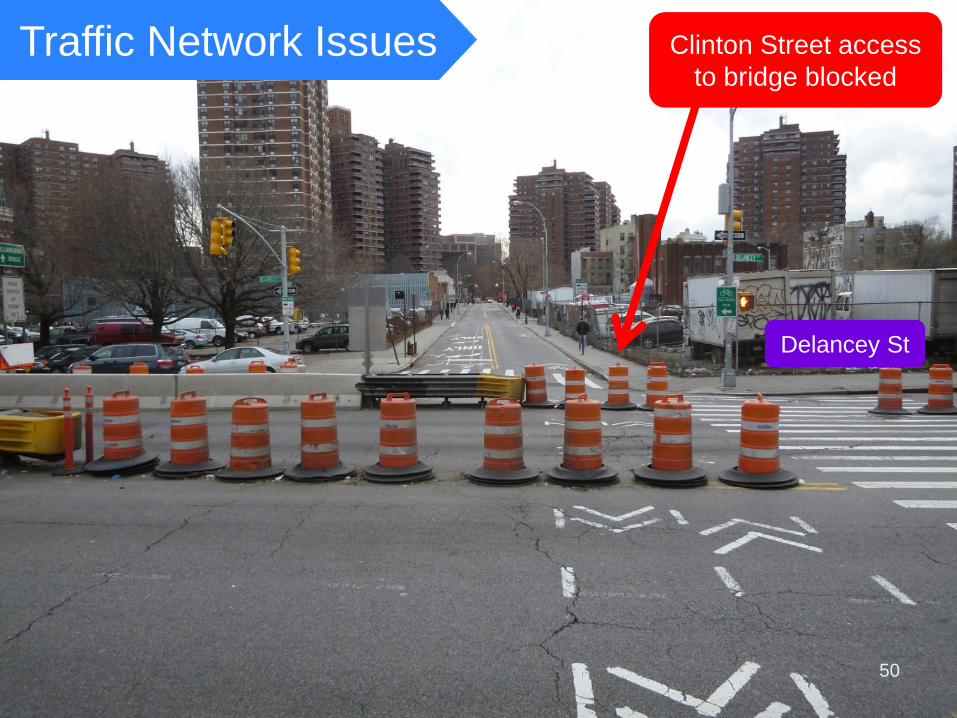
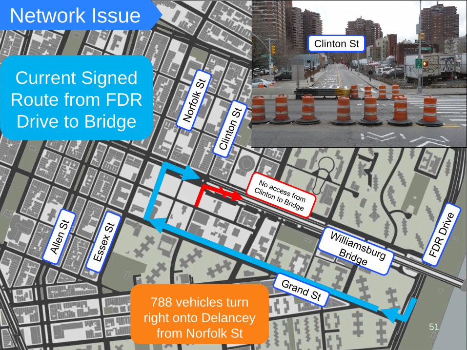
Delancey St
Clinton Street access to bridge blocked
`
Current Signed Route from FDR Drive to Bridge
Network Issue
788 vehicles turn right onto Delancey
from Norfolk St
Clinton St
51
`
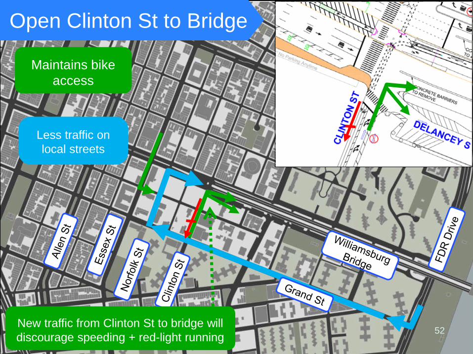
Maintains bike access
Open Clinton St to Bridge
New traffic from Clinton St to bridge will discourage speeding + red-light running
Less traffic on local streets
52
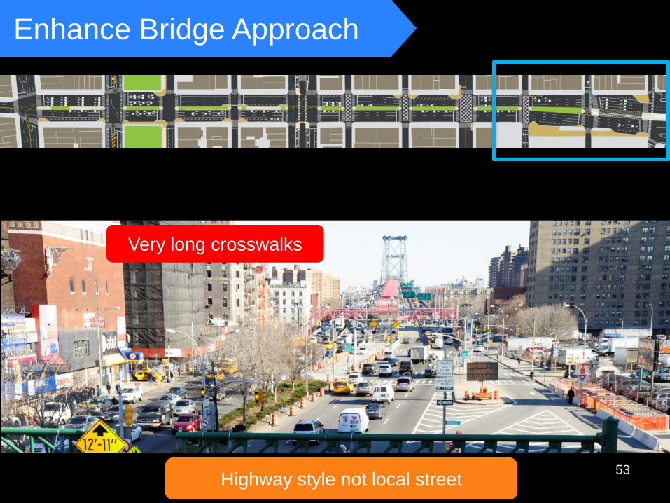
Enhance Bridge Approach
Forsyth St Orchard
53
Very long crosswalks
Highway style not local street
54
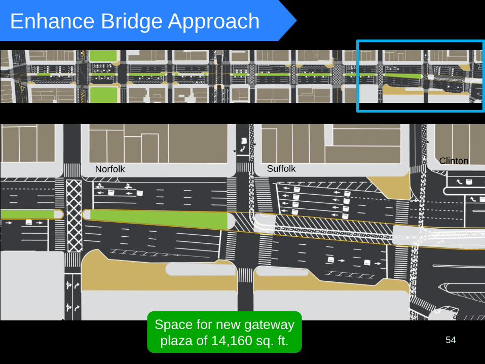
Enhance Bridge Approach
Forsyth St Orchard
Space for new gateway plaza of 14,160 sq. ft.
Norfolk Suffolk Clinton
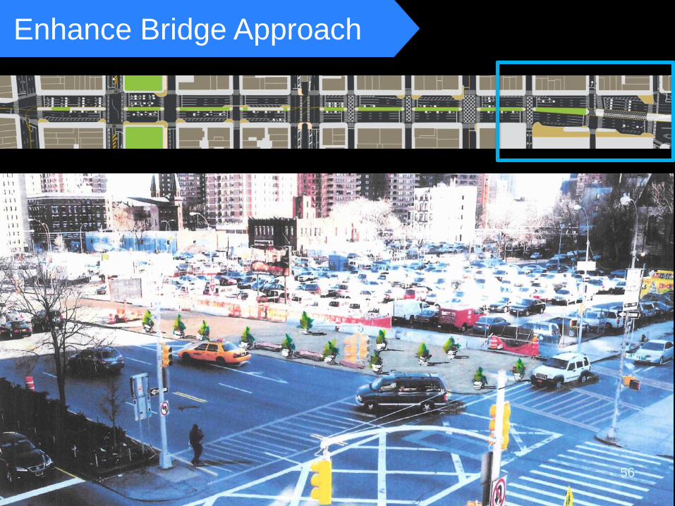
Enhance Bridge Approach
Forsyth St Orchard
56
57
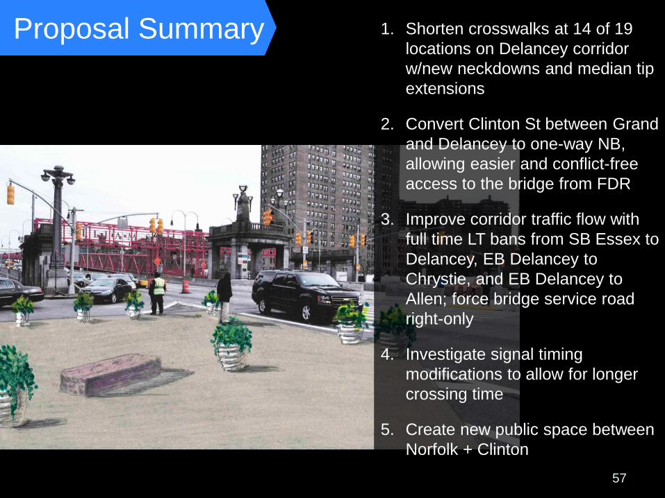
Proposal Summary
1. Shorten crosswalks at 14 of 19 locations on Delancey corridor w/new neckdowns and median tip extensions
2. Convert Clinton St between Grand and Delancey to one-way NB, allowing easier and conflict-free access to the bridge from FDR
3. Improve corridor traffic flow with full time LT bans from SB Essex to Delancey, EB Delancey to Chrystie, and EB Delancey to Allen; force bridge service road right-only
4. Investigate signal timing modifications to allow for longer crossing time
5. Create new public space between Norfolk + Clinton
www.nyc.gov/dot Thank You