Embed Size (px)
Citation preview
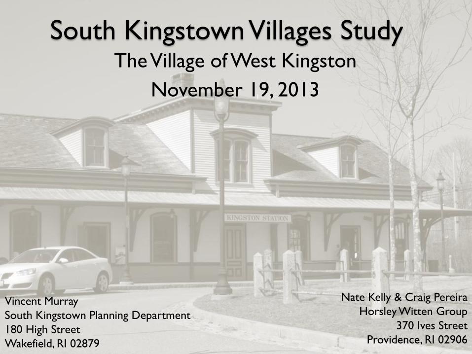
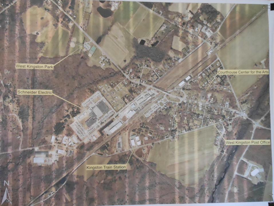
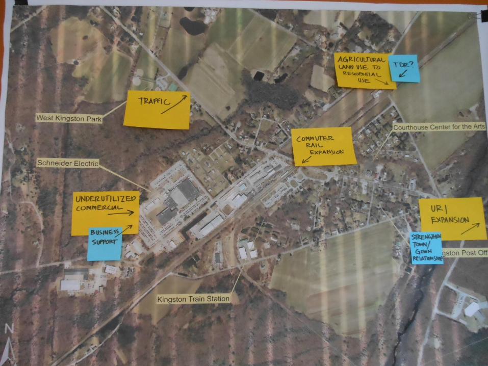
South Kingstown Villages Study The Village of West Kingston
November 19, 2013
Nate Kelly & Craig Pereira
Horsley Witten Group
370 Ives Street
Providence, RI 02906
Vincent Murray
South Kingstown Planning Department
180 High Street
Wakefield, RI 02879
Project Background
Statewide Planning Challenge Grant
Project Goals:
◦ Community Engagement
◦ Economic Development and Viability
◦ Identify Infill Opportunities
◦ Define an Appropriate ‘Village Scale’
Project Scope
Inventory public infrastructure and potential
improvements
Buildout Analysis
Review local planning documents
Conduct public workshops
◦ Identify strengths, weaknesses, opportunities
and threats
Develop ‘vision statement’ and policy directions
Draft amendments to local regulations
March Meeting Discussion…
Review of existing conditions
Defining Issues o Protection/Enforcement of the Groundwater
Protection Overlay District
o Connectivity and circulation
o Potential loss of land in agricultural use to
residential use
o Potential expansion of commuter rail service to
West Kingston
o Zoning Ordinance conformity
o Future viability of industrial uses in area
Tonight’s Meeting Orientation to Meeting Materials
Project Updates:
◦ Potential Commuter Rail Expansion
◦ URI Growth Issues
◦ RIDOT Route 138 Reconstruction Project
◦ Parking Issues at the Train Station
Village Style Development
Map Exercise:
o Identifying Threats and Solutions
o Identifying Opportunities and Strategies
Orientation to
Meeting Materials
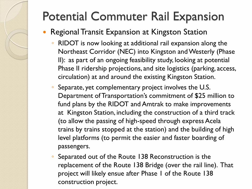
Potential Commuter Rail Expansion Regional Transit Expansion at Kingston Station
◦ RIDOT is now looking at additional rail expansion along the
Northeast Corridor (NEC) into Kingston and Westerly (Phase
II): as part of an ongoing feasibility study, looking at potential
Phase II ridership projections, and site logistics (parking, access,
circulation) at and around the existing Kingston Station.
◦ Separate, yet complementary project involves the U.S.
Department of Transportation’s commitment of $25 million to
fund plans by the RIDOT and Amtrak to make improvements
at Kingston Station, including the construction of a third track
(to allow the passing of high-speed through express Acela
trains by trains stopped at the station) and the building of high
level platforms (to permit the easier and faster boarding of
passengers.
◦ Separated out of the Route 138 Reconstruction is the
replacement of the Route 138 Bridge (over the rail line). That
project will likely ensue after Phase 1 of the Route 138
construction project.
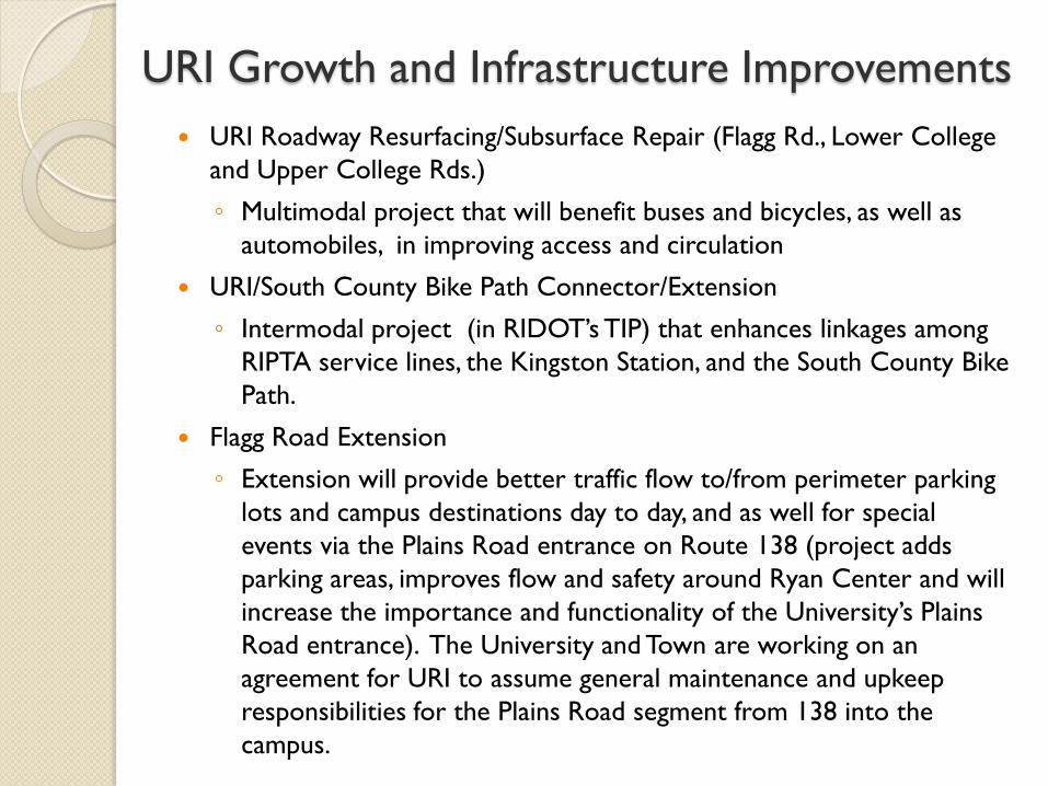
URI Growth and Infrastructure Improvements
URI Roadway Resurfacing/Subsurface Repair (Flagg Rd., Lower College
and Upper College Rds.)
◦ Multimodal project that will benefit buses and bicycles, as well as
automobiles, in improving access and circulation
URI/South County Bike Path Connector/Extension
◦ Intermodal project (in RIDOT’s TIP) that enhances linkages among
RIPTA service lines, the Kingston Station, and the South County Bike
Path.
Flagg Road Extension
◦ Extension will provide better traffic flow to/from perimeter parking
lots and campus destinations day to day, and as well for special
events via the Plains Road entrance on Route 138 (project adds
parking areas, improves flow and safety around Ryan Center and will
increase the importance and functionality of the University’s Plains
Road entrance). The University and Town are working on an
agreement for URI to assume general maintenance and upkeep
responsibilities for the Plains Road segment from 138 into the
campus.
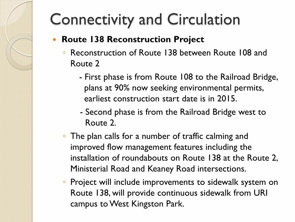
Connectivity and Circulation Route 138 Reconstruction Project
◦ Reconstruction of Route 138 between Route 108 and
Route 2
- First phase is from Route 108 to the Railroad Bridge,
plans at 90% now seeking environmental permits,
earliest construction start date is in 2015.
- Second phase is from the Railroad Bridge west to
Route 2.
◦ The plan calls for a number of traffic calming and
improved flow management features including the
installation of roundabouts on Route 138 at the Route 2,
Ministerial Road and Keaney Road intersections.
◦ Project will include improvements to sidewalk system on
Route 138, will provide continuous sidewalk from URI
campus to West Kingston Park.
Connectivity and Circulation Kingston Station Parking Lot Expansion
◦ Concurrent with the Route 138 Reconstruction, RIDOT
is considering adding parking spaces (135 spaces) in the
area of the detention basin. At present, construction is
under way to add 45 spaces on the north side of the
station near the signal tower .
◦ The RIDOT is also looking into alternatives for a
reconstructed tower adjacent to the existing Station, to
include public restrooms for bike path users. This
project is under a Transportation Improvement Project
(TIP) project award in favor of the “Friends of Kingston
Station”.

Questions
Village Style Development
What are “village patterns”?
Revisit the traditional forms to find out…
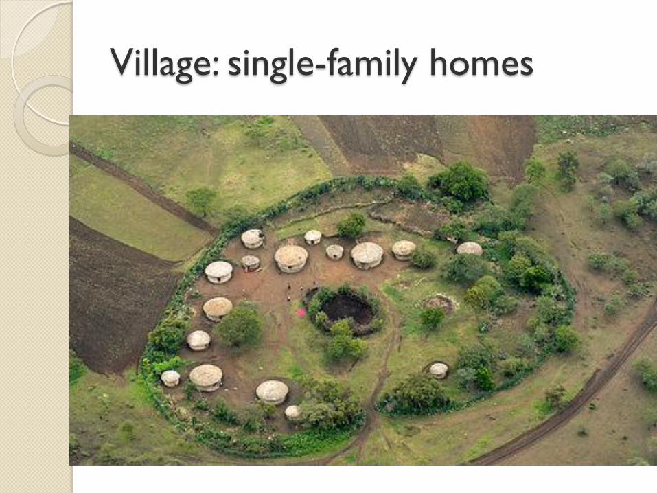
Village: single-family homes
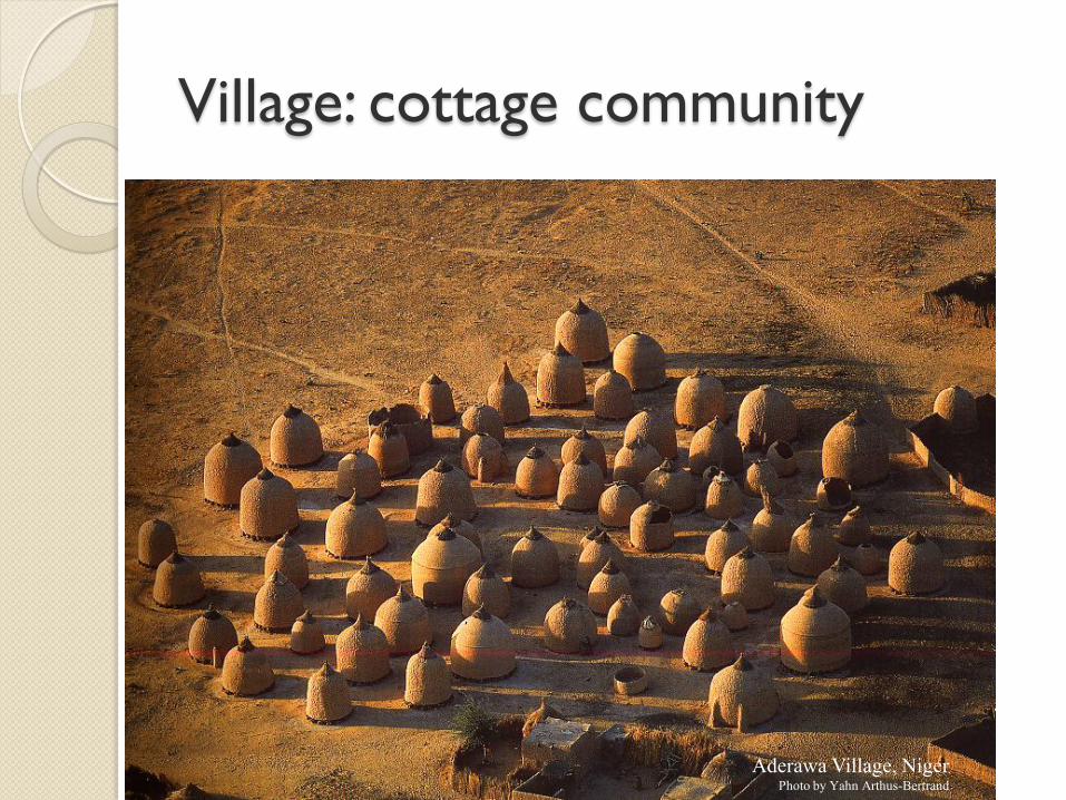
Village: cottage community
Aderawa Village, Niger Photo by Yahn Arthus-Bertrand
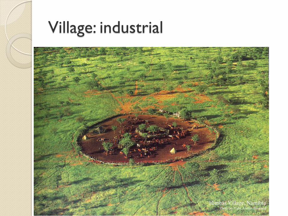
Village: industrial
Himbas Village, Namibia Photo by Yahn Arthus-Bertrand
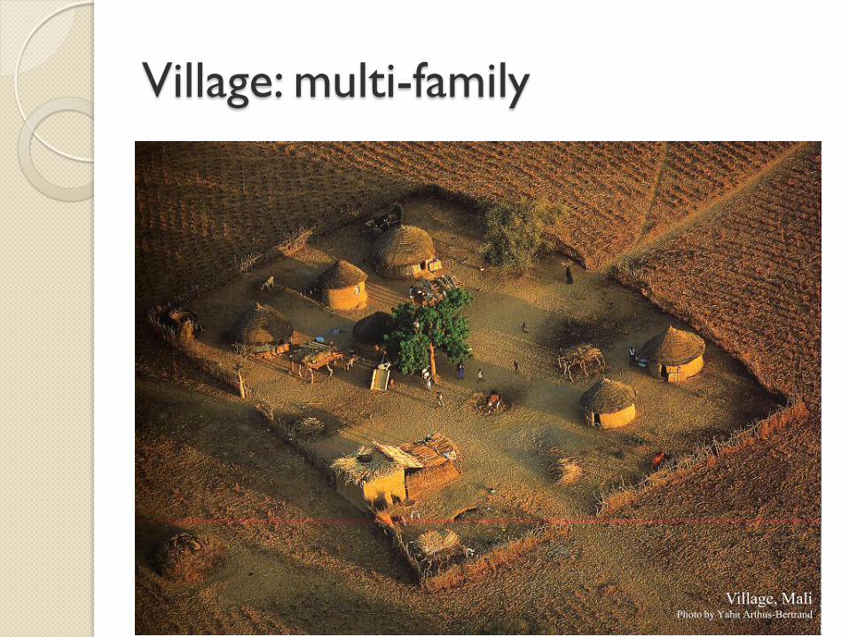
Village: multi-family
Village, Mali Photo by Yahn Arthus-Bertrand
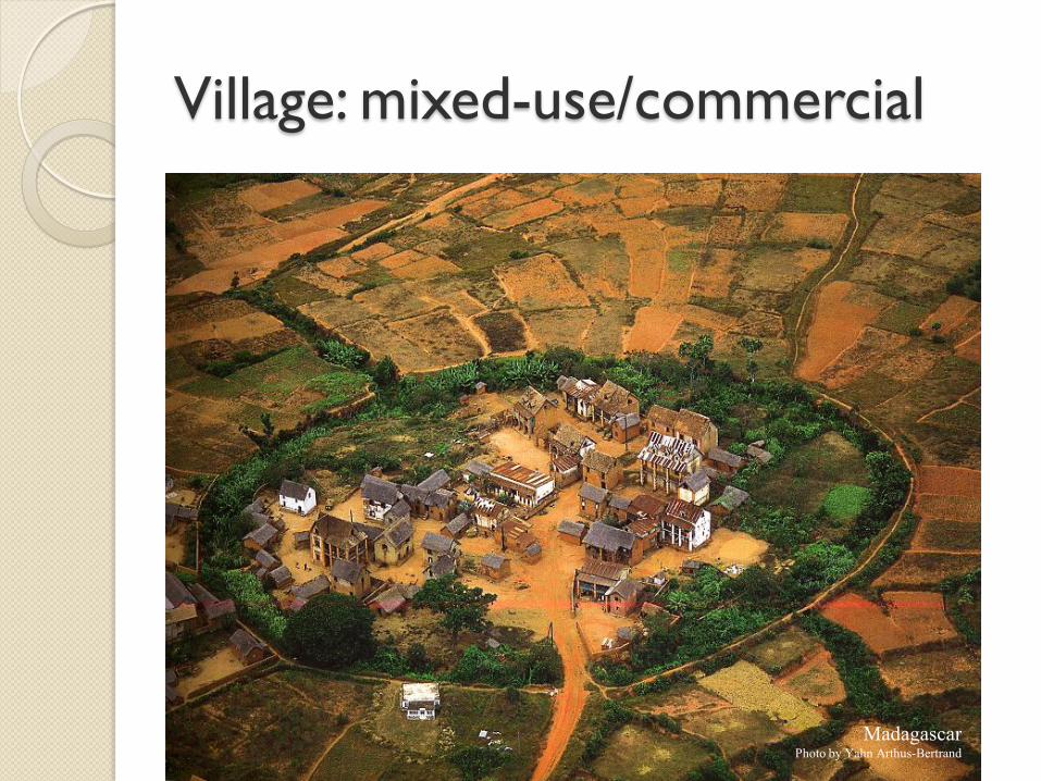
Village: mixed-use/commercial
Madagascar Photo by Yahn Arthus-Bertrand
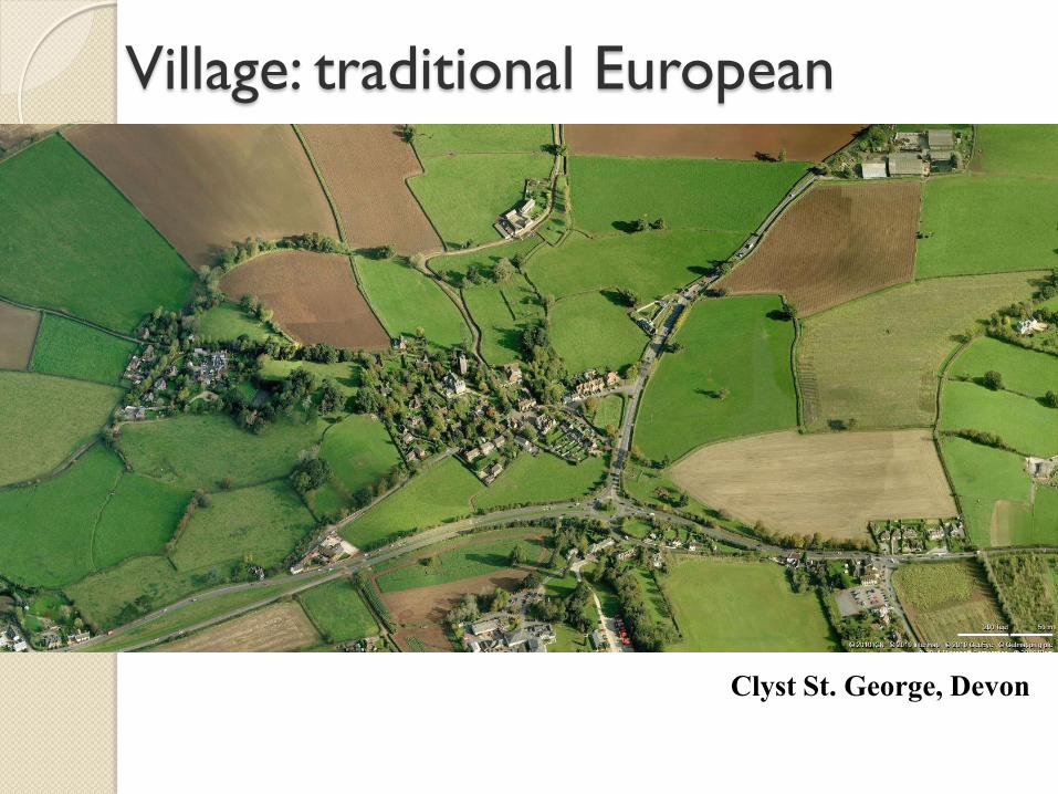
Clyst St. George, Devon
Village: traditional European
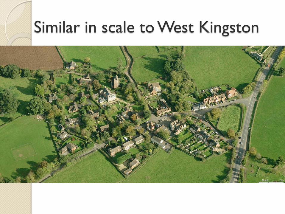
Similar in scale to West Kingston
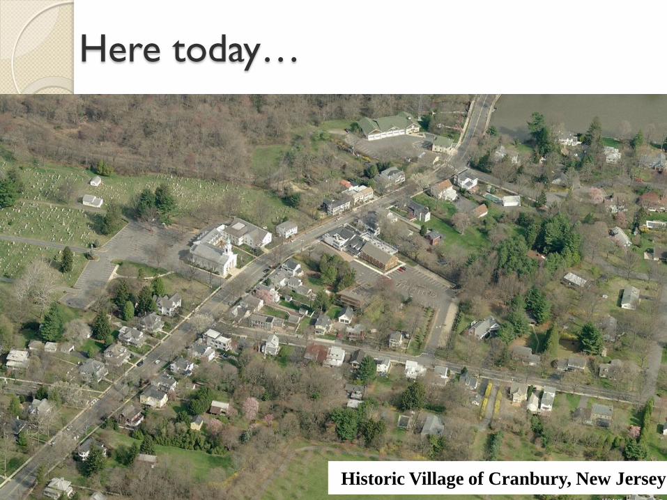
Here today…
Historic Village of Cranbury, New Jersey
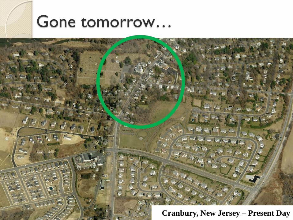
Gone tomorrow…
Cranbury, New Jersey – Present Day
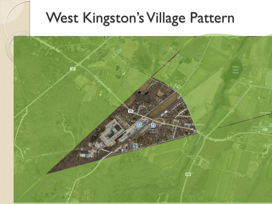
West Kingston’s Village Pattern
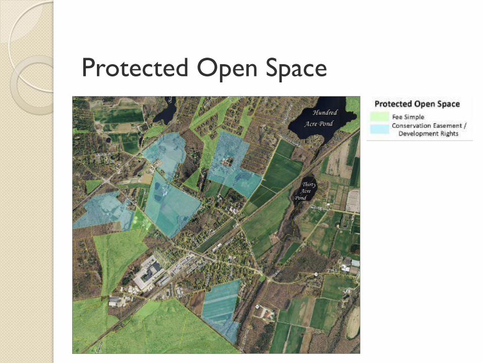
Protected Open Space
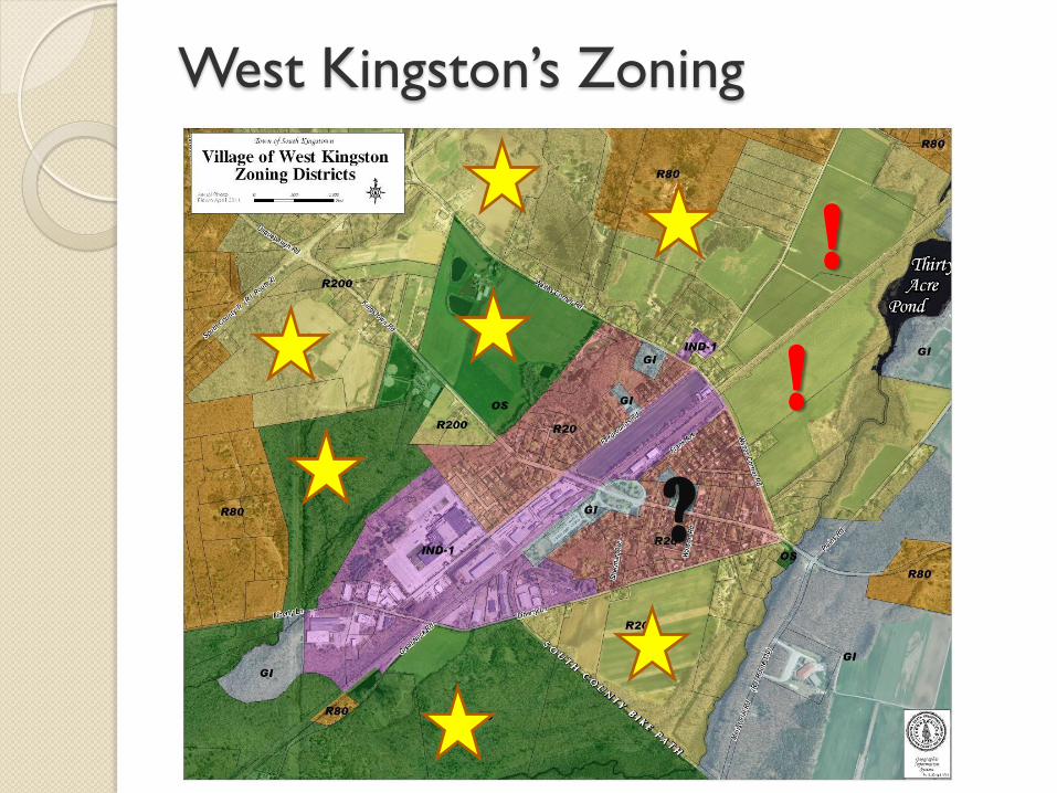
West Kingston’s Zoning
!
?
!
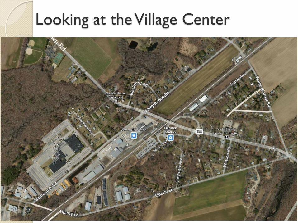
Looking at the Village Center
Zoning Review
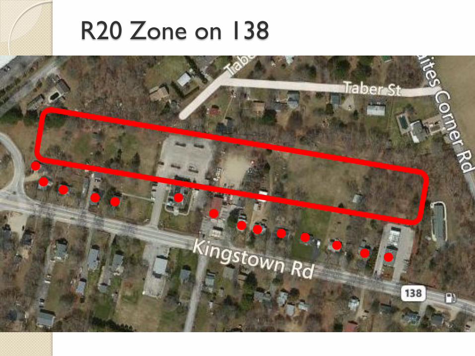
R20 Zone on 138
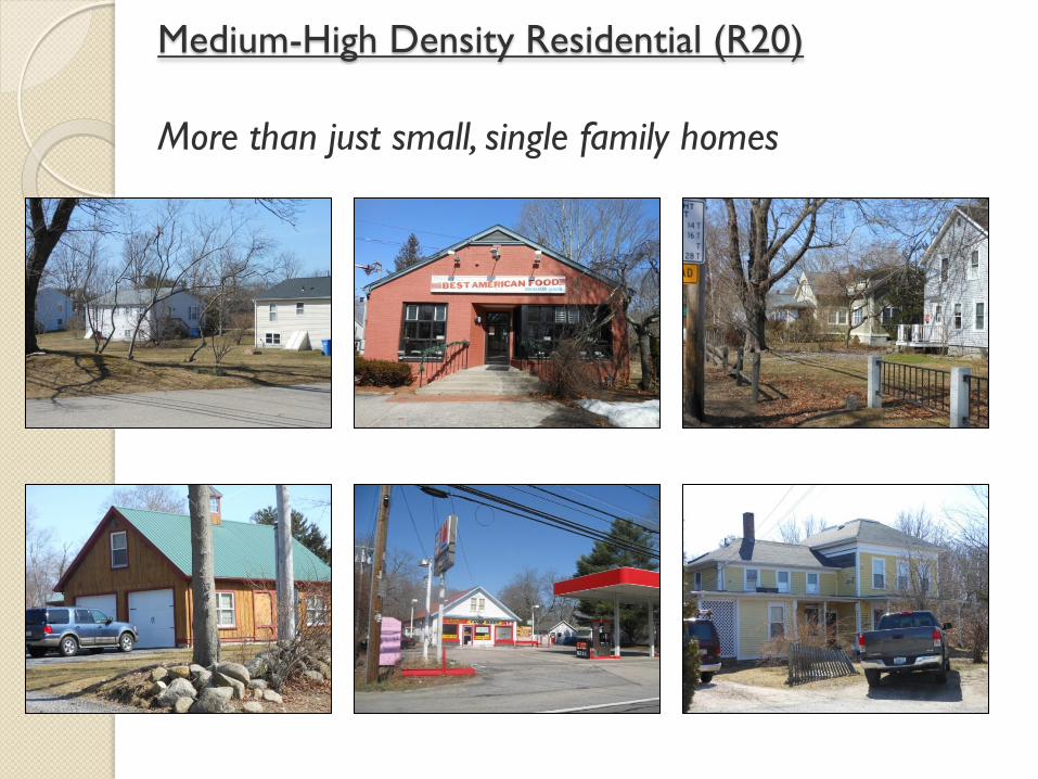
Medium-High Density Residential (R20)
More than just small, single family homes
Are there options to grow?
Revisit the traditional forms to decide…
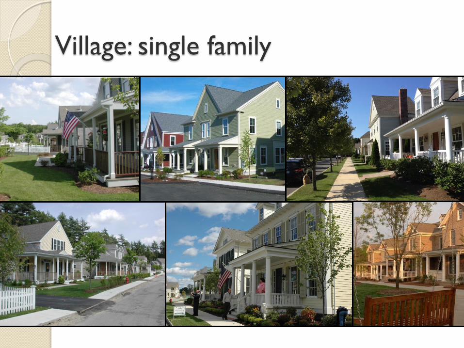
Village: single family
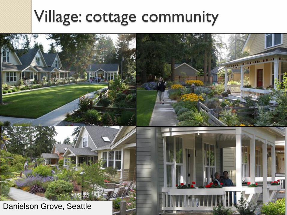
Danielson Grove, Seattle
Village: cottage community
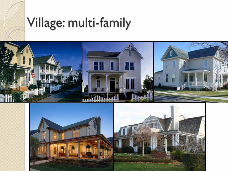
Village: multi-family
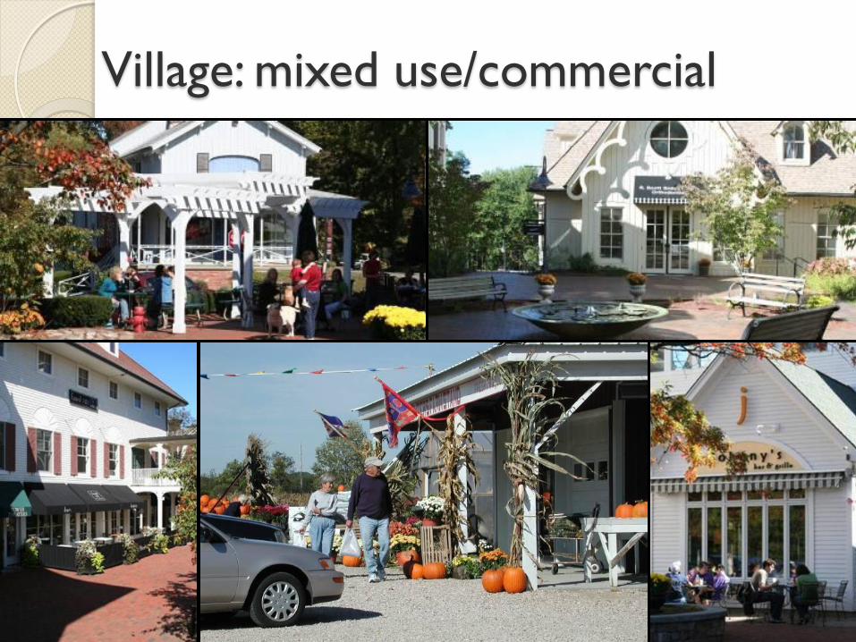
Village: mixed use/commercial
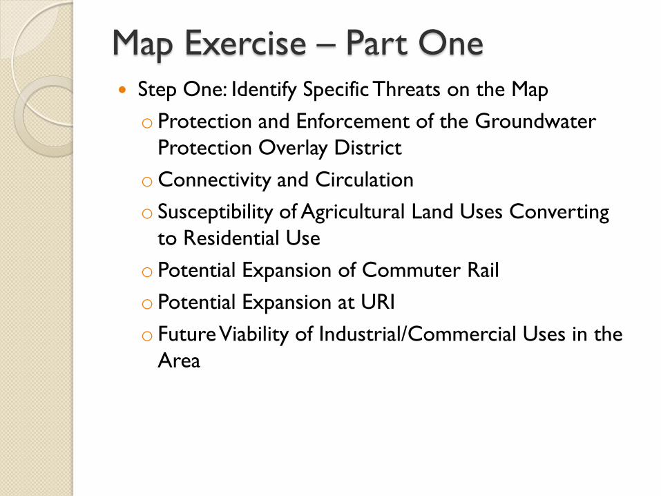
Map Exercise – Part One Step One: Identify Specific Threats on the Map
o Protection and Enforcement of the Groundwater
Protection Overlay District
oConnectivity and Circulation
o Susceptibility of Agricultural Land Uses Converting
to Residential Use
o Potential Expansion of Commuter Rail
o Potential Expansion at URI
o Future Viability of Industrial/Commercial Uses in the
Area
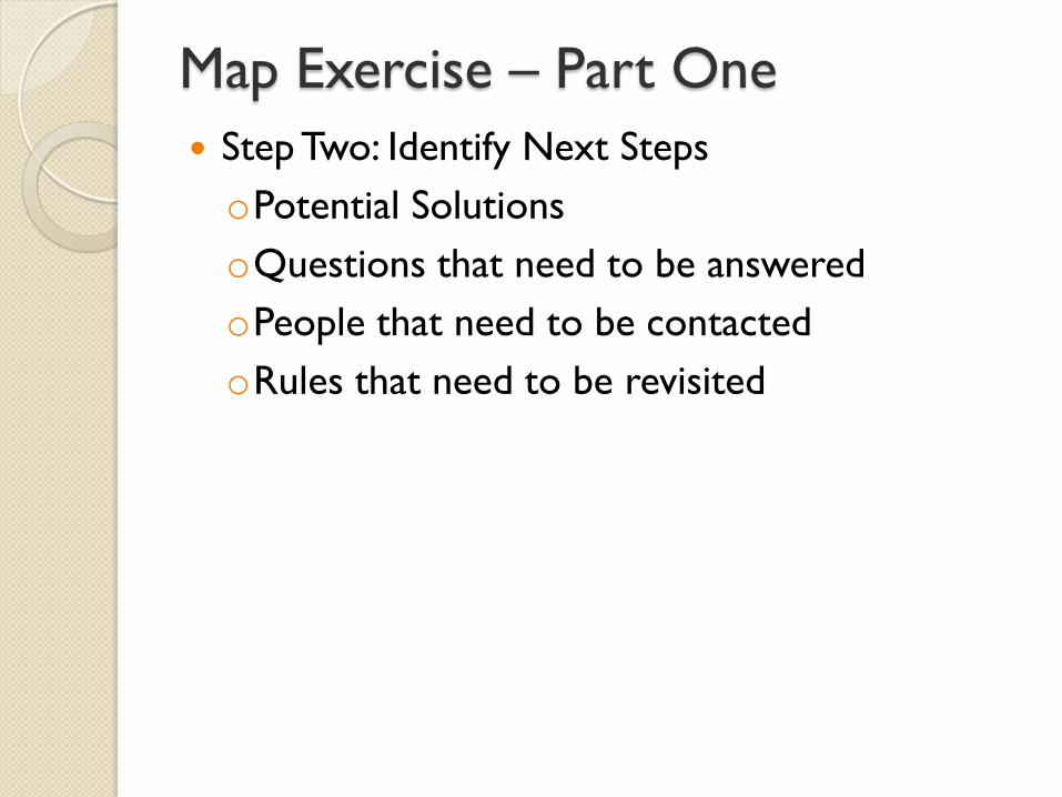
Map Exercise – Part One
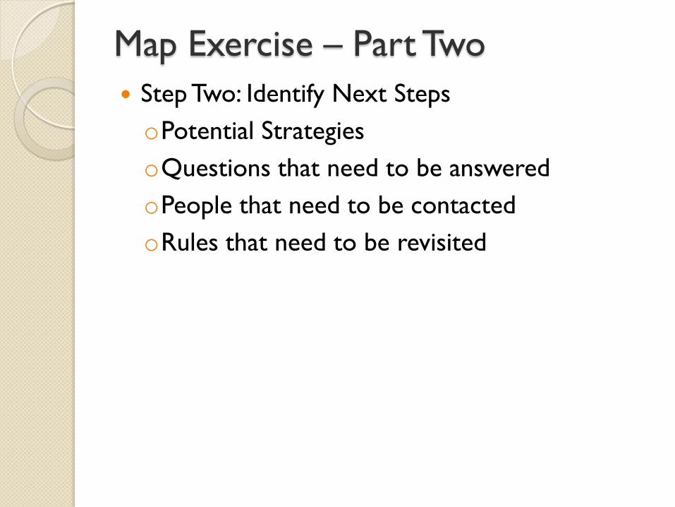
Step Two: Identify Next Steps
oPotential Solutions
oQuestions that need to be answered
oPeople that need to be contacted
oRules that need to be revisited
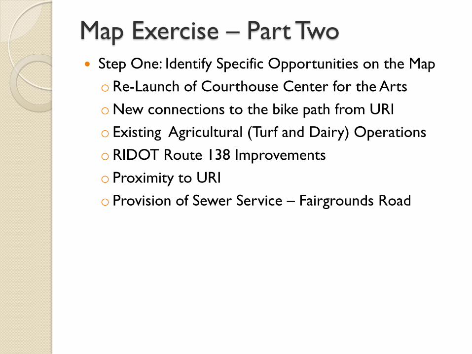
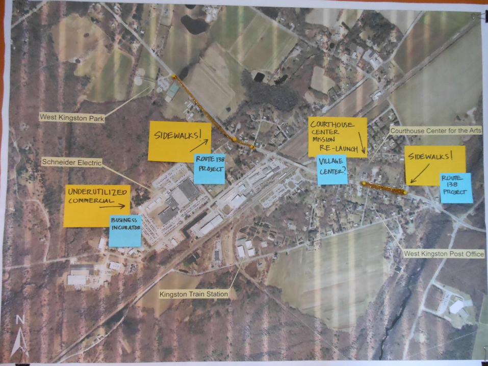
Map Exercise – Part Two Step One: Identify Specific Opportunities on the Map
oRe-Launch of Courthouse Center for the Arts
oNew connections to the bike path from URI
o Existing Agricultural (Turf and Dairy) Operations
oRIDOT Route 138 Improvements
o Proximity to URI
o Provision of Sewer Service – Fairgrounds Road
Map Exercise – Part Two
Step Two: Identify Next Steps
oPotential Strategies
oQuestions that need to be answered
oPeople that need to be contacted
oRules that need to be revisited

Stay Informed, Get Involved!
www.horsleywitten.com/skingstownvillagestudy
Please visit the project website at: