Embed Size (px)
Citation preview
ENVS 390: Sustainable Cities and Urban Design 3
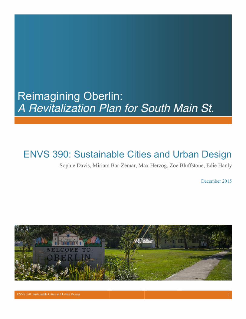
Reimagining Oberlin: A Revitalization Plan for South Main St.
ENVS 390: Sustainable Cities and Urban Design Sophie Davis, Miriam Bar-Zemar, Max Herzog, Zoe Bluffstone, Edie Hanly
December 2015
ENVS 390: Sustainable Cities and Urban Design 2
South Main St. Revitalization Plan South Main St. Reimagined: Vision and Goals
South Main St. is one of the main entryways into Oberlin, and as such, it should be an accessible, attractive, and vibrant street that acts as a gateway to the City of Oberlin. It should contain public greens, community gathering spaces, restaurants and shops, and it should have an aesthetic that draws in and engages visitors and community members alike.
Among the most important goals of this project is the direct engagement of the Oberlin community to ensure the design and building process is executed according to community needs and desires. With the triple bottom line of sustainability in mind, we intend to make a concerted effort to use local resources and citizen knowledge throughout the entire process. Whenever possible, this project will avoid outsourcing of materials and labor, so that this project is economically beneficial to the Oberlin community. This is especially important as a quarter of the city’s population is living below the poverty line.
Accessibility is another major goal of this project. Accessibility here is used to mean both in terms of people being physically able to travel to these community spaces through improved, safer transportation infrastructure and by working to keep these spaces socially welcoming. This goal will be achieved by designating development that suit the needs of the community, which include additional spaces for youth, access to affordable and nutritious foods, expansion of Oberlin Community Services, and locally owned businesses. We would like to compliment the development of the new health and dental facility on S. Main by making the community
services condensed to one area. Improvement in signage, safe walkways that prioritize non-vehicular modes of transit, and infrastructure which provides the space for future public transit system are also ways in which we intend to accomplish accessibility
Celebrating Oberlin’s heritage is the third goal for this project. Plans are already underway to reinvent the Gasholder building on the corner of South Pleasant and Edison St. and the surrounding land as a museum and community gathering space that honors the Underground Railroad and Oberlin’s African American heritage. In our design we intend to use the Underground Railroad museum as the focal point of the redevelopment - putting an emphasis on the visibility of the museum, performance spaces, and community gathering spaces. We also want to build off the existing plans goal of the Underground Railroad serving as a transportation hub that will include a bus stop, park and ride facilities, car-share programs, and plentiful bike parking.
A continuous, safe, and walk-able downtown is the final goal of this project. To make South Main more congruent with Main St. in downtown Oberlin we intend to build off the current downtown street design. This entails widening and fixing sidewalks, planting trees or incorporating other green spaces, bringing store frontage to the street to change the street’s design to focus on pedestrians rather than accommodation of vehicles, adding street furniture such as benches and separate waste receptacles, and various indicators (raised pedestrian crosswalks, signage, narrowing of street with inclusion of bike lane) to slow vehicle traffic and create a heightened awareness of pedestrians. Through our design we want to make productive use of the vacant lots on South Main and ensure safe pedestrian access to most of the businesses on South Main. Our designs will be entirely infill developments so that existing natural and green spaces are not eliminated and the density of the commercial spaces will increase and increase
in vibrancy. Our suggested developments are intended to bolster the local economy by providing spaces for businesses thus leading to job opportunities.
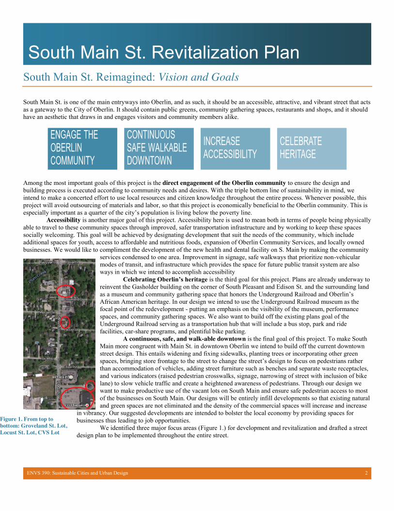
We identified three major focus areas (Figure 1.) for development and revitalization and drafted a street design plan to be implemented throughout the entire street.
Figure 1. From top to bottom: Groveland St. Lot, Locust St. Lot, CVS Lot
ENVS 390: Sustainable Cities and Urban Design 3
South Main St. Revitalization Plan
The Entrance to our Town: Existing Conditions on South Main St.
Main Street, as one might assume from its name, is an important location for Oberlin. The street is contiguous with State Route 58 and is thus a major thoroughfare that connects the town to many other communities. As the de facto entrance to the town, and a center for surrounding communities, South Main St. is integral to the identity of Oberlin and it is vital that the space convey the city’s great qualities and values. Unfortunately, the current built environment of South Main St. does not do Oberlin justice; there are many existing sustainability issues associated with urban design and maintenance that should be addressed. Some of the most important site-wide issues include:
x Car-oriented design: The street is fairly narrow, cars move fast and there are few crosswalks. Additionally, sidewalks are not
well kept thin, and in some places, nonexistent. Street lighting is almost entirely absent. These factors combine to make the entire South Main St. area unwelcoming and even dangerous for sustainable modes of transportation such as biking and walking. The lack of pedestrians, bikers, and general presence of people on the street reveals that it is designed for cars and cars alone. Lack of street lighting contributes to this, but other built factors such as street-fronting parking lots, large setbacks, and big-box businesses also create an atmosphere that this space is not meant for shoppers, community gatherings, or people just going for a walk.
x Lack of diverse economic, social, and community amenities: Based on our personal experiences of living in Oberlin as well as the perspectives of community members we spoke with, we have learned that there is real social and economic need in the predominantly low-income, predominantly people of color Southeast Quadrant that is adjacent to our focus area. This community suffers greatly from the lack of economic activity, social services, and community spaces on South Main St. This deficiency is strongly related to the lack of pedestrian-oriented spaces described but also the lack of community-oriented enterprises.
x Lack of focus on Environmental Sustainability: In addition to the car-oriented
nature of South Main St., there is almost no attempt to integrate green space, renewable energy sources, storm water management, recycled building materials, or any other common aspects of sustainable building in the area.
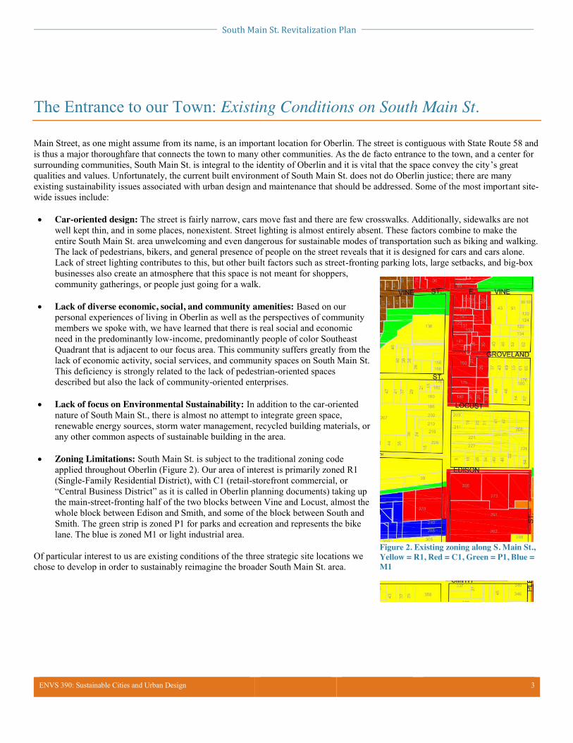
x Zoning Limitations: South Main St. is subject to the traditional zoning code applied throughout Oberlin (Figure 2). Our area of interest is primarily zoned R1 (Single-Family Residential District), with C1 (retail-storefront commercial, or “Central Business District” as it is called in Oberlin planning documents) taking up the main-street-fronting half of the two blocks between Vine and Locust, almost the whole block between Edison and Smith, and some of the block between South and Smith. The green strip is zoned P1 for parks and ecreation and represents the bike lane. The blue is zoned M1 or light industrial area.
Of particular interest to us are existing conditions of the three strategic site locations we chose to develop in order to sustainably reimagine the broader South Main St. area.
Figure 2. Existing zoning along S. Main St., Yellow = R1, Red = C1, Green = P1, Blue = M1
South Main St. Revitalization Plan
ENVS 390: Sustainable Cities and Urban Design 4
Site-Specific Existing Conditions
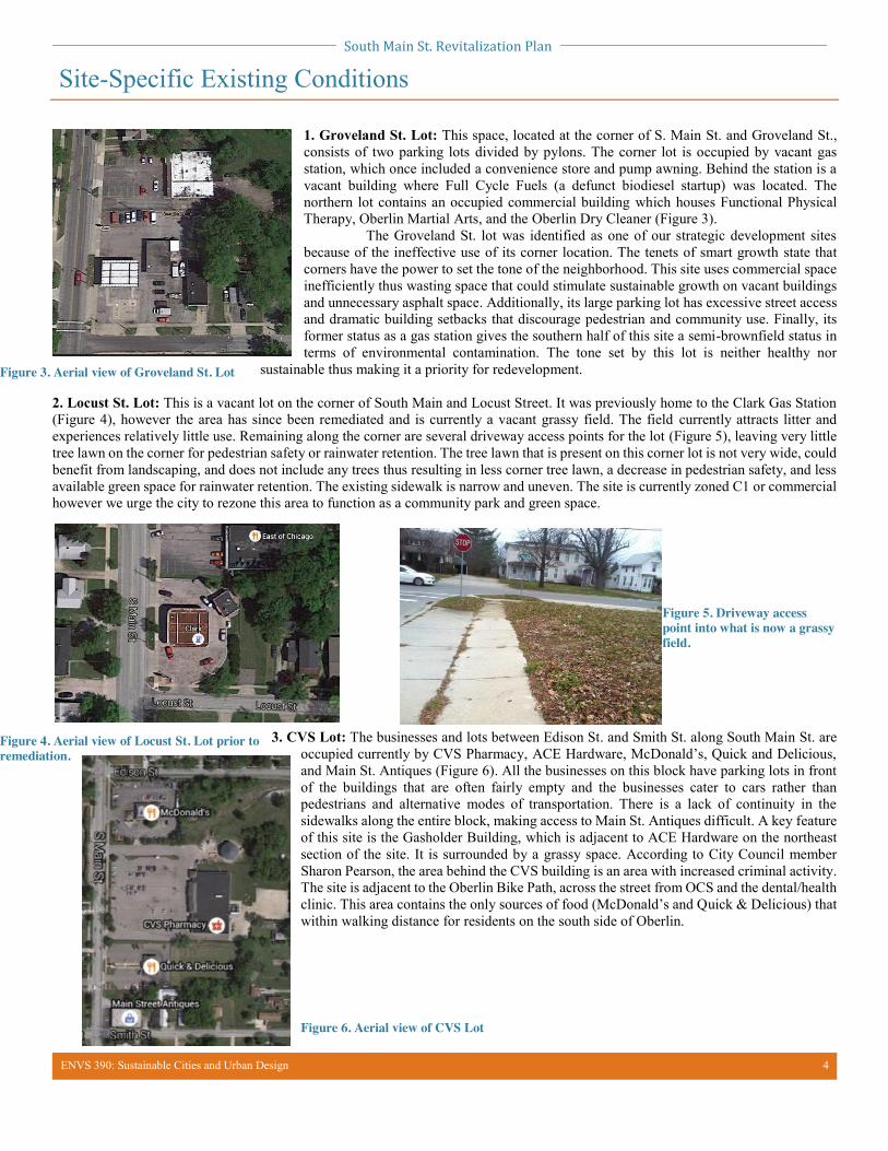
1. Groveland St. Lot: This space, located at the corner of S. Main St. and Groveland St., consists of two parking lots divided by pylons. The corner lot is occupied by vacant gas station, which once included a convenience store and pump awning. Behind the station is a vacant building where Full Cycle Fuels (a defunct biodiesel startup) was located. The northern lot contains an occupied commercial building which houses Functional Physical Therapy, Oberlin Martial Arts, and the Oberlin Dry Cleaner (Figure 3). The Groveland St. lot was identified as one of our strategic development sites because of the ineffective use of its corner location. The tenets of smart growth state that corners have the power to set the tone of the neighborhood. This site uses commercial space inefficiently thus wasting space that could stimulate sustainable growth on vacant buildings and unnecessary asphalt space. Additionally, its large parking lot has excessive street access and dramatic building setbacks that discourage pedestrian and community use. Finally, its former status as a gas station gives the southern half of this site a semi-brownfield status in terms of environmental contamination. The tone set by this lot is neither healthy nor
sustainable thus making it a priority for redevelopment.
2. Locust St. Lot: This is a vacant lot on the corner of South Main and Locust Street. It was previously home to the Clark Gas Station (Figure 4), however the area has since been remediated and is currently a vacant grassy field. The field currently attracts litter and experiences relatively little use. Remaining along the corner are several driveway access points for the lot (Figure 5), leaving very little tree lawn on the corner for pedestrian safety or rainwater retention. The tree lawn that is present on this corner lot is not very wide, could benefit from landscaping, and does not include any trees thus resulting in less corner tree lawn, a decrease in pedestrian safety, and less available green space for rainwater retention. The existing sidewalk is narrow and uneven. The site is currently zoned C1 or commercial however we urge the city to rezone this area to function as a community park and green space.
3. CVS Lot: The businesses and lots between Edison St. and Smith St. along South Main St. are occupied currently by CVS Pharmacy, ACE Hardware, McDonald’s, Quick and Delicious, and Main St. Antiques (Figure 6). All the businesses on this block have parking lots in front of the buildings that are often fairly empty and the businesses cater to cars rather than pedestrians and alternative modes of transportation. There is a lack of continuity in the sidewalks along the entire block, making access to Main St. Antiques difficult. A key feature of this site is the Gasholder Building, which is adjacent to ACE Hardware on the northeast section of the site. It is surrounded by a grassy space. According to City Council member Sharon Pearson, the area behind the CVS building is an area with increased criminal activity. The site is adjacent to the Oberlin Bike Path, across the street from OCS and the dental/health clinic. This area contains the only sources of food (McDonald’s and Quick & Delicious) that within walking distance for residents on the south side of Oberlin.
Figure 3. Aerial view of Groveland St. Lot
Figure 4. Aerial view of Locust St. Lot prior to remediation.
Figure 5. Driveway access point into what is now a grassy field.
Figure 6. Aerial view of CVS Lot
South Main St. Revitalization Plan
ENVS 390: Sustainable Cities and Urban Design 5
Local Context: Existing Resources, Barriers, and Opportunities
We recognize that as a political, economic, and social entity, Oberlin does not exist in a vacuum. In planning any sustainable development project, it is important to situate your plan within a larger context. For the South Main St. project, this means understanding the history of the greater Cleveland area. As a rust-belt city, Cleveland is highly industrial and industries such as steel manufacturing are still major employers in the area alongside renewal-period anchor institutions like the Cleveland Clinic. More relevant however, is the history of interaction between the town of Oberlin and the Oberlin College as an economic institution. Oberlin College has long been the chief driver of economic growth and physical development in the town, but this expansion has been historically limited to northern and western neighborhoods. The area on and around South Main, especially the Southeast Quadrant, is not targeted by any of the College’s development projects, receives little traffic from students, and is not considered a desirable neighborhood for higher-paid faculty and staff. These facts suggest that the design problems, lack of maintenance, and paucity of social and economic opportunities in the area may be related to a lack of engagement on the part of the College. However, many would say that this could be posited in terms of an opportunity rather than a tragedy; Oberlin College has often received criticism for being a less than optimal anchor institution for the Oberlin community. We see South Main as an opportunity to create a more self-sufficient, town-centric, and sustainable Oberlin.
Existing Resources:
Several city documents define, constrain, and support our goals for South Main Street. Firstly, the 2005 Oberlin
Comprehensive Plan is an ordinance outlining the general trajectory of the City of Oberlin between 2005-2015. The document provides recommendations for future land development that recognizes the southward trend of the city’s development down Route 58 (S. Main St) and the need for housing and commercial development. In addition, the plan prioritizes infill-based development, strengthening the downtown core, and moving away from being an auto-centric community.
Another defining document for Oberlin’s development is the Climate Action Plan. Passed by the City Council in 2013, this plan is a roadmap to becoming a climate-positive community by 2050 through the implementation of sustainable energy sources, efficient transportation systems, green building, and waste management. Our South Main Street project holds a great amount of potential to be influential in several of these categories through a commitment to investments in green infrastructure. While the so-called “green premium” finances for such sustainable projects may be disadvantageous, the long-term savings must also be considered. Additionally, there are funding sources available for sustainable design that could support the initiatives of this project.
Lastly, the design plan for the CVS lot is inspired by an existing, partially-funded, multi-functional project to transform the Gasholder building into an educational center that acknowledges and honors Oberlin’s African American community and Underground Railroad history. This location would also serve as a regional transportation hub and provide access to the Oberlin Bike Path. Our proposed design plan for the site expands on the vision of the center by increasing the amount of green space and incorporating sustainable design elements as defined by the tenets of New Urbanism. Barriers and Opportunities:
Other barriers to consider regarding the realistic applicability of this project are mostly in regard to the physical infrastructure
on South Main Street. As South Main St. is also a State Route managed by the Ohio Department of Transportation, development and upkeep of the street system itself are not in the hands of Oberlin itself. This means that the priorities of sustainable, equitable economic development in the city are not the priority of the people in charge of the road -- while traffic is. Additionally, the Oberlin Fire Station is located at 430 S Main St. and thus uses the street as a starting route for all of its emergency calls. Therefore, any aspects of our street design to slow down traffic or car use of the Route might be opposed by the fire department. We have tried to consider this in our proposal already, but this is a powerful stakeholder whose support, or lack thereof, could be very influential in whether this project could be implemented or not.
South Main St. Revitalization Plan
ENVS 390: Sustainable Cities and Urban Design 6
Community Engagement Plan
We recognize that actively engaged citizens are one of Oberlin’s greatest assets – citizen perspectives are not only incredible resources, but through community engagement, citizens have the power to shape the policies and priorities that will define Oberlin in the upcoming decade. Our community engagement plan values early engagement, transparency, accessibility, and inclusion thus creating a community that is aware, empowered, and motivated. We seek to break down community divisions and boundaries by encouraging collaborative participation from underrepresented groups, individuals of all ages, businesses, and nonprofits through a series of events and initiatives involving the public. We acknowledge that participation can take many different forms each of which targets different audiences. We have designed accessible and informative events that foster understanding and collaboration in order to resolve differences and tensions between different audiences. The events and initiatives outlined below build on three levels of participation: education and awareness, feedback, and collaboration.
EDUCATION & AWARENESS Social media: Facebook, Twitter, and Flickr will be used alongside traditional news sources (newspapers, newsletters, school bulletins, mailings, email list serves etc.) and the Environmental Dashboard screens located throughout the city to promote events, meetings, and drafts of planning documents. We will create a website detailing the design of South Main St. that will be continuously updated with resources and new events. Speaker series and planning updates: We will host a monthly speaker series focusing on elements of city and street design that emphasize city initiatives designed and implemented by community members in different cities. These talks will include progress updates from members of the S. Main design committee. The events will be educational in that they increase awareness of local action while presenting case studies of other successful sustainable city plans. We will hold these events in varying locations and times including the Public Library, and churches in the S. Main St. area. All talks will include a free meal and will offer free childcare to encourage attendance from families and those who could not otherwise afford to attend.
COLLABORATIVE Brainstorming Sessions: These sessions will be open to the general public and will be hosted in venues along S. Main St. (the Christ Church Episcopal Church--and other churches in the SE quadrant, Quick & Delicious, McDonalds, the Public Library, the John Frederick Oberlin Homes) They will be safe spaces for people of all ages to share ideas together about what they would like the design of S. Main to include. A variety of brainstorming materials will be provided, including printed out maps, 3D models, and computer software, so that people can engage with the tool that best suits their preferences. The design committee will be present as listeners so they can better represent the citizen voice. School Participation: All middle school and high school students will have the opportunity to attend a planning meeting in order to learn more about the city government process. In addition, we initiate the formation of a S. Main design club in the Oberlin high school. Club members will attend all meetings and act as student members on the committee.
FEEDBACK Surveys: We will use surveys to solicit feedback from all willing citizens along S. Main St. and the surrounding quadrants. The surveys will be used to poll citizen public opinion and to gain feedback on drafts of the design plan. Listening Sessions: A series of monthly workshops will be hosted by the S. Main St. design committee to gain public feedback on drafts of documents associated with the new design. These workshops will function as listening sessions for members of planning committee and will be framed as feedback sessions rather than information sessions. The committee will poll citizens to determine the best times/locations for these sessions.
South Main St. Revitalization Plan
ENVS 390: Sustainable Cities and Urban Design 7
Street Design Plan: Implementing Complete Streets
This plan seeks to extend the street design portion of Oberlin’s 2011 Comprehensive Downtown Revitalization Program from Vine Street to Smith Street. The implementation of a complete-streets vision aims to extend the safety and pedestrian oriented feel of the Main Street district southward. The infrastructural improvement of this stretch is integral to the overall success of this project by improving safety, accessibility, and visitor appeal. Following the principles of Smart Growth, New Urbanism, and Complete Streets our full street design plan includes the following components:
x Prioritize modes of transit other than cars through bike-able, walk-able, wheelchair/handicap accessible pathways that are wide and well protected from vehicular traffic. This includes replacing and/or repairing the sidewalks as needed.
x Prioritize pedestrian safety through elevated and more frequent crosswalks. In addition, we suggest constructing extended curbs at intersections in order to narrow the streets thus forcing traffic to slow.
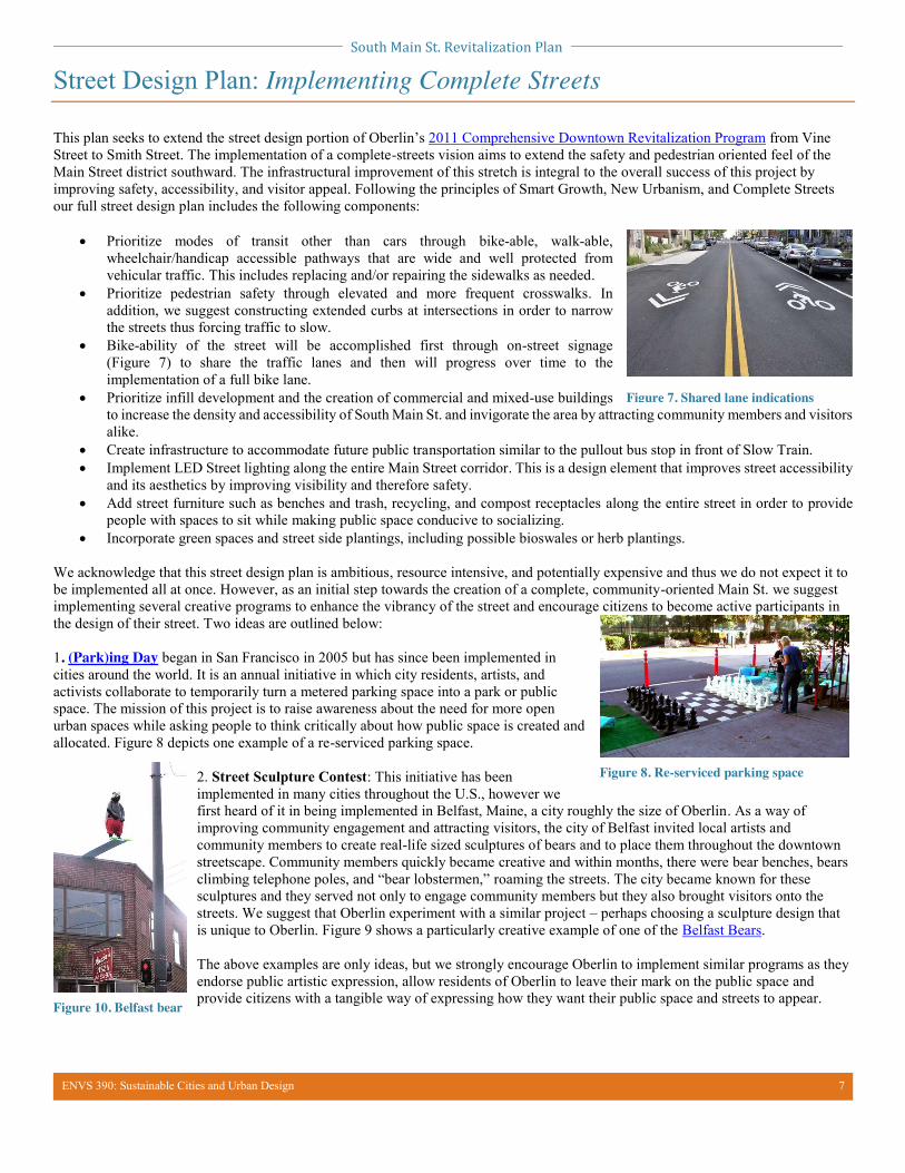
x Bike-ability of the street will be accomplished first through on-street signage (Figure 7) to share the traffic lanes and then will progress over time to the implementation of a full bike lane.
x Prioritize infill development and the creation of commercial and mixed-use buildings to increase the density and accessibility of South Main St. and invigorate the area by attracting community members and visitors alike.
x Create infrastructure to accommodate future public transportation similar to the pullout bus stop in front of Slow Train. x Implement LED Street lighting along the entire Main Street corridor. This is a design element that improves street accessibility
and its aesthetics by improving visibility and therefore safety. x Add street furniture such as benches and trash, recycling, and compost receptacles along the entire street in order to provide
people with spaces to sit while making public space conducive to socializing. x Incorporate green spaces and street side plantings, including possible bioswales or herb plantings.
We acknowledge that this street design plan is ambitious, resource intensive, and potentially expensive and thus we do not expect it to be implemented all at once. However, as an initial step towards the creation of a complete, community-oriented Main St. we suggest implementing several creative programs to enhance the vibrancy of the street and encourage citizens to become active participants in the design of their street. Two ideas are outlined below: 1. (Park)ing Day began in San Francisco in 2005 but has since been implemented in cities around the world. It is an annual initiative in which city residents, artists, and activists collaborate to temporarily turn a metered parking space into a park or public space. The mission of this project is to raise awareness about the need for more open urban spaces while asking people to think critically about how public space is created and allocated. Figure 8 depicts one example of a re-serviced parking space.
2. Street Sculpture Contest: This initiative has been implemented in many cities throughout the U.S., however we first heard of it in being implemented in Belfast, Maine, a city roughly the size of Oberlin. As a way of improving community engagement and attracting visitors, the city of Belfast invited local artists and community members to create real-life sized sculptures of bears and to place them throughout the downtown streetscape. Community members quickly became creative and within months, there were bear benches, bears climbing telephone poles, and “bear lobstermen,” roaming the streets. The city became known for these sculptures and they served not only to engage community members but they also brought visitors onto the streets. We suggest that Oberlin experiment with a similar project – perhaps choosing a sculpture design that is unique to Oberlin. Figure 9 shows a particularly creative example of one of the Belfast Bears. The above examples are only ideas, but we strongly encourage Oberlin to implement similar programs as they endorse public artistic expression, allow residents of Oberlin to leave their mark on the public space and provide citizens with a tangible way of expressing how they want their public space and streets to appear.
Figure 7. Shared lane indications
Figure 8. Re-serviced parking space
Figure 10. Belfast bear
South Main St. Revitalization Plan
ENVS 390: Sustainable Cities and Urban Design 8
Groveland Street Site: Proposal for Redevelopment
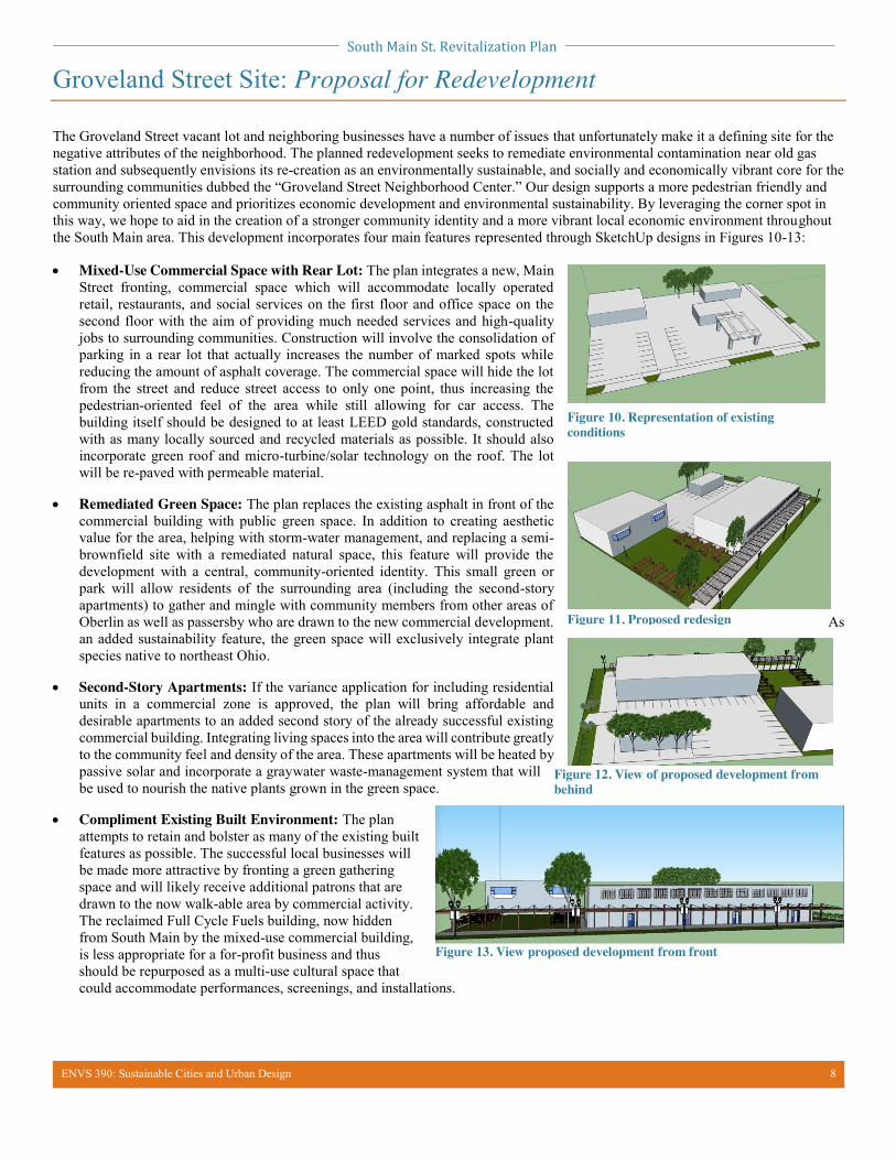
The Groveland Street vacant lot and neighboring businesses have a number of issues that unfortunately make it a defining site for the negative attributes of the neighborhood. The planned redevelopment seeks to remediate environmental contamination near old gas station and subsequently envisions its re-creation as an environmentally sustainable, and socially and economically vibrant core for the surrounding communities dubbed the “Groveland Street Neighborhood Center.” Our design supports a more pedestrian friendly and community oriented space and prioritizes economic development and environmental sustainability. By leveraging the corner spot in this way, we hope to aid in the creation of a stronger community identity and a more vibrant local economic environment throughout the South Main area. This development incorporates four main features represented through SketchUp designs in Figures 10-13: x Mixed-Use Commercial Space with Rear Lot: The plan integrates a new, Main
Street fronting, commercial space which will accommodate locally operated retail, restaurants, and social services on the first floor and office space on the second floor with the aim of providing much needed services and high-quality jobs to surrounding communities. Construction will involve the consolidation of parking in a rear lot that actually increases the number of marked spots while reducing the amount of asphalt coverage. The commercial space will hide the lot from the street and reduce street access to only one point, thus increasing the pedestrian-oriented feel of the area while still allowing for car access. The building itself should be designed to at least LEED gold standards, constructed with as many locally sourced and recycled materials as possible. It should also incorporate green roof and micro-turbine/solar technology on the roof. The lot will be re-paved with permeable material.
x Remediated Green Space: The plan replaces the existing asphalt in front of the
commercial building with public green space. In addition to creating aesthetic value for the area, helping with storm-water management, and replacing a semi-brownfield site with a remediated natural space, this feature will provide the development with a central, community-oriented identity. This small green or park will allow residents of the surrounding area (including the second-story apartments) to gather and mingle with community members from other areas of Oberlin as well as passersby who are drawn to the new commercial development. As an added sustainability feature, the green space will exclusively integrate plant species native to northeast Ohio.
x Second-Story Apartments: If the variance application for including residential
units in a commercial zone is approved, the plan will bring affordable and desirable apartments to an added second story of the already successful existing commercial building. Integrating living spaces into the area will contribute greatly to the community feel and density of the area. These apartments will be heated by passive solar and incorporate a graywater waste-management system that will be used to nourish the native plants grown in the green space.
x Compliment Existing Built Environment: The plan
attempts to retain and bolster as many of the existing built features as possible. The successful local businesses will be made more attractive by fronting a green gathering space and will likely receive additional patrons that are drawn to the now walk-able area by commercial activity. The reclaimed Full Cycle Fuels building, now hidden from South Main by the mixed-use commercial building, is less appropriate for a for-profit business and thus should be repurposed as a multi-use cultural space that could accommodate performances, screenings, and installations.
Figure 10. Representation of existing conditions
Figure 11. Proposed redesign
Figure 12. View of proposed development from behind
Figure 13. View proposed development from front
South Main St. Revitalization Plan
ENVS 390: Sustainable Cities and Urban Design 9
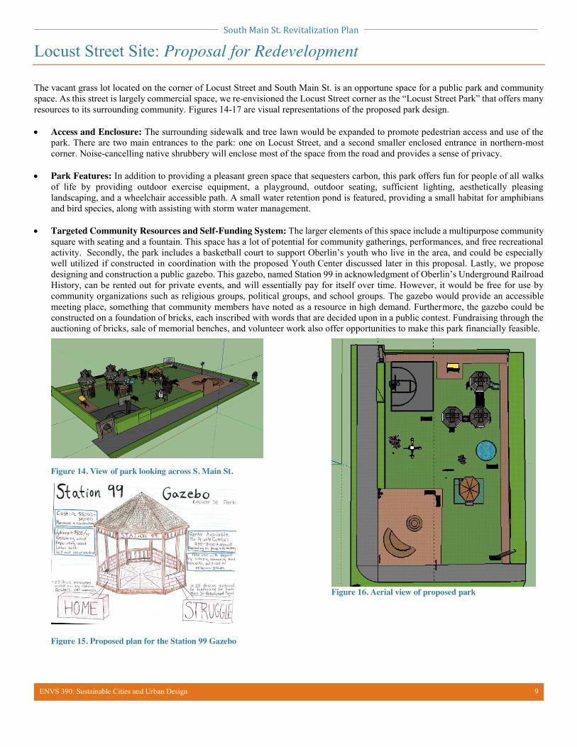
Locust Street Site: Proposal for Redevelopment
The vacant grass lot located on the corner of Locust Street and South Main St. is an opportune space for a public park and community space. As this street is largely commercial space, we re-envisioned the Locust Street corner as the “Locust Street Park” that offers many resources to its surrounding community. Figures 14-17 are visual representations of the proposed park design. x Access and Enclosure: The surrounding sidewalk and tree lawn would be expanded to promote pedestrian access and use of the
park. There are two main entrances to the park: one on Locust Street, and a second smaller enclosed entrance in northern-most corner. Noise-cancelling native shrubbery will enclose most of the space from the road and provides a sense of privacy.
x Park Features: In addition to providing a pleasant green space that sequesters carbon, this park offers fun for people of all walks of life by providing outdoor exercise equipment, a playground, outdoor seating, sufficient lighting, aesthetically pleasing landscaping, and a wheelchair accessible path. A small water retention pond is featured, providing a small habitat for amphibians and bird species, along with assisting with storm water management.
x Targeted Community Resources and Self-Funding System: The larger elements of this space include a multipurpose community
square with seating and a fountain. This space has a lot of potential for community gatherings, performances, and free recreational activity. Secondly, the park includes a basketball court to support Oberlin’s youth who live in the area, and could be especially well utilized if constructed in coordination with the proposed Youth Center discussed later in this proposal. Lastly, we propose designing and construction a public gazebo. This gazebo, named Station 99 in acknowledgment of Oberlin’s Underground Railroad History, can be rented out for private events, and will essentially pay for itself over time. However, it would be free for use by community organizations such as religious groups, political groups, and school groups. The gazebo would provide an accessible meeting place, something that community members have noted as a resource in high demand. Furthermore, the gazebo could be constructed on a foundation of bricks, each inscribed with words that are decided upon in a public contest. Fundraising through the auctioning of bricks, sale of memorial benches, and volunteer work also offer opportunities to make this park financially feasible.
Figure 14. View of park looking across S. Main St.
Figure 15. Proposed plan for the Station 99 Gazebo
Figure 16. Aerial view of proposed park
South Main St. Revitalization Plan
ENVS 390: Sustainable Cities and Urban Design 10
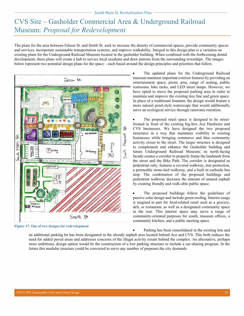
CVS Site – Gasholder Commercial Area & Underground Railroad Museum: Proposal for Redevelopment
The plans for the area between Edison St. and Smith St. seek to increase the density of commercial spaces, provide community spaces and services, incorporate sustainable transportation systems, and improve walkability. Integral to this design plan is a variation on existing plans for the Underground Railroad Museum located in the gasholder building. When combined with the forthcoming dental development, these plans will create a hub to service local residents and draw patrons from the surrounding townships. The images below represent two potential design plans for the space – each based around the design principles and priorities that follow.
x The updated plans for the Underground Railroad museum maintain important exterior features by providing an entertainment space, picnic area, range of seating, public restrooms, bike racks, and LED street lamps. However, we have opted to move the proposed parking area in order to maintain and improve the existing tree line and green space. In place of a traditional fountain, the design would feature a more natural pond-style waterscape that would additionally serve an ecological service through rainwater retention. x The proposed retail space is designed to be street-fronted in front of the existing big-box Ace Hardware and CVS businesses. We have designed the two proposed structures in a way that maintains visibility to existing businesses while bringing commerce and thus community activity closer to the street. The larger structure is designed to complement and enhance the Gasholder building and future Underground Railroad Museum; its north-facing facade creates a corridor to properly frame the landmark from the street and the Bike Path. The corridor is designated as pedestrian only, features a covered walkway, tree protection, a permeable stone-laid walkway, and a built in curbside bus stop. The combination of the proposed buildings and pedestrian walkway decrease the amount of unused asphalt by creating friendly and walk-able public space. x The proposed buildings follow the guidelines of passive solar design and include green roofing. Interior usage is targeted in part for food-related retail such as a grocery, deli, or restaurant, as well as a designated community space in the rear. This interior space may serve a range of community-oriented purposes for youth, museum offices, a community kitchen, and a public meeting space. x Parking has been consolidated in the existing lots and
an additional parking lot has been designated in the already asphalt area located behind Ace and CVS. This both reduces the need for added paved areas and addresses concerns of the illegal activity extant behind the complex. An alternative, perhaps more ambitious, design option would be the construction of a low parking structure to include a car-sharing program. In the future this modular structure could be converted to serve any number of purposes the city demands.
Figure 17. One of two designs for redevelopment
South Main St. Revitalization Plan
ENVS 390: Sustainable Cities and Urban Design 11
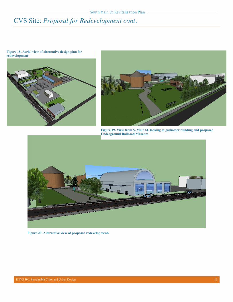
CVS Site: Proposal for Redevelopment cont.
Figure 18. Aerial view of alternative design plan for redevelopment
Figure 19. View from S. Main St. looking at gasholder building and proposed Underground Railroad Museum
Figure 20. Alternative view of proposed redevelopment.
South Main St. Revitalization Plan
ENVS 390: Sustainable Cities and Urban Design 12
Moving Forward: Final Goals and Conclusions
Summary of Plan: The current state of the South Main business district is in need of revitalization with respect to street infrastructure, community spaces, and businesses. Our development plan prioritizes economic development and strives to improve amenities for the underserved population of southeast Oberlin. In our final vision, we have identified three physical points of interest that would serve to simultaneously improve the look, feel and function of the area as a whole. These areas are the Groveland Street vacant gas station, the Locust Street empty lot, and the CVS lot and gasholder building commercial area located between Edison and Smith Streets. In addition to these three locations, the plan includes an extension of the complete streets redesign plan to extend southward along Route 58 from Vine to Smith Street. In addressing these four components the revitalization plan seeks to achieve a number of goals linked to site-specific issues. These goals include:
x Improve overall on-street infrastructure to provide safe and walk-able areas for residents x Increase density of the commercial areas x Broaden the distribution of amenities to serve the South-East Oberlin quadrant, specifically increasing food access x Attract new patrons and visitors to the area x Provide vibrant community spaces, both indoor and outdoor, which serve and represent Oberlin and Oberlin’s heritage x Strive for continuity in design in order to create a cohesive district and better connect the area to its surroundings
Conclusion:
We acknowledge that this plan requires significant commitment on the part of the city however we believe that in order to prioritize creativity and sustainable planning, our design team was unafraid to “dream big.” As was expected, this means that funding for this undertaking is likely to be a major limiting factor. We recognize this and have discussed several funding possibilities.
Starting at a smaller scale, many of the new commercial spaces will be rented out and will in some cases pay for their own construction through rent and/or tax revenues. Additionally, there are many other options for funding including public fundraising, grant applications, private funding sources, and a capital campaign.
x Community Connectors Grants give Ohio students access to mentors and role models who can help inspire them to develop skills in the workplace. In the latest round of grants, 36 partnerships shared over $3 million dollars in grant money. Our proposed Youth Center and/or the Underground Railroad Center may qualify for these grants.
x Through our research and conversations with leading community members such as Sharon Pearson, it became clear that transportation initiatives are becoming more affordable due to the presence of dollar for dollar matching funds. Organizations such as the Transportation for Livable Communities Initiative (TCLI) provide communities with financial assistance for transportation initiatives and land use planning projects that strengthen community livability. TLCI has even been known to fund up to 100% of the total cost of the initiative with both planning grants and implementation grants. These grants could apply to many aspects of our design plan including street design initiatives and efforts to make the area more pedestrian/bike friendly.
x Renewable energy and energy efficiency initiatives can also be financially supported by many generous funding sources. This includes the Municipal Alternative Energy Revolving Loan Program, which allows residents and businesses to create low interest loans to help finance renewable energy initiatives. This could be incorporated as a highly recommended action taken by the businesses and residents that would move into the developments created by this project.
x The Ohio Clean Energy Initiatives provide funding for residential solar and multifamily solar systems. Also, the Oberlin Project should remain a central actor in this process to connect the South Main Street Revitalization Plan with funding sources and resources.
The redevelopment and reimagining of South Main Street is an opportunity for Oberlin to become a “model community” for sustainability and innovation. The current state of haphazard development along South Main St. as compared to the central downtown area is inequitable, especially considering that this area is in close proximity to the low-income, largely African American community of the southeast quadrant. By incorporating African American history, public spaces, green spaces, commercial space, and complete streets into the design plan, we attempt to fulfill a vision that supports environmental, economic, and cultural sustainability through vibrant and resilient development. A commitment and investment into this area of Oberlin has the potential to provide improvements in all three of these areas and to allow Oberlin to better support its residents and local businesses.


![Main South News[1]](https://img.pdfslide.net/doc/110x75/577d237e1a28ab4e1e99ee5a/main-south-news1.jpg)