Embed Size (px)
Citation preview
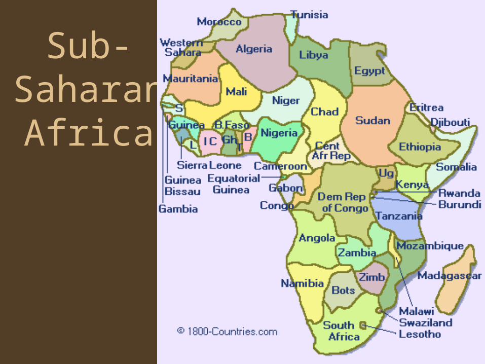
Sub-Saharan
Africa
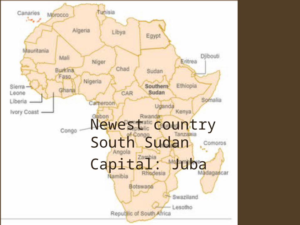
Newest country South Sudan
Capital: Juba
Geography• The worlds second largest continent• Most nations of any continent
–Newest country South Sudan
• Location and Effects–Between two oceans; Atlantic & Indian –
linked and isolated–Part of major trade routes since ancient
times
Regions
• North Africa – above the Sahara Desert– Linked to the Middle East culturally
• Sub-Saharan Africa– West Africa – extends into Atlantic
• Part of major slave trade routes to new world
– Central Africa – home to Africa’s tropical rain forests
– Southern Africa – crucial to trade b/w oceans – East Africa – Great Rift Valley, fertile land
Landforms • The land made exploration difficult for Europeans = natural
barriers• Africa is a continent of Plateaus
– Escarpments: steep cliffs & basins, swamps, lakes
• Mountains: edges – Atlas Mts, Drakensberg Range,Mt. Kilimanjaro – highest mountain in Africa
• Great Rift Valley – a giant fault – Red Sea to Zambezi River – Series of mountain, valleys, lakes– Rich in natural resources, fertile soil– Hard to mine and transport because of the rough terrain
– Olduvai Gorge: bone that belonged to the ancestors of modern people
• Deserts: Sahara (largest), Kalahari• Coastal Plains
Rivers
• Provide food, transportation, irrigation and hydroelectric power– Cataracts: waterfalls; river rapids
• Major Rivers
–Nile, Congo (Zaire), Niger, Zambezi
Nile River – East Africa
• Longest flowing river in the world 4,160 miles – flows north
• Home to early civilizations– Predictable floods supported huge population
• Aswan High Dam– Pros – Hydroelectric Power, Irrigation– Cons – Farmers upstream now need to
purchase fertilizers
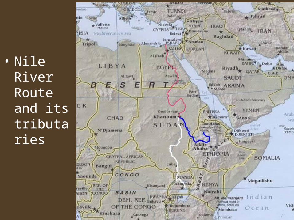
• Nile River Route and its tributaries
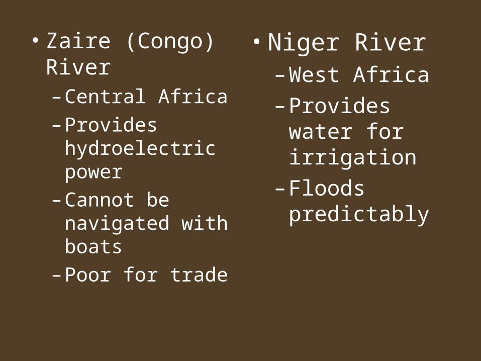
• Zaire (Congo) River– Central Africa
– Provides hydroelectric power
– Cannot be navigated with boats
– Poor for trade
• Niger River– West Africa
– Provides water for irrigation
– Floods predictably
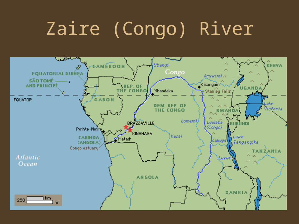
Zaire (Congo) River
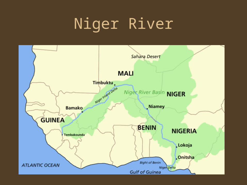
Niger River
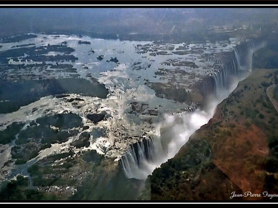
Zambezi River
• Southern Africa
• Creates Victoria Falls, 1 mile wide and 420 ft. high, between Zambia and Zimbabwe
• The Kariba Dam provides hydroelectric power
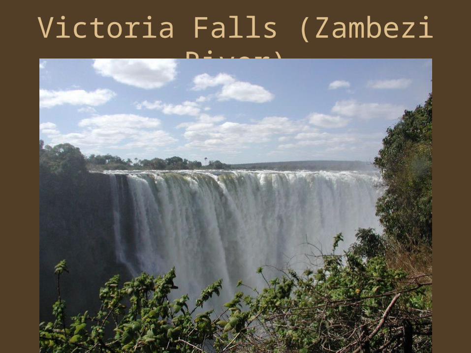
Victoria Falls (Zambezi River)
Africa’s Natural Resources
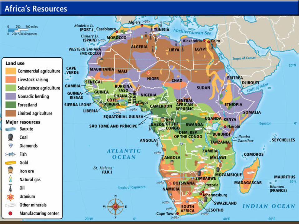
Rich source of resources
• Mineral Resources (see map)• Gold and Diamonds
• Europeans mined much of their gold from west Africa beginning in the Age of Discovery
• Power-Wealth-Trade

Africa’s Resources Today
• Gold and Diamonds – South Africa, D.R. Congo
• Copper – Zaire and Zambia
• Platinum and Cobalt – S. Africa, Zaire, and Botswana
• Oil – Nigeria, Botswana, Libya, Algeria, and Gabon
• Profits from African nations often end up in foreign countries

Adapting to the Land
• Societies developed near sources of water– hunting and gathering– farming– herding– fishing– urban
• Major urban areas developed on the Mediterranean Coast, western savannas, and East Coast
Language
• More than 1,000 languages• Groups only a few miles apart often speak
different languages– Small tribes migrated constantly and used their
own language
• Scholars group African Languages into large families
• Trade and diffusion created new languages– Swahili: Bantu and Arabic
Section 1 Quiz Answers
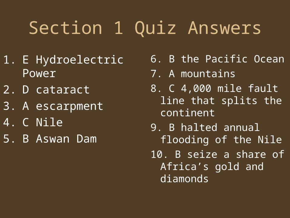
1. E Hydroelectric Power
2. D cataract
3. A escarpment
4. C Nile
5. B Aswan Dam
6. B the Pacific Ocean
7. A mountains
8. C 4,000 mile fault line that splits the continent
9. B halted annual flooding of the Nile
10. B seize a share of Africa’s gold and diamonds