Embed Size (px)
Citation preview
Synoptic, Thermodynamic, Synoptic, Thermodynamic, Shear SettingShear Setting
May 7, 2002 Tornadic Thunderstorm in Southwestern May 7, 2002 Tornadic Thunderstorm in Southwestern KansasKansas
Michele BlazekMichele BlazekMay 15, 2005May 15, 2005
Synoptic Setting – What to look forSynoptic Setting – What to look for
Warm advection Warm advection – Found through height changes and the sounding Found through height changes and the sounding – Moist air advection into the jet streamMoist air advection into the jet stream
Deep layer shear Deep layer shear – Approximated using the difference in the wind vectors Approximated using the difference in the wind vectors
between the surface (surface chart) and 500 mbbetween the surface (surface chart) and 500 mb– Sustains the development of stormSustains the development of storm
Low level shear - Low level shear - – Must be strong enough even with deep layer shear to Must be strong enough even with deep layer shear to
sustain a supercellsustain a supercell
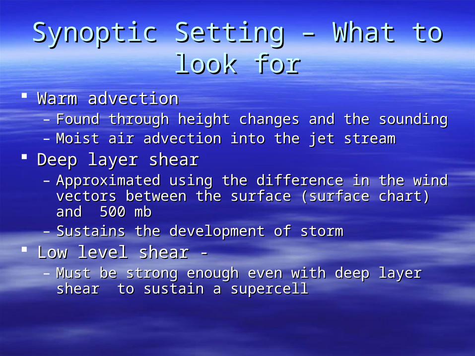
500 mb Wind Direction/Speed
Note the area in SW Kansaswith just east of the trough in the rockies,ageostrophic winds in Central Kansas and significant favorable deep layer shear - 50 kt or 5.0 E-3 /s
500 mb Chart 00 UTC 08 May 2002, ObservationsHeights, Temperatures
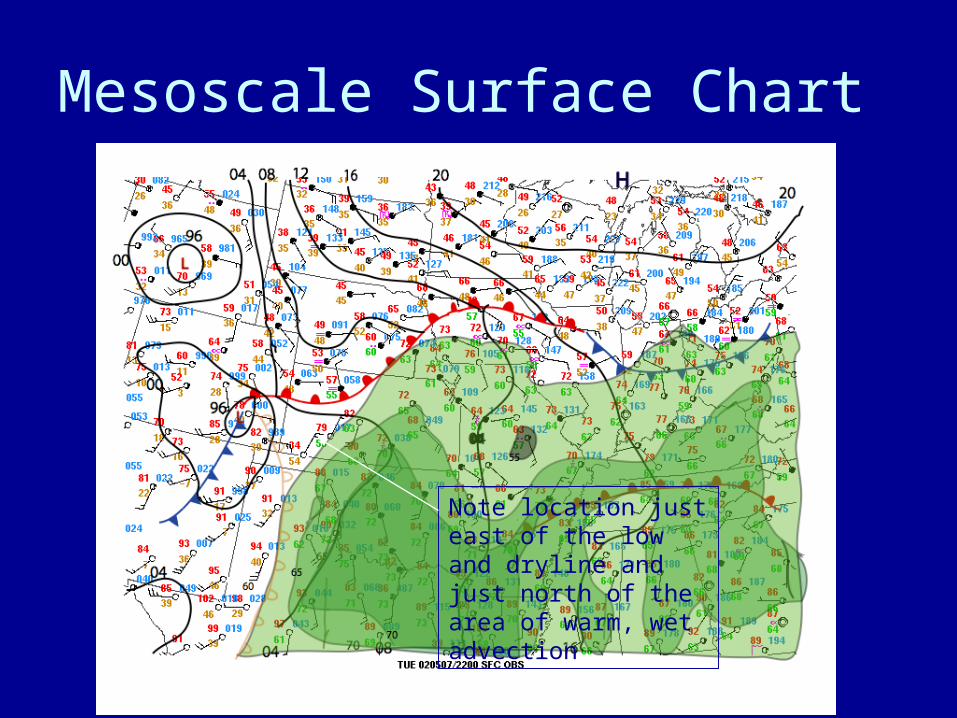
Mesoscale Surface Chart
Note location just east of the low and dryline and just north of the area of warm, wet advection
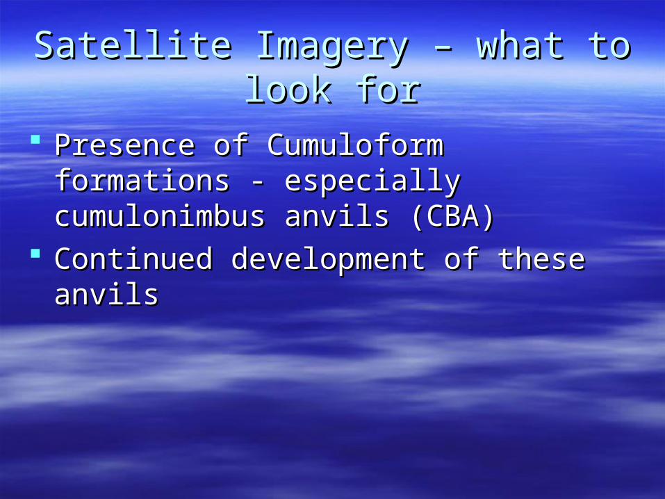
Satellite Imagery – what to look forSatellite Imagery – what to look for
Presence of Cumuloform formations - Presence of Cumuloform formations - especially cumulonimbus anvils (CBA)especially cumulonimbus anvils (CBA)
Continued development of these anvilsContinued development of these anvils
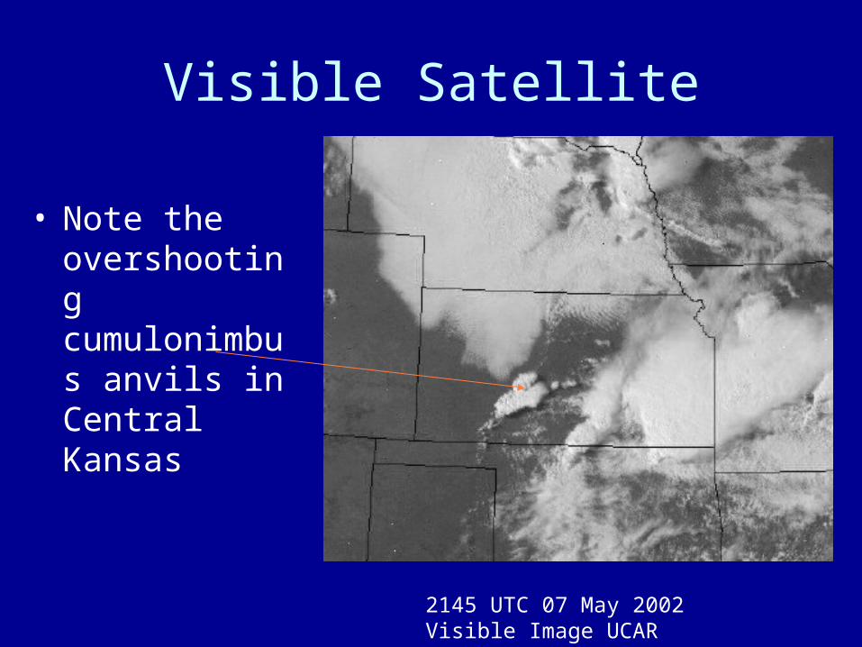
Visible Satellite
• Note the
overshooting cumulonimbus anvils in Central Kansas
2145 UTC 07 May 2002 Visible Image UCAR
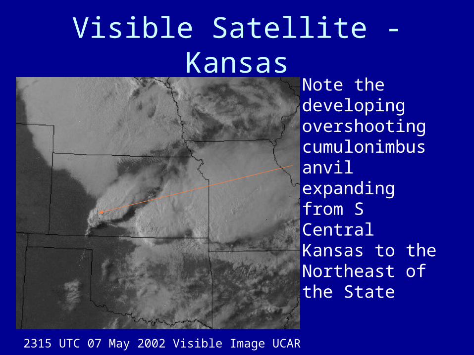
Visible Satellite - Kansas
• Note the
developing overshooting cumulonimbus anvil expanding from S Central Kansas to the Northeast of the State
2315 UTC 07 May 2002 Visible Image UCAR
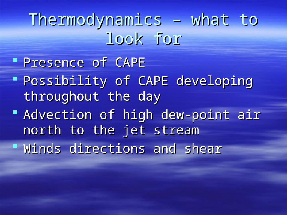
Thermodynamics – what to look forThermodynamics – what to look for
Presence of CAPEPresence of CAPE Possibility of CAPE developing throughout Possibility of CAPE developing throughout
the daythe day Advection of high dew-point air north to the Advection of high dew-point air north to the
jet streamjet stream Winds directions and shearWinds directions and shear
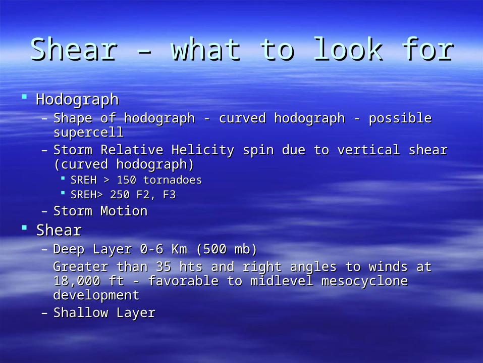
Shear – what to look forShear – what to look for
HodographHodograph– Shape of hodograph - curved hodograph - possible supercell Shape of hodograph - curved hodograph - possible supercell – Storm Relative Helicity spin due to vertical shear (curved Storm Relative Helicity spin due to vertical shear (curved
hodograph)hodograph) SREH > 150 tornadoesSREH > 150 tornadoes SREH> 250 F2, F3 SREH> 250 F2, F3
– Storm MotionStorm Motion ShearShear
– Deep Layer 0-6 Km (500 mb)Deep Layer 0-6 Km (500 mb)Greater than 35 hts and right angles to winds at 18,000 ft - Greater than 35 hts and right angles to winds at 18,000 ft - favorable to midlevel mesocyclone developmentfavorable to midlevel mesocyclone development
– Shallow LayerShallow Layer
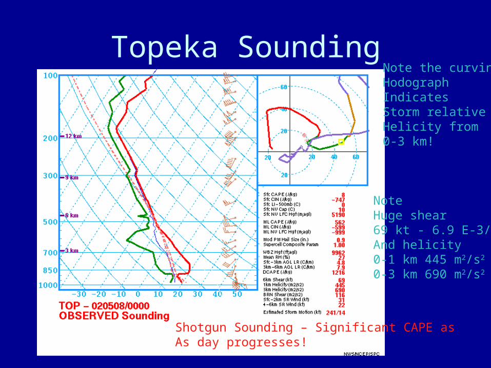
Topeka Sounding
Note Huge shear69 kt - 6.9 E-3/sAnd helicity 0-1 km 445 m2/s2
0-3 km 690 m2/s2
Note the curvingHodograph Indicates Storm relativeHelicity from0-3 km!
Shotgun Sounding – Significant CAPE as As day progresses!
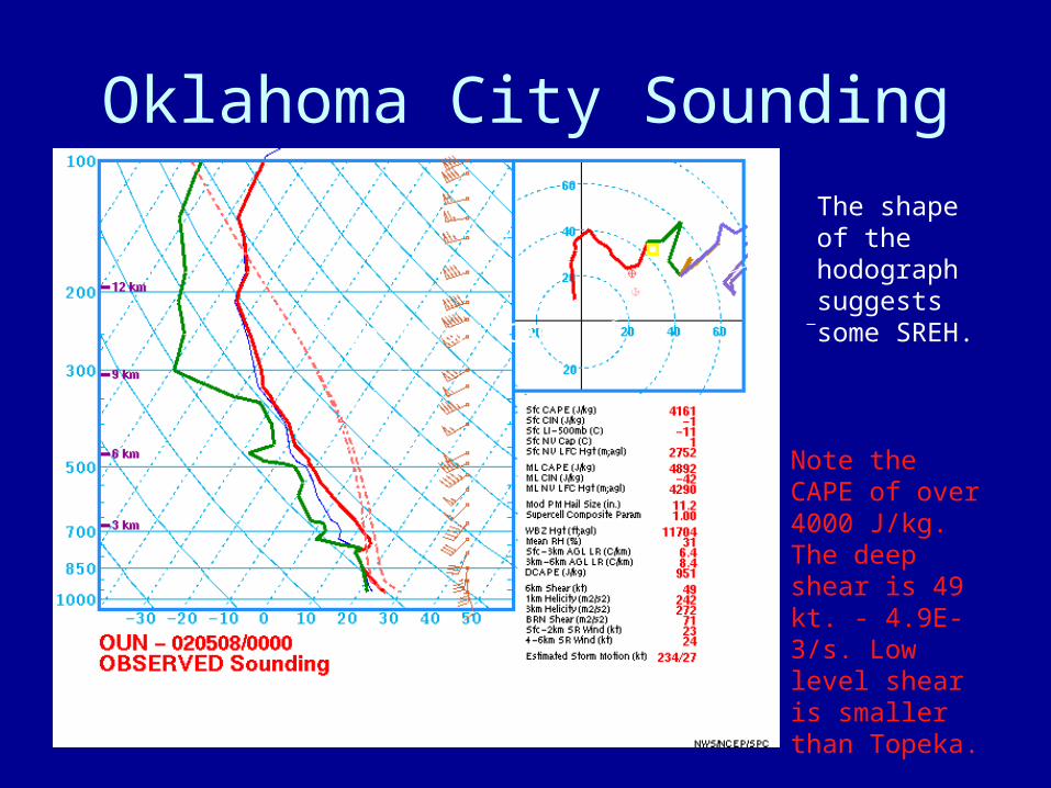
Oklahoma City Sounding
Note the CAPE of over 4000 J/kg.The deep shear is 49 kt. - 4.9E-3/s. Low level shear is smaller than Topeka.
Significant CAPE
The shape of the hodograph suggests some SREH.
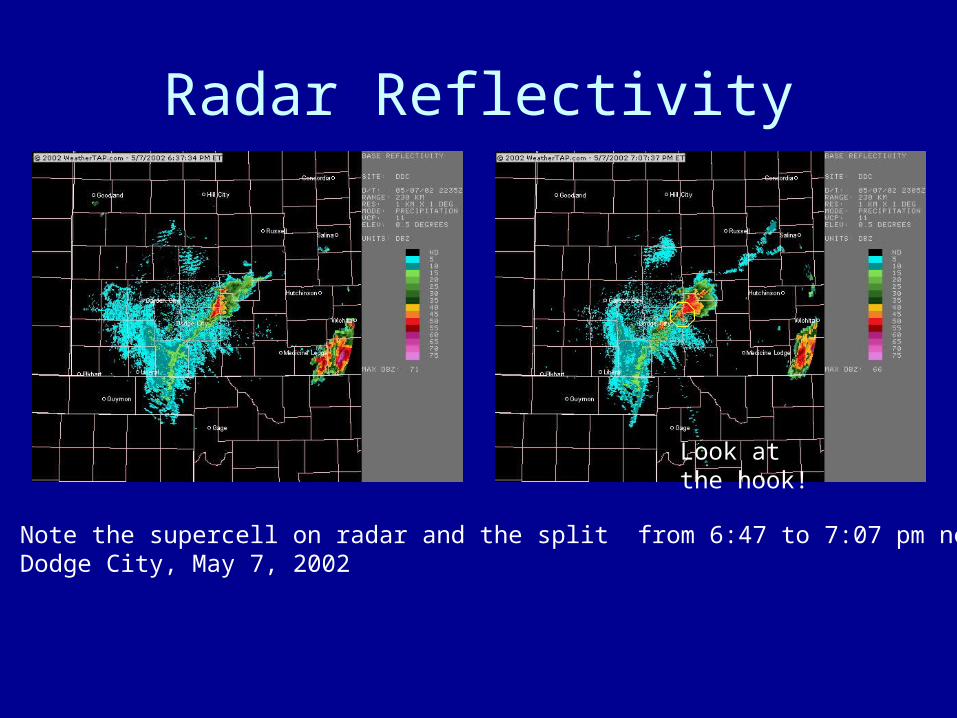
Radar Reflectivity
Note the supercell on radar and the split from 6:47 to 7:07 pm nearDodge City, May 7, 2002
Look at the hook!