Embed Size (px)
Citation preview
Teaching geography in the XXIst century -experiences of Jagiellonian University
Piotr Trzepacz PhDInstitute of Geography and Spatial Management
Jagiellonian University
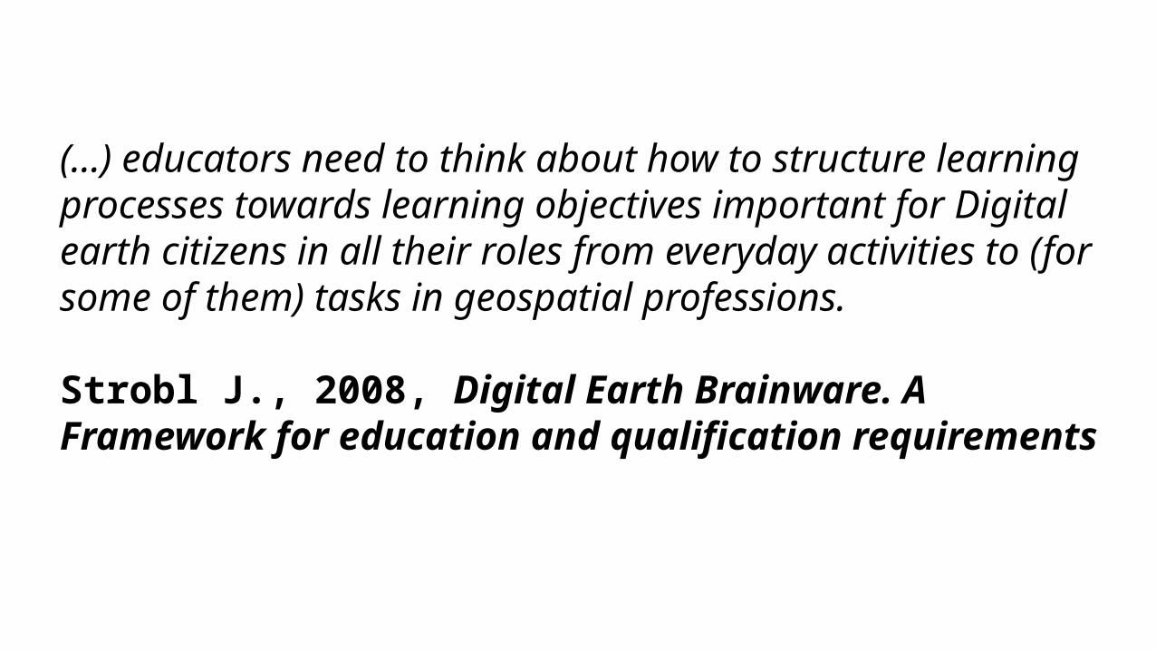
(…) educators need to think about how to structure learning processes towards learning objectives important for Digital earth citizens in all their roles from everyday activities to (for some of them) tasks in geospatial professions.
Strobl J., 2008, Digital Earth Brainware. A Framework for education and qualification requirements
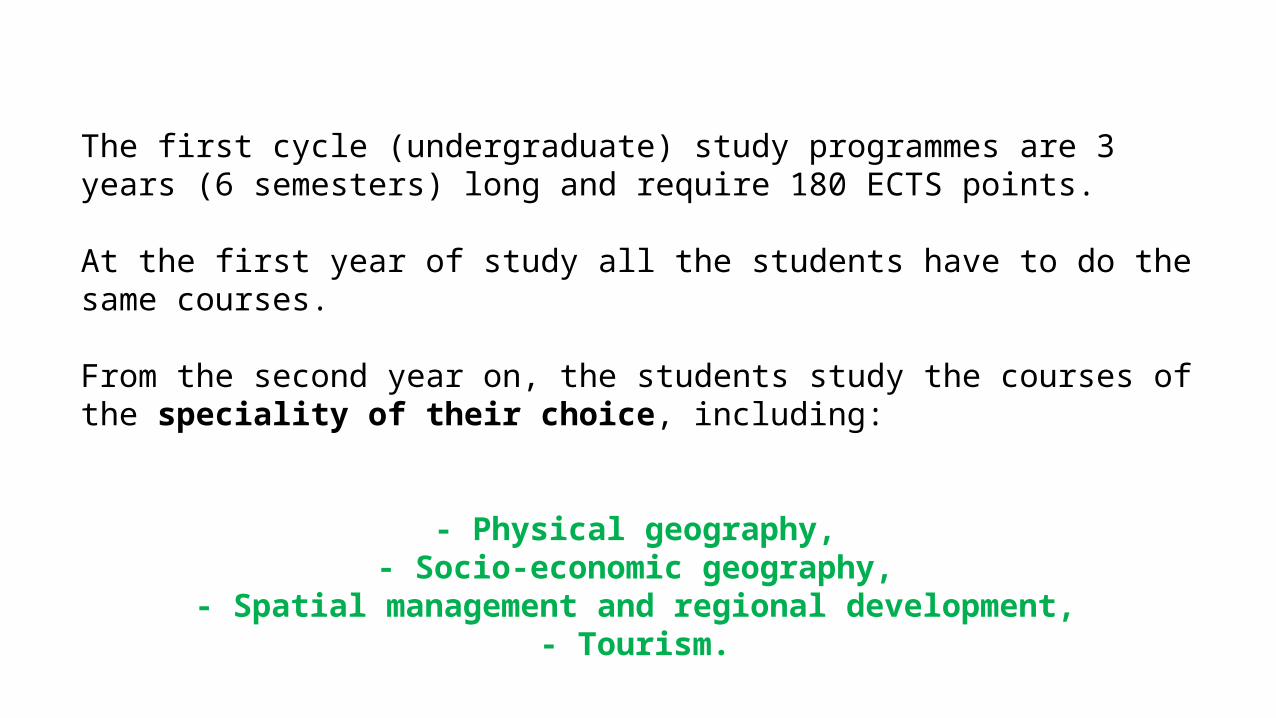
The first cycle (undergraduate) study programmes are 3 years (6 semesters) long and require 180 ECTS points.
At the first year of study all the students have to do the same courses.
From the second year on, the students study the courses of the speciality of their choice, including:
- Physical geography, - Socio-economic geography,
- Spatial management and regional development, - Tourism.
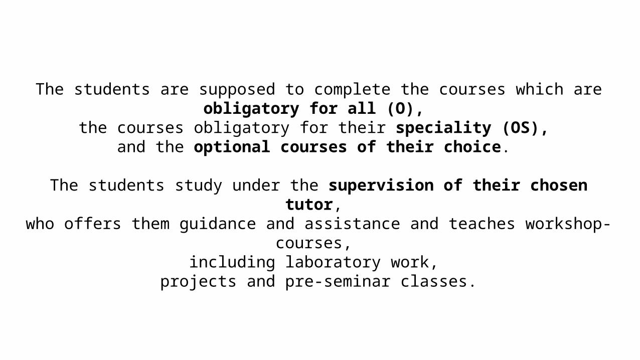
The students are supposed to complete the courses which are obligatory for all (O), the courses obligatory for their speciality (OS),
and the optional courses of their choice.
The students study under the supervision of their chosen tutor, who offers them guidance and assistance and teaches workshop-courses,
including laboratory work, projects and pre-seminar classes.
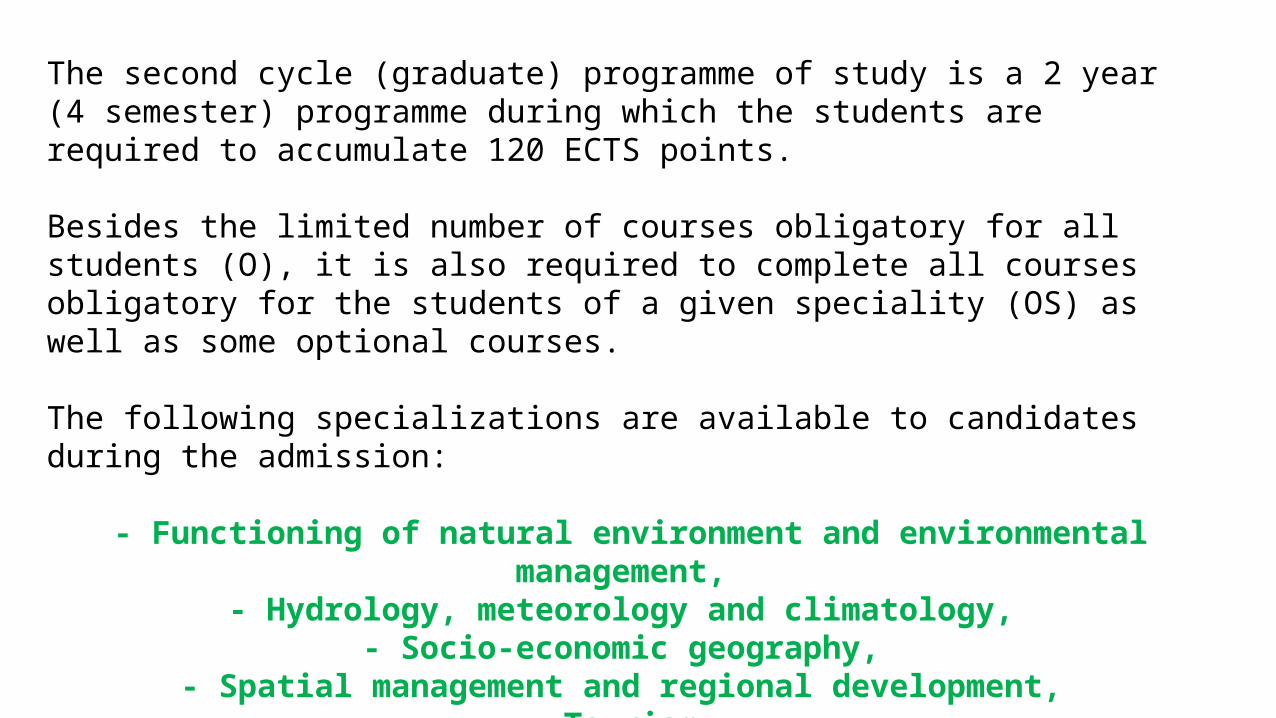
The second cycle (graduate) programme of study is a 2 year (4 semester) programme during which the students are required to accumulate 120 ECTS points.
Besides the limited number of courses obligatory for all students (O), it is also required to complete all courses obligatory for the students of a given speciality (OS) as well as some optional courses.
The following specializations are available to candidates during the admission:
- Functioning of natural environment and environmental management, - Hydrology, meteorology and climatology,
- Socio-economic geography, - Spatial management and regional development,
- Tourism, - Geographic information systems.
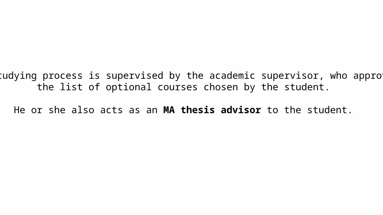
The studying process is supervised by the academic supervisor, who approves the list of optional courses chosen by the student.
He or she also acts as an MA thesis advisor to the student.
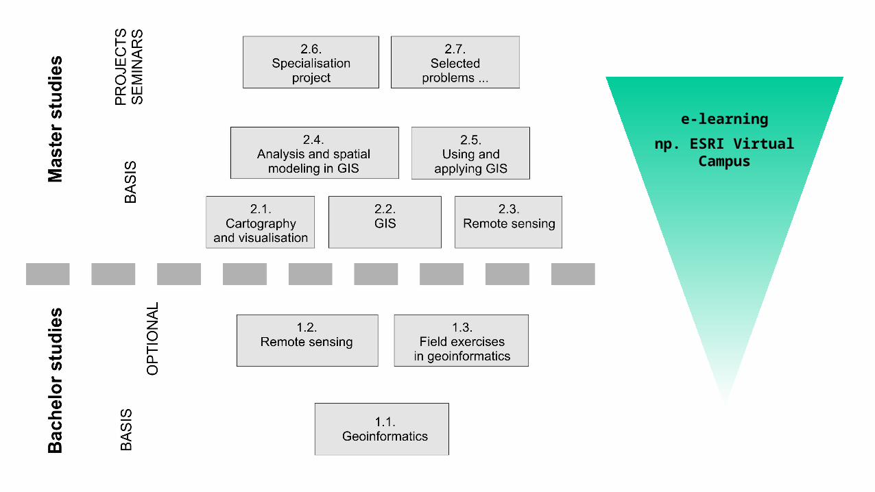
e-learning
np. ESRI Virtual Campus
Rozproszenie
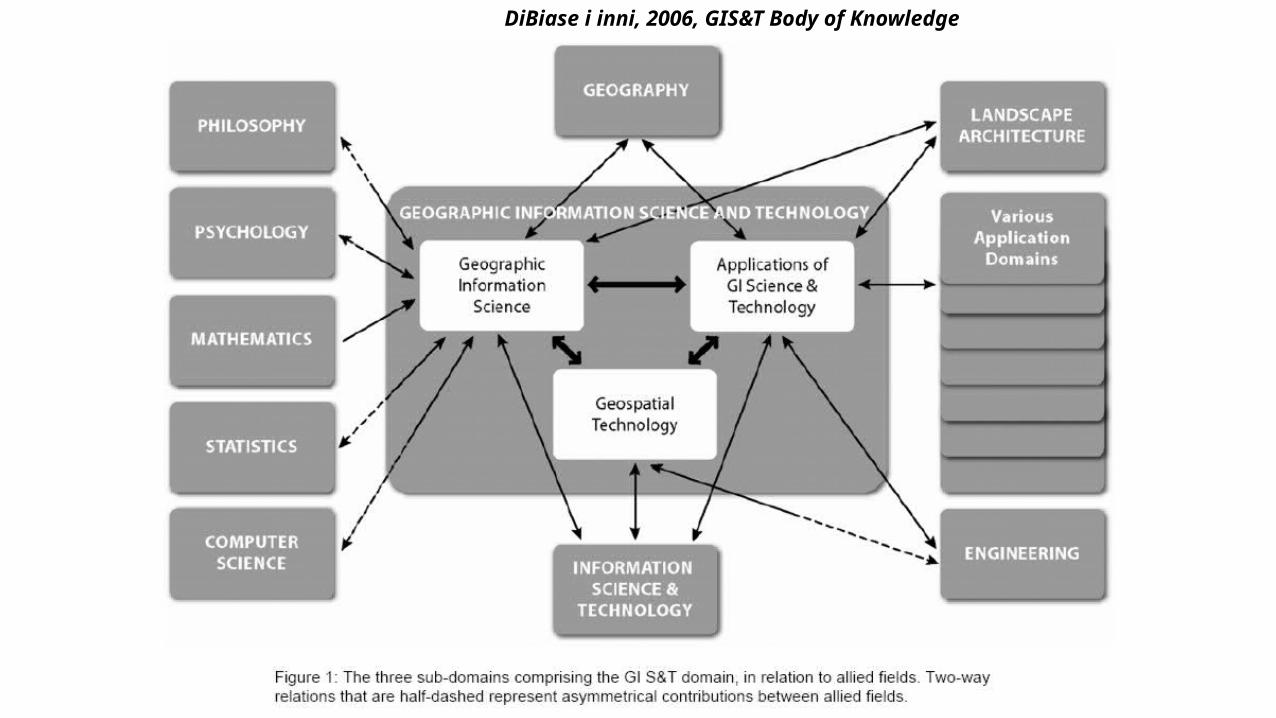
• co jest ‘twardym rdzeniem’ geoinformatyki ?• np.
DiBiase i inni, 2006, GIS&T Body of Knowledge
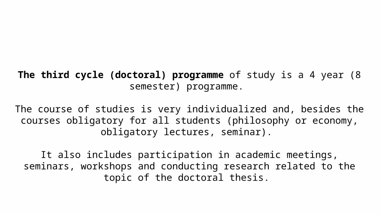
The third cycle (doctoral) programme of study is a 4 year (8 semester) programme.
The course of studies is very individualized and, besides the courses obligatory for all students (philosophy or economy, obligatory lectures, seminar).
It also includes participation in academic meetings, seminars, workshops and conducting research related to the topic of the doctoral thesis.

UNIGIS (www.unigis.net; www.unigis.uj.edu.pl)