Embed Size (px)
Citation preview
1
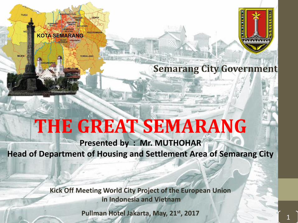
THE GREAT SEMARANGPresented by : Mr. MUTHOHAR
Head of Department of Housing and Settlement Area of Semarang City
Kick Off Meeting World City Project of the European Unionin Indonesia and Vietnam
Pullman Hotel Jakarta, May, 21st, 2017
Semarang City Government
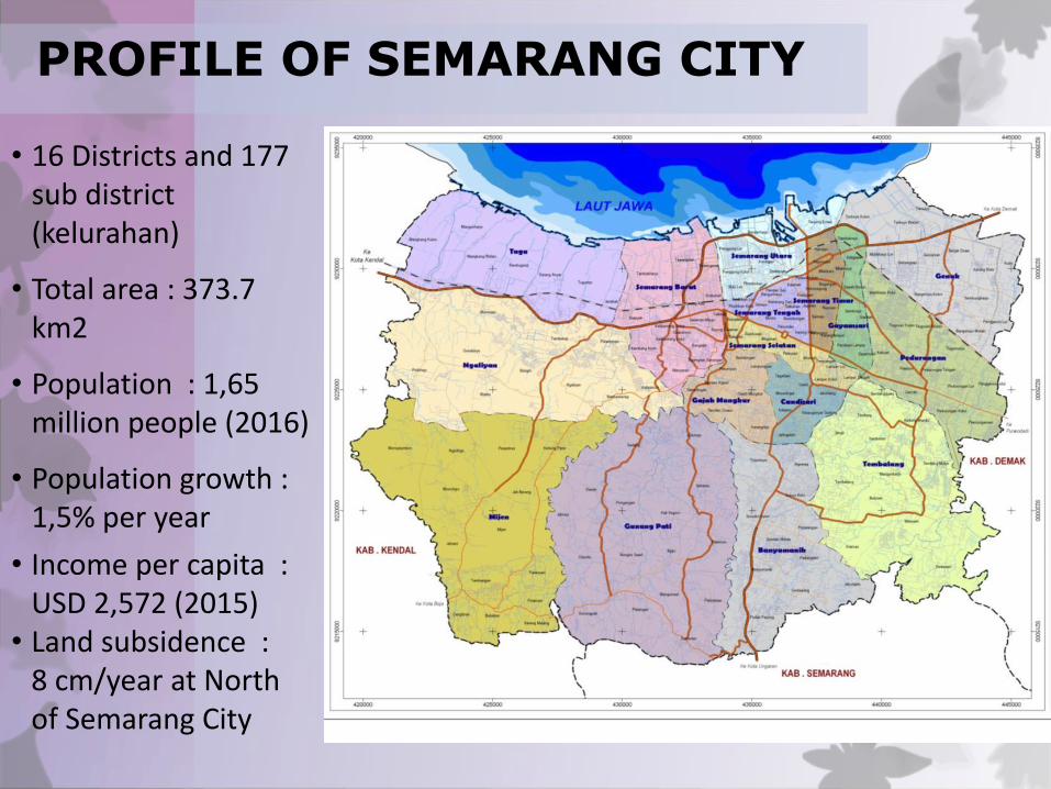
• 16 Districts and 177 sub district (kelurahan)
• Total area : 373.7 km2
• Population : 1,65 million people (2016)
• Population growth : 1,5% per year
• Income per capita :USD 2,572 (2015)
• Land subsidence :8 cm/year at North of Semarang City
PROFILE OF SEMARANG CITY
Kedungsepur
Semarang
Joglosemar
Jakarta
BandungSurabaya
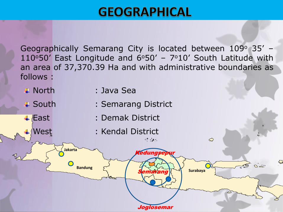
Geographically Semarang City is located between 109o 35’ –110o50’ East Longitude and 6o50’ – 7o10’ South Latitude withan area of 37,370.39 Ha and with administrative boundaries asfollows :
North : Java Sea
South : Semarang District
East : Demak District
West : Kendal District
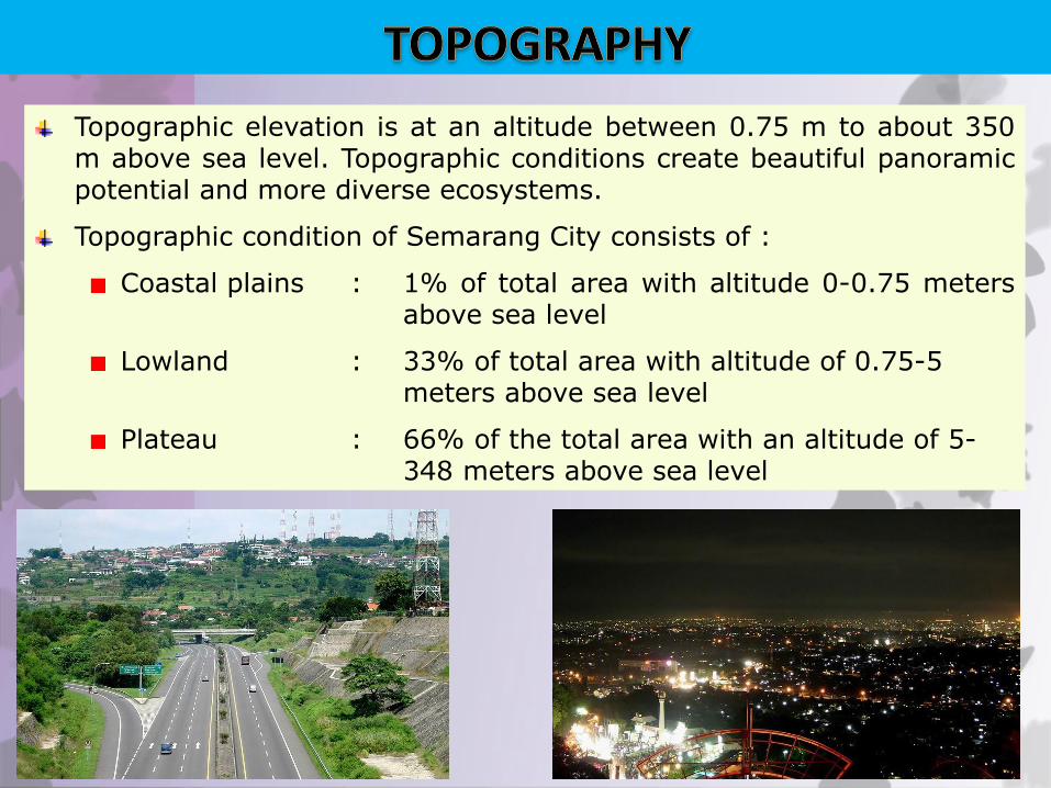
Topographic elevation is at an altitude between 0.75 m to about 350m above sea level. Topographic conditions create beautiful panoramicpotential and more diverse ecosystems.
Topographic condition of Semarang City consists of :
Coastal plains : 1% of total area with altitude 0-0.75 metersabove sea level
Lowland : 33% of total area with altitude of 0.75-5meters above sea level
Plateau : 66% of the total area with an altitude of 5-348 meters above sea level
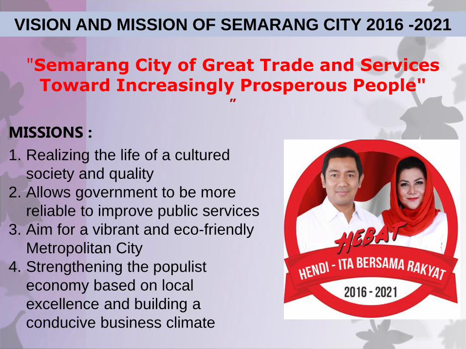
MISSIONS :
1. Realizing the life of a cultured
society and quality
2. Allows government to be more
reliable to improve public services
3. Aim for a vibrant and eco-friendly
Metropolitan City
4. Strengthening the populist
economy based on local
excellence and building a
conducive business climate
"Semarang City of Great Trade and Services Toward Increasingly Prosperous People"
”
VISION AND MISSION OF SEMARANG CITY 2016 -2021
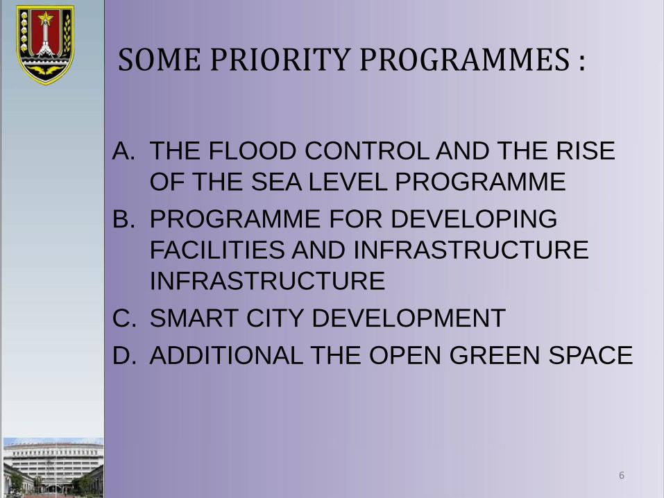
SOME PRIORITY PROGRAMMES :
A. THE FLOOD CONTROL AND THE RISE
OF THE SEA LEVEL PROGRAMME
B. PROGRAMME FOR DEVELOPING
FACILITIES AND INFRASTRUCTURE
INFRASTRUCTURE
C. SMART CITY DEVELOPMENT
D. ADDITIONAL THE OPEN GREEN SPACE
6
A. THE FLOOD CONTROL AND THE RISE OF THE SEA LEVEL PROGRAMME
PEMERINTAH KOTA SEMARANG
BAD AN PE R EN C A N AA N PE M BA N GU N A N D AE R AH
(BA PP ED A )
JL . P EM U D A 148 SE M AR A N G
PEK ER JA AN :
PENYUSUNAN DOKUMEN
MASTERPLAN DRAIN ASE SEM AR AN G
KO N SU L TA N
GA M BA R
GAMBAR L3-4
PETA GENANGAN BANJIR ROB
D IG AM B AR
D IP ER IK SA
M EN YE T U JU I
M EN G ET A H U I
SKA LA N O LE M BA R JM L LE M BA R
MIJEN
TUGU
NGALIYAN
GUNUNG PATI
GENUK
TEMBALANG
BANYUMANIK
PEDURUNGAN
SEMARANG BARAT
SEMARANG
UTARA
CANDISARI
GAYAMSARI
GAJAH MUNGKUR
SEMARANG
TIMUR
SEMARANG
SELATAN
SEMARANG
TENGAH
KETERANGAN
JALAN TOL
JALAN UTAMA
KECAMATAN
SUN GAI
GENANGAN ROB
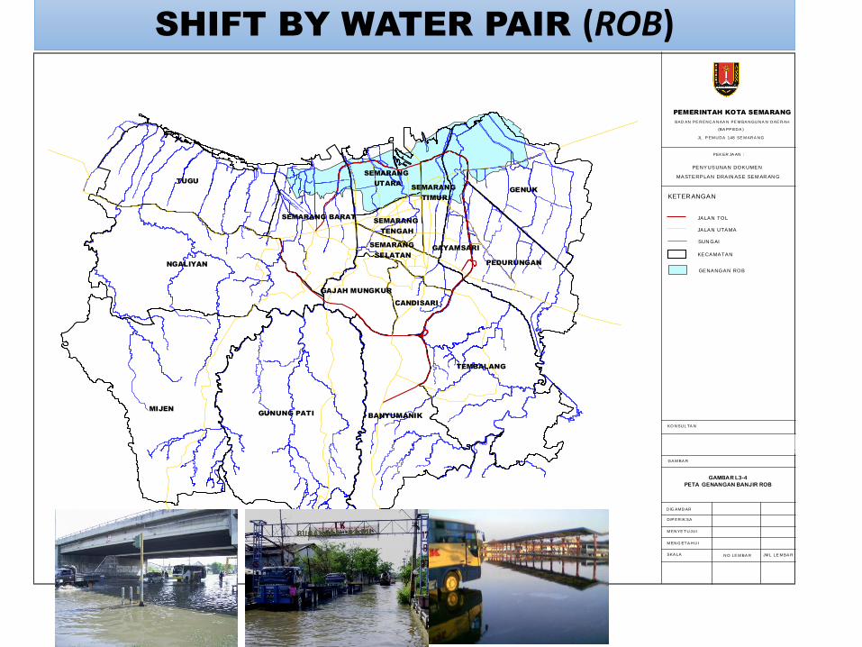
SHIFT BY WATER PAIR (ROB)
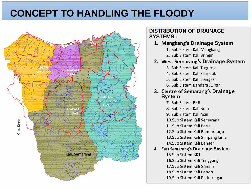
DISTRIBUTION OF DRAINAGE SYSTEMS :
1. Mangkang’s Drainage System1. Sub Sistem Kali Mangkang
2. Sub Sistem Kali Bringin
2. West Semarang’s Drainage System3. Sub Sistem Kali Tugurejo
4. Sub Sistem Kali Silandak
5. Sub Sistem Kali Siangker
6. Sub Sistem Bandara A. Yani
3. Centre of Semarang’s Drainage System
7. Sub Sistem BKB
8. Sub Sistem Kali Bulu
9. Sub Sistem Kali Asin
10.Sub Sistem Kali Semarang
11.Sub Sistem Kali Baru
12.Sub Sistem Kali Bandarharjo
13.Sub Sistem Kali Simpang Lima
14.Sub Sistem Kali Banger
4. East Semarang’s Drainage System
15.Sub Sistem BKT
16.Sub Sistem Kali Tenggang
17.Sub Sistem Kali Sringin
18.Sub Sistem Kali Babon
19.Sub Sistem Kali Pedurungan
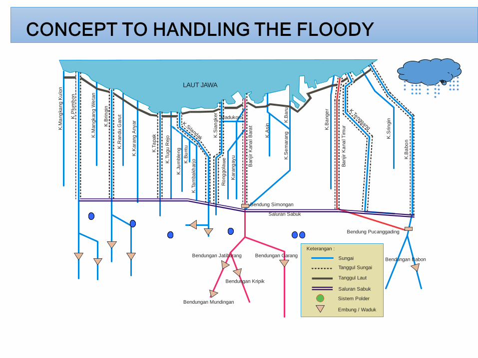
CONCEPT TO HANDLING THE FLOODY
Ka l i Bab
on
SISTEM MANGKANG
SISTEM SEMARANG
TENGAH
SISTEM SEMARANG
BARAT
SISTEM SEMARANG
TIMUR
Kab
. Ken
dal
Kab. Semarang
K.M
ang
kang
Ku
lon
K.M
an
gkan
g W
eta
n
K.P
lum
bon
K.B
rin
gin
K.K
ara
ng
Anyar
K.R
an
du G
aru
t
K.T
apak
K.T
ugu
Rejo
K.J
um
ble
ng
K.Silandak
K.B
untu
K.T
am
ba
kharj
o
K.S
ian
gker
Ban
jir K
ana
l B
ara
t
K.A
sin
K.B
aru
K.S
em
ara
ng
K.B
ange
r
Ba
njir
Ka
na
l Tim
ur
K.Tenggang
K.S
rin
gin
K.B
abo
n
Ro
ng
gola
we
Kara
ng
ayu
Bendung Simongan
Bendung Pucanggading
LAUT JAWA
Madukoro
Saluran Sabuk
Bendungan Jatibarang
Bendungan Mundingan
Sungai
Tanggul Sungai
Tanggul Laut
Sistem Polder
Saluran Sabuk
Keterangan :
Embung / Waduk
Bendungan Babon
Bendungan Kripik
Bendungan Garang
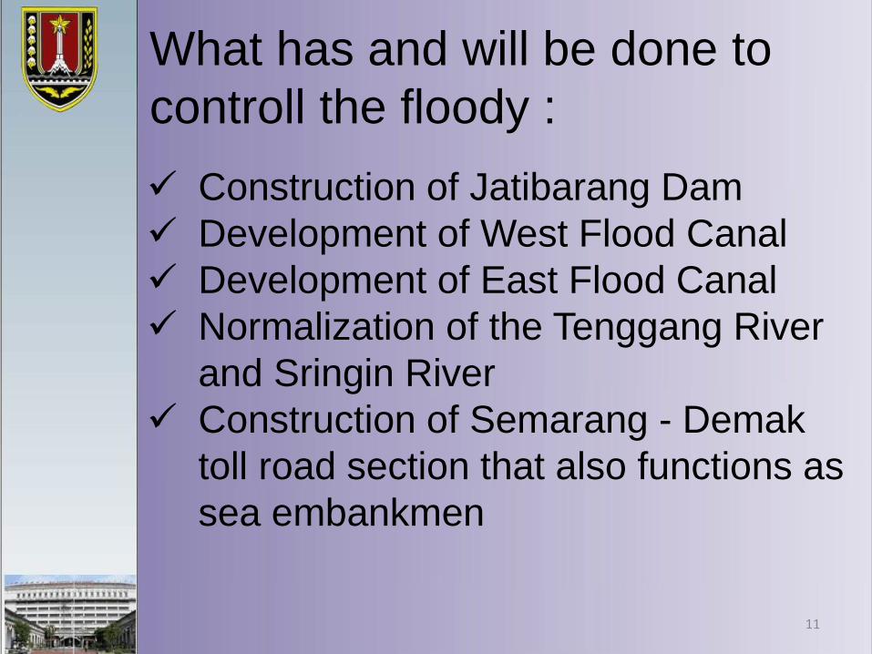
What has and will be done to
controll the floody :
✓ Construction of Jatibarang Dam
✓ Development of West Flood Canal
✓ Development of East Flood Canal
✓ Normalization of the Tenggang River
and Sringin River
✓ Construction of Semarang - Demak
toll road section that also functions as
sea embankmen
11
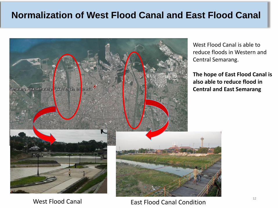
12
West Flood Canal is able to reduce floods in Western and Central Semarang.
The hope of East Flood Canal is also able to reduce flood in Central and East Semarang
Normalization of West Flood Canal and East Flood Canal
West Flood Canal East Flood Canal Condition
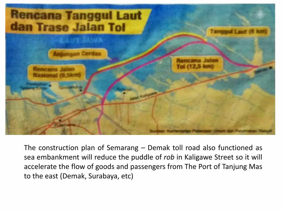
The construction plan of Semarang – Demak toll road also functioned assea embankment will reduce the puddle of rob in Kaligawe Street so it willaccelerate the flow of goods and passengers from The Port of Tanjung Masto the east (Demak, Surabaya, etc)
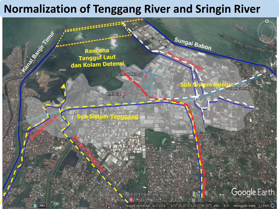
Normalization of Tenggang River and Sringin River
B. DEVELOPMENT OF FACILITIES AND INFRASTRUCTURE OF TRANSPORTATION PROGRAMME
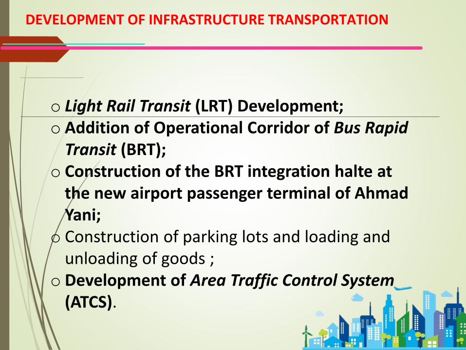
DEVELOPMENT OF INFRASTRUCTURE TRANSPORTATION
o Light Rail Transit (LRT) Development; o Addition of Operational Corridor of Bus Rapid
Transit (BRT); o Construction of the BRT integration halte at
the new airport passenger terminal of Ahmad Yani;
o Construction of parking lots and loading and unloading of goods ;
o Development of Area Traffic Control System(ATCS).
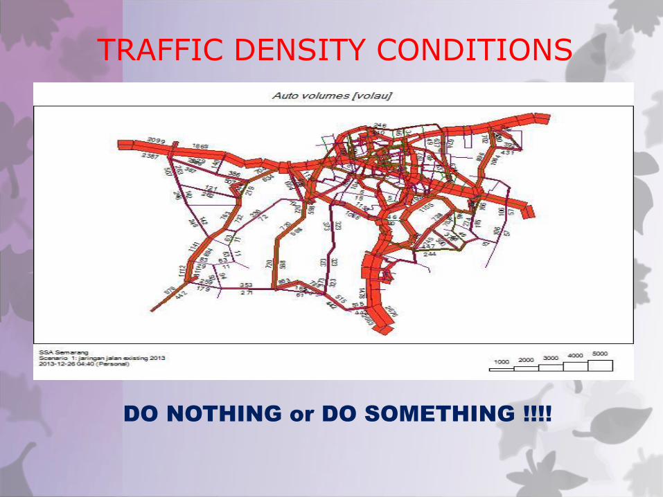
TRAFFIC DENSITY CONDITIONS
DO NOTHING or DO SOMETHING !!!!
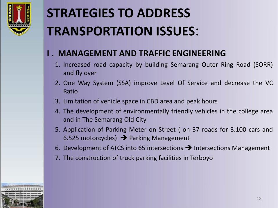
STRATEGIES TO ADDRESS
TRANSPORTATION ISSUES:
18
I . MANAGEMENT AND TRAFFIC ENGINEERING1. Increased road capacity by building Semarang Outer Ring Road (SORR)
and fly over
2. One Way System (SSA) improve Level Of Service and decrease the VCRatio
3. Limitation of vehicle space in CBD area and peak hours
4. The development of environmentally friendly vehicles in the college areaand in The Semarang Old City
5. Application of Parking Meter on Street ( on 37 roads for 3.100 cars and6.525 motorcycles) Parking Management
6. Development of ATCS into 65 intersections Intersections Management
7. The construction of truck parking facilities in Terboyo
19
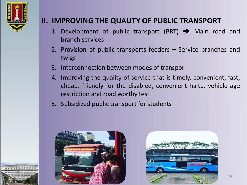
II. IMPROVING THE QUALITY OF PUBLIC TRANSPORT1. Development of public transport (BRT) Main road and
branch services
2. Provision of public transports feeders – Service branches andtwigs
3. Interconnection between modes of transpor
4. Improving the quality of service that is timely, convenient, fast,cheap, friendly for the disabled, convenient halte, vehicle agerestriction and road worthy test
5. Subsidized public transport for students
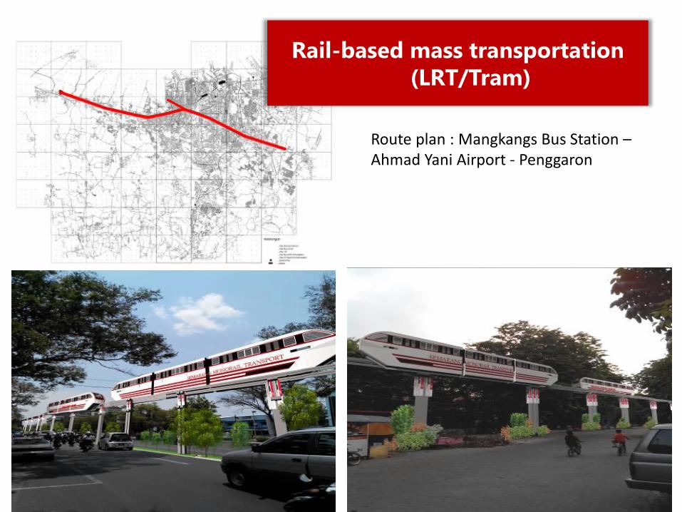
Rail-based mass transportation
(LRT/Tram)
Route plan : Mangkangs Bus Station –Ahmad Yani Airport - Penggaron
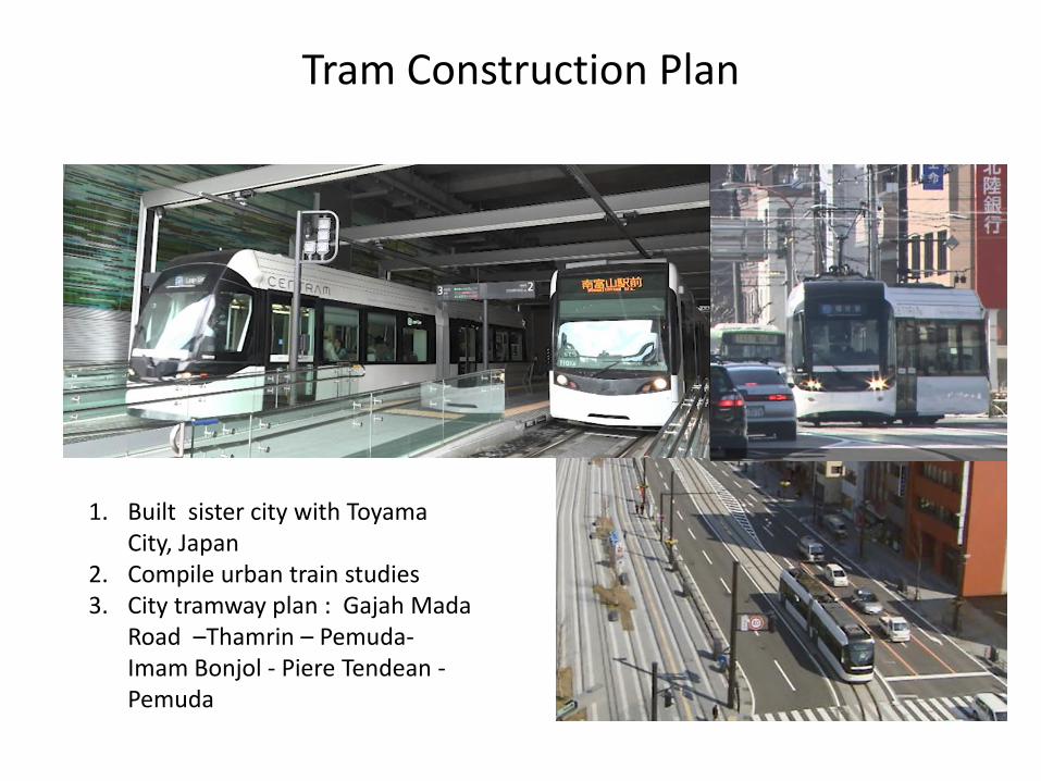
Tram Construction Plan
1. Built sister city with Toyama City, Japan
2. Compile urban train studies3. City tramway plan : Gajah Mada
Road –Thamrin – Pemuda-Imam Bonjol - Piere Tendean -Pemuda
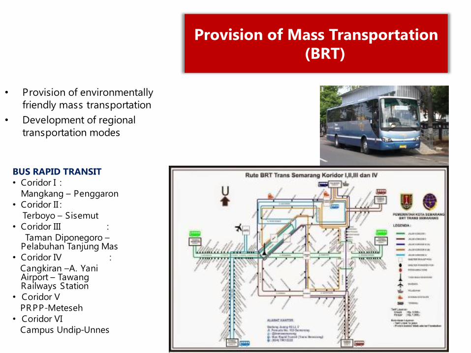
Provision of Mass Transportation
(BRT)
BUS RAPID TRANSIT
• Coridor I :
Mangkang – Penggaron
• Coridor II :
Terboyo – Sisemut
• Coridor III :
Taman Diponegoro –Pelabuhan Tanjung Mas
• Coridor IV :
Cangkiran –A. YaniAirport – TawangRailways Station
• Coridor V
PRPP-Meteseh
• Coridor VI
Campus Undip-Unnes
• Provision of environmentally
friendly mass transportation
• Development of regional
transportation modes
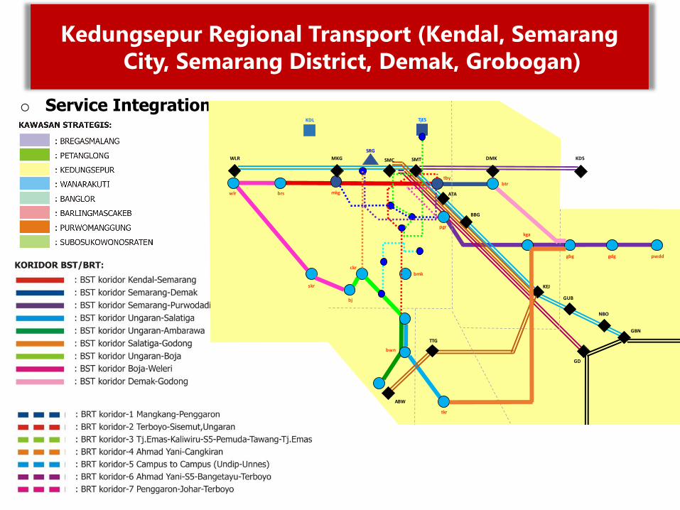
o Service Integration
SMT
SRG
WLR
ABW
KEJ
NBO
GBN
KDL TjES
brs mkg
btrtby
bmk
pgr
bwn
tkr
pwdd
SMC
wlr
skr
MKG DMK KDS
BBG
ATA
TTG
GD
GUB
gdggbg
kga
bj
ckr
Kedungsepur Regional Transport (Kendal, Semarang
City, Semarang District, Demak, Grobogan)
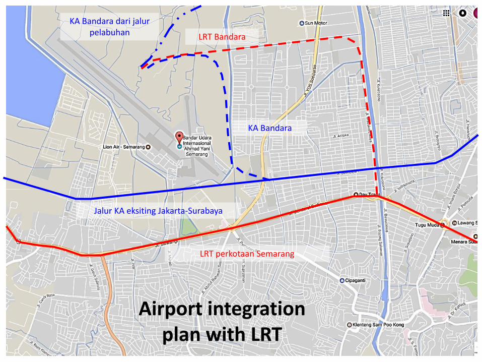
LRT perkotaan Semarang
LRT Bandara
Jalur KA eksiting Jakarta-Surabaya
KA Bandara
KA Bandara dari jalur pelabuhan
Airport integration plan with LRT
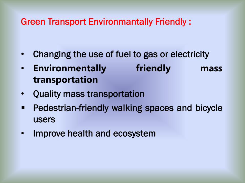
• Changing the use of fuel to gas or electricity
• Environmentally friendly mass
transportation
• Quality mass transportation
▪ Pedestrian-friendly walking spaces and bicycle
users
• Improve health and ecosystem
Green Transport Environmantally Friendly :
C. SMART CITY DEVELOPMENT
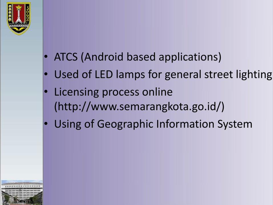
• ATCS (Android based applications)
• Used of LED lamps for general street lighting
• Licensing process online (http://www.semarangkota.go.id/)
• Using of Geographic Information System
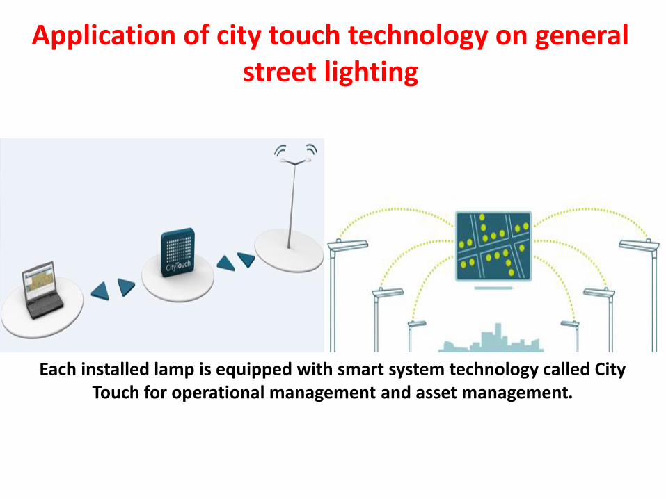
Each installed lamp is equipped with smart system technology called City Touch for operational management and asset management.
Application of city touch technology on general street lighting
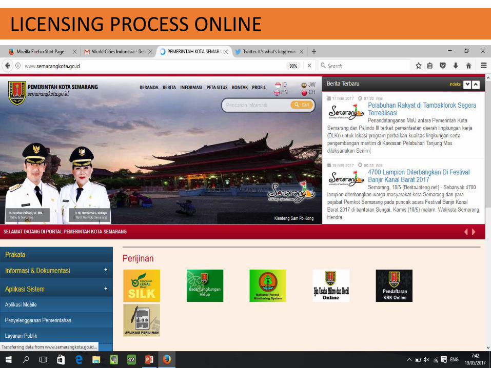
LICENSING PROCESS ONLINE

PUBLIC SERVICE ONLINE

ONLINE GOVERNMENT ADMINISTRATION

SEMARANG CITY PARK INFORMATION SYSTEM
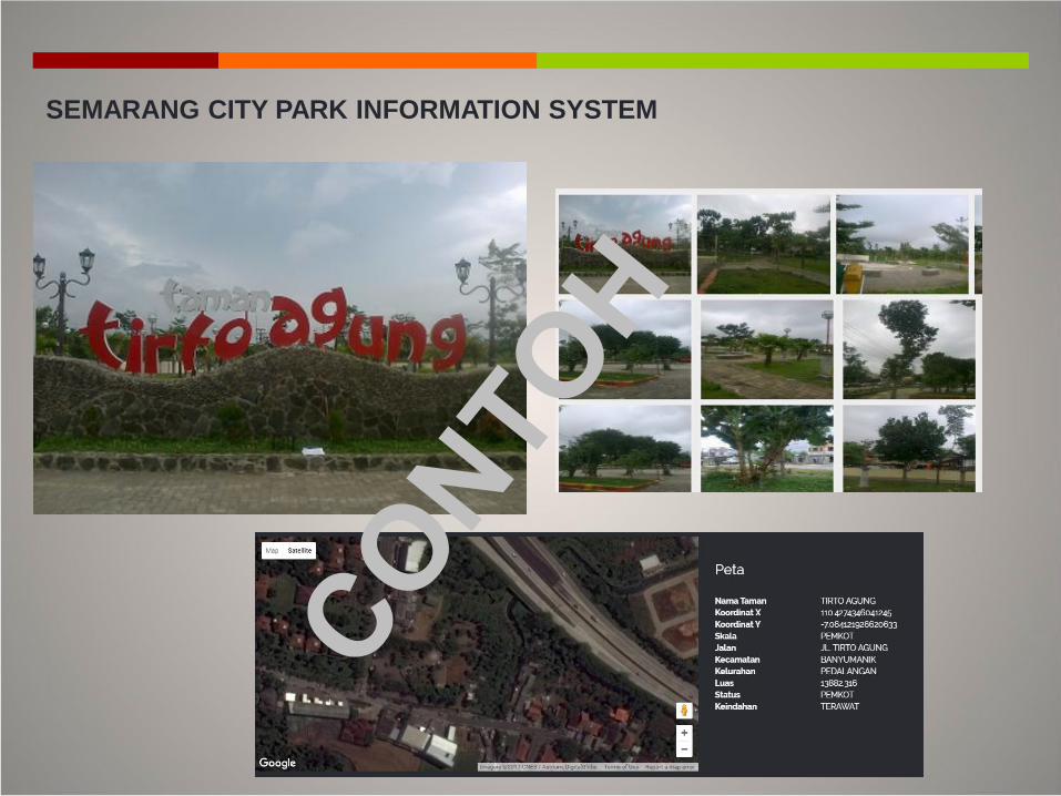
SEMARANG CITY PARK INFORMATION SYSTEM
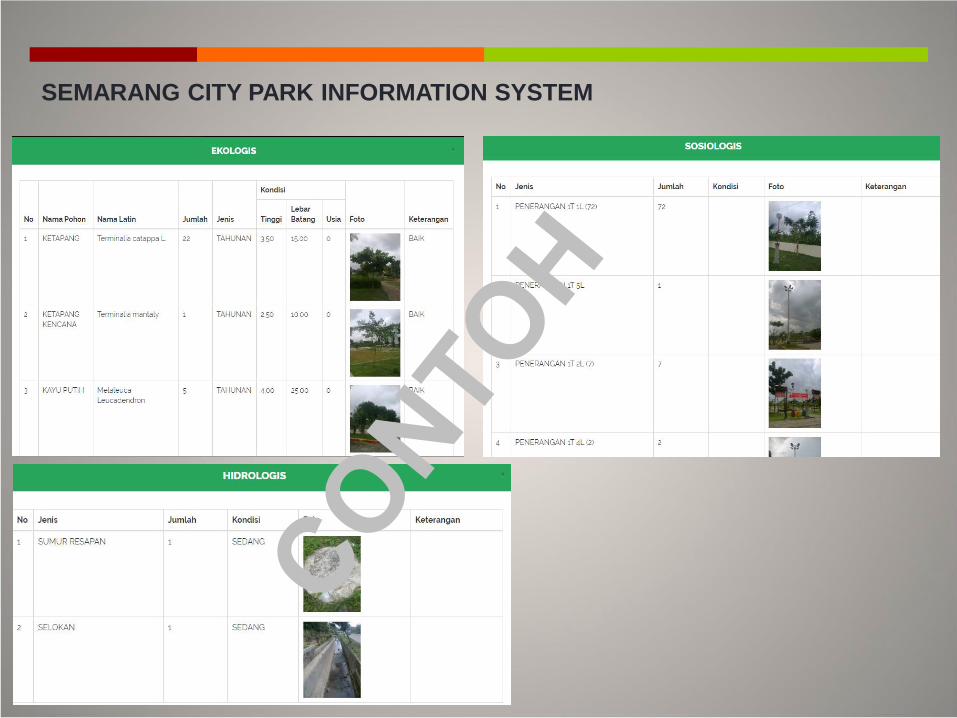
SEMARANG CITY PARK INFORMATION SYSTEM

D. THE ADDITION OF GREEN OPEN SPACE
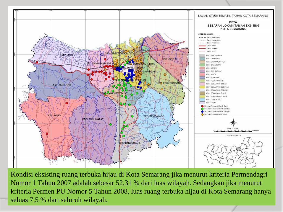
Kondisi eksisting ruang terbuka hijau di Kota Semarang jika menurut kriteria Permendagri
Nomor 1 Tahun 2007 adalah sebesar 52,31 % dari luas wilayah. Sedangkan jika menurut
kriteria Permen PU Nomor 5 Tahun 2008, luas ruang terbuka hijau di Kota Semarang hanya
seluas 7,5 % dari seluruh wilayah.
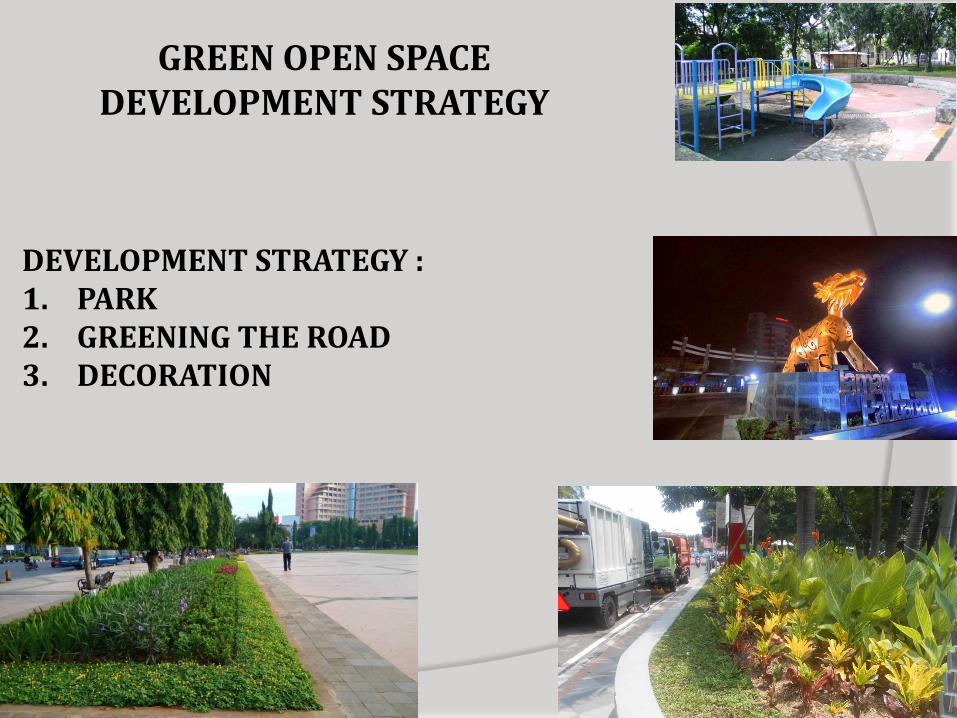
DEVELOPMENT STRATEGY :1. PARK2. GREENING THE ROAD3. DECORATION
GREEN OPEN SPACE DEVELOPMENT STRATEGY
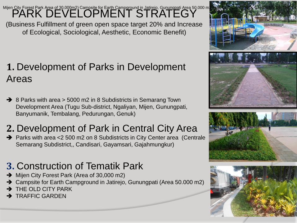
1. Development of Parks in Development
Areas
8 Parks with area > 5000 m2 in 8 Subdistricts in Semarang Town
Development Area (Tugu Sub-district, Ngaliyan, Mijen, Gunungpati,
Banyumanik, Tembalang, Pedurungan, Genuk)
2. Development of Park in Central City Area Parks with area <2 500 m2 on 8 Subdistricts in City Center area (Centrale
Semarang Subdistrict,, Candisari, Gayamsari, Gajahmungkur)
3. Construction of Tematik Park Mijen City Forest Park (Area of 30,000 m2)
Campsite for Earth Campground in Jatirejo, Gunungpati (Area 50.000 m2)
THE OLD CITY PARK
TRAFFIC GARDEN
PARK DEVELOPMENT STRATEGY (Business Fulfillment of green open space target 20% and Increase
of Ecological, Sociological, Aesthetic, Economic Benefit)
Mijen City Forest Park Area of 30,000m2) Campsite for Earth Campground in Jatirejo, Gunungpati Area 50.000 m2 THE OLD CITY PARK GARDENS OF THE CITY OF THE CITY
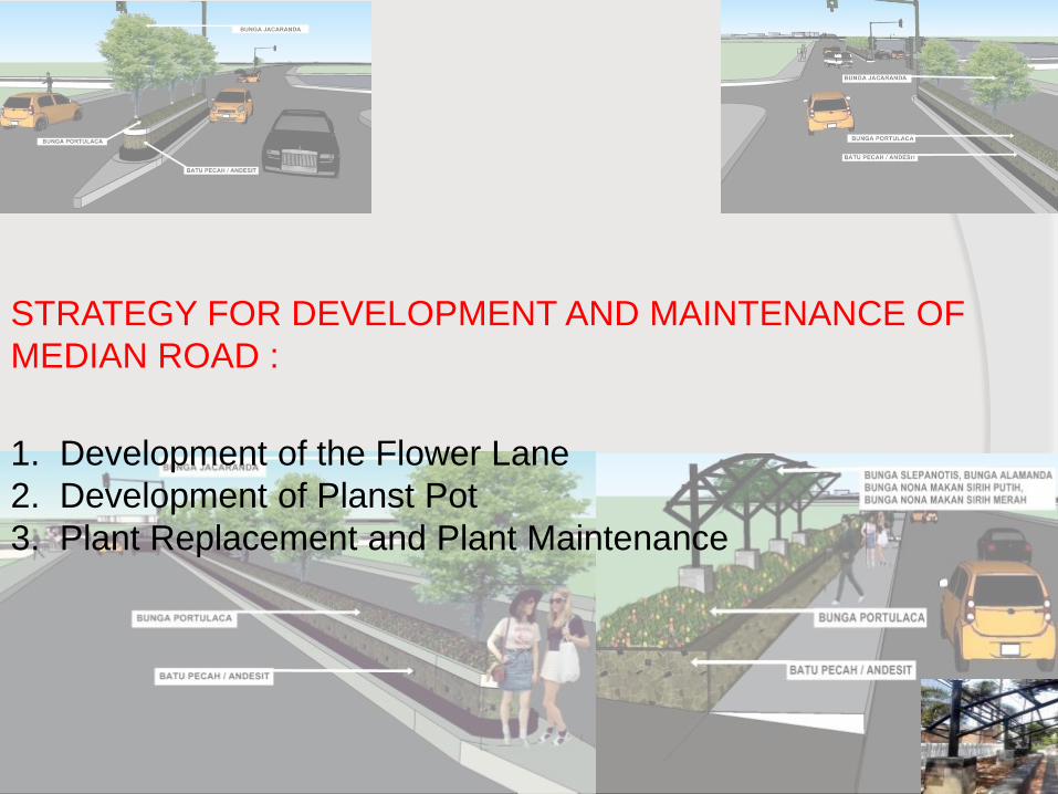
STRATEGY FOR DEVELOPMENT AND MAINTENANCE OF
MEDIAN ROAD :
1. Development of the Flower Lane
2. Development of Planst Pot
3. Plant Replacement and Plant Maintenance