Embed Size (px)
DESCRIPTION
The Hazardous Weather Testbed / Experimental Warning Program. Travis Smith (OU / CIMMS / NSSL) David Andra (NWS / WFO / OUN) 2 nd Workshop on Severe Weather Technology for NWS Warning Decision-Making – July 11, 2007. EFP. EWP. What is the Hazardous Weather Testbed?. - PowerPoint PPT Presentation
Citation preview
The Hazardous Weather Testbed / Experimental Warning Program
Travis Smith (OU / CIMMS / NSSL)David Andra (NWS / WFO / OUN)
2nd Workshop on Severe Weather Technology for NWS Warning Decision-Making – July 11, 2007
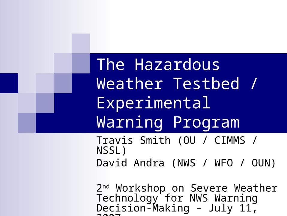
What is the Hazardous Weather Testbed?
• Both a facility and an organization…• The facility is located on the second floor of the new NWC, between the SPC and WFO OUN operational forecasting areas.• An organization that supports and promotes collaborative research activities between NSSL, SPC, OUN, and the broader meteorological community of researcher scientists, academia, and forecasters.
Two Main Program Areas…
Experimental
Warning
Program
Experimental
Forecast
ProgramEFP EWP
Prediction of hazardous mesoscale and stormscale events from a few hours to a week in advance on spatial domains ranging from several counties to the CONUS.
Detection and prediction of hazardous mesoscale and stormscale events up to several hours in advance on spatial domains of counties to fractions of counties.
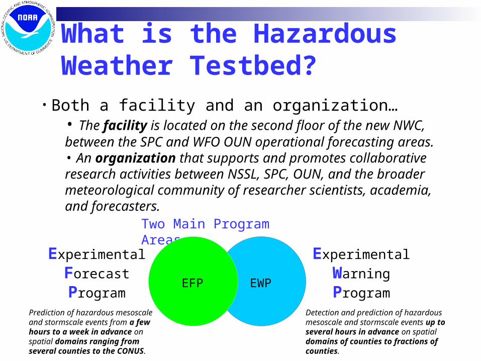
HWT’s Experimental Warning Program Focuses on mesoscale and stormscale
technology, science, and services. Collaborative approach involving NOAA
research and operations, universities, and elements of user community.
Activities rely on visiting scientists and forecasters from across nation.
Results support NOAA mission and goals at 122 WFOs nationwide
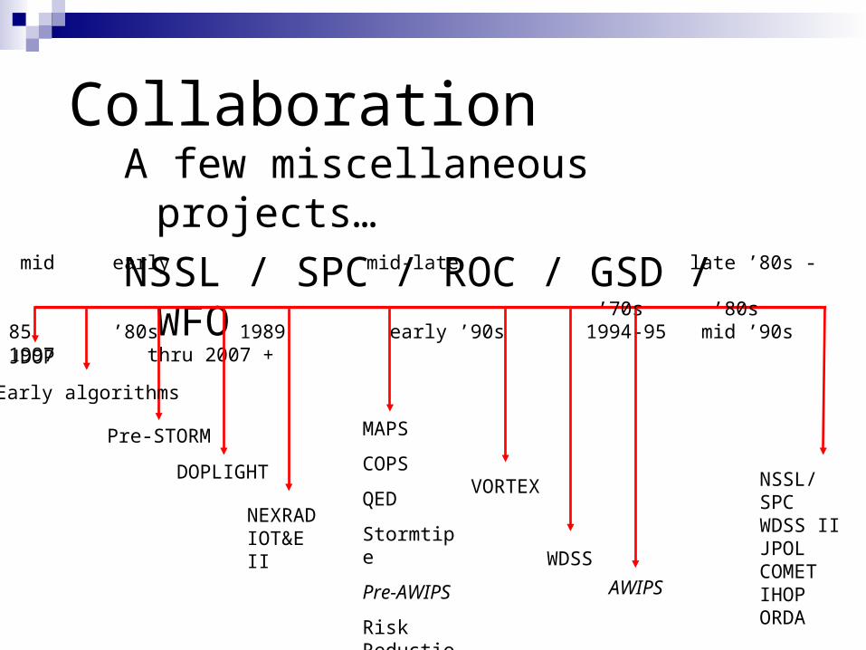
CollaborationA few miscellaneous projects…
NSSL / SPC / ROC / GSD / WFO
JDOP
Pre-STORM
NEXRAD IOT&E II
VORTEX
mid early mid-late late ’80s - ’70s ’80s 85 ’80s 1989 early ’90s 1994-95 mid ’90s 1997 thru 2007 +
Early algorithms
DOPLIGHT
MAPS
COPS
QED
Stormtipe
Pre-AWIPS
Risk Reduction
WDSS
AWIPS
NSSL/SPCWDSS IIJPOLCOMETIHOPORDA
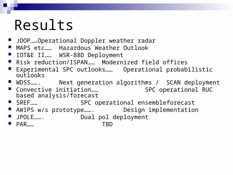
Results JDOP…… Operational Doppler weather
radar MAPS etc…… Hazardous Weather Outlook IOT&E II…… WSR-88D Deployment Risk reduction/ISPAN…… Modernized field offices Experimental SPC outlooks…… Operational probabilistic outlooks WDSS……. Next generation algorithms /
SCAN deployment Convective initiation…… SPC operational RUC based
analysis/forecast SREF…… SPC operational ensemble
forecast AWIPS w/s prototype……. Design implementation JPOLE……. Dual pol deployment PAR…… TBD
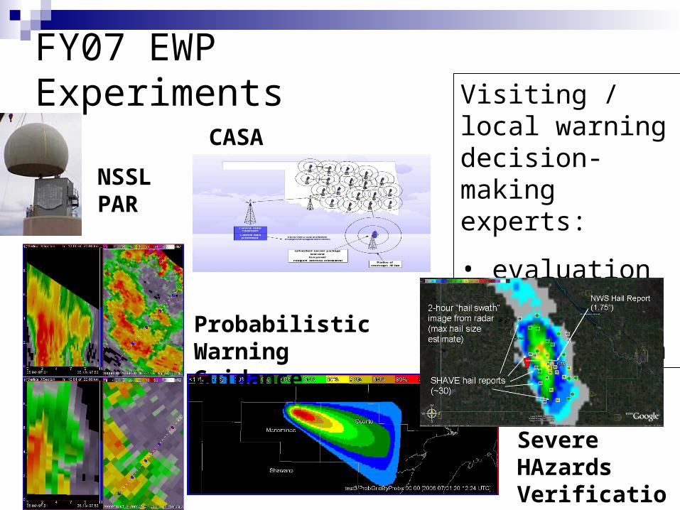
FY07 EWP Experiments
NSSL PAR
CASA
Probabilistic Warning Guidance
Visiting / local warning decision- making experts:
• evaluation
• collaboration
Severe HAzards Verification Experiment
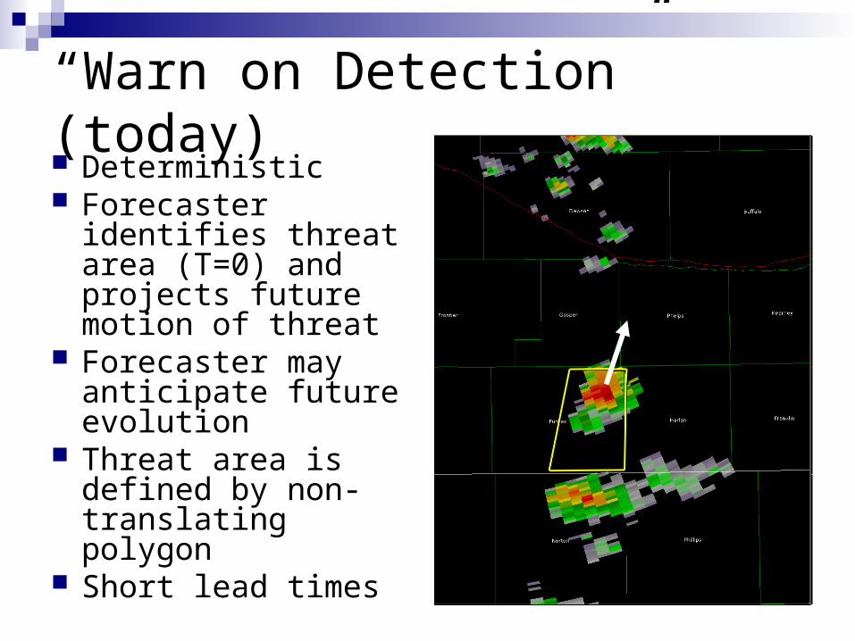
“Warn on Detection” (today) Deterministic Forecaster identifies
threat area (T=0) and projects future motion of threat
Forecaster may anticipate future evolution
Threat area is defined by non-translating polygon
Short lead times
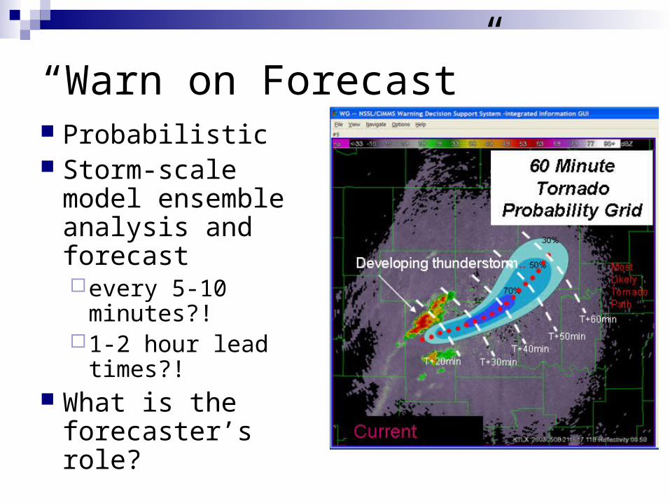
“Warn on Forecast” Probabilistic Storm-scale model
ensemble analysis and forecastevery 5-10
minutes?! 1-2 hour lead
times?! What is the
forecaster’s role?
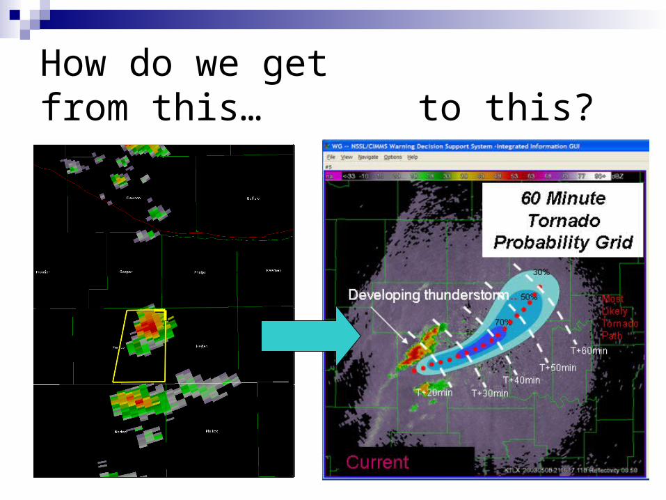
How do we getfrom this… to this?
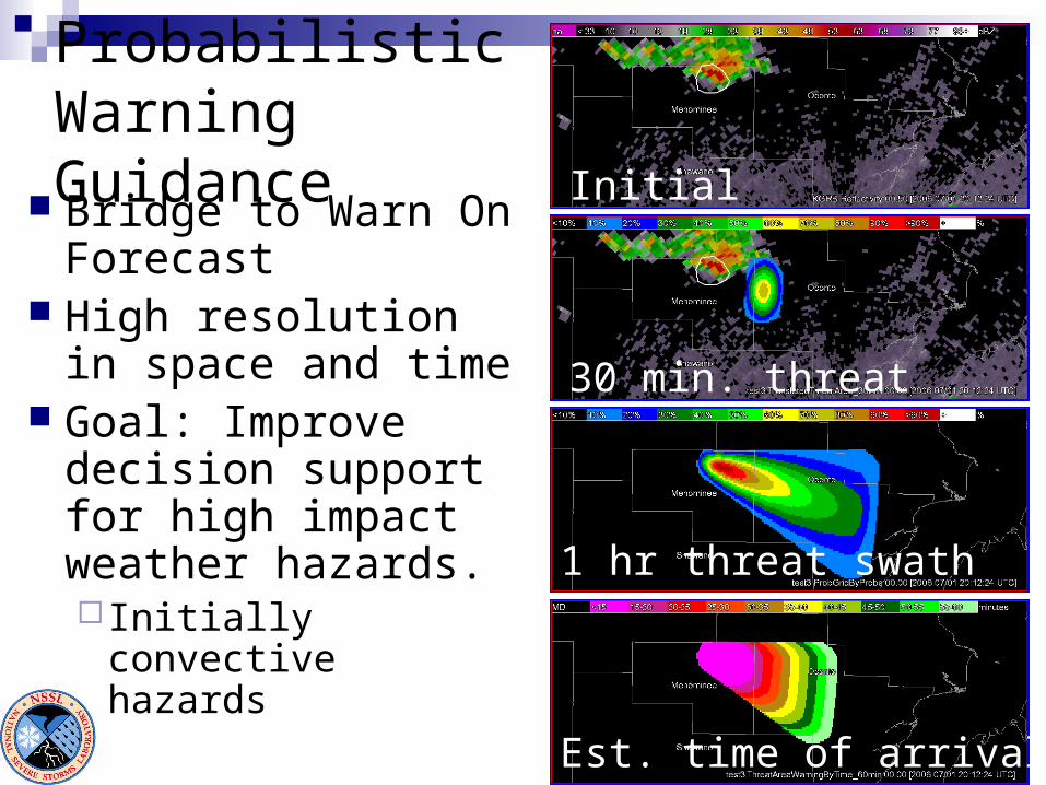
Probabilistic Warning Guidance
Bridge to Warn On Forecast
High resolution in space and time
Goal: Improve decision support for high impact weather hazards. Initially convective
hazards
Initial threat area
30 min. threat probability
1 hr threat swath (accum)
Est. time of arrival
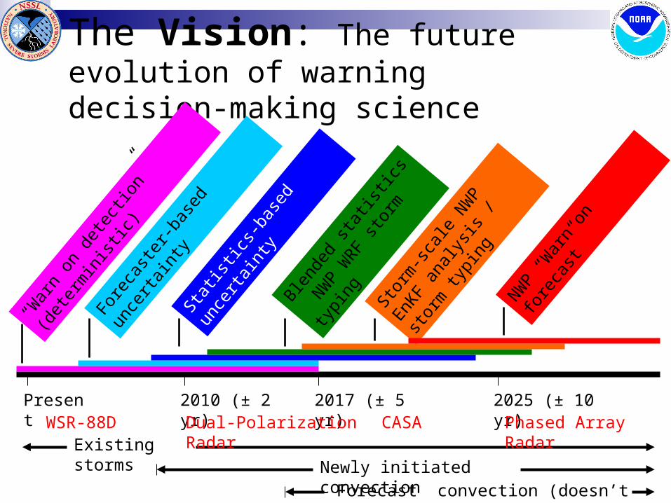
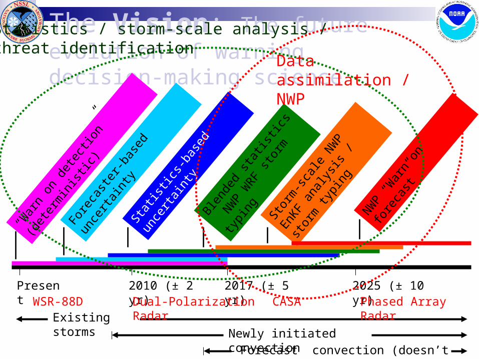
The Vision: The future evolution of warning decision-making science
Fore
cast
er-b
ased
unc
erta
inty
“War
n on
det
ectio
n” (d
eter
min
istic)
Blend
ed s
tatis
tics
NWP W
RF st
orm
typi
ng
Statis
tics-
base
d un
certa
inty
NWP “W
arn
on fo
reca
st”
Storm
-sca
le N
WP E
nKF
anal
ysis
/ sto
rm ty
ping
Existing stormsNewly initiated convection
Present 2010 (± 2 yr) 2017 (± 5 yr) 2025 (± 10 yr)
Forecast convection (doesn’t yet exist)
WSR-88D Dual-Polarization Radar Phased Array RadarCASA
Statistics / storm-scale analysis /threat identification
Data assimilation / NWP
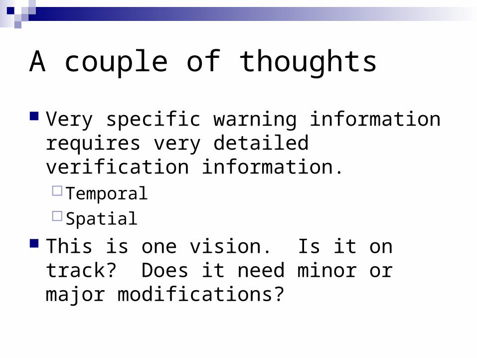
A couple of thoughts
Very specific warning information requires very detailed verification information.TemporalSpatial
This is one vision. Is it on track? Does it need minor or major modifications?
Acknowledgements
HWT leadership: Mike Foster, Jeff Kimpel, Joe Schaefer, Jack Kain, Steve Weiss, David Andra, Travis Smith
2007 Project PIs, EWP Coordinators, Weather Briefers, and Evaluators: Jerry Brotzge, Don Burgess, Patrick Burke, John Ferree, Brad Grant, Pam Heinselman, Angelyn Kolodziej, Jim Ladue, Les Lemon, Kevin Manross, Mike Magsig, Dan Miller, Steve Nelson, Kiel Ortega, Brenda Philips, Liz Quoetone, Kevin Scharfenberg, Paul Schlatter, Dave Sharp, Greg Stumpf, Arthur Witt, and anyone who I inadvertently left out.