Embed Size (px)
Citation preview
JointDanubeSurvey 2
The Joint Danube Survey 2Research Expedition and Conclusions
ImprintPublished by ICPDR – International Commission for the Protection of the Danube RiverVienna International Centre, D0412, PO BOX 500, 1400 Vienna, Austria
Publication Coordination: Jasmine BachmannEditor: Paul CsagolyScience Editor: Igor LiskaConcept / Layout: Büro X Wien, www.buerox.at
© ICPDR 2008, www.icpdr.org
Supported by the Danube Countries, European Commission
JDS2 Core Team
Igor Liska, JDS2 Manager
Jaroslav Slobodnik, Technical coordinator
Bela Csanyi, Team leader
Wolfram Graf, Biologist – macrozoobenthos expert Upper Danube
Patrick Leitner, Biologist – macrozoobenthos expert Upper Danube
Momir Paunovic, Biologist – macrozoobenthos expert Lower Danube
Jarmila Makovinska, Biologist – phytobenthos expert
Martin Dokulil, Biologist – phytoplankton expert
Christina Kaiblinger, Biologist – phytoplankton expert
Brigitte Schmidt, Biologist – macrophytes expert
Gabriel Chiriac, Biologist – general hydrobiology
Mary Craciun, Chemist – suspended solids sampling
Carmen Hamchevici, Chemist – on-board analyses
Hana Hudcova, Chemist – water sampling, sediment processing, radiology
Wolfgang Kraier, Expert in hydromorphology
Ulrich Schwarz, Expert in hydromorphology
Alexander Kirschner, Microbiologist
Branko Velimirov, Microbiologist
Richard Niederreiter, Air-lift sampling expert
Stefan Steiner, Air-lift sampling expert
Fish Team
Christian Wiesner, Team leader and fish expert
Niels Jepsen, Team leader and fish expert – JRC Ispra
Nikolaus Schotzko, Fish expert
Gabor Guti, Fish expert
Grigore Davideanu, Fish expert – Lower Danube
Jaroslav Cerny, Fish expert
Reserve Core Team
Matus Haviar, Biologist – macrozoobenthos expert
Thomas Ofenbock, Biologist – macrozoobenthos expert
Laurentia Ungureanu, Biologist – phytoplankton expert
Eva Lanz, Biologist – macrophytes expert
Zoran Stojanovic, Chemist
Violeta Astratinei, Microbiologist
Nemanja Milosevic, Microbiologist
JDS2 Managerial and Administrative Team
Jasmine Bachmann, Public participation and public relation
Paul Csagoly, Communications and editing
Alexander Hoebart, Information manager
Anna Koch, Financial officer
Patricia Faltusova, Administrative support
Marcela Fabianova, Administrative support
JDS2 National Coordinators
DE Ursula Schmedtje, National Coordinator
DE Jürgen Seibold, Deputy
DE Birgit Wolf, Deputy
AT Wolfgang Rodinger, National Coordinator
AT Franz Wagner, Deputy
CZ Ilja Bernardova, National Coordinator
CZ Monika Machkova, Deputy
SK Jarmila Makovinska, National Coordinator
SK Livia Tothova, Deputy
HU Ferenc Laszlo, National Coordinator
HU Ildiko Horvathne-Kiss, Deputy
HR Dagmar Surmanovic, National Coordinator
HR Marija Marijanovic-Rajcic, Deputy
RS Marija Kostic, National Coordinator
RS Momir Paunovic, Deputy
BG Tzvetanka Dimitrova, National Coordinator
BG Mina Asenova, Deputy
BG Dimitar Vergiev, National Coordinator
BG Hristo Kasadzhikov, Deputy
BG Ivan Ivanov, Deputy
RO Gabriel Chiriac, National Coordinator
RO Liviu Popescu, Deputy
RO Serban Iliescu, Deputy
RO Teodor Lucian Constantinescu, Deputy
MD Gavril Gilca, National Coordinator
UA Oleksander Deziron, National Coordinator
UA Yuriy Nabyvanets, Deputy
UA Valerii Kasianchuk, Deputy
JDS2 Supporting Experts
DE Heinz-Jurgen Brauch
DE Volker Mohaupt
DE Frank Sacher
DE Peter Seel
DE Manfred Sengl
AT Martha Simon
AT Andeas Farnleitner
AT Thilo Hofmann
AT Oliver Gans
AT Gerhard Kavka
AT Veronika Koller-Kreimel
AT Franz Josef Maringer
AT Wolfgang Papesch
AT Dieter Rank
CZ Vera Ocenaskova
CZ Michal Pavonic
HU Keszler Balasz
HU Peter Literathy
HU Katalin Zsuga
RS Vesna Micic
RO Ioana Enache
UA Sergiy Afanasyev
EU Eugen Christoph
EU Bernd Gawlik
EU Anna-Stiina Heiskanen
EU Robert Loos
EU Giulio Mariani
EU Gunter Umlauf
EU Jan Wollgast
IAEA Brent Newman
IAEA Tomas Vitvar
JDS2 National Key Fish Experts
DE Andreas Kolbinger
HR Perica Mustafic, Marko Caleta
AT Nikolaus Schotzko
RS Predrag Simonovic
CZ Zdenek Adamek
RO Grigore Davideanu
SK Jaroslav Cerny, Vladimir Kovac
BG Stoyan Mihov
HU Gabor Guti
UA Yevgen Savchenko
Acknowledgements
3
Table of Contents
A Message from the ICPDR Executive Secretary 5
About the Joint Danube Survey 2 6
What is the Joint Danube Survey 2? 6
Why is the JDS2 so important? 6
The History of Danube Monitoring 6
What were the Results from the JDS1? 6
JDS2 Partners and Cooperation 8
JDS2 Route and Stops 8
The Danube and Pollution – Is the Danube Blue? 9
Danube Pollution and the EU Water Law 10
Hydromorphology – Around the Water, not in it 10
Essential for the Future – the JDS2 11
The JDS2 Boat Expedition – Nobody Said it Would Be Easy 12
JDS2 Final Scientific Results 15
Background 15
Biology 16
Chemistry 22
Hydromorphology 27
New Techniques and Technologies 29
Overall Conclusions from the JDS2 31
JDS2 Overview Map 34
Glossary 38
Acknowledgements 39
5
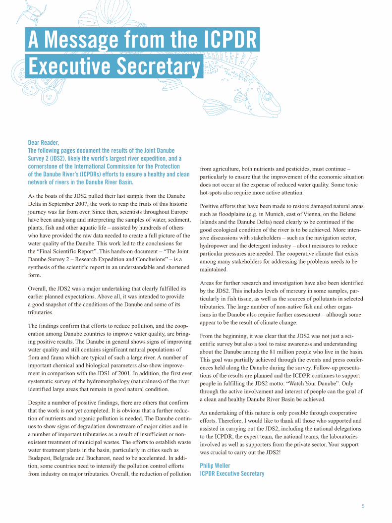
Dear Reader, The following pages document the results of the Joint Danube Survey 2 (JDS2), likely the world’s largest river expedition, and a cornerstone of the International Commission for the Protection of the Danube River’s (ICPDRs) efforts to ensure a healthy and clean network of rivers in the Danube River Basin.
As the boats of the JDS2 pulled their last sample from the Danube Delta in September 2007, the work to reap the fruits of this historic journey was far from over. Since then, scientists throughout Europe have been analysing and interpreting the samples of water, sediment, plants, fish and other aquatic life – assisted by hundreds of others who have provided the raw data needed to create a full picture of the water quality of the Danube. This work led to the conclusions for the “Final Scientific Report”. This hands-on document – “The Joint Danube Survey 2 – Research Expedition and Conclusions” – is a synthesis of the scientific report in an understandable and shortened form.
Overall, the JDS2 was a major undertaking that clearly fulfilled its earlier planned expectations. Above all, it was intended to provide a good snapshot of the conditions of the Danube and some of its tributaries.
The findings confirm that efforts to reduce pollution, and the coop-eration among Danube countries to improve water quality, are bring-ing positive results. The Danube in general shows signs of improving water quality and still contains significant natural populations of flora and fauna which are typical of such a large river. A number of important chemical and biological parameters also show improve-ment in comparison with the JDS1 of 2001. In addition, the first ever systematic survey of the hydromorphology (naturalness) of the river identified large areas that remain in good natural condition.
Despite a number of positive findings, there are others that confirm that the work is not yet completed. It is obvious that a further reduc-tion of nutrients and organic pollution is needed. The Danube contin-ues to show signs of degradation downstream of major cities and in a number of important tributaries as a result of insufficient or non-existent treatment of municipal wastes. The efforts to establish waste water treatment plants in the basin, particularly in cities such as Budapest, Belgrade and Bucharest, need to be accelerated. In addi-tion, some countries need to intensify the pollution control efforts from industry on major tributaries. Overall, the reduction of pollution
from agriculture, both nutrients and pesticides, must continue – particularly to ensure that the improvement of the economic situation does not occur at the expense of reduced water quality. Some toxic hot-spots also require more active attention.
Positive efforts that have been made to restore damaged natural areas such as floodplains (e.g. in Munich, east of Vienna, on the Belene Islands and the Danube Delta) need clearly to be continued if the good ecological condition of the river is to be achieved. More inten-sive discussions with stakeholders – such as the navigation sector, hydropower and the detergent industry – about measures to reduce particular pressures are needed. The cooperative climate that exists among many stakeholders for addressing the problems needs to be maintained.
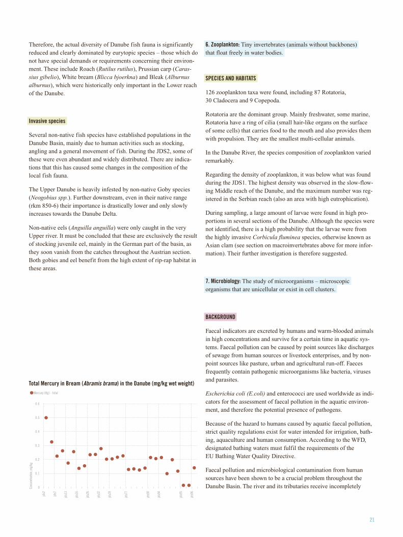
Areas for further research and investigation have also been identified by the JDS2. This includes levels of mercury in some samples, par-ticularly in fish tissue, as well as the sources of pollutants in selected tributaries. The large number of non-native fish and other organ-isms in the Danube also require further assessment – although some appear to be the result of climate change.
From the beginning, it was clear that the JDS2 was not just a sci-entific survey but also a tool to raise awareness and understanding about the Danube among the 81 million people who live in the basin. This goal was partially achieved through the events and press confer-ences held along the Danube during the survey. Follow-up presenta-tions of the results are planned and the ICDPR continues to support people in fulfilling the JDS2 motto: “Watch Your Danube”. Only through the active involvement and interest of people can the goal of a clean and healthy Danube River Basin be achieved.
An undertaking of this nature is only possible through cooperative efforts. Therefore, I would like to thank all those who supported and assisted in carrying out the JDS2, including the national delegations to the ICPDR, the expert team, the national teams, the laboratories involved as well as supporters from the private sector. Your support was crucial to carry out the JDS2!
Philip Weller ICPDR Executive Secretary
A Message from the ICPDR Executive Secretary
What is the Joint Danube Survey 2?
The Joint Danube Survey 2, also known as the “JDS2”, was organised by the International Commission for the Protection of the Danube River (ICPDR) and is likely the world’s biggest river research expe-dition ever. Its main goal was to produce highly comparable and reli-able information on water quality and pollution for the entire Danube River and many of its tributaries.
The JDS2 was officially launched on August 14, 2007, in Regens-burg, Germany. In total, a distance of 2600 km of the Danube River was assessed, 2,415 km of which were completed by the three boats of the JDS2 travelling from Kelheim, Germany, through 10 countries, to the Danube Delta in Romania and Ukraine until late September.
Why is the JDS2 so important?
Water pollution is a major problem in the Danube River Basin. Danube governments need to make sound decisions about what future measures they will take to reduce Danube pollution and improve ecological health. This will help them to meet their obliga-tions to implement the Danube River Protection Convention, which they signed in 1994, as well as the EU Water Framework Directive – possibly the world’s strongest water legislation. Nutrient, organic and hazardous pollution are all factors that could result in their fail-ing to meet the requirements of this EU law.
As a basis for their sound decision-making, Danube countries need high quality and comparable data and information. The JDS2 follows up on, and provides comparative results for, the work done during the first Joint Danube Survey (JDS1) in 2001. The JDS2 also expands on the JDS1 by adding new parameters and sampling locations, and key Danube tributaries were tested for the first time. The collected information enables the ICPDR to have some of the most progressive river databases anywhere in the world – for example, information on thousands of species dependent on the river.
The History of Danube Water Monitoring
The Danube has an extensive history of water quality monitoring. It began with the 1985 “Bucharest Declaration”, which led to a series of fixed monitoring stations being designated for providing information on water quality in the basin. Based on this network, the Trans-National Monitoring Network (TNMN) for the Danube River Basin was designed in 1992 and officially launched in 1996. Coor-dinated by the ICPDR, it now comprises over 75 monitoring stations and provides a regular overview of the main chemical and physical parameters important for assessing water quality. Supplementing the regular monitoring over the last 25 years, other expeditions have navigated and evaluated the Danube including the Equipe Cousteau in 1993, the Burgund Survey in 1998 and the Aquaterra Danube Survey in 2004 – however, these only focused on certain stretches of the Danube or limited parameters. In 2001, the JDS1 was the first expedition to test the entire length of the Danube River and produce comparable, quality results.
What were the results from the JDS1?
The JDS1 in 2001 had a mix of positive and negative results. On the positive side, it found high levels of biodiversity and rare species. On the negative side, results showed areas where organic and micro-biological pollution, heavy metals, oil from ships, pesticides and chemicals were of concern. At the same time, significant awareness was raised about the Danube and the need for pollution reduction measures. Followed by journalists and TV crews, it usually made it into the headlines of major newspaper, radio broadcast and TV news. At many locations where the boats stopped, public events were held with messages about recent national and local efforts made to reduce pollution.
About the Joint Danube Survey 2
7
JDS2 Partners and Cooperation
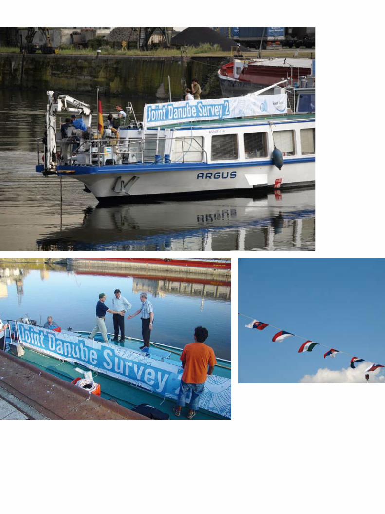
The JDS2 expedition also attracted significant international coopera-tion from all Danube countries from Germany to Ukraine, including EU and non-EU members. The full-time International Team travel-ling the entire length of the Danube included 18 scientists from Ger-many, Austria, Czech Republic, Slovakia, Hungary, Serbia, Romania and Denmark. The Team used three boats donated from different countries and institutions: Serbia’s Argus served as the main research vessel; Hungary’s Széchenyi ice-breaker provided accommodation for the cruise team and carried cargo and supplies; and the small ship Vienna 115, chartered by the EU Commission’s Joint Research Cen-tre in Ispra, Italy, assessed fish fauna. Teams of national scientists also helped with sampling and testing on board the ships on river stretches within their countries.
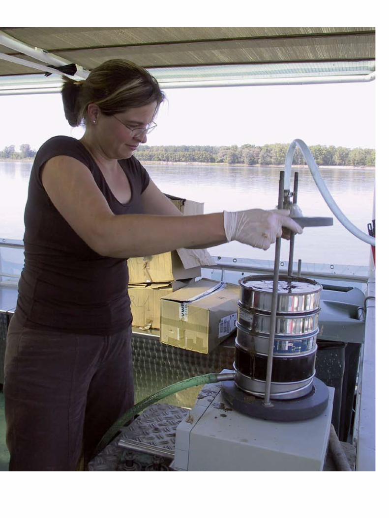
Some of the actual scientific testing took place en route, from analyzsing water samples in the Argus’s own laboratory to electro-fishing along the Danube’s banks. Other samples were sent to labo-ratories throughout Europe for testing – all centres of excellence for particular water quality parameters. Significant support was provided by private sector companies operating in the Danube Basin inclu-ding the Alcoa Foundation, Kommunalkredit Austria, Dexia Kom-munalkredit Bank and Coca-Cola Hellenic. Finally, local authorities and the media living near the Danube helped in raising awareness and concern about Danube pollution and the need for everyone to participate in making it clean and healthy.
JDS2 Route and Stops
On the Danube River there were 96 sampling stations tested covering 10 countries. Samples were also taken from 28 additional stations on the following tributaries: Morava, Drava, Tisza, Sava, Velika Morava, Arges, Olt, Iskar, Rusenski Lom, Jantra and Prut. Sampling at JDS2 monitoring sites included samples of: water, sediment, biology, sus-pended solids, mussels and fish, each taken from the middle and left and right sides of the station cross-sections.
Ten cities were also visited by the expedition. These included an official launch ceremony in Regensburg (Germany) on August 14 and public events in Vienna (Austria), Bratislava (Slovakia), Buda-pest (Hungary), Osijek (Croatia), Belgrade (Serbia), Turnu Severin (Romania), Ruse (Bulgaria), Vilkovo (Ukraine) and Tulcea (Romania).
9
Is the Danube blue?
Depending on the light, location and time of day, the Danube River may appear blue. More typically, however, it looks like a mix of green and brown, with varying underwater visibility. Does this mean that it is polluted? At the particular place you are looking into, not necessarily. But in general, pollution is a problem for the Danube Basin with large variations between locations, and between the main Danube River and its tributaries.
Poorly treated wastewater remains a problem, especially for tributar-ies, according to the “Danube River Analysis 2004” of the ICPDR. The report was the first-ever comprehensive analysis of the Danube Basin’s environment and pressures impacting it. Much of the infor-mation that fed into the report actually came from the first JDS1 in 2001. The report identified main pollution sources to be municipali-ties, industry and agriculture, from both point sources (e.g. pipes) and non-point sources (e.g. agricultural fields and animals).
Overall pollution was found to be declining, mainly because of the drop in industry and agriculture in Central and Eastern Europe (CEE) following political transformations in the late 1980s, but also as a result of investments in pollution control. However, with expected economic improvements in these countries, pollution could increase again. And overall, pollution still causes water quality problems.
Nutrient Pollution
Nutrient pollution, mainly from nitrogen and phosphorus, dropped in the past 20 years. But levels are still almost twice those in the 1950s. Nitrogen use doubled from the 1950s to the mid-1980s followed by a substantial reduction in the 1990s mainly due to economic changes in CEE and improved wastewater treatment in Germany and Austria (and lower scale improvements in other Danube Basin countries). Today, agricultural nitrogen mineral fertilisers and raising livestock are main contributors. The main source of phosphorus in the basin is wastewater from urban settlements. Overall phosphorus levels are 20 % higher than in the 1950s.
The biggest impact from nutrient pollution is eutrophication, which eventually leads to the reduction of oxygen in the water, decreases plant and animal species and worsens water quality. As a result, Danube nutrient pollution has helped create a severe ecological imbalance in the Black Sea (into which the Danube flows at its end).
Hazardous Substances
The Danube River Basin Analysis 2004 also showed that hundreds of hazardous substances are used and released in the Danube Basin. Many pose serious threats to the environment and health. These include a variety of pesticides used for producing cereals, rapeseed, sunflowers, maize, orchard fruits and grapes. A number of hazardous substances have been banned or are being phased out but many have been left in old stockpiles, some in flood-prone areas.
Pesticides are a serious risk in the Danube, and their levels generally increase as you go downstream. “Alarming concentrations” were found in some tributaries and in the lower main branch of the Dan-ube, according to the Danube River Basin Analysis 2004. Since the 1990s, pesticide use has declined by 40 %, but increases are expected with expanded economic developments.
The Danube and Pollution – Is the Danube Blue?
The Danube countries are committed to improving the quality of Danube waters. The European Water Framework Directive (WFD)– possibly the world’s strongest water legislation – is legally binding for EU member states and is also being used by non-EU countries in the Danube Basin. Its goals are to ensure that rivers and lakes not only have clean waters (i.e. “good chemical status”) but also “good ecological status” by 2015.
The latter goal of “good ecological status” is awarded if rivers and lakes provide good conditions such as migration routes and suitable habitats for natural species to live healthily, and the larger ecosystem is sustained. In other words, it is not enough just to have clean water available for drinking... without anything living in it. For example, many types of fish need natural sand or gravel banks for spawning and breeding – a habitat that may not be available along a fully engi-neered stretch of river that might happen to have “clean water”.
Furthermore, the WFD requires countries to apply “river basin man-agement” as the main tool to reach the objectives of the WFD, and to develop a River Basin Management Plan by 2009 which spells out what measures the countries will take to meet the WFD by 2015.
As an initial part of this process, EU countries had until 2004 to assess the degree to which water bodies within their boundaries were at risk of failing to meet the directive’s objectives in relation to four risk categories: organic pollution, hazardous substances, nutrients and hydromorphological alterations (see section below on hydromor-phology). The results showed that significant problems existed for which additional monitoring and actions are needed. The commit-ment of the countries to carry out the JDS2 was part of the initiative to improve the understanding of the problems and identify possible solutions.
The survey and assessment of the “hydromorphology” of the Danube was a completely new task for the JDS2. The task was carried out because the WFD requires EU river systems to have a “good eco-logical status” by 2015, and because good water quality alone is not sufficient to pass the EU test. “Hydromorphology”, as defined by the WFD, is the physical characteristics of the shape, the boundaries and the content of a water body.
To have good ecology, the Danube and its tributaries must, for exam-ple, serve as habitats for characteristic animals and plants, and there-fore provide typical structures required for such habitats. Examples include various forms of river beds and banks, variations in river depth and width, near-natural bank vegetation, dynamic water flows and natural connections with floodplains.
Since the 16th century, people have been changing the natural course of the rivers in the Danube River Basin, mainly for hydropower generation, flood defence and navigation. All these changes affected the ecological quality of the rivers. These changes have reduced the naturalness of the Danube and its tributaries. An evaluation of hydro-morphology during the expedition was therefore of great importance.
Danube Pollution and the EU Water Law
“Hydromorphology” – Around the Water, not in it

11
The Danube countries, under the coordination of the ICPDR, continue to be extremely busy with the production of the “Danube River Basin Management Plan”, required by the EC by 2009 – next year! This work includes significant efforts to identify what measures will be needed to reduce pollution, as well as to restore and protect natural habitats where possible and where required.
New and updated information for this decision-making process is essential, with all countries regularly sampling and testing water quality and pollution in Danube Basin waters, and assessing and exchanging data, to see what is getting better and what is getting worse.
That is exactly why the JDS2 was needed – to bring a wealth of new information to the countries to help them better prepare and plan. And that is exactly what happened, as the next pages will show.
Essential for the Future – the JDS2
Despite initial setbacks and some serious challenges on route, the largest Danube research expedition ever finished two days ahead of schedule. Collecting essential information as well as invasive and new species, the JDS2 also managed to raise public interest about the river, its assets and problems.
If the going is tough at the beginning of a voyage, it doesn’t neces-sarily mean that the end is doomed. Sometimes, the opposite happens.
Days before the “JDS2” expedition was even launched, heavy rains forced Hungary’s Széchenyi ship (with cargo, beds and kitchen) to stop 70 km downstream from the launch city of Regensburg, Ger-many. Soon after, fast opposing waters led to Serbia’s Argus research ship arriving at the sampling station in Kelheim, Germany, in late night darkness, forcing it to tie up at a private dock, and its scientific team to take taxis back to Regensburg. At 5:30 the next morning, they drove back to the Argus and started sampling. That was only Day 1 with 43 days left!
“For the first few sampling days, many scientists didn’t know where their equipment was,” said JDS2 Team Leader Béla Csányi. “They were supposed to have boarded and searched the Széchenyi in Regensburg, but the rains prevented that.” The situation in the Argus laboratory also proved difficult. “At first, our chairs weren’t adjust-able so many of us looked like giraffes stretching our necks to be able to look down the equipment,” said Austrian biologist Christina Kaiblinger. Well, nobody said it would be easy.
Once the ships reached Krems, Austria, the situation had changed for the better. “Now we know where everything is and our work is get-ting better every day,” said Csányi. The crew had caught up on sleep, sampling times had improved (usually to three stations a day), the chemists had new, adjustable lab seats and the Austrians had a small fridge full of local survival aids – muesli, yogurt and chocolate.
New species
Over the next few weeks, the scientific teams made many fascinat-ing scientific discoveries. “The expedition is rich in new data,” said Csányi. “We’re finding animals never found before.”
Early on in Germany, the mass emergence of the mayfly Ephoron virgo, occurring only a few days each year, was observed. “Bridges and ships were covered by millions of these insects which were
attracted by artificial lighting,” said Austrian biologist Patrick Leitner. “Standing near the lanterns was like being in a snow shower.” As the mayfly had disappeared for decades in the 20th century due to water pollution, its return was a good sign.
Sampling revealed that some invasive Gobi species, a fish from the Black Sea, had moved up the river all the way to Niederalteich in Germany. The only sampling station where they were not found was upstream from Kelheim, Germany. They are now even more abun-dant in the Upper than in the Lower reach of the Danube River, due to bank enforcements with “rip-rap” (basically large boulders that have been artificially placed to fix riverbanks). “The population of the Gobi pest in the German and Austrian Danube has been explod-ing over the last 15 years,” said Fish Team Leader Christian Wiesner.
Findings in Slovakia and Hungary included the red-list endangered water fern Ricciocarpos, and the “meat-eating” Utricularia – a criti-cally endangered plant on Hungary’s red list, and never officially detected before in Slovakia’s Danube. Water hyacinth (Eichhornia crassipes), alien fast-growing floating water plants often forming dense “river rafts” that cause problems for boat navigation, were also seen in Hungary.
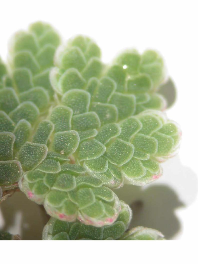
Near Ilok in Croatia, the floating aquatic fern Azolla was identi-fied for the first time in the Danube, confirming higher Danube temper-atures for 2007. At the Serbian mouth of the Tisza River, a small JDS2 boat almost became stuck in a thick green carpet of duckweed stretching out over some 3 km. In Serbia, a few individu-als of the smallest flowering plant in the world (Wolffia) were found, as was green algae (Spirogyra) in its reproducing stage – very rarely observed in nature.
In Romania in the Iron Gate dam reservoir, rare and originally marine needle fish (Syngnathus abaster) were seen – known to exist sparsely in the Danube Delta, they had never been observed this far upstream before. Also in Romania, the very rare snail Theodoxus transversalis was found. Csányi, who has investigated the Danube for nearly his entire life, had not found a living specimen of this snail over the last decade. And an unidentifiable Crustacean that was com-pletely white, with small eyes, apparently adapted to dig in sandy substrates, was also found.
“The amount of additional information that will result from the JDS2 is quite incredible,” said ICPDR Executive Secretary Philip Weller.
The JDS2 Boat Expedition – nobody said it would be easy
13
Never a dull moment
It would be misleading to say that challenges ended in the first week of the expedition. “The JDS2 is the most difficult survey on the Danube that I was involved in so far,” says Romanian chemist Carmen Hamchevici, who participated in three earlier surveys including the JDS1. “There were so many different types of samples and analyses required, and sample delivery has also been quite complex. But the invisible bond among the core team members makes all the difficulties become the nicest memories.”
For the “Chemical Trio” – including Carmen, Romania’s Mary Craciun and the Czech Republic’s Hana Hudcova – work in the Argus lab usually lasted until midnight, processing samples to be sent for analyses to on-land laboratories and carrying out on-board analyses. Considering only the chemical analyses required at one sampling site, more than 20 different bottles, flasks and vessels had to be carefully prepared and labelled!
“For a microbiologist, it was a lot of work,” said Austria’s Alexander Kirschner from the Argus lab. “It required about three hours per sampling station with two to four stations per day under deck. There were not many possibilities to enjoy the landscape.”
The Day of DisastersOne particularly noteworthy day was August 29, the “Day of Disasters”, when the equipment lifting the airlift sediment sampler and the power supply on board the Argus stopped. This prevented the pumps from delivering regular water samples and disabled the crane from lifting a smaller sampling boat in and out of the water. On other days the breakdown of the centrifuge needed for microbiological analyses, the sieves used for sampling sediments and the Vienna 115 “electro-fisher” for collecting fish caused difficulties. Then there were the heavy winds, cold, rain, waves and late hours (especially for the Fish Team’s night sampling). In Bulgaria, fierce waves hurled a small sampling boat against the concrete banks. In Slovakia’s Gabcikovo reservoir, the waves made by a very unfriendly nearby boat severely rocked the Vienna 115 and its crew and led to the loss of an anchor and tools from the deck.
Making the news
The JDS2 stopped at 10 cities where local and national authorities organised events and, in most cases, press conferences. These typically included JDS2 team members, the ICPDR and local and national authorities including high-level officials such as Austrian Minister for Environment Josef Pröll. Press conferences were followed by demonstrations on board the ships.
“We want the Danube to be one of the most important rivers in Europe and the world,” said Hungarian Environment Ministry State Secretary Kálmán Kovács at the press conference in Budapest. In Belgrade, the city’s Chief Architect Dorde Bobic said that the JDS2 work was key to helping the city’s efforts in making the local Rapno Island cleaner and more attractive to residents and tourists.
“The news reached the biggest newspapers and radio and TV stations in each country, so that more people than ever now know about the importance of the Danube and what their governments are doing to improve the situation,” said Lucia Ana Varga, ICPDR President 2007 and Romanian State Secretary in the Ministry of Environment and Sustainable Development. Widespread international coverage included a BBC World TV news spot, a Reuters video and articles in the International Herald Tribune and Associated Press.
Raising public awareness about the Danube was one of the JDS2 main goals from the start. Public events and media efforts were com-plemented by the ICPDR’s coordination of a “Watch your Danube’ campaign, which included a website posting daily ship diary entries and results, fact sheets, posters and leaflets – all for translation and distribution by Danube governments.
Two days ahead of schedule!
On September 25, the ships reached the Black Sea – a first for many of the Széchenyi’s sailors who celebrated with “baptisms” of poured saltwater. On the 26th, the team collectively decided to press on to the last site, 96 at St. Gheorghe, Romania, even though it was sched-uled for sampling only two days later! “There was an indescribable enthusiastic feeling among the entire scientific team and crew,” said Csányi. They had successfully sampled all 96 sites on the Danube River and 28 on its tributaries. The journey from Kelheim, Germany, was completed. It was over.
On the September 27,, the official end of the survey was held in Tulcea, Romania, headed by Romania’s Lucia Ana Varga, including a final cere-mony, traditional folk music and dancing. “We are all tired, but we are happy,” said Slovak biologist Jarmila Makovinska. “And a little bit sad. We all became a very close group.”
“It’s hard to believe we’re finally in Tulcea, looking back at all the difficulties we had to go through,” said JDS2 Technical Coordina-tor Jaroslav Slobodnik, the human link between all of the tasks that needed to be done between ship and land. “It’s almost a miracle that we did it.”
You can read daily stories and the full diary about the expedition on the ICPDR website at: www.icpdr.org/jds/diary, and see the media coverage at www.icpdr.org/jds/press.
Thank-you, National Teams!“The work of the National Teams is a very serious activity parallel to the work of the JDS2 Core Team,” said JDS2 Technical Coordinator Jaroslav Slobodnik. “Besides providing us with valuable assistance on the JDS2 boats, National Teams take samples at tributaries in their countries. They also sample at some of the same places where the “official” JDS2 samples are taken, then testing them at their own national labs. The results from the national and JDS2 labs can then be compared, which is important to ensure result and test validity.” He added that National Team scientists were always there to greet the JDS2 boats as they arrive at the border of a new country, often coming on board to start helping with the day’s work.
15
BACkGROUND
After the actual boat expedition down the Danube ended, analyses of all the collected samples were made by scientists in laboratories and offices throughout the European continent for over 10 months, coordinated by the ICPDR. This led to a number of overall conclu-sions. However, it’s important to note that, even though many con-clusions were reached, the process is not over. Scientists continue to analyse the findings to come up with new insights and connections… basically as science itself progresses. Much of the work done during the JDS2 was not just new for the Danube – much of it was new for Europe and even for the world.
The information that follows is taken from the “Final Scientific Report”, a thick and technical document full of scientific terms and Latin names that provides a comprehensive assessment about the status of a number of parameters that needed to be measured to fulfil WFD requirements. The Scientific Report is understandable for scientists, but a member of the general public would have a difficult time getting through it.
For this reason, this shorter “public brochure” was created. It is hoped that this will give you a very good idea of what was found out, within a short amount of time and space. While the information that follows will not tell you everything that was assessed during the JDS2, it does try to give you an overall snapshot with highlights, and definitions of complicated scientific terms (See the Glossary at the end of the document for help).
YOUR “kEY” TO USING THE RESULTS
The overall scientific results are divided into three sections:
1. Biology2. Chemistry3. Hydromorphology
A colour scheme shows you how the information is structured:
· Definitions of terms
· How well the Danube River Basin appears to meet, or not to meet, the requirements of the EU (WFD), especially in terms of meeting the goals of “good chemical and ecological status”.
· Information about some of the interesting species and habitats that were found and assessed during the expedition.
· Results and additional interesting information.
Important to know about the WFD
The EU Water Framework Directive (WFD) defines five “classes” for surface water status, from class I to V, with class I being the best. The classes are high, good, moderate, poor or bad. The ambition of the WFD is to achieve a “good water status” by 2015. “Good water status” refers to both chemical and ecological status. Finally, under the WFD, environmental quality standards (EQS) refer to commonly agreed concentration levels that are acceptable for “good chemical status”, used by scientists as toxicity indicators.
A NOTE ABOUT NUTRIENT POLLUTION AND EUTROPHICATION
In the Danube Basin, eutrophication is a negative consequence of human pressures such as agriculture and human waste. It is caused by an increase in nutrient pollution – typically compounds contain-ing nitrogen or phosphorus – in an ecosystem which increases exces-sive plant (e.g. phytobenthos such as algae) growth and decay. This then leads to a lack of oxygen and severe reductions in water quality and fish and other animal populations.
Nutrient pollution is one of the significant water management issues in the Danube Basin, having an impact also on the Danube Delta and Black Sea. According to the results of the Danube River Basin Analy- sis 2004, many water bodies across the basin are at risk of failing to meet the WFD’s “good ecological status” objectives due to “nutrient pollution”. Specifically, 55% of the Danube River and 49% of the Danube tributaries were “at risk” or “possibly at risk” due to nutrient pollution by 2004.
According to the WFD, a major requirement for the good ecologi-cal status of rivers and lakes is that “changes do not indicate any accelerated growth of [algae,] phytobenthos or higher forms of plant life resulting in undesirable disturbance to the balance of organisms present in the water …”. As the primary focus of the WFD is on the biological effects resulting from elevated nutrient levels, high nutrient concentrations alone, without the corresponding biological impacts, will not result in the downgrading of the ecological status of the river. Therefore, to meet the requirements of the WFD, biological information is also required.
JDS2 Final Scientific Results
THE DANUBE HAS THREE “REACHES”
The Danube River is divided into three main sections or “reaches” – Upper, Middle and Lower. The Upper Danube is from the Danube’s source in Germany to the “Porta Hungarica”, where the Alps’ eastern foothills connect with the Carpathian Mountains below the conflu-ence of the Danube and Morava rivers east of Vienna. The Middle Danube flows from the “Porta Hungarica” to the start of the southern Carpathian and Balkan mountains before the Iron Gate hydro-electric power plant. The Lower Danube is defined by the Romanian and Bulgarian lowlands including the catchments of the Prut and Siret rivers and their surrounding mountainous landscapes.
If you would like to get more detailed information on any of the parameters or topics, please visit the Final Scientific Report on the ICPDR website at www.icpdr.org/jds
BIOLOGY
The overall biological assessment consisted of separate assessments of the following parameters:
1. Macroinvertebrates2. Macrophytes3. Phytobenthos4. Phytoplankton5. Fish6. Zooplankton7. Microbiology
Assessments of the first five parameters are obligatory under the WFD and only allowed for an “indication” of ecological status at each sampling site. This is because new assessment methods need to be developed and no common method is currently available. Furthermore, a single measurement taken during the JDS2 cannot be used to fully assess ecological status, according to WFD rules. A final assessment depends on various additional factors and can only be done be the EU member states at the national level. (For more information please see the Final Scientific Report.)
Furthermore, the JDS2 went beyond what was required to also assess zooplankton and microbiology.
Overall, the biological indicators generally reveal that healthy con-ditions exist in much of the area surveyed. However, some specific problems need to be addressed, such as in the reservoirs of dams, on specific tributaries and in connection with rising invasive species populations. The microbiological analysis found that about one-third of all sites were polluted.
1. Macroinvertebrates: Aquatic insects, worms, clams, snails and other animals without backbones that can be seen without the aid of a microscope and that live in or on sediments.
MEETING THE WFD
Methods
Macroinvertebrates are commonly used to assess the quality of rivers, largely because of the good existing knowledge of their environ-mental needs and responses to different environmental factors such as temperature and pollution. Along the entire Danube River, their distribution was investigated in earlier studies prior to the implemen-tation of the WFD. However, assessment methods that comply with the WFD are still lacking in some countries and appropriate future sampling methods are still being discussed. Nonetheless, during the JDS2, samples were taken using standardised methods to give an indication of the ecological status of the Danube in a harmonized way.
Results
In general, the analysis of macroinvertebrates in the main river showed that nearly 80% of the sites may be classified as having “indications of good water quality class” regarding organic pollution. Most of the sites (58) indicated “good ecological status” according to the WFD while nine additional sites had a “high ecological status”. There was an indication of “moderate ecological status” for eight sites and “poor ecological status” for three. Serious organic pollu-tion was detected in the Danube downstream from Pancevo (Serbia) and at Giurgeni (Romania). The Danube tributaries Sio, Jantra and Rusenski Lom had noticeable organic pollution problems while the Arges River is excessively polluted – it has no macroinvertebrate specimens at all.
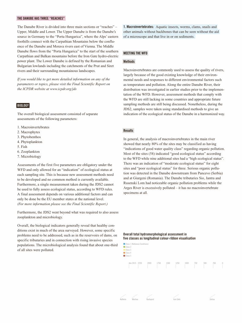
Overall total hydromorphological assessment in five classes as longitudinal colour-ribbon visualisation
Class 1 (Reference Conditions)Class 2Class 3Class 4Class 5
rkm 2415 2250 2000 1750 1500 1250 1000 750 500 250 0
Kelheim Wachau Budapest Iron Gate Sulina
17
SPECIES AND HABITATS
In total, 441 taxa of macroinvertebrates were documented. Regarding species diversity, the most diverse groups are Diptera (true flies and midges with a single pair of wings) and Oligochaeta (worms). Over-all diversity does not change along the three reaches of the Danube, although the number of insects decreases considerably downstream – overall, aquatic insects play only a minor role for Danube River fauna.
In terms of species abundance, macroinvertebrates are dominated by Crustacea (e.g. species such as shrimp, crayfish and wood lice). Regarding species biomass, Mollusca (like clams and snails with soft bodies and usually a hard shell) are the predominant group (e.g. the Asian clam Corbicula fluminea reached up to 8 kg/m) while Crustacea play only a minor role. Mollusca become increas-ingly dominant from the Upper to the Lower reaches.
Rare species include the large burrowing mayfly Palingenia longicauda found in the Prut River, and the formerly widespread snail Theodoxus transversalis, which is now only living in a very restricted section on the Lower Danube (JDS sites 70–86). Invasive Amphipod species (shrimp-like crustaceans) documented for the first time in Austria included Corophium robustum, while Crangonyx pseudogracilis was totally new for the entire Danube.
Invasive species
Invasive species originating from the Ponto-Caspian area (the Black, Azov and Caspian Sea regions), Asia, Australia and North America are a crucial factor influencing Danube macroinvertebrates. The Danube is a part of the Southern Invasive Corridor (Black Sea Dan-ube Main / Danube Canal Main Rhine North Sea waterway), one of Europe’s four most important routes for invasive species. The river is exposed to intensive colonisation of invasive species and further spreading in both north-west and south-east directions throughout the Danube Basin.
With few exceptions, invasive species belong to the Crustacea and Mollusca groups and were distributed along the entire Danube stretch. The highest frequency along the Danube showed the mussel Corbicula fluminea occurring in 93% of the sites. Also known as the Asian clam, this species can release up to 2000 juveniles per day and more than 100,000 in a lifetime. Juveniles are only 1 mm long when discharged. Adults can reach a length of about 5 cm. They feed pri-marily on phytoplankton (algae), which they filter from the sandy or muddy bottom of streams, lakes or canals.
The next highest frequency was of the Caspian mud shrimp Corophium curvispinum (90%) and Dikerogammarus villosus (69%). Populations of the latter species, a voracious predator of macro-invertebrates and also called “killer shrimp”, have caused significant ecological disruption such as reduced biodiversity and local species extinction.
Invasive species reached tremendous abundance with up to 90% of all species observed at some sites in the Upper reach or even 100% in the Middle reach of the Danube. They further accounted for approximately 40% of all of the documented species in the Upper and Middle reach. Given their domination, their classification is crucial for assessing the ecological status and improved manage-ment of the Danube Basin. How to consider them continues to be the object of many discussions among EU member states.
2. Macrophytes: Aquatic plants, either free-floating or attached to thebottom, which can be determined by the naked eye without the needfor a microscope.
MEETING THE WFD
The analysis of macrophytes revealed that the regulated but free-flowing stretches of the Danube often indicate the conditions for good ecological status, and in some cases may even be close to natural conditions.
However, there is a negative influence from some tributaries in the Lower Danube including the Sio, Timok, Rusenski Lom, Arges, Siret and Prut rivers. The missing or very low number of macrophytes in the mouth sections indicates poor ecological status.
In most of the hydro-electric power plant reservoirs, the macrophyte situation is unsatisfactory and the current conditions do not indicate good ecological status.
At the Iron Gates
The Iron Gate holds a special position as an ancient cataract stretch between the Middle and Lower Danube. The constrained width of the Danube in several gorge stretches results in rocky banks and rapids, whereas its wider parts with calmer waters make suitable habitat conditions for many different macrophytes. Despite the typical im-poundment conditions in the Iron Gate, both mosses on rocks and a high diversity of other macrophytes can be found, which indicate good conditions.
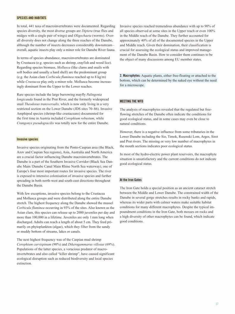
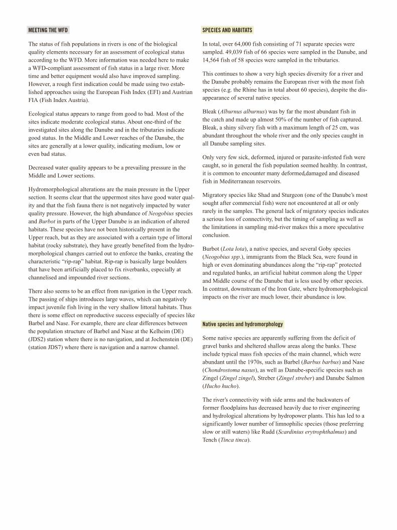
species nativespecies non-native
Native and exotic fish species along the Danube
0
5
10
15
20
25
30
35
40
2.42
02.
278
2.21
52.
118
2.07
22.
010
1.89
41.
875
1.86
51.
860
1.84
01.
826
1.81
71.
807
1.70
51.
662
1.63
21.
446
1.43
01.
380
1.30
31.
252
1.20
21.
163
1.13
21.
107
1.04
693
188
385
078
969
063
460
355
749
143
438
329
617
013
6 83 75 39 6
River-km Irongate II
Spec
ies
num
ber
SPECIES AND HABITATS
The different sections of the Danube River are habitats for various macrophyte species compositions and underline the ecological rich-ness of the Danube. 69 species were observed – considerably more than those observed during the JDS1, which was due in part to the application of a more detailed methodology. The confluences with the Drava, Tisza und Sava were marked by the highest species rich-ness of 32 species, recorded in the main river channel.
The unexpected spread of duckweed (an important food source for waterfowl) in the main river channel was probably triggered by the warm winter period. The fern Salvinia natans, a plant species requir-ing warm conditions, was found in an oxbow system near Vienna and could be an indication of climate change induced migration of such species up the Danube River.
Water hyacinth (Eichhornia crassipes) was observed and must be considered a human impact. It is considered one of the worst aquatic weeds in the world a very fast growing plant, with populations known to double in as little as 12 days. Infestations of this weed block waterways, limiting boat traffic, swimming and fishing. Water hyacinth also prevents sunlight and oxygen from reaching the water column and submerged plants. Its shading and crowding of native aquatic plants can dramatically reduce biological diversity in aquatic ecosystems.
The submerged invasive species Elodea nuttallii, also known as Nuttall’s water weed and as a plant that can become a seriously unfriendly nuisance, migrated from Western Europe down the river into the Delta area and is in the process of replacing Elodea canadensis.
Rare species of aquatic plants found during the JDS2 included Wolffia arrhiza, a duckweed species that is the smallest flowering plant in the world, and Trapa natans, a water nut that can develop into a weed in still waters. Azolla filiculoides is a water fern that is rarely found in temperate climates, indicating that their migration up the Danube may be a result of climate change. Utricularia vulgaris was also observed a “meat-eating” critically endangered plant on Hungary’s red list, and never officially detected before in Slovakia’s Danube.
It is also important to note that many reed and other species were observed along the river’s banks, wetlands and floodplains. Some are endangered and protected, and are important for environmental and conservation consideration, including other EU directives such as the Habitats Directive. While the JDS2’s mandate was to assess water bodies, JDS2 scientists believe future studies of wetland and river bank macrophytes would enhance overall knowledge related to the Danube ecosystem.
3. Phytobenthos: Microscopic plants such as algae that live in thesurface layers of the river and seabed.
MEETING THE WFD
As phytobenthos is a very good bio-indicator for monitoring nutrient pollution and eutrophication, its biomass and biodiversity were elab-orately investigated during the JDS2. The results show a downstream increase of pollution and general degradation. To indicate the ecolo-gical status according to the WFD, a Slovak classification system for phytobenthos-based assessment was used, with most of the sample results falling within the water quality classes II – IV (class I is best).
SPECIES AND HABITATS
The species diversity of phytobenthos was high with 443 taxa identi-fied in total. This was higher than the 340 found during the JDS1, although this may have been the result of different sampling methods being used.
Cyanobacteria (also known as blue-green algae) and green algae pre-vailed from the point of view of relative species abundance in most of the sampling stations. The red algae Hildebrandia rivularis was found upstream of the Abwinden-Asten dam and later upstream from the Greifenstein dam together with Bangia atropurpurea.
Biomass appears to increase downstream with the highest concentra-tions in the Iron Gate Reservoir. However, as biomass was measured for the first time along the whole course of the Danube, it is not pos-sible to compare it with previous results.
19
4. Phytoplankton: Plants, mainly microscopic, existing in water bodies.
MEETING THE WFD
Given the difficulty of measuring microscopic phytoplankton abun-dance, chlorophyll-a is used as an indicator. Keeping in mind that this assessment in not fully WFD-compliant, most chlorophyll-a values fall in a range indicating good water quality. Moderate values are observed upstream from the Drava River, in the Novi Sad region and downstream from the Tisza River. From the tributaries, 15 streams indicate good quality. The rivers Sio and Velika Morava indicate moderate quality, while the Arges indicates poor quality.
Overall, the analysis found most of the Danube with acceptable conditions of phytoplankton growth. Unsatisfactory sites occurred only in the Middle reach. The different reaches of the Danube have the following status: Upper, high to good; Middle, good to moder-ate; Lower, high to good. The investigated tributaries Arges, Velika Morava and Sio indicate bad status, while all others indicate high or good status.
Compared with the JDS1 results, both the concentrations of chloro-phyll-a and phytoplankton biomass declined, especially in the Middle reach – an indication of water quality improvement. Species compo-sition and diversity are similar to JDS1 observations. However, direct comparisons between the two JDSs might be inconclusive because the JDS2 had higher run-offs (e.g. more rain) and therefore a greater dilution effect on samples.
SPECIES AND HABITATS
The species diversity of phytoplankton was high with 327 algal taxa identified in the Danube, its side arms and the main tributaries. This exceeds the 261 species found during the JDS1.
The relative species abundance in most of the sampling stations was dominated by diatoms (a major algae group and one of the most common types of phytoplankton) and green algae. Cyanobacteria were unimportant in the Danube but contributed significantly in some of the major tributaries.
Biomass concentrations remain at low levels in the upstream and downstream sections of the Danube. Higher values occur between Baja (HU, rkm 1481) and Grocka (RS, rkm 1132). The highest concentrations of biomass were reached in the Novi Sad Tisza confluence region between rkm 1262 and rkm 1200.
Measurements of the productivity (growth) of algae were calculated at all sampling stations for the first time.
5. Fish: Aquatic vertebrates (having a backbone) that are typically cold-blooded and covered with scales.
BACkGROUND
While over 70 species of freshwater fish inhabit the Danube along its entire course, the ecology of many species remains poorly known. Although some fish stocks declined and some species became endangered or even extinct in the last decades, fish remain economi-cally important to many people living in the basin. Fish populations are also a potentially good indicator of human pressures, especially hydromorphological alterations. For example, a loss of connectivity due to man-made barriers (e.g. dams) can be reflected in the charac-ter of the fish community.
Method
The JDS2 was the first ever fish survey of the entire length of the Danube and its tributaries. The methods of electric fishing and drift netting with trammel nets were used, both during the day and night.
Electric fishing is the most used method worldwide to sample fish in smaller rivers and shallow waters (up to 2 m). A generator (in a boat) establishes an electric field in the water, which stuns the fish so they can be collected with a net. Under normal conditions, this method does not harm or damage the fish, and they recover fast. Casualties can happen, especially with juvenile fish, but in general electric fish-ing is considered to be a non-lethal sampling method. The method is also a standard sampling approach for WFD purposes.
To sample fish from the deeper main channel of the Danube, trammel nets were used. This is a combination of three nets – two outer ones with very large meshes and an inner one with a small mesh size. The fish are then trapped in the “pockets” of a fine meshed net and thus they are not killed as they are when caught in normal “gill-nets”.
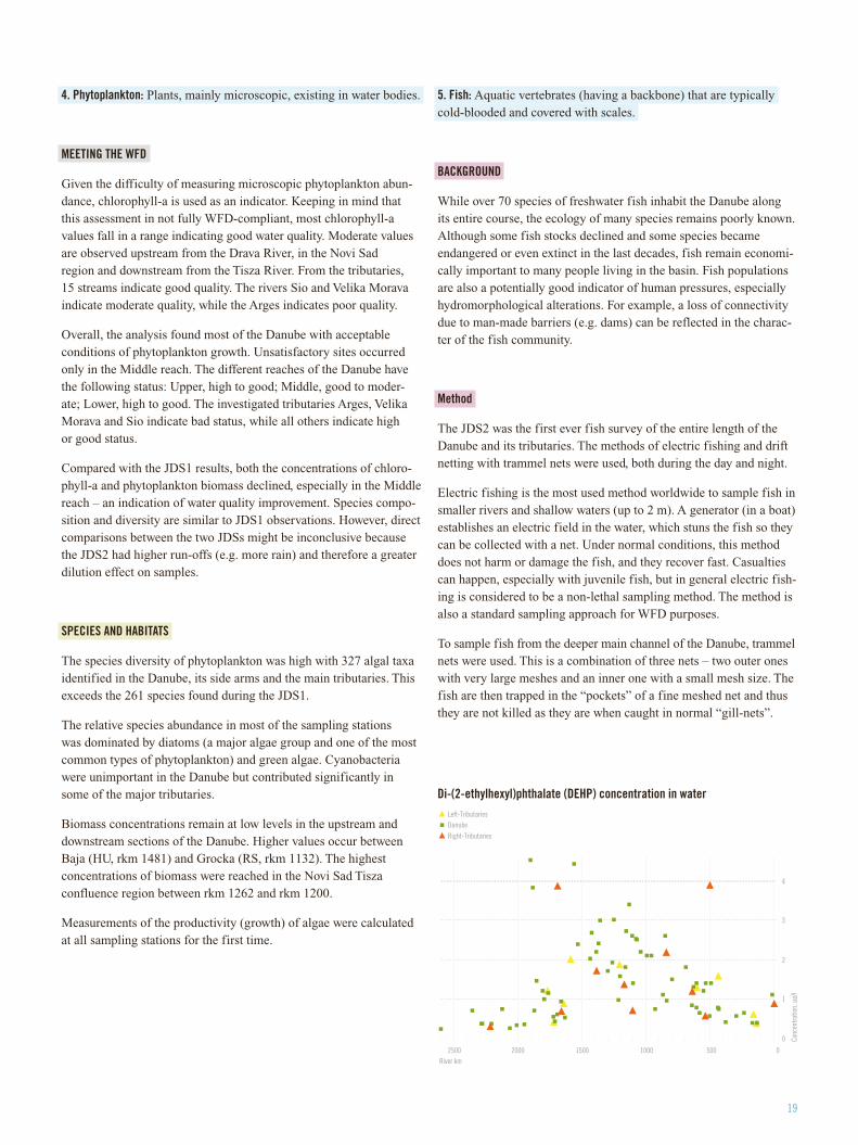
Di-(2-ethylhexyl)phthalate (DEHP) concentration in water
0
1
2
3
4
05001000150020002500River km
Conc
entra
tion,
µg/
l
Left-TributariesDanube
Right-Tributaries
MEETING THE WFD
The status of fish populations in rivers is one of the biological quality elements necessary for an assessment of ecological status according to the WFD. More information was needed here to make a WFD-compliant assessment of fish status in a large river. More time and better equipment would also have improved sampling. However, a rough first indication could be made using two estab-lished approaches using the European Fish Index (EFI) and Austrian FIA (Fish Index Austria).
Ecological status appears to range from good to bad. Most of the sites indicate moderate ecological status. About one-third of the investigated sites along the Danube and in the tributaries indicate good status. In the Middle and Lower reaches of the Danube, the sites are generally at a lower quality, indicating medium, low or even bad status.
Decreased water quality appears to be a prevailing pressure in the Middle and Lower sections.
Hydromorphological alterations are the main pressure in the Upper section. It seems clear that the uppermost sites have good water qual-ity and that the fish fauna there is not negatively impacted by water quality pressure. However, the high abundance of Neogobius species and Burbot in parts of the Upper Danube is an indication of altered habitats. These species have not been historically present in the Upper reach, but as they are associated with a certain type of littoral habitat (rocky substrate), they have greatly benefited from the hydro-morphological changes carried out to enforce the banks, creating the characteristic “rip-rap” habitat. Rip-rap is basically large boulders that have been artificially placed to fix riverbanks, especially at channelised and impounded river sections.
There also seems to be an effect from navigation in the Upper reach. The passing of ships introduces large waves, which can negatively impact juvenile fish living in the very shallow littoral habitats. Thus there is some effect on reproductive success especially of species like Barbel and Nase. For example, there are clear differences between the population structure of Barbel and Nase at the Kelheim (DE) (JDS2) station where there is no navigation, and at Jochenstein (DE) (station JDS7) where there is navigation and a narrow channel.
SPECIES AND HABITATS
In total, over 64,000 fish consisting of 71 separate species were sampled. 49,039 fish of 66 species were sampled in the Danube, and 14,564 fish of 58 species were sampled in the tributaries.
This continues to show a very high species diversity for a river and the Danube probably remains the European river with the most fish species (e.g. the Rhine has in total about 60 species), despite the dis-appearance of several native species.
Bleak (Alburnus alburnus) was by far the most abundant fish in the catch and made up almost 50% of the number of fish captured. Bleak, a shiny silvery fish with a maximum length of 25 cm, was abundant throughout the whole river and the only species caught in all Danube sampling sites.
Only very few sick, deformed, injured or parasite-infested fish were caught, so in general the fish population seemed healthy. In contrast, it is common to encounter many deformed,damaged and diseased fish in Mediterranean reservoirs.
Migratory species like Shad and Sturgeon (one of the Danube’s most sought after commercial fish) were not encountered at all or only rarely in the samples. The general lack of migratory species indicates a serious loss of connectivity, but the timing of sampling as well as the limitations in sampling mid-river makes this a more speculative conclusion.
Burbot (Lota lota), a native species, and several Goby species (Neogobius spp.), immigrants from the Black Sea, were found in high or even dominating abundances along the “rip-rap” protected and regulated banks, an artificial habitat common along the Upper and Middle course of the Danube that is less used by other species. In contrast, downstream of the Iron Gate, where hydromorphological impacts on the river are much lower, their abundance is low.
Native species and hydromorphology
Some native species are apparently suffering from the deficit of gravel banks and sheltered shallow areas along the banks. These include typical mass fish species of the main channel, which were abundant until the 1970s, such as Barbel (Barbus barbus) and Nase (Chondrostoma nasus), as well as Danube-specific species such as Zingel (Zingel zingel), Streber (Zingel streber) and Danube Salmon (Hucho hucho).
The river’s connectivity with side arms and the backwaters of former floodplains has decreased heavily due to river engineering and hydrological alterations by hydropower plants. This has led to a significantly lower number of limnophilic species (those preferring slow or still waters) like Rudd (Scardinius erytrophthalmus) and Tench (Tinca tinca).
21
Therefore, the actual diversity of Danube fish fauna is significantly reduced and clearly dominated by eurytopic species – those which do not have special demands or requirements concerning their environ-ment. These include Roach (Rutilus rutilus), Prussian carp (Caras-sius gibelio), White bream (Blicca bjoerkna) and Bleak (Alburnus alburnus), which were historically only important in the Lower reach of the Danube.
Invasive species
Several non-native fish species have established populations in the Danube Basin, mainly due to human activities such as stocking, angling and a general movement of fish. During the JDS2, some of these were even abundant and widely distributed. There are indica-tions that this has caused some changes in the composition of the local fish fauna.
The Upper Danube is heavily infested by non-native Goby species (Neogobius spp.). Further downstream, even in their native range (rkm 850-6) their importance is drastically lower and only slowly increases towards the Danube Delta.
Non-native eels (Anguilla anguilla) were only caught in the very Upper river. It must be concluded that these are exclusively the result of stocking juvenile eel, mainly in the German part of the basin, as they soon vanish from the catches throughout the Austrian section. Both gobies and eel benefit from the high extent of rip-rap habitat in these areas.
6. Zooplankton: Tiny invertebrates (animals without backbones) that float freely in water bodies.
SPECIES AND HABITATS
126 zooplankton taxa were found, including 87 Rotatoria, 30 Cladocera and 9 Copepoda.
Rotatoria are the dominant group. Mainly freshwater, some marine, Rotatoria have a ring of cilia (small hair-like organs on the surface of some cells) that carries food to the mouth and also provides them with propulsion. They are the smallest multi-cellular animals.
In the Danube River, the species composition of zooplankton varied remarkably.
Regarding the density of zooplankton, it was below what was found during the JDS1. The highest density was observed in the slow-flow-ing Middle reach of the Danube, and the maximum number was reg-istered in the Serbian reach (also an area with high eutrophication).
During sampling, a large amount of larvae were found in high pro-portions in several sections of the Danube. Although the species were not identified, there is a high probability that the larvae were from the highly invasive Corbicula fluminea species, otherwise known as Asian clam (see section on macroinvertebrates above for more infor-mation). Their further investigation is therefore suggested.
7. Microbiology: The study of microorganisms – microscopic organisms that are unicellular or exist in cell clusters.
BACkGROUND
Faecal indicators are excreted by humans and warm-blooded animals in high concentrations and survive for a certain time in aquatic sys-tems. Faecal pollution can be caused by point sources like discharges of sewage from human sources or livestock enterprises, and by non-point sources like pasture, urban and agricultural run-off. Faeces frequently contain pathogenic microorganisms like bacteria, viruses and parasites.
Escherichia coli (E.coli) and enterococci are used worldwide as indi-cators for the assessment of faecal pollution in the aquatic environ-ment, and therefore the potential presence of pathogens.
Because of the hazard to humans caused by aquatic faecal pollution, strict quality regulations exist for water intended for irrigation, bath-ing, aquaculture and human consumption. According to the WFD, designated bathing waters must fulfil the requirements of the EU Bathing Water Quality Directive.
Faecal pollution and microbiological contamination from human sources have been shown to be a crucial problem throughout the Danube Basin. The river and its tributaries receive incompletely 0
0.1
0.2
0.3
0.4
0.5
0.6
jds2
jds7
jds1
3
jds1
6
jds2
6
jds3
2
jds3
9
jds7
7
jds9
0
jds9
4
jds9
5
jds9
6
Conc
entra
tion,
mg/
kg
Mercury (Hg) - total
Total Mercury in Bream (Abramis brama) in the Danube (mg/kg wet weight)
treated waste water from urban areas, animal farms and pasture lead-ing to serious water quality problems. Thus, detailed knowledge on the extent and origin of microbiological faecal pollution is crucial for watershed management activities to maintain safe waters.
RESULTS
Based on the E.coli evaluation, 25% of all sampling stations showed excellent water quality. Evaluating the water based on enterococci, 50% of all sampling stations showed excellent water quality.
Thirty-one JDS sampling sites (22 Danube samples and 9 tributaries /side arms), or about one-third of all sites, were classified as polluted. It appears that most of the E.coli came from human sewage.
The Arges and Rusenski Lom tributaries and the side arms Rackeve-Soroksar and Moson Danube were identified as hot-spots with the highest sources of contamination. The highest contamination levels in the Danube River itself were found in the stretch between Buda-pest and Belgrade.
Lower levels of faecal pollution were found in the uppermost stretches in Germany and Austria, between Esztergom and Budapest in Hungary, in the Iron Gate Reservoir in Serbia, the Western Pontic Danube until Rusenski Lom in Romania, and the Danube Delta itself.
A comparison of the JDS2 data with the JDS1 indicated a high cor-respondence of faecal pollution of the Danube River in both years.
CHEMISTRY
This section presents highlights from the Final Scientific Report related to:
1. Nutrients2. Organic compounds3. Heavy metals4. Radioactivity
The Final Scientific Report also includes separate assessments for: thermal, oxygenation, salinity and acidification conditions; and an isotopic survey.
WHAT ARE PRIORITY SUBSTANCES?
The EU has 33 “Priority Substances” or groups of substances which have been shown to be of major concern for European waters. Prior-ity Substances include organic compounds and heavy metals.
One of the key objectives of the JDS2 was to get a full overview of the EU’s Priority Substances in the Danube and its major tributaries in light of current EU legislation, especially the draft EU directive proposing environmental quality standards (EQS). In response, all of
the EU’s 33 Priority Substances (except C10-C13-chloroalkanes), as well as eight other pollutants from the proposed EU directive, were analysed during the JDS2.
However, the single measurement taken during the JDS2 cannot be used to fully assess chemical status according to WFD rules, so the results should be seen as “indications of chemical status at each sampling site”.
Overall, the chemical indicators reveal that the average concentra-tions of Priority Substances detected during the JDS2 tend to be lower than those measured during the JDS1, especially for organic substances. This indicates that measures taken to reduce emissions of Priority Substances are starting to be successful. However, several Priority Substances such as diethylhexylphthalate or tributyltin, as well as newly “emerging substances” (e.g. anti-corrosive “benzotria-zoles” contained in dishwashing detergents, the pesticide 2,4-D and the pharmaceutical compound “carbamazepine” – a drug that fights epilepsy), are becoming a concern in the Danube Basin and require measures to be taken to minimise their emissions.
1. Nutrients: Food or chemicals that an organism needs to live and grow, or a substance used in an organism’s metabolism which must be taken up from its environment.
MEETING THE WFD
The measurements of nutrients give a snapshot of the conditions that occurred during the JDS2. Classification systems usually require the analysis of time series data (e.g. 12 measurements per year) to address natural variability (e.g. due to season, discharge or even daily fluctuations). Nonetheless, despite the fact that only one-time values were obtained, the JDS2 results were classified into three sta-tus classes – high, good and moderate – to give an indication of the water quality encountered during the survey.
The nutrients assessment was carried out using three different approaches: two new WFD-compliant approaches (Austrian and Czech) and that of the ICPDR (TNMN). Based on the Austrian assessment approach, all the sampling sites located on the Dan-ube River itself are either in the “high” or “good” ecological class while only six tributaries (at their confluence) do not comply with the “good” class criteria. According to the more restrictive Czech scheme, six sampling sites on the Danube and nine sampling sites located at the mouth of tributaries do not comply with “good” class criteria. Based on the TNMN scheme, nearly the entire course of the Danube River had acceptable conditions. More than 80% of the investigated tributaries complied with the TNMN standard for nitrogen concentrations, and more than 60% for phosphorous concentrations.
It is important to note that “physical and chemical” parameters, which include nutrients, support the “biological” parameters in assessing the status of water bodies. This is why the two sets of parameters must be interpreted together.
23
RESULTS
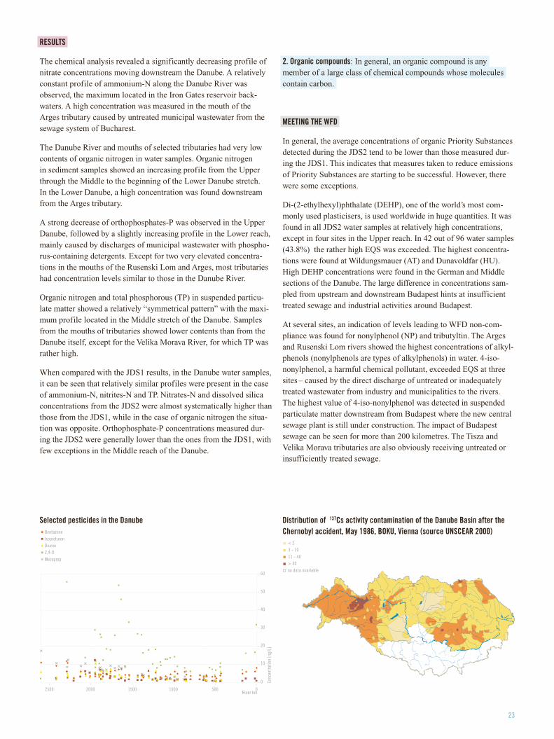
The chemical analysis revealed a significantly decreasing profile of nitrate concentrations moving downstream the Danube. A relatively constant profile of ammonium-N along the Danube River was observed, the maximum located in the Iron Gates reservoir back-waters. A high concentration was measured in the mouth of the Arges tributary caused by untreated municipal wastewater from the sewage system of Bucharest.
The Danube River and mouths of selected tributaries had very low contents of organic nitrogen in water samples. Organic nitrogen in sediment samples showed an increasing profile from the Upper through the Middle to the beginning of the Lower Danube stretch. In the Lower Danube, a high concentration was found downstream from the Arges tributary.
A strong decrease of orthophosphates-P was observed in the Upper Danube, followed by a slightly increasing profile in the Lower reach, mainly caused by discharges of municipal wastewater with phospho-rus-containing detergents. Except for two very elevated concentra-tions in the mouths of the Rusenski Lom and Arges, most tributaries had concentration levels similar to those in the Danube River.
Organic nitrogen and total phosphorous (TP) in suspended particu-late matter showed a relatively “symmetrical pattern” with the maxi-mum profile located in the Middle stretch of the Danube. Samples from the mouths of tributaries showed lower contents than from the Danube itself, except for the Velika Morava River, for which TP was rather high.
When compared with the JDS1 results, in the Danube water samples, it can be seen that relatively similar profiles were present in the case of ammonium-N, nitrites-N and TP. Nitrates-N and dissolved silica concentrations from the JDS2 were almost systematically higher than those from the JDS1, while in the case of organic nitrogen the situa-tion was opposite. Orthophosphate-P concentrations measured dur-ing the JDS2 were generally lower than the ones from the JDS1, with few exceptions in the Middle reach of the Danube.
2. Organic compounds: In general, an organic compound is any member of a large class of chemical compounds whose molecules contain carbon.
MEETING THE WFD
In general, the average concentrations of organic Priority Substances detected during the JDS2 tend to be lower than those measured dur-ing the JDS1. This indicates that measures taken to reduce emissions of Priority Substances are starting to be successful. However, there were some exceptions.
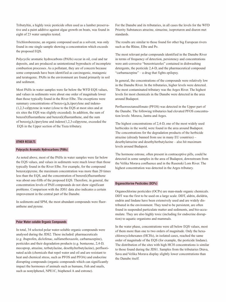
Di-(2-ethylhexyl)phthalate (DEHP), one of the world’s most com-monly used plasticisers, is used worldwide in huge quantities. It was found in all JDS2 water samples at relatively high concentrations, except in four sites in the Upper reach. In 42 out of 96 water samples (43.8%) the rather high EQS was exceeded. The highest concentra-tions were found at Wildungsmauer (AT) and Dunavoldfar (HU). High DEHP concentrations were found in the German and Middle sections of the Danube. The large difference in concentrations sam-pled from upstream and downstream Budapest hints at insufficient treated sewage and industrial activities around Budapest.
At several sites, an indication of levels leading to WFD non-com-pliance was found for nonylphenol (NP) and tributyltin. The Arges and Rusenski Lom rivers showed the highest concentrations of alkyl-phenols (nonylphenols are types of alkylphenols) in water. 4-iso-nonylphenol, a harmful chemical pollutant, exceeded EQS at three sites – caused by the direct discharge of untreated or inadequately treated wastewater from industry and municipalities to the rivers. The highest value of 4-iso-nonylphenol was detected in suspended particulate matter downstream from Budapest where the new central sewage plant is still under construction. The impact of Budapest sewage can be seen for more than 200 kilometres. The Tisza and Velika Morava tributaries are also obviously receiving untreated or insufficiently treated sewage.
0
10
20
30
40
50
60
05001000150020002500River km
Conc
entr
atio
n [n
g/L]
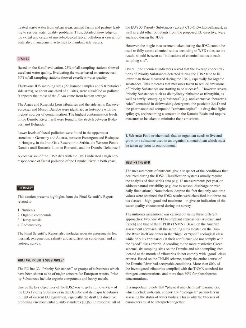
BentazoneIsoproturonDiuron2,4-D
Mecoprop
Selected pesticides in the Danube Distribution of 137Cs activity contamination of the Danube Basin after the Chernobyl accident, May 1986, BOkU, Vienna (source UNSCEAR 2000)
< 2 3 - 10
11 - 40 > 40no data available
< 2 3 - 10
11 - 40 > 40no data available
Tributyltin, a highly toxic pesticide often used as a lumber preserva-tive and a paint additive against algae growth on boats, was found in eight of 23 water samples tested.
Trichlorobenzene, an organic compound used as a solvent, was only found in one single sample showing a concentration which exceeds the proposed EQS.
Polycyclic aromatic hydrocarbons (PAHs) occur in oil, coal and tar deposits, and are produced as unintentional byproducts of incomplete combustion processes. As a pollutant, they are of concern because some compounds have been identified as carcinogenic, mutagenic and teratogenic. PAHs in the environment are found primarily in soil and sediment.
Most PAHs in water samples were far below the WFD EQS values, and values in sediments were about one order of magnitude lower than those typically found in the River Elbe. The exceptions were summary concentrations of benzo-(g,h,i)perylene and indeno- (1,2,3-cd)pyrene in water (close to the EQS at most sites and at six sites the EQS was slightly exceeded). In addition, the sum of benzo(b)fluoranthene and benzo(k)fluoranthene, and the sum of benzo(g,h,i)perylene and indeno(1,2,3-cd)pyrene, exceeded the EQS in the Upper section of the Tisza tributary.
OTHER RESULTS
Polycyclic Aromatic Hydrocarbons (PAHs)
As noted above, most of the PAHs in water samples were far below the EQS values, and values in sediments were much lower than those typically found in the River Elbe. For example, for the compound benzo(a)pyrene, the maximum concentration was more than 20 times less than the EQS, and the concentration of benzo(k)fluoranthene was about one-fifth of the proposed EQS. Therefore, in general, the concentration levels of PAH compounds do not show significant problems. Comparison with the JDS1 data also indicates a certain improvement in the central part of the Danube.
In sediments and SPM, the most abundant compounds were fluor-anthene and pyrene.
Polar Water-soluble Organic Compounds
In total, 34 selected polar water-soluble organic compounds were analysed during the JDS2. These included: pharmaceuticals (e.g. ibuprofen, diclofenac, sulfamethoxazole, carbamazepine), pesticides and their degradation products (e.g. bentazone, 2,4-D, mecoprop, atrazine, terbutylazine, desethylterbutylazine), perfluori-nated acids (chemicals that repel water and oil and are resistant to heat and chemical stress, such as PFOS and PFOA) and endocrine disrupting compounds (organic compounds which can significantly impact the hormones of animals such as humans, fish and snails, such as nonylphenol, NPE1C, bisphenol A and estrone).
For the Danube and its tributaries, in all cases the levels for the WFD Priority Substances atrazine, simazine, isoproturon and diuron met standards.
The results are similar to those found for other big European rivers such as the Rhine, Elbe and Po.
The most relevant polar compounds identified in the Danube River in terms of frequency of detection, persistency and concentrations were anti-corrosive “benzotriazoles” contained in dishwashing detergents, the pesticide 2,4-D, and the pharmaceutical compound “carbamazepine” – a drug that fights epilepsy.
In general, the concentrations of the compounds were relatively low in the Danube River. In the tributaries, higher levels were detected. The most contaminated tributary was the Arges River. The highest levels for most chemicals in the Danube were detected in the area around Budapest.
Perfluorooctansulfonate (PFOS) was detected in the Upper part of the Danube. The following tributaries had elevated PFOS concentra-tion levels: Morava, Jantra and Arges.
The highest concentrations of 2,4-D, one of the most widely used herbicides in the world, were found in the area around Budapest. The concentrations for the degradation products of the herbicide atrazine (already banned from use in many EU countries) – desethylatrazine and desethylterbutylazine – also hit maximum levels around Budapest.
The hormone estrone, often present in contraceptive pills, could be detected in some samples in the area of Budapest, downstream from the Velika Morava confluence and in the Rusenski Lom River. The highest concentration was detected in the Arges tributary.
Organochlorine Pesticides (OCPs)
Organochlorine pesticides (OCPs) are man-made organic chemicals. DDT was the first to be used on a large scale. DDT, aldrin, dieldrin, endrin and lindane have been extensively used and are widely dis-tributed in the environment. They tend to be persistent, are often found in suspended particulate matter and sediments, and bio-accu-mulate. They are also highly toxic (including for endocrine disrup-tion) to aquatic organisms and mammals.
In the water phase, concentrations were all below EQS values, most of them more than one to two orders of magnitude. Only the hexa-chlorocyclohexanes (HCHs), in isolated cases, reached the same order of magnitude of the EQS (for example, the pesticide lindane). The distribution of the sites with high HCH concentrations is similar to those found during the JDS1. Samples from the tributaries Drava, Sava and Velika Morava display slightly lower concentrations than the Danube itself.
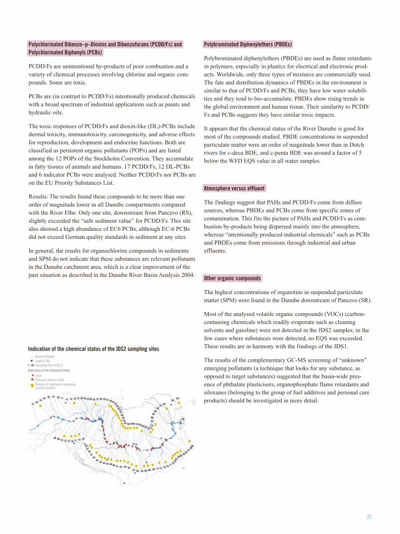
25
Polychlorinated Dibenzo–p–Dioxins and Dibenzofurans (PCDD/Fs) and Polychlorinated Biphenyls (PCBs)
PCDD/Fs are unintentional by-products of poor combustion and a variety of chemical processes involving chlorine and organic com-pounds. Some are toxic.
PCBs are (in contrast to PCDD/Fs) intentionally produced chemicals with a broad spectrum of industrial applications such as paints and hydraulic oils.
The toxic responses of PCDD/Fs and dioxin-like (DL)-PCBs include dermal toxicity, immunotoxicity, carcinogenicity, and adverse effects for reproduction, development and endocrine functions. Both are classified as persistent organic pollutants (POPs) and are listed among the 12 POPs of the Stockholm Convention. They accumulate in fatty tissues of animals and humans. 17 PCDD/Fs, 12 DL-PCBs and 6 indicator PCBs were analysed. Neither PCDD/Fs nor PCBs are on the EU Priority Substances List.
Results: The results found these compounds to be more than one order of magnitude lower in all Danube compartments compared with the River Elbe. Only one site, downstream from Pancevo (RS), slightly exceeded the “safe sediment value” for PCDD/Fs. This site also showed a high abundance of EC6 PCBs, although EC-6 PCBs did not exceed German quality standards in sediment at any sites.
In general, the results for organochlorine compounds in sediments and SPM do not indicate that these substances are relevant pollutants in the Danube catchment area, which is a clear improvement of the past situation as described in the Danube River Basin Analysis 2004.
Polybrominated Diphenylethers (PBDEs)
Polybrominated diphenylethers (PBDEs) are used as flame retardants in polymers, especially in plastics for electrical and electronic prod-ucts. Worldwide, only three types of mixtures are commercially used. The fate and distribution dynamics of PBDEs in the environment is similar to that of PCDD/Fs and PCBs, they have low water solubili-ties and they tend to bio-accumulate. PBDEs show rising trends in the global environment and human tissue. Their similarity to PCDD/Fs and PCBs suggests they have similar toxic impacts.
It appears that the chemical status of the River Danube is good for most of the compounds studied. PBDE concentrations in suspended particulate matter were an order of magnitude lower than in Dutch rivers for c-deca BDE, and c-penta BDE was around a factor of 5 below the WFD EQS value in all water samples.
Atmosphere versus effluent
The findings suggest that PAHs and PCDD/Fs come from diffuse sources, whereas PBDEs and PCBs come from specific zones of contamination. This fits the picture of PAHs and PCDD/Fs as com-bustion by-products being dispersed mainly into the atmosphere, whereas “intentionally produced industrial chemicals” such as PCBs and PBDEs come from emissions through industrial and urban effluents.
Other organic compounds
The highest concentrations of organotins in suspended particulate matter (SPM) were found in the Danube downstream of Pancevo (SR).
Most of the analysed volatile organic compounds (VOCs) (carbon-containing chemicals which readily evaporate such as cleaning solvents and gasoline) were not detected in the JDS2 samples; in the few cases where substances were detected, no EQS was exceeded. These results are in harmony with the findings of the JDS1.
The results of the complementary GC-MS screening of “unknown” emerging pollutants (a technique that looks for any substance, as opposed to target substances) suggested that the basin-wide pres-ence of phthalate plasticisers, organophosphate flame retardants and siloxanes (belonging to the group of fuel additives and personal care products) should be investigated in more detail.
Indication of the chemical status of the JDS2 sampling sites National BorderCapital CitySampling Site of JDS 2
GoodFailing to achieve GoodNumber of substances exceeding quality standars
Indication of the Chemical Status
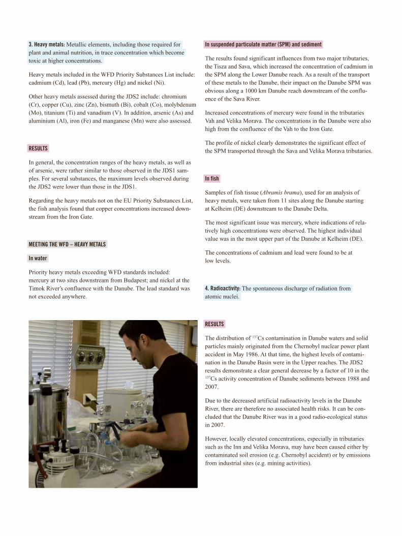
3. Heavy metals: Metallic elements, including those required for plant and animal nutrition, in trace concentration which become toxic at higher concentrations.
Heavy metals included in the WFD Priority Substances List include: cadmium (Cd), lead (Pb), mercury (Hg) and nickel (Ni).
Other heavy metals assessed during the JDS2 include: chromium (Cr), copper (Cu), zinc (Zn), bismuth (Bi), cobalt (Co), molybdenum (Mo), titanium (Ti) and vanadium (V). In addition, arsenic (As) and aluminium (Al), iron (Fe) and manganese (Mn) were also assessed.
RESULTS
In general, the concentration ranges of the heavy metals, as well as of arsenic, were rather similar to those observed in the JDS1 sam-ples. For several substances, the maximum levels observed during the JDS2 were lower than those in the JDS1.
Regarding the heavy metals not on the EU Priority Substances List, the fish analysis found that copper concentrations increased down-stream from the Iron Gate.
MEETING THE WFD – HEAVY METALS
In water
Priority heavy metals exceeding WFD standards included: mercury at two sites downstream from Budapest; and nickel at the Timok River’s confluence with the Danube. The lead standard was not exceeded anywhere.
In suspended particulate matter (SPM) and sediment
The results found significant influences from two major tributaries, the Tisza and Sava, which increased the concentration of cadmium in the SPM along the Lower Danube reach. As a result of the transport of these metals to the Danube, their impact on the Danube SPM was obvious along a 1000 km Danube reach downstream of the conflu-ence of the Sava River.
Increased concentrations of mercury were found in the tributaries Vah and Velika Morava. The concentrations in the Danube were also high from the confluence of the Vah to the Iron Gate.
The profile of nickel clearly demonstrates the significant effect of the SPM transported through the Sava and Velika Morava tributaries.
In fish
Samples of fish tissue (Abramis brama), used for an analysis of heavy metals, were taken from 11 sites along the Danube starting at Kelheim (DE) downstream to the Danube Delta.
The most significant issue was mercury, where indications of rela-tively high concentrations were observed. The highest individual value was in the most upper part of the Danube at Kelheim (DE).
The concentrations of cadmium and lead were found to be at low levels.
4. Radioactivity: The spontaneous discharge of radiation from atomic nuclei.
RESULTS
The distribution of 137Cs contamination in Danube waters and solid particles mainly originated from the Chernobyl nuclear power plant accident in May 1986. At that time, the highest levels of contami-nation in the Danube Basin were in the Upper reaches. The JDS2 results demonstrate a clear general decrease by a factor of 10 in the 137Cs activity concentration of Danube sediments between 1988 and 2007.
Due to the decreased artificial radioactivity levels in the Danube River, there are therefore no associated health risks. It can be con-cluded that the Danube River was in a good radio-ecological status in 2007.
However, locally elevated concentrations, especially in tributaries such as the Inn and Velika Morava, may have been caused either by contaminated soil erosion (e.g. Chernobyl accident) or by emissions from industrial sites (e.g. mining activities).
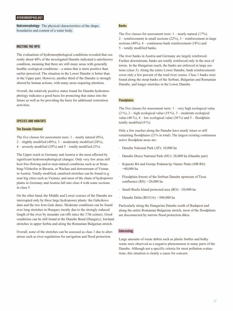
27
HYDROMORPHOLOGY
Hydromorphology: The physical characteristics of the shape, boundaries and content of a water body.
MEETING THE WFD
The evaluations of hydromorphological conditions revealed that cur-rently about 40% of the investigated Danube indicated a satisfactory condition, meaning that there are still many areas with generally healthy ecological conditions – a status that is more positive than earlier perceived. The situation in the Lower Danube is better than in the Upper part. However, another third of the Danube is strongly altered by human actions, with many areas requiring attention.
Overall, the relatively positive status found for Danube hydromor-phology indicates a good basis for protecting that status into the future as well as for providing the basis for additional restoration activities.
SPECIES AND HABITATS
The Danube Channel
The five classes for assessment were: 1 – nearly natural (0%), 2 – slightly modified (40%), 3 – moderately modified (28%), 4 – severely modified (29%) and 5 – totally modified (3%).
The Upper reach in Germany and Austria is the most affected by significant hydromorphological changes. Only very few areas still host free-flowing and/or near-natural conditions such as at Strau-bing-Vilshofen in Bavaria, or Wachau and downstream of Vienna in Austria. Totally modified, canalised stretches can be found (e.g. near big cities such as Vienna), and most of the chain of hydropower plants in Germany and Austria fall into class 4 with some sections in class 5.
On the other hand, the Middle and Lower courses of the Danube are interrupted only by three large hydropower plants: the Gabcikovo dam and the two Iron Gate dams. Moderate conditions can be found over long stretches in Hungary mostly due to the strongly reduced length of the river by meander cut-offs since the 17th century. Good conditions can be still found at the Danube Bend (Hungary), lowland stretches in upper Serbia and along the Romanian Bulgarian stretch.
Overall, none of the stretches can be assessed as class 1 due to alter-ations such as river regulations for navigation and flood protection.
Banks
The five classes for assessment were: 1 – nearly natural (17%), 2 – reinforcement in small sections (22%), 3 – reinforcement in large sections (40%), 4 – continuous bank reinforcement (18%) and 5 – totally modified banks.
The river banks in Austria and Germany are largely reinforced. Further downstream, banks are totally reinforced only in the area of towns. In the Hungarian reach, the banks are enforced in large sec-tions (class 3). Along the entire Lower Danube, bank reinforcements cover only a few percent of the total river course. Class 1 banks were found along the steep banks of the Serbian, Bulgarian and Romanian Danube, and longer stretches in the Lower Danube.
Floodplains
The five classes for assessment were: 1 – very high ecological value (2 %), 2 – high ecological value (19 %), 3 – moderate ecological value (40 %), 4 – low ecological value (30 %) and 5 – floodplain totally modified (9 %).
Only a few reaches along the Danube have nearly intact or still remaining floodplains (21% in total). The largest existing continuous active floodplain areas are:
· Danube National Park (AT): 10,000 ha
· Danube-Drava National Park (HU): 28,000 ha (Danube part)
· Kopacki Rit and Gornje Podunavlje Nature Parks (HR/RS): ~40,000 ha
· Floodplain forests of the Serbian Danube upstream of Tisza confluence (RS): ~20,000 ha
· Small Braila Island protected area (RO): ~20,000 ha
· Danube Delta (RO/UA): ~500,000 ha
Particularly along the Hungarian Danube south of Budapest and along the entire Romanian Bulgarian stretch, most of the floodplains are disconnected by narrow flood protection dikes.
Interesting
Large amounts of waste debris such as plastic bottles and bulky waste were observed as a negative phenomenon in many parts of the Danube. Although not a specific criteria for most pollution evalua-tions, this situation is clearly a cause for concern.
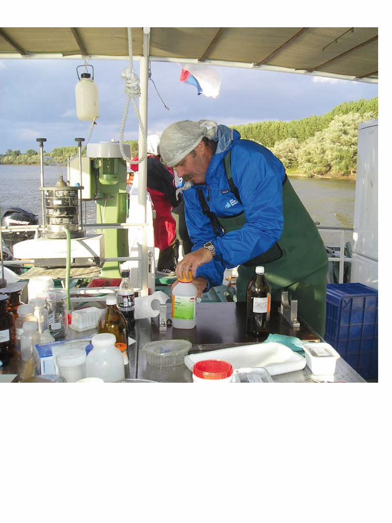
29
The JDS2 proved to be an excellent testing ground for many new scientific techniques and technologies. Many were used for the first time. Many made the work of the JDS2 scientists more accurate and faster, often through “on-board training”. The potential is now there for the results to help other scientists, and even policy-makers, across Europe and the globe in the future.
Sediment searches
The “air-lift” sediment sampler, the most visibly prominent feature of the Argus ship protruding from its bow, was a big success. Used for the first time on the Danube, it could take samples at depths of up to 11 m from substrates including sand, gravel and stone. Before joining the JDS2, Romanian biologist Gabriel Chiriac had relied on the older methods of “kick-and-sweep” and dredging. “But we couldn’t reach big depths before air-lifting,” he said.
An excellent example of the broader scientific ripples being sent out by the JDS2 was the “core sediment sampling” done near Kostolac, Serbia. This is a tricky and expensive technique where cores, once removed, are sliced into 5 cm portions and analysed for pollutants. A team of University of Vienna scientists led by Professor Thilo Hoffman, and with Serbian PhD student Vesna Micic who joined the JDS2 team, is using the technique and resulting data as part of their studies of “endocrine disrupters”, organic compounds which can sig-nificantly impact the hormones of animals such as humans, fish and snails. “JDS1 found alarming concentrations in Danube sediment,” says Hoffman. “We needed the JDS2 to better understand where they are, why they accumulate and how they behave. We would never have had samples without the JDS2.”
Sticky and expensive
One of the scientific institutions most interested in the results of the JDS2 is the European Commission’s Joint Research Centre (JRC) based in Ispra, Italy. One of its key goals is to provide support for the development of EU policies and regulations. Until now, the EC has had legal limits imposed on 33 “priority chemical substances” found in water. Some chemicals, some highly toxic, are very “sticky” and tend to attach to particles and other solid objects. Some of this solid matter is found at the bottom of the river in “sediment”. However, many chemicals also adhere to particles “suspended” in the water, which means that they are transported downstream by river currents.
Understanding which chemicals are trapped by suspended particulate matter or which are at the river bottom could lead to new legislation and environmental quality standards for EU member states. Unsur-prisingly, the idea is extremely controversial. The work being done through the JDS2 was a pilot project and the largest experiment of its kind related to this EU assessment. Basically, river water was continuously pumped from the river to a centrifuge on board the Argus ship which separated the suspended particles from the water. The collected suspended particulate matter and the water from which the particles were removed then underwent simultaneous chemical testing.
New answers
Given that the EU Water Framework Directive (WFD) requires rivers to have a “good chemical and ecological status” by 2015, the JDS2 included significant biological testing. This typically called for JDS2 biologists to grab a sample in the field, contain it, bring it to the lab, place it under a microscope and figure out what was there, often with the help of thick scientific textbooks. But Slovakia’s Jarmila Mako-vinska, a JDS2 Core Team biologist, with her international group of partners, tried to change that by making some biological testing automated and in situ (on site) – progress that could make the work of biologists everywhere much easier.
The Danube Test: New Techniques and Technologies
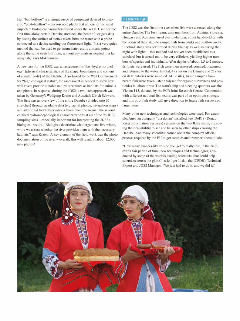
Her “benthofluor” is a unique piece of equipment devised to mea-sure “phytobenthos” – microscopic plants that are one of the most important biological parameters tested under the WFD. Used for the first time along certain Danube stretches, the benthofluor gets data by testing the surface of stones taken from the water with a probe connected to a device sending out fluorescent light. “It’s a very quick method that can be used to get immediate results at many points along the same stretch of river, without any analysis needed in a far away lab,” says Makovinska.
A new task for the JDS2 was an assessment of the “hydromorphol-ogy” (physical characteristics of the shape, boundaries and content of a water body) of the Danube. Also linked to the WFD requirement for “high ecological status”, the assessment is needed to show how well rivers provide suitable natural structures as habitats for animals and plants. In response, during the JDS2, a two-step approach was taken by Germany’s Wolfgang Kraier and Austria’s Ulrich Schwarz. The first was an overview of the entire Danube (divided into 66 stretches) through available data (e.g. aerial photos, navigation maps) and additional field observations taken from the Argus. The second entailed hydromorphological characterizations at all of the 96 JDS2 sampling sites – especially important for interpreting the JDS2’s biological results. “Biologists determine what organisms live where, while we assess whether the river provides them with the necessary habitats,” says Kraier. A key element of the field work was the photo documentation of the river – overall, this will result in about 12,000 new photos!
The time was right
The JDS2 was the first time ever when fish were assessed along the entire Danube. The Fish Team, with members from Austria, Slovakia, Hungary and Romania, used electro-fishing, either hand-held or with the boom of their ship, to sample fish from banks and shallow areas. Electro-fishing was performed during the day as well as during the night with lights – this method had not yet been established as a standard, but it turned out to be very efficient, yielding higher num-bers of species and individuals. After depths of about 1.5 to 2 metres, driftnets were used. The fish were then assessed, counted, measured and returned to the water. In total, 45 sites on the Danube and 21 sites on its tributaries were sampled. At 12 sites, tissue samples from bream fish were taken, later analysed for organic substances and pes-ticides in laboratories. The team’s ship and sleeping quarters was the Vienna 115, donated by the EC’s Joint Research Centre. Cooperation with different national fish teams was part of an optimum strategy, and this pilot fish study will give direction to future fish surveys on large rivers.
Many other new techniques and technologies were used. For exam-ple, Austrian company “via donau” installed new DoRIS (Donau River Information Services) systems on the two JDS2 ships, improv-ing their capabilitiy to see and be seen by other ships cruising the Danube. And many scientists learned about the complex official process required by the EU to get samples and transport them to labs.
“How many chances like this do you get to really test, in the field, over a fair period of time, new techniques and technologies, con-ducted by some of the world’s leading scientists, that could help scientists across the globe?” asks Igor Liska, the ICPDR’s Technical Expert and JDS2 Manager. “We just had to do it, and we did it.”
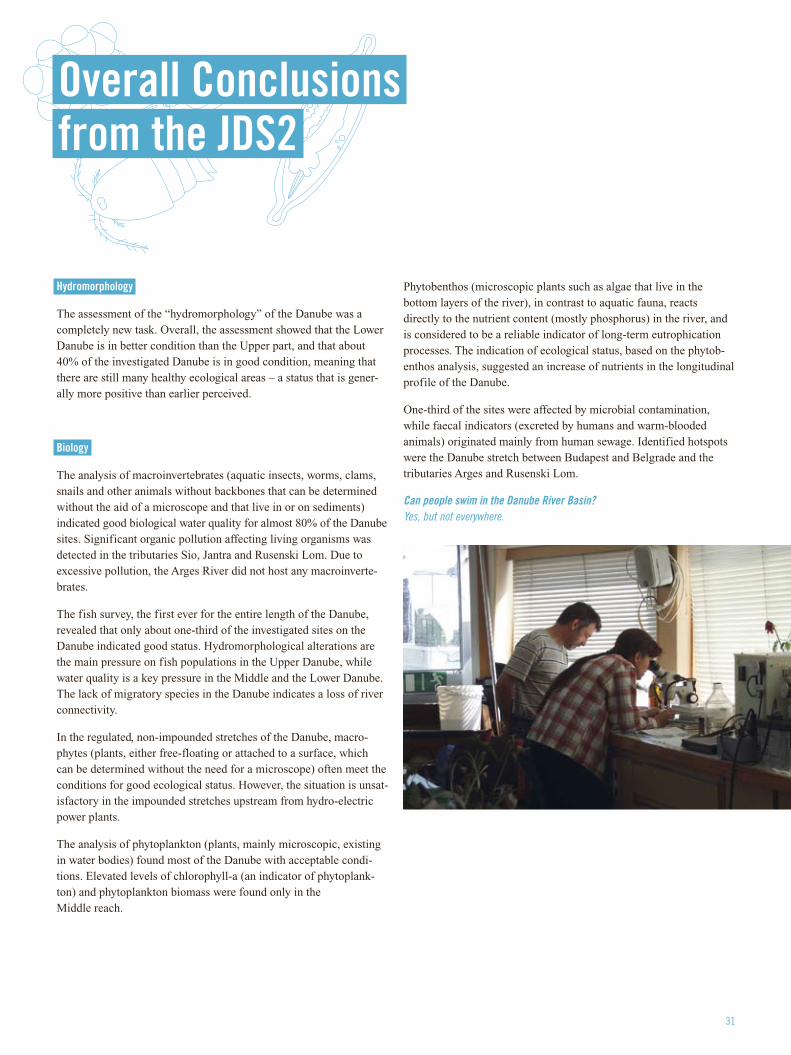
31
Hydromorphology
The assessment of the “hydromorphology” of the Danube was a completely new task. Overall, the assessment showed that the Lower Danube is in better condition than the Upper part, and that about 40% of the investigated Danube is in good condition, meaning that there are still many healthy ecological areas – a status that is gener-ally more positive than earlier perceived.
Biology
The analysis of macroinvertebrates (aquatic insects, worms, clams, snails and other animals without backbones that can be determined without the aid of a microscope and that live in or on sediments) indicated good biological water quality for almost 80% of the Danube sites. Significant organic pollution affecting living organisms was detected in the tributaries Sio, Jantra and Rusenski Lom. Due to excessive pollution, the Arges River did not host any macroinverte-brates.
The fish survey, the first ever for the entire length of the Danube, revealed that only about one-third of the investigated sites on the Danube indicated good status. Hydromorphological alterations are the main pressure on fish populations in the Upper Danube, while water quality is a key pressure in the Middle and the Lower Danube. The lack of migratory species in the Danube indicates a loss of river connectivity.
In the regulated, non-impounded stretches of the Danube, macro-phytes (plants, either free-floating or attached to a surface, which can be determined without the need for a microscope) often meet the conditions for good ecological status. However, the situation is unsat-isfactory in the impounded stretches upstream from hydro-electric power plants.
The analysis of phytoplankton (plants, mainly microscopic, existing in water bodies) found most of the Danube with acceptable condi-tions. Elevated levels of chlorophyll-a (an indicator of phytoplank-ton) and phytoplankton biomass were found only in the Middle reach.
Phytobenthos (microscopic plants such as algae that live in the bottom layers of the river), in contrast to aquatic fauna, reacts directly to the nutrient content (mostly phosphorus) in the river, and is considered to be a reliable indicator of long-term eutrophication processes. The indication of ecological status, based on the phytob-enthos analysis, suggested an increase of nutrients in the longitudinal profile of the Danube.
One-third of the sites were affected by microbial contamination, while faecal indicators (excreted by humans and warm-blooded animals) originated mainly from human sewage. Identified hotspots were the Danube stretch between Budapest and Belgrade and the tributaries Arges and Rusenski Lom.
Can people swim in the Danube River Basin? Yes, but not everywhere.
Overall Conclusions from the JDS2
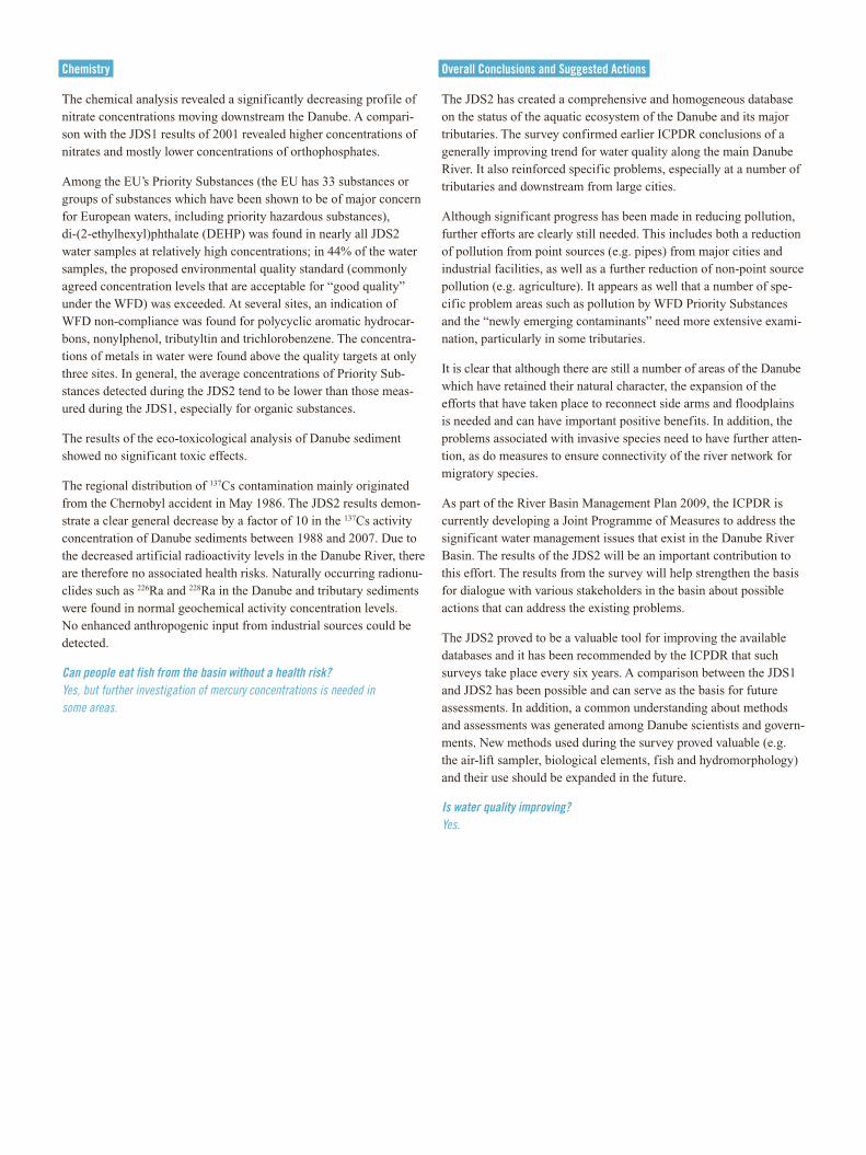
Chemistry
The chemical analysis revealed a significantly decreasing profile of nitrate concentrations moving downstream the Danube. A compari-son with the JDS1 results of 2001 revealed higher concentrations of nitrates and mostly lower concentrations of orthophosphates.
Among the EU’s Priority Substances (the EU has 33 substances or groups of substances which have been shown to be of major concern for European waters, including priority hazardous substances), di-(2-ethylhexyl)phthalate (DEHP) was found in nearly all JDS2 water samples at relatively high concentrations; in 44% of the water samples, the proposed environmental quality standard (commonly agreed concentration levels that are acceptable for “good quality” under the WFD) was exceeded. At several sites, an indication of WFD non-compliance was found for polycyclic aromatic hydrocar-bons, nonylphenol, tributyltin and trichlorobenzene. The concentra-tions of metals in water were found above the quality targets at only three sites. In general, the average concentrations of Priority Sub-stances detected during the JDS2 tend to be lower than those meas-ured during the JDS1, especially for organic substances.
The results of the eco-toxicological analysis of Danube sediment showed no significant toxic effects.
The regional distribution of 137Cs contamination mainly originated from the Chernobyl accident in May 1986. The JDS2 results demon-strate a clear general decrease by a factor of 10 in the 137Cs activity concentration of Danube sediments between 1988 and 2007. Due to the decreased artificial radioactivity levels in the Danube River, there are therefore no associated health risks. Naturally occurring radionu-clides such as 226Ra and 228Ra in the Danube and tributary sediments were found in normal geochemical activity concentration levels. No enhanced anthropogenic input from industrial sources could be detected.
Can people eat fish from the basin without a health risk? Yes, but further investigation of mercury concentrations is needed in some areas.
Overall Conclusions and Suggested Actions
The JDS2 has created a comprehensive and homogeneous database on the status of the aquatic ecosystem of the Danube and its major tributaries. The survey confirmed earlier ICPDR conclusions of a generally improving trend for water quality along the main Danube River. It also reinforced specific problems, especially at a number of tributaries and downstream from large cities.
Although significant progress has been made in reducing pollution, further efforts are clearly still needed. This includes both a reduction of pollution from point sources (e.g. pipes) from major cities and industrial facilities, as well as a further reduction of non-point source pollution (e.g. agriculture). It appears as well that a number of spe-cific problem areas such as pollution by WFD Priority Substances and the “newly emerging contaminants” need more extensive exami-nation, particularly in some tributaries.
It is clear that although there are still a number of areas of the Danube which have retained their natural character, the expansion of the efforts that have taken place to reconnect side arms and floodplains is needed and can have important positive benefits. In addition, the problems associated with invasive species need to have further atten-tion, as do measures to ensure connectivity of the river network for migratory species.
As part of the River Basin Management Plan 2009, the ICPDR is currently developing a Joint Programme of Measures to address the significant water management issues that exist in the Danube River Basin. The results of the JDS2 will be an important contribution to this effort. The results from the survey will help strengthen the basis for dialogue with various stakeholders in the basin about possible actions that can address the existing problems.
The JDS2 proved to be a valuable tool for improving the available databases and it has been recommended by the ICPDR that such surveys take place every six years. A comparison between the JDS1 and JDS2 has been possible and can serve as the basis for future assessments. In addition, a common understanding about methods and assessments was generated among Danube scientists and govern-ments. New methods used during the survey proved valuable (e.g. the air-lift sampler, biological elements, fish and hydromorphology) and their use should be expanded in the future.
Is water quality improving? Yes.
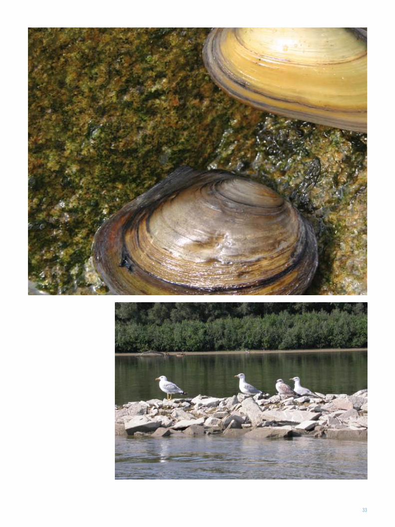
33
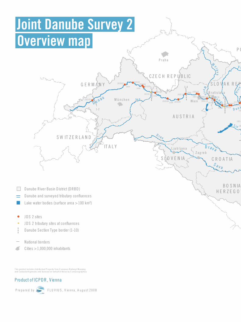
Joint Danube Survey 2 Overview map
D o n a u In n
B lac kS e a
D r a v a
D u n a
S a v a
T is z a
M o r a va
V á h
Hro
n
Ip e ľ
S ió
D u n a v
V e lika M
o r av a Tim
o k
Is k â r
D u n ă r e a
Ol t
A r g e ş
S ire t
Pru t
D r a u
T y s a
S e r e
T i s a
T i s a
D u n a j
Ma
rc h
Y an
t ra
Ip o ly
Product of ICPDR, V ienna
J DS 2 tributary sites at confluences
Danube Section Type border (1-10)
National borders
Cities > 1,000,000 inhabitants
Danube River Basin D istrict (DRBD)
Lake water bodies (surface area > 100 km²)
Danube and surveyed tributary confluences
J DS 2 sites
!!
!
!
!
!
!
!
!
!
!
!
!
!!
!
!
!!
!
!
!
!
!!
G E R M A N Y
C Z E C H R E P U B L IC
A U S T R I A
S W IT Z E R L A N D
IT A L Y
P O L A N D
S L O V A K R E P U B L I C
H U N G A R Y
R O M A N I A
M O L D O V A
U K R A I N E
B U L G A R I A
M A C E D O N I AA L B A N I A
S E R B I AB O S N IA I H E R Z E G O V I N A
C R O A T IAS L O V E N IA
M ü n c h e n Wie n
B ra tis la v a
P r ah a
B u d ap e s t
B u c u re ş ti
B e o g rad
Z ag re bL ju b l jan a
So fija
M O N T E N E G R O
P re p a re d b y F L U V IU S , V ie n n a , A u g u s t 2 0 0 8
T h is p ro d u ct in c lu d e s In te lle ctu a l P ro p e rty fro m E u ro p e a n N a tio n a l M a p pin gan d C a d a s tra l A g e nc ie s a n d lice n s e d o n b e h a lf o f th e s e b y E u ro G e o g rap h ics
J D S 0 1
24 00
1-2
2-3
J D S 0 2J D S 0 3
J D S 0 4J D S 0 5
24 00
J D S 0 6J D S 0 7
J D S 0 8 J D S 0 9
J D S 1 0J D S 1 1
J D S 1 2
J D S 1 3
J D S 1 4J D S 1 5
J D S 1 6
J D S 1 7 J D S 1 8
J D S 1 9
3-4
4-522 00
21 00
20 00
19 00
J D S 2 0
J D S 21J D S 2 2J D S 2 3
J D S 24
J D S 2 5
J D S 26J D S 2 8
J D S 27
J D S 2 9J D S 3 0
J D S 3 1J D S 3 2
J D S 3 3 J D S 3 4
J D S 3 5
J D S 3 6
1700
16 00
5-6
J D S 3 7
J D S 3 8
J D S 3 9
J D S 4 0
15 00
14 00J D S 4 1
J D S 4 2J D S 4 3
J D S 4 4
J D S 4 5 J D S 4 6
J D S 4 7
J D S 4 8
J D S 49
J D S 5 0
J D S 5 1
J D S 5 2 J D S 5 3
J D S 5 4
J D S 5 5
J D S 5 6
J D S 5 7
J D S 5 8 J D S 5 9
J D S 6 0
J D S 6 1
J D S 6 2
6-713 00
12 00
1100 10 00 90 0
80 0 70 0600
7 -8
J D S 6 3
J D S 6 4J D S 6 5
J D S 6 6J D S 6 7
J D S 6 8
J D S 6 9
J D S 7 0J D S 7 1
J D S 7 2
J D S 7 3
8-9
J D S 74J D S 7 5
J D S 7 6
J D S 7 7
J D S 7 8
J D S 7 9
J D S 8 0J D S 8 1 (R u sse n sk i L o m )
J D S 8 2J D S 8 3
J D S 8 4
J D S 8 5
J D S 8 7
J D S 8 8
50 0
400
30 0
20 0
100
0
J D S 8 9J D S 9 0
J D S 9 1
J D S 9 2
J D S 9 3 J D S 9
J D S 9 5
J D S 9 6
9-1 0
10
10
10
18 00
0 50 10 0 15 0 20 0 25 0 K ilo m e te rs
±S c a le : 1 : 4 ,5 0 0 ,0 0 0(S ca le 1 : 6 m ill in A 4 lan d sc ap e pa pe r fo rm at)
Sarajevo
ChisinauD o n a u In n
B lac kS e a
D r a v a
D u n a
S a v a
T is z a
M o r a va
V á h
Hro
n
Ip e ľ
S ió
D u n a v
V e lika M
o r av a Tim
o k
Is k â r
D u n ă r e a
Ol t
A r g e ş
S ire t
Pru t
D r a u
T y s a
S e r e
T i s a
T i s a
D u n a j
Ma
rc h
Y an
t ra
Ip o ly
Product of ICPDR, V ienna
J DS 2 tributary sites at confluences
Danube Section Type border (1-10)
National borders
Cities > 1,000,000 inhabitants
Danube River Basin D istrict (DRBD)
Lake water bodies (surface area > 100 km²)
Danube and surveyed tributary confluences
J DS 2 sites
!!
!
!
!
!
!
!
!
!
!
!
!
!!
!
!
!!
!
!
!
!
!!
G E R M A N Y
C Z E C H R E P U B L IC
A U S T R I A
S W IT Z E R L A N D
IT A L Y
P O L A N D
S L O V A K R E P U B L I C
H U N G A R Y
R O M A N I A
M O L D O V A
U K R A I N E
B U L G A R I A
M A C E D O N I AA L B A N I A
S E R B I AB O S N IA I H E R Z E G O V I N A
C R O A T IAS L O V E N IA
M ü n c h e n Wie n
B ra tis la v a
P r ah a
B u d ap e s t
B u c u re ş ti
B e o g rad
Z ag re bL ju b l jan a
So fija
M O N T E N E G R O
P re p a re d b y F L U V IU S , V ie n n a , A u g u s t 2 0 0 8
T h is p ro d u ct in c lu d e s In te lle ctu a l P ro p e rty fro m E u ro p e a n N a tio n a l M a p pin gan d C a d a s tra l A g e nc ie s a n d lice n s e d o n b e h a lf o f th e s e b y E u ro G e o g rap h ics
J D S 0 1
24 00
1-2
2-3
J D S 0 2J D S 0 3
J D S 0 4J D S 0 5
24 00
J D S 0 6J D S 0 7
J D S 0 8 J D S 0 9
J D S 1 0J D S 1 1
J D S 1 2
J D S 1 3
J D S 1 4J D S 1 5
J D S 1 6
J D S 1 7 J D S 1 8
J D S 1 9
3-4
4-522 00
21 00
20 00
19 00
J D S 2 0
J D S 21J D S 2 2J D S 2 3
J D S 24
J D S 2 5
J D S 26J D S 2 8
J D S 27
J D S 2 9J D S 3 0
J D S 3 1J D S 3 2
J D S 3 3 J D S 3 4
J D S 3 5
J D S 3 6
1700
16 00
5-6
J D S 3 7
J D S 3 8
J D S 3 9
J D S 4 0
15 00
14 00J D S 4 1
J D S 4 2J D S 4 3
J D S 4 4
J D S 4 5 J D S 4 6
J D S 4 7
J D S 4 8
J D S 49
J D S 5 0
J D S 5 1
J D S 5 2 J D S 5 3
J D S 5 4
J D S 5 5
J D S 5 6
J D S 5 7
J D S 5 8 J D S 5 9
J D S 6 0
J D S 6 1
J D S 6 2
6-713 00
12 00
1100 10 00 90 0
80 0 70 0600
7 -8
J D S 6 3
J D S 6 4J D S 6 5
J D S 6 6J D S 6 7
J D S 6 8
J D S 6 9
J D S 7 0J D S 7 1
J D S 7 2
J D S 7 3
8-9
J D S 74J D S 7 5
J D S 7 6
J D S 7 7
J D S 7 8
J D S 7 9
J D S 8 0J D S 8 1 (R u sse n sk i L o m )
J D S 8 2J D S 8 3
J D S 8 4
J D S 8 5
J D S 8 7
J D S 8 8
50 0
400
30 0
20 0
100
0
J D S 8 9J D S 9 0
J D S 9 1
J D S 9 2
J D S 9 3 J D S 9
J D S 9 5
J D S 9 6
9-1 0
10
10
10
18 00
0 50 10 0 15 0 20 0 25 0 K ilo m e te rs
±S c a le : 1 : 4 ,5 0 0 ,0 0 0(S ca le 1 : 6 m ill in A 4 lan d sc ap e pa pe r fo rm at)
Sarajevo
Chisinau
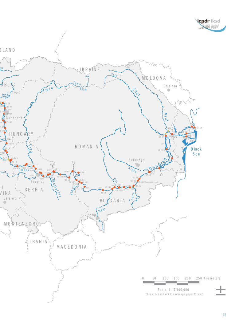
35
D o n a u In n
B lac kS e a
D r a v a
D u n a
S a v a
T is z a
M o r a va
V á h
Hro
n
Ip e ľ
S ió
D u n a v
V e lika M
o r av a Tim
o k
Is k â r
D u n ă r e a
Ol t
A r g e ş
S ire t
Pru t
D r a u
T y s a
S e r e
T i s a
T i s a
D u n a j
Ma
rc h
Y an
t ra
Ip o ly
Product of ICPDR, V ienna
J DS 2 tributary sites at confluences
Danube Section Type border (1-10)
National borders
Cities > 1,000,000 inhabitants
Danube River Basin D istrict (DRBD)
Lake water bodies (surface area > 100 km²)
Danube and surveyed tributary confluences
J DS 2 sites
!!
!
!
!
!
!
!
!
!
!
!
!
!!
!
!
!!
!
!
!
!
!!
G E R M A N Y
C Z E C H R E P U B L IC
A U S T R I A
S W IT Z E R L A N D
IT A L Y
P O L A N D
S L O V A K R E P U B L I C
H U N G A R Y
R O M A N I A
M O L D O V A
U K R A I N E
B U L G A R I A
M A C E D O N I AA L B A N I A
S E R B I AB O S N IA I H E R Z E G O V I N A
C R O A T IAS L O V E N IA
M ü n c h e n Wie n
B ra tis la v a
P r ah a
B u d ap e s t
B u c u re ş ti
B e o g rad
Z ag re bL ju b l jan a
So fija
M O N T E N E G R O
P re p a re d b y F L U V IU S , V ie n n a , A u g u s t 2 0 0 8
T h is p ro d u ct in c lu d e s In te lle ctu a l P ro p e rty fro m E u ro p e a n N a tio n a l M a p pin gan d C a d a s tra l A g e nc ie s a n d lice n s e d o n b e h a lf o f th e s e b y E u ro G e o g rap h ics
J D S 0 1
24 00
1-2
2-3
J D S 0 2J D S 0 3
J D S 0 4J D S 0 5
24 00
J D S 0 6J D S 0 7
J D S 0 8 J D S 0 9
J D S 1 0J D S 1 1
J D S 1 2
J D S 1 3
J D S 1 4J D S 1 5
J D S 1 6
J D S 1 7 J D S 1 8
J D S 1 9
3-4
4-522 00
21 00
20 00
19 00
J D S 2 0
J D S 21J D S 2 2J D S 2 3
J D S 24
J D S 2 5
J D S 26J D S 2 8
J D S 27
J D S 2 9J D S 3 0
J D S 3 1J D S 3 2
J D S 3 3 J D S 3 4
J D S 3 5
J D S 3 6
1700
16 00
5-6
J D S 3 7
J D S 3 8
J D S 3 9
J D S 4 0
15 00
14 00J D S 4 1
J D S 4 2J D S 4 3
J D S 4 4
J D S 4 5 J D S 4 6
J D S 4 7
J D S 4 8
J D S 49
J D S 5 0
J D S 5 1
J D S 5 2 J D S 5 3
J D S 5 4
J D S 5 5
J D S 5 6
J D S 5 7
J D S 5 8 J D S 5 9
J D S 6 0
J D S 6 1
J D S 6 2
6-713 00
12 00
1100 10 00 90 0
80 0 70 0600
7 -8
J D S 6 3
J D S 6 4J D S 6 5
J D S 6 6J D S 6 7
J D S 6 8
J D S 6 9
J D S 7 0J D S 7 1
J D S 7 2
J D S 7 3
8-9
J D S 74J D S 7 5
J D S 7 6
J D S 7 7
J D S 7 8
J D S 7 9
J D S 8 0J D S 8 1 (R u sse n sk i L o m )
J D S 8 2J D S 8 3
J D S 8 4
J D S 8 5
J D S 8 7
J D S 8 8
50 0
400
30 0
20 0
100
0
J D S 8 9J D S 9 0
J D S 9 1
J D S 9 2
J D S 9 3 J D S 9
J D S 9 5
J D S 9 6
9-1 0
10
10
10
18 00
0 50 10 0 15 0 20 0 25 0 K ilo m e te rs
±S c a le : 1 : 4 ,5 0 0 ,0 0 0(S ca le 1 : 6 m ill in A 4 lan d sc ap e pa pe r fo rm at)
Sarajevo
ChisinauD o n a u In n
B lac kS e a
D r a v a
D u n a
S a v a
T is z a
M o r a va
V á h
Hro
n
Ip e ľ
S ió
D u n a v
V e lika M
o r av a Tim
o k
Is k â r
D u n ă r e a
Ol t
A r g e ş
S ire t
Pru t
D r a u
T y s a
S e r e
T i s a
T i s a
D u n a j
Ma
rc h
Y an
t ra
Ip o ly
Product of ICPDR, V ienna
J DS 2 tributary sites at confluences
Danube Section Type border (1-10)
National borders
Cities > 1,000,000 inhabitants
Danube River Basin D istrict (DRBD)
Lake water bodies (surface area > 100 km²)
Danube and surveyed tributary confluences
J DS 2 sites
!!
!
!
!
!
!
!
!
!
!
!
!
!!
!
!
!!
!
!
!
!
!!
G E R M A N Y
C Z E C H R E P U B L IC
A U S T R I A
S W IT Z E R L A N D
IT A L Y
P O L A N D
S L O V A K R E P U B L I C
H U N G A R Y
R O M A N I A
M O L D O V A
U K R A I N E
B U L G A R I A
M A C E D O N I AA L B A N I A
S E R B I AB O S N IA I H E R Z E G O V I N A
C R O A T IAS L O V E N IA
M ü n c h e n Wie n
B ra tis la v a
P r ah a
B u d ap e s t
B u c u re ş ti
B e o g rad
Z ag re bL ju b l jan a
So fija
M O N T E N E G R O
P re p a re d b y F L U V IU S , V ie n n a , A u g u s t 2 0 0 8
T h is p ro d u ct in c lu d e s In te lle ctu a l P ro p e rty fro m E u ro p e a n N a tio n a l M a p pin gan d C a d a s tra l A g e nc ie s a n d lice n s e d o n b e h a lf o f th e s e b y E u ro G e o g rap h ics
J D S 0 1
24 00
1-2
2-3
J D S 0 2J D S 0 3
J D S 0 4J D S 0 5
24 00
J D S 0 6J D S 0 7
J D S 0 8 J D S 0 9
J D S 1 0J D S 1 1
J D S 1 2
J D S 1 3
J D S 1 4J D S 1 5
J D S 1 6
J D S 1 7 J D S 1 8
J D S 1 9
3-4
4-522 00
21 00
20 00
19 00
J D S 2 0
J D S 21J D S 2 2J D S 2 3
J D S 24
J D S 2 5
J D S 26J D S 2 8
J D S 27
J D S 2 9J D S 3 0
J D S 3 1J D S 3 2
J D S 3 3 J D S 3 4
J D S 3 5
J D S 3 6
1700
16 00
5-6
J D S 3 7
J D S 3 8
J D S 3 9
J D S 4 0
15 00
14 00J D S 4 1
J D S 4 2J D S 4 3
J D S 4 4
J D S 4 5 J D S 4 6
J D S 4 7
J D S 4 8
J D S 49
J D S 5 0
J D S 5 1
J D S 5 2 J D S 5 3
J D S 5 4
J D S 5 5
J D S 5 6
J D S 5 7
J D S 5 8 J D S 5 9
J D S 6 0
J D S 6 1
J D S 6 2
6-713 00
12 00
1100 10 00 90 0
80 0 70 0600
7 -8
J D S 6 3
J D S 6 4J D S 6 5
J D S 6 6J D S 6 7
J D S 6 8
J D S 6 9
J D S 7 0J D S 7 1
J D S 7 2
J D S 7 3
8-9
J D S 74J D S 7 5
J D S 7 6
J D S 7 7
J D S 7 8
J D S 7 9
J D S 8 0J D S 8 1 (R u sse n sk i L o m )
J D S 8 2J D S 8 3
J D S 8 4
J D S 8 5
J D S 8 7
J D S 8 8
50 0
400
30 0
20 0
100
0
J D S 8 9J D S 9 0
J D S 9 1
J D S 9 2
J D S 9 3 J D S 9
J D S 9 5
J D S 9 6
9-1 0
10
10
10
18 00
0 50 10 0 15 0 20 0 25 0 K ilo m e te rs
±S c a le : 1 : 4 ,5 0 0 ,0 0 0(S ca le 1 : 6 m ill in A 4 lan d sc ap e pa pe r fo rm at)
Sarajevo
Chisinau
4

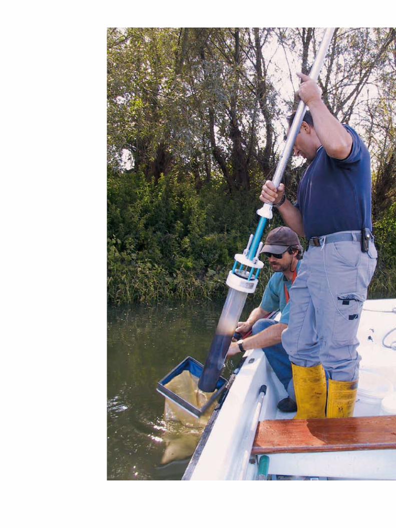
Biodiversity: The variation of life forms within a given ecosystem, biome or for the entire Earth. Biodiversity is often used as a measure of the health of biological systems.
Bio-indicator: Species or chemicals used to monitor the health of an environment or ecosystem.
Biomass: Biological material derived from living or recently living organisms.
Carcinogenic: Capable of causing cancer.
Crustacean: This large group of species includes vari-ous familiar animals such as crabs, lobsters, crayfish, shrimp and barnacles. The majority of them are aquatic.
Danube River Basin Analysis 2004: The first-ever com-prehensive analysis of the Danube Basin’s environ-ment and pressures impacting it, coordinated by the ICPDR.
Danube River Basin Management Plan: The WFD requires all EU countries to have River Basin Management Plans, including a Programme of Measures, by 2009.
Danube River Protection Convention: Signed in 1994 by Danube countries and the EU, it is the major legal instrument for cooperation and transboundary water management in the Danube River Basin.
Diatoms: A major algae group and one of the most common types of phytoplankton.
Electric fishing: The act of using an electric field in water to stun fish so they can be collected with a net, assessed and then released, usually unharmed.
Endocrine disrupting compounds: Organic compounds which can significantly impact the hormones of ani-mals such as humans, fish and snails.
Environmental quality standards (EQS): Under the WFD, EQS refer to commonly agreed concentration levels that are acceptable for “good chemical status”, used by scientists as toxicity indicators.
Eutrophication: Elevated production of biomass in waters mainly due to an overload of nutrients (typi-cally nitrogen or phosphorus).
Fauna: A typical collection of animals found in a spe-cific time or place.
Fish: Aquatic vertebrates (having a backbone) that are typically cold-blooded and covered with scales.
Floodplain: Any land area susceptible to being inun-dated by floodwaters from any source.
Flora: A typical collection of plants found in a specific time or place.
Good biological and ecological status: The quality required for a water body to meet WFD requirements.
Habitat: The physical and biological environment on which a given species depends for its survival.
Hydromorphology: As defined by the WFD, the physical characteristics of the shape, boundaries and content of a water body.
Immunotoxicity: Toxicity to the immune system.
International Commission for the Protection of the Danube River (ICPDR): The international organisation which has been established to implement the Danube River Protection Convention.
Invasive species: Non-indigenous species (e.g. plants or animals) that adversely affect the habitats they invade economically, environmentally or ecologically.
JDS1: The first Joint Danube Survey coordinated by the ICPDR in 2001.
JDS2: The second Joint Danube Survey coordinated by the ICPDR in 2007.
Macroinvertebrates: Aquatic insects, worms, clams, snails and other animals without backbones that can be determined without the aid of a microscope and that live in or on sediments.
Macrophytes: Aquatic plants, either free-floating or attached to the bottom, which can be determined by the naked eye without the need for a microscope.
Microbiology: The study of microscopic organisms that are unicellular or exist in cell clusters.
Mutagenic: Can damage genes and possibly cause cancer.
Nutrient: Substances such as nitrogen and phosphorus, used by organisms to grow.
Nutrient pollution: Contamination of water resources by excessive inputs of nutrients. In surface waters, excess algal production is a major concern.
Order of magnitude: An amount equal to 10 times a given value.
Organic compounds: Natural or synthetic substances based on carbon.
Organic pollution: Occurs when an excess of organic matter, such as manure or sewage, enters the water.
Parameter: A quantity that defines certain characteris-tics of systems or functions.
Pathogens: Bacteria, viruses, parasites or fungi that can cause disease.
Perfluorinated acids: Chemicals that repel water and oil and are resistant to heat and chemical stress.
Persistent organic pollutants (POPs): Chemicals that remain intact in the environment for long periods, become widely distributed geographically, accumu-late in the fatty tissue of living organisms and are toxic to humans and wildlife.
Pesticide: A substance, usually chemical, used to kill unwanted plants and animals.
Phytobenthos: Microscopic plants such as algae that live in the bottom layers of the river and seabed.
Phytoplankton: Plants, mainly microscopic, existing in water bodies.
Point source: A well defined source of pollution from a single point, such as a pipe. Non-point sources of pollution enter water from a dispersed (or “diffuse”) and uncontrolled source, such as run-off from land or from the atmosphere, rather than through a pipe.
Priority Substances: The EU’s 33 “Priority Substances” or groups of substances which have been shown to be of major concern for European waters. Priority Sub-stances include organic compounds and heavy metals.
Radioactivity: The spontaneous discharge of radiation from atomic nuclei.
Reach: The Danube is split into three “reaches”.
Rip-rap: Large boulders that have been artificially placed to fix riverbanks, especially at channelised and impounded river sections.
Rkm: Distance in the river upstream from the river’s mouth (for the Danube River, distance from the Dan-ube Delta).
Sediment: Material that was suspended in water and that settles at the bottom of a body of water.
Species abundance: The number of individuals per species. Relative abundance species is the species abundance relative to the abundances of other species represented in the community.
Species diversity: The number of species within a biological community (also known as “species rich-ness”).
Suspended sediment refers to the solid particles, sus-pended within the water column, which the water is carrying. Also known as suspended particulate matter (SPM).
Taxon (sg), Taxa (pl): A group or category of living organisms.
Teratogenic: Capable of causing birth defects.
Trans-National Monitoring Network (TNMN): Coordinated by the ICPDR, it comprises over 75 monitoring sta-tions and provides a regular overview of the main chemical and physical parameters important for assessing water quality.
Tributary: A river that flows into a larger river or other body of water.
Volatile organic compounds (VOCs): Carbon-containing chemicals which readily evaporate, such as cleaning solvents and gasoline.
Water Framework Directive (WFD): A framework for the European Union action in the field of water policy (see more on page 17 in box “Important to know about the WFD”).
Zooplankton: Tiny invertebrates (animals without back-
bones) that float freely in water bodies.
Glossary
JDS2 Core Team
Igor Liska, JDS2 Manager
Jaroslav Slobodnik, Technical coordinator
Bela Csanyi, Team leader
Wolfram Graf, Biologist – macrozoobenthos expert Upper Danube
Patrick Leitner, Biologist – macrozoobenthos expert Upper Danube
Momir Paunovic, Biologist – macrozoobenthos expert Lower Danube
Jarmila Makovinska, Biologist – phytobenthos expert
Martin Dokulil, Biologist – phytoplankton expert
Christina Kaiblinger, Biologist – phytoplankton expert
Brigitte Schmidt, Biologist – macrophytes expert
Gabriel Chiriac, Biologist – general hydrobiology
Mary Craciun, Chemist – suspended solids sampling
Carmen Hamchevici, Chemist – on-board analyses
Hana Hudcova, Chemist – water sampling, sediment processing, radiology
Wolfgang Kraier, Expert in hydromorphology
Ulrich Schwarz, Expert in hydromorphology
Alexander Kirschner, Microbiologist
Branko Velimirov, Microbiologist
Richard Niederreiter, Air-lift sampling expert
Stefan Steiner, Air-lift sampling expert
Fish Team
Christian Wiesner, Team leader and fish expert
Niels Jepsen, Team leader and fish expert – JRC Ispra
Nikolaus Schotzko, Fish expert
Gabor Guti, Fish expert
Grigore Davideanu, Fish expert – Lower Danube
Jaroslav Cerny, Fish expert
Reserve Core Team
Matus Haviar, Biologist – macrozoobenthos expert
Thomas Ofenbock, Biologist – macrozoobenthos expert
Laurentia Ungureanu, Biologist – phytoplankton expert
Eva Lanz, Biologist – macrophytes expert
Zoran Stojanovic, Chemist
Violeta Astratinei, Microbiologist
Nemanja Milosevic, Microbiologist
JDS2 Managerial and Administrative Team
Jasmine Bachmann, Public participation and public relation
Paul Csagoly, Communications and editing
Alexander Hoebart, Information manager
Anna Koch, Financial officer
Patricia Faltusova, Administrative support
Marcela Fabianova, Administrative support
JDS2 National Coordinators
DE Ursula Schmedtje, National Coordinator
DE Jürgen Seibold, Deputy
DE Birgit Wolf, Deputy
AT Wolfgang Rodinger, National Coordinator
AT Franz Wagner, Deputy
CZ Ilja Bernardova, National Coordinator
CZ Monika Machkova, Deputy
SK Jarmila Makovinska, National Coordinator
SK Livia Tothova, Deputy
HU Ferenc Laszlo, National Coordinator
HU Ildiko Horvathne-Kiss, Deputy
HR Dagmar Surmanovic, National Coordinator
HR Marija Marijanovic-Rajcic, Deputy
RS Marija Kostic, National Coordinator
RS Momir Paunovic, Deputy
BG Tzvetanka Dimitrova, National Coordinator
BG Mina Asenova, Deputy
BG Dimitar Vergiev, National Coordinator
BG Hristo Kasadzhikov, Deputy
BG Ivan Ivanov, Deputy
RO Gabriel Chiriac, National Coordinator
RO Liviu Popescu, Deputy
RO Serban Iliescu, Deputy
RO Teodor Lucian Constantinescu, Deputy
MD Gavril Gilca, National Coordinator
UA Oleksander Deziron, National Coordinator
UA Yuriy Nabyvanets, Deputy
UA Valerii Kasianchuk, Deputy
JDS2 Supporting Experts
DE Heinz-Jurgen Brauch
DE Volker Mohaupt
DE Frank Sacher
DE Peter Seel
DE Manfred Sengl
AT Martha Simon
AT Andeas Farnleitner
AT Thilo Hofmann
AT Oliver Gans
AT Gerhard Kavka
AT Veronika Koller-Kreimel
AT Franz Josef Maringer
AT Wolfgang Papesch
AT Dieter Rank
CZ Vera Ocenaskova
CZ Michal Pavonic
HU Keszler Balasz
HU Peter Literathy
HU Katalin Zsuga
RS Vesna Micic
RO Ioana Enache
UA Sergiy Afanasyev
EU Eugen Christoph
EU Bernd Gawlik
EU Anna-Stiina Heiskanen
EU Robert Loos
EU Giulio Mariani
EU Gunter Umlauf
EU Jan Wollgast
IAEA Brent Newman
IAEA Tomas Vitvar
JDS2 National Key Fish Experts
DE Andreas Kolbinger
HR Perica Mustafic, Marko Caleta
AT Nikolaus Schotzko
RS Predrag Simonovic
CZ Zdenek Adamek
RO Grigore Davideanu
SK Jaroslav Cerny, Vladimir Kovac
BG Stoyan Mihov
HU Gabor Guti
UA Yevgen Savchenko
Acknowledgements

JointDanubeSurvey 2
The Joint Danube Survey 2Research Expedition and Conclusions
ImprintPublished by ICPDR – International Commission for the Protection of the Danube RiverVienna International Centre, D0412, PO BOX 500, 1400 Vienna, Austria
Publication Coordination: Jasmine BachmannEditor: Paul CsagolyScience Editor: Igor LiskaConcept / Layout: Büro X Wien, www.buerox.at
© ICPDR 2008, www.icpdr.org
Supported by the Danube Countries, European Commission