Embed Size (px)
Citation preview
NATIONAL DROUGHT MITIGATION CENTER
The National Drought Mitigation Center &
The U.S. Drought MonitorThe National Drought Mitigation Center & The U.S. Drought Monitor
Deborah Bathke, NDMC & Aaron Jacobs, NWS
Southeast Alaska Drought Workshop
Juneau, Alaska
May 7, 2019
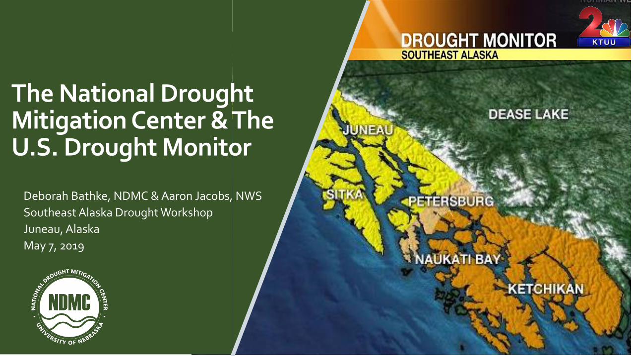
TODAY’S TALK
Objectives
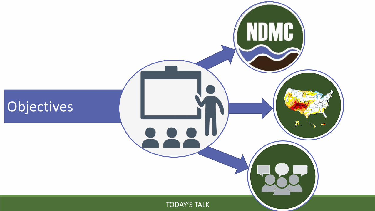
The National Drought Mitigation Center (NDMC)
NATIONAL DROUGHT MITIGATION CENTER
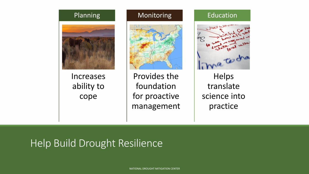
Help Build Drought Resilience
Increases ability to
cope
Planning
Provides the foundation
for proactive management
Monitoring
Helps translate
science into practice
Education
NATIONAL DROUGHT MITIGATION CENTER
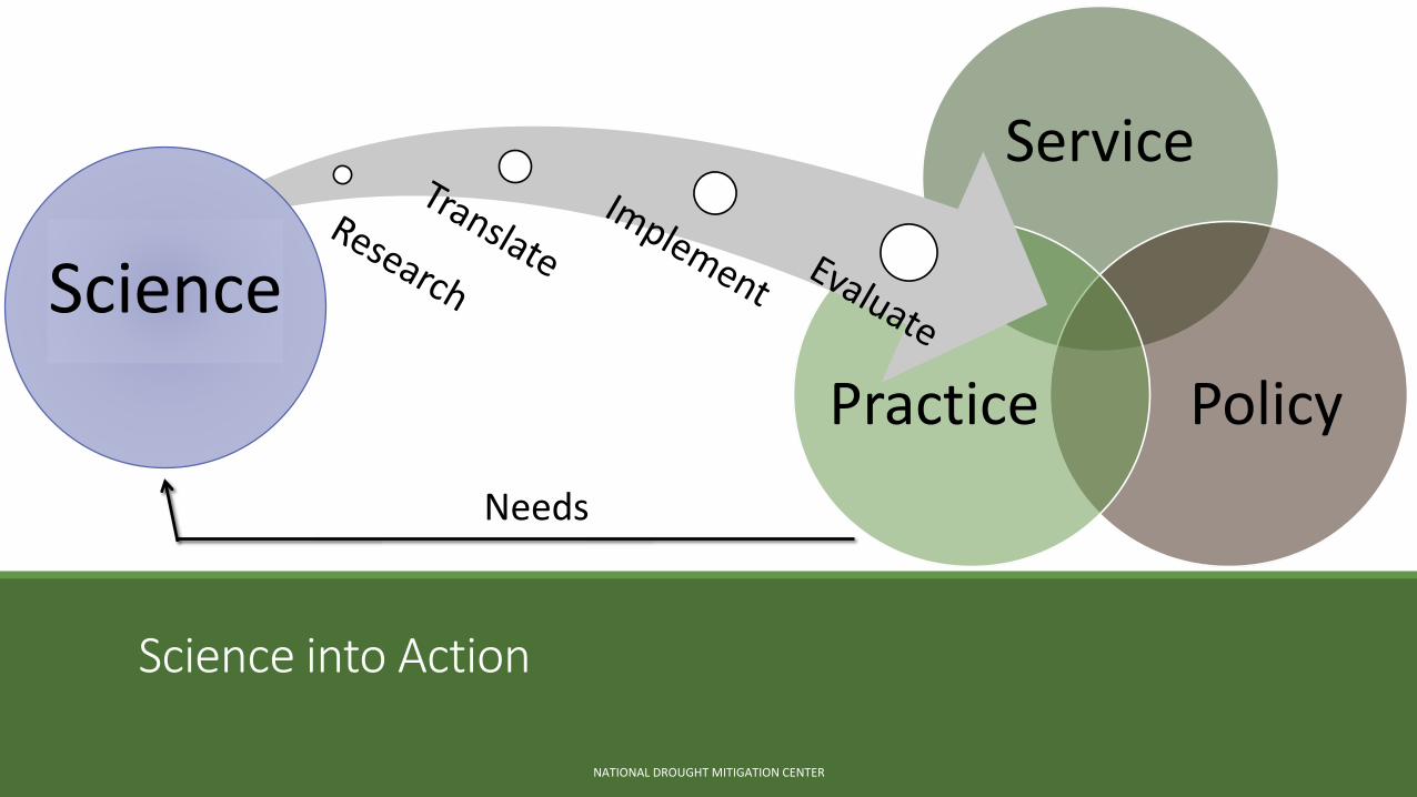
Service
PolicyPractice
Science into Action
NATIONAL DROUGHT MITIGATION CENTER
Science
Needs
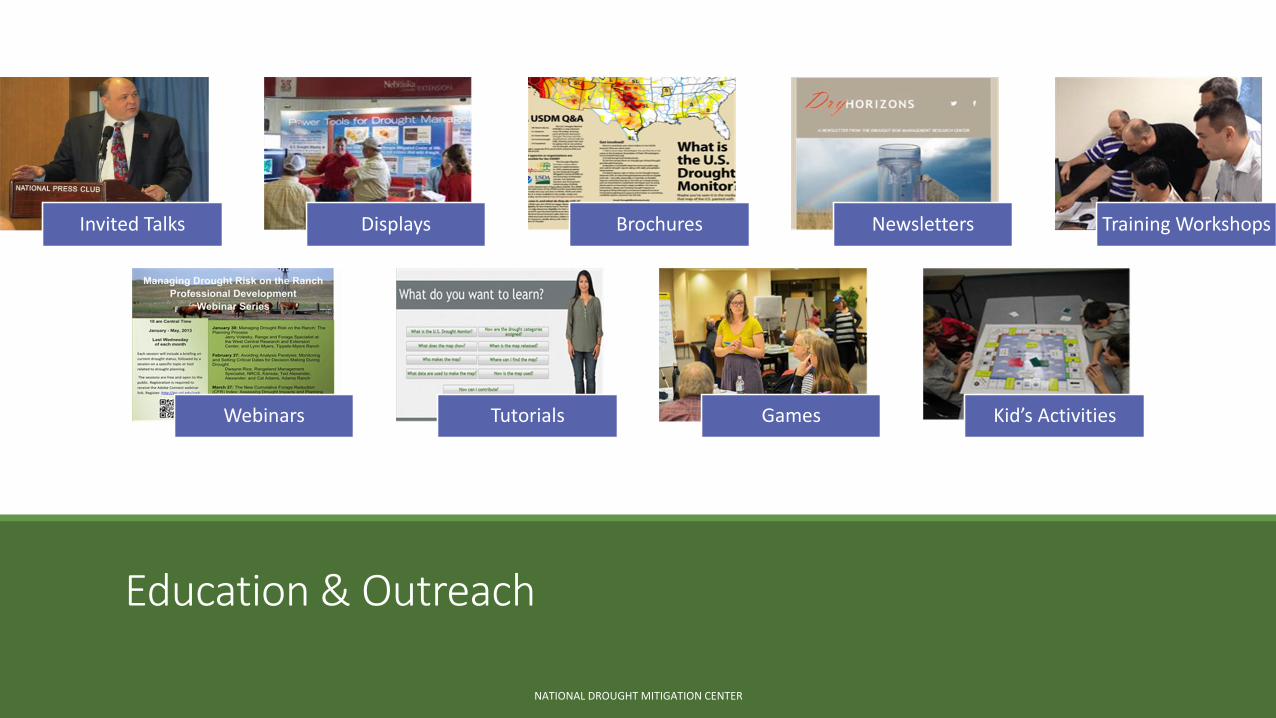
Education & Outreach
Invited Talks Displays Brochures Newsletters Training Workshops
Webinars Tutorials Games Kid’s Activities
NATIONAL DROUGHT MITIGATION CENTER
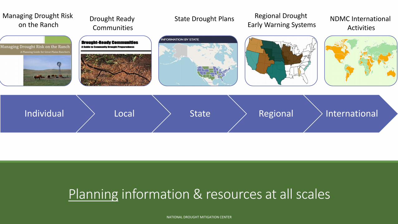
Planning information & resources at all scales
NATIONAL DROUGHT MITIGATION CENTER
Regional Drought Early Warning Systems
NDMC International Activities
State Drought PlansDrought Ready Communities
Managing Drought Risk on the Ranch
Individual Local State Regional International
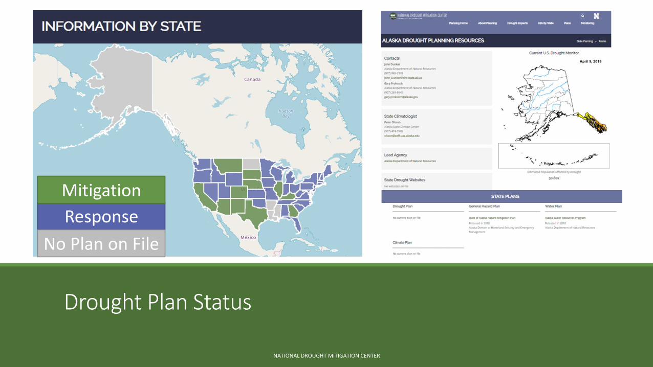
Drought Plan Status
NATIONAL DROUGHT MITIGATION CENTER
Response
Mitigation
No Plan on File
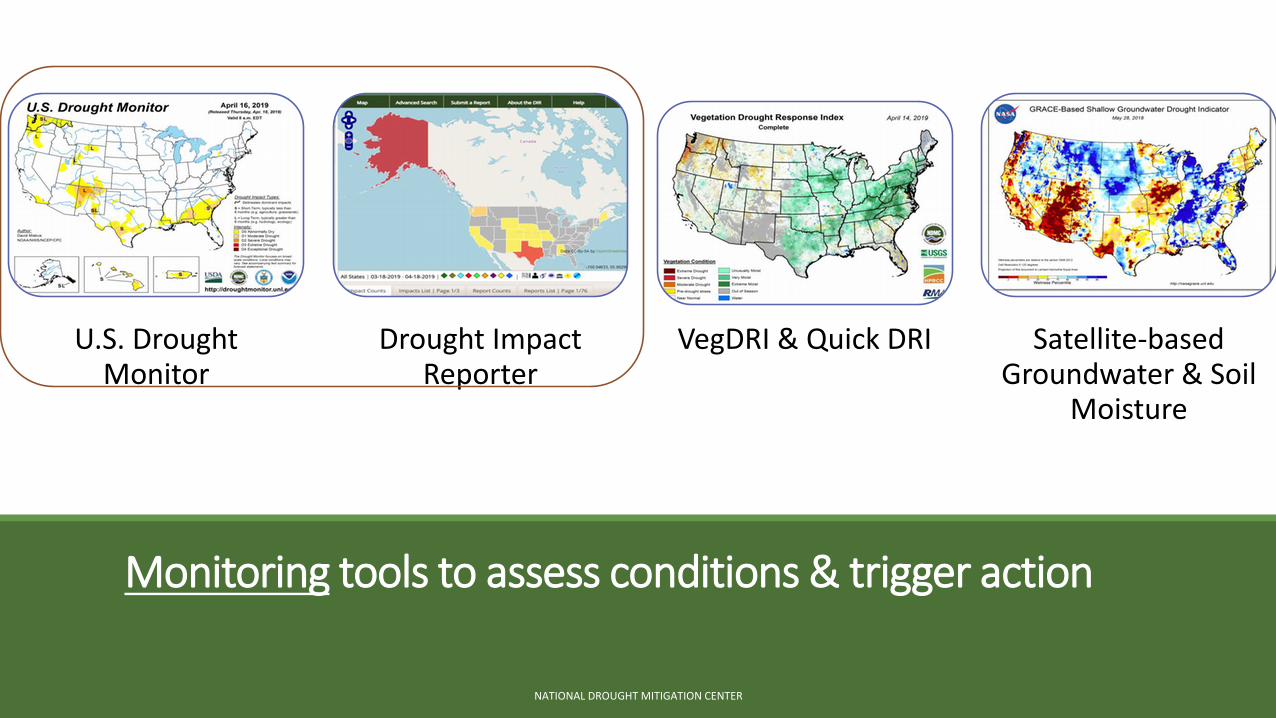
U.S. Drought Monitor
Drought Impact Reporter
VegDRI & Quick DRI Satellite-based Groundwater & Soil
Moisture
Monitoring tools to assess conditions & trigger action
NATIONAL DROUGHT MITIGATION CENTER
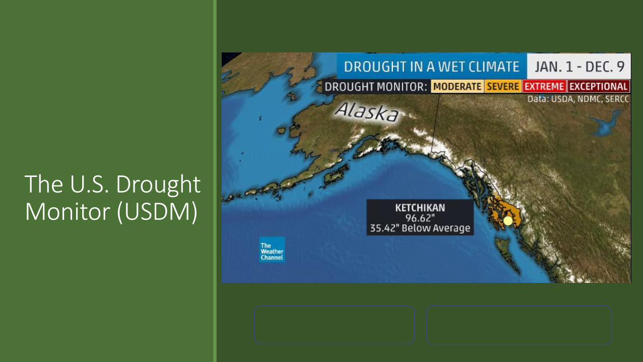
The U.S. Drought Monitor (USDM)
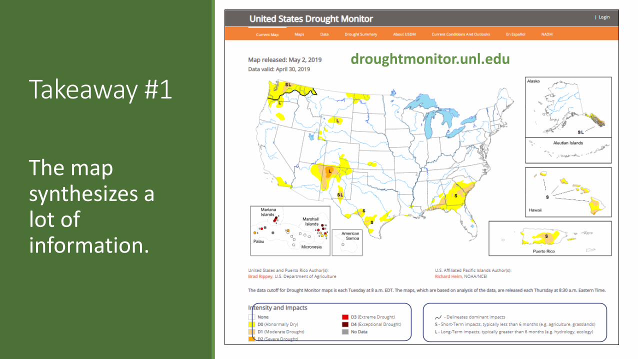
Takeaway #1
The map synthesizes a lot of information.
droughtmonitor.unl.edu
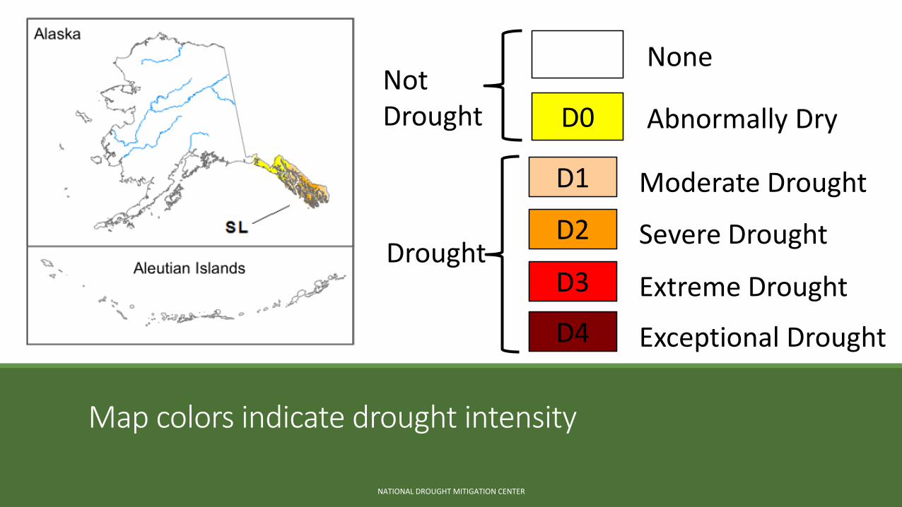
Map colors indicate drought intensity
NATIONAL DROUGHT MITIGATION CENTER
None
D0 Abnormally Dry
Not Drought
D4 Exceptional Drought
D1 Moderate Drought
D2 Severe Drought
D3 Extreme DroughtDrought
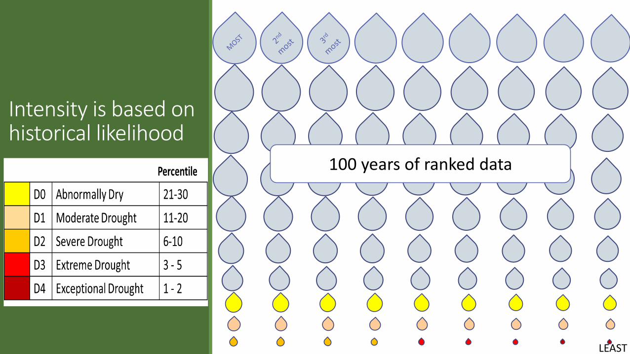
Intensity is based on historical likelihood
100 years of ranked data
LEAST
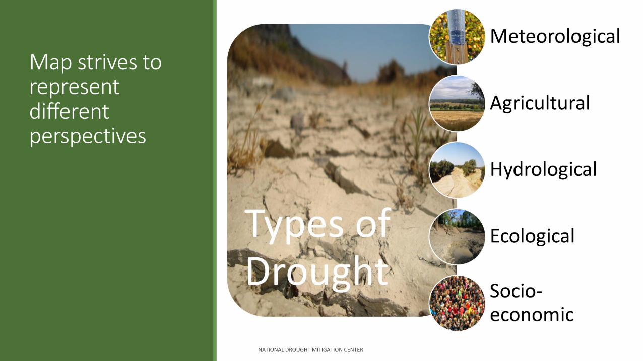
Map strives to represent different perspectives
NATIONAL DROUGHT MITIGATION CENTER
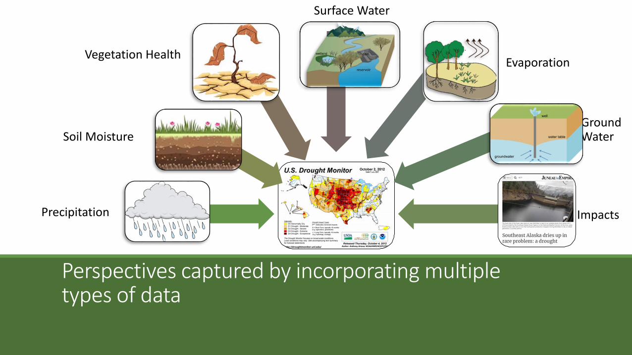
Perspectives captured by incorporating multiple types of data
Precipitation
Soil Moisture
Vegetation HealthEvaporation
Ground Water
Impacts
Surface Water
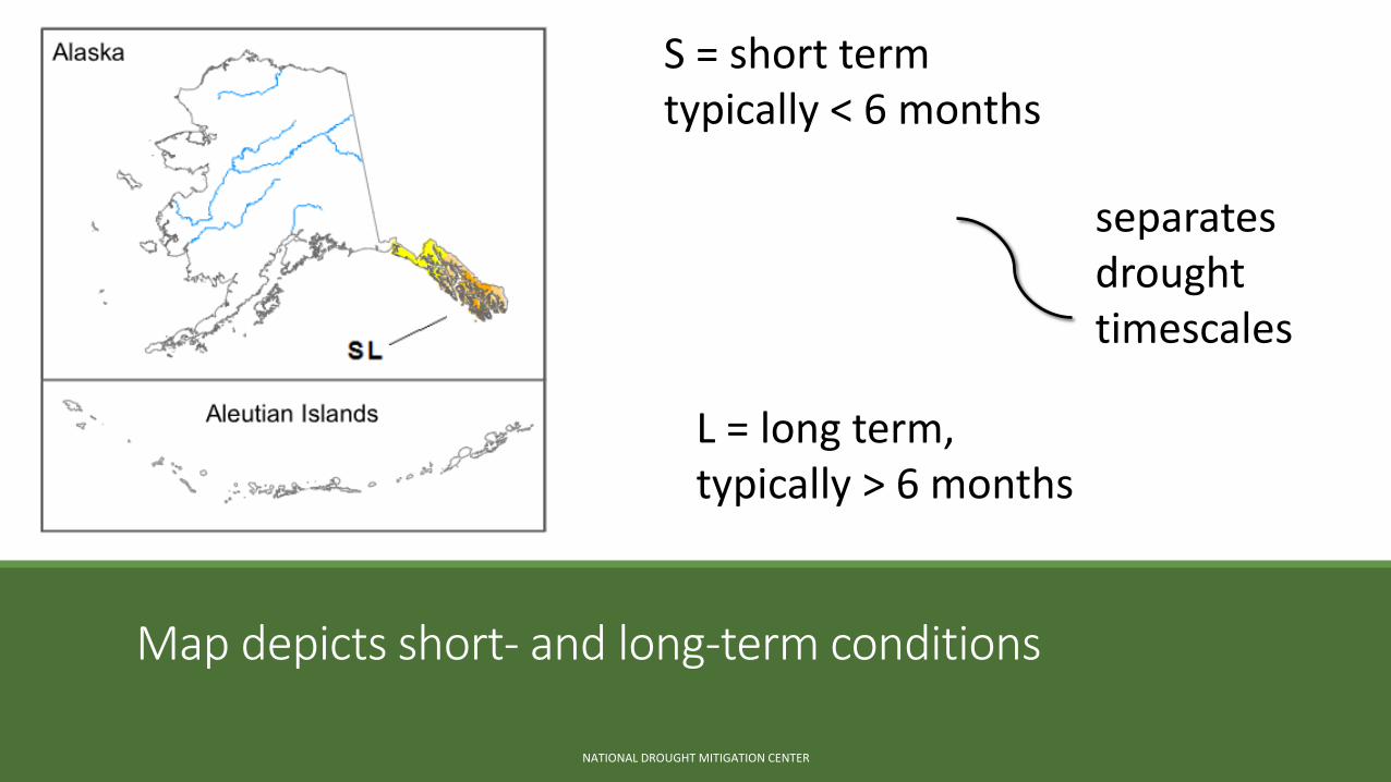
Map depicts short- and long-term conditions
NATIONAL DROUGHT MITIGATION CENTER
S = short termtypically < 6 months
L = long term, typically > 6 months
separates drought timescales
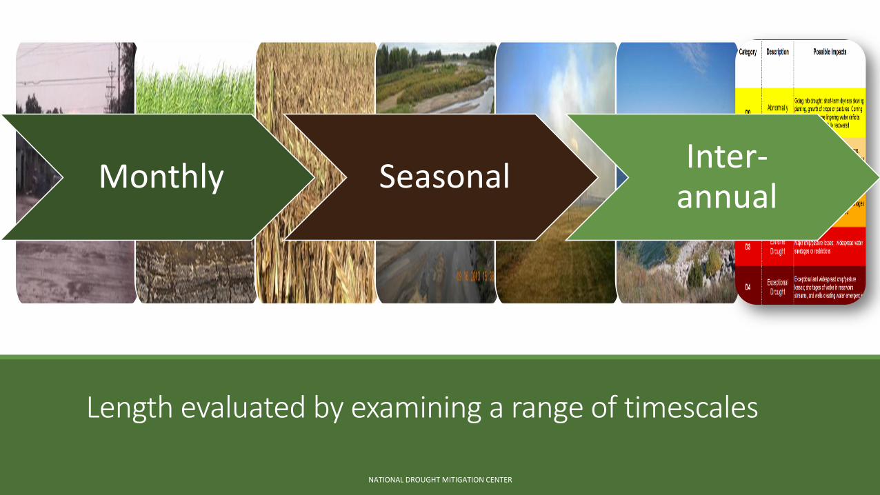
Length evaluated by examining a range of timescales
Monthly SeasonalInter-
annual
NATIONAL DROUGHT MITIGATION CENTER
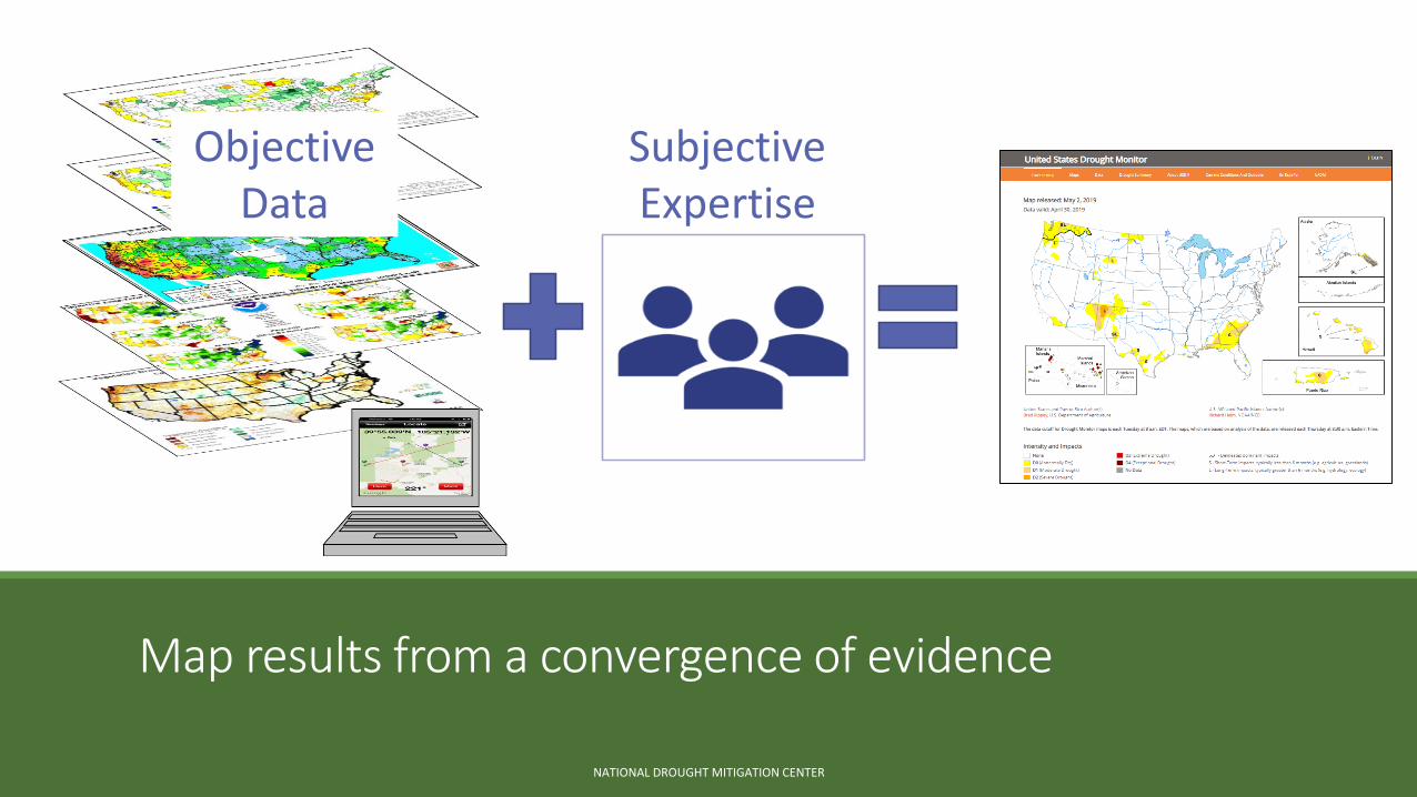
Map results from a convergence of evidence
NATIONAL DROUGHT MITIGATION CENTER
Objective Data
Subjective Expertise
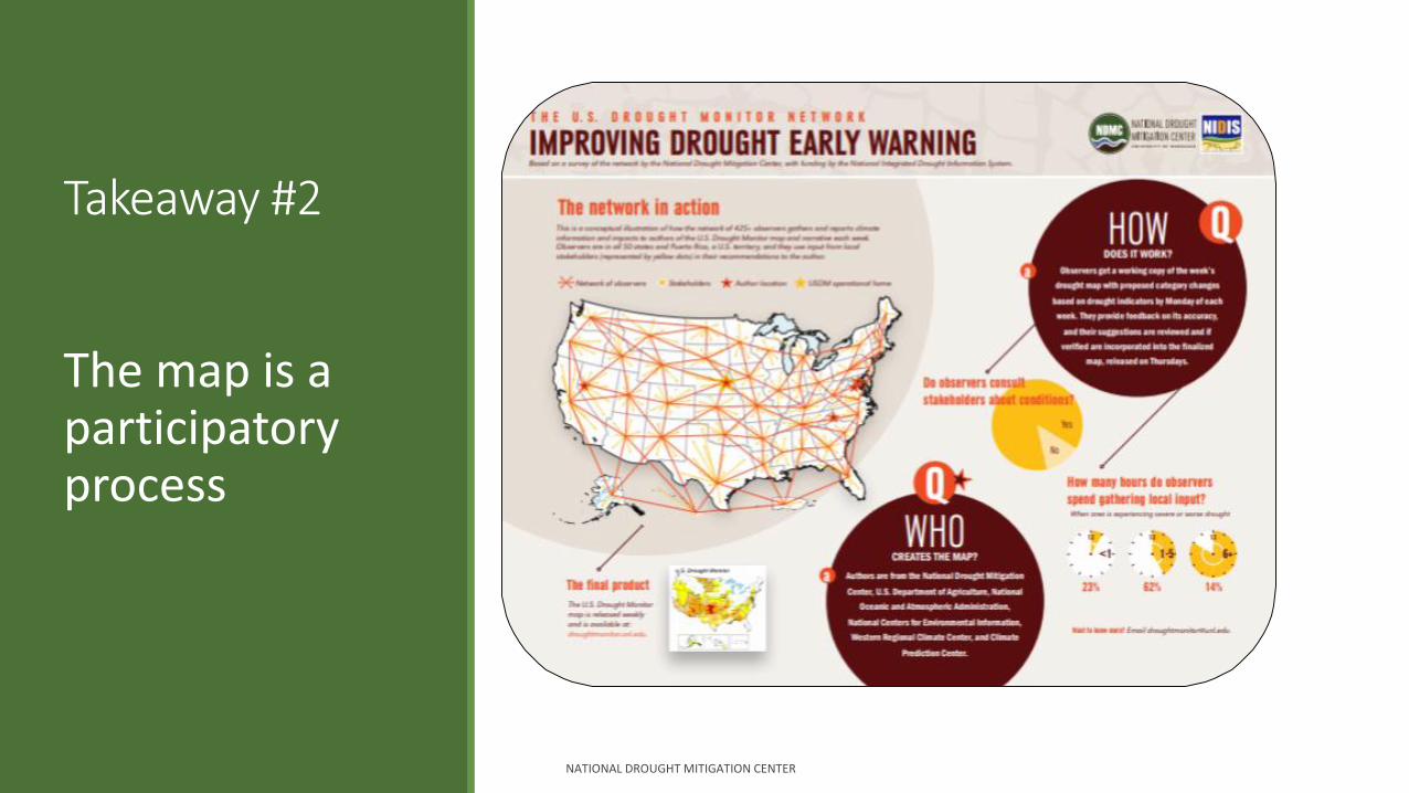
Takeaway #2
The map is a participatory process
NATIONAL DROUGHT MITIGATION CENTER
Partners collaborate on map standards & methodology
NATIONAL DROUGHT MITIGATION CENTER
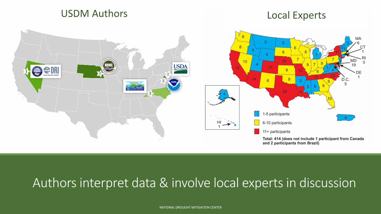
Authors interpret data & involve local experts in discussion
NATIONAL DROUGHT MITIGATION CENTER
Local ExpertsUSDM Authors
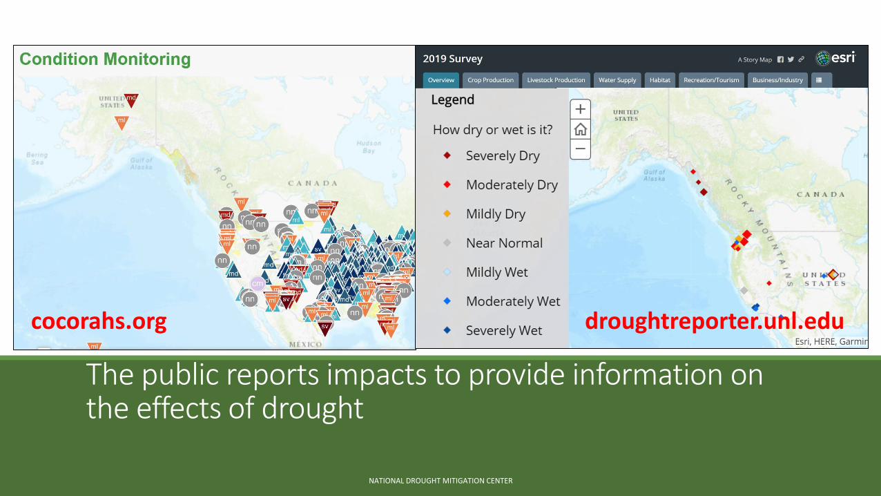
droughtreporter.unl.edu
The public reports impacts to provide information on the effects of drought
NATIONAL DROUGHT MITIGATION CENTER
cocorahs.org
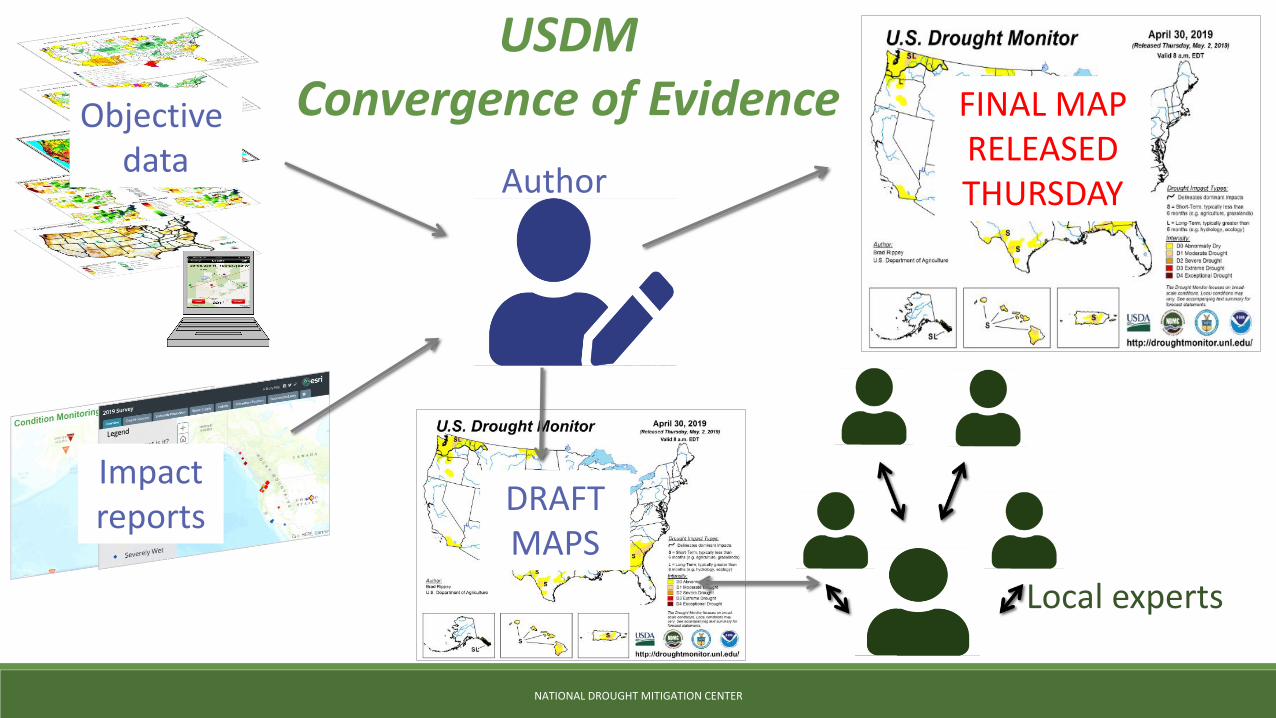
DRAFTMAPS
Local experts
NATIONAL DROUGHT MITIGATION CENTER
Objectivedata
Author
Impact reports
FINAL MAP RELEASED THURSDAY
USDMConvergence of Evidence
NATIONAL DROUGHT MITIGATION CENTER
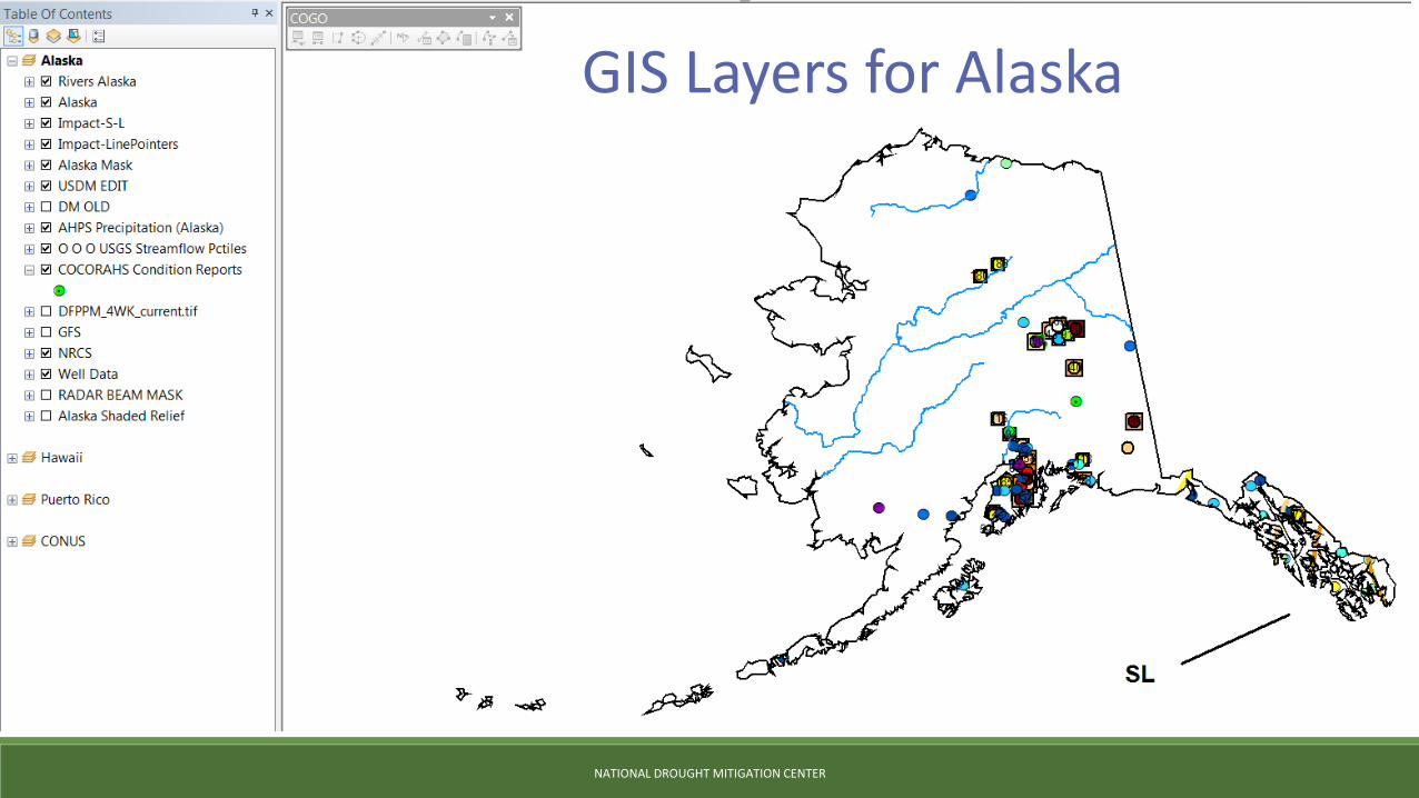
GIS Layers for Alaska
droughtreporter.unl.edu
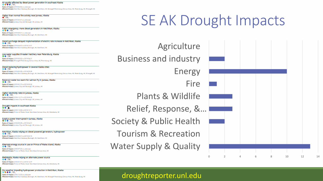
SE AK Drought Impacts
Relief, Response, & Restrictions
Fire
Water Supply &Quality
0 2 4 6 8 10 12 14
Water Supply & Quality
Tourism & Recreation
Society & Public Health
Relief, Response, &…
Plants & Wildlife
Fire
Energy
Business and industry
Agriculture
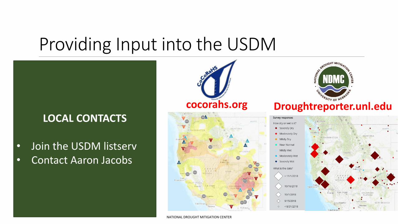
Providing Input into the USDM
NATIONAL DROUGHT MITIGATION CENTER
cocorahs.org Droughtreporter.unl.eduLOCAL CONTACTS
• Join the USDM listserv• Contact Aaron Jacobs
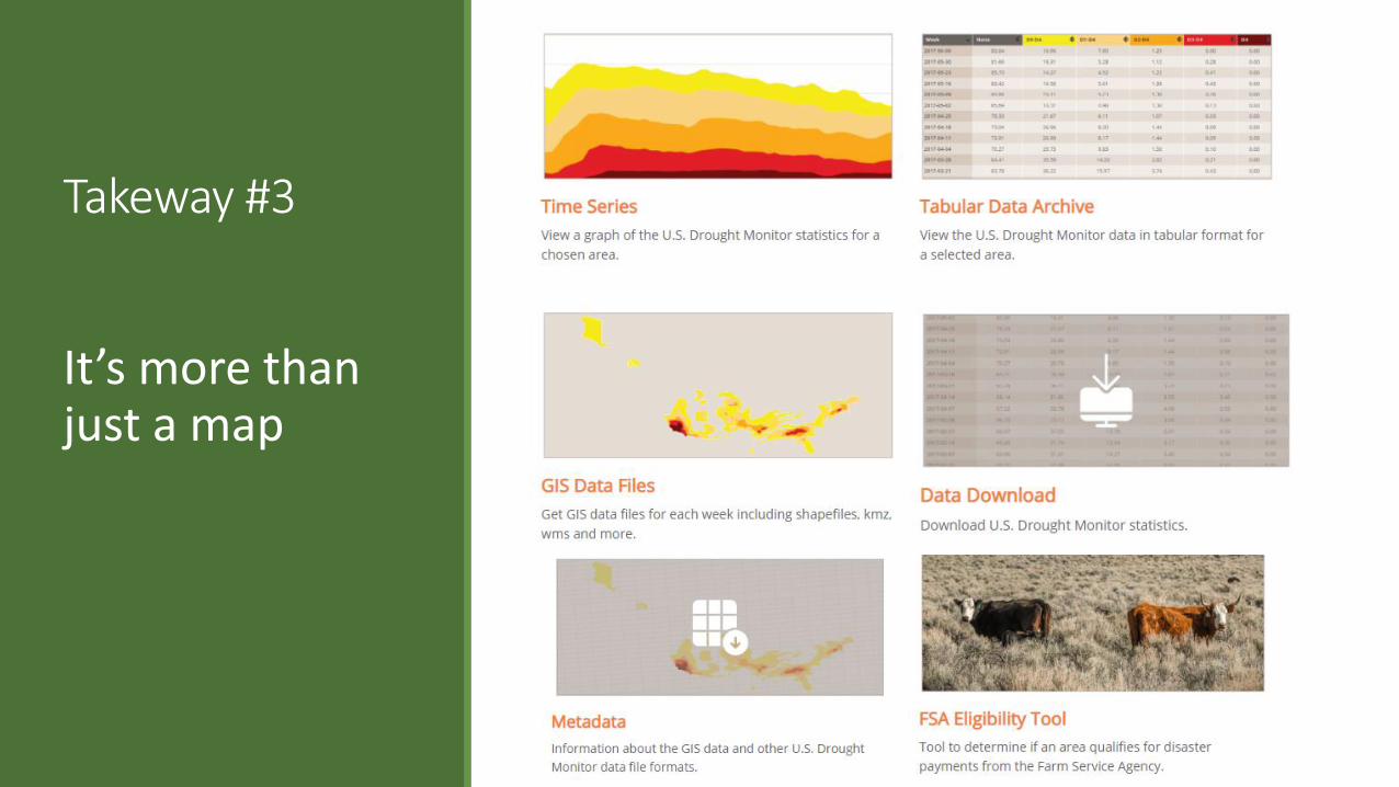
Takeway #3
It’s more than just a map
NATIONAL DROUGHT MITIGATION CENTER
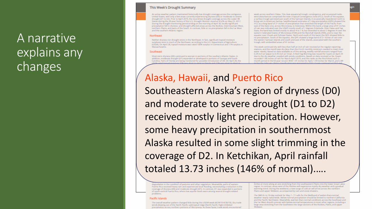
A narrative explains any changes
NATIONAL DROUGHT MITIGATION CENTER
Alaska, Hawaii, and Puerto RicoSoutheastern Alaska’s region of dryness (D0) and moderate to severe drought (D1 to D2) received mostly light precipitation. However, some heavy precipitation in southernmost Alaska resulted in some slight trimming in the coverage of D2. In Ketchikan, April rainfall totaled 13.73 inches (146% of normal).….
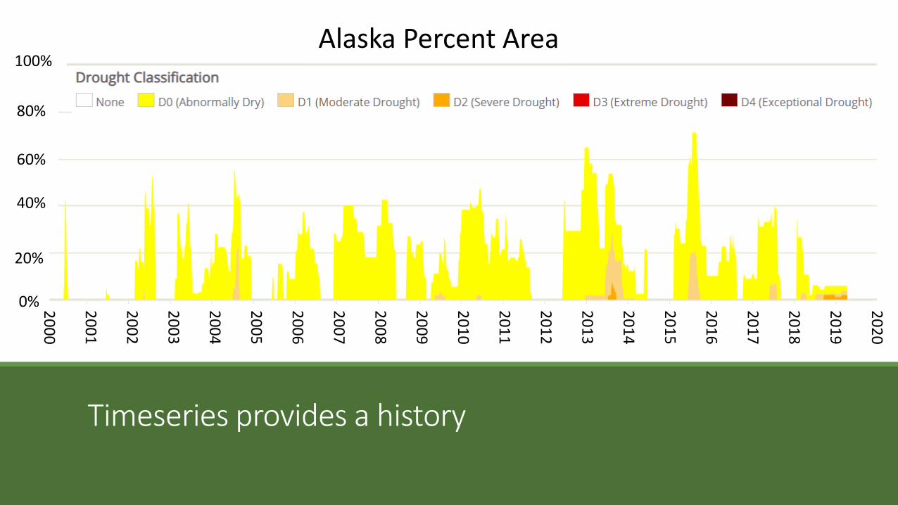
Timeseries provides a history
20
01
20
02
20
06
20
13
20
14
20
15
20
16
20
17
20
18
20
10
20
11
20
12
20
19
20
03
20
04
20
05
20
07
20
08
20
09
Alaska Percent Area2
02
0
20%
40%
60%
80%
100%
0% 20
00
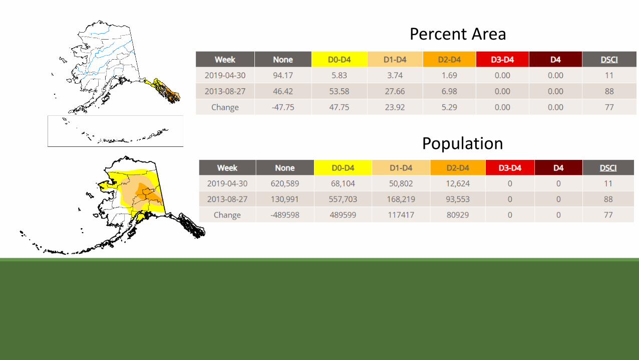
Percent Area
Population
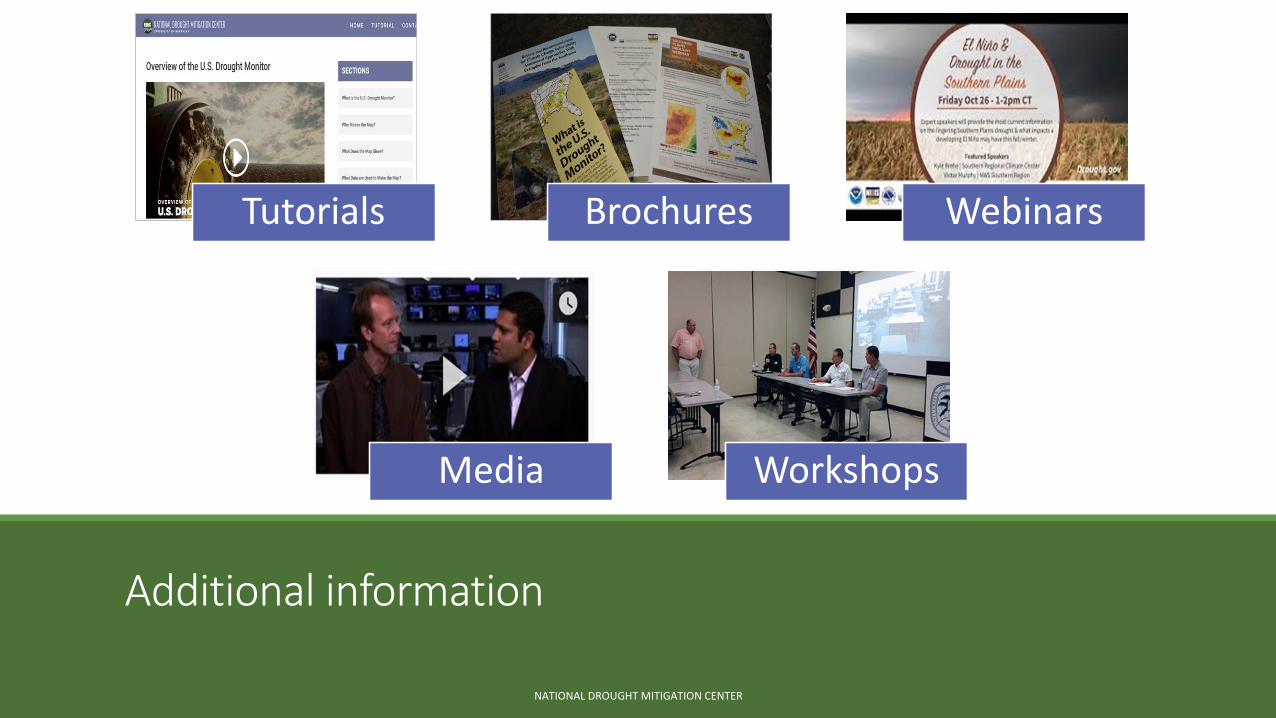
Additional information
NATIONAL DROUGHT MITIGATION CENTER
Tutorials Brochures Webinars
Media Workshops
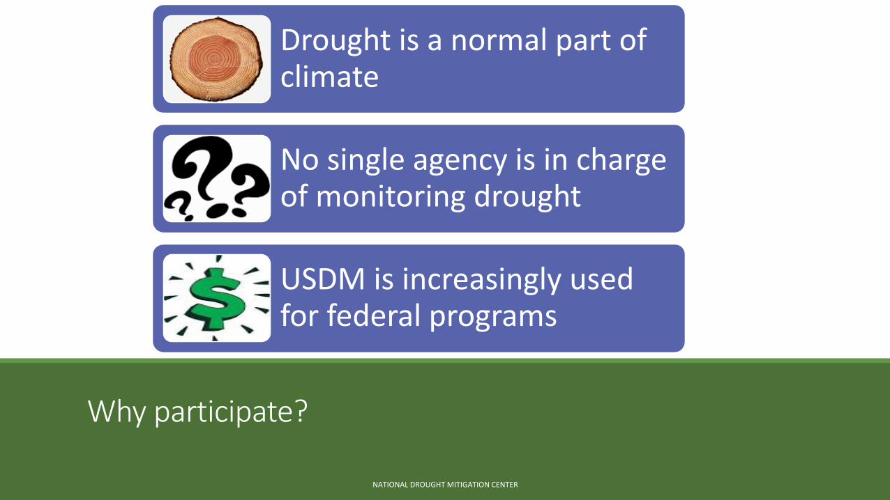
Why participate?
NATIONAL DROUGHT MITIGATION CENTER
Drought is a normal part of climate
No single agency is in charge of monitoring drought
USDM is increasingly used for federal programs
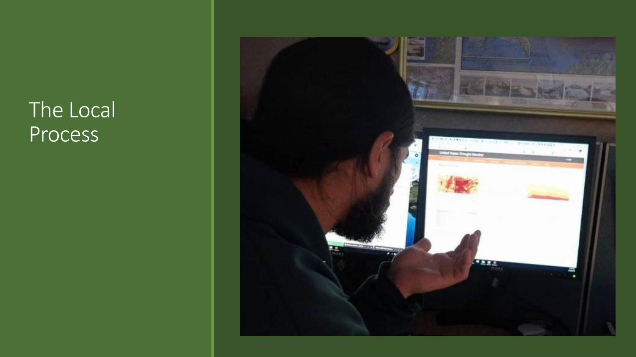
The Local Process
NATIONAL DROUGHT MITIGATION CENTER
NATIONAL DROUGHT MITIGATION CENTER
Southeast Alaska Local Drought Monitor(DM) Contact:Aaron Jacobs
(Senior Service Hydrologist/Meteorologist NOAA National Weather Service in Juneau)
• Look at current and past rainfall/snow data (weekly/monthly)
• Determines if there are deficits for drought impacts.
• Reach out to community's hydro power companies for impacts.
• Reach out to ADF&G about fisheries issues.
• Search for news articles• Make drought category(D0-D4)
recommendations to DM author.
• HOW CAN YOU IMPROVE/HELP THIS PROCESS????
NATIONAL DROUGHT MITIGATION CENTER
How to improve SEAK drought impact reporting &
What type of information is needed
• Use the Drought Reporter to pass on impacts.
• Send email to local DM contact
• Call local DM contact
• Reservoir levels compare to rule curve• Water restrictions/conservation• Use of diesel power (how much: intermittent/full
time)
• Low stream flows• Fisheries (Fish kills, hatcheries impacts, other?)
• Forest/ecology impacts • Impacts from low snowpack (winter sports)
NATIONAL DROUGHT MITIGATION CENTER
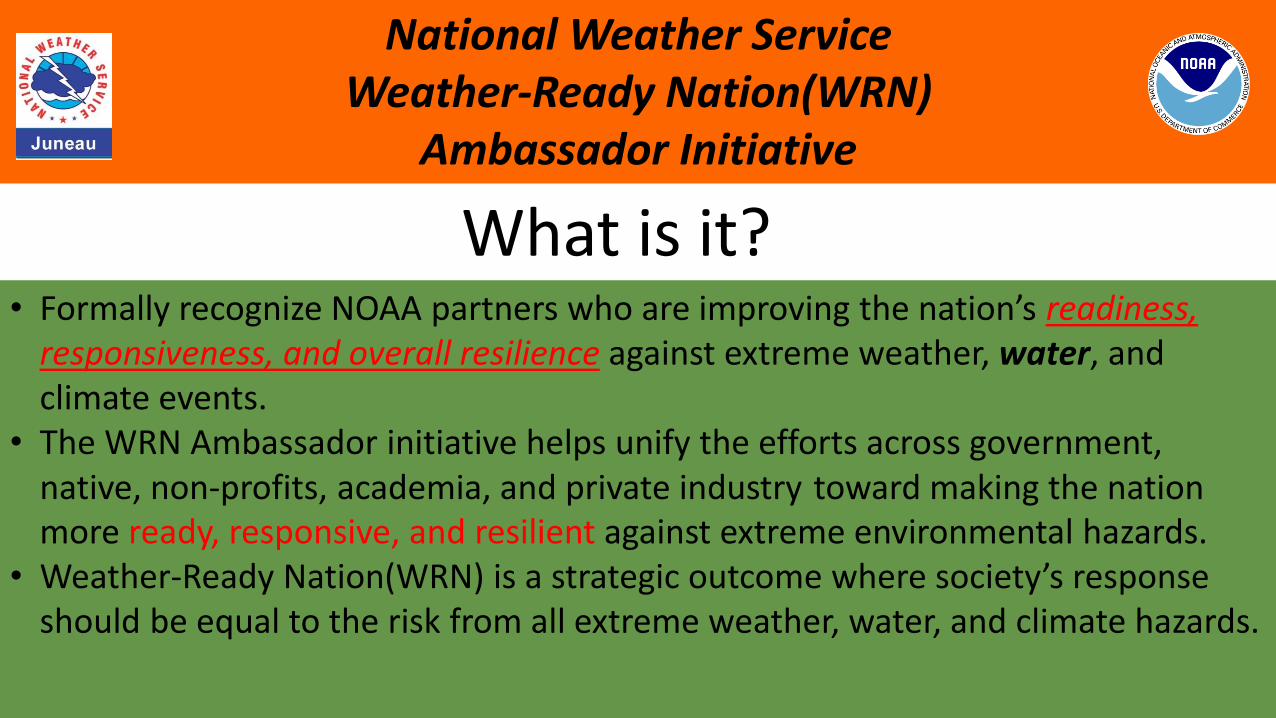
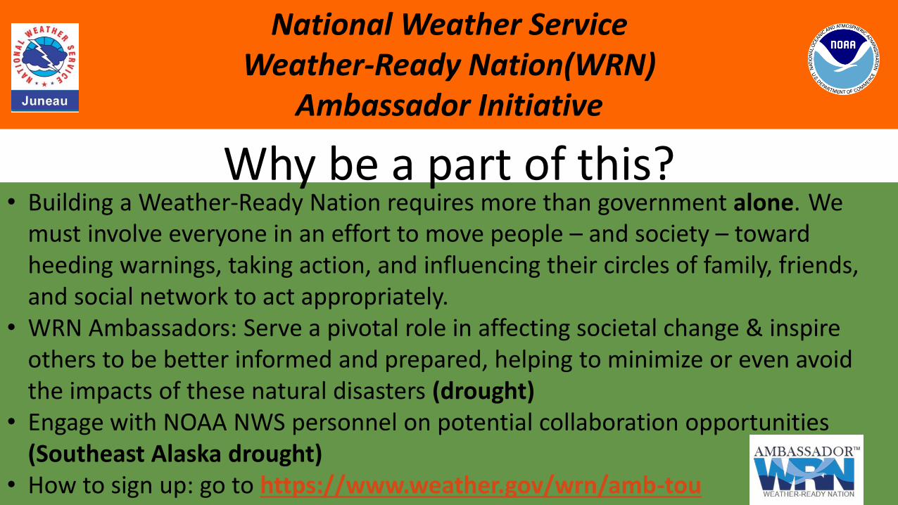
National Weather Service Weather-Ready Nation(WRN)
Ambassador Initiative
• Formally recognize NOAA partners who are improving the nation’s readiness, responsiveness, and overall resilience against extreme weather, water, and climate events.
• The WRN Ambassador initiative helps unify the efforts across government, native, non-profits, academia, and private industry toward making the nation more ready, responsive, and resilient against extreme environmental hazards.
• Weather-Ready Nation(WRN) is a strategic outcome where society’s response should be equal to the risk from all extreme weather, water, and climate hazards.
What is it?
NATIONAL DROUGHT MITIGATION CENTER
National Weather Service Weather-Ready Nation(WRN)
Ambassador Initiative
• Building a Weather-Ready Nation requires more than government alone. We must involve everyone in an effort to move people – and society – toward heeding warnings, taking action, and influencing their circles of family, friends, and social network to act appropriately.
• WRN Ambassadors: Serve a pivotal role in affecting societal change & inspire others to be better informed and prepared, helping to minimize or even avoid the impacts of these natural disasters (drought)
• Engage with NOAA NWS personnel on potential collaboration opportunities (Southeast Alaska drought)
• How to sign up: go to https://www.weather.gov/wrn/amb-tou
Why be a part of this?