Embed Size (px)
Citation preview
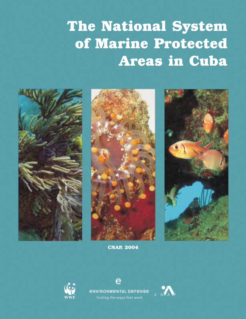
The National System of Marine Protected
Areas in Cuba
CNAP, 2004
1 National Center for Protected Areas, CNAP, Calle 18 a No 4114e / 41 y 47, Playa, C. Habana, Cuba.Tel. 537 2027970, Fax. 537 2040798 Email: [email protected]
2 University of the West Indies Centre for Environment &Development, 13 Gibraltar Camp Way, Mona Campus, Kingston7, Jamaica, W.I.
3 WWF Canada, Cuba Field Office, Cooperation Cuba, MuseoNatural, Plaza de Armas, Habana Vieja, C. Habana, Cuba.
4 Environmental Defense, 14630 SW 144 Terr, Miami, FL 33186.www.environmentaldefense.org/cuba
Design/Editing: Aylem HernándezSusana Aguilar
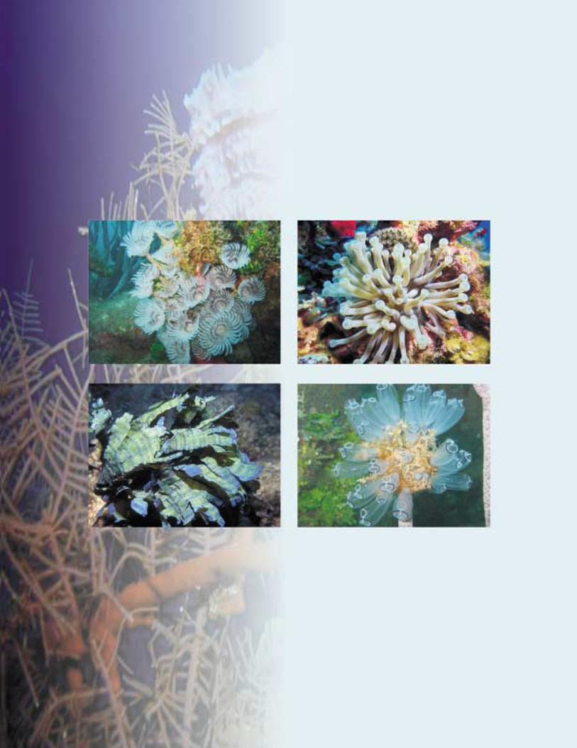
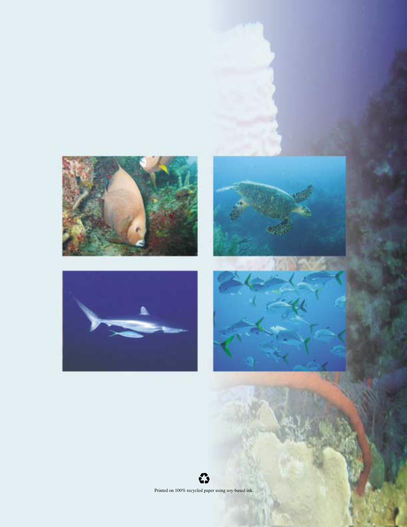
Photography: Rafael Mesa (National Aquarium)Noel Lopez (Azulmar)Photographic Archives of the National Center for Protected Areas.
The National System of Marine Protected
Areas in Cuba
Authors: Reinaldo Estrada Estrada1
Aylem Hernández Avila1
José Luis Gerhartz Muro1,2
Augusto Martínez Zorrilla1
Marvel Melero Leon1
Michel Bliemsrieder Izquierdo3
Kenyon C. Lindeman4
1. Introduction
The coastal and marine protected areas of Cuba con-stitute a subsystem within the National System of Pro-tected Areas. The Cuban Subsystem of Marine Protect-ed Areas (SAMP, Subsistema de Áreas Marinas Protegi-das) has developed in relatively different manners com-pared to terrestrial areas, especially in terms of imple-mentation. These differences derive from less relativeunderstanding of marine systems; a deeply-rooted, tradi-tional emphasis on terrestrial areas in Cuba; and the highcost of marine protected area management which, at aminimum, requires vessels, communications equipment,and specialized personnel.
In Cuba, marine protected areas (MPAs) are those pro-tected areas that have a marine or coastal component;this includes coastal wetlands, the submerged coastalzone (mean high water line to a depth of 200 m), and off-shore keys. Emergent portions of the SAMP are importantbut not highly emphasized in the present summary.
2. Evolution of the Cuban Subsystemof Marine Protected Areas
The first proposals for a National System of ProtectedAreas (SNAP, Sistema Nacional de Áreas Protegidas)date from 1968 and 1973. These were developed byKenton Miller, FAO consultant at that time (Miller, 1984),and by the Botanical Institute and the Flora and FaunaCommission of the Cuban Academy of Sciences (e.g.,work by Onaney MuĖiz, Enrique del Risco, and others).Both of the original proposals had almost a complete ter-restrial focus, although mangroves, lagoons, and someother coastal ecosystems were included.
During the First National Protected Areas Workshop,held in 1989, a SNAP proposal was developed in a multi-organizational manner for the first time among expertsfrom various national and provincial institutions. Initial dis-cussions of marine areas occurred at this meeting, how-ever, terrestrial and coastal components dominated theproposals. In the Second National Protected Areas Work-shop, held in 1995, a total of 535 proposed areas wereanalyzed and marine components were explicitly recog-nized as a subdivision of the SNAP. Many of the areas inthe current SAMP originally date from this period.
At this stage, considerable information was also pro-vided on marine areas from work at the Institute ofOceanology (IDO), including a proposal to close certain
areas to fishing to ensure sustainable management ofCuban shelf resources (IDO, 1995). This work discussedprincipals and benefits of fishery reserves and explicitlyproposed 18 of them. Of these, 15 areas that achieveprotection or conservation objectives for marine speciesor ecosystems have been incorporated into the SAMP.
At the same time, the Ministry of the Fishing Industrythrough the Office of Fishing Regulations began theprocess of declaring “Zones under Special Regimes ofUse and Protection”. In practice, these zones constitute(and are commonly called) fishery reserves that act asprotected areas and have served as points of departurefor many Cuban MPAs now officially declared or in theprocess of being declared (e.g., Jardines de la ReinaNational Park, Punta Francés National Park, Ciénaga deZapata National Park, Cayo Largo Ecological Reserve).The fishery reserve at Cayo Doce Leguas, established in1996 within the Archipiélago Jardines de la Reina insoutheast Cuba, is the largest in the Caribbean (Appel-doorn and Lindeman, 2003).
After the 1995 workshop, in consideration of the limitedrepresentation of marine areas in the SNAP, the recentlycreated National Center for Protected Areas (CNAP) initi-ated a planning process for the SAMP that continued inthe Third National Protected Areas Workshop (1998),where the marine theme was treated as a program ofwork. Most of the largely marine areas of the SAMP wereincluded in this last phase as part of the SNAP.
Various national and international courses, includinginterim meetings for SNAP and SAMP updates, wereheld in 2000-2001 with support from the United NationsDevelopment Program (UNDP) and the Global Environ-ment Facility (GEF). These courses strengthened thefoundation of the system and led to the publication of the2003-2008 SNAP Plan (CNAP, 2002), where prioritieswithin the SAMP included the delimitation and signage ofareas, prevention of pollution, restoration of habitats, andthe establishment of regulations for the use and conser-vation of marine ecosystems.
In May 2003, initial components of an extended gapanalysis of the SAMP were completed. Led by IDO andCNAP, with support from WWF Canada and Environ-mental Defense, this process included a broad array ofCuban scientific institutions and protected area man-agers. This multi-year process largely validated the exist-ing and proposed SAMP and demonstrated the impor-
1
tance of using ecoregional planning, cross-shelf habitatclassification, geographic information systems, remotesensing, digital cartography, spawning aggregation sit-ing, and decision support systems (Sala et al., 2002;Airamé et al. 2003; Leslie et al., 2003; Roberts et al.2003) in the design and management of MPAs in Cuba(methods and results will be published separately).
3. Legal Framework
The legal framework used for the Cuban SAMP is sim-ilar to the terrestrial system; there are no legal differencesbetween the two systems. The two principal tools includeEnvironmental Law 81, Cuba’s framework law for envi-ronmental management, and Decree Law 201 for theNational System of Protected Areas. Law 81, adopted in1997, defines the SNAP as an integrated marine-terres-trial system and establishes its objectives and basic prin-cipals. Decree Law 201, adopted in 1999, is the primarylegal document for the SNAP. It contains formally definedprotected area categories (equally valid for land or sea);administrative formulations; mechanisms for proposalsand approvals, and guidance for participatory area plan-ning (Appendix 1).
The first group of MPAs was formally declared throughAgreement 4262 in 2001 by the Executive Committee ofthe Council of Ministers (CECM). This Agreement codifieda total of 32 protected areas, of which 18 include marinesurface waters. Another three MPAs have been declaredthrough other legal instruments not specifically dedicatedto protected areas (Appendix 2). A second group of 23protected areas, where the marine component was one ofthe most important elements for selection, is currently inits final phase of approval by the CECM; 12 of these areconsidered to be very important marine areas.
Other legal instruments, many of which are currently inuse (such as methodology guides), are in final process-es of approval. Instruments related directly or indirectly tothe SAMP include portions of the SNAP 2003-2008 Plan,methodologies for the preparation of Management Plans,Operational Plans, and environmental regulations for div-ing zones and other areas.
4. Management and Planning Principles for theCuban SAMP
General principles can guide the planning, selection,design and management of terrestrial and marine pro-tected areas (including the establishment of objectives,categories, planning stages, etc.) (Estrada and Perera,1998; Kelleher, 1999; PNUMA-PAC, 2000). Importantmarine and terrestrial contrasts that have influenced theearly stages of the selection and design of Cuban MPAsinclude:
• Less relative knowledge compared to terrestrial areas.• Implementation requires a larger investment.• The ocean is a public resource.• Rather than isolation, access is widespread.
“Inaccessible places” rarely exist, except in extensivecoastal wetlands.
• Low levels of endemism often exist in marine areas(in comparison with terrestrial systems on largeislands such as Cuba).
• Use of resources is common within MPAs, yet usersoften assume significant habitat impacts do not resultfrom their activities.
• Fundamental design principals include conservationbiology, metapopulation biology, and landscape ecology,but fishery biology is also extremely important.
• Connectivity and three-dimensional parameters suchas depth, currents, and other abiotic factors are alsoimportant.
In Cuba, the existence of well-conserved coral forma-tions has been used as a principal guide to establish themore rigorous conservation areas (e.g., IUCN Cate-gories I-IV). Sites critical to significant populations ofimportant species have also been emphasized from bothconservation and economic perspectives. Other impor-tant elements taken into account include uncommon fea-tures such as blue holes and banks off the shelf. Indesigning boundaries, different ecosystems were oftenincluded in order to integrate landscape ecology con-cepts, with an emphasis on large and well-defined pro-tected areas. It should be noted that on numerous occa-sions, based on the above ecosystem principles, the ori-gin of specific MPAs was in part based on the extensionof existing or proposed terrestrial areas towards the sea.
2
4.1. Zoning
MPA zoning differs in numerous ways from the zoningof terrestrial protected areas. Zoning approaches inCuba, established by K. Miller, recognize important dif-ferences for marine areas. The concept of public use isintrinsic to the entire area and to socioeconomic use(Miller’s “socioeconomic zone”). This also extends to theocean, including uses typical of Miller’s non-consumptive“public use zones” and consumptive “zones of socioeco-nomic use”. These zones are not clearly distinguished inmany MPAs but are represented by a combination ofzones that include basic types, gradients, and restrictionson the intensive use of resources. In particular, thisincludes uses such as fishing (recreational, commercial,traditional, catch and release, trawling, etc.), diving, snor-keling, water sports, and swimming areas.
Given the differing challenges in the case of marineareas, some types of zones can overlap and can includetemporal zones with specific prohibitions and restrictions.In addition, as part of the concept of zoning, conservationzones, core zones, “no take” areas, or marine reservesare important areas where conservation restrictions ontraditional extractive activities are strong, and only scien-tific and non-consumptive activities are permitted.
Zoning helps to partially resolve the old and continuingSLOSS debate (Single Large or Several Small protectedareas) and other similar issues. In many cases, a combi-nation of relatively large areas of differing categories canbe established (e.g., IUCN categories II to VI). Anotheroption is to establish zones that correspond to no fishingzones or conservation zones (for IUCN categories II toIV), or individual protected areas within IUCN categoriesV to VI.
4.2 Integrating Networks and Connectivity
The theoretical conceptualization of the SAMP alsorequires recognition of complex macro-scale issues.These include the interconnections between terrestrialand marine ecosystems (commonly viewed in terms ofwatersheds and wetlands) and issues specific to purelymarine habitats. Consideration is being given to connec-tivity between marine populations and the potential tobuild a network of interconnected MPAs through knowl-edge of oceanographic processes, larval dispersal, andspawning aggregations (Claro and Lindeman, 2003).These and additional issues, such as resilience in theface of climate change, are being considered within sev-
eral components of SAMP design in order to produce themost robust system feasible.
5. Conservation Goals
In the national protected area plan (CNAP, 2002), thefollowing goals are established for the Cuban SAMP:
• Represent at least 15% of the Cuban insular shelf.• Represent at least 25% of the coral reef areas.• Represent at least 25% of each subtype of wetland
for each wetland region.
In the process of completing a gap analysis of theSAMP, several goals have been organized and refinedinto the following groups:
• Protect outstanding land- and sea-scapes, and re-presentative samples of marine-coastal biodiversity.
• Contribute to the sustainable management of fisheries.• Represent the most outstanding geographical
features of the marine-coastal zone of Cuba, as wellas historical and cultural values.
6. Current Status of the Cuban SAMP
Twenty-one coastal and marine protected areas havealready been legally declared with thirteen more in thefinal approval process by the CECM. There are a total of108 proposed marine protected areas in the 2003-2008SNAP plan (CNAP, 2002). Of these areas, 85 containmarine surface waters, representing 21.9% of the Cubaninsular shelf (Table 1). Forty-four of these, representingapproximately 20.2% of the shelf, are considered to havenational significance due to their marine biodiversityvalue. The remaining 32 are of local significance and rep-resent 1.7% of the shelf. Of the 21 currently approvedmarine protected areas, 18 contain marine surfacewaters (10 with national and 8 with local significance,together representing 3.5% of the Cuban shelf) and 3 areemergent coastal areas. Of the 13 MPAs in the finalapproval process, 12 contain marine surface waters (11with national and 1 with local significance, representing7.1% of the insular shelf), with some areas also includingwaters off the shelf (68,610 ha) (Table 1).
Of the 34 total areas that are approved or are in thefinal approval process, 30 of these contain marine sur-face waters that represent 10.5% of the Cuban insularshelf. This figure represents 56.61% of the proposedextent of the SAMP (without considering one specific cat-
3
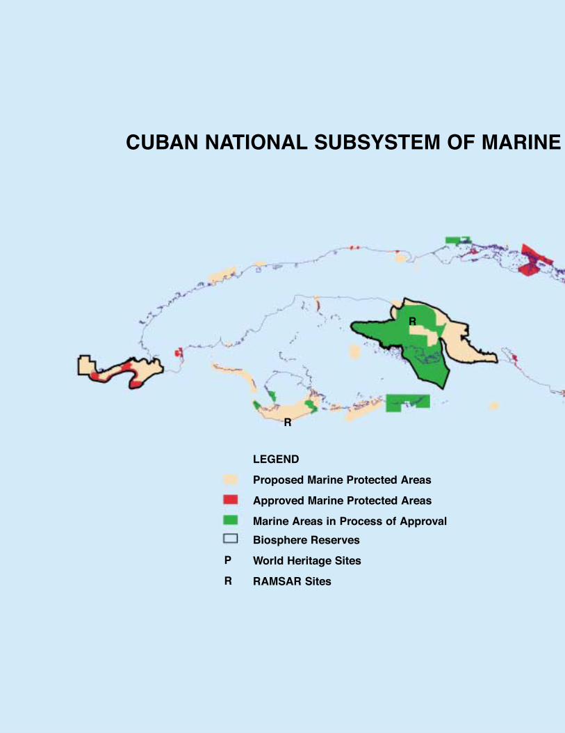
CUBAN NATIONAL SUBSYSTEM OF MARINE
LEGEND
Proposed Marine Protected Areas
Approved Marine Protected Areas
Marine Areas in Process of Approval
Biosphere Reserves
World Heritage Sites
RAMSAR Sites
P
R
R
R
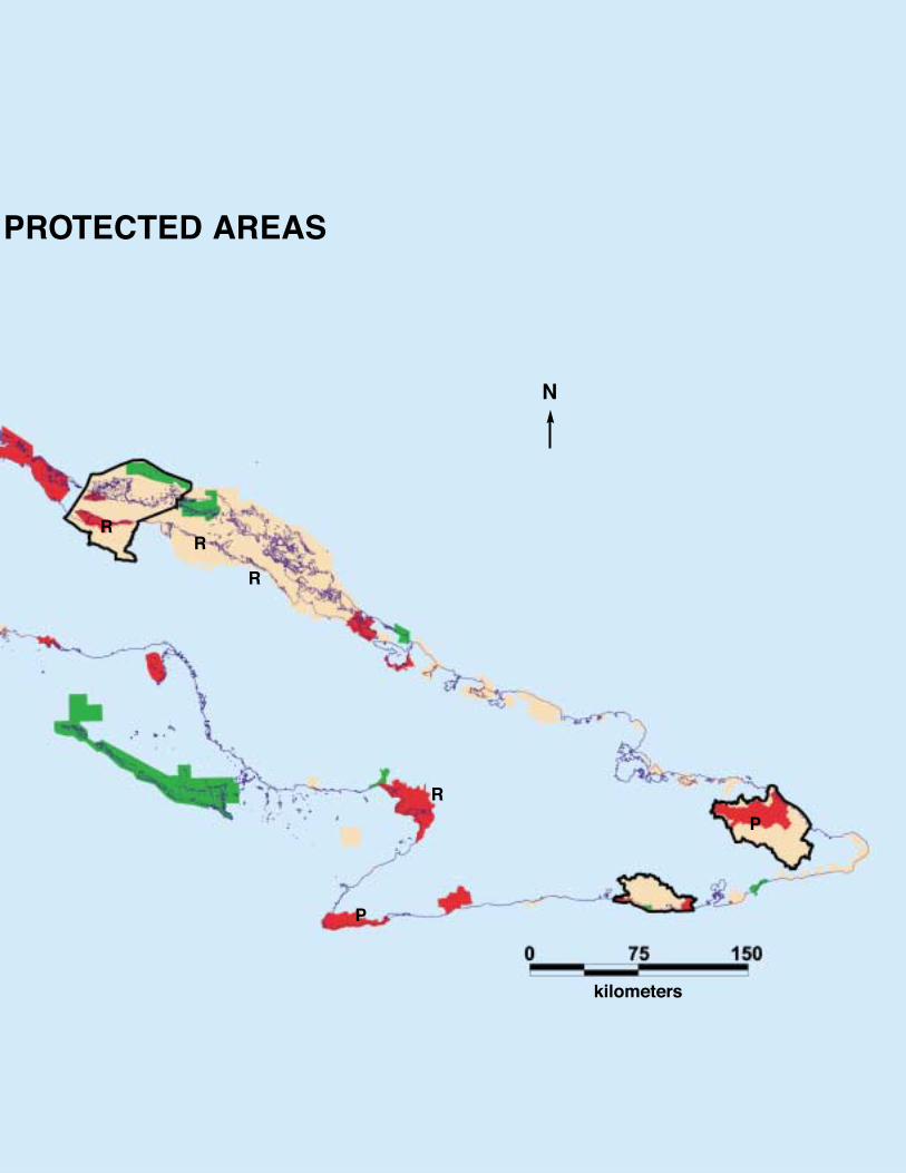
PROTECTED AREAS
RR
R
R
P
P
N
kilometers
egory of protected areas – the APRMs, Appendix 1 andTable 1). Within this group, it is worth highlighting the bio-diversity value, size, and importance of the Jardines dela Reina (Gardens of the Queen) National Park and theCiénaga de Zapata (Zapata Wetlands) National Park,two of the most important MPAs in Cuba. Other veryimportant marine and coastal national parks includePunta Francés, Guanahacabibes, and Caimanes. Impor-tant Faunal Refuges include Lanzanillo-Pajonal-Fragoso,Cayos Las Picúas-Cayos del Cristo, Río Máximo andDelta del Cauto.
None of these marine areas are yet comprehensivelymanaged, although many are supported through interna-tional projects (WWF Canada, GEF, PNUD, Havana-Ecópolis, HIVOS, Environmental Defense, and others),which make it possible to conduct basic managementtasks (construction of management plans, personnel forbasic enforcement and control of public use). However,adequate means still do not exist for thorough marineenforcement, research, or monitoring.
The majority of the remaining proposed areas cur-rently exist only on paper. Many of these, especiallythose six areas that are almost totally marine and arelocated relatively far from the coast, do not yet haveclearly defined limits.
A special protected area classification, related to IUCNcategory VI, is the Special Regions of Sustainable Devel-opment (REDS) category. This type of protected areacontains extensive areas of high economic and conser-vation interest. It includes the two largest archipelagos inCuba (Sabana-Camaguey and Canarreos) and Ciénagade Zapata (the largest wetland in the insular Caribbean)which was approved as a REDS on January 23, 1995under Decree-Law 197.
To optimize organizational interactions, a process isunderway to establish a SNAP Coordination Board. Thisis a collaborative organ that is directed by CNAP andincludes the six most important decision-making institu-tions of the SNAP (CNAP, Fishery Regulations Office,State Forestry Service, National Enterprise for Flora andFauna, Corps of Forest Wardens, and Directorate of theEnvironment). The approval and planning of protectedareas occurs through a participative process, includingfederal and provincial agencies, local communities, andrelevant socio-economic groups (e.g., fishermen)through formal and informal meetings, negotiations, plan-ning workshops, conflict resolution, and education.
7.The Cuban SAMP in an International Context
Two of the World Natural Heritage Sites declared inCuba by UNESCO have marine components that werenot previously considered important for WHS declara-tions. These sites are the Desembarco del GranmaNational Park (declared in 1999) and the Alejandro deHumboldt National Park (declared in 2001).
In 2001, Cuba joined the Convention on Wetlands ofInternational Importance, commonly referred to as theRamsar Convention. The first Ramsar site to be declaredin Cuba was the Ciénaga de Zapata due to its classifica-tion as the largest and best conserved wetland in theinsular Caribbean. In 2002, five new areas were incorpo-rated: Rio Máximo Faunal Refuge, Delta de Cauto Fau-nal Refuge, Gran Humedal del Norte de Ciego de Avila,Ciénaga de Lanier y Sur de la Isla de Juventud, andHumedal Buenavista, all of which represent importantcomponents of the SAMP.
Of the six Biosphere Reserves declared in Cuba, fiveinclude marine or coastal areas. Three of these includemarine-coastal ecosystems of very high importance: Cié-naga de Zapata, Buenavista, and Guanahacabibes. Theother two marine-associated Biosphere Reserves areCuchillas del Toa and Baconao.
8. Future Activities
A number of projects are underway to improve theCuban SAMP, including:
a) The multi-year marine gap analysis is near comple-tion, including ecoregional planning, comprehensivedatalayer assembly, and decision support modeling.To date, this process has validated the existing andproposed SAMP coverage and established a number of recommendations which will allow new areas to be identified and existing areas to be improved by refiningboundaries, zoning, areas of coverage, and manage-ment priorities.
b) A proposal is underway for the inclusion of Ciénagade Zapata National Park and the Coral Reef Systemof the Cuban Caribbean (SACC) as World NaturalHeritage Sites. The SACC will consist of 11 MPAs thatare approved, in the process of approval, or proposed.At a UNESCO MPA forum in Vietnam in March 2002,experts supported the preliminary proposal for theseareas to be declared a World Heritage Site. Cuba offi-
8
cially presented the proposal to UNESCO in early2003 to include in the tentative list of World NaturalHeritage Sites, a key step needed for official propos-al and approval as a World Heritage Site.
c) Work to apply a bioregional focus to the protectedarea system has been completed, including thepossible declaration of new Biosphere Reserves andRamsar sites.
d) Plans are now being evaluated for new protectedareas beyond the insular shelf to protect offshorewaters within the Exclusive Economic Zone. Untilnow, such plans have only focused on protectedareas within shallow submerged banks that arerelatively close to the insular shelf.
e) Within the SNAP plan, a search for international funding is a high priority to assist efforts to best planand implement Cuban marine protected areas givethe high costs of development and management.
Appendix 1. Management Categories
In Cuba, Article 5 of Decree Law No. 201/99 for theNational System of Protected Areas establishes eightmanagement categories, similar for both terrestrial andmarine areas:
1) Natural Reserve (RN, Cat. I IUCN)2) National Park (PN, Cat. II IUCN)3) Ecological Reserve (RE, Cat. II IUCN)4) Outstanding Natural Element (END, Cat. III IUCN)5) Managed Floral Reserve (RFM, Cat. IV IUCN)6) Faunal Refuge (RF, Cat. IV IUCN)7) Protected Natural Landscape (PNP, Cat. V IUCN)8) Protected Area for Managed Resources (APRM,
Cat. VI IUCN)
In Article 3 of Decree Law 201, the following levels ofclassification were established:
• Protected Areas of National Significance (APSN): because of their importance in terms of conservation,uniqueness, complexity, representation, or other outstanding elements, these areas are considered ofinternational, regional or national importance andconstitute the fundamental nucleus of SNAP.
• Protected Areas of Local Significance (APSL): because of their size, frequency, or level of conservation,these areas are not classified as having nationalsignificance.
• Special Regions of Sustainable Development(REDS): large regions with sensitive ecosystems ofeconomic and social importance; these areasrequire national attention and coordination inorder to achieve conservation and sustainabledevelopment.
Appendix 2. Marine and coastal protectedareas approved by Agreement 4262/2001,
Executive Committee of the Council ofMinisters.
National Parks (Province):• Caguanes (Sancti Spiritus)• Guanahacabibes (Pinar del Río)• Desembarco del Granma (Granma)• Alejandro de Humboldt (Guantánamo y Holguín)• Turquino (Santiago y Granma)
Ecological Reserves:• Hatibonico (Guantánamo)• Siboney – Justicí (Santiago de Cuba)
Managed Floral Reserve:• San Ubaldo – Sabanalamar (Pinar del Río)
Faunal Refuges:• Lanzanillo – Pajonal – Fragoso (Villa Clara) • Delta del Cauto (Granma y Las Tunas)• Río Máximo (Camagüey)• Cayos de Ana María (Ciego de Ávila)• Las Picúas – Cayo del Cristo (Villa Clara)• Guanaroca – Gavilanes (Cienfuegos)• Las Loras (Villa Clara)• Cinco Leguas (Matanzas)• Tunas de Zaza (Sancti Spiritus)• Cayo Ballenato y manglares de la Bahía de
Nuevitas (Camagüey)
Three other MPAs have been declared by other legalinstruments:
Ecological Reserve:• Bacunayagua (Matanzas)
Faunal Refuge:• Laguna del Cobre – Itabo (C. Habana)
Protected Natural Landscape • Rincón de Guanabo (C. Habana)
9
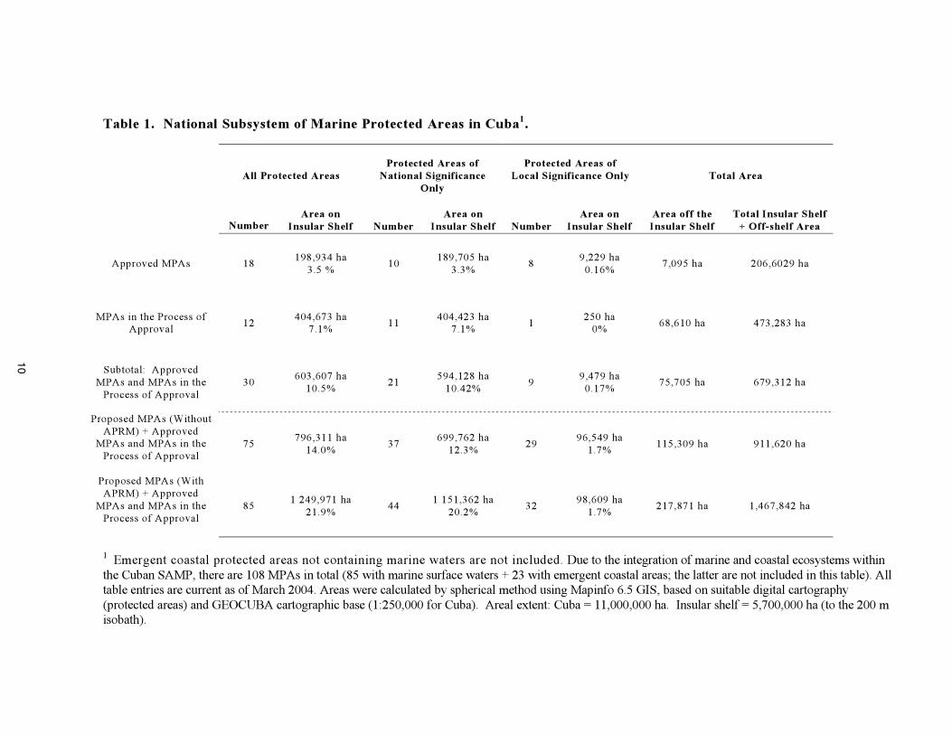
Table 1. National Subsystem of Marine Protected Areas in Cuba1.
All Protected AreasProtected Areas of
National SignificanceOnly
Protected Areas ofLocal Significance Only Total Area
NumberArea on
Insular Shelf NumberArea on
Insular Shelf NumberArea on
Insular ShelfArea off theInsular Shelf
Total Insular Shelf+ Off-shelf Area
Approved MPAs 18198,934 ha
3.5 %10
189,705 ha3.3%
89,229 ha0.16%
7,095 ha 206,6029 ha
MPAs in the Process ofApproval 12
404,673 ha7.1% 11
404,423 ha7.1% 1
250 ha0% 68,610 ha 473,283 ha
Subtotal: ApprovedMPAs and MPAs in theProcess of Approval
30603,607 ha
10.5%21
594,128 ha10.42%
99,479 ha0.17%
75,705 ha 679,312 ha
Proposed MPAs (WithoutAPRM) + Approved
MPAs and MPAs in theProcess of Approval
75796,311 ha
14.0%37
699,762 ha12.3%
2996,549 ha
1.7%115,309 ha 911,620 ha
Proposed MPAs (WithAPRM) + Approved
MPAs and MPAs in theProcess of Approval
851 249,971 ha
21.9%44
1 151,362 ha20.2%
3298,609 ha
1.7%217,871 ha 1,467,842 ha
1 Emergent coastal protected areas not containing marine waters are not included. Due to the integration of marine and coastal ecosystems withinthe Cuban SAMP, there are 108 MPAs in total (85 with marine surface waters + 23 with emergent coastal areas; the latter are not included in this table). Alltable entries are current as of March 2004. Areas were calculated by spherical method using Mapinfo 6.5 GIS, based on suitable digital cartography(protected areas) and GEOCUBA cartographic base (1:250,000 for Cuba). Areal extent: Cuba = 11,000,000 ha. Insular shelf = 5,700,000 ha (to the 200 misobath).
10
Literature Cited
• Asamblea Nacional del Poder Popular. (11 de Julio de 1997). Ley No. 81 del Medio Ambiente. Gaceta Ofi-cial de la República de Cuba. Edición extraordinaria. Número 7. AĖo XCV.
• Airamé, S. et al (2003). Applying ecological criteria to marine reserve design: a case study from CaliforniaChannel Islands. Ecological Applications. 13(1):475-510.
• Appeldoorn, R.S. and K.C. Lindeman. (2003). A Caribbean-wide survey of marine reserves: spatial cover-age and attributes of effectiveness. Gulf and Caribbean Research 14(2):139-154.
• Bustamante, G. (2001). Potential World Natural Heritage Sites: filling critical gaps and promoting multi-siteapproaches to new nominations of tropical coastal, marine and small island ecosystems. UNESCO WorldHeritage Center, Paris.
• Centro Nacional de Áreas Protegidas. (2000). Marco Legal. Sistema Nacional de Áreas Protegidas. Cuba.CNAP. AMA. CITMA. 46 Pp.
• Centro Nacional de Áreas Protegidas (CNAP). (2002). Sistema Nacional de Áreas Protegidas, Cuba. Plan2003-2008. CNAP. 202 pp.
• Claro, R. and K.C. Lindeman. (2003). Spawning aggregation sites of snapper and grouper species (Lut-janidae and Serranidae) on the insular shelf of Cuba. Gulf and Caribbean Research 14(2):91-106.
• Comité Ejecutivo del Consejo de Ministros. (1 de febrero del 2001). Acuerdo 4262. Declaración de ÁreasProtegidas.
• Consejo de Ministros. (24 de diciembre de 1999). Decreto Ley No. 201 del Sistema Nacional de ÁreasProtegidas. Gaceta Oficial de la República de Cuba. Número 84. Año XCVII. Pp. 1355 – 1363.
• Estrada, R.E. and Perera, A. (1998). Determining significance of protected areas in Cuba. Intern. Journ.Wilderness, 4(2):13-16.
• Instituto de Oceanología (IDO). (1995). Propuesta de áreas vedadas de pesca, para el manejo sosteniblede los recursos de la plataforma cubana. Ministerio de Ciencia, Tecnología y Medio Ambiente, Habana,Cuba.
• Kelleher, G. (1999). Guidelines for marine protected areas. IUCN, Gland, Switzerland, and Cambridge, UK.107 pp.
• Leslie, H. et al. (2003). Using siting algorithms in the design of marine reserve networks. EcologicalApplications 13(1):185-198.
• Miller, K. (1984). Planificación de parques nacionales para el ecodesarrollo en latinoamérica. Fundaciónpara la Ecología y la Protección del Medio Ambiente (FEPMA). 500 pp.
• PNUMA -PAC. (2000). Manual de capacitación en el manejo de areas marinas protegidas. Bayahibe.República Dominicana.. 63 Pp.
• Roberts, C.M. et al. (2003). Application of ecological criteria in selecting marine reserves and developingreserve networks. Ecological Applications. 13(1):215-228.
• Roberts, C.M. et al. (2003). Ecological criteria for evaluating candidate sites for marine reserves. EcologicalApplications. 13(1):199-214.
• Sala, E. et al. (2002). A general model for designing networks of marine reserves. Science Vol 298. 6December:1991-1993.
National Center for Protected AreasCalle 18A No 4114 e/ 41 y 47. Playa. Ciudad de La Habana, CubaTel: 2027970Fax: (537) 204 0789e-mail: [email protected]