Embed Size (px)
Citation preview
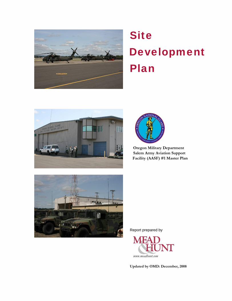
Site Development Plan
Oregon Military Department Salem Army Aviation Support Facility (AASF) #1 Master Plan
Report prepared by
www.meadhunt.com
Updated by OMD: December, 2008
The Salem Army Aviation Support Facility (AASF1) Site Development Plan is an Administrative document and a component of the Real Property Development Plan (RPDP) managed by the Oregon Military Department (OMD) Adjutant General’s Installations Division for purpose of providing long-range planning for real property interests to sustainably support the OMD’s missions. An Executive summary and associated maps are provided for review. For further information contact: Joanne Manson, AICP Oregon Military Department Installations P.O. Box 14350 Salem, OR 97309 Email: [email protected] Telephone: (503) 584-3560
- 1 - AASF1DrftSDPExecSumm_JAN09.doc
Chapter 1 Introduction
Purpose
This report is intended to analyze the development of the Army National Guard’s (ARNG) aviation facilities at McNary Airport in Salem, Oregon. The study includes an analysis of the current ARNG plans and considers future development of the site over the next 25 years.
The Oregon Military Department (OMD) master plan is to consider the current mix of twelve (12) UH-60 “Blackhawk”, four (4) OH-58 “Kiowa”, one (1) C-23 “Sherpa” and one (1) C-12 “Huron” aircraft. The ARNG is anticipating the replacement of the OH-58 with the new LUH-72 “Lakota”. They also anticipate that the C-23 will be replaced with the new C-27J “Spartan” light cargo aircraft that is currently being developed jointly by the US Army and Air Force. The ARNG plans to base the C-27J aircraft at another location in Oregon, and this analysis is not included in this master plan. Currently, the Salem Army Aviation Support Facility #1 (AASF #1) has plans to construct a new composite aviation operations facility and civil support team (CST) facility in the near term. The optimal location of this facility will be addressed in the long range master plan.
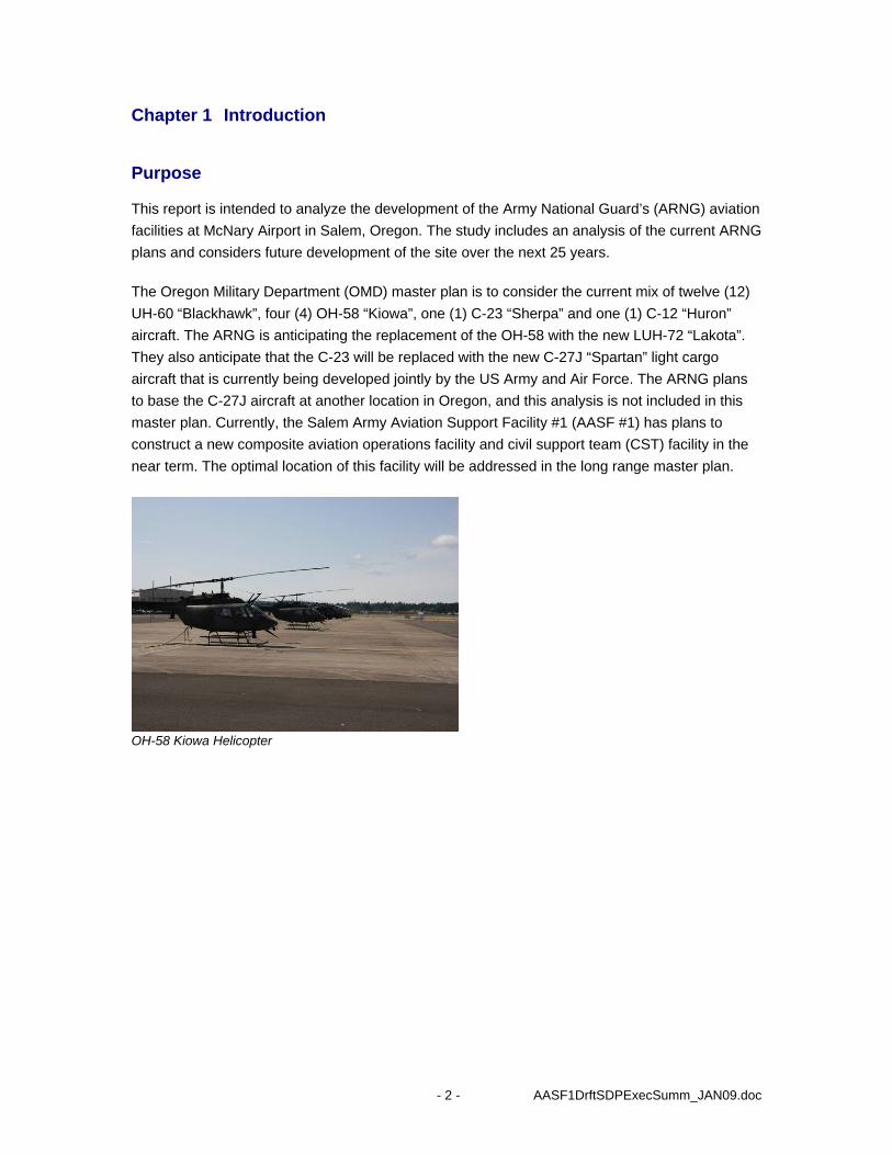
OH-58 Kiowa Helicopter
- 2 - AASF1DrftSDPExecSumm_JAN09.doc
Goals and Objectives
The master plan is intended to review and assess the long term facility and infrastructure needs to support the ARNG primary air ambulance missions and additional miscellaneous and support roles for the next 25 years. The long range plan is based upon the assumption that this site will support:
• Fifteen (15) UH-60 Blackhawk helicopters, • Four (4) LUH-72 Lakota observation helicopter, • One (1) C-12 Huron fixed wing aircraft, and
• Accommodation for landing C-27J and other fixed wing aircraft.
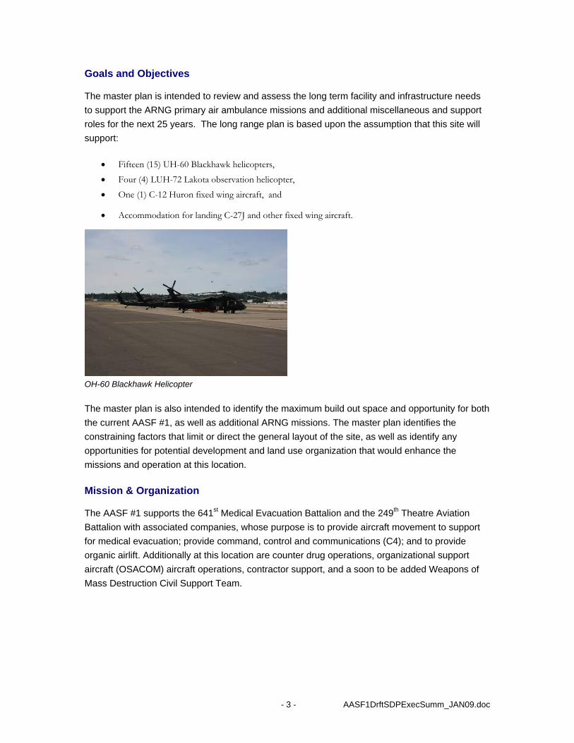
OH-60 Blackhawk Helicopter
The master plan is also intended to identify the maximum build out space and opportunity for both the current AASF #1, as well as additional ARNG missions. The master plan identifies the constraining factors that limit or direct the general layout of the site, as well as identify any opportunities for potential development and land use organization that would enhance the missions and operation at this location.
Mission & Organization
The AASF #1 supports the 641st Medical Evacuation Battalion and the 249th Theatre Aviation Battalion with associated companies, whose purpose is to provide aircraft movement to support for medical evacuation; provide command, control and communications (C4); and to provide organic airlift. Additionally at this location are counter drug operations, organizational support aircraft (OSACOM) aircraft operations, contractor support, and a soon to be added Weapons of Mass Destruction Civil Support Team.
- 3 - AASF1DrftSDPExecSumm_JAN09.doc
- 4 - AASF1DrftSDPExecSumm_JAN09.doc
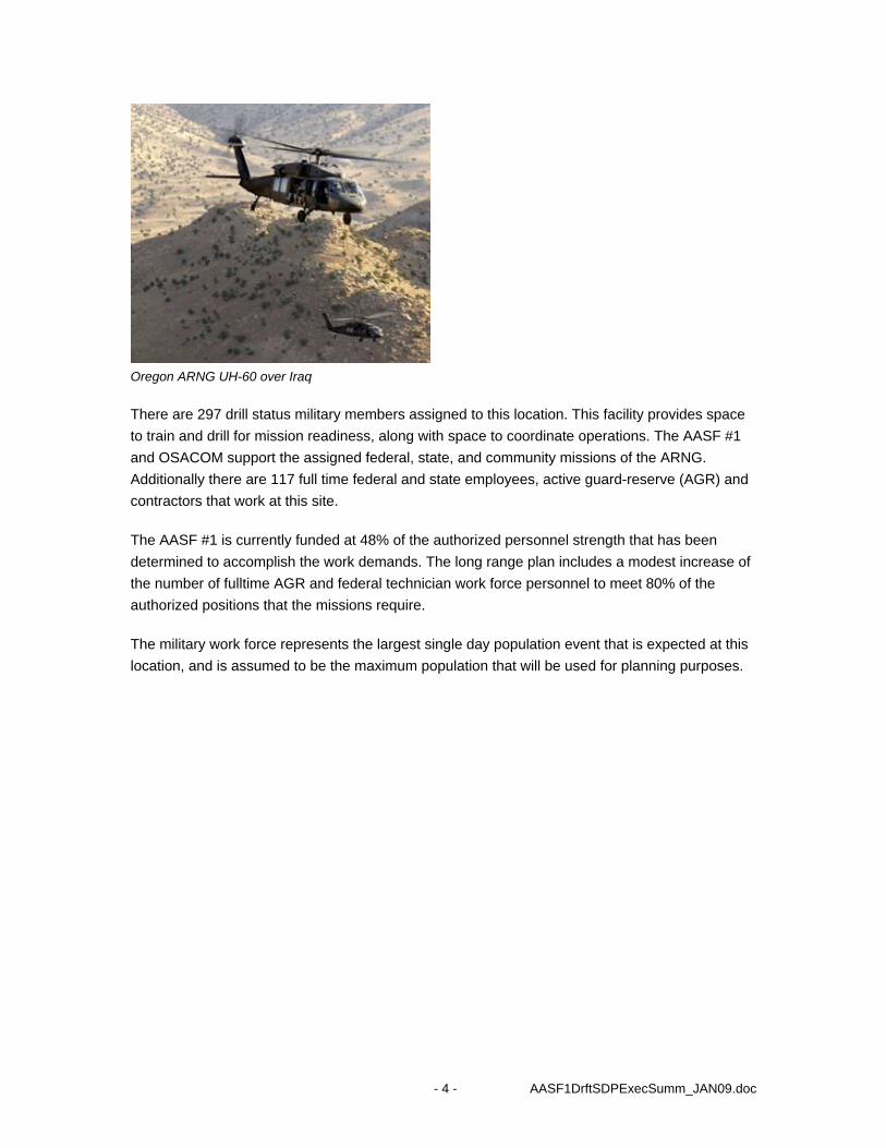
Oregon ARNG UH-60 over Iraq
There are 297 drill status military members assigned to this location. This facility provides space to train and drill for mission readiness, along with space to coordinate operations. The AASF #1 and OSACOM support the assigned federal, state, and community missions of the ARNG. Additionally there are 117 full time federal and state employees, active guard-reserve (AGR) and contractors that work at this site.
The AASF #1 is currently funded at 48% of the authorized personnel strength that has been determined to accomplish the work demands. The long range plan includes a modest increase of the number of fulltime AGR and federal technician work force personnel to meet 80% of the authorized positions that the missions require.
The military work force represents the largest single day population event that is expected at this location, and is assumed to be the maximum population that will be used for planning purposes.
Chapter 2 Long Range Component Plan
Current and future real property requirements and conditions
Salem is located approximately 45 miles southwest of Portland and 60 miles northeast of Eugene in the mid- Willamette Valley. Salem is located in Marion County and is the Oregon state capitol. State Highways 99E, 22, and 221 connect in Salem, and U.S. Interstate 5 (I-5), which travels in a north-south direction, east of the airport. Exhibit 1.1 depicts the location of Salem relative to other communities in the area.
McNary Field Airport is located approximately two miles southeast of downtown Salem, immediately west of U.S. I-5 The east side of the airport accommodates the ARNG complex, and several business users. Exhibit 1.2 displays the location of the Army National Guard relative to the City of Salem
The AASF #1, addressed as 1921 Turner Road, is located at the northeast end of Runway 16/34 and is bordered on the west by the McNary Field Airport runways 16/34 and 13/; Turner Road SE on the north and east; and the airport to the south. Across Turner Road is a shopping center and small lake. Exhibit 1.3 depicts the general layout of the McNary Airport.
The overall AASF #1 site is approximately 77 acres. Fifty-eight (58) acres are dedicated to a sole use military taxiway that will likely become joint use in the future. The remaining 19 acres include aircraft parking aprons, support facilities, hangars and vehicle parking for the sole use of the ARNG. Additionally, the State of Oregon is acquiring 4.56 acres of land known as the Eyerly property that abuts the 19 acres ARNG parcels and has frontage along Turner Road.
The Oregon Military Department (OMD) has a current mix of twelve (12) UH-60 “Blackhawk”, four (4) OH-58 “Kiowa”, one (1) C-23 “Sherpa” and one (1) C-12 “Huron” aircraft. The Salem Army Aviation Support Facility #1 (AASF #1) has immediate plans to construct a new composite aviation operations facility and civil support team (CST) facility in the near term. Exhibit 1.4 is the current facility information as identified on the FISP.
The site has three hangar facilities, aircraft aprons, fuel storage, a hazardous materials storage facility, and parking for both government owned vehicles (GOV) and privately owned vehicles (POV). Hangar #1 is used primarily for maintenance of the OH-58, but also as a multi-use facility, for drill floor, dining, meetings, flight planning, counter drug (RAID) and administrative functions.
Hangar #2 is the primary UH-60 helicopter hangar. The limited maintenance space restricts the helicopter repair work.
Hangar #3 is a pre-manufactured metal building that is used for contractor-supported maintenance of the C-12 and C-23 aircraft. The building is adequate for aircraft maintenance; however it does not have the supporting features such as a passenger waiting area and flight planning facilities. Exhibit 1.5 is the current site map of the Salem AASF #1. Unit Mission
- 5 - AASF1DrftSDPExecSumm_JAN09.doc
The AASF #1 supports the 641st Medical Evacuation Battalion and the 249th Theatre Aviation Battalion with associated companies, whose purpose is to provide aircraft movement to support for medical evacuation; provide command, control and communications (C4); and to provide organic airlift. Additionally at this location are counter drug operations, organizational support aircraft (OSACOM) aircraft operations, contractor support, and a soon to be added Weapons of Mass Destruction Civil Support Team.
There are 297 drill status military members assigned to this location. This facility provides space to train and drill for mission readiness, along with space to coordinate operations. The AASF #1 and OSACOM support the assigned federal, state, and community missions of the ARNG. Additionally there are 117 full time federal and state employees, active guard-reserve (AGR) and contractors that work at this site.
The military work force represents the largest single day population event that is expected at this location, and is assumed to be the maximum population that will be used for planning purposes. Appendix _ reflects the current authorized staffing of the ARNG units located on the AASF #1 site.
The AASF #1 Site Development Plan (based on 15 PAA Blackhawk, 4 PAA Lakota and 1 PAA C-12) is assumed to be 106,839 SF plus an additional 11,498 SF for the Civil Support Team (CST) for a total of 118,337 SF. AT/FP and DOD/FAA aircraft parking criteria are the predominant influences to the future site development plan. Appendix _ is the NGB facility space authorizations compared to actual conditions for the Salem AASF #1. There is currently an approximate 30,000 sq.ft. deficit of hangar space.
The Readiness Center is currently not authorized and a specific scope has not been developed for this facility. The site plan assumes a maximum allowable building envelope with a three story facility of 146,612 SF.
The Unheated Aircraft Storage Facilities for the 19 PAA helicopters is assumed to be 35,075 SF. The site plan allows for additional expansion room for additional unforeseen storage requirements. There is currently an approximate 40,000 sq.ft. deficit of unheated storage space.
The primary AT/FP Entry Control Point at the four way lighted entry is proposed to be a traffic circle. The gate house is set back from Turner Road by over 100 feet and provides 80 feet for a vehicle inspection lane (minimum AT/FP requirement).
This entrance also serves as a short and direct supply delivery point for fuel and material deliveries to the AASF and Readiness Center and restricts access to the flight line and controlled access areas. The central fuel location serves as a single point for incoming government vehicles, a vendor supplied fuel off load point and on continuous aircraft refueler truck on loading operations.
- 6 - AASF1DrftSDPExecSumm_JAN09.doc
The secondary entry control point is a long range concept of the Oregon Military Department envisioned to be a shared entry with the airport. The airport has long term plans for business jet hangars and new terminal facility to the south of the ARNG area and will likely require new accesses to the site.
The overall site lends itself to a high level of design and landscaping that can project a professional image for the military department and contributes as a city gateway. The entrance and the elongated retention pond areas along the street side of the buildings provide an opportunity for a creative landscaping, public art and aircraft display while better controlling the flooding issues on the site. Exhibit 1.8 is the recommended future site plan. Exhibit 1.9 is the list of capital improvement projects necessary to develop the future site plan.
Environmental Quality and Natural/cultural resources
The AASF #1 operates under an Integrated Contingency Plan, which is prepared and maintained by OMD and primarily addresses above ground fuel storage tanks (AST), flight line refueling, incidental or accidental spills, and hazardous material management. The AASF #1 has been classified as a small-quantity generator of hazardous waste and operates under a City of Salem storm water permit. There are no underground storage tanks (UST) on the property owned or leased by the ARNG. The ARNG decommissioned four (4) JP-4/gasolines UST in 1996, and the closure report was submitted to the Oregon Department of Environmental Quality (DEQ), which is pending approval.
The OMD is acquiring an additional 4.56 acre parcel of land, known as the Eyerly property, that adjoins the AASF #1. The final acquisition is pending upon DEQ closure approval of the contaminated area and cleanup that is ongoing with the present land owner. Active investigation and remediation of VOC in both soil and groundwater, and chromium in soil, are currently on-going. It is possible that migration of the VOC has occurred under Hangar #1 from the Eyerly property.
The AASF #1 is located in a Zone AE flood plain and is subject to and delineated to inundation by a 100 year flood. It will be necessary to mitigate the effects of this flood-prone area by constructing buildings above the predicted flood levels. Exhibit 1.10 describes the environmental quality.
Land Use analysis
The City of Salem has adopted zoning ordinances that classify the ARNG area as a Public Service (PS) district (Exhibit 1.11). The City of Salem has also established an airport overlay zone in June 1979, which restricts the use and height of development surrounding the airport. The zone includes land beneath FAR Part 77 approach, transitional, horizontal, and conical surfaces. The general development standards in this zoning code include: Transportation, communications, electric, gas, and sanitary services;
- 7 - AASF1DrftSDPExecSumm_JAN09.doc
• Retail trade; • Services; • Public administration; • Manufacturing; • Other uses as defined by the ordinance
The OMD currently owns three parcels of property which are used by the ARNG. Parcel 1 is 8.36 acres and includes Hangar #1, helicopter parking and fuel storage. Parcel 2 is 4.11 acres and includes Hangar #2 and helicopter parking. Parcel 3 is 1.96 acres and includes aircraft apron (Exhibit 1.12). The ARNG also holds a long term lease for 58.19 acres of land from the City of Salem (Parcel 4). This property includes Hangar #3, GOV and exclusive use of the east taxiway. Additionally, the OMD is acquiring 4.56 acres of land known as the Eyerly property (Parcel 5).
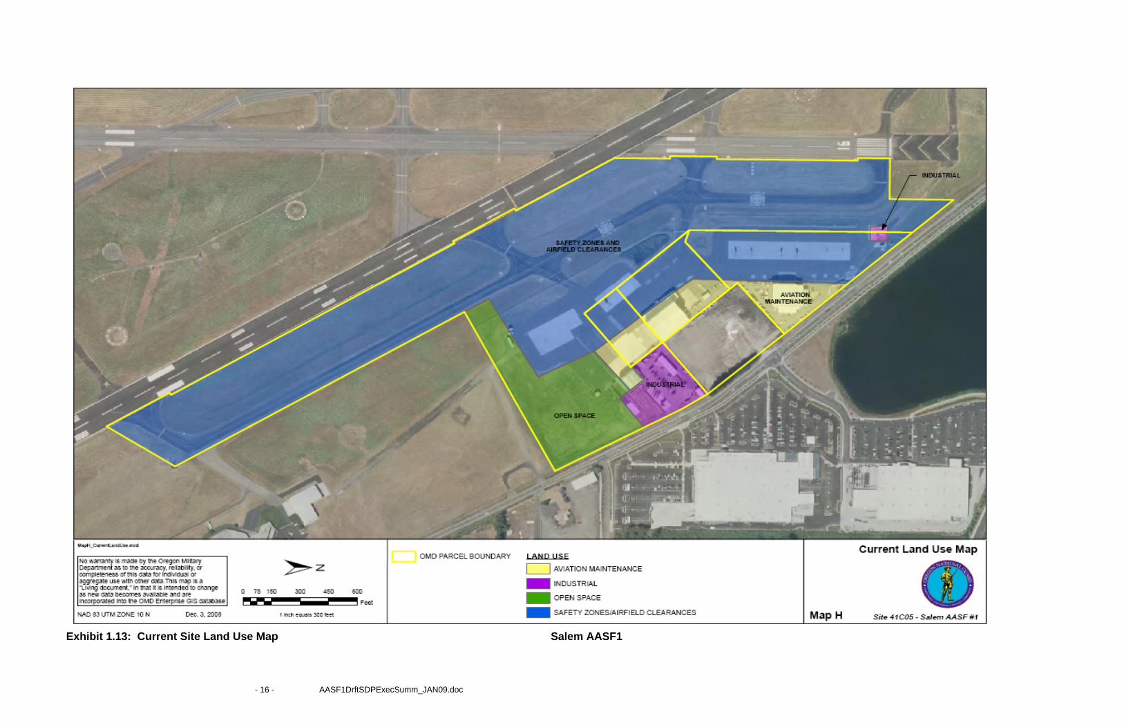
The ARNG land use is primarily classified as airfield pavements areas, aircraft operations and maintenance facilities uses that support of AASF #1. Exhibit 1.13 depicts the current land use.
The existing land use is divided into four primary components, Safety Zones and Airfield Clearances, Aviation Maintenance, Industrial and Open Space. The Eyerly property currently shapes the land use by forcing the facilities to border the property and creates an awkward situation for the Army National Guard. The eventual cleanup and acquisition of this property will significantly improve this condition and allow for an improved land use. The aircraft aprons are spread the length of the ARNG property and are not the most efficient or best use of the property. The aprons use a disproportionate amount of the property due to the configuration of the pavements. Exhibit 1.14 displays the future land use of the site.
Utilities Assessment
Current utilities run parallel to Turner Road. The plan proposes a new utility corridor parallel to the POV parking. The water and sanitary sewer utilities are adequate to support the current operations. The water line has a 6 inch line connecting from the main city water line at the north end of the property which should be replaced with an 8 inch connection in the future. The water line is a looped system with a second connection that is an 8 inch line. The water supply has a continuous pressure and is an adequate supply for the current facilities.
The City of Salem maintains a 48 inch storm sewer and an open drainage system along Turner Road. The city is planning additional improvements along Turner Road that include widening the open drainage south of the ARNG to drain the general area. Storm drainage both on and off the site is inadequate to drain the impervious surface area. It is recommended that a series of linear retention areas be developed as part of the long range future plan to contain storm runoffs that the city systems are unable to accommodate.
Electrical utilities are provided by a commercial vendor and are adequate to meet the needs. The above ground electrical distribution system is out dated and will need to be replaced in the future due to general maintenance and modifications due to the ARNG construction plans. Natural gas is
- 8 - AASF1DrftSDPExecSumm_JAN09.doc
provided by a commercial vendor and the lines are adequate. Distribution lines will need to be rerouted in the future due to changes in the site construction layout.
Communications is provided by a commercial vendor and is adequate for the site. It is recommended that new communications ducts be installed as a part of the master planned development in the future for ease of connections and modifications to the communications systems. Exhibit 1.15 depicts the current utility system at the site.
The proposed future utility corridor is expected to include: water main, sanitary sewer main, natural gas, electrical duct, and a communications line as shown in Exhibit 1.16.
Storm Drainage
The intent of storm drainage design is to limit disruption and pollution of natural water flows by managing storm water runoff. Modeling storm events will aid in remediating conditions caused by increased storm water discharge to the surrounding areas.
It is recommended that a series of elongated storm water retention areas be located in the buffer area between the proposed POV parking lots and the proposed buildings. This area is expected to retain the storm runoff of 1 and 2- year storm event and can retain the excess runoff that would be distributed to the City of Salem storm drainage systems.
Sanitary Sewer
This current sanitary sewer pipe should continue to be utilized and connect to a new 10” pipe installed in the proposed utility corridor. This is expected to provide capacity for the integrated improvements and conditions. Consideration should be given to the installation of oil/water separators to collect pollutants from the proposed wash rack areas.
Water Service
A new 8 inch pipe should be installed within the new proposed utility corridor and connected to the current water main connections. This should provide a positive pressure, looped system. It is suggested that the north 6 inch secondary connection be replaced with a new 8 inch pipe with the necessary back draft valves as required by the City of Salem. This installation should provide an adequate capacity for the proposed plan.
Electrical, Natural Gas and Communications
Specific design for gas, electrical and communication capacity will be determined during the design of each project. The new utility lines should be located within the proposed utility corridor. It is assumed that there is adequate service available in the area.
- 9 - AASF1DrftSDPExecSumm_JAN09.doc
Transportation Assessment
The AASF #1 has a single roadway entrance, connecting to a signalized intersection to Turner Road and an adjacent shopping center entrance. The entrance roadway accesses directly to Hangar #1 and flight line. It has an indistinct parking area that allows parking that surrounds the hangar and does not comply with current Anti Terrorism/Force Protection (AT/FP)policies. There is comingling of POV, GOV and aircraft operations in and near the hangars and flight line areas which present potential safety and security risks. There are no traffic controls in place to restrict vehicle access to the flightline, and deliveries drive directly to the flightline, fuel storage tanks and Hangar #2.
The general condition of the GOV parking and roadways are crushed rock and there are no paved surfaces except for the fuel truck parking area. The condition causes a foreign object damage (FOD) hazard. POV parking is on paved and unimproved areas, which is inadequate for the largest military population during unit training assemblies.
Turner Road is undergoing a major improvement by the City of Salem. The portion of the roadway bordering the ARNG property is complete with new paving, curbing, a four way stop light intersection, walking pathways and landscaping. There are no additional requirements to improve this section of road. The ARNG is responsible to maintain the drainage channels and right of way from Turner Road. Exhibit 1.17 shows the future on-site circulation plan.
Assessment of Environmental Effects
Operational Constraints:
Airfield clearances are established by Federal Aviation Administration (FAA) Advisory Circular (AC) 150/5300-13 Airport Design and the Department of Defense (DoD) Unified Facilities Criteria 3-260-01, Airfield and Heliport Planning and Design. ARNG units co-located on civilian airfields generally follow both DoD and FAA criteria and use the most restrictive requirements when criteria conflicts between the two agencies.
Per the airport layout plan, McNary Field is currently an airport design group III, based on both the wing span and tail height of the current and future controlling design aircraft, the British Aerospace Bae125-800a.
The C-12 and C-23 aircraft define the airfield design criteria as a Class A airfield for fixed wing military aircraft. Should the C-27J operate from this field, additional taxiway widths will be required to accommodate the wingspan of that aircraft, but the airfield would remain classified as a Class A.
Explosive Safety Constraints:
There are no major safety constraints at the existing AASF #1; however, the site does include a fuel storage facility that requires a safety zone of 100 feet from the storage tanks to the property
- 10 - AASF1DrftSDPExecSumm_JAN09.doc
- 11 - AASF1DrftSDPExecSumm_JAN09.doc
line, and 50 feet from any building or substantial structure per National Fire Protection Association (NFPA) 30. The ARNG does not store explosives of significance at the location, and therefore has no explosive safety constraints. Munitions storage is stored at other facilities. Explosive safety constraints do not have a significant impact to the master plan development.
Anti Terrorism/Force Protection Constraints:
There are three hangars located at the AASF #1. Hangar #1 and Hangar #2 are both considered primary gathering facilities. Hangar #1 does not comply with the force protection setbacks at this location and should be considered for replacement in the future. Hangar #3 is considered a low occupancy building and there is no requirement for a security buffer surrounding this facility.
Noise Constraints:
The AASF #1site is generally at or below the 65 DNL. There are no significant noise impacts that would require special or additional noise attenuation of the AASF #1 facilities.
Summary of Site Constraints
Combining airfield clearance, environmental, security, and physical constraints, the AASF #1 has a limited area to expand and develop. AT/FP impact will reduce the available buildable area footprint. Airfield clearances restrict building heights, but not so much as to prohibit long term development. Helicopter parking aprons do not fully utilize the available area. There is an opportunity to consolidate aircraft parking and expand or extend parking further towards the runway, and into a more comprehensive and manageable parking scheme. Impacts due to noise and explosive safety are not expected to have significant impacts on development. (Exhibit 1.18)
Current environmental conditions do not present a long term impact to the future development of the property. The OMD in concert with the State Department of Environmental Quality (DEQ) is pursuing cleanup and resolution of environmental issues associates with the Eyerly property and it is expected become available for use by the ARNG by 2009. The flood plain is a condition that the ARNG is aware of and can be resolved through elevating the structures above the predicted flood heights.
Assessment of potential encroachment
The City of Salem airport overlay zone in June 1979, which restricts the use and height of development surrounding the airport, is successfully preventing encroachment of the airfield and the surrounding safety zones. It is an integral part of the City of Salem’s comprehensive planning. There is no evidence of potential encroachment or crowding of the airport or the AASF #1 in the future. Some natural physical constraints adjacent to the site such as a large lake area and a relatively low density shopping center assist in protecting the area from future encroachment.
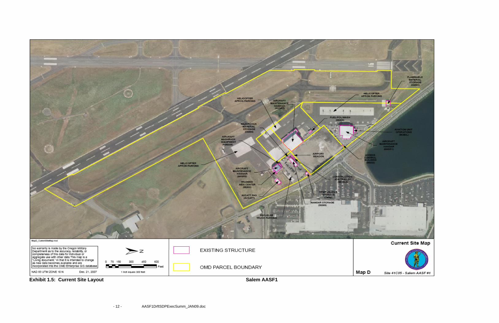
Exhibit 1.5: Current Site Layout Salem AASF1
- 12 - AASF1DrftSDPExecSumm_JAN09.doc
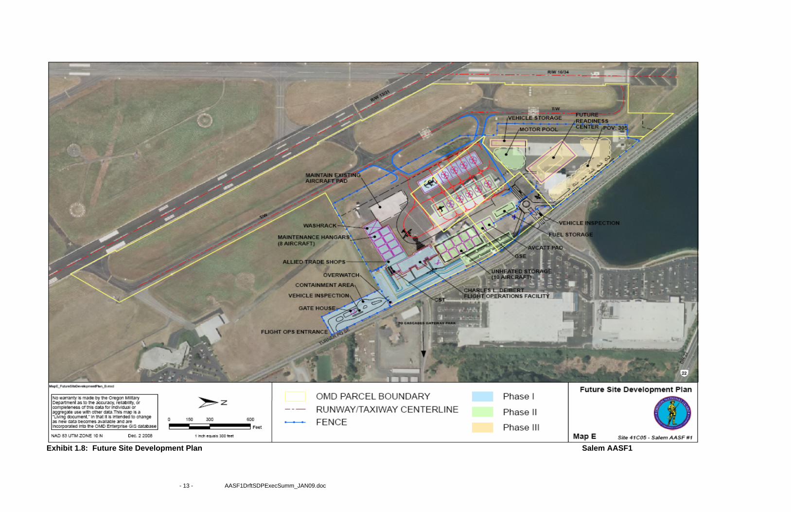
Exhibit 1.8: Future Site Development Plan Salem AASF1
- 13 - AASF1DrftSDPExecSumm_JAN09.doc
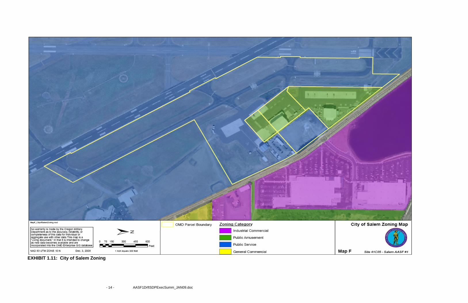
EXHIBIT 1.11: City of Salem Zoning
- 14 - AASF1DrftSDPExecSumm_JAN09.doc
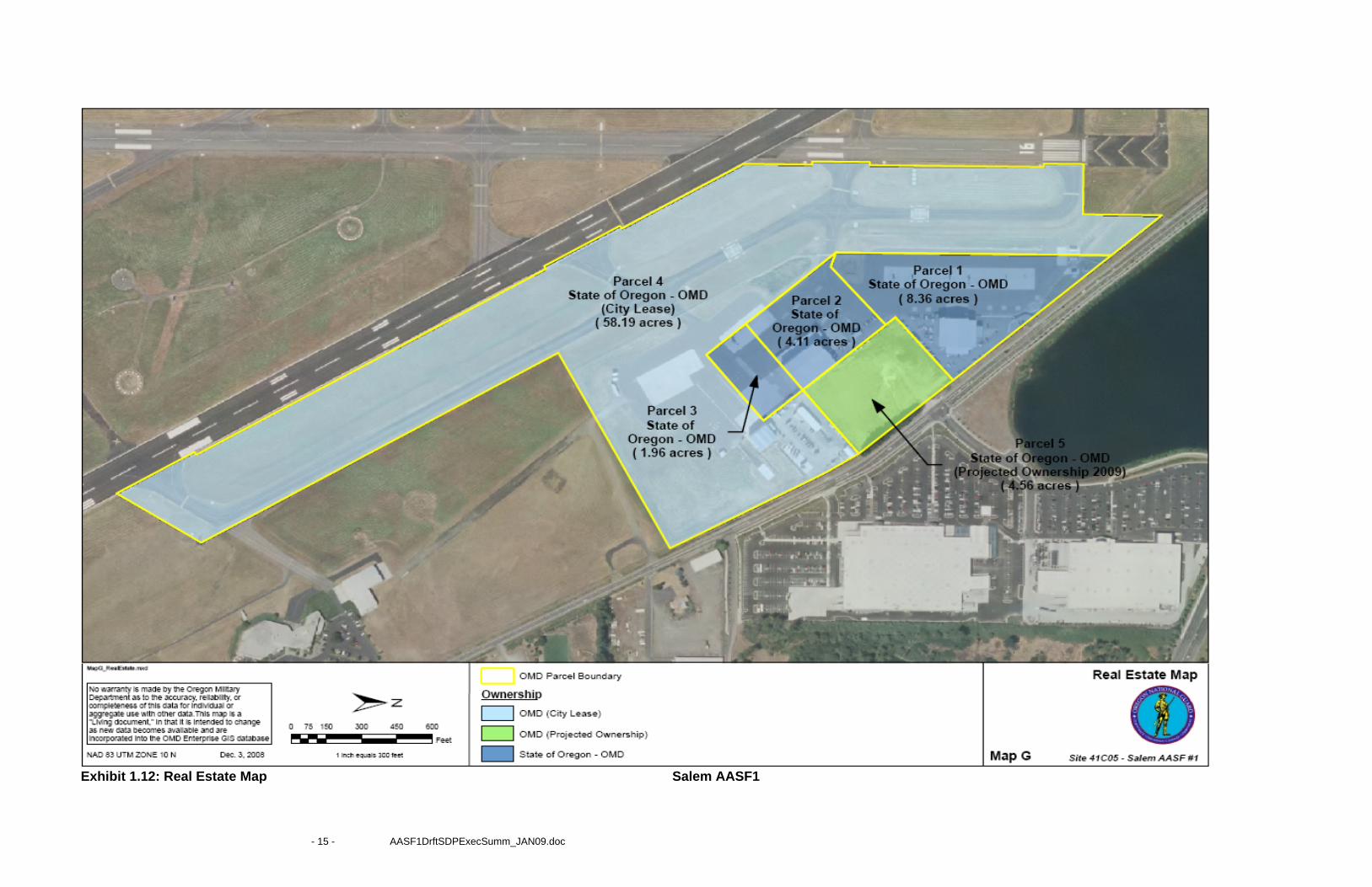
Exhibit 1.12: Real Estate Map Salem AASF1
- 15 - AASF1DrftSDPExecSumm_JAN09.doc
- 16 - AASF1DrftSDPExecSumm_JAN09.doc
Exhibit 1.13: Current Site Land Use Map Salem AASF1
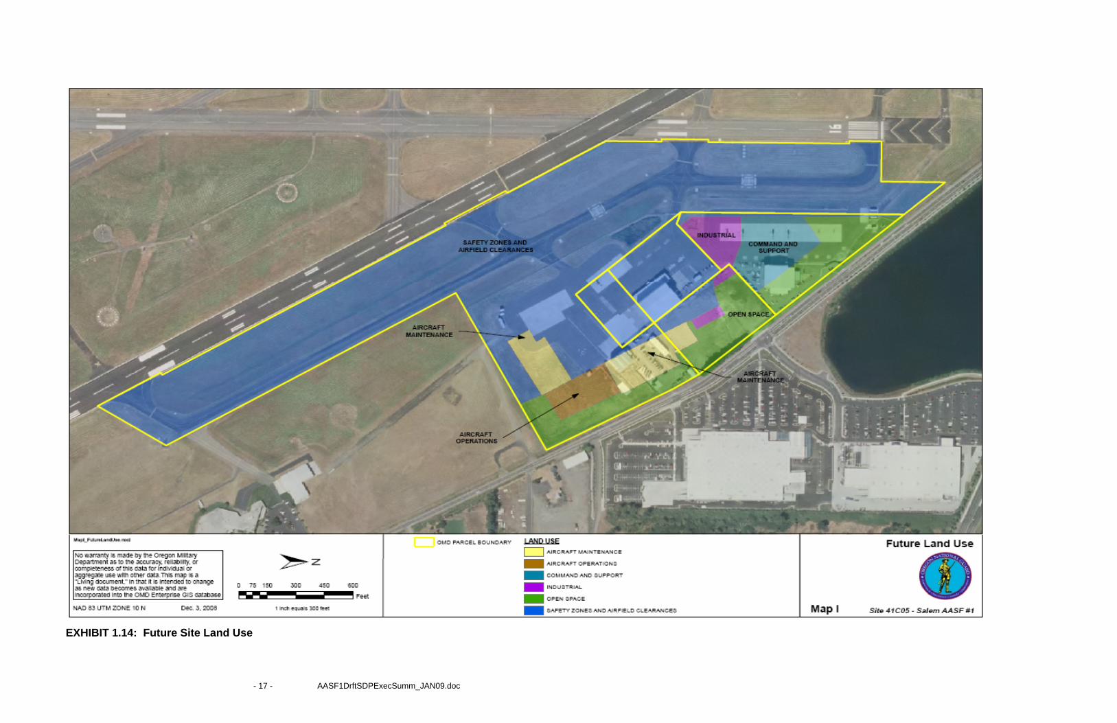
EXHIBIT 1.14: Future Site Land Use
- 17 - AASF1DrftSDPExecSumm_JAN09.doc
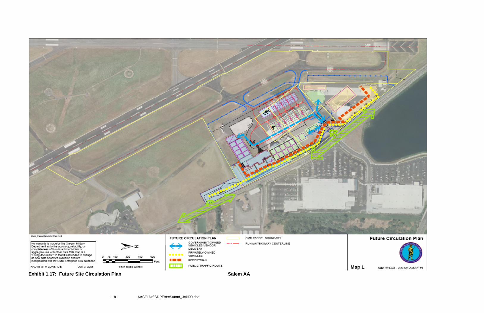
Exhibit 1.17: Future Site Circulation Plan Salem AA
- 18 - AASF1DrftSDPExecSumm_JAN09.doc