Embed Size (px)
Citation preview
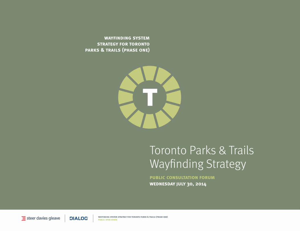
wayfinding system strategy for toronto
parks & trails (phase one)
Toronto Parks & Trails Wayfinding Strategypublic consultation forumwednesday july 30, 2014

agenda
1 welcome2 project overview3 wayfinding context4 strategy inputs5 wayfinding strategy6 system components7 wayfinding pilot8 feedback and comments
welcome
This presentation summarizes the outcomes of the Parks & Trails Wayfinding Strategy (Phase One) study, which began in January 2014.
The study aimed to establish robust foundations for the development and delivery of a consistent, high-quality wayfinding system for Toronto’s parks & trails.
janette harvey City of Toronto - Parks, Forestry & Recreation
phil berczuk Partner-in-charge
Steer Davies Gleave
antonio gómez-palacio Partner-in-charge
DIALOG
today’s event
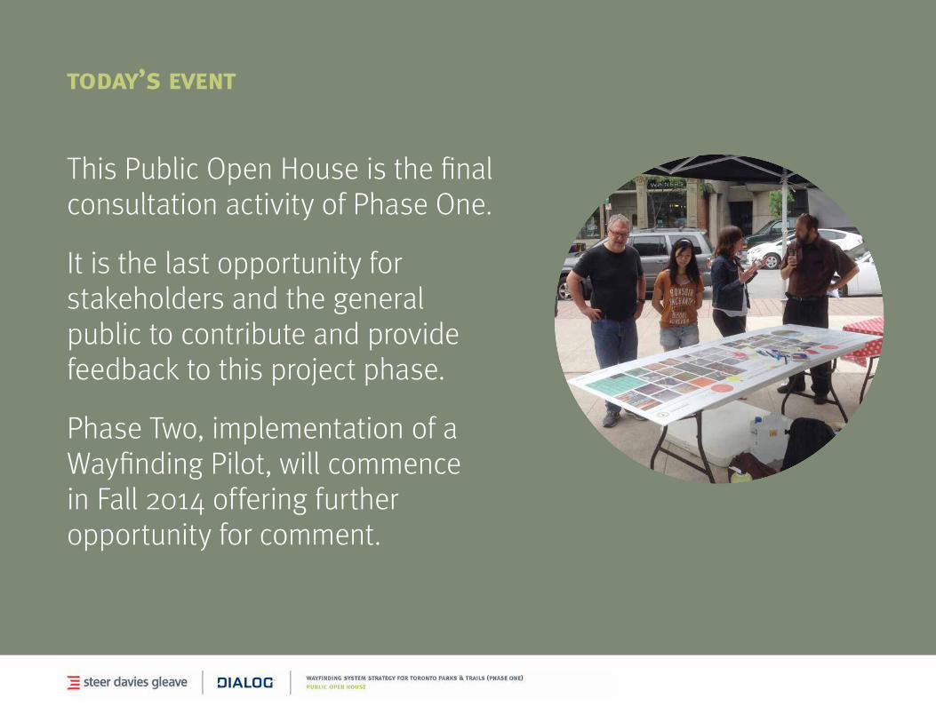
This Public Open House is the final consultation activity of Phase One.
It is the last opportunity for stakeholders and the general public to contribute and provide feedback to this project phase.
Phase Two, implementation of a Wayfinding Pilot, will commence in Fall 2014 offering further opportunity for comment.
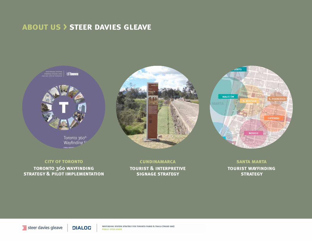
about us > steer davies gleave
city of torontotoronto 360 wayfinding
strategy & pilot implementation
cundinamarcatourist & interpretive
signage strategy
santa martatourist wayfinding
strategy

about us > dialog
town of tecumsehlakewood park
plan
city of londonlondon placemaking
implementation guidelines
city of torontounion station peer review
+ master plan
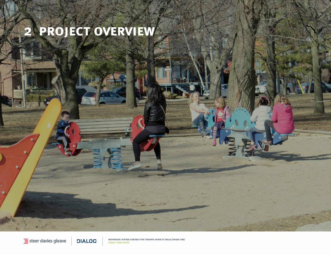
2 project overview
project overview
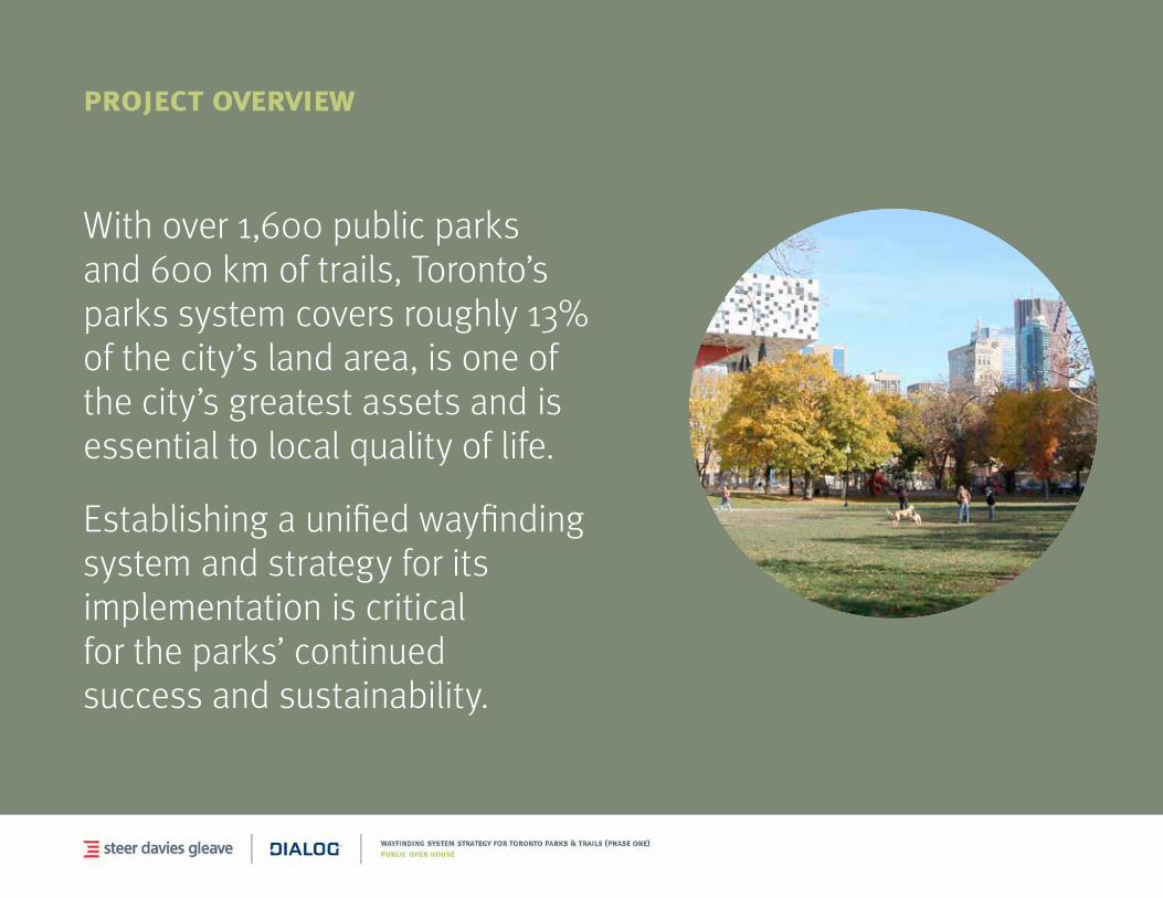
With over 1,600 public parks and 600 km of trails, Toronto’s parks system covers roughly 13% of the city’s land area, is one of the city’s greatest assets and is essential to local quality of life.
Establishing a unified wayfinding system and strategy for its implementation is critical for the parks’ continued success and sustainability.
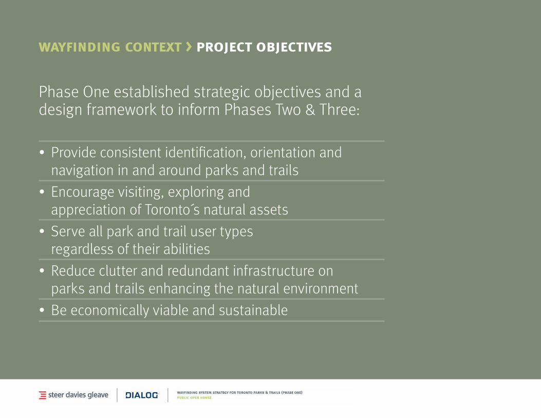
wayfinding context > project objectives
Phase One established strategic objectives and a design framework to inform Phases Two & Three:
• Provideconsistentidentification,orientationandnavigation in and around parks and trails
• Encouragevisiting,exploringandappreciation of Toronto s natural assets
• Serveallparkandtrailusertypesregardless of their abilities
• Reduceclutterandredundantinfrastructureonparks and trails enhancing the natural environment
• Beeconomicallyviableandsustainable

project overview > process
Phase One work program
stage 1
Information Gathering
Jan - April 2014
stage 2
Wayfinding Framework
April - May 2014
stage 3Concept Design
May -June 2014
stage 4Pilot Definition &
Implementation Plan
July - August 2014
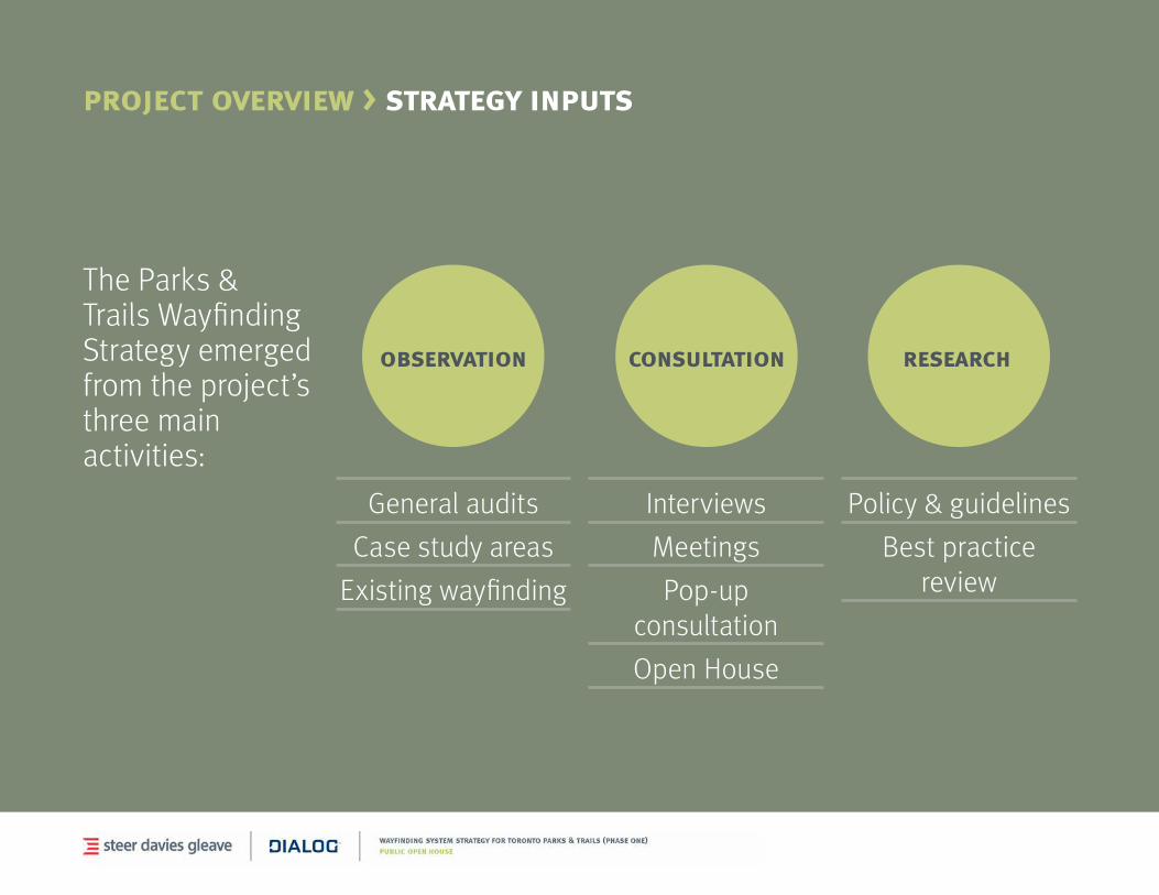
project overview > strategy inputs
The Parks & Trails Wayfinding Strategy emerged from the project’s three main activities:
observation
General audits
Case study areas
Existingwayfinding
consultation
Interviews
Meetings
Pop-up consultation
Open House
research
Policy & guidelines
Bestpractice review
3 wayfinding context
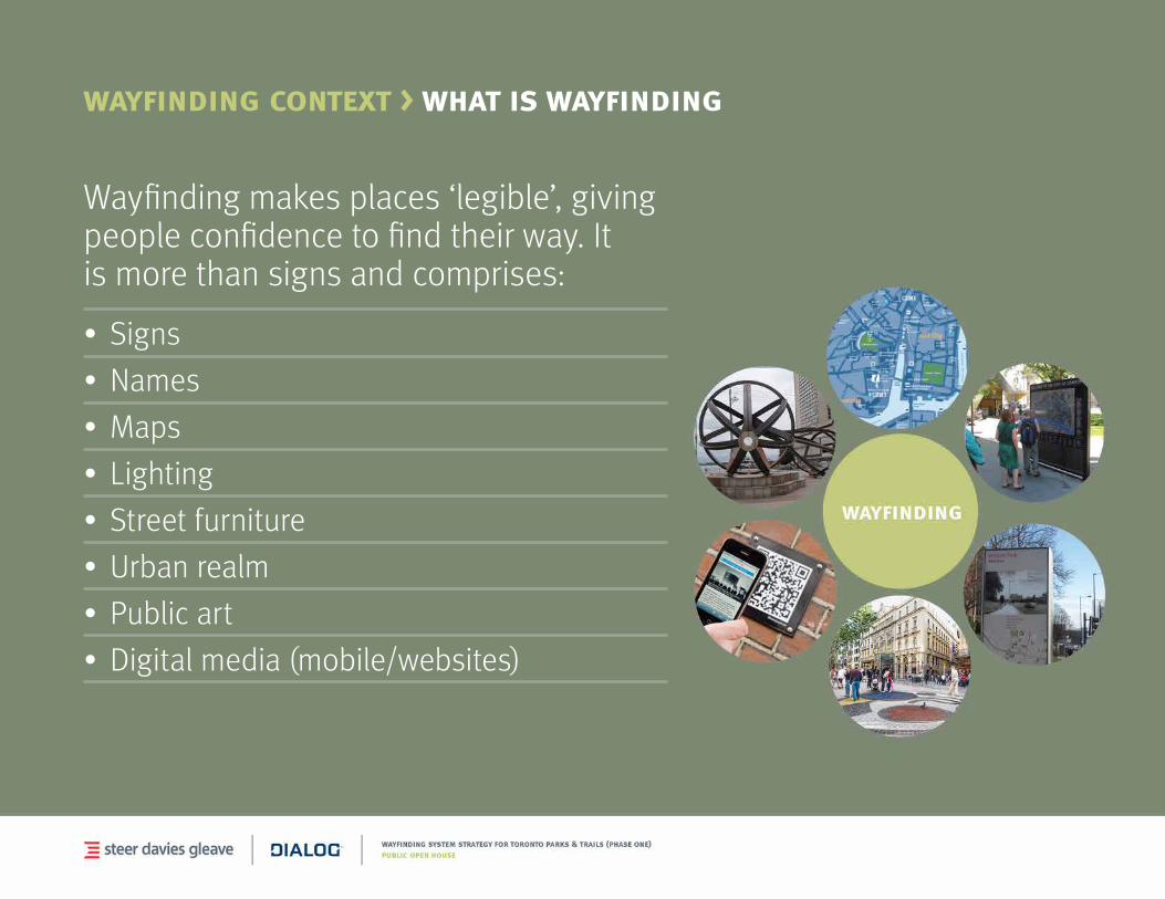
wayfinding context > what is wayfinding
Wayfinding makes places ‘legible’, giving people confidence to find their way. It is more than signs and comprises:
• Signs
• Names
• Maps
• Lighting
• Streetfurniture
• Urbanrealm
• Publicart
• Digitalmedia(mobile/websites)
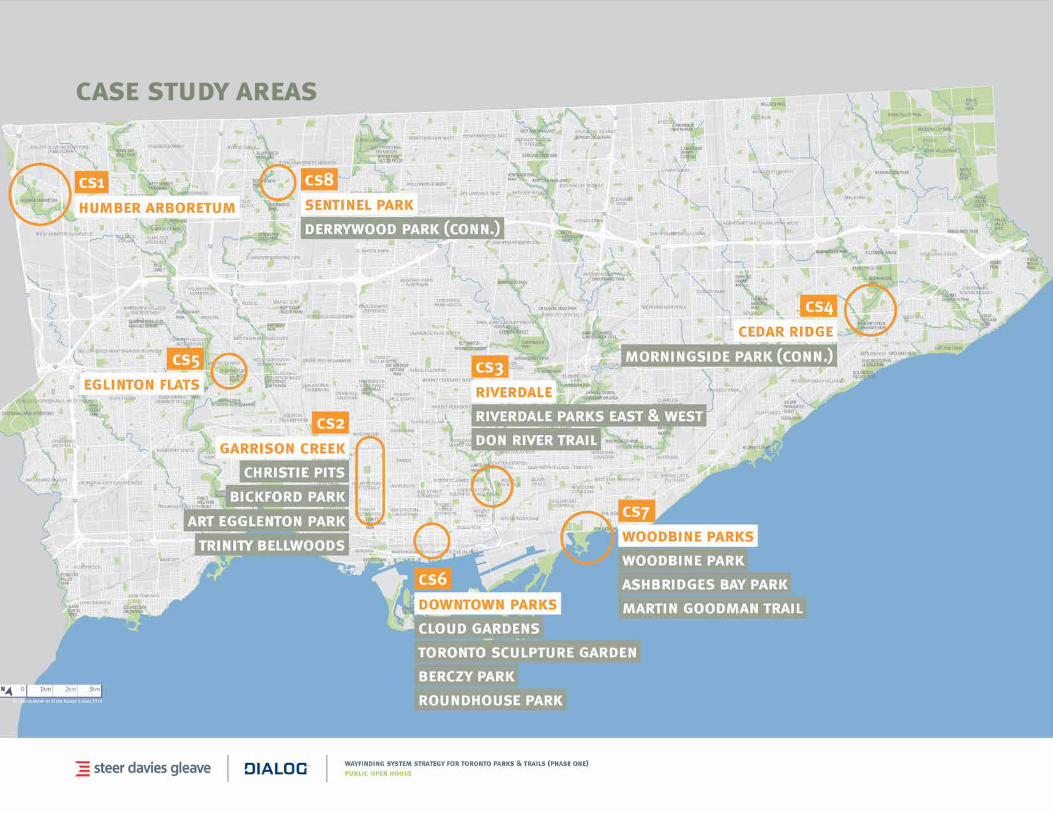
case study areas
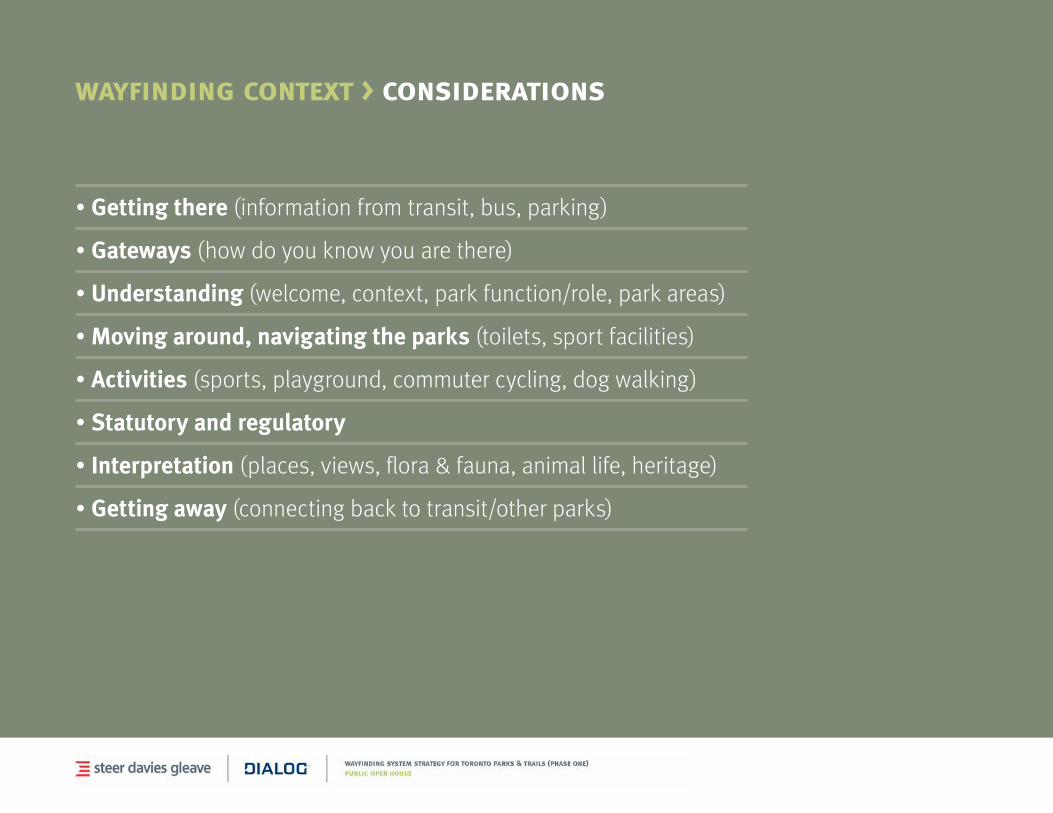
wayfinding context > considerations
•Getting there (information from transit, bus, parking)
•Gateways (how do you know you are there)
•Understanding(welcome,context,parkfunction/role,parkareas)
•Moving around, navigating the parks (toilets, sport facilities)
•Activities (sports, playground, commuter cycling, dog walking)
• Statutory and regulatory
•Interpretation (places, views, flora & fauna, animal life, heritage)
•Getting away (connectingbacktotransit/otherparks)
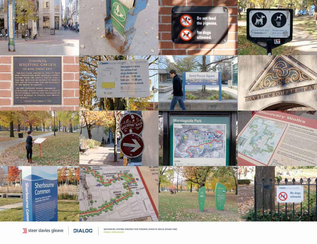
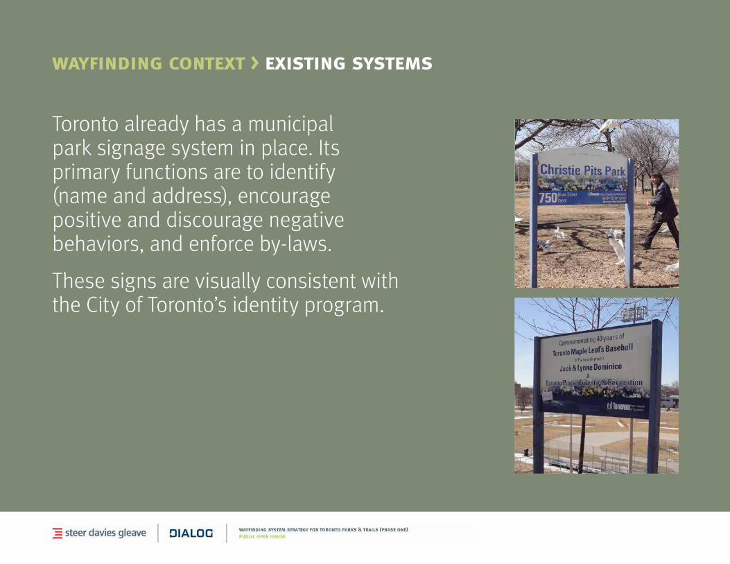
wayfinding context > existing systems
Toronto already has a municipal park signage system in place. Its primary functions are to identify (name and address), encourage positive and discourage negative behaviors, and enforce by-laws.
These signs are visually consistent with the City of Toronto’s identity program.
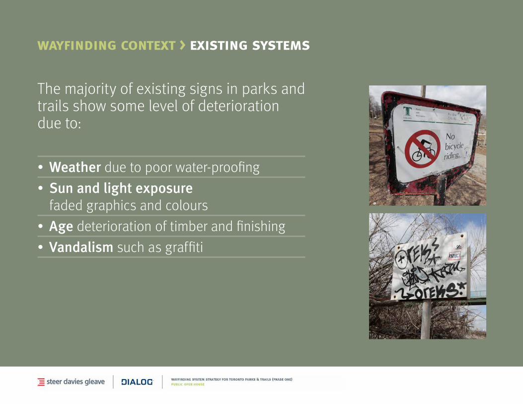
wayfinding context > existing systems
Themajorityofexistingsignsinparksandtrails show some level of deterioration due to:
• Weather due to poor water-proofing
• Sun and light exposure faded graphics and colours
• Age deterioration of timber and finishing
• Vandalism such as graffiti
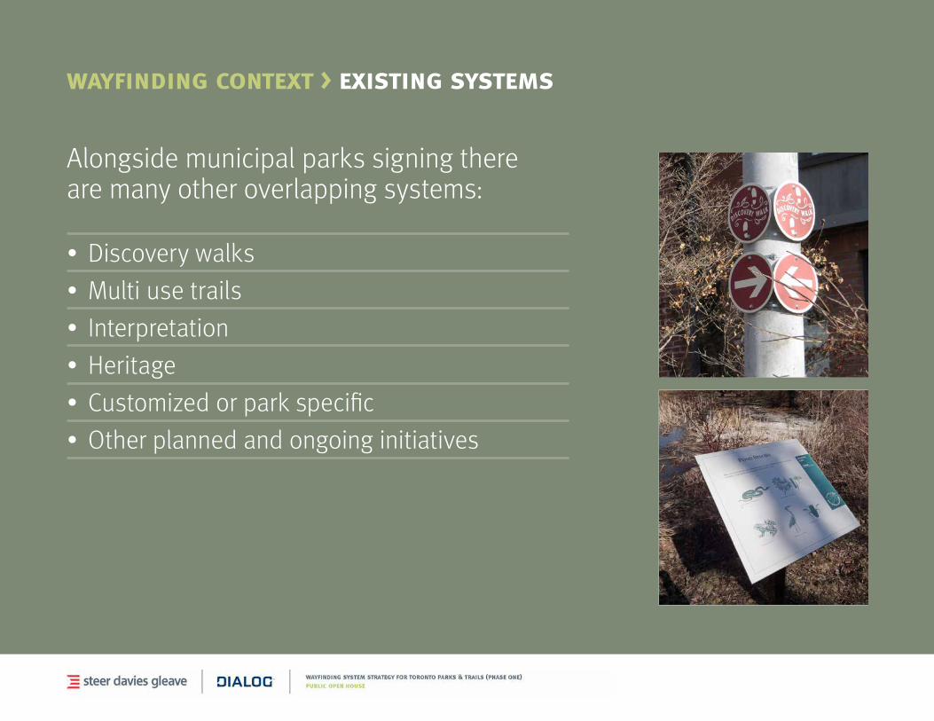
wayfinding context > existing systems
Alongside municipal parks signing there are many other overlapping systems:
• Discoverywalks
• Multiusetrails
• Interpretation
• Heritage
• Customizedorparkspecific
• Otherplannedandongoinginitiatives
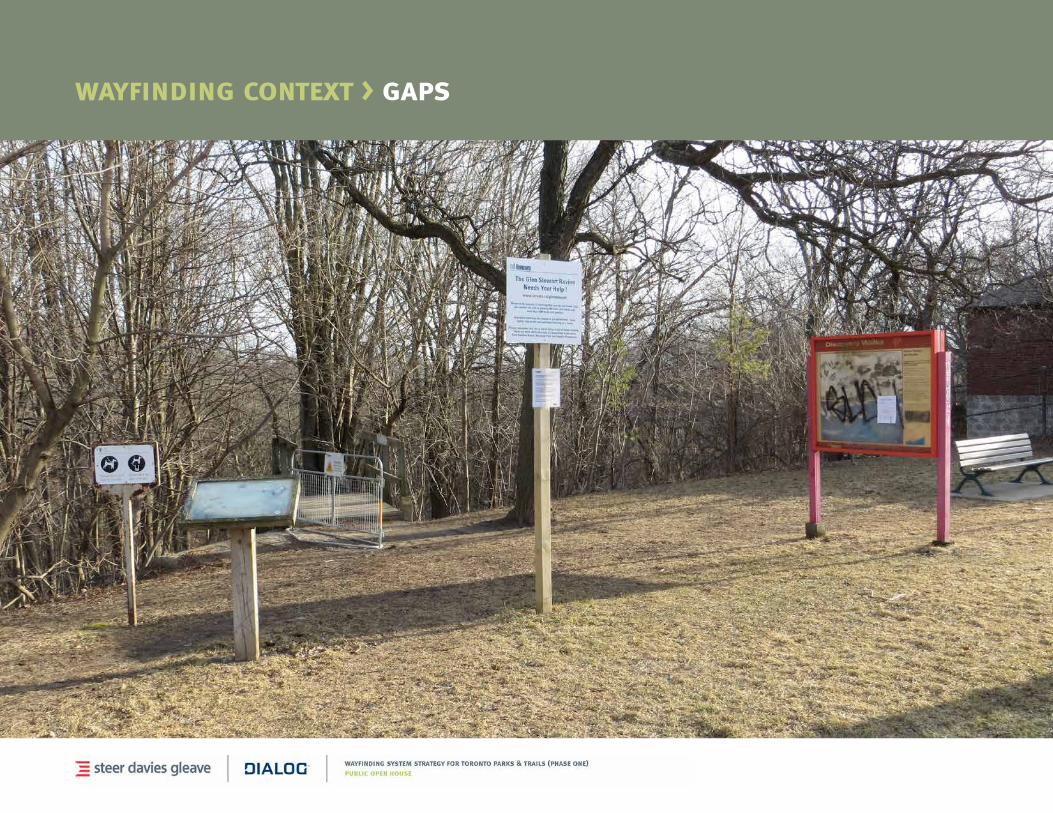
wayfinding context > gaps
Site visits, observations and user engagement across the eight case study areas identified fivefundamentalgaps/issueswithcurrent parks & trails wayfinding.
• Clutterandrepetition
• Informationoverload/gaps
• Accessibility
• Contentandnaminghierarchy
• Attractiveness
wayfinding context > gaps
4 strategy inputs

stakeholder consultation > interviews
parks operations
tourism
trails / walking
park / watershed advocates
cycling
accessibility
culture / heritage
environmental programs
recreation
life saving stations and ems
waterfront
pan am games
We had conversations with over 30 stakeholder organizations and special interest groups including:

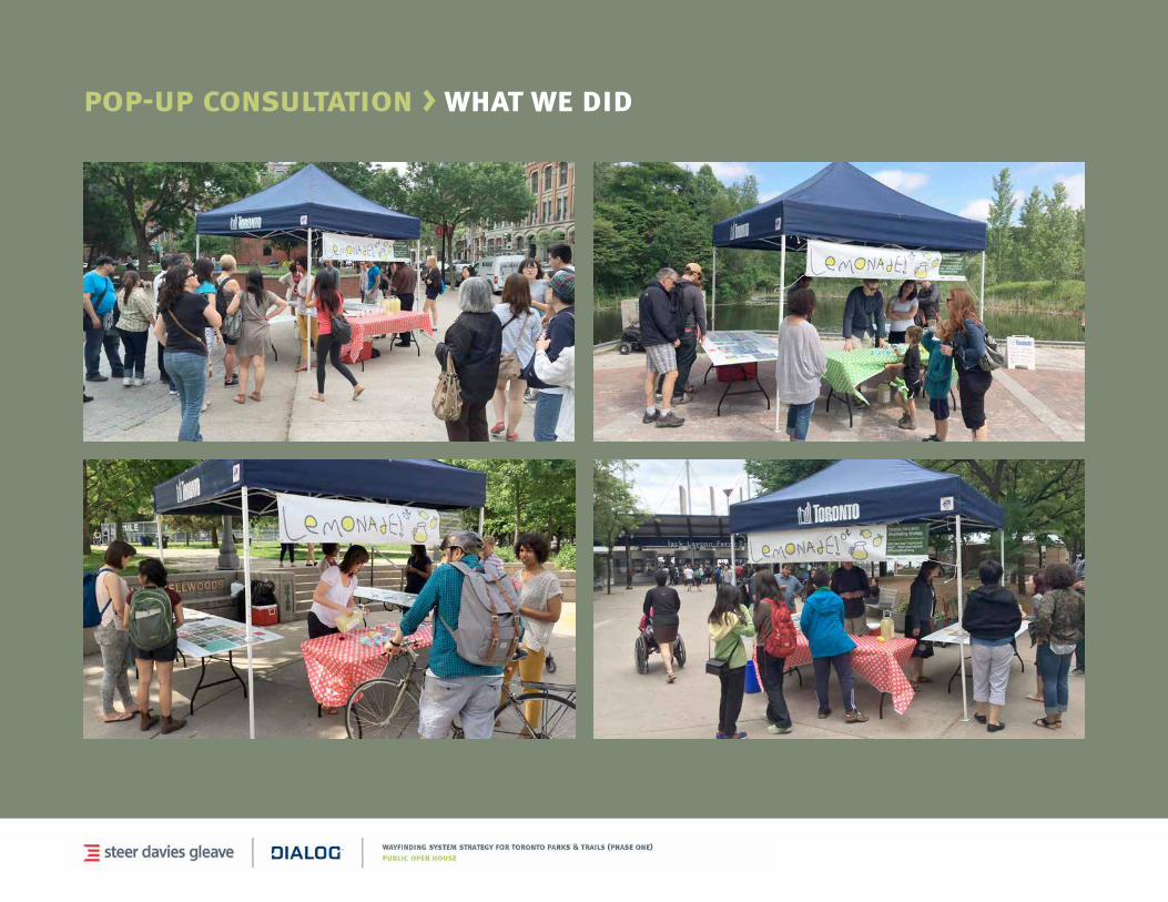
pop-up consultation > what we did
Pop-up events held at four sites over two days:
•BerczyPark,FridayJune13
•Trinity-BellwoodsPark,FridayJune13
•EvergreenBrickWorks,SaturdayJune14
•TorontoIslandFerryTerminal,Sat.June14
Free lemonade and four interactive panels.
pop-up consultation > what we did
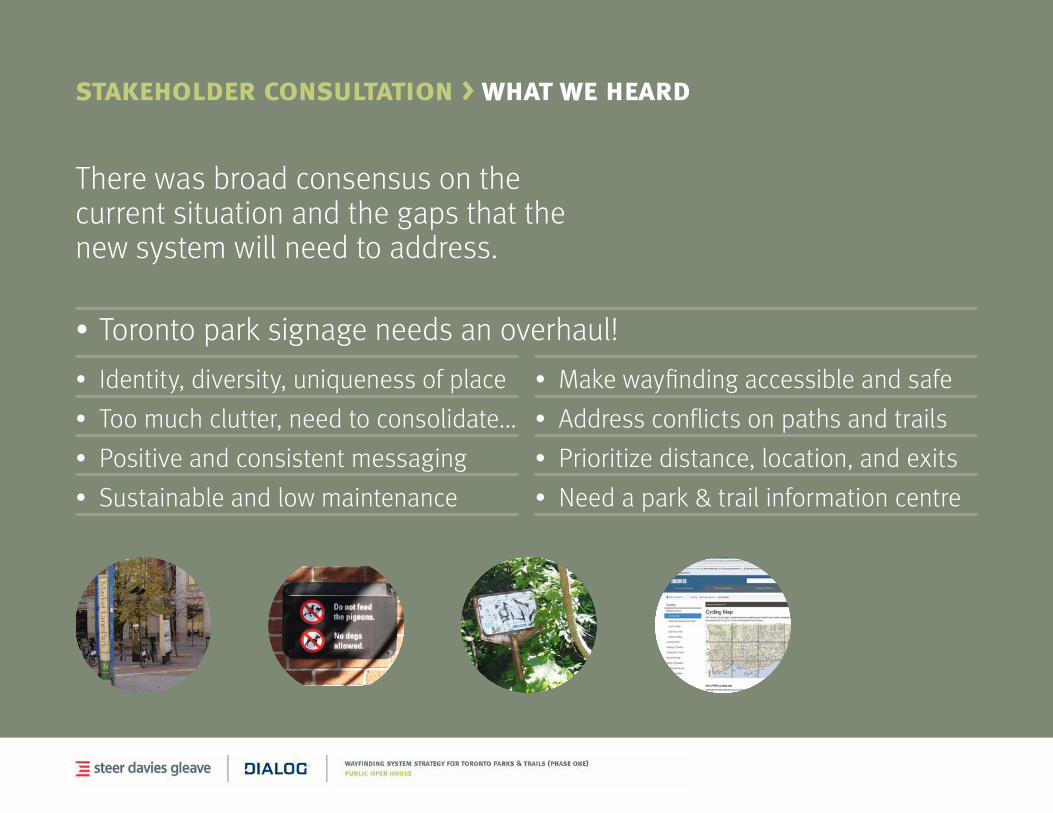
• Identity,diversity,uniquenessofplace
• Toomuchclutter,needtoconsolidate...
• Positiveandconsistentmessaging
• Sustainableandlowmaintenance
•Torontoparksignageneedsanoverhaul!
stakeholder consultation > what we heard
There was broad consensus on the current situation and the gaps that the new system will need to address.
• Makewayfindingaccessibleandsafe
• Addressconflictsonpathsandtrails
• Prioritizedistance,location,andexits
• Needapark&trailinformationcentre

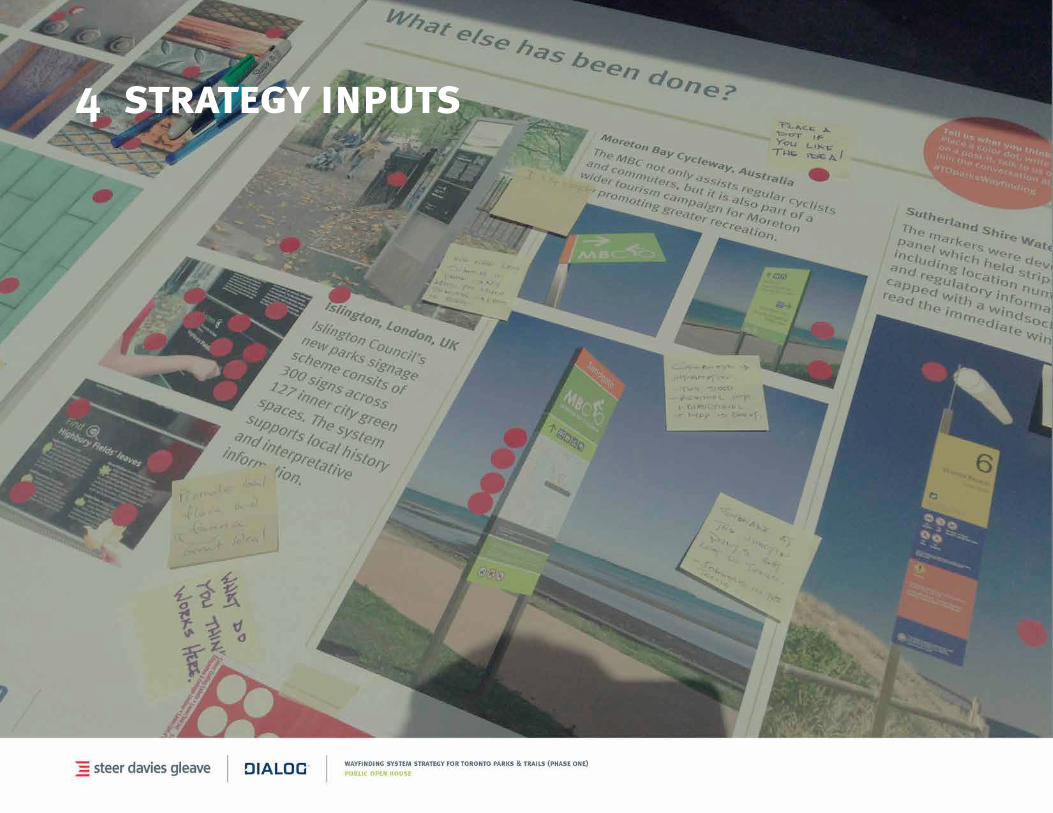
international best practices
A broad range of international parks wayfinding systems were reviewed including:
BatteryPointTrail,AUS
DurhamParks&Recreation,USA
HighLine,NYC,USA
Lisbon Cycle Trail, Portugal
MBCTrail,Australia
NationalMall&MemorialParks,USA
StockwellPark,UK
IslingtonGreenspace,UK
NYCParks,USA
TheParklands,AUS
5 wayfinding strategy
wayfinding strategy
• Toronto Parkland wayfinding principles
• Interaction with other systems (current and on-going projects)
wayfinding strategy > opportunities
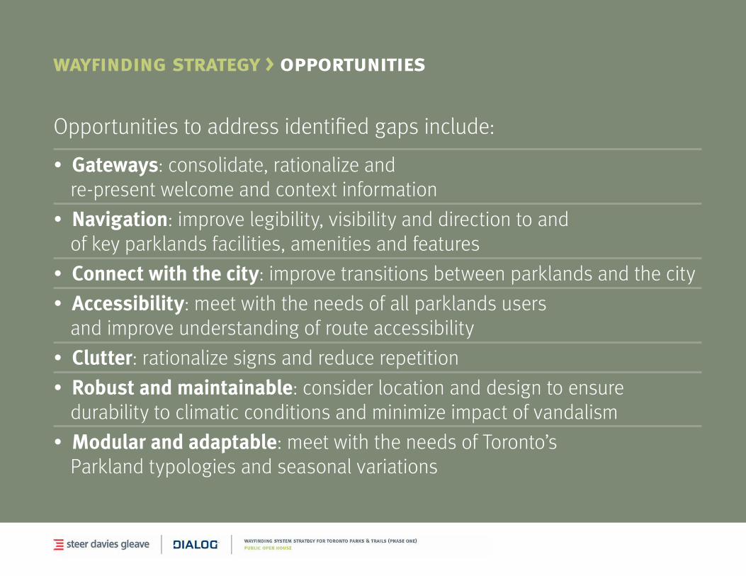
Opportunities to address identified gaps include:
•Gateways: consolidate, rationalize and re-presentwelcomeandcontextinformation
•Navigation: improve legibility, visibility and direction to and of key parklands facilities, amenities and features
• Connect with the city: improve transitions between parklands and the city
•Accessibility: meet with the needs of all parklands users and improve understanding of route accessibility
•Clutter: rationalize signs and reduce repetition
• Robust and maintainable: consider location and design to ensure durability to climatic conditions and minimize impact of vandalism
•Modular and adaptable: meet with the needs of Toronto’s Parkland typologies and seasonal variations
wayfinding strategy > priorities
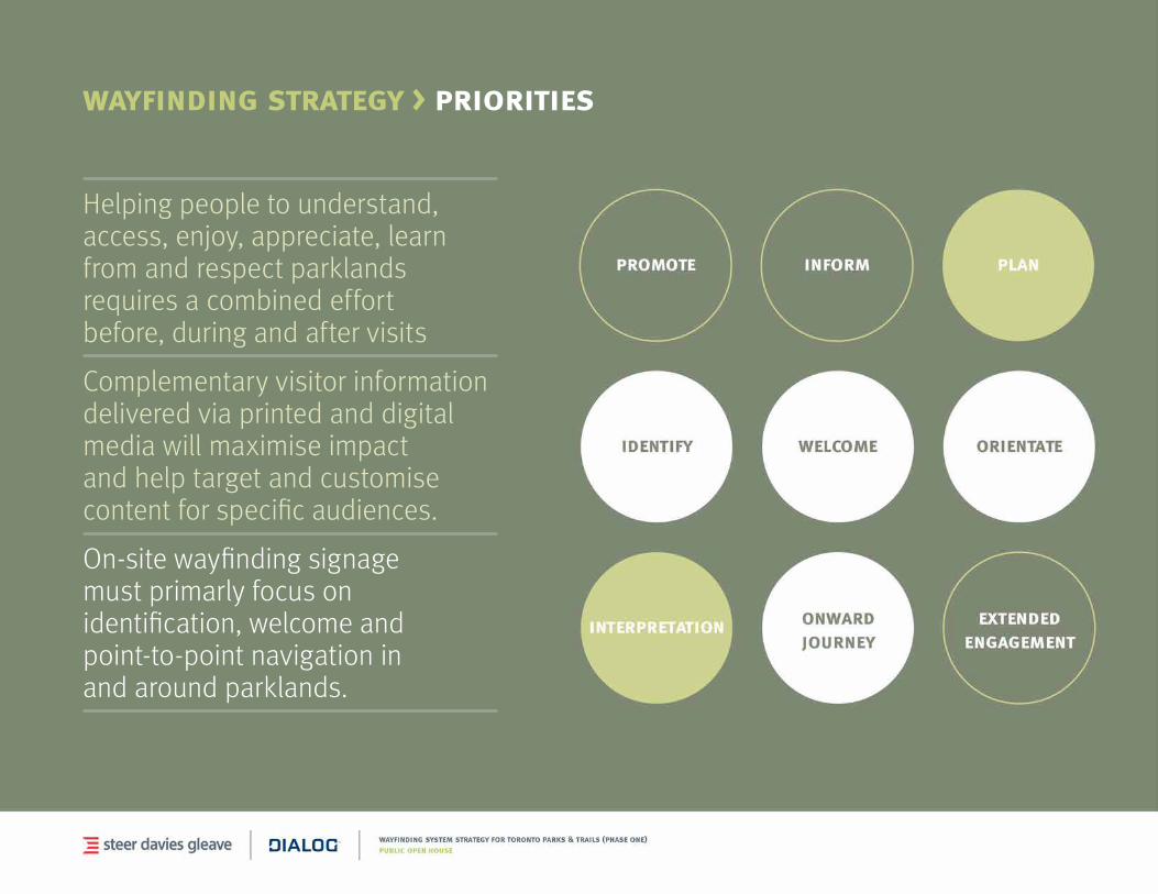
Helping people to understand, access, enjoy, appreciate, learn from and respect parklands requires a combined effort before, during and after visits
Complementary visitor information delivered via printed and digital mediawillmaximiseimpactand help target and customise content for specific audiences.
On-site wayfinding signage must primarly focus on identification, welcome and point-to-point navigation in and around parklands.
wayfinding strategy > to360 strategy
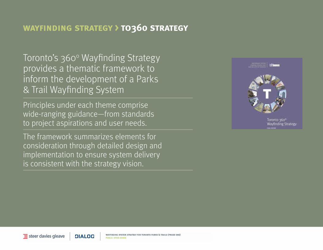
Toronto’s 3600 Wayfinding Strategy provides a thematic framework to inform the development of a Parks & Trail Wayfinding System
Principles under each theme comprise wide-ranging guidance—from standards to project aspirations and user needs.
The framework summarizes elements for consideration through detailed design and implementation to ensure system delivery is consistent with the strategy vision.
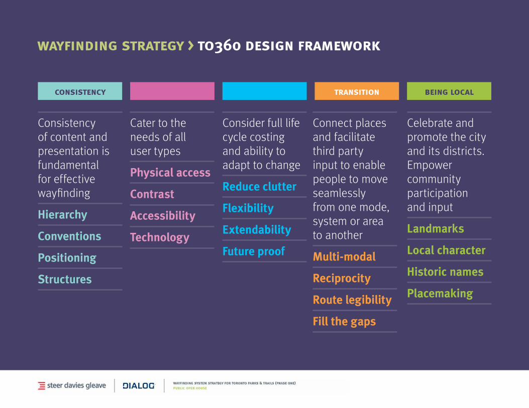
wayfinding strategy > to360 design framework
consistency
Consistency of content and presentation is fundamental for effective wayfinding
Hierarchy
Conventions
Positioning
Structures
inclusivity
Cater to the needs of all user types
Physical access
Contrast
Accessibility
Technology
sustainability
Consider full life cycle costing and ability to adapt to change
Reduce clutter
Flexibility
Extendability
Future proof
transition
Connect places and facilitate third party input to enable people to move seamlessly from one mode, system or area to another
Multi-modal
Reciprocity
Route legibility
Fill the gaps
being local
Celebrate and promote the city and its districts. Empower community participation and input
Landmarks
Local character
Historic names
Placemaking
While the TO360 principles are broadly applicable they need to be translated into relevant design decisions for Toronto Parks & Trails.
Complementary principles for Parks & Trails signing include:
•Auser-basedapproach
•Simplicity
•Placement
•Visuallanguageandidentity
•Integratedwithsurroundings
•Modularandeasilyupdateable
•Encourageinteraction
•Asignforallseasons
wayfinding strategy > opportunities
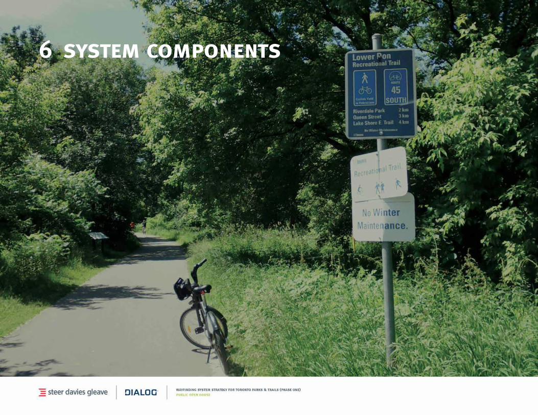
6 system components
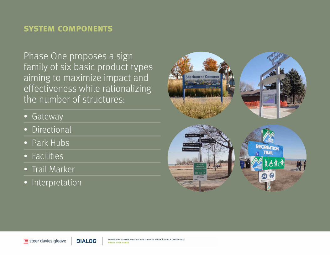
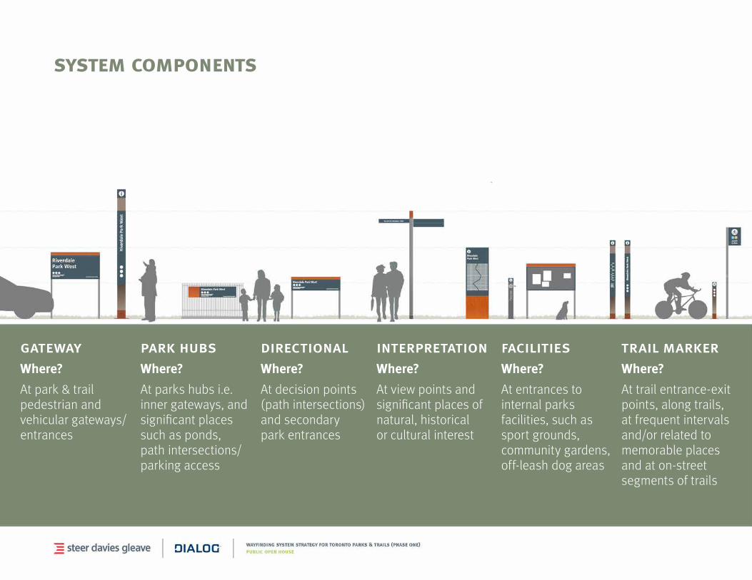
system components
Phase One proposes a sign familyofsixbasicproducttypesaimingtomaximizeimpactandeffectiveness while rationalizing the number of structures:
•Gateway
•Directional
•ParkHubs
•Facilities
•TrailMarker
•Interpretation
system components
gatewayWhere?
At park & trail pedestrian and vehiculargateways/entrances
facilitiesWhere?
At entrances to internal parks facilities, such as sport grounds, community gardens,off-leash dog areas
directionalWhere?
At decision points (path intersections) and secondary park entrances
trail markerWhere?
Attrailentrance-exitpoints, along trails, at frequent intervals and/orrelatedto
memorable places and at on-street segments of trails
park hubsWhere?
At parks hubs i.e. inner gateways, and significant places such as ponds, pathintersections/parking access
interpretationWhere?
At view points and significant places of natural, historical or cultural interest
system components > interactions
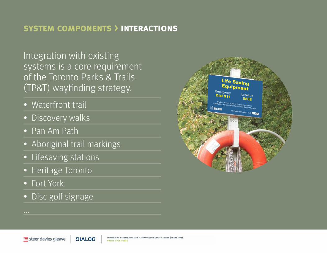
Integrationwithexistingsystems is a core requirement of the Toronto Parks & Trails (TP&T) wayfinding strategy.
•Waterfronttrail
•Discoverywalks
•PanAmPath
•Aboriginaltrailmarkings
•Lifesavingstations
•HeritageToronto
•FortYork
•Discgolfsignage
...
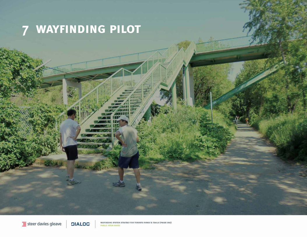
7 wayfinding pilot
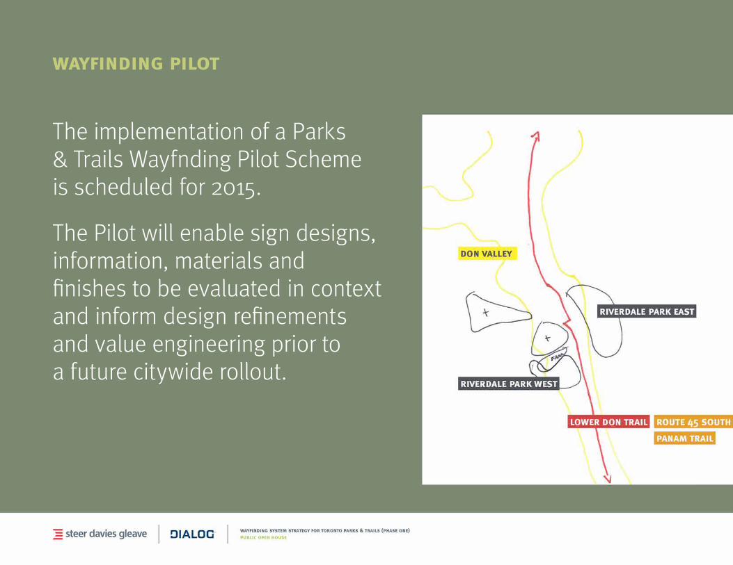
wayfinding pilot
The implementation of a Parks & Trails Wayfnding Pilot Scheme is scheduled for 2015.
The Pilot will enable sign designs, information, materials and finishestobeevaluatedincontextand inform design refinements and value engineering prior to a future citywide rollout.
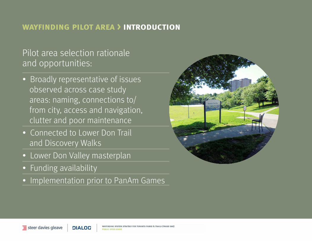
wayfinding pilot area > introduction
Pilot area selection rationale and opportunities:
•Broadlyrepresentativeofissuesobserved across case study areas:naming,connectionsto/from city, access and navigation, clutter and poor maintenance
•ConnectedtoLowerDonTrailand Discovery Walks
•LowerDonValleymasterplan
•Fundingavailability
•ImplementationpriortoPanAmGames
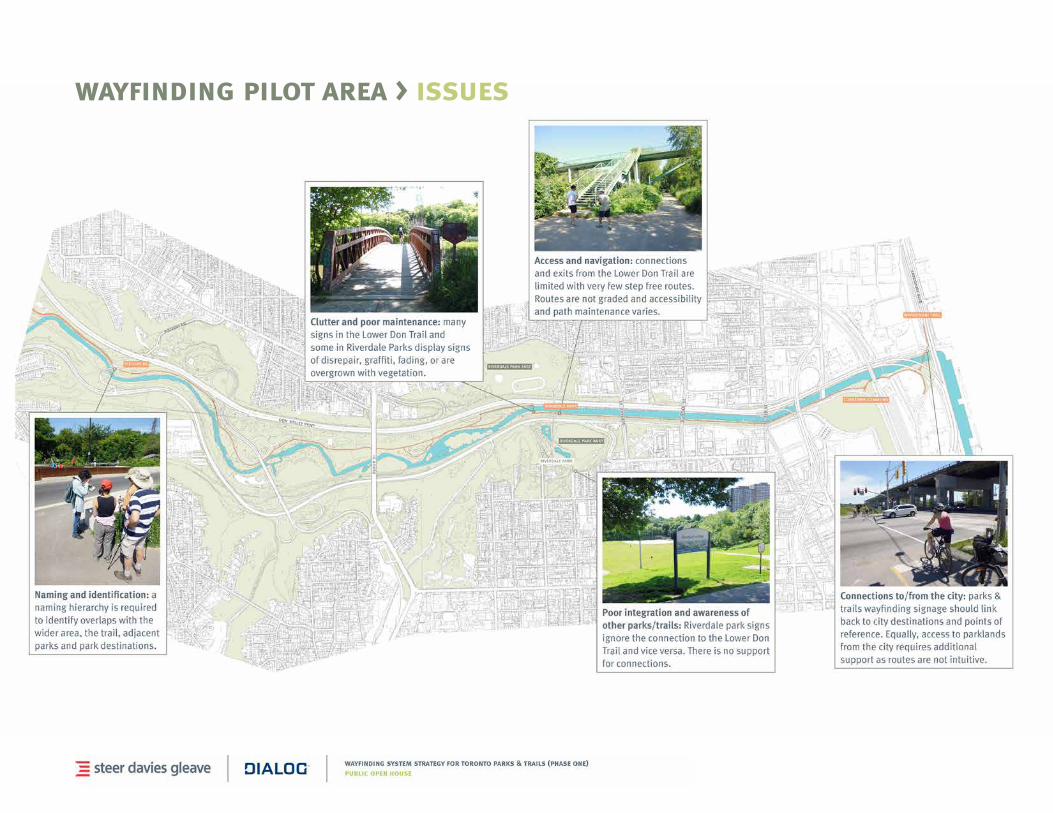
wayfinding pilot area > issues
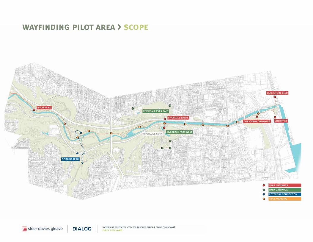
wayfinding pilot area > scope
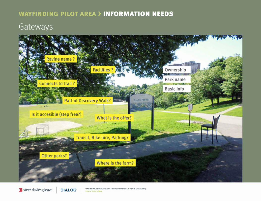
wayfinding pilot area > information needs
Gateways
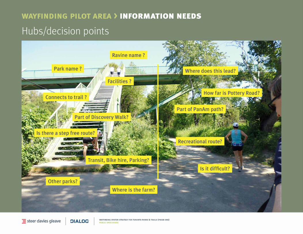
Hubs/decisionpoints
wayfinding pilot area > information needs
wayfinding pilot > next steps
Following completion of the Toronto Parks & Trails Wayfinding Strategy in August 2014, the City will proceed with Phase Two – pilot implementation.
Phase Two includes consultation with stakeholders, detailed graphic and product design, and implementation in the Lower Don Pilot Area.
PhaseTwoisexpectedtobecompleteinadvanceoftheTorontoParapan/PanAmGames in July 2015. The City will undertake a pre- and post-evaluation of the pilot.

8 feedback and comments
contact us
janette harvey City of Toronto
Parks, Forestry & Recreation [email protected]
(416) 392-1339
gail shillingfordDIALOG
[email protected] (416) 849-6825
Thank you!