Embed Size (px)
Citation preview

UIS 2009 - Hof, 04./05. Juni 20091
Martin Klenke, Stefanie Konstantinidis, Fred Kruse
Aufbau eines europäischen Bodeninformations-Portals
im Rahmen des eContentplus-Projekts GS Soil
als Baustein für SEIS auf Basis von PortalU®-Technologie
UIS 2009 - Hof, 04./05. Juni 20092
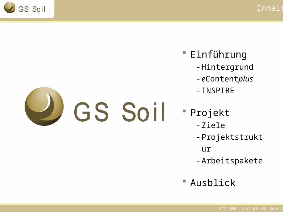
Inhalt
Einführung - Hintergrund- eContentplus- INSPIRE
Projekt - Ziele- Projektstruktur- Arbeitspakete
Ausblick
UIS 2009 - Hof, 04./05. Juni 20093
Warum ?
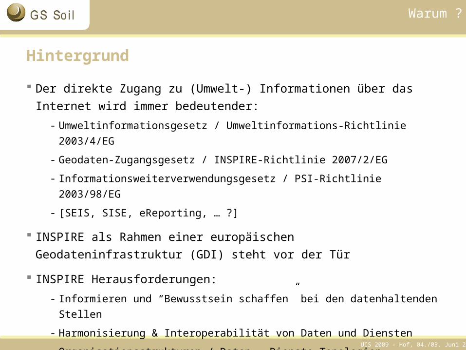
Hintergrund
Der direkte Zugang zu (Umwelt-) Informationen über das Internet wird immer bedeutender:
- Umweltinformationsgesetz / Umweltinformations-Richtlinie 2003/4/EG
- Geodaten-Zugangsgesetz / INSPIRE-Richtlinie 2007/2/EG
- Informationsweiterverwendungsgesetz / PSI-Richtlinie 2003/98/EG
- [SEIS, SISE, eReporting, … ?]
INSPIRE als Rahmen einer europäischen Geodateninfrastruktur (GDI) steht vor der Tür
INSPIRE Herausforderungen: - Informieren und “Bewusstsein schaffen” bei den datenhaltenden Stellen
- Harmonisierung & Interoperabilität von Daten und Diensten
- Organisationsstrukturen / Daten-, Dienste-Topologien
- …
UIS 2009 - Hof, 04./05. Juni 20094
eContentplus
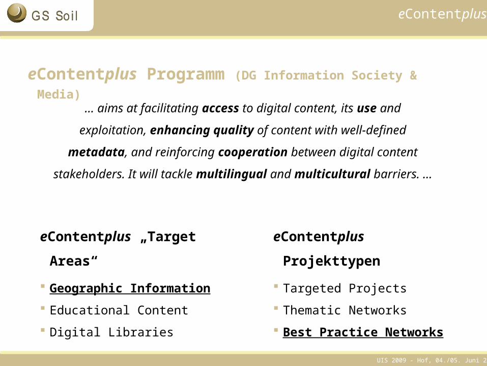
eContentplus Programm (DG Information Society & Media)
… aims at facilitating access to digital content, its use and
exploitation, enhancing quality of content with well-defined
metadata, and reinforcing cooperation between digital content
stakeholders. It will tackle multilingual and multicultural barriers. …
eContentplus Projekttypen
Targeted Projects
Thematic Networks
Best Practice Networks
eContentplus „Target Areas“
Geographic Information Educational Content
Digital Libraries
UIS 2009 - Hof, 04./05. Juni 20095
eContentplus: Geographic Information & Best Practice Networks
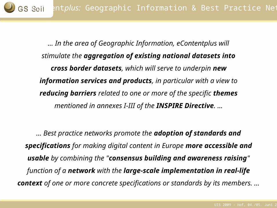
… Best practice networks promote the adoption of standards and
specifications for making digital content in Europe more accessible and
usable by combining the "consensus building and awareness raising"
function of a network with the large-scale implementation in real-life context
of one or more concrete specifications or standards by its members. …
… In the area of Geographic Information, eContentplus will
stimulate the aggregation of existing national datasets into
cross border datasets, which will serve to underpin new
information services and products, in particular with a view to
reducing barriers related to one or more of the specific themes
mentioned in annexes I-III of the INSPIRE Directive. …
UIS 2009 - Hof, 04./05. Juni 20096
Bodendaten: Relevanz & Bestand
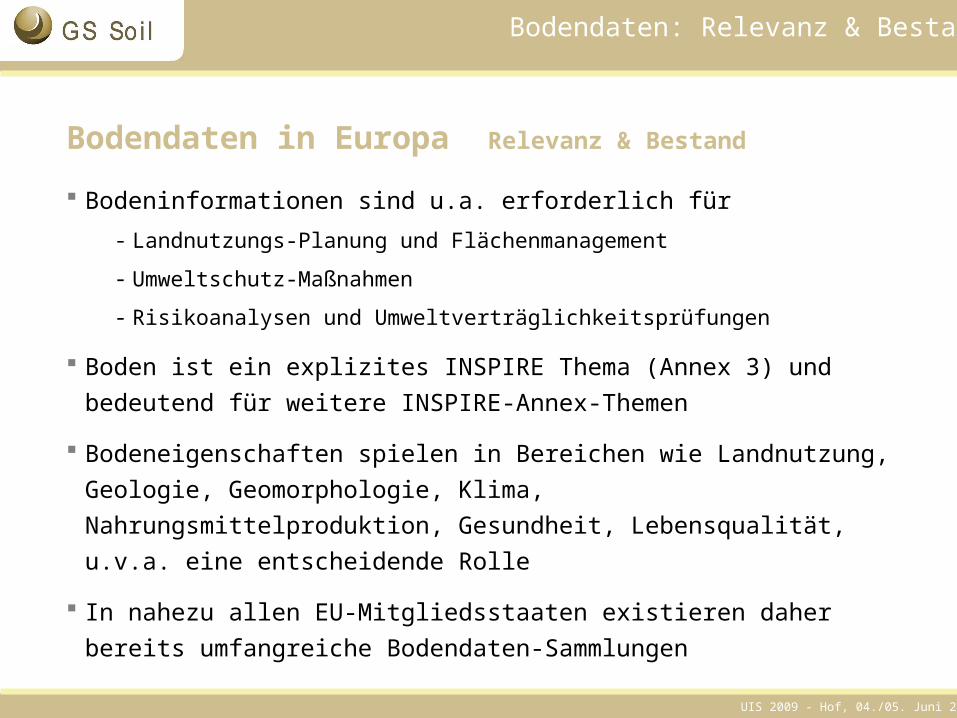
Bodendaten in Europa Relevanz & Bestand
Bodeninformationen sind u.a. erforderlich für - Landnutzungs-Planung und Flächenmanagement
- Umweltschutz-Maßnahmen
- Risikoanalysen und Umweltverträglichkeitsprüfungen
Boden ist ein explizites INSPIRE Thema (Annex 3) und bedeutend für weitere INSPIRE-Annex-Themen
Bodeneigenschaften spielen in Bereichen wie Landnutzung, Geologie, Geomorphologie, Klima, Nahrungsmittelproduktion, Gesundheit, Lebensqualität, u.v.a. eine entscheidende Rolle
In nahezu allen EU-Mitgliedsstaaten existieren daher bereits umfangreiche Bodendaten-Sammlungen
UIS 2009 - Hof, 04./05. Juni 20097
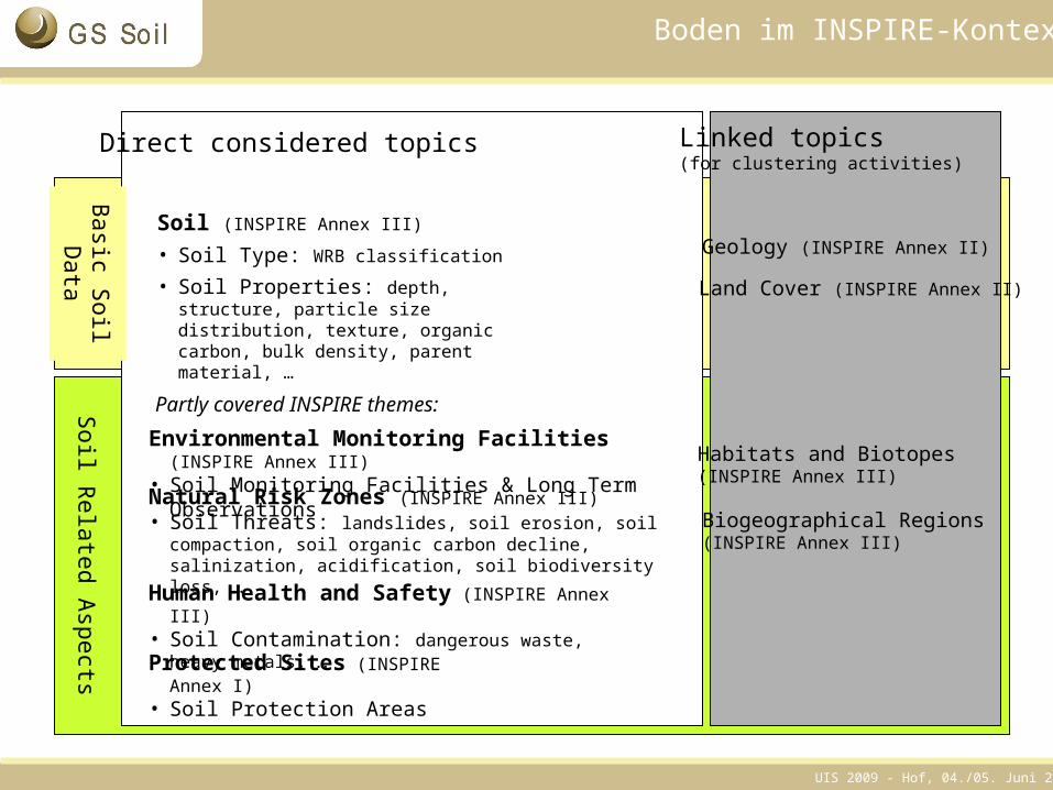
Soil (INSPIRE Annex III)
• Soil Type: WRB classification
• Soil Properties: depth, structure, particle size distribution, texture, organic carbon, bulk density, parent material, …
Direct considered topics
Protected Sites (INSPIRE Annex I)• Soil Protection Areas
Human Health and Safety (INSPIRE Annex III)• Soil Contamination: dangerous waste, heavy metals, …
Environmental Monitoring Facilities (INSPIRE Annex III)• Soil Monitoring Facilities & Long Term Observations
Partly covered INSPIRE themes:
Biogeographical Regions(INSPIRE Annex III)
Soil R
elated Aspects
Basic S
oil D
ata
Linked topics (for clustering activities)
Geology (INSPIRE Annex II)
Land Cover (INSPIRE Annex II)
Habitats and Biotopes (INSPIRE Annex III)
Natural Risk Zones (INSPIRE Annex III)• Soil Threats: landslides, soil erosion, soil compaction, soil
organic carbon decline, salinization, acidification, soil biodiversity loss, …
Boden im INSPIRE-Kontext
UIS 2009 - Hof, 04./05. Juni 20098
Herausforderungen
Bodendaten in Europa Herausforderungen
Die existierenden Bodendaten sind, auch wenn Teile digital vorliegen, bislang für Interessenten außerhalb der datenhaltenden Stellen nur schwer zu recherchieren und zu nutzen
Sowohl auf nationaler Ebene als insbesondere auch auf zwischenstaatlicher Ebene existieren erhebliche Unterschiede in Art, Umfang, Aktualität und Erhebungsmethoden der Bodendaten
Bodendaten und -zuständigkeiten sind über administrative und institutionelle Grenzen hinweg breit verteilt, wer hat den Überblick ?
Große Teile der existierenden europäischen Bodendaten sind derzeit …
… weder mit einheitlicher Semantik hinterlegt,
… noch sind existierende Dienste technisch interoperabel
UIS 2009 - Hof, 04./05. Juni 20099
GS Soil: Projektskizze
Projektskizze
GS Soil: Assessment and strategic development of INSPIRE compliant Geodata-Services for European Soil Data
EU-Programm: eContentplus*
Förderung: 4,1 Mio €
Projektdauer: Drei Jahre
Projektkoordination durch die Koordinierungsstelle PortalU: Zwei zusätzliche Stellen für drei Jahre
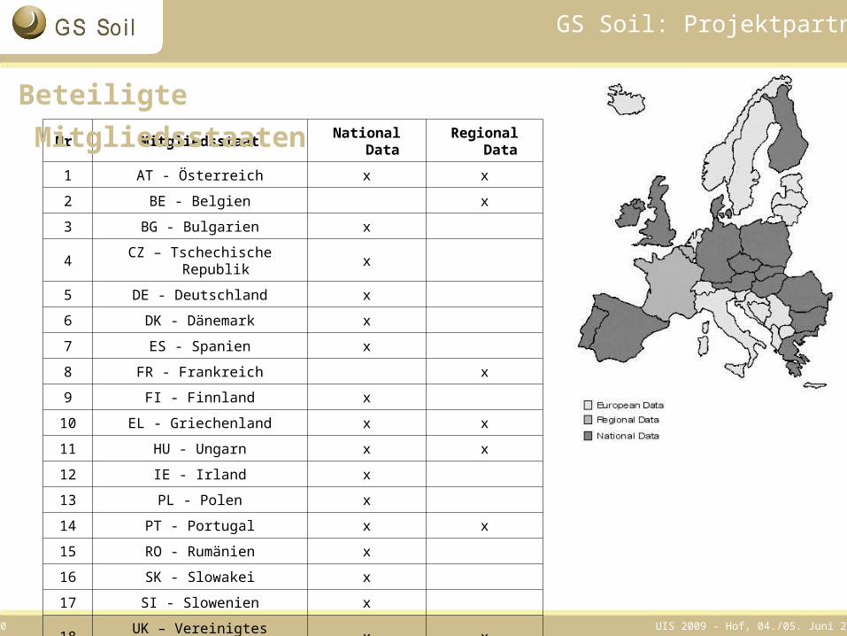
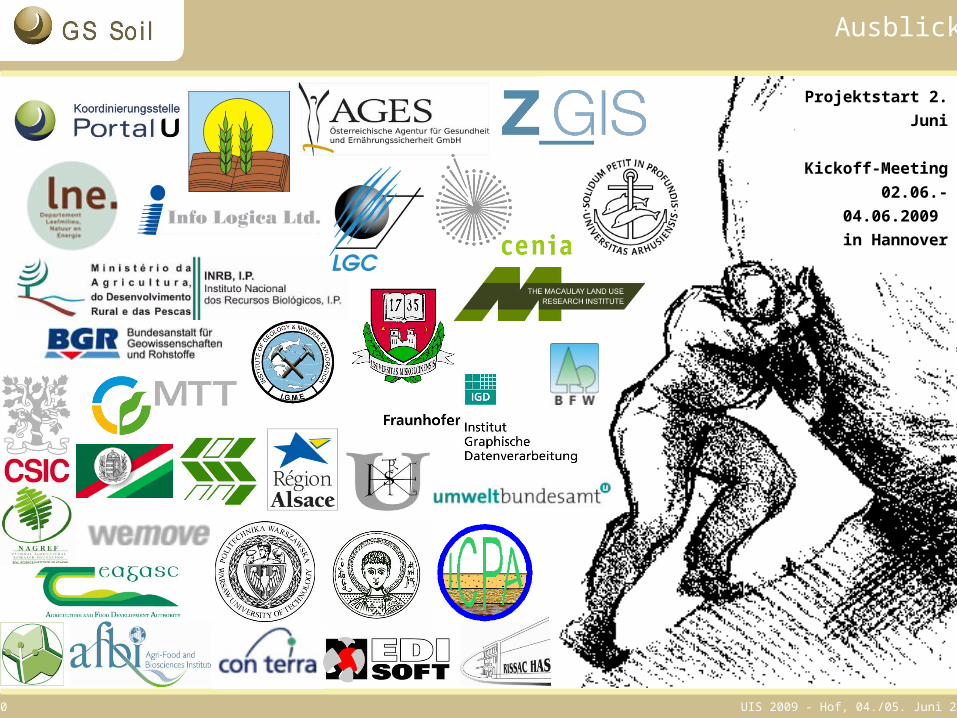
Beteiligte: 34 Partner aus 18 EU-Mitgliedsstaaten
24 Partner stellen Bodendaten bereit
Projektstart: 01. Juni 2009 / Kickoff-Meeting 02.06. - 04.06.2009
* http://ec.europa.eu/information_society/activities/econtentplus/index_en.htm
UIS 2009 - Hof, 04./05. Juni 200910
GS Soil: Projektpartner
Nr. Mitgliedsstaat National Data Regional Data
1 AT - Österreich x x
2 BE - Belgien x
3 BG - Bulgarien x
4 CZ – Tschechische Republik x
5 DE - Deutschland x
6 DK - Dänemark x
7 ES - Spanien x
8 FR - Frankreich x
9 FI - Finnland x
10 EL - Griechenland x x
11 HU - Ungarn x x
12 IE - Irland x
13 PL - Polen x
14 PT - Portugal x x
15 RO - Rumänien x
16 SK - Slowakei x
17 SI - Slowenien x
18 UK – Vereinigtes Königreich x x
Beteiligte Mitgliedsstaaten
UIS 2009 - Hof, 04./05. Juni 200911
GS Soil: Ziele
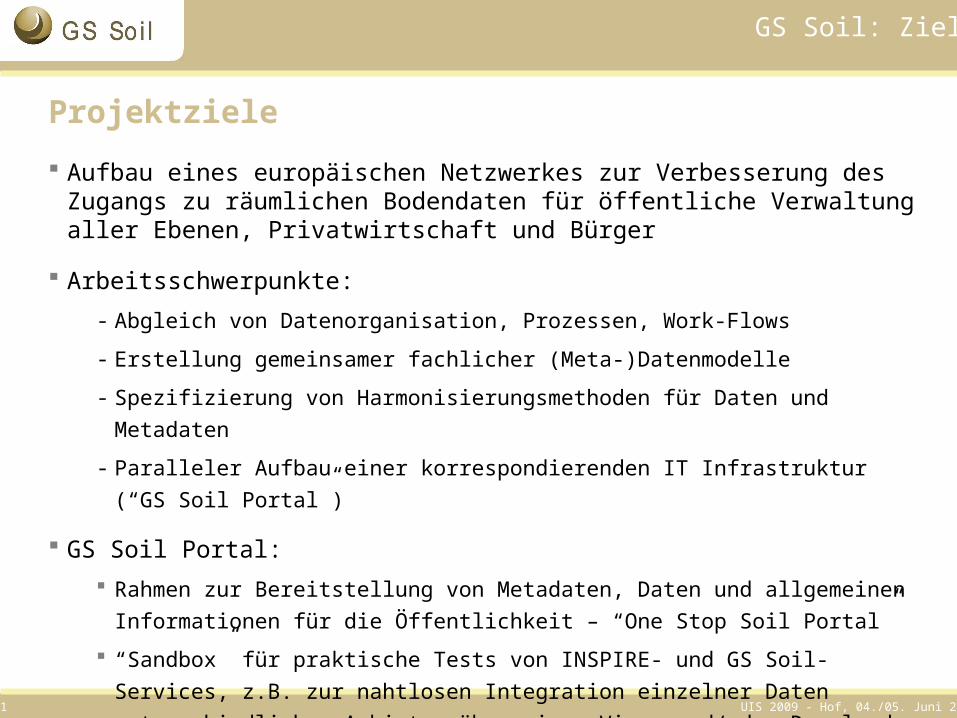
Projektziele Aufbau eines europäischen Netzwerkes zur Verbesserung des Zugangs zu
räumlichen Bodendaten für öffentliche Verwaltung aller Ebenen, Privatwirtschaft und Bürger
Arbeitsschwerpunkte:- Abgleich von Datenorganisation, Prozessen, Work-Flows
- Erstellung gemeinsamer fachlicher (Meta-)Datenmodelle
- Spezifizierung von Harmonisierungsmethoden für Daten und Metadaten
- Paralleler Aufbau einer korrespondierenden IT Infrastruktur (“GS Soil Portal”)
GS Soil Portal: Rahmen zur Bereitstellung von Metadaten, Daten und allgemeinen Informationen für
die Öffentlichkeit – “One Stop Soil Portal”
“Sandbox” für praktische Tests von INSPIRE- und GS Soil-Services, z.B. zur nahtlosen Integration einzelner Daten unterschiedlicher Anbieter über einen View- und/oder Download-Service
UIS 2009 - Hof, 04./05. Juni 200912
GS Soil: Angestrebte Ergebnisse
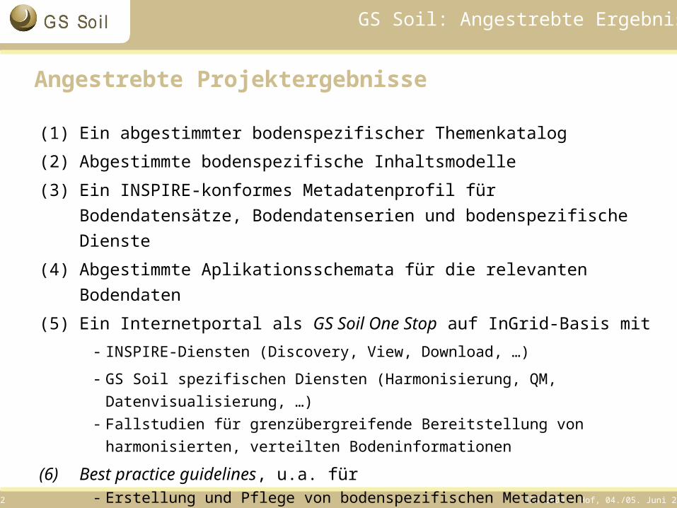
Angestrebte Projektergebnisse
(1) Ein abgestimmter bodenspezifischer Themenkatalog
(2) Abgestimmte bodenspezifische Inhaltsmodelle
(3) Ein INSPIRE-konformes Metadatenprofil für Bodendatensätze, Bodendatenserien und bodenspezifische Dienste
(4) Abgestimmte Aplikationsschemata für die relevanten Bodendaten
(5) Ein Internetportal als GS Soil One Stop auf InGrid-Basis mit- INSPIRE-Diensten (Discovery, View, Download, …)
- GS Soil spezifischen Diensten (Harmonisierung, QM, Datenvisualisierung, …)- Fallstudien für grenzübergreifende Bereitstellung von harmonisierten, verteilten
Bodeninformationen
(6) Best practice guidelines, u.a. für- Erstellung und Pflege von bodenspezifischen Metadaten - Harmonisierung von Bodendaten
UIS 2009 - Hof, 04./05. Juni 200913
GS Soil: Umfeld
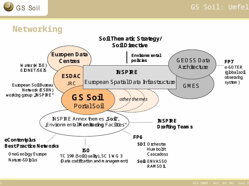
Networking
Europen Data Centres
Water (WISE)EIONET/SEIS
INSPIRE Annex themes „Soil“, „Environmental Monitoring Facilities“
GS SoilPortal Soil
eContentplusBest Practice Networks
OneGeology EuropeNature-SDIplus
FP6Orchestra HumboldtCascadoss
European Spatial Data Infrastructure
INSPIRE
GEOSS Data Architecture
FP7e-SOTER(global soilobservingsystem)
ENVASSO RAMSOIL
SDI
Soil
other themes
GMES
Soil Thematic Strategy/Soil Directive
Environmentalpolicies
TC 190 (Soil Quality), SC 1 WG 3 (Data codification and management)
ISO
INSPIRE Drafting Teams
European Soil Bureau Network (ESBN)
working group „INSPIRE“
ESDACJRC
UIS 2009 - Hof, 04./05. Juni 200914
GS Soil: Organigramm
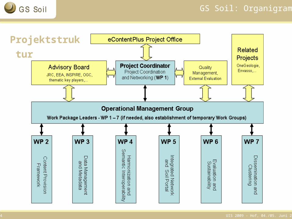
Projektstruktur
UIS 2009 - Hof, 04./05. Juni 200915
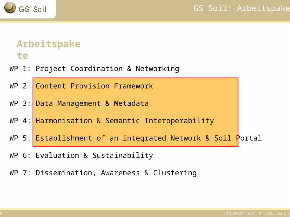
GS Soil: Arbeitspakete
WP 1: Project Coordination & Networking
WP 2: Content Provision Framework
WP 3: Data Management & Metadata
WP 4: Harmonisation & Semantic Interoperability
WP 5: Establishment of an integrated Network & Soil Portal
WP 6: Evaluation & Sustainability
WP 7: Dissemination, Awareness & Clustering
Arbeitspakete
UIS 2009 - Hof, 04./05. Juni 200916
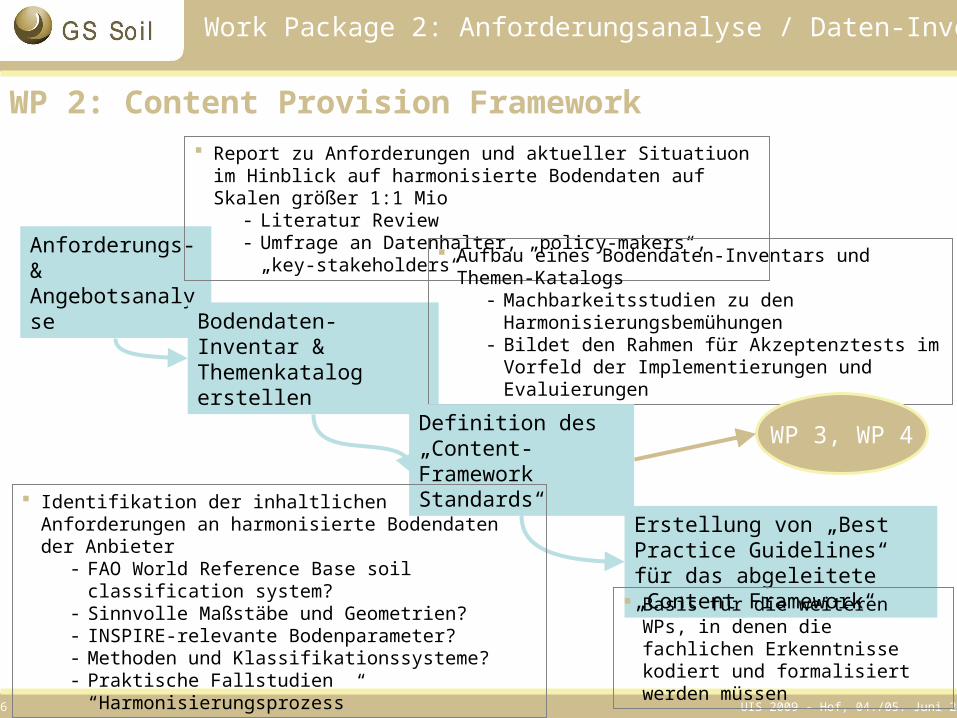
Work Package 2: Anforderungsanalyse / Daten-Inventar
Anforderungs- & Angebotsanalyse
WP 2: Content Provision Framework Report zu Anforderungen und aktueller Situatiuon im Hinblick auf
harmonisierte Bodendaten auf Skalen größer 1:1 Mio- Literatur Review- Umfrage an Datenhalter, „policy-makers“, „key-
stakeholders“
Bodendaten-Inventar & Themenkatalog erstellen
Aufbau eines Bodendaten-Inventars und Themen-Katalogs
- Machbarkeitsstudien zu den Harmonisierungsbemühungen
- Bildet den Rahmen für Akzeptenztests im Vorfeld der Implementierungen und Evaluierungen
Erstellung von „Best Practice Guidelines“ für das abgeleitete „Content Framework“
Basis für die weiteren WPs, in denen die fachlichen Erkenntnisse kodiert und formalisiert werden müssen
WP 3, WP 4Definition des „Content-Framework Standards“
Identifikation der inhaltlichen Anforderungen an harmonisierte Bodendaten der Anbieter
- FAO World Reference Base soil classification system?
- Sinnvolle Maßstäbe und Geometrien?- INSPIRE-relevante Bodenparameter?- Methoden und Klassifikationssysteme?- Praktische Fallstudien “Harmonisierungsprozess”
UIS 2009 - Hof, 04./05. Juni 200917
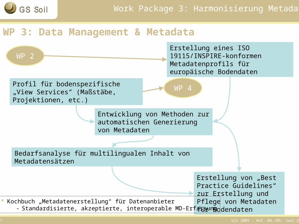
Erstellung eines ISO 19115/INSPIRE-konformen Metadatenprofils für europäische Bodendaten
Profil für bodenspezifische „View Services“ (Maßstäbe, Projektionen, etc.)
Entwicklung von Methoden zur automatischen Generierung von Metadaten
Bedarfsanalyse für multilingualen Inhalt von Metadatensätzen
Erstellung von „Best Practice Guidelines“ zur Erstellung und Pflege von Metadaten für Bodendaten
Work Package 3: Harmonisierung Metadaten
WP 3: Data Management & Metadata
WP 2
WP 4
Kochbuch „Metadatenerstellung“ für Datenanbieter- Standardisierte, akzeptierte, interoperable MD-Erfassung
UIS 2009 - Hof, 04./05. Juni 200918
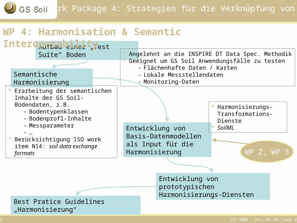
Aufbau einer „Test Suite“ Boden
Semantische Harmonisierung
Entwicklung von Basis-Datenmodellen als Input für die Harmonisierung
Best Pratice Guidelines „Harmonisierung“
Entwicklung von prototypischen Harmonisierungs-Diensten
Work Package 4: Strategien für die Verknüpfung von Daten
WP 4: Harmonisation & Semantic Interoperability
WP 2, WP 3
Angelehnt an die INSPIRE DT Data Spec. Methodik Geeignet um GS Soil Anwendungsfälle zu testen
- Flächenhafte Daten / Karten- Lokale Messstellendaten- Monitoring-Daten
Erarbeitung der semantischen Inhalte der GS Soil-Bodendaten, z.B.
- Bodentypenklassen- Bodenprofl-Inhalte- Messparameter- …
Berücksichtigung ISO work item N14: soil data exchange formats
Harmonisierungs-Transformations-Dienste
SoilML
UIS 2009 - Hof, 04./05. Juni 200919
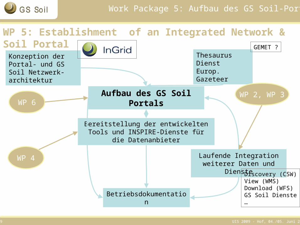
Aufbau des GS Soil Portals
Betriebsdokumentation
Thesaurus DienstEurop. Gazeteer
Bereitstellung der entwickelten Tools und INSPIRE-Dienste für die Datenanbieter
Work Package 5: Aufbau des GS Soil-Portals
WP 5: Establishment of an Integrated Network & Soil Portal
WP 2, WP 3WP 6
WP 4 Laufende Integration weiterer Daten und Dienste
GEMET ?
Discovery (CSW)View (WMS)Download (WFS)GS Soil Dienste…
Konzeption der Portal- und GS Soil Netzwerk-architektur
UIS 2009 - Hof, 04./05. Juni 200920
Ausblick
Projektstart 2. Juni
Kickoff-Meeting02.06.-04.06.2009
in Hannover
UIS 2009 - Hof, 04./05. Juni 200921
Dr. Martin Klenke
Koordinierungsstelle PortalUim Niedersächsischen Ministerium für Umwelt und Klimaschutz
Archivstr. 2D-30169 Hannover
Tel.: +49 (0) 511 120 3407eMail: [email protected]
Kontakt
Katharina Feiden (GS Soil Projektkoordination)Tel.: +49 (0) 511 120 3451
Klaus Wieland (Technik)Tel.: +49 (0) 511 120 3452
eMail: [email protected]: http://www.gssoil.eu/