Embed Size (px)
Citation preview
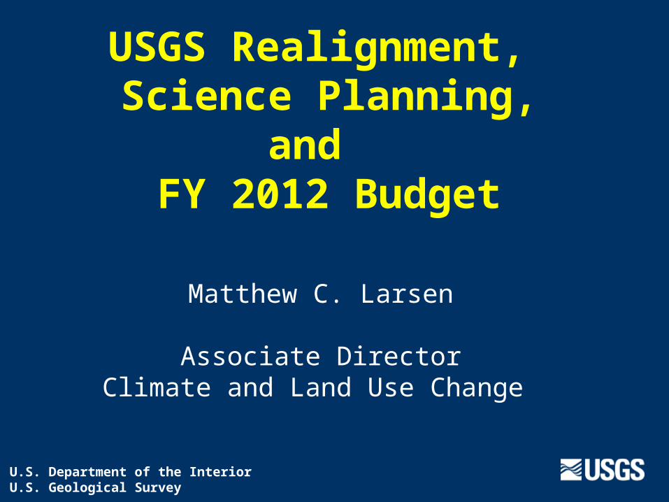
USGS Realignment, Science Planning,
and FY 2012 Budget
Matthew C. Larsen
Associate DirectorClimate and Land Use Change
U.S. Department of the InteriorU.S. Geological Survey
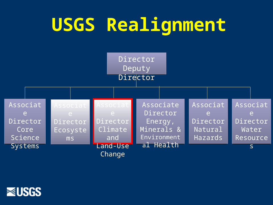
DirectorDeputy Director
DirectorDeputy Director
Associate Director
Climate and Land-Use Change
Associate Director
Climate and Land-Use Change
Associate DirectorNatural Hazards
Associate DirectorNatural Hazards
Associate DirectorWater
Resources
Associate DirectorWater
Resources
Associate Director
Energy, Minerals & Environmental
Health
Associate Director
Energy, Minerals & Environmental
Health
Associate Director
Core Science Systems
Associate Director
Core Science Systems
Associate Director
Ecosystems
Associate Director
Ecosystems
USGS Realignment
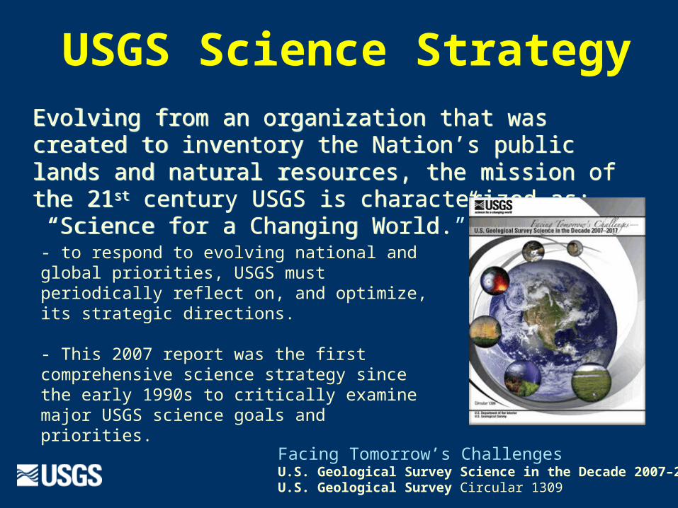
Evolving from an organization that was created to inventory the Nation’s public lands and natural resources, the mission of the 21st century USGS is characterized as: “Science for a Changing World.”
Evolving from an organization that was created to inventory the Nation’s public lands and natural resources, the mission of the 21st century USGS is characterized as: “Science for a Changing World.”- to respond to evolving national and global priorities, USGS must periodically reflect on, and optimize, its strategic directions.
- This 2007 report was the first comprehensive science strategy since the early 1990s to critically examine major USGS science goals and priorities.
Facing Tomorrow’s ChallengesU.S. Geological Survey Science in the Decade 2007–2017 U.S. Geological Survey Circular 1309
USGS Science Strategy
• in 2010 USGS aligned leadership and science staff with the six major science directions in the 2007 Science Strategy
• Strategic Science Planning Teams appointed for all 6 future science directions
• Global Change team completed draft science strategy & posted for review
• we seek stakeholder input
• comments requested by April 8, 2011
“The purpose of the SSPT is to develop a comprehensive 5-year strategic plan, including research priorities and associated
implementation steps for USGS Global Change Science.” USGS Director Marcia McNutt, January 26, 2010
Mission area science strategies
Global Change Science StrategyUSGS Core strengths identified:
• Fundamental and applied science
• Long-term research and monitoring
• Integration of climate and environmental data
• Consistent data collection and synthesis
• Multi-scale studies
• Synthesis, assessment, modeling
• Comprehensive characterizations (based on mapping, monitoring, research)
• National / global presence
• Fundamental process studies
• National-scale mapping
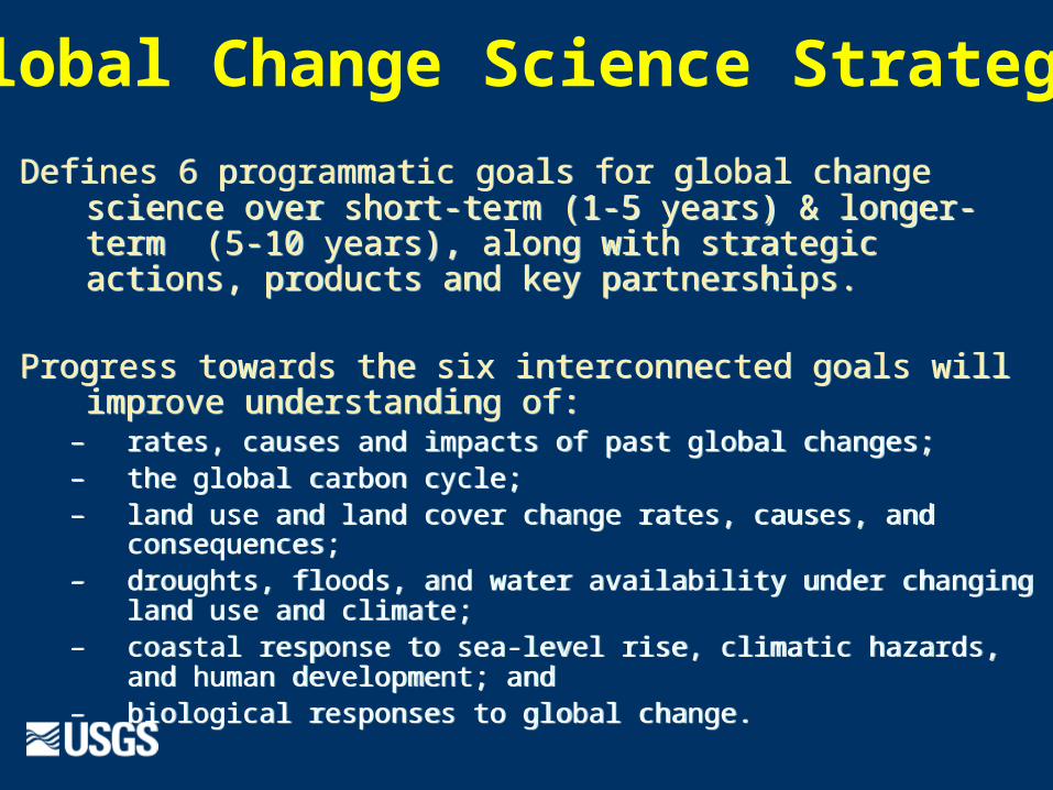
Defines 6 programmatic goals for global change science over short-term (1-5 years) & longer-term (5-10 years), along with strategic actions, products and key partnerships.
Progress towards the six interconnected goals will improve understanding of:
– rates, causes and impacts of past global changes; – the global carbon cycle;– land use and land cover change rates, causes, and consequences; – droughts, floods, and water availability under changing land use and
climate; – coastal response to sea-level rise, climatic hazards, and human
development; and– biological responses to global change.
Global Change Science Strategy
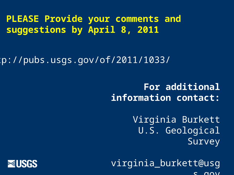
For additional information contact:
Virginia Burkett
U.S. Geological Survey
318-256-5628
http://pubs.usgs.gov/of/2011/1033/
PLEASE Provide your comments and suggestions by April 8, 2011
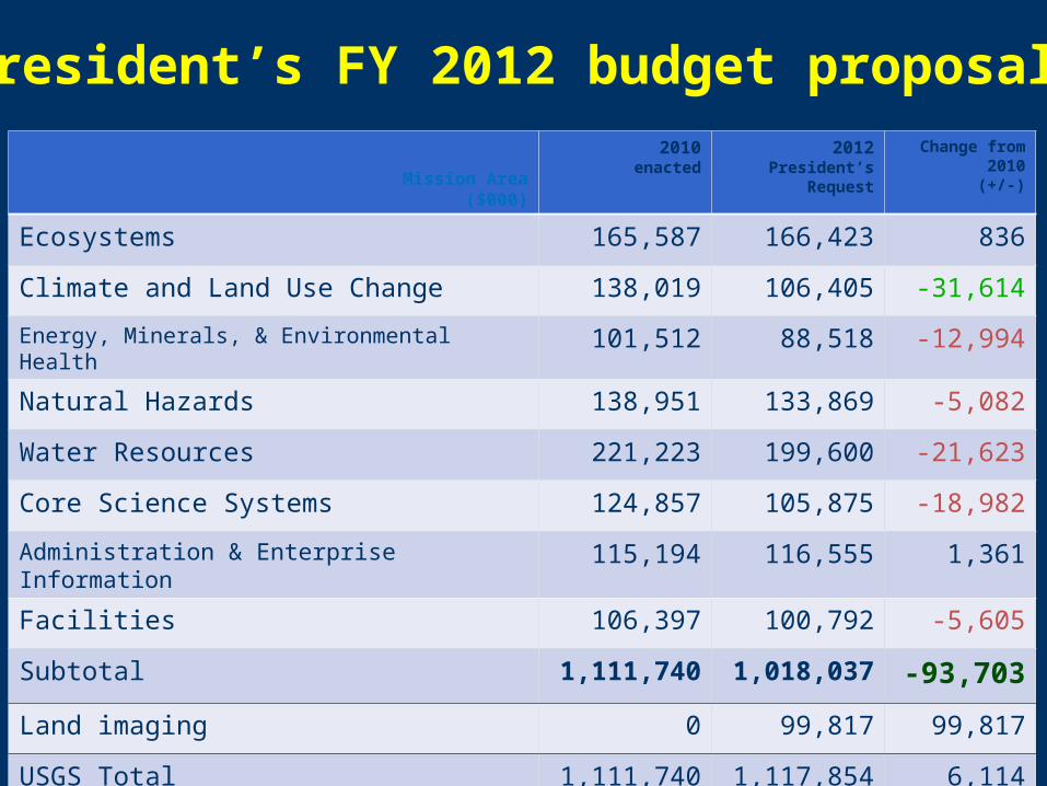
Mission Area($000)
2010enacted
2012President’s
Request
Change from 2010(+/-)
Ecosystems 165,587 166,423 836
Climate and Land Use Change 138,019 106,405 -31,614
Energy, Minerals, & Environmental Health 101,512 88,518 -12,994
Natural Hazards 138,951 133,869 -5,082
Water Resources 221,223 199,600 -21,623
Core Science Systems 124,857 105,875 -18,982
Administration & Enterprise Information 115,194 116,555 1,361
Facilities 106,397 100,792 -5,605
Subtotal 1,111,740 1,018,037 -93,703
Land imaging 0 99,817 99,817
USGS Total 1,111,740 1,117,854 6,114
President’s FY 2012 budget proposal
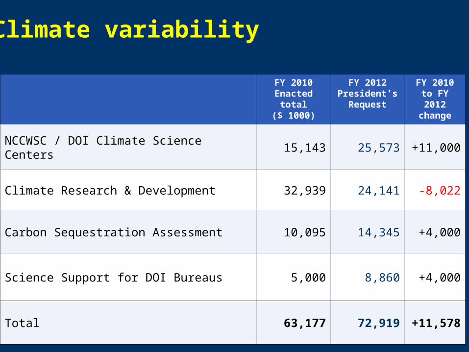
FY 2010Enacted total
($ 1000)
FY 2012 President’s
Request
FY 2010 to FY 2012 change
NCCWSC / DOI Climate Science Centers 15,143 25,573 +11,000
Climate Research & Development 32,939 24,141 -8,022
Carbon Sequestration Assessment 10,095 14,345 +4,000
Science Support for DOI Bureaus 5,000 8,860 +4,000
Total 63,177 72,919 +11,578
Climate variability
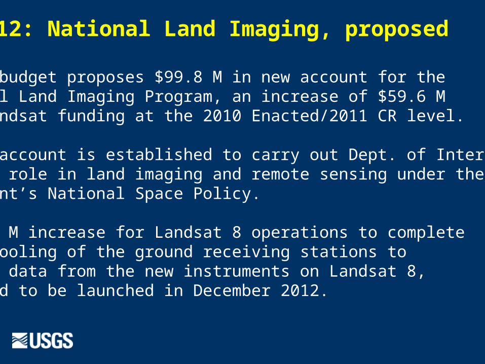
FY 2012: National Land Imaging, proposed
- 2012 budget proposes $99.8 M in new account for the National Land Imaging Program, an increase of $59.6 M from Landsat funding at the 2010 Enacted/2011 CR level.
- new account is established to carry out Dept. of Interior’s Landsat role in land imaging and remote sensing under thePresident’s National Space Policy.
- $13.4 M increase for Landsat 8 operations to completethe retooling of the ground receiving stations to receive data from the new instruments on Landsat 8, expected to be launched in December 2012.
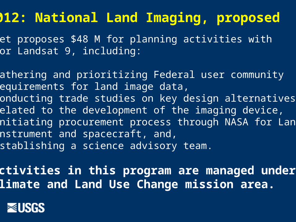
FY 2012: National Land Imaging, proposed
- budget proposes $48 M for planning activities withNASA for Landsat 9, including:
- gathering and prioritizing Federal user communityrequirements for land image data,
- conducting trade studies on key design alternativesrelated to the development of the imaging device,
- initiating procurement process through NASA for Landsat 9instrument and spacecraft, and,
- establishing a science advisory team.
The activities in this program are managed underthe Climate and Land Use Change mission area.
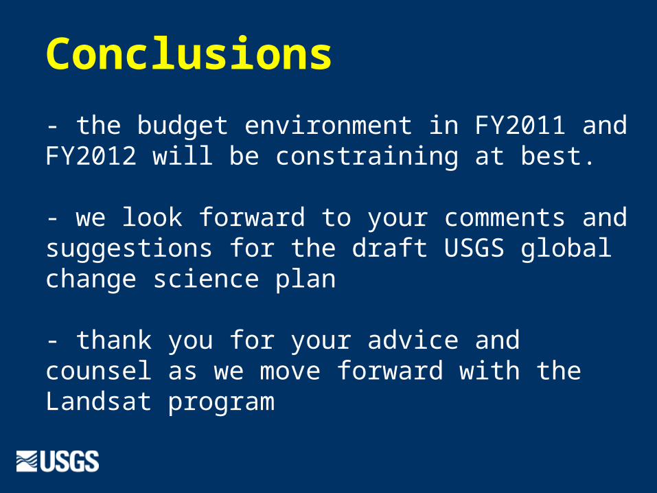
Conclusions
- the budget environment in FY2011 and FY2012 will be constraining at best.
- we look forward to your comments and suggestions for the draft USGS global change science plan
- thank you for your advice and counsel as we move forward with the Landsat program