Embed Size (px)
Citation preview
Using Hec-GeoRas to Extract Cross Sections from a DTM for HEC/RAS Input
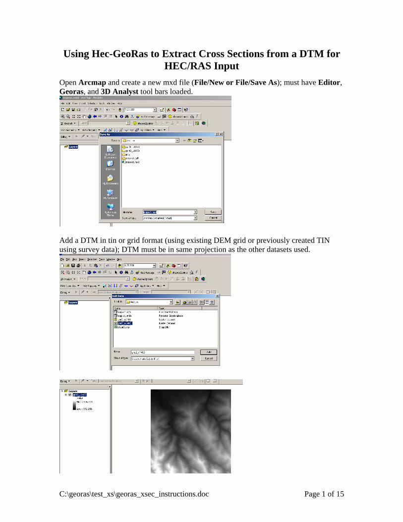
Open Arcmap and create a new mxd file (File/New or File/Save As); must have Editor, Georas, and 3D Analyst tool bars loaded.
Add a DTM in tin or grid format (using existing DEM grid or previously created TIN using survey data); DTM must be in same projection as the other datasets used.
C:\georas\test_xs\georas_xsec_instructions.doc Page 1 of 15
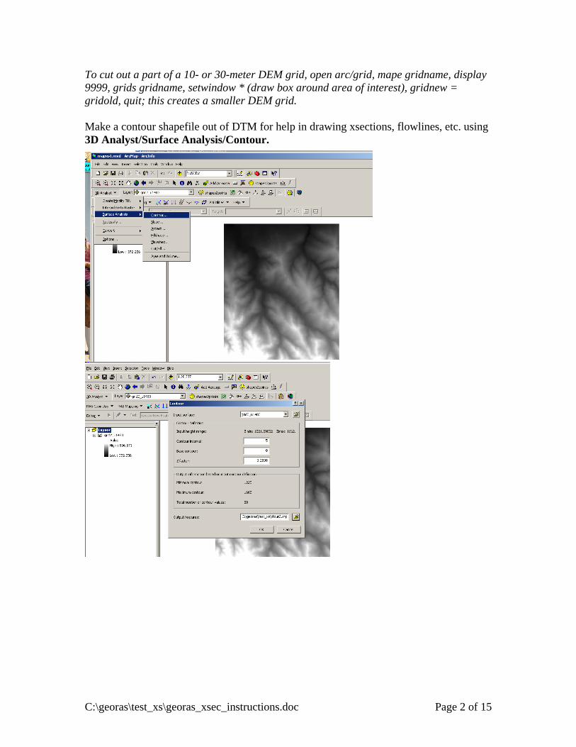
To cut out a part of a 10- or 30-meter DEM grid, open arc/grid, mape gridname, display 9999, grids gridname, setwindow * (draw box around area of interest), gridnew = gridold, quit; this creates a smaller DEM grid. Make a contour shapefile out of DTM for help in drawing xsections, flowlines, etc. using 3D Analyst/Surface Analysis/Contour.
C:\georas\test_xs\georas_xsec_instructions.doc Page 2 of 15
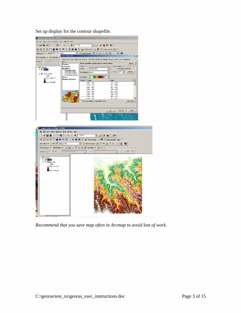
Set up display for the contour shapefile.
Recommend that you save map often in Arcmap to avoid lost of work.
C:\georas\test_xs\georas_xsec_instructions.doc Page 3 of 15
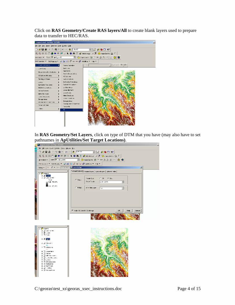
Click on RAS Geometry/Create RAS layers/All to create blank layers used to prepare data to transfer to HEC/RAS.
In RAS Geometry/Set Layers, click on type of DTM that you have (may also have to set pathnames in ApUtilities/Set Target Locations).
C:\georas\test_xs\georas_xsec_instructions.doc Page 4 of 15
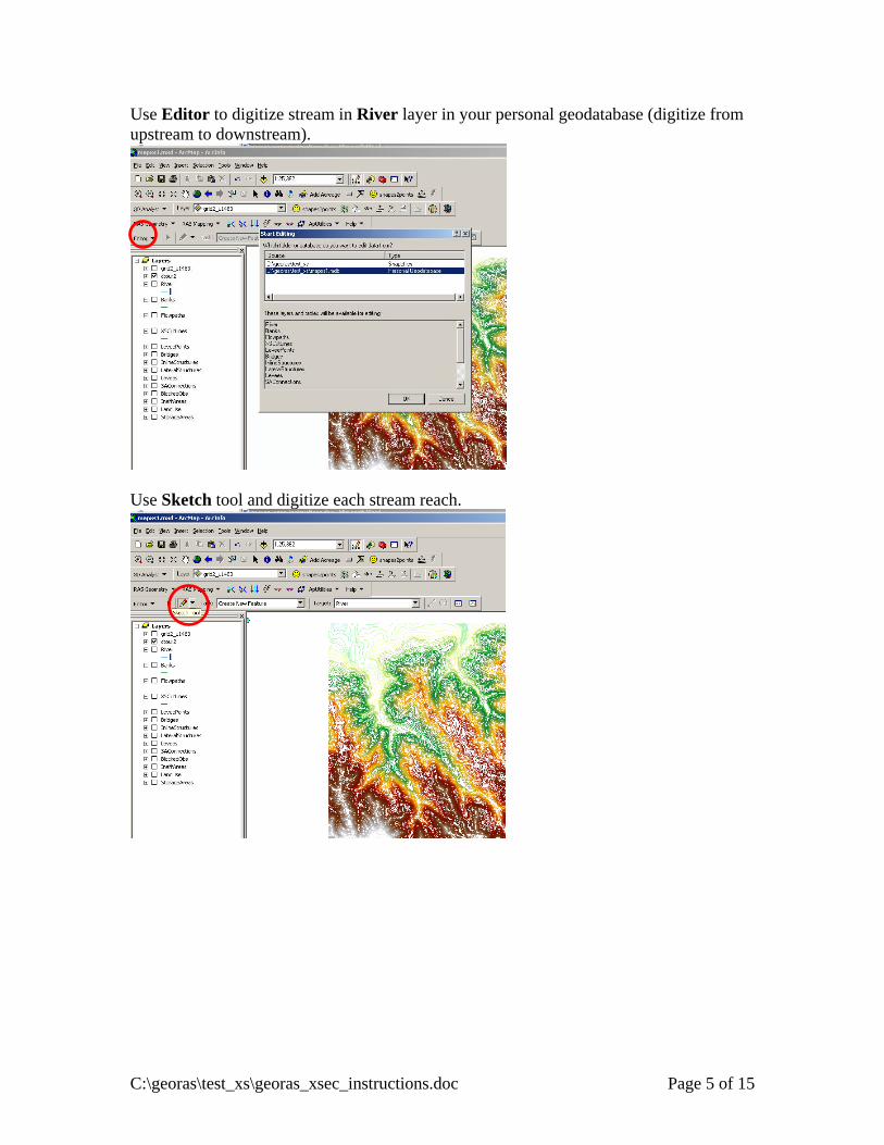
Use Editor to digitize stream in River layer in your personal geodatabase (digitize from upstream to downstream).
Use Sketch tool and digitize each stream reach.
C:\georas\test_xs\georas_xsec_instructions.doc Page 5 of 15
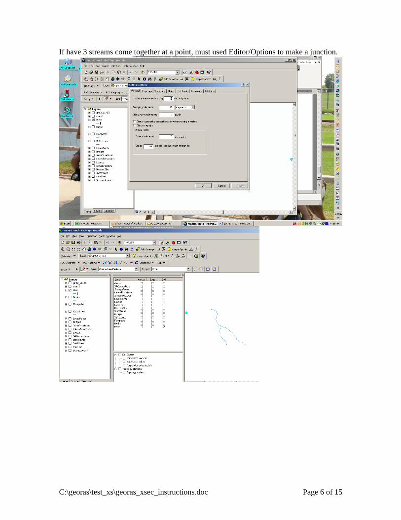
If have 3 streams come together at a point, must used Editor/Options to make a junction.
C:\georas\test_xs\georas_xsec_instructions.doc Page 6 of 15
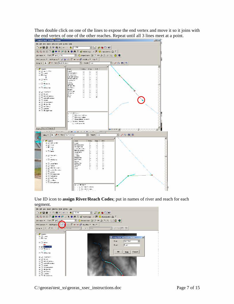
Then double click on one of the lines to expose the end vertex and move it so it joins with the end vertex of one of the other reaches. Repeat until all 3 lines meet at a point.
Use ID icon to assign River/Reach Codes; put in names of river and reach for each segment.
C:\georas\test_xs\georas_xsec_instructions.doc Page 7 of 15
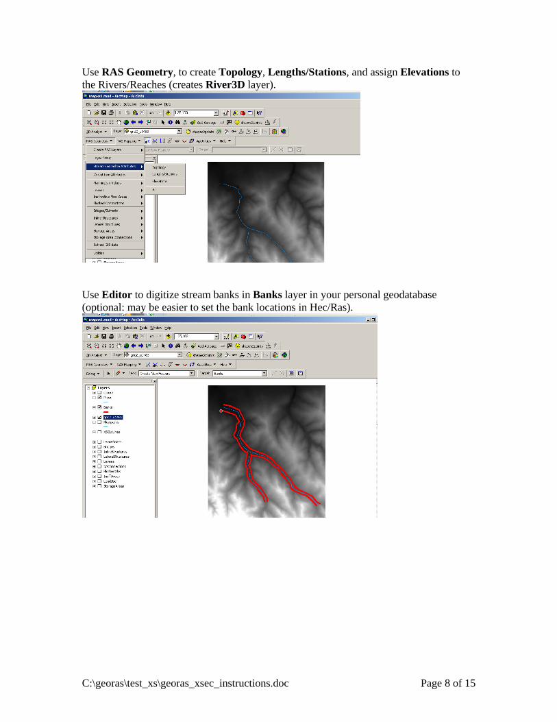
Use RAS Geometry, to create Topology, Lengths/Stations, and assign Elevations to the Rivers/Reaches (creates River3D layer).
Use Editor to digitize stream banks in Banks layer in your personal geodatabase (optional: may be easier to set the bank locations in Hec/Ras).
C:\georas\test_xs\georas_xsec_instructions.doc Page 8 of 15
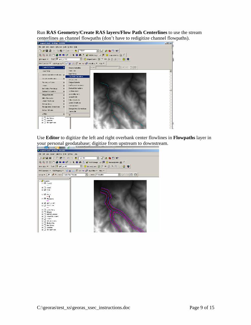
Run RAS Geometry/Create RAS layers/Flow Path Centerlines to use the stream centerlines as channel flowpaths (don’t have to redigitize channel flowpaths).
Use Editor to digitize the left and right overbank center flowlines in Flowpaths layer in your personal geodatabase; digitize from upstream to downstream.
C:\georas\test_xs\georas_xsec_instructions.doc Page 9 of 15
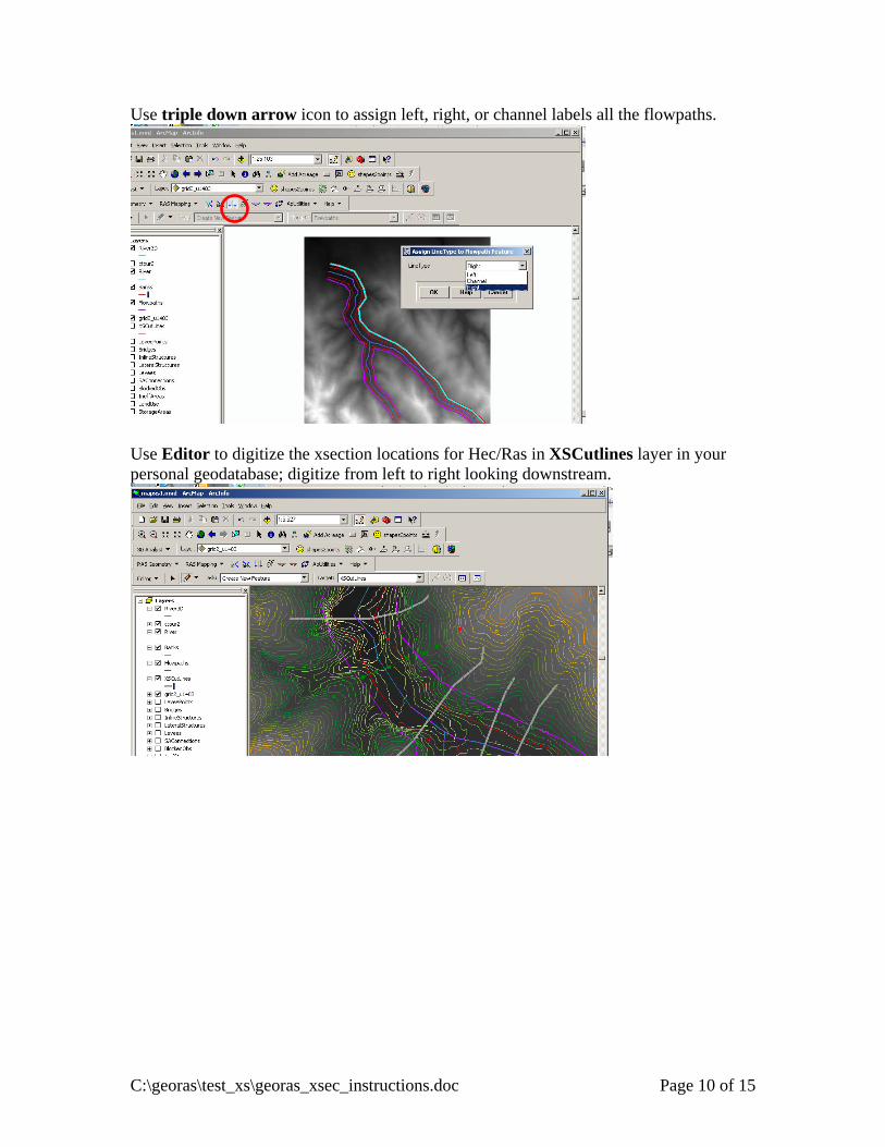
Use triple down arrow icon to assign left, right, or channel labels all the flowpaths.
Use Editor to digitize the xsection locations for Hec/Ras in XSCutlines layer in your personal geodatabase; digitize from left to right looking downstream.
C:\georas\test_xs\georas_xsec_instructions.doc Page 10 of 15
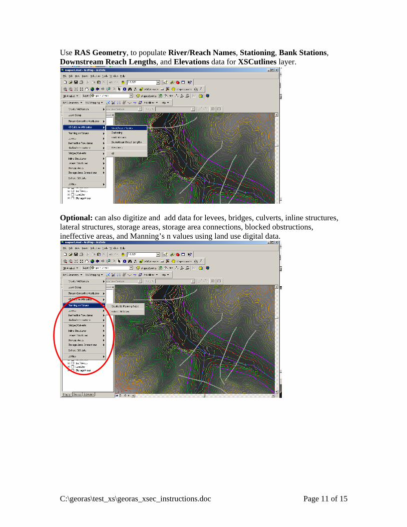
Use RAS Geometry, to populate River/Reach Names, Stationing, Bank Stations, Downstream Reach Lengths, and Elevations data for XSCutlines layer.
Optional: can also digitize and add data for levees, bridges, culverts, inline structures, lateral structures, storage areas, storage area connections, blocked obstructions, ineffective areas, and Manning’s n values using land use digital data.
C:\georas\test_xs\georas_xsec_instructions.doc Page 11 of 15
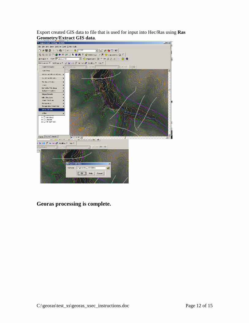
Export created GIS data to file that is used for input into Hec/Ras using Ras Geometry/Extract GIS data.
Georas processing is complete.
C:\georas\test_xs\georas_xsec_instructions.doc Page 12 of 15
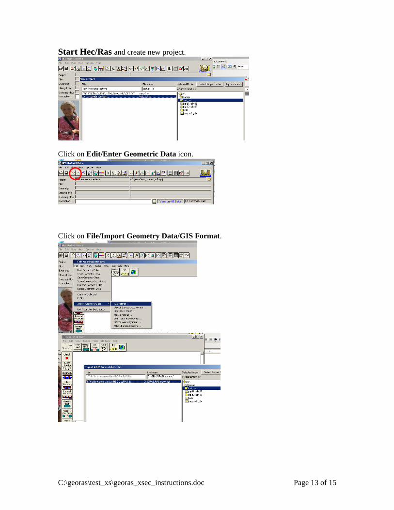
Start Hec/Ras and create new project.
Click on Edit/Enter Geometric Data icon.
Click on File/Import Geometry Data/GIS Format.
C:\georas\test_xs\georas_xsec_instructions.doc Page 13 of 15
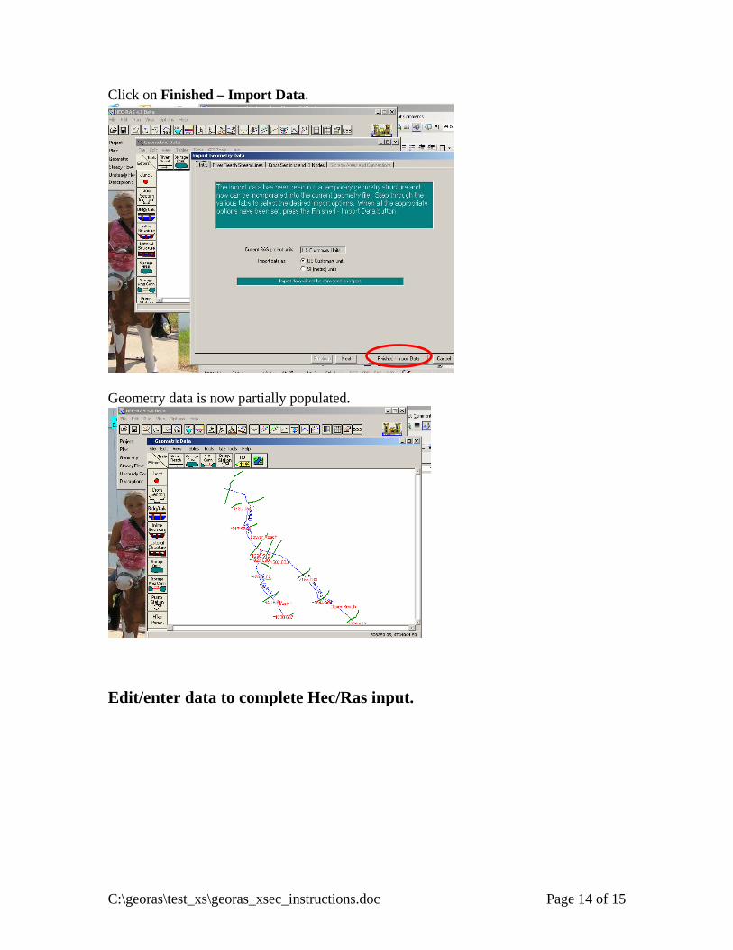
Click on Finished – Import Data.
Geometry data is now partially populated.
Edit/enter data to complete Hec/Ras input.
C:\georas\test_xs\georas_xsec_instructions.doc Page 14 of 15
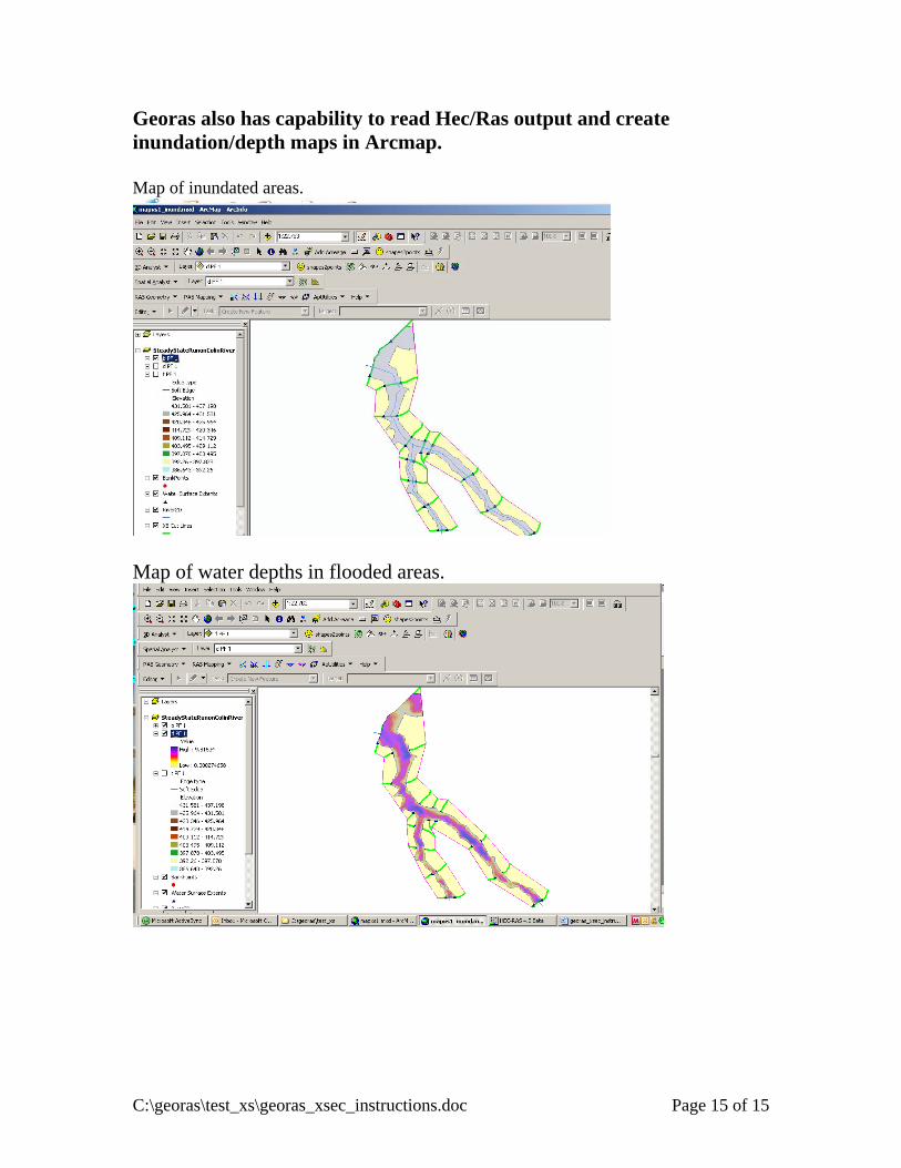
Georas also has capability to read Hec/Ras output and create inundation/depth maps in Arcmap. Map of inundated areas.
Map of water depths in flooded areas.
C:\georas\test_xs\georas_xsec_instructions.doc Page 15 of 15


![Memoria 2012.ppt [Modo de compatibilidad] · * PátiPráctico de di ñdiseño y cál lálculo de if t tinfraestructuras viiiarias con ISTRAM. * Curso práctico de HEC‐RAS y HEC‐GEORAS](https://img.pdfslide.net/doc/110x75/5ba12d8c09d3f26b6b8bc9c0/memoria-2012ppt-modo-de-compatibilidad-patipractico-de-di-ndiseno-y.jpg)