Embed Size (px)
Citation preview
Today’s Agenda
This seminar is designed to help you understand:
1) Using Python to increase productivity
2) Overview of ArcGIS Runtime
Python (The Essentials)
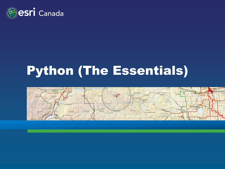
Why Python?
Fulfills the needs of our user community
• Simple and easy to learn
• Scalable
• Modular
• Object Oriented
• Easy to maintain
• Cross platform
• Established and active user community
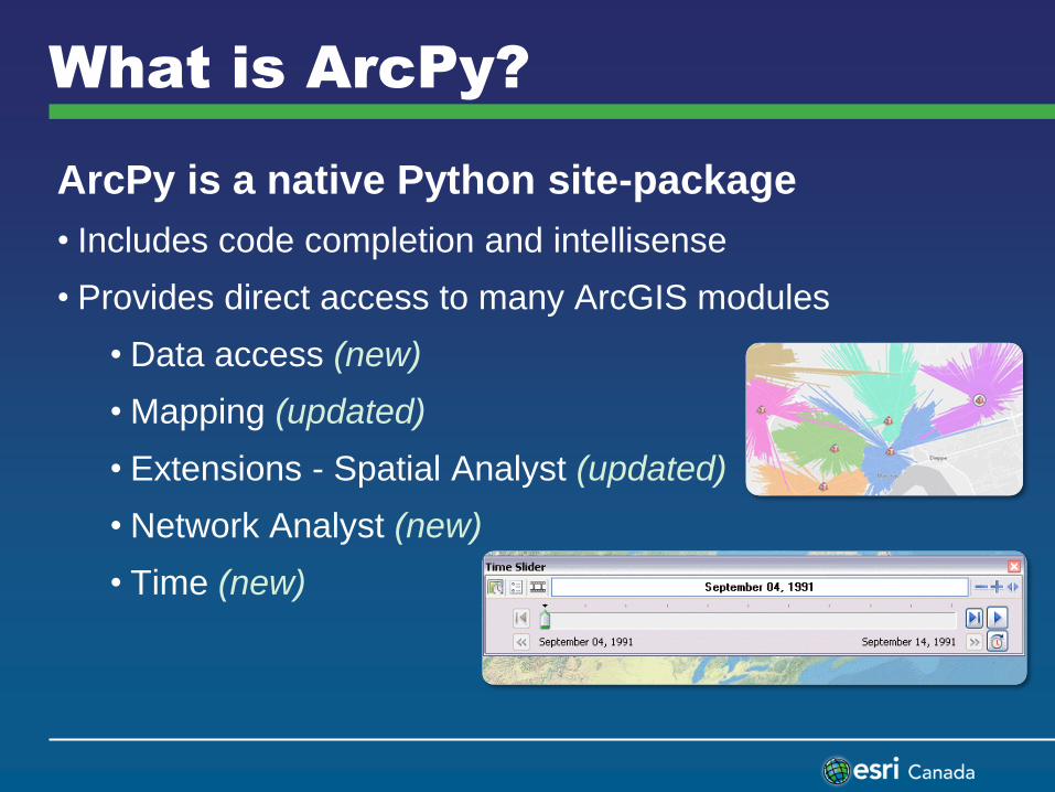
What is ArcPy?
ArcPy is a native Python site-package
• Includes code completion and intellisense
• Provides direct access to many ArcGIS modules
• Data access (new)
• Mapping (updated)
• Extensions - Spatial Analyst (updated)
• Network Analyst (new)
• Time (new)
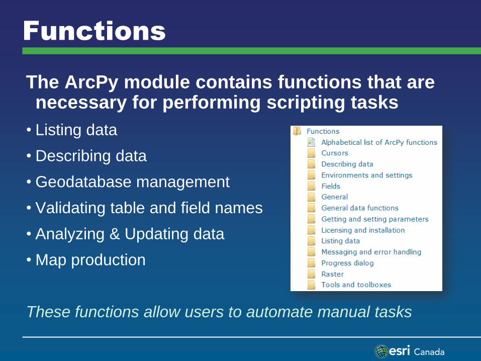
Functions
The ArcPy module contains functions that are necessary for performing scripting tasks
• Listing data
• Describing data
• Geodatabase management
• Validating table and field names
• Analyzing & Updating data
• Map production
These functions allow users to automate manual tasks
What’s new in Python in
ArcGIS 10.1
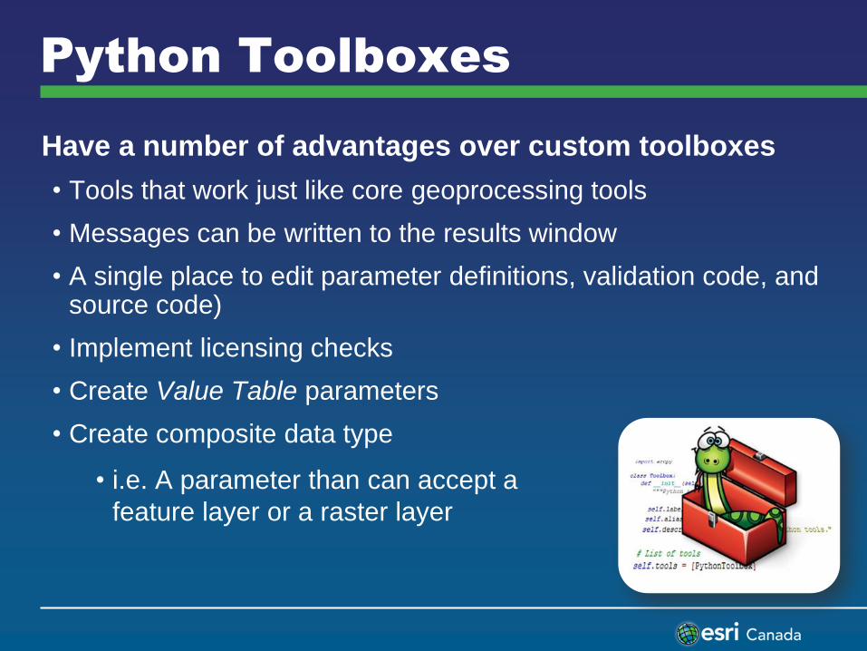
Have a number of advantages over custom toolboxes
• Tools that work just like core geoprocessing tools
• Messages can be written to the results window
• A single place to edit parameter definitions, validation code, and source code)
• Implement licensing checks
• Create Value Table parameters
• Create composite data type
• i.e. A parameter than can accept a
feature layer or a raster layer
Python Toolboxes
Data Access Module
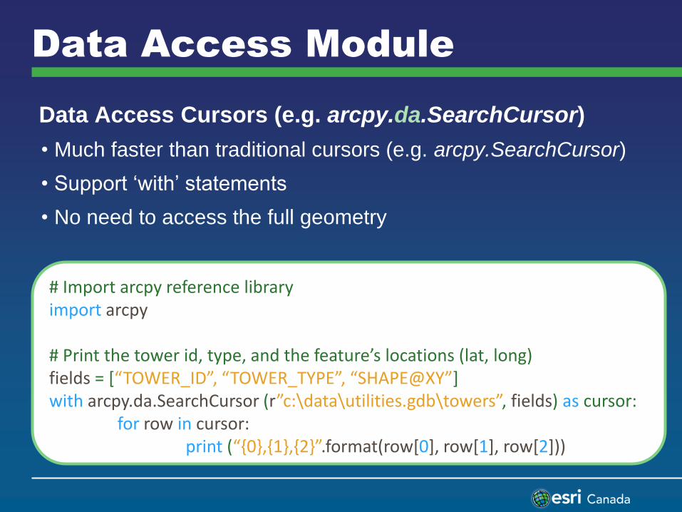
Data Access Cursors (e.g. arcpy.da.SearchCursor)
• Much faster than traditional cursors (e.g. arcpy.SearchCursor)
• Support ‘with’ statements
• No need to access the full geometry
# Import arcpy reference library import arcpy # Print the tower id, type, and the feature’s locations (lat, long) fields = [“TOWER_ID”, “TOWER_TYPE”, “SHAPE@XY”] with arcpy.da.SearchCursor (r”c:\data\utilities.gdb\towers”, fields) as cursor: for row in cursor: print (“{0},{1},{2}”.format(row[0], row[1], row[2]))
Accessing Geometry
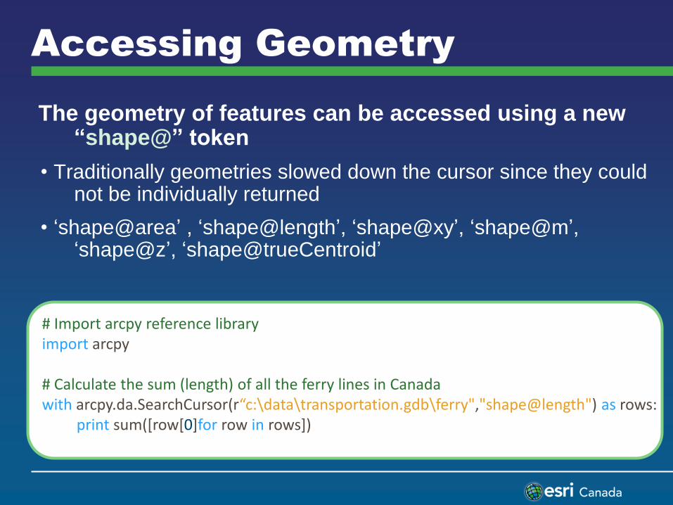
The geometry of features can be accessed using a new “shape@” token
• Traditionally geometries slowed down the cursor since they could not be individually returned
• ‘shape@area’ , ‘shape@length’, ‘shape@xy’, ‘shape@m’, ‘shape@z’, ‘shape@trueCentroid’
# Import arcpy reference library import arcpy # Calculate the sum (length) of all the ferry lines in Canada with arcpy.da.SearchCursor(r“c:\data\transportation.gdb\ferry","shape@length") as rows: print sum([row[0]for row in rows])

Writing Feature Geometry
Insert cursors must be used to create new features
• Point and Array objects are used to create the feature parts
Update cursors can be used to replace a row’s existing geometry
# Add a new ferry line to the ferry feature class using an InsertCursor with arcpy.da.InsertCursor(r“c:\data\transportation.gdb\ferry","shape@") as ferrycursor: # Create an array using a series of point objects ptList = [arcpy.Point(-9090915.5, 5662586.6), arcpy.Point(-8916290.1, 5674228.3)] lineArray = arcpy.Array(ptList) # Create a stream polyline from the array polyline = arcpy.Polyline (lineArray) # Insert stream polyline into the dataset ferrycursor.insertRow([polyline])
Editor Class
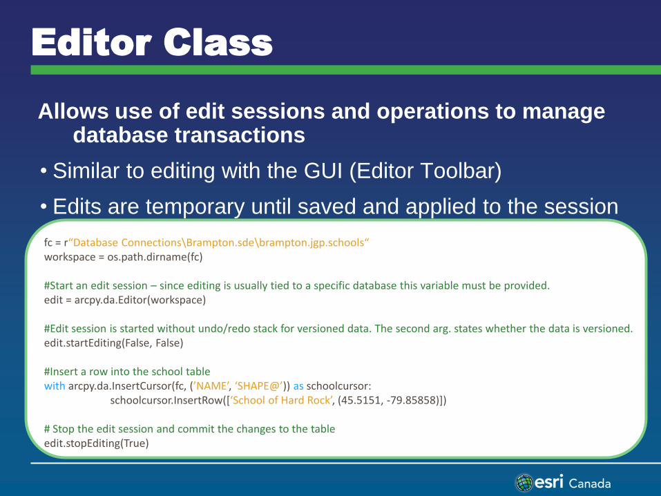
Allows use of edit sessions and operations to manage database transactions
• Similar to editing with the GUI (Editor Toolbar)
• Edits are temporary until saved and applied to the session
fc = r“Database Connections\Brampton.sde\brampton.jgp.schools“ workspace = os.path.dirname(fc) #Start an edit session – since editing is usually tied to a specific database this variable must be provided. edit = arcpy.da.Editor(workspace) #Edit session is started without undo/redo stack for versioned data. The second arg. states whether the data is versioned. edit.startEditing(False, False) #Insert a row into the school table with arcpy.da.InsertCursor(fc, (’NAME’, ‘SHAPE@’)) as schoolcursor: schoolcursor.InsertRow([‘School of Hard Rock’, (45.5151, -79.85858)]) # Stop the edit session and commit the changes to the table edit.stopEditing(True)
Python Add-ins
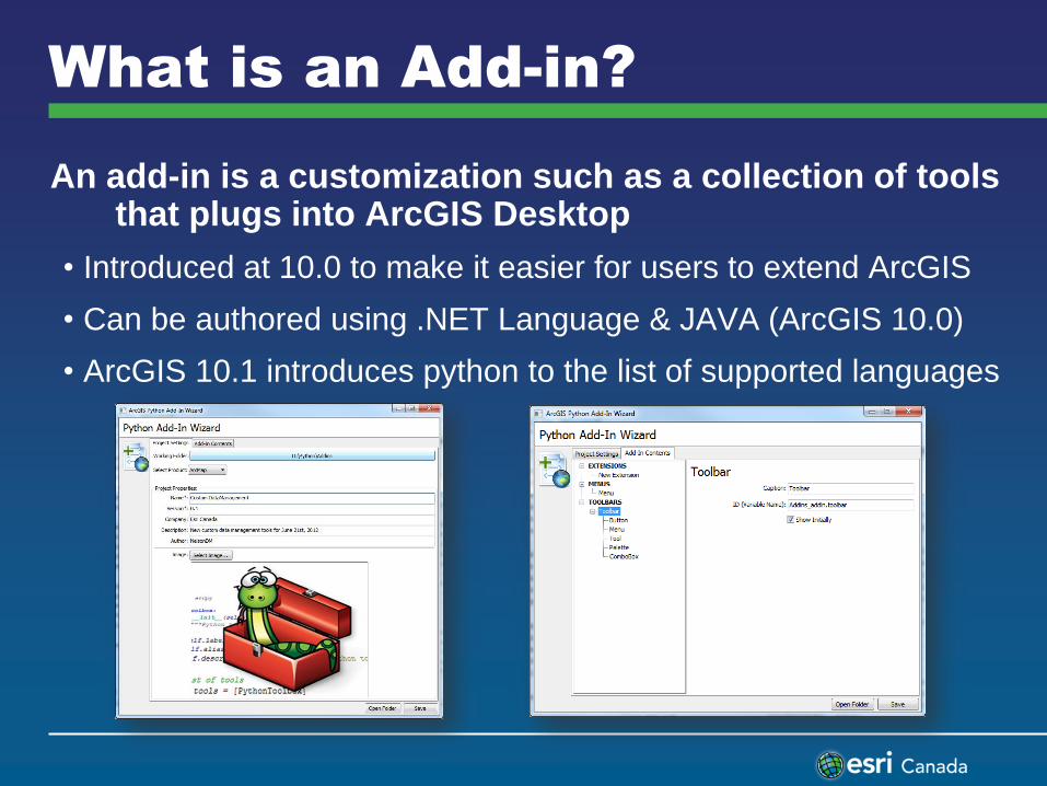
What is an Add-in?
An add-in is a customization such as a collection of tools that plugs into ArcGIS Desktop
• Introduced at 10.0 to make it easier for users to extend ArcGIS
• Can be authored using .NET Language & JAVA (ArcGIS 10.0)
• ArcGIS 10.1 introduces python to the list of supported languages
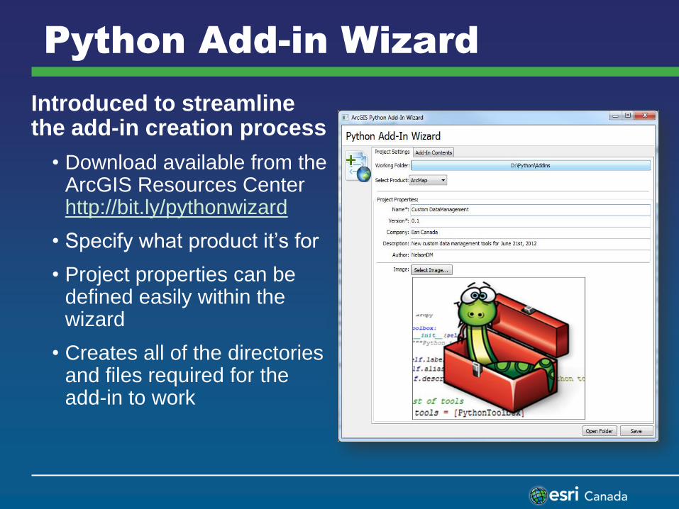
Python Add-in Wizard
Introduced to streamline the add-in creation process
• Download available from the ArcGIS Resources Center http://bit.ly/pythonwizard
• Specify what product it’s for
• Project properties can be defined easily within the wizard
• Creates all of the directories and files required for the add-in to work
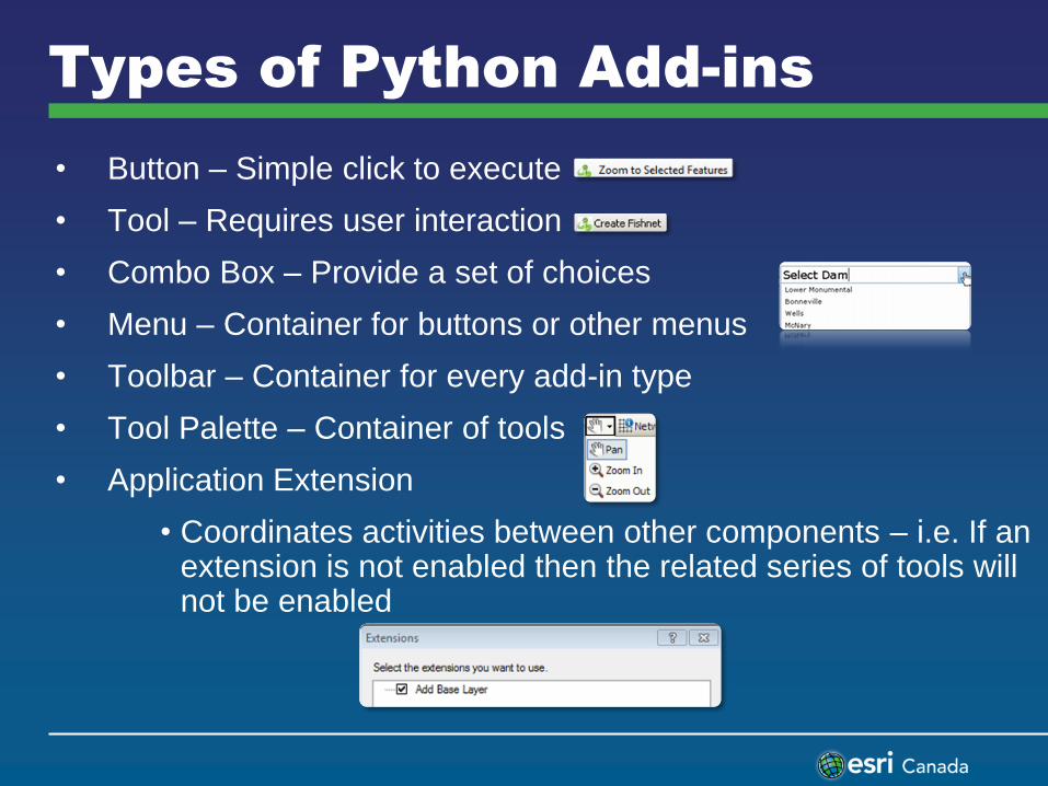
• Button – Simple click to execute
• Tool – Requires user interaction
• Combo Box – Provide a set of choices
• Menu – Container for buttons or other menus
• Toolbar – Container for every add-in type
• Tool Palette – Container of tools
• Application Extension
• Coordinates activities between other components – i.e. If an extension is not enabled then the related series of tools will not be enabled
Types of Python Add-ins
Demonstration
• Python resource center
• Creating a python toolbox
• Creating a python add-in
ArcGIS Runtime SDK for
WPF
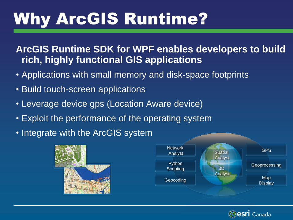
Why ArcGIS Runtime?
ArcGIS Runtime SDK for WPF enables developers to build rich, highly functional GIS applications
• Applications with small memory and disk-space footprints
• Build touch-screen applications
• Leverage device gps (Location Aware device)
• Exploit the performance of the operating system
• Integrate with the ArcGIS system
Map
Display
GPS
Geocoding
Geoprocessing Python
Scripting
Network
Analyst Spatial
Analyst
3D
Analyst
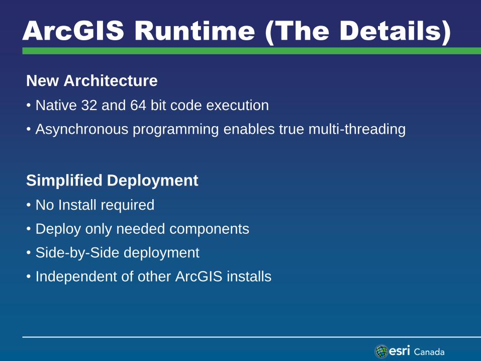
ArcGIS Runtime (The Details)
New Architecture
• Native 32 and 64 bit code execution
• Asynchronous programming enables true multi-threading
Simplified Deployment
• No Install required
• Deploy only needed components
• Side-by-Side deployment
• Independent of other ArcGIS installs
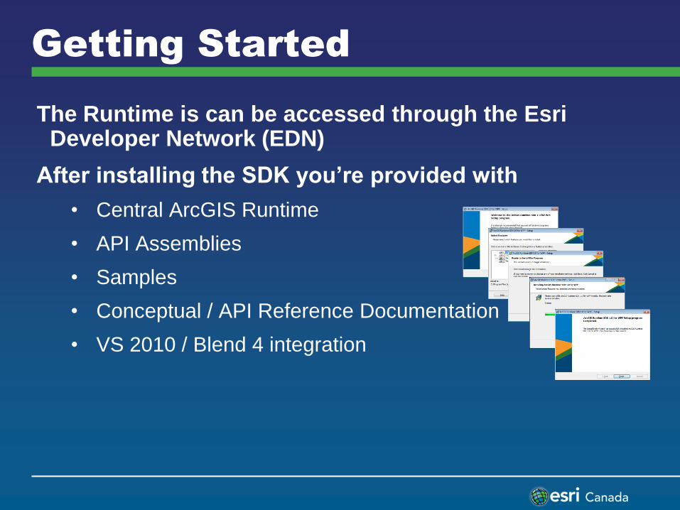
Getting Started
The Runtime is can be accessed through the Esri Developer Network (EDN)
After installing the SDK you’re provided with
• Central ArcGIS Runtime
• API Assemblies
• Samples
• Conceptual / API Reference Documentation
• VS 2010 / Blend 4 integration
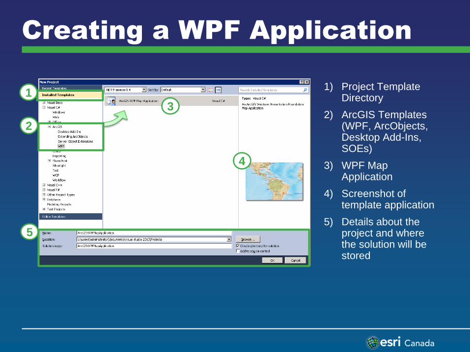
Creating a WPF Application
1
2
3
4
5
1) Project Template Directory
2) ArcGIS Templates (WPF, ArcObjects, Desktop Add-Ins, SOEs)
3) WPF Map Application
4) Screenshot of template application
5) Details about the project and where the solution will be stored
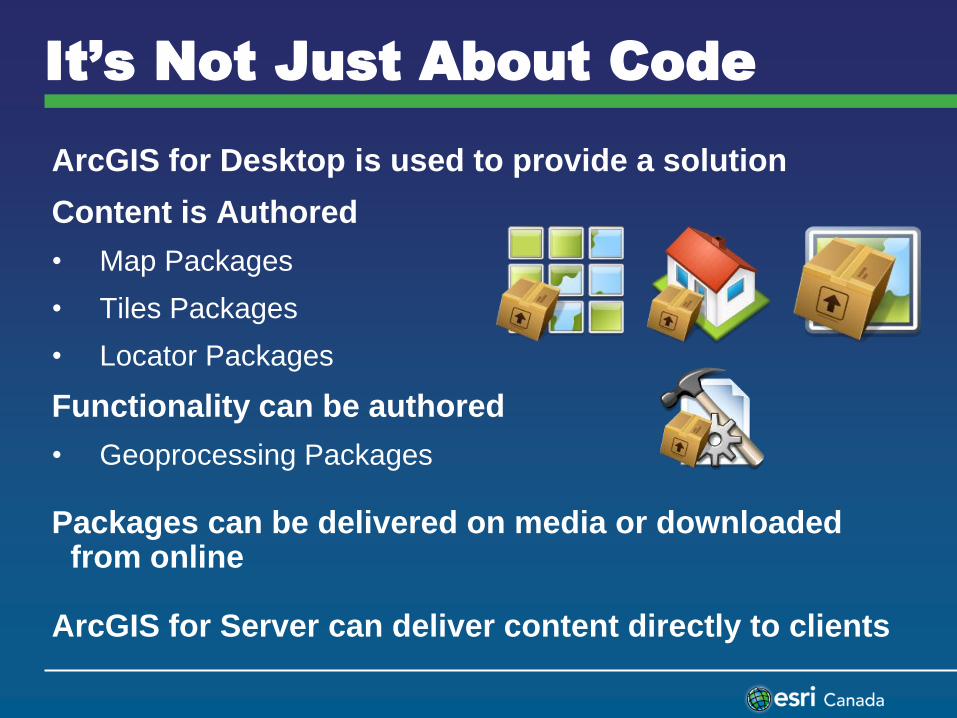
ArcGIS for Desktop is used to provide a solution
Content is Authored
• Map Packages
• Tiles Packages
• Locator Packages
Functionality can be authored
• Geoprocessing Packages
Packages can be delivered on media or downloaded from online
ArcGIS for Server can deliver content directly to clients
It’s Not Just About Code
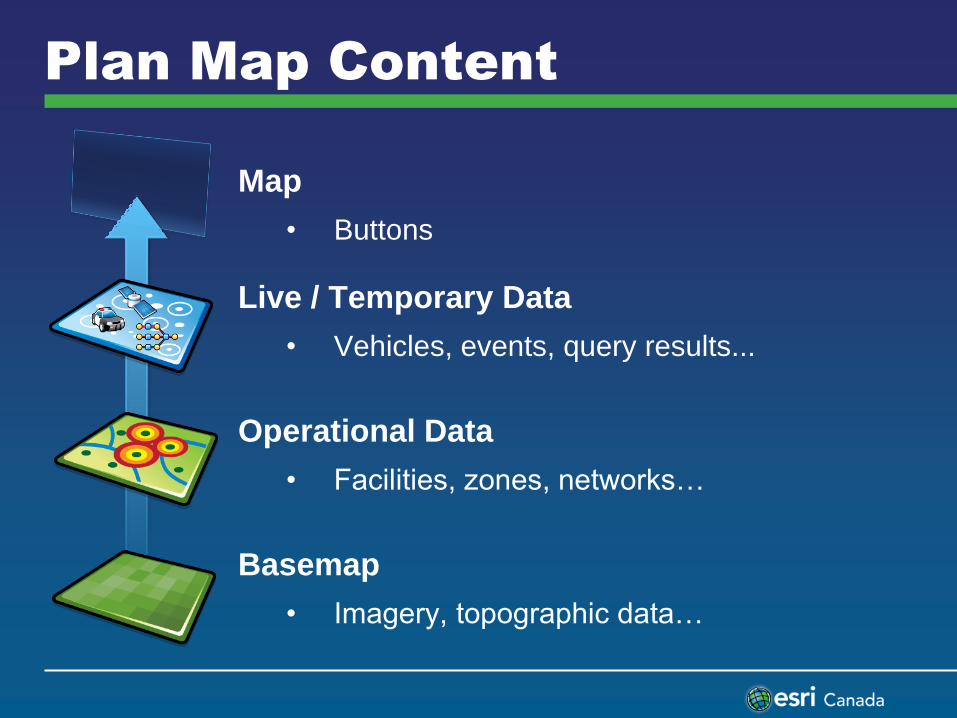
Plan Map Content
Map
• Buttons
Live / Temporary Data
• Vehicles, events, query results...
Operational Data
• Facilities, zones, networks…
Basemap
• Imagery, topographic data…
Identify Operations
Attribute and spatial queries
Handled by specific task classes in the ESRI.ArcGIS.Client.Task namespace
Similar programming pattern for each task
• Define input parameters
• Execute task asynchronously
• Process and display results
Querying data
Editing
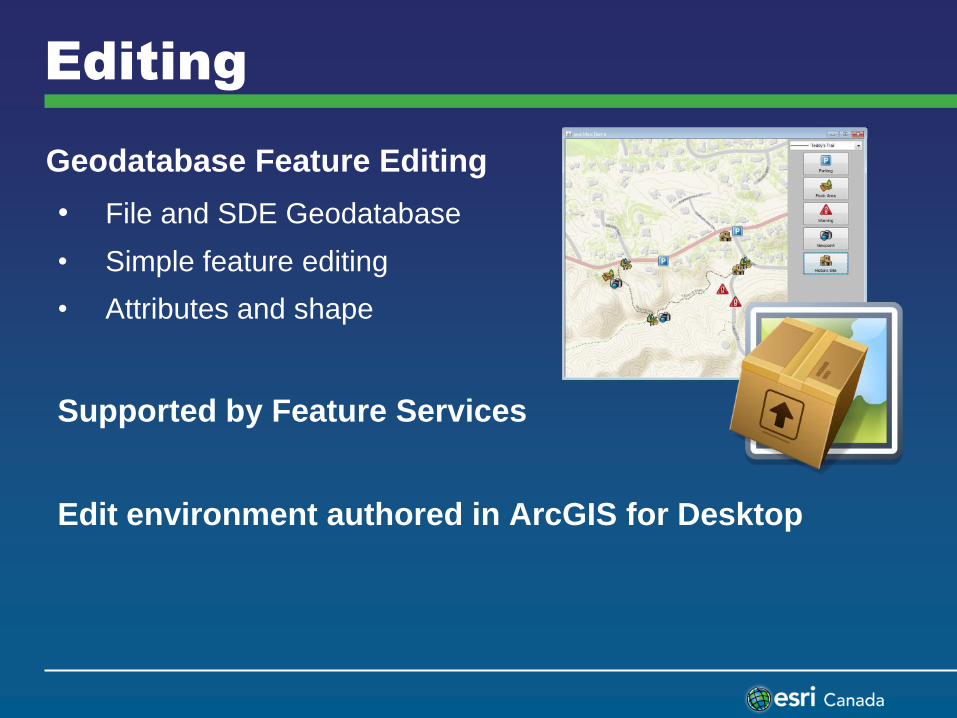
Geodatabase Feature Editing
• File and SDE Geodatabase
• Simple feature editing
• Attributes and shape
Supported by Feature Services
Edit environment authored in ArcGIS for Desktop
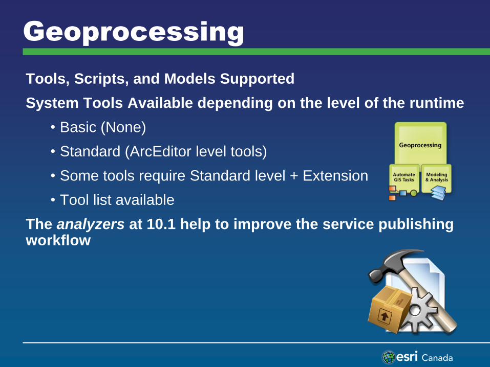
Geoprocessing
Tools, Scripts, and Models Supported
System Tools Available depending on the level of the runtime
• Basic (None)
• Standard (ArcEditor level tools)
• Some tools require Standard level + Extension
• Tool list available
The analyzers at 10.1 help to improve the service publishing workflow
Demonstration II
• ArcGIS Resource Center
• IDE Integration
• WPF Sample Editing
Summary
In this seminar you were introduced to:
1) Using Python to increase productivity
2) Overview of ArcGIS Runtime
Python Resources
ArcGIS Resources Center
• http://resources.arcgis.com/
Using Python Help
• http://resources.arcgis.com/en/communities/python/
ArcGIS Python Recipes
• http://arcpy.wordpress.com/
twitter.com/EsriCanada facebook.com/EsriCanada
Runtime WPF Resources
ArcGIS Resources Center
• http://resources.arcgis.com/
Using WPF Runtime Help
• http://resources.arcgis.com/en/communities/runtime-wpf/
WPF Runtime Concepts
• http://resources.arcgis.com/en/help/runtime-wpf/concepts/index.html#//01700000002t000000
twitter.com/EsriCanada facebook.com/EsriCanada


![[Arcgis] Riset ArcGIS JS & Flex](https://img.pdfslide.net/doc/110x75/55cf96d7550346d0338e2017/arcgis-riset-arcgis-js-flex.jpg)