Embed Size (px)
Citation preview
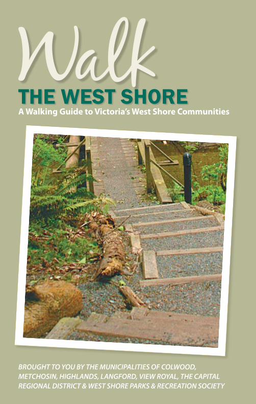
BROUGHT TO YOU BY THE MUNICIPALITIES OF COLWOOD, METCHOSIN, HIGHLANDS, LANGFORD, VIEW ROYAL, THE CAPITAL REGIONAL DISTRICT & WEST SHORE PARKS & RECREATION SOCIETY
THE WEST SHOREA Walking Guide to Victoria’s West Shore Communities
1
2
3
45
6
131415
1011
12
98
7
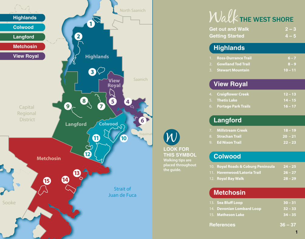
Metchosin
Colwood
ViewRoyal
Langford
Highlands
Sooke
CapitalRegional
District
Strait ofJuan de Fuca
Saanich
North Saanich
Esquimalt
Colwood
Highlands
Langford
Metchosin
ViewRoyalHighlands
ViewRoyal
Langford
Colwood
Metchosin
References 36–37
LOOKFORTHISSYMBOLWalking tips are placed throughout the guide.
�
GetoutandWalk 2–3GettingStarted 4–5
Ross-Durrance Trail 6 – 7Gowlland Tod Trail 8 – 9Stewart Mountain 10 – 11
1.2.3.
Craigflower Creek 12 – 13Thetis Lake 14 – 15Portage Park Trails 16 – 17
4.5.6.
Millstream Creek 18 – 19Strachan Trail 20 – 21Ed Nixon Trail 22 – 23
7.8.9.
Royal Roads & Coburg Peninsula 24 – 25Havenwood/Latoria Trail 26 – 27Royal Bay Walk 28 – 29
10.11.12.
Sea Bluff Loop 30 – 31Devonian Lombard Loop 32 – 33Matheson Lake 34 – 35
13.14.15.
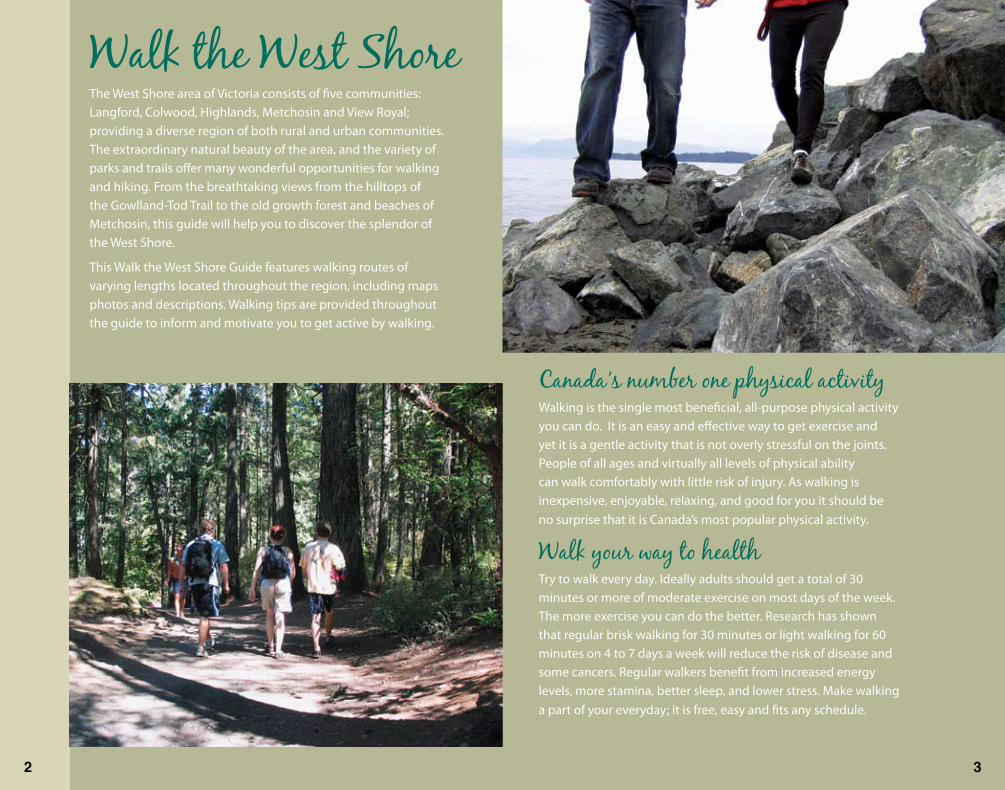
Walk the West ShoreThe West Shore area of Victoria consists of five communities: Langford, Colwood, Highlands, Metchosin and View Royal; providing a diverse region of both rural and urban communities. The extraordinary natural beauty of the area, and the variety of parks and trails offer many wonderful opportunities for walking and hiking. From the breathtaking views from the hilltops of the Gowlland-Tod Trail to the old growth forest and beaches of Metchosin, this guide will help you to discover the splendor of the West Shore.
This Walk the West Shore Guide features walking routes of varying lengths located throughout the region, including maps photos and descriptions. Walking tips are provided throughout the guide to inform and motivate you to get active by walking.
Canada’s number one physical activityWalking is the single most beneficial, all-purpose physical activity you can do. It is an easy and effective way to get exercise and yet it is a gentle activity that is not overly stressful on the joints. People of all ages and virtually all levels of physical ability can walk comfortably with little risk of injury. As walking is inexpensive, enjoyable, relaxing, and good for you it should be no surprise that it is Canada’s most popular physical activity.
Walk your way to healthTry to walk every day. Ideally adults should get a total of 30 minutes or more of moderate exercise on most days of the week. The more exercise you can do the better. Research has shown that regular brisk walking for 30 minutes or light walking for 60 minutes on 4 to 7 days a week will reduce the risk of disease and some cancers. Regular walkers benefit from increased energy levels, more stamina, better sleep, and lower stress. Make walking a part of your everyday; it is free, easy and fits any schedule.
2 3
Before getting started on a walking program talk to your doctor if you:
have been inactive for a long time
are very overweight
are a smoker
have high blood pressure
have a history of heart disease or chest pains
have diabetes
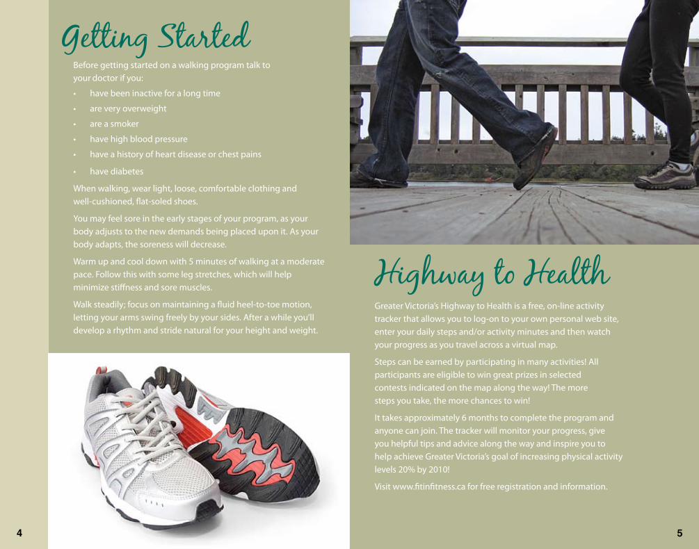
When walking, wear light, loose, comfortable clothing and well-cushioned, flat-soled shoes.
You may feel sore in the early stages of your program, as your body adjusts to the new demands being placed upon it. As your body adapts, the soreness will decrease.
Warm up and cool down with 5 minutes of walking at a moderate pace. Follow this with some leg stretches, which will help minimize stiffness and sore muscles.
Walk steadily; focus on maintaining a fluid heel-to-toe motion, letting your arms swing freely by your sides. After a while you’ll develop a rhythm and stride natural for your height and weight.
•
•
•
•
•
•
Getting Started
Highway to Health Greater Victoria’s Highway to Health is a free, on-line activity tracker that allows you to log-on to your own personal web site, enter your daily steps and/or activity minutes and then watch your progress as you travel across a virtual map.
Steps can be earned by participating in many activities! All participants are eligible to win great prizes in selected contests indicated on the map along the way! The more steps you take, the more chances to win!
It takes approximately 6 months to complete the program and anyone can join. The tracker will monitor your progress, give you helpful tips and advice along the way and inspire you to help achieve Greater Victoria’s goal of increasing physical activity levels 20% by 2010!
Visit www.fitinfitness.ca for free registration and information.
4 5
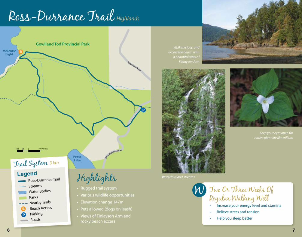
Waterfalls and streams
MckenzieBight
PeaseLake
100 50 0 100 Metres
Ro
ss-Durance Road
Willis Point Road
Gowlland Tod Provincial Park
Keep your eyes open for native plant life like trillium
HighlightsRugged trail system
Various wildlife opportunities
Elevation change 147m
Pets allowed (dogs on leash)
Views of Finlayson Arm and rocky beach access
•
•
•
•
•
Walk the loop and access the beach with
a beautiful view of Finlayson Arm
Ross-Durrance TrailHighlands
Trail System 3 km
Two Or Three Weeks Of Regular Walking Will
Increase your energy level and stamina
Relieve stress and tension
Help you sleep better
•
•
•
LegendRoss-Durrance Trail
Streams
Water Bodies
ParksNearby Trails
Beach Access
Parking
Roads
6 7
FinlaysonArm
Gowlland Tod Provincial Park
Lone Tree HillRegional Park
HazlittCreekPark
300 150 0 300 Metres
Highlands Park Terra
ce
Red Cedar Crt
Caleb PikeRo
ad
MillsteamRoad
Millstr eam Road
Martlett Road
Emma Dixon
W
hitePine
Tr.
Rockridge Pl
So
uthwind D
rive
Lake
Road
Blac
ktai
l Road
Lorimer Road
HighlightsRugged trail system
Elevation change 220m
Pets allowed (dogs on leash)
Horse trails
Views of Finlayson Arm
•
•
•
•
•
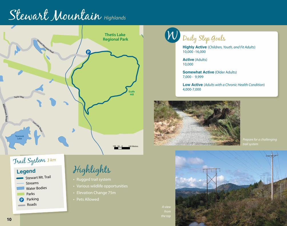
Get a PedometerWearing a pedometer is an easy way to track your steps each day. Start by wearing the pedometer every day for one week. Put it on when you get up in the morning and wear it until bed time. Record your daily steps in a log or notebook. By the end of the week you will know your average daily steps. You might be surprised how many (or how few) steps you get in each day.
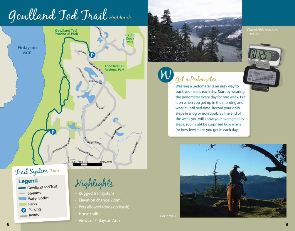
View of Finlayson Arm in Winter
Horse trails
� �
Trail System 7 km
LegendGowlland Tod Trail
Streams
Water Bodies
ParksParking
Roads
Gowlland Tod TrailHighlands
TeanookLakeMatson
Lake
Thetis Lake Regional Park
Scafe Hill
100 50 0 100 Metres
Taylor Way
Stewart Mountain Road
Millstream
Road
Mill streamRd
Lost Lake Road
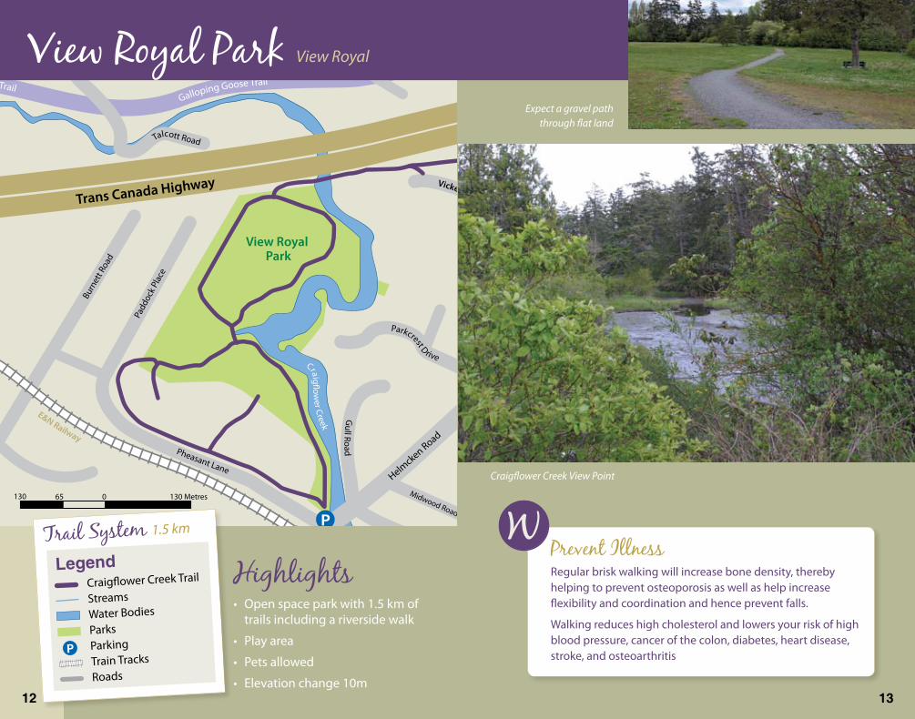
Prepare for a challenging trail system
A view from
the top
Stewart Mountain Highlands
HighlightsRugged trail system
Various wildlife opportunities
Elevation Change 75m
Pets Allowed
•
•
•
•
Daily Step GoalsHighlyActive(Children, Youth, and Fit Adults) 10,000 -16,000
Active (Adults) 10,000
SomewhatActive (Older Adults) 7,000 - 9,999
LowActive(Adults with a Chronic Health Condition) 4,000-7,000
�0 ��
Trail System 3 km
LegendStewart Mt. Trail
Streams
Water Bodies
ParksParking
Roads
Midwood Road
E&N Railway
Galloping Goose TrailGalloping Goose Trail
Trans Canada Highway
Helmcken Road
Helm
cken
Road
PortageInlet
View Royal Park
Burn
ett R
oad
Padd
ock Pl
ace
Island Highway
GullRoad
Talcott Road
Pheasant Lane
Caton Place
Parkcrest DriveCraig�ow
er Creek
130 65 0 130 Metres
Vickery Road
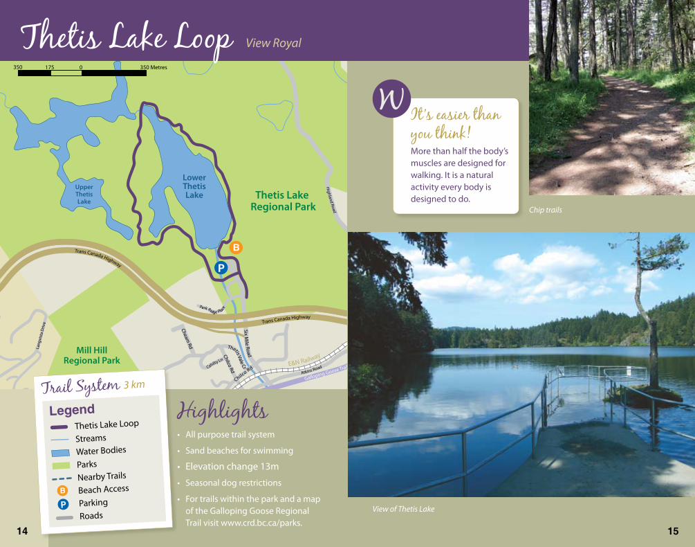
Expect a gravel path through flat land
Craigflower Creek View Point
View Royal Park View Royal
HighlightsOpen space park with 1.5 km of trails including a riverside walk
Play area
Pets allowed
Elevation change 10m
•
•
•
•
Prevent IllnessRegular brisk walking will increase bone density, thereby helping to prevent osteoporosis as well as help increase flexibility and coordination and hence prevent falls.
Walking reduces high cholesterol and lowers your risk of high blood pressure, cancer of the colon, diabetes, heart disease, stroke, and osteoarthritis
�2 �3
LegendCraigflower Creek Trail
StreamsWater Bodies
ParksParkingTrain Tracks
Roads
Trail System 1.5 km
UpperThetisLake
LowerThetisLake Thetis Lake
Regional Park
Mill HillRegional Park
350 175 0 350 Metres
E&N Railway
Galloping Goose Trail
Trans Canada Highway
Trans Canada Highway
Island Highway
SixM
ileRoad
Lang
vist
aD
rive
Highland
Road
Atkins Road
Park Ridge Place
Chilco Rd
ThetisValeCr
ChilcoRdCahilty
Ln
CheamRd
View of Thetis Lake
Thetis Lake Loop View Royal
HighlightsAll purpose trail system
Sand beaches for swimming
Elevation change 13m
Seasonal dog restrictions
For trails within the park and a map of the Galloping Goose Regional Trail visit www.crd.bc.ca/parks.
•
•
•
•
•
It’s easier than you think!More than half the body’s muscles are designed for walking. It is a natural activity every body is designed to do.
Trail System 3 km
LegendThetis Lake Loop
Streams
Water Bodies
ParksNearby Trails
Beach Access
Parking
Roads
Chip trails
�4 �5

Portage Inlet
Esquimalt Harbour
ThetisCove
PortagePark
RichardsIsland
160 80 0 160 Metres
Adm
irals
Road
Shoreline Drive
Glentana
Road
Demos Pl
Falst
a�
Place
View Royal Avenue
Plow
right
Road
Pallister Ave
View Royal Ave
Stor
mon
t Ave
Glenairlie Drive
Suza
nne Pl
ace
Brian Pl
Abinger Pl
Fenton Road
Island HighwayBeau
mon
tAve
nue
Aldersmith Pl.
SteepStairs
Be prepared for gravel trails, where as some of the minor
trails are dirt and or chip
Portage Park Trails View Royal
HighlightsSteep stairs lead to an all purpose trail system
Shoreline and beach access at Thetis Cove
Pets allowed
Views of Richards Island and Esquimalt Harbour
Elevation change 12m
•
•
•
•
•
Walk a little EverydayWalking a little every day is more beneficial than an occasional, intense bout of exercise. Alternating short, 15 minute walks with 45 to 60 minute walks every second day will help maximize the health benefits of walking.
Trail System 1 km
LegendPortage Park Trails
StreamsWater Bodies
ParksNearby Trails
Beach Access
ParkingTrain Tracks
Roads
Richards Island
�6 �7
250 125 0 250 Metres
Ranson Rd
Gourman Place
Trans Canada Hwy
SelwynRoad
Setc
h�el
dAv
e.
Hoylake Avenue
MillstreamRoad
M
illstreamRoad
Mis
tyW
ay
McCallum Road
Mo
yesRd.
Hansen Avenue
MillstreamCreek
To Florence Lake Trail
MILLSTREAMVILLAGE
HOMEDEPOT
Treanor Avenue
Treanor Avenue
Bellamy Road
Goldie Ave.
Bella
my Road
Phelps AvenueBe
lair
Road
Ashley Pl
.
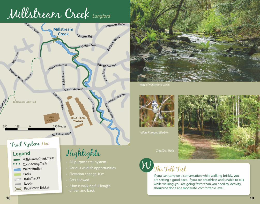
View of Millstream Creek
Yellow Rumped Warbler
Millstream Creek Langford
HighlightsAll purpose trail system
Various wildlife opportunities
Elevation change 10m
Pets allowed
3 km is walking full length of trail and back
•
•
•
•
•
The Talk TestIf you can carry on a conversation while walking briskly, you are setting a good pace. If you are breathless and unable to talk while walking, you are going faster than you need to. Activity should be done at a moderate, comfortable level.
Chip/Dirt TrailsLegend
Millstream Creek Trails
Connecting Trails
Water Bodies
ParksTrain Tracks
Roads
Pedestrian Bridge
Trail System 3 km
�� ��
COSTCO
Preston Way
Spen
cer R
d
FlorenceLake
Boat Launch
250 125 0 205 Metres
Trans Canada Highway
Savo
ryRo
ad
FlorenceLake
Road
Brock Avenue
McCallum Road
Setch�eld
Road
Jack
linRo
ad
Mat
son
Road
Stra
thm
ore
Road
Fleet
woo
d Road
Pros
pect
orW
ay
Millstone
Rd
Martin
Road
FlorenceLake
RoadBrock Avenue
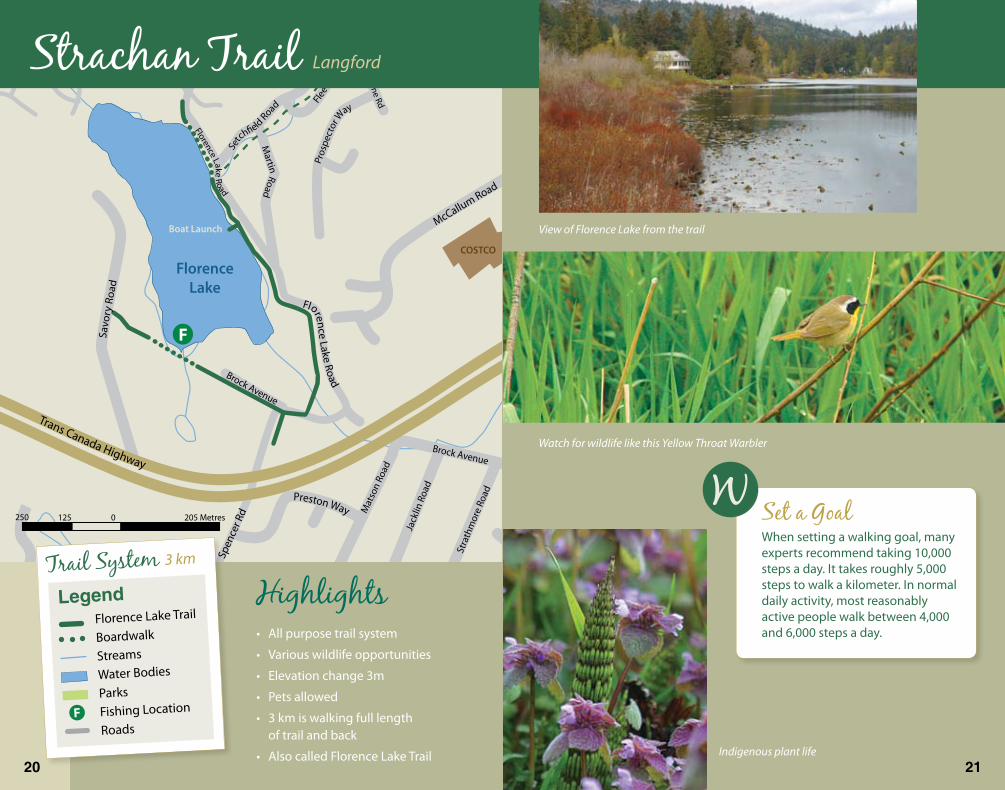
Watch for wildlife like this Yellow Throat Warbler
View of Florence Lake from the trail
Strachan Trail Langford
HighlightsAll purpose trail system
Various wildlife opportunities
Elevation change 3m
Pets allowed
3 km is walking full length of trail and back
Also called Florence Lake Trail
•
•
•
•
•
•
Set a GoalWhen setting a walking goal, many experts recommend taking 10,000 steps a day. It takes roughly 5,000 steps to walk a kilometer. In normal daily activity, most reasonably active people walk between 4,000 and 6,000 steps a day.
Indigenous plant life20 2�
Trail System 3 km
LegendFlorence Lake Trail
Boardwalk
Streams
Water Bodies
Parks
Fishing Location
RoadsF
Trans Canada Highway
Wes
tSho
rePa
rkw
ay
400 200 0 400 Metres
Trans Canada Highway
GoldstreamAvenue
Lake End Rd
Leigh Road
Henry Ing PlaceLe
igh
Roa d
Dunford Ave
LangfordLake
GlennLake
S
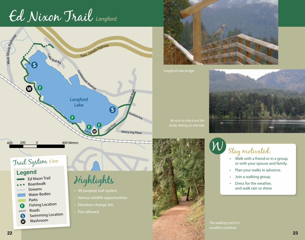
Be sure to check out the boats fishing on the lake
Langford Lake bridge
Ed Nixon Trail Langford
HighlightsAll purpose trail system
Various wildlife opportunities
Elevation change 2m
Pets allowed
•
•
•
•
The walking trail is in excellent condition
Stay motivated:Walk with a friend or in a group, or with your spouse and family.
Plan your walks in advance.
Join a walking group.
Dress for the weather, and walk rain or shine.
•
•
•
•
22 23
Trail System 5 km
LegendEd Nixon Trail
Boardwalk
StreamsWater Bodies
Parks Fishing Location
RoadsSwimming Location
Washroom
250 125 0 250 Metres
Esquimalt Lagoon
Esquimalt LagoonBird Sanctuary Since 1938
Hatley ParkRoyal Roads University
Fort Rodd HillNational Park
Metchosin
Road
Milburn Drive
Portsmouth Drive
Ocean Blvd
Ocean
Blvd
Ocean
Blvd
Lagoon Road
Hea
ther
bell
Road
Matilda
Dr
Sea�eld Road
Anchor
age
Ave
Aloha Ave
Belmont Road
Sooke Road
Wish
art R
oad
Galloping Goose Trail
Trail inside fence of Royal Roads
Stairs atCreek
Crossing
Pump Station
College Drive
Beautifully constructed trails throughout Hatley Park
Esquimalt Lagoon
Royal Roads & Coburg Peninsula Colwood
HighlightsRoyal Roads forest (moderate)
Waterfowl viewing opportunities
Elevation change 71m
Pets are required to be on a leash
The short 3 km loop rises from about 35 m to 75 m
The long loop (7 km) rises from sea level to 35 metres
•
•
•
•
•
•
Hatley Castle at Royal Roads University
Make walking part of a your daily routine
Walk to the store, or on other errands.
Walk all or part of the way to work or school.
Take the stairs instead of the elevator or escalator.
Walk around the block or near by trail on your lunch break.
•
•
•
•
LegendRoyal Roads University
& Coburg Trails
Streams
Water Bodies
ParksRoads
Trail System 3 km & 7 km
24 25

Latoria Road
Latoria Road
200 185 0 200 Metres
Vetra
nsM
emor
ial P
arkw
ay
Olympic View Golf Course
Latoria Creek Park
Stairs &Steep Slope
Strait ofJuan de Fuca
Albert Head Lagoon
Colwood
Metchosin
GrattonRoad
Met
chos
inRo
ad
MetchosinRo
ad
Duk e
Road
DelgadaD
rPark
Drive
Bunkerr RoadRoyal Bay Driv
ePromenad
eCr
esce
nt
Longworth Pl
Wis
hart
Road
Pain
ter R
oad
Benhomer Drive
Cotlow Drive
Lagoon Road
Aloha Drive
Milburn Drive
Hat
ley
Driv
e
Permieter Pl
Pelican DriveBriarwood Lane
Windthrop Road
Wish
art R
oad
Granrose Terrace
Brookside Road
Bidwell Pl.
Anchora
geAve
Dressler Road
Beach Walk
Royal Bay Walk Colwood
HighlightsA long walk over mixed surfaces
Enjoy the lapping waves under the big maples along the beach or take in the long view from the lookout above Rockwood Terrace
Pets are required to be on a leash
Elevation change 69m
•
•
•
•
Safety TipsAlways let someone know where you’re going and your expected time of return.
Keep hydrated. If you’re going on a long or strenuous walk, drink water before you start, and carry a supply with you, especially in hot weather. A small backpack is useful for carrying water, sunglasses, sunscreen and other important items.
Be prepared for loose sand and some driftwood dodging
26 27
Trail System 8 km
LegendRoyal Bay Walk
StreamsWater Bodies
Parks Beach Access
LookoutRoads
140 70 0 140 Metres
Granrose Terrace
Castlewood Rd
Brookside Road
Granrose Terrace
Bunker Road
Kelly
Dawn
Plac
e
Wendey Drive
Des
mon
dD
rive
Sun Estates
Sunheights Drive
SunH
ills RoadSun Vista
Fulto
nRo
ad
Windthrop Road
Vetra
nsM
emor
ial P
arkw
ay
Vetr
ans M
emor
ialP
arkw
ay
Latoria Road
Latoria Road
Havenwood Park
Olympic View Golf Course
Mar
yAn
neCr
Pattison Way
Walk on RoadNarrow Shoulder
Trail is easy to spot o� the end
of Desmond Drive
Gravel pathways
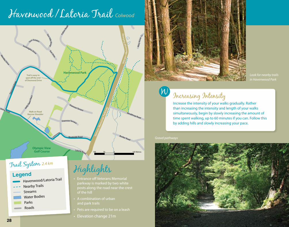
Look for nearby trails in Havenwood Park
Havenwood / Latoria Trail Colwood
HighlightsEntrance off Veterans Memorial parkway is marked by two white posts along the road near the crest of the hill
A combination of urban and park trails
Pets are required to be on a leash
Elevation change 21m
•
•
•
•
Increasing IntensityIncrease the intensity of your walks gradually. Rather than increasing the intensity and length of your walks simultaneously, begin by slowly increasing the amount of time spent walking, up to 60 minutes if you can. Follow this by adding hills and slowly increasing your pace.
LegendHavenwood/Latoria Trail
Nearby Trails
Streams
Water Bodies
ParksRoads
Trail System 2.4 km
2� 2�

Will
iam
Hea
dRo
ad
Still
Mea
dow
Road
Witty Beach Road
Wooton Road
Parry Road
Parr
yCr
oss Ro
ad
Met
chos
inRo
ad
Parry Bay
Witty’sLagoon
200 100 0 200 Metres
Keep your dog on a leash! There are farm animals on this trail
Stop to see beautiful views of Parry Bay
30 min of Walking will ..Walking for 30 minutes or more at a quick pace 4 to 7 days a week will help you manage your body weight, reduce body fat and tone muscles.
Don’t forget to close all gates behind you!
Sea Bluff Loop Metchosin
HighlightsWalk through a working sheep farm with views of Parry Bay
Pets are required to be on a leash
Please close all gates behind you
Limited parking at the end of paved section of Wootton Road
Elevation change 13m
•
•
•
•
•
LegendPortage Park Trails
Streams
Water Bodies
ParksRoads
Trail System 1 km
30 3�
Strait ofJuan de Fuca
TaylorBeach
Devonian
Regional Park
390 195 0 390 Metres
William
Head Road
Willi
amHead
Road
Rocky Point Road
Tava
neRo
ad
Parry
Parry Road
Taylor Road
Taylor Road
Walpole
Rd
Mor
iand
Kangaroo Road
Arden Road
Lombard Drive
Swanwick Road
Boblaw Place
Pega
sus Way
Kevere PLace
Gal
lopi
ngG
oose
Trai
l
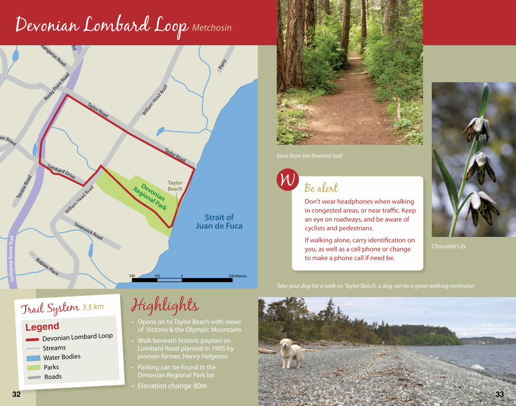
Devonian Lombard Loop Metchosin
HighlightsOpens on to Taylor Beach with views of Victoria & the Olympic Mountains
Walk beneath historic poplars on Lombard Road planted in 1905 by pioneer farmer, Henry Helgesen
Parking can be found in the Devonian Regional Park lot
Elevation change 80m
•
•
•
•
Chocolate Lily
Be alertDon’t wear headphones when walking in congested areas, or near traffic. Keep an eye on roadways, and be aware of cyclists and pedestrians.
If walking alone, carry identification on you, as well as a cell phone or change to make a phone call if need be.
View from the forested trail
Take your dog for a walk on Taylor Beach, a dog can be a great walking motivator
LegendDevonian Lombard Loop
Streams
Water Bodies
ParksRoads
Trail System 3.5 km
32 33
500 250 0 500 Metres
Sooke
Metchosin
Matheson Lake
MathesonLake
Regional Park
Horse Trail
Wayne’s RockTrail
BuckbrushSwamp Trail
Roche Cove
Roche CoveRegional Park
Gill
epsi
eRo
ad
Gillepsie
Rd
Rock
yPo
int R
oad
LaBonne
Road
La Bonne Road
LibertyD
r
Liberty Drive
Woodley Ghyll Drive
Maltoch Road
Matheson Lake Park Road
Mt. Matheson Road
Mt.M
ath e s o n
Rd
Ed’s Lane
Canis
Way
Galloping Goose Trail
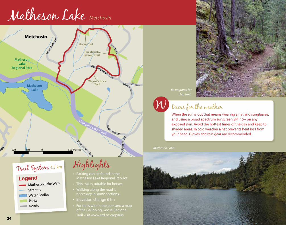
Be prepared for chip trails
Matheson Lake
Matheson Lake Metchosin
HighlightsParking can be found in the Matheson Lake Regional Park lot
This trail is suitable for horses
Walking along the road is necessary in some sections.
Elevation change 61mFor trails within the park and a map of the Galloping Goose Regional Trail visit www.crd.bc.ca/parks
•
•
•
••
Dress for the weatherWhen the sun is out that means wearing a hat and sunglasses, and using a broad spectrum sunscreen SPF 15+ on any exposed skin. Avoid the hottest times of the day and keep to shaded areas. In cold weather a hat prevents heat loss from your head. Gloves and rain gear are recommended.
LegendMatheson Lake Walk
Streams
Water Bodies
ParksRoads
Trail System 4.3 km
34
Walking TipsInformation for this booklet was compiled from a variety of sources, including the following:Pedometer Handbook. British Columbia Recreation and Parks Association, 2006.Walking: the Activity of a Lifetime. Published by the Ontario Ministry of Tourism and Recreation. Queens Printer of Ontario, 2005.Walking Handbook. British Columbia Recreation and Parks Association, 2006.Walking Program Resource Guide. British Columbia Recreation and Parks Association, 2006.Walking, Weight and Wellness. Written by Dr. Martin Collins. Trafford Publishing, 2006.
Thank You
Walking and Healthy Living Web PagesActive Communities Greater Victoria: www.activecommunities.bc.caActive Communities Greater Victoria Highway to Health: www.stepsout.com/gvAct Now BC www.actnowbc.gov.bc.caBritish Columbia Recreation and Parks Association: www.bcrpa.bc.ca/walking2010 Legacies Now: www.2010legaciesnow.com
West Shore Trails On-line:Colwood www.city.colwood.bc.ca
Metchosin www.district.metchosin.bc.ca/parks.htm
Highlands www.highlands.bc.ca/maps
Langford www.cityoflangford.ca/maps.asp
View Royal town.viewroyal.bc.ca/docs_townmaps
CRD Parks www.crd.bc.ca/parks
and to these organizations ...
Graphic Design & Layout Provided By Kathryn Mullis and West Shore Parks & Recreation
Mapping and Photography provided by Thomas Roy of Cascadia Biological Services
UNION OF
BRITISH
COLUMBIA
MUNICIPALITIES
Cascadia Biological Services
Thank you to West Shore Parks & Recreation, the City of Colwood, the City of Langford, the District of Metchosin, the District of Highlands, the Town of View Royal and Capital Regional District Parks all whom have contributed their time and effort to Walk the West Shore – A Walking Guide to Victoria’s West Shore Communities.
More walking maps to come!Visit West Shore Parks & Recreation online at www.jdfrecreation.com
36 37

10%
Cert no. SW-COC-002226