Embed Size (px)
Citation preview
Weather Satellite Data in FAA OperationsRandy BassAviation Weather Research Program
Aviation Weather Division
NextGen Organization
Federal Aviation Administration 1 May 2015
Federal Aviation Administration
2
• FAA Mission: Provide the safest, most efficient aerospace system in the world• Next Generation Air Transportation System (NextGen): National Airspace
System (NAS) being implemented across the United States by the FAA• NextGen transforms America’s air traffic control system from a ground-
based system to a satellite-based system• Satellite-enabled technology is used to shorten routes, save time and fuel,
reduce traffic delays, increase capacity, and permit controllers to monitor and manage aircraft with greater safety margins
• A major component of NextGen is improved weather support• Stovepiped systems consolidated into a single national weather
information system, updated in real time• Common weather picture across the NAS to enable better air
transportation decision making
Timely, accurate weather information is critical in operational decision-making for pilots, controllers, flight operators, and airport operators
Aviation Weather Division
3
• The FAA’s Aviation Weather Division (AWD) supports weather-dependent Operational Improvements and Operational Sustainment integration in the NAS by leading shortfall analyses, concept and requirement definition, enterprise system engineering, and solution prototyping and evaluation• Aligns and manages the weather research portfolio toward new
concepts/capabilities that reduce the impact of weather in the NAS• Represents U.S. MET Authority on International
coordination/harmonization activity• Assures development and integration of productive weather information
into Air Traffic Management (ATM) decisions by pilots, controllers, flight operators, and airport operators through orchestration of:• Better quality weather information• Better access to weather information• Better utilization of weather information
Aviation Weather Research Program
4
• The Aviation Weather Research Program, as part of AWD, conducts research to assure development and integration of weather information into ATM decisions to support NextGen initiatives• Applied research to minimize the impact of weather on the NAS• Specific initiatives to support NextGen weather Operational
Improvements contained in the NextGen Implementation Plans • Collaborative, complimentary initiatives with NWS to
transition legacy capabilities to meet NextGen and evolving requirements
• Focused initiatives to help mitigate safety and/or efficiency issues associated with well documented weather problems
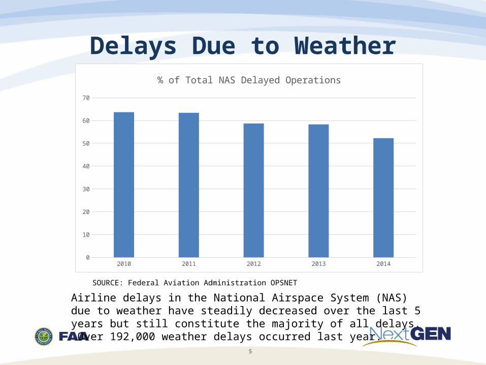
Delays Due to Weather
5
Airline delays in the National Airspace System (NAS) due to weather have steadily decreased over the last 5 years but still constitute the majority of all delays. Over 192,000 weather delays occurred last year.
SOURCE: Federal Aviation Administration OPSNET
2010 2011 2012 2013 20140
10
20
30
40
50
60
70
% of Total NAS Delayed Operations
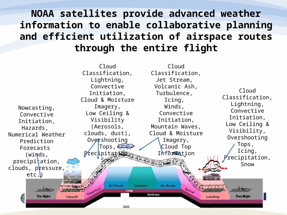
NOAA satellites provide advanced weather information to enable collaborative planning and efficient utilization
of airspace routes through the entire flight
Cloud Classification,Lightning,
Convective Initiation,Cloud & Moisture
Imagery,Low Ceiling & Visibility
(Aerosols, clouds, dust),
Overshooting Tops,Precipitation,
Snow
Cloud Classification, Jet Stream,
Volcanic Ash, Turbulence,
Icing, Winds,
Convective Initiation,Mountain Waves,Cloud & Moisture
Imagery,Cloud Top Information
Cloud Classification,Lightning,
Convective Initiation,
Low Ceiling & Visibility,
Overshooting Tops, Icing,
Precipitation,Snow
Nowcasting,Convective Initiation,
Hazards, Numerical Weather
Prediction Forecasts (winds, precipitation,
clouds, pressure, etc.)
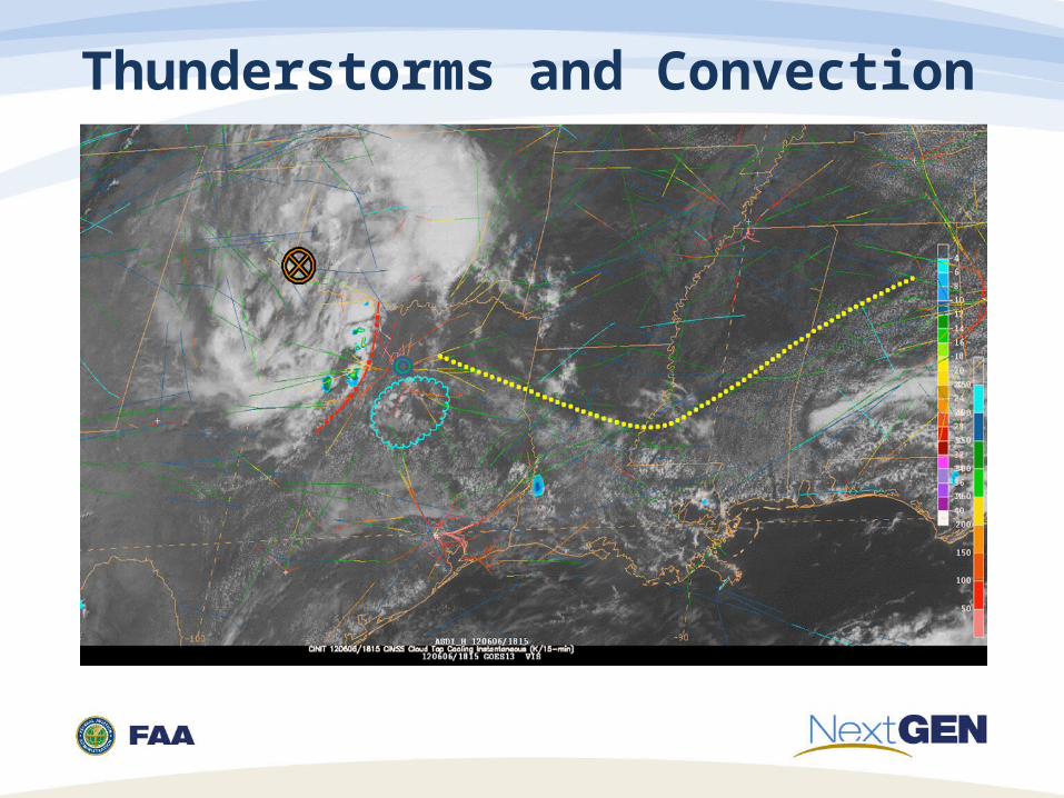
Thunderstorms and Convection
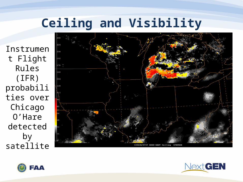
Ceiling and Visibility
Instrument Flight Rules
(IFR) probabilities
over Chicago O’Hare
detected by satellite
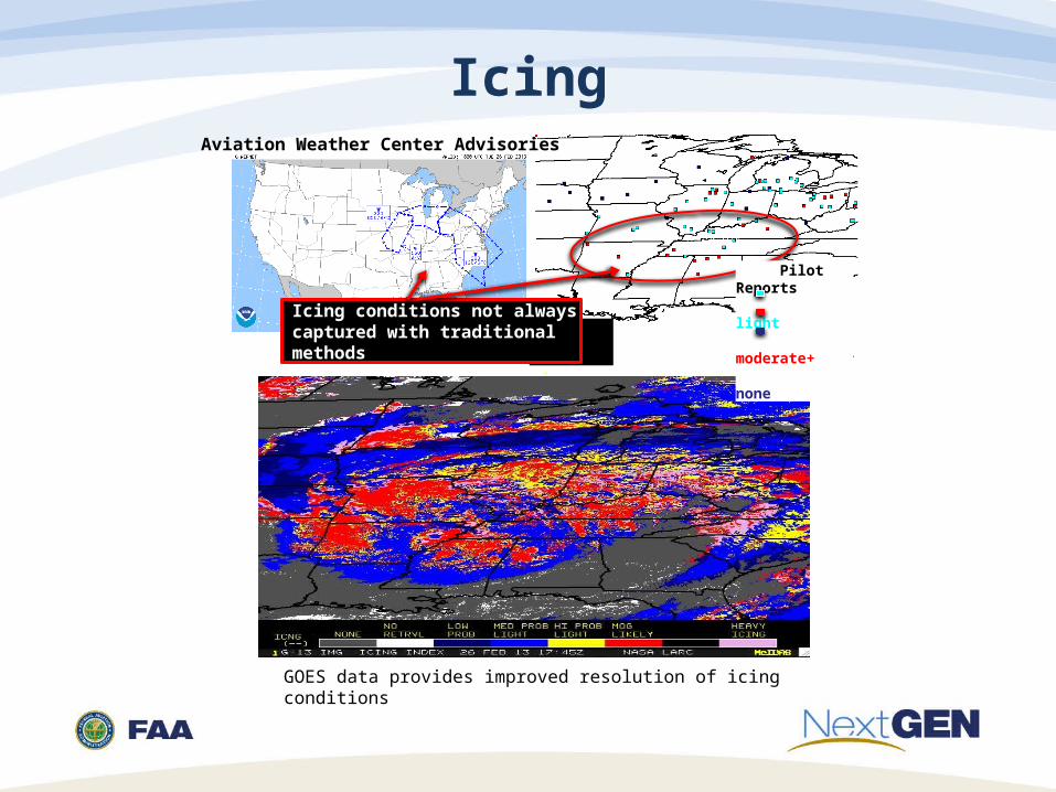
Icing
GOES data provides improved resolution of icing conditions
Pilot Reports light moderate+ none
Aviation Weather Center Advisories
Icing conditions not always captured with traditional methods
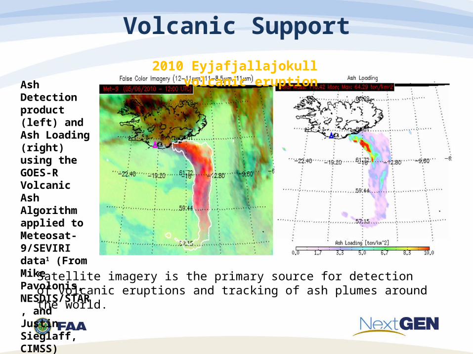
Volcanic Support
Ash Detection product (left) and Ash Loading (right) using the GOES-R Volcanic Ash Algorithm applied to Meteosat-9/SEVIRI data1 (From Mike Pavolonis, NESDIS/STAR, and Justin Sieglaff, CIMSS)
2010 Eyjafjallajokull volcanic eruption
Satellite imagery is the primary source for detection of volcanic eruptions and tracking of ash plumes around the world.
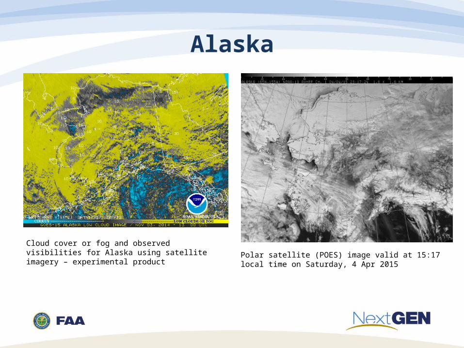
Alaska
Cloud cover or fog and observed visibilities for Alaska using satellite imagery – experimental product Polar satellite (POES) image valid at 15:17 local time on
Saturday, 4 Apr 2015
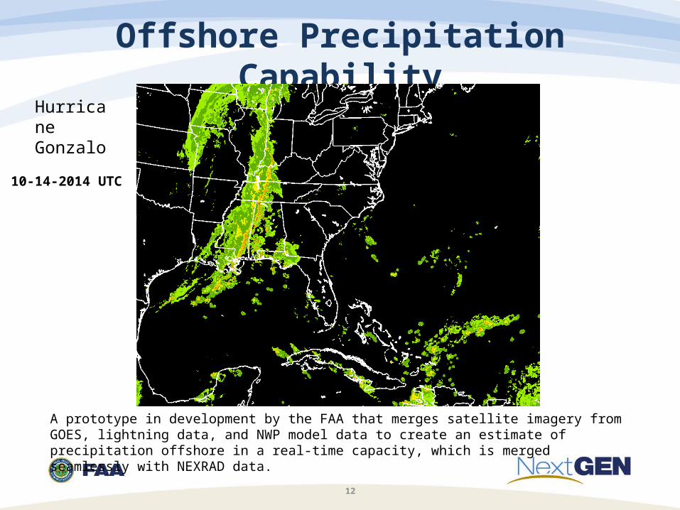
Offshore Precipitation Capability
12
10-14-2014 UTC
A prototype in development by the FAA that merges satellite imagery from GOES, lightning data, and NWP model data to create an estimate of precipitation offshore in a real-time capacity, which is merged seamlessly with NEXRAD data.
Hurricane Gonzalo
Aviation Weather Challenges
13
• Tactical versus strategic applications• Towers, Terminal Radar Approach Control Facilities, Air Route Traffic
Control Centers, the Air Traffic Control System Command Center, and airlines all have different weather needs at different timelines
• One size does not fit all• Bandwidth issues
• Amount of data possible from GOES-R, new numerical weather prediction models and other sources may overwhelm current communication circuits
• Weather Uncertainty• How to integrate uncertainty inherent in weather into decision support
tools for operations; probabilistic versus deterministic outputs• Weather solution independent: any new technology acquired by the FAA
should be able to utilize data output from any provider, especially NWS, to include satellite data