Embed Size (px)
Citation preview
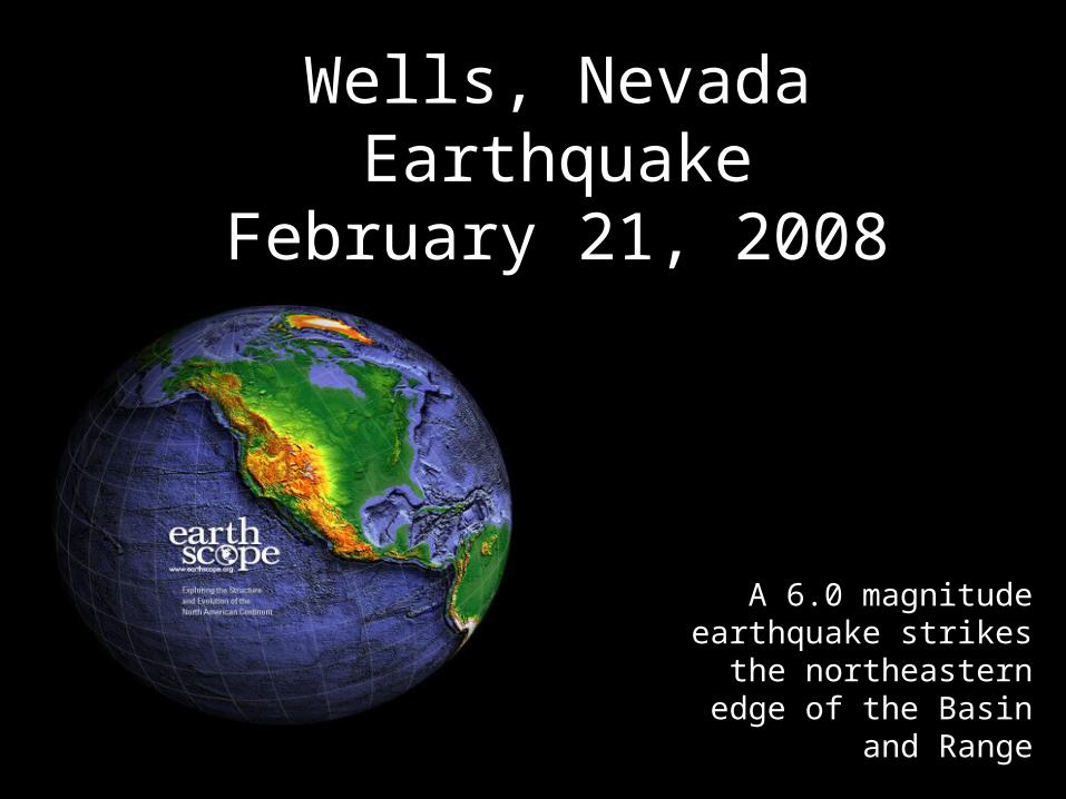
Wells, Nevada EarthquakeFebruary 21, 2008
A 6.0 magnitude earthquake strikes the
northeastern edge of the Basin and Range
Wells, Nevada Earthquake
Basin and Range
Parks and Plates©2005 Robert J. Lillie
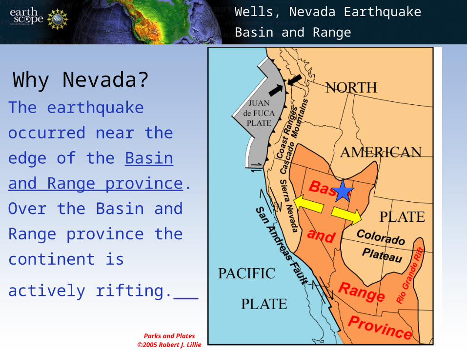
The earthquake
occurred near the edge
of the Basin and Range
province. Over the
Basin and Range
province the continent
is actively rifting.
Why Nevada?
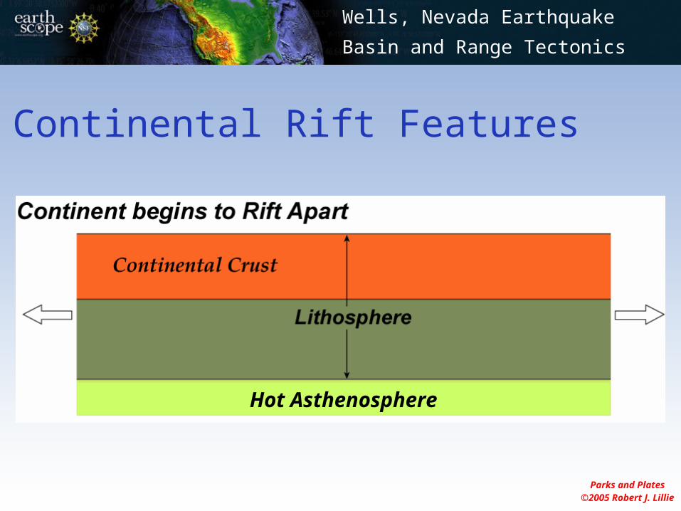
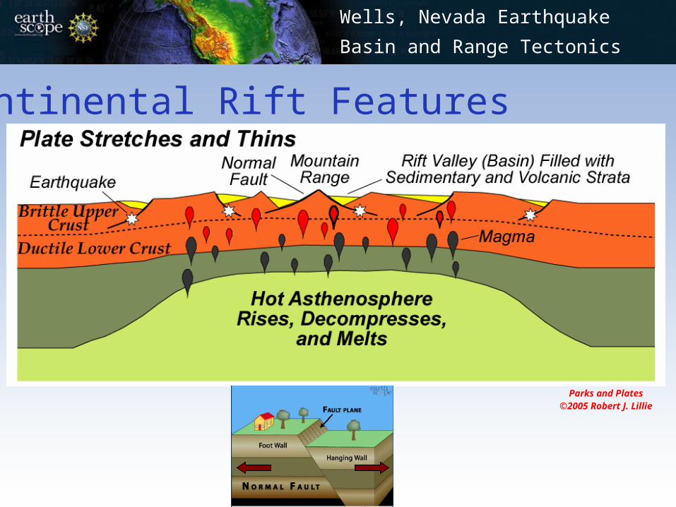
Continental Rift Features
Parks and Plates©2005 Robert J. Lillie
Hot Asthenosphere
Wells, Nevada Earthquake
Basin and Range Tectonics
Parks and Plates©2005 Robert J. Lillie
Wells, Nevada Earthquake
Basin and Range Tectonics
Continental Rift Features
Wells, Nevada Earthquake
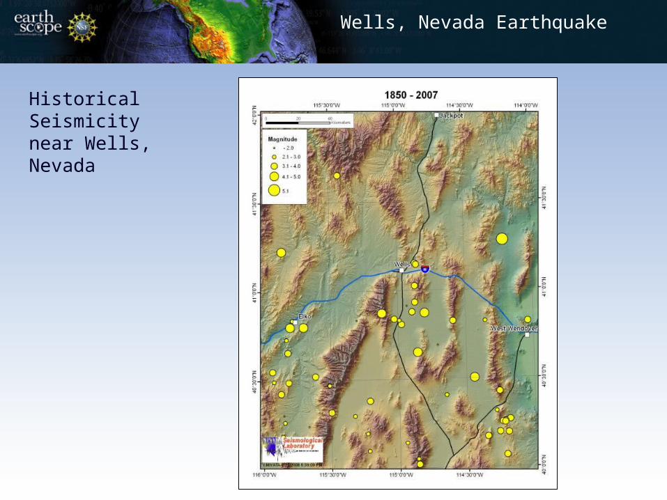
Historical Seismicity near Wells, Nevada
Wells, Nevada Earthquake
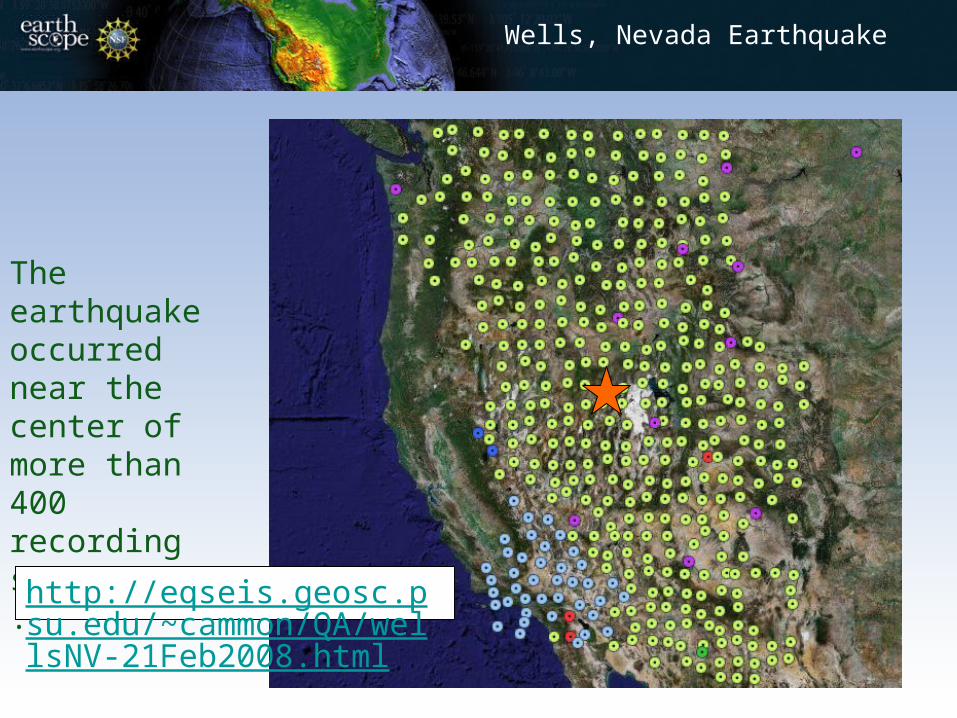
The earthquake occurred near the center of more than 400 recording seismometers.
http://eqseis.geosc.psu.edu/~cammon/QA/wellsNV-21Feb2008.html
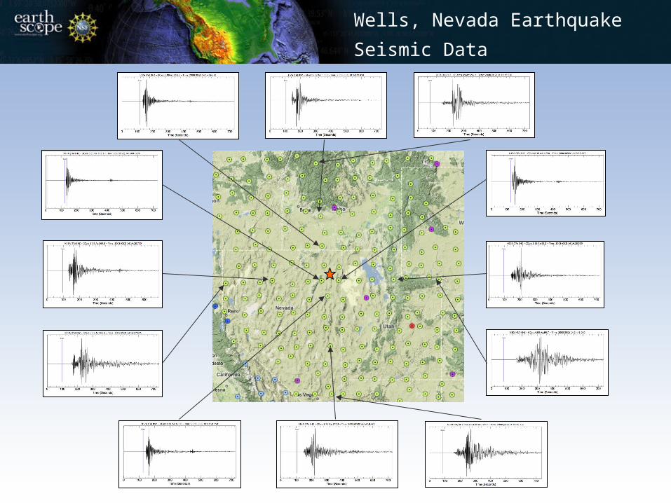
Wells, Nevada Earthquake
Seismic Data
Wells, Nevada Earthquake
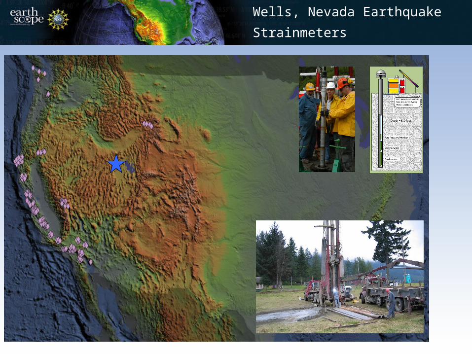
Strainmeters
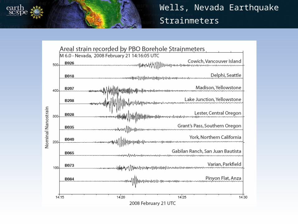
Wells, Nevada Earthquake
Strainmeters

(Hammond and Kreemer, University of Nevada Reno)
Wells, Nevada Earthquake
Horizontal Displacement
The actual source mechanism
(USGS)
The modeled source mechanism
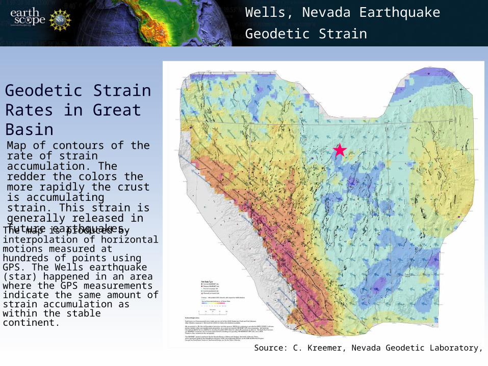
Source: C. Kreemer, Nevada Geodetic Laboratory, UNR.
Map of contours of the rate of strain accumulation. The redder the colors the more rapidly the crust is accumulating strain. This strain is generally released in future earthquakes. The map is produced by interpolation of horizontal motions measured at hundreds of points using GPS. The Wells earthquake (star) happened in an area where the GPS measurements indicate the same amount of strain accumulation as within the stable continent.
Geodetic Strain Rates in Great Basin
Wells, Nevada Earthquake
Geodetic Strain
• They are a part of EarthScope - a national earth science experiment. • EarthScope is:
• Exploring the structure and evolution of the North American continent.• Understanding the processes that cause earthquakes and volcanic
eruptions.
Wells, Nevada Earthquake
EarthScope
Why are there so many geophysical instruments in the West, anyway?
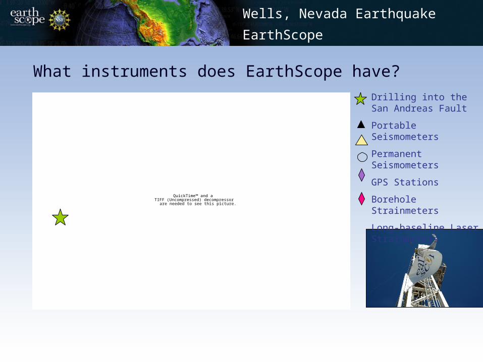
What instruments does EarthScope have?
Wells, Nevada Earthquake
EarthScope
QuickTime™ and aTIFF (Uncompressed) decompressor
are needed to see this picture.
Drilling into the San Andreas Fault
Portable Seismometers
Permanent Seismometers
GPS Stations
Borehole Strainmeters
Long-baseline Laser Strainmeters
Wells, Nevada Earthquake
EarthScope Partners