Embed Size (px)
Citation preview
WILDFIRE
MANAGEMENT TOOL WEB EDITION
Using NASA Web World Wind to Predict Wildfire Behavior
Southern California Government GIS User Group
Torrance, CA
September 16, 2015
http://emxsys.com
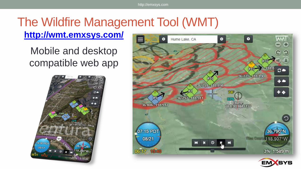
The Wildfire Management Tool (WMT)http://wmt.emxsys.com/
Mobile and desktop
compatible web app
http://emxsys.com
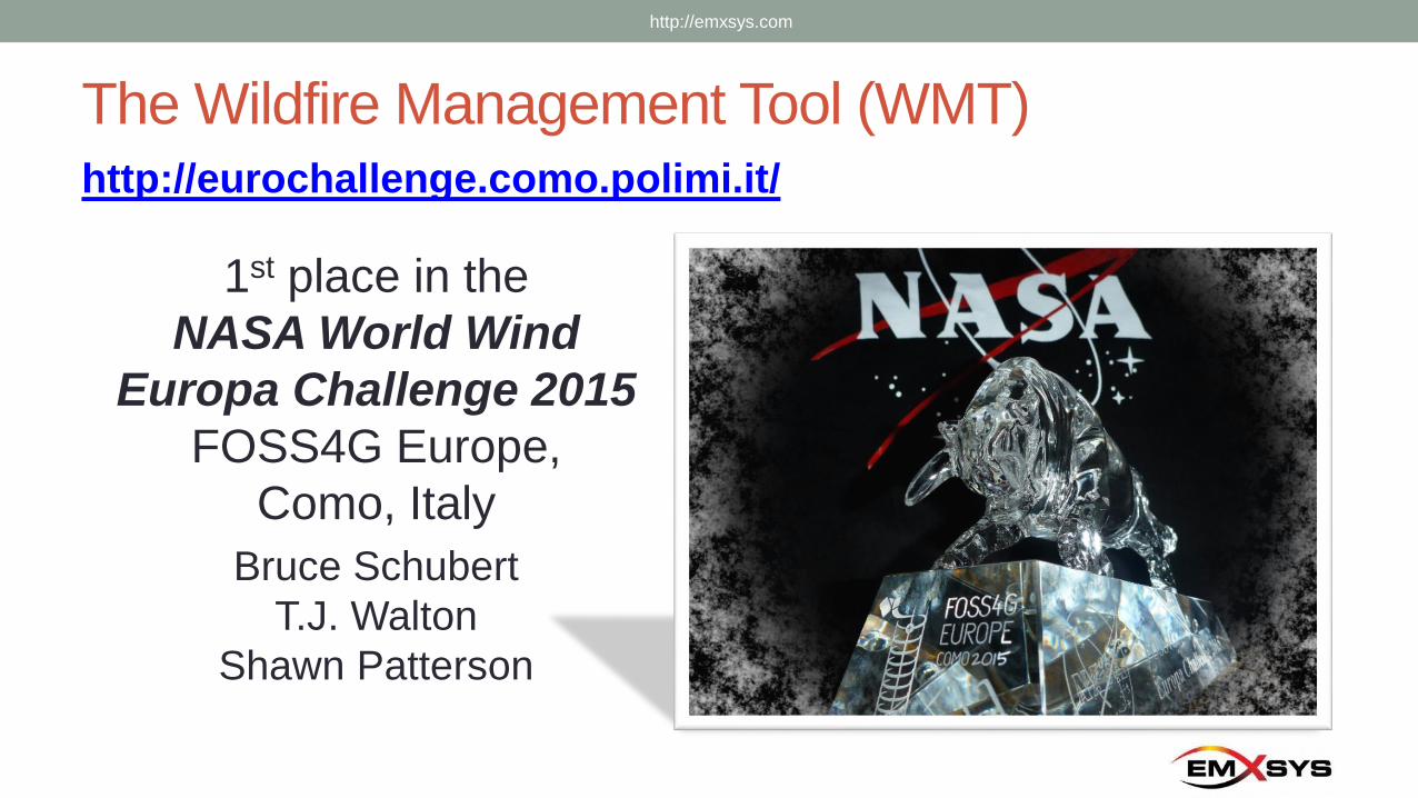
The Wildfire Management Tool (WMT)
1st place in the
NASA World Wind
Europa Challenge 2015
FOSS4G Europe,
Como, Italy
Bruce Schubert
T.J. Walton
Shawn Patterson
http://eurochallenge.como.polimi.it/
http://emxsys.com
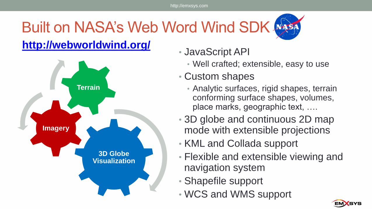
Built on NASA’s Web Word Wind SDKhttp://webworldwind.org/
• JavaScript API• Well crafted; extensible, easy to use
• Custom shapes• Analytic surfaces, rigid shapes, terrain
conforming surface shapes, volumes, place marks, geographic text, ….
• 3D globe and continuous 2D map mode with extensible projections
• KML and Collada support
• Flexible and extensible viewing and navigation system
• Shapefile support
• WCS and WMS support
3D Globe Visualization
Imagery
Terrain
http://emxsys.com
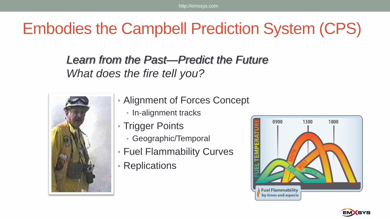
Embodies the Campbell Prediction System (CPS)
• Alignment of Forces Concept
• In-alignment tracks
• Trigger Points
• Geographic/Temporal
• Fuel Flammability Curves
• Replications
http://emxsys.com
Learn from the Past—Predict the Future
What does the fire tell you?
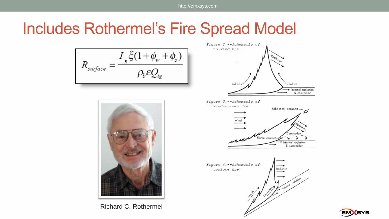
Includes Rothermel’s Fire Spread Model
http://emxsys.com
Richard C. Rothermel
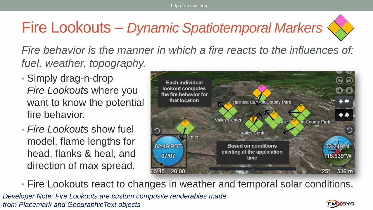
Fire Lookouts – Dynamic Spatiotemporal Markers
Fire behavior is the manner in which a fire reacts to the influences of:
fuel, weather, topography.
• Simply drag-n-drop
Fire Lookouts where you
want to know the potential
fire behavior.
• Fire Lookouts show fuel
model, flame lengths for
head, flanks & heal, and
direction of max spread.
• Fire Lookouts react to changes in weather and temporal solar conditions.Developer Note: Fire Lookouts are custom composite renderables made
from Placemark and GeographicText objects
http://emxsys.com
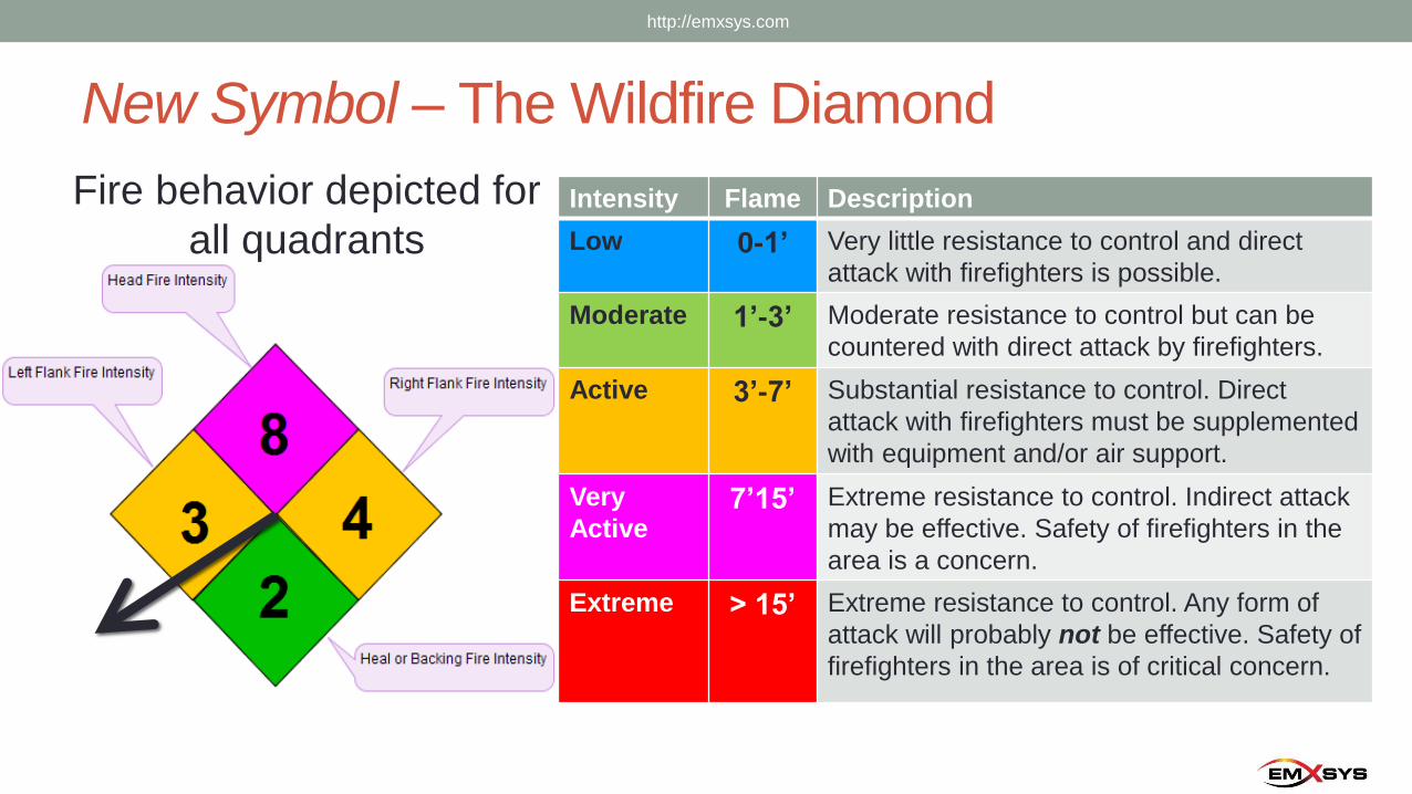
New Symbol – The Wildfire Diamond
Fire behavior depicted for
all quadrantsIntensity Flame Description
Low 0-1’ Very little resistance to control and direct
attack with firefighters is possible.
Moderate 1’-3’ Moderate resistance to control but can be
countered with direct attack by firefighters.
Active 3’-7’ Substantial resistance to control. Direct
attack with firefighters must be supplemented
with equipment and/or air support.
Very
Active7’15’ Extreme resistance to control. Indirect attack
may be effective. Safety of firefighters in the
area is a concern.
Extreme > 15’ Extreme resistance to control. Any form of
attack will probably not be effective. Safety of
firefighters in the area is of critical concern.
http://emxsys.com
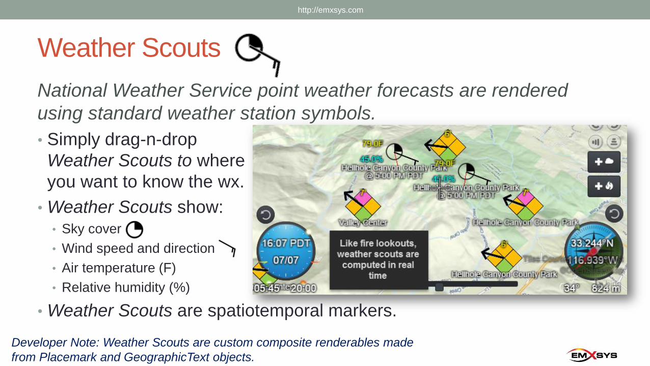
Weather Scouts
National Weather Service point weather forecasts are rendered
using standard weather station symbols.
• Simply drag-n-drop
Weather Scouts to where
you want to know the wx.
• Weather Scouts show:• Sky cover
• Wind speed and direction
• Air temperature (F)
• Relative humidity (%)
• Weather Scouts are spatiotemporal markers.
Developer Note: Weather Scouts are custom composite renderables made
from Placemark and GeographicText objects.
http://emxsys.com
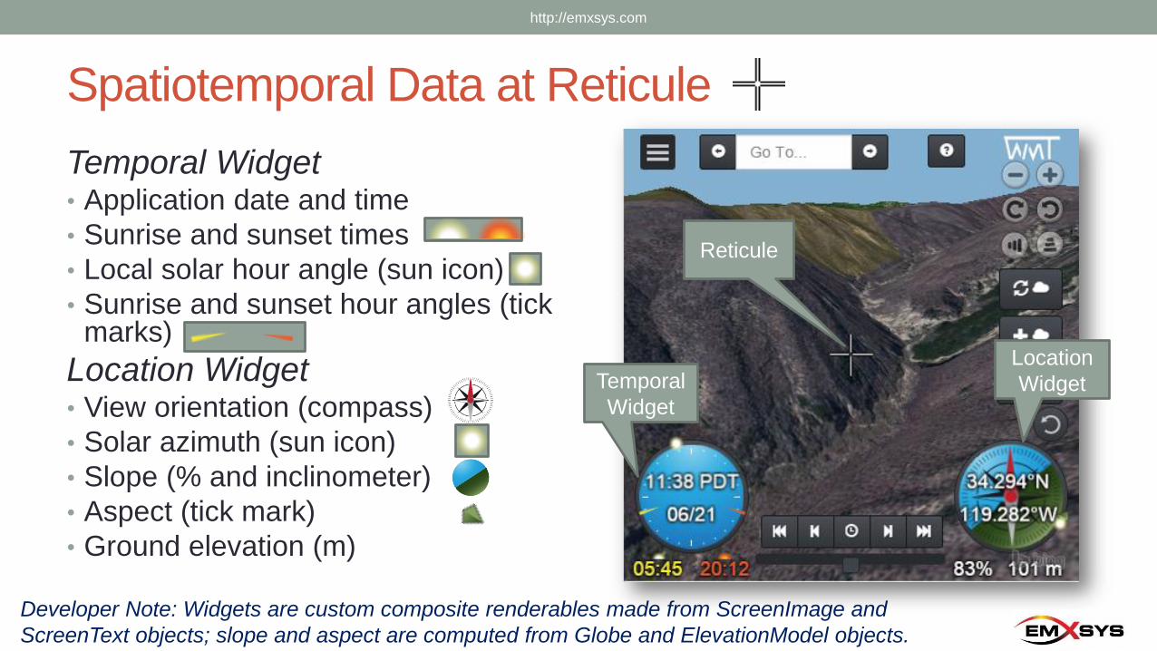
Spatiotemporal Data at Reticule
Temporal Widget• Application date and time
• Sunrise and sunset times
• Local solar hour angle (sun icon)
• Sunrise and sunset hour angles (tick marks)
Location Widget• View orientation (compass)
• Solar azimuth (sun icon)
• Slope (% and inclinometer)
• Aspect (tick mark)
• Ground elevation (m)
Developer Note: Widgets are custom composite renderables made from ScreenImage and
ScreenText objects; slope and aspect are computed from Globe and ElevationModel objects.
Temporal
Widget
Location
Widget
Reticule
http://emxsys.com
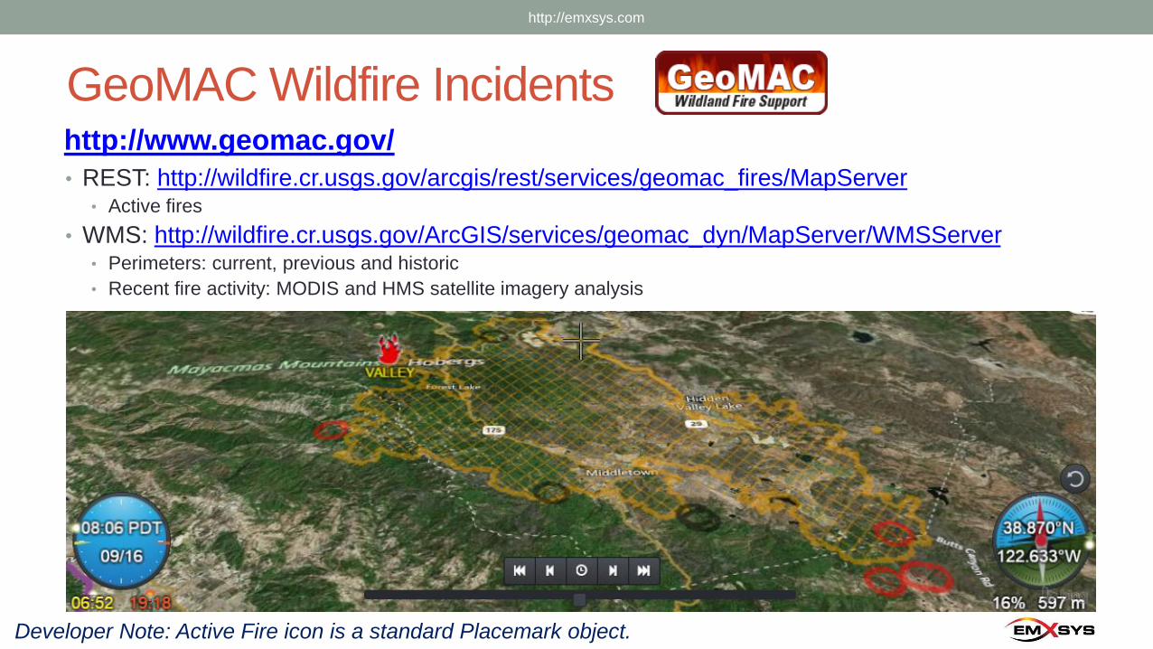
GeoMAC Wildfire Incidentshttp://www.geomac.gov/
• REST: http://wildfire.cr.usgs.gov/arcgis/rest/services/geomac_fires/MapServer• Active fires
• WMS: http://wildfire.cr.usgs.gov/ArcGIS/services/geomac_dyn/MapServer/WMSServer• Perimeters: current, previous and historic
• Recent fire activity: MODIS and HMS satellite imagery analysis
Developer Note: Active Fire icon is a standard Placemark object.
http://emxsys.com
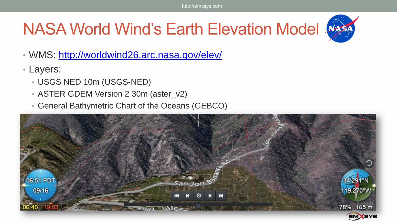
NASA World Wind’s Earth Elevation Model
• WMS: http://worldwind26.arc.nasa.gov/elev/
• Layers:
• USGS NED 10m (USGS-NED)
• ASTER GDEM Version 2 30m (aster_v2)
• General Bathymetric Chart of the Oceans (GEBCO)
http://emxsys.com
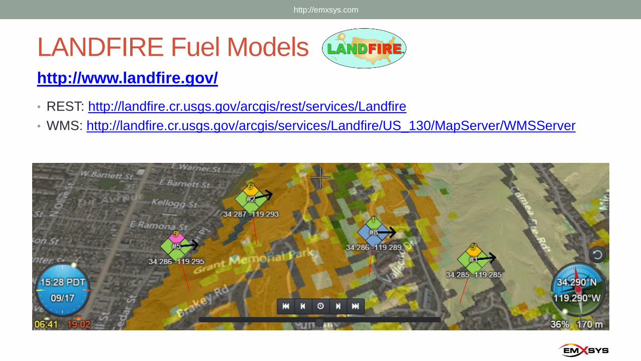
LANDFIRE Fuel Models
• REST: http://landfire.cr.usgs.gov/arcgis/rest/services/Landfire
• WMS: http://landfire.cr.usgs.gov/arcgis/services/Landfire/US_130/MapServer/WMSServer
http://www.landfire.gov/
http://emxsys.com
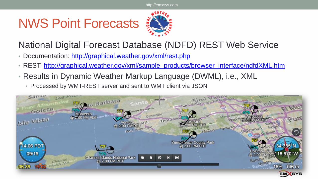
NWS Point Forecasts
National Digital Forecast Database (NDFD) REST Web Service • Documentation: http://graphical.weather.gov/xml/rest.php
• REST: http://graphical.weather.gov/xml/sample_products/browser_interface/ndfdXML.htm
• Results in Dynamic Weather Markup Language (DWML), i.e., XML• Processed by WMT-REST server and sent to WMT client via JSON
http://emxsys.com
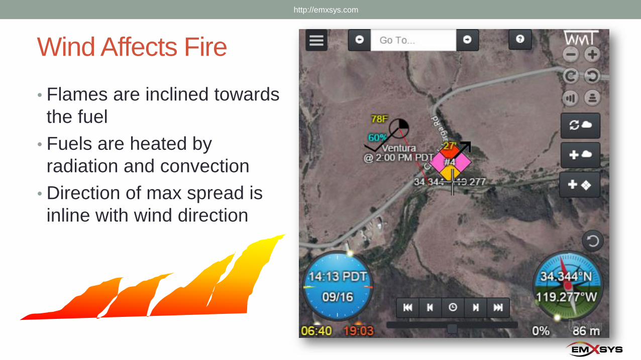
Wind Affects Fire
• Flames are inclined towards
the fuel
• Fuels are heated by
radiation and convection
• Direction of max spread is
inline with wind direction
http://emxsys.com
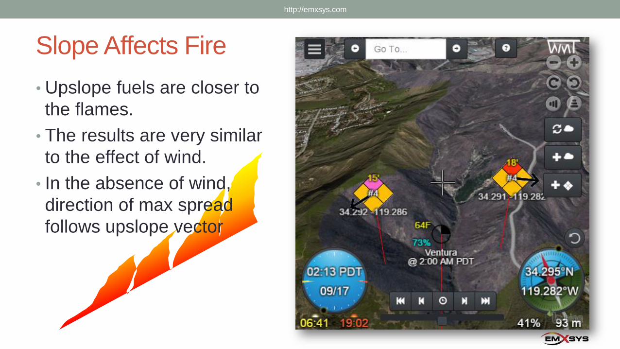
Slope Affects Fire
• Upslope fuels are closer to
the flames.
• The results are very similar
to the effect of wind.
• In the absence of wind,
direction of max spread
follows upslope vector
http://emxsys.com
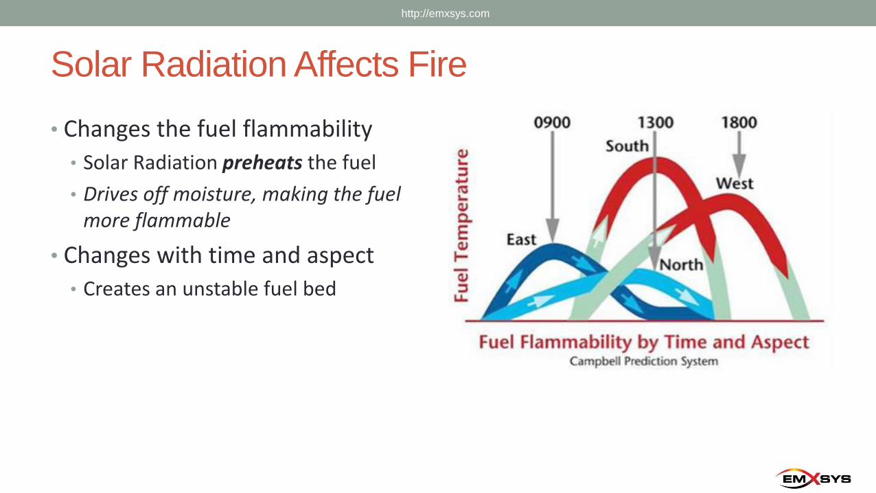
Solar Radiation Affects Fire
• Changes the fuel flammability
• Solar Radiation preheats the fuel
• Drives off moisture, making the fuel more flammable
• Changes with time and aspect
• Creates an unstable fuel bed
http://emxsys.com
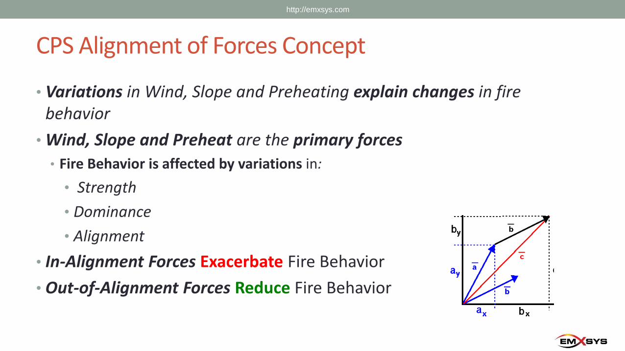
CPS Alignment of Forces Concept
• Variations in Wind, Slope and Preheating explain changes in fire behavior
• Wind, Slope and Preheat are the primary forces
• Fire Behavior is affected by variations in:
• Strength
• Dominance
• Alignment
• In-Alignment Forces Exacerbate Fire Behavior
• Out-of-Alignment Forces Reduce Fire Behavior
http://emxsys.com
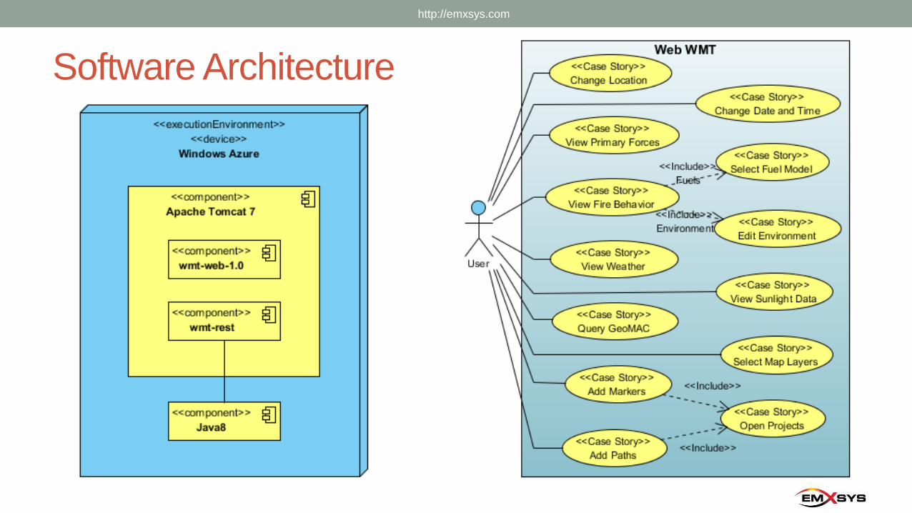
Software Architecture
http://emxsys.com
In Closing
• Email:
• “Bruce Schubert” [email protected]
• Website:
• http://emxsys.com
• WMT Web App:
• http://wmt.emxsys.com
• Wildfire Management Tool – Web open source project
(wiki, issue tracker, and source code):
• https://bitbucket.org/emxsys/wildfire-management-tool-web/
http://emxsys.com