Embed Size (px)
DESCRIPTION
Wroxeter Conservation Management PlanRoman city in the West Midlands of England.ROGER WHITE, JENNY MARRIOTT and MALCOLM REID JULY 2009; REVISED JULY 2010 for English Heritage.
Citation preview
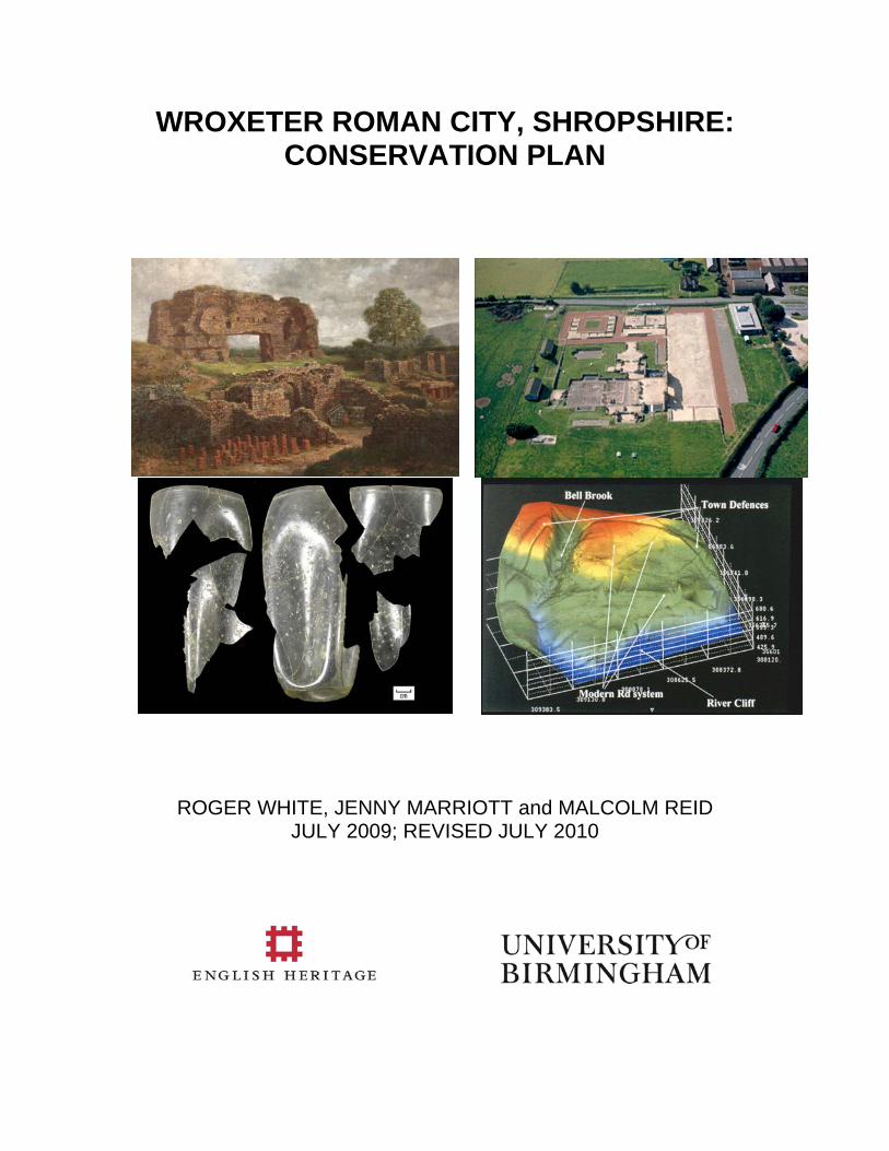
WROXETER ROMAN CITY, SHROPSHIRE: CONSERVATION PLAN
ROGER WHITE, JENNY MARRIOTT and MALCOLM REID JULY 2009; REVISED JULY 2010
CONTENTS
List of Acronyms v
List of Figures vi
List of Heritage Assets by Heritage Asset Type and a guide to their use ix
Key to HLC Map ( Figure 2.27) xii
EXECUTIVE SUMMARY: BREATHING LIFE INTO WROXETER 1
CHAPTER 1. THE NEED FOR A CONSERVATION PLAN 2
1. The aims and objectives of the Wroxeter Conservation Plan 2
CHAPTER 2. CHARACTERISING THE DEFINED AREA 6
2.1 Definition of the study area 6
2.2 Ownership and current land use 6
2.3 Physical Character of the defined area 6
2.4 Vegetation and Ecology 10
2.5 Heritage 12
2.5.1 Initial investigations 12
2.5.2. Wroxeter discovered 13
2.5.3 The State intervenes 14
2.5.4 Buildings and other surveys 16
2.5.6 Chronological summary of development 21
CHAPTER 3. WHY WROXETER MATTERS: THE SIGNIFICANCE OF THE DEFINED AREA
24
Evidential 24
Historical 32
Aesthetic 34
Communal 38
ii
CHAPTER 4. MANAGING WROXETER TODAY: CURRENT ISSUES AND RELATIONSHIP TO NATIONAL AND LOCAL POLICIES
41
4.1 Towards a new land management process 41
4.2 Building management 44
4.3 Opportunities/constraints within the policy framework for retaining significance and realising potential
44
4.4 Outcomes from the consultation process 49
4.4 Consideration of an extension to statutory protection for parts of the site 49
CHAPTER 5: MANAGEMENT RECOMMENDATIONS 50
Evidential 50
Historical 52
Aesthetic 53
Communal 55
Appendix 1: List of sources used in compiling the Conservation Plan 57
Appendix 2: Consultation Process 58
Appendix 3: Wroxeter Visitor Survey, March-April 2009 (data supplied by Kate Churchill). Taken from 73 responses (198 individuals)
60
Appendix 4: DCMS Listings for Historic Buildings in Wroxeter study area (Source: Heritage Gateway)
62
Appendix 5: List of the main national, regional and local policy documents relating to cultural/historic environment/biodiversity matters:
63
Appendix 6: Current Management Issues relating to the Monument 64
BIBLIOGRAPHY 73
iii

Acknowledgements The authors are extremely grateful to everyone who has helped in the compilation of this report. Of key importance of course were the English Heritage staff, notably Heather Sebire, William Du Croz and Tony Fleming who commissioned and monitored the report through its many and varied drafts, responding at all times with courtesy and rapidity. Others in the organisation who supplied useful detail about the functioning of the site and their role in running it were Nola and Steve Ames, Mark Badger, Jo Beach, Heather Bird, Emma Carver, Graham Deacon, Tim Johnson, Bill Klemperer, Jeremy Lake, Sara Lunt, Russell Man, Cameron Moffett, Pete Wilson and Richard Zeizer. In addition to the English Heritage staff we received much co-operation from individuals within other organisations with an interest in Wroxeter, not least Jeremy Milln and Bob Thurston of the National Trust, Jez Bretherton of English Nature and Michael Eaton, Hugh Hannaford, Emma-Kate Lanyon, Nigel Nixon, Penny Ward, Andy Wigley, Mary White, Fran Yaroll and Liz Young of Shropshire Council. From the local community we would like to thank especially Brian Nelson (Wroxeter & Uppington PC), Nigel Baker, Ed Hall (Wroxeter Hotel), The Millington Family and Richard Jones-Perrott and Andrew Lewis of the Raby Estate. James Lawson, Peter Kienzle, Peter Wade-Martins and Hilary Cool provided academic support and information on aspects of Wroxeter’s past while Kate Churchill took on the task of carrying out a visitor survey. Finally at Birmingham Archaeology Roger White would especially like to acknowledge the support of their Finance Manager Caroline Raynor and chief illustrator, Nigel Dodds, who supplied the necessary maps.
iv
List of acronyms AMP Asset Management Plan ARC Archaeological Resource Centre BAR Buildings at Risk BTCV British Trust for Conservation Volunteers CCT Churches Conservation Trust CMP Conservation Management Plan CP Conservation Plan CSS Countryside Stewardship Scheme DCMS Department of Media, Culture and Sport DEFRA Department for Environment Food and Rural Affairs DoE Department of Environment EH English Heritage ELS Entry Level Scheme ESA Environmental Stewardship Agreement GI Green Infrastructure HAR Heritage at Risk HLC Historic Landscape Character/Characterisation HLF Heritage Lottery Fund HLS Higher Level Scheme HPA Heritage Partnership Agreement LDF Local Development Framework NT National Trust SC Shropshire Council WHP Wroxeter Hinterland Project WRC Wroxeter Roman City
v
List of Figures Executive summary The Old Work 1.1 Location of Wroxeter Village and the Roman Town of Viroconium Cornoviorum
1.2 Viroconium Roman Town and the village of Wroxeter: scheduled area.
2.1: Land ownership and land management survey at WRC (Source: White 1976). The shaded strip of land on the east side of the site, from south of the Bell Brook to the B4380, has since been acquired by English Heritage.
2.2: Soils within a 1km radius of WRC (outlined) and the course of the River Severn. The radius of the catchment is calculated from the outer limits of the town.
2.3: Soils groups within a 5km radius of WRC (outlined), with the course of the river Severn.
2.4: HAN218, the river cliff and floodplain from north of ‘The Cottage’. 2.5: Stream bank below Mount Pleasant buildings.
2.6: Bell Brook valley, eastern half from east.
2.7: Aerial view of Bell Brook valley, western half from SE.
2.8: Sycamore plantation HAN216 from the west. Note ivy growth on tree boles and on boundary wall HAN408 in the foreground.
2.9: Copse and scrub north of Bell Brook at western entrance to town.
2.10: HAN600, a black mulberry (Morus nigra) in the field opposite the Wroxeter Hotel. Note protective fencing.
2.11: Leylandii hedge flanking the holloway to the ford (HAN411) at The Boathouse (opposite the Church of St Andrew).
2.12: Aerofilms view of Wroxeter Baths, 1929 (NMR AFL03 25 28868).
2.13: Dr Arnold Baker (rear cockpit) on another Wroxeter flight.
2.14: Wroxeter aqueduct (HAN557) photographed by Dr Graham Webster before its destruction.
2:15: The gradiometry survey of WRC produced collaboratively by GSB Prospection and English Heritage.
2.16: The north side of St Andrew’s, Wroxeter (HAN111). 2.17: The gates of St Andrew’s with re-used Roman columns (HAN120). 2.18: The Grange and its gazebo, HAN112 & 113 (right). 2.19: Glebe Cottage HAN115. 2.20: The Old Post Office HAN113. 2.21: The Old School House HAN114. 2.22: Wroxeter Hotel HAN110. 2.23: Mount Pleasant Cottages HAN117.
vi
2.24: HAN100,The former Smithy (latterly the Post Office) at the Wroxeter crossroads. 2.25: HAN104, 1 & 2 The Ruins. A back-to-back cottage built for Raby Estate tenants.
Detached pig sties to right. 2.26: HAN101, Wroxeter Farm, a fine model farm of 1850-1880. 2.27: Historic Landscape Character Assessment for WRC and environs © Shropshire
Council courtesy of Dr Andy Wigley. (Key at end of list of illustrations)
2.28: John Rocque’s map of Wroxeter produced in 1746 (SA 6900/1).
2.29:The bank of the River Severn at Wroxeter with waterlogged tree-stumps in gravel (foreground).
2.30: The cliff lane at Wroxeter (HAN407), suggested by Bassett (1990) to be pre-Roman in date.
2.31: The suggested developed of WRC, from fortress (top left) to Brittonic town (bottom right). Source: White & Barker 1998.
2.32: The site of Wroxeter’s Medieval manor house (HAN306), viewed from the church tower.
2.33: The green lane (HAN402) leading to Wroxeter’s former east gate showing the reverse S shape imposed during the middle ages.
3.1: The Old Work and the baths (HAN118 and 119) under snow. 3.2: WRC’s defences (HAN305), behind Glebe Cottage. 3.3: The Breidden from Wroxeter with Atcham village (foreground).
3.4: Lawley and Caer Caradoc from Wroxeter.
3.5: The cropmarks around Norton Farm (HAN556) as plotted by RCHME [English Heritage].
3.6: The Forum Inscription, Rowley’s House Museum. Dated to AD 129-130 it is acknowledged as the finest Roman Inscription in Britain.
3.7: WRC from the Wrekin. The white Wroxeter Hotel can clearly be seen immediately above the rape field in the centre ground.
3.8: Thomas Girtin’s watercolour of the North side of the Old Work with Wroxeter Church framed in the doorway. The pond in the foreground has been transposed from the other side of the wall since a contemporary watercolour shows the north field under the plough.
3.9: Stereoscopic souvenir photograph of Wright’s excavations, 1859. Note 1 & 2 The Ruins visible behind the spoil heap.
3.10: Thomas Prytharch’s ‘The Fall of Uriconium’ (ca.1920) English Heritage, Kenilworth Castle
3.11: The Wroxeter Mirror. A 30 troy oz. silver mirror, one of the finest examples surviving from the ancient world.
3.12: Amédée Forestier’s reconstruction of Wroxeter Forum.
3.13: Alan Sorrell’s reconstruction of the Bushe-Fox buildings.
3.14: School children reconstruct the columns of the baths basilica.
vii
3.15: Fran Yarroll of Shropshire Museum Service dressing school children in Roman costume.
3.16: Volunteers collecting resistivity data during an open day in 1996.
3.17: County archaeologist Mike Watson guiding visitors at Wroxeter in 1996.
4.1: Land ownership and access to scheduled area (source: Barlow Associates (2008).
5.1: Key sites identified for protection.
5.2: The late 5th century tombstone of Cunorix.
5.3: Wroxeter’s street grid made visible in HAN207 during a drought.
5.4: Attingham Park Estate, as shown on the newly installed panel in the Welcome Centre at Attingham Park.
5.5: The 2009 footbridge installed over the River Tern within Attingham Park.
5.6: Timescope. A method for interpreting ruins. http://www.ename974.org/Eng/pagina/ archeo_concept.html
6.1: Visitors viewing the baths basilica interpretation. Note the bleeding of coloured gravels and moss growth.
6.2: HAN119, The baths as first laid out, in 1992, demonstrating original clear delineation of colour coding.
6.3: On-going damage to the monument. From left to right: original herringbone floor decaying; east baths praefurnium wall; animal and other damage in natatio.
6.4: Mole damage, south of the baths in HAN207.
6.5: Poaching by cattle on either side of the Bell Brook in HAN200 & 203.
6.6: Ruts caused by farm traffic to feed stock.
6.7: Lime dump on HAN224, adjacent to Norton Farm.
6.8: Chestnut paling and concrete-and wire fence in baths field.
6.9: Wooden gate buried in overgrown hedge.
6.10: Unrecorded Roman stone HAN410 in Grange garden wall.
6.11; Unrecorded wall (HAN409) defining The Cottage.
6.12: Silts deposited in HAN203 by the Bell Brook adjacent to B4394.
6.13: Ivy understorey in Sycamore plantation HAN216.
6.14: Fly tipping / fence repair adjacent to B4394.
6.15: HAN101, Wroxeter Farm and its farmyard.
6.16: Derelict pig sties behind 1 & 2 The Ruins.
6.17: Original 1980s gate notice.
viii
WROXETER ROMAN CITY (SHROPSHIRE SCHEDULED ANCIENT MONUMENT NO.670):
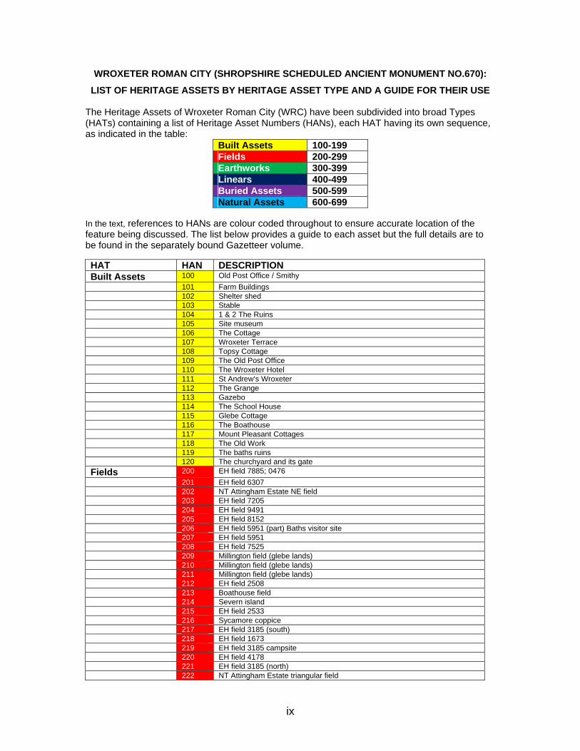
LIST OF HERITAGE ASSETS BY HERITAGE ASSET TYPE AND A GUIDE FOR THEIR USE The Heritage Assets of Wroxeter Roman City (WRC) have been subdivided into broad Types (HATs) containing a list of Heritage Asset Numbers (HANs), each HAT having its own sequence, as indicated in the table:
Built Assets 100-199 Fields 200-299 Earthworks 300-399 Linears 400-499 Buried Assets 500-599 Natural Assets 600-699
In the text, references to HANs are colour coded throughout to ensure accurate location of the feature being discussed. The list below provides a guide to each asset but the full details are to be found in the separately bound Gazetteer volume. HAT HAN DESCRIPTION Built Assets 100 Old Post Office / Smithy 101 Farm Buildings 102 Shelter shed 103 Stable 104 1 & 2 The Ruins 105 Site museum 106 The Cottage 107 Wroxeter Terrace 108 Topsy Cottage 109 The Old Post Office 110 The Wroxeter Hotel 111 St Andrew’s Wroxeter 112 The Grange 113 Gazebo 114 The School House 115 Glebe Cottage 116 The Boathouse 117 Mount Pleasant Cottages 118 The Old Work 119 The baths ruins 120 The churchyard and its gate Fields 200 EH field 7885; 0476 201 EH field 6307 202 NT Attingham Estate NE field 203 EH field 7205 204 EH field 9491 205 EH field 8152 206 EH field 5951 (part) Baths visitor site 207 EH field 5951 208 EH field 7525 209 Millington field (glebe lands) 210 Millington field (glebe lands) 211 Millington field (glebe lands) 212 EH field 2508 213 Boathouse field 214 Severn island 215 EH field 2533 216 Sycamore coppice 217 EH field 3185 (south) 218 EH field 1673 219 EH field 3185 campsite 220 EH field 4178 221 EH field 3185 (north) 222 NT Attingham Estate triangular field
ix
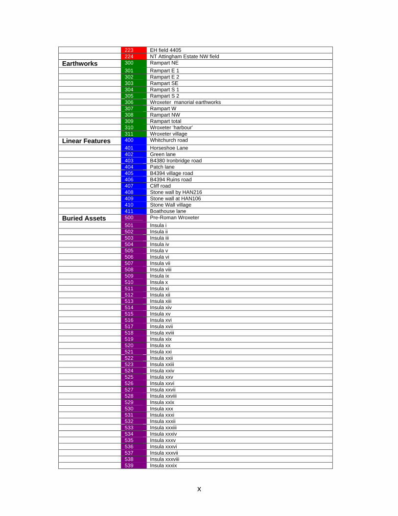
223 EH field 4405 224 NT Attingham Estate NW field Earthworks 300 Rampart NE 301 Rampart E 1 302 Rampart E 2 303 Rampart SE 304 Rampart S 1 305 Rampart S 2 306 Wroxeter manorial earthworks 307 Rampart W 308 Rampart NW 309 Rampart total 310 Wroxeter ‘harbour’ 311 Wroxeter village Linear Features 400 Whitchurch road 401 Horseshoe Lane 402 Green lane 403 B4380 Ironbridge road 404 Patch lane 405 B4394 village road 406 B4394 Ruins road 407 Cliff road 408 Stone wall by HAN216 409 Stone wall at HAN106 410 Stone Wall village 411 Boathouse lane Buried Assets 500 Pre-Roman Wroxeter 501 Insula i 502 Insula ii 503 Insula iii 504 Insula iv 505 Insula v 506 Insula vi 507 Insula vii 508 Insula viii 509 Insula ix 510 Insula x 511 Insula xi 512 Insula xii 513 Insula xiii 514 Insula xiv 515 Insula xv 516 Insula xvi 517 Insula xvii 518 Insula xviii 519 Insula xix 520 Insula xx 521 Insula xxi 522 Insula xxii 523 Insula xxiii 524 Insula xxiv 525 Insula xxv 526 Insula xxvi 527 Insula xxvii 528 Insula xxviii 529 Insula xxix 530 Insula xxx 531 Insula xxxi 532 Insula xxxii 533 Insula xxxiii 534 Insula xxxiv 535 Insula xxxv 536 Insula xxxvi 537 Insula xxxvii 538 Insula xxxviii 539 Insula xxxix
x

xi
540 Insula xxxx 541 Insula xxxxi 542 Insula xxxxii 543 Insula xxxxiii 544 Insula xxxxiv 545 Insula xxxxv 546 Insula xxxxvi 547 Insula xxxxvii 548 Insula xxxxviii 549 Cemetery (north) 550 Middle Crows Green cemetery 551 Legionary fortress and associated features 552 Early Civil town AD90-120 553 Mature Roman town AD120-500 554 Late Roman / Post-Roman town AD500-650 555 Medieval village AD650-1600 556 Norton cropmarks 557 Line of aqueduct Natural Assets 600 Black Mulberry 601 Veteran Oak
-- -- --
xii
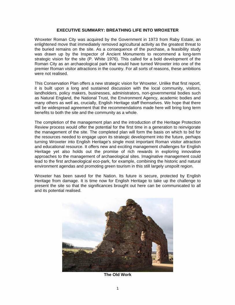
EXECUTIVE SUMMARY: BREATHING LIFE INTO WROXETER Wroxeter Roman City was acquired by the Government in 1973 from Raby Estate, an enlightened move that immediately removed agricultural activity as the greatest threat to the buried remains on the site. As a consequence of the purchase, a feasibility study was drawn up by the Inspector of Ancient Monuments to recommend a long-term strategic vision for the site (P. White 1976). This called for a bold development of the Roman City as an archaeological park that would have turned Wroxeter into one of the premier Roman visitor attractions in the country. For all sorts of reasons, these ambitions were not realised. This Conservation Plan offers a new strategic vision for Wroxeter. Unlike that first report, it is built upon a long and sustained discussion with the local community, visitors, landholders, policy makers, businesses, administrators, non-governmental bodies such as Natural England, the National Trust, the Environment Agency, academic bodies and many others as well as, crucially, English Heritage staff themselves. We hope that there will be widespread agreement that the recommendations made here will bring long term benefits to both the site and the community as a whole. The completion of the management plan and the introduction of the Heritage Protection Review process would offer the potential for the first time in a generation to reinvigorate the management of the site. The completed plan will form the basis on which to bid for the resources needed to engage upon its strategic development into the future, perhaps turning Wroxeter into English Heritage’s single most important Roman visitor attraction and educational resource. It offers new and exciting management challenges for English Heritage yet also holds out the promise of rich rewards in exploring innovative approaches to the management of archaeological sites. Imaginative management could lead to the first archaeological eco-park, for example, combining the historic and natural environment agendas and promoting green tourism in this still largely unspoilt region. Wroxeter has been saved for the Nation. Its future is secure, protected by English Heritage from damage. It is time now for English Heritage to take up the challenge to present the site so that the significances brought out here can be communicated to all and its potential realised.
The Old Work
1
CHAPTER 1. THE NEED FOR A CONSERVATION PLAN 1. The aims and objectives of the Wroxeter Conservation Plan This document has been commissioned by English Heritage (EH) to inform the long term preservation and interpretation of Wroxeter Roman city. It is also the first step in the establishment of a Heritage Partnership Agreement (HPA) for Wroxeter Roman City (WRC), Shropshire (Figure 1.1). that will enable English Heritage, as owners of a large part of the archaeological site, to develop mechanisms for its long-term management. Future management is best achieved through the mechanism of a Conservation Management Plan (CMP) for the site which will be drawn up in the light of the recommendations offered here, along with other considerations and consultations. The operation of the CMP would be as part of the future HPA for the site. The main aim of this document is to develop an understanding of the significance of the archaeological remains at WRC and to arrive at management recommendations for future development of the site based on that understanding. The defined area studied here is a living and evolving environment and this Conservation Plan (CP) provides a strategy to manage these remains, to explore its strategic elements and to arrive at a means of broadening understanding and appreciation of the site among those who live and work there as well as those who visit it. Establishment of a Heritage Partnership Agreement will see EH engaging with other stakeholders to actively promote the interests of the monument to the benefit of all. Decisions made by EH regarding the future of the site will use this CP as guidance in forming their own views on how the site might be managed. The constraints of time and opportunity mean that the Conservation Plan has not been able to explore fully all options through consultation. However, the plan is not a finalised document and will always be open to revision in the light of further developments and comments from interested parties.
This document is structured to reflect the purpose of the EH Commission (Sebire 2/2/08). These were:
• To inform the management of the monument in order to continue to protect and sustain its significance;
• To inform the long term strategy for the site; • To inform the maintenance of the site to an exemplary conservation standard; • To inform the management of current levels of public access and enjoyment and
where appropriate identify additional opportunities; • To inform the interpretation of the site in a way that enhances the visitor
experience without adversely impacting on its significance; • To inform English Heritage on the most appropriate use of all the assets,
especially the farm buildings and residential properties. The brief further stipulated that the significance of the site be considered in light of Conservation Principles (English Heritage 2008) whereby the Evidential, Historical, Aesthetic and Communal aspects of the site are considered. Accordingly the aims, methods and objectives of this document can be set out thus:
2
3
Aims
• to provide a management framework for Wroxeter Roman City that will incorporate data in respect of the archaeological resource mapped in relation to the existing landscape;
• to assess the current understanding of the condition and values of the site in all its aspects; archaeological, ecological, historical, aesthetic and communal so as to arrive at an understanding of the significance of the monument at local, regional, national and international levels;
• to institute a mechanism by which English Heritage can engage with all stakeholders in the future management of the monument through a Heritage Partnership Agreement;
• to develop an understanding of the nature and importance of the archaeological resource that can be communicated to the public and form the basis of relevant management policies.
Methods
• use of walk-over survey and desk-based research into all aspects of the site to provide a detailed consideration of the existing state of the monument, its relationship to the surrounding landscape and an assessment of the extent and quality of the underlying archaeological resource. The desk-based and other sources used to compile this report are listed in Appendix 1 while the gazetteer of heritage assets is bound as a separate annex;
• broad consultation through face-to-face stakeholder meetings with relevant groups including representatives at national, county and district levels and of stakeholder organisations and individuals (Appendix 2);
• consultation with the local community and provision of visitor statistics (Appendix 3).
Objectives
• to produce a Conservation Plan for Wroxeter Roman City that will realise its potential as a visitor attraction without compromising the archaeological and natural resource;
• to highlight the significance and values of the site to visitors and stakeholders alike;
• to make recommendations on how the monument might be managed into the future in a sustainable and coherent fashion following the formulation of a coherent strategic vision for the site;
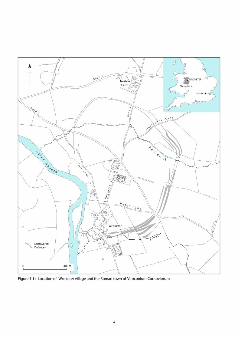
• to understand and popularise the archaeological resource. The limits of the Conservation Plan are the boundary of the currently Scheduled Area, which largely coincides with the late 2nd century defences of the town, encompassing ca. 78ha (Figure.1.2). Aspects of the wider landscape are discussed only in order to provide contextual background. The Plan provides recommendations for the conservation and future management of this resource and this should provide guidance for any future interventions. It also presents a coherent strategy for the long-term sustainability of the resource within the contemporary environment.
Earthworks/Defences
Ri v
er
Se
v e r n
B
el l
Br o o k
0 400m
B 4 3 8 0
B 5 0 6 1
P a t c h L a n e
Cl i f f
L
an
e
London
Shropshir e
B r o o k
Wroxeter
NortonFarm
W a
t l i
n g
S t
r e e
t
H
or s e s h o e
L a n e
WROXETER
B 4
3 9
4
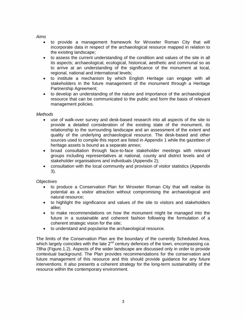
Figure 1.1 : Location of Wroxeter village and the Roman town of Viroconium Cornoviorum
4
Figure 1.2: Viroconium Roman Town and the village of Wroxeter: existing scheduled area.
5
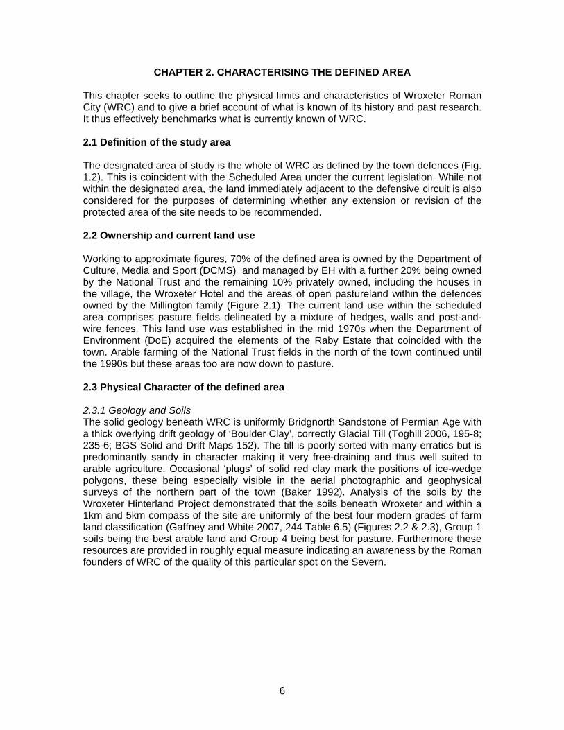
CHAPTER 2. CHARACTERISING THE DEFINED AREA This chapter seeks to outline the physical limits and characteristics of Wroxeter Roman City (WRC) and to give a brief account of what is known of its history and past research. It thus effectively benchmarks what is currently known of WRC. 2.1 Definition of the study area The designated area of study is the whole of WRC as defined by the town defences (Fig. 1.2). This is coincident with the Scheduled Area under the current legislation. While not within the designated area, the land immediately adjacent to the defensive circuit is also considered for the purposes of determining whether any extension or revision of the protected area of the site needs to be recommended. 2.2 Ownership and current land use Working to approximate figures, 70% of the defined area is owned by the Department of Culture, Media and Sport (DCMS) and managed by EH with a further 20% being owned by the National Trust and the remaining 10% privately owned, including the houses in the village, the Wroxeter Hotel and the areas of open pastureland within the defences owned by the Millington family (Figure 2.1). The current land use within the scheduled area comprises pasture fields delineated by a mixture of hedges, walls and post-and-wire fences. This land use was established in the mid 1970s when the Department of Environment (DoE) acquired the elements of the Raby Estate that coincided with the town. Arable farming of the National Trust fields in the north of the town continued until the 1990s but these areas too are now down to pasture. 2.3 Physical Character of the defined area 2.3.1 Geology and Soils The solid geology beneath WRC is uniformly Bridgnorth Sandstone of Permian Age with a thick overlying drift geology of ‘Boulder Clay’, correctly Glacial Till (Toghill 2006, 195-8; 235-6; BGS Solid and Drift Maps 152). The till is poorly sorted with many erratics but is predominantly sandy in character making it very free-draining and thus well suited to arable agriculture. Occasional ‘plugs’ of solid red clay mark the positions of ice-wedge polygons, these being especially visible in the aerial photographic and geophysical surveys of the northern part of the town (Baker 1992). Analysis of the soils by the Wroxeter Hinterland Project demonstrated that the soils beneath Wroxeter and within a 1km and 5km compass of the site are uniformly of the best four modern grades of farm land classification (Gaffney and White 2007, 244 Table 6.5) (Figures 2.2 & 2.3), Group 1 soils being the best arable land and Group 4 being best for pasture. Furthermore these resources are provided in roughly equal measure indicating an awareness by the Roman founders of WRC of the quality of this particular spot on the Severn.
6
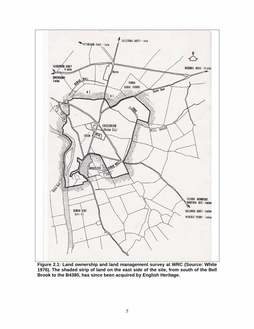
Figure 2.1: Land ownership and land management survey at WRC (Source: White 1976). The shaded strip of land on the east side of the site, from south of the Bell Brook to the B4380, has since been acquired by English Heritage.
7
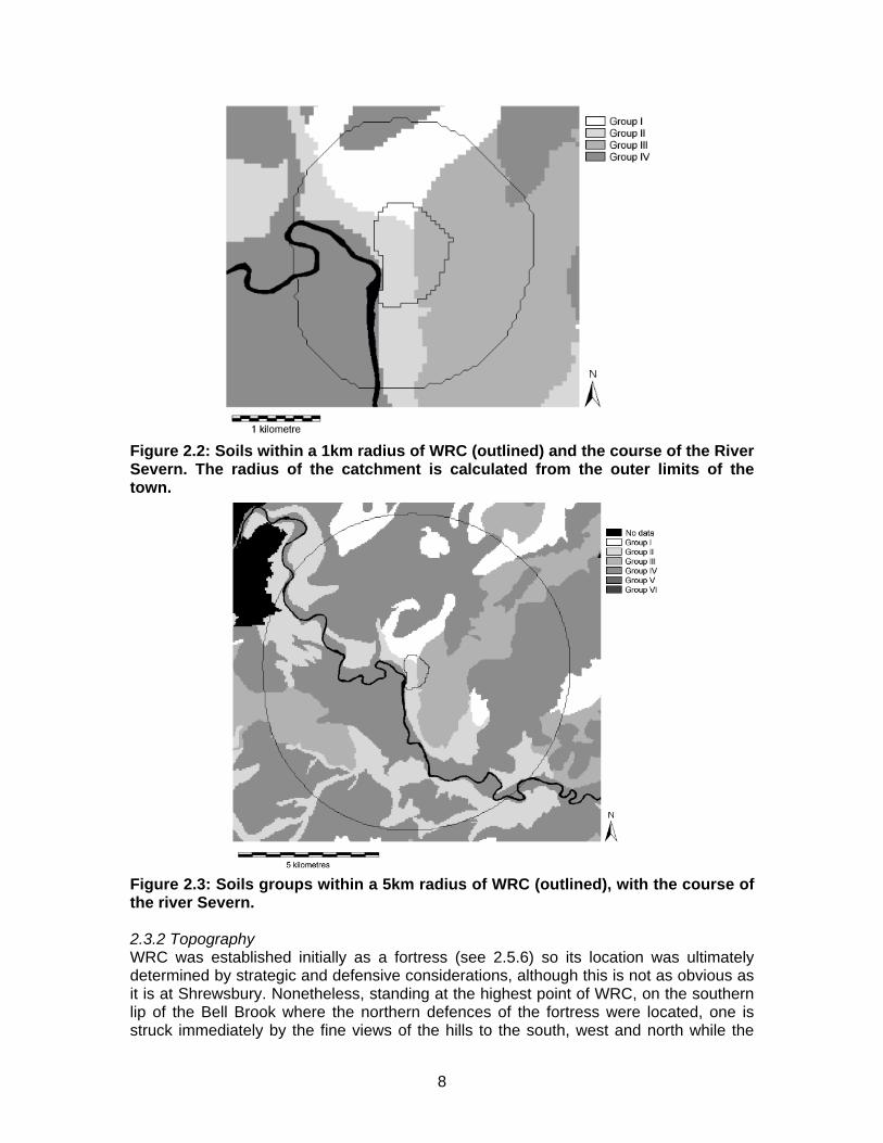
Figure 2.2: Soils within a 1km radius of WRC (outlined) and the course of the River Severn. The radius of the catchment is calculated from the outer limits of the town.
Figure 2.3: Soils groups within a 5km radius of WRC (outlined), with the course of the river Severn. 2.3.2 Topography WRC was established initially as a fortress (see 2.5.6) so its location was ultimately determined by strategic and defensive considerations, although this is not as obvious as it is at Shrewsbury. Nonetheless, standing at the highest point of WRC, on the southern lip of the Bell Brook where the northern defences of the fortress were located, one is struck immediately by the fine views of the hills to the south, west and north while the
8
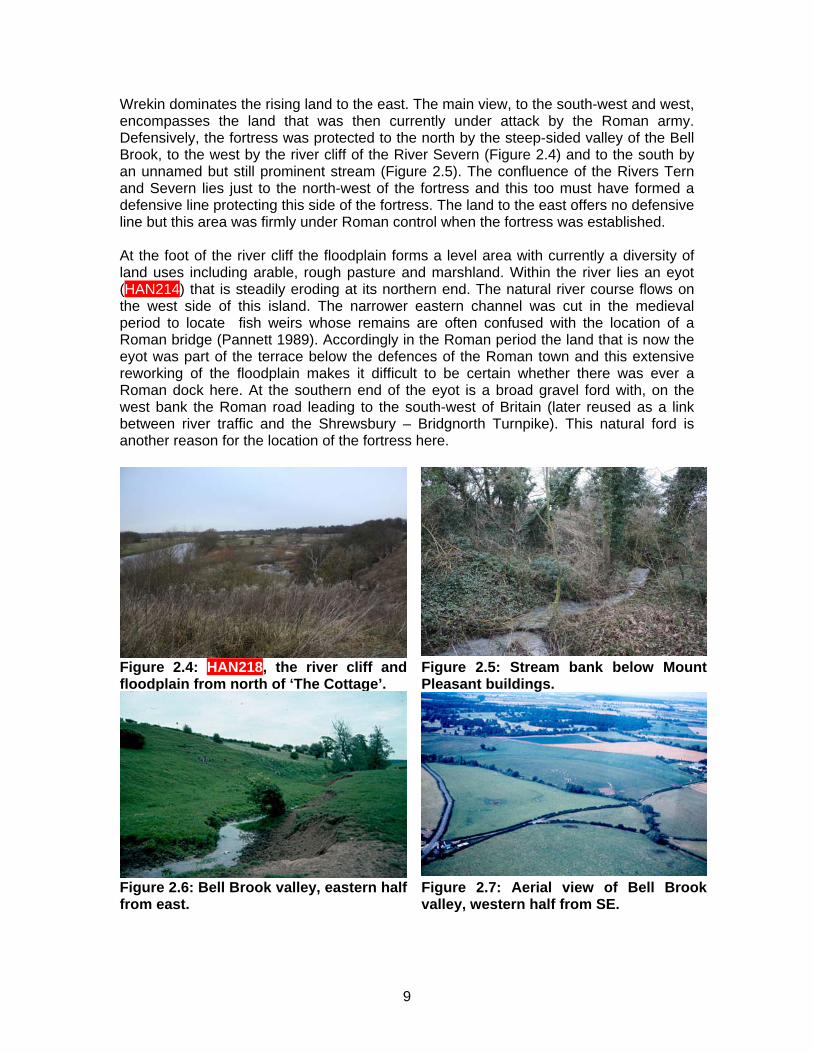
Wrekin dominates the rising land to the east. The main view, to the south-west and west, encompasses the land that was then currently under attack by the Roman army. Defensively, the fortress was protected to the north by the steep-sided valley of the Bell Brook, to the west by the river cliff of the River Severn (Figure 2.4) and to the south by an unnamed but still prominent stream (Figure 2.5). The confluence of the Rivers Tern and Severn lies just to the north-west of the fortress and this too must have formed a defensive line protecting this side of the fortress. The land to the east offers no defensive line but this area was firmly under Roman control when the fortress was established. At the foot of the river cliff the floodplain forms a level area with currently a diversity of land uses including arable, rough pasture and marshland. Within the river lies an eyot (HAN214) that is steadily eroding at its northern end. The natural river course flows on the west side of this island. The narrower eastern channel was cut in the medieval period to locate fish weirs whose remains are often confused with the location of a Roman bridge (Pannett 1989). Accordingly in the Roman period the land that is now the eyot was part of the terrace below the defences of the Roman town and this extensive reworking of the floodplain makes it difficult to be certain whether there was ever a Roman dock here. At the southern end of the eyot is a broad gravel ford with, on the west bank the Roman road leading to the south-west of Britain (later reused as a link between river traffic and the Shrewsbury – Bridgnorth Turnpike). This natural ford is another reason for the location of the fortress here.
Figure 2.4: HAN218, the river cliff and floodplain from north of ‘The Cottage’.
Figure 2.5: Stream bank below Mount Pleasant buildings.
Figure 2.6: Bell Brook valley, eastern half from east.
Figure 2.7: Aerial view of Bell Brook valley, western half from SE.
9
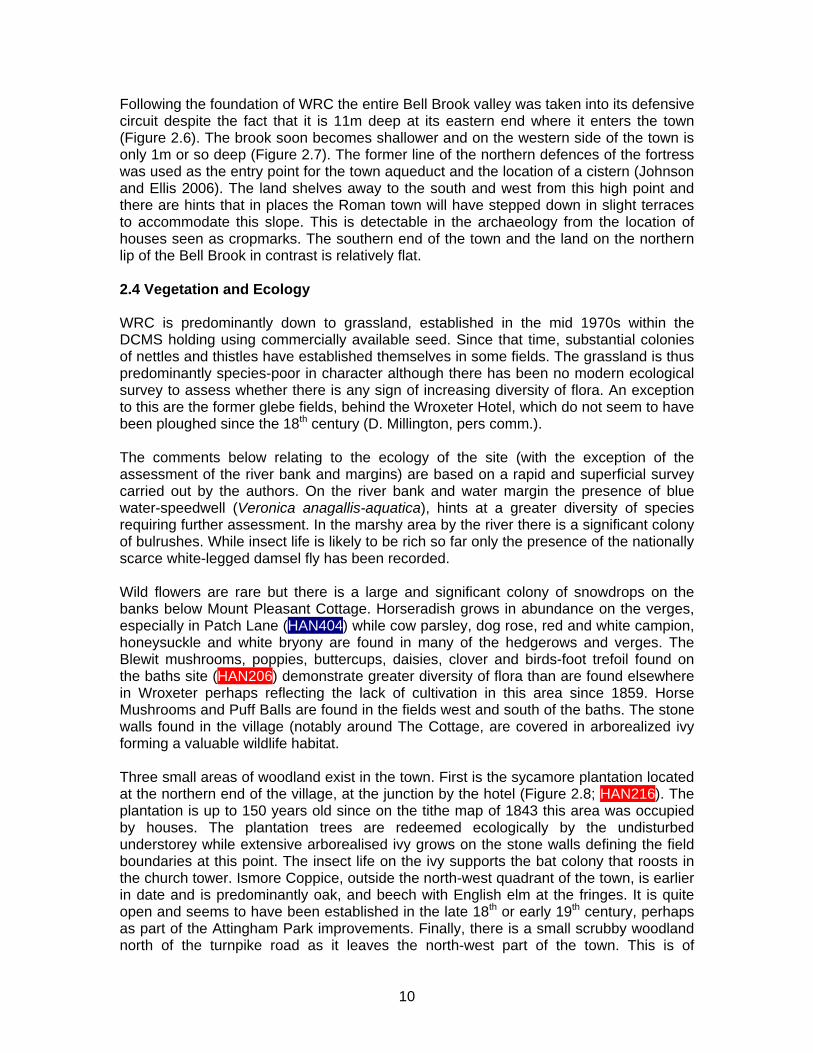
Following the foundation of WRC the entire Bell Brook valley was taken into its defensive circuit despite the fact that it is 11m deep at its eastern end where it enters the town (Figure 2.6). The brook soon becomes shallower and on the western side of the town is only 1m or so deep (Figure 2.7). The former line of the northern defences of the fortress was used as the entry point for the town aqueduct and the location of a cistern (Johnson and Ellis 2006). The land shelves away to the south and west from this high point and there are hints that in places the Roman town will have stepped down in slight terraces to accommodate this slope. This is detectable in the archaeology from the location of houses seen as cropmarks. The southern end of the town and the land on the northern lip of the Bell Brook in contrast is relatively flat. 2.4 Vegetation and Ecology WRC is predominantly down to grassland, established in the mid 1970s within the DCMS holding using commercially available seed. Since that time, substantial colonies of nettles and thistles have established themselves in some fields. The grassland is thus predominantly species-poor in character although there has been no modern ecological survey to assess whether there is any sign of increasing diversity of flora. An exception to this are the former glebe fields, behind the Wroxeter Hotel, which do not seem to have been ploughed since the 18th century (D. Millington, pers comm.). The comments below relating to the ecology of the site (with the exception of the assessment of the river bank and margins) are based on a rapid and superficial survey carried out by the authors. On the river bank and water margin the presence of blue water-speedwell (Veronica anagallis-aquatica), hints at a greater diversity of species requiring further assessment. In the marshy area by the river there is a significant colony of bulrushes. While insect life is likely to be rich so far only the presence of the nationally scarce white-legged damsel fly has been recorded. Wild flowers are rare but there is a large and significant colony of snowdrops on the banks below Mount Pleasant Cottage. Horseradish grows in abundance on the verges, especially in Patch Lane (HAN404) while cow parsley, dog rose, red and white campion, honeysuckle and white bryony are found in many of the hedgerows and verges. The Blewit mushrooms, poppies, buttercups, daisies, clover and birds-foot trefoil found on the baths site (HAN206) demonstrate greater diversity of flora than are found elsewhere in Wroxeter perhaps reflecting the lack of cultivation in this area since 1859. Horse Mushrooms and Puff Balls are found in the fields west and south of the baths. The stone walls found in the village (notably around The Cottage, are covered in arborealized ivy forming a valuable wildlife habitat. Three small areas of woodland exist in the town. First is the sycamore plantation located at the northern end of the village, at the junction by the hotel (Figure 2.8; HAN216). The plantation is up to 150 years old since on the tithe map of 1843 this area was occupied by houses. The plantation trees are redeemed ecologically by the undisturbed understorey while extensive arborealised ivy grows on the stone walls defining the field boundaries at this point. The insect life on the ivy supports the bat colony that roosts in the church tower. Ismore Coppice, outside the north-west quadrant of the town, is earlier in date and is predominantly oak, and beech with English elm at the fringes. It is quite open and seems to have been established in the late 18th or early 19th century, perhaps as part of the Attingham Park improvements. Finally, there is a small scrubby woodland north of the turnpike road as it leaves the north-west part of the town. This is of
10
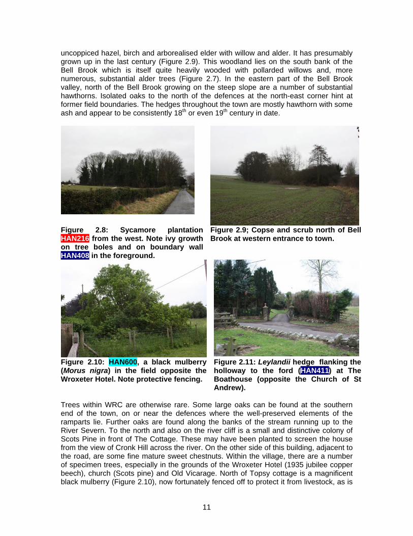
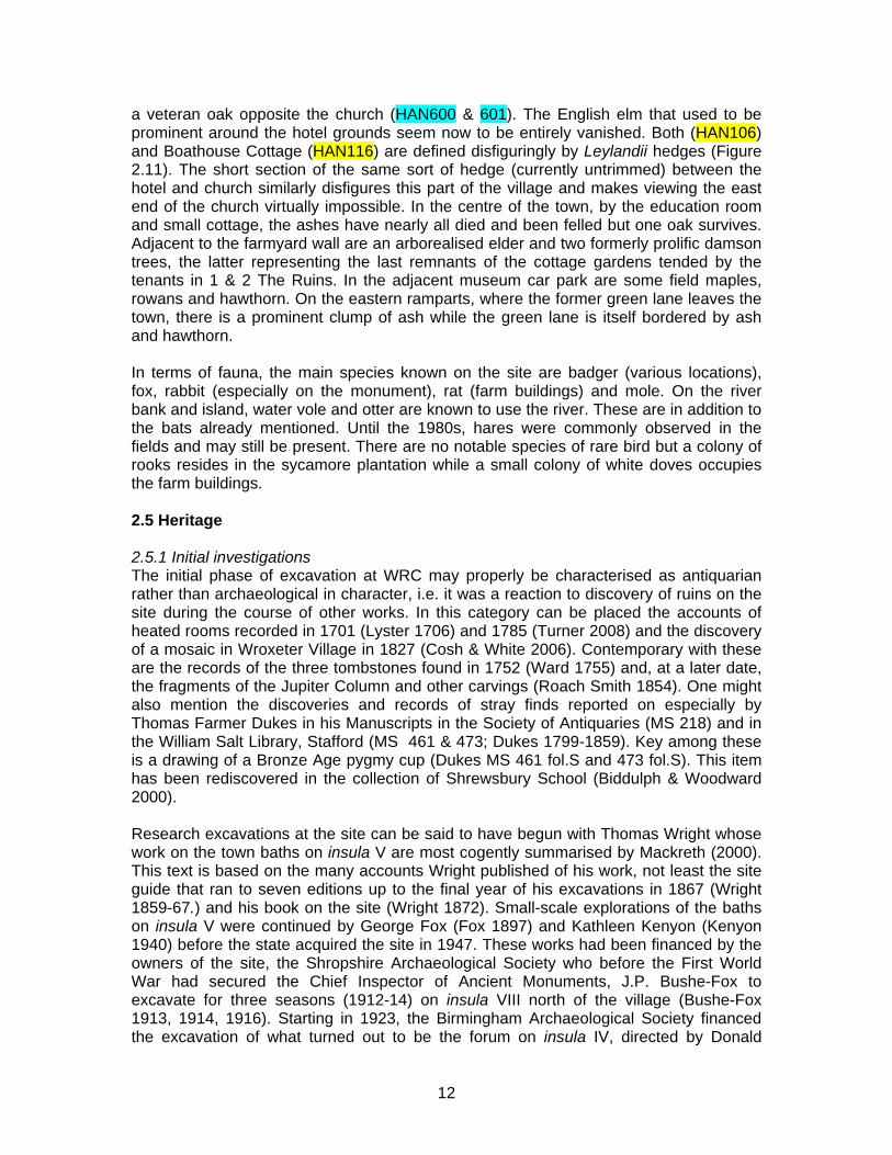
uncoppiced hazel, birch and arborealised elder with willow and alder. It has presumably grown up in the last century (Figure 2.9). This woodland lies on the south bank of the Bell Brook which is itself quite heavily wooded with pollarded willows and, more numerous, substantial alder trees (Figure 2.7). In the eastern part of the Bell Brook valley, north of the Bell Brook growing on the steep slope are a number of substantial hawthorns. Isolated oaks to the north of the defences at the north-east corner hint at former field boundaries. The hedges throughout the town are mostly hawthorn with some ash and appear to be consistently 18th or even 19th century in date.
Figure 2.8: Sycamore plantation HAN216 from the west. Note ivy growth on tree boles and on boundary wall HAN408 in the foreground.
Figure 2.9; Copse and scrub north of Bell Brook at western entrance to town.
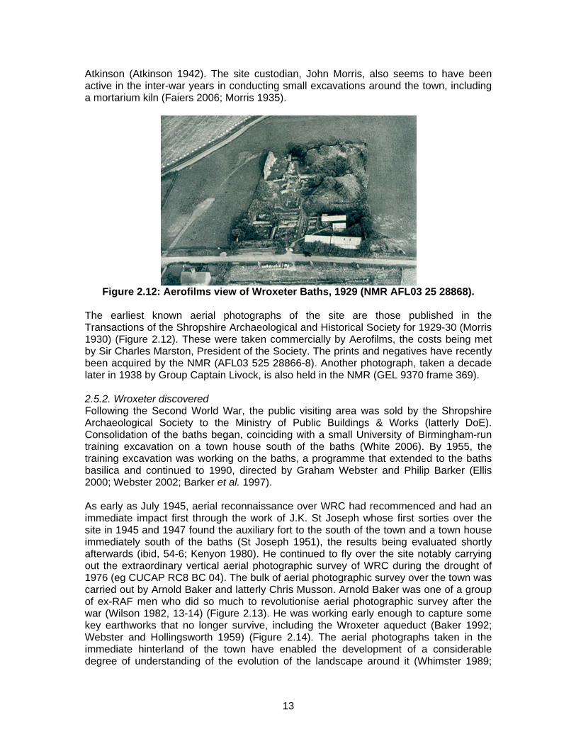
Figure 2.10: HAN600, a black mulberry (Morus nigra) in the field opposite the Wroxeter Hotel. Note protective fencing.
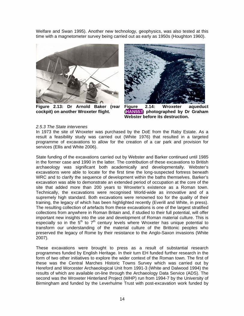
Figure 2.11: Leylandii hedge flanking the holloway to the ford (HAN411) at The Boathouse (opposite the Church of St Andrew).
Trees within WRC are otherwise rare. Some large oaks can be found at the southern end of the town, on or near the defences where the well-preserved elements of the ramparts lie. Further oaks are found along the banks of the stream running up to the River Severn. To the north and also on the river cliff is a small and distinctive colony of Scots Pine in front of The Cottage. These may have been planted to screen the house from the view of Cronk Hill across the river. On the other side of this building, adjacent to the road, are some fine mature sweet chestnuts. Within the village, there are a number of specimen trees, especially in the grounds of the Wroxeter Hotel (1935 jubilee copper beech), church (Scots pine) and Old Vicarage. North of Topsy cottage is a magnificent black mulberry (Figure 2.10), now fortunately fenced off to protect it from livestock, as is
11
a veteran oak opposite the church (HAN600 & 601). The English elm that used to be prominent around the hotel grounds seem now to be entirely vanished. Both (HAN106) and Boathouse Cottage (HAN116) are defined disfiguringly by Leylandii hedges (Figure 2.11). The short section of the same sort of hedge (currently untrimmed) between the hotel and church similarly disfigures this part of the village and makes viewing the east end of the church virtually impossible. In the centre of the town, by the education room and small cottage, the ashes have nearly all died and been felled but one oak survives. Adjacent to the farmyard wall are an arborealised elder and two formerly prolific damson trees, the latter representing the last remnants of the cottage gardens tended by the tenants in 1 & 2 The Ruins. In the adjacent museum car park are some field maples, rowans and hawthorn. On the eastern ramparts, where the former green lane leaves the town, there is a prominent clump of ash while the green lane is itself bordered by ash and hawthorn. In terms of fauna, the main species known on the site are badger (various locations), fox, rabbit (especially on the monument), rat (farm buildings) and mole. On the river bank and island, water vole and otter are known to use the river. These are in addition to the bats already mentioned. Until the 1980s, hares were commonly observed in the fields and may still be present. There are no notable species of rare bird but a colony of rooks resides in the sycamore plantation while a small colony of white doves occupies the farm buildings. 2.5 Heritage 2.5.1 Initial investigations The initial phase of excavation at WRC may properly be characterised as antiquarian rather than archaeological in character, i.e. it was a reaction to discovery of ruins on the site during the course of other works. In this category can be placed the accounts of heated rooms recorded in 1701 (Lyster 1706) and 1785 (Turner 2008) and the discovery of a mosaic in Wroxeter Village in 1827 (Cosh & White 2006). Contemporary with these are the records of the three tombstones found in 1752 (Ward 1755) and, at a later date, the fragments of the Jupiter Column and other carvings (Roach Smith 1854). One might also mention the discoveries and records of stray finds reported on especially by Thomas Farmer Dukes in his Manuscripts in the Society of Antiquaries (MS 218) and in the William Salt Library, Stafford (MS 461 & 473; Dukes 1799-1859). Key among these is a drawing of a Bronze Age pygmy cup (Dukes MS 461 fol.S and 473 fol.S). This item has been rediscovered in the collection of Shrewsbury School (Biddulph & Woodward 2000). Research excavations at the site can be said to have begun with Thomas Wright whose work on the town baths on insula V are most cogently summarised by Mackreth (2000). This text is based on the many accounts Wright published of his work, not least the site guide that ran to seven editions up to the final year of his excavations in 1867 (Wright 1859-67.) and his book on the site (Wright 1872). Small-scale explorations of the baths on insula V were continued by George Fox (Fox 1897) and Kathleen Kenyon (Kenyon 1940) before the state acquired the site in 1947. These works had been financed by the owners of the site, the Shropshire Archaeological Society who before the First World War had secured the Chief Inspector of Ancient Monuments, J.P. Bushe-Fox to excavate for three seasons (1912-14) on insula VIII north of the village (Bushe-Fox 1913, 1914, 1916). Starting in 1923, the Birmingham Archaeological Society financed the excavation of what turned out to be the forum on insula IV, directed by Donald
12
Atkinson (Atkinson 1942). The site custodian, John Morris, also seems to have been active in the inter-war years in conducting small excavations around the town, including a mortarium kiln (Faiers 2006; Morris 1935).
Figure 2.12: Aerofilms view of Wroxeter Baths, 1929 (NMR AFL03 25 28868).
The earliest known aerial photographs of the site are those published in the Transactions of the Shropshire Archaeological and Historical Society for 1929-30 (Morris 1930) (Figure 2.12). These were taken commercially by Aerofilms, the costs being met by Sir Charles Marston, President of the Society. The prints and negatives have recently been acquired by the NMR (AFL03 525 28866-8). Another photograph, taken a decade later in 1938 by Group Captain Livock, is also held in the NMR (GEL 9370 frame 369). 2.5.2. Wroxeter discovered Following the Second World War, the public visiting area was sold by the Shropshire Archaeological Society to the Ministry of Public Buildings & Works (latterly DoE). Consolidation of the baths began, coinciding with a small University of Birmingham-run training excavation on a town house south of the baths (White 2006). By 1955, the training excavation was working on the baths, a programme that extended to the baths basilica and continued to 1990, directed by Graham Webster and Philip Barker (Ellis 2000; Webster 2002; Barker et al. 1997). As early as July 1945, aerial reconnaissance over WRC had recommenced and had an immediate impact first through the work of J.K. St Joseph whose first sorties over the site in 1945 and 1947 found the auxiliary fort to the south of the town and a town house immediately south of the baths (St Joseph 1951), the results being evaluated shortly afterwards (ibid, 54-6; Kenyon 1980). He continued to fly over the site notably carrying out the extraordinary vertical aerial photographic survey of WRC during the drought of 1976 (eg CUCAP RC8 BC 04). The bulk of aerial photographic survey over the town was carried out by Arnold Baker and latterly Chris Musson. Arnold Baker was one of a group of ex-RAF men who did so much to revolutionise aerial photographic survey after the war (Wilson 1982, 13-14) (Figure 2.13). He was working early enough to capture some key earthworks that no longer survive, including the Wroxeter aqueduct (Baker 1992; Webster and Hollingsworth 1959) (Figure 2.14). The aerial photographs taken in the immediate hinterland of the town have enabled the development of a considerable degree of understanding of the evolution of the landscape around it (Whimster 1989;
13
Welfare and Swan 1995). Another new technology, geophysics, was also tested at this time with a magnetometer survey being carried out as early as 1950s (Houghton 1960).
Figure 2.13: Dr Arnold Baker (rear cockpit) on another Wroxeter flight.
Figure 2.14: Wroxeter aqueduct (HAN557) photographed by Dr Graham Webster before its destruction.
2.5.3 The State intervenes In 1973 the site of Wroxeter was purchased by the DoE from the Raby Estate. As a result a feasibility study was carried out (White 1976) that resulted in a targeted programme of excavations to allow for the creation of a car park and provision for services (Ellis and White 2006). State funding of the excavations carried out by Webster and Barker continued until 1985 in the former case and 1990 in the latter. The contribution of these excavations to British archaeology was significant both academically and developmentally. Webster’s excavations were able to locate for the first time the long-suspected fortress beneath WRC and to clarify the sequence of development within the baths themselves. Barker’s excavation was able to demonstrate an extended period of occupation at the core of the site that added more than 200 years to Wroxeter’s existence as a Roman town. Technically, the excavations were recognised World-wide as innovative and of a supremely high standard. Both excavations were renowned too for the quality of their training, the legacy of which has been highlighted recently (Everill and White, in press). The resulting collection of artefacts from these excavations is one of the largest stratified collections from anywhere in Roman Britain and, if studied to their full potential, will offer important new insights into the use and development of Roman material culture. This is especially so in the 5th to 7th century levels where Wroxeter has unique potential to transform our understanding of the material culture of the Brittonic peoples who preserved the legacy of Rome by their resistance to the Anglo-Saxon invasions (White 2007). These excavations were brought to press as a result of substantial research programmes funded by English Heritage. In their turn EH funded further research in the form of two other initiatives to explore the wider context of the Roman town. The first of these was the Central Marches Historic Towns Survey which was carried out by Hereford and Worcester Archaeological Unit from 1991-3 (White and Dalwood 1994) the results of which are available on-line through the Archaeology Data Service (ADS). The second was the Wroxeter Hinterland Project (WHP) run from 1994-7 by the University of Birmingham and funded by the Leverhulme Trust with post-excavation work funded by
14
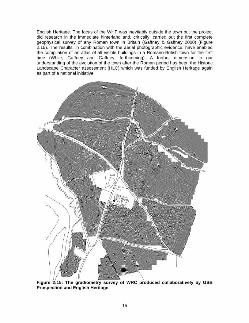
English Heritage. The focus of the WHP was inevitably outside the town but the project did research in the immediate hinterland and, critically, carried out the first complete geophysical survey of any Roman town in Britain (Gaffney & Gaffney 2000) (Figure 2.15). The results, in combination with the aerial photographic evidence, have enabled the compilation of an atlas of all visible buildings in a Romano-British town for the first time (White, Gaffney and Gaffney, forthcoming). A further dimension to our understanding of the evolution of the town after the Roman period has been the Historic Landscape Character assessment (HLC) which was funded by English Heritage again as part of a national initiative.
Figure 2:15: The gradiometry survey of WRC produced collaboratively by GSB Prospection and English Heritage.
15
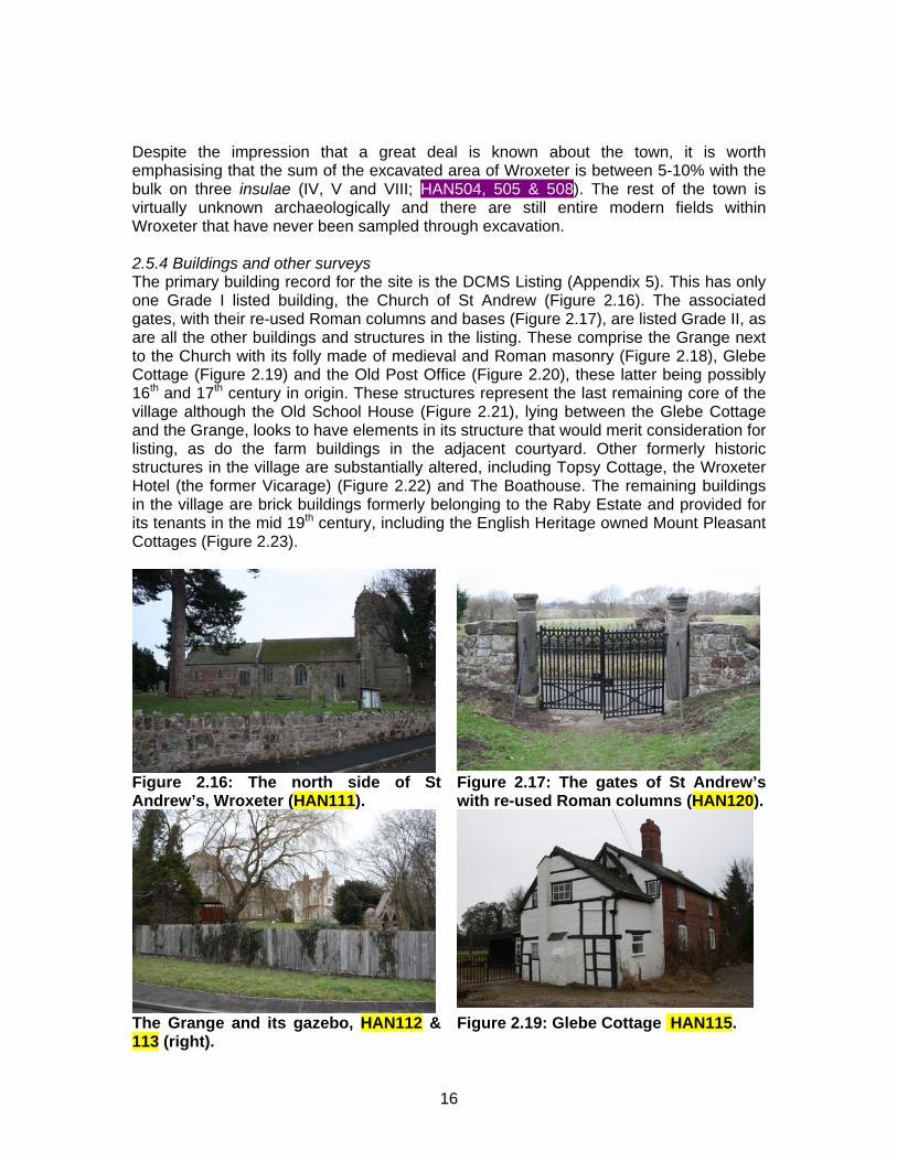
Despite the impression that a great deal is known about the town, it is worth emphasising that the sum of the excavated area of Wroxeter is between 5-10% with the bulk on three insulae (IV, V and VIII; HAN504, 505 & 508). The rest of the town is virtually unknown archaeologically and there are still entire modern fields within Wroxeter that have never been sampled through excavation. 2.5.4 Buildings and other surveys The primary building record for the site is the DCMS Listing (Appendix 5). This has only one Grade I listed building, the Church of St Andrew (Figure 2.16). The associated gates, with their re-used Roman columns and bases (Figure 2.17), are listed Grade II, as are all the other buildings and structures in the listing. These comprise the Grange next to the Church with its folly made of medieval and Roman masonry (Figure 2.18), Glebe Cottage (Figure 2.19) and the Old Post Office (Figure 2.20), these latter being possibly 16th and 17th century in origin. These structures represent the last remaining core of the village although the Old School House (Figure 2.21), lying between the Glebe Cottage and the Grange, looks to have elements in its structure that would merit consideration for listing, as do the farm buildings in the adjacent courtyard. Other formerly historic structures in the village are substantially altered, including Topsy Cottage, the Wroxeter Hotel (the former Vicarage) (Figure 2.22) and The Boathouse. The remaining buildings in the village are brick buildings formerly belonging to the Raby Estate and provided for its tenants in the mid 19th century, including the English Heritage owned Mount Pleasant Cottages (Figure 2.23).
Figure 2.16: The north side of St Andrew’s, Wroxeter (HAN111).
Figure 2.17: The gates of St Andrew’s with re-used Roman columns (HAN120).
The Grange and its gazebo, HAN112 & 113 (right).
Figure 2.19: Glebe Cottage HAN115.
16
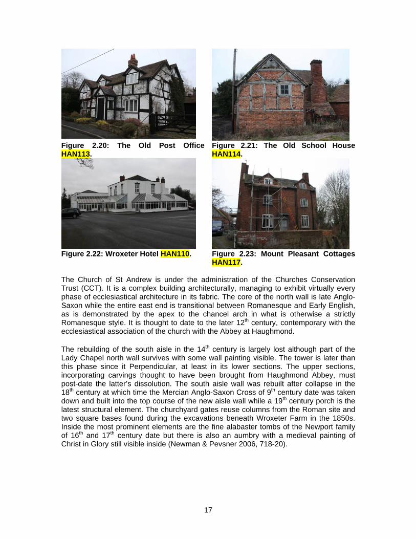
Figure 2.20: The Old Post Office HAN113.
Figure 2.21: The Old School House HAN114.
Figure 2.22: Wroxeter Hotel HAN110. Figure 2.23: Mount Pleasant Cottages
HAN117. The Church of St Andrew is under the administration of the Churches Conservation Trust (CCT). It is a complex building architecturally, managing to exhibit virtually every phase of ecclesiastical architecture in its fabric. The core of the north wall is late Anglo-Saxon while the entire east end is transitional between Romanesque and Early English, as is demonstrated by the apex to the chancel arch in what is otherwise a strictly Romanesque style. It is thought to date to the later 12th century, contemporary with the ecclesiastical association of the church with the Abbey at Haughmond. The rebuilding of the south aisle in the 14th century is largely lost although part of the Lady Chapel north wall survives with some wall painting visible. The tower is later than this phase since it Perpendicular, at least in its lower sections. The upper sections, incorporating carvings thought to have been brought from Haughmond Abbey, must post-date the latter’s dissolution. The south aisle wall was rebuilt after collapse in the 18th century at which time the Mercian Anglo-Saxon Cross of 9th century date was taken down and built into the top course of the new aisle wall while a 19th century porch is the latest structural element. The churchyard gates reuse columns from the Roman site and two square bases found during the excavations beneath Wroxeter Farm in the 1850s. Inside the most prominent elements are the fine alabaster tombs of the Newport family of 16th and 17th century date but there is also an aumbry with a medieval painting of Christ in Glory still visible inside (Newman & Pevsner 2006, 718-20).
17
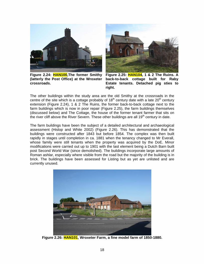
Figure 2.24: HAN100,The former Smithy (latterly the Post Office) at the Wroxeter crossroads.
Figure 2.25: HAN104, 1 & 2 The Ruins. A back-to-back cottage built for Raby Estate tenants. Detached pig sties to right.
The other buildings within the study area are the old Smithy at the crossroads in the centre of the site which is a cottage probably of 18th century date with a late 20th century extension (Figure 2.24), 1 & 2 The Ruins, the former back-to-back cottage next to the farm buildings which is now in poor repair (Figure 2.25), the farm buildings themselves (discussed below) and The Cottage, the house of the former tenant farmer that sits on the river cliff above the River Severn. These other buildings are all 19th century in date. The farm buildings have been the subject of a detailed architectural and archaeological assessment (Hislop and White 2002) (Figure 2.26). This has demonstrated that the buildings were constructed after 1843 but before 1854. The complex was then built rapidly in stages until completion in ca. 1881 when the tenancy changed to Mr Everall, whose family were still tenants when the property was acquired by the DoE. Minor modifications were carried out up to 1901 with the last element being a Dutch Barn built post Second World War (since demolished). The buildings incorporate large amounts of Roman ashlar, especially where visible from the road but the majority of the building is in brick. The buildings have been assessed for Listing but as yet are unlisted and are currently unused.
Figure 2.26: HAN101, Wroxeter Farm, a fine model farm of 1850-1880.
18
Scale: 1:10,000
14
48
23
48
48
42
48
47
42
48
6
41
48
42
47
29
47
48
42
42
42
42
36
48
4842
426
42
4745
36
40
40
29
40
42
40
48
7
30
41
36
45
47
40
42
40
48
42
40
29
50
42
48
-
Economy & EnvironmentThe Shirehall, Abbey Foregate
Shrewsbury, Shropshire, SY2 6ND
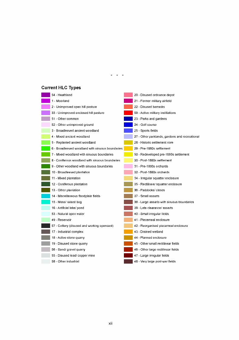
Historic Landscape Character (HLC) Map for Wroxeter and environs.(Annotated numbers refer to 'Current HLC Types' legend - see p.xii).
© Crown Copyright. All rights reserved.Shropshire County Council 100019801(2008)
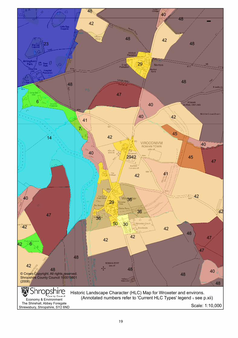
19
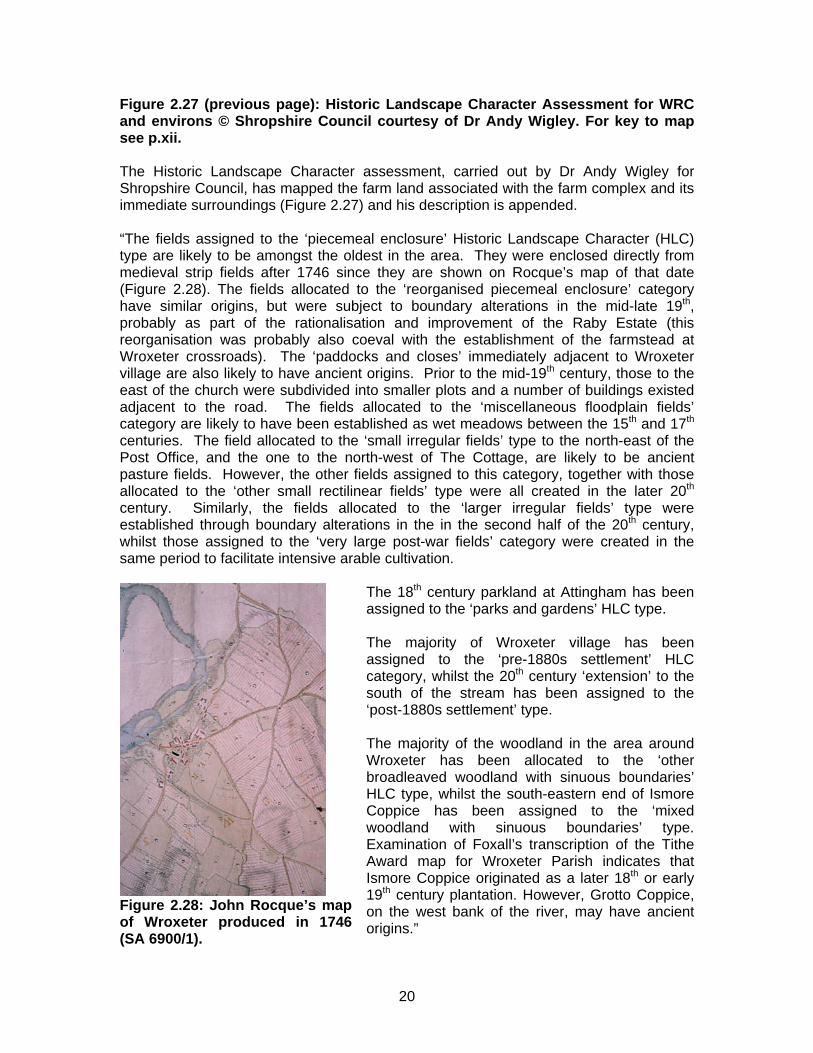
Figure 2.27 (previous page): Historic Landscape Character Assessment for WRC and environs © Shropshire Council courtesy of Dr Andy Wigley. For key to map see p.xii. The Historic Landscape Character assessment, carried out by Dr Andy Wigley for Shropshire Council, has mapped the farm land associated with the farm complex and its immediate surroundings (Figure 2.27) and his description is appended.
“The fields assigned to the ‘piecemeal enclosure’ Historic Landscape Character (HLC) type are likely to be amongst the oldest in the area. They were enclosed directly from medieval strip fields after 1746 since they are shown on Rocque’s map of that date (Figure 2.28). The fields allocated to the ‘reorganised piecemeal enclosure’ category have similar origins, but were subject to boundary alterations in the mid-late 19th, probably as part of the rationalisation and improvement of the Raby Estate (this reorganisation was probably also coeval with the establishment of the farmstead at Wroxeter crossroads). The ‘paddocks and closes’ immediately adjacent to Wroxeter village are also likely to have ancient origins. Prior to the mid-19th century, those to the east of the church were subdivided into smaller plots and a number of buildings existed adjacent to the road. The fields allocated to the ‘miscellaneous floodplain fields’ category are likely to have been established as wet meadows between the 15th and 17th centuries. The field allocated to the ‘small irregular fields’ type to the north-east of the Post Office, and the one to the north-west of The Cottage, are likely to be ancient pasture fields. However, the other fields assigned to this category, together with those allocated to the ‘other small rectilinear fields’ type were all created in the later 20th century. Similarly, the fields allocated to the ‘larger irregular fields’ type were established through boundary alterations in the in the second half of the 20th century, whilst those assigned to the ‘very large post-war fields’ category were created in the same period to facilitate intensive arable cultivation.
Figure 2.28: John Rocque’s map of Wroxeter produced in 1746 (SA 6900/1).
The 18th century parkland at Attingham has been assigned to the ‘parks and gardens’ HLC type.
The majority of Wroxeter village has been assigned to the ‘pre-1880s settlement’ HLC category, whilst the 20th century ‘extension’ to the south of the stream has been assigned to the ‘post-1880s settlement’ type.
The majority of the woodland in the area around Wroxeter has been allocated to the ‘other broadleaved woodland with sinuous boundaries’ HLC type, whilst the south-eastern end of Ismore Coppice has been assigned to the ‘mixed woodland with sinuous boundaries’ type. Examination of Foxall’s transcription of the Tithe Award map for Wroxeter Parish indicates that Ismore Coppice originated as a later 18th or early 19th century plantation. However, Grotto Coppice, on the west bank of the river, may have ancient origins.”
20
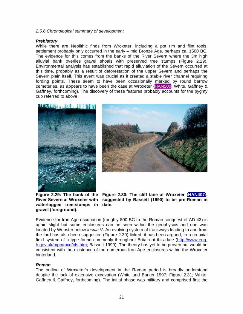
2.5.6 Chronological summary of development Prehistory While there are Neolithic finds from Wroxeter, including a pot rim and flint tools, settlement probably only occurred in the early – mid Bronze Age, perhaps ca. 1500 BC. The evidence for this comes from the banks of the River Severn where the 3m high alluvial bank overlies gravel shoals with preserved tree stumps (Figure 2.29). Environmental analysis has established that rapid alluviation of the Severn occurred at this time, probably as a result of deforestation of the upper Severn and perhaps the Severn plain itself. This event was crucial as it created a stable river channel requiring fording points. These seem to have been occasionally marked by round barrow cemeteries, as appears to have been the case at Wroxeter (HAN500; White, Gaffney & Gaffney, forthcoming). The discovery of these features probably accounts for the pygmy cup referred to above.
Figure 2.29: The bank of the River Severn at Wroxeter with waterlogged tree-stumps in gravel (foreground).
Figure 2.30: The cliff lane at Wroxeter (HAN407), suggested by Bassett (1990) to be pre-Roman in date.
Evidence for Iron Age occupation (roughly 800 BC to the Roman conquest of AD 43) is again slight but some enclosures can be seen within the geophysics and one was located by Webster below insula V. An evolving system of trackways leading to and from the ford has also been suggested (Figure 2.30) linked, it has been argued, to a co-axial field system of a type found commonly throughout Britain at this date (http://www.eng-h.gov.uk/mpp/mcd/cfs.htm; Bassett 1990). The theory has yet to be proven but would be consistent with the existence of the numerous Iron Age enclosures within the Wroxeter hinterland. Roman The outline of Wroxeter’s development in the Roman period is broadly understood despite the lack of extensive excavation (White and Barker 1997; Figure 2.31; White, Gaffney & Gaffney, forthcoming). The initial phase was military and comprised first the
21
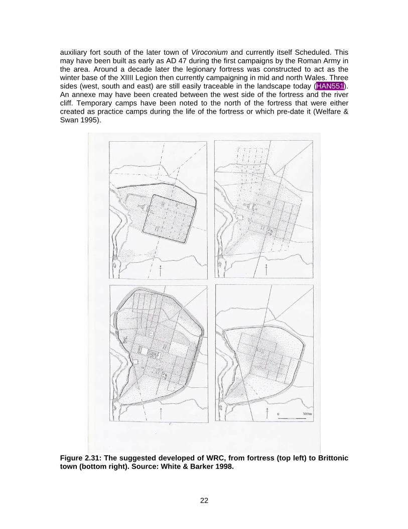
auxiliary fort south of the later town of Viroconium and currently itself Scheduled. This may have been built as early as AD 47 during the first campaigns by the Roman Army in the area. Around a decade later the legionary fortress was constructed to act as the winter base of the XIIII Legion then currently campaigning in mid and north Wales. Three sides (west, south and east) are still easily traceable in the landscape today (HAN551). An annexe may have been created between the west side of the fortress and the river cliff. Temporary camps have been noted to the north of the fortress that were either created as practice camps during the life of the fortress or which pre-date it (Welfare & Swan 1995).
Figure 2.31: The suggested developed of WRC, from fortress (top left) to Brittonic town (bottom right). Source: White & Barker 1998.
22
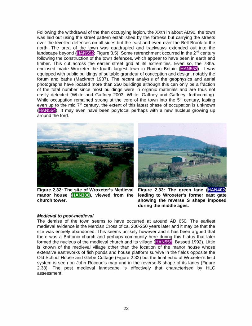
Following the withdrawal of the then occupying legion, the XXth in about AD90, the town was laid out using the street pattern established by the fortress but carrying the streets over the levelled defences on all sides but the east and even over the Bell Brook to the north. The area of the town was quadrupled and trackways extended out into the landscape beyond (HAN552; Figure 3.5). Some retrenchment occurred in the 2nd century following the construction of the town defences, which appear to have been in earth and timber. This cut across the earlier street grid at its extremities. Even so, the 78ha. enclosed made Wroxeter the fourth largest town in Roman Britain (HAN553). It was equipped with public buildings of suitable grandeur of conception and design, notably the forum and baths (Mackreth 1987). The recent analysis of the geophysics and aerial photographs have located more than 260 buildings although this can only be a fraction of the total number since most buildings were in organic materials and are thus not easily detected (White and Gaffney 2003; White, Gaffney and Gaffney, forthcoming). While occupation remained strong at the core of the town into the 5th century, lasting even up to the mid 7th century, the extent of this latest phase of occupation is unknown (HAN554). It may even have been polyfocal perhaps with a new nucleus growing up around the ford.
Figure 2.32: The site of Wroxeter’s Medieval manor house (HAN306), viewed from the church tower.
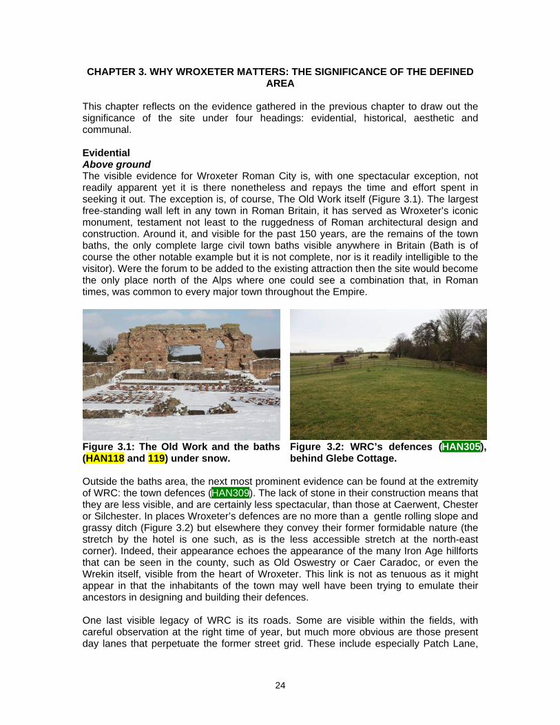
Figure 2.33: The green lane (HAN402) leading to Wroxeter’s former east gate showing the reverse S shape imposed during the middle ages.
Medieval to post-medieval The demise of the town seems to have occurred at around AD 650. The earliest medieval evidence is the Mercian Cross of ca. 200-250 years later and it may be that the site was entirely abandoned. This seems unlikely however and it has been argued that there was a Brittonic church and perhaps community here during this hiatus that later formed the nucleus of the medieval church and its village (HAN555; Bassett 1992). Little is known of the medieval village other than the location of the manor house whose extensive earthworks of fish ponds and house platform survive in the fields opposite the Old School House and Glebe Cottage (Figure 2.32) but the final echo of Wroxeter’s field system is seen on John Rocque’s map and in the reverse-S shape of its lanes (Figure 2.33). The post medieval landscape is effectively that characterised by HLC assessment.
23
CHAPTER 3. WHY WROXETER MATTERS: THE SIGNIFICANCE OF THE DEFINED AREA
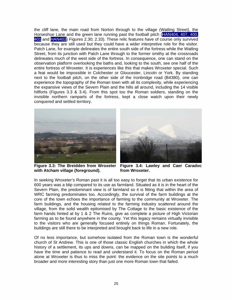
This chapter reflects on the evidence gathered in the previous chapter to draw out the significance of the site under four headings: evidential, historical, aesthetic and communal. Evidential Above ground The visible evidence for Wroxeter Roman City is, with one spectacular exception, not readily apparent yet it is there nonetheless and repays the time and effort spent in seeking it out. The exception is, of course, The Old Work itself (Figure 3.1). The largest free-standing wall left in any town in Roman Britain, it has served as Wroxeter’s iconic monument, testament not least to the ruggedness of Roman architectural design and construction. Around it, and visible for the past 150 years, are the remains of the town baths, the only complete large civil town baths visible anywhere in Britain (Bath is of course the other notable example but it is not complete, nor is it readily intelligible to the visitor). Were the forum to be added to the existing attraction then the site would become the only place north of the Alps where one could see a combination that, in Roman times, was common to every major town throughout the Empire.
Figure 3.1: The Old Work and the baths (HAN118 and 119) under snow.
Figure 3.2: WRC’s defences (HAN305), behind Glebe Cottage.
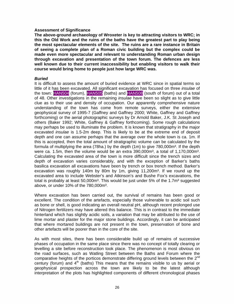
Outside the baths area, the next most prominent evidence can be found at the extremity of WRC: the town defences (HAN309). The lack of stone in their construction means that they are less visible, and are certainly less spectacular, than those at Caerwent, Chester or Silchester. In places Wroxeter’s defences are no more than a gentle rolling slope and grassy ditch (Figure 3.2) but elsewhere they convey their former formidable nature (the stretch by the hotel is one such, as is the less accessible stretch at the north-east corner). Indeed, their appearance echoes the appearance of the many Iron Age hillforts that can be seen in the county, such as Old Oswestry or Caer Caradoc, or even the Wrekin itself, visible from the heart of Wroxeter. This link is not as tenuous as it might appear in that the inhabitants of the town may well have been trying to emulate their ancestors in designing and building their defences. One last visible legacy of WRC is its roads. Some are visible within the fields, with careful observation at the right time of year, but much more obvious are those present day lanes that perpetuate the former street grid. These include especially Patch Lane,
24
the cliff lane, the main road from Norton through to the village (Watling Street), the Horseshoe Lane and the green lane running past the football pitch (HAN404, 407, 400, 401 and HAN402) Figures 2.30; 2.33). These relic features have of course only survived because they are still used but they could have a wider interpretive role for the visitor. Patch Lane, for example delineates the entire south side of the fortress while the Watling Street, from its junction with Patch Lane through to the former smithy at the crossroads delineates much of the west side of the fortress. In consequence, one can stand on the observation platform overlooking the baths and, looking to the south, see one half of the entire fortress of Wroxeter. It is experiences like this that makes Wroxeter special. Such a feat would be impossible in Colchester or Gloucester, Lincoln or York. By standing next to the football pitch, on the other side of the Ironbridge road (B4380), one can experience the topography of the Roman town with all its complexity, while experiencing the expansive views of the Severn Plain and the hills all around, including the 14 visible hillforts (Figures 3.3 & 3.4). From this spot too the Roman soldiers, standing on the invisible northern ramparts of the fortress, kept a close watch upon their newly conquered and settled territory.
Figure 3.3: The Breidden from Wroxeter with Atcham village (foreground).
Figure 3.4: Lawley and Caer Caradoc from Wroxeter.
In seeking Wroxeter’s Roman past it is all too easy to forget that its urban existence for 600 years was a blip compared to its use as farmland. Situated as it is in the heart of the Severn Plain, the predominant view is of farmland so it is fitting that within the area of WRC farming predominates too. Accordingly, the survival of the farm buildings at the core of the town echoes the importance of farming to the community at Wroxeter. The farm buildings, and the housing related to the farming industry scattered around the village, from the solid wealth epitomised by The Cottage to the basic existence of the farm hands hinted at by 1 & 2 The Ruins, give as complete a picture of High Victorian farming as to be found anywhere in the county. Yet this legacy remains virtually invisible to the visitors who are generally focused entirely on things Roman. Fortunately, the buildings are still there to be interpreted and brought back to life in a new role. Of no less importance, but somehow isolated from the Roman town is the wonderful church of St Andrew. This is one of those classic English churches in which the whole history of a settlement, its ups and downs, can be mapped on the building itself, if you have the time and patience to read and understand it. To focus on the Roman period alone at Wroxeter is thus to miss the point: the evidence on the site points to a much broader and more interesting story than just one more Roman town that failed.
25
Assessment of Significance The above-ground archaeology of Wroxeter is key to attracting visitors to WRC; in this the Old Work and the ruins of the baths have the greatest part to play being the most spectacular elements of the site. The ruins are a rare instance in Britain of seeing a complete plan of a Roman civic building but the complex could be made even more spectacular and relevant to understanding Roman urban design through excavation and presentation of the town forum. The defences are less well known due to their current inaccessibility but enabling visitors to walk their course would bring home to people just how large WRC was. Buried It is difficult to assess the amount of buried evidence at WRC since in spatial terms so little of it has been excavated. All significant excavation has focused on three insulae of the town: HAN504 (forum), HAN505 (baths) and HAN508 (south of forum) out of a total of 48. Other investigations in the remaining insulae have been so slight as to give little clue as to their use and density of occupation. Our apparently comprehensive nature understanding of the town has come from remote surveys, either the extensive geophysical survey of 1995-7 (Gaffney and Gaffney 2000; White, Gaffney and Gaffney forthcoming) or the aerial photographic surveys by Dr Arnold Baker, J.K. St Joseph and others (Baker 1992; White, Gaffney & Gaffney forthcoming). Some rough calculations may perhaps be used to illuminate the problem. It is known that stratigraphy in the major excavated insulae is 1.5-2m deep. This is likely to be at the extreme end of deposit depth and one can assume perhaps that the average over the whole town is ca. 1m. If this is accepted, then the total amount of stratigraphic volume can be calculated by the formula of multiplying the area (78ha.) by the depth (1m) to give 780,000m³. If the depth were ca. 1.5m, then the volume would be an extra 390,000m³, a total of 1,170,000m³. Calculating the excavated area of the town is more difficult since the trench sizes and depth of excavation varies considerably, and with the exception of Barker’s baths basilica excavation all excavations have been by trench or box trench method. Barker’s excavation was roughly 140m by 80m by 1m, giving 11,200m³. If we round up the excavated area to include Webster’s and Atkinson’s and Bushe Fox’s excavations, the total is probably at least 50,000m³. This would be just under 5% of the 1.7m³ suggested above, or under 10% of the 780,000m³. Where excavation has been carried out, the survival of remains has been good or excellent. The condition of the artefacts, especially those vulnerable to acidic soil such as bone or shell, is good indicating an overall neutral pH, although recent prolonged use of Nitrogen fertilizers may have altered this balance. This is in contrast to the immediate hinterland which has slightly acidic soils, a variation that may be attributed to the use of lime mortar and plaster for the major stone buildings. Accordingly, it can be anticipated that where mortared buildings are not present in the town, preservation of bone and other artefacts will be poorer than in the core of the site. As with most sites, there has been considerable build up of remains of successive phases of occupation in the same place since there was no concept of totally clearing or levelling a site before reconstruction took place. The phenomenon is most obvious on the road surfaces, such as Watling Street between the Baths and Forum where the comparative heights of the porticos demonstrate differing ground levels between the 2nd century (forum) and 4th (baths) This means that the remains visible to us by aerial or geophysical prospection across the town are likely to be the latest although interpretation of the plots has highlighted components of different chronological phases
26
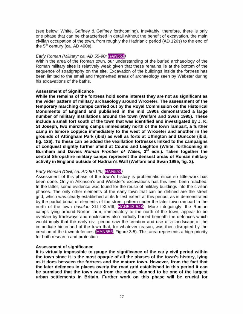
(see below; White, Gaffney & Gaffney forthcoming). Inevitably, therefore, there is only one phase that can be characterised in detail without the benefit of excavation, the main civilian occupation of the town, from roughly the Hadrianic period (AD 120s) to the end of the 5th century (ca. AD 490s). Early Roman (Military; ca. AD 55-90; HAN551) Within the area of the Roman town, our understanding of the buried archaeology of the Roman military sites is relatively weak given that these remains lie at the bottom of the sequence of stratigraphy on the site. Excavation of the buildings inside the fortress has been limited to the small and fragmented areas of archaeology seen by Webster during his excavations of the baths. Assessment of Significance While the remains of the fortress hold some interest they are not as significant as the wider pattern of military archaeology around Wroxeter. The assessment of the temporary marching camps carried out by the Royal Commission on the Historical Monuments of England and published in the mid 1990s demonstrated a large number of military instillations around the town (Welfare and Swan 1995). These include a small fort south of the town that was identified and investigated by J. K. St Joseph, two marching camps immediately north of the town rampart, a further camp in Ismore coppice immediately to the west of Wroxeter and another in the grounds of Attingham Park (ibid) as well as forts at Uffington and Duncote (ibid, fig. 126). To these can be added the vexillation fortresses linked to the campaigns of conquest slightly further afield at Cound and Leighton (White, forthcoming in Burnham and Davies Roman Frontier of Wales, 3rd edn.). Taken together the central Shropshire military camps represent the densest areas of Roman military activity in England outside of Hadrian’s Wall (Welfare and Swan 1995, fig. 2). Early Roman (Civil; ca. AD 90-120; HAN552) Assessment of this phase of the town’s history is problematic since so little work has been done. Only in Atkinson’s and Webster’s excavations has this level been reached. In the latter, some evidence was found for the reuse of military buildings into the civilian phases. The only other elements of the early town that can be defined are the street grid, which was clearly established at its fullest extent at this period, as is demonstrated by the partial burial of elements of the street pattern under the later town rampart in the north of the town (insulae XLIII-XLVIII; HAN543-548). More intriguingly, the Roman camps lying around Norton farm, immediately to the north of the town, appear to be overlain by trackways and enclosures also partially buried beneath the defences which would imply that the early civil period saw the creation and use of a landscape in the immediate hinterland of the town that, for whatever reason, was then disrupted by the creation of the town defences (HAN556; Figure 3.5). This area represents a high priority for both research and protection. Assessment of significance It is virtually impossible to gauge the significance of the early civil period within the town since it is the most opaque of all the phases of the town’s history, lying as it does between the fortress and the mature town. However, from the fact that the later defences in places overly the road grid established in this period it can be surmised that the town was from the outset planned to be one of the largest urban settlements in Britain. Further work on this phase will be crucial for
27
characterising the ambitions of the civilian establishment at this period and its potential is high given that it is deeply stratified. The possible identification of an early Roman landscape in association with the Roman town represents a potentially unique survival within Britain. These fields are still currently under plough although recent geophysical survey has demonstrated that the cropmark features still survive. It is therefore an urgent priority to secure the future of these remains by taking this field out of cultivation so as to preserve it for future investigation.
Figure 3.5: The cropmarks around Norton Farm (HAN556) as plotted by RCHME [English Heritage]. Civil period, (ca. AD 120-490 HAN553) This period of Wroxeter’s history is the most comprehensively understood and there is too much information to easily summarise. The remains have been characterised and described in detail (White and Gaffney 2003; White, Gaffney and Gaffney forthcoming) giving for the first time an over view of the whole town, or at least those elements of the town that are visible in the aerial photographs and in the geophysics. Broad patterns can however be presented. Both survey sets demonstrate that the central insulae of the town have many masonry buildings, mainly town houses of various sizes including substantial courtyard buildings, linear houses with three or four rooms and corridors and simple strip-houses aligned onto street frontages. Some public buildings can also be identified, notably the forum (insula IV; HAN504), public baths (insula V; HAN505) and probable main temple (insula I HAN501; i.e. beneath the farm buildings). Other temples are visible south and north-west of the baths. A cattle market, forum boarium, has been tentatively identified in insula III HAN503 along with a possible mansio in insula XIII HAN513. The
28
insulae adjacent to the east defences appear to be filled with lower status structures while the insulae in the south of the town have a scatter of masonry houses set within open land. North of the Bell Brook, a cluster of dense, low status housing parallel to the rampart has been detected, an arrangement that echoes the position of housing in an Iron Age oppidum or hillfort (HAN534). The north-west part of the town shows a street grid laid out over the Bell Brook rather than respecting it. Pits are densely packed within these insulae indicative perhaps of an industrial area. If so then the industry might be water-dependent given the proximity to the Bell Brook (tanning and fulling have been suggested; White and Barker 1998). The infrastructure of the town is relatively well understood too. The defences seem to have been earthwork through the town’s life although they began as a rampart with two ditches before reaching their final form as a single rampart with broad single ditch and counterscarp bank. There is some debate as to whether the defences were in stone or were earthwork (as is argued by Barker 1985, for instance). As yet too little has been examined to decide this question. The line of the town’s aqueduct is known although the extant earthworks were ploughed out only 50 years ago. Elements of the street grid survive as modern lanes but the bulk of the road system is known only from cropmarks. There have been suggestions that there was a bridge across the Severn but there is no conclusive proof of this and a ford is as likely. Masonry in the river appears to relate to medieval or post medieval fish weirs (Pannett 1989). Activity in the immediate hinterland is relatively well understood although cannot be examined in detail here. GIS modelling indicates a preference for settlement location on the pastureland in the immediate hinterland, indicating that livestock processing may have been an important element in the town’s economy (Gaffney and White 2007). Assessment of Significance There are few towns in Britain that provide the level of detail and comprehensiveness of data that Wroxeter can furnish for this period. The other towns of similar calibre – Caerwent, Silchester, Verulamium – are much more extensively excavated and / or damaged by ploughing. Similarly, their hinterlands have not been subject to extensive modern survey, with the exception of Silchester. Wroxeter thus has enormous potential for helping us to understand what an important town looked like in Roman Britain and how it functioned. To some extent this has been demonstrated by the work of the Wroxeter Hinterland Project but potentially there is much more that could be done to characterise the site. We would single out two interlinked areas of research that could enable considerable enhancement of our understanding of the site: geochemical prospection to test some of the hypotheses relating to the industrial areas of the site and a paleo-environmental survey of Wroxeter and its hinterland to characterise economic and agricultural change in the town throughout its existence. It is also important to realise that for the Romans, towns did not stop at the defences. They counted the immediate territory around the town as part of its area and thus key elements of the town are located beyond the defences, a fact that modern management must take into account. Not the least of these elements are the cemeteries. These have been investigated in a number of locations at WRC, notably on both sides of the Horseshoe Lane by Wright (1862), Atkinson (1924) and Houghton (1968). Only Wright was successful in discovering undisturbed graves and it seems clear that the cremation cemeteries known along this road
29
are now lost. Another cemetery lay just south of Norton farm but this too has only yielded cremations found by Wright. However, the fields to the west of Norton appear to show evidence for enclosed cemeteries which, if the case, would indicate a 3rd or 4th century date. These features have yet to be confirmed or excavated. They are under plough and are vulnerable to metal detectorists. Removing the threat of both is a high priority. Late Antiquity (ca. AD 490-650; HAN554) This phase has only been identified in excavation with the classic exposition being Barker’s excavations on the baths basilica (phase Z) (Barker et al. 1997). The phase can be characterised as the remodelling of pubic space into a private demesne perhaps for a warlord or bishop, creating timber buildings designed and executed in Roman mode. Surrounding insulae (HAN502, 504, 506, 509) have produced evidence for similar structures even though not fully recognised at the time. Quite how widespread this phase of occupation was across the town is unclear but it is likely that the focus was small, as with other Late Antique sites known from the continent or North Africa. Despite the much diminished area of occupation, the nature and scale of the evidence suggests continuing urban activity (White 2007). Note that this phase is not susceptible to aerial or geophysical survey yet is the most vulnerable phase as it lies at the top of the stratigraphic sequence. There has been a suggestion that the early defences on the southern lip of the Bell Brook (if that is what they were) were remodelled in this phase to provide a defensive feature defining the northern limit of this reduced core of the town. Further work is needed to confirm this picture. Assessment of Significance This is perhaps the most important phase in Wroxeter’s history in that no other site in Britain has produced as much evidence of urban occupation of this date. It has huge regional and national significance in helping researchers to understand and characterise this difficult period. The value comes in particular from the association of a very large dataset of stratified artefacts that can cast considerable light on how the transition from Roman material culture to a Brittonic one occurred. While is it not possible to fully characterise this phase spatially its importance and accessibility as the uppermost layer in the town suggests that it carries a high priority for future work. Early medieval and Medieval (ca. AD 650-1500; HAN555) Excavation in the town centre has implied the virtual abandonment of the area within the walled circuit around AD 650. The only exception to this appears to be the church, or rather the cross known to have stood within the churchyard until the 1740s. This Mercian style cross dates to the late 9th century and it is thus a possibility that the whole town was abandoned after ca. AD 650. However Bassett (1992) has argued on various grounds, not least the presence of a college of priests at Domesday, that before the church there was a Brittonic monastery established in the vicinity of the ford. The buried remains in the churchyard, although inevitably complicated by the existence of the cemetery, has potential as the providing the longest unbroken sequence of occupation / use in the whole town. The existence of a church implies a village too and it can only be assumed that the Anglo-Saxon village of Wroxeter lay around the church, as has now been proven at the neighbouring village of Atcham, which also has an Anglo-Saxon church. That being the case it is assumed that the later medieval (or more probably early post-medieval)
30
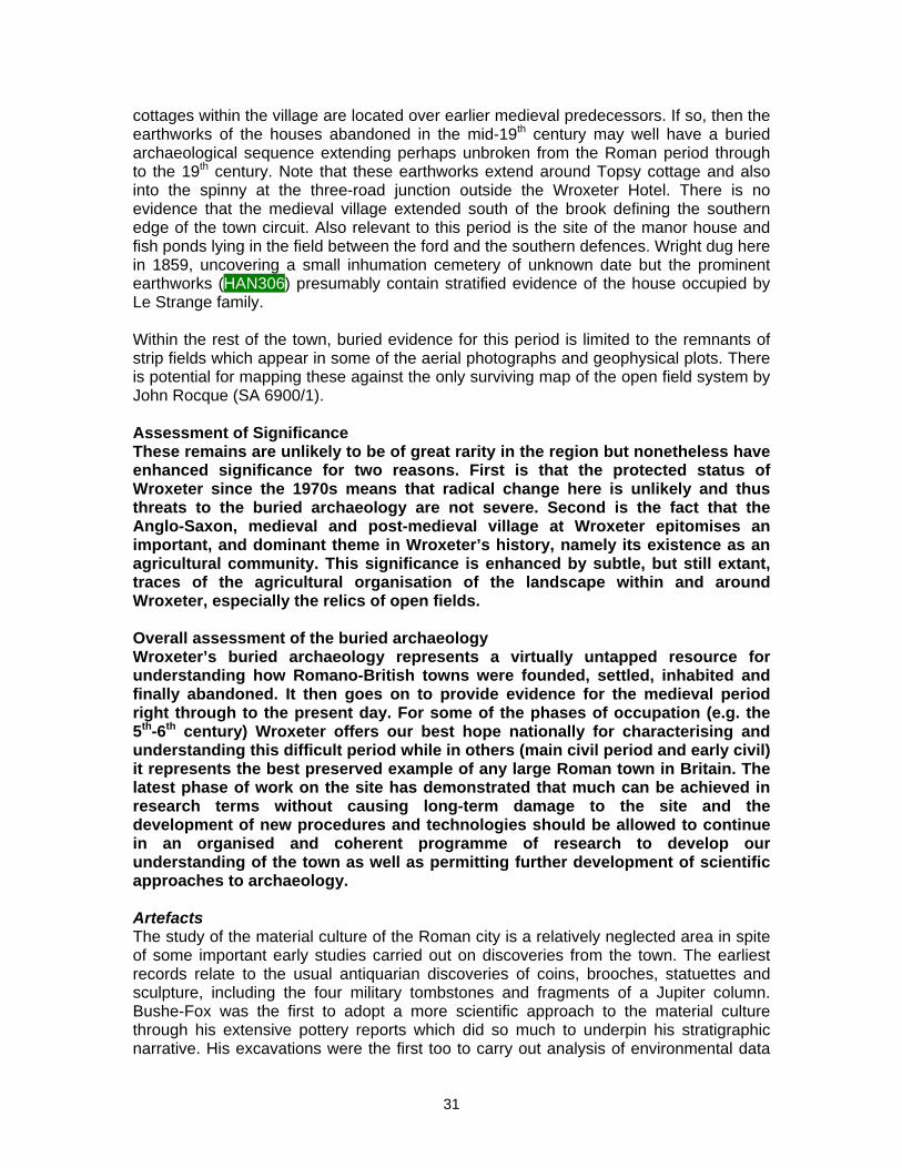
cottages within the village are located over earlier medieval predecessors. If so, then the earthworks of the houses abandoned in the mid-19th century may well have a buried archaeological sequence extending perhaps unbroken from the Roman period through to the 19th century. Note that these earthworks extend around Topsy cottage and also into the spinny at the three-road junction outside the Wroxeter Hotel. There is no evidence that the medieval village extended south of the brook defining the southern edge of the town circuit. Also relevant to this period is the site of the manor house and fish ponds lying in the field between the ford and the southern defences. Wright dug here in 1859, uncovering a small inhumation cemetery of unknown date but the prominent earthworks (HAN306) presumably contain stratified evidence of the house occupied by Le Strange family. Within the rest of the town, buried evidence for this period is limited to the remnants of strip fields which appear in some of the aerial photographs and geophysical plots. There is potential for mapping these against the only surviving map of the open field system by John Rocque (SA 6900/1). Assessment of Significance These remains are unlikely to be of great rarity in the region but nonetheless have enhanced significance for two reasons. First is that the protected status of Wroxeter since the 1970s means that radical change here is unlikely and thus threats to the buried archaeology are not severe. Second is the fact that the Anglo-Saxon, medieval and post-medieval village at Wroxeter epitomises an important, and dominant theme in Wroxeter’s history, namely its existence as an agricultural community. This significance is enhanced by subtle, but still extant, traces of the agricultural organisation of the landscape within and around Wroxeter, especially the relics of open fields. Overall assessment of the buried archaeology Wroxeter’s buried archaeology represents a virtually untapped resource for understanding how Romano-British towns were founded, settled, inhabited and finally abandoned. It then goes on to provide evidence for the medieval period right through to the present day. For some of the phases of occupation (e.g. the 5th-6th century) Wroxeter offers our best hope nationally for characterising and understanding this difficult period while in others (main civil period and early civil) it represents the best preserved example of any large Roman town in Britain. The latest phase of work on the site has demonstrated that much can be achieved in research terms without causing long-term damage to the site and the development of new procedures and technologies should be allowed to continue in an organised and coherent programme of research to develop our understanding of the town as well as permitting further development of scientific approaches to archaeology. Artefacts The study of the material culture of the Roman city is a relatively neglected area in spite of some important early studies carried out on discoveries from the town. The earliest records relate to the usual antiquarian discoveries of coins, brooches, statuettes and sculpture, including the four military tombstones and fragments of a Jupiter column. Bushe-Fox was the first to adopt a more scientific approach to the material culture through his extensive pottery reports which did so much to underpin his stratigraphic narrative. His excavations were the first too to carry out analysis of environmental data
31
recovered. In contrast, Atkinson’s work was much less concerned with a proper analysis of the cultural material tending instead to focus on the spectacular discoveries made in the forum, including the gutter find, inscription, silver mirror and diploma. None of these early excavators found significant amounts of material and were often selective in what they kept. With the start of modern excavation under Webster the practice of selection of pottery and other finds continued for a while until, in the mid 1960s, Barker adopted a more comprehensive approach to collection of artefacts. It is from these two excavations that the bulk of Wroxeter’s material culture is known since Graham Webster gradually adopted the approach of keeping all finds, although never sieving spoil as Barker did to retrieve finds. The exceptional quantity and quality of the remains from these two excavations, and the complete coverage they afford of the whole sequence of the town’s Roman history, offer a unique insight into the economy and society of the town yet the potential of these remains largely untapped (Cool 2006, 231-2). The finds from the baths basilica excavations alone offer huge quantities of artefacts for research: 1.5 tonnes of animal bone, 1 tonne of pottery, over 7000 stratified coins, 11,000 small finds in total. This is one of the largest groups of stratified material culture of Roman date from anywhere in Britain. Its analysis could cast considerable light on changing patterns of the Romano-British economy, on changing social mores and dress styles and on the economic basis of the town (Cool 2006). While much of the material has been studied, it has not been brought together in such a way as to realise its potential and far too much of the data rests in archives, inaccessible to researchers and the public alike. If studied and put into the context of the excavation it has the potential to revolutionise our understanding especially of the latest, 5th-6th century material culture, but will also cast considerable light on the adoption of Romanised lifestyles by the Cornovii. Furthermore, study of the stratified material will enable some context to be restored to the material found by earlier excavators, especially those working on insula V (HAN505). Work on this extensive collection is undoubtedly hindered by the division of the material between Shropshire Council and English Heritage. If at all possible these collections should be housed together so as to be capable of joint study. Assessment of Significance The material culture collected from the site at Wroxeter represents one of the largest and most comprehensive of any stratified Roman dataset from Britain (Cool, pers. comm.). Despite this its research potential remains largely unrealised due to the failure to fully study the material culture, especially from the Baths Basilica site. This mistake should be rectified through a concerted research programme designed to study and characterise the assemblage recovered from the site with a view to establishing a benchmark for the material culture of 5th and 6th century Britain. In order to facilitate this, it is further suggested that this nationally important collection be brought together to create an archaeological resource centre on the site, establishing a major resource for the study of Roman Britain. Historical Wroxeter’s historical importance is less certain than its archaeological legacy because history is in many senses more intangible in the absence of written records. Thus it is merely speculation that the Emperor Hadrian could have visited the town during his stay
32
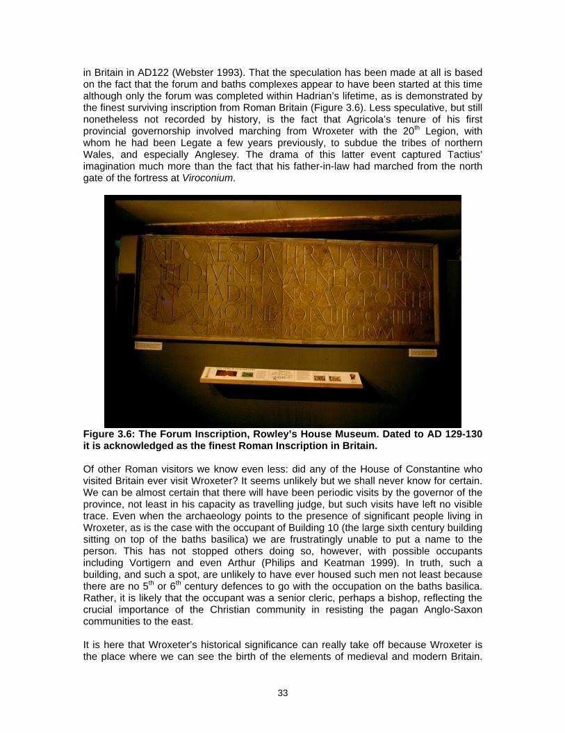
in Britain in AD122 (Webster 1993). That the speculation has been made at all is based on the fact that the forum and baths complexes appear to have been started at this time although only the forum was completed within Hadrian’s lifetime, as is demonstrated by the finest surviving inscription from Roman Britain (Figure 3.6). Less speculative, but still nonetheless not recorded by history, is the fact that Agricola’s tenure of his first provincial governorship involved marching from Wroxeter with the 20th Legion, with whom he had been Legate a few years previously, to subdue the tribes of northern Wales, and especially Anglesey. The drama of this latter event captured Tactius’ imagination much more than the fact that his father-in-law had marched from the north gate of the fortress at Viroconium.
Figure 3.6: The Forum Inscription, Rowley’s House Museum. Dated to AD 129-130 it is acknowledged as the finest Roman Inscription in Britain. Of other Roman visitors we know even less: did any of the House of Constantine who visited Britain ever visit Wroxeter? It seems unlikely but we shall never know for certain. We can be almost certain that there will have been periodic visits by the governor of the province, not least in his capacity as travelling judge, but such visits have left no visible trace. Even when the archaeology points to the presence of significant people living in Wroxeter, as is the case with the occupant of Building 10 (the large sixth century building sitting on top of the baths basilica) we are frustratingly unable to put a name to the person. This has not stopped others doing so, however, with possible occupants including Vortigern and even Arthur (Philips and Keatman 1999). In truth, such a building, and such a spot, are unlikely to have ever housed such men not least because there are no 5th or 6th century defences to go with the occupation on the baths basilica. Rather, it is likely that the occupant was a senior cleric, perhaps a bishop, reflecting the crucial importance of the Christian community in resisting the pagan Anglo-Saxon communities to the east. It is here that Wroxeter’s historical significance can really take off because Wroxeter is the place where we can see the birth of the elements of medieval and modern Britain.
33
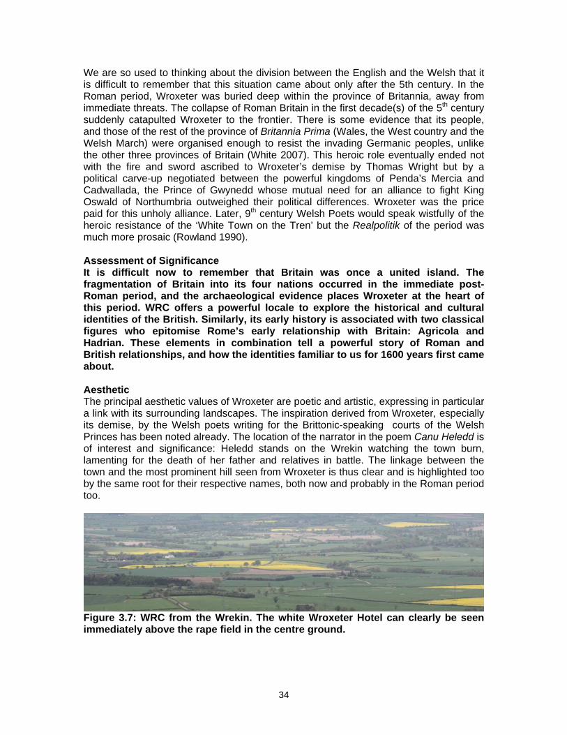
We are so used to thinking about the division between the English and the Welsh that it is difficult to remember that this situation came about only after the 5th century. In the Roman period, Wroxeter was buried deep within the province of Britannia, away from immediate threats. The collapse of Roman Britain in the first decade(s) of the 5th century suddenly catapulted Wroxeter to the frontier. There is some evidence that its people, and those of the rest of the province of Britannia Prima (Wales, the West country and the Welsh March) were organised enough to resist the invading Germanic peoples, unlike the other three provinces of Britain (White 2007). This heroic role eventually ended not with the fire and sword ascribed to Wroxeter’s demise by Thomas Wright but by a political carve-up negotiated between the powerful kingdoms of Penda’s Mercia and Cadwallada, the Prince of Gwynedd whose mutual need for an alliance to fight King Oswald of Northumbria outweighed their political differences. Wroxeter was the price paid for this unholy alliance. Later, 9th century Welsh Poets would speak wistfully of the heroic resistance of the ‘White Town on the Tren’ but the Realpolitik of the period was much more prosaic (Rowland 1990). Assessment of Significance It is difficult now to remember that Britain was once a united island. The fragmentation of Britain into its four nations occurred in the immediate post-Roman period, and the archaeological evidence places Wroxeter at the heart of this period. WRC offers a powerful locale to explore the historical and cultural identities of the British. Similarly, its early history is associated with two classical figures who epitomise Rome’s early relationship with Britain: Agricola and Hadrian. These elements in combination tell a powerful story of Roman and British relationships, and how the identities familiar to us for 1600 years first came about. Aesthetic The principal aesthetic values of Wroxeter are poetic and artistic, expressing in particular a link with its surrounding landscapes. The inspiration derived from Wroxeter, especially its demise, by the Welsh poets writing for the Brittonic-speaking courts of the Welsh Princes has been noted already. The location of the narrator in the poem Canu Heledd is of interest and significance: Heledd stands on the Wrekin watching the town burn, lamenting for the death of her father and relatives in battle. The linkage between the town and the most prominent hill seen from Wroxeter is thus clear and is highlighted too by the same root for their respective names, both now and probably in the Roman period too.
Figure 3.7: WRC from the Wrekin. The white Wroxeter Hotel can clearly be seen immediately above the rape field in the centre ground.
34
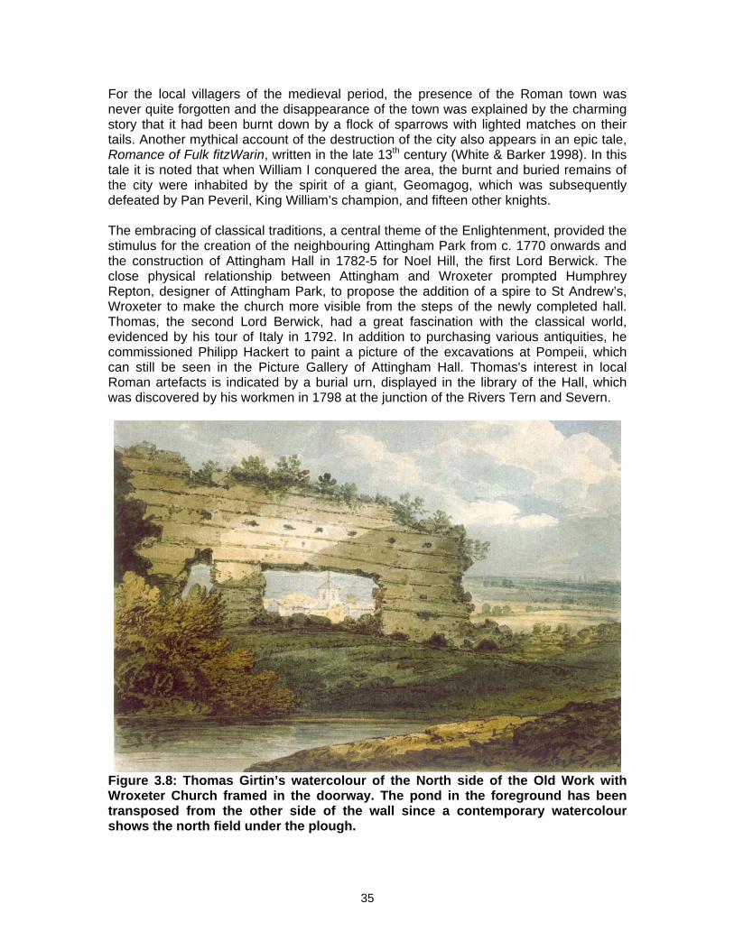
For the local villagers of the medieval period, the presence of the Roman town was never quite forgotten and the disappearance of the town was explained by the charming story that it had been burnt down by a flock of sparrows with lighted matches on their tails. Another mythical account of the destruction of the city also appears in an epic tale, Romance of Fulk fitzWarin, written in the late 13th century (White & Barker 1998). In this tale it is noted that when William I conquered the area, the burnt and buried remains of the city were inhabited by the spirit of a giant, Geomagog, which was subsequently defeated by Pan Peveril, King William’s champion, and fifteen other knights. The embracing of classical traditions, a central theme of the Enlightenment, provided the stimulus for the creation of the neighbouring Attingham Park from c. 1770 onwards and the construction of Attingham Hall in 1782-5 for Noel Hill, the first Lord Berwick. The close physical relationship between Attingham and Wroxeter prompted Humphrey Repton, designer of Attingham Park, to propose the addition of a spire to St Andrew’s, Wroxeter to make the church more visible from the steps of the newly completed hall. Thomas, the second Lord Berwick, had a great fascination with the classical world, evidenced by his tour of Italy in 1792. In addition to purchasing various antiquities, he commissioned Philipp Hackert to paint a picture of the excavations at Pompeii, which can still be seen in the Picture Gallery of Attingham Hall. Thomas's interest in local Roman artefacts is indicated by a burial urn, displayed in the library of the Hall, which was discovered by his workmen in 1798 at the junction of the Rivers Tern and Severn.
Figure 3.8: Thomas Girtin’s watercolour of the North side of the Old Work with Wroxeter Church framed in the doorway. The pond in the foreground has been transposed from the other side of the wall since a contemporary watercolour shows the north field under the plough.
35
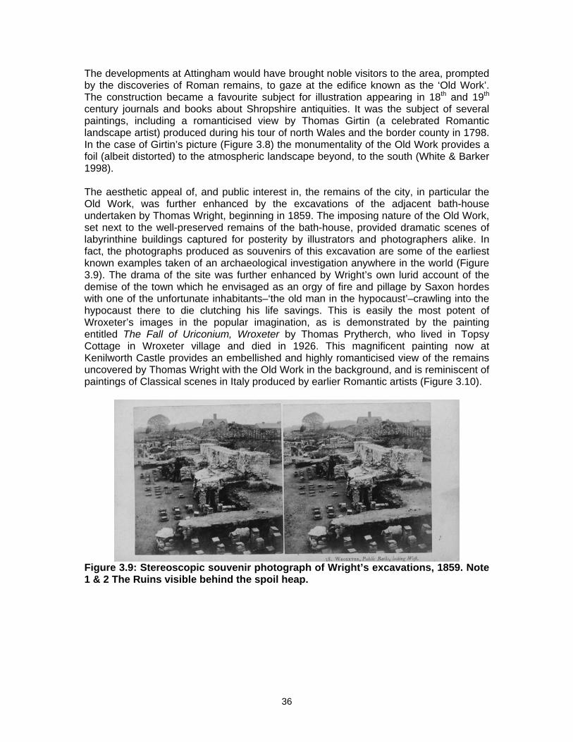
The developments at Attingham would have brought noble visitors to the area, prompted by the discoveries of Roman remains, to gaze at the edifice known as the ‘Old Work’. The construction became a favourite subject for illustration appearing in 18th and 19th century journals and books about Shropshire antiquities. It was the subject of several paintings, including a romanticised view by Thomas Girtin (a celebrated Romantic landscape artist) produced during his tour of north Wales and the border county in 1798. In the case of Girtin’s picture (Figure 3.8) the monumentality of the Old Work provides a foil (albeit distorted) to the atmospheric landscape beyond, to the south (White & Barker 1998). The aesthetic appeal of, and public interest in, the remains of the city, in particular the Old Work, was further enhanced by the excavations of the adjacent bath-house undertaken by Thomas Wright, beginning in 1859. The imposing nature of the Old Work, set next to the well-preserved remains of the bath-house, provided dramatic scenes of labyrinthine buildings captured for posterity by illustrators and photographers alike. In fact, the photographs produced as souvenirs of this excavation are some of the earliest known examples taken of an archaeological investigation anywhere in the world (Figure 3.9). The drama of the site was further enhanced by Wright’s own lurid account of the demise of the town which he envisaged as an orgy of fire and pillage by Saxon hordes with one of the unfortunate inhabitants–‘the old man in the hypocaust’–crawling into the hypocaust there to die clutching his life savings. This is easily the most potent of Wroxeter’s images in the popular imagination, as is demonstrated by the painting entitled The Fall of Uriconium, Wroxeter by Thomas Prytherch, who lived in Topsy Cottage in Wroxeter village and died in 1926. This magnificent painting now at Kenilworth Castle provides an embellished and highly romanticised view of the remains uncovered by Thomas Wright with the Old Work in the background, and is reminiscent of paintings of Classical scenes in Italy produced by earlier Romantic artists (Figure 3.10).
Figure 3.9: Stereoscopic souvenir photograph of Wright’s excavations, 1859. Note 1 & 2 The Ruins visible behind the spoil heap.
36
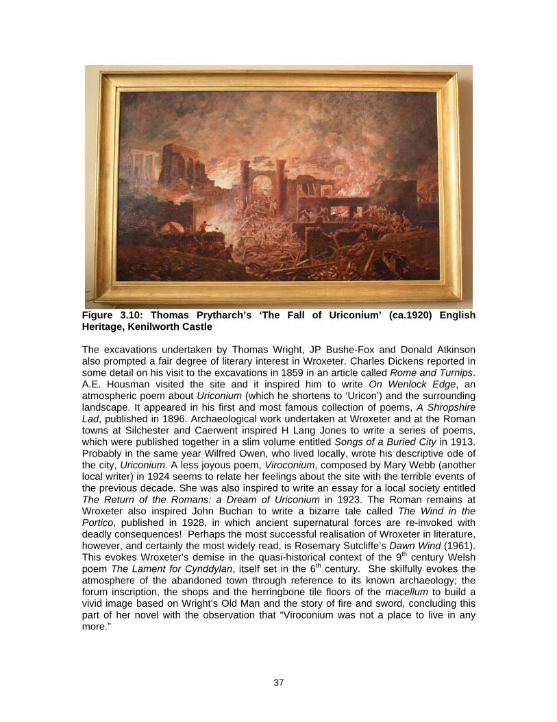
Figure 3.10: Thomas Prytharch’s ‘The Fall of Uriconium’ (ca.1920) English Heritage, Kenilworth Castle The excavations undertaken by Thomas Wright, JP Bushe-Fox and Donald Atkinson also prompted a fair degree of literary interest in Wroxeter. Charles Dickens reported in some detail on his visit to the excavations in 1859 in an article called Rome and Turnips. A.E. Housman visited the site and it inspired him to write On Wenlock Edge, an atmospheric poem about Uriconium (which he shortens to ‘Uricon’) and the surrounding landscape. It appeared in his first and most famous collection of poems, A Shropshire Lad, published in 1896. Archaeological work undertaken at Wroxeter and at the Roman towns at Silchester and Caerwent inspired H Lang Jones to write a series of poems, which were published together in a slim volume entitled Songs of a Buried City in 1913. Probably in the same year Wilfred Owen, who lived locally, wrote his descriptive ode of the city, Uriconium. A less joyous poem, Viroconium, composed by Mary Webb (another local writer) in 1924 seems to relate her feelings about the site with the terrible events of the previous decade. She was also inspired to write an essay for a local society entitled The Return of the Romans: a Dream of Uriconium in 1923. The Roman remains at Wroxeter also inspired John Buchan to write a bizarre tale called The Wind in the Portico, published in 1928, in which ancient supernatural forces are re-invoked with deadly consequences! Perhaps the most successful realisation of Wroxeter in literature, however, and certainly the most widely read, is Rosemary Sutcliffe’s Dawn Wind (1961). This evokes Wroxeter’s demise in the quasi-historical context of the 9th century Welsh poem The Lament for Cynddylan, itself set in the 6th century. She skilfully evokes the atmosphere of the abandoned town through reference to its known archaeology; the forum inscription, the shops and the herringbone tile floors of the macellum to build a vivid image based on Wright’s Old Man and the story of fire and sword, concluding this part of her novel with the observation that “Viroconium was not a place to live in any more.”
37
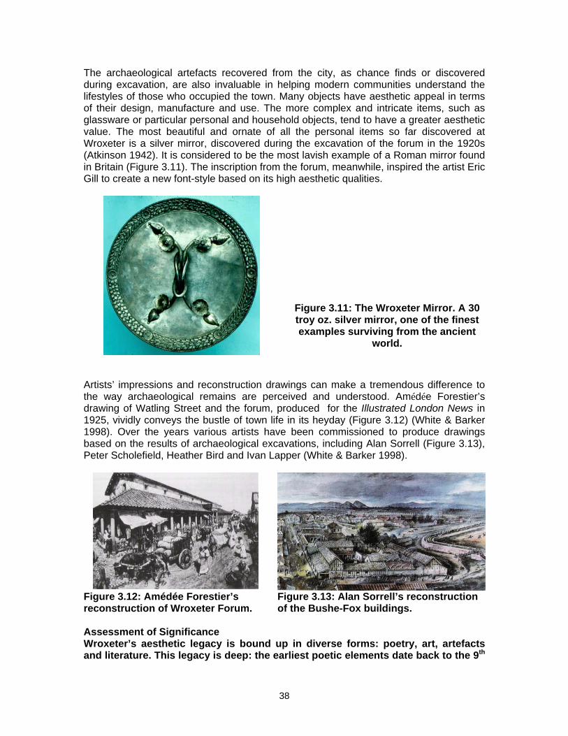
The archaeological artefacts recovered from the city, as chance finds or discovered during excavation, are also invaluable in helping modern communities understand the lifestyles of those who occupied the town. Many objects have aesthetic appeal in terms of their design, manufacture and use. The more complex and intricate items, such as glassware or particular personal and household objects, tend to have a greater aesthetic value. The most beautiful and ornate of all the personal items so far discovered at Wroxeter is a silver mirror, discovered during the excavation of the forum in the 1920s (Atkinson 1942). It is considered to be the most lavish example of a Roman mirror found in Britain (Figure 3.11). The inscription from the forum, meanwhile, inspired the artist Eric Gill to create a new font-style based on its high aesthetic qualities.
Figure 3.11: The Wroxeter Mirror. A 30 troy oz. silver mirror, one of the finest examples surviving from the ancient
world.
Artists’ impressions and reconstruction drawings can make a tremendous difference to the way archaeological remains are perceived and understood. Amédée Forestier’s drawing of Watling Street and the forum, produced for the Illustrated London News in 1925, vividly conveys the bustle of town life in its heyday (Figure 3.12) (White & Barker 1998). Over the years various artists have been commissioned to produce drawings based on the results of archaeological excavations, including Alan Sorrell (Figure 3.13), Peter Scholefield, Heather Bird and Ivan Lapper (White & Barker 1998).
Figure 3.12: Amédée Forestier’s reconstruction of Wroxeter Forum.
Figure 3.13: Alan Sorrell’s reconstruction of the Bushe-Fox buildings.
Assessment of Significance Wroxeter’s aesthetic legacy is bound up in diverse forms: poetry, art, artefacts and literature. This legacy is deep: the earliest poetic elements date back to the 9th
38
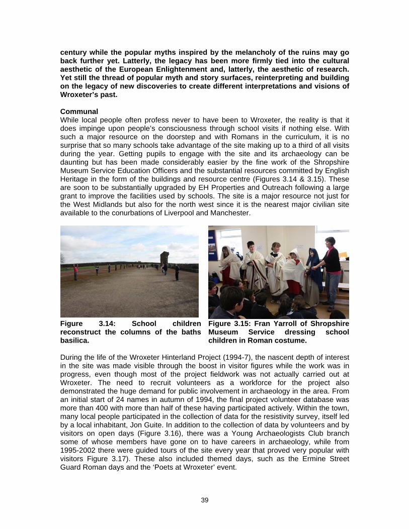
century while the popular myths inspired by the melancholy of the ruins may go back further yet. Latterly, the legacy has been more firmly tied into the cultural aesthetic of the European Enlightenment and, latterly, the aesthetic of research. Yet still the thread of popular myth and story surfaces, reinterpreting and building on the legacy of new discoveries to create different interpretations and visions of Wroxeter’s past. Communal While local people often profess never to have been to Wroxeter, the reality is that it does impinge upon people’s consciousness through school visits if nothing else. With such a major resource on the doorstep and with Romans in the curriculum, it is no surprise that so many schools take advantage of the site making up to a third of all visits during the year. Getting pupils to engage with the site and its archaeology can be daunting but has been made considerably easier by the fine work of the Shropshire Museum Service Education Officers and the substantial resources committed by English Heritage in the form of the buildings and resource centre (Figures 3.14 & 3.15). These are soon to be substantially upgraded by EH Properties and Outreach following a large grant to improve the facilities used by schools. The site is a major resource not just for the West Midlands but also for the north west since it is the nearest major civilian site available to the conurbations of Liverpool and Manchester.
Figure 3.14: School children reconstruct the columns of the baths basilica.
Figure 3.15: Fran Yarroll of Shropshire Museum Service dressing school children in Roman costume.
During the life of the Wroxeter Hinterland Project (1994-7), the nascent depth of interest in the site was made visible through the boost in visitor figures while the work was in progress, even though most of the project fieldwork was not actually carried out at Wroxeter. The need to recruit volunteers as a workforce for the project also demonstrated the huge demand for public involvement in archaeology in the area. From an initial start of 24 names in autumn of 1994, the final project volunteer database was more than 400 with more than half of these having participated actively. Within the town, many local people participated in the collection of data for the resistivity survey, itself led by a local inhabitant, Jon Guite. In addition to the collection of data by volunteers and by visitors on open days (Figure 3.16), there was a Young Archaeologists Club branch some of whose members have gone on to have careers in archaeology, while from 1995-2002 there were guided tours of the site every year that proved very popular with visitors Figure 3.17). These also included themed days, such as the Ermine Street Guard Roman days and the ‘Poets at Wroxeter’ event.
39
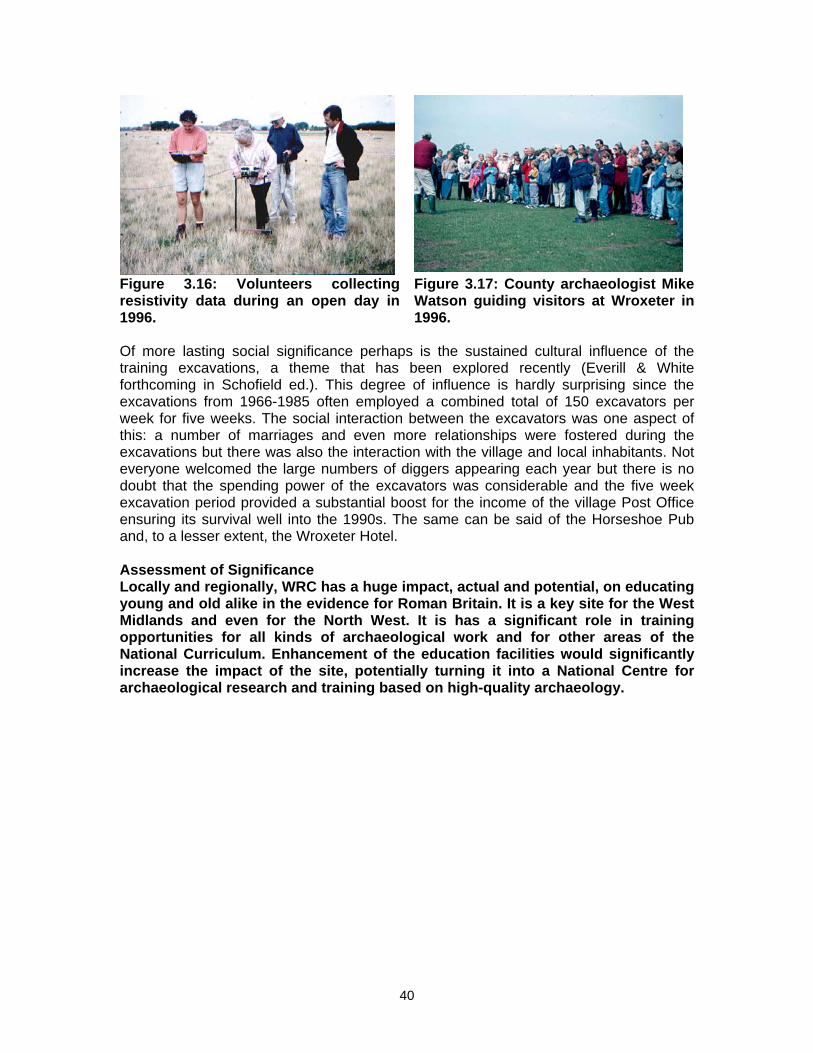
40
Figure 3.16: Volunteers collecting resistivity data during an open day in 1996.
Figure 3.17: County archaeologist Mike Watson guiding visitors at Wroxeter in 1996.
Of more lasting social significance perhaps is the sustained cultural influence of the training excavations, a theme that has been explored recently (Everill & White forthcoming in Schofield ed.). This degree of influence is hardly surprising since the excavations from 1966-1985 often employed a combined total of 150 excavators per week for five weeks. The social interaction between the excavators was one aspect of this: a number of marriages and even more relationships were fostered during the excavations but there was also the interaction with the village and local inhabitants. Not everyone welcomed the large numbers of diggers appearing each year but there is no doubt that the spending power of the excavators was considerable and the five week excavation period provided a substantial boost for the income of the village Post Office ensuring its survival well into the 1990s. The same can be said of the Horseshoe Pub and, to a lesser extent, the Wroxeter Hotel. Assessment of Significance Locally and regionally, WRC has a huge impact, actual and potential, on educating young and old alike in the evidence for Roman Britain. It is a key site for the West Midlands and even for the North West. It is has a significant role in training opportunities for all kinds of archaeological work and for other areas of the National Curriculum. Enhancement of the education facilities would significantly increase the impact of the site, potentially turning it into a National Centre for archaeological research and training based on high-quality archaeology.

CHAPTER 4. MANAGING WROXETER TODAY: CURRENT ISSUES AND RELATIONSHIP TO NATIONAL AND LOCAL POLICIES
This chapter aims to outline the current management issues within WRC, covering the whole scheduled area, regardless of ownership. The current management process is outlined and then the text considers the buildings, the relationship of the management to national, regional and local government and NGOs, the consultation process and lastly the scheduled area itself. 4.1 Towards a new land management process The land managed by English Heritage equates to the Secretary of State’s holding in guardianship (Figure 4.1). This accounts for the largest ownership; much of the remainder of the Roman city is managed by the National Trust. In addition, there are a number of private owners, mainly in Wroxeter village. The majority of the farmed landscape is tenanted. The Ancient Monuments and Archaeological Areas Act 1979 is the current legislation under which management is implemented. The objective for future management is to simplify the current system under which separate consents have to be granted for separate management initiatives, however minor these might be. Under proposed legislation (the new Heritage Act) a more streamlined system would operate via Heritage Partnership Agreements (HPAs) which would serve as an overarching framework within which regular cyclical maintenance as well as one-off management initiatives could be implemented. HPAs would be able to grant consent for relatively minor and/or repetitive works such as fencing, sign-posting and routine repairs to buildings such as maintenance of the museum. These works will be grouped under an Asset Management Plan (AMP). On the other hand, certain works would require separate consent and might typically include all repairs to boundary walls and all repairs to the historic fabric of the displayed monument. The means of achieving management objectives could be via Environmental Stewardship Agreements (ESAs), agreements with individual private owners, with the National Trust, with Raby Estate and so on; in fact the remit is very wide. The HPA would be a public document agreed with the Local Authority and would be subject to monitoring and performance regulation. An HPA for Wroxeter would operate under the current legislation but would serve as a model to be tested in advance of a new Heritage Act. Partners would normally include the owner (in the case of Wroxeter, English Heritage’s Property and Outreach section would fulfil the role of manager), the Local Planning Authority (Shropshire Council) and English Heritage’s Planning and Development group. Consultees could typically include adjoining occupiers, relevant local and national amenity societies and other relevant local and national bodies. This Conservation Plan (CP) is the first step towards enabling a consistent and sustainable approach to the management of the entire monument which has never been achieved previously. It will feed into a comprehensive Conservation Management Plan (CMP) that contains strategic options and methods for sustaining the various significances identified in the CP. This will then lead to a series of HPAs targeted at specific works and cyclical operations (e.g. routine maintenance works) that will be prioritised. Thus, this section simply concentrates on summarising what types of assets need to be managed and what are the principal threats to those assets.
41
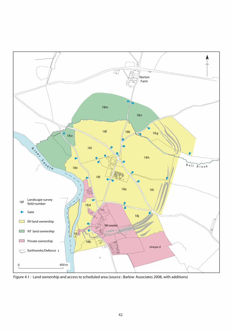
Earthworks/Defence s
18c
Ri v
er
Se
v e r nB e l l B r o o k
0 400 m
Gate
EH land ownership
NT land ownership
Private ownership
Landscape surveyfield number
18l
18e
18l
18o18f
18m
18n
18g
18h
18i18a
18d
18b
18j
18f
18k
vineyar d
Wroxeter
NortonFarm
Figure 4.1 : Land ownership and access to scheduled area (source : Barlow Associates 2008, with additions)
42

The main vulnerabilities/defects are: • the condition of the Roman ruins; • the extent of animal burrowing across the site; • the damage being caused by poaching by cattle; • the damage caused by nighthawking metal detectorists; • the condition and appearance of field boundaries; • the condition of water courses; • the colonisation of scrub and unmanaged woodland on parts of the site; • the presence of fly-tipping; • the management of the Farm buildings; • the condition and future of some tenanted houses, e.g. Mount Pleasant, the
former Smithy / Post Office; • the variable quality, condition and placement of signage; • the management implications of the lack of statutory protection (scheduling)
for parts of the site with known remains. All but the last of these aspects are examined in detail in Appendix 6, which draws in content largely from a recent condition survey conditioned by English Heritage from Barlow Associates (2008). Other management issues include the implications of widening access to the site and the provision of enhanced interpretation. This overview of management issues at Wroxeter can provide a basis on which to make further recommendations for the retention of significant features of the site. This could be achieved by:
• maintenance and conservation; • legal protection; • continuing identification, recording and research; • education and training; • presentation and interpretation; • liaison with the appropriate organisations and individuals.
It is clear that what is currently lacking for the site is an overarching framework within which to achieve these objectives and it is envisaged that this framework will be provided by the Heritage Partnership Agreement currently being formulated. It will be as important to agree the priority of works within the HPA as it will be to identify those works and it is suggested that the issue of boundaries across the site should be high on the agenda. There is also a pressing need to acquire an up-to-date topographical survey of the entire site (to include all earthworks and walls) as a basis for making informed management recommendations. A programme of test pitting across the site to determine the depth of topsoil could also be a very useful tool on which to base management actions. A review of current Environmental Stewardship provision is also required and the possibility of extending and increasing the remit of existing provision via a Higher Level Scheme (HLS) should be considered, although it should be noted that EH is not itself eligible for the HLS scheme. A number of management objectives for Wroxeter would fulfil current HLS eligibility criteria, e.g. arable reversion, hedge planting for biodiversity protection, securing positive management for historic
43

buildings, protecting and enhancing undesignated historic environment features, enhancing and improving access and recreation. There is very good potential for realising a comprehensive set of management objectives for Wroxeter within a HLS. 4.2. Building management The disparate collection of buildings on the site is in varying condition and there is no real problem in making recommendations to deal with the material concerns. Indeed, this has been adequately covered already by a number of surveys e.g. Tolley and Walker 1999; Barlow Associates, 2008, and the programme of cyclical maintenance works drawn up by English Heritage which will eventually replace existing maintenance works programmes. The cyclical maintenance works schedule is part of the Asset Management Plan process and is evolving all the time. It has not yet been implemented in the current form because the costings have yet to be assigned before the work can be put out to tender. Of more importance however, is the need to find a sustainable use for the buildings so that their management can be integrated into a long-term strategy for the site. These issues are further explored in Appendix 6. 4.3 Opportunities/constraints within the policy framework for retaining significance and realising potential A wide range of local and national policy documents has been reviewed in relation to the management of Wroxeter (Appendix 5). This has been done largely to inform the process of formulating recommendations for the future management of the site (Chapter 5). There were no major areas of conflict detected but the documents and individuals consulted proved invaluable in formulating recommendations that would actively engage with current proposals and policies. The policy context for the management objectives of this CP is the national, regional and local framework. At the national level, both legislation and strategic guidance is in place to ensure both the protection of the historic environment and to highlight overarching themes that are felt to be important. At all levels - national, regional and local - the maximising of historical/cultural/biodiversity assets has risen rapidly up the political agenda. The spirit of much of the current policy that might influence the promotion of Wroxeter as a place of cultural/historical significance is positive rather than negative. Many of the key policy documents, whether at national, regional or local level, stress the importance of landscape character and historic assets and the value of realising their potential for enhancing the social, spiritual and economic vitality of communities. Policy documents that have appeared within the last five years or so in particular, embody an understanding of the need to promote ‘landscape’ in it widest sense – historical, archaeological, cultural, ecological, spatial, recreational, occupational - and this multi-facetted approach allows us considerable flexibility in the promotion of the historic and natural environment. This section briefly looks at the main policy documents in relation to the main objectives of this CP which are to:
• raise the profile of Wroxeter as a place of international significance; • conserve, protect and maintain the upstanding archaeological remains, the
farming landscape and specific standing structures within it without compromising the biodiversity values of the site;
• increase understanding of the entire site by engaging in further survey and research;
44

• to promote the entire site to as wide an audience as possible by improving the visitor’s experience and understanding through better on-site interpretation and wider, more inclusive access to the site.
The national policy framework as enshrined in English Heritage‘s Power of Place, 2000, which is not dwelt on here, acknowledges the importance of involving people in decisions about their heritage and observes that the historic environment is generally seen by people as a totality and a major contributor to quality of life. Other bodies, such as Natural England and the National Trust give voice to the values of integrated natural and cultural heritage conservation and management and the need to work in partnership to achieve objectives. In other words, there is little in national policy that is at variance with the objectives of this Conservation Plan. Much more detail on national policy is available on-line. Regional policy, embodied in the Regional Spatial Strategy for the West Midlands, 2008, incorporating the Regional Transport Strategy, 2008, highlights the importance of providing:
• a social infrastructure, including health, education, spiritual, cultural activities, sport and recreation;
• a green infrastructure to mitigate and adapt to a changing climate; provide green space for health and well-being and enhance biodiversity and landscape character;
• a public transport infrastructure and low carbon transport such as walking and cycling.
The West Midlands Regional Economic Strategy, 2007 also promotes the significance of a green and cultural infrastructure as being important for attracting businesses and tourists to the region. It stresses the importance of enhancing and maintaining environmental assets such as historic and other visitor attractions. In other words, the strategy regards green and cultural infrastructure as a key economic asset. The Biodiversity Strategy for the West Midlands (Restoring the Region’s Wildlife: the Regional Biodiversity Strategy for the West Midlands (2005), the Regional Forestry Framework (Growing Our Future: the West Midlands Regional Forestry Framework (2004) and the West Midlands Health and Well Being Strategy (2008) all acknowledge the importance of preserving the region’s rich and varied heritage. While these documents provide an overarching acknowledgement of the significance of the cultural/historic resource and an understanding of the opportunities available to enhance its significance, at the local level, there is a much greater emphasis on the distinctiveness of the historic/cultural environment and the ways in which it can play a positive role in any vision for the borough. Wroxeter lies within the former Shrewsbury and Atcham District, now called Shrewsbury and Atcham Borough, whose council is one of the six authorities comprising the new unitary authority for Shropshire. The borough has been working with the other five authorities to develop planning policy and produce the new Local Development Framework (LDF) for the new area. The ‘Green Infrastructure’ (GI) of the LDF specifically includes the historic, cultural and natural environment with a vision as follows:
45
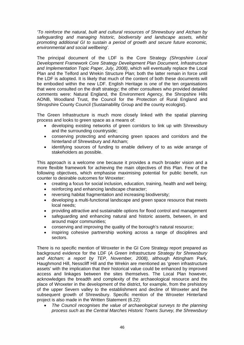
‘To reinforce the natural, built and cultural resources of Shrewsbury and Atcham by safeguarding and managing historic, biodiversity and landscape assets, whilst promoting additional GI to sustain a period of growth and secure future economic, environmental and social wellbeing’. The principal document of the LDF is the Core Strategy (Shropshire Local Development Framework Core Strategy Development Plan Document, Infrastructure and Implementation Topic Paper, July, 2008), which will eventually replace the Local Plan and the Telford and Wrekin Structure Plan; both the latter remain in force until the LDF is adopted. It is likely that much of the content of both these documents will be embodied within the new LDF. English Heritage is one of the ten organisations that were consulted on the draft strategy; the other consultees who provided detailed comments were: Natural England, the Environment Agency, the Shropshire Hills AONB, Woodland Trust, the Council for the Protection of Rural England and Shropshire County Council (Sustainability Group and the county ecologist). The Green Infrastructure is much more closely linked with the spatial planning process and looks to green space as a means of:
• developing existing networks of green corridors to link up with Shrewsbury and the surrounding countryside;
• conserving protecting and enhancing green spaces and corridors and the hinterland of Shrewsbury and Atcham;
• identifying sources of funding to enable delivery of to as wide arrange of stakeholders as possible.
This approach is a welcome one because it provides a much broader vision and a more flexible framework for achieving the main objectives of this Plan. Few of the following objectives, which emphasise maximising potential for public benefit, run counter to desirable outcomes for Wroxeter:
• creating a focus for social inclusion, education, training, health and well being; • reinforcing and enhancing landscape character; • reversing habitat fragmentation and increasing biodiversity; • developing a multi-functional landscape and green space resource that meets
local needs; • providing attractive and sustainable options for flood control and management • safeguarding and enhancing natural and historic asserts, between, in and
around major communities; • conserving and improving the quality of the borough’s natural resource; • inspiring cohesive partnership working across a range of disciplines and
sectors. There is no specific mention of Wroxeter in the GI Core Strategy report prepared as background evidence for the LDF (A Green Infrastructure Strategy for Shrewsbury and Atcham; a report by TEP, November, 2008), although Attingham Park, Haughmond Hill, Nesscliff Hill and the Wrekin are mentioned as ‘green infrastructure assets’ with the implication that their historical value could be enhanced by improved access and linkages between the sites themselves. The Local Plan however, acknowledges the breadth and complexity of the archaeological resource and the place of Wroxeter in the development of the district, for example, from the prehistory of the upper Severn valley to the establishment and decline of Wroxeter and the subsequent growth of Shrewsbury. Specific mention of the Wroxeter Hinterland project is also made in the Written Statement (6.22):
• The Council recognises the value of archaeological surveys to the planning process such as the Central Marches Historic Towns Survey, the Shrewsbury
46
Urban Archaeological Database, the North West Wetlands Survey and the Wroxeter Hinterland Project.
There is little in the vision of the Local Plan that is at variance with the intent behind the newly emerging LDF, for the Local Plan’s aims are:
• to actively encourage a diverse and sustainable rural economy; • to promote development of the Borough’s tourism potential in a way which is
sympathetic to the local environment; • to conserve and enhance the Borough’s historic buildings, Conservation
Areas, archaeological sites and historic landscape; • to promote development of a range of recreation, leisure and tourism
opportunities within the borough and • to preserve and enhance elements of ecological and landscape importance
and promote opportunities to create new habitats. There is support in the Local Plan (Written Statement, 6.54) for the creation of new Conservation Areas (currently 17 in the borough) and Wroxeter meets many of the criteria for this, for example, good evidence (both documentary and surviving on the ground) for historic land-use, attractive relationship between buildings and open spaces, archaeological interest, social interest, landscape value. In terms of improving the visitor experience, the Local Plan again supports one of the main objectives for Wroxeter, namely:
• …..the council will seek to develop initiatives which would involve both owners and the local community in finding ways to interpret the history of particular sites and to provide, as resources permit, the means for the public to access the sites and to have the necessary facilities which may be required to provide for the proper interpretation and understanding of the sites as well as providing for the comfort of the visitor.’ (Written Statement, 6.93).
Further:
• The council will encourage the provision and maintenance of public access to allow for the interpretation of sites of historic interest….and will support proposals for the sympathetic interpretation of the sites by way marking, signing and if required, the provision of car parking and other facilities (Written Statement, 6.93, Statement).
The remaining key local plans all acknowledge the significance of the historic/cultural and natural environments. For example, Shropshire’s economic development strategy (Shropshire’s Futures, 2003) recognises that outstanding natural and built environments are key economic assets to be nurtured and harnessed. The Shropshire Sustainable Community Strategy, 2006 urges development of a green infrastructure, and community buildings, investment in leisure services, walking and cycling networks. In this Wroxeter is already embedded in that it lies on a National Cycleway, a National Footpath (Severn Way) and an operational bus route. The Town and Village Design Statements for Shropshire all urge the preservation of local distinctiveness and the importance of keeping rural communities vital and the rural economy strong. Within their remit, support will be given to non-agricultural enterprises which could include the adaptation and re-use of rural buildings in open countryside.
47

The Shrewsbury Countryside Strategy and Rural Area Countryside Strategy, 1991 – recommend a series of projects and policies that would ensure the protection and enhancement of its countryside resource. This is not confined to nature conservation but includes landscape and historical issues and has resulted in a network of ‘Countryside Heritage Sites’ managed by the Countryside Unit (the organisation of these in the new unitary authority is uncertain). The key objectives of Shrewsbury and Atcham Borough’s tourism strategy all accord well with the vision for Wroxeter. They are to:
• improve and enhancing the visitor experience; • increase visitor spending through targeted promotions utilising the Tourist
Information Centre and • develop Shrewsbury as a leading regional cultural centre.
There appear to be few actual impediments to achieving the Conservation Plan’s objectives. Although the West Midlands Spatial Strategy identifies Shrewsbury and its hinterland as a new domestic and economic growth point, any proposals will specifically require the conservation and enhancement of the environment. In any case, Wroxeter’s status as a scheduled monument protects it from major development, but there are positive implications for the setting of the site; it seems unlikely that this would be compromised by the siting of new development in or close to the scheduled monument and of course, any such proposals would be subject to consultation. Wroxeter and its hinterland are not mapped in the supporting documentation for the GI but is undoubtedly an area of low development capacity / high historic value. The GI is mindful that such areas should be protected and designated within development proposals as being low priority for development due to the high presence, quality and sustainability of historic environment features. A positive spin-off in making WRC more accessible is that these areas are identified as likely to be suitable as extensions to the green space network within the urban fringe areas, using and enhancing existing accessible features, e.g. cycleways (Wroxeter is already on a National Cycle Route), waterways, footpaths, multi-use routes, to provide a ‘green link’ between the urban area and the adjoining countryside. In summary, both existing and proposed policy provide an optimistic framework within which to pursue the objectives of this CP. The degree of accord between the various policies discussed here is not perhaps surprising and it would be alarming if the situation were otherwise. In particular, the proposed Green Infrastructure is a timely opportunity to realise most if not all the key objectives for WRC. Perhaps the most fruitful outcome in GI terms could be the creation of improved tourist facilities and wider access. Wroxeter is currently an under-valued resource and its promotion is weak. The LDF and local planning policies identify the natural and historic environments as a ‘tourist pull’ but point to a lack of widespread access and tourist facilities. The tourist attractions of Shrewsbury itself are well recognised (though could be improved) but WRC is one of the ‘pockets across the borough’ that the GI recognises as having key tourism assets within attractive landscapes and in close proximity to primary trails and access routes. The GI specifically mentions here the Severn corridor to the south, Haughmond Hill, Attingham Park and the landscape around Buildwas. Wroxeter is not mentioned but is an obvious omission in that it could form part of a trail between such sites, particularly between Haughmond Hill and Attingham Park.
48

49
4.4 Outcomes from the consultation process An informally-constituted steering group, with representatives from several organisations and individuals, has overseen the production of this Conservation Plan. It is recommended that this process should continue in order to ensure that all the interests in the defined area are represented and fed into the Heritage Partnership Agreement. As part of the consultation process, a number of meetings have been held with the public and interest groups (Appendix 2). The aim of these meetings has been to get feedback from as many interested parties as possible, including the community. The issues raised are listed in Appendix 2. It is clear from these proceedings that the local community and interest groups are eager to be involved with the Conservation Plan process. The goodwill generated through the consultation process is perhaps something that might be usefully continued by EH in future management plans. 4.5 Consideration of an extension to statutory protection for parts of the site The scheduled status of WRC (Figure 1.2, page 4), affords it statutory protection in the face of any policy dictates, but not all the site is so protected and it is therefore important that the current scheduling is reviewed to take account of outlying parts of the site that would merit such protection. The primary areas of concern are:
• land within the defences not under the ownership of either the Secretary of State or the unalienable land owned by the National Trust. This principally includes the small plot of land between Boathouse Cottage and the River Severn and the former glebe lands behind the Wroxeter Hotel owned by the Millington family;
• the cropmarks relating to the camps, early civilian-period trackways and possible cemeteries to the north of the defences on either side of Norton Farm and one field to the north of B5061;
• the Roman Burial ground at Middle Crows Green to the south of the Horseshoe Lane;
• The fields south of the Bell Brook up to the B4380 and containing the line of the town aqueduct;
• The fields south of the B4380 and extending round to the bank of the Severn, incorporating the already Scheduled Auxiliary Fort adjacent to the river;
• The land on the first terrace between the River Severn and Ismore Coppice, the site of Wroxeter’s tilery and brickworks (Houghton 1960).
Of these the most important are the lands within the defences, the area of cropmarks around Norton Farm which are of national importance in preserving a rare and transient phase in Wroxeter’s early history (Figure 3.5, page 27). Scheduling of these extramural areas would bring the added benefit of promoting links between Attingham Park’s estate and the site of Wroxeter Roman City.
The main vulnerabilities/defects are: • the condition of the Roman ruins; • the extent of animal burrowing across the site; • the damage being caused by poaching by cattle; • the damage caused by nighthawking metal detectorists; • the condition and appearance of field boundaries; • the condition of water courses; • the colonisation of scrub and unmanaged woodland on parts of the site; • the presence of fly-tipping; • the management of the Farm buildings; • the condition and future of some tenanted houses, e.g. Mount Pleasant, the
former Smithy / Post Office; • the variable quality, condition and placement of signage; • the management implications of the lack of statutory protection (scheduling)
for parts of the site with known remains. All but the last of these aspects are examined in detail in Appendix 6, which draws in content largely from a recent condition survey conditioned by English Heritage from Barlow Associates (2008). Other management issues include the implications of widening access to the site and the provision of enhanced interpretation. This overview of management issues at Wroxeter can provide a basis on which to make further recommendations for the retention of significant features of the site. This could be achieved by:
• maintenance and conservation; • legal protection; • continuing identification, recording and research; • education and training; • presentation and interpretation; • liaison with the appropriate organisations and individuals.
It is clear that what is currently lacking for the site is an overarching framework within which to achieve these objectives and it is envisaged that this framework will be provided by the Heritage Partnership Agreement currently being formulated. It will be as important to agree the priority of works within the HPA as it will be to identify those works and it is suggested that the issue of boundaries across the site should be high on the agenda. There is also a pressing need to acquire an up-to-date topographical survey of the entire site (to include all earthworks and walls) as a basis for making informed management recommendations. A programme of test pitting across the site to determine the depth of topsoil could also be a very useful tool on which to base management actions. A review of current Environmental Stewardship provision is also required and the possibility of extending and increasing the remit of existing provision via a Higher Level Scheme (HLS) should be considered, although it should be noted that EH is not itself eligible for the HLS scheme. A number of management objectives for Wroxeter would fulfil current HLS eligibility criteria, e.g. arable reversion, hedge planting for biodiversity protection, securing positive management for historic
43

buildings, protecting and enhancing undesignated historic environment features, enhancing and improving access and recreation. There is very good potential for realising a comprehensive set of management objectives for Wroxeter within a HLS. 4.2. Building management The disparate collection of buildings on the site is in varying condition and there is no real problem in making recommendations to deal with the material concerns. Indeed, this has been adequately covered already by a number of surveys e.g. Tolley and Walker 1999; Barlow Associates, 2008, and the programme of cyclical maintenance works drawn up by English Heritage which will eventually replace existing maintenance works programmes. The cyclical maintenance works schedule is part of the Asset Management Plan process and is evolving all the time. It has not yet been implemented in the current form because the costings have yet to be assigned before the work can be put out to tender. Of more importance however, is the need to find a sustainable use for the buildings so that their management can be integrated into a long-term strategy for the site. These issues are further explored in Appendix 6. 4.3 Opportunities/constraints within the policy framework for retaining significance and realising potential A wide range of local and national policy documents has been reviewed in relation to the management of Wroxeter (Appendix 5). This has been done largely to inform the process of formulating recommendations for the future management of the site (Chapter 5). There were no major areas of conflict detected but the documents and individuals consulted proved invaluable in formulating recommendations that would actively engage with current proposals and policies. The policy context for the management objectives of this CP is the national, regional and local framework. At the national level, both legislation and strategic guidance is in place to ensure both the protection of the historic environment and to highlight overarching themes that are felt to be important. At all levels - national, regional and local - the maximising of historical/cultural/biodiversity assets has risen rapidly up the political agenda. The spirit of much of the current policy that might influence the promotion of Wroxeter as a place of cultural/historical significance is positive rather than negative. Many of the key policy documents, whether at national, regional or local level, stress the importance of landscape character and historic assets and the value of realising their potential for enhancing the social, spiritual and economic vitality of communities. Policy documents that have appeared within the last five years or so in particular, embody an understanding of the need to promote ‘landscape’ in it widest sense – historical, archaeological, cultural, ecological, spatial, recreational, occupational - and this multi-facetted approach allows us considerable flexibility in the promotion of the historic and natural environment. This section briefly looks at the main policy documents in relation to the main objectives of this CP which are to:
• raise the profile of Wroxeter as a place of international significance; • conserve, protect and maintain the upstanding archaeological remains, the
farming landscape and specific standing structures within it without compromising the biodiversity values of the site;
• increase understanding of the entire site by engaging in further survey and research;
44

• to promote the entire site to as wide an audience as possible by improving the visitor’s experience and understanding through better on-site interpretation and wider, more inclusive access to the site.
The national policy framework as enshrined in English Heritage‘s Power of Place, 2000, which is not dwelt on here, acknowledges the importance of involving people in decisions about their heritage and observes that the historic environment is generally seen by people as a totality and a major contributor to quality of life. Other bodies, such as Natural England and the National Trust give voice to the values of integrated natural and cultural heritage conservation and management and the need to work in partnership to achieve objectives. In other words, there is little in national policy that is at variance with the objectives of this Conservation Plan. Much more detail on national policy is available on-line. Regional policy, embodied in the Regional Spatial Strategy for the West Midlands, 2008, incorporating the Regional Transport Strategy, 2008, highlights the importance of providing:
• a social infrastructure, including health, education, spiritual, cultural activities, sport and recreation;
• a green infrastructure to mitigate and adapt to a changing climate; provide green space for health and well-being and enhance biodiversity and landscape character;
• a public transport infrastructure and low carbon transport such as walking and cycling.
The West Midlands Regional Economic Strategy, 2007 also promotes the significance of a green and cultural infrastructure as being important for attracting businesses and tourists to the region. It stresses the importance of enhancing and maintaining environmental assets such as historic and other visitor attractions. In other words, the strategy regards green and cultural infrastructure as a key economic asset. The Biodiversity Strategy for the West Midlands (Restoring the Region’s Wildlife: the Regional Biodiversity Strategy for the West Midlands (2005), the Regional Forestry Framework (Growing Our Future: the West Midlands Regional Forestry Framework (2004) and the West Midlands Health and Well Being Strategy (2008) all acknowledge the importance of preserving the region’s rich and varied heritage. While these documents provide an overarching acknowledgement of the significance of the cultural/historic resource and an understanding of the opportunities available to enhance its significance, at the local level, there is a much greater emphasis on the distinctiveness of the historic/cultural environment and the ways in which it can play a positive role in any vision for the borough. Wroxeter lies within the former Shrewsbury and Atcham District, now called Shrewsbury and Atcham Borough, whose council is one of the six authorities comprising the new unitary authority for Shropshire. The borough has been working with the other five authorities to develop planning policy and produce the new Local Development Framework (LDF) for the new area. The ‘Green Infrastructure’ (GI) of the LDF specifically includes the historic, cultural and natural environment with a vision as follows:
45

‘To reinforce the natural, built and cultural resources of Shrewsbury and Atcham by safeguarding and managing historic, biodiversity and landscape assets, whilst promoting additional GI to sustain a period of growth and secure future economic, environmental and social wellbeing’. The principal document of the LDF is the Core Strategy (Shropshire Local Development Framework Core Strategy Development Plan Document, Infrastructure and Implementation Topic Paper, July, 2008), which will eventually replace the Local Plan and the Telford and Wrekin Structure Plan; both the latter remain in force until the LDF is adopted. It is likely that much of the content of both these documents will be embodied within the new LDF. English Heritage is one of the ten organisations that were consulted on the draft strategy; the other consultees who provided detailed comments were: Natural England, the Environment Agency, the Shropshire Hills AONB, Woodland Trust, the Council for the Protection of Rural England and Shropshire County Council (Sustainability Group and the county ecologist). The Green Infrastructure is much more closely linked with the spatial planning process and looks to green space as a means of:
• developing existing networks of green corridors to link up with Shrewsbury and the surrounding countryside;
• conserving protecting and enhancing green spaces and corridors and the hinterland of Shrewsbury and Atcham;
• identifying sources of funding to enable delivery of to as wide arrange of stakeholders as possible.
This approach is a welcome one because it provides a much broader vision and a more flexible framework for achieving the main objectives of this Plan. Few of the following objectives, which emphasise maximising potential for public benefit, run counter to desirable outcomes for Wroxeter:
• creating a focus for social inclusion, education, training, health and well being; • reinforcing and enhancing landscape character; • reversing habitat fragmentation and increasing biodiversity; • developing a multi-functional landscape and green space resource that meets
local needs; • providing attractive and sustainable options for flood control and management • safeguarding and enhancing natural and historic asserts, between, in and
around major communities; • conserving and improving the quality of the borough’s natural resource; • inspiring cohesive partnership working across a range of disciplines and
sectors. There is no specific mention of Wroxeter in the GI Core Strategy report prepared as background evidence for the LDF (A Green Infrastructure Strategy for Shrewsbury and Atcham; a report by TEP, November, 2008), although Attingham Park, Haughmond Hill, Nesscliff Hill and the Wrekin are mentioned as ‘green infrastructure assets’ with the implication that their historical value could be enhanced by improved access and linkages between the sites themselves. The Local Plan however, acknowledges the breadth and complexity of the archaeological resource and the place of Wroxeter in the development of the district, for example, from the prehistory of the upper Severn valley to the establishment and decline of Wroxeter and the subsequent growth of Shrewsbury. Specific mention of the Wroxeter Hinterland project is also made in the Written Statement (6.22):
• The Council recognises the value of archaeological surveys to the planning process such as the Central Marches Historic Towns Survey, the Shrewsbury
46

Urban Archaeological Database, the North West Wetlands Survey and the Wroxeter Hinterland Project.
There is little in the vision of the Local Plan that is at variance with the intent behind the newly emerging LDF, for the Local Plan’s aims are:
• to actively encourage a diverse and sustainable rural economy; • to promote development of the Borough’s tourism potential in a way which is
sympathetic to the local environment; • to conserve and enhance the Borough’s historic buildings, Conservation
Areas, archaeological sites and historic landscape; • to promote development of a range of recreation, leisure and tourism
opportunities within the borough and • to preserve and enhance elements of ecological and landscape importance
and promote opportunities to create new habitats. There is support in the Local Plan (Written Statement, 6.54) for the creation of new Conservation Areas (currently 17 in the borough) and Wroxeter meets many of the criteria for this, for example, good evidence (both documentary and surviving on the ground) for historic land-use, attractive relationship between buildings and open spaces, archaeological interest, social interest, landscape value. In terms of improving the visitor experience, the Local Plan again supports one of the main objectives for Wroxeter, namely:
• …..the council will seek to develop initiatives which would involve both owners and the local community in finding ways to interpret the history of particular sites and to provide, as resources permit, the means for the public to access the sites and to have the necessary facilities which may be required to provide for the proper interpretation and understanding of the sites as well as providing for the comfort of the visitor.’ (Written Statement, 6.93).
Further:
• The council will encourage the provision and maintenance of public access to allow for the interpretation of sites of historic interest….and will support proposals for the sympathetic interpretation of the sites by way marking, signing and if required, the provision of car parking and other facilities (Written Statement, 6.93, Statement).
The remaining key local plans all acknowledge the significance of the historic/cultural and natural environments. For example, Shropshire’s economic development strategy (Shropshire’s Futures, 2003) recognises that outstanding natural and built environments are key economic assets to be nurtured and harnessed. The Shropshire Sustainable Community Strategy, 2006 urges development of a green infrastructure, and community buildings, investment in leisure services, walking and cycling networks. In this Wroxeter is already embedded in that it lies on a National Cycleway, a National Footpath (Severn Way) and an operational bus route. The Town and Village Design Statements for Shropshire all urge the preservation of local distinctiveness and the importance of keeping rural communities vital and the rural economy strong. Within their remit, support will be given to non-agricultural enterprises which could include the adaptation and re-use of rural buildings in open countryside.
47
The Shrewsbury Countryside Strategy and Rural Area Countryside Strategy, 1991 – recommend a series of projects and policies that would ensure the protection and enhancement of its countryside resource. This is not confined to nature conservation but includes landscape and historical issues and has resulted in a network of ‘Countryside Heritage Sites’ managed by the Countryside Unit (the organisation of these in the new unitary authority is uncertain). The key objectives of Shrewsbury and Atcham Borough’s tourism strategy all accord well with the vision for Wroxeter. They are to:
• improve and enhancing the visitor experience; • increase visitor spending through targeted promotions utilising the Tourist
Information Centre and • develop Shrewsbury as a leading regional cultural centre.
There appear to be few actual impediments to achieving the Conservation Plan’s objectives. Although the West Midlands Spatial Strategy identifies Shrewsbury and its hinterland as a new domestic and economic growth point, any proposals will specifically require the conservation and enhancement of the environment. In any case, Wroxeter’s status as a scheduled monument protects it from major development, but there are positive implications for the setting of the site; it seems unlikely that this would be compromised by the siting of new development in or close to the scheduled monument and of course, any such proposals would be subject to consultation. Wroxeter and its hinterland are not mapped in the supporting documentation for the GI but is undoubtedly an area of low development capacity / high historic value. The GI is mindful that such areas should be protected and designated within development proposals as being low priority for development due to the high presence, quality and sustainability of historic environment features. A positive spin-off in making WRC more accessible is that these areas are identified as likely to be suitable as extensions to the green space network within the urban fringe areas, using and enhancing existing accessible features, e.g. cycleways (Wroxeter is already on a National Cycle Route), waterways, footpaths, multi-use routes, to provide a ‘green link’ between the urban area and the adjoining countryside. In summary, both existing and proposed policy provide an optimistic framework within which to pursue the objectives of this CP. The degree of accord between the various policies discussed here is not perhaps surprising and it would be alarming if the situation were otherwise. In particular, the proposed Green Infrastructure is a timely opportunity to realise most if not all the key objectives for WRC. Perhaps the most fruitful outcome in GI terms could be the creation of improved tourist facilities and wider access. Wroxeter is currently an under-valued resource and its promotion is weak. The LDF and local planning policies identify the natural and historic environments as a ‘tourist pull’ but point to a lack of widespread access and tourist facilities. The tourist attractions of Shrewsbury itself are well recognised (though could be improved) but WRC is one of the ‘pockets across the borough’ that the GI recognises as having key tourism assets within attractive landscapes and in close proximity to primary trails and access routes. The GI specifically mentions here the Severn corridor to the south, Haughmond Hill, Attingham Park and the landscape around Buildwas. Wroxeter is not mentioned but is an obvious omission in that it could form part of a trail between such sites, particularly between Haughmond Hill and Attingham Park.
48
49
4.4 Outcomes from the consultation process An informally-constituted steering group, with representatives from several organisations and individuals, has overseen the production of this Conservation Plan. It is recommended that this process should continue in order to ensure that all the interests in the defined area are represented and fed into the Heritage Partnership Agreement. As part of the consultation process, a number of meetings have been held with the public and interest groups (Appendix 2). The aim of these meetings has been to get feedback from as many interested parties as possible, including the community. The issues raised are listed in Appendix 2. It is clear from these proceedings that the local community and interest groups are eager to be involved with the Conservation Plan process. The goodwill generated through the consultation process is perhaps something that might be usefully continued by EH in future management plans. 4.5 Consideration of an extension to statutory protection for parts of the site The scheduled status of WRC (Figure 1.2, page 4), affords it statutory protection in the face of any policy dictates, but not all the site is so protected and it is therefore important that the current scheduling is reviewed to take account of outlying parts of the site that would merit such protection. The primary areas of concern are:
• land within the defences not under the ownership of either the Secretary of State or the unalienable land owned by the National Trust. This principally includes the small plot of land between Boathouse Cottage and the River Severn and the former glebe lands behind the Wroxeter Hotel owned by the Millington family;
• the cropmarks relating to the camps, early civilian-period trackways and possible cemeteries to the north of the defences on either side of Norton Farm and one field to the north of B5061;
• the Roman Burial ground at Middle Crows Green to the south of the Horseshoe Lane;
• The fields south of the Bell Brook up to the B4380 and containing the line of the town aqueduct;
• The fields south of the B4380 and extending round to the bank of the Severn, incorporating the already Scheduled Auxiliary Fort adjacent to the river;
• The land on the first terrace between the River Severn and Ismore Coppice, the site of Wroxeter’s tilery and brickworks (Houghton 1960).
Of these the most important are the lands within the defences, the area of cropmarks around Norton Farm which are of national importance in preserving a rare and transient phase in Wroxeter’s early history (Figure 3.5, page 27). Scheduling of these extramural areas would bring the added benefit of promoting links between Attingham Park’s estate and the site of Wroxeter Roman City.
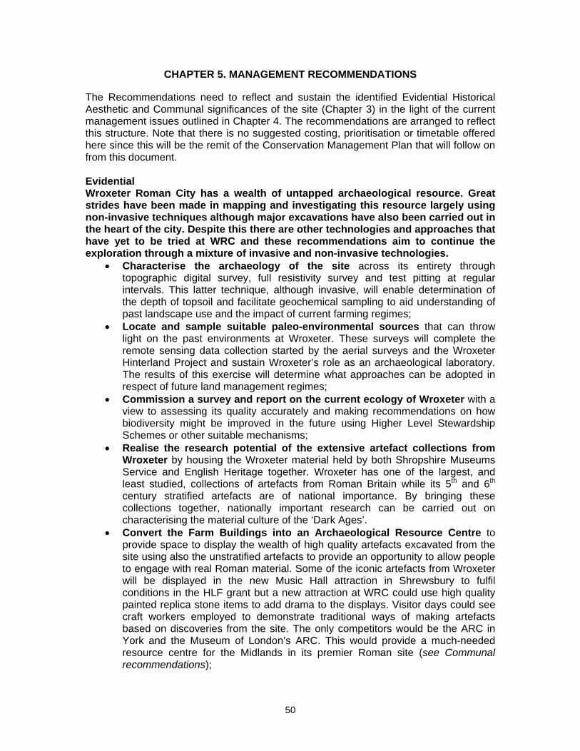
CHAPTER 5. MANAGEMENT RECOMMENDATIONS The Recommendations need to reflect and sustain the identified Evidential Historical Aesthetic and Communal significances of the site (Chapter 3) in the light of the current management issues outlined in Chapter 4. The recommendations are arranged to reflect this structure. Note that there is no suggested costing, prioritisation or timetable offered here since this will be the remit of the Conservation Management Plan that will follow on from this document. Evidential Wroxeter Roman City has a wealth of untapped archaeological resource. Great strides have been made in mapping and investigating this resource largely using non-invasive techniques although major excavations have also been carried out in the heart of the city. Despite this there are other technologies and approaches that have yet to be tried at WRC and these recommendations aim to continue the exploration through a mixture of invasive and non-invasive technologies.
• Characterise the archaeology of the site across its entirety through topographic digital survey, full resistivity survey and test pitting at regular intervals. This latter technique, although invasive, will enable determination of the depth of topsoil and facilitate geochemical sampling to aid understanding of past landscape use and the impact of current farming regimes;
• Locate and sample suitable paleo-environmental sources that can throw light on the past environments at Wroxeter. These surveys will complete the remote sensing data collection started by the aerial surveys and the Wroxeter Hinterland Project and sustain Wroxeter’s role as an archaeological laboratory. The results of this exercise will determine what approaches can be adopted in respect of future land management regimes;
• Commission a survey and report on the current ecology of Wroxeter with a view to assessing its quality accurately and making recommendations on how biodiversity might be improved in the future using Higher Level Stewardship Schemes or other suitable mechanisms;
• Realise the research potential of the extensive artefact collections from Wroxeter by housing the Wroxeter material held by both Shropshire Museums Service and English Heritage together. Wroxeter has one of the largest, and least studied, collections of artefacts from Roman Britain while its 5th and 6th century stratified artefacts are of national importance. By bringing these collections together, nationally important research can be carried out on characterising the material culture of the ‘Dark Ages’.
• Convert the Farm Buildings into an Archaeological Resource Centre to provide space to display the wealth of high quality artefacts excavated from the site using also the unstratified artefacts to provide an opportunity to allow people to engage with real Roman material. Some of the iconic artefacts from Wroxeter will be displayed in the new Music Hall attraction in Shrewsbury to fulfil conditions in the HLF grant but a new attraction at WRC could use high quality painted replica stone items to add drama to the displays. Visitor days could see craft workers employed to demonstrate traditional ways of making artefacts based on discoveries from the site. The only competitors would be the ARC in York and the Museum of London’s ARC. This would provide a much-needed resource centre for the Midlands in its premier Roman site (see Communal recommendations);
50
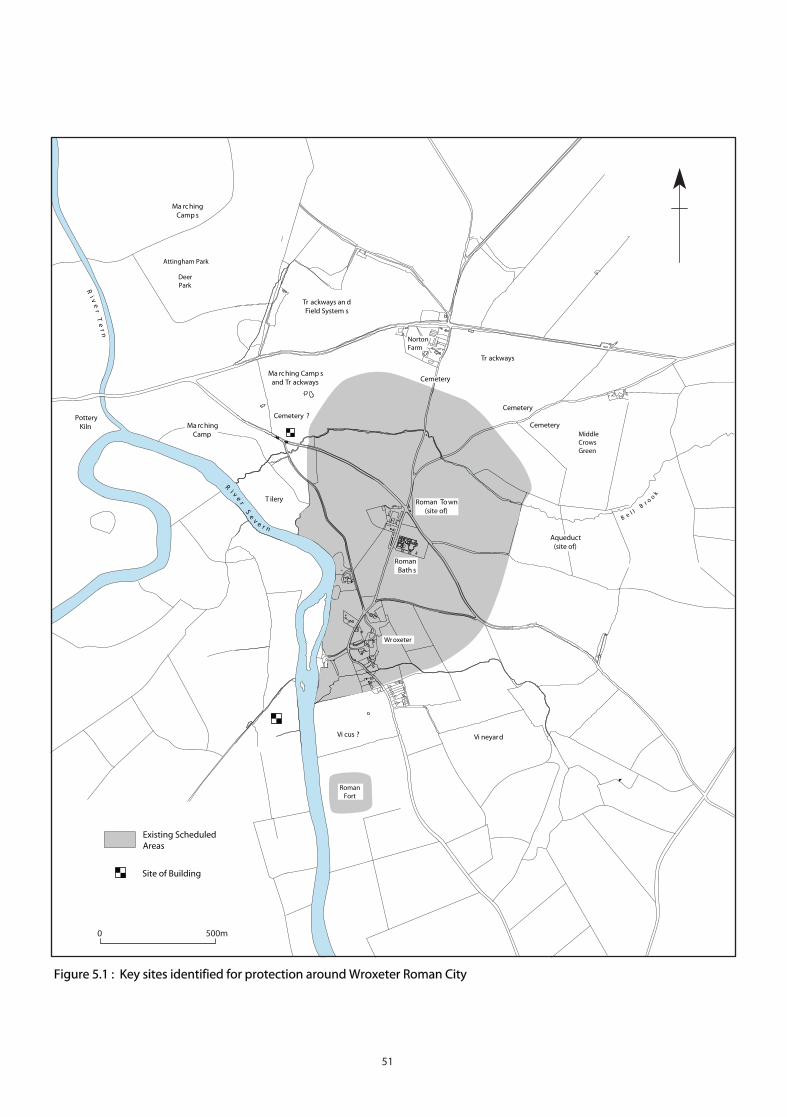
Ri v
er
Se
v e r n
B e l lB
r oo
k
0 500m
Existing ScheduledAreas
Attingham Park
Site of Building
Wroxeter
Vi neyar d
NortonFarm
MiddleCrowsGreen
RomanBath s
Roman To wn(site of)
DeerPark
RomanFort
Ri v
er
Te
rn
Figure 5.1 : Key sites identified for protection around Wroxeter Roman City
Vi cus ?
Aqueduct(site of)
Cemetery
Cemetery
Cemetery
Cemetery ?
Tr ackways
T ilery
Ma rc hingCamp
Ma rc hingCamp s
Ma rc hing Camp sand Tr ackways
Tr ackways an dField System s
PotteryKiln
51
Figure 5.2: The late 5th century tombstone of Cunorix.
Figure 5.3: Wroxeter’s street grid made visible in HAN207 during a drought.
• Review the scheduled area with a view to enhancing the protection of the
assets in the immediate area around WRC that were part of its operational infrastructure (earlier military forts, cemeteries, trackways, aqueduct, tile and pottery works, extra-mural buildings) (Figure 5.1). Of particular significance is HAN556, the nationally important cropmark landscape around Norton Farm dateable to the late 1st – late 2nd century AD. Consideration should also be given to resolving the anomalies of protection within the defences where some fields remain in private hands (e.g. the former glebe lands; HAN209, 210, 211) or are outside the scheduled area though within the defences (eg HAN213, the strip of land in front of The Boathouse) ;
• Record the field walls in and around the village (HAN408-410) since they incorporate a great deal of Roman masonry. Some consideration needs to be given to the stripping away of ivy from these walls, since the arborealised ivy does support a considerable variety of native insect species that aid bat and bird life.
Historical Wroxeter’s historical significance offers strong potential for exploring deep questions of identity and cultural perceptions that arose from the transformation of late Roman Britain into the nation states of the Medieval period. The site also offers other perspectives on historical figures that have in more recent times been associated with the site scientifically or culturally.
• Use the breadth of understanding about the Roman city to explore how Roman towns developed in Britain: how typical was WRC, and what can be learnt from its ultimate failure?;
• Exploit the nationally important ‘Dark Age’ remains on the site to explore how the boundaries of England and Wales were shaped and how new national identities emerged that still resonate today;
• Explore new interpretations based on historical people associated with the site. For the Roman period these include Agricola and Hadrian but the tombstones and few written records offer potential for stories about the townspeople too (Figure 5.2). We know, for instance that the early soldiers came
52
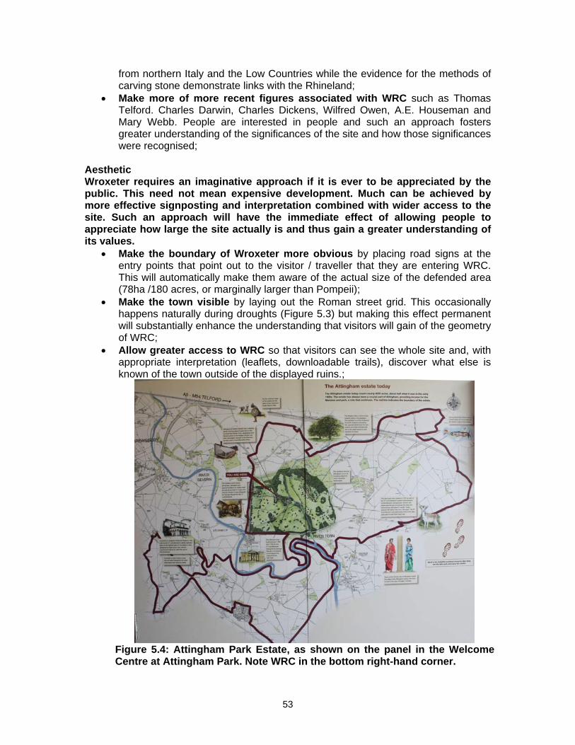
from northern Italy and the Low Countries while the evidence for the methods of carving stone demonstrate links with the Rhineland;
• Make more of more recent figures associated with WRC such as Thomas Telford. Charles Darwin, Charles Dickens, Wilfred Owen, A.E. Houseman and Mary Webb. People are interested in people and such an approach fosters greater understanding of the significances of the site and how those significances were recognised;
Aesthetic Wroxeter requires an imaginative approach if it is ever to be appreciated by the public. This need not mean expensive development. Much can be achieved by more effective signposting and interpretation combined with wider access to the site. Such an approach will have the immediate effect of allowing people to appreciate how large the site actually is and thus gain a greater understanding of its values.
• Make the boundary of Wroxeter more obvious by placing road signs at the entry points that point out to the visitor / traveller that they are entering WRC. This will automatically make them aware of the actual size of the defended area (78ha /180 acres, or marginally larger than Pompeii);
• Make the town visible by laying out the Roman street grid. This occasionally happens naturally during droughts (Figure 5.3) but making this effect permanent will substantially enhance the understanding that visitors will gain of the geometry of WRC;
• Allow greater access to WRC so that visitors can see the whole site and, with appropriate interpretation (leaflets, downloadable trails), discover what else is known of the town outside of the displayed ruins.;
Figure 5.4: Attingham Park Estate, as shown on the panel in the Welcome Centre at Attingham Park. Note WRC in the bottom right-hand corner.
53
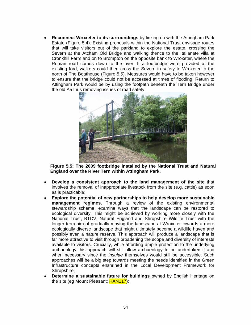
• Reconnect Wroxeter to its surroundings by linking up with the Attingham Park
Estate (Figure 5.4). Existing proposals within the National Trust envisage routes that will take visitors out of the parkland to explore the estate, crossing the Severn at the Atcham Old Bridge and walking thence to the Italianate villa at Cronkhill Farm and on to Brompton on the opposite bank to Wroxeter, where the Roman road comes down to the river. If a footbridge were provided at the existing ford, walkers could then cross the Severn in safety to Wroxeter to the north of The Boathouse (Figure 5.5). Measures would have to be taken however to ensure that the bridge could not be accessed at times of flooding. Return to Attingham Park would be by using the footpath beneath the Tern Bridge under the old A5 thus removing issues of road safety;
Figure 5.5: The 2009 footbridge installed by the National Trust and Natural England over the River Tern within Attingham Park.
• Develop a consistent approach to the land management of the site that
involves the removal of inappropriate livestock from the site (e.g. cattle) as soon as is practicable;
• Explore the potential of new partnerships to help develop more sustainable management regimes. Through a review of the existing environmental stewardship scheme, examine ways that the landscape can be restored to ecological diversity. This might be achieved by working more closely with the National Trust, BTCV, Natural England and Shropshire Wildlife Trust with the longer term aim of gradually moving the landscape at Wroxeter towards a more ecologically diverse landscape that might ultimately become a wildlife haven and possibly even a nature reserve. This approach will produce a landscape that is far more attractive to visit through broadening the scope and diversity of interests available to visitors. Crucially, while affording ample protection to the underlying archaeology this approach will still allow archaeology to be undertaken if and when necessary since the insulae themselves would still be accessible. Such approaches will be a big step towards meeting the needs identified in the Green Infrastructure concepts enshrined in the Local Development Framework for Shropshire;
• Determine a sustainable future for buildings owned by English Heritage on the site (eg Mount Pleasant; HAN117);
54
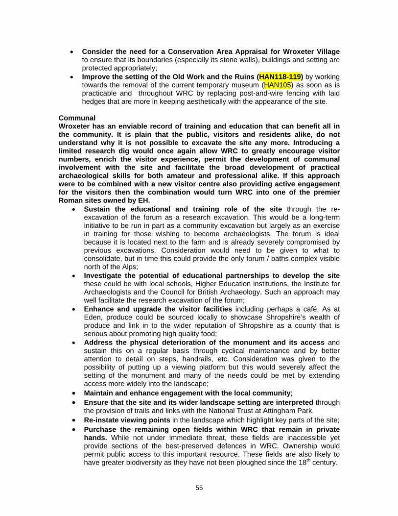
• Consider the need for a Conservation Area Appraisal for Wroxeter Village to ensure that its boundaries (especially its stone walls), buildings and setting are protected appropriately;
• Improve the setting of the Old Work and the Ruins (HAN118-119) by working towards the removal of the current temporary museum (HAN105) as soon as is practicable and throughout WRC by replacing post-and-wire fencing with laid hedges that are more in keeping aesthetically with the appearance of the site.
Communal Wroxeter has an enviable record of training and education that can benefit all in the community. It is plain that the public, visitors and residents alike, do not understand why it is not possible to excavate the site any more. Introducing a limited research dig would once again allow WRC to greatly encourage visitor numbers, enrich the visitor experience, permit the development of communal involvement with the site and facilitate the broad development of practical archaeological skills for both amateur and professional alike. If this approach were to be combined with a new visitor centre also providing active engagement for the visitors then the combination would turn WRC into one of the premier Roman sites owned by EH.
• Sustain the educational and training role of the site through the re-excavation of the forum as a research excavation. This would be a long-term initiative to be run in part as a community excavation but largely as an exercise in training for those wishing to become archaeologists. The forum is ideal because it is located next to the farm and is already severely compromised by previous excavations. Consideration would need to be given to what to consolidate, but in time this could provide the only forum / baths complex visible north of the Alps;
• Investigate the potential of educational partnerships to develop the site these could be with local schools, Higher Education institutions, the Institute for Archaeologists and the Council for British Archaeology. Such an approach may well facilitate the research excavation of the forum;
• Enhance and upgrade the visitor facilities including perhaps a café. As at Eden, produce could be sourced locally to showcase Shropshire’s wealth of produce and link in to the wider reputation of Shropshire as a county that is serious about promoting high quality food;
• Address the physical deterioration of the monument and its access and sustain this on a regular basis through cyclical maintenance and by better attention to detail on steps, handrails, etc. Consideration was given to the possibility of putting up a viewing platform but this would severely affect the setting of the monument and many of the needs could be met by extending access more widely into the landscape;
• Maintain and enhance engagement with the local community; • Ensure that the site and its wider landscape setting are interpreted through
the provision of trails and links with the National Trust at Attingham Park. • Re-instate viewing points in the landscape which highlight key parts of the site; • Purchase the remaining open fields within WRC that remain in private
hands. While not under immediate threat, these fields are inaccessible yet provide sections of the best-preserved defences in WRC. Ownership would permit public access to this important resource. These fields are also likely to have greater biodiversity as they have not been ploughed since the 18th century.
55
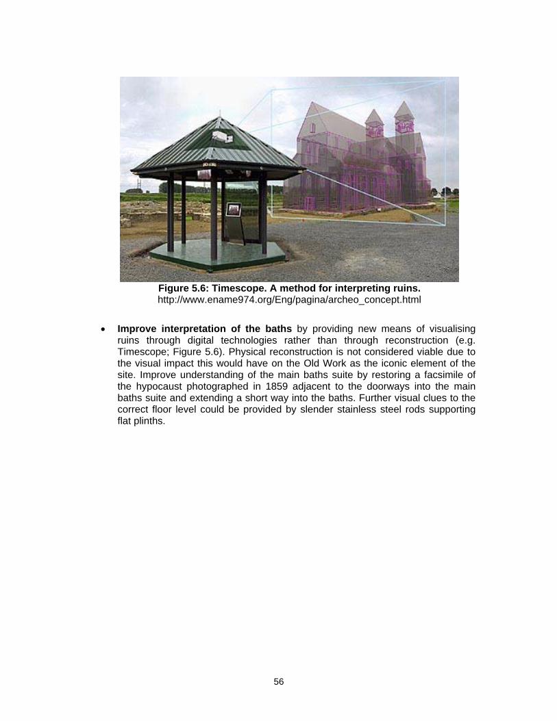
Figure 5.6: Timescope. A method for interpreting ruins. http://www.ename974.org/Eng/pagina/archeo_concept.html
• Improve interpretation of the baths by providing new means of visualising
ruins through digital technologies rather than through reconstruction (e.g. Timescope; Figure 5.6). Physical reconstruction is not considered viable due to the visual impact this would have on the Old Work as the iconic element of the site. Improve understanding of the main baths suite by restoring a facsimile of the hypocaust photographed in 1859 adjacent to the doorways into the main baths suite and extending a short way into the baths. Further visual clues to the correct floor level could be provided by slender stainless steel rods supporting flat plinths.
56
Appendix 1: List of sources used in compiling the Conservation Plan Unpublished reports used These documents provided important information on the current state of the holdings at Wroxeter (Barlow Associates) and detail on particular aspects of the site (Baker 1992; White & Hislop 2002). The Archaeological Assessment (White and Dalwood 1994) was an exercise in generating a comprehensive HER for the site and can be accessed via ADS. Baker, W.A. 1992 Air Archaeology in the Valley of the River Severn Unpubl Doctoral Thesis,
University of Southampton Barlow Associates 2008 Wroxeter Roman City. Site Number 670. Periodic Condition Survey
Report. Report Number 670/08 Sebire, H. Asset Management Plan (AMP) Project. Summary Statement of Significance.
Report No. SSoS-670 Wroxeter Roman City (SAM 32) 19/6/08 Tolley, R and Walker, S.T. 1999 English Heritage Review of Properties: West Midlands
Region, Wroxeter Roman City, Shropshire White, P. 1976 Wroxeter Roman City. Feasibility Study of Proposed Development DoE White, R.H. and Dalwood, H. 1994 Archaeological Assessment of Wroxeter, Shropshire
Hereford & Worcester County Report White, R.H. and Hislop, M. 2002 Summary Report on an Archaeological Evaluation and
Building Record at Wroxeter Farm, Shropshire. BUFAU Rep. 893.2 Archives Consulted National Monument Record:
• All aerial photographs relating to Wroxeter Roman City (1000 + prints housed in four red boxes + Aerofilms archive)
• Wroxeter Roman City – Plans Catalogue (23/7/07) Northamptonshire Archives Henry Dryden Papers (1880) (NRO D (CA) 505) Shropshire Archives Apportionment of the rent-charge in lieu of tithes in the Parish of Wroxeter in the County of
Salop (1840); Plan of the Parish of Wroxeter in the County of Salop (1842) SA2656/16-17
A Survey of the Manor of Wroxeter, Eyton, Uppington, Eaton Constantine, etc situated in the County of Salop, one of the estates of John Newport esq. Surveyed and drawn by John Rocque 1746 (SA 6900)
Foxall Placenames map, Wroxeter Parish (1972) SA Watton Newspaper Cuttings, vol 1 (1829) (SA901/1) Staffordshire Archives, Salt Collection Thomas Farmer Dukes MS (1799-49) Wroxeter and other Shropshire Antiquities (MS 461 &
473, Salt Colln. Stafford; similar to Idem, Soc of Antiq London MS 218) Roger White, Wroxeter Archive (held at Ironbridge Institute) The following list comprises the materials used to produce and support the findings of the report and represents a listing of the materials held by Roger White relating to the site.
• Photocopies of all articles relating to Wroxeter from 1709-current as well as MS / original documents
• Birmingham Archaeology / BUFAU archive reports on Wroxeter projects • Copies of all published works on Wroxeter including representatives of all Wroxeter
site guides 1859-current • Original measured hachured survey of monument and town by Percy Taylor, 1931
(unpublished and not in NMR) • Original prints and photocopies of photographs relating to Wroxeter • Collection of slides and digital images taken by Roger White as well as Wroxeter slide
collections from Philip Barker, Charles Daniel and Graham Webster (ca. 3000 slides in total)
57
Appendix 2: Consultation Process Date of Meeting Venue and type of meeting Area of interest represented 6th Feb. 2009 Society of Antiquaries;
Symposium Academic community
7th March 2009 Wroxeter Hotel; Guided tour and presentation
Local householders
16th March 2009 Rowley’s House, Shrewsbury; Museum Curators, Education Officers
Collections holders
20th March 2009 Attingham Park; presentation and discussion
Landowners and natural environment groups
March-April Wroxeter Roman City; visitor survey
Visitors to EH monument
18th April 2009 Radio Shropshire; live interview General public 18th April 2009 Shirehall; presentation Local history societies and
local historians; general public 23rd April 2009 Wroxeter Hotel; presentation EH staff 11th May 2009 Wroxeter Hotel; presentation Wroxeter PC The management issues formed common themes raised in many of the meetings held with the local community:
• traffic management – there was support for implementing speed reduction and some sort of traffic calming on the B4380 (Shrewsbury to Ironbridge road). However, the possibility of increased traffic in the village was a negative aspect. There was a desire for some kind of speed control on the main access route to the village (‘Watling Street’);
• road closures – local opinion was set against any road closures but desired to see less use of the minor roads (Patch Lane and the cliff road) leading to the village. / Closure of Watling Street would have implications for the three point-to-point meetings held each year at Eyton-on-Severn and the farm business there;
• Wroxeter church – people felt there were greater opportunities for increased liaison between EH and CCT to encourage greater use of the church;
• farm buildings – people felt these could serve as an ideal visitor centre to replace the existing one with potential for:
enhanced interpretation and a museum café (with possible franchise to the Wroxeter Hotel or vineyard);
interpretation of the vernacular farm buildings which would include re-building them;
possible use of parts of the farm buildings as a working farm; possibility of including an interpretation of the interior of a Roman
house, baths etc.; reinforcing the need to return dispersed artefacts to Wroxeter so that
they can be displayed as a complete assemblage. • access – people felt there should be wider access to the site:
walks to allow interpretation of the main site; walks linking up with Attingham Park via the River Severn and Ismore
Coppice; walks linking up with the wider landscape west of the Severn, perhaps
by a new footbridge provided near Boathouse Cottage.
58
• visitor numbers – it was felt that large increases in visitor numbers could not be easily sustained. Residents felt there could be security issues with increased visitor numbers accessing wider areas of the site;
• interpretation – apart from enhanced interpretation in a new visitor centre using the farm buildings, many people would like to see interpretation of a greater proportion of the site and this included a call for further archaeological excavation involving the local community;
• landscape features – appreciation of the ‘special’ nature of the landscape was expressed, with an understanding of the significance of the Roman site and its landscape setting.
Other, generally favourable, responses to the draft recommendations and expressions of support were received from the following individuals and organisations (emails in archive): Harold Bound (Shrewsbury Resident) Kath Bristow (Shrewsbury and Mid-Shropshire Ramblers Group) Dr Andrew Burnett (British Museum, Secretary of the Society for the Promotion of
Roman Studies) Dean Carroll (Shrewsbury Resident) Dr Hilary Cool (Freelance Archaeological Consultant) Mike Corbishley (University College London) Jo Cross (Churches Conservation Trust) Sir Barry Cunliffe (Acting Chair English Heritage) Paul Flynn (Environment Agency) Mick Jones (Lincoln City Archaeologist) Peter Kienzle (Landschaftsverband Rheinland) James Lawson (Shropshire Archaeological and Historical Society) Shelagh Lewis (CBA West Midlands) Prof Martin Millett (University of Cambridge) Jeremy Milln (West Midlands Region Archaeologist, National Trust) Marilyn Priddey (Shrewsbury Resident) David Rudling (University of Sussex) Peter Wade-Martins (Norfolk Archaeology Trust) Dr Pete Wilson (Head of Research Policy (Roman Period), English Heritage) Fran Yarroll (Shropshire Museums Education Officer)
59
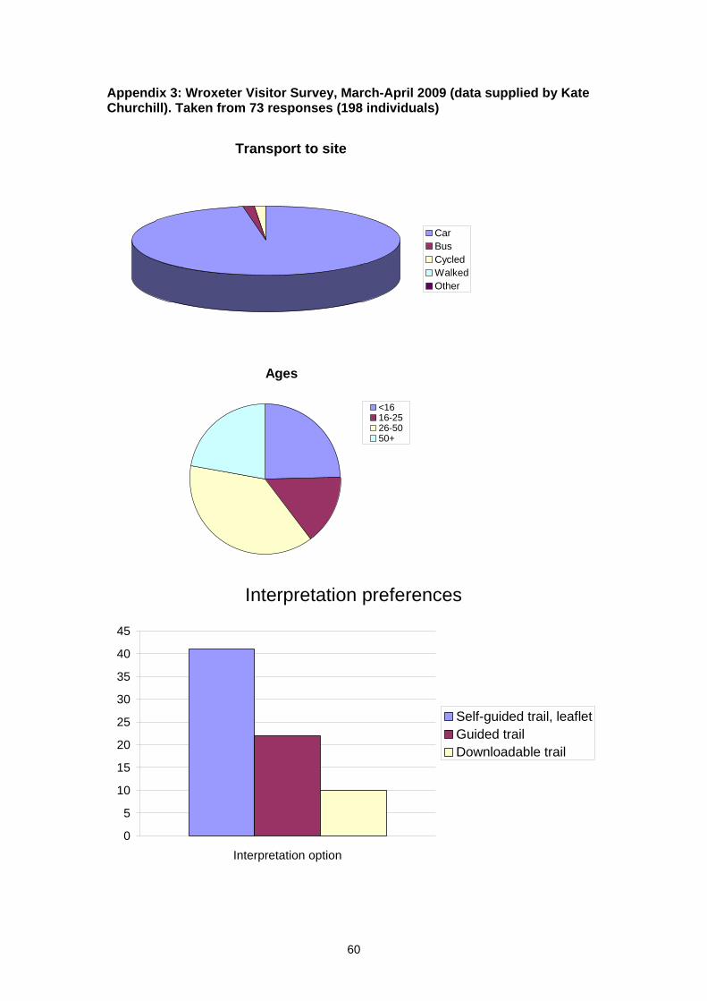
Appendix 3: Wroxeter Visitor Survey, March-April 2009 (data supplied by Kate Churchill). Taken from 73 responses (198 individuals)
Transport to site
CarBusCycledWalkedOther
Ages
<1616-2526-5050+
Interpretation preferences
0
5
10
15
20
25
30
35
40
45
Interpretation option
Self-guided trail, leafletGuided trailDownloadable trail
60
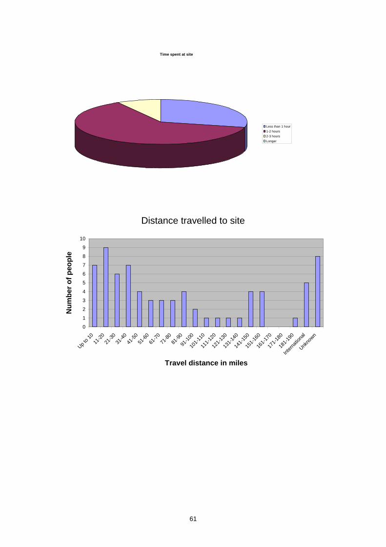
Time spent at site
Less than 1 hour1-2 hours2-3 hoursLonger
Distance travelled to site
0
1
2
3
4
5
6
7
8
9
10
Up to 1
011
-2021
-3031
-4041
-5051
-6061
-7071
-8081
-90
91-10
0
101-1
10
111-1
20
121-1
30
131-1
40
141-1
50
151-1
60
161-1
70
171-1
80
181-1
90
Intern
ation
al
Unkno
wn
Travel distance in miles
Num
ber o
f peo
ple
61

Appendix 4: DCMS Listings for Historic Buildings in Wroxeter study area (Source: Heritage Gateway) Building name LBS No. Grade Date of listing NGR Churchyard gates 420920 II 17.2.85 SJ5629808243Wroxeter Grange 420921 II 17.2.85 SJ5634208213Folly SW of Grange 420922 II 17.2.85 SJ5632008172Horseshoe Inn 418756 II 17.2.85 SJ5771709437Glebe Cottage 419963 II 17.2.85 SJ5639808144The Old Post Office 419965 II 17.2.85 SJ5632908310Church of St Andrew 419966 I 13.6.58 SJ5633008247
62
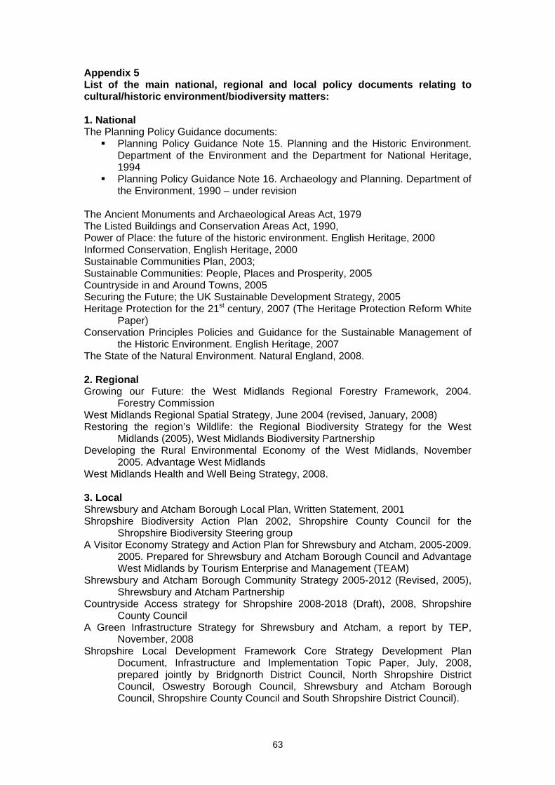
63
Appendix 5 List of the main national, regional and local policy documents relating to cultural/historic environment/biodiversity matters: 1. National The Planning Policy Guidance documents:
Planning Policy Guidance Note 15. Planning and the Historic Environment. Department of the Environment and the Department for National Heritage, 1994
Planning Policy Guidance Note 16. Archaeology and Planning. Department of the Environment, 1990 – under revision
The Ancient Monuments and Archaeological Areas Act, 1979 The Listed Buildings and Conservation Areas Act, 1990, Power of Place: the future of the historic environment. English Heritage, 2000 Informed Conservation, English Heritage, 2000 Sustainable Communities Plan, 2003; Sustainable Communities: People, Places and Prosperity, 2005 Countryside in and Around Towns, 2005 Securing the Future; the UK Sustainable Development Strategy, 2005 Heritage Protection for the 21st century, 2007 (The Heritage Protection Reform White
Paper) Conservation Principles Policies and Guidance for the Sustainable Management of
the Historic Environment. English Heritage, 2007 The State of the Natural Environment. Natural England, 2008. 2. Regional Growing our Future: the West Midlands Regional Forestry Framework, 2004.
Forestry Commission West Midlands Regional Spatial Strategy, June 2004 (revised, January, 2008) Restoring the region’s Wildlife: the Regional Biodiversity Strategy for the West
Midlands (2005), West Midlands Biodiversity Partnership Developing the Rural Environmental Economy of the West Midlands, November
2005. Advantage West Midlands West Midlands Health and Well Being Strategy, 2008. 3. Local Shrewsbury and Atcham Borough Local Plan, Written Statement, 2001 Shropshire Biodiversity Action Plan 2002, Shropshire County Council for the
Shropshire Biodiversity Steering group A Visitor Economy Strategy and Action Plan for Shrewsbury and Atcham, 2005-2009.
2005. Prepared for Shrewsbury and Atcham Borough Council and Advantage West Midlands by Tourism Enterprise and Management (TEAM)
Shrewsbury and Atcham Borough Community Strategy 2005-2012 (Revised, 2005), Shrewsbury and Atcham Partnership
Countryside Access strategy for Shropshire 2008-2018 (Draft), 2008, Shropshire County Council
A Green Infrastructure Strategy for Shrewsbury and Atcham, a report by TEP, November, 2008
Shropshire Local Development Framework Core Strategy Development Plan Document, Infrastructure and Implementation Topic Paper, July, 2008, prepared jointly by Bridgnorth District Council, North Shropshire District Council, Oswestry Borough Council, Shrewsbury and Atcham Borough Council, Shropshire County Council and South Shropshire District Council).
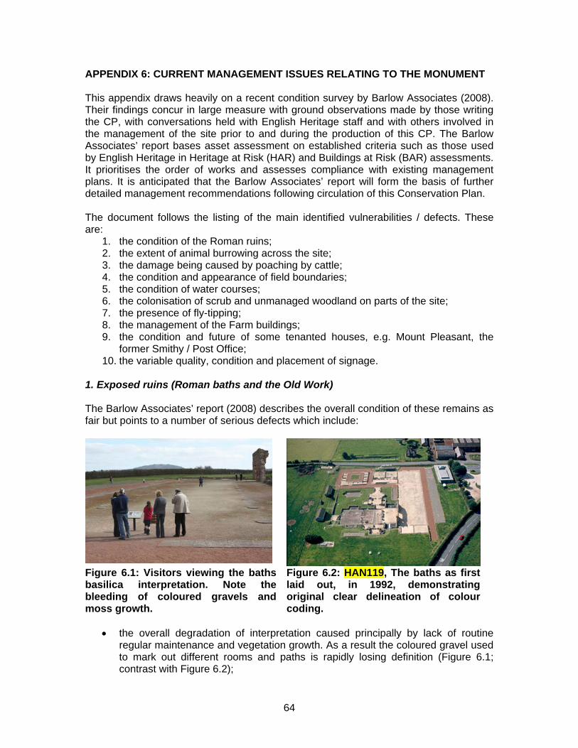
APPENDIX 6: CURRENT MANAGEMENT ISSUES RELATING TO THE MONUMENT This appendix draws heavily on a recent condition survey by Barlow Associates (2008). Their findings concur in large measure with ground observations made by those writing the CP, with conversations held with English Heritage staff and with others involved in the management of the site prior to and during the production of this CP. The Barlow Associates’ report bases asset assessment on established criteria such as those used by English Heritage in Heritage at Risk (HAR) and Buildings at Risk (BAR) assessments. It prioritises the order of works and assesses compliance with existing management plans. It is anticipated that the Barlow Associates’ report will form the basis of further detailed management recommendations following circulation of this Conservation Plan. The document follows the listing of the main identified vulnerabilities / defects. These are:
1. the condition of the Roman ruins; 2. the extent of animal burrowing across the site; 3. the damage being caused by poaching by cattle; 4. the condition and appearance of field boundaries; 5. the condition of water courses; 6. the colonisation of scrub and unmanaged woodland on parts of the site; 7. the presence of fly-tipping; 8. the management of the Farm buildings; 9. the condition and future of some tenanted houses, e.g. Mount Pleasant, the
former Smithy / Post Office; 10. the variable quality, condition and placement of signage.
1. Exposed ruins (Roman baths and the Old Work) The Barlow Associates’ report (2008) describes the overall condition of these remains as fair but points to a number of serious defects which include:
Figure 6.1: Visitors viewing the baths basilica interpretation. Note the bleeding of coloured gravels and moss growth.
Figure 6.2: HAN119, The baths as first laid out, in 1992, demonstrating original clear delineation of colour coding.
• the overall degradation of interpretation caused principally by lack of routine
regular maintenance and vegetation growth. As a result the coloured gravel used to mark out different rooms and paths is rapidly losing definition (Figure 6.1; contrast with Figure 6.2);
64
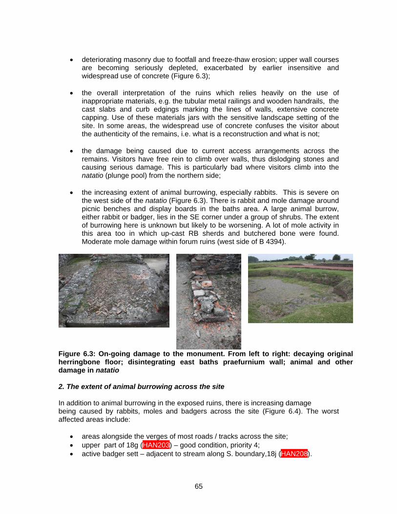
• deteriorating masonry due to footfall and freeze-thaw erosion; upper wall courses
are becoming seriously depleted, exacerbated by earlier insensitive and widespread use of concrete (Figure 6.3);
• the overall interpretation of the ruins which relies heavily on the use of
inappropriate materials, e.g. the tubular metal railings and wooden handrails, the cast slabs and curb edgings marking the lines of walls, extensive concrete capping. Use of these materials jars with the sensitive landscape setting of the site. In some areas, the widespread use of concrete confuses the visitor about the authenticity of the remains, i.e. what is a reconstruction and what is not;
• the damage being caused due to current access arrangements across the
remains. Visitors have free rein to climb over walls, thus dislodging stones and causing serious damage. This is particularly bad where visitors climb into the natatio (plunge pool) from the northern side;
• the increasing extent of animal burrowing, especially rabbits. This is severe on
the west side of the natatio (Figure 6.3). There is rabbit and mole damage around picnic benches and display boards in the baths area. A large animal burrow, either rabbit or badger, lies in the SE corner under a group of shrubs. The extent of burrowing here is unknown but likely to be worsening. A lot of mole activity in this area too in which up-cast RB sherds and butchered bone were found. Moderate mole damage within forum ruins (west side of B 4394).
Figure 6.3: On-going damage to the monument. From left to right: decaying original herringbone floor; disintegrating east baths praefurnium wall; animal and other damage in natatio 2. The extent of animal burrowing across the site In addition to animal burrowing in the exposed ruins, there is increasing damage being caused by rabbits, moles and badgers across the site (Figure 6.4). The worst affected areas include:
• areas alongside the verges of most roads / tracks across the site; • upper part of 18g (HAN203) – good condition, priority 4; • active badger sett – adjacent to stream along S. boundary,18j (HAN208).
65
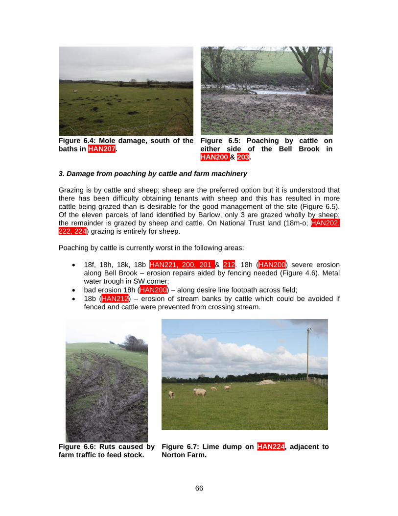
Figure 6.4: Mole damage, south of the baths in HAN207.
Figure 6.5: Poaching by cattle on either side of the Bell Brook in HAN200 & 203.
3. Damage from poaching by cattle and farm machinery Grazing is by cattle and sheep; sheep are the preferred option but it is understood that there has been difficulty obtaining tenants with sheep and this has resulted in more cattle being grazed than is desirable for the good management of the site (Figure 6.5). Of the eleven parcels of land identified by Barlow, only 3 are grazed wholly by sheep; the remainder is grazed by sheep and cattle. On National Trust land (18m-o; HAN202, 222, 224) grazing is entirely for sheep. Poaching by cattle is currently worst in the following areas:
• 18f, 18h, 18k, 18b HAN221, 200, 201 & 212. 18h (HAN200) severe erosion along Bell Brook – erosion repairs aided by fencing needed (Figure 4.6). Metal water trough in SW corner;
• bad erosion 18h (HAN200) – along desire line footpath across field; • 18b (HAN212) – erosion of stream banks by cattle which could be avoided if
fenced and cattle were prevented from crossing stream.
Figure 6.6: Ruts caused by farm traffic to feed stock.
Figure 6.7: Lime dump on HAN224, adjacent to Norton Farm.
66
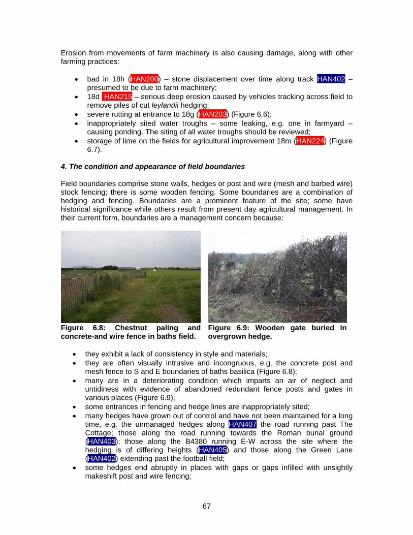
Erosion from movements of farm machinery is also causing damage, along with other farming practices:
• bad in 18h (HAN200) – stone displacement over time along track HAN402 – presumed to be due to farm machinery;
• 18d HAN215 – serious deep erosion caused by vehicles tracking across field to remove piles of cut leylandii hedging;
• severe rutting at entrance to 18g (HAN203) (Figure 6.6); • inappropriately sited water troughs – some leaking, e.g. one in farmyard –
causing ponding. The siting of all water troughs should be reviewed; • storage of lime on the fields for agricultural improvement 18m (HAN224) (Figure
6.7). 4. The condition and appearance of field boundaries Field boundaries comprise stone walls, hedges or post and wire (mesh and barbed wire) stock fencing; there is some wooden fencing. Some boundaries are a combination of hedging and fencing. Boundaries are a prominent feature of the site; some have historical significance while others result from present day agricultural management. In their current form, boundaries are a management concern because:
Figure 6.8: Chestnut paling and concrete-and wire fence in baths field.
Figure 6.9: Wooden gate buried in overgrown hedge.
• they exhibit a lack of consistency in style and materials; • they are often visually intrusive and incongruous, e.g. the concrete post and
mesh fence to S and E boundaries of baths basilica (Figure 6.8); • many are in a deteriorating condition which imparts an air of neglect and
untidiness with evidence of abandoned redundant fence posts and gates in various places (Figure 6.9);
• some entrances in fencing and hedge lines are inappropriately sited; • many hedges have grown out of control and have not been maintained for a long
time, e.g. the unmanaged hedges along HAN407 the road running past The Cottage; those along the road running towards the Roman burial ground (HAN403); those along the B4380 running E-W across the site where the hedging is of differing heights (HAN405) and those along the Green Lane (HAN402) extending past the football field;
• some hedges end abruptly in places with gaps or gaps infilled with unsightly makeshift post and wire fencing;
67
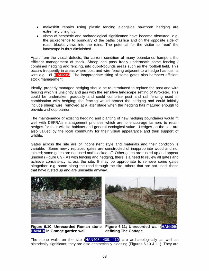
• makeshift repairs using plastic fencing alongside hawthorn hedging are extremely unsightly;
• vistas of aesthetic and archaeological significance have become obscured e.g. the picket fence to boundary of the baths basilica and on the opposite side of road, blocks views into the ruins. The potential for the visitor to ‘read’ the landscape is thus diminished.
Apart from the visual defects, the current condition of many boundaries hampers the efficient management of stock. Sheep can pass freely underneath some fencing / combined hedging and fencing, into out-of-bounds areas such as the football field. This occurs frequently in areas where post and wire fencing adjacent to a hedge has lost its wire e.g. 18i (HAN205). The inappropriate siting of some gates also hampers efficient stock management.
Ideally, properly managed hedging should be re-introduced to replace the post and wire fencing which is unsightly and jars with the sensitive landscape setting of Wroxeter. This could be undertaken gradually and could comprise post and rail fencing used in combination with hedging; the fencing would protect the hedging and could initially include sheep wire, removed at a later stage when the hedging has matured enough to provide a sheep barrier. The maintenance of existing hedging and planting of new hedging boundaries would fit well with DEFRA’s management priorities which are to encourage farmers to retain hedges for their wildlife habitats and general ecological value. Hedges on the site are also valued by the local community for their visual appearance and their support of wildlife. Gates across the site are of inconsistent style and materials and their condition is variable. Some newly replaced gates are constructed of inappropriate wood and not jointed; some gates are not used and blocked off. Other gates are rusted up and appear unused (Figure 6.9). As with fencing and hedging, there is a need to review all gates and achieve consistency across the site. It may be appropriate to remove some gates altogether, e.g. some along the road through the site, others that are not used, those that have rusted up and are unusable anyway.
Figure 6.10: Unrecorded Roman stone HAN410 in Grange garden wall.
Figure 6.11; Unrecorded wall (HAN409) defining The Cottage.
The stone walls on the site (HAN408, 409, 410) are archaeologically as well as historically significant; they are also aesthetically pleasing (Figures 6.10 & 11). They are
68
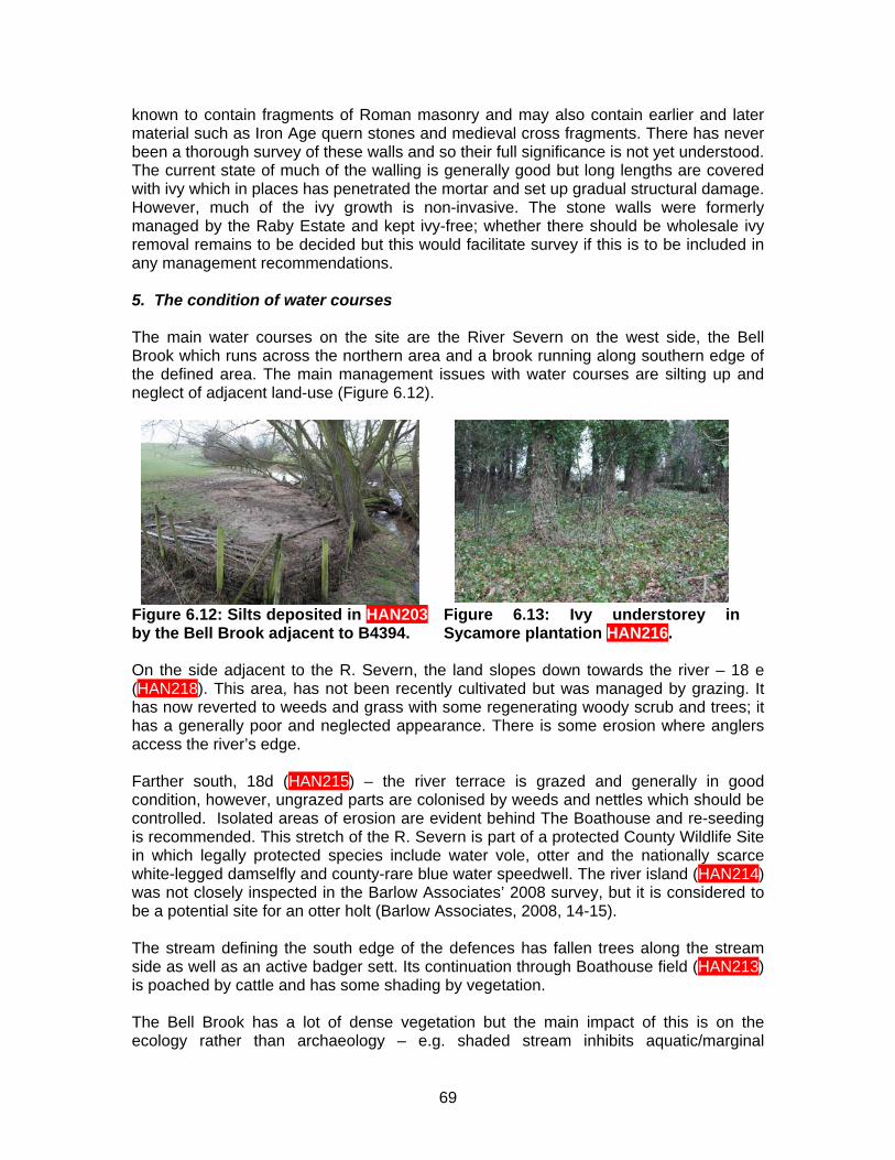
known to contain fragments of Roman masonry and may also contain earlier and later material such as Iron Age quern stones and medieval cross fragments. There has never been a thorough survey of these walls and so their full significance is not yet understood. The current state of much of the walling is generally good but long lengths are covered with ivy which in places has penetrated the mortar and set up gradual structural damage. However, much of the ivy growth is non-invasive. The stone walls were formerly managed by the Raby Estate and kept ivy-free; whether there should be wholesale ivy removal remains to be decided but this would facilitate survey if this is to be included in any management recommendations. 5. The condition of water courses The main water courses on the site are the River Severn on the west side, the Bell Brook which runs across the northern area and a brook running along southern edge of the defined area. The main management issues with water courses are silting up and neglect of adjacent land-use (Figure 6.12).
Figure 6.12: Silts deposited in HAN203 by the Bell Brook adjacent to B4394.
Figure 6.13: Ivy understorey in Sycamore plantation HAN216.
On the side adjacent to the R. Severn, the land slopes down towards the river – 18 e (HAN218). This area, has not been recently cultivated but was managed by grazing. It has now reverted to weeds and grass with some regenerating woody scrub and trees; it has a generally poor and neglected appearance. There is some erosion where anglers access the river’s edge. Farther south, 18d (HAN215) – the river terrace is grazed and generally in good condition, however, ungrazed parts are colonised by weeds and nettles which should be controlled. Isolated areas of erosion are evident behind The Boathouse and re-seeding is recommended. This stretch of the R. Severn is part of a protected County Wildlife Site in which legally protected species include water vole, otter and the nationally scarce white-legged damselfly and county-rare blue water speedwell. The river island (HAN214) was not closely inspected in the Barlow Associates’ 2008 survey, but it is considered to be a potential site for an otter holt (Barlow Associates, 2008, 14-15). The stream defining the south edge of the defences has fallen trees along the stream side as well as an active badger sett. Its continuation through Boathouse field (HAN213) is poached by cattle and has some shading by vegetation. The Bell Brook has a lot of dense vegetation but the main impact of this is on the ecology rather than archaeology – e.g. shaded stream inhibits aquatic/marginal
69
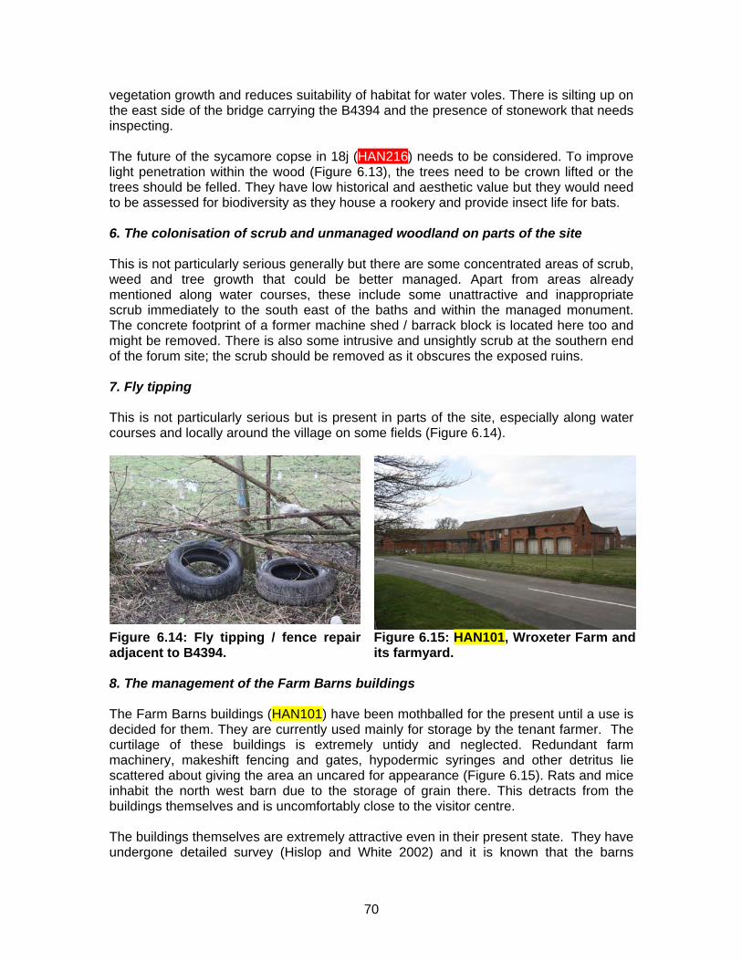
vegetation growth and reduces suitability of habitat for water voles. There is silting up on the east side of the bridge carrying the B4394 and the presence of stonework that needs inspecting. The future of the sycamore copse in 18j (HAN216) needs to be considered. To improve light penetration within the wood (Figure 6.13), the trees need to be crown lifted or the trees should be felled. They have low historical and aesthetic value but they would need to be assessed for biodiversity as they house a rookery and provide insect life for bats. 6. The colonisation of scrub and unmanaged woodland on parts of the site This is not particularly serious generally but there are some concentrated areas of scrub, weed and tree growth that could be better managed. Apart from areas already mentioned along water courses, these include some unattractive and inappropriate scrub immediately to the south east of the baths and within the managed monument. The concrete footprint of a former machine shed / barrack block is located here too and might be removed. There is also some intrusive and unsightly scrub at the southern end of the forum site; the scrub should be removed as it obscures the exposed ruins. 7. Fly tipping This is not particularly serious but is present in parts of the site, especially along water courses and locally around the village on some fields (Figure 6.14).
Figure 6.14: Fly tipping / fence repair adjacent to B4394.
Figure 6.15: HAN101, Wroxeter Farm and its farmyard.
8. The management of the Farm Barns buildings The Farm Barns buildings (HAN101) have been mothballed for the present until a use is decided for them. They are currently used mainly for storage by the tenant farmer. The curtilage of these buildings is extremely untidy and neglected. Redundant farm machinery, makeshift fencing and gates, hypodermic syringes and other detritus lie scattered about giving the area an uncared for appearance (Figure 6.15). Rats and mice inhabit the north west barn due to the storage of grain there. This detracts from the buildings themselves and is uncomfortably close to the visitor centre. The buildings themselves are extremely attractive even in their present state. They have undergone detailed survey (Hislop and White 2002) and it is known that the barns
70
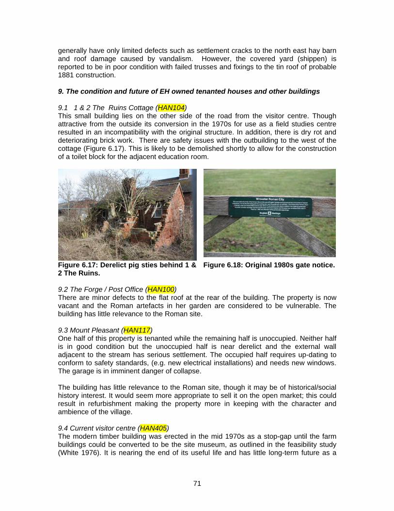
generally have only limited defects such as settlement cracks to the north east hay barn and roof damage caused by vandalism. However, the covered yard (shippen) is reported to be in poor condition with failed trusses and fixings to the tin roof of probable 1881 construction. 9. The condition and future of EH owned tenanted houses and other buildings 9.1 1 & 2 The Ruins Cottage (HAN104) This small building lies on the other side of the road from the visitor centre. Though attractive from the outside its conversion in the 1970s for use as a field studies centre resulted in an incompatibility with the original structure. In addition, there is dry rot and deteriorating brick work. There are safety issues with the outbuilding to the west of the cottage (Figure 6.17). This is likely to be demolished shortly to allow for the construction of a toilet block for the adjacent education room.
Figure 6.17: Derelict pig sties behind 1 & 2 The Ruins.
Figure 6.18: Original 1980s gate notice.
9.2 The Forge / Post Office (HAN100) There are minor defects to the flat roof at the rear of the building. The property is now vacant and the Roman artefacts in her garden are considered to be vulnerable. The building has little relevance to the Roman site. 9.3 Mount Pleasant (HAN117) One half of this property is tenanted while the remaining half is unoccupied. Neither half is in good condition but the unoccupied half is near derelict and the external wall adjacent to the stream has serious settlement. The occupied half requires up-dating to conform to safety standards, (e.g. new electrical installations) and needs new windows. The garage is in imminent danger of collapse. The building has little relevance to the Roman site, though it may be of historical/social history interest. It would seem more appropriate to sell it on the open market; this could result in refurbishment making the property more in keeping with the character and ambience of the village. 9.4 Current visitor centre (HAN405) The modern timber building was erected in the mid 1970s as a stop-gap until the farm buildings could be converted to be the site museum, as outlined in the feasibility study (White 1976). It is nearing the end of its useful life and has little long-term future as a
71
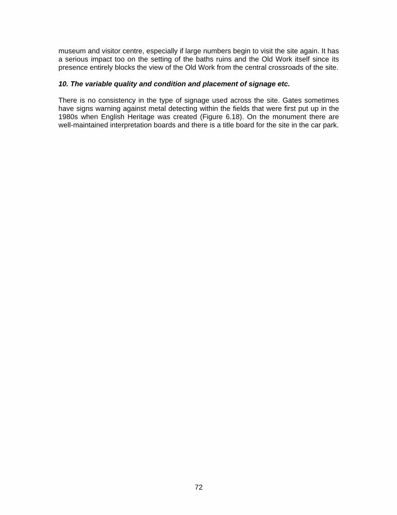
72
museum and visitor centre, especially if large numbers begin to visit the site again. It has a serious impact too on the setting of the baths ruins and the Old Work itself since its presence entirely blocks the view of the Old Work from the central crossroads of the site. 10. The variable quality and condition and placement of signage etc. There is no consistency in the type of signage used across the site. Gates sometimes have signs warning against metal detecting within the fields that were first put up in the 1980s when English Heritage was created (Figure 6.18). On the monument there are well-maintained interpretation boards and there is a title board for the site in the car park.
BIBLIOGRAPHY Unpublished sources Baker, W.A. 1992 Air Archaeology in the Valley of the River Severn Unpubl Doctoral
Thesis, University of Southampton Barlow Associates 2008 Wroxeter Roman City. Site Number 670. Periodic Condition
Survey Report. Report Number 670/08 Biddulph, M. and Woodward, A. 2000 The Wroxeter Pygmy Cup, In V.L. Gaffney & R.H.
White Wroxeter Hinterland Project Final Report BUFAU Report 500.1, 166-7 Dukes, T.F. 1799-49 Wroxeter and other Shropshire Antiquities (MS 461 & 473, Salt
Colln. Stafford; similar to Idem, Soc of Antiq London MS 218) Tolley, R and Walker, S.T. 1999 English Heritage Review of Properties: West Midlands
Region, Wroxeter Roman City, Shropshire White, P. 1976 Wroxeter Roman City. Feasibility Study of Proposed Development DoE White, R.H. and Dalwood, H. 1994 Archaeological Assessment of Wroxeter, Shropshire
Hereford & Worcester County Report White, R.H. and Hislop, M. 2002 Summary Report on an Archaeological Evaluation and
Building Record at Wroxeter Farm, Shropshire. BUFAU Rep. 893.2 Published sources Atkinson, D. 1942 Report on Excavations at Wroxeter (the Roman City of Viroconium) in
the County of Salop 1923-1927 OUP Barker, P.A., White, R.H., Pretty, K.B., Bird, H & Corbishley, M. 1997 The Baths Basilica
Wroxeter. Excavations 1966-90 English Heritage Archaeol Rep 8 Bassett, S.R. 1990 The Roman and medieval landscape of Wroxeter, In P.A. Barker
(ed.) From Roman Viroconium to medieval Wroxeter, Worcester, 3-7 Bassett, S.R. 1992 Medieval Ecclesiastical Organisation in the vicinity of Wroxeter and
its British Antecedents J British Archaeol Assn 145, 1-28 Bushe-Fox, J.P. 1913 Excavations on the Site of the Roman Town at Wroxeter
Shropshire, in 1912 Rep Res Comm Soc Antiq London 1 Bushe-Fox, J.P. 1914 Second Report on the Excavations on the Site of the Roman
Town at Wroxeter Shropshire 1913 Rep Res Comm Soc Antiq London 2 Bushe-Fox, J.P. 1916 Third Report on the Excavations on the Site of the Roman Town
at Wroxeter Shropshire in 1914 Rep Res Comm Soc Antiq London 4 Cosh, S. and White, R.H. 2006 A Rediscovered Mosaic from insula XXVI, In P. Ellis &
R.H. White (eds.), 141-7
73
Ellis, P. (ed.) 2000 The Roman Baths and Macellum at Wroxeter. Excavations by Graham Webster 1955-85 English Heritage Archaeol Rep. 9
Ellis, P. & White, R.H. (eds.) Wroxeter Archaeology. Excavation and Research on the
Defences and in the town, 1968-1992 [=Shropshire Archaeol and Hist Trans 78] Fox, G.E. 1897 Uriconium Archaeol J 54, 123-73 Gaffney, C. and Gaffney, V.L. 2000 Non-Invasive Investigations at Wroxeter at the end
of the Twentieth Century Archaeol Prospection 7.2 Gaffney, V.L. and White R.H. Wroxeter, The Cornovii and the Urban Process. Final
Report on The Wroxeter Hinterland Project 1994-1997. Volume 1. Researching the Hinterland Jnl Roman Archaeol Supp Ser 68 Portsmouth, Rhode Island
Houghton, A.W.J. 1960 A Roman Tilery and Brickfield near Wroxeter Shropshire
Newsletter 11, 3 Johnson, S. and Ellis, P. 2006 Excavations on the Eastern Defences, 1975 and 1976 In
P. Ellis and R. White (eds), 12-53 Kenyon, K.M. 1940 Excavations at Viroconium, 1936-7 Archaeologia 78, 175-227 Kenyon, K.M. 1980 Excavations at Viroconium in Insula 9, 1952-3 Trans Shropshire
Archaeol Soc 60 (1975-6), 5-73 Lyster, J. 1706 A Description of a Roman Sudatory, or Hypocaustum, found at Wroxeter,
in Shropshire Anno 1701 Philosophical Trans. 25; No. 306, 2226-9 Mackreth, D. 1987 Roman Public Buildings In J. Schofield & R. Leech (eds.) Urban
Archaeology in Britain CBA Res Rep 61, 133-46 Mackreth, D. 2000 The nineteenth-century excavations in the baths insula by Thomas
Wright and others, In P. Ellis (ed.), 347-75 Morris, J.A. 1930 Aero-Films of the Excavations at Wroxeter TSAS 45 (1929-30), viii-ix Morris, J.A. 1935 A Guide to the Roman City of Uriconium at Wroxeter Shropshire
Shrewsbury Newman, J. and Pevsner, N. 2006 The Buildings of England: Shropshire (2nd edn.) Yale Pannett, D. 1989 The River Severn at Wroxeter Shropshire Hist and Archaeol 66, 48-55 Phillips, G. and Keatman, M. 1999 King Arthur: the True Story Roach Smith, C. 1854 Roman Sculptures found at Wroxeter Collectanea Antiqua III, 29-
32 Rowland, J. 1990 Early Welsh Saga Poetry D.S. Brewer, Woodbridge
74
75
St Joseph, J.K. 1951 Roman Forts on Watling Street near Penkridge and Wroxeter Trans Birmingham & Warks Arch Soc 69, 50-6
Toghill, P. 2006 Geology of Shropshire (2nd edn.) Crowood Press Turner, R. 2008 Thomas Telford the Archaeologist, Antiq. J 88, 365-75 Ward, J. 1755 An Account of four Roman Inscriptions, cut into three large stones, found
in a ploughed field near Wroxeter in Shropshire, in the year 1752: with some observations on them Philosophical Trans 49(i), 196-205
Webster, G. 1993 The City of Viroconium (Wroxeter): its military origins and expansion
under Hadrian, In S. Greep (ed.) Roman Towns: the Wheeler Inheritance CBA REs Rep 93, 50-5
Webster, G. (ed. J. Chadderton) 2002 The Legionary Fortress at Wroxeter. Excavations
by Graham Webster, 1955-85 English Heritage Archaeol Rep. 19 Webster, G. and Hollingsworth, D. 1959 The Wroxeter Aqueduct Trans Shropshire
Archaeol & Hist Soc 56, 133-7 Welfare, H. and Swan, V. 1995 Roman Camps in England. The Field Archaeology
HMSO Whimster, R. 1989 The Emerging Past HMSO White, R.H. 2006 Afterword: excavating Wroxeter at the end of the twentieth century, In
P. Ellis and R.H. White (eds.), 165-9 White, R.H. 2007 Britannia Prima. Britain’s Last Roman Province White, R.H. and Barker, P.A. 1998 Wroxeter. Life and Death of a Roman City White, R.H., Gaffney, C. and Gaffney, V.L. forthcoming Wroxeter Hinterland Project
volume 2. Characterising the Roman City: an atlas of Viroconium Cornoviorum. Wilson, D.R. 1982 Air Photo Interpretation for Archaeologists Wright, T. 1859 Guide to the Ruins of Uriconium at Wroxeter (1st edn.) Shrewsbury Wright, T. 1872 Uriconium; a historical account of the ancient Roman city at Wroxeter,
and of the excavations made upon its site at Wroxeter, in Shropshire, forming a sketch of the condition and history of the Welsh Border during the Roman Period London
WROXETER ROMAN CITY, SHROPSHIRE:
GAZETTEER OF HERITAGE ASSETS
ROGER WHITE, JENNY MARRIOTT and MALCOLM REID
JULY 2010
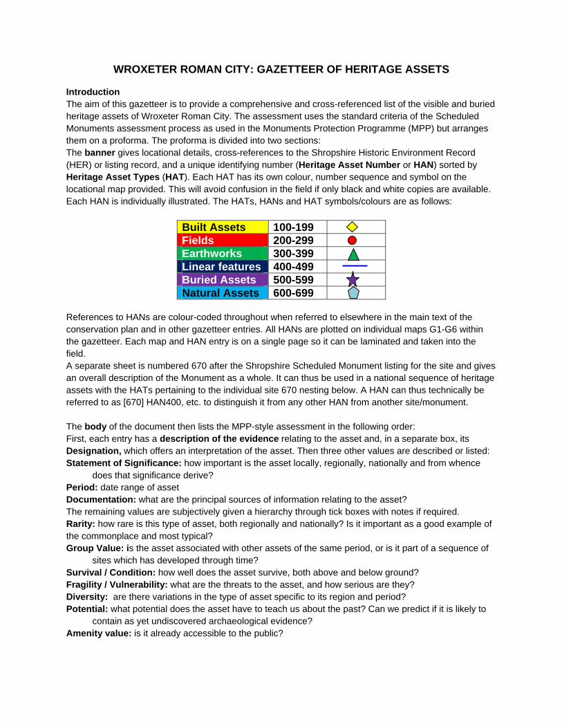
WROXETER ROMAN CITY: GAZETTEER OF HERITAGE ASSETS
Introduction The aim of this gazetteer is to provide a comprehensive and cross-referenced list of the visible and buried heritage assets of Wroxeter Roman City. The assessment uses the standard criteria of the Scheduled Monuments assessment process as used in the Monuments Protection Programme (MPP) but arranges them on a proforma. The proforma is divided into two sections: The banner gives locational details, cross-references to the Shropshire Historic Environment Record (HER) or listing record, and a unique identifying number (Heritage Asset Number or HAN) sorted by Heritage Asset Types (HAT). Each HAT has its own colour, number sequence and symbol on the locational map provided. This will avoid confusion in the field if only black and white copies are available. Each HAN is individually illustrated. The HATs, HANs and HAT symbols/colours are as follows:
Built Assets 100-199 Fields 200-299 Earthworks 300-399 Linear features 400-499 Buried Assets 500-599 Natural Assets 600-699
References to HANs are colour-coded throughout when referred to elsewhere in the main text of the conservation plan and in other gazetteer entries. All HANs are plotted on individual maps G1-G6 within the gazetteer. Each map and HAN entry is on a single page so it can be laminated and taken into the field. A separate sheet is numbered 670 after the Shropshire Scheduled Monument listing for the site and gives an overall description of the Monument as a whole. It can thus be used in a national sequence of heritage assets with the HATs pertaining to the individual site 670 nesting below. A HAN can thus technically be referred to as [670] HAN400, etc. to distinguish it from any other HAN from another site/monument. The body of the document then lists the MPP-style assessment in the following order: First, each entry has a description of the evidence relating to the asset and, in a separate box, its Designation, which offers an interpretation of the asset. Then three other values are described or listed: Statement of Significance: how important is the asset locally, regionally, nationally and from whence
does that significance derive? Period: date range of asset Documentation: what are the principal sources of information relating to the asset? The remaining values are subjectively given a hierarchy through tick boxes with notes if required. Rarity: how rare is this type of asset, both regionally and nationally? Is it important as a good example of the commonplace and most typical? Group Value: is the asset associated with other assets of the same period, or is it part of a sequence of
sites which has developed through time? Survival / Condition: how well does the asset survive, both above and below ground? Fragility / Vulnerability: what are the threats to the asset, and how serious are they? Diversity: are there variations in the type of asset specific to its region and period? Potential: what potential does the asset have to teach us about the past? Can we predict if it is likely to
contain as yet undiscovered archaeological evidence? Amenity value: is it already accessible to the public?
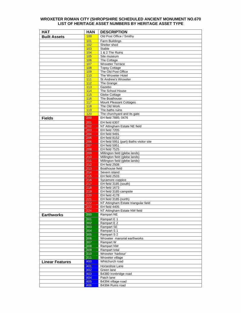
WROXETER ROMAN CITY (SHROPSHIRE SCHEDULED ANCIENT MONUMENT NO.670 LIST OF HERITAGE ASSET NUMBERS BY HERITAGE ASSET TYPE
HAT HAN DESCRIPTION Built Assets 100 Old Post Office / Smithy 101 Farm Buildings 102 Shelter shed 103 Stable 104 1 & 2 The Ruins 105 Site museum 106 The Cottage 107 Wroxeter Terrace 108 Topsy Cottage 109 The Old Post Office 110 The Wroxeter Hotel 111 St Andrew’s Wroxeter 112 The Grange 113 Gazebo 114 The School House 115 Glebe Cottage 116 The Boathouse 117 Mount Pleasant Cottages 118 The Old Work 119 The baths ruins 120 The churchyard and its gate Fields 200 EH field 7885; 0476 201 EH field 6307 202 NT Attingham Estate NE field 203 EH field 7205 204 EH field 9491 205 EH field 8152 206 EH field 5951 (part) Baths visitor site 207 EH field 5951 208 EH field 7525 209 Millington field (glebe lands) 210 Millington field (glebe lands) 211 Millington field (glebe lands) 212 EH field 2508 213 Boathouse field 214 Severn island 215 EH field 2533 216 Sycamore coppice 217 EH field 3185 (south) 218 EH field 1673 219 EH field 3185 campsite 220 EH field 4178 221 EH field 3185 (north) 222 NT Attingham Estate triangular field 223 EH field 4405 224 NT Attingham Estate NW field Earthworks 300 Rampart NE 301 Rampart E 1 302 Rampart E 2 303 Rampart SE 304 Rampart S 1 305 Rampart S 2 306 Wroxeter manorial earthworks 307 Rampart W 308 Rampart NW 309 Rampart total 310 Wroxeter ‘harbour’ 311 Wroxeter village Linear Features 400 Whitchurch road 401 Horseshoe Lane 402 Green lane 403 B4380 Ironbridge road 404 Patch lane 405 B4394 village road 406 B4394 Ruins road
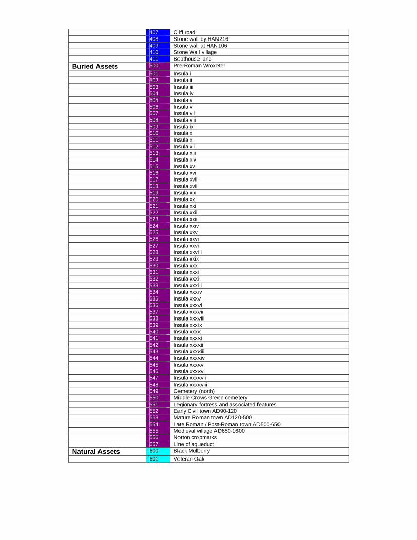
407 Cliff road 408 Stone wall by HAN216 409 Stone wall at HAN106 410 Stone Wall village 411 Boathouse lane Buried Assets 500 Pre-Roman Wroxeter 501 Insula i 502 Insula ii 503 Insula iii 504 Insula iv 505 Insula v 506 Insula vi 507 Insula vii 508 Insula viii 509 Insula ix 510 Insula x 511 Insula xi 512 Insula xii 513 Insula xiii 514 Insula xiv 515 Insula xv 516 Insula xvi 517 Insula xvii 518 Insula xviii 519 Insula xix 520 Insula xx 521 Insula xxi 522 Insula xxii 523 Insula xxiii 524 Insula xxiv 525 Insula xxv 526 Insula xxvi 527 Insula xxvii 528 Insula xxviii 529 Insula xxix 530 Insula xxx 531 Insula xxxi 532 Insula xxxii 533 Insula xxxiii 534 Insula xxxiv 535 Insula xxxv 536 Insula xxxvi 537 Insula xxxvii 538 Insula xxxviii 539 Insula xxxix 540 Insula xxxx 541 Insula xxxxi 542 Insula xxxxii 543 Insula xxxxiii 544 Insula xxxxiv 545 Insula xxxxv 546 Insula xxxxvi 547 Insula xxxxvii 548 Insula xxxxviii 549 Cemetery (north) 550 Middle Crows Green cemetery 551 Legionary fortress and associated features 552 Early Civil town AD90-120 553 Mature Roman town AD120-500 554 Late Roman / Post-Roman town AD500-650 555 Medieval village AD650-1600 556 Norton cropmarks 557 Line of aqueduct Natural Assets 600 Black Mulberry 601 Veteran Oak
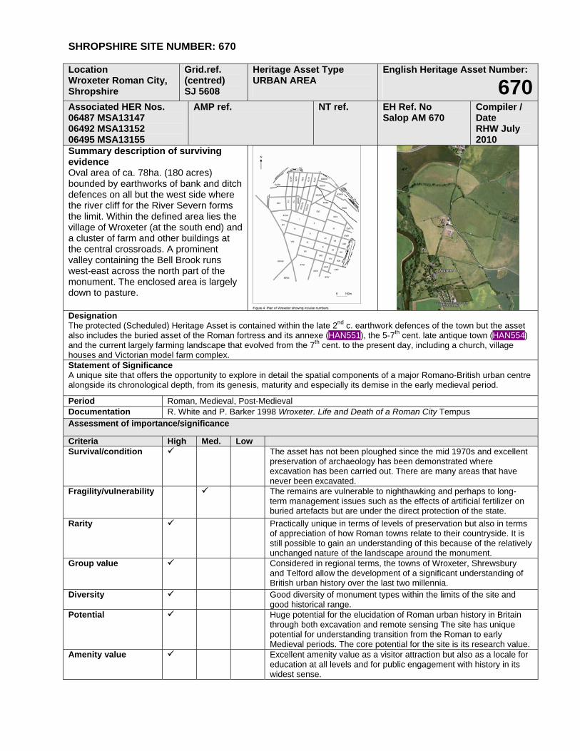
SHROPSHIRE SITE NUMBER: 670
Location Wroxeter Roman City, Shropshire
Grid.ref. (centred) SJ 5608
Heritage Asset Type URBAN AREA
English Heritage Asset Number:
670Associated HER Nos. 06487 MSA13147 06492 MSA13152 06495 MSA13155
AMP ref.
NT ref. EH Ref. No Salop AM 670
Compiler / Date RHW July 2010
Summary description of surviving evidence Oval area of ca. 78ha. (180 acres) bounded by earthworks of bank and ditch defences on all but the west side where the river cliff for the River Severn forms the limit. Within the defined area lies the village of Wroxeter (at the south end) and a cluster of farm and other buildings at the central crossroads. A prominent valley containing the Bell Brook runs west-east across the north part of the monument. The enclosed area is largely down to pasture.
Designation The protected (Scheduled) Heritage Asset is contained within the late 2nd c. earthwork defences of the town but the asset also includes the buried asset of the Roman fortress and its annexe (HAN551), the 5-7th cent. late antique town (HAN554) and the current largely farming landscape that evolved from the 7th cent. to the present day, including a church, village houses and Victorian model farm complex. Statement of Significance A unique site that offers the opportunity to explore in detail the spatial components of a major Romano-British urban centre alongside its chronological depth, from its genesis, maturity and especially its demise in the early medieval period.
Period Roman, Medieval, Post-Medieval Documentation R. White and P. Barker 1998 Wroxeter. Life and Death of a Roman City Tempus Assessment of importance/significance
Criteria High Med. Low Survival/condition The asset has not been ploughed since the mid 1970s and excellent
preservation of archaeology has been demonstrated where excavation has been carried out. There are many areas that have never been excavated.
Fragility/vulnerability The remains are vulnerable to nighthawking and perhaps to long-term management issues such as the effects of artificial fertilizer on buried artefacts but are under the direct protection of the state.
Rarity Practically unique in terms of levels of preservation but also in terms of appreciation of how Roman towns relate to their countryside. It is still possible to gain an understanding of this because of the relatively unchanged nature of the landscape around the monument.
Group value Considered in regional terms, the towns of Wroxeter, Shrewsbury and Telford allow the development of a significant understanding of British urban history over the last two millennia.
Diversity Good diversity of monument types within the limits of the site and good historical range.
Potential Huge potential for the elucidation of Roman urban history in Britain through both excavation and remote sensing The site has unique potential for understanding transition from the Roman to early Medieval periods. The core potential for the site is its research value.
Amenity value Excellent amenity value as a visitor attraction but also as a locale for education at all levels and for public engagement with history in its widest sense.
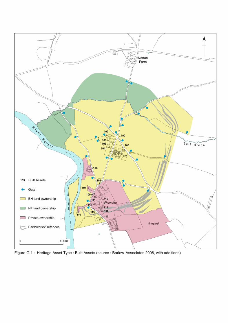
Earthworks/Defences
43
5
21
Ri v e r
Se v e r n
B e l l B r o o k
0 400m
Gate
EH land ownership
NT land ownership
Private ownership
vineyard
Wroxeter
NortonFarm
Figure G.1 : Heritage Asset Type : Built Assets (source : Barlow Associates 2008, with additions)
Built Assets105
105
100102
101103
104
106
108
117
107
116
109
111 110
114115
112
113
118
119
120
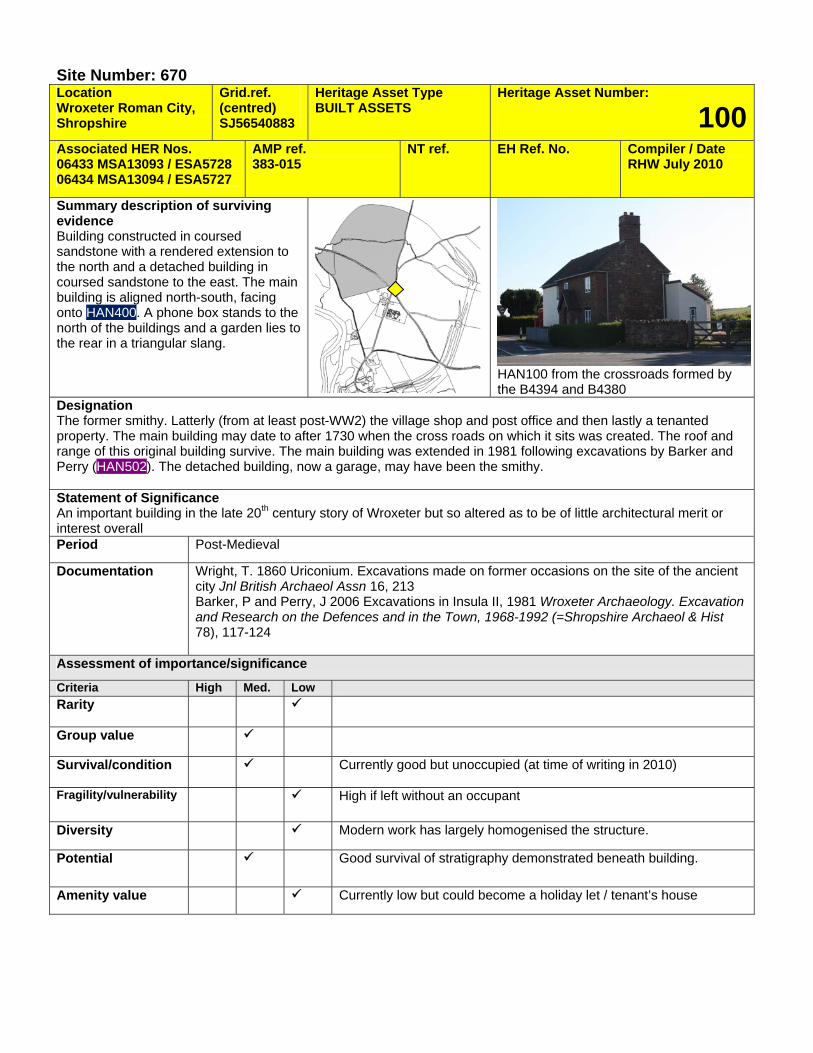
Site Number: 670 Location Wroxeter Roman City, Shropshire
Grid.ref. (centred) SJ56540883
Heritage Asset Type BUILT ASSETS
Heritage Asset Number:
100Associated HER Nos. 06433 MSA13093 / ESA5728 06434 MSA13094 / ESA5727
AMP ref. 383-015
NT ref. EH Ref. No. Compiler / Date RHW July 2010
Summary description of surviving evidence Building constructed in coursed sandstone with a rendered extension to the north and a detached building in coursed sandstone to the east. The main building is aligned north-south, facing onto HAN400. A phone box stands to the north of the buildings and a garden lies to the rear in a triangular slang.
HAN100 from the crossroads formed by the B4394 and B4380
Designation The former smithy. Latterly (from at least post-WW2) the village shop and post office and then lastly a tenanted property. The main building may date to after 1730 when the cross roads on which it sits was created. The roof and range of this original building survive. The main building was extended in 1981 following excavations by Barker and Perry (HAN502). The detached building, now a garage, may have been the smithy. Statement of Significance An important building in the late 20th century story of Wroxeter but so altered as to be of little architectural merit or interest overall Period Post-Medieval
Documentation Wright, T. 1860 Uriconium. Excavations made on former occasions on the site of the ancient city Jnl British Archaeol Assn 16, 213 Barker, P and Perry, J 2006 Excavations in Insula II, 1981 Wroxeter Archaeology. Excavation and Research on the Defences and in the Town, 1968-1992 (=Shropshire Archaeol & Hist 78), 117-124
Assessment of importance/significance
Criteria High Med. Low Rarity
Group value
Survival/condition Currently good but unoccupied (at time of writing in 2010)
Fragility/vulnerability High if left without an occupant
Diversity Modern work has largely homogenised the structure.
Potential Good survival of stratigraphy demonstrated beneath building.
Amenity value Currently low but could become a holiday let / tenant’s house
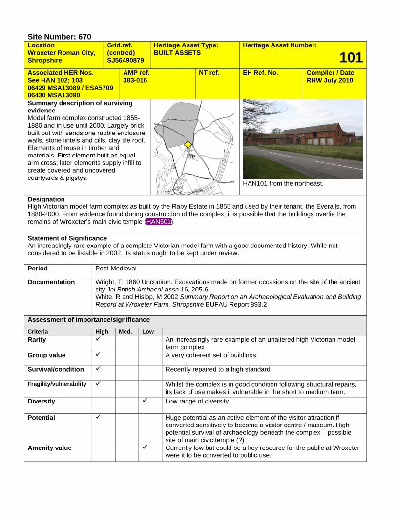
Site Number: 670 Location Wroxeter Roman City, Shropshire
Grid.ref. (centred) SJ56490879
Heritage Asset Type: BUILT ASSETS
Heritage Asset Number:
101Associated HER Nos. See HAN 102; 103 06429 MSA13089 / ESA5709 06430 MSA13090
AMP ref. 383-016
NT ref. EH Ref. No. Compiler / Date RHW July 2010
Summary description of surviving evidence Model farm complex constructed 1855-1880 and in use until 2000. Largely brick-built but with sandstone rubble enclosure walls, stone lintels and cills, clay tile roof. Elements of reuse in timber and materials. First element built as equal-arm cross; later elements supply infill to create covered and uncovered courtyards & pigstys.
HAN101 from the northeast.
Designation High Victorian model farm complex as built by the Raby Estate in 1855 and used by their tenant, the Everalls, from 1880-2000. From evidence found during construction of the complex, it is possible that the buildings overlie the remains of Wroxeter’s main civic temple (HAN501). Statement of Significance An increasingly rare example of a complete Victorian model farm with a good documented history. While not considered to be listable in 2002, its status ought to be kept under review. Period Post-Medieval
Documentation Wright, T. 1860 Uriconium. Excavations made on former occasions on the site of the ancient city Jnl British Archaeol Assn 16, 205-6 White, R and Hislop, M 2002 Summary Report on an Archaeological Evaluation and Building Record at Wroxeter Farm, Shropshire BUFAU Report 893.2
Assessment of importance/significance
Criteria High Med. Low Rarity An increasingly rare example of an unaltered high Victorian model
farm complex Group value A very coherent set of buildings
Survival/condition Recently repaired to a high standard
Fragility/vulnerability Whilst the complex is in good condition following structural repairs, its lack of use makes it vulnerable in the short to medium term.
Diversity Low range of diversity
Potential Huge potential as an active element of the visitor attraction if converted sensitively to become a visitor centre / museum. High potential survival of archaeology beneath the complex – possible site of main civic temple (?)
Amenity value Currently low but could be a key resource for the public at Wroxeter were it to be converted to public use.

Site Number: 670 Location Wroxeter Roman City, Shropshire
Grid.ref. (centred) SJ56430884
Heritage Asset Type BUILT ASSETS
Heritage Asset Number:
102Associated HER Nos. AMP ref.
383-017d NT ref. EH ref. no. Compiler / Date
RHW July 2010
Summary description of surviving evidence Small rectangular open-fronted structure constructed in coarse sandstone rubble with clay-tile roof supported on three brick piers in open facade. Lies to north-west of main complex (HAN101)
HAN102 from the farmyard associated with HAN101
Designation Sheep fold contemporary with farm building HAN101. Statement of Significance Of interest mainly from the material of which it is built and its association with the rest of the farm complex. Period Post-Medieval
Documentation White, R and Hislop, M 2002 Summary Report on an Archaeological Evaluation and Building Record at Wroxeter Farm, Shropshire BUFAU Report 893.2
Assessment of importance/significance
Criteria High Med. Low Rarity Probably not especially rare as a building type in the region,
although getting rarer.
Group value High due to association with the rest of the farm complex
Survival/condition Fair conditio0n
Fragility/vulnerability No real current use makes the structure vulnerable
Diversity Low – single build period
Potential Limited due to is location and open front. Underlying archaeological potential is probably good.
Amenity value Has poor reuse value.
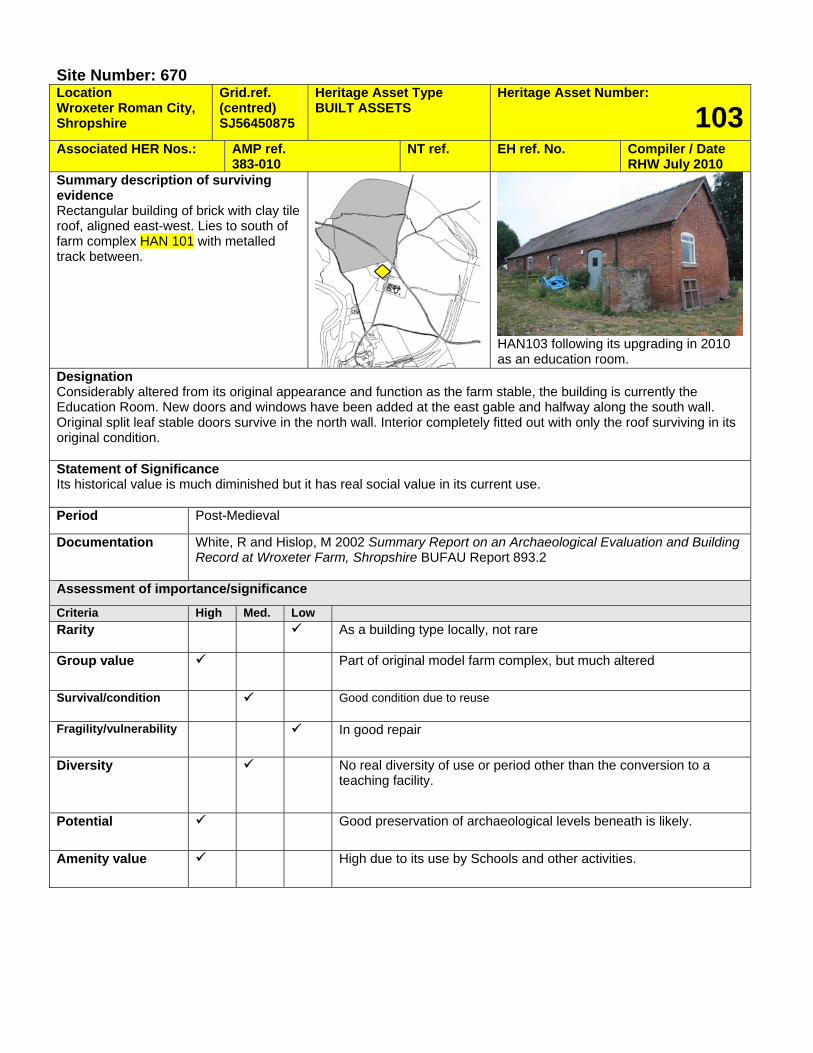
Site Number: 670 Location Wroxeter Roman City, Shropshire
Grid.ref. (centred) SJ56450875
Heritage Asset Type BUILT ASSETS
Heritage Asset Number:
103Associated HER Nos.: AMP ref.
383-010 NT ref. EH ref. No. Compiler / Date
RHW July 2010 Summary description of surviving evidence Rectangular building of brick with clay tile roof, aligned east-west. Lies to south of farm complex HAN 101 with metalled track between.
HAN103 following its upgrading in 2010 as an education room.
Designation Considerably altered from its original appearance and function as the farm stable, the building is currently the Education Room. New doors and windows have been added at the east gable and halfway along the south wall. Original split leaf stable doors survive in the north wall. Interior completely fitted out with only the roof surviving in its original condition. Statement of Significance Its historical value is much diminished but it has real social value in its current use. Period Post-Medieval
Documentation White, R and Hislop, M 2002 Summary Report on an Archaeological Evaluation and Building Record at Wroxeter Farm, Shropshire BUFAU Report 893.2
Assessment of importance/significance
Criteria High Med. Low Rarity As a building type locally, not rare
Group value Part of original model farm complex, but much altered
Survival/condition Good condition due to reuse
Fragility/vulnerability In good repair
Diversity No real diversity of use or period other than the conversion to a teaching facility.
Potential Good preservation of archaeological levels beneath is likely.
Amenity value High due to its use by Schools and other activities.
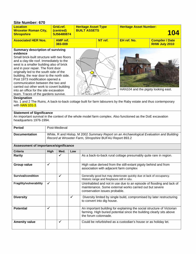
Site Number: 670 Location Wroxeter Roman City, Shropshire
Grid.ref. (centred) SJ56480874
Heritage Asset Type BUILT ASSETS
Heritage Asset Number:
104Associated HER Nos. AMP ref.
383-009 NT ref. EH ref. No. Compiler / Date
RHW July 2010
Summary description of surviving evidence Small brick-built structure with two floors and a clay-tile roof. Immediately to the west is a smaller building also of brick and in poor repair. The front door originally led to the south side of the building, the rear door to the north side. Post 1973 modification opened a communication between the two and carried out other work to covert building into an office for the site excavation team. Traces of the gardens survive.
HAN104 and the pigsty looking east.
Designation No. 1 and 2 The Ruins, A back-to-back cottage built for farm labourers by the Raby estate and thus contemporary with HAN 101-3. Statement of Significance An important survival in the context of the whole model farm complex. Also functioned as the DoE excavation headquarters 1976-1994. Period Post-Medieval
Documentation White, R and Hislop, M 2002 Summary Report on an Archaeological Evaluation and Building Record at Wroxeter Farm, Shropshire BUFAU Report 893.2
Assessment of importance/significance
Criteria High Med. Low Rarity As a back-to-back rural cottage presumably quite rare in region.
Group value High value derived from the still-extant pigsty behind and from association with adjacent farm complex
Survival/condition Generally good but may deteriorate quickly due ot lack of occupancy. Historic range and fireplaces still in situ.
Fragility/vulnerability Uninhabited and not in use due to an episode of flooding and lack of maintenance. Some external works carried out but severe conservation issues probable.
Diversity Diversity limited by single build, compromised by later restructuring to convert into dig house.
Potential An important building for explaining the social structure of Victorian farming. High buried potential since the building clearly sits above the forum colonnade.
Amenity value Could be refurbished as a custodian’s house or as holiday let.
Site Number: 670 Location Wroxeter Roman City, Shropshire
Grid.ref. (centred) SJ56550874
Heritage Asset Type BUILT ASSETS
Heritage Asset Number:
105Associated HER Nos. AMP ref.
383-008 NT ref. EH ref. No. Compiler / Date
RHW July 2010 Summary description of surviving evidence Rectangular timber building on concrete raft with flat asphalt roof and shallow clerestorey above. Towards west end there is a glazed pyramid providing a lightwell for the underlying shop.
HAN105 seen from the road (HAN406)
Designation English Heritage site museum and shop. Statement of Significance Temporary visitor centre and museum. Period Modern (1970s)
Documentation
Assessment of importance/significance
Criteria High Med. Low Rarity
Group value
Survival/condition
Fragility/vulnerability
Diversity
Potential Built over site of excavation trench from 1960s so little archaeology beneath.
Amenity value Has some value as the current site museum but only a temporary structure.
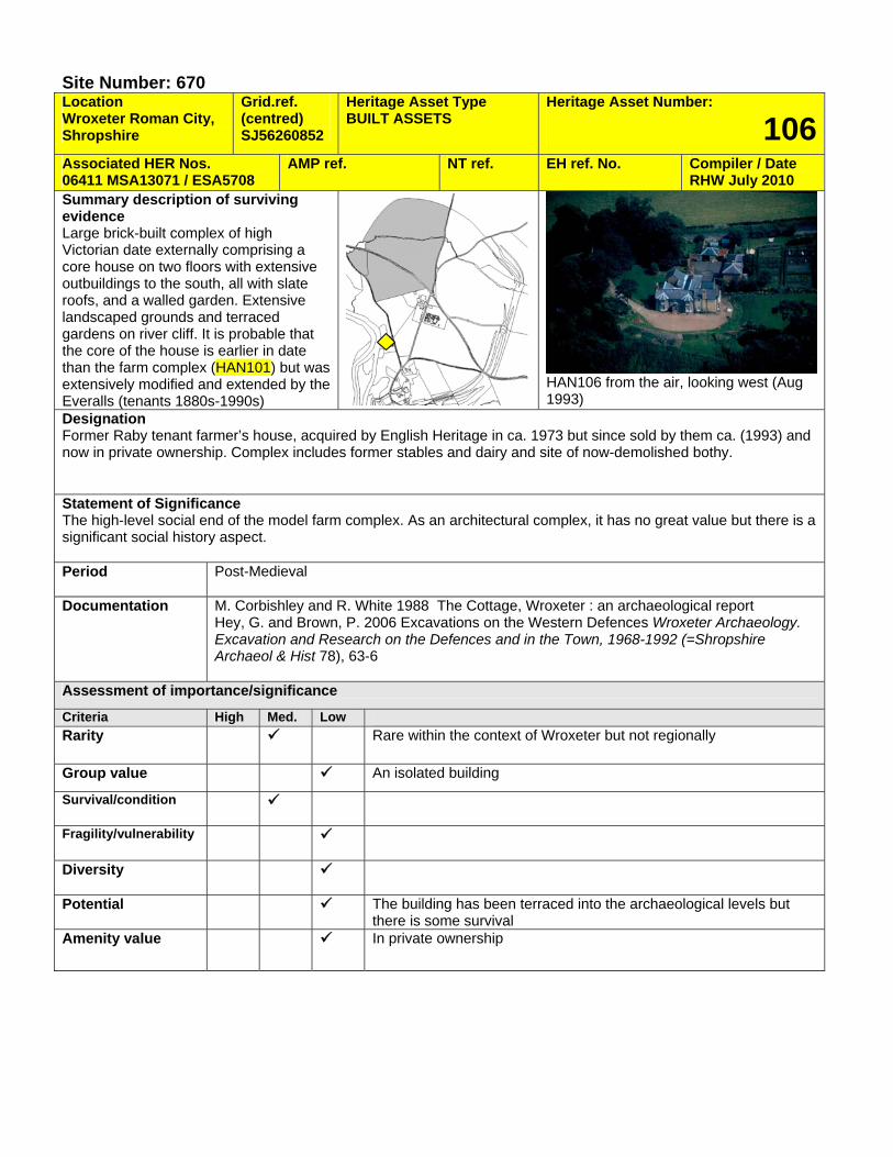
Site Number: 670 Location Wroxeter Roman City, Shropshire
Grid.ref. (centred) SJ56260852
Heritage Asset Type BUILT ASSETS
Heritage Asset Number:
106Associated HER Nos. 06411 MSA13071 / ESA5708
AMP ref. NT ref. EH ref. No. Compiler / Date RHW July 2010
Summary description of surviving evidence Large brick-built complex of high Victorian date externally comprising a core house on two floors with extensive outbuildings to the south, all with slate roofs, and a walled garden. Extensive landscaped grounds and terraced gardens on river cliff. It is probable that the core of the house is earlier in date than the farm complex (HAN101) but was extensively modified and extended by the Everalls (tenants 1880s-1990s)
HAN106 from the air, looking west (Aug 1993)
Designation Former Raby tenant farmer’s house, acquired by English Heritage in ca. 1973 but since sold by them ca. (1993) and now in private ownership. Complex includes former stables and dairy and site of now-demolished bothy. Statement of Significance The high-level social end of the model farm complex. As an architectural complex, it has no great value but there is a significant social history aspect. Period Post-Medieval
Documentation M. Corbishley and R. White 1988 The Cottage, Wroxeter : an archaeological report
Hey, G. and Brown, P. 2006 Excavations on the Western Defences Wroxeter Archaeology. Excavation and Research on the Defences and in the Town, 1968-1992 (=Shropshire Archaeol & Hist 78), 63-6
Assessment of importance/significance
Criteria High Med. Low Rarity Rare within the context of Wroxeter but not regionally
Group value An isolated building
Survival/condition
Fragility/vulnerability
Diversity
Potential The building has been terraced into the archaeological levels but there is some survival
Amenity value In private ownership
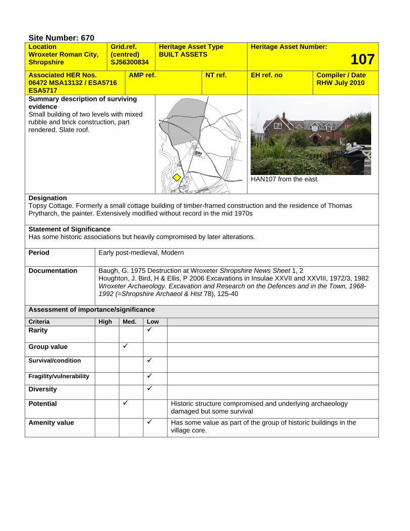
Site Number: 670 Location Wroxeter Roman City, Shropshire
Grid.ref. (centred) SJ56300834
Heritage Asset Type BUILT ASSETS
Heritage Asset Number:
107Associated HER Nos. 06472 MSA13132 / ESA5716 ESA5717
AMP ref. NT ref. EH ref. no Compiler / Date RHW July 2010
Summary description of surviving evidence Small building of two levels with mixed rubble and brick construction, part rendered. Slate roof.
HAN107 from the east.
Designation Topsy Cottage. Formerly a small cottage building of timber-framed construction and the residence of Thomas Prytharch, the painter. Extensively modified without record in the mid 1970s Statement of Significance Has some historic associations but heavily compromised by later alterations. Period Early post-medieval, Modern
Documentation Baugh, G. 1975 Destruction at Wroxeter Shropshire News Sheet 1, 2 Houghton, J. Bird, H & Ellis, P 2006 Excavations in Insulae XXVII and XXVIII, 1972/3, 1982 Wroxeter Archaeology. Excavation and Research on the Defences and in the Town, 1968-1992 (=Shropshire Archaeol & Hist 78), 125-40
Assessment of importance/significance
Criteria High Med. Low Rarity
Group value
Survival/condition
Fragility/vulnerability
Diversity
Potential Historic structure compromised and underlying archaeology damaged but some survival
Amenity value Has some value as part of the group of historic buildings in the village core.
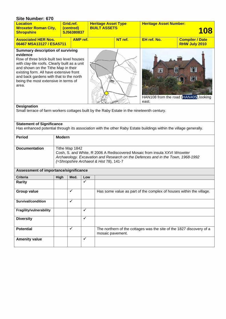
Site Number: 670 Location Wroxeter Roman City, Shropshire
Grid.ref. (centred) SJ56380837
Heritage Asset Type BUILT ASSETS
Heritage Asset Number:
108Associated HER Nos. 06467 MSA13127 / ESA5711
AMP ref. NT ref. EH ref. No. Compiler / Date RHW July 2010
Summary description of surviving evidence Row of three brick-built two level houses with clay-tile roofs. Clearly built as a unit and shown on the Tithe Map in their existing form. All have extensive front and back gardens with that to the north being the most extensive in terms of area.
HAN108 from the road (HAN405),looking east.
Designation Small terrace of farm workers cottages built by the Raby Estate in the nineteenth century. Statement of Significance Has enhanced potential through its association with the other Raby Estate buildings within the village generally. Period Modern
Documentation Tithe Map 1842 Cosh, S. and White, R 2006 A Rediscovered Mosaic from insula XXVI Wroxeter Archaeology. Excavation and Research on the Defences and in the Town, 1968-1992 (=Shropshire Archaeol & Hist 78), 141-7
Assessment of importance/significance
Criteria High Med. Low Rarity
Group value Has some value as part of the complex of houses within the village.
Survival/condition
Fragility/vulnerability
Diversity
Potential The northern of the cottages was the site of the 1827 discovery of a mosaic pavement.
Amenity value
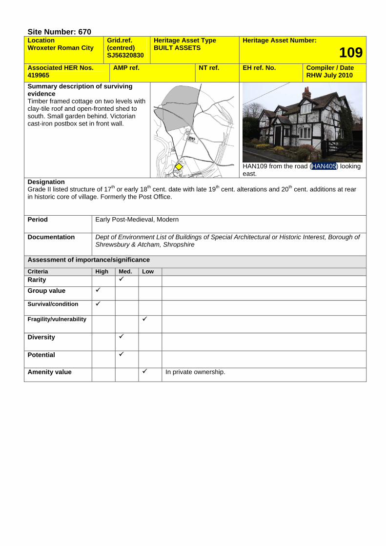
Site Number: 670 Location Wroxeter Roman City
Grid.ref. (centred) SJ56320830
Heritage Asset Type BUILT ASSETS
Heritage Asset Number:
109Associated HER Nos. 419965
AMP ref. NT ref. EH ref. No. Compiler / Date RHW July 2010
Summary description of surviving evidence Timber framed cottage on two levels with clay-tile roof and open-fronted shed to south. Small garden behind. Victorian cast-iron postbox set in front wall.
HAN109 from the road (HAN405) looking east.
Designation Grade II listed structure of 17th or early 18th cent. date with late 19th cent. alterations and 20th cent. additions at rear in historic core of village. Formerly the Post Office. Period Early Post-Medieval, Modern
Documentation Dept of Environment List of Buildings of Special Architectural or Historic Interest, Borough of Shrewsbury & Atcham, Shropshire
Assessment of importance/significance
Criteria High Med. Low Rarity Group value
Survival/condition
Fragility/vulnerability
Diversity
Potential
Amenity value In private ownership.
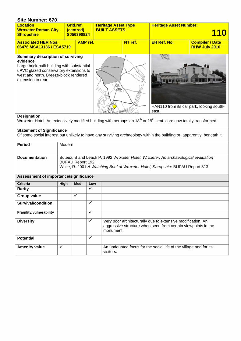
Site Number: 670 Location Wroxeter Roman City, Shropshire
Grid.ref. (centred) SJ56390824
Heritage Asset Type BUILT ASSETS
Heritage Asset Number:
110Associated HER Nos. 06476 MSA13136 / ESA5719
AMP ref. NT ref. EH Ref. No. Compiler / Date RHW July 2010
Summary description of surviving evidence Large brick-built building with substantial uPVC glazed conservatory extensions to west and north. Breeze-block rendered extension to rear.
HAN110 from its car park, looking south-east.
Designation Wroxeter Hotel. An extensively modified building with perhaps an 18th or 19th cent. core now totally transformed. Statement of Significance Of some social interest but unlikely to have any surviving archaeology within the building or, apparently, beneath it. Period Modern
Documentation Buteux, S and Leach P. 1992 Wroxeter Hotel, Wroxeter: An archaeological evaluation BUFAU Report 192 White, R. 2001 A Watching Brief at Wroxeter Hotel, Shropshire BUFAU Report 813
Assessment of importance/significance
Criteria High Med. Low Rarity
Group value
Survival/condition
Fragility/vulnerability
Diversity Very poor architecturally due to extensive modification. An aggressive structure when seen from certain viewpoints in the monument.
Potential
Amenity value An undoubted focus for the social life of the village and for its visitors.
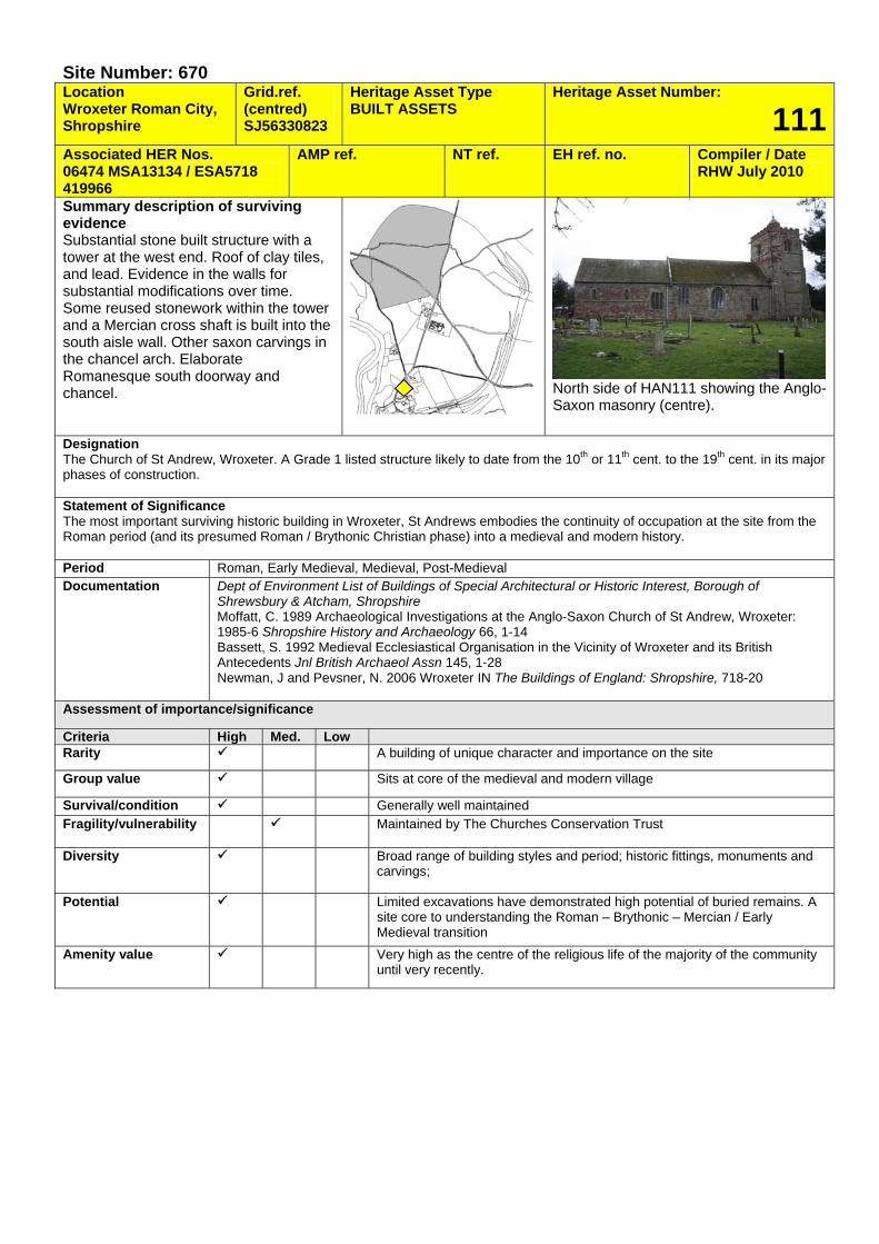
Site Number: 670 Location Wroxeter Roman City, Shropshire
Grid.ref. (centred) SJ56330823
Heritage Asset Type BUILT ASSETS
Heritage Asset Number:
111Associated HER Nos. 06474 MSA13134 / ESA5718 419966
AMP ref. NT ref. EH ref. no. Compiler / Date RHW July 2010
Summary description of surviving evidence Substantial stone built structure with a tower at the west end. Roof of clay tiles, and lead. Evidence in the walls for substantial modifications over time. Some reused stonework within the tower and a Mercian cross shaft is built into the south aisle wall. Other saxon carvings in the chancel arch. Elaborate Romanesque south doorway and chancel.
North side of HAN111 showing the Anglo-Saxon masonry (centre).
Designation The Church of St Andrew, Wroxeter. A Grade 1 listed structure likely to date from the 10th or 11th cent. to the 19th cent. in its major phases of construction. Statement of Significance The most important surviving historic building in Wroxeter, St Andrews embodies the continuity of occupation at the site from the Roman period (and its presumed Roman / Brythonic Christian phase) into a medieval and modern history. Period Roman, Early Medieval, Medieval, Post-Medieval Documentation Dept of Environment List of Buildings of Special Architectural or Historic Interest, Borough of
Shrewsbury & Atcham, Shropshire Moffatt, C. 1989 Archaeological Investigations at the Anglo-Saxon Church of St Andrew, Wroxeter: 1985-6 Shropshire History and Archaeology 66, 1-14 Bassett, S. 1992 Medieval Ecclesiastical Organisation in the Vicinity of Wroxeter and its British Antecedents Jnl British Archaeol Assn 145, 1-28 Newman, J and Pevsner, N. 2006 Wroxeter IN The Buildings of England: Shropshire, 718-20
Assessment of importance/significance
Criteria High Med. Low Rarity A building of unique character and importance on the site
Group value Sits at core of the medieval and modern village
Survival/condition Generally well maintained Fragility/vulnerability Maintained by The Churches Conservation Trust
Diversity Broad range of building styles and period; historic fittings, monuments and carvings;
Potential Limited excavations have demonstrated high potential of buried remains. A site core to understanding the Roman – Brythonic – Mercian / Early Medieval transition
Amenity value Very high as the centre of the religious life of the majority of the community until very recently.

Site Number: 670 Location Wroxeter Roman City, Shropshire
Grid.ref. (centred) SJ56290824
Heritage Asset Type BUILT ASSETS
Heritage Asset Number:
112Associated HER Nos. 420921
AMP ref. NT ref. EH ref. no. Compiler / Date RHW July 2010
Summary description of surviving evidence Structure of two stories in brick and timber with render. Dated to 1690 with mid and late 19th cent. and 20th cent. alterations
HAN112 from the churchyard, looking south-east
Designation The Grange, a substantial house that has been much altered. Listed Grade 2. Statement of Significance A prominent house within the village due to its proximity to the church. Period Post-Medieval, Modern
Documentation Dept of Environment List of Buildings of Special Architectural or Historic Interest, Borough of Shrewsbury & Atcham, Shropshire
Assessment of importance/significance
Criteria High Med. Low Rarity
Group value Survival/condition
Fragility/vulnerability
Diversity
Potential Possibly some archaeological levels but quite close to rampart.
Amenity value Private residence
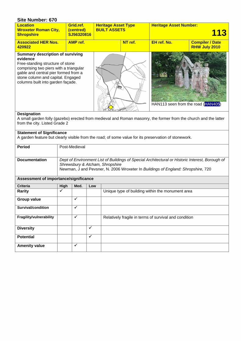
Site Number: 670 Location Wroxeter Roman City, Shropshire
Grid.ref. (centred) SJ56320816
Heritage Asset Type BUILT ASSETS
Heritage Asset Number:
113Associated HER Nos. 420922
AMP ref. NT ref. EH ref. No. Compiler / Date RHW July 2010
Summary description of surviving evidence Free-standing structure of stone comprising two piers with a triangular gable and central pier formed from a stone column and capital. Engaged columns built into garden façade.
HAN113 seen from the road (HAN405)
Designation A small garden folly (gazebo) erected from medieval and Roman masonry, the former from the church and the latter from the city. Listed Grade 2 Statement of Significance A garden feature but clearly visible from the road; of some value for its preservation of stonework. Period Post-Medieval
Documentation Dept of Environment List of Buildings of Special Architectural or Historic Interest, Borough of Shrewsbury & Atcham, Shropshire Newman, J and Pevsner, N. 2006 Wroxeter In Buildings of England: Shropshire, 720
Assessment of importance/significance
Criteria High Med. Low Rarity Unique type of building within the monument area
Group value
Survival/condition
Fragility/vulnerability Relatively fragile in terms of survival and condition
Diversity
Potential
Amenity value
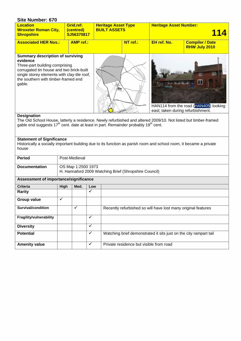
Site Number: 670 Location Wroxeter Roman City, Shropshire
Grid.ref. (centred) SJ56370817
Heritage Asset Type BUILT ASSETS
Heritage Asset Number:
114Associated HER Nos.: AMP ref.: NT ref.: EH ref. No. Compiler / Date
RHW July 2010
Summary description of surviving evidence Three-part building comprising corrugated tin house and two brick-built single storey elements with clay-tile roof, the southern with timber-framed end gable.
HAN114 from the road (HAN405) looking east; taken during refurbishment.
Designation The Old School House, latterly a residence. Newly refurbished and altered 2009/10. Not listed but timber-framed gable end suggests 17th cent. date at least in part. Remainder probably 19th cent. Statement of Significance Historically a socially important building due to its function as parish room and school room, it became a private house Period Post-Medieval
Documentation OS Map 1:2500 1973 H. Hannaford 2009 Watching Brief (Shropshire Council)
Assessment of importance/significance
Criteria High Med. Low Rarity
Group value
Survival/condition Recently refurbished so will have lost many original features
Fragility/vulnerability
Diversity
Potential Watching brief demonstrated it sits just on the city rampart tail
Amenity value Private residence but visible from road
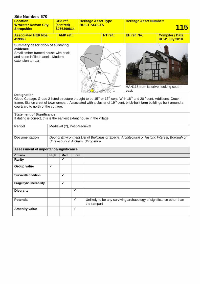
Site Number: 670 Location Wroxeter Roman City, Shropshire
Grid.ref. (centred) SJ56390814
Heritage Asset Type BUILT ASSETS
Heritage Asset Number:
115Associated HER Nos. 419963
AMP ref.: NT ref.: EH ref. No. Compiler / Date RHW July 2010
Summary description of surviving evidence Small timber-framed house with brick and stone infilled panels. Modern extension to rear.
HAN115 from its drive, looking south-east.
Designation Glebe Cottage. Grade 2 listed structure thought to be 15th or 16th cent. With 18th and 20th cent. Additions. Cruck-frame. Sits on crest of town rampart. Associated with a cluster of 19th cent. brick-built farm buildings built around a courtyard to north of the cottage. Statement of Significance If dating is correct, this is the earliest extant house in the village. Period Medieval (?), Post-Medieval
Documentation Dept of Environment List of Buildings of Special Architectural or Historic Interest, Borough of Shrewsbury & Atcham, Shropshire
Assessment of importance/significance
Criteria High Med. Low Rarity
Group value
Survival/condition
Fragility/vulnerability
Diversity
Potential Unlikely to be any surviving archaeology of significance other than the rampart
Amenity value
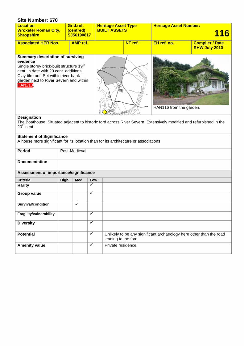
Site Number: 670 Location Wroxeter Roman City, Shropshire
Grid.ref. (centred) SJ56190817
Heritage Asset Type BUILT ASSETS
Heritage Asset Number:
116Associated HER Nos. AMP ref. NT ref. EH ref. no. Compiler / Date
RHW July 2010
Summary description of surviving evidence Single storey brick-built structure 19th cent. in date with 20 cent. additions. Clay-tile roof. Set within river-bank garden next to River Severn and within HAN213.
HAN116 from the garden.
Designation The Boathouse. Situated adjacent to historic ford across River Severn. Extensively modified and refurbished in the 20th cent. Statement of Significance A house more significant for its location than for its architecture or associations Period Post-Medieval
Documentation
Assessment of importance/significance
Criteria High Med. Low Rarity
Group value
Survival/condition
Fragility/vulnerability
Diversity
Potential Unlikely to be any significant archaeology here other than the road leading to the ford.
Amenity value Private residence

Site Number: 670 Location Wroxeter Roman City, Shropshire
Grid.ref. (centred) SJ56380807
Heritage Asset Type BUILT ASSETS
Heritage Asset Number:
117Associated HER Nos. AMP ref.
383-020 NT ref.: EH ref. No. Compiler / Date
RHW July 2010
Summary description of surviving evidence Terrace of two brick-built three storey houses with clay-tile roof. 19th cent. in date.
HAN117 seen from the garden of HAN115, looking south
Designation Mount Pleasant cottages. Built by the Raby estate for farm hands and acquired in the 1970s by English Heritage. Not listed.
Statement of Significance Have some value as evidence for accommodation provided for farm workers by Raby Estate. Period Post-Medieval
Documentation
Assessment of importance/significance
Criteria High Med. Low Rarity
Group value
Survival/condition Currently the northern building is unoccupied and in very poor condition
Fragility/vulnerability
Diversity
Potential Sits on counter-scarp of the town ditch (= south bank of stream)
Amenity value Private residence
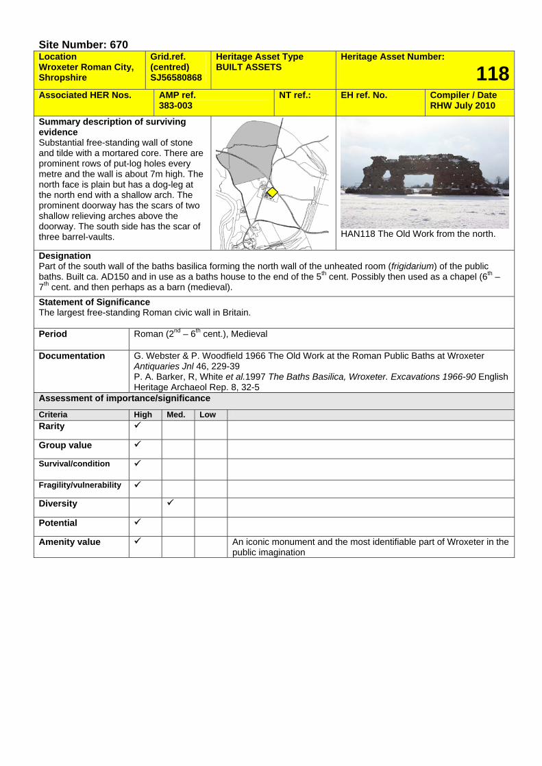
Site Number: 670 Location Wroxeter Roman City, Shropshire
Grid.ref. (centred) SJ56580868
Heritage Asset Type BUILT ASSETS
Heritage Asset Number:
118Associated HER Nos. AMP ref.
383-003 NT ref.: EH ref. No. Compiler / Date
RHW July 2010
Summary description of surviving evidence Substantial free-standing wall of stone and tilde with a mortared core. There are prominent rows of put-log holes every metre and the wall is about 7m high. The north face is plain but has a dog-leg at the north end with a shallow arch. The prominent doorway has the scars of two shallow relieving arches above the doorway. The south side has the scar of three barrel-vaults.
HAN118 The Old Work from the north.
Designation Part of the south wall of the baths basilica forming the north wall of the unheated room (frigidarium) of the public baths. Built ca. AD150 and in use as a baths house to the end of the 5th cent. Possibly then used as a chapel (6th – 7th cent. and then perhaps as a barn (medieval). Statement of Significance The largest free-standing Roman civic wall in Britain. Period Roman (2nd – 6th cent.), Medieval
Documentation G. Webster & P. Woodfield 1966 The Old Work at the Roman Public Baths at Wroxeter Antiquaries Jnl 46, 229-39 P. A. Barker, R, White et al.1997 The Baths Basilica, Wroxeter. Excavations 1966-90 English Heritage Archaeol Rep. 8, 32-5
Assessment of importance/significance
Criteria High Med. Low Rarity
Group value
Survival/condition
Fragility/vulnerability
Diversity
Potential
Amenity value An iconic monument and the most identifiable part of Wroxeter in the public imagination
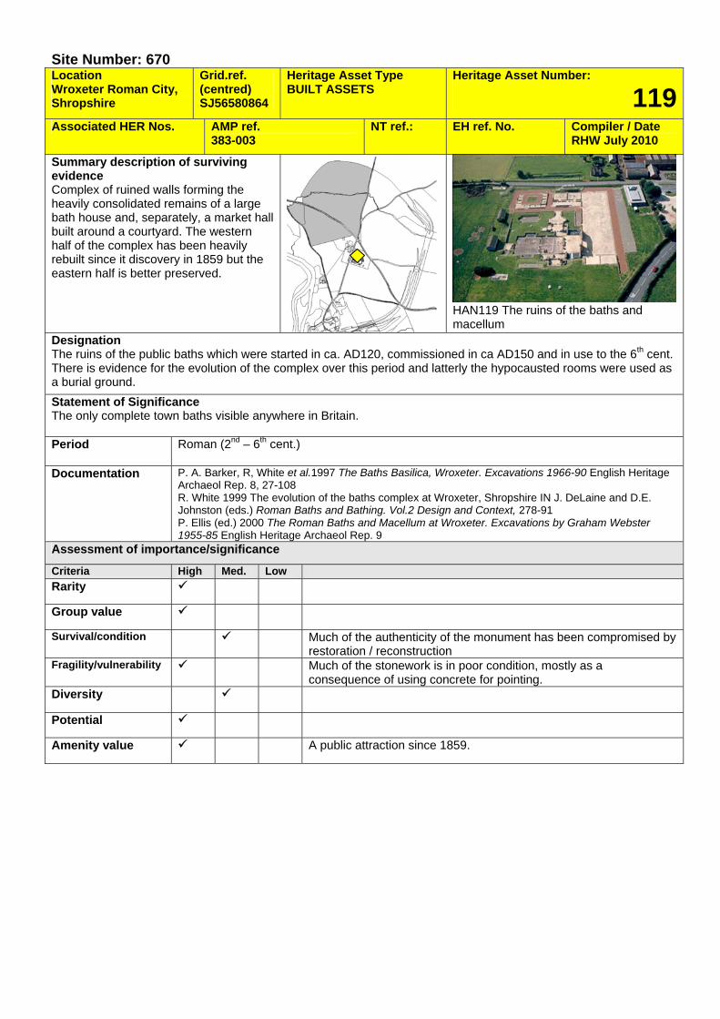
Site Number: 670 Location Wroxeter Roman City, Shropshire
Grid.ref. (centred) SJ56580864
Heritage Asset Type BUILT ASSETS
Heritage Asset Number:
119Associated HER Nos. AMP ref.
383-003 NT ref.: EH ref. No. Compiler / Date
RHW July 2010
Summary description of surviving evidence Complex of ruined walls forming the heavily consolidated remains of a large bath house and, separately, a market hall built around a courtyard. The western half of the complex has been heavily rebuilt since it discovery in 1859 but the eastern half is better preserved.
HAN119 The ruins of the baths and macellum
Designation The ruins of the public baths which were started in ca. AD120, commissioned in ca AD150 and in use to the 6th cent. There is evidence for the evolution of the complex over this period and latterly the hypocausted rooms were used as a burial ground. Statement of Significance The only complete town baths visible anywhere in Britain. Period Roman (2nd – 6th cent.)
Documentation P. A. Barker, R, White et al.1997 The Baths Basilica, Wroxeter. Excavations 1966-90 English Heritage Archaeol Rep. 8, 27-108 R. White 1999 The evolution of the baths complex at Wroxeter, Shropshire IN J. DeLaine and D.E. Johnston (eds.) Roman Baths and Bathing. Vol.2 Design and Context, 278-91 P. Ellis (ed.) 2000 The Roman Baths and Macellum at Wroxeter. Excavations by Graham Webster 1955-85 English Heritage Archaeol Rep. 9
Assessment of importance/significance
Criteria High Med. Low Rarity
Group value
Survival/condition Much of the authenticity of the monument has been compromised by restoration / reconstruction
Fragility/vulnerability Much of the stonework is in poor condition, mostly as a consequence of using concrete for pointing.
Diversity
Potential
Amenity value A public attraction since 1859.
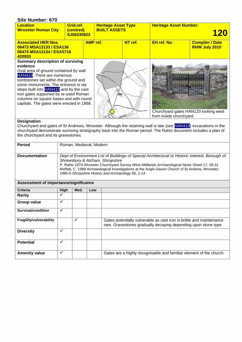
Site Number: 670 Location Wroxeter Roman City
Grid.ref. (centred) SJ56330823
Heritage Asset Type BUILT ASSETS
Heritage Asset Number:
120Associated HER Nos. 06473 MSA13133 / ESA136 06474 MSA13134 / ESA5718 420920
AMP ref. NT ref. EH ref. No. Compiler / Date RHW July 2010
Summary description of surviving evidence Oval area of ground contained by wall HAN410. There are numerous tombstones set within the ground and some monuments. The entrance is via steps built into HAN410 and by the cast iron gates supported by re-used Roman columns on square bases and with round capitals. The gates were erected in 1868.
Churchyard gates HAN120 looking west from inside churchyard.
Designation Churchyard and gates of St Andrews, Wroxeter. Although the retaining wall is late (see HAN410) excavations in the churchyard demonstrate surviving stratigraphy back into the Roman period. The Rahtz document includes a plan of the churchyard and its gravestones. Period Roman, Medieval, Modern
Documentation Dept of Environment List of Buildings of Special Architectural or Historic Interest, Borough of Shrewsbury & Atcham, Shropshire P. Rahtz 1974 Wroxeter Churchyard Survey West Midlands Archaeological News Sheet 17, 28-31 Moffatt, C. 1989 Archaeological Investigations at the Anglo-Saxon Church of St Andrew, Wroxeter: 1985-6 Shropshire History and Archaeology 66, 1-14
Assessment of importance/significance
Criteria High Med. Low Rarity Group value
Survival/condition
Fragility/vulnerability Gates potentially vulnerable as cast iron is brittle and maintenance rare. Gravestones gradually decaying depending upon stone type
Diversity
Potential
Amenity value Gates are a highly recognisable and familiar element of the church
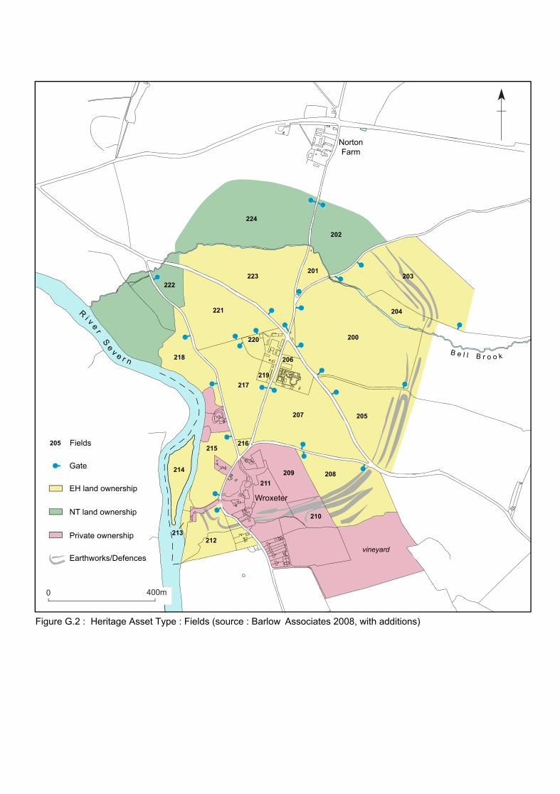
Earthworks/Defences
43
5
21
Ri v e r
Se v e r n
B e l l B r o o k
0 400m
Gate
EH land ownership
NT land ownership
Private ownership
vineyard
Wroxeter
NortonFarm
Figure G.2 : Heritage Asset Type : Fields (source : Barlow Associates 2008, with additions)
Fields205
224
202
222223
200
203
204
205207
208209
210
212
214
215
213
216
217
218
221
220
206
219
211
201
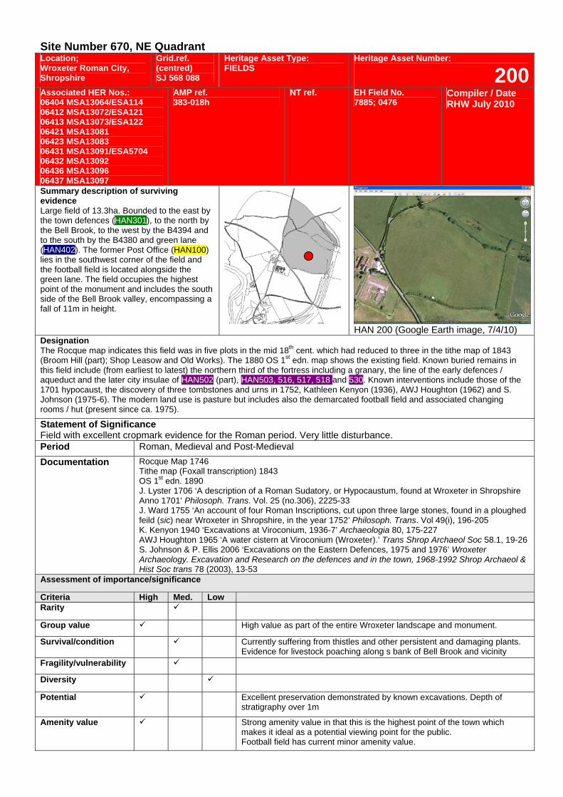
Site Number 670, NE Quadrant Location; Wroxeter Roman City, Shropshire
Grid.ref. (centred) SJ 568 088
Heritage Asset Type: FIELDS
Heritage Asset Number:
200Associated HER Nos.: 06404 MSA13064/ESA114 06412 MSA13072/ESA121 06413 MSA13073/ESA122 06421 MSA13081 06423 MSA13083 06431 MSA13091/ESA5704 06432 MSA13092 06436 MSA13096 06437 MSA13097
AMP ref. 383-018h
NT ref. EH Field No. 7885; 0476
Compiler / Date RHW July 2010
Summary description of surviving evidence Large field of 13.3ha. Bounded to the east by the town defences (HAN301), to the north by the Bell Brook, to the west by the B4394 and to the south by the B4380 and green lane (HAN402). The former Post Office (HAN100) lies in the southwest corner of the field and the football field is located alongside the green lane. The field occupies the highest point of the monument and includes the south side of the Bell Brook valley, encompassing a fall of 11m in height.
HAN 200 (Google Earth image, 7/4/10)
Designation The Rocque map indicates this field was in five plots in the mid 18th cent. which had reduced to three in the tithe map of 1843 (Broom Hill (part); Shop Leasow and Old Works). The 1880 OS 1st edn. map shows the existing field. Known buried remains in this field include (from earliest to latest) the northern third of the fortress including a granary, the line of the early defences / aqueduct and the later city insulae of HAN502 (part), HAN503, 516, 517, 518 and 530. Known interventions include those of the 1701 hypocaust, the discovery of three tombstones and urns in 1752, Kathleen Kenyon (1936), AWJ Houghton (1962) and S. Johnson (1975-6). The modern land use is pasture but includes also the demarcated football field and associated changing rooms / hut (present since ca. 1975). Statement of Significance Field with excellent cropmark evidence for the Roman period. Very little disturbance. Period Roman, Medieval and Post-Medieval Documentation Rocque Map 1746
Tithe map (Foxall transcription) 1843 OS 1st edn. 1890 J. Lyster 1706 ‘A description of a Roman Sudatory, or Hypocaustum, found at Wroxeter in Shropshire Anno 1701’ Philosoph. Trans. Vol. 25 (no.306), 2225-33 J. Ward 1755 ‘An account of four Roman Inscriptions, cut upon three large stones, found in a ploughed feild (sic) near Wroxeter in Shropshire, in the year 1752’ Philosoph. Trans. Vol 49(i), 196-205 K. Kenyon 1940 ‘Excavations at Viroconium, 1936-7’ Archaeologia 80, 175-227 AWJ Houghton 1965 ‘A water cistern at Viroconium (Wroxeter).’ Trans Shrop Archaeol Soc 58.1, 19-26 S. Johnson & P. Ellis 2006 ‘Excavations on the Eastern Defences, 1975 and 1976’ Wroxeter Archaeology. Excavation and Research on the defences and in the town, 1968-1992 Shrop Archaeol & Hist Soc trans 78 (2003), 13-53
Assessment of importance/significance
Criteria High Med. Low Rarity
Group value High value as part of the entire Wroxeter landscape and monument.
Survival/condition Currently suffering from thistles and other persistent and damaging plants. Evidence for livestock poaching along s bank of Bell Brook and vicinity
Fragility/vulnerability
Diversity
Potential Excellent preservation demonstrated by known excavations. Depth of stratigraphy over 1m
Amenity value Strong amenity value in that this is the highest point of the town which makes it ideal as a potential viewing point for the public. Football field has current minor amenity value.
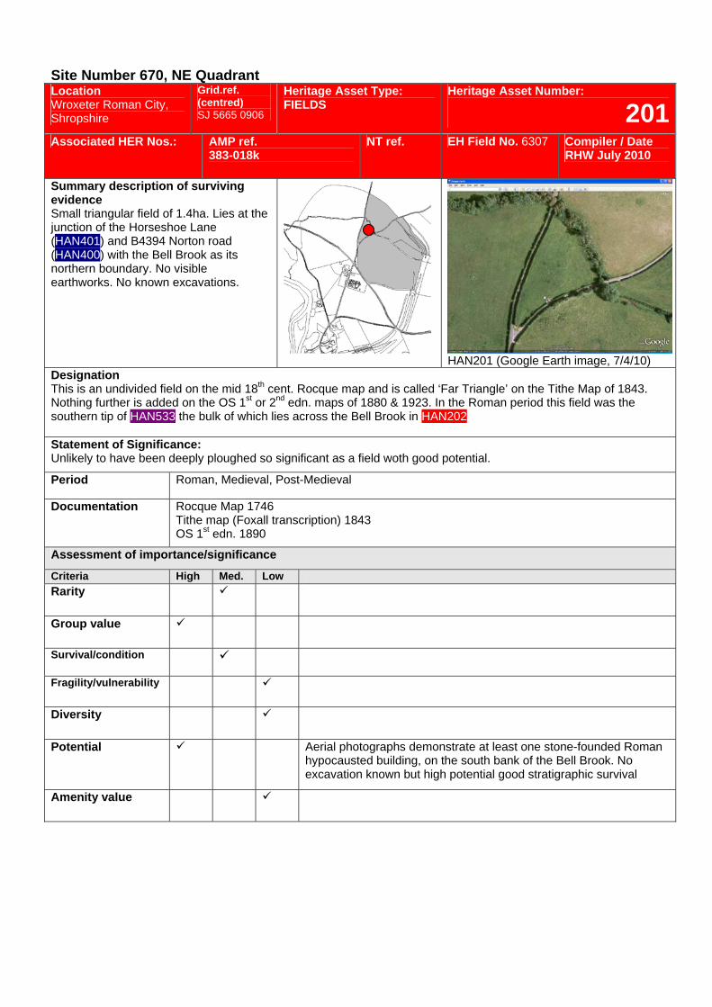
Site Number 670, NE Quadrant Location Wroxeter Roman City, Shropshire
Grid.ref. (centred) SJ 5665 0906
Heritage Asset Type: FIELDS
Heritage Asset Number:
201Associated HER Nos.: AMP ref.
383-018k NT ref. EH Field No. 6307 Compiler / Date
RHW July 2010
Summary description of surviving evidence Small triangular field of 1.4ha. Lies at the junction of the Horseshoe Lane (HAN401) and B4394 Norton road (HAN400) with the Bell Brook as its northern boundary. No visible earthworks. No known excavations.
HAN201 (Google Earth image, 7/4/10)
Designation This is an undivided field on the mid 18th cent. Rocque map and is called ‘Far Triangle’ on the Tithe Map of 1843. Nothing further is added on the OS 1st or 2nd edn. maps of 1880 & 1923. In the Roman period this field was the southern tip of HAN533 the bulk of which lies across the Bell Brook in HAN202. Statement of Significance: Unlikely to have been deeply ploughed so significant as a field woth good potential.
Period Roman, Medieval, Post-Medieval
Documentation Rocque Map 1746 Tithe map (Foxall transcription) 1843 OS 1st edn. 1890
Assessment of importance/significance
Criteria High Med. Low Rarity
Group value
Survival/condition
Fragility/vulnerability
Diversity
Potential Aerial photographs demonstrate at least one stone-founded Roman hypocausted building, on the south bank of the Bell Brook. No excavation known but high potential good stratigraphic survival
Amenity value
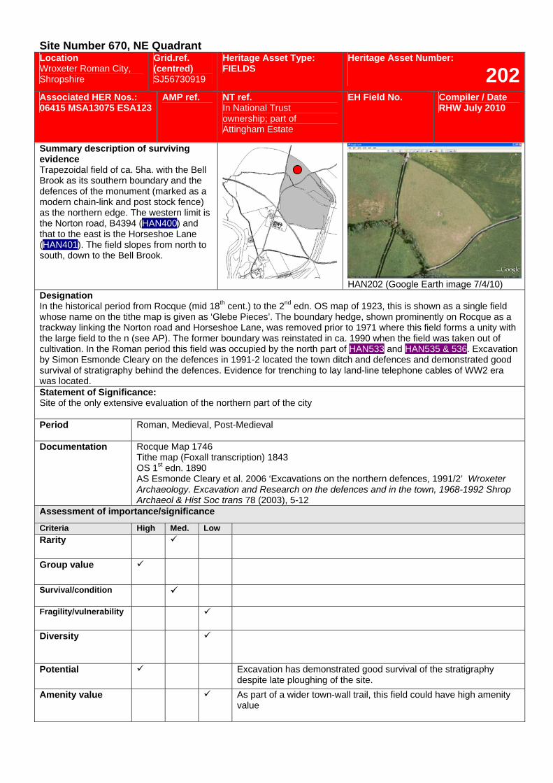
Site Number 670, NE Quadrant Location Wroxeter Roman City, Shropshire
Grid.ref. (centred) SJ56730919
Heritage Asset Type: FIELDS
Heritage Asset Number:
202Associated HER Nos.: 06415 MSA13075 ESA123
AMP ref.
NT ref. In National Trust ownership; part of Attingham Estate
EH Field No. Compiler / Date RHW July 2010
Summary description of surviving evidence Trapezoidal field of ca. 5ha. with the Bell Brook as its southern boundary and the defences of the monument (marked as a modern chain-link and post stock fence) as the northern edge. The western limit is the Norton road, B4394 (HAN400) and that to the east is the Horseshoe Lane (HAN401). The field slopes from north to south, down to the Bell Brook.
HAN202 (Google Earth image 7/4/10)
Designation In the historical period from Rocque (mid 18th cent.) to the 2nd edn. OS map of 1923, this is shown as a single field whose name on the tithe map is given as ‘Glebe Pieces’. The boundary hedge, shown prominently on Rocque as a trackway linking the Norton road and Horseshoe Lane, was removed prior to 1971 where this field forms a unity with the large field to the n (see AP). The former boundary was reinstated in ca. 1990 when the field was taken out of cultivation. In the Roman period this field was occupied by the north part of HAN533 and HAN535 & 536. Excavation by Simon Esmonde Cleary on the defences in 1991-2 located the town ditch and defences and demonstrated good survival of stratigraphy behind the defences. Evidence for trenching to lay land-line telephone cables of WW2 era was located. Statement of Significance: Site of the only extensive evaluation of the northern part of the city Period Roman, Medieval, Post-Medieval
Documentation Rocque Map 1746 Tithe map (Foxall transcription) 1843 OS 1st edn. 1890 AS Esmonde Cleary et al. 2006 ‘Excavations on the northern defences, 1991/2’ Wroxeter Archaeology. Excavation and Research on the defences and in the town, 1968-1992 Shrop Archaeol & Hist Soc trans 78 (2003), 5-12
Assessment of importance/significance
Criteria High Med. Low Rarity
Group value
Survival/condition
Fragility/vulnerability
Diversity
Potential Excavation has demonstrated good survival of the stratigraphy despite late ploughing of the site.
Amenity value As part of a wider town-wall trail, this field could have high amenity value
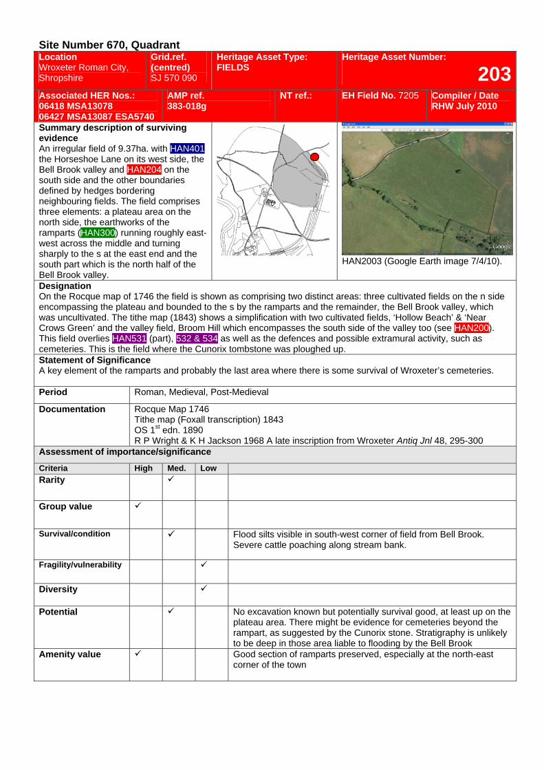
Site Number 670, Quadrant Location Wroxeter Roman City, Shropshire
Grid.ref. (centred) SJ 570 090
Heritage Asset Type: FIELDS
Heritage Asset Number:
203Associated HER Nos.: 06418 MSA13078 06427 MSA13087 ESA5740
AMP ref. 383-018g
NT ref.: EH Field No. 7205 Compiler / Date RHW July 2010
Summary description of surviving evidence An irregular field of 9.37ha. with HAN401 the Horseshoe Lane on its west side, the Bell Brook valley and HAN204 on the south side and the other boundaries defined by hedges bordering neighbouring fields. The field comprises three elements: a plateau area on the north side, the earthworks of the ramparts (HAN300) running roughly east-west across the middle and turning sharply to the s at the east end and the south part which is the north half of the Bell Brook valley.
HAN2003 (Google Earth image 7/4/10).
Designation On the Rocque map of 1746 the field is shown as comprising two distinct areas: three cultivated fields on the n side encompassing the plateau and bounded to the s by the ramparts and the remainder, the Bell Brook valley, which was uncultivated. The tithe map (1843) shows a simplification with two cultivated fields, ‘Hollow Beach’ & ‘Near Crows Green’ and the valley field, Broom Hill which encompasses the south side of the valley too (see HAN200). This field overlies HAN531 (part), 532 & 534 as well as the defences and possible extramural activity, such as cemeteries. This is the field where the Cunorix tombstone was ploughed up. Statement of Significance A key element of the ramparts and probably the last area where there is some survival of Wroxeter’s cemeteries. Period Roman, Medieval, Post-Medieval
Documentation Rocque Map 1746 Tithe map (Foxall transcription) 1843 OS 1st edn. 1890 R P Wright & K H Jackson 1968 A late inscription from Wroxeter Antiq Jnl 48, 295-300
Assessment of importance/significance
Criteria High Med. Low Rarity
Group value
Survival/condition Flood silts visible in south-west corner of field from Bell Brook. Severe cattle poaching along stream bank.
Fragility/vulnerability
Diversity
Potential No excavation known but potentially survival good, at least up on the plateau area. There might be evidence for cemeteries beyond the rampart, as suggested by the Cunorix stone. Stratigraphy is unlikely to be deep in those area liable to flooding by the Bell Brook
Amenity value Good section of ramparts preserved, especially at the north-east corner of the town
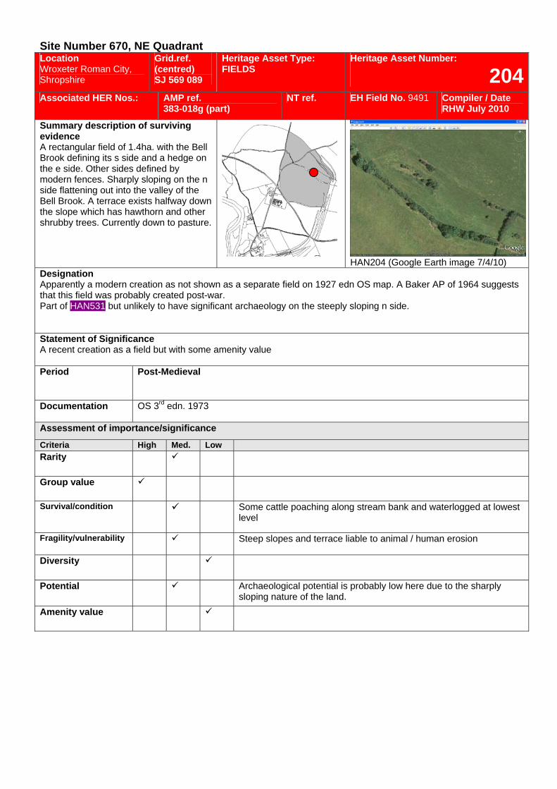
Site Number 670, NE Quadrant Location Wroxeter Roman City, Shropshire
Grid.ref. (centred) SJ 569 089
Heritage Asset Type: FIELDS
Heritage Asset Number:
204Associated HER Nos.: AMP ref.
383-018g (part) NT ref. EH Field No. 9491 Compiler / Date
RHW July 2010
Summary description of surviving evidence A rectangular field of 1.4ha. with the Bell Brook defining its s side and a hedge on the e side. Other sides defined by modern fences. Sharply sloping on the n side flattening out into the valley of the Bell Brook. A terrace exists halfway down the slope which has hawthorn and other shrubby trees. Currently down to pasture.
HAN204 (Google Earth image 7/4/10)
Designation Apparently a modern creation as not shown as a separate field on 1927 edn OS map. A Baker AP of 1964 suggests that this field was probably created post-war. Part of HAN531 but unlikely to have significant archaeology on the steeply sloping n side. Statement of Significance A recent creation as a field but with some amenity value Period Post-Medieval
Documentation OS 3rd edn. 1973
Assessment of importance/significance
Criteria High Med. Low Rarity
Group value
Survival/condition Some cattle poaching along stream bank and waterlogged at lowest level
Fragility/vulnerability Steep slopes and terrace liable to animal / human erosion
Diversity
Potential Archaeological potential is probably low here due to the sharply sloping nature of the land.
Amenity value
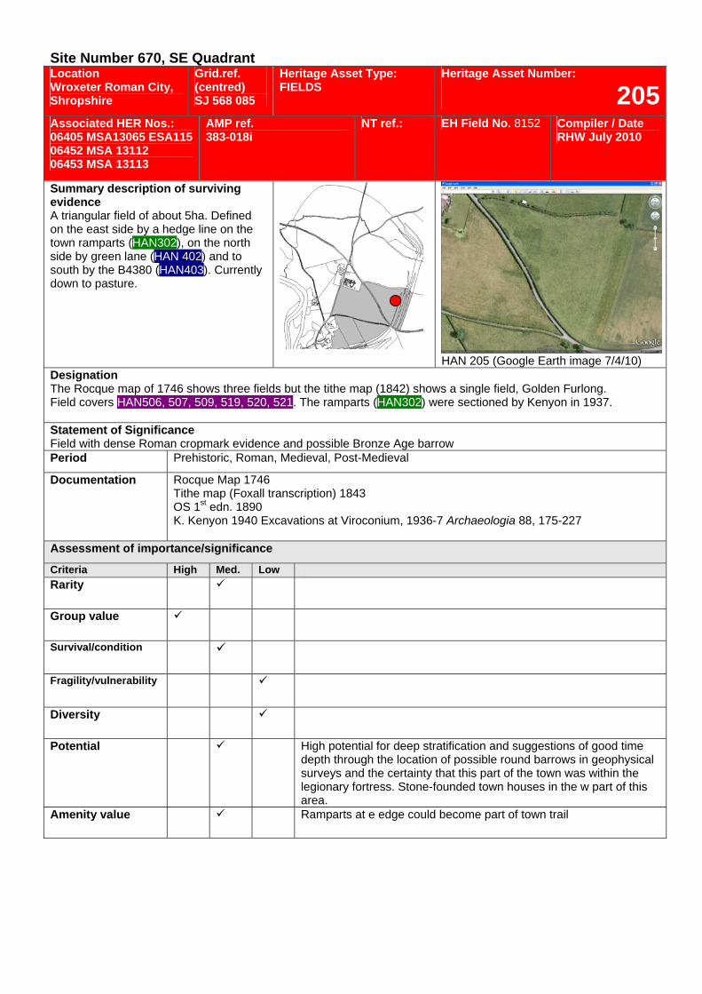
Site Number 670, SE Quadrant Location Wroxeter Roman City, Shropshire
Grid.ref. (centred) SJ 568 085
Heritage Asset Type: FIELDS
Heritage Asset Number:
205Associated HER Nos.: 06405 MSA13065 ESA115 06452 MSA 13112 06453 MSA 13113
AMP ref. 383-018i
NT ref.: EH Field No. 8152 Compiler / Date RHW July 2010
Summary description of surviving evidence A triangular field of about 5ha. Defined on the east side by a hedge line on the town ramparts (HAN302), on the north side by green lane (HAN 402) and to south by the B4380 (HAN403). Currently down to pasture.
HAN 205 (Google Earth image 7/4/10)
Designation The Rocque map of 1746 shows three fields but the tithe map (1842) shows a single field, Golden Furlong. Field covers HAN506, 507, 509, 519, 520, 521. The ramparts (HAN302) were sectioned by Kenyon in 1937. Statement of Significance Field with dense Roman cropmark evidence and possible Bronze Age barrow Period Prehistoric, Roman, Medieval, Post-Medieval
Documentation Rocque Map 1746 Tithe map (Foxall transcription) 1843 OS 1st edn. 1890 K. Kenyon 1940 Excavations at Viroconium, 1936-7 Archaeologia 88, 175-227
Assessment of importance/significance
Criteria High Med. Low Rarity
Group value
Survival/condition
Fragility/vulnerability
Diversity
Potential High potential for deep stratification and suggestions of good time depth through the location of possible round barrows in geophysical surveys and the certainty that this part of the town was within the legionary fortress. Stone-founded town houses in the w part of this area.
Amenity value Ramparts at e edge could become part of town trail
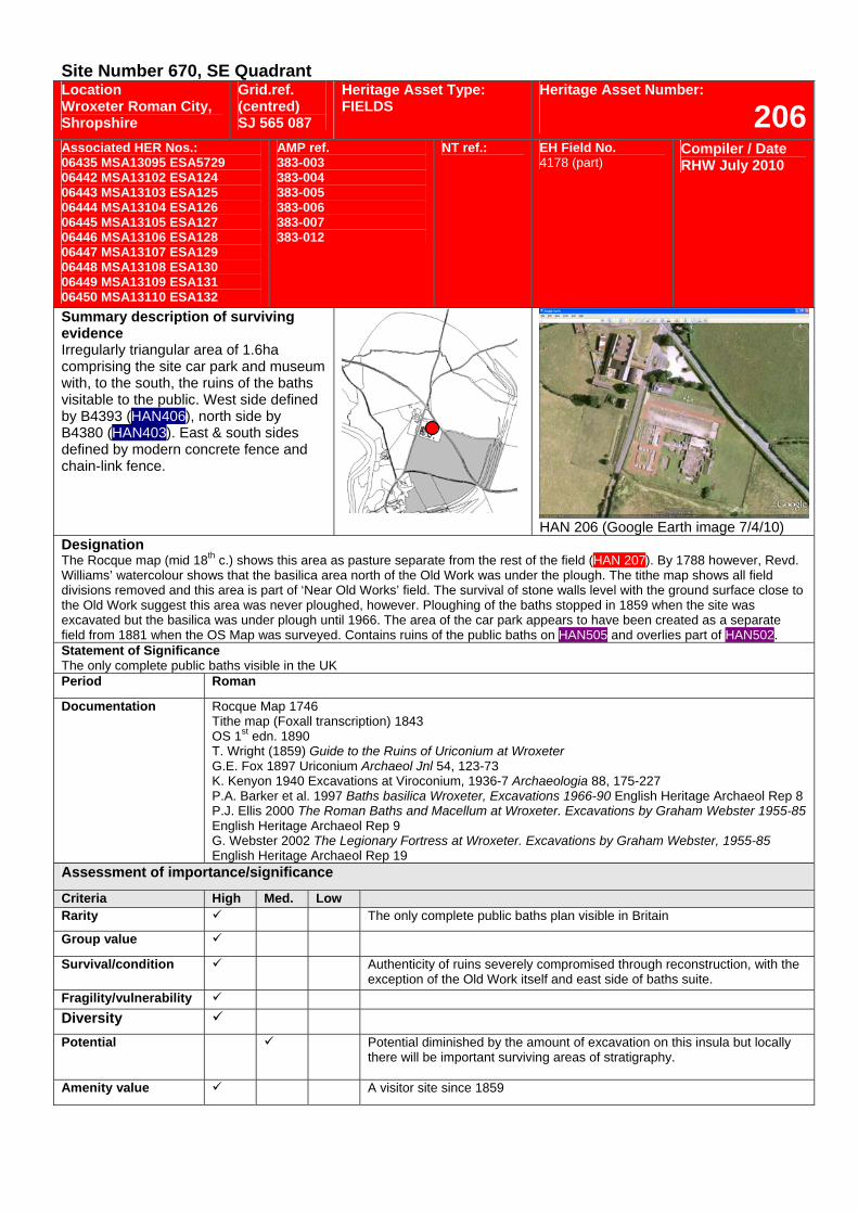
Site Number 670, SE Quadrant Location Wroxeter Roman City, Shropshire
Grid.ref. (centred) SJ 565 087
Heritage Asset Type: FIELDS
Heritage Asset Number:
206Associated HER Nos.: 06435 MSA13095 ESA5729 06442 MSA13102 ESA124 06443 MSA13103 ESA125 06444 MSA13104 ESA126 06445 MSA13105 ESA127 06446 MSA13106 ESA128 06447 MSA13107 ESA129 06448 MSA13108 ESA130 06449 MSA13109 ESA131 06450 MSA13110 ESA132
AMP ref. 383-003 383-004 383-005 383-006 383-007 383-012
NT ref.: EH Field No. 4178 (part)
Compiler / Date RHW July 2010
Summary description of surviving evidence Irregularly triangular area of 1.6ha comprising the site car park and museum with, to the south, the ruins of the baths visitable to the public. West side defined by B4393 (HAN406), north side by B4380 (HAN403). East & south sides defined by modern concrete fence and chain-link fence.
HAN 206 (Google Earth image 7/4/10)
Designation The Rocque map (mid 18th c.) shows this area as pasture separate from the rest of the field (HAN 207). By 1788 however, Revd. Williams’ watercolour shows that the basilica area north of the Old Work was under the plough. The tithe map shows all field divisions removed and this area is part of ‘Near Old Works’ field. The survival of stone walls level with the ground surface close to the Old Work suggest this area was never ploughed, however. Ploughing of the baths stopped in 1859 when the site was excavated but the basilica was under plough until 1966. The area of the car park appears to have been created as a separate field from 1881 when the OS Map was surveyed. Contains ruins of the public baths on HAN505 and overlies part of HAN502. Statement of Significance The only complete public baths visible in the UK Period Roman
Documentation
Rocque Map 1746 Tithe map (Foxall transcription) 1843 OS 1st edn. 1890 T. Wright (1859) Guide to the Ruins of Uriconium at Wroxeter G.E. Fox 1897 Uriconium Archaeol Jnl 54, 123-73 K. Kenyon 1940 Excavations at Viroconium, 1936-7 Archaeologia 88, 175-227 P.A. Barker et al. 1997 Baths basilica Wroxeter, Excavations 1966-90 English Heritage Archaeol Rep 8 P.J. Ellis 2000 The Roman Baths and Macellum at Wroxeter. Excavations by Graham Webster 1955-85 English Heritage Archaeol Rep 9 G. Webster 2002 The Legionary Fortress at Wroxeter. Excavations by Graham Webster, 1955-85 English Heritage Archaeol Rep 19
Assessment of importance/significance
Criteria High Med. Low Rarity The only complete public baths plan visible in Britain
Group value
Survival/condition Authenticity of ruins severely compromised through reconstruction, with the exception of the Old Work itself and east side of baths suite.
Fragility/vulnerability Diversity Potential Potential diminished by the amount of excavation on this insula but locally
there will be important surviving areas of stratigraphy.
Amenity value A visitor site since 1859
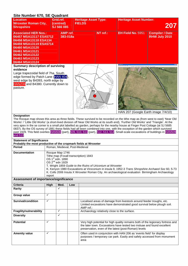
Site Number 670, SE Quadrant Location Wroxeter Roman City, Shropshire
Grid.ref. (centred) SJ 566 085
Heritage Asset Type: FIELDS
Heritage Asset Number:
207Associated HER Nos.: 06457 MSA13117 ESA5712 06458 MSA13118 ESA134 06459 MSA13119 ESA5714 06460 MSA13120 06461 MSA13121 06462 MSA13122 06463 MSA13123 06464 MSA13124
AMP ref. 383-018a
NT ref.: EH Field No. 5951 Compiler / Date RHW July 2010
Summary description of surviving evidence Large trapezoidal field of 7ha. South edge formed by Patch Lane (HAN 404), west edge by B4393, north edge by HAN206 and B4380. Currently down to pasture.
HAN 207 (Google Earth image 7/4/10)
Designation The Rocque map shows this area as three fields. These survived to be recorded on the tithe map as (from west to east) ‘Near Old Works’ / ‘Little Old Works’ (a short-lived division off Near Old Works at its south end), ‘Further Old Works’ and ‘Triangle’. At the very apex in the se corner is a small plot labelled as garden, perhaps for the nearby house at Finger Post Cottage (at SJ 5685 0837). By the OS survey of 1881 these fields had all been combined into one, with the exception of the garden which survived past 1929. This field overlies HAN506 (part), 509, 510, 511 (part), 512, 513, 514. Small-scale excavations of buildings in HAN509 and 510.
Statement of Significance Probably the most productive of the cropmark fields at Wroxeter Period Roman, Medieval, Post-Medieval
Documentation Rocque Map 1746 Tithe map (Foxall transcription) 1843 OS 1st edn. 1890 OS 2nd edn 1929 T. Wright 1859 Guide to the Ruins of Uriconium at Wroxeter K. Kenyon 1980 Excavations at Viroconium in insula 9, 1952-3 Trans Shropshire Archaeol Soc 60, 5-73 K. Colls 2006 Insula X Wroxeter Roman City. An archaeological evaluation Birmingham Archaeology report
Assessment of importance/significance
Criteria High Med. Low Rarity
Group value
Survival/condition Localised areas of damage from livestock around feeder troughs, etc. Limited excavations have demonstrated good survival below plough soil. AMP ref.:
Fragility/vulnerability Archaeology relatively close to the surface. Diversity
Potential Very high potential for high quality remains both of the legionary fortress and the later town. Excavations have tested two insluae and found excellent preservation, even of the latest (post-Roman) levels
Amenity value Often used in conjunction with HAN 206 as ‘events field’ for display purposes / temporary car park. Easily and safely accessed from monument area
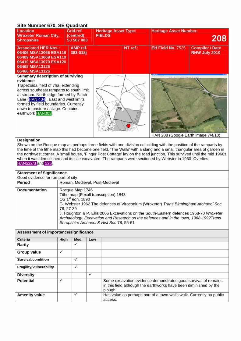
Site Number 670, SE Quadrant Location Wroxeter Roman City, Shropshire
Grid.ref. (centred) SJ 567 083
Heritage Asset Type: FIELDS
Heritage Asset Number:
208Associated HER Nos.: 06406 MSA13066 ESA116 06409 MSA13069 ESA119 06410 MSA13070 ESA120 06465 MSA13125 06466 MSA13126
AMP ref. 383-018j
NT ref.: EH Field No. 7525 Compiler / Date RHW July 2010
Summary description of surviving evidence Trapezoidal field of 7ha. extending across southeast ramparts to south limit at stream. North edge formed by Patch Lane (HAN 404). East and west limits formed by field boundaries. Currently down to pasture / silage. Contains earthwork HAN303.
HAN 208 (Google Earth image 7/4/10)
Designation Shown on the Rocque map as perhaps three fields with one division coinciding with the position of the ramparts by the time of the tithe map this had become one field, ‘The Walls’ with a slang and a small triangular area of garden in the northwest corner. A small house, ‘Finger Post Cottage’ lay on the road junction. This survived until the mid 1960s when it was demolished and its site excavated. The ramparts were sectioned by Webster in 1960. Overlies HAN522/3 and 525. Statement of Significance Good evidence for rampart of city Period Roman, Medieval, Post-Medieval
Documentation Rocque Map 1746 Tithe map (Foxall transcription) 1843 OS 1st edn. 1890 G. Webster 1962 The defences of Viroconium (Wroxeter) Trans Birmingham Archaeol Soc 78, 27-39 J. Houghton & P. Ellis 2006 Excavations on the South-Eastern defences 1968-70 Wroxeter Archaeology. Excavation and Research on the defences and in the town, 1968-1992Trans Shropshire Archaeol & Hist Soc 78, 55-61
Assessment of importance/significance
Criteria High Med. Low Rarity
Group value
Survival/condition
Fragility/vulnerability
Diversity Potential Some excavation evidence demonstrates good survival of remains
in this field although the earthworks have been diminished by the plough.
Amenity value Has value as perhaps part of a town-walls walk. Currently no public access.
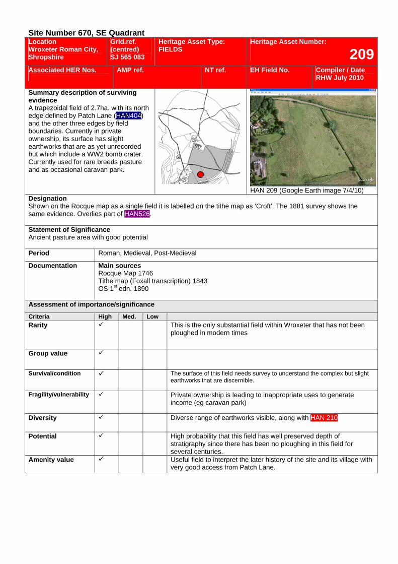
Site Number 670, SE Quadrant Location Wroxeter Roman City, Shropshire
Grid.ref. (centred) SJ 565 083
Heritage Asset Type: FIELDS
Heritage Asset Number:
209Associated HER Nos.
AMP ref. NT ref. EH Field No. Compiler / Date RHW July 2010
Summary description of surviving evidence A trapezoidal field of 2.7ha. with its north edge defined by Patch Lane (HAN404) and the other three edges by field boundaries. Currently in private ownership, its surface has slight earthworks that are as yet unrecorded but which include a WW2 bomb crater. Currently used for rare breeds pasture and as occasional caravan park.
HAN 209 (Google Earth image 7/4/10)
Designation Shown on the Rocque map as a single field it is labelled on the tithe map as ‘Croft’. The 1881 survey shows the same evidence. Overlies part of HAN526. Statement of Significance Ancient pasture area with good potential Period Roman, Medieval, Post-Medieval
Documentation Main sources Rocque Map 1746 Tithe map (Foxall transcription) 1843 OS 1st edn. 1890
Assessment of importance/significance
Criteria High Med. Low Rarity This is the only substantial field within Wroxeter that has not been
ploughed in modern times
Group value
Survival/condition The surface of this field needs survey to understand the complex but slight earthworks that are discernible.
Fragility/vulnerability Private ownership is leading to inappropriate uses to generate income (eg caravan park)
Diversity Diverse range of earthworks visible, along with HAN 210
Potential High probability that this field has well preserved depth of stratigraphy since there has been no ploughing in this field for several centuries.
Amenity value Useful field to interpret the later history of the site and its village with very good access from Patch Lane.
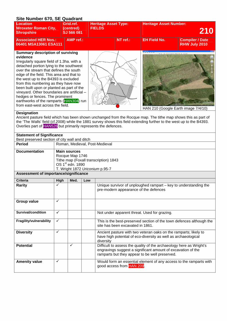
Site Number 670, SE Quadrant Location Wroxeter Roman City, Shropshire
Grid.ref. (centred) SJ 566 081
Heritage Asset Type: FIELDS
Heritage Asset Number:
210Associated HER Nos.: 06401 MSA13061 ESA111
AMP ref.: NT ref.: EH Field No. Compiler / Date RHW July 2010
Summary description of surviving evidence Irregularly square field of 1.3ha. with a detached portion lying to the southwest over the stream that defines the south edge of the field. This area and that to the west up to the B4393 is excluded from this numbering as they have now been built upon or planted as part of the vineyard. Other boundaries are artificial – hedges or fences. The prominent earthworks of the ramparts (HAN304) run from east-west across the field.
HAN 210 (Google Earth image 7/4/10) Designation Ancient pasture field which has been shown unchanged from the Rocque map. The tithe map shows this as part of the ‘The Walls’ field (cf.2008) while the 1881 survey shows this field extending further to the west up to the B4393. Overlies part of HAN526 but primarily represents the defences. Statement of Significance Best preserved section of city wall and ditch Period Roman, Medieval, Post-Medieval
Documentation Main sources Rocque Map 1746 Tithe map (Foxall transcription) 1843 OS 1st edn. 1890 T. Wright 1872 Uriconium p.95-7
Assessment of importance/significance
Criteria High Med. Low Rarity Unique survivor of unploughed rampart – key to understanding the
pre-modern appearance of the defences
Group value
Survival/condition Not under apparent threat. Used for grazing.
Fragility/vulnerability This is the best-preserved section of the town defences although the site has been excavated in 1861.
Diversity Ancient pasture with two veteran oaks on the ramparts; likely to have high potential of eco-diversity as well as archaeological diversity
Potential Difficult to assess the quality of the archaeology here as Wright’s engravings suggest a significant amount of excavation of the ramparts but they appear to be well preserved.
Amenity value Would form an essential element of any access to the ramparts with good access from HAN 209.
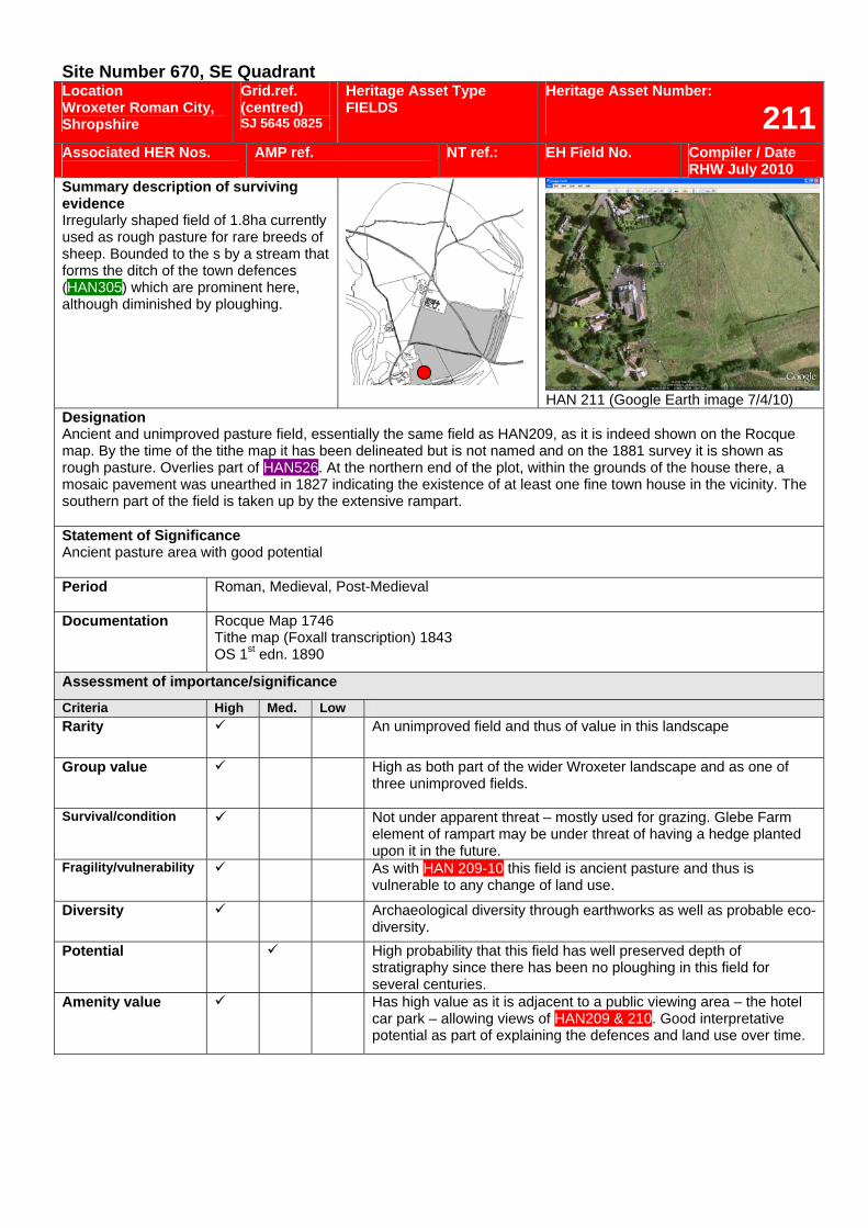
Site Number 670, SE Quadrant Location Wroxeter Roman City, Shropshire
Grid.ref. (centred) SJ 5645 0825
Heritage Asset Type FIELDS
Heritage Asset Number:
211Associated HER Nos.
AMP ref.
NT ref.: EH Field No. Compiler / Date RHW July 2010
Summary description of surviving evidence Irregularly shaped field of 1.8ha currently used as rough pasture for rare breeds of sheep. Bounded to the s by a stream that forms the ditch of the town defences (HAN305) which are prominent here, although diminished by ploughing.
HAN 211 (Google Earth image 7/4/10)
Designation Ancient and unimproved pasture field, essentially the same field as HAN209, as it is indeed shown on the Rocque map. By the time of the tithe map it has been delineated but is not named and on the 1881 survey it is shown as rough pasture. Overlies part of HAN526. At the northern end of the plot, within the grounds of the house there, a mosaic pavement was unearthed in 1827 indicating the existence of at least one fine town house in the vicinity. The southern part of the field is taken up by the extensive rampart. Statement of Significance Ancient pasture area with good potential Period Roman, Medieval, Post-Medieval
Documentation Rocque Map 1746 Tithe map (Foxall transcription) 1843 OS 1st edn. 1890
Assessment of importance/significance
Criteria High Med. Low Rarity An unimproved field and thus of value in this landscape
Group value
High as both part of the wider Wroxeter landscape and as one of three unimproved fields.
Survival/condition Not under apparent threat – mostly used for grazing. Glebe Farm element of rampart may be under threat of having a hedge planted upon it in the future.
Fragility/vulnerability As with HAN 209-10 this field is ancient pasture and thus is vulnerable to any change of land use.
Diversity Archaeological diversity through earthworks as well as probable eco-diversity.
Potential High probability that this field has well preserved depth of stratigraphy since there has been no ploughing in this field for several centuries.
Amenity value Has high value as it is adjacent to a public viewing area – the hotel car park – allowing views of HAN209 & 210. Good interpretative potential as part of explaining the defences and land use over time.
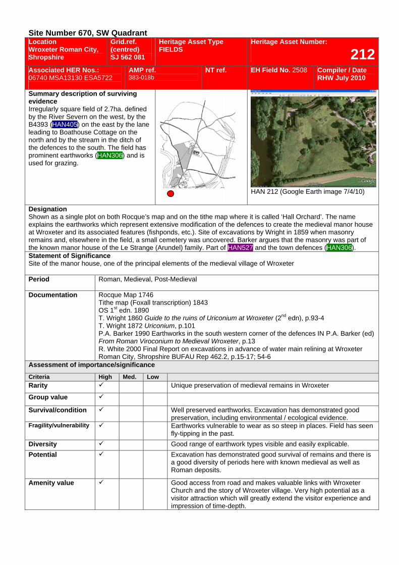
Site Number 670, SW Quadrant Location Wroxeter Roman City, Shropshire
Grid.ref. (centred) SJ 562 081
Heritage Asset Type FIELDS
Heritage Asset Number:
212Associated HER Nos.: 06740 MSA13130 ESA5722
AMP ref. 383-018b
NT ref. EH Field No. 2508 Compiler / Date RHW July 2010
Summary description of surviving evidence Irregularly square field of 2.7ha. defined by the River Severn on the west, by the B4393 (HAN405) on the east by the lane leading to Boathouse Cottage on the north and by the stream in the ditch of the defences to the south. The field has prominent earthworks (HAN306) and is used for grazing.
HAN 212 (Google Earth image 7/4/10)
Designation Shown as a single plot on both Rocque’s map and on the tithe map where it is called ‘Hall Orchard’. The name explains the earthworks which represent extensive modification of the defences to create the medieval manor house at Wroxeter and its associated features (fishponds, etc.). Site of excavations by Wright in 1859 when masonry remains and, elsewhere in the field, a small cemetery was uncovered. Barker argues that the masonry was part of the known manor house of the Le Strange (Arundel) family. Part of HAN527 and the town defences (HAN306). Statement of Significance Site of the manor house, one of the principal elements of the medieval village of Wroxeter
Period Roman, Medieval, Post-Medieval
Documentation Rocque Map 1746 Tithe map (Foxall transcription) 1843 OS 1st edn. 1890 T. Wright 1860 Guide to the ruins of Uriconium at Wroxeter (2nd edn), p.93-4 T. Wright 1872 Uriconium, p.101 P.A. Barker 1990 Earthworks in the south western corner of the defences IN P.A. Barker (ed) From Roman Viroconium to Medieval Wroxeter, p.13 R. White 2000 Final Report on excavations in advance of water main relining at Wroxeter Roman City, Shropshire BUFAU Rep 462.2, p.15-17; 54-6
Assessment of importance/significance
Criteria High Med. Low Rarity Unique preservation of medieval remains in Wroxeter
Group value
Survival/condition Well preserved earthworks. Excavation has demonstrated good preservation, including environmental / ecological evidence.
Fragility/vulnerability Earthworks vulnerable to wear as so steep in places. Field has seen fly-tipping in the past.
Diversity Good range of earthwork types visible and easily explicable. Potential Excavation has demonstrated good survival of remains and there is
a good diversity of periods here with known medieval as well as Roman deposits.
Amenity value Good access from road and makes valuable links with Wroxeter Church and the story of Wroxeter village. Very high potential as a visitor attraction which will greatly extend the visitor experience and impression of time-depth.
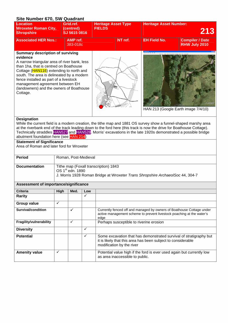
Site Number 670, SW Quadrant Location Wroxeter Roman City, Shropshire
Grid.ref. (centred) SJ 5615 0816
Heritage Asset Type FIELDS
Heritage Asset Number:
213Associated HER Nos.: AMP ref.
383-018c NT ref. EH Field No. Compiler / Date
RHW July 2010
Summary description of surviving evidence A narrow triangular area of river bank, less than 1ha, that is centred on Boathouse Cottage (HAN116) extending to north and south. The area is delineated by a modern fence installed as part of a livestock management agreement between EH (landowners) and the owners of Boathouse Cottage.
HAN 213 (Google Earth image 7/4/10)
Designation While the current field is a modern creation, the tithe map and 1881 OS survey show a funnel-shaped marshy area at the riverbank end of the track leading down to the ford here (this track is now the drive for Boathouse Cottage). Technically straddles HAN527 and HAN528. Morris’ excavations in the late 1920s demonstrated a possible bridge abutment foundation here (see HAN 214) Statement of Significance Area of Roman and later ford for Wroxeter
Period Roman, Post-Medieval
Documentation Tithe map (Foxall transcription) 1843 OS 1st edn. 1890 J. Morris 1928 Roman Bridge at Wroxeter Trans Shropshire ArchaeolSoc 44, 304-7
Assessment of importance/significance
Criteria High Med. Low Rarity
Group value Survival/condition Currently fenced off and managed by owners of Boathouse Cottage under
active management scheme to prevent livestock poaching at the water’s edge
Fragility/vulnerability Perhaps susceptible to riverine erosion
Diversity
Potential Some excavation that has demonstrated survival of stratigraphy but it is likely that this area has been subject to considerable modification by the river
Amenity value Potential value high if the ford is ever used again but currently low as area inaccessible to public.
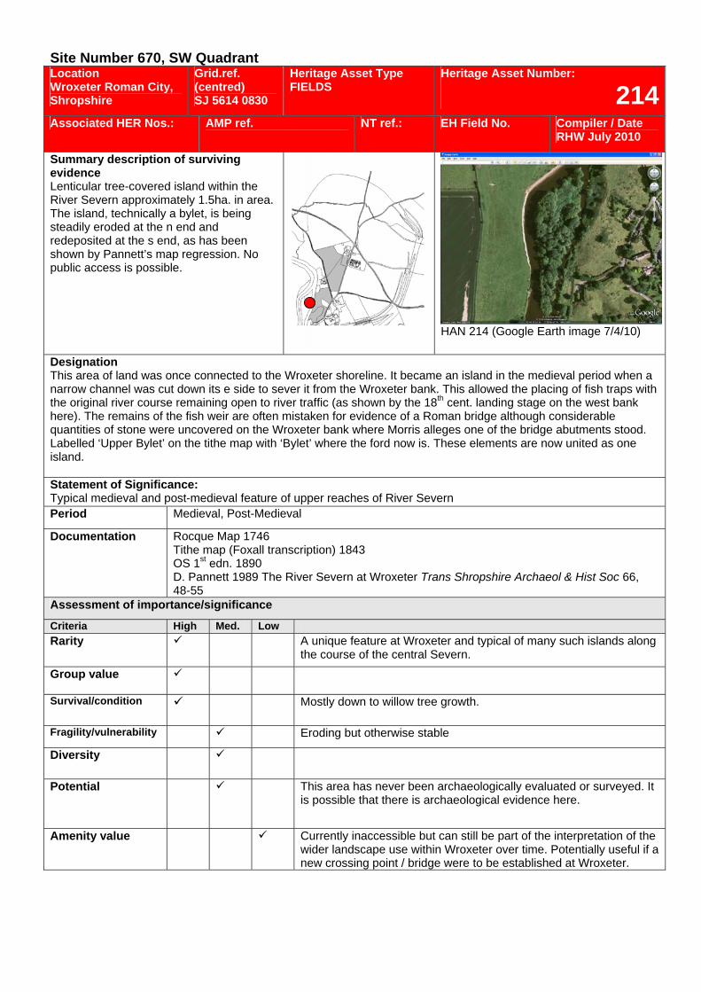
Site Number 670, SW Quadrant Location Wroxeter Roman City, Shropshire
Grid.ref. (centred) SJ 5614 0830
Heritage Asset Type FIELDS
Heritage Asset Number:
214Associated HER Nos.: AMP ref.
NT ref.: EH Field No. Compiler / Date
RHW July 2010
Summary description of surviving evidence Lenticular tree-covered island within the River Severn approximately 1.5ha. in area. The island, technically a bylet, is being steadily eroded at the n end and redeposited at the s end, as has been shown by Pannett’s map regression. No public access is possible.
HAN 214 (Google Earth image 7/4/10)
Designation This area of land was once connected to the Wroxeter shoreline. It became an island in the medieval period when a narrow channel was cut down its e side to sever it from the Wroxeter bank. This allowed the placing of fish traps with the original river course remaining open to river traffic (as shown by the 18th cent. landing stage on the west bank here). The remains of the fish weir are often mistaken for evidence of a Roman bridge although considerable quantities of stone were uncovered on the Wroxeter bank where Morris alleges one of the bridge abutments stood. Labelled ‘Upper Bylet’ on the tithe map with ‘Bylet’ where the ford now is. These elements are now united as one island. Statement of Significance: Typical medieval and post-medieval feature of upper reaches of River Severn Period Medieval, Post-Medieval
Documentation Rocque Map 1746 Tithe map (Foxall transcription) 1843 OS 1st edn. 1890 D. Pannett 1989 The River Severn at Wroxeter Trans Shropshire Archaeol & Hist Soc 66, 48-55
Assessment of importance/significance
Criteria High Med. Low Rarity A unique feature at Wroxeter and typical of many such islands along
the course of the central Severn. Group value
Survival/condition Mostly down to willow tree growth.
Fragility/vulnerability Eroding but otherwise stable
Diversity
Potential This area has never been archaeologically evaluated or surveyed. It is possible that there is archaeological evidence here.
Amenity value Currently inaccessible but can still be part of the interpretation of the wider landscape use within Wroxeter over time. Potentially useful if a new crossing point / bridge were to be established at Wroxeter.

Site Number 670, SW Quadrant Location Wroxeter Roman City, Shropshire
Grid.ref. (centred) SJ 5625 0835
Heritage Asset Type FIELDS
Heritage Asset Number:
215Associated HER Nos.: 06471 MSA13131 ESA5725
AMP ref. 383-018d
NT ref.: EH Field No. 2533 Compiler / Date RHW July 2010
Summary description of surviving evidence An irregularly oval field of about 8ha. The west limit is defined by the River Severn, the east limit by the B4393 (HAN405) and the riverside lane (HAN407), the south limit by the track leading to Boathouse Cottage and the north limit by the property boundary of The Cottage, Wroxeter (HAN106). The land has extensive earthworks in places and is used for grazing.
HAN 215 (Google Earth image 7/4/10)
Designation Rocque’s map shows that this field was extensively divided up into smaller plots and was occupied by a number of houses along the road frontages whose earthworks survive (HAN311). The field is even more densely built up on the tithe map about 100 years later with the paddocks in the northern part of the area being called ‘The Yard’. Orchard trees are also marked, the last survivor of which is possibly the Black Mulberry by the road junction (adjacent to HAN 216). By the 1881 OS survey, most of the houses had vanished and the field was much as it is today, the only survivor being ‘Topsy Cottage’ on the east side of the field. A number of excavations are known in the field, notably those by Morris, Houghton and White. Part of HAN527. Statement of Significance: Site of Wroxeter Village, ca. AD 700 - 1850 Period Roman, Medieval, Post-Medieval
Documentation Rocque Map 1746 Tithe map (Foxall transcription) 1843 OS 1st edn. 1890 J. Morris 1928 Roman Bridge at Wroxeter Trans Shropshire Archaeol Soc 44, 304-7 R. White 2000 Final Report on excavations in advance of water main relining at Wroxeter Roman City, Shropshire BUFAU Rep 462.2, 10-15 J. Houghton, H. Bird, P. Ellis 2006 Excavations in insulae xxvii and xxviii, Wroxeter Archaeology. Excavation and Research on the defences and in the town, 1968-1992 Trans Shropshire Archaeol& Hist Soc 78, 125-40
Assessment of importance/significance
Criteria High Med. Low Rarity The nucleus of Wroxeter’s village until ca. 1850
Group value
Survival/condition Grazing and thistle growth are the main threats here. Veteran trees (HAN600, 601) need continuing protection
Fragility/vulnerability Vulnerable to livestock damage in places.
Diversity Evidence of habitation as well as traces of Roman occupation (line of Roman road to ford).
Potential Excavation has demonstrated excellent potential for archaeology here, ranging from the earliest Roman period through to the mid-Victorian village. Possibly a key area for understanding the evolution of the village following the abandonment of the town.
Amenity value Has good amenity value as the focus for interpreting village life in the past and as an attractive setting for the church. Good potential to become part of a wider trail, especially so if a bridge were to be reinstated.
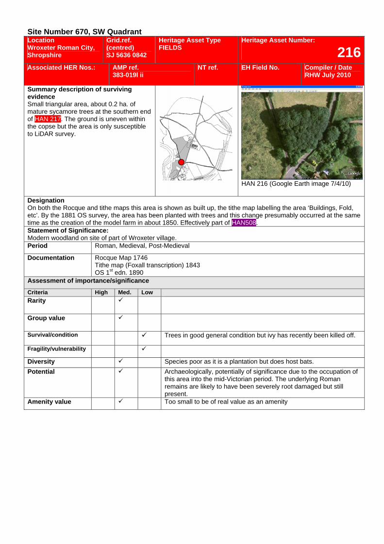
Site Number 670, SW Quadrant Location Wroxeter Roman City, Shropshire
Grid.ref. (centred) SJ 5636 0842
Heritage Asset Type FIELDS
Heritage Asset Number:
216Associated HER Nos.: AMP ref.
383-019l ii NT ref. EH Field No. Compiler / Date
RHW July 2010
Summary description of surviving evidence Small triangular area, about 0.2 ha. of mature sycamore trees at the southern end of HAN 217. The ground is uneven within the copse but the area is only susceptible to LiDAR survey.
HAN 216 (Google Earth image 7/4/10)
Designation On both the Rocque and tithe maps this area is shown as built up, the tithe map labelling the area ‘Buildings, Fold, etc’. By the 1881 OS survey, the area has been planted with trees and this change presumably occurred at the same time as the creation of the model farm in about 1850. Effectively part of HAN508. Statement of Significance: Modern woodland on site of part of Wroxeter village. Period Roman, Medieval, Post-Medieval
Documentation Rocque Map 1746 Tithe map (Foxall transcription) 1843 OS 1st edn. 1890
Assessment of importance/significance
Criteria High Med. Low Rarity
Group value
Survival/condition Trees in good general condition but ivy has recently been killed off.
Fragility/vulnerability
Diversity Species poor as it is a plantation but does host bats. Potential Archaeologically, potentially of significance due to the occupation of
this area into the mid-Victorian period. The underlying Roman remains are likely to have been severely root damaged but still present.
Amenity value Too small to be of real value as an amenity
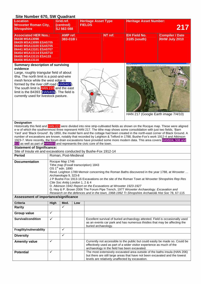
Site Number 670, SW Quadrant Location Wroxeter Roman City, Shropshire
Grid.ref. (centred) SJ 563 088
Heritage Asset Type FIELDS
Heritage Asset Number:
217Associated HER Nos.: 06438 MSA13098 06439 MSA13099 ESA5705 06440 MSA13100 ESA5705 06441 MSA13101 ESA5707 06454 MSA13114 ESA5710 06455 MSA13115 ESA133 06456 MSA13116
AMP ref. 383-018l i
NT ref.
EH Field No. 3185 (south)
Compiler / Date RHW July 2010
Summary description of surviving evidence Large, roughly triangular field of about 6ha. The north limit is a post-and-wire mesh fence while the west edge is formed by the river cliff road (HAN407). The south limit is HAN 216 and the east limit is the B4393 (HAN406). The field is currently used for livestock pasture.
HAN 217 (Google Earth image 7/4/10)
Designation Historically this field and HAN 221 were divided into nine strip-cultivated fields as shown on the Rocque map. These were aligned e-w of which the southernmost three represent HAN 217. The tithe map shows some consolidation with just two fields, ‘Barn Yard’ and ‘Black Ground’. By 1850, the model farm and the cottage had been created in the north-east corner of Black Ground. A number of excavations are known, notably that recorded by Leighton & Telford in 1788, Bushe-Fox’s work 1912-4 and Atkinson 1923-7. More recently, the forum drain excavations have provided some more modern data. This area covers HAN504, 508 and 515 as well as part of HAN501 and represents the civic core of the town. Statement of Significance: Site of Insula viii and excavations conducted by Bushe-Fox 1912-14 Period Roman, Post-Medieval
Documentation Rocque Map 1746 Tithe map (Foxall transcription) 1843 OS 1st edn. 1890 Revd. Leighton 1789 Memoir concerning the Roman Baths discovered in the year 1788, at Wroxeter … Archaeologia 9, 323-8 J P Bushe-Fox 1913-16 Excavations on the site of the Roman Town at Wroxeter Shropshire Rep Res Ctte Soc Antiq London 1, 2 & 4 D. Atkinson 1942 Report on the Excavations at Wroxeter 1923-1927 G. Hey & P. Brown 2006 The Forum Pipe Trench, 1977 Wroxeter Archaeology. Excavation and Research on the defences and in the town, 1968-1992 Tr.Shropshire Archaeol& Hist Soc 78, 67-115
Assessment of importance/significance
Criteria High Med. Low Rarity
Group value Survival/condition Excellent survival of buried archaeology attested. Field is occasionally used
as an events car park and has numerous thistles that may be affecting the buried archaeology.
Fragility/vulnerability
Diversity
Amenity value Currently not accessible to the public but could easily be made so. Could be effectively used as part of a wider visitor experience as much of the archaeology in the field has been excavated.
Potential The most extensively excavated area outside of the baths insula (HAN 206) but there are still large areas that have not been excavated and the lowest levels are relatively unaffected by excavation.
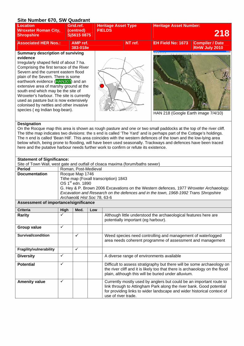
Site Number 670, SW Quadrant Location Wroxeter Roman City, Shropshire
Grid.ref. (centred) Sj5615 0875
Heritage Asset Type FIELDS
Heritage Asset Number:
218Associated HER Nos.:
AMP ref. 383-018e
NT ref. EH Field No: 1673 Compiler / Date RHW July 2010
Summary description of surviving evidence Irregularly shaped field of about 7 ha. Comprising the first terrace of the River Severn and the current eastern flood plain of the Severn. There is some earthwork evidence (HAN307) and an extensive area of marshy ground at the south end which may be the site of Wroxeter’s harbour. The site is currently used as pasture but is now extensively colonised by nettles and other invasive species ( eg Indian bog-bean).
HAN 218 (Google Earth image 7/4/10)
Designation On the Rocque map this area is shown as rough pasture and one or two small paddocks at the top of the river cliff. The tithe map indicates two divisions: the s end is called ‘The Yard’ and is perhaps part of the Cottage’s holdings. The n end is called ‘Bean Hill’. This area coincides with the western defences of the town and the low-lying area below which, being prone to flooding, will have been used seasonally. Trackways and defences have been traced here and the putative harbour needs further work to confirm or refute its existence.
Statement of Significance: Site of Town Wall, west gate and outfall of cloaca maxima (forum/baths sewer) Period Roman, Post-Medieval Documentation Rocque Map 1746
Tithe map (Foxall transcription) 1843 OS 1st edn. 1890 G. Hey & P. Brown 2006 Excavations on the Western defences, 1977 Wroxeter Archaeology. Excavation and Research on the defences and in the town, 1968-1992 Trans Shropshire Archaeol& Hist Soc 78, 63-6
Assessment of importance/significance
Criteria High Med. Low Rarity Although little understood the archaeological features here are
potentially important (eg harbour).
Group value
Survival/condition Weed species need controlling and management of waterlogged area needs coherent programme of assessment and management
Fragility/vulnerability Diversity A diverse range of environments available
Potential Difficult to assess stratigraphy but there will be some archaeology on the river cliff and it is likely too that there is archaeology on the flood plain, although this will be buried under alluvium.
Amenity value Currently mostly used by anglers but could be an important route to link through to Attingham Park along the river bank. Good potential for providing links to wider landscape and wider historical context of use of river trade.
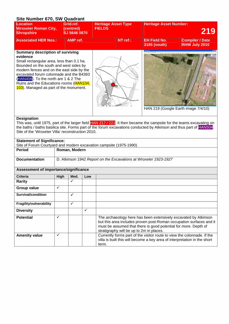
Site Number 670, SW Quadrant Location Wroxeter Roman City, Shropshire
Grid.ref. (centred) SJ 5646 0870
Heritage Asset Type FIELDS
Heritage Asset Number:
219Associated HER Nos.: AMP ref.
NT ref.: EH Field No.
3185 (south) Compiler / Date RHW July 2010
Summary description of surviving evidence Small rectangular area, less than 0.1 ha. Bounded on the south and west sides by modern fences and on the east side by the excavated forum colonnade and the B4393 (HAN406). To the north are 1 & 2 The Ruins and the Educations rooms (HAN104, 103). Managed as part of the monument.
HAN 219 (Google Earth image 7/4/10)
Designation This was, until 1975, part of the larger field HAN 217 / 221. It then became the campsite for the teams excavating on the baths / baths basilica site. Forms part of the forum excavations conducted by Atkinson and thus part of HAN504. Site of the ‘Wroxeter Villa’ reconstruction 2010. Statement of Significance: Site of Forum Courtyard and modern excavation campsite (1975-1990) Period Roman, Modern
Documentation D. Atkinson 1942 Report on the Excavations at Wroxeter 1923-1927
Assessment of importance/significance
Criteria High Med. Low Rarity Group value Survival/condition
Fragility/vulnerability Diversity
Potential The archaeology here has been extensively excavated by Atkinson but this area includes proven post-Roman occupation surfaces and it must be assumed that there is good potential for more. Depth of stratigraphy will be up to 2m in places.
Amenity value Currently forms part of the visitor route to view the colonnade. If the villa is built this will become a key area of interpretation in the short term.
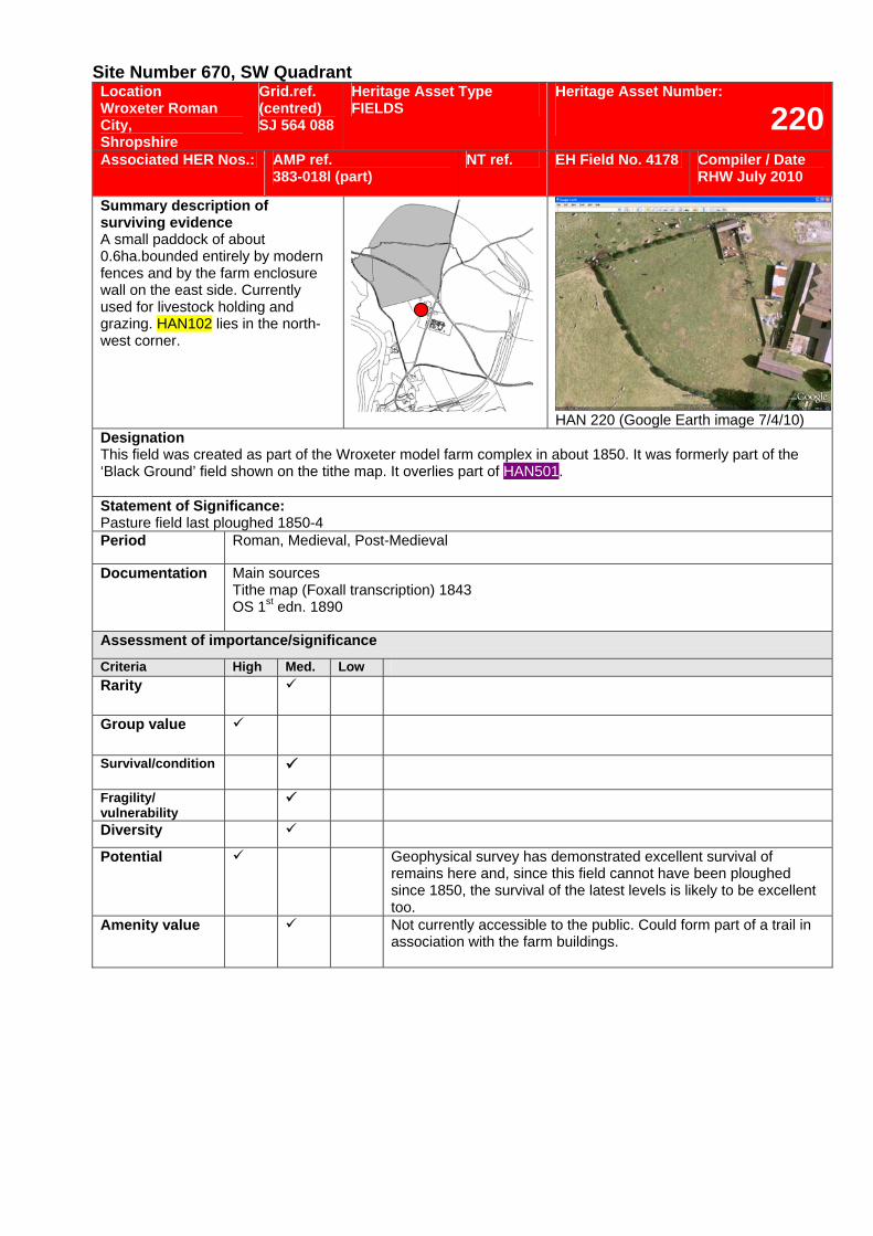
Site Number 670, SW Quadrant Location Wroxeter Roman City, Shropshire
Grid.ref. (centred) SJ 564 088
Heritage Asset Type FIELDS
Heritage Asset Number:
220Associated HER Nos.: AMP ref.
383-018l (part) NT ref. EH Field No. 4178 Compiler / Date
RHW July 2010
Summary description of surviving evidence A small paddock of about 0.6ha.bounded entirely by modern fences and by the farm enclosure wall on the east side. Currently used for livestock holding and grazing. HAN102 lies in the north-west corner.
HAN 220 (Google Earth image 7/4/10)
Designation This field was created as part of the Wroxeter model farm complex in about 1850. It was formerly part of the ‘Black Ground’ field shown on the tithe map. It overlies part of HAN501. Statement of Significance: Pasture field last ploughed 1850-4 Period Roman, Medieval, Post-Medieval
Documentation Main sources Tithe map (Foxall transcription) 1843 OS 1st edn. 1890
Assessment of importance/significance
Criteria High Med. Low Rarity
Group value
Survival/condition
Fragility/ vulnerability
Diversity
Potential Geophysical survey has demonstrated excellent survival of remains here and, since this field cannot have been ploughed since 1850, the survival of the latest levels is likely to be excellent too.
Amenity value Not currently accessible to the public. Could form part of a trail in association with the farm buildings.
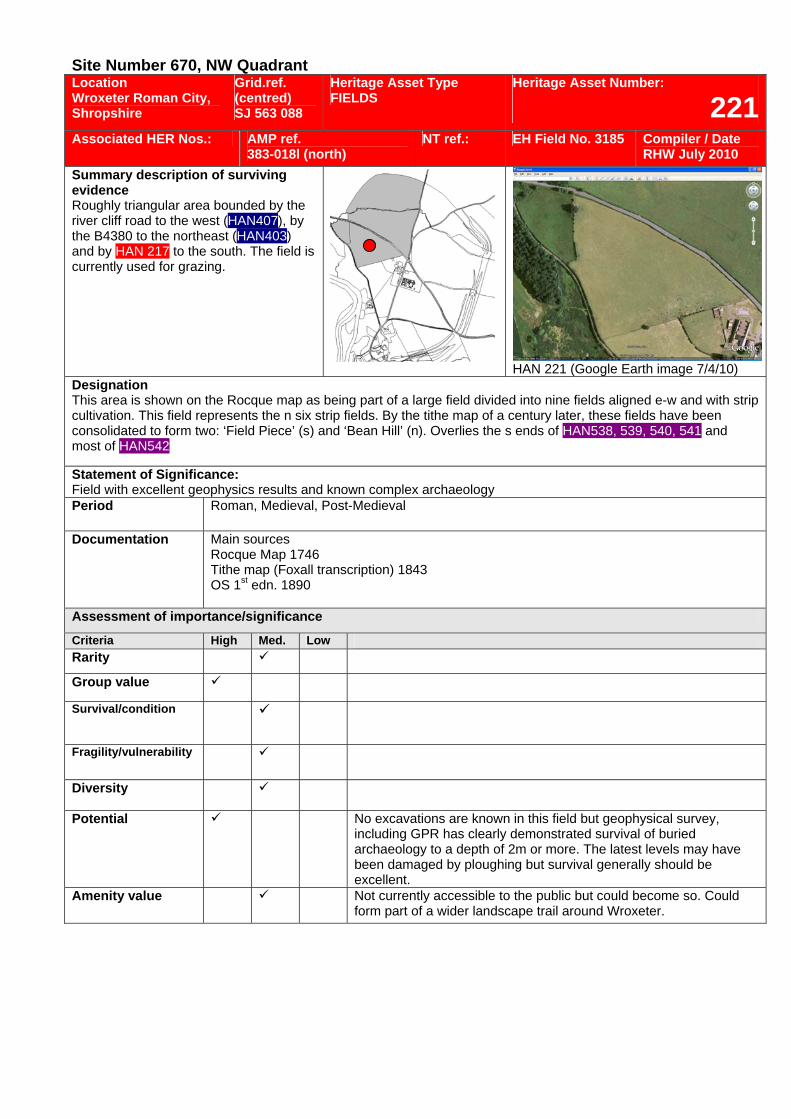
Site Number 670, NW Quadrant Location Wroxeter Roman City, Shropshire
Grid.ref. (centred) SJ 563 088
Heritage Asset Type FIELDS
Heritage Asset Number:
221Associated HER Nos.: AMP ref.
383-018l (north) NT ref.: EH Field No. 3185 Compiler / Date
RHW July 2010 Summary description of surviving evidence Roughly triangular area bounded by the river cliff road to the west (HAN407), by the B4380 to the northeast (HAN403) and by HAN 217 to the south. The field is currently used for grazing.
HAN 221 (Google Earth image 7/4/10)
Designation This area is shown on the Rocque map as being part of a large field divided into nine fields aligned e-w and with strip cultivation. This field represents the n six strip fields. By the tithe map of a century later, these fields have been consolidated to form two: ‘Field Piece’ (s) and ‘Bean Hill’ (n). Overlies the s ends of HAN538, 539, 540, 541 and most of HAN542
Statement of Significance: Field with excellent geophysics results and known complex archaeology Period Roman, Medieval, Post-Medieval
Documentation Main sources Rocque Map 1746 Tithe map (Foxall transcription) 1843 OS 1st edn. 1890
Assessment of importance/significance
Criteria High Med. Low Rarity
Group value
Survival/condition
Fragility/vulnerability
Diversity
Potential No excavations are known in this field but geophysical survey, including GPR has clearly demonstrated survival of buried archaeology to a depth of 2m or more. The latest levels may have been damaged by ploughing but survival generally should be excellent.
Amenity value Not currently accessible to the public but could become so. Could form part of a wider landscape trail around Wroxeter.
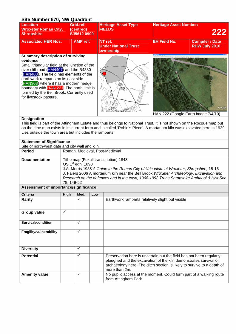
Site Number 670, NW Quadrant Location Wroxeter Roman City, Shropshire
Grid.ref. (centred) SJ5612 0900
Heritage Asset Type FIELDS
Heritage Asset Number:
222Associated HER Nos. AMP ref. NT ref.
Under National Trust ownership
EH Field No. Compiler / Date RHW July 2010
Summary description of surviving evidence Small triangular field at the junction of the river cliff road (HAN407) and the B4380 (HAN403). The field has elements of the earthwork ramparts on its east side (HAN308) where it has a modern hedge boundary with HAN 221. The north limit is formed by the Bell Brook. Currently used for livestock pasture.
HAN 222 (Google Earth image 7/4/10) Designation This field is part of the Attingham Estate and thus belongs to National Trust. It is not shown on the Rocque map but on the tithe map exists in its current form and is called ‘Robin’s Piece’. A mortarium kiln was excavated here in 1929. Lies outside the town area but includes the ramparts. Statement of Significance Site of north-west gate and city wall and kiln Period Roman, Medieval, Post-Medieval
Documentation Tithe map (Foxall transcription) 1843 OS 1st edn. 1890 J.A. Morris 1935 A Guide to the Roman City of Uriconium at Wroxeter, Shropshire, 15-16 J. Faiers 2006 A mortarium kiln near the Bell Brook Wroxeter Archaeology. Excavation and Research on the defences and in the town, 1968-1992 Trans Shropshire Archaeol & Hist Soc 78, 149-52
Assessment of importance/significance
Criteria High Med. Low Rarity Earthwork ramparts relatively slight but visible
Group value
Survival/condition
Fragility/vulnerability
Diversity
Potential Preservation here is uncertain but the field has not been regularly ploughed and the excavation of the kiln demonstrates survival of archaeology here. The ditch section is likely to survive to a depth of more than 2m.
Amenity value No public access at the moment. Could form part of a walking route from Attingham Park.
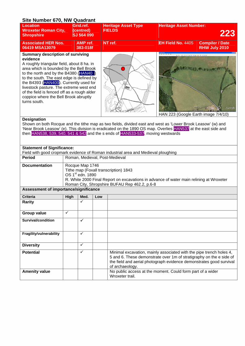
Site Number 670, NW Quadrant Location Wroxeter Roman City, Shropshire
Grid.ref. (centred) SJ 564 090
Heritage Asset Type FIELDS
Heritage Asset Number:
223Associated HER Nos. 06419 MSA13079
AMP ref. 383-018f
NT ref.
EH Field No. 4405 Compiler / Date RHW July 2010
Summary description of surviving evidence A roughly triangular field, about 8 ha. in area which is bounded by the Bell Brook to the north and by the B4380 (HAN403) to the south. The east edge is defined by the B4393 (HAN400). Currently used for livestock pasture. The extreme west end of the field is fenced off as a rough alder coppice where the Bell Brook abruptly turns south.
HAN 223 (Google Earth image 7/4/10) Designation Shown on both Rocque and the tithe map as two fields, divided east and west as ‘Lower Brook Leasow’ (w) and ‘Near Brook Leasow’ (e). This division is eradicated on the 1890 OS map. Overlies HAN537 at the east side and then HAN538, 539, 540, 541 & 542 and the s ends of HAN533-537, moving westwards Statement of Significance: Field with good cropmark evidence of Roman industrial area and Medieval ploughing Period Roman, Medieval, Post-Medieval
Documentation Rocque Map 1746 Tithe map (Foxall transcription) 1843 OS 1st edn. 1890 R. White 2000 Final Report on excavations in advance of water main relining at Wroxeter Roman City, Shropshire BUFAU Rep 462.2, p.6-8
Assessment of importance/significance
Criteria High Med. Low Rarity
Group value Survival/condition
Fragility/vulnerability
Diversity
Potential Minimal excavation, mainly associated with the pipe trench holes 4, 5 and 6. These demonstrate over 1m of stratigraphy on the e side of the field and aerial photograph evidence demonstrates good survival of archaeology.
Amenity value No public access at the moment. Could form part of a wider Wroxeter trail.
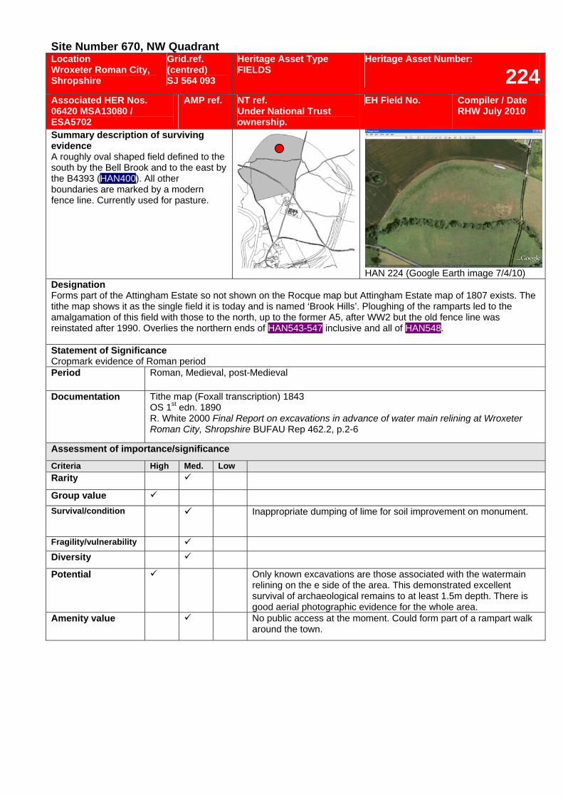
Site Number 670, NW Quadrant Location Wroxeter Roman City, Shropshire
Grid.ref. (centred) SJ 564 093
Heritage Asset Type FIELDS
Heritage Asset Number:
224Associated HER Nos. 06420 MSA13080 / ESA5702
AMP ref. NT ref. Under National Trust ownership.
EH Field No. Compiler / Date RHW July 2010
Summary description of surviving evidence A roughly oval shaped field defined to the south by the Bell Brook and to the east by the B4393 (HAN400). All other boundaries are marked by a modern fence line. Currently used for pasture.
HAN 224 (Google Earth image 7/4/10) Designation Forms part of the Attingham Estate so not shown on the Rocque map but Attingham Estate map of 1807 exists. The tithe map shows it as the single field it is today and is named ‘Brook Hills’. Ploughing of the ramparts led to the amalgamation of this field with those to the north, up to the former A5, after WW2 but the old fence line was reinstated after 1990. Overlies the northern ends of HAN543-547 inclusive and all of HAN548. Statement of Significance Cropmark evidence of Roman period Period Roman, Medieval, post-Medieval
Documentation Tithe map (Foxall transcription) 1843 OS 1st edn. 1890 R. White 2000 Final Report on excavations in advance of water main relining at Wroxeter Roman City, Shropshire BUFAU Rep 462.2, p.2-6
Assessment of importance/significance
Criteria High Med. Low Rarity
Group value Survival/condition Inappropriate dumping of lime for soil improvement on monument.
Fragility/vulnerability Diversity
Potential Only known excavations are those associated with the watermain relining on the e side of the area. This demonstrated excellent survival of archaeological remains to at least 1.5m depth. There is good aerial photographic evidence for the whole area.
Amenity value No public access at the moment. Could form part of a rampart walk around the town.

Earthworks/Defences
43
5
21
Ri v e r
Se v e r n
B e l l B r o o k
0 400m
Gate
EH land ownership
NT land ownership
Private ownership
vineyard
Wroxeter
NortonFarm
Figure G.3 : Heritage Asset Type : Earthworks (source : Barlow Associates 2008, with additions)
309
300
308
307
306305
304303
302
301
308 Earthworks
310
311
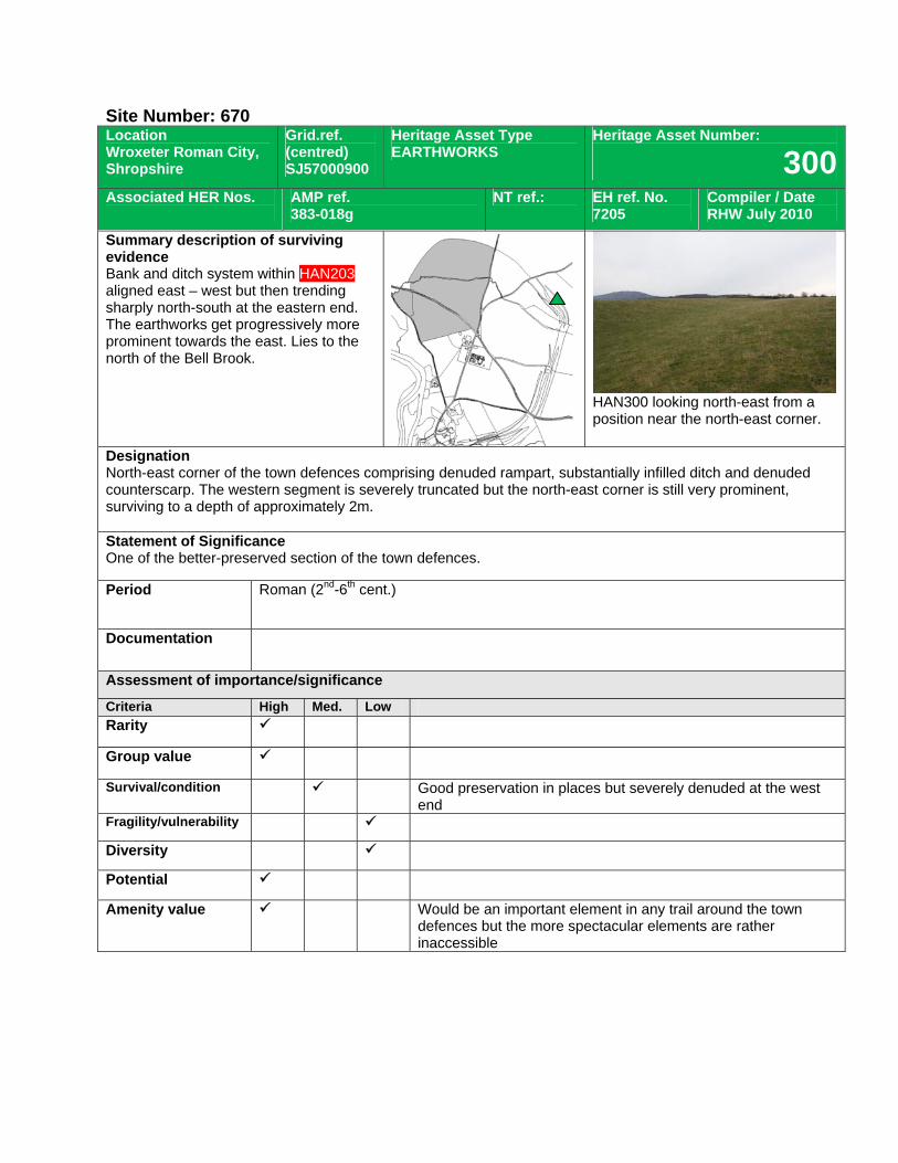
Site Number: 670 Location Wroxeter Roman City, Shropshire
Grid.ref. (centred) SJ57000900
Heritage Asset Type EARTHWORKS
Heritage Asset Number:
300Associated HER Nos.
AMP ref. 383-018g
NT ref.: EH ref. No. 7205
Compiler / Date RHW July 2010
Summary description of surviving evidence Bank and ditch system within HAN203 aligned east – west but then trending sharply north-south at the eastern end. The earthworks get progressively more prominent towards the east. Lies to the north of the Bell Brook.
HAN300 looking north-east from a position near the north-east corner.
Designation North-east corner of the town defences comprising denuded rampart, substantially infilled ditch and denuded counterscarp. The western segment is severely truncated but the north-east corner is still very prominent, surviving to a depth of approximately 2m. Statement of Significance One of the better-preserved section of the town defences.
Period Roman (2nd-6th cent.)
Documentation
Assessment of importance/significance
Criteria High Med. Low Rarity
Group value
Survival/condition Good preservation in places but severely denuded at the west end
Fragility/vulnerability
Diversity
Potential
Amenity value Would be an important element in any trail around the town defences but the more spectacular elements are rather inaccessible
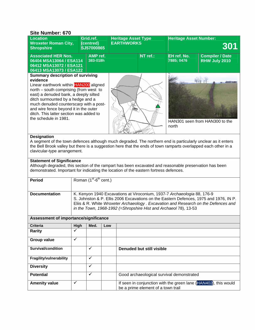
Site Number: 670 Location Wroxeter Roman City, Shropshire
Grid.ref. (centred) SJ57000865
Heritage Asset Type EARTHWORKS
Heritage Asset Number:
301Associated HER Nos. 06404 MSA13064 / ESA114 06412 MSA13072 / ESA121 06413 MSA13073 / ESA122
AMP ref. 383-018h
NT ref.: EH ref. No. 7885; 0476
Compiler / Date RHW July 2010
Summary description of surviving evidence Linear earthwork within HAN200 aligned north – south comprising (from west to east) a denuded bank, a deeply silted ditch surmounted by a hedge and a much denuded counterscarp with a post-and wire fence beyond it in the outer ditch. This latter section was added to the schedule in 1981.
HAN301 seen from HAN300 to the north
Designation A segment of the town defences although much degraded. The northern end is particularly unclear as it enters the Bell Brook valley but there is a suggestion here that the ends of town ramparts overlapped each other in a clavicular-type arrangement. Statement of Significance Although degraded, this section of the rampart has been excavated and reasonable preservation has been demonstrated. Important for indicating the location of the eastern fortress defences. Period Roman (1st-6th cent.)
Documentation K. Kenyon 1940 Excavations at Viroconium, 1937-7 Archaeologia 88, 176-9 S. Johnston & P. Ellis 2006 Excavations on the Eastern Defences, 1975 and 1976, IN P. Eliis & R. White Wroxeter Archaeology . Excavation and Research on the Defences and in the Town, 1968-1992 (=Shropshire Hist and Archaeol 78), 13-53
Assessment of importance/significance
Criteria High Med. Low Rarity
Group value
Survival/condition Denuded but still visible
Fragility/vulnerability
Diversity
Potential Good archaeological survival demonstrated
Amenity value If seen in conjunction with the green lane (HAN402), this would be a prime element of a town trail
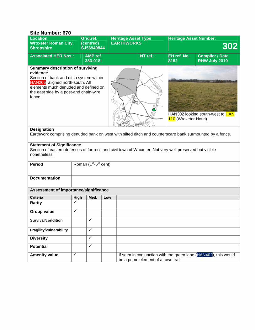
Site Number: 670 Location Wroxeter Roman City, Shropshire
Grid.ref. (centred) SJ56940844
Heritage Asset Type EARTHWORKS
Heritage Asset Number:
302Associated HER Nos.: AMP ref.
383-018i NT ref.: EH ref. No.
8152 Compiler / Date RHW July 2010
Summary description of surviving evidence Section of bank and ditch system within HAN205, aligned north-south. All elements much denuded and defined on the east side by a post-and chain-wire fence.
HAN302 looking south-west to HAN 110 (Wroxeter Hotel)
Designation Earthwork comprising denuded bank on west with silted ditch and counterscarp bank surmounted by a fence. Statement of Significance Section of eastern defences of fortress and civil town of Wroxeter. Not very well preserved but visible nonetheless. Period Roman (1st-6th cent)
Documentation
Assessment of importance/significance
Criteria High Med. Low Rarity
Group value
Survival/condition
Fragility/vulnerability
Diversity
Potential
Amenity value If seen in conjunction with the green lane (HAN402), this would be a prime element of a town trail
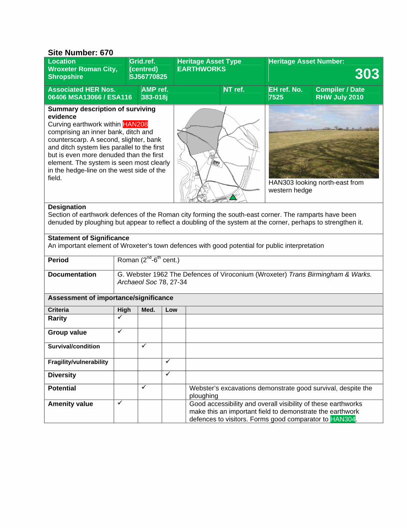
Site Number: 670 Location Wroxeter Roman City, Shropshire
Grid.ref. (centred) SJ56770825
Heritage Asset Type EARTHWORKS
Heritage Asset Number:
303Associated HER Nos. 06406 MSA13066 / ESA116
AMP ref. 383-018j
NT ref. EH ref. No. 7525
Compiler / Date RHW July 2010
Summary description of surviving evidence Curving earthwork within HAN208 comprising an inner bank, ditch and counterscarp. A second, slighter, bank and ditch system lies parallel to the first but is even more denuded than the first element. The system is seen most clearly in the hedge-line on the west side of the field.
HAN303 looking north-east from western hedge
Designation Section of earthwork defences of the Roman city forming the south-east corner. The ramparts have been denuded by ploughing but appear to reflect a doubling of the system at the corner, perhaps to strengthen it. Statement of Significance An important element of Wroxeter’s town defences with good potential for public interpretation
Period Roman (2nd-6th cent.)
Documentation G. Webster 1962 The Defences of Viroconium (Wroxeter) Trans Birmingham & Warks. Archaeol Soc 78, 27-34
Assessment of importance/significance
Criteria High Med. Low Rarity
Group value
Survival/condition
Fragility/vulnerability
Diversity
Potential Webster’s excavations demonstrate good survival, despite the ploughing
Amenity value Good accessibility and overall visibility of these earthworks make this an important field to demonstrate the earthwork defences to visitors. Forms good comparator to HAN304.
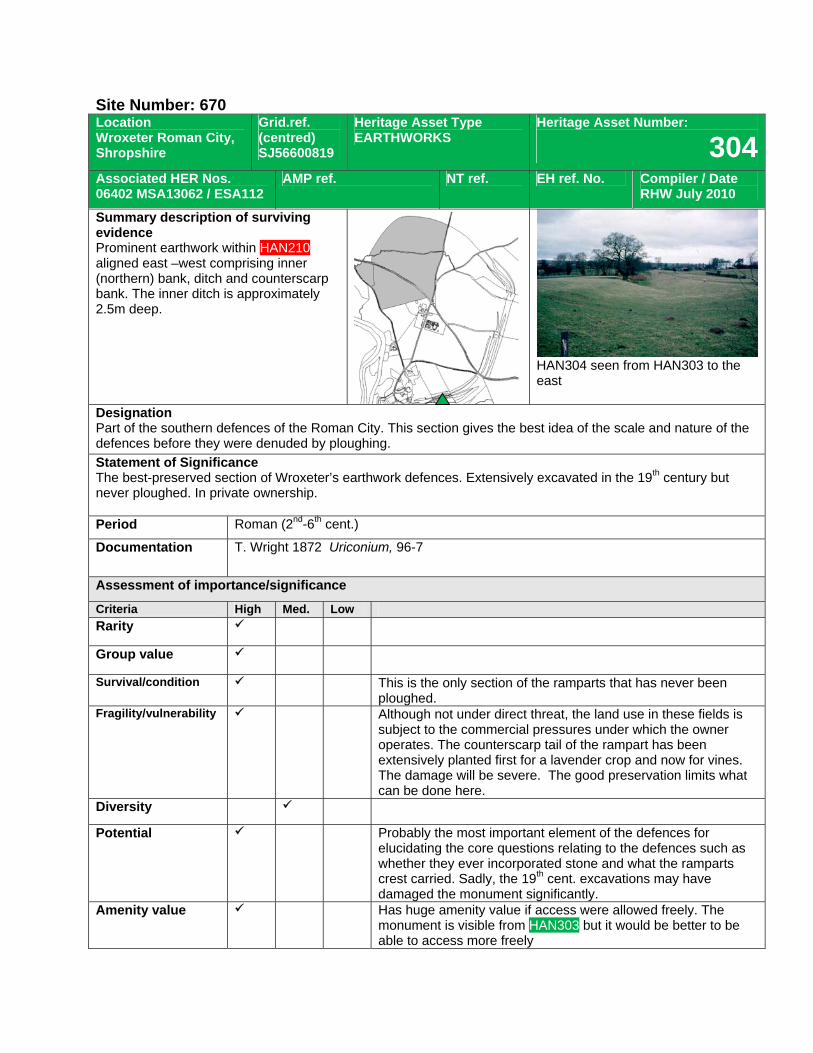
Site Number: 670 Location Wroxeter Roman City, Shropshire
Grid.ref. (centred) SJ56600819
Heritage Asset Type EARTHWORKS
Heritage Asset Number:
304Associated HER Nos. 06402 MSA13062 / ESA112
AMP ref. NT ref. EH ref. No. Compiler / Date RHW July 2010
Summary description of surviving evidence Prominent earthwork within HAN210 aligned east –west comprising inner (northern) bank, ditch and counterscarp bank. The inner ditch is approximately 2.5m deep.
HAN304 seen from HAN303 to the east
Designation Part of the southern defences of the Roman City. This section gives the best idea of the scale and nature of the defences before they were denuded by ploughing. Statement of Significance The best-preserved section of Wroxeter’s earthwork defences. Extensively excavated in the 19th century but never ploughed. In private ownership. Period Roman (2nd-6th cent.)
Documentation T. Wright 1872 Uriconium, 96-7
Assessment of importance/significance
Criteria High Med. Low Rarity
Group value
Survival/condition This is the only section of the ramparts that has never been ploughed.
Fragility/vulnerability Although not under direct threat, the land use in these fields is subject to the commercial pressures under which the owner operates. The counterscarp tail of the rampart has been extensively planted first for a lavender crop and now for vines. The damage will be severe. The good preservation limits what can be done here.
Diversity
Potential Probably the most important element of the defences for elucidating the core questions relating to the defences such as whether they ever incorporated stone and what the ramparts crest carried. Sadly, the 19th cent. excavations may have damaged the monument significantly.
Amenity value Has huge amenity value if access were allowed freely. The monument is visible from HAN303 but it would be better to be able to access more freely
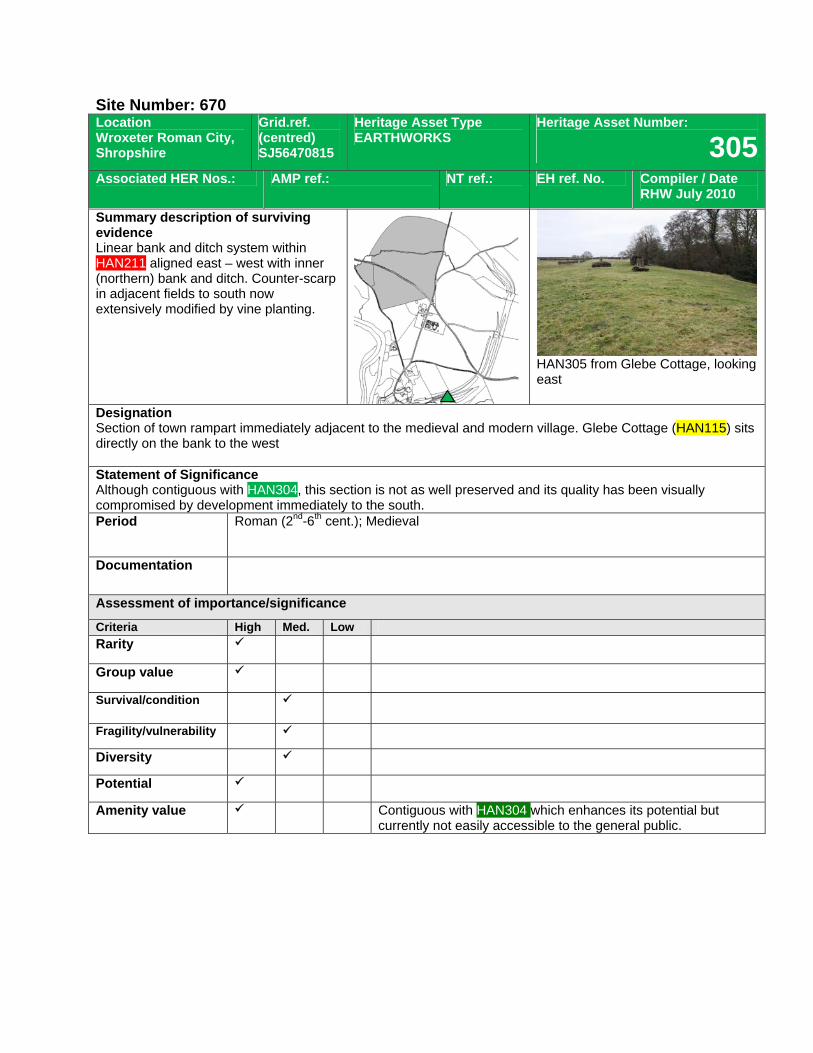
Site Number: 670 Location Wroxeter Roman City, Shropshire
Grid.ref. (centred) SJ56470815
Heritage Asset Type EARTHWORKS
Heritage Asset Number:
305Associated HER Nos.: AMP ref.: NT ref.: EH ref. No. Compiler / Date
RHW July 2010
Summary description of surviving evidence Linear bank and ditch system within HAN211 aligned east – west with inner (northern) bank and ditch. Counter-scarp in adjacent fields to south now extensively modified by vine planting.
HAN305 from Glebe Cottage, looking east
Designation Section of town rampart immediately adjacent to the medieval and modern village. Glebe Cottage (HAN115) sits directly on the bank to the west Statement of Significance Although contiguous with HAN304, this section is not as well preserved and its quality has been visually compromised by development immediately to the south. Period Roman (2nd-6th cent.); Medieval
Documentation
Assessment of importance/significance
Criteria High Med. Low Rarity
Group value
Survival/condition
Fragility/vulnerability
Diversity
Potential
Amenity value Contiguous with HAN304 which enhances its potential but currently not easily accessible to the general public.
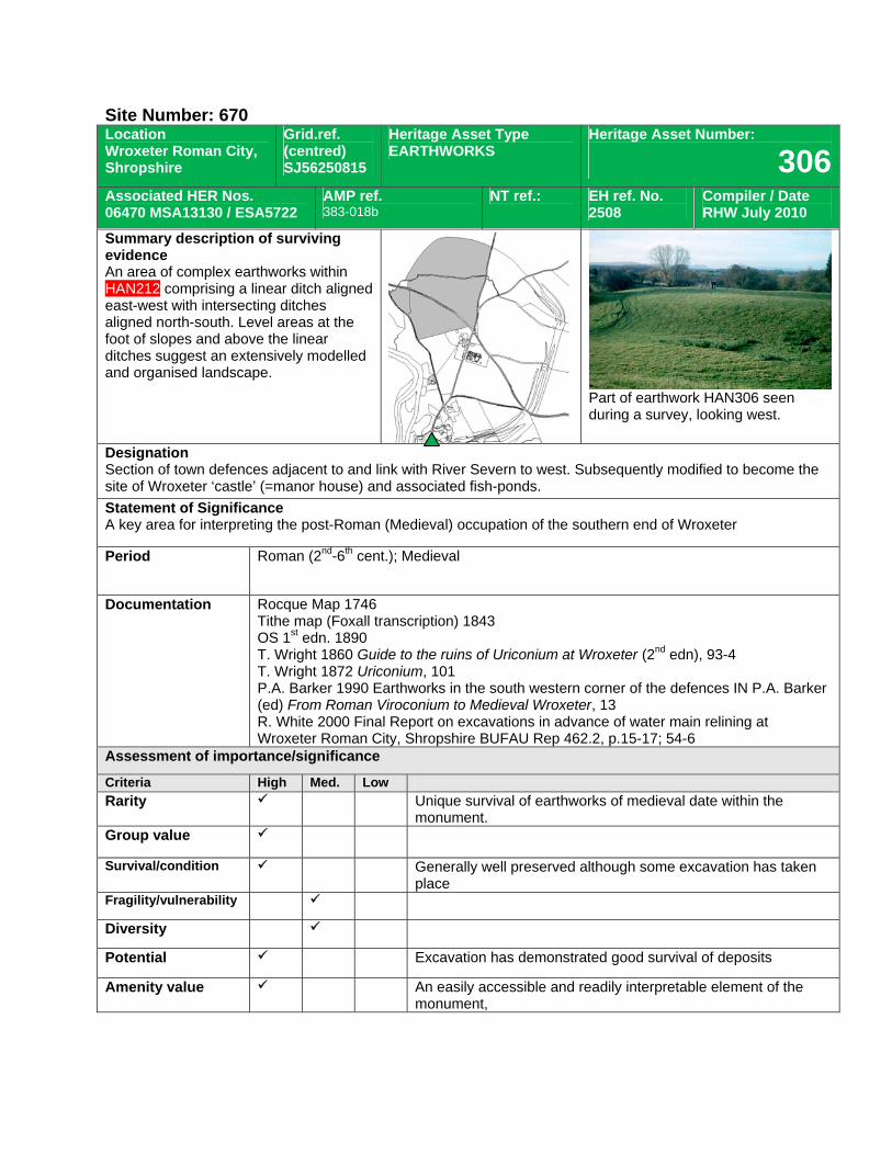
Site Number: 670 Location Wroxeter Roman City, Shropshire
Grid.ref. (centred) SJ56250815
Heritage Asset Type EARTHWORKS
Heritage Asset Number:
306Associated HER Nos. 06470 MSA13130 / ESA5722
AMP ref. 383-018b
NT ref.: EH ref. No. 2508
Compiler / Date RHW July 2010
Summary description of surviving evidence An area of complex earthworks within HAN212 comprising a linear ditch aligned east-west with intersecting ditches aligned north-south. Level areas at the foot of slopes and above the linear ditches suggest an extensively modelled and organised landscape.
Part of earthwork HAN306 seen during a survey, looking west.
Designation Section of town defences adjacent to and link with River Severn to west. Subsequently modified to become the site of Wroxeter ‘castle’ (=manor house) and associated fish-ponds. Statement of Significance A key area for interpreting the post-Roman (Medieval) occupation of the southern end of Wroxeter
Period Roman (2nd-6th cent.); Medieval
Documentation Rocque Map 1746 Tithe map (Foxall transcription) 1843 OS 1st edn. 1890 T. Wright 1860 Guide to the ruins of Uriconium at Wroxeter (2nd edn), 93-4 T. Wright 1872 Uriconium, 101 P.A. Barker 1990 Earthworks in the south western corner of the defences IN P.A. Barker (ed) From Roman Viroconium to Medieval Wroxeter, 13 R. White 2000 Final Report on excavations in advance of water main relining at Wroxeter Roman City, Shropshire BUFAU Rep 462.2, p.15-17; 54-6
Assessment of importance/significance
Criteria High Med. Low Rarity Unique survival of earthworks of medieval date within the
monument. Group value
Survival/condition Generally well preserved although some excavation has taken place
Fragility/vulnerability
Diversity
Potential Excavation has demonstrated good survival of deposits
Amenity value An easily accessible and readily interpretable element of the monument,
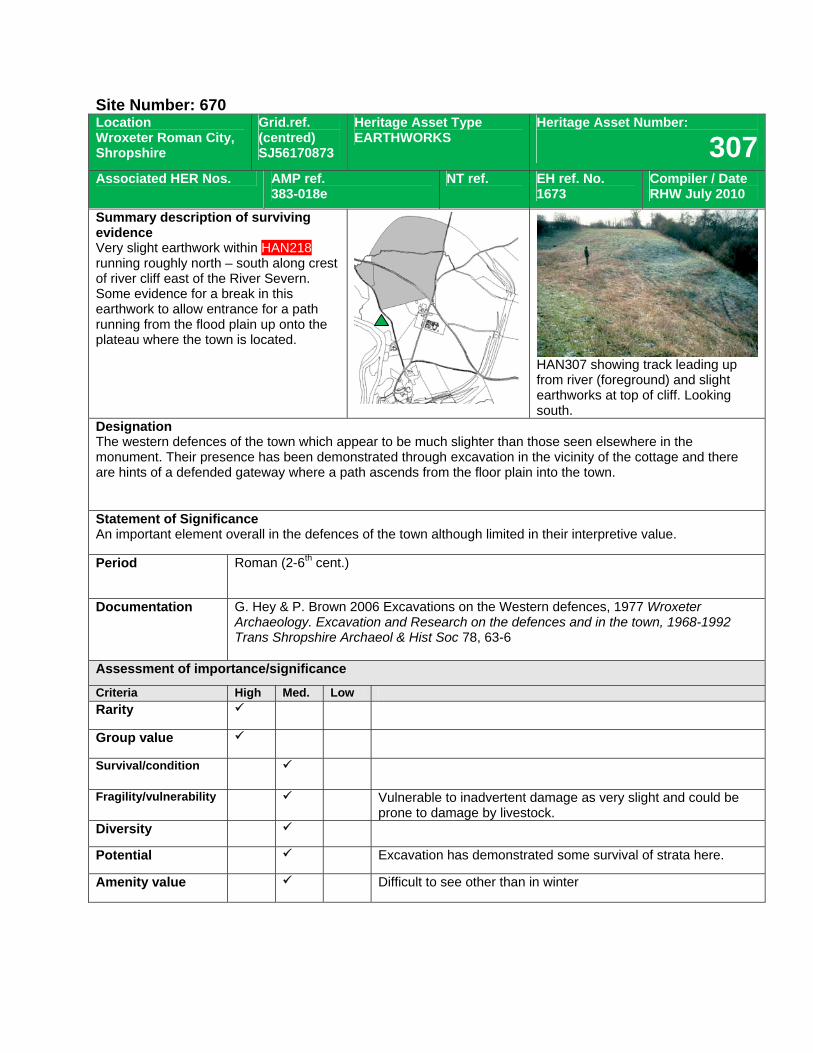
Site Number: 670 Location Wroxeter Roman City, Shropshire
Grid.ref. (centred) SJ56170873
Heritage Asset Type EARTHWORKS
Heritage Asset Number:
307Associated HER Nos. AMP ref.
383-018e NT ref. EH ref. No.
1673 Compiler / Date RHW July 2010
Summary description of surviving evidence Very slight earthwork within HAN218 running roughly north – south along crest of river cliff east of the River Severn. Some evidence for a break in this earthwork to allow entrance for a path running from the flood plain up onto the plateau where the town is located.
HAN307 showing track leading up from river (foreground) and slight earthworks at top of cliff. Looking south.
Designation The western defences of the town which appear to be much slighter than those seen elsewhere in the monument. Their presence has been demonstrated through excavation in the vicinity of the cottage and there are hints of a defended gateway where a path ascends from the floor plain into the town. Statement of Significance An important element overall in the defences of the town although limited in their interpretive value.
Period Roman (2-6th cent.)
Documentation G. Hey & P. Brown 2006 Excavations on the Western defences, 1977 Wroxeter Archaeology. Excavation and Research on the defences and in the town, 1968-1992 Trans Shropshire Archaeol & Hist Soc 78, 63-6
Assessment of importance/significance
Criteria High Med. Low Rarity
Group value
Survival/condition
Fragility/vulnerability Vulnerable to inadvertent damage as very slight and could be prone to damage by livestock.
Diversity
Potential Excavation has demonstrated some survival of strata here.
Amenity value Difficult to see other than in winter
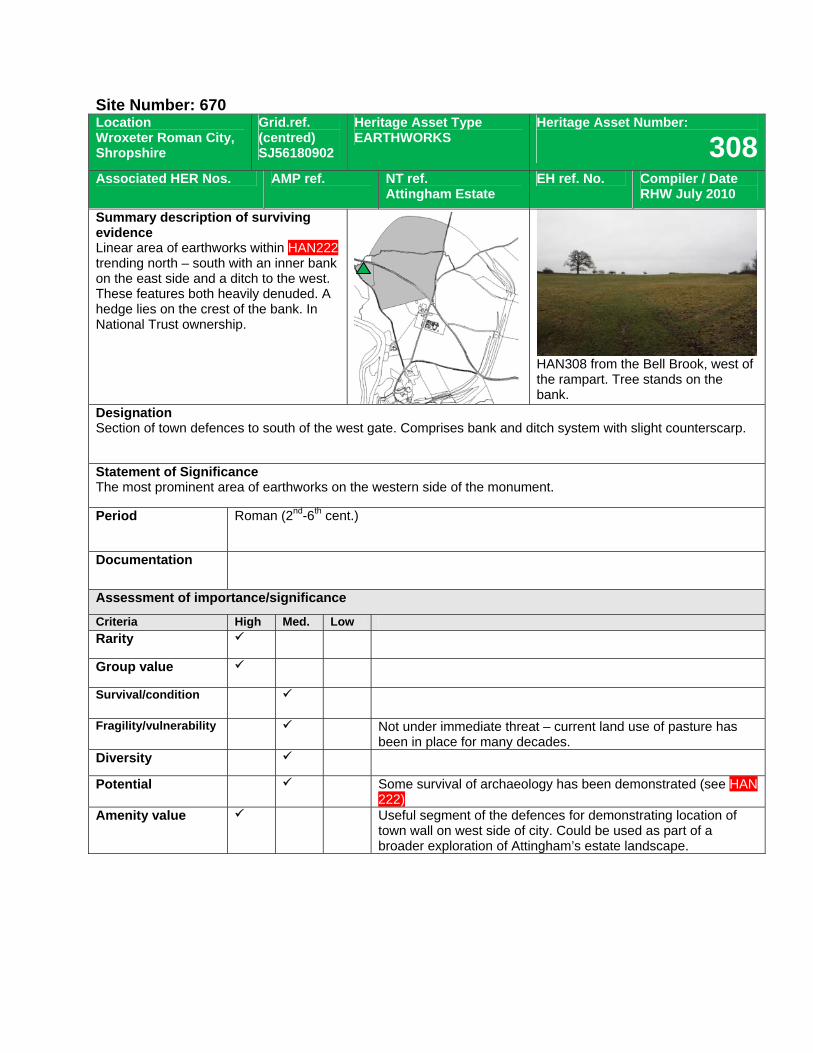
Site Number: 670 Location Wroxeter Roman City, Shropshire
Grid.ref. (centred) SJ56180902
Heritage Asset Type EARTHWORKS
Heritage Asset Number:
308Associated HER Nos. AMP ref. NT ref.
Attingham Estate EH ref. No. Compiler / Date
RHW July 2010
Summary description of surviving evidence Linear area of earthworks within HAN222 trending north – south with an inner bank on the east side and a ditch to the west. These features both heavily denuded. A hedge lies on the crest of the bank. In National Trust ownership.
HAN308 from the Bell Brook, west of the rampart. Tree stands on the bank.
Designation Section of town defences to south of the west gate. Comprises bank and ditch system with slight counterscarp.
Statement of Significance The most prominent area of earthworks on the western side of the monument.
Period Roman (2nd-6th cent.)
Documentation
Assessment of importance/significance
Criteria High Med. Low Rarity
Group value
Survival/condition
Fragility/vulnerability Not under immediate threat – current land use of pasture has been in place for many decades.
Diversity
Potential Some survival of archaeology has been demonstrated (see HAN 222)
Amenity value Useful segment of the defences for demonstrating location of town wall on west side of city. Could be used as part of a broader exploration of Attingham’s estate landscape.
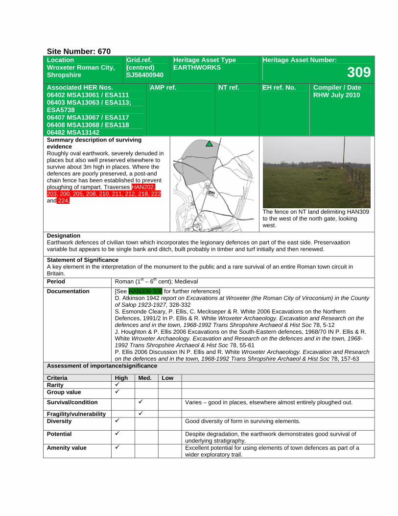
Site Number: 670 Location Wroxeter Roman City, Shropshire
Grid.ref. (centred) SJ56400940
Heritage Asset Type EARTHWORKS
Heritage Asset Number:
309Associated HER Nos. 06402 MSA13061 / ESA111 06403 MSA13063 / ESA113; ESA5738 06407 MSA13067 / ESA117 06408 MSA13068 / ESA118 06482 MSA13142
AMP ref. NT ref. EH ref. No. Compiler / Date RHW July 2010
Summary description of surviving evidence Roughly oval earthwork, severely denuded in places but also well preserved elsewhere to survive about 3m high in places. Where the defences are poorly preserved, a post-and chain fence has been established to prevent ploughing of rampart. Traverses HAN202, 203, 200, 205, 208, 210, 211, 212, 218, 222 and 224,
The fence on NT land delimiting HAN309 to the west of the north gate, looking west.
Designation Earthwork defences of civilian town which incorporates the legionary defences on part of the east side. Preservaation variable but appears to be single bank and ditch, built probably in timber and turf initially and then renewed.
Statement of Significance A key element in the interpretation of the monument to the public and a rare survival of an entire Roman town circuit in Britain. Period Roman (1st – 6th cent); Medieval Documentation [See HAN300-308 for further references]
D. Atkinson 1942 report on Excavations at Wroxeter (the Roman City of Viroconium) in the County of Salop 1923-1927, 328-332 S. Esmonde Cleary, P. Ellis, C. Meckseper & R. White 2006 Excavations on the Northern Defences, 1991/2 In P. Ellis & R. White Wroxeter Archaeology. Excavation and Research on the defences and in the town, 1968-1992 Trans Shropshire Archaeol & Hist Soc 78, 5-12 J. Houghton & P. Ellis 2006 Excavations on the South-Eastern defences, 1968/70 IN P. Ellis & R. White Wroxeter Archaeology. Excavation and Research on the defences and in the town, 1968-1992 Trans Shropshire Archaeol & Hist Soc 78, 55-61 P. Ellis 2006 Discussion IN P. Ellis and R. White Wroxeter Archaeology. Excavation and Research on the defences and in the town, 1968-1992 Trans Shropshire Archaeol & Hist Soc 78, 157-63
Assessment of importance/significance
Criteria High Med. Low Rarity Group value
Survival/condition Varies – good in places, elsewhere almost entirely ploughed out.
Fragility/vulnerability Diversity Good diversity of form in surviving elements.
Potential Despite degradation, the earthwork demonstrates good survival of underlying stratigraphy.
Amenity value Excellent potential for using elements of town defences as part of a wider exploratory trail.
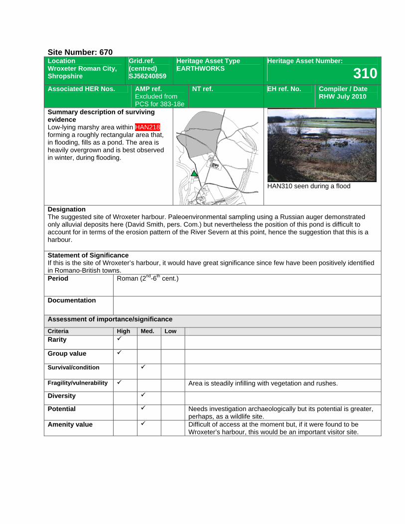
Site Number: 670 Location Wroxeter Roman City, Shropshire
Grid.ref. (centred) SJ56240859
Heritage Asset Type EARTHWORKS
Heritage Asset Number:
310Associated HER Nos. AMP ref.
Excluded from PCS for 383-18e
NT ref.
EH ref. No. Compiler / Date RHW July 2010
Summary description of surviving evidence Low-lying marshy area within HAN218 forming a roughly rectangular area that, in flooding, fills as a pond. The area is heavily overgrown and is best observed in winter, during flooding.
HAN310 seen during a flood
Designation The suggested site of Wroxeter harbour. Paleoenvironmental sampling using a Russian auger demonstrated only alluvial deposits here (David Smith, pers. Com.) but nevertheless the position of this pond is difficult to account for in terms of the erosion pattern of the River Severn at this point, hence the suggestion that this is a harbour. Statement of Significance If this is the site of Wroxeter’s harbour, it would have great significance since few have been positively identified in Romano-British towns. Period Roman (2nd-6th cent.)
Documentation
Assessment of importance/significance
Criteria High Med. Low Rarity
Group value
Survival/condition
Fragility/vulnerability Area is steadily infilling with vegetation and rushes.
Diversity
Potential Needs investigation archaeologically but its potential is greater, perhaps, as a wildlife site.
Amenity value Difficult of access at the moment but, if it were found to be Wroxeter’s harbour, this would be an important visitor site.
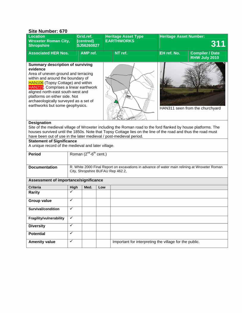
Site Number: 670 Location Wroxeter Roman City, Shropshire
Grid.ref. (centred) SJ56260827
Heritage Asset Type EARTHWORKS
Heritage Asset Number:
311Associated HER Nos. AMP ref.
NT ref.
EH ref. No. Compiler / Date RHW July 2010
Summary description of surviving evidence Area of uneven ground and terracing within and around the boundary of HAN106 (Topsy Cottage) and within HAN215. Comprises a linear earthwork aligned north-east south-west and platforms on either side. Not archaeologically surveyed as a set of earthworks but some geophysics.
HAN311 seen from the churchyard
Designation Site of the medieval village of Wroxeter including the Roman road to the ford flanked by house platforms. The houses survived until the 1850s. Note that Topsy Cottage lies on the line of the road and thus the road must have been out of use in the later medieval / post-medieval period. Statement of Significance A unique record of the medieval and later village.
Period Roman (2nd-6th cent.)
Documentation R. White 2000 Final Report on excavations in advance of water main relining at Wroxeter Roman City, Shropshire BUFAU Rep 462.2,
Assessment of importance/significance
Criteria High Med. Low Rarity
Group value
Survival/condition
Fragility/vulnerability
Diversity
Potential
Amenity value Important for interpreting the village for the public.
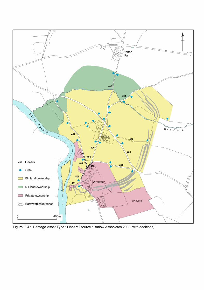
Earthworks/Defences
43
5
21
Ri v e r
Se v e r n
B e l l B r o o k
0 400m
Linears405
Gate
EH land ownership
NT land ownership
Private ownership
vineyard
Wroxeter
NortonFarm
Figure G.4 : Heritage Asset Type : Linears (source : Barlow Associates 2008, with additions)
409
408
410
405
403
404
406
402
400
401
407
411
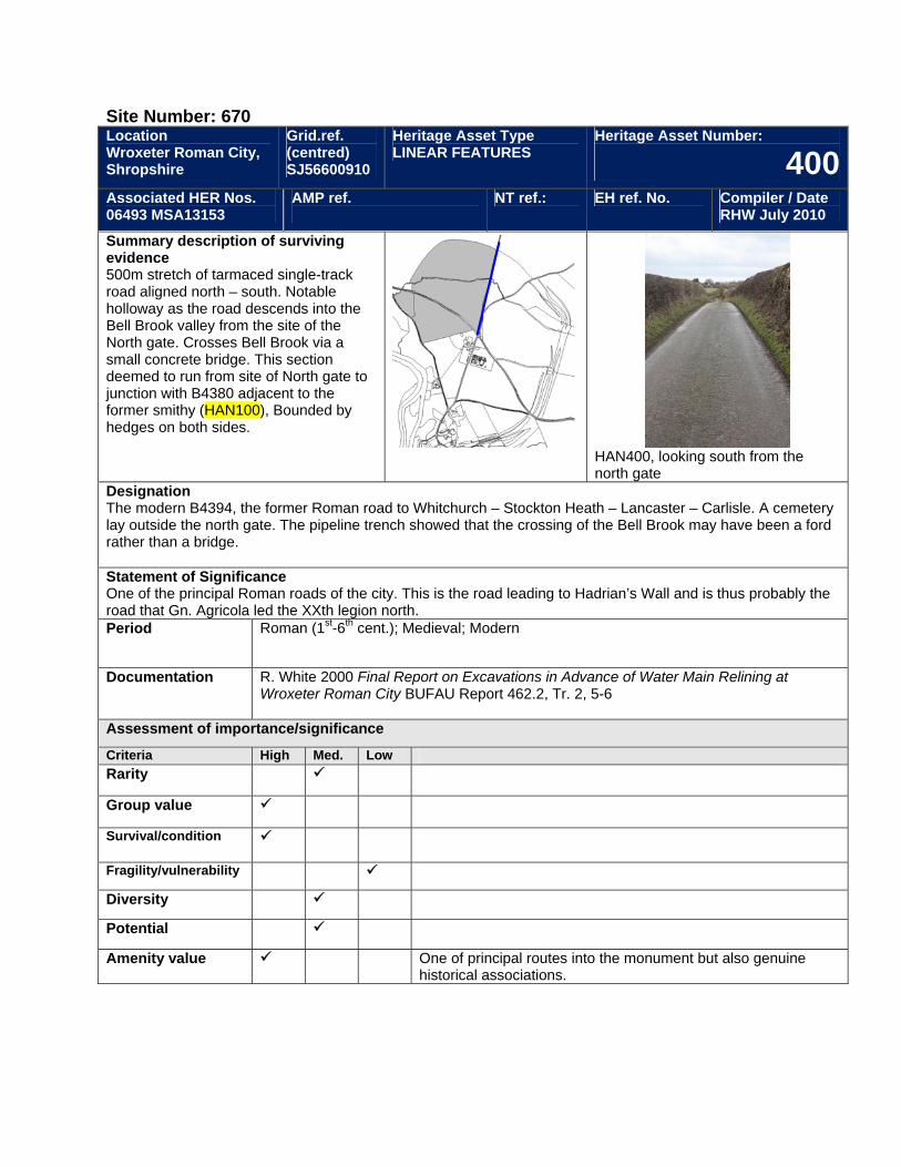
Site Number: 670 Location Wroxeter Roman City, Shropshire
Grid.ref. (centred) SJ56600910
Heritage Asset Type LINEAR FEATURES
Heritage Asset Number:
400Associated HER Nos. 06493 MSA13153
AMP ref.
NT ref.: EH ref. No. Compiler / Date RHW July 2010
Summary description of surviving evidence 500m stretch of tarmaced single-track road aligned north – south. Notable holloway as the road descends into the Bell Brook valley from the site of the North gate. Crosses Bell Brook via a small concrete bridge. This section deemed to run from site of North gate to junction with B4380 adjacent to the former smithy (HAN100), Bounded by hedges on both sides.
HAN400, looking south from the north gate
Designation The modern B4394, the former Roman road to Whitchurch – Stockton Heath – Lancaster – Carlisle. A cemetery lay outside the north gate. The pipeline trench showed that the crossing of the Bell Brook may have been a ford rather than a bridge. Statement of Significance One of the principal Roman roads of the city. This is the road leading to Hadrian’s Wall and is thus probably the road that Gn. Agricola led the XXth legion north. Period Roman (1st-6th cent.); Medieval; Modern
Documentation R. White 2000 Final Report on Excavations in Advance of Water Main Relining at Wroxeter Roman City BUFAU Report 462.2, Tr. 2, 5-6
Assessment of importance/significance
Criteria High Med. Low Rarity
Group value
Survival/condition
Fragility/vulnerability
Diversity
Potential
Amenity value One of principal routes into the monument but also genuine historical associations.
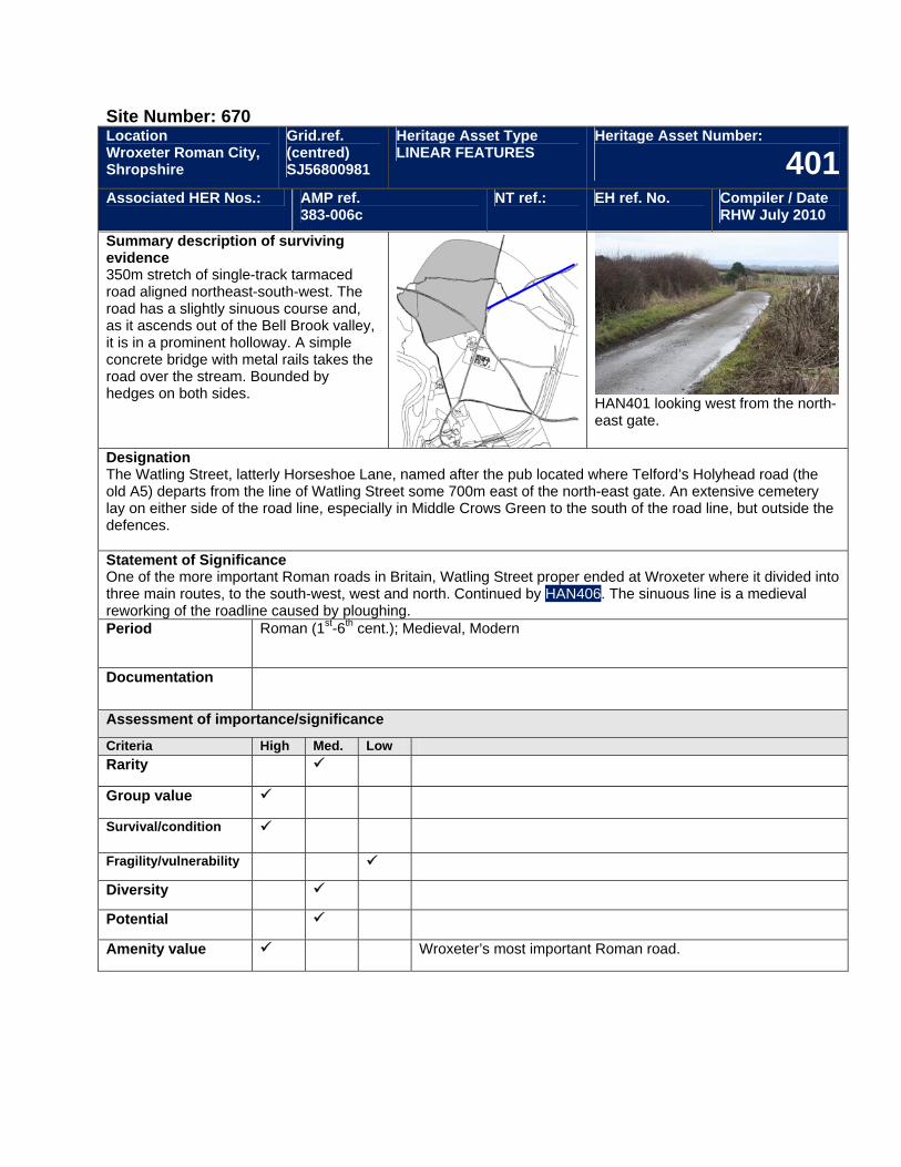
Site Number: 670 Location Wroxeter Roman City, Shropshire
Grid.ref. (centred) SJ56800981
Heritage Asset Type LINEAR FEATURES
Heritage Asset Number:
401Associated HER Nos.: AMP ref.
383-006c NT ref.: EH ref. No. Compiler / Date
RHW July 2010
Summary description of surviving evidence 350m stretch of single-track tarmaced road aligned northeast-south-west. The road has a slightly sinuous course and, as it ascends out of the Bell Brook valley, it is in a prominent holloway. A simple concrete bridge with metal rails takes the road over the stream. Bounded by hedges on both sides.
HAN401 looking west from the north-east gate.
Designation The Watling Street, latterly Horseshoe Lane, named after the pub located where Telford’s Holyhead road (the old A5) departs from the line of Watling Street some 700m east of the north-east gate. An extensive cemetery lay on either side of the road line, especially in Middle Crows Green to the south of the road line, but outside the defences. Statement of Significance One of the more important Roman roads in Britain, Watling Street proper ended at Wroxeter where it divided into three main routes, to the south-west, west and north. Continued by HAN406. The sinuous line is a medieval reworking of the roadline caused by ploughing. Period Roman (1st-6th cent.); Medieval, Modern
Documentation
Assessment of importance/significance
Criteria High Med. Low Rarity
Group value
Survival/condition
Fragility/vulnerability
Diversity
Potential
Amenity value Wroxeter’s most important Roman road.
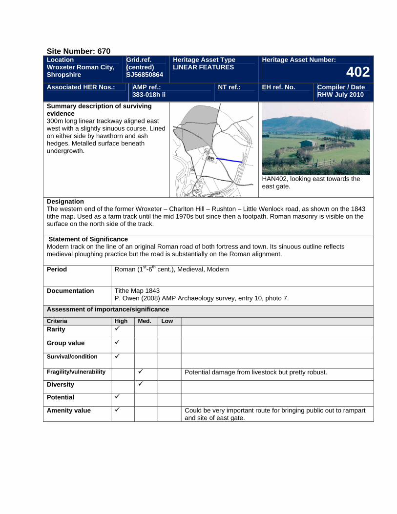
Site Number: 670 Location Wroxeter Roman City, Shropshire
Grid.ref. (centred) SJ56850864
Heritage Asset Type LINEAR FEATURES
Heritage Asset Number:
402Associated HER Nos.: AMP ref.:
383-018h ii NT ref.: EH ref. No. Compiler / Date
RHW July 2010
Summary description of surviving evidence 300m long linear trackway aligned east west with a slightly sinuous course. Lined on either side by hawthorn and ash hedges. Metalled surface beneath undergrowth.
HAN402, looking east towards the east gate.
Designation The western end of the former Wroxeter – Charlton Hill – Rushton – Little Wenlock road, as shown on the 1843 tithe map. Used as a farm track until the mid 1970s but since then a footpath. Roman masonry is visible on the surface on the north side of the track. Statement of Significance Modern track on the line of an original Roman road of both fortress and town. Its sinuous outline reflects medieval ploughing practice but the road is substantially on the Roman alignment. Period Roman (1st-6th cent.), Medieval, Modern
Documentation Tithe Map 1843 P. Owen (2008) AMP Archaeology survey, entry 10, photo 7.
Assessment of importance/significance
Criteria High Med. Low Rarity
Group value
Survival/condition
Fragility/vulnerability Potential damage from livestock but pretty robust.
Diversity
Potential
Amenity value Could be very important route for bringing public out to rampart and site of east gate.
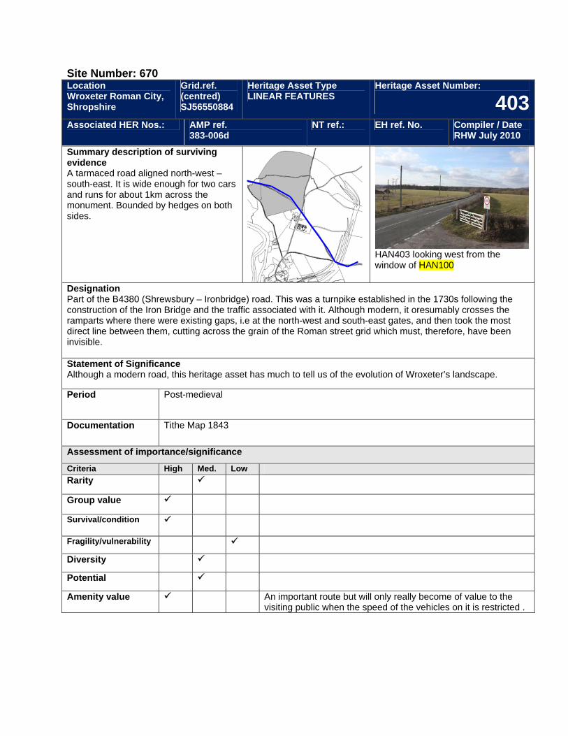
Site Number: 670 Location Wroxeter Roman City, Shropshire
Grid.ref. (centred) SJ56550884
Heritage Asset Type LINEAR FEATURES
Heritage Asset Number:
403Associated HER Nos.: AMP ref.
383-006d NT ref.: EH ref. No. Compiler / Date
RHW July 2010
Summary description of surviving evidence A tarmaced road aligned north-west – south-east. It is wide enough for two cars and runs for about 1km across the monument. Bounded by hedges on both sides.
HAN403 looking west from the window of HAN100
Designation Part of the B4380 (Shrewsbury – Ironbridge) road. This was a turnpike established in the 1730s following the construction of the Iron Bridge and the traffic associated with it. Although modern, it oresumably crosses the ramparts where there were existing gaps, i.e at the north-west and south-east gates, and then took the most direct line between them, cutting across the grain of the Roman street grid which must, therefore, have been invisible. Statement of Significance Although a modern road, this heritage asset has much to tell us of the evolution of Wroxeter’s landscape.
Period Post-medieval
Documentation Tithe Map 1843
Assessment of importance/significance
Criteria High Med. Low Rarity
Group value
Survival/condition
Fragility/vulnerability
Diversity
Potential
Amenity value An important route but will only really become of value to the visiting public when the speed of the vehicles on it is restricted .
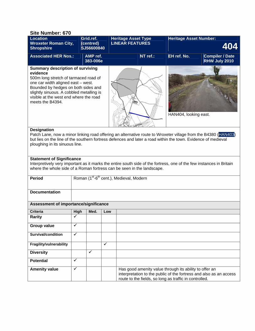
Site Number: 670 Location Wroxeter Roman City, Shropshire
Grid.ref. (centred) SJ56600840
Heritage Asset Type LINEAR FEATURES
Heritage Asset Number:
404Associated HER Nos.: AMP ref.
383-006e NT ref.: EH ref. No. Compiler / Date
RHW July 2010
Summary description of surviving evidence 500m long stretch of tarmaced road of one car width aligned east – west. Bounded by hedges on both sides and slightly sinuous. A cobbled metalling is visible at the west end where the road meets the B4394.
HAN404, looking east.
Designation Patch Lane, now a minor linking road offering an alternative route to Wroxeter village from the B4380 (HAN403) but lies on the line of the southern fortress defences and later a road within the town. Evidence of medieval ploughing in its sinuous line. Statement of Significance Interpretively very important as it marks the entire south side of the fortress, one of the few instances in Britain where the whole side of a Roman fortress can be seen in the landscape. Period Roman (1st-6th cent.), Medieval, Modern
Documentation
Assessment of importance/significance
Criteria High Med. Low Rarity
Group value
Survival/condition
Fragility/vulnerability
Diversity
Potential
Amenity value Has good amenity value through its ability to offer an interpretation to the public of the fortress and also as an access route to the fields, so long as traffic in controlled.
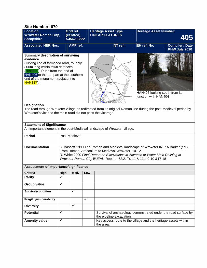
Site Number: 670 Location Wroxeter Roman City, Shropshire
Grid.ref. (centred) SJ56290822
Heritage Asset Type LINEAR FEATURES
Heritage Asset Number:
405Associated HER Nos.
AMP ref. NT ref.: EH ref. No. Compiler / Date RHW July 2010
Summary description of surviving evidence Curving line of tarmaced road, roughly 300m long within town defences (HAN309). Runs from the end of HAN406 to the rampart at the southern end of the monument (adjacent to HAN117).
HAN405 looking south from its junction with HAN404
Designation The road through Wroxeter village as redirected from its original Roman line during the post-Medieval period by Wroxeter’s vicar so the main road did not pass the vicarage. Statement of Significance An important element in the post-Medieval landscape of Wroxeter village.
Period Post-Medieval
Documentation S. Bassett 1990 The Roman and Medieval landscape of Wroxeter IN P A Barker (ed.) From Roman Viroconium to Medieval Wroxeter, 10-12 R. White 2000 Final Report on Excavations in Advance of Water Main Relining at Wroxeter Roman City BUFAU Report 462.2, Tr. 11 & 11a, 9-10 &17-18
Assessment of importance/significance
Criteria High Med. Low Rarity
Group value
Survival/condition
Fragility/vulnerability
Diversity
Potential Survival of archaeology demonstrated under the road surface by the pipeline excavation
Amenity value Key access route to the village and the heritage assets within the area.
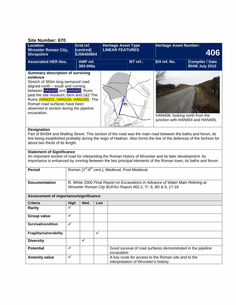
Site Number: 670 Location Wroxeter Roman City, Shropshire
Grid.ref. (centred) SJ56450854
Heritage Asset Type LINEAR FEATURES
Heritage Asset Number:
406Associated HER Nos.
AMP ref. 383-006a
NT ref.: EH ref. No. Compiler / Date RHW July 2010
Summary description of surviving evidence Stretch of 360m long tarmaced road aligned north – south and running between HAN400 and HAN405. Runs past the site museum, farm and 1&2 The Ruins (HAN101, HAN104, HAN105). The Roman road surfaces have been observed in section during the pipeline excavation.
HAN406, looking north from the junction with HAN404 and HAN405.
Designation Part of B4394 and Watling Street. This section of the road was the main road between the baths and forum, its line being established probably during the reign of Hadrian. Also forms the line of the defences of the fortress for about two thirds of its length. Statement of Significance An important section of road for interpreting the Roman history of Wroxeter and its later development. Its importance is enhanced by running between the two principal elements of the Roman town, its baths and forum. Period Roman (1st-6th cent.), Medieval, Post-Medieval
Documentation R. White 2000 Final Report on Excavations in Advance of Water Main Relining at Wroxeter Roman City BUFAU Report 462.2, Tr. 8, 8D & 9, 17-18
Assessment of importance/significance
Criteria High Med. Low Rarity
Group value
Survival/condition
Fragility/vulnerability
Diversity
Potential Good survival of road surfaces demonstrated in the pipeline excavation
Amenity value A key route for access to the Roman site and to the interpretation of Wroxeter’s history.
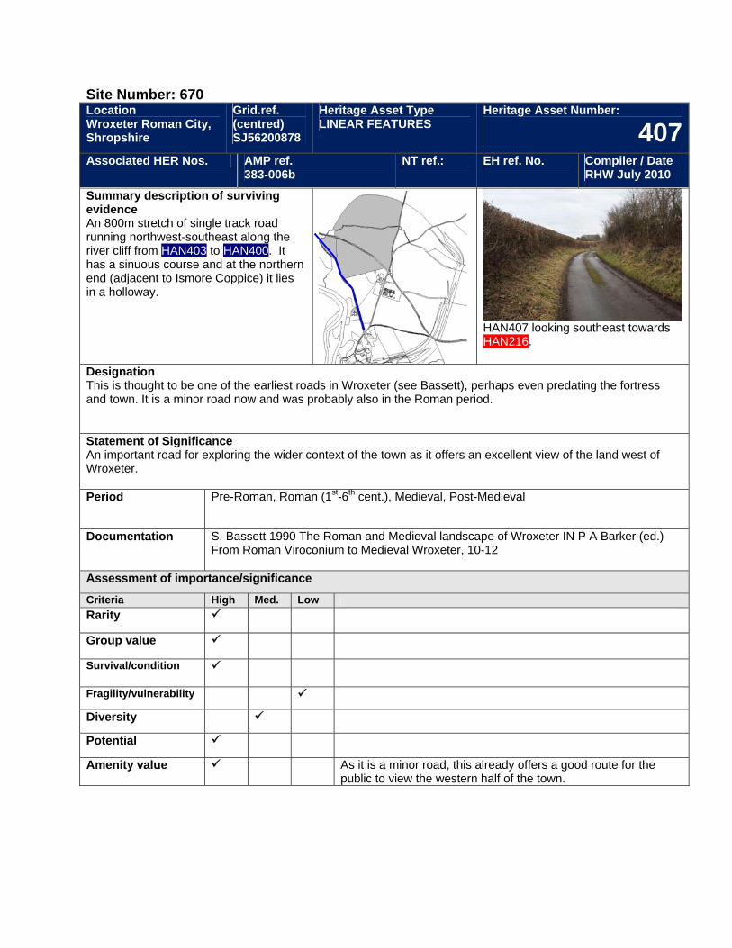
Site Number: 670 Location Wroxeter Roman City, Shropshire
Grid.ref. (centred) SJ56200878
Heritage Asset Type LINEAR FEATURES
Heritage Asset Number:
407Associated HER Nos. AMP ref.
383-006b NT ref.: EH ref. No. Compiler / Date
RHW July 2010
Summary description of surviving evidence An 800m stretch of single track road running northwest-southeast along the river cliff from HAN403 to HAN400. It has a sinuous course and at the northern end (adjacent to Ismore Coppice) it lies in a holloway.
HAN407 looking southeast towards HAN216.
Designation This is thought to be one of the earliest roads in Wroxeter (see Bassett), perhaps even predating the fortress and town. It is a minor road now and was probably also in the Roman period. Statement of Significance An important road for exploring the wider context of the town as it offers an excellent view of the land west of Wroxeter. Period Pre-Roman, Roman (1st-6th cent.), Medieval, Post-Medieval
Documentation S. Bassett 1990 The Roman and Medieval landscape of Wroxeter IN P A Barker (ed.) From Roman Viroconium to Medieval Wroxeter, 10-12
Assessment of importance/significance
Criteria High Med. Low Rarity
Group value
Survival/condition
Fragility/vulnerability
Diversity
Potential
Amenity value As it is a minor road, this already offers a good route for the public to view the western half of the town.
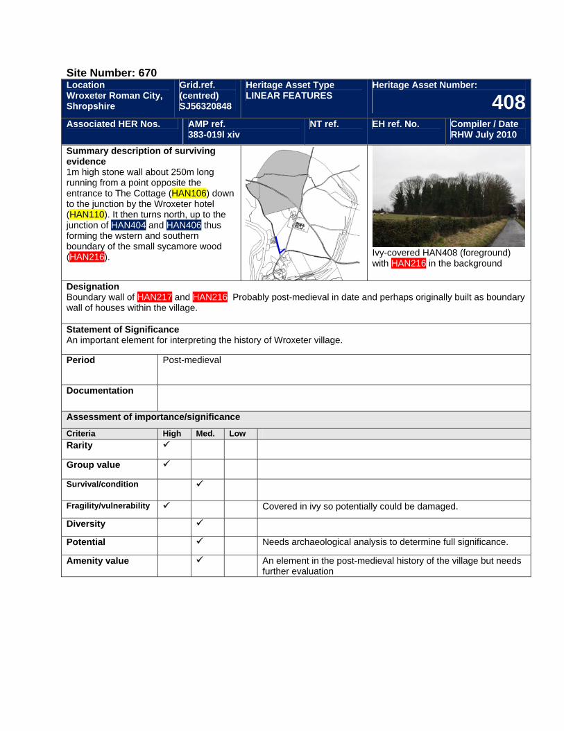
Site Number: 670 Location Wroxeter Roman City, Shropshire
Grid.ref. (centred) SJ56320848
Heritage Asset Type LINEAR FEATURES
Heritage Asset Number:
408Associated HER Nos. AMP ref.
383-019l xiv NT ref. EH ref. No. Compiler / Date
RHW July 2010
Summary description of surviving evidence 1m high stone wall about 250m long running from a point opposite the entrance to The Cottage (HAN106) down to the junction by the Wroxeter hotel (HAN110). It then turns north, up to the junction of HAN404 and HAN406 thus forming the wstern and southern boundary of the small sycamore wood (HAN216).
Ivy-covered HAN408 (foreground) with HAN216 in the background
Designation Boundary wall of HAN217 and HAN216. Probably post-medieval in date and perhaps originally built as boundary wall of houses within the village. Statement of Significance An important element for interpreting the history of Wroxeter village.
Period Post-medieval
Documentation
Assessment of importance/significance
Criteria High Med. Low Rarity
Group value
Survival/condition
Fragility/vulnerability Covered in ivy so potentially could be damaged.
Diversity
Potential Needs archaeological analysis to determine full significance.
Amenity value An element in the post-medieval history of the village but needs further evaluation
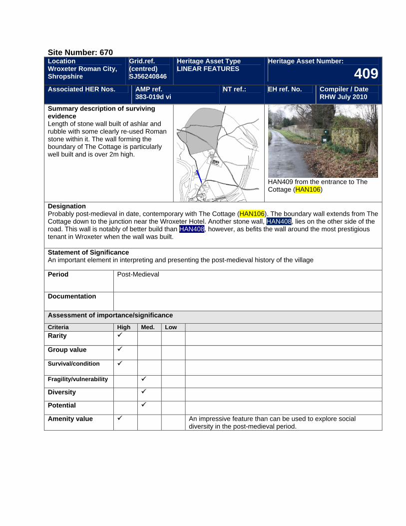
Site Number: 670 Location Wroxeter Roman City, Shropshire
Grid.ref. (centred) SJ56240846
Heritage Asset Type LINEAR FEATURES
Heritage Asset Number:
409Associated HER Nos. AMP ref.
383-019d vi NT ref.: EH ref. No. Compiler / Date
RHW July 2010
Summary description of surviving evidence Length of stone wall built of ashlar and rubble with some clearly re-used Roman stone within it. The wall forming the boundary of The Cottage is particularly well built and is over 2m high.
HAN409 from the entrance to The Cottage (HAN106)
Designation Probably post-medieval in date, contemporary with The Cottage (HAN106). The boundary wall extends from The Cottage down to the junction near the Wroxeter Hotel. Another stone wall, HAN408, lies on the other side of the road. This wall is notably of better build than HAN408, however, as befits the wall around the most prestigious tenant in Wroxeter when the wall was built. Statement of Significance An important element in interpreting and presenting the post-medieval history of the village
Period Post-Medieval
Documentation
Assessment of importance/significance
Criteria High Med. Low Rarity
Group value
Survival/condition
Fragility/vulnerability
Diversity
Potential
Amenity value An impressive feature than can be used to explore social diversity in the post-medieval period.
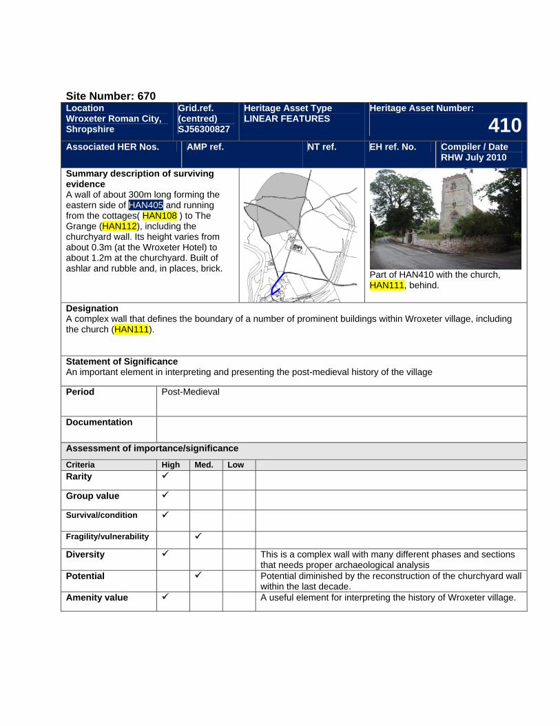
Site Number: 670 Location Wroxeter Roman City, Shropshire
Grid.ref. (centred) SJ56300827
Heritage Asset Type LINEAR FEATURES
Heritage Asset Number:
410Associated HER Nos. AMP ref. NT ref. EH ref. No. Compiler / Date
RHW July 2010
Summary description of surviving evidence A wall of about 300m long forming the eastern side of HAN405 and running from the cottages( HAN108 ) to The Grange (HAN112), including the churchyard wall. Its height varies from about 0.3m (at the Wroxeter Hotel) to about 1.2m at the churchyard. Built of ashlar and rubble and, in places, brick.
Part of HAN410 with the church, HAN111, behind.
Designation A complex wall that defines the boundary of a number of prominent buildings within Wroxeter village, including the church (HAN111). Statement of Significance An important element in interpreting and presenting the post-medieval history of the village
Period Post-Medieval
Documentation
Assessment of importance/significance
Criteria High Med. Low Rarity
Group value
Survival/condition
Fragility/vulnerability
Diversity This is a complex wall with many different phases and sections that needs proper archaeological analysis
Potential Potential diminished by the reconstruction of the churchyard wall within the last decade.
Amenity value A useful element for interpreting the history of Wroxeter village.
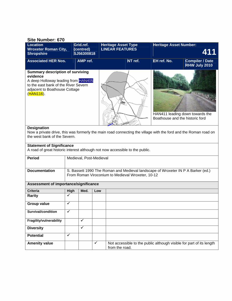
Site Number: 670 Location Wroxeter Roman City, Shropshire
Grid.ref. (centred) SJ56300818
Heritage Asset Type LINEAR FEATURES
Heritage Asset Number:
411Associated HER Nos. AMP ref. NT ref. EH ref. No. Compiler / Date
RHW July 2010
Summary description of surviving evidence A deep Holloway leading from HAN405 to the east bank of the River Severn adjacent to Boathouse Cottage (HAN116).
HAN411 leading down towards the Boathouse and the historic ford
Designation Now a private drive, this was formerly the main road connecting the village with the ford and the Roman road on the west bank of the Severn. Statement of Significance A road of great historic interest although not now accessible to the public.
Period Medieval, Post-Medieval
Documentation S. Bassett 1990 The Roman and Medieval landscape of Wroxeter IN P A Barker (ed.) From Roman Viroconium to Medieval Wroxeter, 10-12
Assessment of importance/significance
Criteria High Med. Low Rarity
Group value
Survival/condition
Fragility/vulnerability
Diversity
Potential
Amenity value Not accessible to the public although visible for part of its length from the road.
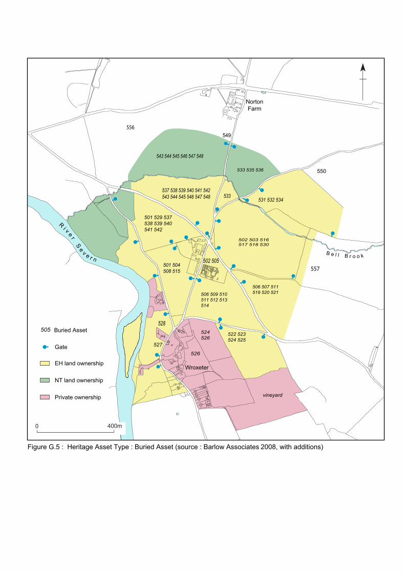
R i v e r S e v e r nB e l l B r o o k
0 400m
Gate
EH land ownership
NT land ownership
Private ownership
Buried Asset
501 529 537538 539 540 541 542
501 504508 515
537 538 539 540 541 542543 544 545 546 547 548
543 544 545 546 547 548
533 535 536
531 532 534
502 503 516517 518 530
506 507 511519 520 521506 509 510
511 512 513514
528
527
522 523524 525
505
533
vineyard
Wroxeter
NortonFarm
Figure G.5 : Heritage Asset Type : Buried Asset (source : Barlow Associates 2008, with additions)
502 505
524526
526
549
550
556
557
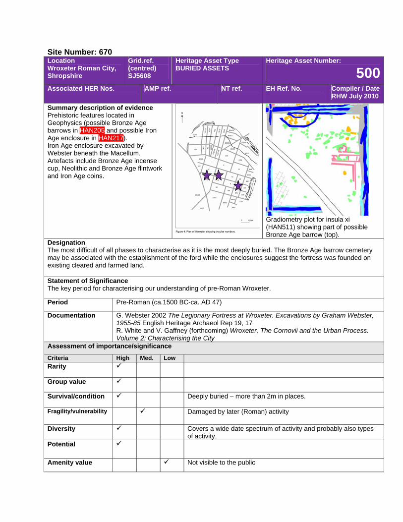
Site Number: 670 Location Wroxeter Roman City, Shropshire
Grid.ref. (centred) SJ5608
Heritage Asset Type BURIED ASSETS
Heritage Asset Number:
500Associated HER Nos. AMP ref. NT ref. EH Ref. No. Compiler / Date
RHW July 2010
Summary description of evidence Prehistoric features located in Geophysics (possible Bronze Age barrows in HAN205 and possible Iron Age enclosure in HAN217). Iron Age enclosure excavated by Webster beneath the Macellum. Artefacts include Bronze Age incense cup, Neolithic and Bronze Age flintwork and Iron Age coins.
Gradiometry plot for insula xi (HAN511) showing part of possible Bronze Age barrow (top).
Designation The most difficult of all phases to characterise as it is the most deeply buried. The Bronze Age barrow cemetery may be associated with the establishment of the ford while the enclosures suggest the fortress was founded on existing cleared and farmed land. Statement of Significance The key period for characterising our understanding of pre-Roman Wroxeter.
Period Pre-Roman (ca.1500 BC-ca. AD 47)
Documentation G. Webster 2002 The Legionary Fortress at Wroxeter. Excavations by Graham Webster, 1955-85 English Heritage Archaeol Rep 19, 17 R. White and V. Gaffney (forthcoming) Wroxeter, The Cornovii and the Urban Process. Volume 2: Characterising the City
Assessment of importance/significance
Criteria High Med. Low Rarity
Group value
Survival/condition Deeply buried – more than 2m in places.
Fragility/vulnerability Damaged by later (Roman) activity
Diversity Covers a wide date spectrum of activity and probably also types of activity.
Potential
Amenity value Not visible to the public
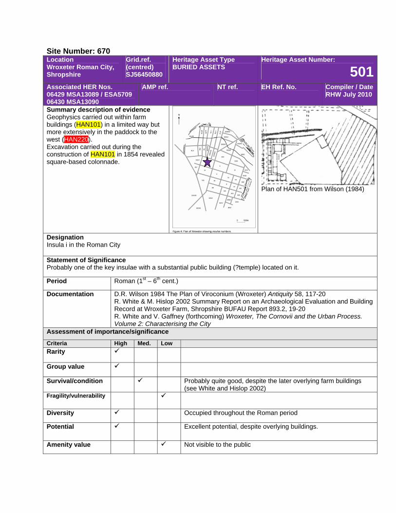
Site Number: 670 Location Wroxeter Roman City, Shropshire
Grid.ref. (centred) SJ56450880
Heritage Asset Type BURIED ASSETS
Heritage Asset Number:
501Associated HER Nos. 06429 MSA13089 / ESA5709 06430 MSA13090
AMP ref. NT ref. EH Ref. No. Compiler / Date RHW July 2010
Summary description of evidence Geophysics carried out within farm buildings (HAN101) in a limited way but more extensively in the paddock to the west (HAN220). Excavation carried out during the construction of HAN101 in 1854 revealed square-based colonnade.
Plan of HAN501 from Wilson (1984)
Designation Insula i in the Roman City Statement of Significance Probably one of the key insulae with a substantial public building (?temple) located on it.
Period Roman (1st – 6th cent.)
Documentation D.R. Wilson 1984 The Plan of Viroconium (Wroxeter) Antiquity 58, 117-20 R. White & M. Hislop 2002 Summary Report on an Archaeological Evaluation and Building Record at Wroxeter Farm, Shropshire BUFAU Report 893.2, 19-20 R. White and V. Gaffney (forthcoming) Wroxeter, The Cornovii and the Urban Process. Volume 2: Characterising the City
Assessment of importance/significance
Criteria High Med. Low Rarity
Group value
Survival/condition Probably quite good, despite the later overlying farm buildings (see White and Hislop 2002)
Fragility/vulnerability
Diversity Occupied throughout the Roman period
Potential Excellent potential, despite overlying buildings.
Amenity value Not visible to the public
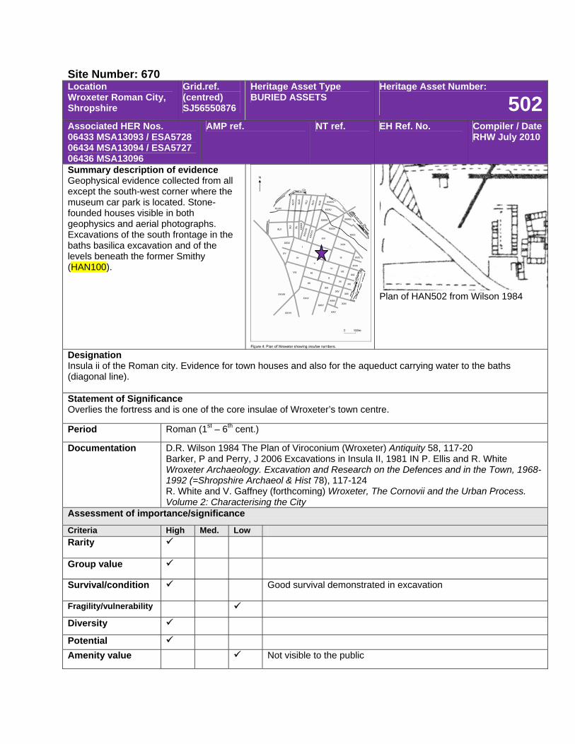
Site Number: 670 Location Wroxeter Roman City, Shropshire
Grid.ref. (centred) SJ56550876
Heritage Asset Type BURIED ASSETS
Heritage Asset Number:
502Associated HER Nos. 06433 MSA13093 / ESA5728 06434 MSA13094 / ESA5727 06436 MSA13096
AMP ref. NT ref. EH Ref. No. Compiler / Date RHW July 2010
Summary description of evidence Geophysical evidence collected from all except the south-west corner where the museum car park is located. Stone-founded houses visible in both geophysics and aerial photographs. Excavations of the south frontage in the baths basilica excavation and of the levels beneath the former Smithy (HAN100).
Plan of HAN502 from Wilson 1984
Designation Insula ii of the Roman city. Evidence for town houses and also for the aqueduct carrying water to the baths (diagonal line). Statement of Significance Overlies the fortress and is one of the core insulae of Wroxeter’s town centre.
Period Roman (1st – 6th cent.)
Documentation D.R. Wilson 1984 The Plan of Viroconium (Wroxeter) Antiquity 58, 117-20 Barker, P and Perry, J 2006 Excavations in Insula II, 1981 IN P. Ellis and R. White Wroxeter Archaeology. Excavation and Research on the Defences and in the Town, 1968-1992 (=Shropshire Archaeol & Hist 78), 117-124 R. White and V. Gaffney (forthcoming) Wroxeter, The Cornovii and the Urban Process. Volume 2: Characterising the City
Assessment of importance/significance
Criteria High Med. Low Rarity
Group value
Survival/condition Good survival demonstrated in excavation
Fragility/vulnerability
Diversity
Potential Amenity value Not visible to the public
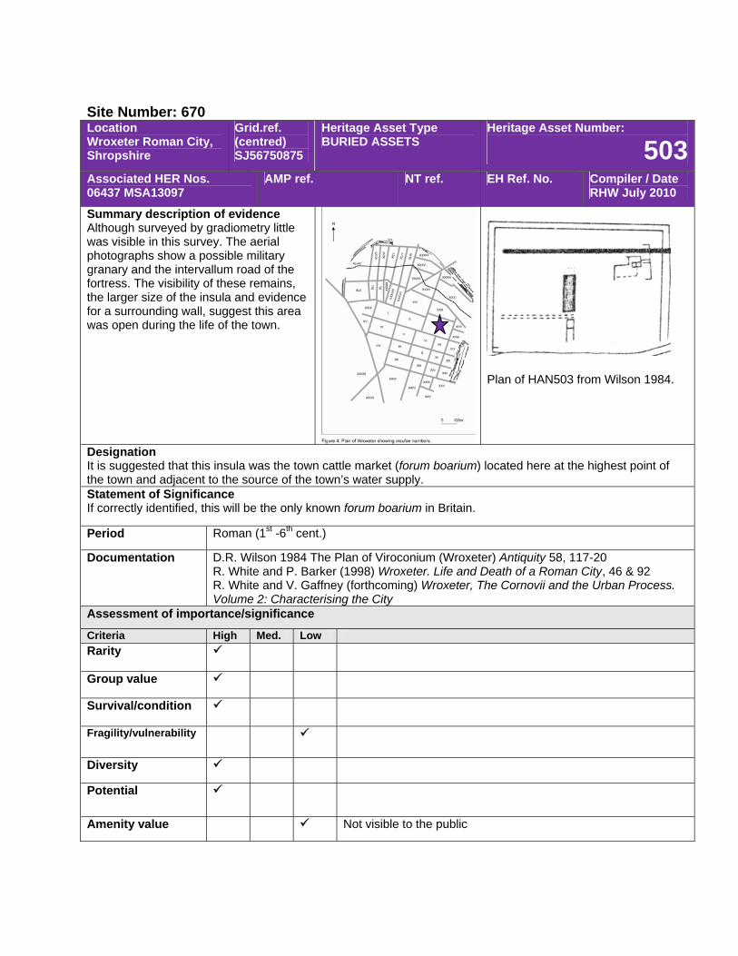
Site Number: 670 Location Wroxeter Roman City, Shropshire
Grid.ref. (centred) SJ56750875
Heritage Asset Type BURIED ASSETS
Heritage Asset Number:
503Associated HER Nos. 06437 MSA13097
AMP ref. NT ref. EH Ref. No. Compiler / Date RHW July 2010
Summary description of evidence Although surveyed by gradiometry little was visible in this survey. The aerial photographs show a possible military granary and the intervallum road of the fortress. The visibility of these remains, the larger size of the insula and evidence for a surrounding wall, suggest this area was open during the life of the town.
Plan of HAN503 from Wilson 1984.
Designation It is suggested that this insula was the town cattle market (forum boarium) located here at the highest point of the town and adjacent to the source of the town’s water supply. Statement of Significance If correctly identified, this will be the only known forum boarium in Britain.
Period Roman (1st -6th cent.)
Documentation D.R. Wilson 1984 The Plan of Viroconium (Wroxeter) Antiquity 58, 117-20 R. White and P. Barker (1998) Wroxeter. Life and Death of a Roman City, 46 & 92 R. White and V. Gaffney (forthcoming) Wroxeter, The Cornovii and the Urban Process. Volume 2: Characterising the City
Assessment of importance/significance
Criteria High Med. Low Rarity
Group value
Survival/condition
Fragility/vulnerability
Diversity
Potential
Amenity value Not visible to the public
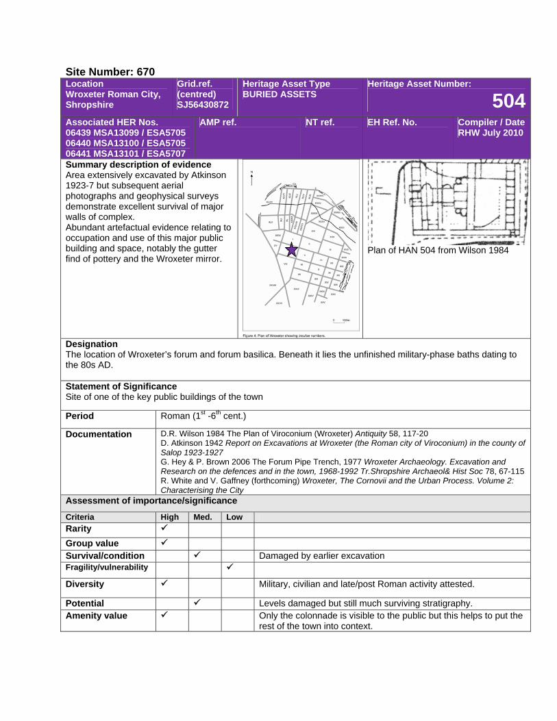
Site Number: 670 Location Wroxeter Roman City, Shropshire
Grid.ref. (centred) SJ56430872
Heritage Asset Type BURIED ASSETS
Heritage Asset Number:
504Associated HER Nos. 06439 MSA13099 / ESA5705 06440 MSA13100 / ESA5705 06441 MSA13101 / ESA5707
AMP ref. NT ref. EH Ref. No. Compiler / Date RHW July 2010
Summary description of evidence Area extensively excavated by Atkinson 1923-7 but subsequent aerial photographs and geophysical surveys demonstrate excellent survival of major walls of complex. Abundant artefactual evidence relating to occupation and use of this major public building and space, notably the gutter find of pottery and the Wroxeter mirror.
Plan of HAN 504 from Wilson 1984
Designation The location of Wroxeter’s forum and forum basilica. Beneath it lies the unfinished military-phase baths dating to the 80s AD. Statement of Significance Site of one of the key public buildings of the town
Period Roman (1st -6th cent.)
Documentation D.R. Wilson 1984 The Plan of Viroconium (Wroxeter) Antiquity 58, 117-20 D. Atkinson 1942 Report on Excavations at Wroxeter (the Roman city of Viroconium) in the county of Salop 1923-1927 G. Hey & P. Brown 2006 The Forum Pipe Trench, 1977 Wroxeter Archaeology. Excavation and Research on the defences and in the town, 1968-1992 Tr.Shropshire Archaeol& Hist Soc 78, 67-115 R. White and V. Gaffney (forthcoming) Wroxeter, The Cornovii and the Urban Process. Volume 2: Characterising the City
Assessment of importance/significance
Criteria High Med. Low Rarity Group value Survival/condition Damaged by earlier excavation Fragility/vulnerability
Diversity Military, civilian and late/post Roman activity attested.
Potential Levels damaged but still much surviving stratigraphy. Amenity value Only the colonnade is visible to the public but this helps to put the
rest of the town into context.
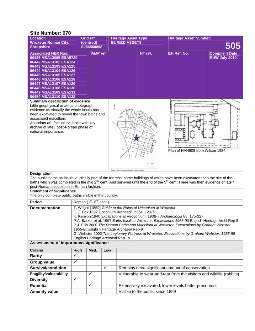
Site Number: 670 Location Wroxeter Roman City, Shropshire
Grid.ref. (centred) SJ56550868
Heritage Asset Type BURIED ASSETS
Heritage Asset Number:
505Associated HER Nos. 06435 MSA13095 ESA5729 06442 MSA13102 ESA124 06443 MSA13103 ESA125 06444 MSA13104 ESA126 06445 MSA13105 ESA127 06446 MSA13106 ESA128 06447 MSA13107 ESA129 06448 MSA13108 ESA130 06449 MSA13109 ESA131 06450 MSA13110 ESA132
AMP ref. NT ref. EH Ref. No. Compiler / Date RHW July 2010
Summary description of evidence Little geophysical or aerial photograph evidence as virtually the whole insula has been excavated to reveal the town baths and associated macellum. Abundant artefactual evidence with key archive of late / post-Roman phase of national importance.
Plan of HAN505 from Wilson 1984
Designation The public baths on insula v. Initially part of the fortress, some buildings of which have been excavated then the site of the baths which was completed in the mid 2nd cent. And survived until the end of the 5th cent. There was then evidence of late / post-Roman occupation in Roman fashion. Statement of Significance The only complete public baths visible in the country.
Period Roman (1st- 6th cent.) Documentation T. Wright (1859) Guide to the Ruins of Uriconium at Wroxeter
G.E. Fox 1897 Uriconium Archaeol Jnl 54, 123-73 K. Kenyon 1940 Excavations at Viroconium, 1936-7 Archaeologia 88, 175-227 P.A. Barker et al. 1997 Baths basilica Wroxeter, Excavations 1966-90 English Heritage Archl Rep 8 P.J. Ellis 2000 The Roman Baths and Macellum at Wroxeter. Excavations by Graham Webster 1955-85 English Heritage Archaeol Rep 9 G. Webster 2002 The Legionary Fortress at Wroxeter. Excavations by Graham Webster, 1955-85 English Heritage Archaeol Rep 19
Assessment of importance/significance
Criteria High Med. Low Rarity Group value Survival/condition Remains need significant amount of conservation Fragility/vulnerability Vulnerable to wear-and-tear from the visitors and wildlife (rabbits) Diversity Potential Extensively excavated; lower levels better preserved. Amenity value Visible to the public since 1859
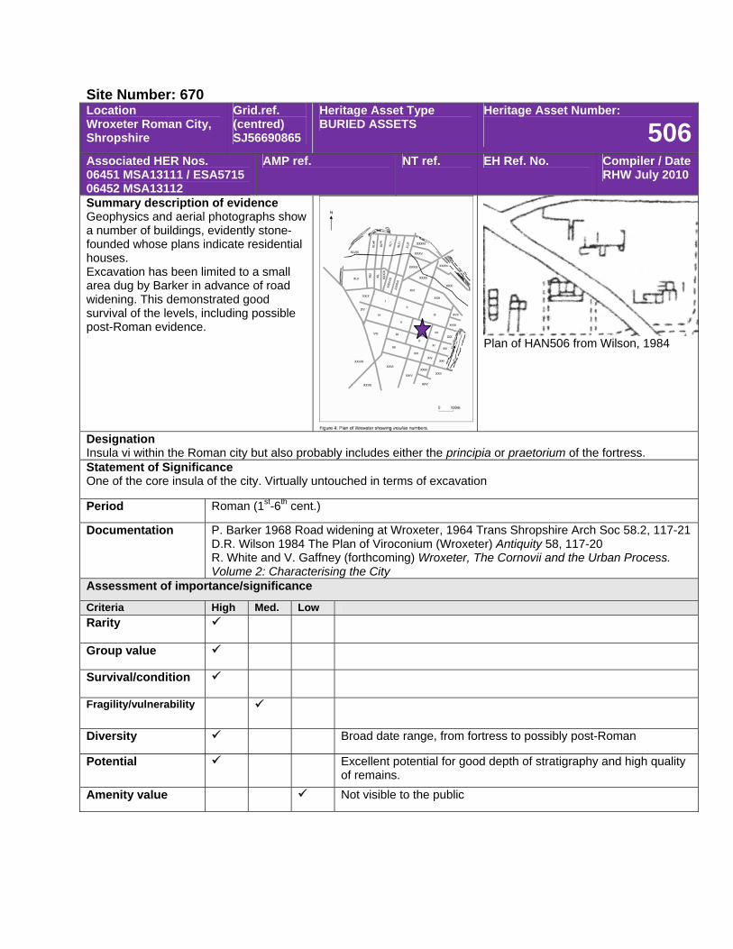
Site Number: 670 Location Wroxeter Roman City, Shropshire
Grid.ref. (centred) SJ56690865
Heritage Asset Type BURIED ASSETS
Heritage Asset Number:
506Associated HER Nos. 06451 MSA13111 / ESA5715 06452 MSA13112
AMP ref. NT ref. EH Ref. No. Compiler / Date RHW July 2010
Summary description of evidence Geophysics and aerial photographs show a number of buildings, evidently stone-founded whose plans indicate residential houses. Excavation has been limited to a small area dug by Barker in advance of road widening. This demonstrated good survival of the levels, including possible post-Roman evidence.
Plan of HAN506 from Wilson, 1984
Designation Insula vi within the Roman city but also probably includes either the principia or praetorium of the fortress. Statement of Significance One of the core insula of the city. Virtually untouched in terms of excavation
Period Roman (1st-6th cent.)
Documentation P. Barker 1968 Road widening at Wroxeter, 1964 Trans Shropshire Arch Soc 58.2, 117-21 D.R. Wilson 1984 The Plan of Viroconium (Wroxeter) Antiquity 58, 117-20 R. White and V. Gaffney (forthcoming) Wroxeter, The Cornovii and the Urban Process. Volume 2: Characterising the City
Assessment of importance/significance
Criteria High Med. Low Rarity
Group value
Survival/condition
Fragility/vulnerability
Diversity Broad date range, from fortress to possibly post-Roman
Potential Excellent potential for good depth of stratigraphy and high quality of remains.
Amenity value Not visible to the public
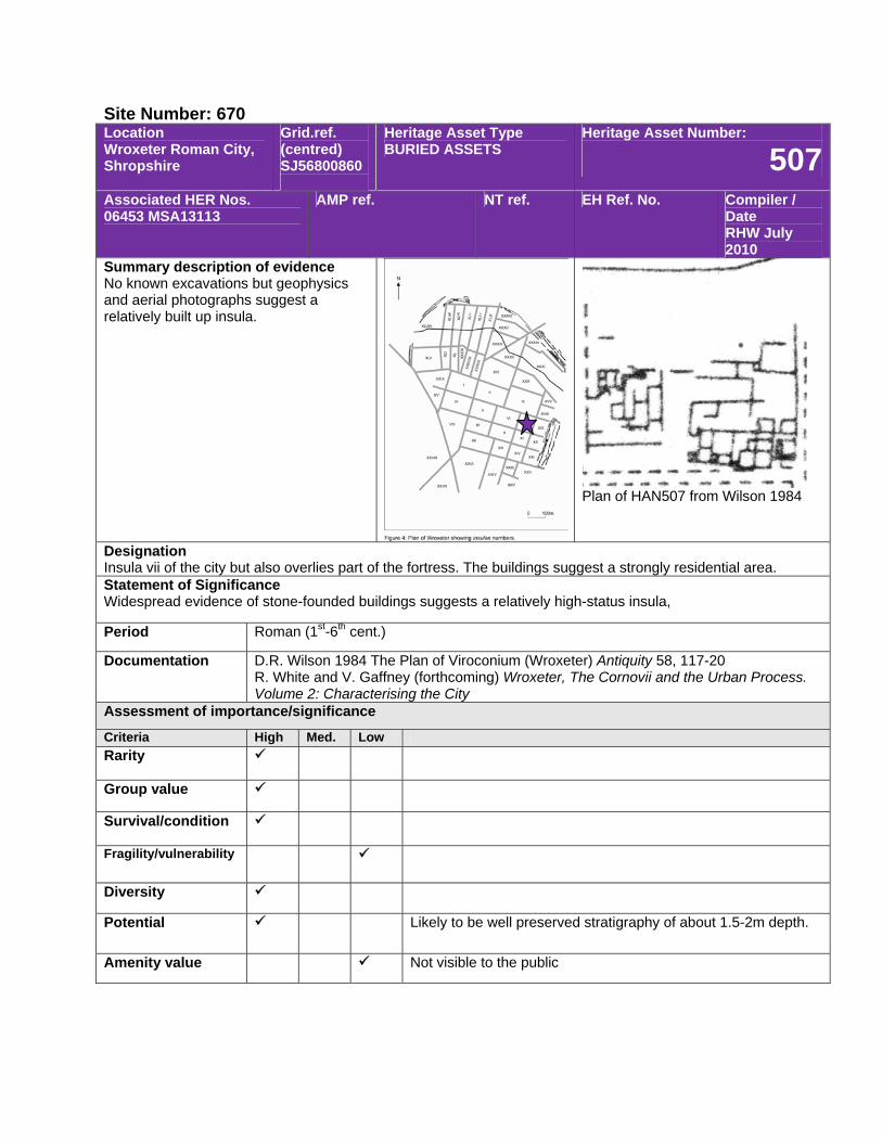
Site Number: 670 Location Wroxeter Roman City, Shropshire
Grid.ref. (centred) SJ56800860
Heritage Asset Type BURIED ASSETS
Heritage Asset Number:
507Associated HER Nos. 06453 MSA13113
AMP ref. NT ref. EH Ref. No. Compiler / Date RHW July 2010
Summary description of evidence No known excavations but geophysics and aerial photographs suggest a relatively built up insula.
Plan of HAN507 from Wilson 1984
Designation Insula vii of the city but also overlies part of the fortress. The buildings suggest a strongly residential area. Statement of Significance Widespread evidence of stone-founded buildings suggests a relatively high-status insula,
Period Roman (1st-6th cent.)
Documentation D.R. Wilson 1984 The Plan of Viroconium (Wroxeter) Antiquity 58, 117-20 R. White and V. Gaffney (forthcoming) Wroxeter, The Cornovii and the Urban Process. Volume 2: Characterising the City
Assessment of importance/significance
Criteria High Med. Low Rarity
Group value
Survival/condition
Fragility/vulnerability
Diversity
Potential Likely to be well preserved stratigraphy of about 1.5-2m depth.
Amenity value Not visible to the public
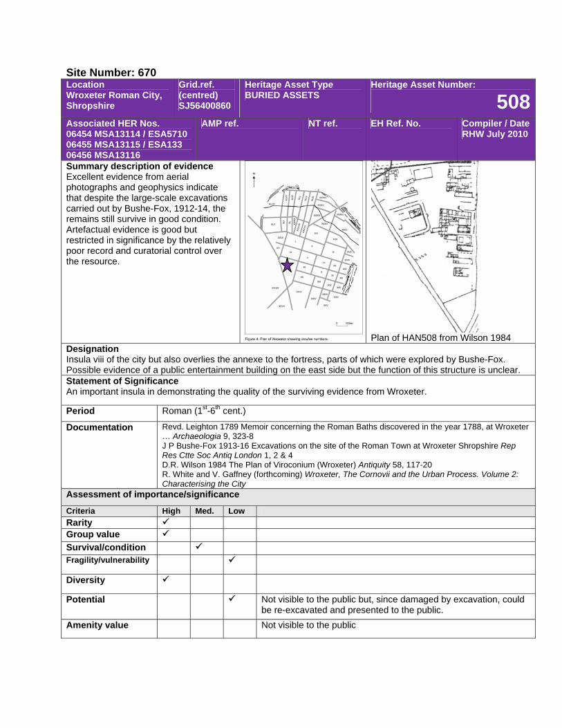
Site Number: 670 Location Wroxeter Roman City, Shropshire
Grid.ref. (centred) SJ56400860
Heritage Asset Type BURIED ASSETS
Heritage Asset Number:
508Associated HER Nos. 06454 MSA13114 / ESA5710 06455 MSA13115 / ESA133 06456 MSA13116
AMP ref. NT ref. EH Ref. No. Compiler / Date RHW July 2010
Summary description of evidence Excellent evidence from aerial photographs and geophysics indicate that despite the large-scale excavations carried out by Bushe-Fox, 1912-14, the remains still survive in good condition. Artefactual evidence is good but restricted in significance by the relatively poor record and curatorial control over the resource.
Plan of HAN508 from Wilson 1984
Designation Insula viii of the city but also overlies the annexe to the fortress, parts of which were explored by Bushe-Fox. Possible evidence of a public entertainment building on the east side but the function of this structure is unclear. Statement of Significance An important insula in demonstrating the quality of the surviving evidence from Wroxeter.
Period Roman (1st-6th cent.)
Documentation Revd. Leighton 1789 Memoir concerning the Roman Baths discovered in the year 1788, at Wroxeter … Archaeologia 9, 323-8 J P Bushe-Fox 1913-16 Excavations on the site of the Roman Town at Wroxeter Shropshire Rep Res Ctte Soc Antiq London 1, 2 & 4 D.R. Wilson 1984 The Plan of Viroconium (Wroxeter) Antiquity 58, 117-20 R. White and V. Gaffney (forthcoming) Wroxeter, The Cornovii and the Urban Process. Volume 2: Characterising the City
Assessment of importance/significance
Criteria High Med. Low Rarity Group value Survival/condition Fragility/vulnerability
Diversity
Potential Not visible to the public but, since damaged by excavation, could be re-excavated and presented to the public.
Amenity value Not visible to the public
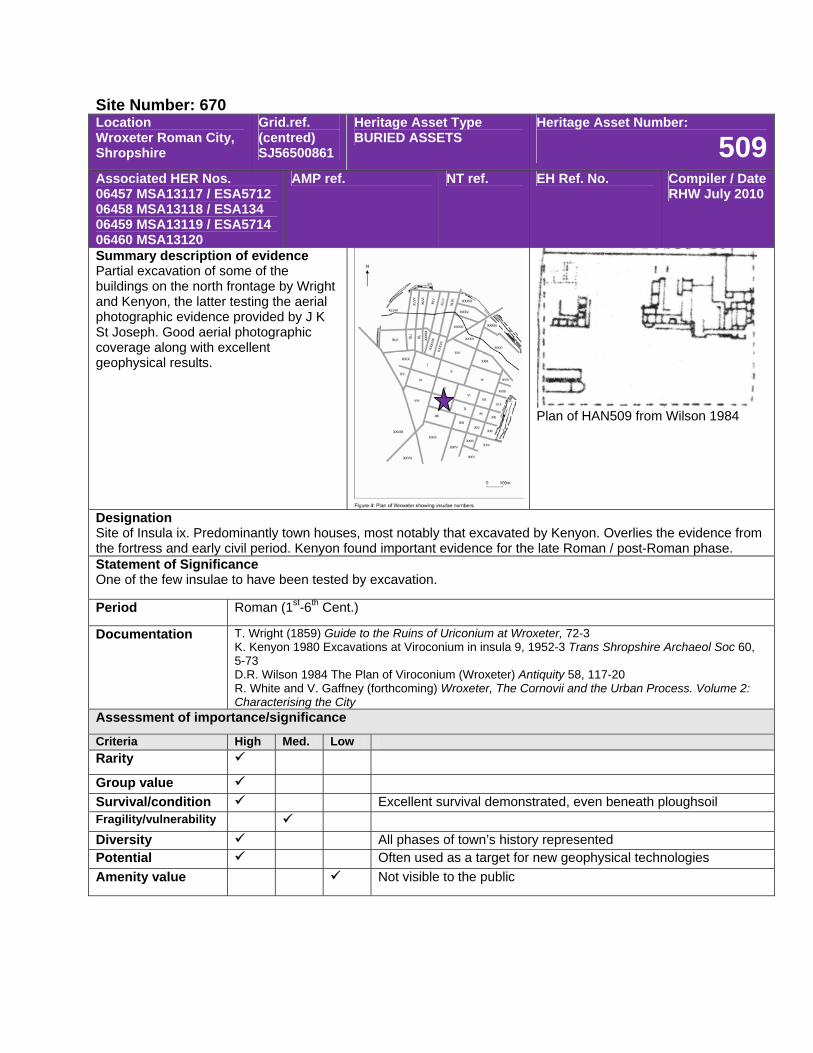
Site Number: 670 Location Wroxeter Roman City, Shropshire
Grid.ref. (centred) SJ56500861
Heritage Asset Type BURIED ASSETS
Heritage Asset Number:
509Associated HER Nos. 06457 MSA13117 / ESA5712 06458 MSA13118 / ESA134 06459 MSA13119 / ESA5714 06460 MSA13120
AMP ref. NT ref. EH Ref. No. Compiler / Date RHW July 2010
Summary description of evidence Partial excavation of some of the buildings on the north frontage by Wright and Kenyon, the latter testing the aerial photographic evidence provided by J K St Joseph. Good aerial photographic coverage along with excellent geophysical results.
Plan of HAN509 from Wilson 1984
Designation Site of Insula ix. Predominantly town houses, most notably that excavated by Kenyon. Overlies the evidence from the fortress and early civil period. Kenyon found important evidence for the late Roman / post-Roman phase. Statement of Significance One of the few insulae to have been tested by excavation.
Period Roman (1st-6th Cent.)
Documentation T. Wright (1859) Guide to the Ruins of Uriconium at Wroxeter, 72-3 K. Kenyon 1980 Excavations at Viroconium in insula 9, 1952-3 Trans Shropshire Archaeol Soc 60, 5-73 D.R. Wilson 1984 The Plan of Viroconium (Wroxeter) Antiquity 58, 117-20 R. White and V. Gaffney (forthcoming) Wroxeter, The Cornovii and the Urban Process. Volume 2: Characterising the City
Assessment of importance/significance
Criteria High Med. Low Rarity
Group value Survival/condition Excellent survival demonstrated, even beneath ploughsoil Fragility/vulnerability Diversity All phases of town’s history represented Potential Often used as a target for new geophysical technologies Amenity value Not visible to the public
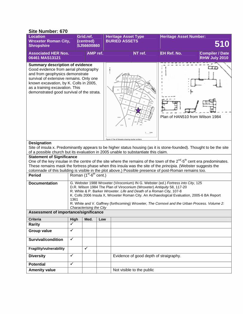
Site Number: 670 Location Wroxeter Roman City, Shropshire
Grid.ref. (centred) SJ56600860
Heritage Asset Type BURIED ASSETS
Heritage Asset Number:
510Associated HER Nos. 06461 MAS13121
AMP ref. NT ref. EH Ref. No. Compiler / Date RHW July 2010
Summary description of evidence Good evidence from aerial photography and from geophysics demonstrate survival of extensive remains. Only one known excavation, by K. Colls in 2005, as a training excavation. This demonstrated good survival of the strata.
Plan of HAN510 from Wilson 1984
Designation Site of insula x. Predominantly appears to be higher status housing (as it is stone-founded). Thought to be the site of a possible church but its evaluation in 2005 unable to substantiate this claim. Statement of Significance One of the key insulae in the centre of the site where the remains of the town of the 2nd-5th cent era predominates. These remains mask the fortress phase when this insula was the site of the principia. (Webster suggests the colonnade of this building is visible in the plot above.) Possible presence of post-Roman remains too. Period Roman (1st-6th cent.)
Documentation G. Webster 1988 Wroxeter (Viroconium) IN G. Webster (ed.) Fortress into City, 125 D.R. Wilson 1984 The Plan of Viroconium (Wroxeter) Antiquity 58, 117-20 R. White & P. Barker Wroxeter. Life and Death of a Roman City, 107-8 K. Colls 2006 Insula X, Wroxeter Roman City. An Archaeological Evaluation, 2005-6 BA Report 1361 R. White and V. Gaffney (forthcoming) Wroxeter, The Cornovii and the Urban Process. Volume 2: Characterising the City
Assessment of importance/significance
Criteria High Med. Low Rarity Group value
Survival/condition
Fragility/vulnerability
Diversity Evidence of good depth of straigraphy.
Potential Amenity value Not visible to the public
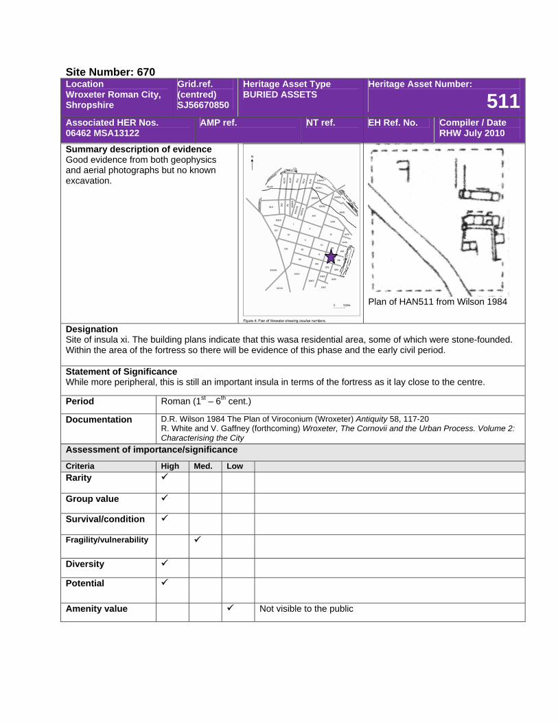
Site Number: 670 Location Wroxeter Roman City, Shropshire
Grid.ref. (centred) SJ56670850
Heritage Asset Type BURIED ASSETS
Heritage Asset Number:
511Associated HER Nos. 06462 MSA13122
AMP ref. NT ref. EH Ref. No. Compiler / Date RHW July 2010
Summary description of evidence Good evidence from both geophysics and aerial photographs but no known excavation.
Plan of HAN511 from Wilson 1984
Designation Site of insula xi. The building plans indicate that this wasa residential area, some of which were stone-founded. Within the area of the fortress so there will be evidence of this phase and the early civil period. Statement of Significance While more peripheral, this is still an important insula in terms of the fortress as it lay close to the centre.
Period Roman (1st – 6th cent.)
Documentation D.R. Wilson 1984 The Plan of Viroconium (Wroxeter) Antiquity 58, 117-20 R. White and V. Gaffney (forthcoming) Wroxeter, The Cornovii and the Urban Process. Volume 2: Characterising the City
Assessment of importance/significance
Criteria High Med. Low Rarity
Group value
Survival/condition
Fragility/vulnerability
Diversity
Potential
Amenity value Not visible to the public
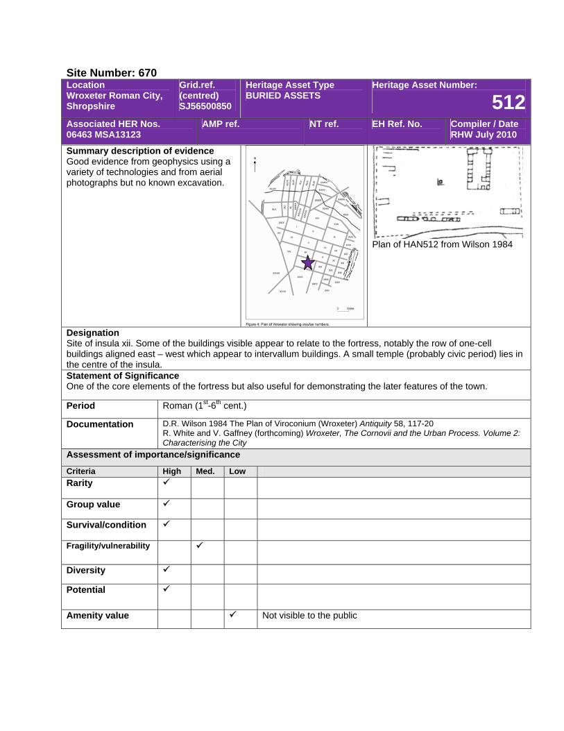
Site Number: 670 Location Wroxeter Roman City, Shropshire
Grid.ref. (centred) SJ56500850
Heritage Asset Type BURIED ASSETS
Heritage Asset Number:
512Associated HER Nos. 06463 MSA13123
AMP ref. NT ref. EH Ref. No. Compiler / Date RHW July 2010
Summary description of evidence Good evidence from geophysics using a variety of technologies and from aerial photographs but no known excavation.
Plan of HAN512 from Wilson 1984
Designation Site of insula xii. Some of the buildings visible appear to relate to the fortress, notably the row of one-cell buildings aligned east – west which appear to intervallum buildings. A small temple (probably civic period) lies in the centre of the insula. Statement of Significance One of the core elements of the fortress but also useful for demonstrating the later features of the town.
Period Roman (1st-6th cent.)
Documentation D.R. Wilson 1984 The Plan of Viroconium (Wroxeter) Antiquity 58, 117-20 R. White and V. Gaffney (forthcoming) Wroxeter, The Cornovii and the Urban Process. Volume 2: Characterising the City
Assessment of importance/significance
Criteria High Med. Low Rarity
Group value
Survival/condition
Fragility/vulnerability
Diversity
Potential
Amenity value Not visible to the public
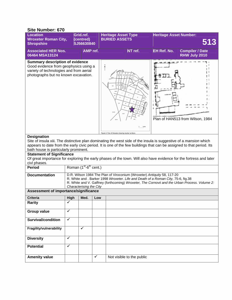
Site Number: 670 Location Wroxeter Roman City, Shropshire
Grid.ref. (centred) SJ56630840
Heritage Asset Type BURIED ASSETS
Heritage Asset Number:
513Associated HER Nos. 06464 MSA13124
AMP ref. NT ref. EH Ref. No. Compiler / Date RHW July 2010
Summary description of evidence Good evidence from geophysics using a variety of technologies and from aerial photographs but no known excavation.
Plan of HAN513 from Wilson, 1984
Designation Site of insula xiii. The distinctive plan dominating the west side of the insula is suggestive of a mansion which appears to date from the early civic period. It is one of the few buildings that can be assigned to that period. Its bath house is particularly prominent. Statement of Significance Of great importance for exploring the early phases of the town. Will also have evidence for the fortress and later civl phases. Period Roman (1st-6th cent.)
Documentation D.R. Wilson 1984 The Plan of Viroconium (Wroxeter) Antiquity 58, 117-20 R. White and . Barker 1998 Wroxeter. Life and Death of a Roman City, 75-6, fig.38 R. White and V. Gaffney (forthcoming) Wroxeter, The Cornovii and the Urban Process. Volume 2: Characterising the City
Assessment of importance/significance
Criteria High Med. Low Rarity
Group value
Survival/condition
Fragility/vulnerability
Diversity
Potential
Amenity value Not visible to the public
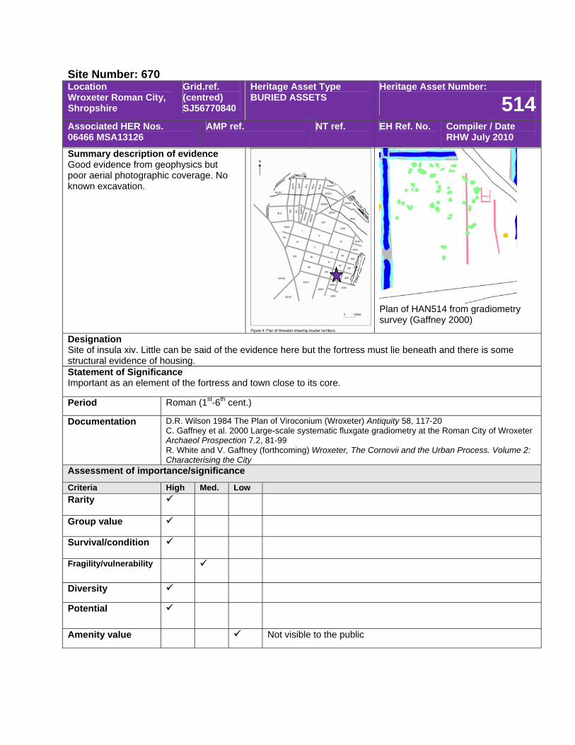
Site Number: 670 Location Wroxeter Roman City, Shropshire
Grid.ref. (centred) SJ56770840
Heritage Asset Type BURIED ASSETS
Heritage Asset Number:
514Associated HER Nos. 06466 MSA13126
AMP ref. NT ref. EH Ref. No. Compiler / Date RHW July 2010
Summary description of evidence Good evidence from geophysics but poor aerial photographic coverage. No known excavation.
Plan of HAN514 from gradiometry survey (Gaffney 2000)
Designation Site of insula xiv. Little can be said of the evidence here but the fortress must lie beneath and there is some structural evidence of housing. Statement of Significance Important as an element of the fortress and town close to its core.
Period Roman (1st-6th cent.)
Documentation D.R. Wilson 1984 The Plan of Viroconium (Wroxeter) Antiquity 58, 117-20 C. Gaffney et al. 2000 Large-scale systematic fluxgate gradiometry at the Roman City of Wroxeter Archaeol Prospection 7.2, 81-99 R. White and V. Gaffney (forthcoming) Wroxeter, The Cornovii and the Urban Process. Volume 2: Characterising the City
Assessment of importance/significance
Criteria High Med. Low Rarity
Group value
Survival/condition
Fragility/vulnerability
Diversity
Potential
Amenity value Not visible to the public
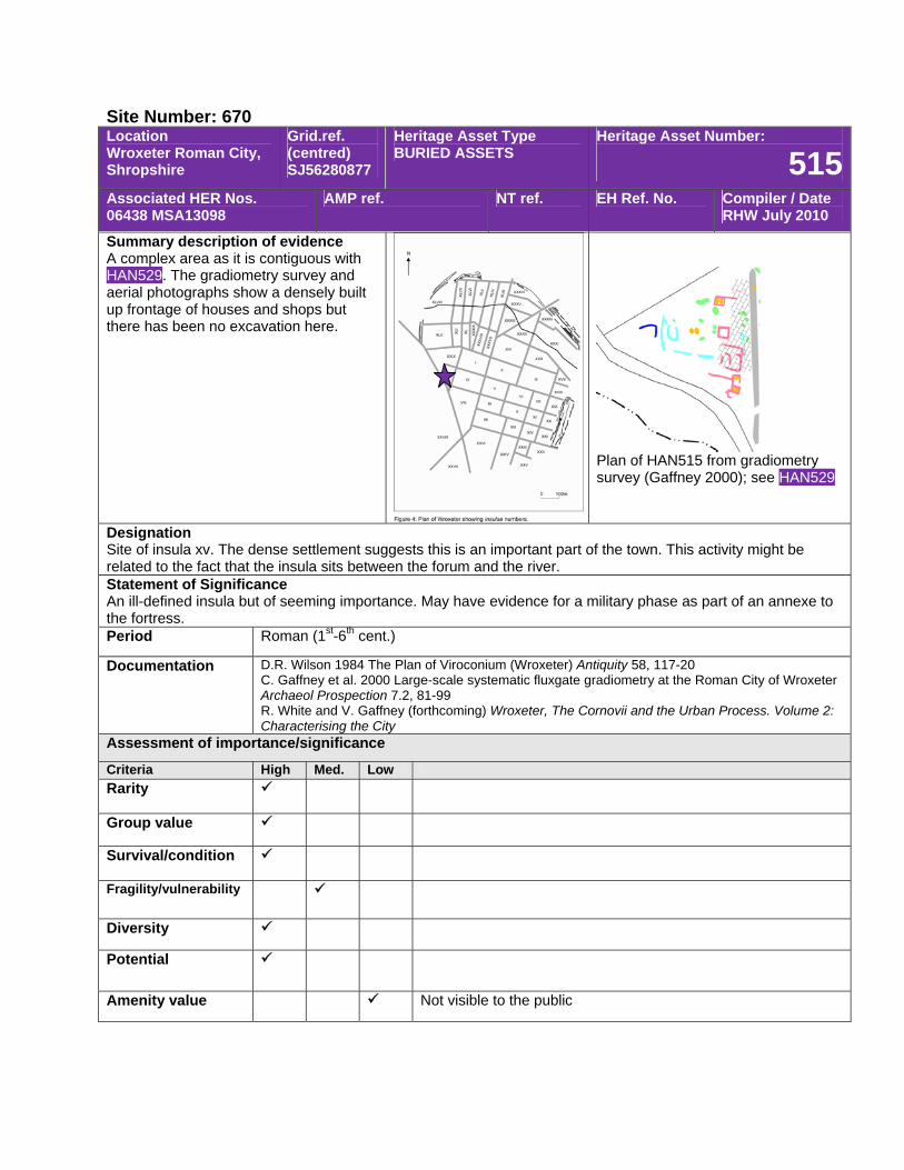
Site Number: 670 Location Wroxeter Roman City, Shropshire
Grid.ref. (centred) SJ56280877
Heritage Asset Type BURIED ASSETS
Heritage Asset Number:
515Associated HER Nos. 06438 MSA13098
AMP ref. NT ref. EH Ref. No. Compiler / Date RHW July 2010
Summary description of evidence A complex area as it is contiguous with HAN529. The gradiometry survey and aerial photographs show a densely built up frontage of houses and shops but there has been no excavation here.
Plan of HAN515 from gradiometry survey (Gaffney 2000); see HAN529
Designation Site of insula xv. The dense settlement suggests this is an important part of the town. This activity might be related to the fact that the insula sits between the forum and the river. Statement of Significance An ill-defined insula but of seeming importance. May have evidence for a military phase as part of an annexe to the fortress. Period Roman (1st-6th cent.)
Documentation D.R. Wilson 1984 The Plan of Viroconium (Wroxeter) Antiquity 58, 117-20 C. Gaffney et al. 2000 Large-scale systematic fluxgate gradiometry at the Roman City of Wroxeter Archaeol Prospection 7.2, 81-99 R. White and V. Gaffney (forthcoming) Wroxeter, The Cornovii and the Urban Process. Volume 2: Characterising the City
Assessment of importance/significance
Criteria High Med. Low Rarity
Group value
Survival/condition
Fragility/vulnerability
Diversity
Potential
Amenity value Not visible to the public
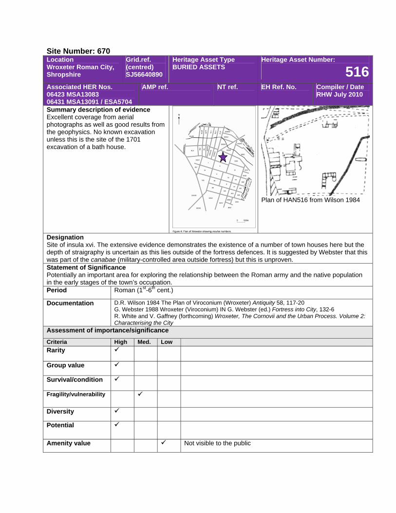
Site Number: 670 Location Wroxeter Roman City, Shropshire
Grid.ref. (centred) SJ56640890
Heritage Asset Type BURIED ASSETS
Heritage Asset Number:
516Associated HER Nos. 06423 MSA13083 06431 MSA13091 / ESA5704
AMP ref. NT ref. EH Ref. No. Compiler / Date RHW July 2010
Summary description of evidence Excellent coverage from aerial photographs as well as good results from the geophysics. No known excavation unless this is the site of the 1701 excavation of a bath house.
Plan of HAN516 from Wilson 1984
Designation Site of insula xvi. The extensive evidence demonstrates the existence of a number of town houses here but the depth of straigraphy is uncertain as this lies outside of the fortress defences. It is suggested by Webster that this was part of the canabae (military-controlled area outside fortress) but this is unproven. Statement of Significance Potentially an important area for exploring the relationship between the Roman army and the native population in the early stages of the town’s occupation. Period Roman (1st-6th cent.)
Documentation D.R. Wilson 1984 The Plan of Viroconium (Wroxeter) Antiquity 58, 117-20 G. Webster 1988 Wroxeter (Viroconium) IN G. Webster (ed.) Fortress into City, 132-6 R. White and V. Gaffney (forthcoming) Wroxeter, The Cornovii and the Urban Process. Volume 2: Characterising the City
Assessment of importance/significance
Criteria High Med. Low Rarity
Group value
Survival/condition
Fragility/vulnerability
Diversity
Potential
Amenity value Not visible to the public
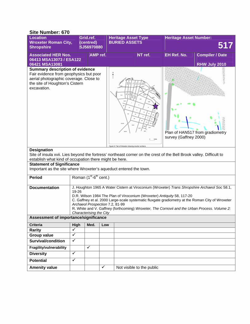
Site Number: 670 Location Wroxeter Roman City, Shropshire
Grid.ref. (centred) SJ56970880
Heritage Asset Type BURIED ASSETS
Heritage Asset Number:
517Associated HER Nos. 06413 MSA13073 / ESA122 06421 MSA13081
AMP ref. NT ref. EH Ref. No. Compiler / Date RHW July 2010
Summary description of evidence Fair evidence from geophysics but poor aerial photographic coverage. Close to the site of Houghton’s Cistern excavation.
Plan of HAN517 from gradiometry survey (Gaffney 2000)
Designation Site of insula xvii. Lies beyond the fortress’ northeast corner on the crest of the Bell Brook valley. Difficult to establish what kind of occupation there might be here. Statement of Significance Important as the site where Wroxeter’s aqueduct entered the town.
Period Roman (1st-6th cent.)
Documentation J. Houghton 1965 A Water Cistern at Viroconium (Wroxeter) Trans Shropshire Archaeol Soc 58.1, 19-26 D.R. Wilson 1984 The Plan of Viroconium (Wroxeter) Antiquity 58, 117-20 C. Gaffney et al. 2000 Large-scale systematic fluxgate gradiometry at the Roman City of Wroxeter Archaeol Prospection 7.2, 81-99 R. White and V. Gaffney (forthcoming) Wroxeter, The Cornovii and the Urban Process. Volume 2: Characterising the City
Assessment of importance/significance
Criteria High Med. Low Rarity Group value Survival/condition Fragility/vulnerability Diversity
Potential
Amenity value Not visible to the public
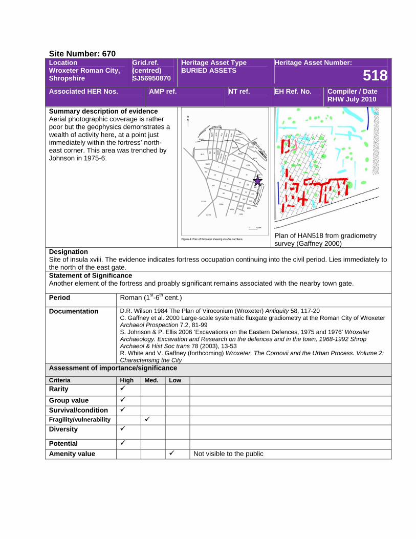
Site Number: 670 Location Wroxeter Roman City, Shropshire
Grid.ref. (centred) SJ56950870
Heritage Asset Type BURIED ASSETS
Heritage Asset Number:
518Associated HER Nos. AMP ref. NT ref. EH Ref. No. Compiler / Date
RHW July 2010
Summary description of evidence Aerial photographic coverage is rather poor but the geophysics demonstrates a wealth of activity here, at a point just immediately within the fortress’ north-east corner. This area was trenched by Johnson in 1975-6.
Plan of HAN518 from gradiometry survey (Gaffney 2000)
Designation Site of insula xviii. The evidence indicates fortress occupation continuing into the civil period. Lies immediately to the north of the east gate. Statement of Significance Another element of the fortress and proably significant remains associated with the nearby town gate.
Period Roman (1st-6th cent.)
Documentation D.R. Wilson 1984 The Plan of Viroconium (Wroxeter) Antiquity 58, 117-20 C. Gaffney et al. 2000 Large-scale systematic fluxgate gradiometry at the Roman City of Wroxeter Archaeol Prospection 7.2, 81-99 S. Johnson & P. Ellis 2006 ‘Excavations on the Eastern Defences, 1975 and 1976’ Wroxeter Archaeology. Excavation and Research on the defences and in the town, 1968-1992 Shrop Archaeol & Hist Soc trans 78 (2003), 13-53 R. White and V. Gaffney (forthcoming) Wroxeter, The Cornovii and the Urban Process. Volume 2: Characterising the City
Assessment of importance/significance
Criteria High Med. Low Rarity Group value Survival/condition Fragility/vulnerability Diversity
Potential Amenity value Not visible to the public
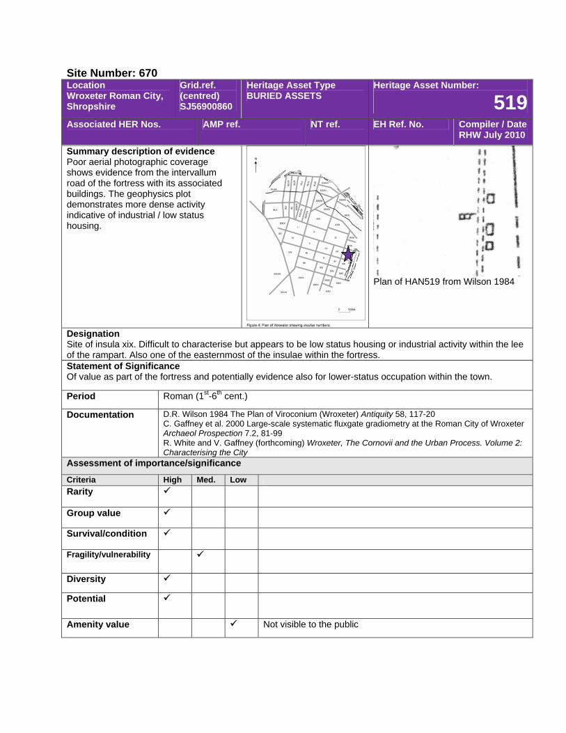
Site Number: 670 Location Wroxeter Roman City, Shropshire
Grid.ref. (centred) SJ56900860
Heritage Asset Type BURIED ASSETS
Heritage Asset Number:
519Associated HER Nos. AMP ref. NT ref. EH Ref. No. Compiler / Date
RHW July 2010
Summary description of evidence Poor aerial photographic coverage shows evidence from the intervallum road of the fortress with its associated buildings. The geophysics plot demonstrates more dense activity indicative of industrial / low status housing.
Plan of HAN519 from Wilson 1984
Designation Site of insula xix. Difficult to characterise but appears to be low status housing or industrial activity within the lee of the rampart. Also one of the easternmost of the insulae within the fortress. Statement of Significance Of value as part of the fortress and potentially evidence also for lower-status occupation within the town.
Period Roman (1st-6th cent.)
Documentation D.R. Wilson 1984 The Plan of Viroconium (Wroxeter) Antiquity 58, 117-20 C. Gaffney et al. 2000 Large-scale systematic fluxgate gradiometry at the Roman City of Wroxeter Archaeol Prospection 7.2, 81-99 R. White and V. Gaffney (forthcoming) Wroxeter, The Cornovii and the Urban Process. Volume 2: Characterising the City
Assessment of importance/significance
Criteria High Med. Low Rarity
Group value
Survival/condition
Fragility/vulnerability
Diversity
Potential
Amenity value Not visible to the public
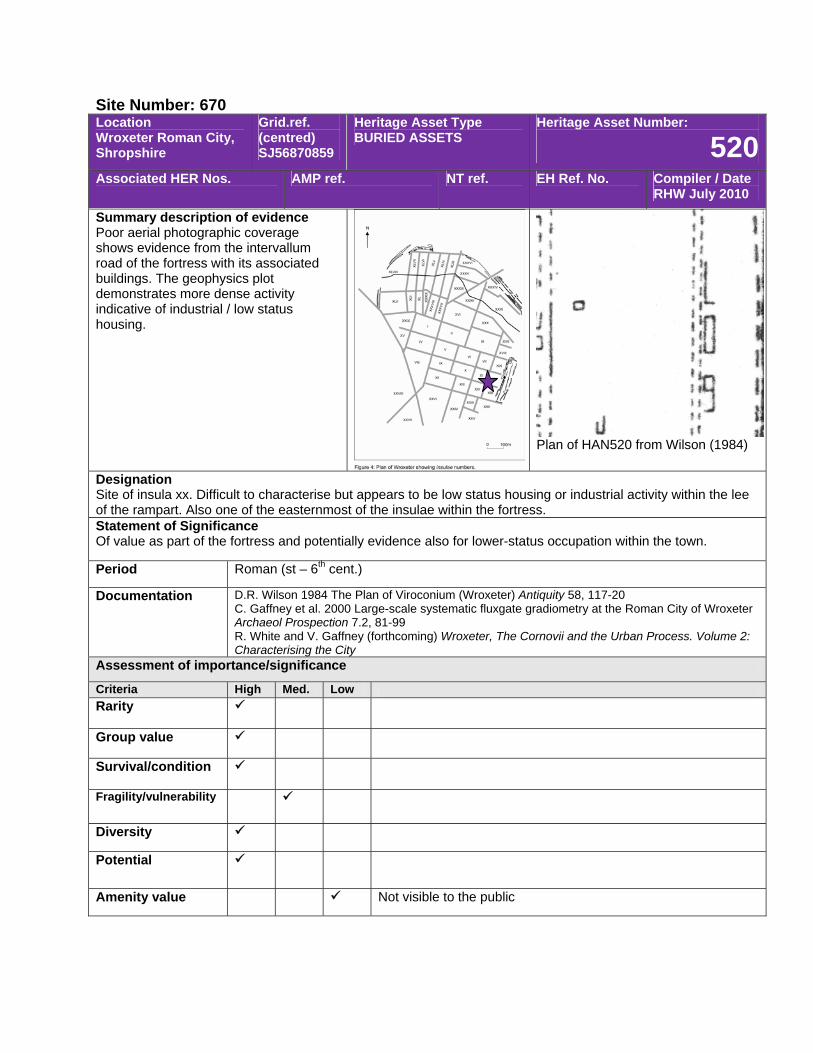
Site Number: 670 Location Wroxeter Roman City, Shropshire
Grid.ref. (centred) SJ56870859
Heritage Asset Type BURIED ASSETS
Heritage Asset Number:
520Associated HER Nos. AMP ref. NT ref. EH Ref. No. Compiler / Date
RHW July 2010
Summary description of evidence Poor aerial photographic coverage shows evidence from the intervallum road of the fortress with its associated buildings. The geophysics plot demonstrates more dense activity indicative of industrial / low status housing.
Plan of HAN520 from Wilson (1984)
Designation Site of insula xx. Difficult to characterise but appears to be low status housing or industrial activity within the lee of the rampart. Also one of the easternmost of the insulae within the fortress. Statement of Significance Of value as part of the fortress and potentially evidence also for lower-status occupation within the town.
Period Roman (st – 6th cent.)
Documentation D.R. Wilson 1984 The Plan of Viroconium (Wroxeter) Antiquity 58, 117-20 C. Gaffney et al. 2000 Large-scale systematic fluxgate gradiometry at the Roman City of Wroxeter Archaeol Prospection 7.2, 81-99 R. White and V. Gaffney (forthcoming) Wroxeter, The Cornovii and the Urban Process. Volume 2: Characterising the City
Assessment of importance/significance
Criteria High Med. Low Rarity
Group value
Survival/condition
Fragility/vulnerability
Diversity
Potential
Amenity value Not visible to the public
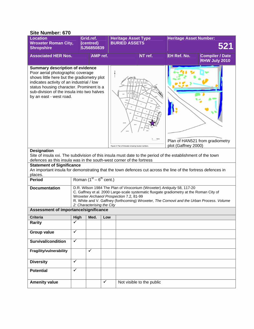
Site Number: 670 Location Wroxeter Roman City, Shropshire
Grid.ref. (centred) SJ56850839
Heritage Asset Type BURIED ASSETS
Heritage Asset Number:
521Associated HER Nos. AMP ref. NT ref. EH Ref. No. Compiler / Date
RHW July 2010
Summary description of evidence Poor aerial photographic coverage shows little here but the gradiometry plot indicates activity of an industrial / low status housing character. Prominent is a sub-division of the insula into two halves by an east - west road.
Plan of HAN521 from gradiometry plot (Gaffney 2000)
Designation Site of insula xxi. The subdivision of this insula must date to the period of the establishment of the town defences as this insula was in the south-west corner of the fortress Statement of Significance An important insula for demonstrating that the town defences cut across the line of the fortress defences in places. Period Roman (1st – 6th cent.)
Documentation D.R. Wilson 1984 The Plan of Viroconium (Wroxeter) Antiquity 58, 117-20 C. Gaffney et al. 2000 Large-scale systematic fluxgate gradiometry at the Roman City of Wroxeter Archaeol Prospection 7.2, 81-99 R. White and V. Gaffney (forthcoming) Wroxeter, The Cornovii and the Urban Process. Volume 2: Characterising the City
Assessment of importance/significance
Criteria High Med. Low Rarity
Group value
Survival/condition
Fragility/vulnerability
Diversity
Potential
Amenity value Not visible to the public
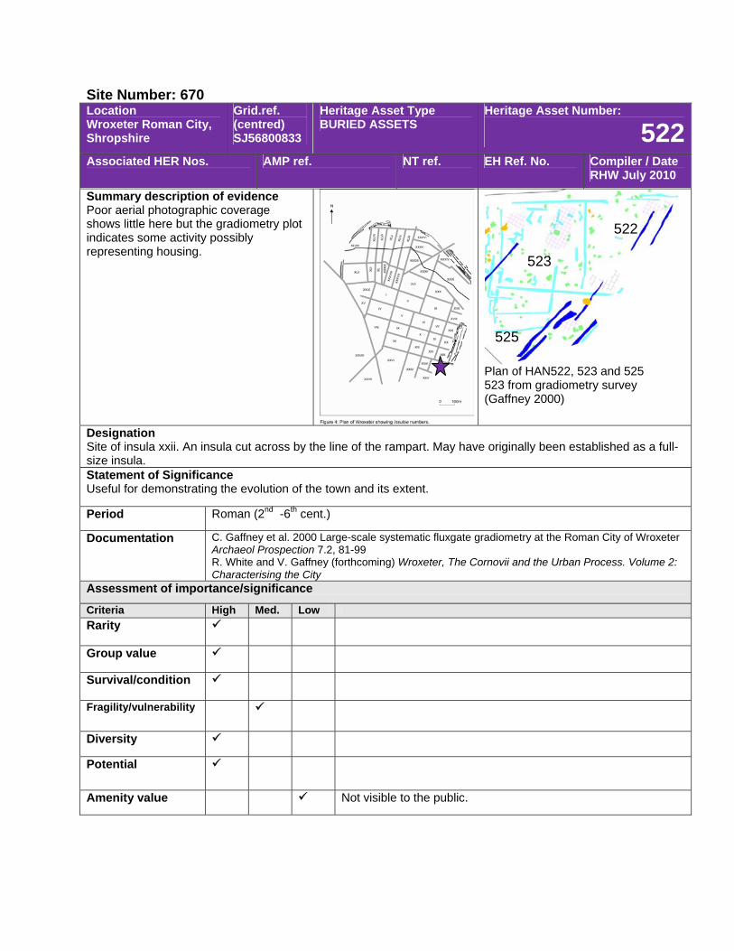
Site Number: 670 Location Wroxeter Roman City, Shropshire
Grid.ref. (centred) SJ56800833
Heritage Asset Type BURIED ASSETS
Heritage Asset Number:
522Associated HER Nos. AMP ref. NT ref. EH Ref. No. Compiler / Date
RHW July 2010
Summary description of evidence Poor aerial photographic coverage shows little here but the gradiometry plot indicates some activity possibly representing housing.
Plan of HAN522, 523 and 525 523 from gradiometry survey (Gaffney 2000)
Designation Site of insula xxii. An insula cut across by the line of the rampart. May have originally been established as a full-size insula. Statement of Significance Useful for demonstrating the evolution of the town and its extent.
Period Roman (2nd -6th cent.)
Documentation C. Gaffney et al. 2000 Large-scale systematic fluxgate gradiometry at the Roman City of Wroxeter Archaeol Prospection 7.2, 81-99 R. White and V. Gaffney (forthcoming) Wroxeter, The Cornovii and the Urban Process. Volume 2: Characterising the City
Assessment of importance/significance
Criteria High Med. Low Rarity
Group value
Survival/condition
Fragility/vulnerability
Diversity
Potential
Amenity value Not visible to the public.
522
523
525
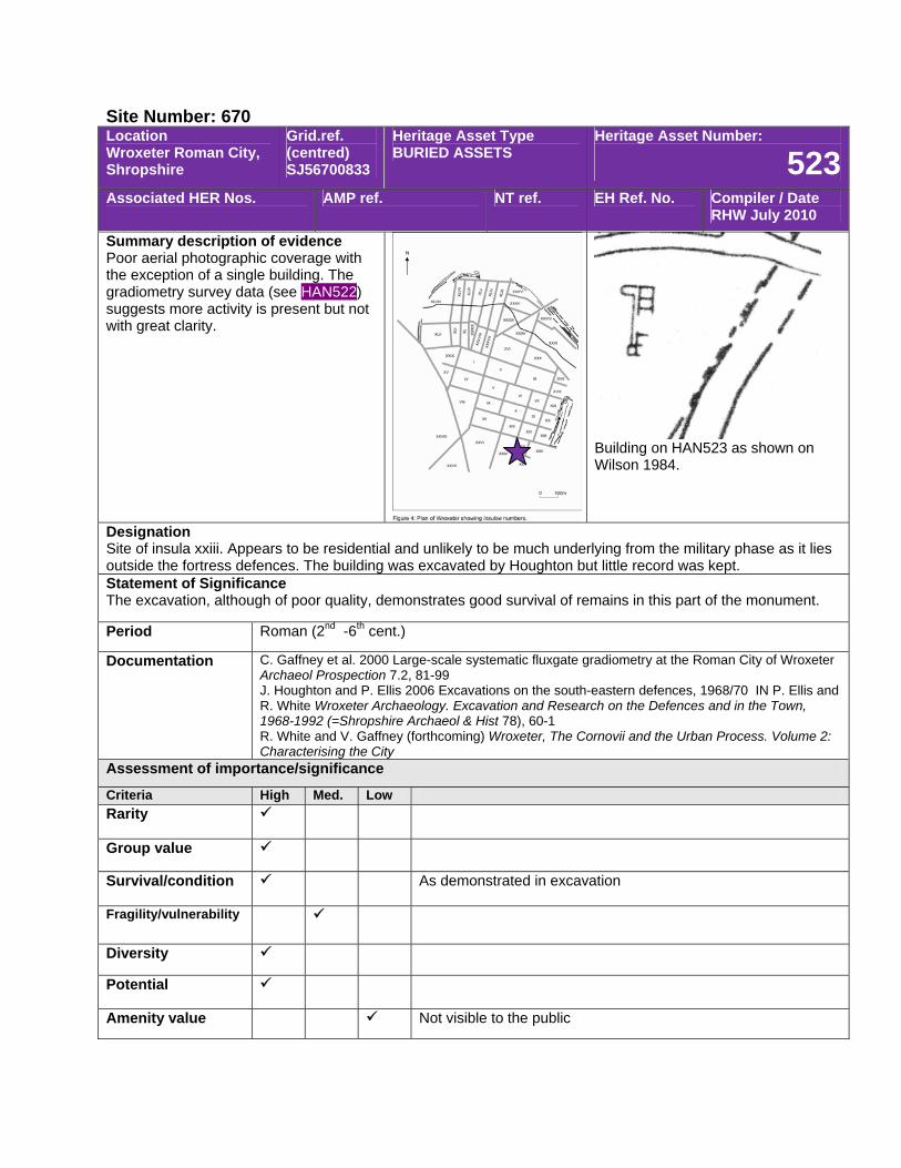
Site Number: 670 Location Wroxeter Roman City, Shropshire
Grid.ref. (centred) SJ56700833
Heritage Asset Type BURIED ASSETS
Heritage Asset Number:
523Associated HER Nos. AMP ref. NT ref. EH Ref. No. Compiler / Date
RHW July 2010
Summary description of evidence Poor aerial photographic coverage with the exception of a single building. The gradiometry survey data (see HAN522) suggests more activity is present but not with great clarity.
Building on HAN523 as shown on Wilson 1984.
Designation Site of insula xxiii. Appears to be residential and unlikely to be much underlying from the military phase as it lies outside the fortress defences. The building was excavated by Houghton but little record was kept. Statement of Significance The excavation, although of poor quality, demonstrates good survival of remains in this part of the monument.
Period Roman (2nd -6th cent.)
Documentation C. Gaffney et al. 2000 Large-scale systematic fluxgate gradiometry at the Roman City of Wroxeter Archaeol Prospection 7.2, 81-99 J. Houghton and P. Ellis 2006 Excavations on the south-eastern defences, 1968/70 IN P. Ellis and R. White Wroxeter Archaeology. Excavation and Research on the Defences and in the Town, 1968-1992 (=Shropshire Archaeol & Hist 78), 60-1 R. White and V. Gaffney (forthcoming) Wroxeter, The Cornovii and the Urban Process. Volume 2: Characterising the City
Assessment of importance/significance
Criteria High Med. Low Rarity
Group value
Survival/condition As demonstrated in excavation
Fragility/vulnerability
Diversity
Potential
Amenity value Not visible to the public
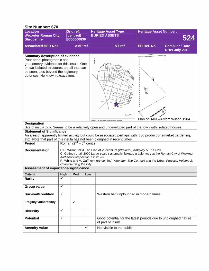
Site Number: 670 Location Wroxeter Roman City, Shropshire
Grid.ref. (centred) SJ56600830
Heritage Asset Type BURIED ASSETS
Heritage Asset Number:
524Associated HER Nos. AMP ref. NT ref. EH Ref. No. Compiler / Date
RHW July 2010
Summary description of evidence Poor aerial photographic and gradiometry evidence for this insula. One or two isolated structures are all that can be seen. Lies beyond the legionary defences. No known excavations
Plan of HAN524 from Wilson 1984
Designation Site of insula xxiv. Seems to be a relatively open and undeveloped part of the town with isolated houses. Statement of Significance An area of apparently limited activity but could be associated perhaps with food production (market gardening, etc). Note that part of this insula has not been ploughed in recent times. Period Roman (2nd – 6th cent.)
Documentation D.R. Wilson 1984 The Plan of Viroconium (Wroxeter) Antiquity 58, 117-20 C. Gaffney et al. 2000 Large-scale systematic fluxgate gradiometry at the Roman City of Wroxeter Archaeol Prospection 7.2, 81-99 R. White and V. Gaffney (forthcoming) Wroxeter, The Cornovii and the Urban Process. Volume 2: Characterising the City
Assessment of importance/significance
Criteria High Med. Low Rarity
Group value
Survival/condition Western half unploughed in modern times.
Fragility/vulnerability
Diversity
Potential Good potential for the latest periods due to unploughed nature of part of insula.
Amenity value Not visible to the public

Site Number: 670 Location Wroxeter Roman City, Shropshire
Grid.ref. (centred) SJ56700826
Heritage Asset Type BURIED ASSETS
Heritage Asset Number:
525Associated HER Nos. AMP ref. NT ref. EH Ref. No. Compiler / Date
RHW July 2010
Summary description of evidence Poor aerial photographic coverage shows little here but the gradiometry plot indicates some activity possibly representing housing.
Plan of HAN522, 523 and 525 523 from gradiometry survey (Gaffney 2000)
Designation Site of insula xxv. An insula cut across by the line of the rampart. May have originally been established as a full-size insula. Statement of Significance Useful for demonstrating the evolution of the town and its extent.
Period Roman (2nd -6th cent.)
Documentation C. Gaffney et al. 2000 Large-scale systematic fluxgate gradiometry at the Roman City of Wroxeter Archaeol Prospection 7.2, 81-99 R. White and V. Gaffney (forthcoming) Wroxeter, The Cornovii and the Urban Process. Volume 2: Characterising the City
Assessment of importance/significance
Criteria High Med. Low Rarity
Group value
Survival/condition
Fragility/vulnerability
Diversity
Potential
Amenity value Not visible to the public
522
523
525
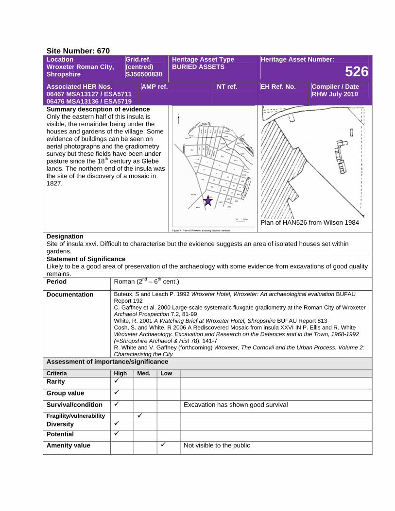
Site Number: 670 Location Wroxeter Roman City, Shropshire
Grid.ref. (centred) SJ56500830
Heritage Asset Type BURIED ASSETS
Heritage Asset Number:
526Associated HER Nos. 06467 MSA13127 / ESA5711 06476 MSA13136 / ESA5719
AMP ref. NT ref. EH Ref. No. Compiler / Date RHW July 2010
Summary description of evidence Only the eastern half of this insula is visible, the remainder being under the houses and gardens of the village. Some evidence of buildings can be seen on aerial photographs and the gradiometry survey but these fields have been under pasture since the 18th century as Glebe lands. The northern end of the insula was the site of the discovery of a mosaic in 1827.
Plan of HAN526 from Wilson 1984
Designation Site of insula xxvi. Difficult to characterise but the evidence suggests an area of isolated houses set within gardens. Statement of Significance Likely to be a good area of preservation of the archaeology with some evidence from excavations of good quality remains. Period Roman (2nd – 6th cent.)
Documentation Buteux, S and Leach P. 1992 Wroxeter Hotel, Wroxeter: An archaeological evaluation BUFAU Report 192 C. Gaffney et al. 2000 Large-scale systematic fluxgate gradiometry at the Roman City of Wroxeter Archaeol Prospection 7.2, 81-99 White, R. 2001 A Watching Brief at Wroxeter Hotel, Shropshire BUFAU Report 813 Cosh, S. and White, R 2006 A Rediscovered Mosaic from insula XXVI IN P. Ellis and R. White Wroxeter Archaeology. Excavation and Research on the Defences and in the Town, 1968-1992 (=Shropshire Archaeol & Hist 78), 141-7 R. White and V. Gaffney (forthcoming) Wroxeter, The Cornovii and the Urban Process. Volume 2: Characterising the City
Assessment of importance/significance
Criteria High Med. Low Rarity
Group value
Survival/condition Excavation has shown good survival
Fragility/vulnerability Diversity Potential
Amenity value Not visible to the public
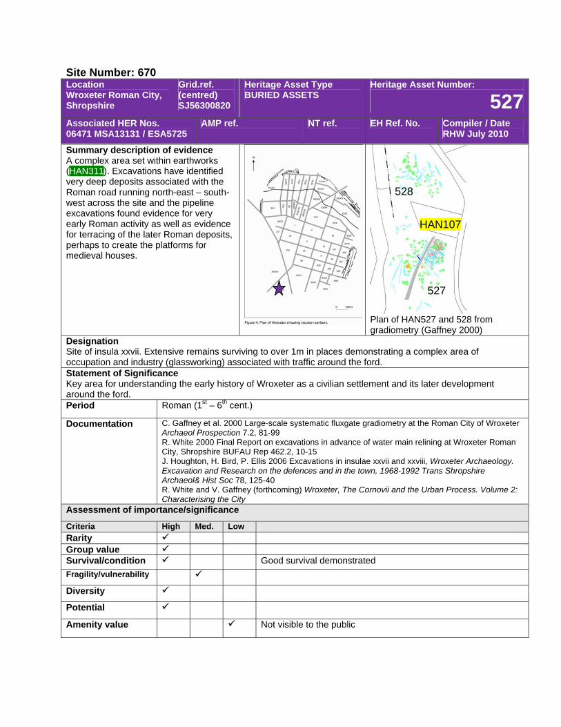
Site Number: 670 Location Wroxeter Roman City, Shropshire
Grid.ref. (centred) SJ56300820
Heritage Asset Type BURIED ASSETS
Heritage Asset Number:
527Associated HER Nos. 06471 MSA13131 / ESA5725
AMP ref. NT ref. EH Ref. No. Compiler / Date RHW July 2010
Summary description of evidence A complex area set within earthworks (HAN311). Excavations have identified very deep deposits associated with the Roman road running north-east – south-west across the site and the pipeline excavations found evidence for very early Roman activity as well as evidence for terracing of the later Roman deposits, perhaps to create the platforms for medieval houses.
Plan of HAN527 and 528 from gradiometry (Gaffney 2000)
Designation Site of insula xxvii. Extensive remains surviving to over 1m in places demonstrating a complex area of occupation and industry (glassworking) associated with traffic around the ford. Statement of Significance Key area for understanding the early history of Wroxeter as a civilian settlement and its later development around the ford. Period Roman (1st – 6th cent.)
Documentation C. Gaffney et al. 2000 Large-scale systematic fluxgate gradiometry at the Roman City of Wroxeter Archaeol Prospection 7.2, 81-99 R. White 2000 Final Report on excavations in advance of water main relining at Wroxeter Roman City, Shropshire BUFAU Rep 462.2, 10-15 J. Houghton, H. Bird, P. Ellis 2006 Excavations in insulae xxvii and xxviii, Wroxeter Archaeology. Excavation and Research on the defences and in the town, 1968-1992 Trans Shropshire Archaeol& Hist Soc 78, 125-40 R. White and V. Gaffney (forthcoming) Wroxeter, The Cornovii and the Urban Process. Volume 2: Characterising the City
Assessment of importance/significance
Criteria High Med. Low Rarity Group value Survival/condition Good survival demonstrated Fragility/vulnerability
Diversity
Potential
Amenity value Not visible to the public
528
HAN107
527
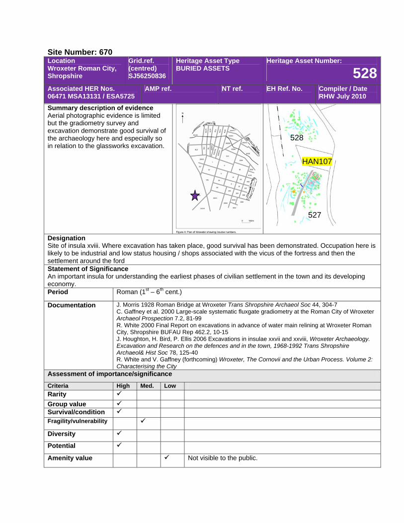
Site Number: 670 Location Wroxeter Roman City, Shropshire
Grid.ref. (centred) SJ56250836
Heritage Asset Type BURIED ASSETS
Heritage Asset Number:
528Associated HER Nos. 06471 MSA13131 / ESA5725
AMP ref. NT ref. EH Ref. No. Compiler / Date RHW July 2010
Summary description of evidence Aerial photographic evidence is limited but the gradiometry survey and excavation demonstrate good survival of the archaeology here and especially so in relation to the glassworks excavation.
Designation Site of insula xviii. Where excavation has taken place, good survival has been demonstrated. Occupation here is likely to be industrial and low status housing / shops associated with the vicus of the fortress and then the settlement around the ford Statement of Significance An important insula for understanding the earliest phases of civilian settlement in the town and its developing economy. Period Roman (1st – 6th cent.)
Documentation J. Morris 1928 Roman Bridge at Wroxeter Trans Shropshire Archaeol Soc 44, 304-7 C. Gaffney et al. 2000 Large-scale systematic fluxgate gradiometry at the Roman City of Wroxeter Archaeol Prospection 7.2, 81-99 R. White 2000 Final Report on excavations in advance of water main relining at Wroxeter Roman City, Shropshire BUFAU Rep 462.2, 10-15 J. Houghton, H. Bird, P. Ellis 2006 Excavations in insulae xxvii and xxviii, Wroxeter Archaeology. Excavation and Research on the defences and in the town, 1968-1992 Trans Shropshire Archaeol& Hist Soc 78, 125-40 R. White and V. Gaffney (forthcoming) Wroxeter, The Cornovii and the Urban Process. Volume 2: Characterising the City
Assessment of importance/significance
Criteria High Med. Low Rarity Group value Survival/condition Fragility/vulnerability
Diversity
Potential
Amenity value Not visible to the public.
528
HAN107
527
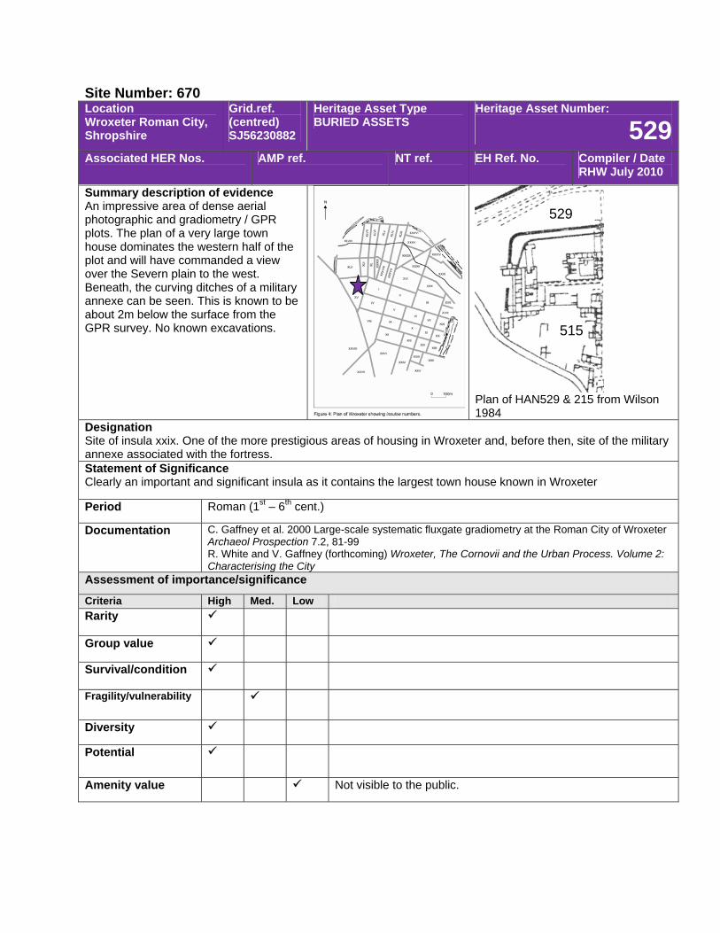
Site Number: 670 Location Wroxeter Roman City, Shropshire
Grid.ref. (centred) SJ56230882
Heritage Asset Type BURIED ASSETS
Heritage Asset Number:
529Associated HER Nos. AMP ref. NT ref. EH Ref. No. Compiler / Date
RHW July 2010
Summary description of evidence An impressive area of dense aerial photographic and gradiometry / GPR plots. The plan of a very large town house dominates the western half of the plot and will have commanded a view over the Severn plain to the west. Beneath, the curving ditches of a military annexe can be seen. This is known to be about 2m below the surface from the GPR survey. No known excavations.
Plan of HAN529 & 215 from Wilson 1984
Designation Site of insula xxix. One of the more prestigious areas of housing in Wroxeter and, before then, site of the military annexe associated with the fortress. Statement of Significance Clearly an important and significant insula as it contains the largest town house known in Wroxeter
Period Roman (1st – 6th cent.)
Documentation C. Gaffney et al. 2000 Large-scale systematic fluxgate gradiometry at the Roman City of Wroxeter Archaeol Prospection 7.2, 81-99 R. White and V. Gaffney (forthcoming) Wroxeter, The Cornovii and the Urban Process. Volume 2: Characterising the City
Assessment of importance/significance
Criteria High Med. Low Rarity
Group value
Survival/condition
Fragility/vulnerability
Diversity
Potential
Amenity value Not visible to the public.
529
515
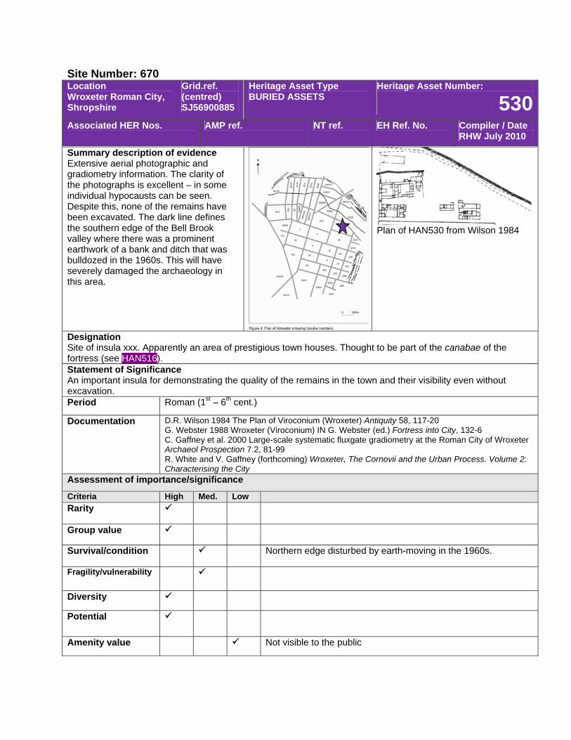
Site Number: 670 Location Wroxeter Roman City, Shropshire
Grid.ref. (centred) SJ56900885
Heritage Asset Type BURIED ASSETS
Heritage Asset Number:
530Associated HER Nos. AMP ref. NT ref. EH Ref. No. Compiler / Date
RHW July 2010
Summary description of evidence Extensive aerial photographic and gradiometry information. The clarity of the photographs is excellent – in some individual hypocausts can be seen. Despite this, none of the remains have been excavated. The dark line defines the southern edge of the Bell Brook valley where there was a prominent earthwork of a bank and ditch that was bulldozed in the 1960s. This will have severely damaged the archaeology in this area.
Plan of HAN530 from Wilson 1984
Designation Site of insula xxx. Apparently an area of prestigious town houses. Thought to be part of the canabae of the fortress (see HAN516). Statement of Significance An important insula for demonstrating the quality of the remains in the town and their visibility even without excavation. Period Roman (1st – 6th cent.)
Documentation D.R. Wilson 1984 The Plan of Viroconium (Wroxeter) Antiquity 58, 117-20 G. Webster 1988 Wroxeter (Viroconium) IN G. Webster (ed.) Fortress into City, 132-6 C. Gaffney et al. 2000 Large-scale systematic fluxgate gradiometry at the Roman City of Wroxeter Archaeol Prospection 7.2, 81-99 R. White and V. Gaffney (forthcoming) Wroxeter, The Cornovii and the Urban Process. Volume 2: Characterising the City
Assessment of importance/significance
Criteria High Med. Low Rarity
Group value
Survival/condition Northern edge disturbed by earth-moving in the 1960s.
Fragility/vulnerability
Diversity
Potential
Amenity value Not visible to the public
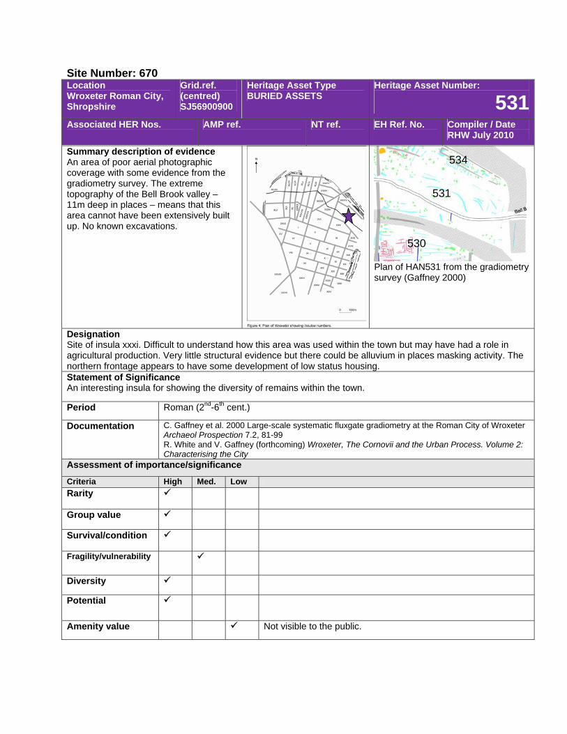
Site Number: 670 Location Wroxeter Roman City, Shropshire
Grid.ref. (centred) SJ56900900
Heritage Asset Type BURIED ASSETS
Heritage Asset Number:
531Associated HER Nos. AMP ref. NT ref. EH Ref. No. Compiler / Date
RHW July 2010
Summary description of evidence An area of poor aerial photographic coverage with some evidence from the gradiometry survey. The extreme topography of the Bell Brook valley – 11m deep in places – means that this area cannot have been extensively built up. No known excavations.
Plan of HAN531 from the gradiometry survey (Gaffney 2000)
Designation Site of insula xxxi. Difficult to understand how this area was used within the town but may have had a role in agricultural production. Very little structural evidence but there could be alluvium in places masking activity. The northern frontage appears to have some development of low status housing. Statement of Significance An interesting insula for showing the diversity of remains within the town.
Period Roman (2nd-6th cent.)
Documentation C. Gaffney et al. 2000 Large-scale systematic fluxgate gradiometry at the Roman City of Wroxeter Archaeol Prospection 7.2, 81-99 R. White and V. Gaffney (forthcoming) Wroxeter, The Cornovii and the Urban Process. Volume 2: Characterising the City
Assessment of importance/significance
Criteria High Med. Low Rarity
Group value
Survival/condition
Fragility/vulnerability
Diversity
Potential
Amenity value Not visible to the public.
534
531
530
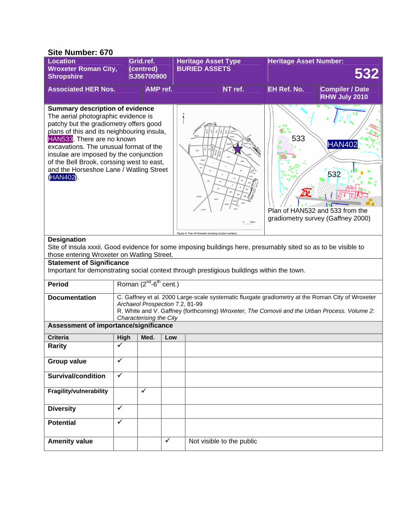
Site Number: 670 Location Wroxeter Roman City, Shropshire
Grid.ref. (centred) SJ56700900
Heritage Asset Type BURIED ASSETS
Heritage Asset Number:
532Associated HER Nos. AMP ref. NT ref. EH Ref. No. Compiler / Date
RHW July 2010
Summary description of evidence The aerial photographic evidence is patchy but the gradiometry offers good plans of this and its neighbouring insula, HAN533. There are no known excavations. The unusual format of the insulae are imposed by the conjunction of the Bell Brook, corssing west to east, and the Horseshoe Lane / Watling Street (HAN402).
Plan of HAN532 and 533 from the gradiometry survey (Gaffney 2000)
Designation Site of insula xxxii. Good evidence for some imposing buildings here, presumably sited so as to be visible to those entering Wroxeter on Watling Street. Statement of Significance Important for demonstrating social context through prestigious buildings within the town.
Period Roman (2nd-6th cent.)
Documentation C. Gaffney et al. 2000 Large-scale systematic fluxgate gradiometry at the Roman City of Wroxeter Archaeol Prospection 7.2, 81-99 R. White and V. Gaffney (forthcoming) Wroxeter, The Cornovii and the Urban Process. Volume 2: Characterising the City
Assessment of importance/significance
Criteria High Med. Low Rarity
Group value
Survival/condition
Fragility/vulnerability
Diversity
Potential
Amenity value Not visible to the public
533 HAN402
532
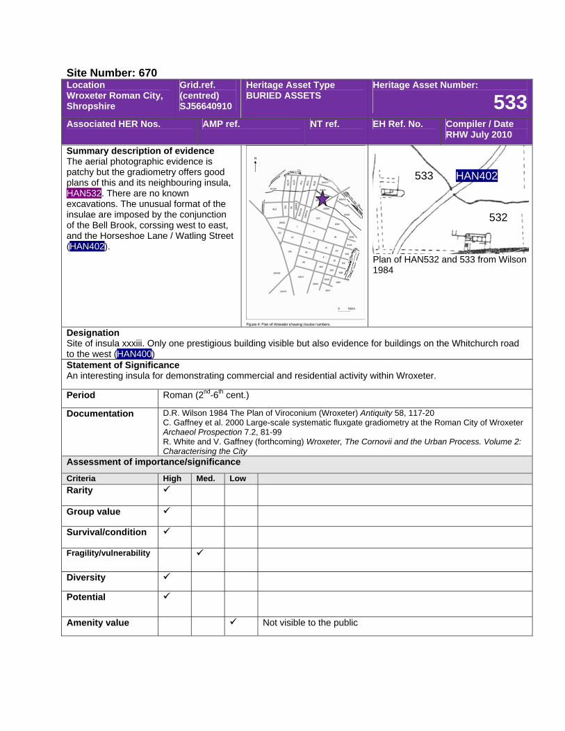
Site Number: 670 Location Wroxeter Roman City, Shropshire
Grid.ref. (centred) SJ56640910
Heritage Asset Type BURIED ASSETS
Heritage Asset Number:
533Associated HER Nos. AMP ref. NT ref. EH Ref. No. Compiler / Date
RHW July 2010
Summary description of evidence The aerial photographic evidence is patchy but the gradiometry offers good plans of this and its neighbouring insula, HAN532. There are no known excavations. The unusual format of the insulae are imposed by the conjunction of the Bell Brook, corssing west to east, and the Horseshoe Lane / Watling Street (HAN402).
Plan of HAN532 and 533 from Wilson 1984
Designation Site of insula xxxiii. Only one prestigious building visible but also evidence for buildings on the Whitchurch road to the west (HAN400) Statement of Significance An interesting insula for demonstrating commercial and residential activity within Wroxeter.
Period Roman (2nd-6th cent.)
Documentation D.R. Wilson 1984 The Plan of Viroconium (Wroxeter) Antiquity 58, 117-20 C. Gaffney et al. 2000 Large-scale systematic fluxgate gradiometry at the Roman City of Wroxeter Archaeol Prospection 7.2, 81-99 R. White and V. Gaffney (forthcoming) Wroxeter, The Cornovii and the Urban Process. Volume 2: Characterising the City
Assessment of importance/significance
Criteria High Med. Low Rarity
Group value
Survival/condition
Fragility/vulnerability
Diversity
Potential
Amenity value Not visible to the public
533 HAN402
532
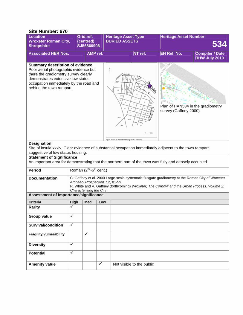
Site Number: 670 Location Wroxeter Roman City, Shropshire
Grid.ref. (centred) SJ56860906
Heritage Asset Type BURIED ASSETS
Heritage Asset Number:
534Associated HER Nos. AMP ref. NT ref. EH Ref. No. Compiler / Date
RHW July 2010
Summary description of evidence Poor aerial photographic evidence but there the gradiometry survey clearly demonstrates extensive low status occupation immediately by the road and behind the town rampart.
Plan of HAN534 in the gradiometry survey (Gaffney 2000)
Designation Site of insula xxxiv. Clear evidence of substantial occupation immediately adjacent to the town rampart suggestive of low status housing. Statement of Significance An important area for demonstrating that the northern part of the town was fully and densely occupied.
Period Roman (2nd-6th cent.)
Documentation C. Gaffney et al. 2000 Large-scale systematic fluxgate gradiometry at the Roman City of Wroxeter Archaeol Prospection 7.2, 81-99 R. White and V. Gaffney (forthcoming) Wroxeter, The Cornovii and the Urban Process. Volume 2: Characterising the City
Assessment of importance/significance
Criteria High Med. Low Rarity
Group value
Survival/condition
Fragility/vulnerability
Diversity
Potential
Amenity value Not visible to the public
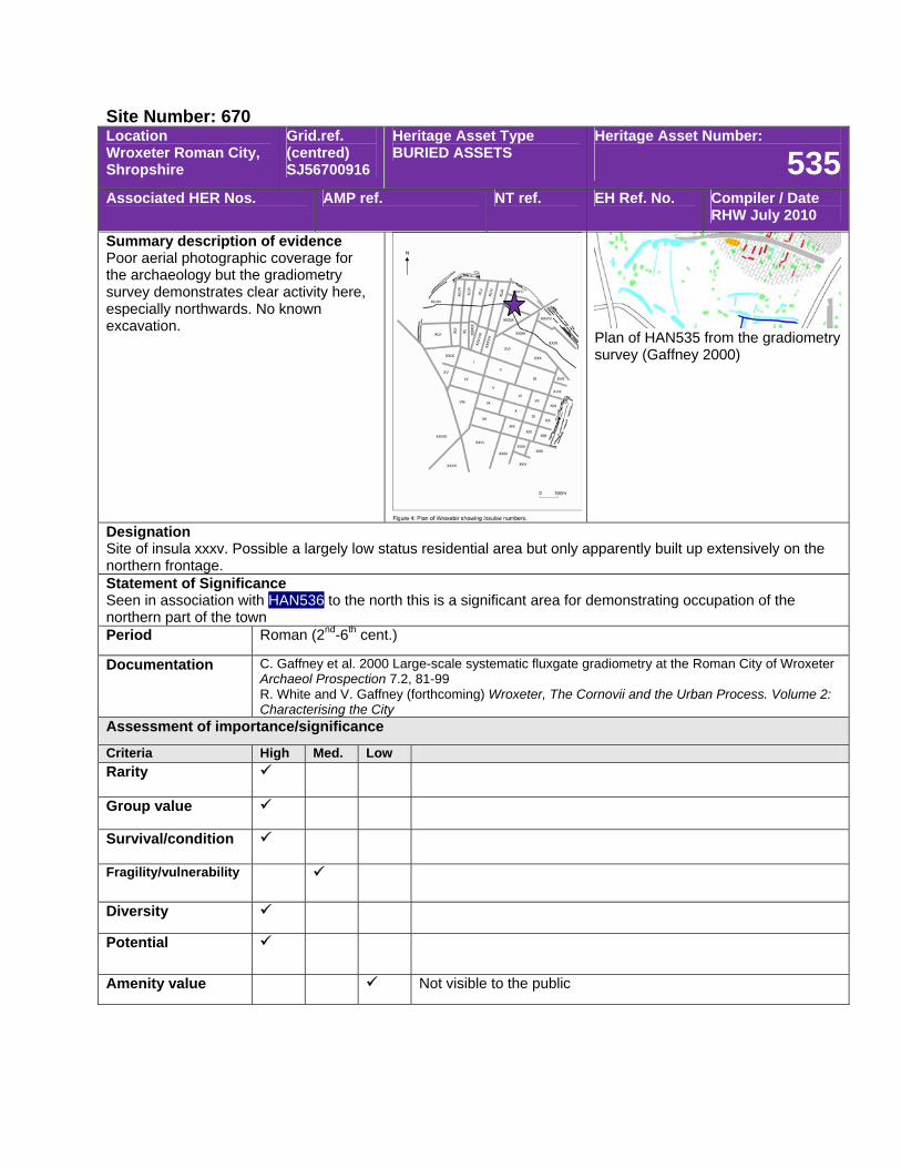
Site Number: 670 Location Wroxeter Roman City, Shropshire
Grid.ref. (centred) SJ56700916
Heritage Asset Type BURIED ASSETS
Heritage Asset Number:
535Associated HER Nos. AMP ref. NT ref. EH Ref. No. Compiler / Date
RHW July 2010
Summary description of evidence Poor aerial photographic coverage for the archaeology but the gradiometry survey demonstrates clear activity here, especially northwards. No known excavation.
Plan of HAN535 from the gradiometry survey (Gaffney 2000)
Designation Site of insula xxxv. Possible a largely low status residential area but only apparently built up extensively on the northern frontage. Statement of Significance Seen in association with HAN536 to the north this is a significant area for demonstrating occupation of the northern part of the town Period Roman (2nd-6th cent.)
Documentation C. Gaffney et al. 2000 Large-scale systematic fluxgate gradiometry at the Roman City of Wroxeter Archaeol Prospection 7.2, 81-99 R. White and V. Gaffney (forthcoming) Wroxeter, The Cornovii and the Urban Process. Volume 2: Characterising the City
Assessment of importance/significance
Criteria High Med. Low Rarity
Group value
Survival/condition
Fragility/vulnerability
Diversity
Potential
Amenity value Not visible to the public
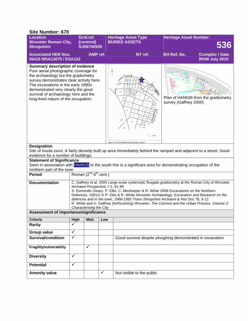
Site Number: 670 Location Wroxeter Roman City, Shropshire
Grid.ref. (centred) SJ56740928
Heritage Asset Type BURIED ASSETS
Heritage Asset Number:
536Associated HER Nos. 06415 MSA13075 / ESA123
AMP ref. NT ref. EH Ref. No. Compiler / Date RHW July 2010
Summary description of evidence Poor aerial photographic coverage for the archaeology but the gradiometry survey demonstrates clear activity here. The excavations in the early 1990s demonstrated very clearly the good survival of archaeology here and the long-lived nature of the occupation. Plan of HAN536 from the gradiometry
survey (Gaffney 2000)
Designation Site of insula xxxvi. A fairly densely built up area immediately behind the rampart and adjacent to a street. Good evidence for a number of buildings. Statement of Significance Seen in association with HAN535 to the south this is a significant area for demonstrating occupation of the northern part of the town Period Roman (2nd-6th cent.)
Documentation C. Gaffney et al. 2000 Large-scale systematic fluxgate gradiometry at the Roman City of Wroxeter Archaeol Prospection 7.2, 81-99 S. Esmonde Cleary, P. Ellis, C. Meckseper & R. White 2006 Excavations on the Northern Defences, 1991/2 In P. Ellis & R. White Wroxeter Archaeology. Excavation and Research on the defences and in the town, 1968-1992 Trans Shropshire Archaeol & Hist Soc 78, 5-12 R. White and V. Gaffney (forthcoming) Wroxeter, The Cornovii and the Urban Process. Volume 2: Characterising the City
Assessment of importance/significance
Criteria High Med. Low Rarity
Group value Survival/condition Good survival despite ploughing demonstrated in excavation
Fragility/vulnerability
Diversity
Potential
Amenity value Not visible to the public
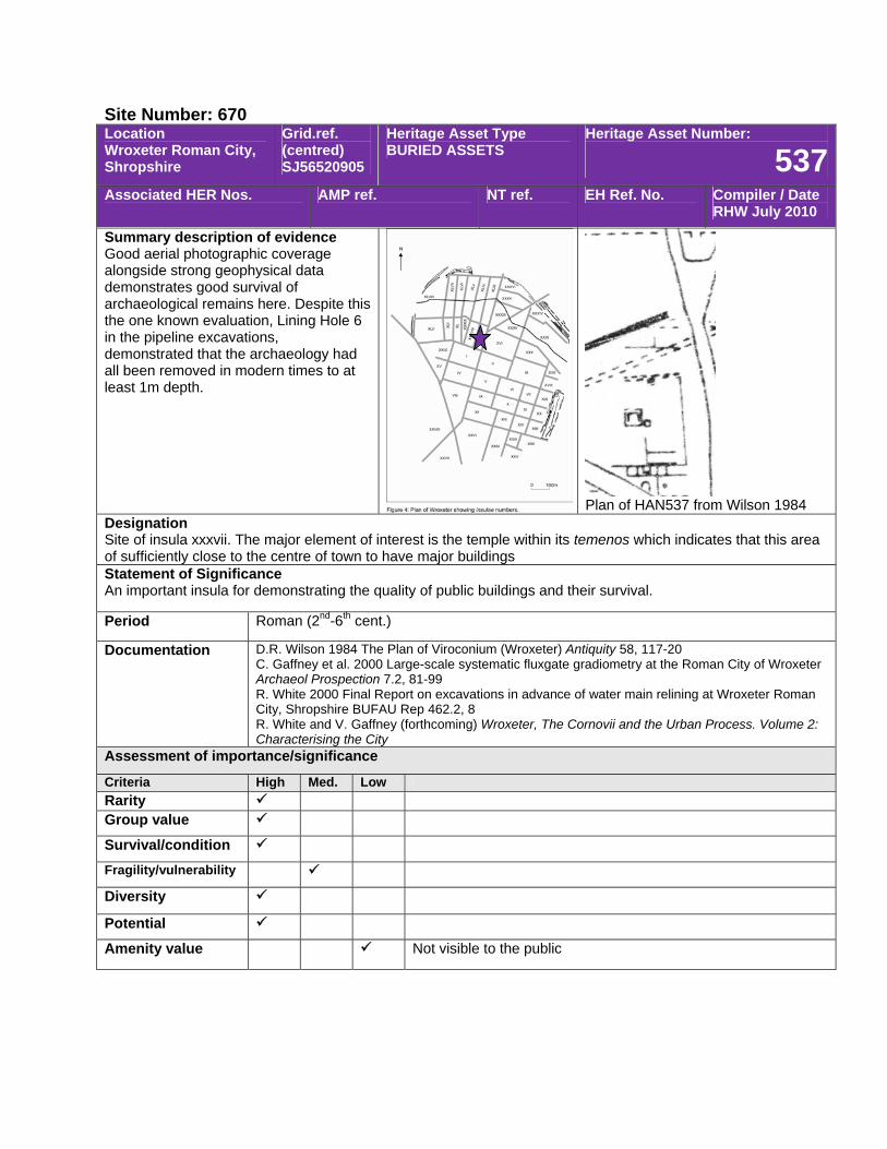
Site Number: 670 Location Wroxeter Roman City, Shropshire
Grid.ref. (centred) SJ56520905
Heritage Asset Type BURIED ASSETS
Heritage Asset Number:
537Associated HER Nos. AMP ref. NT ref. EH Ref. No. Compiler / Date
RHW July 2010
Summary description of evidence Good aerial photographic coverage alongside strong geophysical data demonstrates good survival of archaeological remains here. Despite this the one known evaluation, Lining Hole 6 in the pipeline excavations, demonstrated that the archaeology had all been removed in modern times to at least 1m depth.
Plan of HAN537 from Wilson 1984
Designation Site of insula xxxvii. The major element of interest is the temple within its temenos which indicates that this area of sufficiently close to the centre of town to have major buildings Statement of Significance An important insula for demonstrating the quality of public buildings and their survival.
Period Roman (2nd-6th cent.)
Documentation D.R. Wilson 1984 The Plan of Viroconium (Wroxeter) Antiquity 58, 117-20 C. Gaffney et al. 2000 Large-scale systematic fluxgate gradiometry at the Roman City of Wroxeter Archaeol Prospection 7.2, 81-99 R. White 2000 Final Report on excavations in advance of water main relining at Wroxeter Roman City, Shropshire BUFAU Rep 462.2, 8 R. White and V. Gaffney (forthcoming) Wroxeter, The Cornovii and the Urban Process. Volume 2: Characterising the City
Assessment of importance/significance
Criteria High Med. Low Rarity Group value
Survival/condition
Fragility/vulnerability
Diversity
Potential
Amenity value Not visible to the public

Site Number: 670 Location Wroxeter Roman City, Shropshire
Grid.ref. (centred) SJ56470905
Heritage Asset Type BURIED ASSETS
Heritage Asset Number:
538Associated HER Nos. AMP ref. NT ref. EH Ref. No. Compiler / Date
RHW July 2010
Summary description of evidence Poor aerial photographic evidence but the geophysics demonstrates evidence of pitting over much of the insula. No excavation known.
Plan of HAN538 from gradiometry survey (Gaffney 2000)
Designation Site of insula xxxviii. This and the nearby insulae to the west, appear to have a large number of pits of industrial size. It may be evidence for a water-related industry. Statement of Significance Difficult to assess without further evidence but if an industrial zone this would be a very significant area.
Period Roman (2nd-6th cent.)
Documentation C. Gaffney et al. 2000 Large-scale systematic fluxgate gradiometry at the Roman City of Wroxeter Archaeol Prospection 7.2, 81-99 R. White and V. Gaffney (forthcoming) Wroxeter, The Cornovii and the Urban Process. Volume 2: Characterising the City
Assessment of importance/significance
Criteria High Med. Low Rarity
Group value
Survival/condition
Fragility/vulnerability
Diversity
Potential
Amenity value Not visible to the public
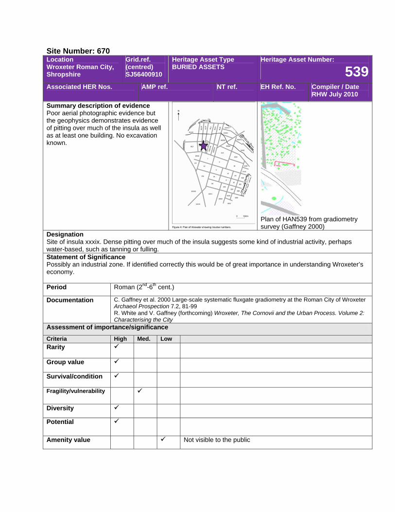
Site Number: 670 Location Wroxeter Roman City, Shropshire
Grid.ref. (centred) SJ56400910
Heritage Asset Type BURIED ASSETS
Heritage Asset Number:
539Associated HER Nos. AMP ref. NT ref. EH Ref. No. Compiler / Date
RHW July 2010
Summary description of evidence Poor aerial photographic evidence but the geophysics demonstrates evidence of pitting over much of the insula as well as at least one building. No excavation known.
Plan of HAN539 from gradiometry survey (Gaffney 2000)
Designation Site of insula xxxix. Dense pitting over much of the insula suggests some kind of industrial activity, perhaps water-based, such as tanning or fulling. Statement of Significance Possibly an industrial zone. If identified correctly this would be of great importance in understanding Wroxeter’s economy. Period Roman (2nd-6th cent.)
Documentation C. Gaffney et al. 2000 Large-scale systematic fluxgate gradiometry at the Roman City of Wroxeter Archaeol Prospection 7.2, 81-99 R. White and V. Gaffney (forthcoming) Wroxeter, The Cornovii and the Urban Process. Volume 2: Characterising the City
Assessment of importance/significance
Criteria High Med. Low Rarity
Group value
Survival/condition
Fragility/vulnerability
Diversity
Potential
Amenity value Not visible to the public
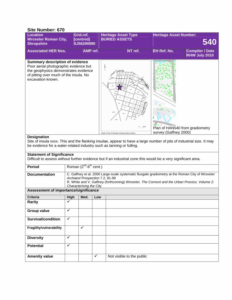
Site Number: 670 Location Wroxeter Roman City, Shropshire
Grid.ref. (centred) SJ56290890
Heritage Asset Type BURIED ASSETS
Heritage Asset Number:
540Associated HER Nos. AMP ref. NT ref. EH Ref. No. Compiler / Date
RHW July 2010
Summary description of evidence Poor aerial photographic evidence but the geophysics demonstrates evidence of pitting over much of the insula. No excavation known.
Plan of HAN540 from gradiometry survey (Gaffney 2000)
Designation Site of insula xxxx. This and the flanking insulae, appear to have a large number of pits of industrial size. It may be evidence for a water-related industry such as tanning or fulling. Statement of Significance Difficult to assess without further evidence but if an industrial zone this would be a very significant area.
Period Roman (2nd-6th cent.)
Documentation C. Gaffney et al. 2000 Large-scale systematic fluxgate gradiometry at the Roman City of Wroxeter Archaeol Prospection 7.2, 81-99 R. White and V. Gaffney (forthcoming) Wroxeter, The Cornovii and the Urban Process. Volume 2: Characterising the City
Assessment of importance/significance
Criteria High Med. Low Rarity
Group value
Survival/condition
Fragility/vulnerability
Diversity
Potential
Amenity value Not visible to the public
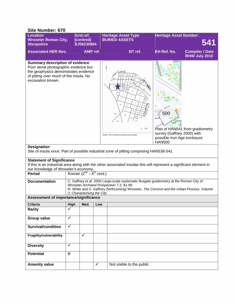
Site Number: 670 Location Wroxeter Roman City, Shropshire
Grid.ref. (centred) SJ56230894
Heritage Asset Type BURIED ASSETS
Heritage Asset Number:
541Associated HER Nos. AMP ref. NT ref. EH Ref. No. Compiler / Date
RHW July 2010
Summary description of evidence Poor aerial photographic evidence but the geophysics demonstrates evidence of pitting over much of the insula. No excavation known.
Plan of HAN541 from gradiometry survey (Gaffney 2000) with possible Iron Age enclosure HAN500
Designation Site of insula xxxxi. Part of possible industrial zone of pitting comprising HAN538-541. Statement of Significance If this is an industrial area along with the other associated insulae this will represent a significant element in our knowledge of Wroxeter’s economy. Period Roman (2nd – 6th cent.)
Documentation C. Gaffney et al. 2000 Large-scale systematic fluxgate gradiometry at the Roman City of Wroxeter Archaeol Prospection 7.2, 81-99 R. White and V. Gaffney (forthcoming) Wroxeter, The Cornovii and the Urban Process. Volume 2: Characterising the City
Assessment of importance/significance
Criteria High Med. Low Rarity
Group value
Survival/condition
Fragility/vulnerability
Diversity
Potential V
Amenity value Not visible to the public
500
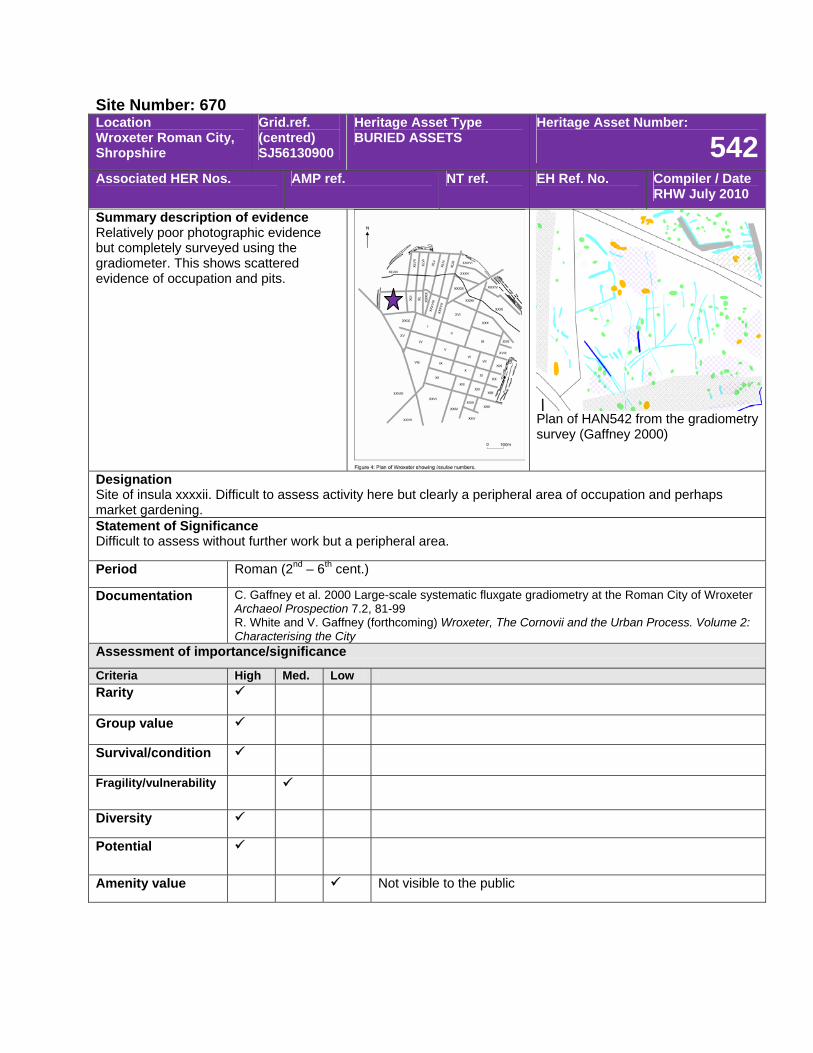
Site Number: 670 Location Wroxeter Roman City, Shropshire
Grid.ref. (centred) SJ56130900
Heritage Asset Type BURIED ASSETS
Heritage Asset Number:
542Associated HER Nos. AMP ref. NT ref. EH Ref. No. Compiler / Date
RHW July 2010
Summary description of evidence Relatively poor photographic evidence but completely surveyed using the gradiometer. This shows scattered evidence of occupation and pits.
Plan of HAN542 from the gradiometry survey (Gaffney 2000)
Designation Site of insula xxxxii. Difficult to assess activity here but clearly a peripheral area of occupation and perhaps market gardening. Statement of Significance Difficult to assess without further work but a peripheral area.
Period Roman (2nd – 6th cent.)
Documentation C. Gaffney et al. 2000 Large-scale systematic fluxgate gradiometry at the Roman City of Wroxeter Archaeol Prospection 7.2, 81-99 R. White and V. Gaffney (forthcoming) Wroxeter, The Cornovii and the Urban Process. Volume 2: Characterising the City
Assessment of importance/significance
Criteria High Med. Low Rarity
Group value
Survival/condition
Fragility/vulnerability
Diversity
Potential
Amenity value Not visible to the public
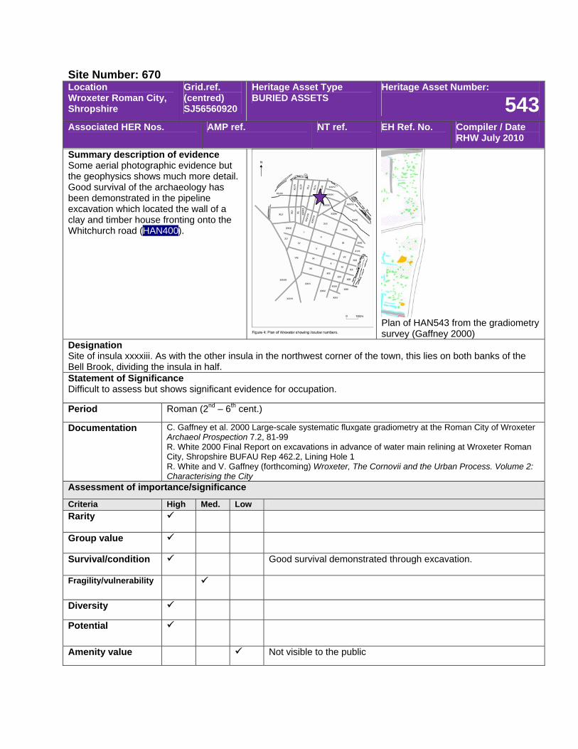
Site Number: 670 Location Wroxeter Roman City, Shropshire
Grid.ref. (centred) SJ56560920
Heritage Asset Type BURIED ASSETS
Heritage Asset Number:
543Associated HER Nos. AMP ref. NT ref. EH Ref. No. Compiler / Date
RHW July 2010
Summary description of evidence Some aerial photographic evidence but the geophysics shows much more detail. Good survival of the archaeology has been demonstrated in the pipeline excavation which located the wall of a clay and timber house fronting onto the Whitchurch road (HAN400).
Plan of HAN543 from the gradiometry survey (Gaffney 2000)
Designation Site of insula xxxxiii. As with the other insula in the northwest corner of the town, this lies on both banks of the Bell Brook, dividing the insula in half. Statement of Significance Difficult to assess but shows significant evidence for occupation.
Period Roman (2nd – 6th cent.)
Documentation C. Gaffney et al. 2000 Large-scale systematic fluxgate gradiometry at the Roman City of Wroxeter Archaeol Prospection 7.2, 81-99 R. White 2000 Final Report on excavations in advance of water main relining at Wroxeter Roman City, Shropshire BUFAU Rep 462.2, Lining Hole 1 R. White and V. Gaffney (forthcoming) Wroxeter, The Cornovii and the Urban Process. Volume 2: Characterising the City
Assessment of importance/significance
Criteria High Med. Low Rarity
Group value
Survival/condition Good survival demonstrated through excavation.
Fragility/vulnerability
Diversity
Potential
Amenity value Not visible to the public

Site Number: 670 Location Wroxeter Roman City, Shropshire
Grid.ref. (centred) SJ56500920
Heritage Asset Type BURIED ASSETS
Heritage Asset Number:
544Associated HER Nos. AMP ref. NT ref. EH Ref. No. Compiler / Date
RHW July 2010
Summary description of evidence Relatively poor aerial photographic evidence but hte gradiometry plot appears to show some small buildings and industrial activity. The north end of the insula underlies the defences of the later town.
Plan of HAN544 from the gradiometry survey (Gaffney 2000)
Designation Site of insula xxxxiv. The northern end of this and the neighbouring insulae are overlain by the ramparts of the town demonstrating that the street grid was laid out here before the town defences were constructed at the end of the 2nd cent. Statement of Significance An important insulae for demonstrating that the town grid was established at its full extent in the early civil period. Period Roman (2nd – 6th cent.)
Documentation C. Gaffney et al. 2000 Large-scale systematic fluxgate gradiometry at the Roman City of Wroxeter Archaeol Prospection 7.2, 81-99 R. White and V. Gaffney (forthcoming) Wroxeter, The Cornovii and the Urban Process. Volume 2: Characterising the City
Assessment of importance/significance
Criteria High Med. Low Rarity
Group value
Survival/condition
Fragility/vulnerability
Diversity
Potential
Amenity value Not visible to the public
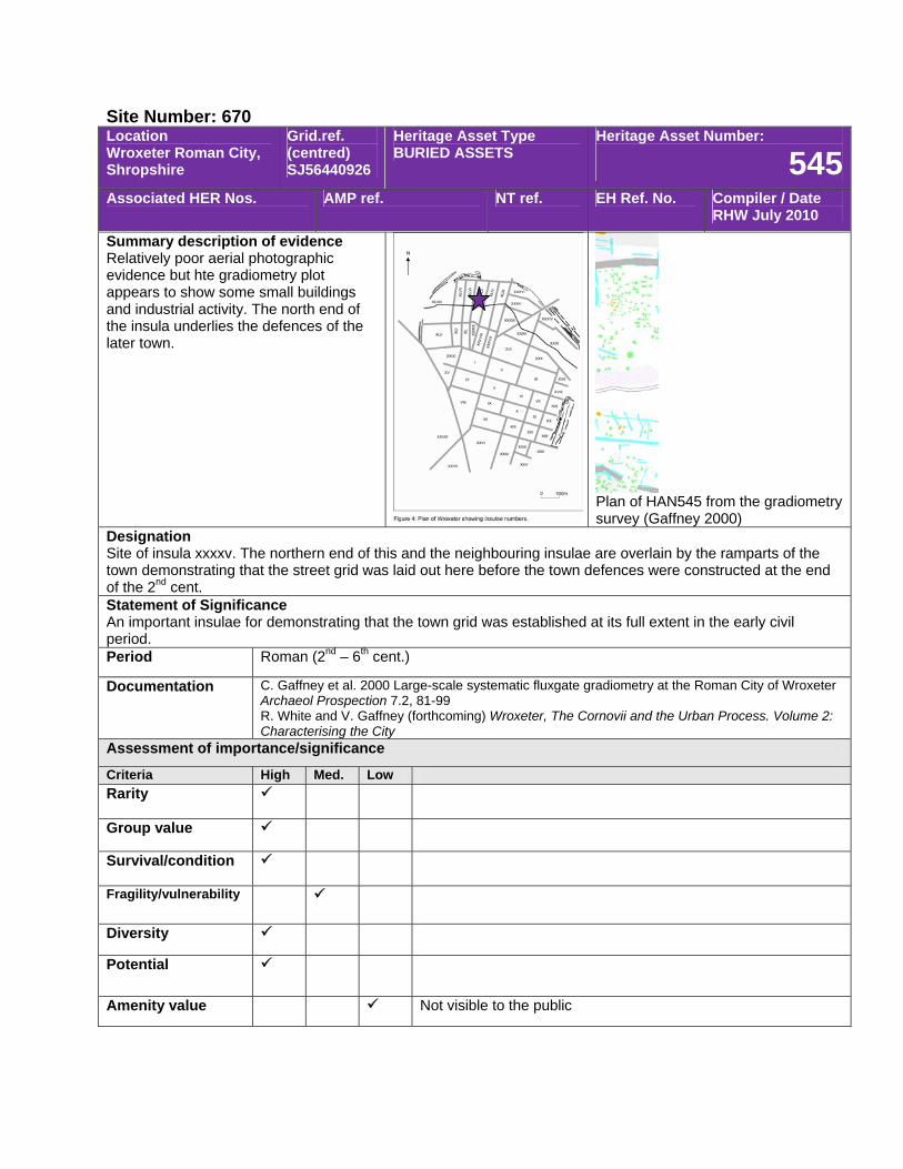
Site Number: 670 Location Wroxeter Roman City, Shropshire
Grid.ref. (centred) SJ56440926
Heritage Asset Type BURIED ASSETS
Heritage Asset Number:
545Associated HER Nos. AMP ref. NT ref. EH Ref. No. Compiler / Date
RHW July 2010
Summary description of evidence Relatively poor aerial photographic evidence but hte gradiometry plot appears to show some small buildings and industrial activity. The north end of the insula underlies the defences of the later town.
Plan of HAN545 from the gradiometry survey (Gaffney 2000)
Designation Site of insula xxxxv. The northern end of this and the neighbouring insulae are overlain by the ramparts of the town demonstrating that the street grid was laid out here before the town defences were constructed at the end of the 2nd cent. Statement of Significance An important insulae for demonstrating that the town grid was established at its full extent in the early civil period. Period Roman (2nd – 6th cent.)
Documentation C. Gaffney et al. 2000 Large-scale systematic fluxgate gradiometry at the Roman City of Wroxeter Archaeol Prospection 7.2, 81-99 R. White and V. Gaffney (forthcoming) Wroxeter, The Cornovii and the Urban Process. Volume 2: Characterising the City
Assessment of importance/significance
Criteria High Med. Low Rarity
Group value
Survival/condition
Fragility/vulnerability
Diversity
Potential
Amenity value Not visible to the public
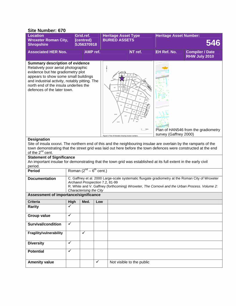
Site Number: 670 Location Wroxeter Roman City, Shropshire
Grid.ref. (centred) SJ56370918
Heritage Asset Type BURIED ASSETS
Heritage Asset Number:
546Associated HER Nos. AMP ref. NT ref. EH Ref. No. Compiler / Date
RHW July 2010
Summary description of evidence Relatively poor aerial photographic evidence but hte gradiometry plot appears to show some small buildings and industrial activity, notably pitting. The north end of the insula underlies the defences of the later town.
Plan of HAN546 from the gradiometry survey (Gaffney 2000)
Designation Site of insula xxxxvi. The northern end of this and the neighbouring insulae are overlain by the ramparts of the town demonstrating that the street grid was laid out here before the town defences were constructed at the end of the 2nd cent. Statement of Significance An important insulae for demonstrating that the town grid was established at its full extent in the early civil period. Period Roman (2nd – 6th cent.)
Documentation C. Gaffney et al. 2000 Large-scale systematic fluxgate gradiometry at the Roman City of Wroxeter Archaeol Prospection 7.2, 81-99 R. White and V. Gaffney (forthcoming) Wroxeter, The Cornovii and the Urban Process. Volume 2: Characterising the City
Assessment of importance/significance
Criteria High Med. Low Rarity
Group value
Survival/condition
Fragility/vulnerability
Diversity
Potential
Amenity value Not visible to the public
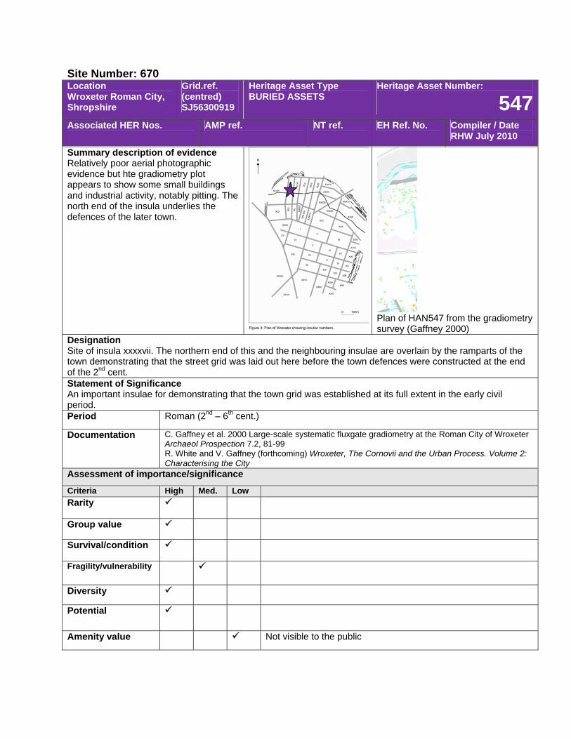
Site Number: 670 Location Wroxeter Roman City, Shropshire
Grid.ref. (centred) SJ56300919
Heritage Asset Type BURIED ASSETS
Heritage Asset Number:
547Associated HER Nos. AMP ref. NT ref. EH Ref. No. Compiler / Date
RHW July 2010
Summary description of evidence Relatively poor aerial photographic evidence but hte gradiometry plot appears to show some small buildings and industrial activity, notably pitting. The north end of the insula underlies the defences of the later town.
Plan of HAN547 from the gradiometry survey (Gaffney 2000)
Designation Site of insula xxxxvii. The northern end of this and the neighbouring insulae are overlain by the ramparts of the town demonstrating that the street grid was laid out here before the town defences were constructed at the end of the 2nd cent. Statement of Significance An important insulae for demonstrating that the town grid was established at its full extent in the early civil period. Period Roman (2nd – 6th cent.)
Documentation C. Gaffney et al. 2000 Large-scale systematic fluxgate gradiometry at the Roman City of Wroxeter Archaeol Prospection 7.2, 81-99 R. White and V. Gaffney (forthcoming) Wroxeter, The Cornovii and the Urban Process. Volume 2: Characterising the City
Assessment of importance/significance
Criteria High Med. Low Rarity
Group value
Survival/condition
Fragility/vulnerability
Diversity
Potential
Amenity value Not visible to the public
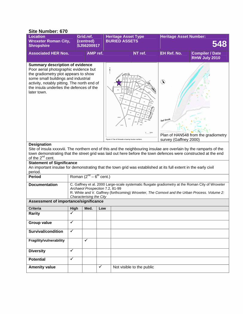
Site Number: 670 Location Wroxeter Roman City, Shropshire
Grid.ref. (centred) SJ56200917
Heritage Asset Type BURIED ASSETS
Heritage Asset Number:
548Associated HER Nos. AMP ref. NT ref. EH Ref. No. Compiler / Date
RHW July 2010
Summary description of evidence Poor aerial photographic evidence but the gradiometry plot appears to show some small buildings and industrial activity, notably pitting. The north end of the insula underlies the defences of the later town.
Plan of HAN548 from the gradiometry survey (Gaffney 2000)
Designation Site of insula xxxxviii. The northern end of this and the neighbouring insulae are overlain by the ramparts of the town demonstrating that the street grid was laid out here before the town defences were constructed at the end of the 2nd cent. Statement of Significance An important insulae for demonstrating that the town grid was established at its full extent in the early civil period. Period Roman (2nd – 6th cent.)
Documentation C. Gaffney et al. 2000 Large-scale systematic fluxgate gradiometry at the Roman City of Wroxeter Archaeol Prospection 7.2, 81-99 R. White and V. Gaffney (forthcoming) Wroxeter, The Cornovii and the Urban Process. Volume 2: Characterising the City
Assessment of importance/significance
Criteria High Med. Low Rarity
Group value
Survival/condition
Fragility/vulnerability
Diversity
Potential
Amenity value Not visible to the public
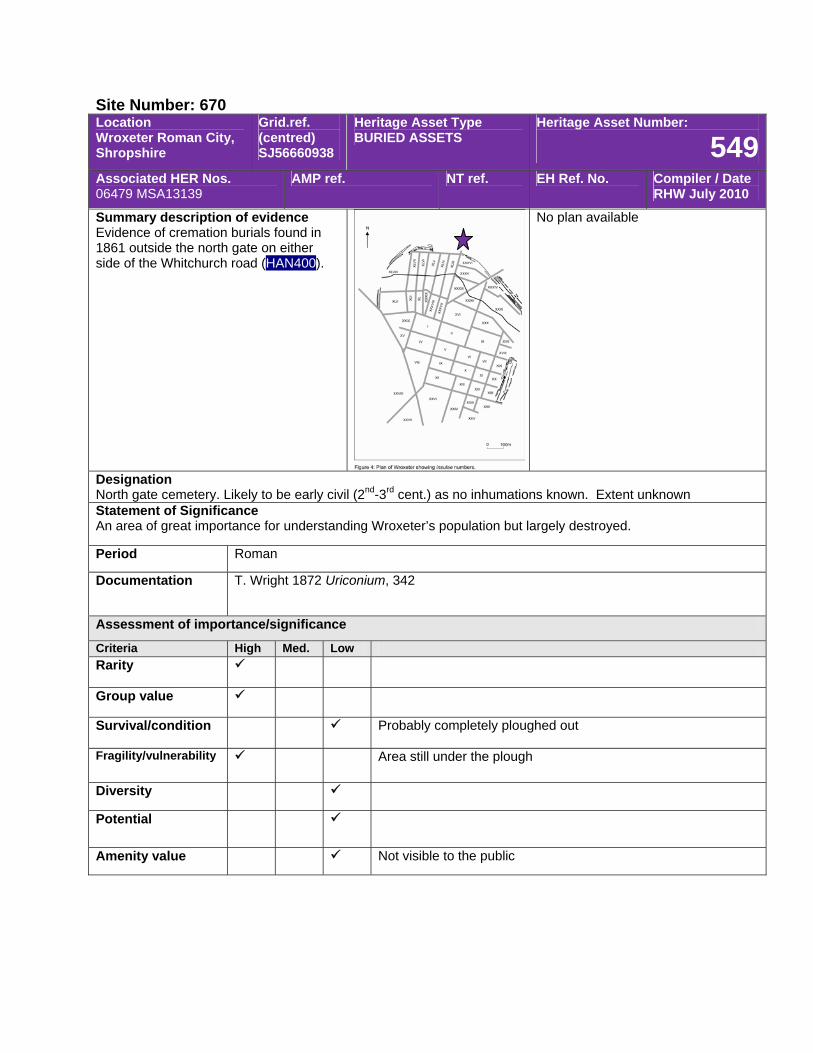
Site Number: 670 Location Wroxeter Roman City, Shropshire
Grid.ref. (centred) SJ56660938
Heritage Asset Type BURIED ASSETS
Heritage Asset Number:
549Associated HER Nos. 06479 MSA13139
AMP ref. NT ref. EH Ref. No. Compiler / Date RHW July 2010
Summary description of evidence Evidence of cremation burials found in 1861 outside the north gate on either side of the Whitchurch road (HAN400).
No plan available
Designation North gate cemetery. Likely to be early civil (2nd-3rd cent.) as no inhumations known. Extent unknown Statement of Significance An area of great importance for understanding Wroxeter’s population but largely destroyed.
Period Roman
Documentation T. Wright 1872 Uriconium, 342
Assessment of importance/significance
Criteria High Med. Low Rarity
Group value
Survival/condition Probably completely ploughed out
Fragility/vulnerability Area still under the plough
Diversity
Potential
Amenity value Not visible to the public
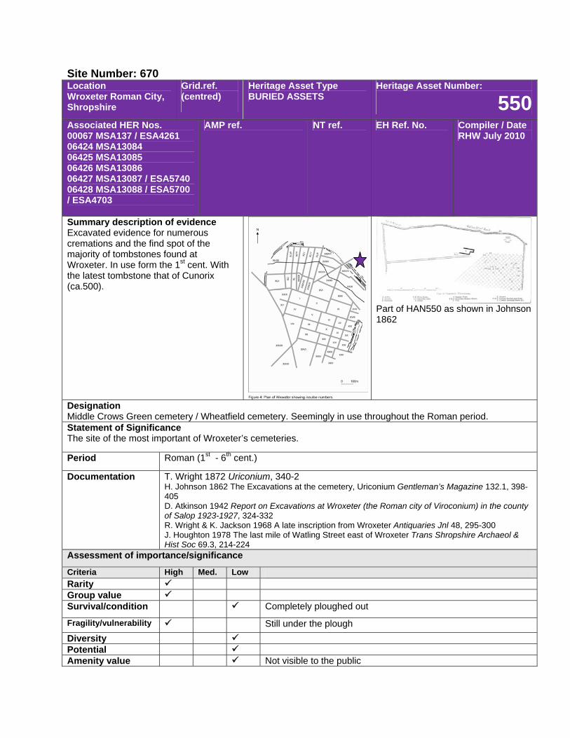
Site Number: 670 Location Wroxeter Roman City, Shropshire
Grid.ref. (centred)
Heritage Asset Type BURIED ASSETS
Heritage Asset Number:
550Associated HER Nos. 00067 MSA137 / ESA4261 06424 MSA13084 06425 MSA13085 06426 MSA13086 06427 MSA13087 / ESA5740 06428 MSA13088 / ESA5700 / ESA4703
AMP ref. NT ref. EH Ref. No. Compiler / Date RHW July 2010
Summary description of evidence Excavated evidence for numerous cremations and the find spot of the majority of tombstones found at Wroxeter. In use form the 1st cent. With the latest tombstone that of Cunorix (ca.500).
Part of HAN550 as shown in Johnson 1862
Designation Middle Crows Green cemetery / Wheatfield cemetery. Seemingly in use throughout the Roman period. Statement of Significance The site of the most important of Wroxeter’s cemeteries.
Period Roman (1st - 6th cent.)
Documentation T. Wright 1872 Uriconium, 340-2 H. Johnson 1862 The Excavations at the cemetery, Uriconium Gentleman’s Magazine 132.1, 398-405 D. Atkinson 1942 Report on Excavations at Wroxeter (the Roman city of Viroconium) in the county of Salop 1923-1927, 324-332 R. Wright & K. Jackson 1968 A late inscription from Wroxeter Antiquaries Jnl 48, 295-300 J. Houghton 1978 The last mile of Watling Street east of Wroxeter Trans Shropshire Archaeol & Hist Soc 69.3, 214-224
Assessment of importance/significance
Criteria High Med. Low Rarity Group value Survival/condition Completely ploughed out
Fragility/vulnerability Still under the plough Diversity Potential Amenity value Not visible to the public
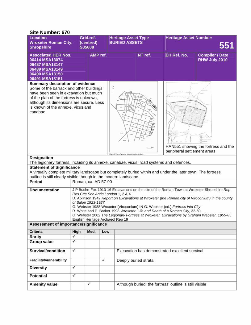
Site Number: 670 Location Wroxeter Roman City, Shropshire
Grid.ref. (centred) SJ5608
Heritage Asset Type BURIED ASSETS
Heritage Asset Number:
551Associated HER Nos. 06414 MSA13074 06487 MSA13147 06489 MSA13149 06490 MSA13150 06491 MSA13151
AMP ref. NT ref. EH Ref. No. Compiler / Date RHW July 2010
Summary description of evidence Some of the barrack and other buildings have been seen in excavation but much of the plan of the fortress is unknown, although its dimensions are secure. Less is known of the annexe, vicus and canabae.
HAN551 showing the fortress and the peripheral settlement areas
Designation The legionary fortress, including its annexe, canabae, vicus, road systems and defences. Statement of Significance A virtually complete military landscape but completely buried within and under the later town. The fortress’ outline is still clearly visible though in the modern landscape. Period Roman, ca. AD 57-90
Documentation J P Bushe-Fox 1913-16 Excavations on the site of the Roman Town at Wroxeter Shropshire Rep Res Ctte Soc Antiq London 1, 2 & 4 D. Atkinson 1942 Report on Excavations at Wroxeter (the Roman city of Viroconium) in the county of Salop 1923-1927 G. Webster 1988 Wroxeter (Viroconium) IN G. Webster (ed.) Fortress into City R. White and P. Barker 1998 Wroxeter. Life and Death of a Roman City, 32-50 G. Webster 2002 The Legionary Fortress at Wroxeter. Excavations by Graham Webster, 1955-85 English Heritage Archaeol Rep 19
Assessment of importance/significance
Criteria High Med. Low Rarity Group value
Survival/condition Excavation has demonstrated excellent survival
Fragility/vulnerability Deeply buried strata
Diversity
Potential
Amenity value Although buried, the fortress’ outline is still visible
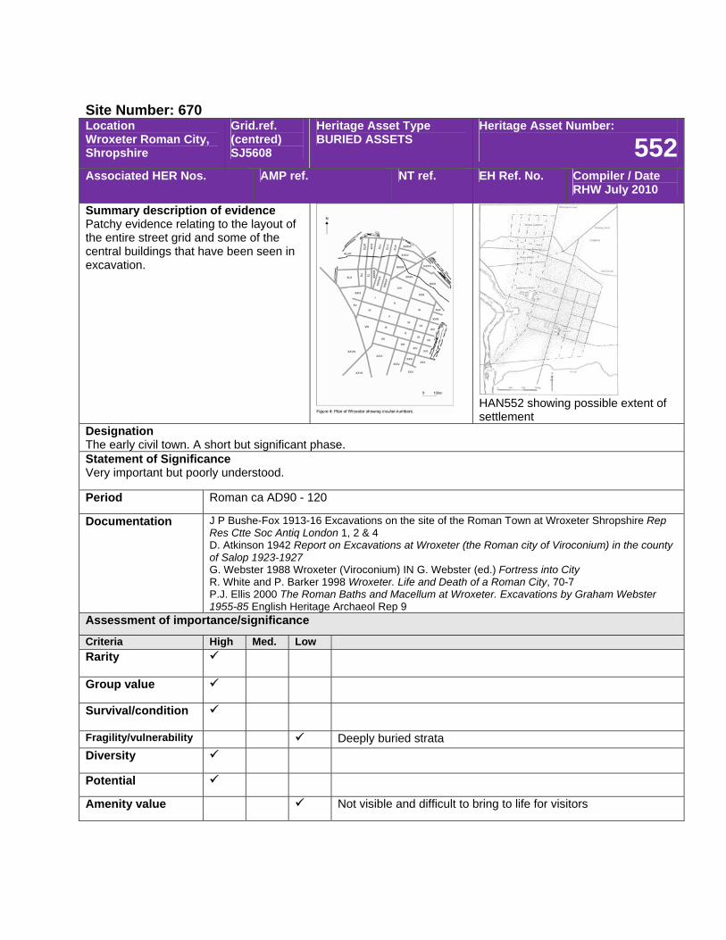
Site Number: 670 Location Wroxeter Roman City, Shropshire
Grid.ref. (centred) SJ5608
Heritage Asset Type BURIED ASSETS
Heritage Asset Number:
552Associated HER Nos. AMP ref. NT ref. EH Ref. No. Compiler / Date
RHW July 2010
Summary description of evidence Patchy evidence relating to the layout of the entire street grid and some of the central buildings that have been seen in excavation.
HAN552 showing possible extent of settlement
Designation The early civil town. A short but significant phase. Statement of Significance Very important but poorly understood.
Period Roman ca AD90 - 120
Documentation J P Bushe-Fox 1913-16 Excavations on the site of the Roman Town at Wroxeter Shropshire Rep Res Ctte Soc Antiq London 1, 2 & 4 D. Atkinson 1942 Report on Excavations at Wroxeter (the Roman city of Viroconium) in the county of Salop 1923-1927 G. Webster 1988 Wroxeter (Viroconium) IN G. Webster (ed.) Fortress into City R. White and P. Barker 1998 Wroxeter. Life and Death of a Roman City, 70-7 P.J. Ellis 2000 The Roman Baths and Macellum at Wroxeter. Excavations by Graham Webster 1955-85 English Heritage Archaeol Rep 9
Assessment of importance/significance
Criteria High Med. Low Rarity
Group value
Survival/condition
Fragility/vulnerability Deeply buried strata Diversity
Potential
Amenity value Not visible and difficult to bring to life for visitors
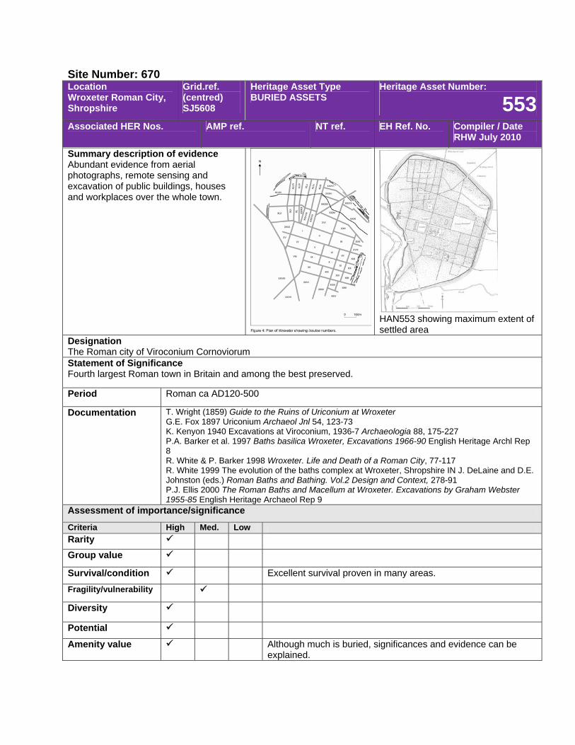
Site Number: 670 Location Wroxeter Roman City, Shropshire
Grid.ref. (centred) SJ5608
Heritage Asset Type BURIED ASSETS
Heritage Asset Number:
553Associated HER Nos. AMP ref. NT ref. EH Ref. No. Compiler / Date
RHW July 2010
Summary description of evidence Abundant evidence from aerial photographs, remote sensing and excavation of public buildings, houses and workplaces over the whole town.
HAN553 showing maximum extent of settled area
Designation The Roman city of Viroconium Cornoviorum Statement of Significance Fourth largest Roman town in Britain and among the best preserved.
Period Roman ca AD120-500
Documentation T. Wright (1859) Guide to the Ruins of Uriconium at Wroxeter G.E. Fox 1897 Uriconium Archaeol Jnl 54, 123-73 K. Kenyon 1940 Excavations at Viroconium, 1936-7 Archaeologia 88, 175-227 P.A. Barker et al. 1997 Baths basilica Wroxeter, Excavations 1966-90 English Heritage Archl Rep 8 R. White & P. Barker 1998 Wroxeter. Life and Death of a Roman City, 77-117 R. White 1999 The evolution of the baths complex at Wroxeter, Shropshire IN J. DeLaine and D.E. Johnston (eds.) Roman Baths and Bathing. Vol.2 Design and Context, 278-91 P.J. Ellis 2000 The Roman Baths and Macellum at Wroxeter. Excavations by Graham Webster 1955-85 English Heritage Archaeol Rep 9
Assessment of importance/significance
Criteria High Med. Low Rarity Group value
Survival/condition Excellent survival proven in many areas.
Fragility/vulnerability
Diversity
Potential
Amenity value Although much is buried, significances and evidence can be explained.
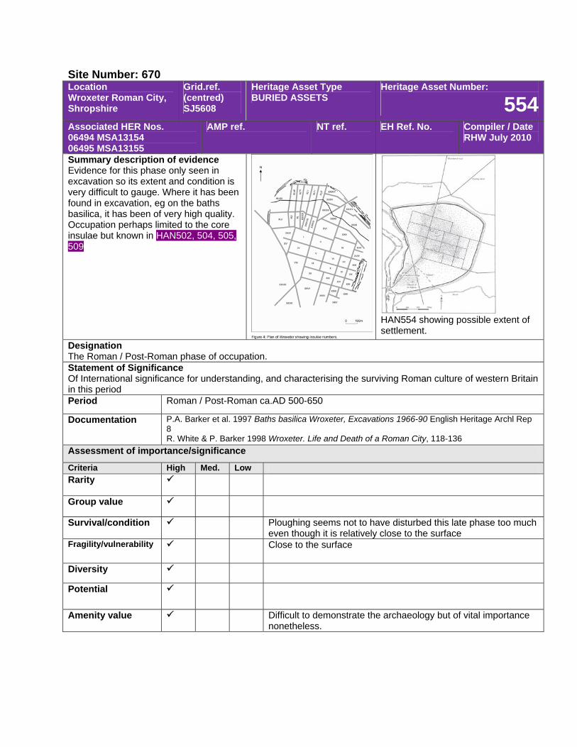
Site Number: 670 Location Wroxeter Roman City, Shropshire
Grid.ref. (centred) SJ5608
Heritage Asset Type BURIED ASSETS
Heritage Asset Number:
554Associated HER Nos. 06494 MSA13154 06495 MSA13155
AMP ref. NT ref. EH Ref. No. Compiler / Date RHW July 2010
Summary description of evidence Evidence for this phase only seen in excavation so its extent and condition is very difficult to gauge. Where it has been found in excavation, eg on the baths basilica, it has been of very high quality. Occupation perhaps limited to the core insulae but known in HAN502, 504, 505, 509
HAN554 showing possible extent of settlement.
Designation The Roman / Post-Roman phase of occupation. Statement of Significance Of International significance for understanding, and characterising the surviving Roman culture of western Britain in this period Period Roman / Post-Roman ca.AD 500-650
Documentation P.A. Barker et al. 1997 Baths basilica Wroxeter, Excavations 1966-90 English Heritage Archl Rep 8 R. White & P. Barker 1998 Wroxeter. Life and Death of a Roman City, 118-136
Assessment of importance/significance
Criteria High Med. Low Rarity
Group value
Survival/condition Ploughing seems not to have disturbed this late phase too much even though it is relatively close to the surface
Fragility/vulnerability Close to the surface
Diversity
Potential
Amenity value Difficult to demonstrate the archaeology but of vital importance nonetheless.
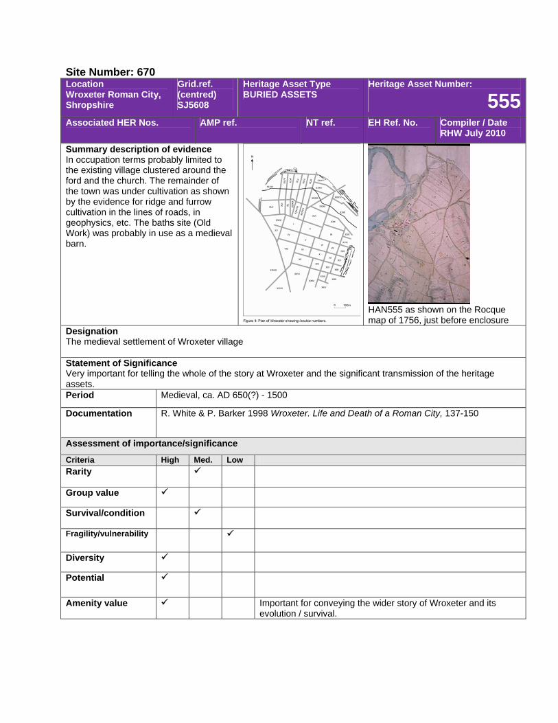
Site Number: 670 Location Wroxeter Roman City, Shropshire
Grid.ref. (centred) SJ5608
Heritage Asset Type BURIED ASSETS
Heritage Asset Number:
555Associated HER Nos. AMP ref. NT ref. EH Ref. No. Compiler / Date
RHW July 2010
Summary description of evidence In occupation terms probably limited to the existing village clustered around the ford and the church. The remainder of the town was under cultivation as shown by the evidence for ridge and furrow cultivation in the lines of roads, in geophysics, etc. The baths site (Old Work) was probably in use as a medieval barn.
HAN555 as shown on the Rocque map of 1756, just before enclosure
Designation The medieval settlement of Wroxeter village Statement of Significance Very important for telling the whole of the story at Wroxeter and the significant transmission of the heritage assets. Period Medieval, ca. AD 650(?) - 1500
Documentation R. White & P. Barker 1998 Wroxeter. Life and Death of a Roman City, 137-150
Assessment of importance/significance
Criteria High Med. Low Rarity
Group value
Survival/condition
Fragility/vulnerability
Diversity
Potential
Amenity value Important for conveying the wider story of Wroxeter and its evolution / survival.
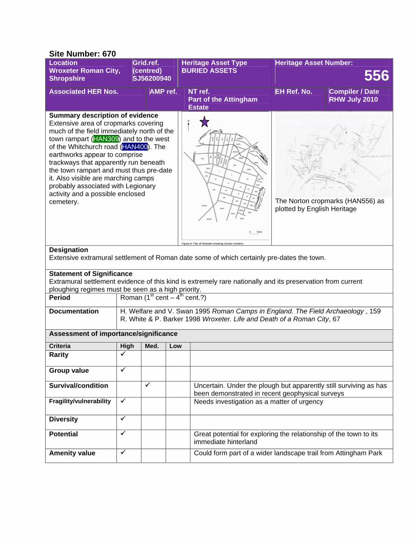
Site Number: 670 Location Wroxeter Roman City, Shropshire
Grid.ref. (centred) SJ56200940
Heritage Asset Type BURIED ASSETS
Heritage Asset Number:
556Associated HER Nos. AMP ref. NT ref.
Part of the Attingham Estate
EH Ref. No. Compiler / Date RHW July 2010
Summary description of evidence Extensive area of cropmarks covering much of the field immediately north of the town rampart (HAN309) and to the west of the Whitchurch road (HAN400). The earthworks appear to comprise trackways that apparently run beneath the town rampart and must thus pre-date it. Also visible are marching camps probably associated with Legionary activity and a possible enclosed cemetery. The Norton cropmarks (HAN556) as
plotted by English Heritage
Designation Extensive extramural settlement of Roman date some of which certainly pre-dates the town. Statement of Significance Extramural settlement evidence of this kind is extremely rare nationally and its preservation from current ploughing regimes must be seen as a high priority. Period Roman (1st cent – 4th cent.?)
Documentation H. Welfare and V. Swan 1995 Roman Camps in England. The Field Archaeology , 159 R. White & P. Barker 1998 Wroxeter. Life and Death of a Roman City, 67
Assessment of importance/significance
Criteria High Med. Low Rarity
Group value
Survival/condition Uncertain. Under the plough but apparently still surviving as has been demonstrated in recent geophysical surveys
Fragility/vulnerability Needs investigation as a matter of urgency
Diversity
Potential Great potential for exploring the relationship of the town to its immediate hinterland
Amenity value Could form part of a wider landscape trail from Attingham Park

Site Number: 670 Location Wroxeter Roman City, Shropshire
Grid.ref. (centred) SJ5608
Heritage Asset Type BURIED ASSETS
Heritage Asset Number:
557Associated HER Nos. AMP ref. NT ref. EH Ref. No. Compiler / Date
RHW July 2010
Summary description of evidence Site of former aqueduct channel, a V-shaped leat following the highest contour of the southern side of the Bell Brook valley to bring water into Wroxeter’s highest point. When surveyed in the 1930s it was said to be 2.5 miles long.
Photo showing the aqueduct channel HAN557just before its destruction in the late1950s
Designation The aqueduct / leat supplying water to the Roman city. Destroyed in the late 1950s as an earthwork, it may still survive beneath the ground. Statement of Significance Fourth largest Roman town in Britain and among the best preserved.
Period Roman ca AD120-500
Documentation R.W. Pocock 1934 Note on the water supply of Uriconium Trans Shropshire Archaeol Soc 47, 79-80 G. Webster & D. Hollingsworth 1959 The Wroxeter Aqueduct Trans Shropshire Archaeol Soc 56, 133-7
Assessment of importance/significance
Criteria High Med. Low Rarity Group value
Survival/condition Unknown whether the monument survives or not.
Fragility/vulnerability Still under the plough
Diversity
Potential Needs archaeological evaluation. This may be possible in the narrow strip of land to the east of the ramparts.
Amenity value Potential largest lost although its site can be pointed out and interpreted.
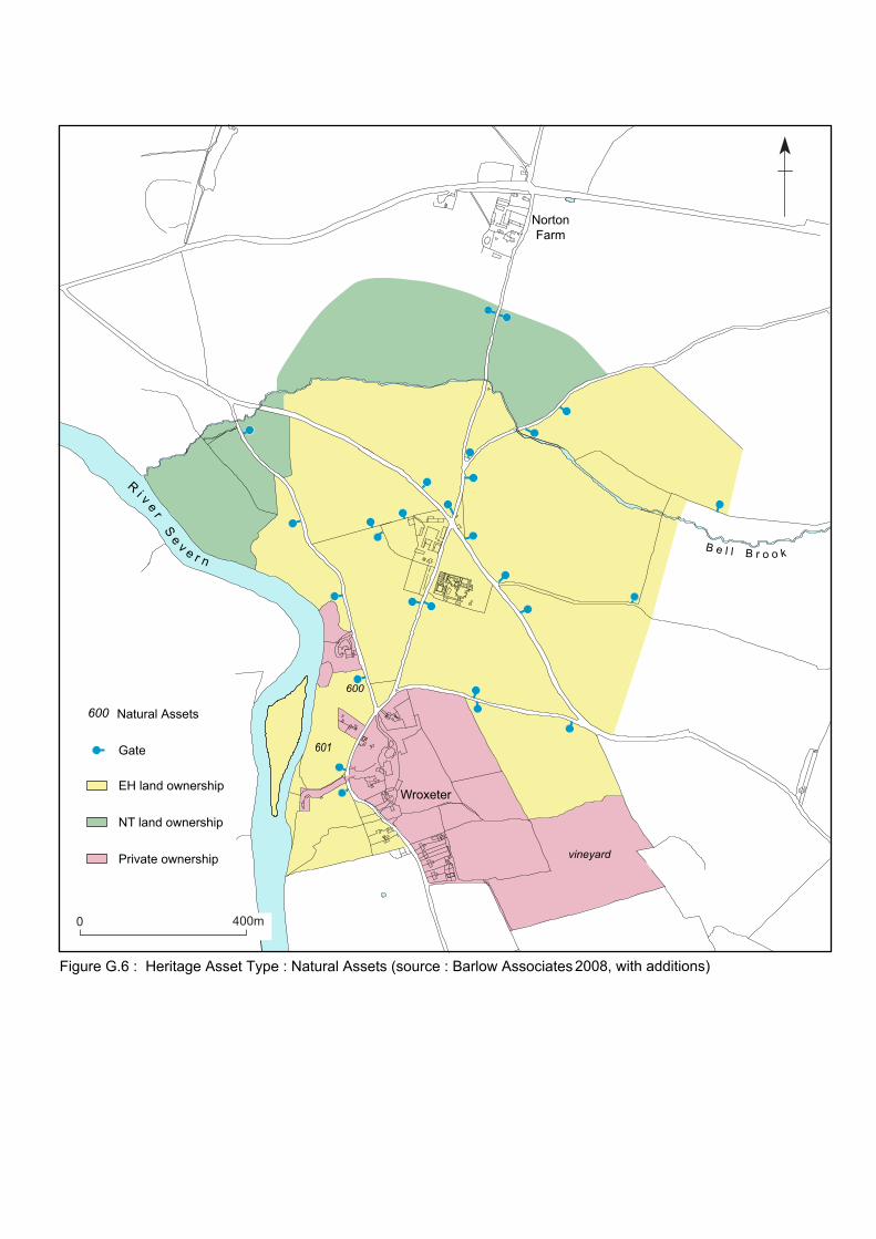
R i v e r S e v e r nB e l l B r o o k
0 400m
Gate
EH land ownership
NT land ownership
Private ownership
Natural Assets
600
600
vineyard
Wroxeter
NortonFarm
Figure G.6 : Heritage Asset Type : Natural Assets (source : Barlow Associates
601
2008, with additions)
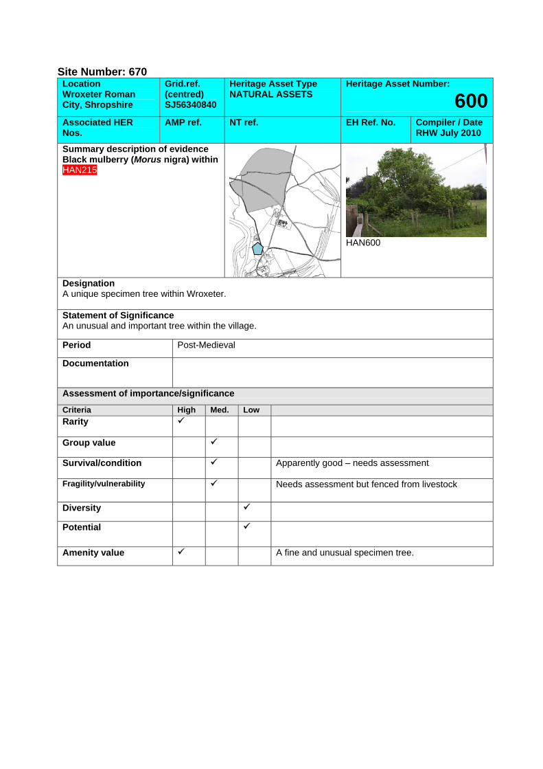
Site Number: 670 Location Wroxeter Roman City, Shropshire
Grid.ref. (centred) SJ56340840
Heritage Asset Type NATURAL ASSETS
Heritage Asset Number:
600Associated HER Nos.
AMP ref. NT ref. EH Ref. No. Compiler / Date RHW July 2010
Summary description of evidence Black mulberry (Morus nigra) within HAN215
HAN600
Designation A unique specimen tree within Wroxeter. Statement of Significance An unusual and important tree within the village.
Period Post-Medieval
Documentation
Assessment of importance/significance
Criteria High Med. Low Rarity
Group value
Survival/condition Apparently good – needs assessment
Fragility/vulnerability Needs assessment but fenced from livestock
Diversity
Potential
Amenity value A fine and unusual specimen tree.
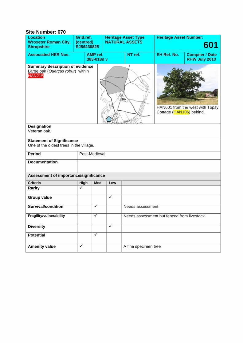
Site Number: 670 Location Wroxeter Roman City, Shropshire
Grid.ref. (centred) SJ56230825
Heritage Asset Type NATURAL ASSETS
Heritage Asset Number:
601Associated HER Nos. AMP ref.
383-018d v NT ref. EH Ref. No. Compiler / Date
RHW July 2010
Summary description of evidence Large oak (Quercus robur) within HAN215.
HAN601 from the west with Topsy Cottage (HAN106) behind.
Designation Veteran oak. Statement of Significance One of the oldest trees in the village.
Period Post-Medieval
Documentation
Assessment of importance/significance
Criteria High Med. Low Rarity
Group value
Survival/condition Needs assessment
Fragility/vulnerability Needs assessment but fenced from livestock
Diversity
Potential
Amenity value A fine specimen tree