Inclusive and Sustainable Mobility
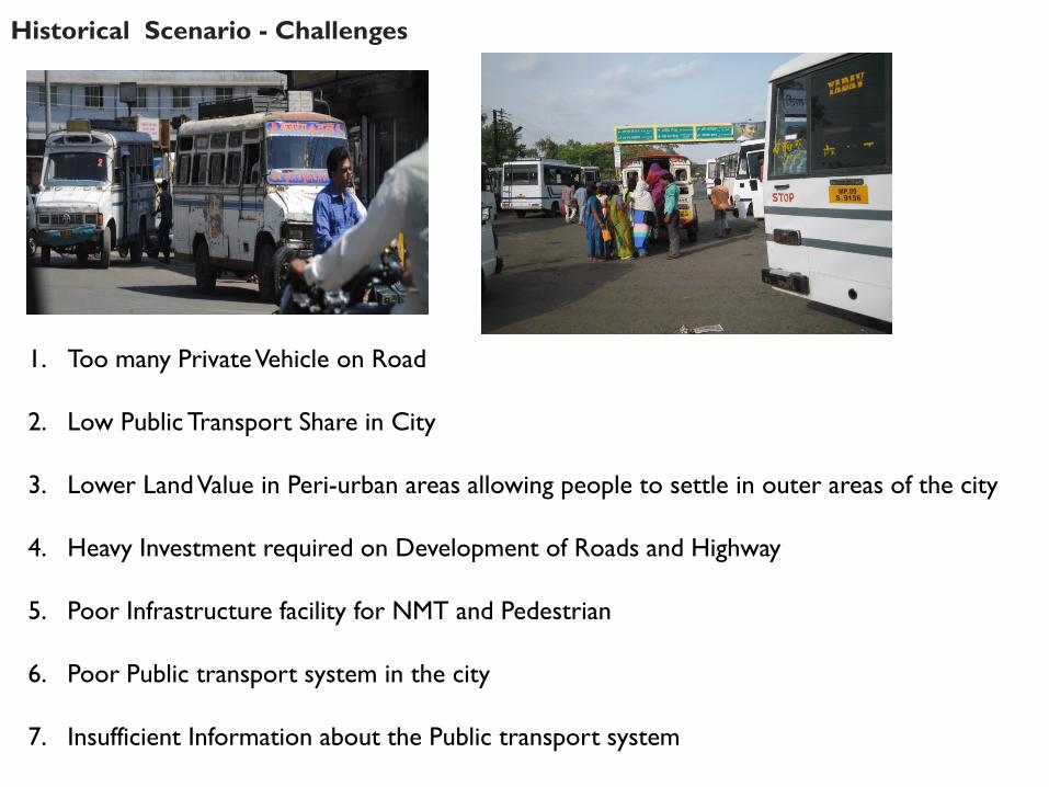
Historical Scenario - Challenges
1. Too many Private Vehicle on Road
2. Low Public Transport Share in City
3. Lower Land Value in Peri-urban areas allowing people to settle in outer areas of the city
4. Heavy Investment required on Development of Roads and Highway
5. Poor Infrastructure facility for NMT and Pedestrian
6. Poor Public transport system in the city
7. Insufficient Information about the Public transport system
Stake Holders
1. Low Income Group Citizens 2. Motorized Vehicle Owners 3. Existing Public Transport Operators 4. Environmentalists 5. Business Owners 6. Real Estate Developers. 7. Private Sector Investors 8. Financial Institutions 9. State/ Central Government 10.City Administration
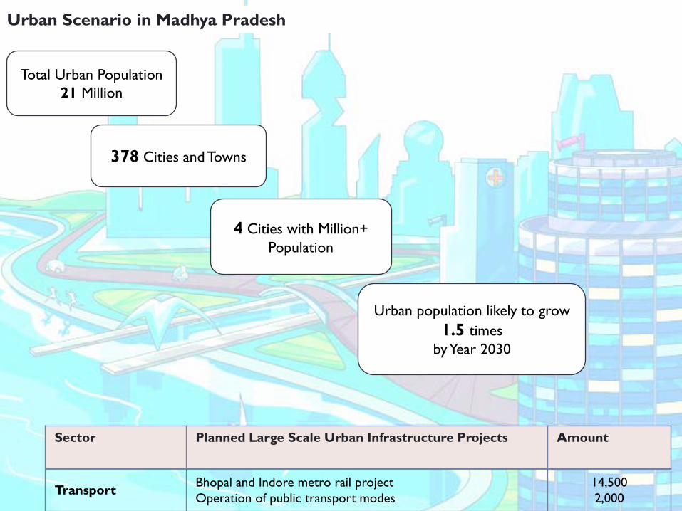
Total Urban Population21 Million
378 Cities and Towns
4 Cities with Million+ Population
Urban population likely to grow 1.5 times
by Year 2030
Urban Scenario in Madhya Pradesh
Sector Planned Large Scale Urban Infrastructure Projects Amount
Transport Bhopal and Indore metro rail projectOperation of public transport modes
14,5002,000
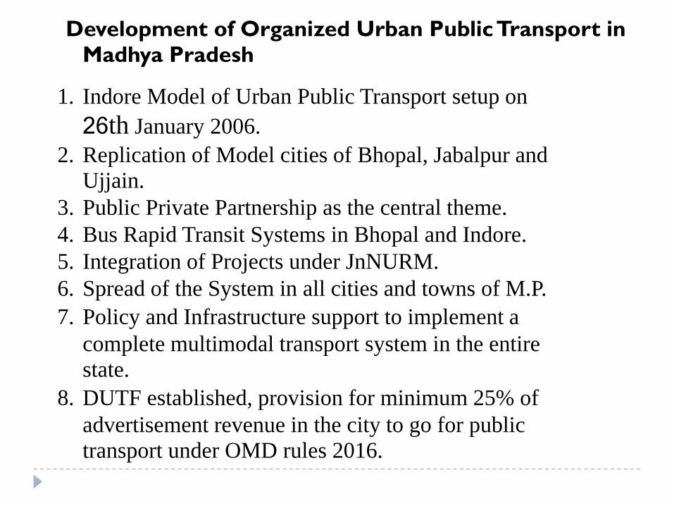
Development of Organized Urban Public Transport in Madhya Pradesh
1. Indore Model of Urban Public Transport setup on 26th January 2006.
2. Replication of Model cities of Bhopal, Jabalpur and Ujjain.
3. Public Private Partnership as the central theme. 4. Bus Rapid Transit Systems in Bhopal and Indore. 5. Integration of Projects under JnNURM. 6. Spread of the System in all cities and towns of M.P. 7. Policy and Infrastructure support to implement a
complete multimodal transport system in the entire state.
8. DUTF established, provision for minimum 25% of advertisement revenue in the city to go for public transport under OMD rules 2016.
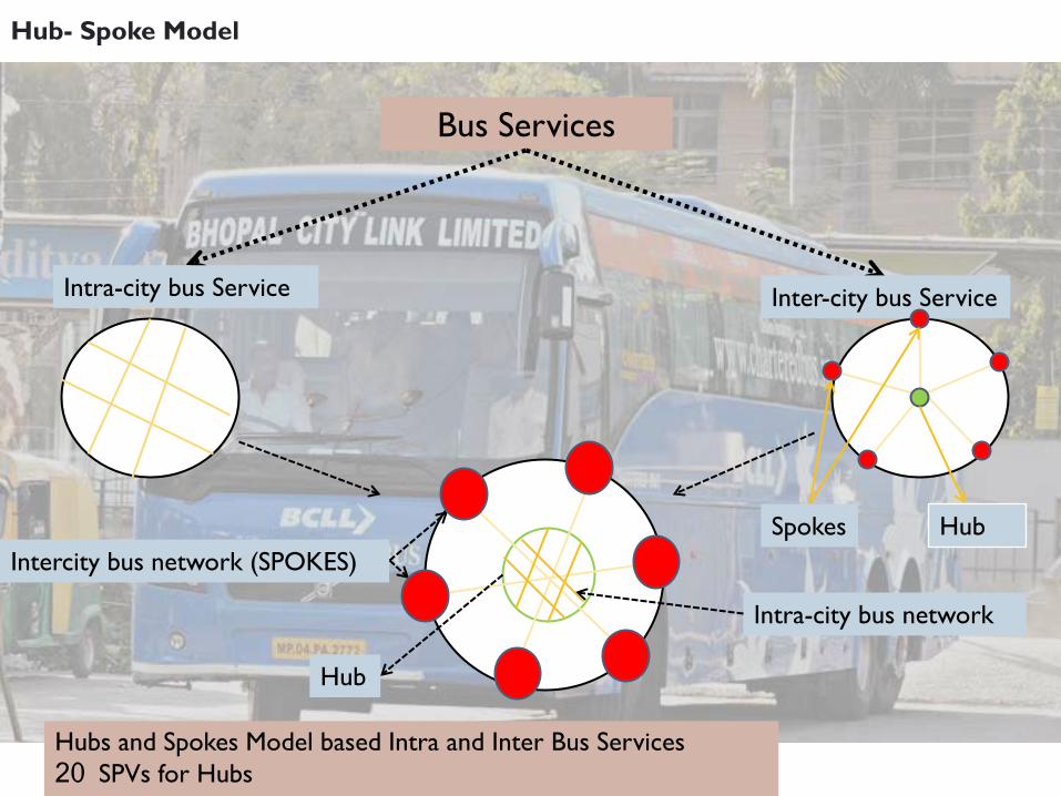
Bus Services
Intra-city bus network
Intercity bus network (SPOKES)
Hubs and Spokes Model based Intra and Inter Bus Services 20 SPVs for Hubs
Hub
Intra-city bus Service Inter-city bus Service
Hub
Spokes
Hub- Spoke Model
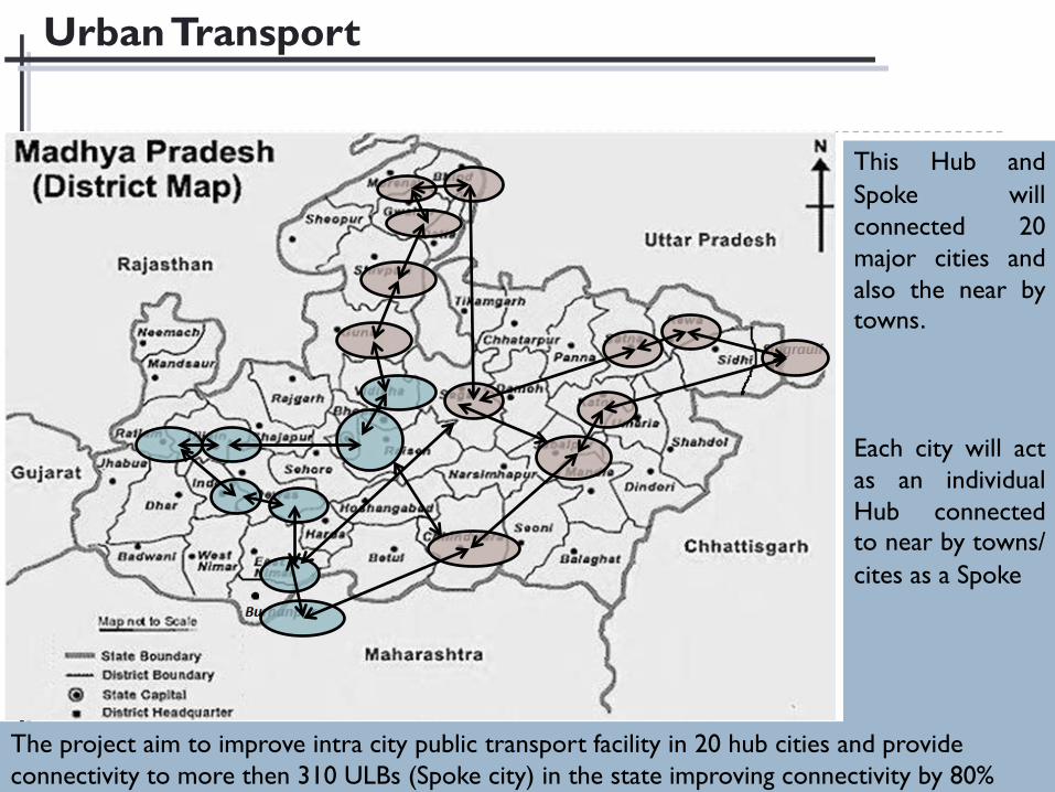
Urban Transport
This Hub and Spoke willconnected 20major cities andalso the near bytowns.
Each city will actas an individualHub connectedto near by towns/ cites as a Spoke
The project aim to improve intra city public transport facility in 20 hub cities and provide connectivity to more then 310 ULBs (Spoke city) in the state improving connectivity by 80%
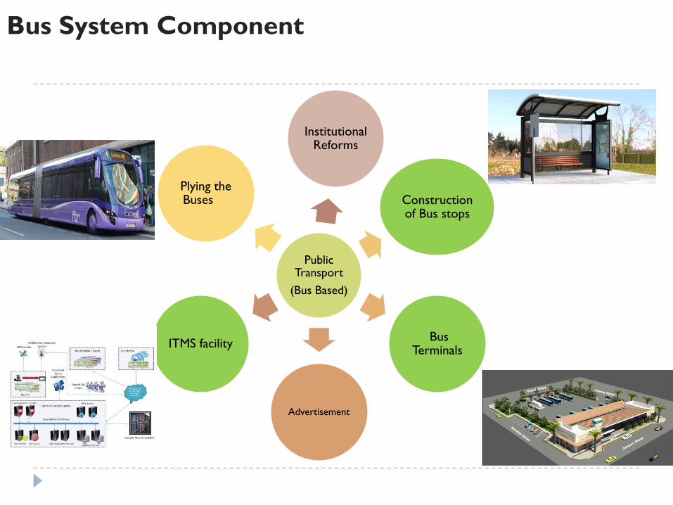
Public Transport
(Bus Based)
Plying the Buses Construction
of Bus stops
Bus Terminals
Advertisement
ITMS facility
Institutional Reforms
Bus System Component
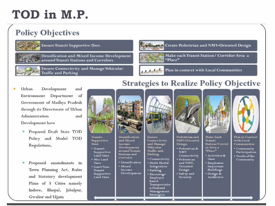
TOD in M.P.
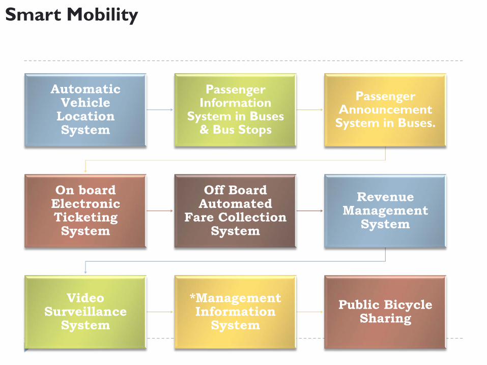
Automatic Vehicle
Location System
Passenger Information
System in Buses & Bus Stops
Passenger Announcement
System in Buses.
On board Electronic Ticketing System
Off Board Automated
Fare Collection System
Revenue Management
System
Video Surveillance
System
*Management Information
System Public Bicycle
Sharing
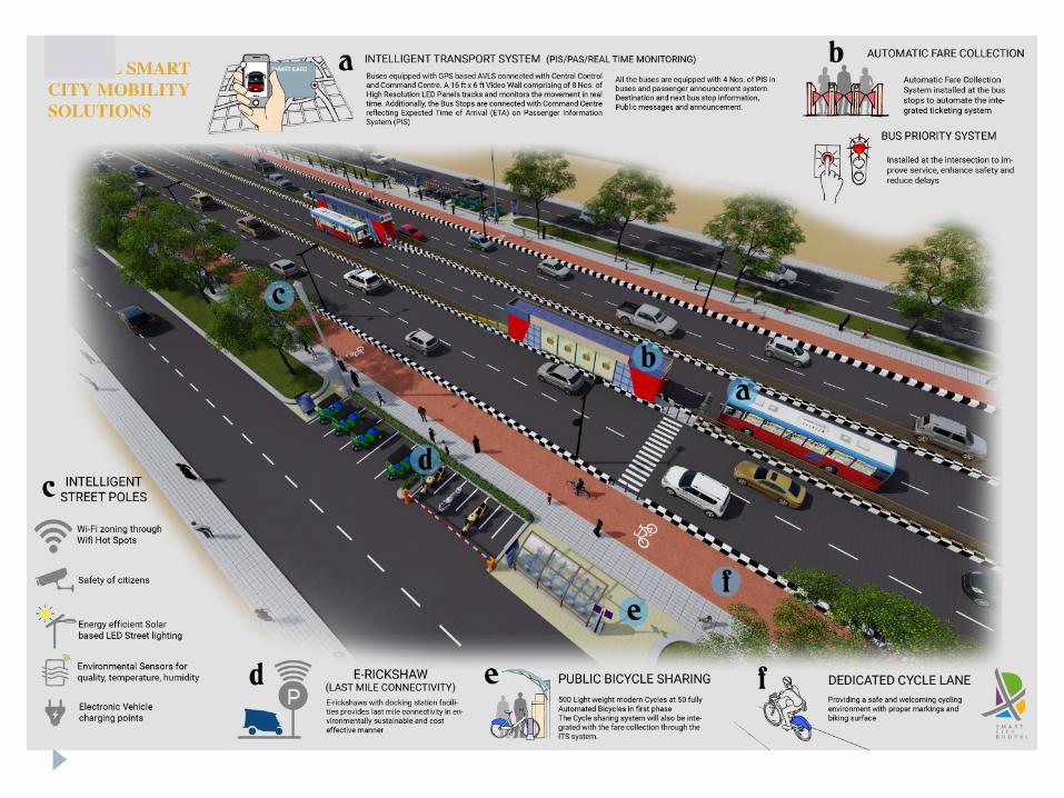
Smart Mobility
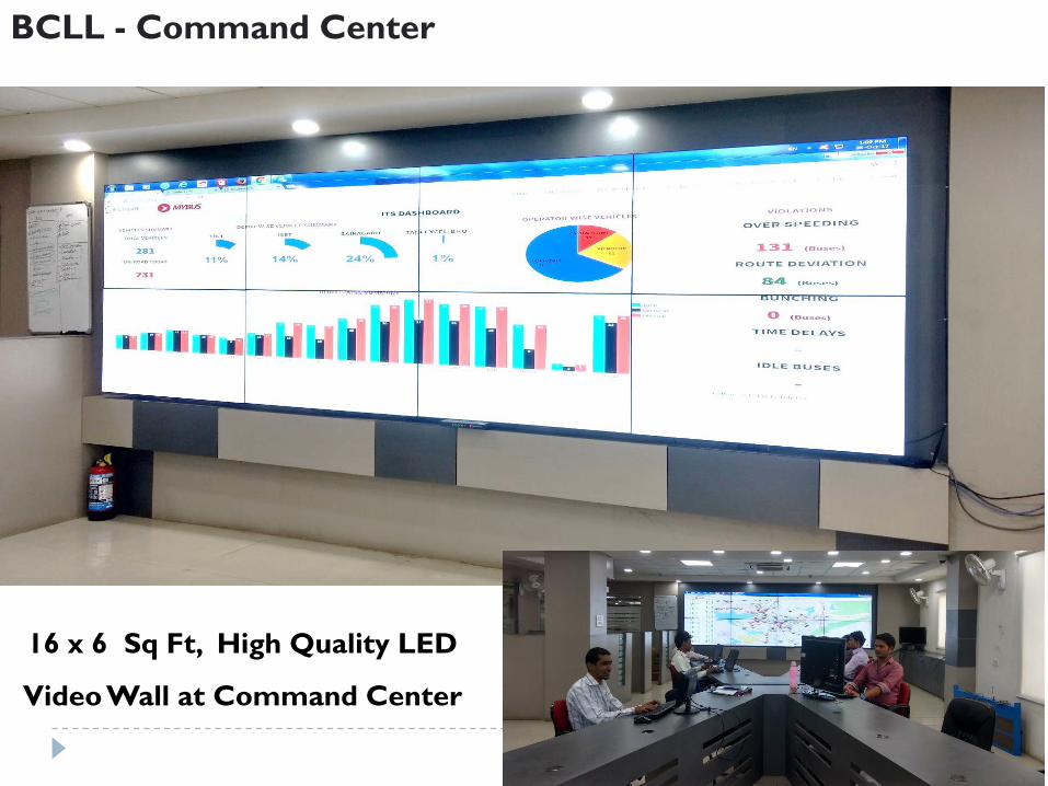
16 x 6 Sq Ft, High Quality LED
Video Wall at Command Center
BCLL - Command Center
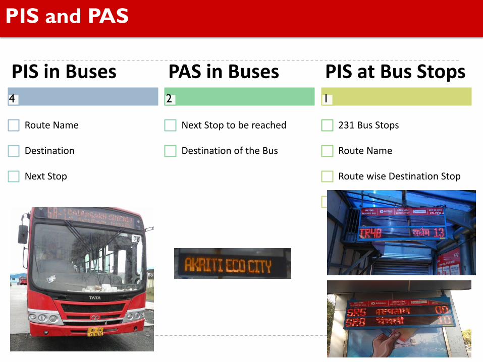
PIS and PAS
PIS in Buses
Route Name
Destination
Next Stop
PAS in Buses
Next Stop to be reached
Destination of the Bus
PIS at Bus Stops
231 Bus Stops
Route Name
Route wise Destination Stop
ETA of bus
4 2 1

AFC at BRT Bus Stop
Off Board ticketing & Smart card
recharge though
ATVM’s on Bus stop.
On Board Ticketing
with ETVM’s.
Subsidized Smart card
for easy travelling with MY
BUS.
Universal Smart card valid on all
routes.
Revenue management
system.
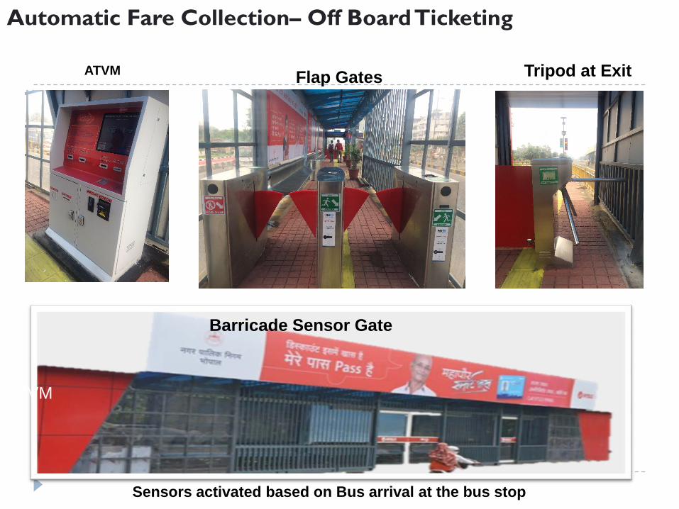
Barricade Sensor Gate
Tripod at Exit
Flap Barriers
ATVM
Sensors activated based on Bus arrival at the bus stop
ATVM
- Flap barriers / gates for Commuter entry and exit
Automatic Fare Collection– Off Board Ticketing
Flap Gates
18
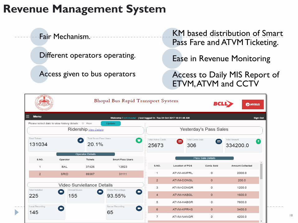
Revenue Management System
Fair Mechanism.
Different operators operating.
Access given to bus operators
KM based distribution of Smart Pass Fare and ATVM Ticketing.
Ease in Revenue Monitoring
Access to Daily MIS Report of ETVM, ATVM and CCTV
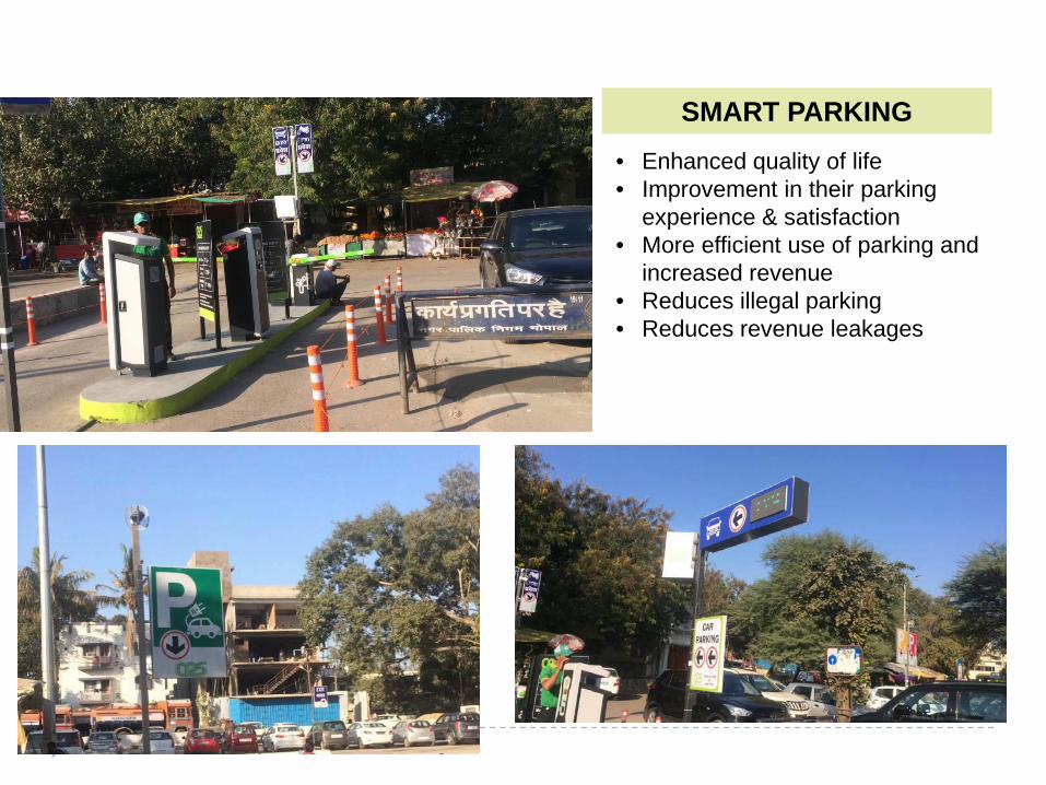
SMART PARKING• Enhanced quality of life• Improvement in their parking
experience & satisfaction• More efficient use of parking and
increased revenue• Reduces illegal parking• Reduces revenue leakages
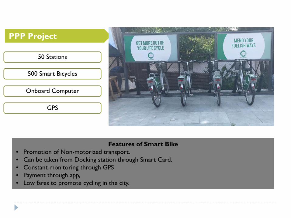
PPP Project
Features of Smart Bike• Promotion of Non-motorized transport.• Can be taken from Docking station through Smart Card.• Constant monitoring through GPS• Payment through app,• Low fares to promote cycling in the city.
50 Stations
500 Smart Bicycles
Onboard Computer
GPS
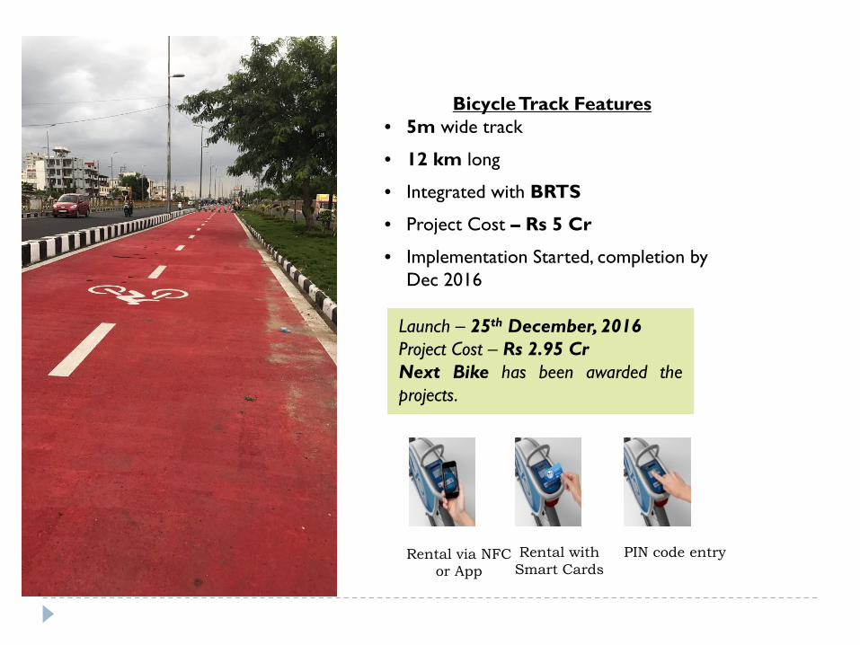
Rental with Smart Cards
Rental via NFC or App
PIN code entry
Launch – 25th December, 2016Project Cost – Rs 2.95 CrNext Bike has been awarded theprojects.
Bicycle Track Features• 5m wide track
• 12 km long
• Integrated with BRTS
• Project Cost – Rs 5 Cr
• Implementation Started, completion by Dec 2016
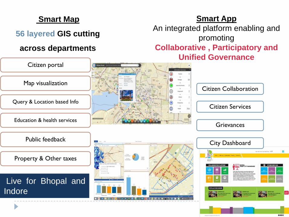
Citizen portal
Map visualization
Query & Location based Info
Education & health services
Public feedback
Property & Other taxes
Live for Bhopal andIndore
Smart Map
56 layered GIS cutting
across departments
Smart AppAn integrated platform enabling and
promoting Collaborative , Participatory and
Unified Governance
Citizen Collaboration
Citizen Services
Grievances
City Dashboard
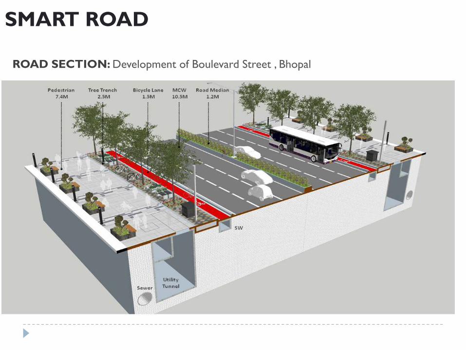
SMART ROAD
ROAD SECTION: Development of Boulevard Street , Bhopal
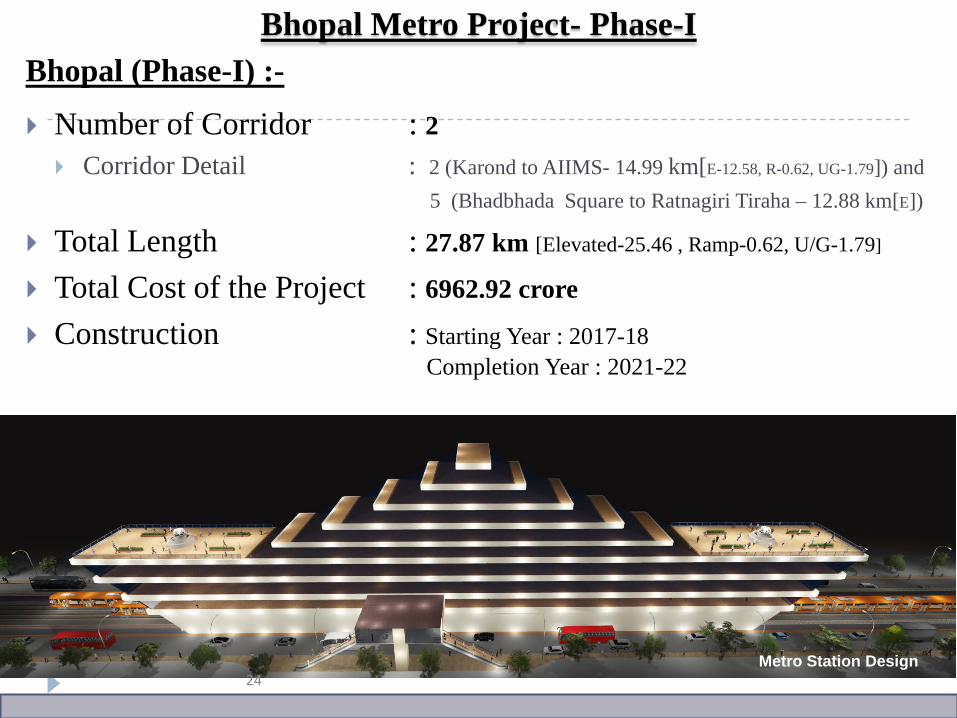
Bhopal (Phase-I) :-
Number of Corridor : 2 Corridor Detail : 2 (Karond to AIIMS- 14.99 km[E-12.58, R-0.62, UG-1.79]) and
5 (Bhadbhada Square to Ratnagiri Tiraha – 12.88 km[E])
Total Length : 27.87 km [Elevated-25.46 , Ramp-0.62, U/G-1.79]
Total Cost of the Project : 6962.92 crore
Construction : Starting Year : 2017-18Completion Year : 2021-22
Bhopal Metro Project- Phase-I
Metro Station Design24
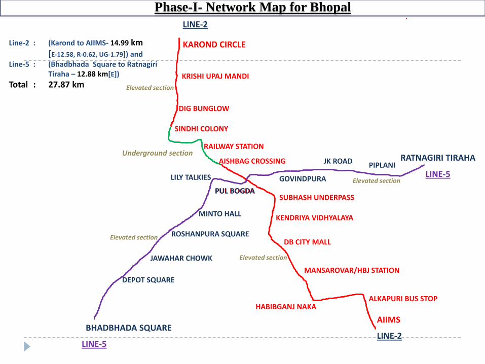
KAROND CIRCLE
KRISHI UPAJ MANDI
DIG BUNGLOW
SINDHI COLONY
RAILWAY STATION
AISHBAG CROSSING
PUL BOGDASUBHASH UNDERPASS
KENDRIYA VIDHYALAYA
DB CITY MALL
MANSAROVAR/HBJ STATION
HABIBGANJ NAKAALKAPURI BUS STOP
AIIMSBHADBHADA SQUARE
RATNAGIRI TIRAHA
DEPOT SQUARE
JAWAHAR CHOWK
ROSHANPURA SQUARE
MINTO HALL
LILY TALKIES GOVINDPURA
JK ROAD PIPLANI
PUL BOGDA
LINE-2
LINE-2LINE-5
LINE-5
Underground section
Elevated section
Elevated section
Elevated section
Elevated section
Phase-I- Network Map for Bhopal
Line-2 : (Karond to AIIMS- 14.99 km[E-12.58, R-0.62, UG-1.79]) and
Line-5 : (Bhadbhada Square to RatnagiriTiraha – 12.88 km[E])
Total : 27.87 km
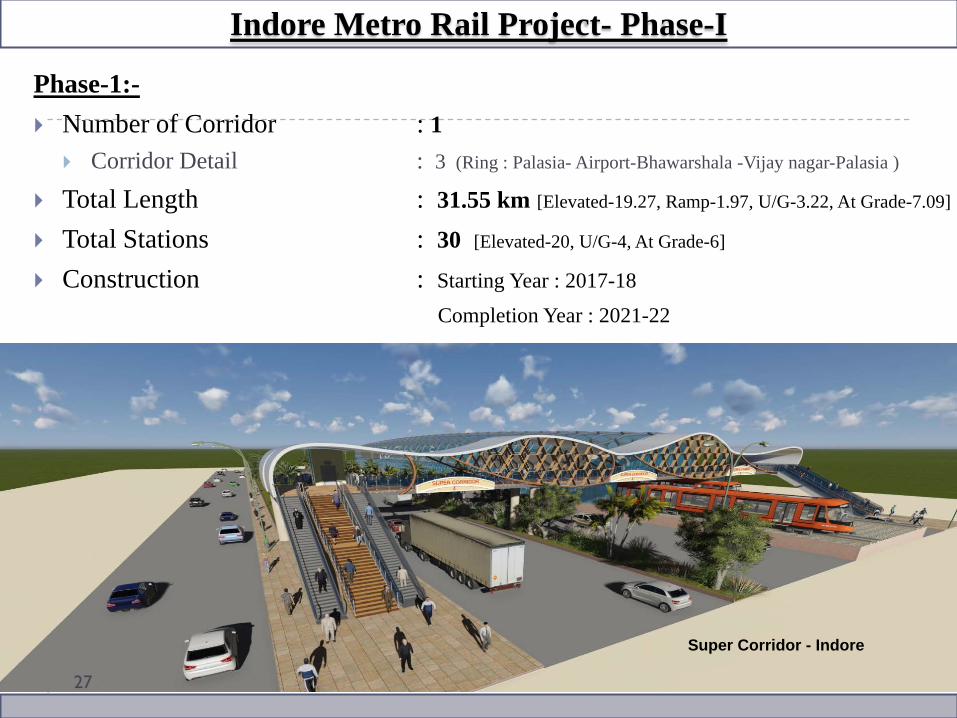
Phase-1:- Number of Corridor : 1
Corridor Detail : 3 (Ring : Palasia- Airport-Bhawarshala -Vijay nagar-Palasia )
Total Length : 31.55 km [Elevated-19.27, Ramp-1.97, U/G-3.22, At Grade-7.09]
Total Stations : 30 [Elevated-20, U/G-4, At Grade-6]
Construction : Starting Year : 2017-18Completion Year : 2021-22
Indore Metro Rail Project- Phase-I
Super Corridor - Indore
27
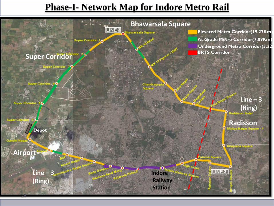
Line – 3 (Ring)
Line – 3 (Ring)
28
Phase-I- Network Map for Indore Metro Rail
Bhawarsala Square
Airport
Super Corridor
Radisson
IndoreRailwayStation
Elevated Metro Corridor(19.27Km)
At Grade Metro Corridor(7.09Km)Underground Metro Corridor(3.22KBRTS Corridor
Depot
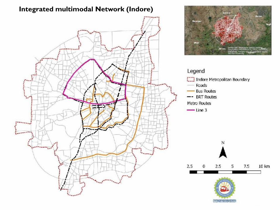
Integrated multimodal Network (Indore)
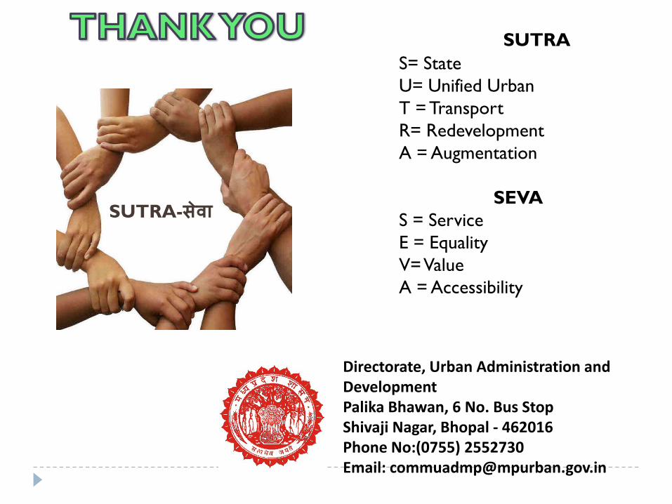
Directorate, Urban Administration and DevelopmentPalika Bhawan, 6 No. Bus Stop Shivaji Nagar, Bhopal - 462016 Phone No:(0755) 2552730Email: [email protected]
SUTRA-सेवा
SUTRAS= StateU= Unified UrbanT = TransportR= RedevelopmentA = Augmentation
SEVAS = ServiceE = EqualityV= ValueA = Accessibility
Recommended