1
Moraga Existing Trails Map,
and
Trail Opportunity Maps
for Moraga trails discussion and report.
Table of Contents:
Map of Current Trials in Moraga from Moraga Staff. BPMP 2
Map of version sent to council in February 2016 3
Trails by best guess name (commission input on naming convention) 4
Moraga Park and Recreation Master Plan of Trails2007 5
Various Raw map types 6- 8
xx
List of trails approved by council in last two years 9-12
Possible trail report styles 14 -16
Survey on Mobil Apps in Moraga 17
Future Items to be added to final report x
MCclosker Parcel and Moraga Ridge EBRPD new park 19
Hand drawn map of the Hacienda Trails 18
Links to other mapping sources 20
John Muir Land Trust Carr Ranch (future) X
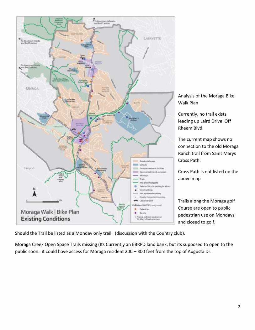
2
Analysis of the Moraga Bike
Walk Plan
Currently, no trail exists
leading up Laird Drive Off
Rheem Blvd.
The current map shows no
connection to the old Moraga
Ranch trail from Saint Marys
Cross Path.
Cross Path is not listed on the
above map
Trails along the Moraga golf
Course are open to public
pedestrian use on Mondays
and closed to golf.
Should the Trail be listed as a Monday only trail. (discussion with the Country club).
Moraga Creek Open Space Trails missing (Its Currently an EBRPD land bank, but its supposed to open to the
public soon. it could have access for Moraga resident 200 – 300 feet from the top of Augusta Dr.
3
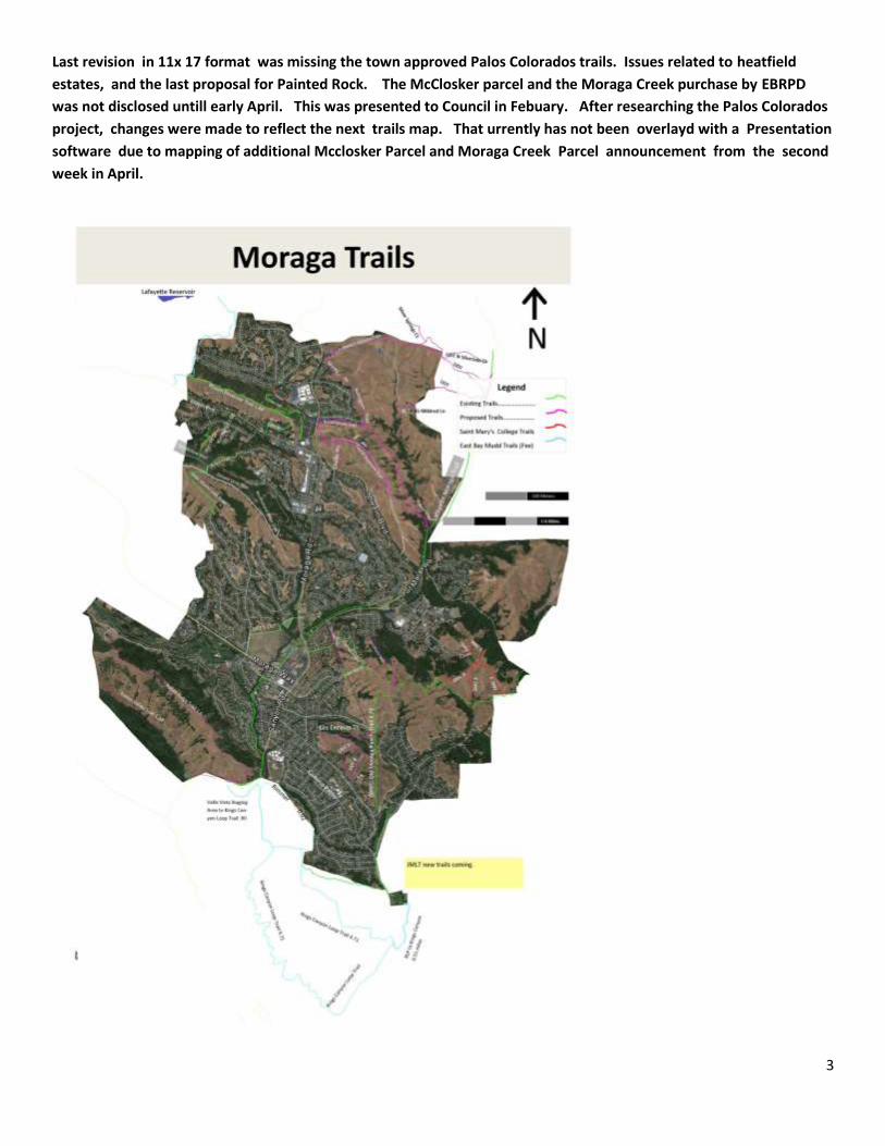
Last revision in 11x 17 format was missing the town approved Palos Colorados trails. Issues related to heatfield
estates, and the last proposal for Painted Rock. The McClosker parcel and the Moraga Creek purchase by EBRPD
was not disclosed untill early April. This was presented to Council in Febuary. After researching the Palos Colorados
project, changes were made to reflect the next trails map. That urrently has not been overlayd with a Presentation
software due to mapping of additional Mcclosker Parcel and Moraga Creek Parcel announcement from the second
week in April.
4
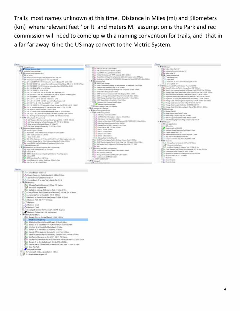
Trails most names unknown at this time. Distance in Miles (mi) and Kilometers
(km) where relevant feet ‘ or ft and meters M. assumption is the Park and rec
commission will need to come up with a naming convention for trails, and that in
a far far away time the US may convert to the Metric System.
5
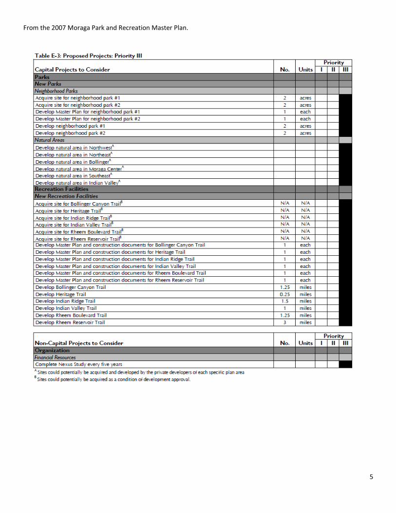
From the 2007 Moraga Park and Recreation Master Plan.
6
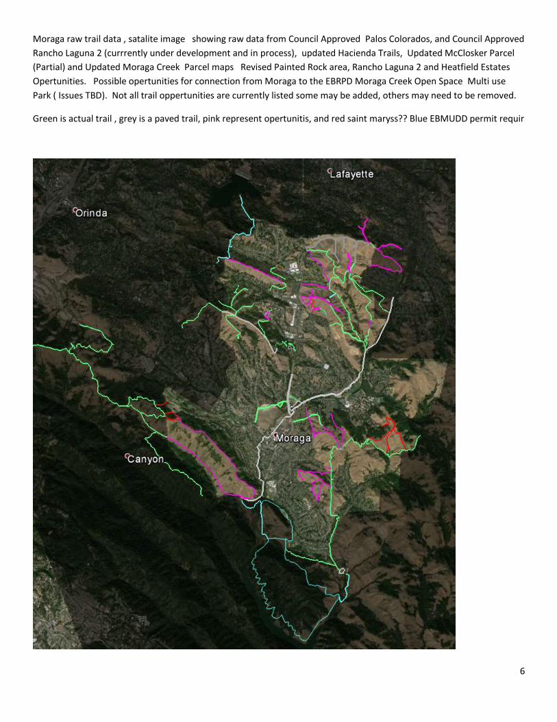
Moraga raw trail data , satalite image showing raw data from Council Approved Palos Colorados, and Council Approved
Rancho Laguna 2 (currrently under development and in process), updated Hacienda Trails, Updated McClosker Parcel
(Partial) and Updated Moraga Creek Parcel maps Revised Painted Rock area, Rancho Laguna 2 and Heatfield Estates
Opertunities. Possible opertunities for connection from Moraga to the EBRPD Moraga Creek Open Space Multi use
Park ( Issues TBD). Not all trail oppertunities are currently listed some may be added, others may need to be removed.
Green is actual trail , grey is a paved trail, pink represent opertunitis, and red saint maryss?? Blue EBMUDD permit requir
7
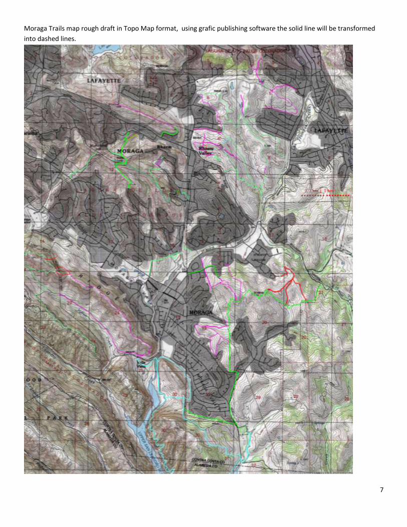
Moraga Trails map rough draft in Topo Map format, using grafic publishing software the solid line will be transformed
into dashed lines.
8
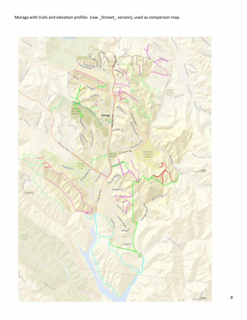
Moraga with trails and elevation profiles (raw _Streeet_ version), used as comparison map.
9
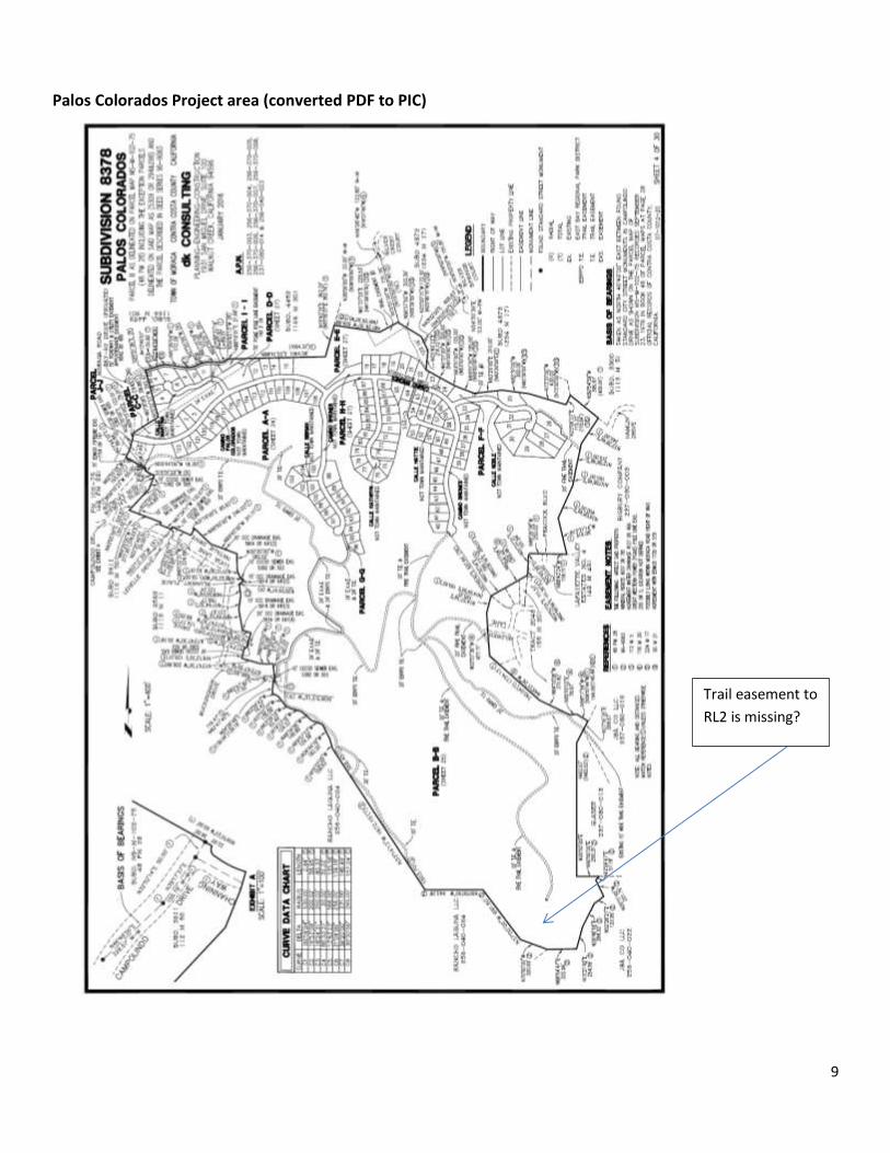
Palos Colorados Project area (converted PDF to PIC)
Trail easement to
RL2 is missing?
10
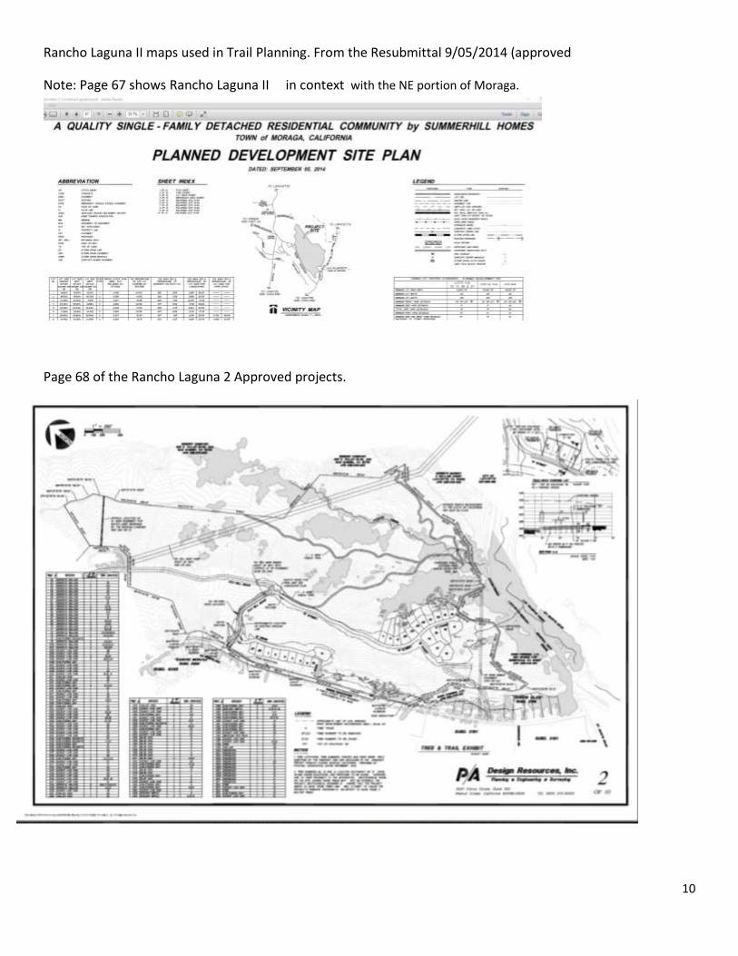
Rancho Laguna II maps used in Trail Planning. From the Resubmittal 9/05/2014 (approved
Note: Page 67 shows Rancho Laguna II in context with the NE portion of Moraga.
Page 68 of the Rancho Laguna 2 Approved projects.
11
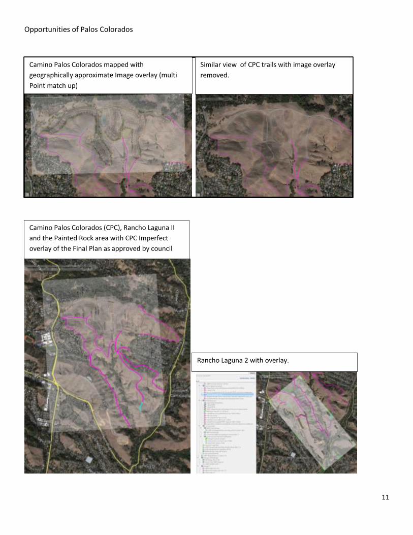
Opportunities of Palos Colorados
Camino Palos Colorados mapped with
geographically approximate Image overlay (multi
Point match up)
Similar view of CPC trails with image overlay
removed.
Camino Palos Colorados (CPC), Rancho Laguna II
and the Painted Rock area with CPC Imperfect
overlay of the Final Plan as approved by council
Rancho Laguna 2 with overlay.
12
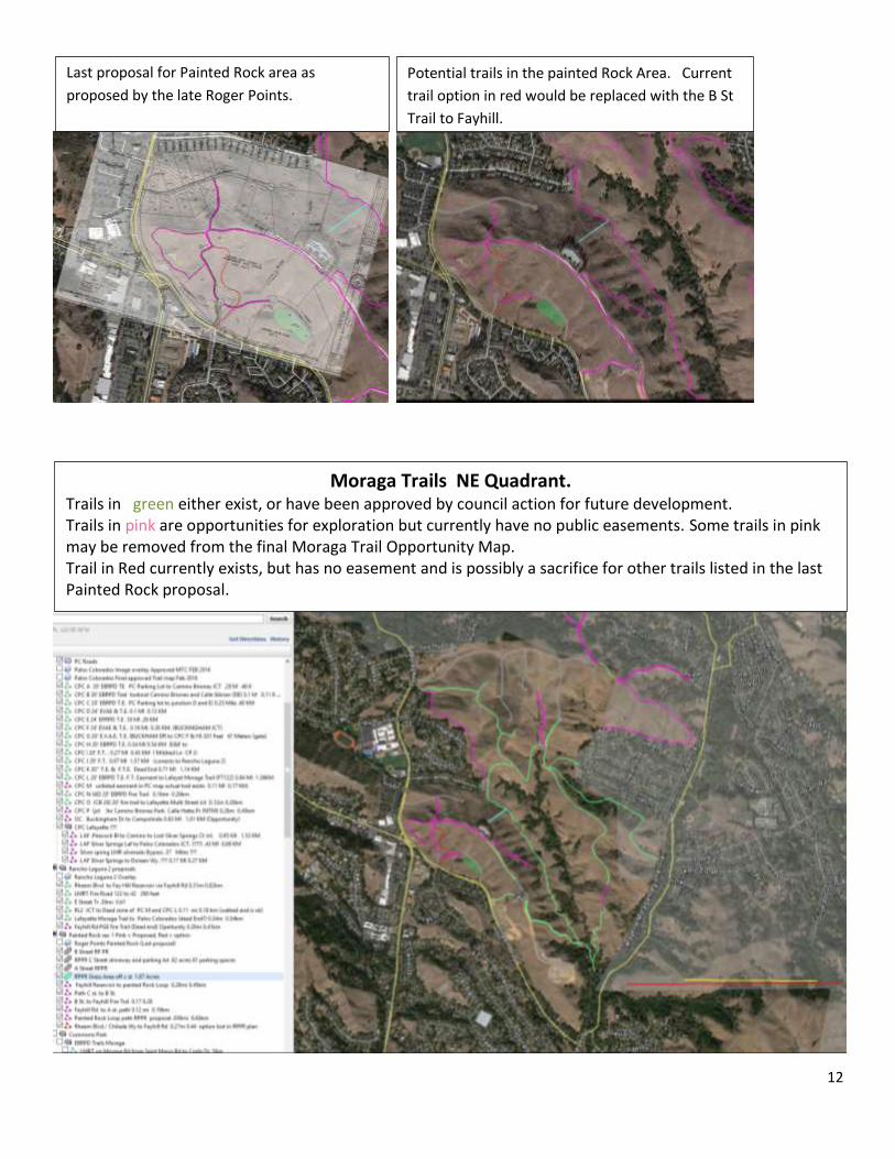
Last proposal for Painted Rock area as
proposed by the late Roger Points.
Potential trails in the painted Rock Area. Current
trail option in red would be replaced with the B St
Trail to Fayhill.
Moraga Trails NE Quadrant. Trails in green either exist, or have been approved by council action for future development. Trails in pink are opportunities for exploration but currently have no public easements. Some trails in pink may be removed from the final Moraga Trail Opportunity Map. Trail in Red currently exists, but has no easement and is possibly a sacrifice for other trails listed in the last Painted Rock proposal.
13
Hetfield Estates Project ???
On May 21 (year not listed) the Town Council voted to uphold the previous Planning Commission decision and approve the Vesting
Tentative Map, General Development Plan, Conditional Use Permit and Hillside Development Permit for the 7-lot Hetfield Estates
Project. The approval modified Conditions of Approval, providing more specific guidelines regarding the proposed fire trail (an unpaved,
16 foot access) on the project site. The fire trail would not be required at the time of project construction, but an easement would be
dedicated and money would be set aside for a 10-year period to fund the fire trail, should it be desired in the future. The Conditions also
call for studying an alternate alignment for the fire trail on an existing cleared Moraga-Orinda Fire District trail, which will be considered
during the Precise Development Plan at a future date. The Town Council also modified conditions to locate some parking spaces closer
to the proposed homes and not require street lighting.
( NEED to REVIEW FINAL EIR)
14
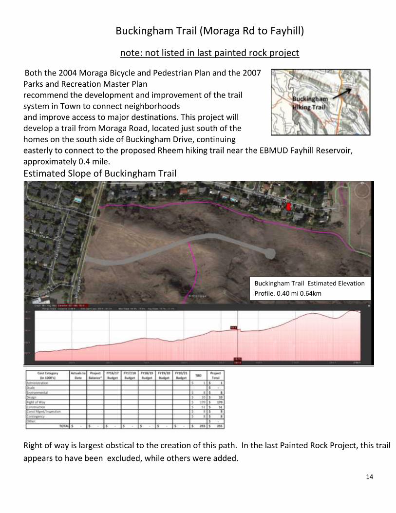
Buckingham Trail (Moraga Rd to Fayhill)
note: not listed in last painted rock project
Both the 2004 Moraga Bicycle and Pedestrian Plan and the 2007 Parks and Recreation Master Plan recommend the development and improvement of the trail system in Town to connect neighborhoods and improve access to major destinations. This project will develop a trail from Moraga Road, located just south of the homes on the south side of Buckingham Drive, continuing easterly to connect to the proposed Rheem hiking trail near the EBMUD Fayhill Reservoir, approximately 0.4 mile.
Estimated Slope of Buckingham Trail
Right of way is largest obstical to the creation of this path. In the last Painted Rock Project, this trail
appears to have been excluded, while others were added.
Buckingham Trail Estimated Elevation
Profile. 0.40 mi 0.64km
15
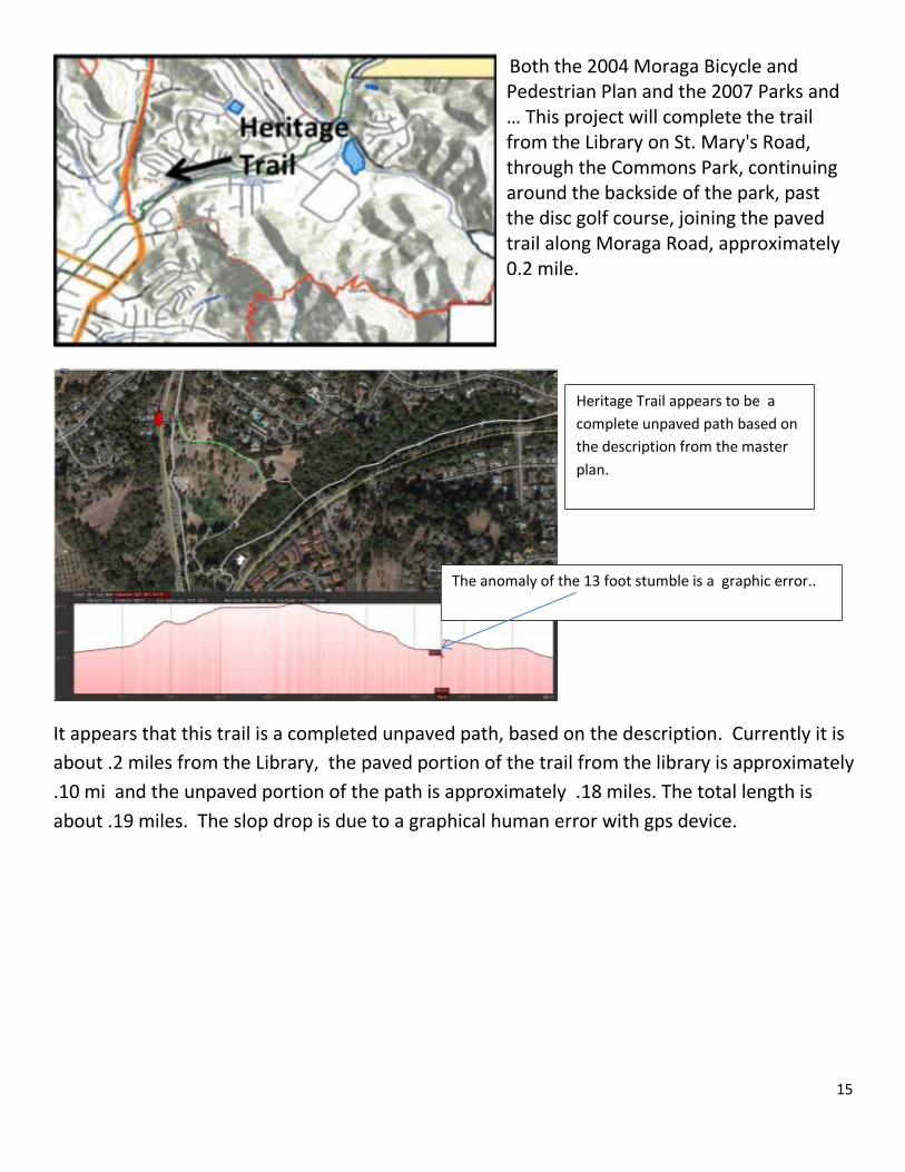
Both the 2004 Moraga Bicycle and Pedestrian Plan and the 2007 Parks and … This project will complete the trail from the Library on St. Mary's Road, through the Commons Park, continuing around the backside of the park, past the disc golf course, joining the paved trail along Moraga Road, approximately 0.2 mile.
It appears that this trail is a completed unpaved path, based on the description. Currently it is
about .2 miles from the Library, the paved portion of the trail from the library is approximately
.10 mi and the unpaved portion of the path is approximately .18 miles. The total length is
about .19 miles. The slop drop is due to a graphical human error with gps device.
Heritage Trail appears to be a
complete unpaved path based on
the description from the master
plan.
The anomaly of the 13 foot stumble is a graphic error..
16
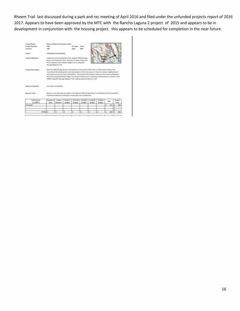
Rheem Trail last discussed during a park and rec meeting of April 2016 and filed under the unfunded projects report of 2016
2017. Appears to have been approved by the MTC with the Rancho Laguna 2 project of 2015 and appears to be in
development in conjunction with the housing project. this appears to be scheduled for completion in the near future.

17
Moraga Nextdoor Non Scientific Survey on Mobil hiking apps
Results : TO BE CUT AN PASTED FROM NEXTDOOR Thursday Viewable at Nextdoor. Currently Live
Mobil Apps used to map trails in Moraga.
Is there is currently a popular mobile hiking app used by residents in
Moraga?
If you use one of the following mobile apps, please vote for your favorite
hiking app. If you know of a better app for hiking, please comment with
the name of the app. If someone mentions a good hiking app, please
thank them if you use it too.
What is your favorite mobile hiking app? ( survey closes on May 11th
midnight)
All Trails
Open Trails
My Trails
Geotag Photos
Earth
Ersi ArcGIS
I don’t use mobile hiking apps
I prefer another (please list)
18
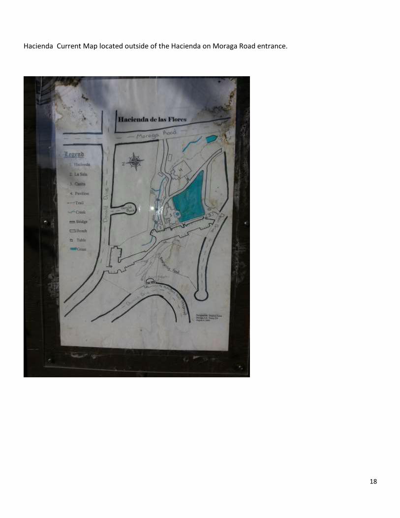
Hacienda Current Map located outside of the Hacienda on Moraga Road entrance.
19
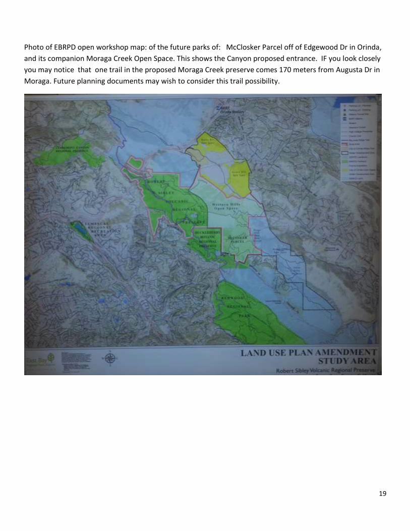
Photo of EBRPD open workshop map: of the future parks of: McClosker Parcel off of Edgewood Dr in Orinda,
and its companion Moraga Creek Open Space. This shows the Canyon proposed entrance. IF you look closely
you may notice that one trail in the proposed Moraga Creek preserve comes 170 meters from Augusta Dr in
Moraga. Future planning documents may wish to consider this trail possibility.

20
Effective Resources for further study
Community handbook on mapping a community for pedestrian considerations. 10 pages.
http://www.feetfirst.org/wp-content/uploads/2013/02/Services_How-To-Kits_Community-Map-Making-
Handbook.pdf
opportunity

21
Recommended