WILDFIRE
MANAGEMENT TOOL WEB EDITION
Using NASA Web World Wind to Predict Wildfire Behavior
Southern California Government GIS User Group
Torrance, CA
September 16, 2015
http://emxsys.com
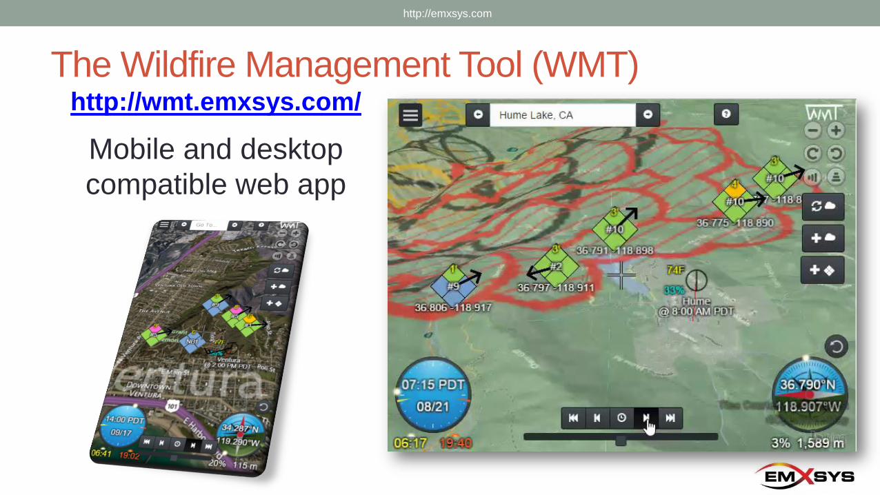
The Wildfire Management Tool (WMT)http://wmt.emxsys.com/
Mobile and desktop
compatible web app
http://emxsys.com
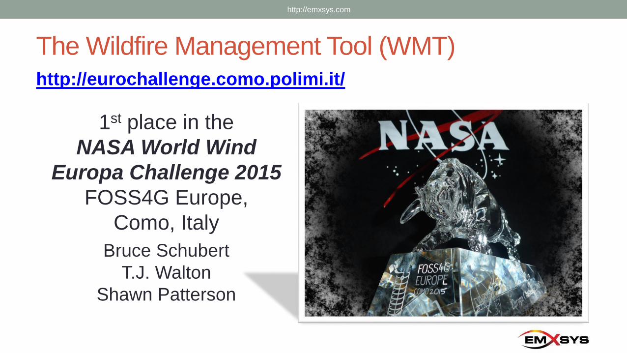
The Wildfire Management Tool (WMT)
1st place in the
NASA World Wind
Europa Challenge 2015
FOSS4G Europe,
Como, Italy
Bruce Schubert
T.J. Walton
Shawn Patterson
http://eurochallenge.como.polimi.it/
http://emxsys.com
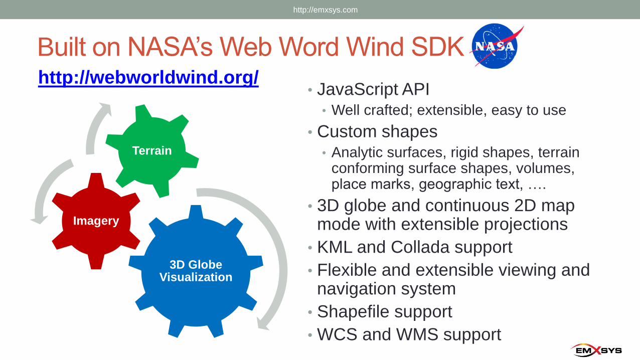
Built on NASA’s Web Word Wind SDKhttp://webworldwind.org/
• JavaScript API• Well crafted; extensible, easy to use
• Custom shapes• Analytic surfaces, rigid shapes, terrain
conforming surface shapes, volumes, place marks, geographic text, ….
• 3D globe and continuous 2D map mode with extensible projections
• KML and Collada support
• Flexible and extensible viewing and navigation system
• Shapefile support
• WCS and WMS support
3D Globe Visualization
Imagery
Terrain
http://emxsys.com
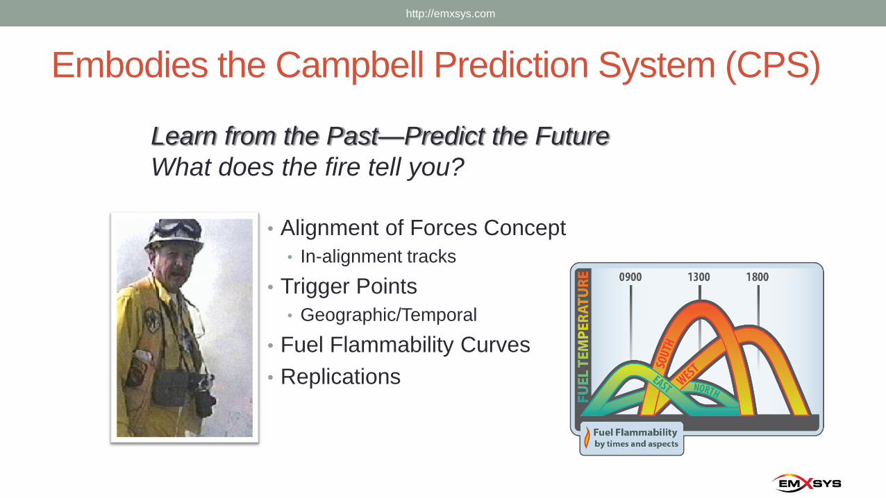
Embodies the Campbell Prediction System (CPS)
• Alignment of Forces Concept
• In-alignment tracks
• Trigger Points
• Geographic/Temporal
• Fuel Flammability Curves
• Replications
http://emxsys.com
Learn from the Past—Predict the Future
What does the fire tell you?
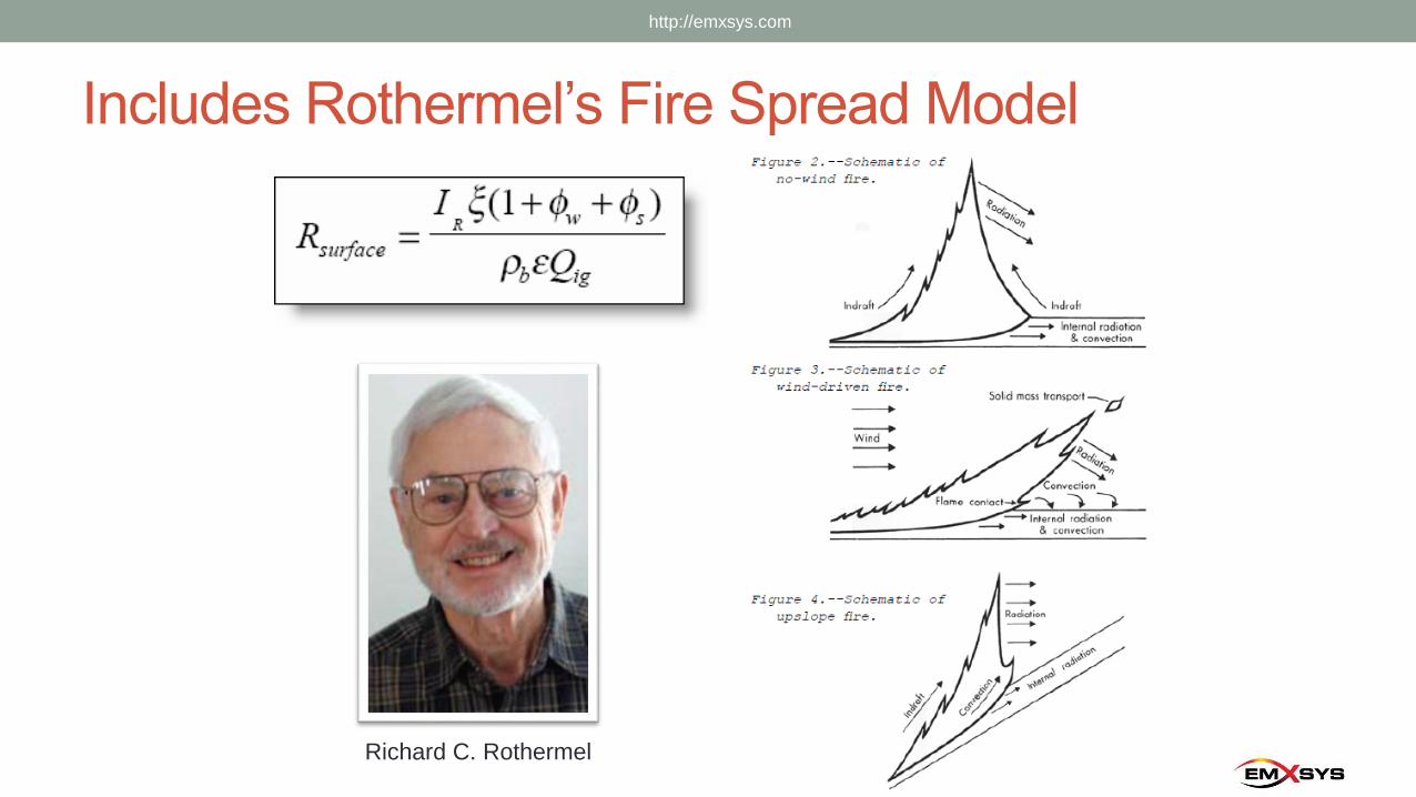
Includes Rothermel’s Fire Spread Model
http://emxsys.com
Richard C. Rothermel
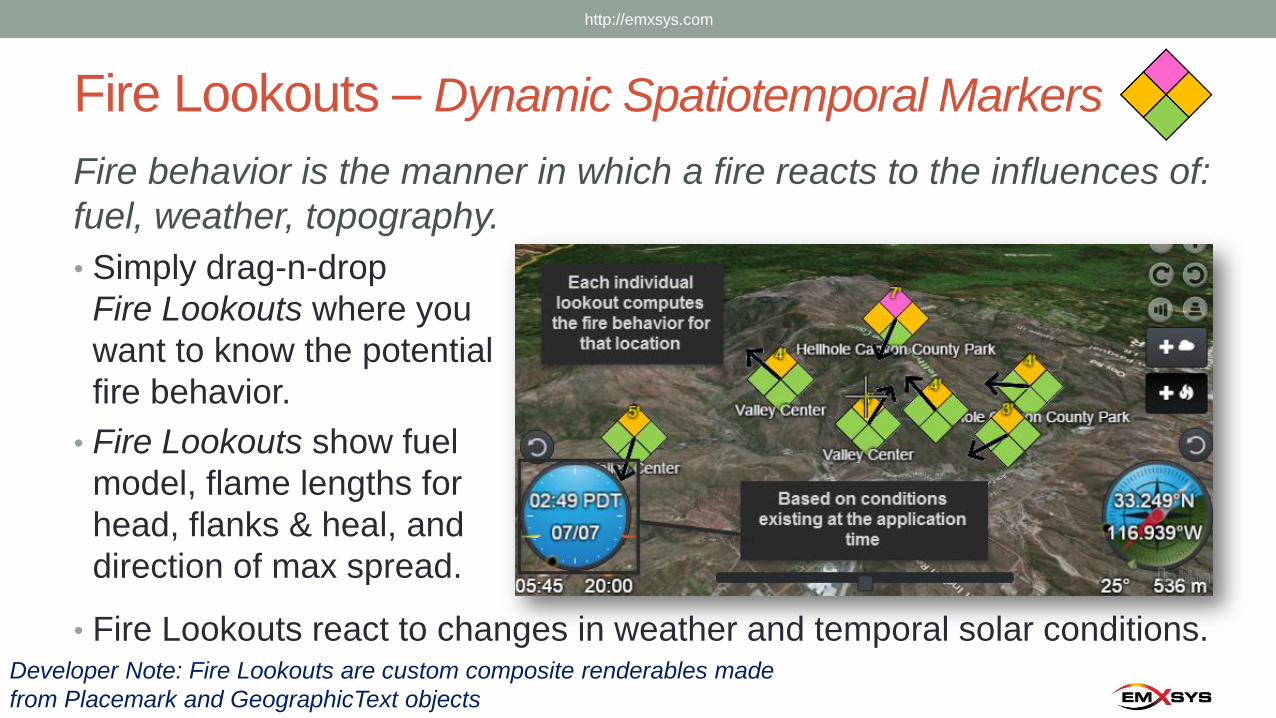
Fire Lookouts – Dynamic Spatiotemporal Markers
Fire behavior is the manner in which a fire reacts to the influences of:
fuel, weather, topography.
• Simply drag-n-drop
Fire Lookouts where you
want to know the potential
fire behavior.
• Fire Lookouts show fuel
model, flame lengths for
head, flanks & heal, and
direction of max spread.
• Fire Lookouts react to changes in weather and temporal solar conditions.Developer Note: Fire Lookouts are custom composite renderables made
from Placemark and GeographicText objects
http://emxsys.com
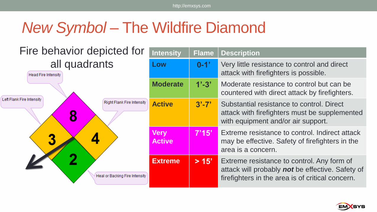
New Symbol – The Wildfire Diamond
Fire behavior depicted for
all quadrantsIntensity Flame Description
Low 0-1’ Very little resistance to control and direct
attack with firefighters is possible.
Moderate 1’-3’ Moderate resistance to control but can be
countered with direct attack by firefighters.
Active 3’-7’ Substantial resistance to control. Direct
attack with firefighters must be supplemented
with equipment and/or air support.
Very
Active7’15’ Extreme resistance to control. Indirect attack
may be effective. Safety of firefighters in the
area is a concern.
Extreme > 15’ Extreme resistance to control. Any form of
attack will probably not be effective. Safety of
firefighters in the area is of critical concern.
http://emxsys.com
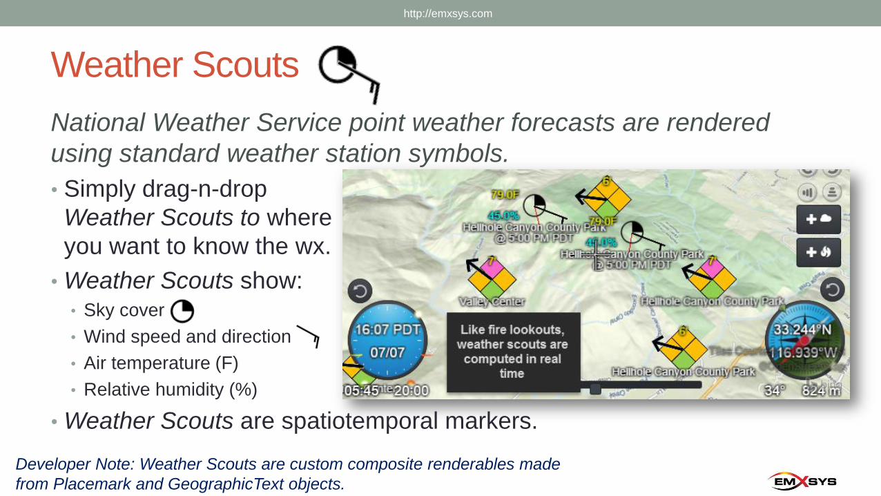
Weather Scouts
National Weather Service point weather forecasts are rendered
using standard weather station symbols.
• Simply drag-n-drop
Weather Scouts to where
you want to know the wx.
• Weather Scouts show:• Sky cover
• Wind speed and direction
• Air temperature (F)
• Relative humidity (%)
• Weather Scouts are spatiotemporal markers.
Developer Note: Weather Scouts are custom composite renderables made
from Placemark and GeographicText objects.
http://emxsys.com
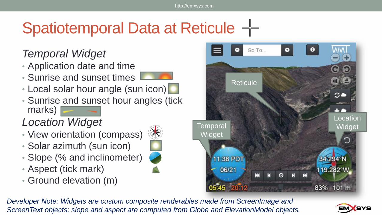
Spatiotemporal Data at Reticule
Temporal Widget• Application date and time
• Sunrise and sunset times
• Local solar hour angle (sun icon)
• Sunrise and sunset hour angles (tick marks)
Location Widget• View orientation (compass)
• Solar azimuth (sun icon)
• Slope (% and inclinometer)
• Aspect (tick mark)
• Ground elevation (m)
Developer Note: Widgets are custom composite renderables made from ScreenImage and
ScreenText objects; slope and aspect are computed from Globe and ElevationModel objects.
Temporal
Widget
Location
Widget
Reticule
http://emxsys.com
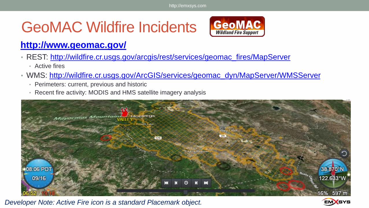
GeoMAC Wildfire Incidentshttp://www.geomac.gov/
• REST: http://wildfire.cr.usgs.gov/arcgis/rest/services/geomac_fires/MapServer• Active fires
• WMS: http://wildfire.cr.usgs.gov/ArcGIS/services/geomac_dyn/MapServer/WMSServer• Perimeters: current, previous and historic
• Recent fire activity: MODIS and HMS satellite imagery analysis
Developer Note: Active Fire icon is a standard Placemark object.
http://emxsys.com
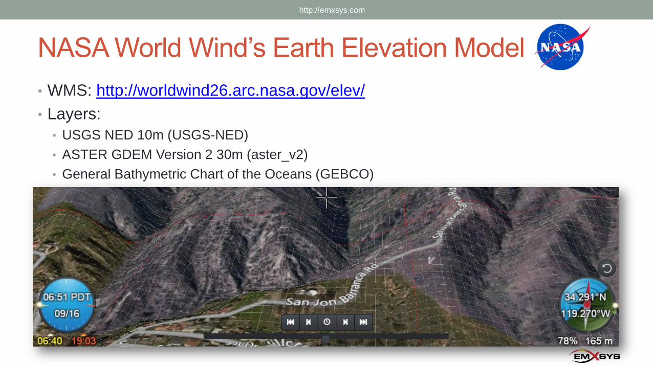
NASA World Wind’s Earth Elevation Model
• WMS: http://worldwind26.arc.nasa.gov/elev/
• Layers:
• USGS NED 10m (USGS-NED)
• ASTER GDEM Version 2 30m (aster_v2)
• General Bathymetric Chart of the Oceans (GEBCO)
http://emxsys.com
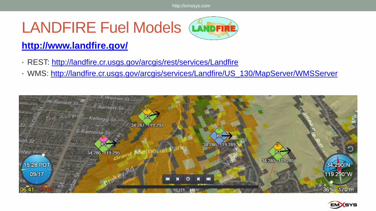
LANDFIRE Fuel Models
• REST: http://landfire.cr.usgs.gov/arcgis/rest/services/Landfire
• WMS: http://landfire.cr.usgs.gov/arcgis/services/Landfire/US_130/MapServer/WMSServer
http://www.landfire.gov/
http://emxsys.com
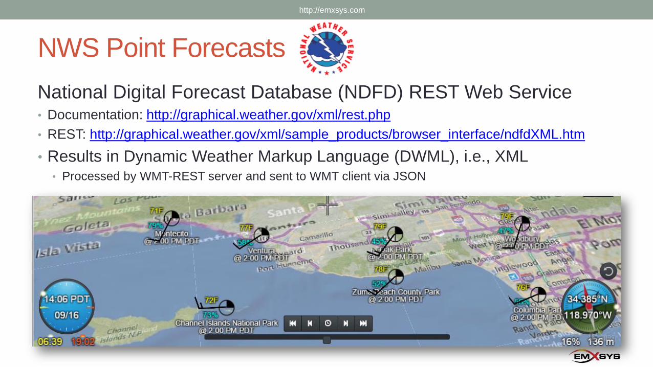
NWS Point Forecasts
National Digital Forecast Database (NDFD) REST Web Service • Documentation: http://graphical.weather.gov/xml/rest.php
• REST: http://graphical.weather.gov/xml/sample_products/browser_interface/ndfdXML.htm
• Results in Dynamic Weather Markup Language (DWML), i.e., XML• Processed by WMT-REST server and sent to WMT client via JSON
http://emxsys.com
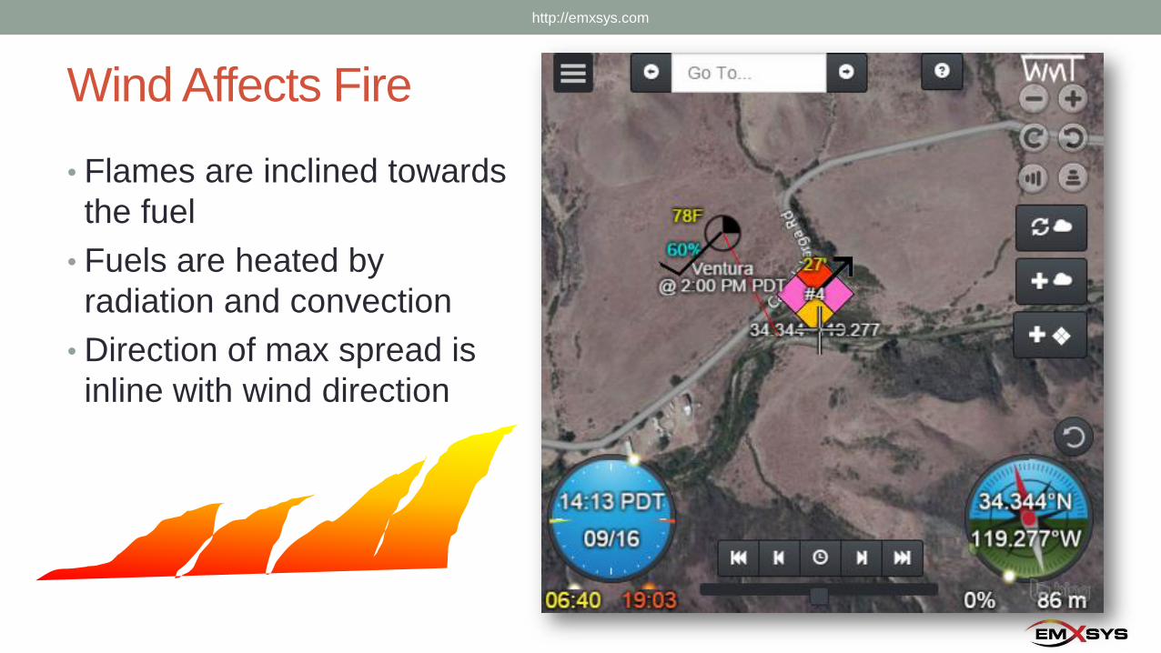
Wind Affects Fire
• Flames are inclined towards
the fuel
• Fuels are heated by
radiation and convection
• Direction of max spread is
inline with wind direction
http://emxsys.com
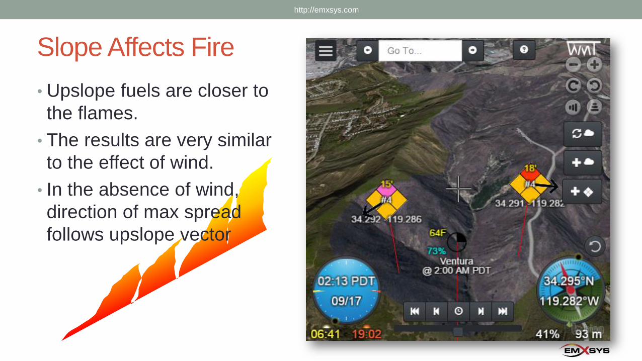
Slope Affects Fire
• Upslope fuels are closer to
the flames.
• The results are very similar
to the effect of wind.
• In the absence of wind,
direction of max spread
follows upslope vector
http://emxsys.com
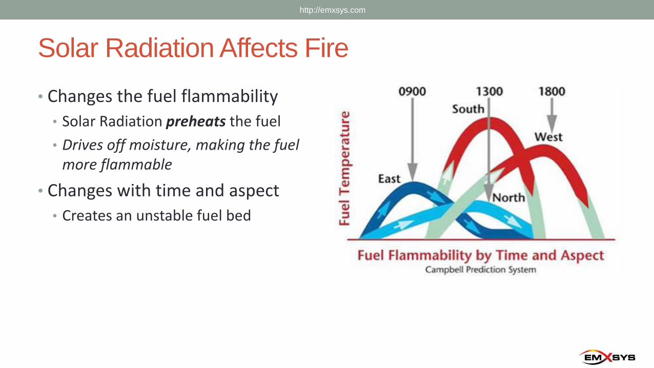
Solar Radiation Affects Fire
• Changes the fuel flammability
• Solar Radiation preheats the fuel
• Drives off moisture, making the fuel more flammable
• Changes with time and aspect
• Creates an unstable fuel bed
http://emxsys.com
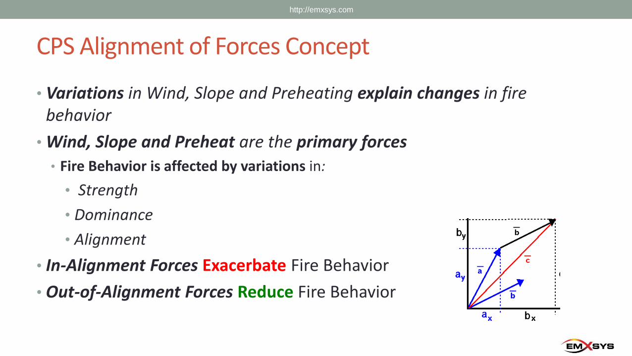
CPS Alignment of Forces Concept
• Variations in Wind, Slope and Preheating explain changes in fire behavior
• Wind, Slope and Preheat are the primary forces
• Fire Behavior is affected by variations in:
• Strength
• Dominance
• Alignment
• In-Alignment Forces Exacerbate Fire Behavior
• Out-of-Alignment Forces Reduce Fire Behavior
http://emxsys.com
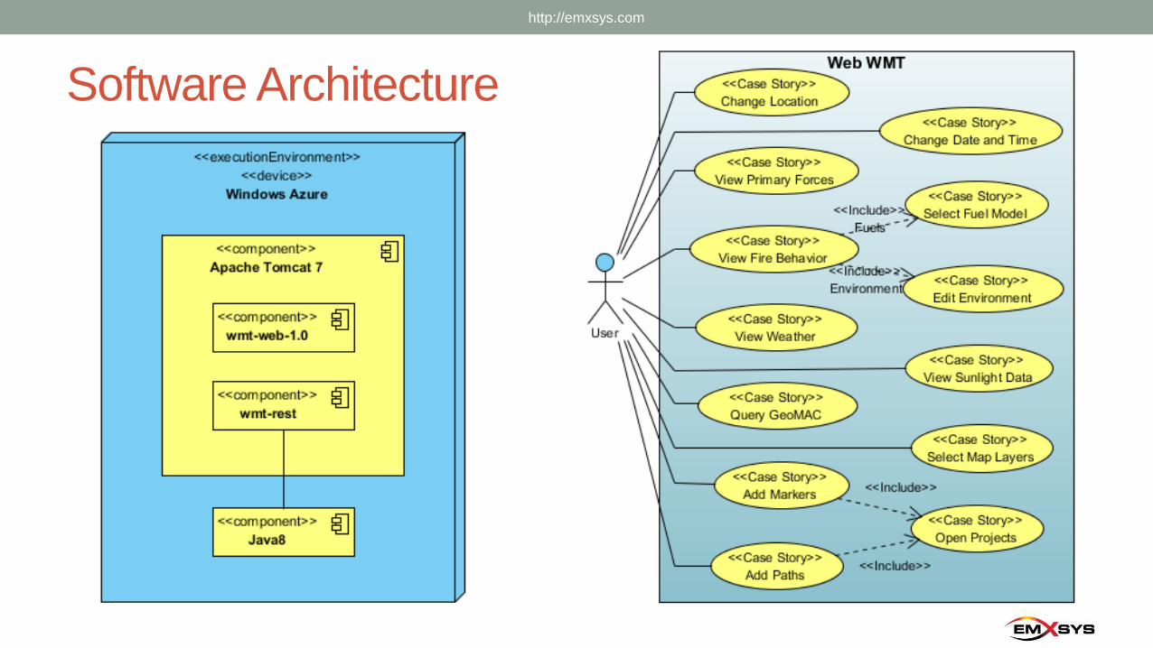
Software Architecture
http://emxsys.com
In Closing
• Email:
• “Bruce Schubert” [email protected]
• Website:
• http://emxsys.com
• WMT Web App:
• http://wmt.emxsys.com
• Wildfire Management Tool – Web open source project
(wiki, issue tracker, and source code):
• https://bitbucket.org/emxsys/wildfire-management-tool-web/
http://emxsys.com
Recommended