Embed Size (px)
Citation preview
| Final Project | Part A- Process Journal Report Compilation | Pamphlet & Model Representation
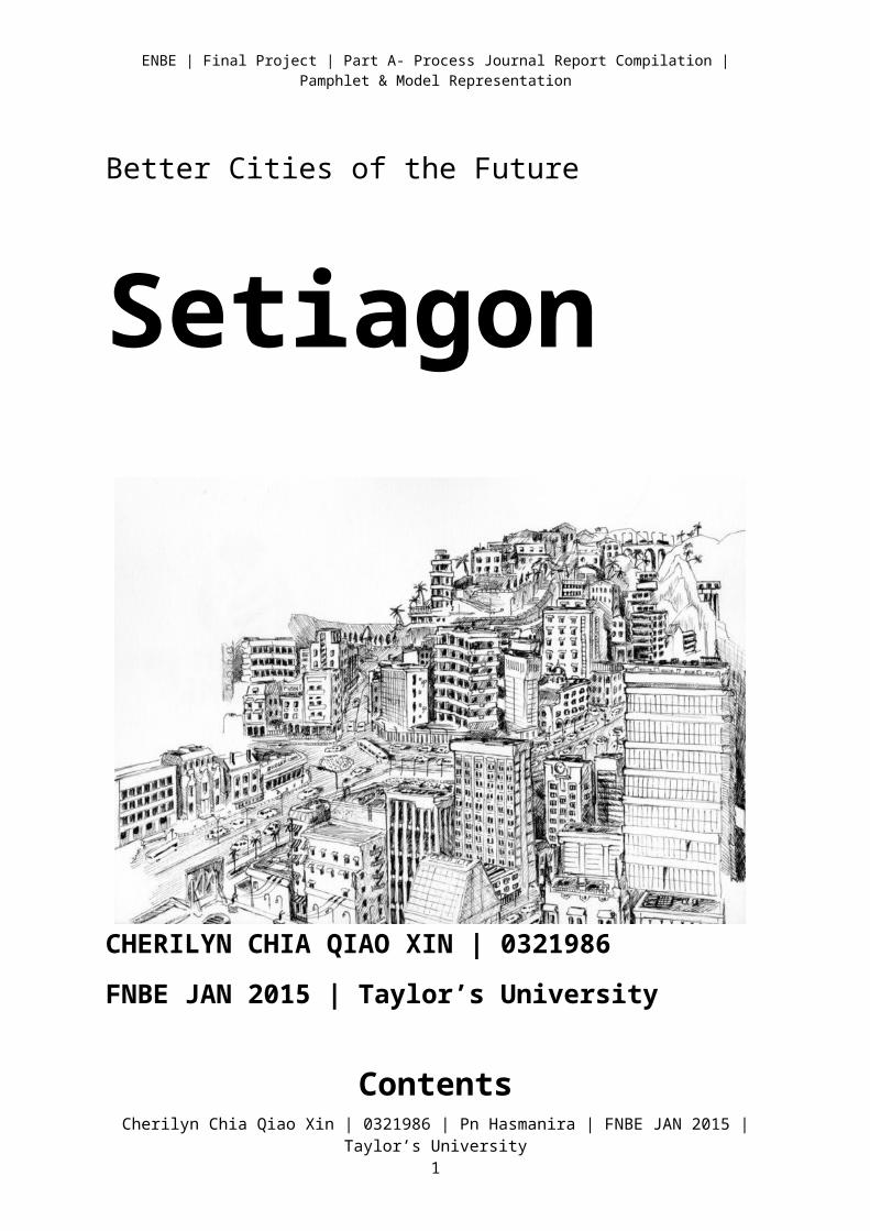
Better Cities of the Future
Setiagon
CHERILYN CHIA QIAO XIN | 0321986
FNBE JAN 2015 | Taylor’s University
Contents
Cherilyn Chia Qiao Xin | 0321986 | Pn Hasmanira | FNBE JAN 2015 | Taylor’s University1
| Final Project | Part A- Process Journal Report Compilation | Pamphlet & Model Representation
1. Introduction
2. A City
3. Investigation on Better City Guidelines and Issues
4. Investigation & Data Collection: Ancient and old cities
5. Investigation & Data Collection: The present city/cities
6. Investigation & Data Collection: The future city/cities
7. The New “X” City- Setiagon
8. All about The Pamphlet
9. Conclusion
10. References
Introduction
In this project, we were required to plan a city in a specific place such as the following:
i. An underground city (or in a cave)
Cherilyn Chia Qiao Xin | 0321986 | Pn Hasmanira | FNBE JAN 2015 | Taylor’s University
| Final Project | Part A- Process Journal Report Compilation | Pamphlet & Model Representation
ii. An underwater or floating on water city (sea/saltwater wetlands)iii. An underwater or floating on water city (fresh water wetlands)iv. A city that blends in the forest (Swamp Area)v. A city in the air (skyscraper city/in the mountains)
Each of the students are required to produce an A4 size folded pamphlet to promote the new city development. Students will need to understand what a “city” is, its development and history, components and elements of a city.
The size of the proposed new city should be between 30-50km2, with a population between 100,000-250,000. The people of the city are Malaysian and the location of the city will be in Malaysia with Malaysian settings and environment.
A City
The Definition
Cherilyn Chia Qiao Xin | 0321986 | Pn Hasmanira | FNBE JAN 2015 | Taylor’s University

| Final Project | Part A- Process Journal Report Compilation | Pamphlet & Model Representation
A city is an inhabited place of greater size, population, or importance than a town or village. Although there is no agreement on how a city is distinguished from a town, many cities have a particular administrative, legal, or historical status based on local law. Cities also have complex systems for sanitation, utilities, land usage, housing, and transportation.
Brief history of city formation
Cities first form after the Neolithic revolution. At that time, agriculture is the main activity which support a city’s development, encouraging the increase in human population. According to Vere Gordon Childe, for a settlement to qualify as a city, raw materials is a must to support the growing human population.
The reason for city formation can be also related to the reduction of transportation costs for goods, people and ideas. A city was also formed as central places for trading and the benefits include exchanging of ideas, sharing of natural resources and providing amenities such as sewage disposal. A city has professional administrators, regulations, taxations as the pay for government workers.
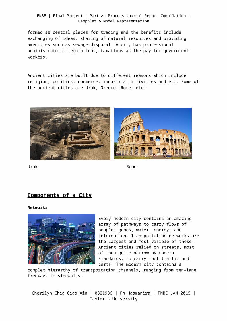
Ancient cities are built due to different reasons which include religion, politics, commerce, industrial activities and etc. Some of the ancient cities are Uruk, Greece, Rome, etc.
Uruk Rome
Components of a City
Networks
Cherilyn Chia Qiao Xin | 0321986 | Pn Hasmanira | FNBE JAN 2015 | Taylor’s University
| Final Project | Part A- Process Journal Report Compilation | Pamphlet & Model Representation
Every modern city contains an amazing array of pathways to carry flows of people, goods, water, energy, and information. Transportation networks are the largest and most visible of these. Ancient cities relied on streets, most of them quite narrow by modern standards, to carry foot traffic and carts. The modern city contains a complex hierarchy of transportation channels, ranging from ten-lane freeways to sidewalks.
Modern cities rely on complex networks of utilities. When cities were small, obtaining pure water and disposing of wastes was not a major problem, but cities with large populations and high densities require expensive public infrastructure. Rapid urban growth and industrialization caused overcrowding, pollution, and disease in urban areas. After the connection between impure water and disease was established, cities began to install adequate sewer and water systems. Cities have also been laced with wires and conduits carrying electricity, gas, and communications signals.
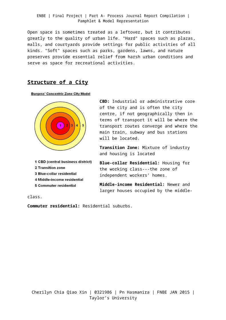
Buildings
Buildings are the most visible elements of the city, the features that give each city its unique character. Residential structures occupy almost half of all urban land, with the building types ranging from scattered single-family homes to dense high-rise apartments. Commercial buildings are clustered downtown and at various subcenters, with skyscrapers packed into the central business district and low-rise structures prevailing elsewhere. Industrial buildings come
in many forms ranging from large factory complexes in industrial districts to small workshops.
Open Spaces
Open space is sometimes treated as a leftover, but it contributes greatly to the quality of urban life. "Hard" spaces such as plazas, malls, and courtyards provide settings for public activities of all kinds. "Soft" spaces
Cherilyn Chia Qiao Xin | 0321986 | Pn Hasmanira | FNBE JAN 2015 | Taylor’s University
| Final Project | Part A- Process Journal Report Compilation | Pamphlet & Model Representation
such as parks, gardens, lawns, and nature preserves provide essential relief from harsh urban conditions and serve as space for recreational activities.
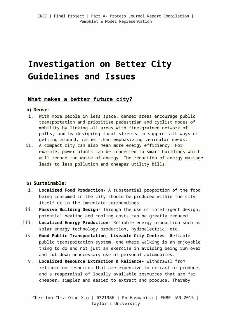
Structure of a City
CBD: Industrial or administrative core of the city and is often the city centre, if not geographically then in terms of transport it will be where the transport routes converge and where the main train, subway and bus stations will be located.
Transition Zone: Mixture of industry and housing is located
Blue-collar Residential: Housing for the working class---the zone of independent workers’ homes.
Middle-income Residential: Newer and larger houses occupied by the middle-class.
Commuter residential: Residential suburbs.
Investigation on Better City Guidelines and Issues
What makes a better future city?
a) Dense:
Cherilyn Chia Qiao Xin | 0321986 | Pn Hasmanira | FNBE JAN 2015 | Taylor’s University
| Final Project | Part A- Process Journal Report Compilation | Pamphlet & Model Representation
i. With more people in less space, denser areas encourage public transportation and prioritize pedestrian and cyclist modes of mobility by linking all areas with fine-grained network of paths, and by designing local streets to support all ways of getting around, rather than emphasizing vehicular needs.
ii. A compact city can also mean more energy efficiency. For example, power plants can be connected to smart buildings which will reduce the waste of energy. The reduction of energy wastage leads to less pollution and cheaper utility bills.
b) Sustainable:i. Localized Food Production- A substantial proportion of the food being consumed in the city
should be produced within the city itself or in the immediate surroundings.ii. Passive Building Design- Through the use of intelligent design, potential heating and cooling
costs can be greatly reduced.iii. Localized Energy Production- Reliable energy production such as solar energy technology
production, hydroelectric, etc.iv. Good Public Transportation, Liveable City Centres- Reliable public transportation system, one
where walking is an enjoyable thing to do and not just an exercise in avoiding being run over and cut down unnecessary use of personal automobiles.
v. Localized Resource Extraction & Reliance- Withdrawal from reliance on resources that are expensive to extract or produce, and a reappraisal of locally available resources that are far cheaper, simpler and easier to extract and produce. Thereby decreasing reliance on an increasingly volatile globalized market, and increasing self-sufficiency.
Common Issues in the Modern City
There are a list of issues occurring in the city which revolves around the people and the environment, some which includes the following:
Traffic and automobile problems: Increasing number of cars causing more traffic
Cherilyn Chia Qiao Xin | 0321986 | Pn Hasmanira | FNBE JAN 2015 | Taylor’s University
| Final Project | Part A- Process Journal Report Compilation | Pamphlet & Model Representation
Pollutions: Air, water, sound, and land pollutions
Communications: Miscommunication or lack of communication between the local government
and business, residents and other entities.
Downtown management: Difficulty accessing local resources to synchronize initiatives for
maximum impact.
Water supply problems: Lack of water resources and increasing water wastage
Poor urban planning
High living expenses: High-end lifestyle causing increased crime rates and unbalanced distribution
for different classes of people
Economic issues: The income of the city decreases, causing the residents to live in harsh
situations.
Investigation & Data Collection: Ancient/old cities
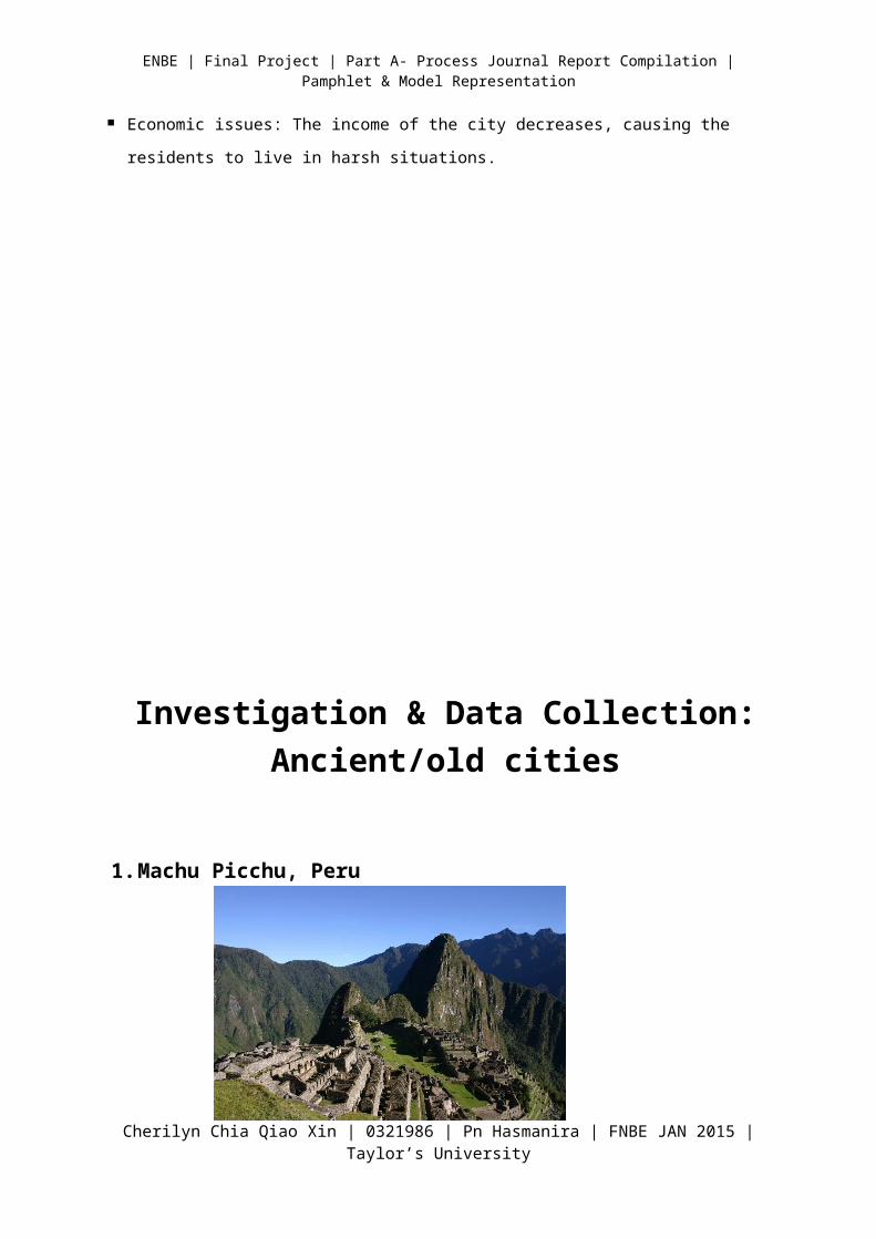
1. Machu Picchu, Peru
Cherilyn Chia Qiao Xin | 0321986 | Pn Hasmanira | FNBE JAN 2015 | Taylor’s University
| Final Project | Part A- Process Journal Report Compilation | Pamphlet & Model Representation
Machu Picchu is located 2,430 m above sea level.
The location of the city was a military secret, and its deep precipices and steep mountains provide excellent natural defences.
It has a water supply from springs and enough land to grow food for about four times as many people as ever lived there.
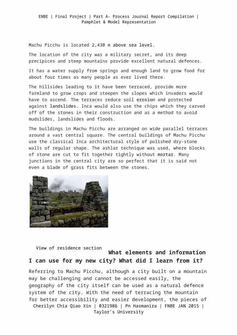
The hillsides leading to it have been terraced, provide more farmland to grow crops and steepen the slopes which invaders would have to ascend. The terraces reduce soil erosion and protected against landslides. Inca would also use the chips which they carved off of the stones in their construction and as a method to avoid mudslides, landslides and floods.
The buildings in Machu Picchu are arranged on wide parallel terraces around a vast central square. The central buildings of Machu Picchu use the classical Inca architectural style of polished dry-stone walls of regular shape. The ashlar technique was used, where blocks of stone are cut to fit together tightly without mortar. Many junctions in the central city are so perfect that it is said not even a blade of grass fits between the stones.
What elements and information I can use for my new city? What did I learn from it?
Referring to Machu Picchu, although a city built on a mountain may be challenging and cannot be accessed easily, the geography of the city itself can be used as a natural defence system of the city. With the need of terracing the mountain for better accessibility and easier development, the pieces of carved rocks can be used in constructions and creating barriers. The terracing of hillsides can also serve as a method to overcome natural disasters such as landslides and flooding. For my new city, I plan to develop it on a terraced land to
Cherilyn Chia Qiao Xin | 0321986 | Pn Hasmanira | FNBE JAN 2015 | Taylor’s University
View of residence section of the City
| Final Project | Part A- Process Journal Report Compilation | Pamphlet & Model Representation
create a larger space for agriculture purposes. With the terraced site, the development of transportation can be more convenient.
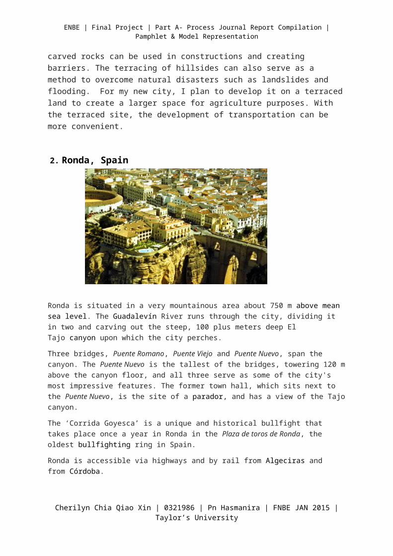
2. Ronda, Spain
Ronda is situated in a very mountainous area about 750 m above mean sea level. The Guadalevín River runs through the city, dividing it in two and carving out the steep, 100 plus meters deep El Tajo canyon upon which the city perches.
Three bridges, Puente Romano, Puente Viejo and Puente Nuevo, span the canyon. The Puente Nuevo is the tallest of the bridges, towering 120 m above the canyon floor, and all three serve as some of the city's most impressive features. The former town hall, which sits next to the Puente Nuevo, is the site of a parador, and has a view of the Tajo canyon.
The ‘Corrida Goyesca’ is a unique and historical bullfight that takes place once a year in Ronda in the Plaza de toros de Ronda, the oldest bullfighting ring in Spain.
Ronda is accessible via highways and by rail from Algeciras and from Córdoba.
What elements and information I can use for my new city? What did I learn from it?
Although Ronda is built on the mountain, it becomes more accessible when bridges were built. My new city can be also accessible by building bridges but highways and rails will be a more effective way to reach the city.
Cherilyn Chia Qiao Xin | 0321986 | Pn Hasmanira | FNBE JAN 2015 | Taylor’s University
| Final Project | Part A- Process Journal Report Compilation | Pamphlet & Model Representation
Investigation & Data Collection: The present city
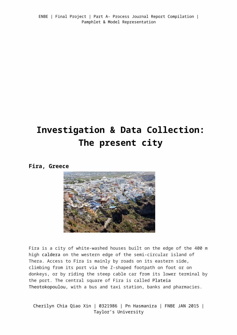
Fira, Greece
Cherilyn Chia Qiao Xin | 0321986 | Pn Hasmanira | FNBE JAN 2015 | Taylor’s University
| Final Project | Part A- Process Journal Report Compilation | Pamphlet & Model Representation
Fira is a city of white-washed houses built on the edge of the 400 m high caldera on the western edge of the semi-circular island of Thera. Access to Fira is mainly by roads on its eastern side, climbing from its port via the Z-shaped footpath on foot or on donkeys, or by riding the steep cable car from its lower terminal by the port. The central square of Fira is called Plateia Theotokopoulou, with a bus and taxi station, banks and pharmacies.
What elements and information I can use for my new city? What did I learn from it?
With a city built on a mountain, the modes of transportation are limited. Even so, people can still reach the city via cable car that acts as both a transportation system and tourist attraction. The city central can be determined with a main transport system in it. It should be accessible to all modes of transportation. Health institutions such as hospitals should be included into the city in order to sustain the overall health of the citizens.
Investigation & Data Collection: The future city
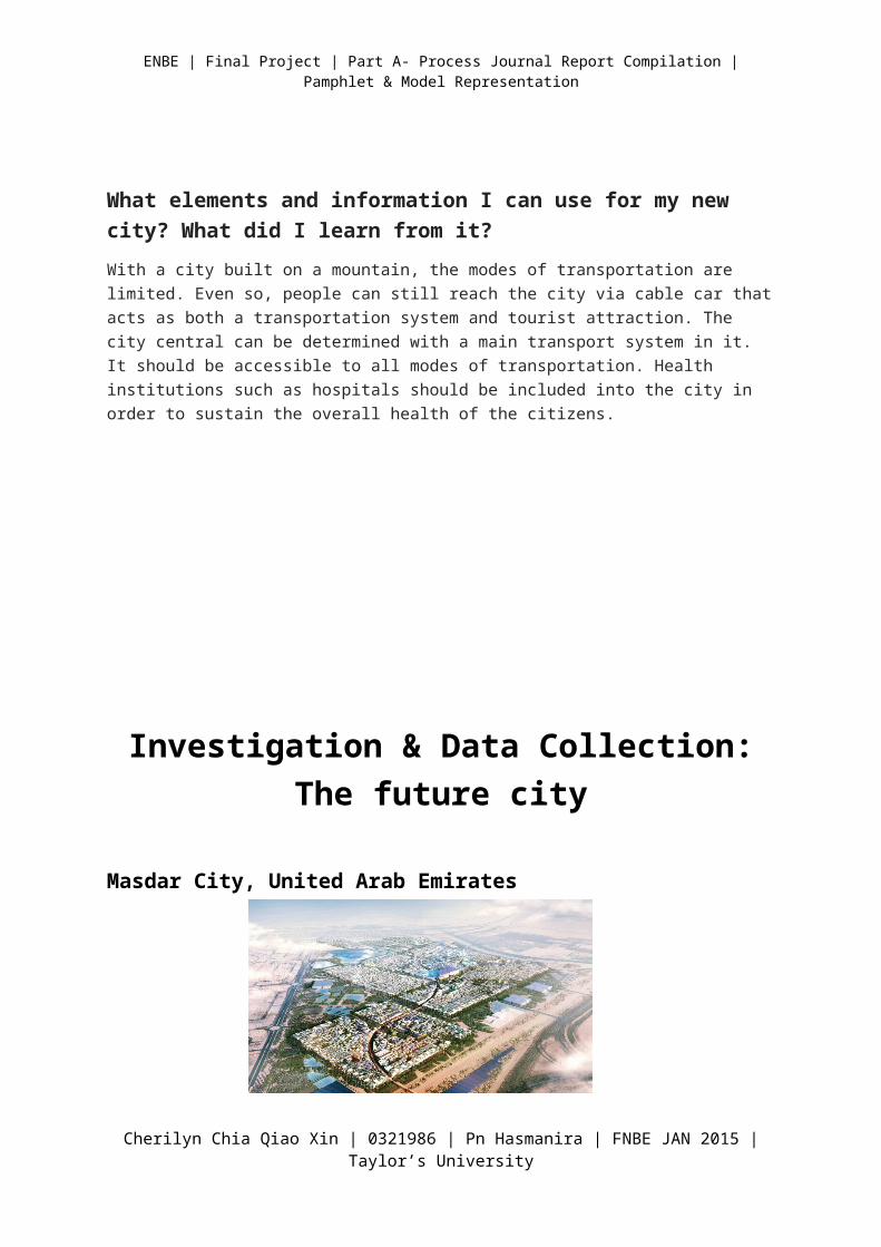
Masdar City, United Arab Emirates
Cherilyn Chia Qiao Xin | 0321986 | Pn Hasmanira | FNBE JAN 2015 | Taylor’s University
| Final Project | Part A- Process Journal Report Compilation | Pamphlet & Model Representation
Masdar City is a project to develop the world’s most sustainable eco-city. The city, which combines ancient Arabic architectural techniques with modern technology and captures prevailing winds is cooler and more comfortable during the high summer temperatures. Being in the location with high sun exposure, Masdar City uses energy generated through solar panels.
The low-carbon development of Masdar City has an integral role in transforming Abu Dhabi’s economy from an oil foundation to one with a knowledge and innovation base. It serves as a centralised test bed for global renewable energy and technology companies.
The city itself is designed to maximise convenience and reduce environmental impacts.
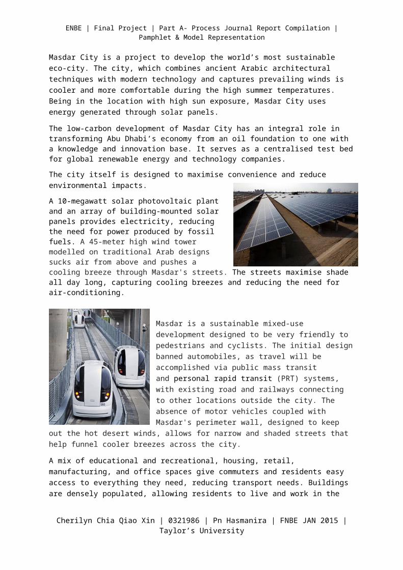
A 10-megawatt solar photovoltaic plant and an array of building-mounted solar panels provides electricity, reducing the need for power produced by fossil fuels. A 45-meter high wind tower modelled on traditional Arab designs sucks air from above and pushes a cooling breeze through Masdar's streets. The streets maximise shade all day long, capturing cooling breezes and reducing the need for air-conditioning.
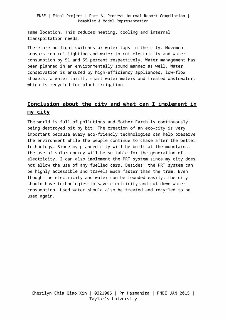
Masdar is a sustainable mixed-use development designed to be very friendly to pedestrians and cyclists. The initial design banned automobiles, as travel will be accomplished via public mass transit and personal rapid transit (PRT) systems, with existing road and railways connecting to other locations outside the city. The absence of motor vehicles coupled with Masdar's perimeter wall, designed to keep out the hot desert winds, allows for narrow and shaded streets that help funnel cooler breezes across the city.
A mix of educational and recreational, housing, retail, manufacturing, and office spaces give commuters and residents
easy access to everything they need, reducing transport needs. Buildings are densely populated, allowing residents to live and work in the same location. This reduces heating, cooling and internal transportation needs.
There are no light switches or water taps in the city. Movement sensors control lighting and water to cut electricity and water consumption by 51 and 55 percent respectively. Water management has been planned in an environmentally sound manner as well. Water conservation is ensured by high-efficiency appliances, low-flow showers, a water tariff, smart water meters and treated wastewater, which is recycled for plant irrigation.
Cherilyn Chia Qiao Xin | 0321986 | Pn Hasmanira | FNBE JAN 2015 | Taylor’s University
| Final Project | Part A- Process Journal Report Compilation | Pamphlet & Model Representation
Conclusion about the city and what can I implement in my city
The world is full of pollutions and Mother Earth is continuously being destroyed bit by bit. The creation of an eco-city is very important because every eco-friendly technologies can help preserve the environment while the people continue to chase after the better technology. Since my planned city will be built at the mountains, the use of solar energy will be suitable for the generation of electricity. I can also implement the PRT system since my city does not allow the use of any fuelled cars. Besides, the PRT system can be highly accessible and travels much faster than the tram. Even though the electricity and water can be founded easily, the city should have technologies to save electricity and cut down water consumption. Used water should also be treated and recycled to be used again.
The New ‘X’ City - SETIAGON
Cherilyn Chia Qiao Xin | 0321986 | Pn Hasmanira | FNBE JAN 2015 | Taylor’s University
| Final Project | Part A- Process Journal Report Compilation | Pamphlet & Model Representation
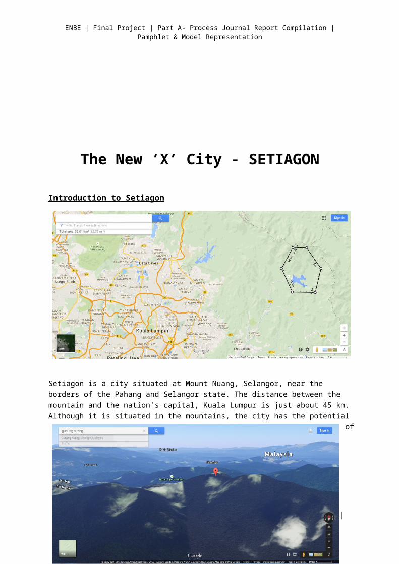
Introduction to Setiagon
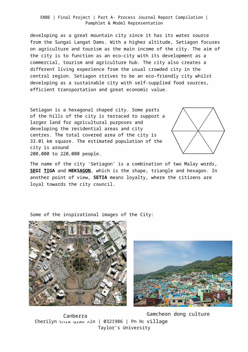
Setiagon is a city situated at Mount Nuang, Selangor, near the borders of the Pahang and Selangor state. The distance between the mountain and the nation’s capital, Kuala Lumpur is just about 45 km. Although it is situated in the mountains, the city has the potential of developing as a great mountain city since it has its water source from the Sungai Langat Dams. With a higher altitude, Setiagon focuses on agriculture and tourism as the main income of the city. The aim of the city is to function as an eco-city with its development as a commercial, tourism and agriculture hub. The city also creates a different living experience from the usual crowded city in the central region. Setiagon strives to be an eco-friendly city whilst developing as a sustainable city with self-supplied food sources, efficient transportation and great economic value.
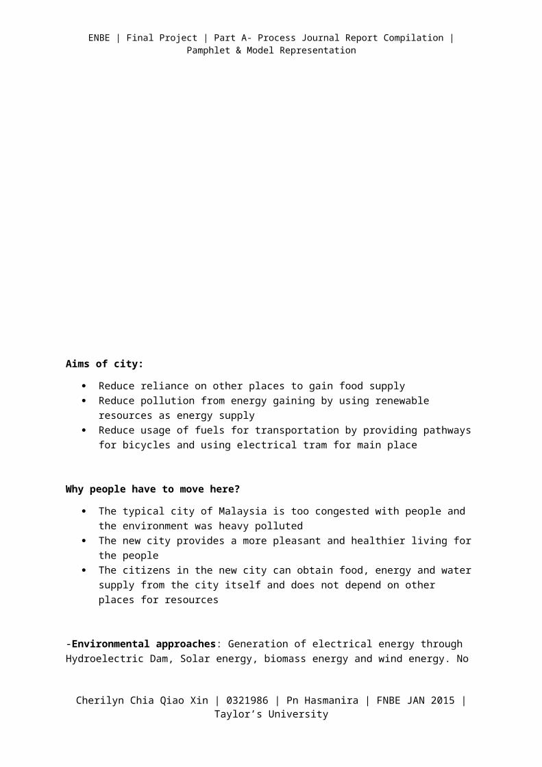
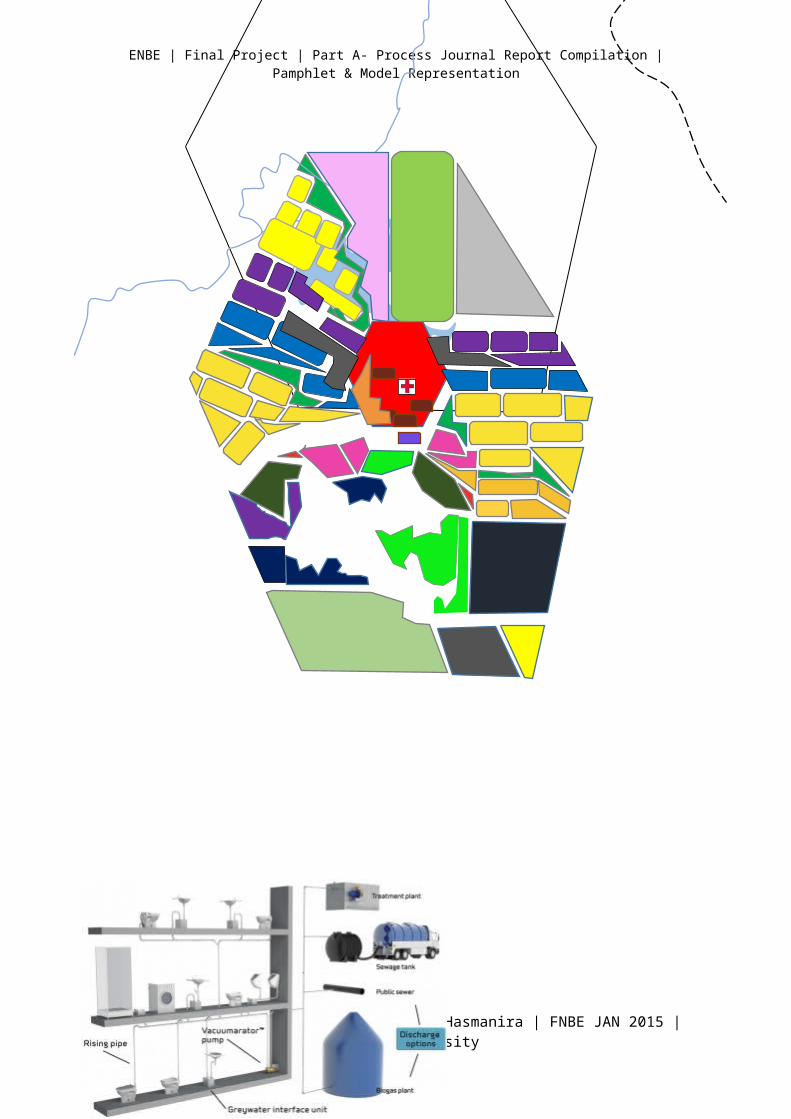
Setiagon is a hexagonal shaped city. Some parts of the hills of the city is terraced to support a larger land for agricultural purposes and developing the residential areas and city centres. The total covered area of the city is 33.01 km square. The estimated population of the city is around 200,000 to 220,000 people.
Cherilyn Chia Qiao Xin | 0321986 | Pn Hasmanira | FNBE JAN 2015 | Taylor’s University
| Final Project | Part A- Process Journal Report Compilation | Pamphlet & Model Representation
The name of the city ‘Setiagon’ is a combination of two Malay words, SEGI TIGA and HEKSAGON, which is the shape, triangle and hexagon. In another point of view, SETIA means loyalty, where the citizens are loyal towards the city council.
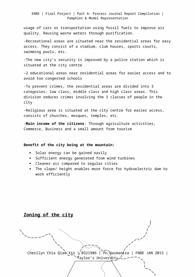
Some of the inspirational images of the City:
Aims of city:
Reduce reliance on other places to gain food supply Reduce pollution from energy gaining by using renewable resources as energy supply
Cherilyn Chia Qiao Xin | 0321986 | Pn Hasmanira | FNBE JAN 2015 | Taylor’s University
Canberra Gamcheon dong culture village
| Final Project | Part A- Process Journal Report Compilation | Pamphlet & Model Representation
Reduce usage of fuels for transportation by providing pathways for bicycles and using electrical tram for main place
Why people have to move here?
The typical city of Malaysia is too congested with people and the environment was heavy polluted
The new city provides a more pleasant and healthier living for the people The citizens in the new city can obtain food, energy and water supply from the city itself and
does not depend on other places for resources
-Environmental approaches: Generation of electrical energy through Hydroelectric Dam, Solar energy, biomass energy and wind energy. No usage of cars or transportation using fossil fuels to improve air quality. Reusing waste waters through purification.
-Recreational areas are situated near the residential areas for easy access. They consist of a stadium, club houses, sports courts, swimming pools, etc.
-The new city’s security is improved by a police station which is situated at the city centre
-2 educational areas near residential areas for easier access and to avoid too congested schools
-To prevent crimes, the residential areas are divided into 3 categories: low class, middle class and high class areas. This division reduces crimes involving the 3 classes of people in the city
-Religious area is situated at the city centre for easier access, consists of churches, mosques, temples, etc.
-Main income of the citizens: Through agriculture activities, Commerce, Business and a small amount from tourism
Benefit of the city being at the mountain:
Solar energy can be gained easily Sufficient energy generated from wind turbines Cleaner air compared to regular cities The slope/ height enables more force for hydroelectric dam to work efficiently
Zoning of the city
Cherilyn Chia Qiao Xin | 0321986 | Pn Hasmanira | FNBE JAN 2015 | Taylor’s University
| Final Project | Part A- Process Journal Report Compilation | Pamphlet & Model Representation
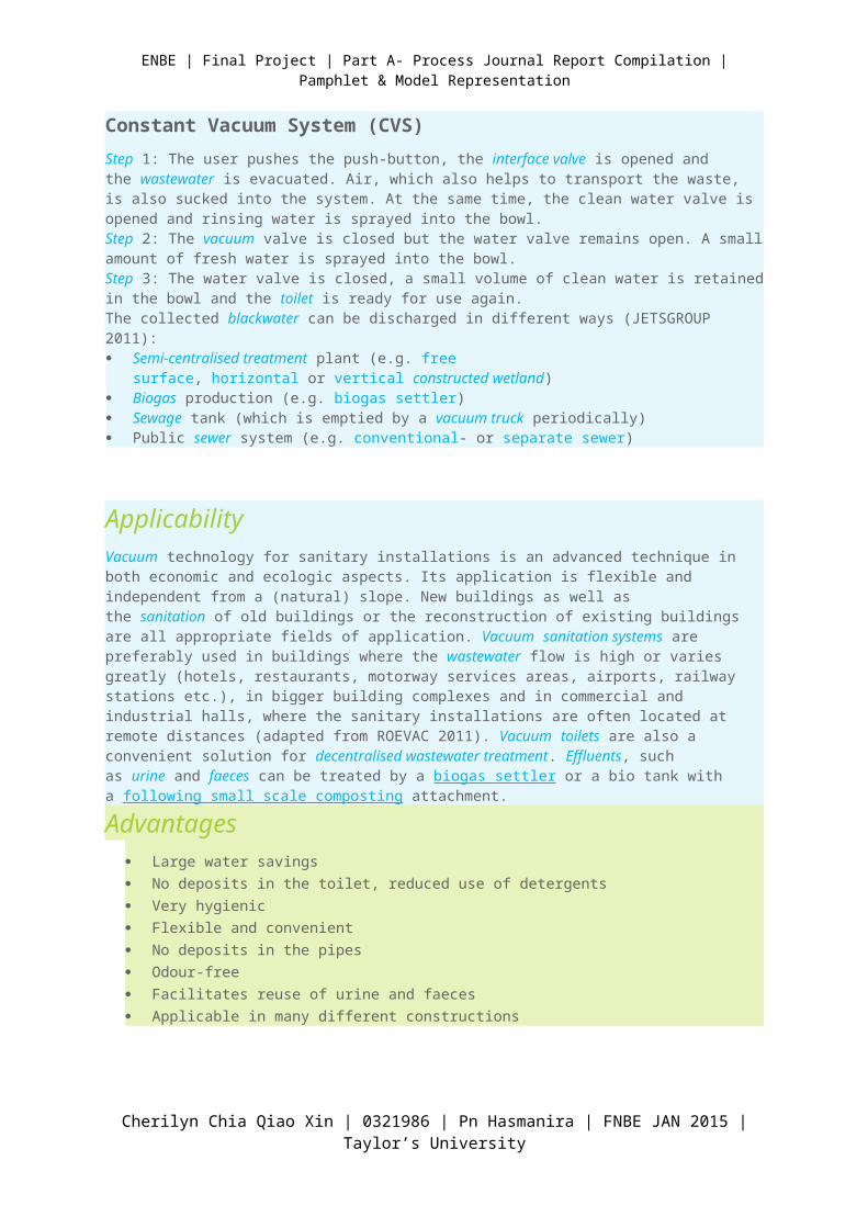
Constant Vacuum System (CVS)
Cherilyn Chia Qiao Xin | 0321986 | Pn Hasmanira | FNBE JAN 2015 | Taylor’s University
| Final Project | Part A- Process Journal Report Compilation | Pamphlet & Model Representation
Step 1: The user pushes the push-button, the interface valve is opened and the wastewater is evacuated. Air, which also helps to transport the waste, is also sucked into the system. At the same time, the clean water valve is opened and rinsing water is sprayed into the bowl.Step 2: The vacuum valve is closed but the water valve remains open. A small amount of fresh water is sprayed into the bowl.Step 3: The water valve is closed, a small volume of clean water is retained in the bowl and the toilet is ready for use again.The collected blackwater can be discharged in different ways (JETSGROUP 2011): Semi-centralised treatment plant (e.g. free surface, horizontal or vertical constructed
wetland) Biogas production (e.g. biogas settler) Sewage tank (which is emptied by a vacuum truck periodically) Public sewer system (e.g. conventional- or separate sewer)
ApplicabilityVacuum technology for sanitary installations is an advanced technique in both economic and ecologic aspects. Its application is flexible and independent from a (natural) slope. New buildings as well as the sanitation of old buildings or the reconstruction of existing buildings are all appropriate fields of application. Vacuum sanitation systems are preferably used in buildings where the wastewater flow is high or varies greatly (hotels, restaurants, motorway services areas, airports, railway stations etc.), in bigger building complexes and in commercial and industrial halls, where the sanitary installations are often located at remote distances (adapted from ROEVAC 2011). Vacuum toilets are also a convenient solution for decentralised wastewater treatment. Effluents, such as urine and faeces can be treated by a biogas settler or a bio tank with a following small scale composting attachment.
Advantages Large water savings
No deposits in the toilet, reduced use of detergents
Very hygienic
Flexible and convenient
No deposits in the pipes
Odour-free
Facilitates reuse of urine and faeces
Applicable in many different constructions
Cherilyn Chia Qiao Xin | 0321986 | Pn Hasmanira | FNBE JAN 2015 | Taylor’s University
| Final Project | Part A- Process Journal Report Compilation | Pamphlet & Model Representation
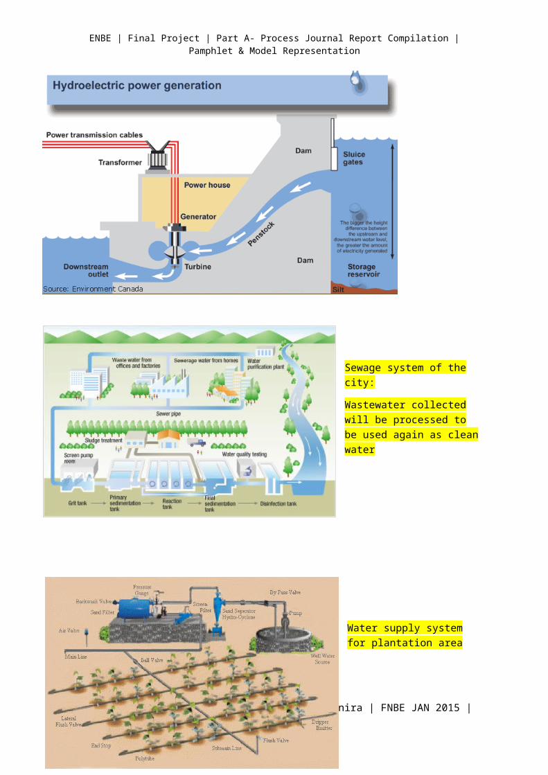
Sewage system of the city:
Wastewater collected will be processed to be used again as clean water
Water supply system for plantation area
Cherilyn Chia Qiao Xin | 0321986 | Pn Hasmanira | FNBE JAN 2015 | Taylor’s University
| Final Project | Part A- Process Journal Report Compilation | Pamphlet & Model Representation
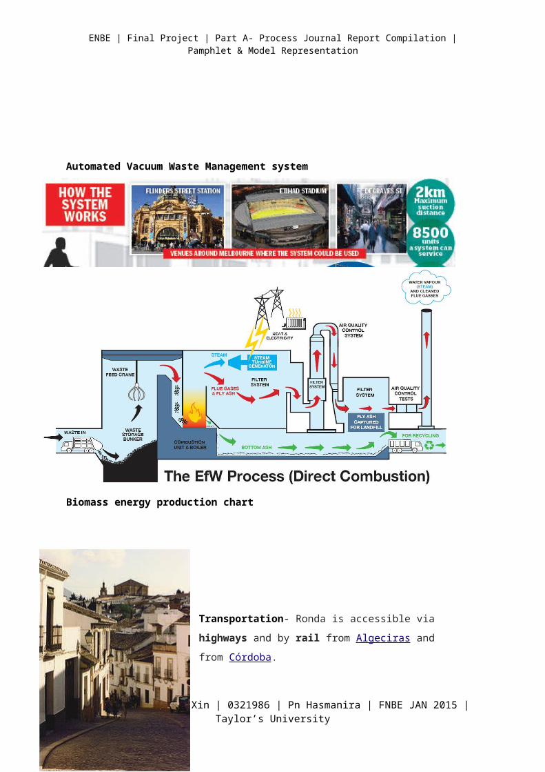
Automated Vacuum Waste Management system
Biomass energy production chart
Transportation- Ronda is accessible via highways and by
rail from Algeciras and from Córdoba.
The single track railway between Ronda and Algeciras was
built between 1890 and 1892 by the Gibraltar Railway
Company. It enabled the British military officers to escape the
summer heat of Gibraltar. The railway was built by James
Morrison, an engineer, in partnership with Sir Alexander
Henderson, a financier. The station at Ronda was opened in
1892.
Tram System-Tramways powered by electricity
Cherilyn Chia Qiao Xin | 0321986 | Pn Hasmanira | FNBE JAN 2015 | Taylor’s University
| Final Project | Part A- Process Journal Report Compilation | Pamphlet & Model Representation
Bicycle routes available for rent. Reduce air pollution. Increase accessibility.
All about the Pamphlet
A pamphlet is an unbound booklet (that is, without a hard cover or binding). It may consist of a
single sheet of paper that is printed on both sides and folded in half, in thirds, or in fourths (called a
leaflet), or it may consist of a few pages that are folded in half and saddle stapled at the crease to
make a simple book.
In order to count as a pamphlet, UNESCO requires a publication (other than a periodical) to have "at
least 5 but not more than 48 pages exclusive of the cover pages"; a longer item is a book
The purpose of a pamphlet is
Pamphlets are useful in business communications.
To educate, inform, persuade, or entertain your intended audience.
Cherilyn Chia Qiao Xin | 0321986 | Pn Hasmanira | FNBE JAN 2015 | Taylor’s University
| Final Project | Part A- Process Journal Report Compilation | Pamphlet & Model Representation
To mobilise people to support your cause.
To advertise a meeting or specific event.
To popularise your slogans and messages.
Step by Step brochure guidelines
#1: Know the purpose of your brochure and be clear on your message.
#2: Use the format of your brochure to your advantage, but don't let it restrict your design.
#3: Consider carefully the number and size of pages (or panels)
#4: Be selective about paper stock for your brochure
#5: Create a compelling cover.
Types of Folds of Pamphlets
Cherilyn Chia Qiao Xin | 0321986 | Pn Hasmanira | FNBE JAN 2015 | Taylor’s University
| Final Project | Part A- Process Journal Report Compilation | Pamphlet & Model Representation
References
Cherilyn Chia Qiao Xin | 0321986 | Pn Hasmanira | FNBE JAN 2015 | Taylor’s University
| Final Project | Part A- Process Journal Report Compilation | Pamphlet & Model Representation
http://www.sswm.info/content/vacuum-toilet
http://cronodon.com/PlanetTech/Cities_Structure.html
http://www.masdar.ae/en/masdar-city/detail/masdar-city-at-a-glance
http://www.scientificamerican.com/article/agricultures-sustainable-future/
http://www.citylab.com/work/2012/11/cities-denser-cores-do-better/3911/
http://en.wikipedia.org/wiki/Ronda
http://travel.nationalgeographic.com/travel/world-heritage/machu-picchu/
http://www.hollistercreative.com/try-something-new-and-see-what-unfolds/
http://www.creativebloq.com/graphic-design-tips/how-to-design-a-brochure-123267
Cherilyn Chia Qiao Xin | 0321986 | Pn Hasmanira | FNBE JAN 2015 | Taylor’s University