Embed Size (px)
DESCRIPTION
a presentation on roman civilization. focus point on ancient town planning and architecture. use of creative animations.
Citation preview
ROMAN CIVILISATIONPRESENTED BY :-
SAURABH MAURYA,131109030
LALIT KUMAWAT,131109031
RIKHI,131109033
VENODHA,131109036
ALOK TRIPATHI,131109037
SURAJ PATEL,131109039
JAYACHANDRA,131109040
ALOK SINGH,131109042
Maulana Azad National Institute of Technology
STRUCTURE OF THE PRESENTATION
• LOCATION
• IN THE BEGINNING
• FORMATION OF ROMAN REPUBLIC
• THE EMPIRE’S HIGH WATER MARK
• CITY AS INSTRUMENTS OF EMPIRE
• THE ROMAN URBAN SYSTEM AROUND 200 AD
• ROMAN CITIES AND TOWN
• PLAN OF THE ROME AND GRID IRON PLAN
• ROADS
• FORUMS
• CONCLUSIONMaulana Azad National Institute of Technology
ROMAN CIVILISATION
• Ancient Rome was an Italic civilization that began on the Italian Peninsula as early as the 8th century BC. Located along the Mediterranean Sea and centered on the city of Rome.
• It expanded to become one of the largest empires in the ancient world with an estimated 50 to 90 million inhabitants (roughly 20% of the world's population) and covering 6.5 million square kilometers (2.5 million sq. mi) during its height between the first and second centuries AD.
Maulana Azad National Institute of Technology
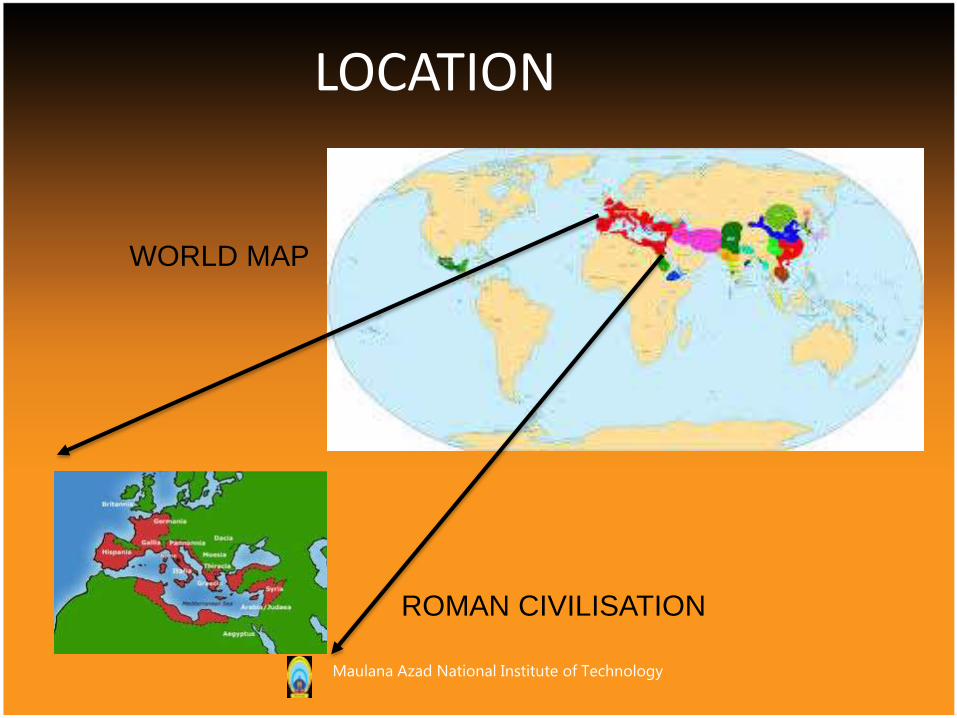
LOCATION
WORLD MAP
ROMAN CIVILISATION
Maulana Azad National Institute of Technology

• Ancient Rome begin as a group of villages along the Tiber River in what is now Italy.
• Around 750 B.C. these villages united to form the city of Rome.
In the Beginning…
Maulana Azad National Institute of Technology
• For more than 200 years, kings ruled Rome.
• In 509 B.C. Rome became a republic.
• The Roman Senate was an assembly of elected representatives. It was the single most powerful ruling body of the Roman Republic.
Formation of Roman Republic
Maulana Azad National Institute of Technology
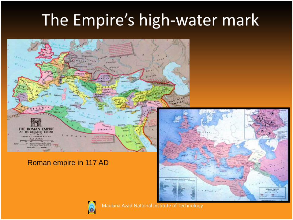
The Empire’s high-water mark
Roman empire in 117 AD
Maulana Azad National Institute of Technology
Cities as instruments of empire
Rome expanded beyond Italian peninsula in 133BC
Romans played their enemies off each other, then planted colonial cities to administer conquered lands
The “castra” or army camp was walled and laid out in a grid → planned cities (< 5,000 pop.)
Empire’s maximum extent by 211AD, collapsed after 250AD
Maulana Azad National Institute of Technology
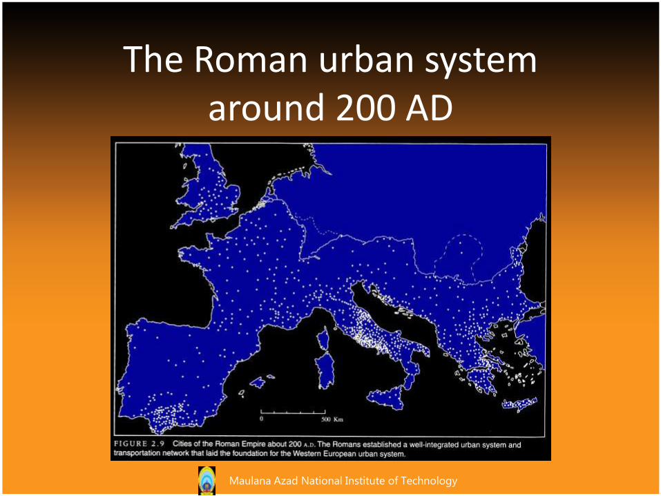
The Roman urban system around 200 AD
Maulana Azad National Institute of Technology
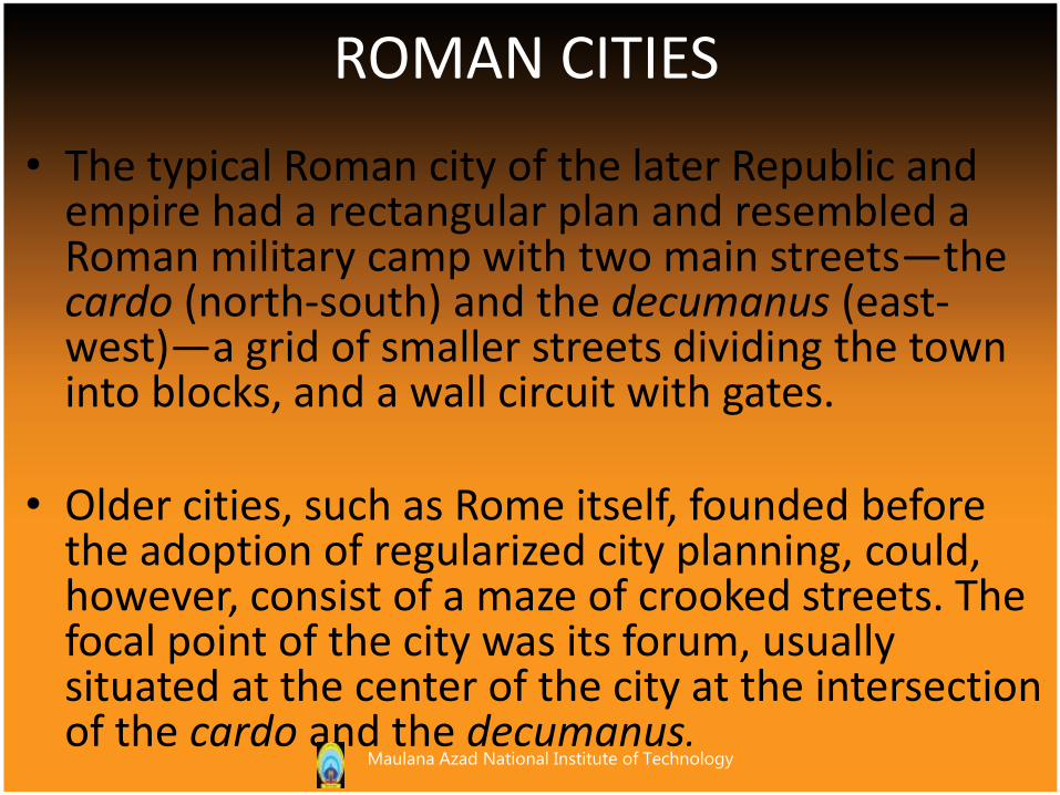
ROMAN CITIES
• The typical Roman city of the later Republic and empire had a rectangular plan and resembled a Roman military camp with two main streets—the cardo (north-south) and the decumanus (east-west)—a grid of smaller streets dividing the town into blocks, and a wall circuit with gates.
• Older cities, such as Rome itself, founded before the adoption of regularized city planning, could, however, consist of a maze of crooked streets. The focal point of the city was its forum, usually situated at the center of the city at the intersection of the cardo and the decumanus.
Maulana Azad National Institute of Technology
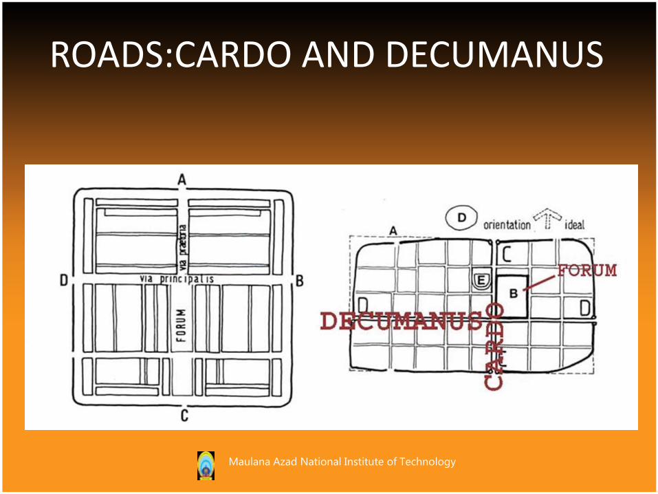
ROADS:CARDO AND DECUMANUS
Maulana Azad National Institute of Technology
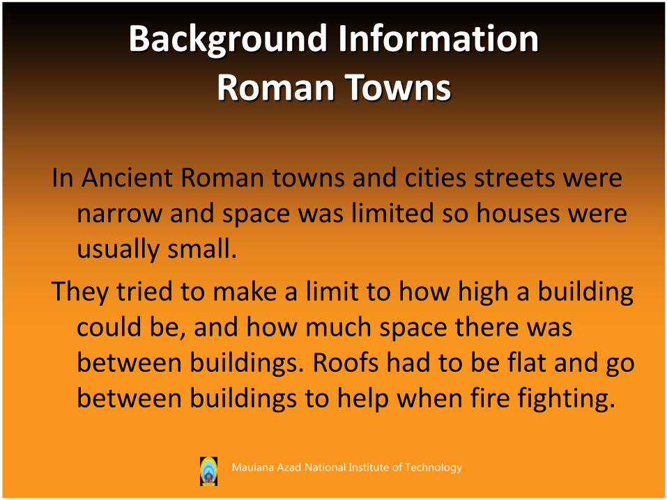
In Ancient Roman towns and cities streets were narrow and space was limited so houses were usually small.
They tried to make a limit to how high a building could be, and how much space there was between buildings. Roofs had to be flat and go between buildings to help when fire fighting.
Background Information Roman Towns
Maulana Azad National Institute of Technology
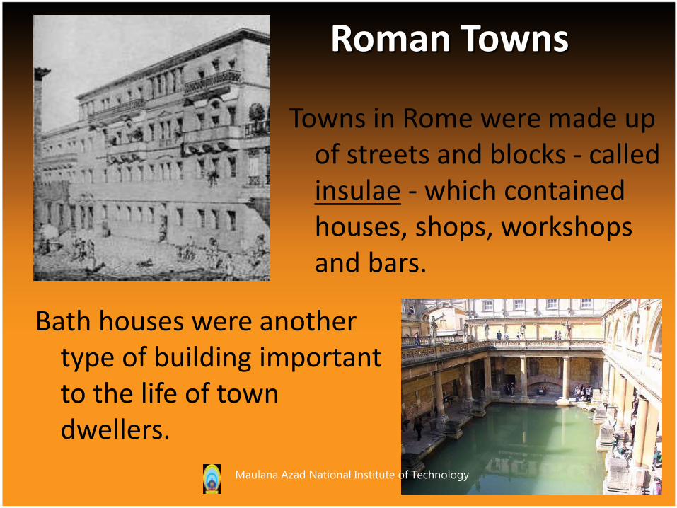
Towns in Rome were made up of streets and blocks - called insulae - which contained houses, shops, workshops and bars.
Bath houses were another type of building important to the life of town dwellers.
Roman Towns
Maulana Azad National Institute of Technology

Most Roman towns were smaller than modern cities, with populations ranging between a few thousand people to perhaps 30,000. Only great trading cities and capitals of the Empire were bigger than this. Rome was home to a million or more.
Roman Towns
Maulana Azad National Institute of Technology
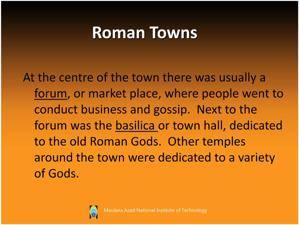
At the centre of the town there was usually a forum, or market place, where people went to conduct business and gossip. Next to the forum was the basilica or town hall, dedicated to the old Roman Gods. Other temples around the town were dedicated to a variety of Gods.
Roman Towns
Maulana Azad National Institute of Technology
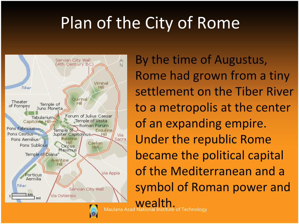
By the time of Augustus, Rome had grown from a tiny settlement on the Tiber River to a metropolis at the center of an expanding empire. Under the republic Rome became the political capital of the Mediterranean and a symbol of Roman power and wealth.
Plan of the City of Rome
Maulana Azad National Institute of Technology
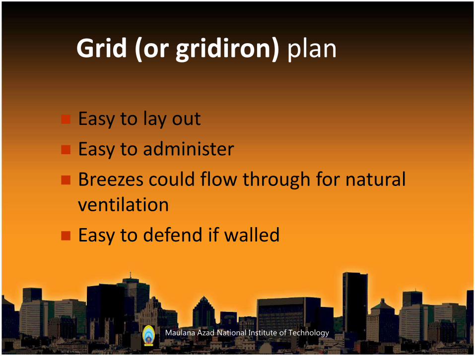
Grid (or gridiron) plan
Easy to lay out
Easy to administer
Breezes could flow through for natural ventilation
Easy to defend if walled
Maulana Azad National Institute of Technology
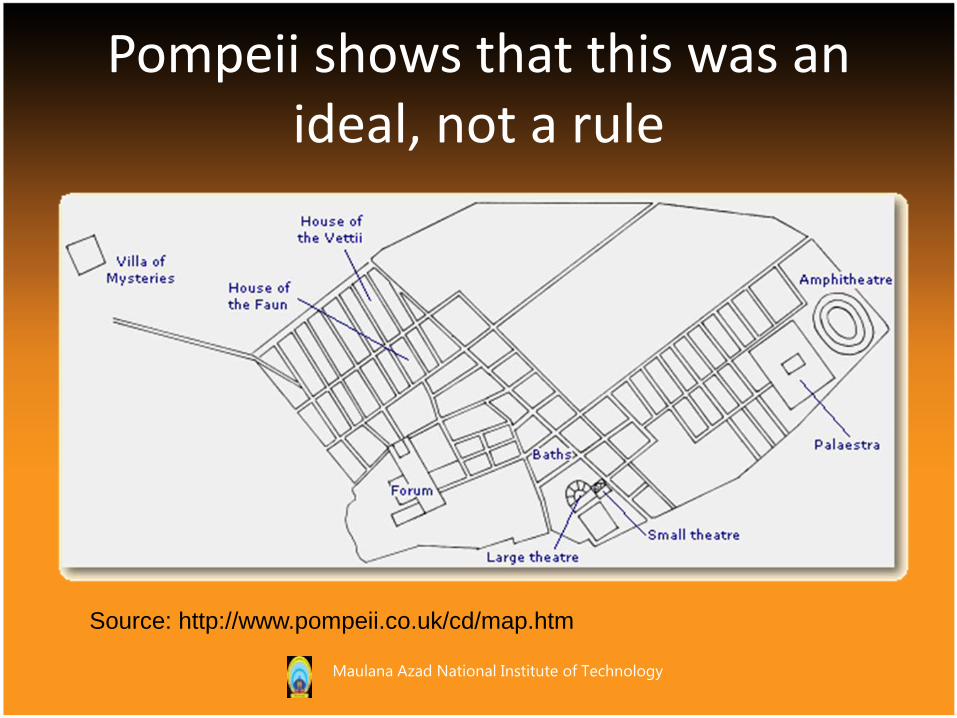
Pompeii shows that this was an ideal, not a rule
Source: http://www.pompeii.co.uk/cd/map.htm
Maulana Azad National Institute of Technology
Roads
Maulana Azad National Institute of Technology
Maulana Azad National Institute of Technology

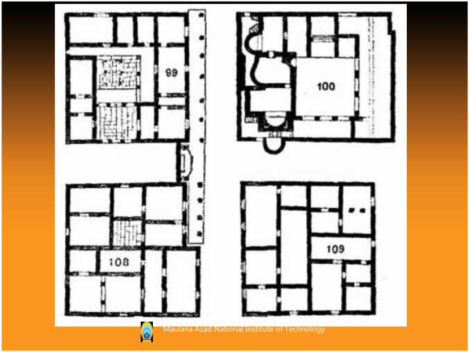
STREET PATTERNThe interior of the town was divided by streets into a chess-board pattern of small square house-blocks; from north to south
there were twelve such blocks and from east to west eleven—not twelve, as is often stated.
Maulana Azad National Institute of Technology
Maulana Azad National Institute of Technology
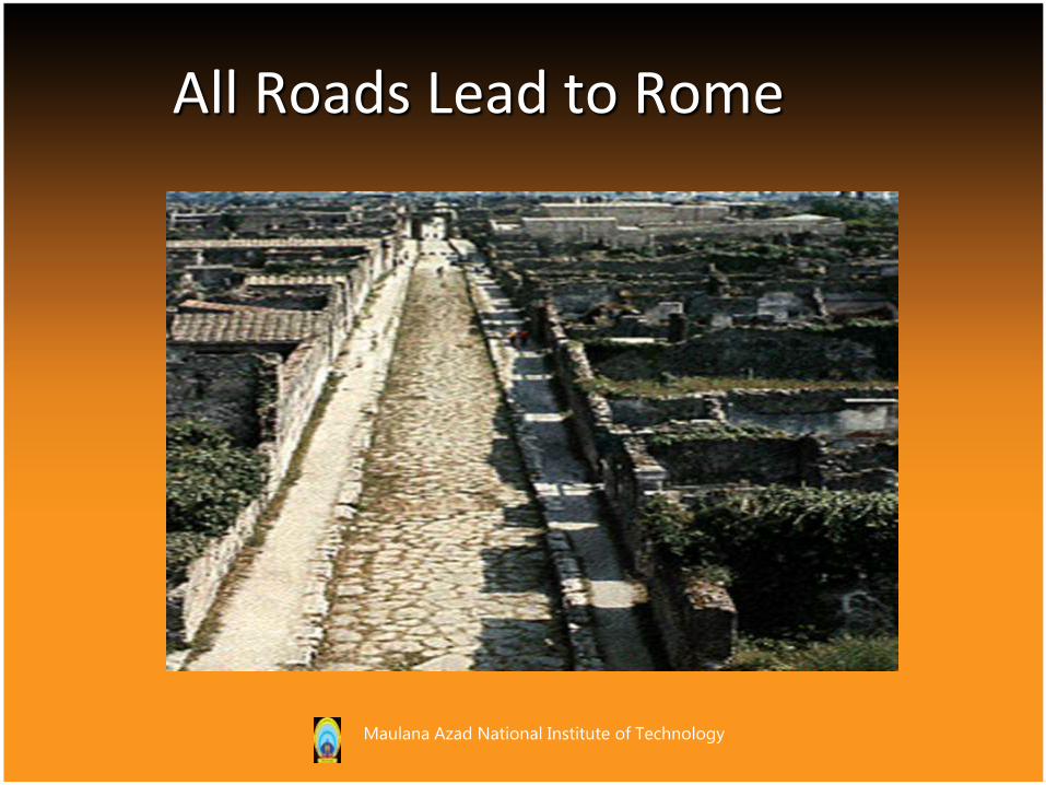
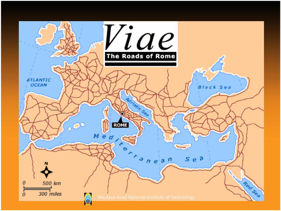
All Roads Lead to Rome
Maulana Azad National Institute of Technology
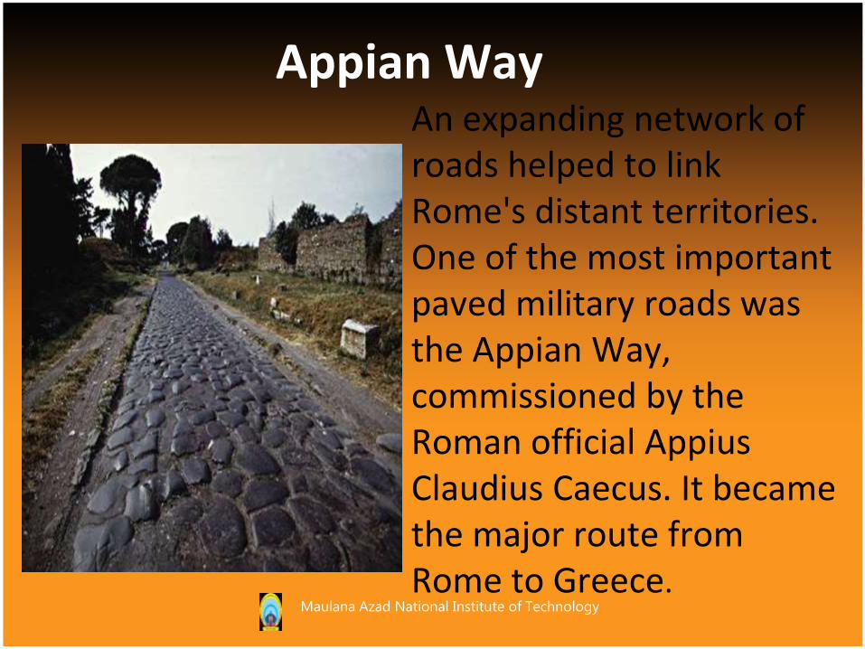
An expanding network of roads helped to link Rome's distant territories. One of the most important paved military roads was the Appian Way, commissioned by the Roman official Appius Claudius Caecus. It became the major route from Rome to Greece.
Appian Way
Maulana Azad National Institute of Technology
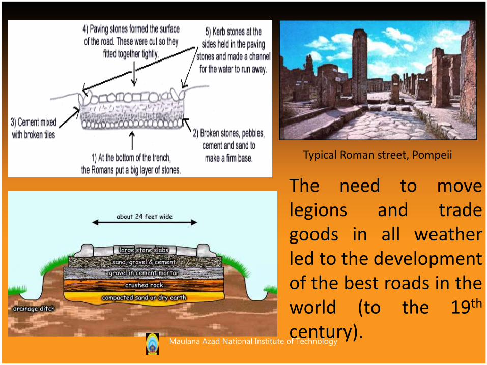
Typical Roman street, Pompeii
The need to movelegions and tradegoods in all weatherled to the developmentof the best roads in theworld (to the 19th
century).Maulana Azad National Institute of Technology

• In the 8th century B.C.,the inhabitants of somesmall Latin settlementson hills in the TIBERVALLEY united andestablished a commonmeeting place, theFORUM, around whichthe city of Rome grew.
Maulana Azad National Institute of Technology
• The forum, an open area bordered by colonnades with shops, functioned as the chief meeting place of the town. It was also the site of the city's primary religious and civic buildings, among them the Senate house, records office, and basilica.
Forums
Maulana Azad National Institute of Technology

The Forum
Bordered by everything important: temples, offices, jails, butcher shops
Public processions and ceremonies took place there
For a mainly pedestrian population, the surrounding colonnade was a very important urban design feature
Maulana Azad National Institute of Technology

Roman Forum (artist’s conception)
Source: A.E.J. Morris, History of Urban Form
Maulana Azad National Institute of Technology
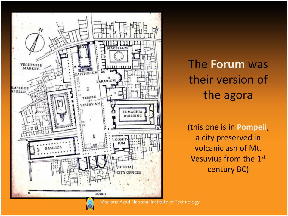
The Forum was their version of
the agora
(this one is in Pompeii, a city preserved in volcanic ash of Mt.
Vesuvius from the 1st
century BC)
Maulana Azad National Institute of Technology
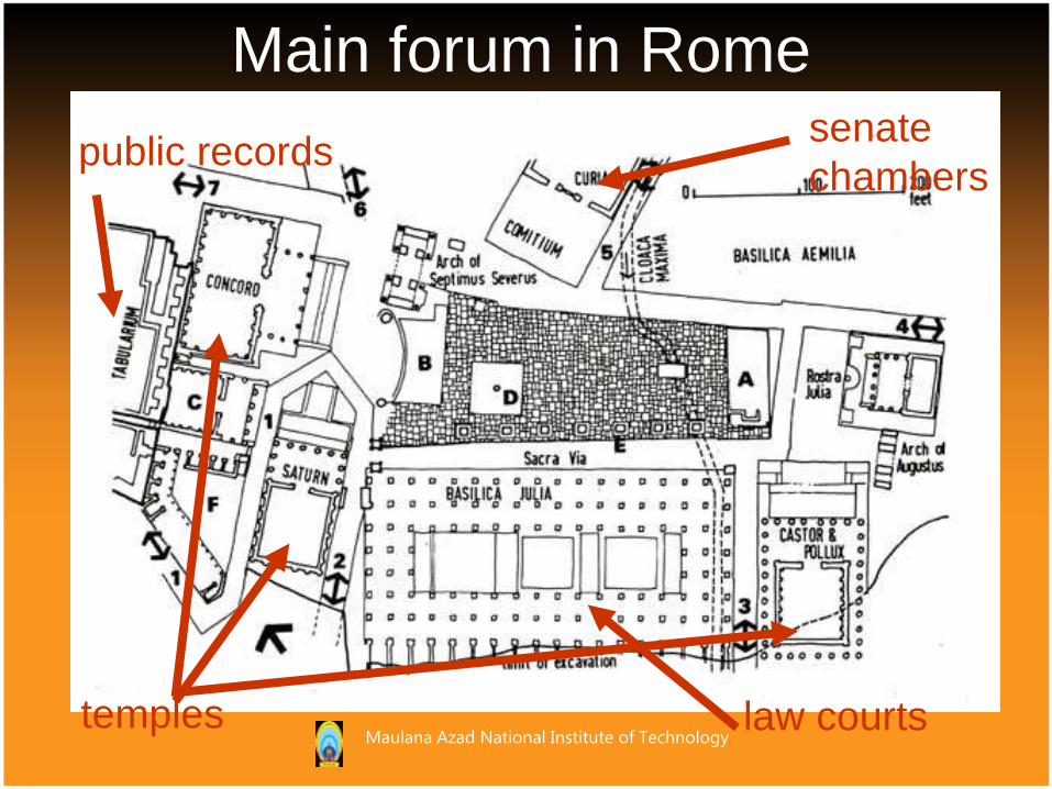
Main forum in Rome
temples
public recordssenate
chambers
law courtsMaulana Azad National Institute of Technology
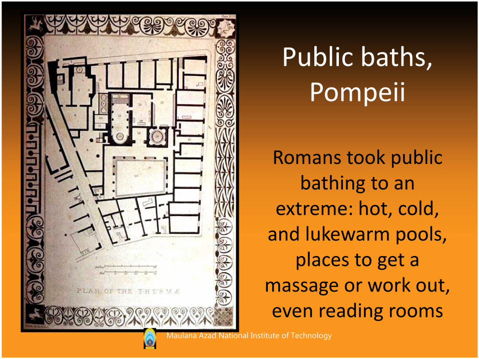
Public baths,Pompeii
Romans took public bathing to an
extreme: hot, cold, and lukewarm pools,
places to get a massage or work out, even reading rooms
Maulana Azad National Institute of Technology
The Romans were very practical but they also carried remnants of an older, mystical view of the city Augury (an animal was cut open in order to
examine its entrails for signs that it was a good or bad place for a city)
At founding of a city, a priest would plow the outline of the city to ritually mark it off from the surrounding wilderness
The city was divided into quarters by the creation of two perpendicular streets: the Cardo and the Decumanus
CONCLUSION
Maulana Azad National Institute of Technology
REFERENCES
• GOOGLE IMAGES
• www.utexas.edu.com
• www.crystalinks.com
• THE URBAN PATTERN: ARTHUR GALLION & SIMON EISNER
Maulana Azad National Institute of Technology
Maulana Azad National Institute of Technology