Embed Size (px)
Citation preview

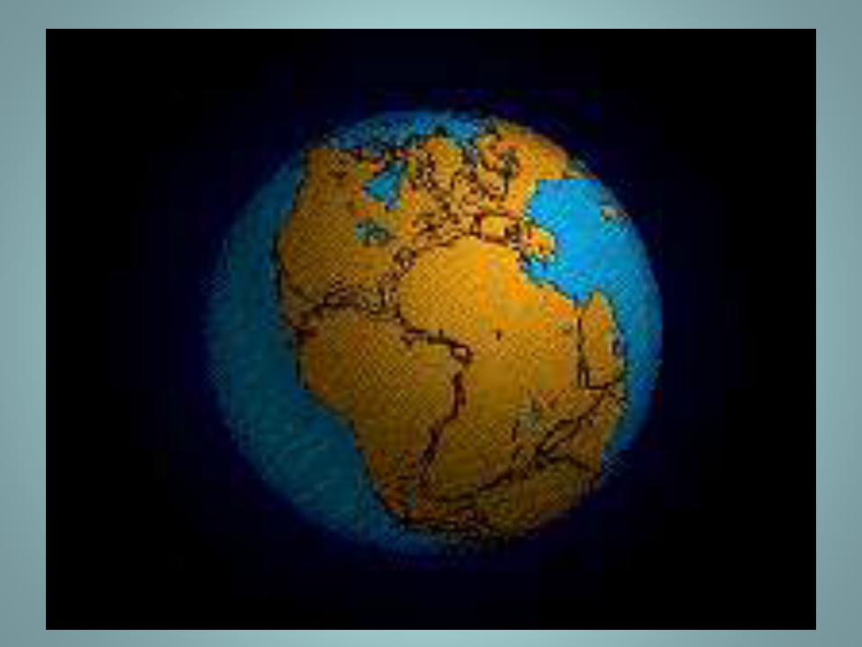
FORMATION
OF
PHYSICAL FEATURES OF
INDIA
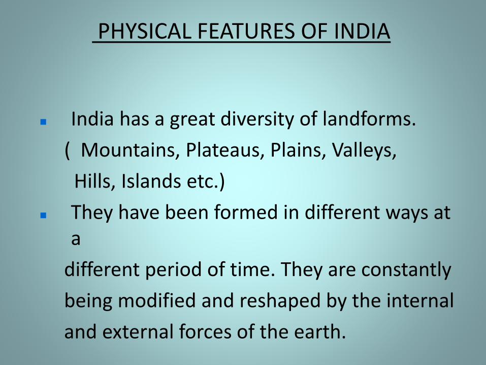
PHYSICAL FEATURES OF INDIA
India has a great diversity of landforms.
( Mountains, Plateaus, Plains, Valleys,
Hills, Islands etc.)
They have been formed in different ways at a
different period of time. They are constantly
being modified and reshaped by the internal
and external forces of the earth.
FORMATION OF PHYSICAL FEATURES
To understand the physical features of India, we need to know how these physical features are formed and evolved.
The formation of the physical features of India is linked to the interior structure of the Earth.
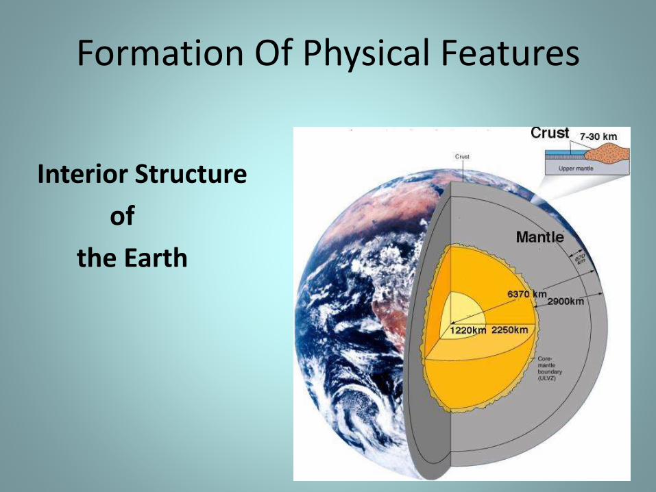
Formation Of Physical Features
Interior Structure
of
the Earth
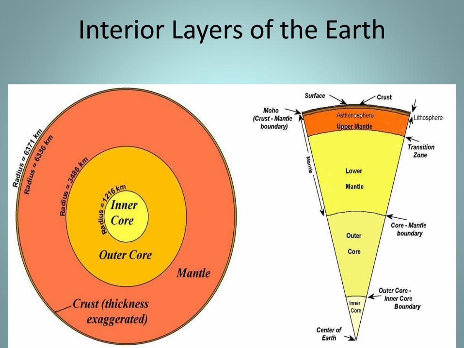
Interior Layers of the Earth
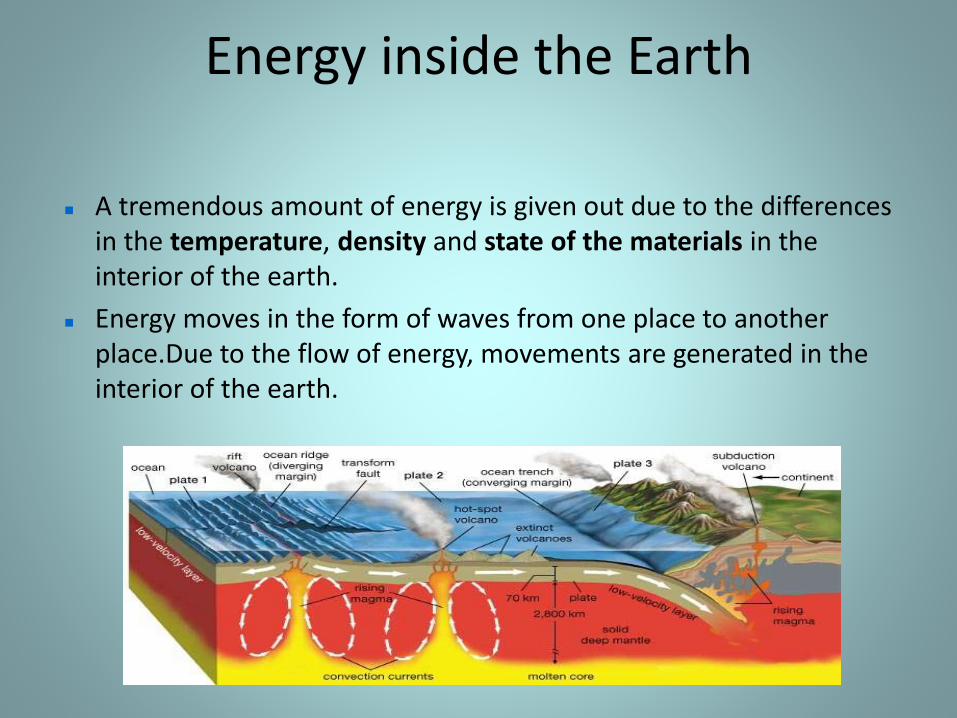
Energy inside the Earth
A tremendous amount of energy is given out due to the differences in the temperature, density and state of the materials in the interior of the earth.
Energy moves in the form of waves from one place to another place.Due to the flow of energy, movements are generated in the interior of the earth.
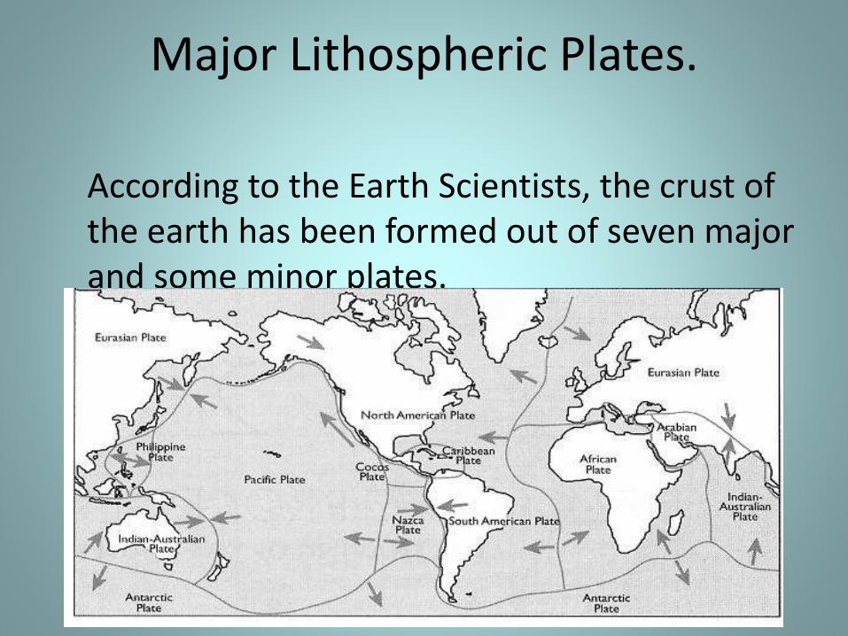
Major Lithospheric Plates.
According to the Earth Scientists, the crust of the earth has been formed out of seven major and some minor plates.
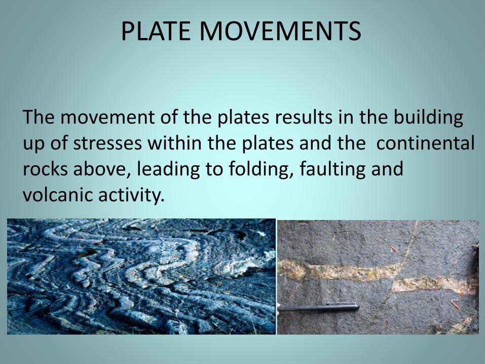
PLATE MOVEMENTS
The movement of the plates results in the building up of stresses within the plates and the continental rocks above, leading to folding, faulting and volcanic activity.
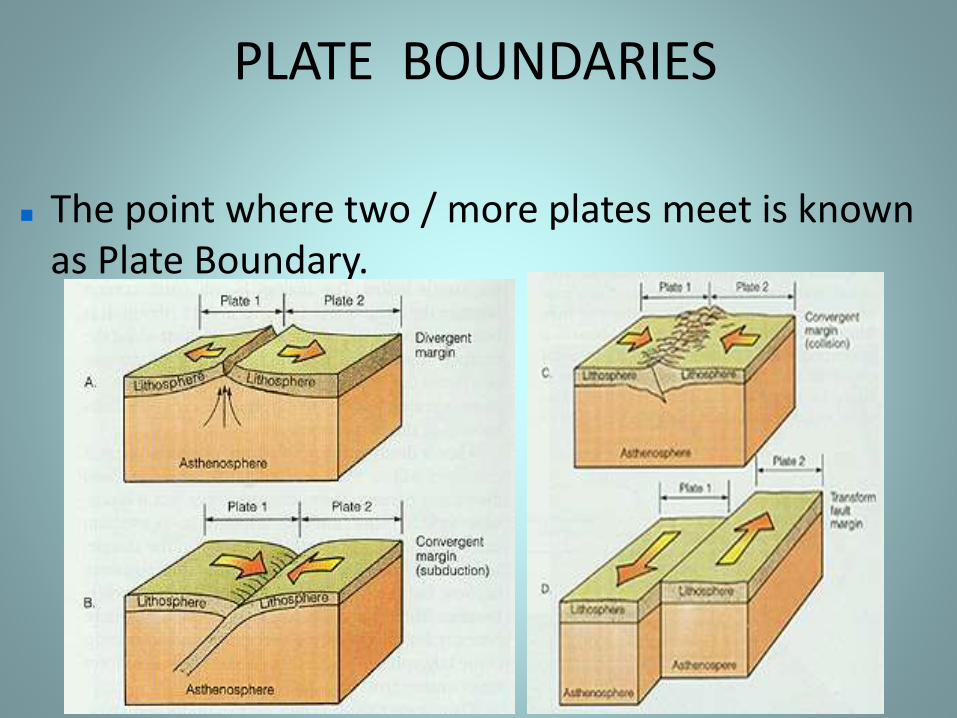
PLATE BOUNDARIES
The point where two / more plates meet is known as Plate Boundary.
The movement of these lithospheric plates have changed the position and size of the continents over millions of years. These movements have also influenced the evolution of the present landform features of India.
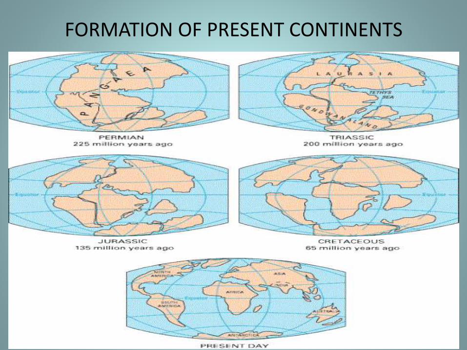
FORMATION OF PRESENT CONTINENTS
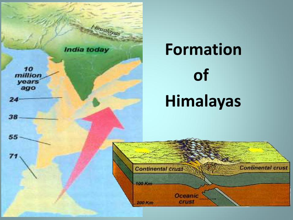
Formation
of
Himalayas
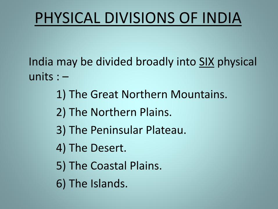
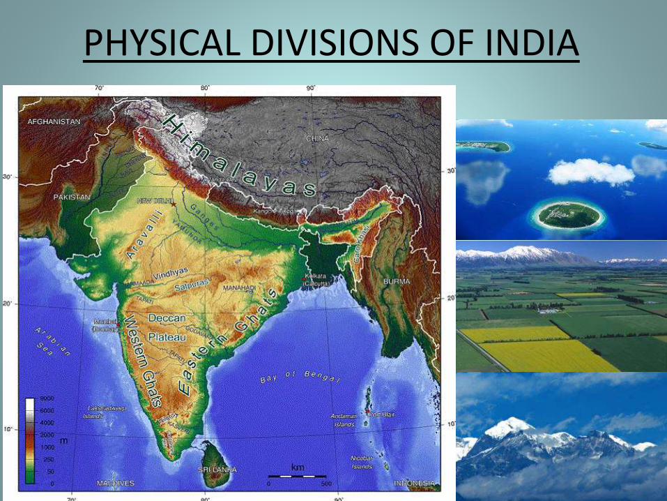
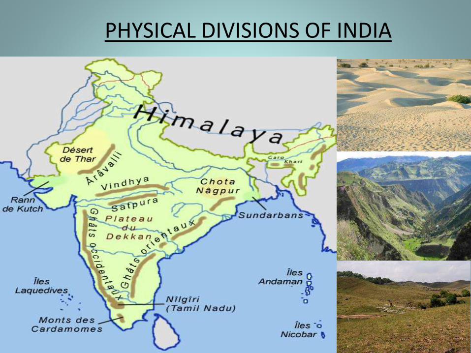
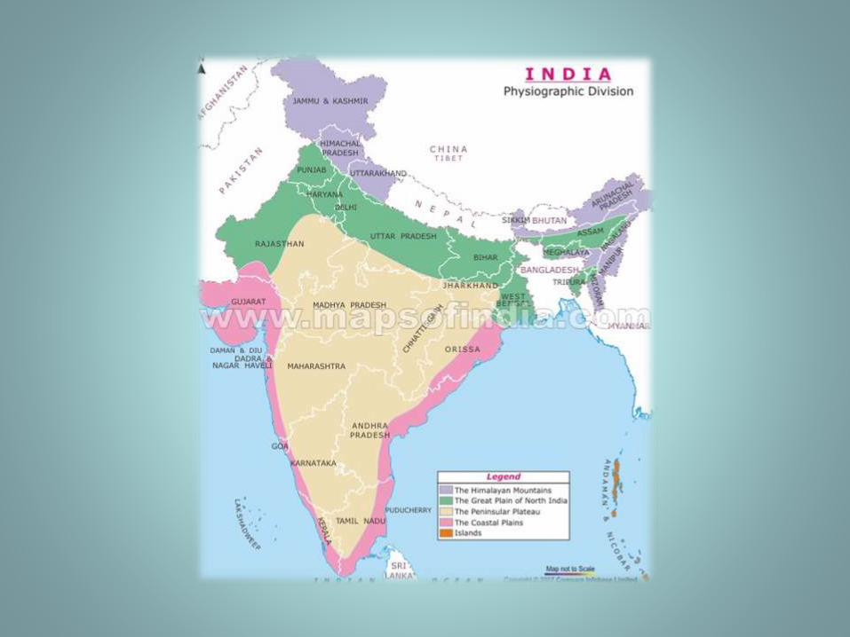
PHYSICAL DIVISIONS OF INDIA
India may be divided broadly into SIX physical units : –
1) The Great Northern Mountains.
2) The Northern Plains.
3) The Peninsular Plateau.
4) The Desert.
5) The Coastal Plains.
6) The Islands.
PHYSICAL DIVISIONS OF INDIA
PHYSICAL DIVISIONS OF INDIA
1) THE GREAT NORTHERN MOUNTAINS
From Pamir Plateau in the west to the Indo-Myanmar border in the east, there is a chain of mountains. They stretch almost uninterruptedly for about 3600 km and form an arc. The width of this mountain belt various between 150 km to 400 km.
A) The Karakoram Range.
B) The Himalayas.
C) The Purvachal.
A) THE KARAKORAM RANGE
The mountains extending between the Pamir Plateau and the Indus river in Kashmir are known as the Karakoram Range.
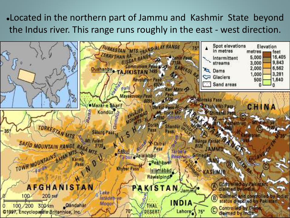
Located in the northern part of Jammu and Kashmir State beyond the Indus river. This range runs roughly in the east - west direction.
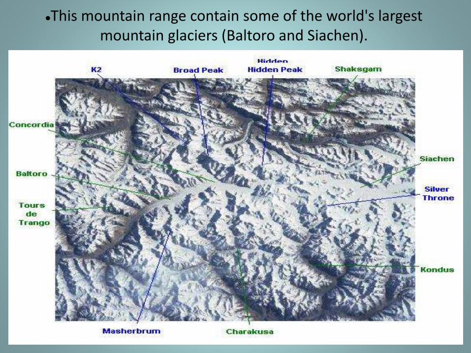
This mountain range contain some of the world's largest mountain glaciers (Baltoro and Siachen).
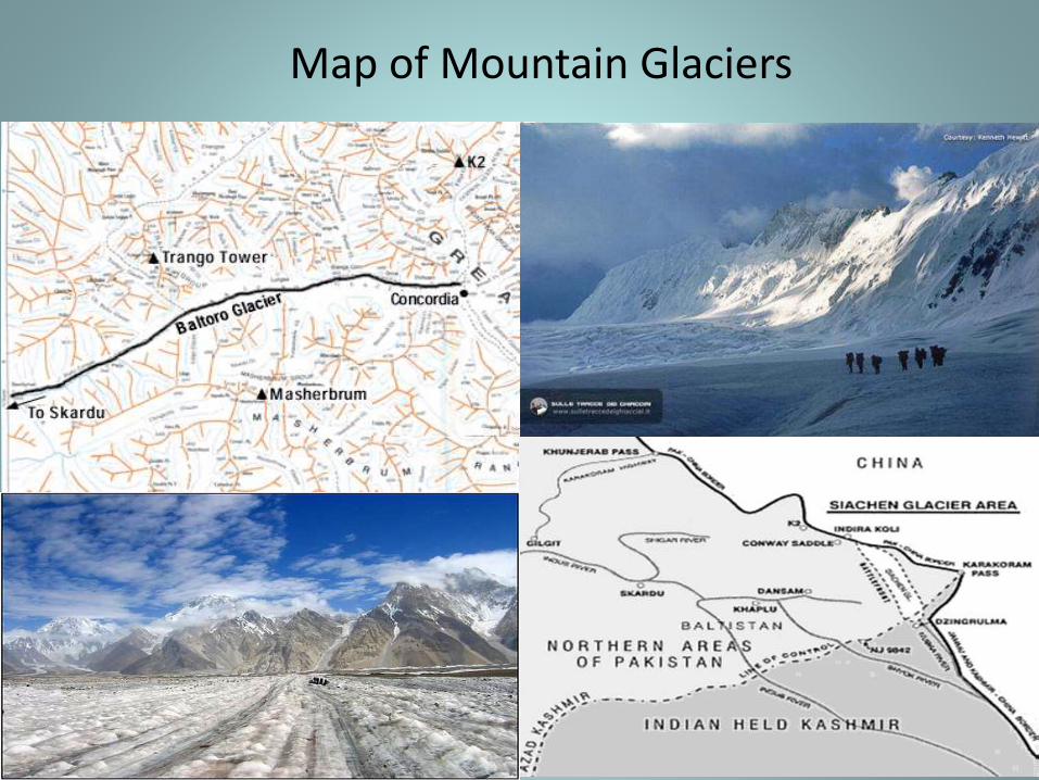
Map of Mountain Glaciers
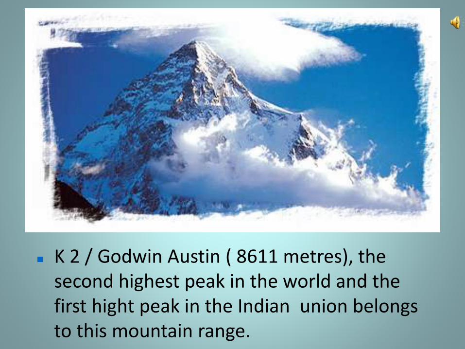
K 2 / Godwin Austin ( 8611 metres), the second highest peak in the world and the first hight peak in the Indian union belongs to this mountain range.
B) THE HIMALAYAS
The mountains extending between the Indus river and the Brahmaputra river are called the Himalayas ( abode / house of snow ).
(i) THE HIMALAYAN MOUNTAIN:-
• The Himalayan ranges contain several high peaks.
Mount Everest is the highest peak in the world.
• The Himalayan Mountains stretch in a long curve
from Jammu and Kashmir in the west to
Arunachal Pradesh in the east.
• Their length is about 2000 kilometers and width
between 230 and 400 kilometers.
The Himalayas are quite useful to us. The
advantages are as follows:-
High mountain ranges and peaks act a barrier for enemies and so
play a great role in the Defense of India.
The Himalayas protect the country against the cold winds blowing
from Siberia through central Asia.
The Himalayas check rain bearing wind and cause heavy rainfall.
The eastern part of the mountain prevents the monsoon
clouds from escaping northwards out of India. This causes rain in
the whole of northern India.
There are dense forests up to an altitude of 1500 meters. Different
types of trees, bushes and wild animals are found in these forests.
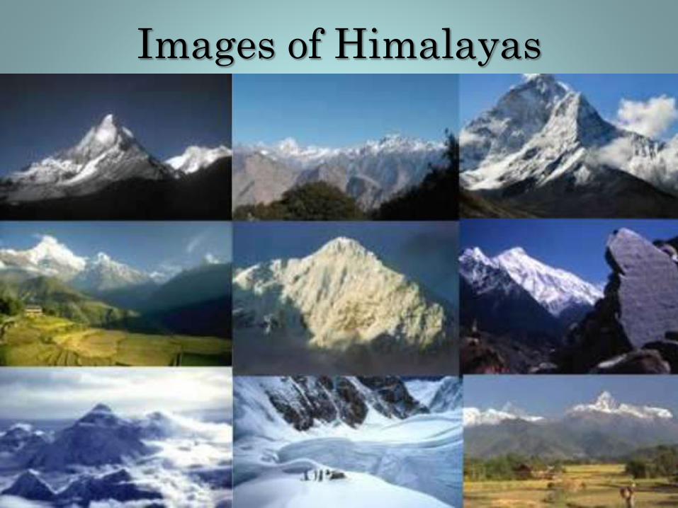
Images of Himalayas
The Himalayan Ranges
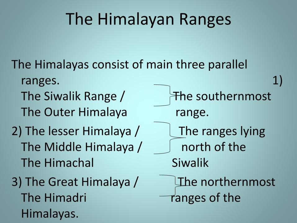
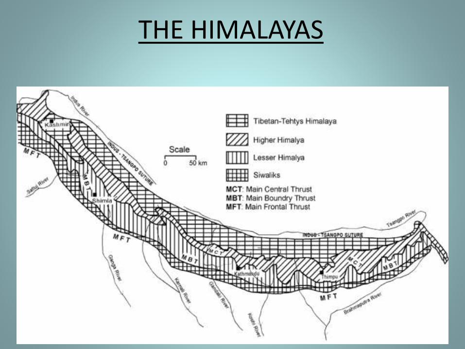
The Himalayas consist of main three parallel ranges. 1) The Siwalik Range / The southernmost The Outer Himalaya range.
2) The lesser Himalaya / The ranges lying The Middle Himalaya / north of the The Himachal Siwalik
3) The Great Himalaya / The northernmost The Himadri ranges of the Himalayas.
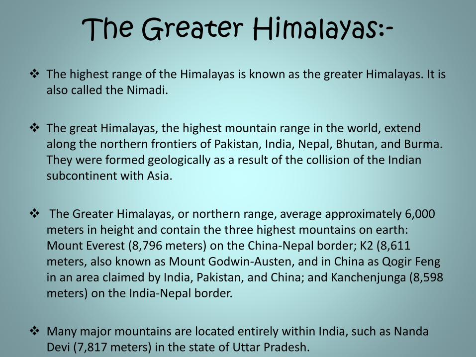
The Greater Himalayas:- The highest range of the Himalayas is known as the greater Himalayas. It is
also called the Nimadi.
The great Himalayas, the highest mountain range in the world, extend along the northern frontiers of Pakistan, India, Nepal, Bhutan, and Burma. They were formed geologically as a result of the collision of the Indian subcontinent with Asia.
The Greater Himalayas, or northern range, average approximately 6,000 meters in height and contain the three highest mountains on earth: Mount Everest (8,796 meters) on the China-Nepal border; K2 (8,611 meters, also known as Mount Godwin-Austen, and in China as Qogir Feng in an area claimed by India, Pakistan, and China; and Kanchenjunga (8,598 meters) on the India-Nepal border.
Many major mountains are located entirely within India, such as Nanda Devi (7,817 meters) in the state of Uttar Pradesh.
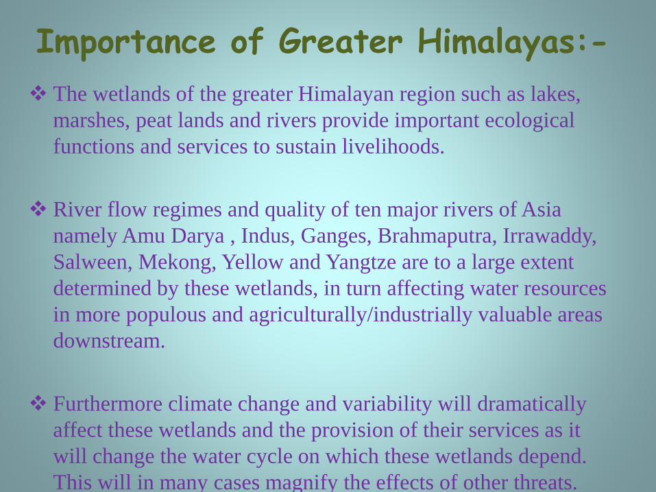
Importance of Greater Himalayas:-
The wetlands of the greater Himalayan region such as lakes,
marshes, peat lands and rivers provide important ecological
functions and services to sustain livelihoods.
River flow regimes and quality of ten major rivers of Asia
namely Amu Darya , Indus, Ganges, Brahmaputra, Irrawaddy,
Salween, Mekong, Yellow and Yangtze are to a large extent
determined by these wetlands, in turn affecting water resources
in more populous and agriculturally/industrially valuable areas
downstream.
Furthermore climate change and variability will dramatically
affect these wetlands and the provision of their services as it
will change the water cycle on which these wetlands depend.
This will in many cases magnify the effects of other threats.
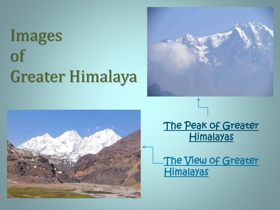
Images of Greater Himalaya
The Peak of Greater Himalayas
The View of Greater Himalayas
(ii) The Lesser Himalayas• The Lower Himalayan Range (also known as the Lesser
Himalayan Range) lies north of the Sub-Himalayan
Range or Siwalik Range and south of the Great
Himalayas.
• The Lesser Himalayas is a prominent range 2,000 to
3,000 meters (6,600 to 9,800 ft) high formed along the
Main Boundary .
Importance of Lesser Himalaya
• They provide a physical screen within
which the monsoon system operates and are
the source of the great river systems that
water the alluvial plains below.
• As a result of erosion, the rivers coming
from the mountains carry vast quantities
of silt that enrich the plains.
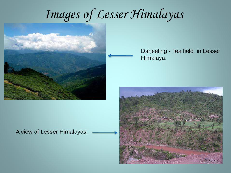
Images of Lesser Himalayas
Darjeeling - Tea field in Lesser
Himalaya.
A view of Lesser Himalayas.
(iii) The Shivalik ranges
• The Shivalik Hills or Range are the southernmost and geologically youngest east-west mountain chain of the Himalayas.
• The Shivalik form a belt, which runs continuously from Jammu, Kangra valley, Sirmur district to Dehradun and finally ending up in the Bhabbar tracts of Garhwal and Kumaon. The Sivalik extends about 1,689 km from southwest Kashmir through northern India into southern Nepal. The hills consists of 6000 meters of layered rocks
• The Shivaliks crest at 600 to 1,200 metres and have many sub-ranges. They extend 1,600 km from the Teesta River in Sikkim, westward through Nepal and Uttarkhand, continuing into Kashmir and Northern Pakistan, and are cut through at wide intervals by large rivers flowing south from the Himalayas.
Importance of Shivalik hills
•The physical features and the climatic conditions of this region have played an important role in shaping and making it an important part from the rest of the country.
•The physical features and the climatic conditions of this region have played an important role in shaping and making it an important part from the rest of the country.
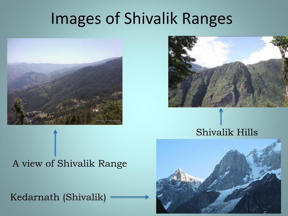
Images of Shivalik Ranges
Shivalik Hills
Kedarnath (Shivalik)
A view of Shivalik Range
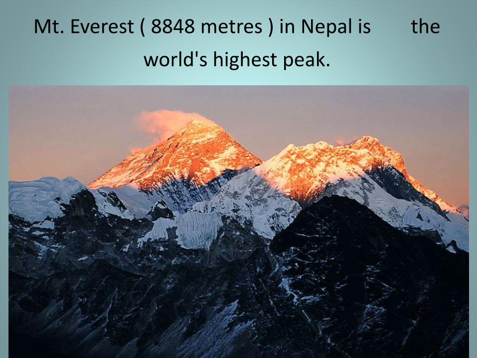
Mt. Everest ( 8848 metres ) in Nepal is the
world's highest peak.
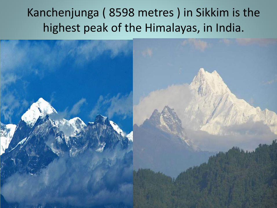
Kanchenjunga ( 8598 metres ) in Sikkim is the highest peak of the Himalayas, in India.
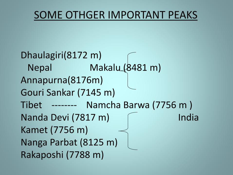
SOME OTHGER IMPORTANT PEAKS
Dhaulagiri(8172 m) Nepal Makalu (8481 m)
Annapurna(8176m) Gouri Sankar (7145 m) Tibet -------- Namcha Barwa (7756 m ) Nanda Devi (7817 m) India Kamet (7756 m) Nanga Parbat (8125 m) Rakaposhi (7788 m)
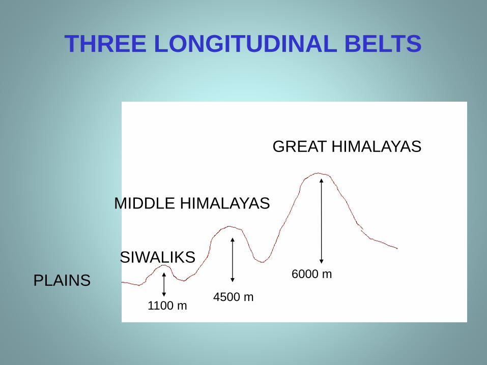
THREE LONGITUDINAL BELTS
PLAINS
SIWALIKS
MIDDLE HIMALAYAS
GREAT HIMALAYAS
1100 m4500 m
6000 m
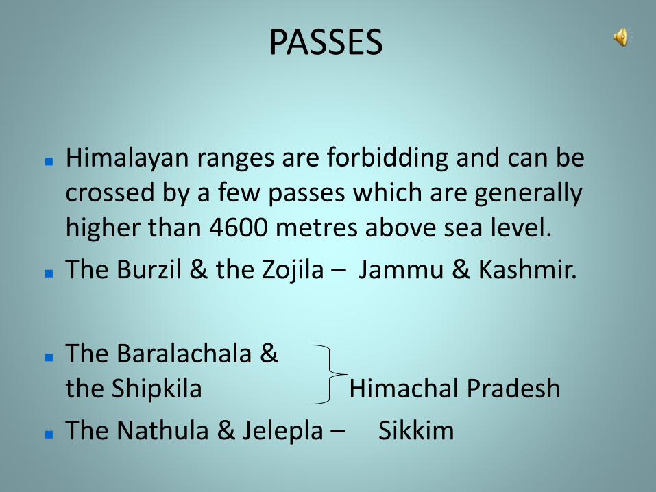
PASSES
Himalayan ranges are forbidding and can be crossed by a few passes which are generally higher than 4600 metres above sea level.
The Burzil & the Zojila – Jammu & Kashmir.
The Baralachala & the Shipkila Himachal Pradesh
The Nathula & Jelepla – Sikkim
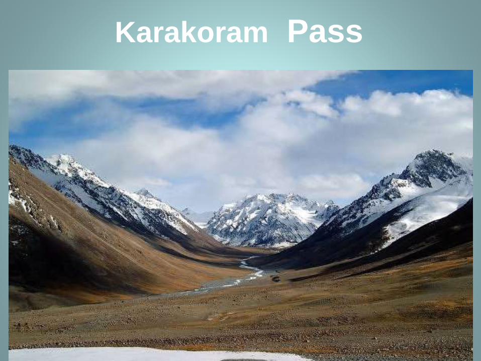
Karakoram Pass
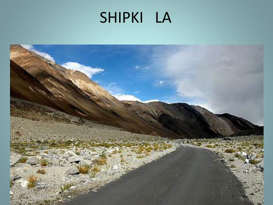
SHIPKI LA
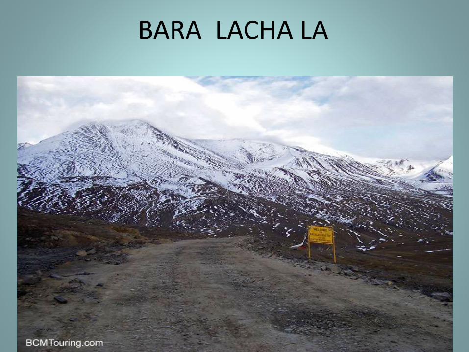
BARA LACHA LA
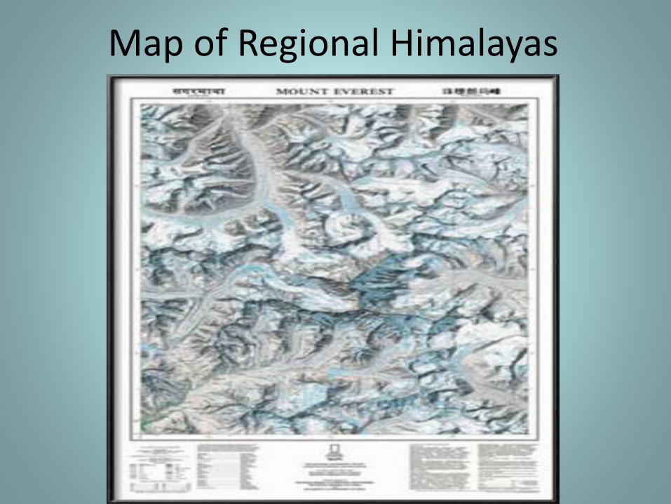
REGIONAL DIVISIONS OF HIMALAYAS
The Himalayas have been divided on the basis of regions from west to east.
These divisions have been demarcated by river valleys.

REGIONWISE HIMALAYAS
Punjab Himalayas:--
The part of the Himalayas lying between Indus river and Satluj river.
Kumaon Himalayas:--
The part of the Himalayas lying between Satluj river and Kali river.
REGIONWISE HIMALAYAS
Nepal Himalayas:--
The part of the Himalayas lying between Kali river and Tista river.
Assam Himalayas:--
The part of the Himalayas lying between Tista river and Dihang river.
Map of Regional Himalayas
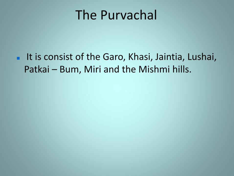
C) THE PURVANCHAL
The eastern extension of the Himalayan mountains along the border of Myanmar is known as the Purvanchal or the Eastern Hills and Mountains.
The Purvachal
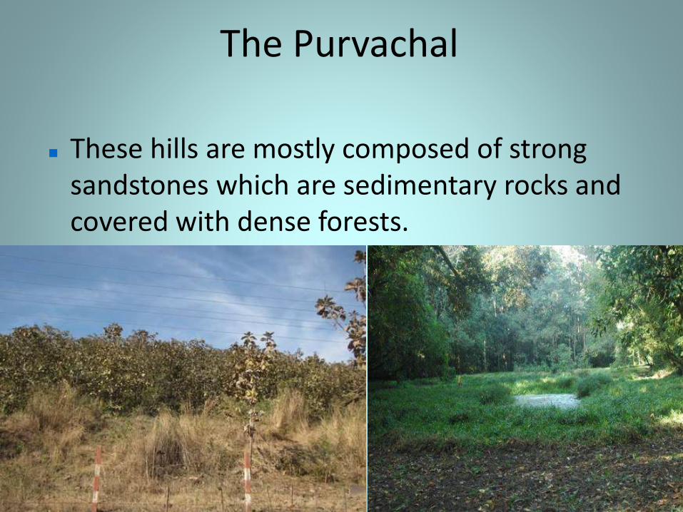
These hills are mostly composed of strong sandstones which are sedimentary rocks and covered with dense forests.
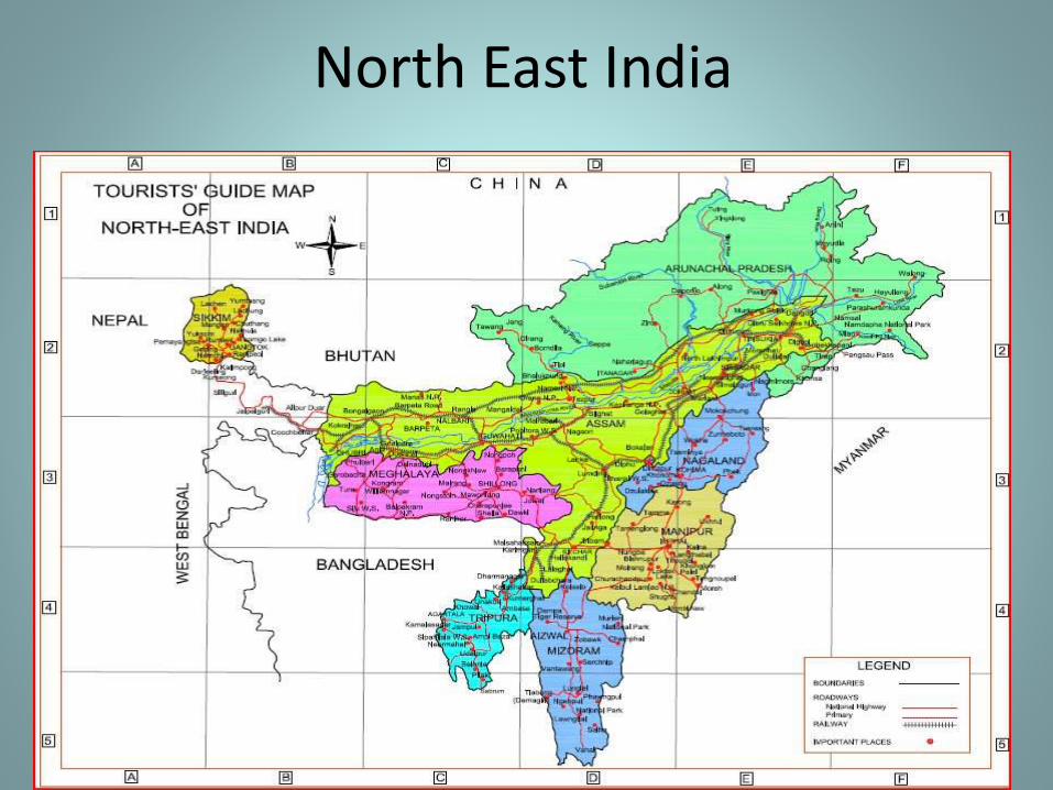
North East India
The Purvachal
It is consist of the Garo, Khasi, Jaintia, Lushai, Patkai – Bum, Miri and the Mishmi hills.
THE HIMALAYAS
It has been made by the three major river systems:- The Indus
The Ganga
The Brahmaputra
It plain is formed by alluvial soil.
The area covered by this plain is 7 lakh kilometers.
The plain is about 2400 km long and 240 to 320 km broad is a densely physiographic division.
THE PUNJAB PLAIN
THE GANGA PLAIN
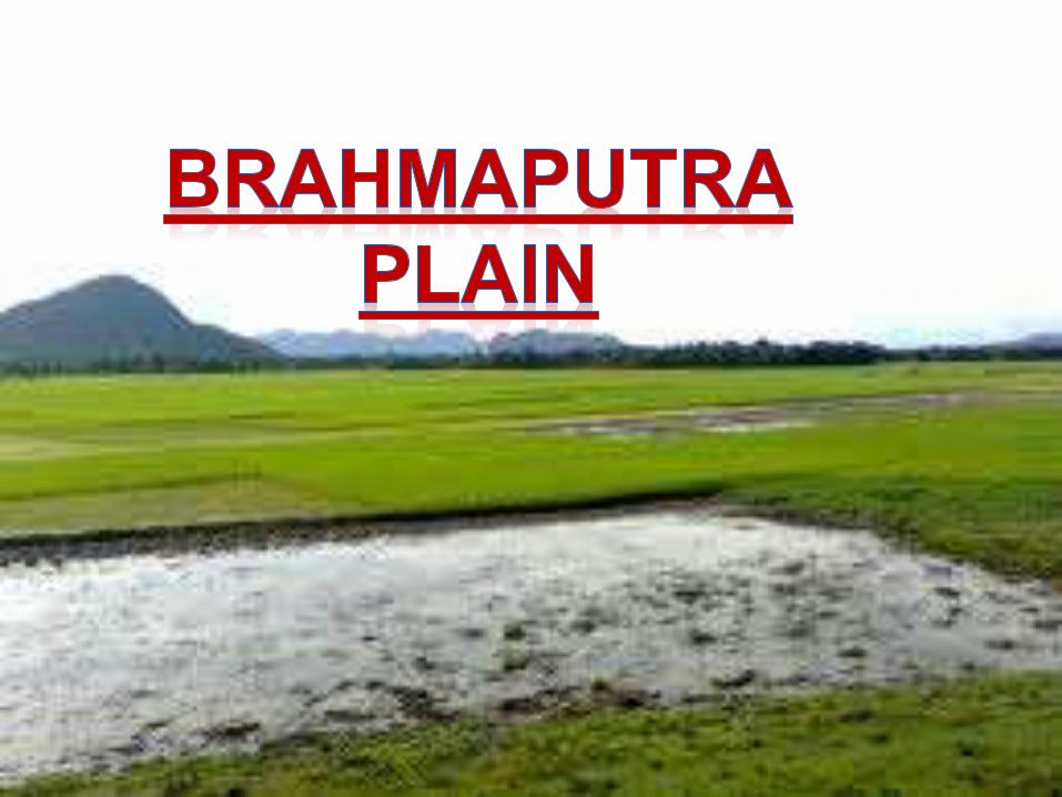
THE BRAHMAPUTRA PLAIN
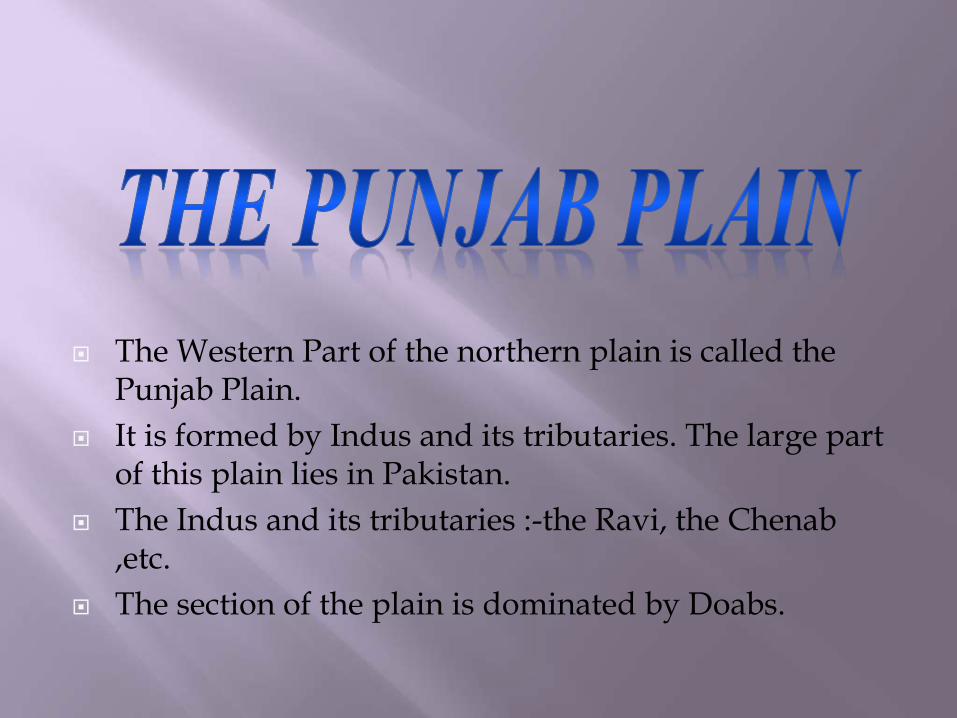
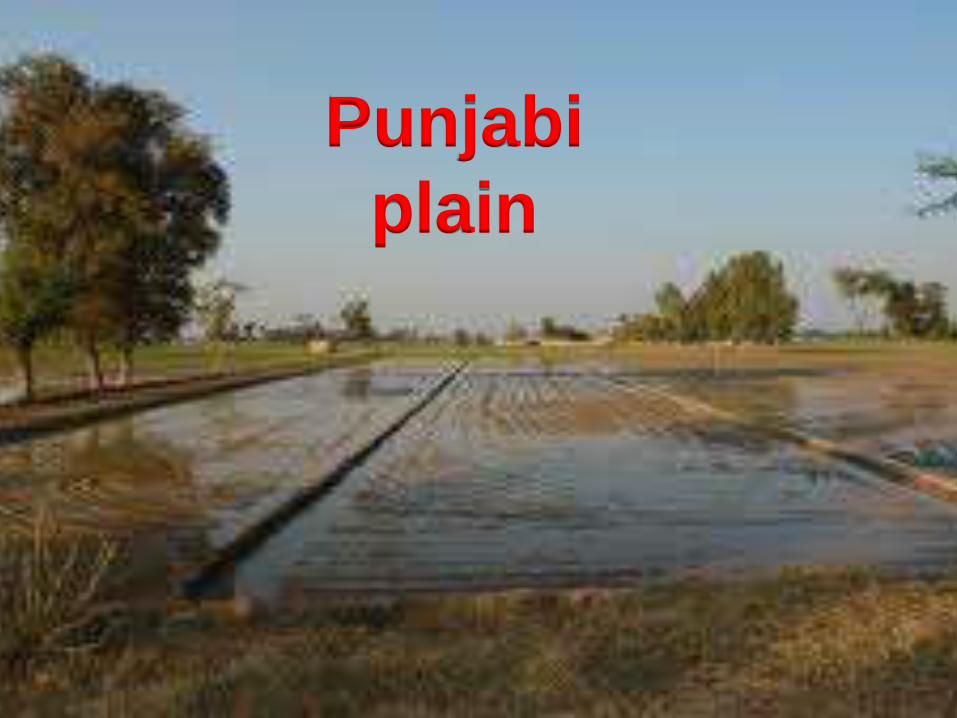
The Western Part of the northern plain is called the Punjab Plain.
It is formed by Indus and its tributaries. The large part of this plain lies in Pakistan.
The Indus and its tributaries :-the Ravi, the Chenab ,etc.
The section of the plain is dominated by Doabs.
Punjabi
plain

It extends between Ghaggar and testa
river.
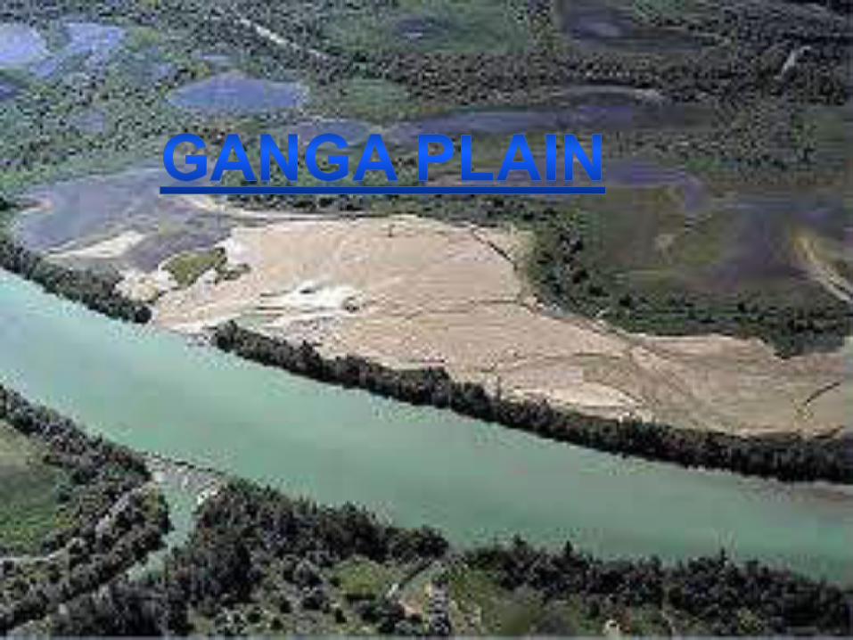
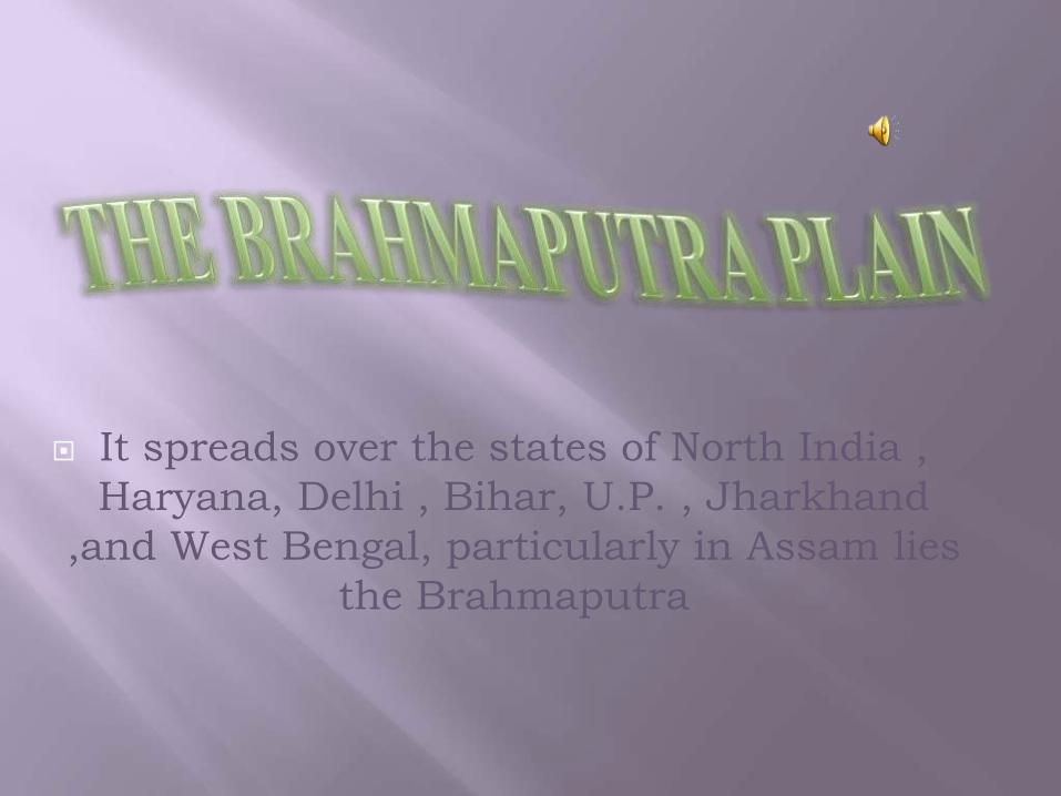
It spreads over the states of North India ,
Haryana, Delhi , Bihar, U.P. , Jharkhand
,and West Bengal, particularly in Assam lies
the Brahmaputra
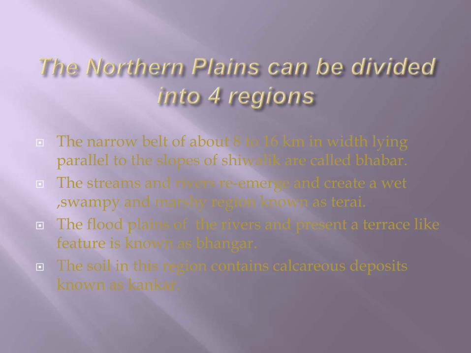
The narrow belt of about 8 to 16 km in width lying parallel to the slopes of shiwalik are called bhabar.
The streams and rivers re-emerge and create a wet ,swampy and marshy region known as terai.
The flood plains of the rivers and present a terrace like feature is known as bhangar.
The soil in this region contains calcareous deposits known as kankar.

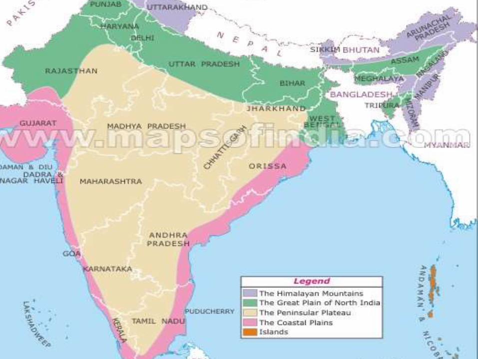
The Peninsular Plateau
Physical Features of India
The Himalayan Mountains
The Northern Plains
The Peninsular Plateau
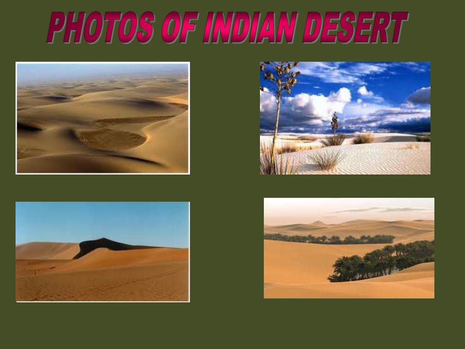
The Indian Desert
The Coastal Plains
The Islands
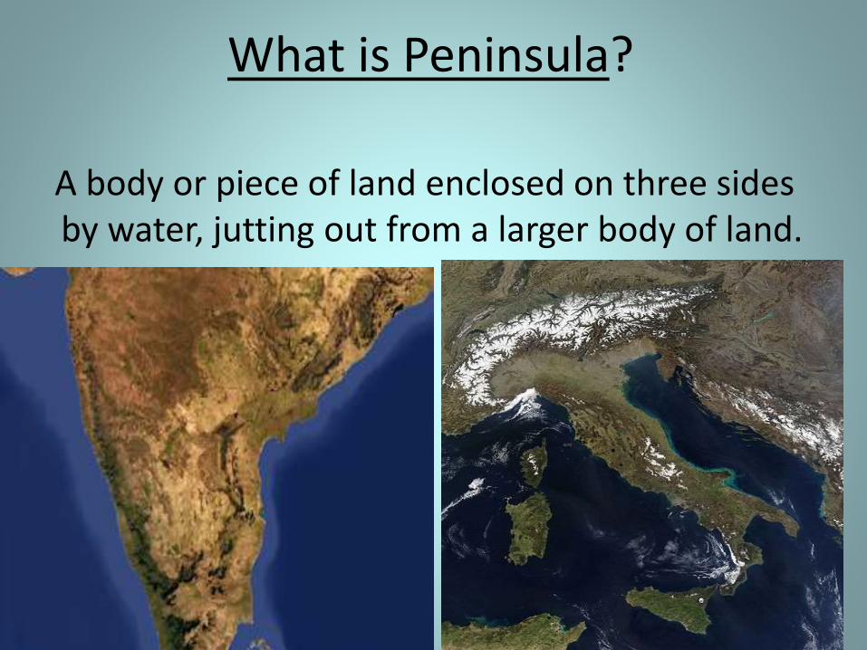
What is Peninsula?
A body or piece of land enclosed on three sides by water, jutting out from a larger body of land.
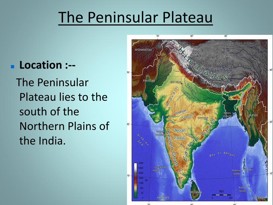
The Peninsular Plateau
Location :--
The Peninsular Plateau lies to the south of the Northern Plains of the India.
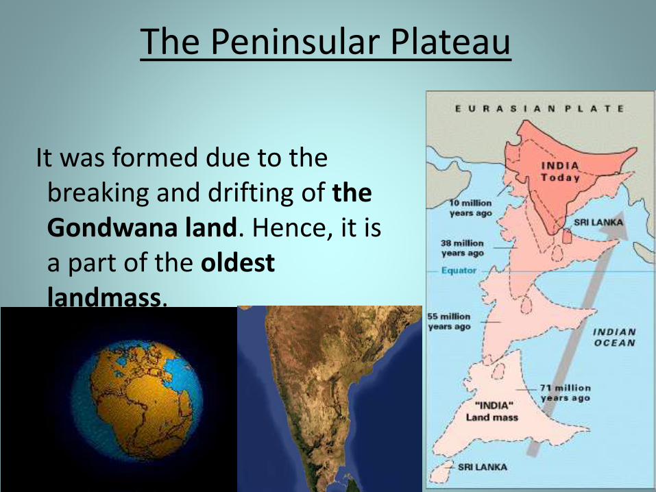
The Peninsular Plateau
It was formed due to the breaking and drifting of the Gondwana land. Hence, it is a part of the oldest landmass.
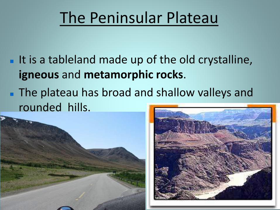
The Peninsular Plateau
It is a tableland made up of the old crystalline, igneous and metamorphic rocks.
The plateau has broad and shallow valleys and rounded hills.
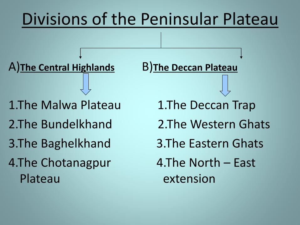
Divisions of the Peninsular Plateau
A)The Central Highlands B)The Deccan Plateau
1.The Malwa Plateau 1.The Deccan Trap
2.The Bundelkhand 2.The Western Ghats
3.The Baghelkhand 3.The Eastern Ghats
4.The Chotanagpur 4.The North – East Plateau extension
The Peninsular Plateau
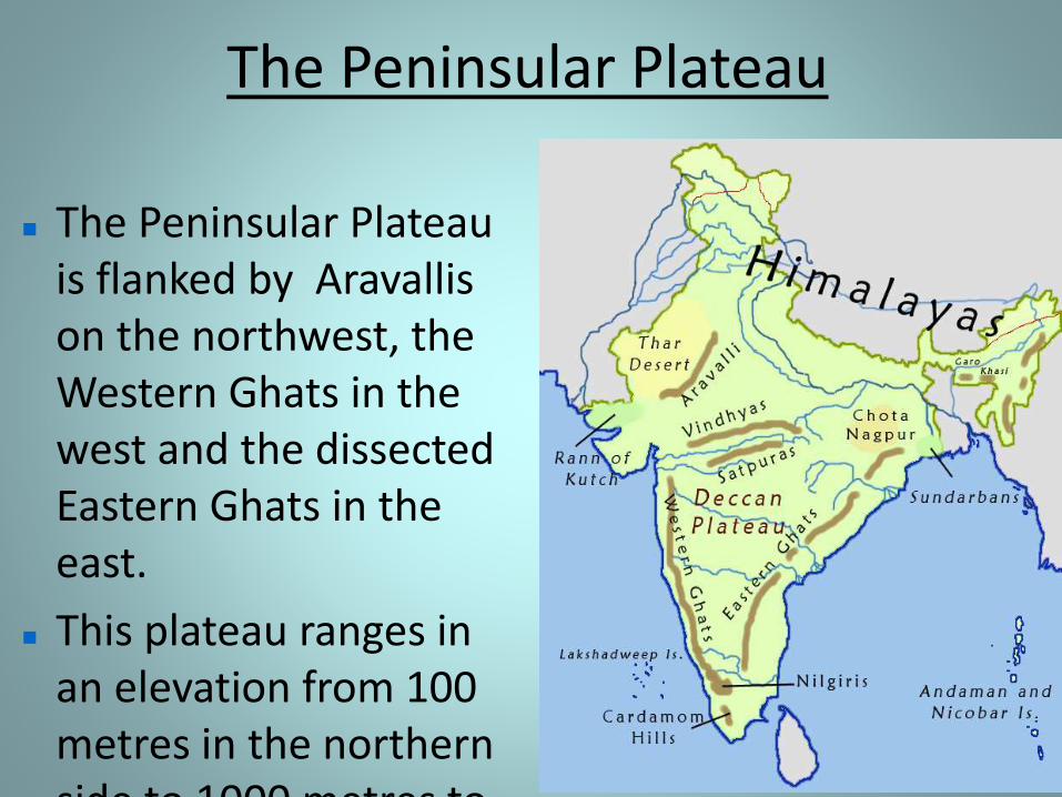
The Peninsular Plateau is flanked by Aravallis on the northwest, the Western Ghats in the west and the dissected Eastern Ghats in the east.
This plateau ranges in an elevation from 100 metres in the northern side to 1000 metres to
The Peninsular Plateau
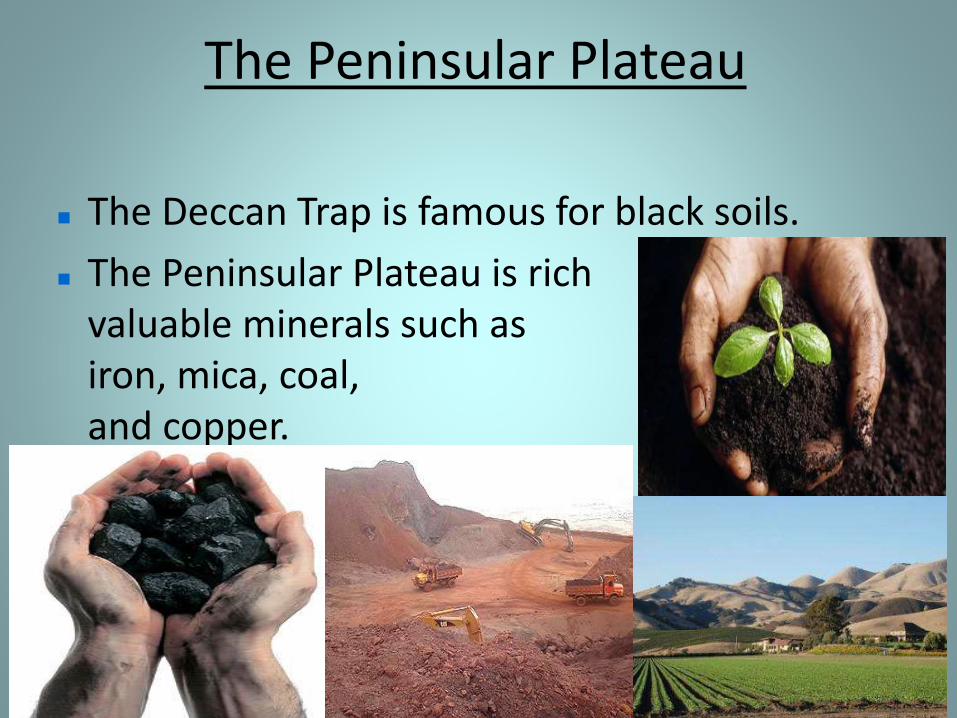
The Deccan Trap is famous for black soils.
The Peninsular Plateau is rich in valuable minerals such as mananese, iron, mica, coal, bauxite, gold and copper.
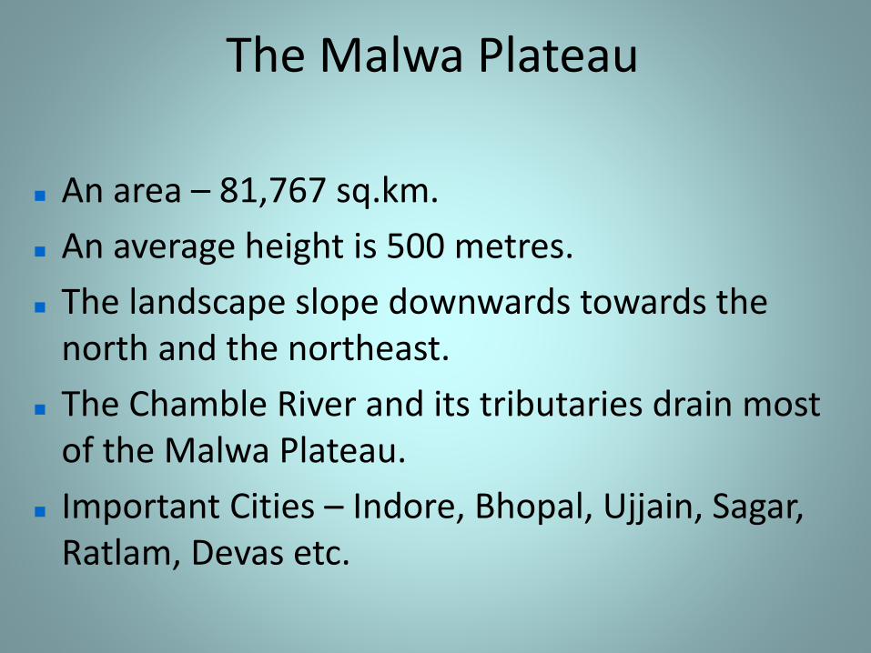
The Malwa Plateau
An area – 81,767 sq.km.
An average height is 500 metres.
The landscape slope downwards towards the north and the northeast.
The Chamble River and its tributaries drain most of the Malwa Plateau.
Important Cities – Indore, Bhopal, Ujjain, Sagar, Ratlam, Devas etc.
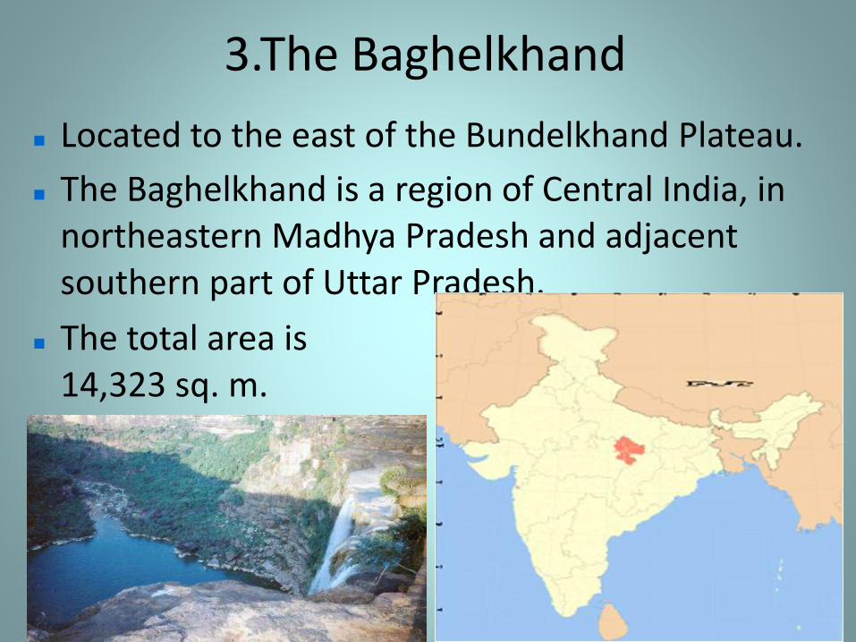
3.The Baghelkhand
Located to the east of the Bundelkhand Plateau.
The Baghelkhand is a region of Central India, in northeastern Madhya Pradesh and adjacent southern part of Uttar Pradesh.
The total area is 14,323 sq. m.
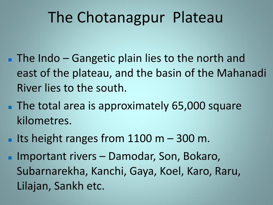
The Chotanagpur Plateau
The Indo – Gangetic plain lies to the north and east of the plateau, and the basin of the Mahanadi River lies to the south.
The total area is approximately 65,000 square kilometres.
Its height ranges from 1100 m – 300 m.
Important rivers – Damodar, Son, Bokaro, Subarnarekha, Kanchi, Gaya, Koel, Karo, Raru, Lilajan, Sankh etc.
B) The Deccan Plateau
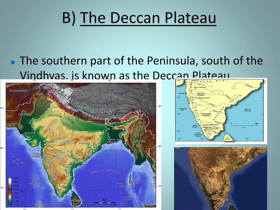
The southern part of the Peninsula, south of the Vindhyas, is known as the Deccan Plateau.
The Deccan Plateau
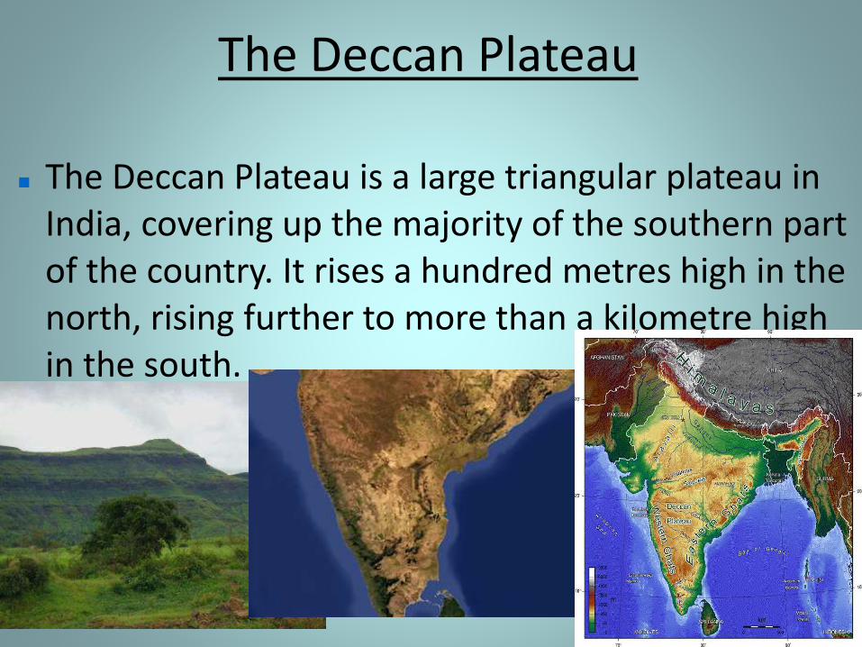
The Deccan Plateau is a large triangular plateau in India, covering up the majority of the southern part of the country. It rises a hundred metres high in the north, rising further to more than a kilometre high in the south.
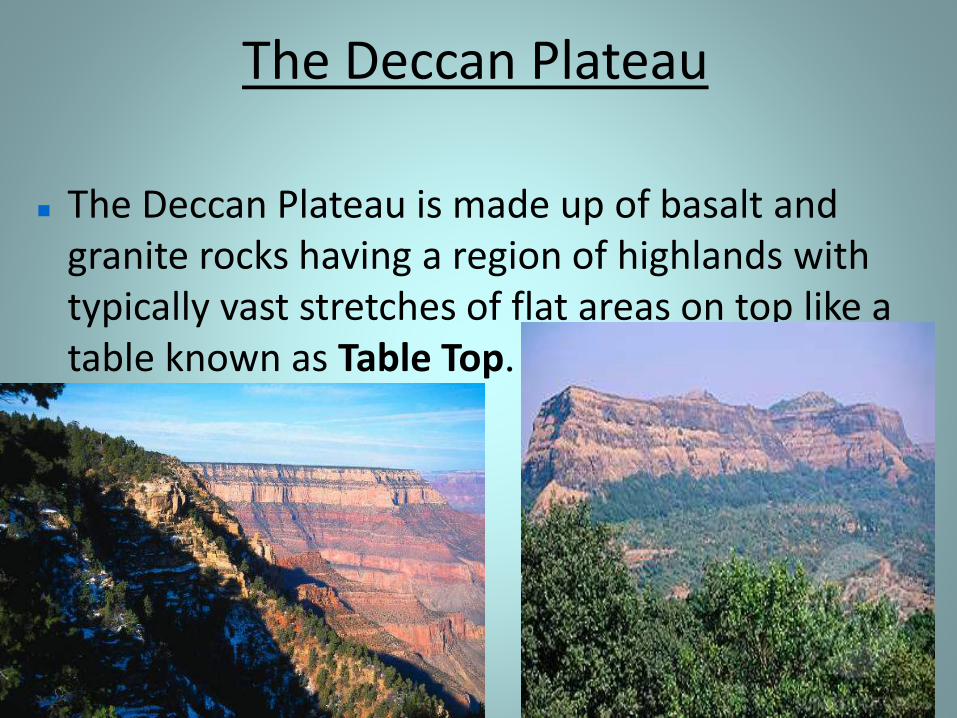
The Deccan Plateau
The Deccan Plateau is made up of basalt and granite rocks having a region of highlands with typically vast stretches of flat areas on top like a table known as Table Top.
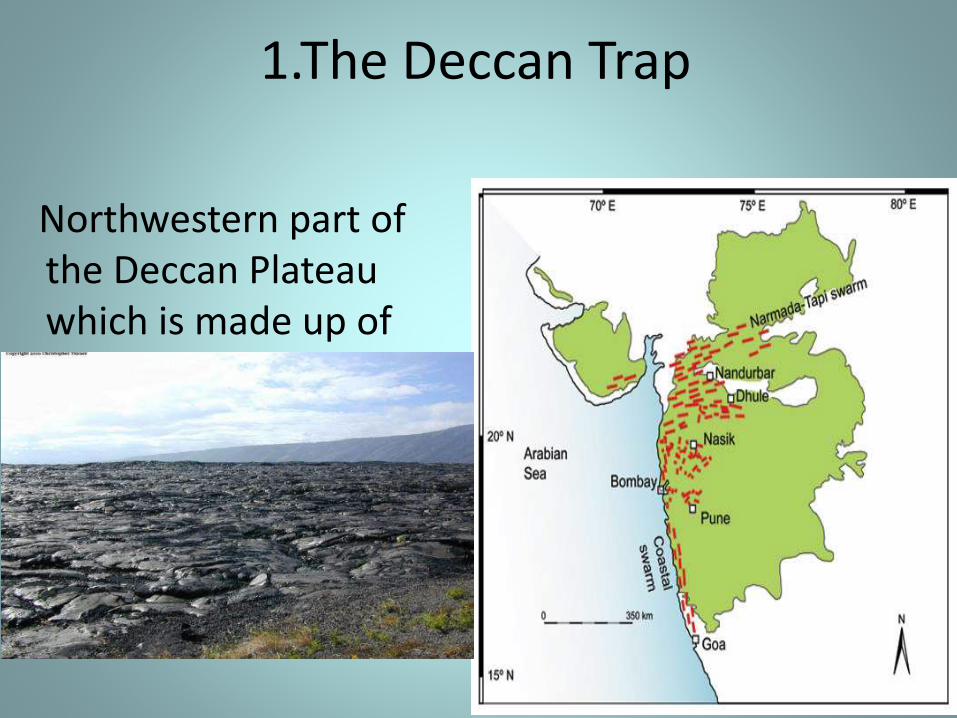
1.The Deccan Trap
Northwestern part of the Deccan Plateau which is made up of lava flows.
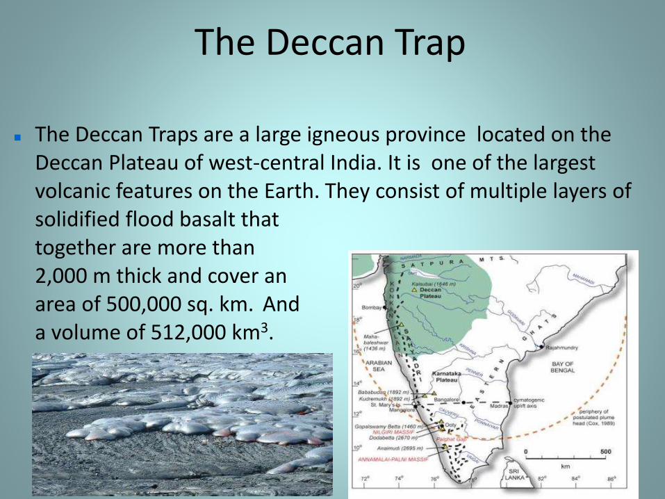
The Deccan Trap
The Deccan Traps are a large igneous province located on the Deccan Plateau of west-central India. It is one of the largest volcanic features on the Earth. They consist of multiple layers of solidified flood basalt that together are more than 2,000 m thick and cover an area of 500,000 sq. km. And a volume of 512,000 km3.
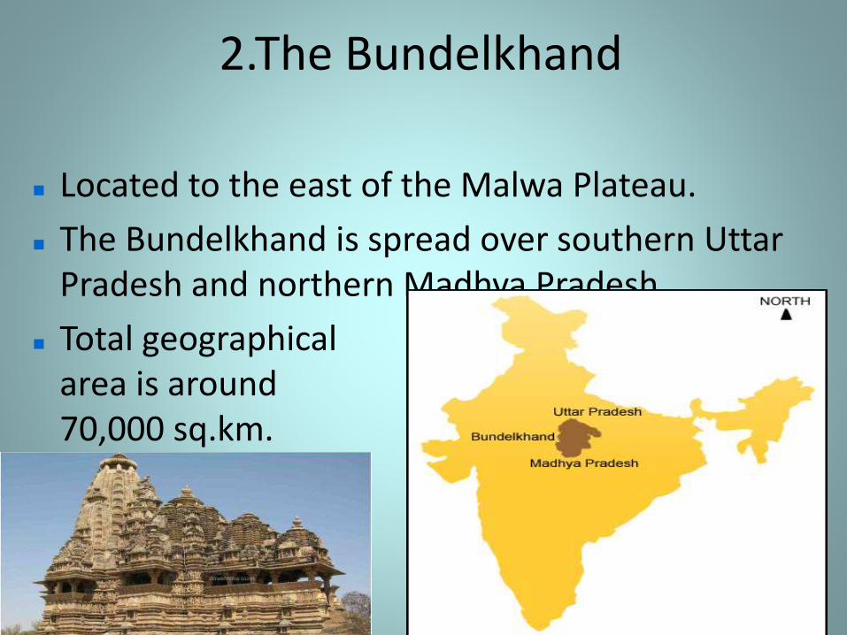
2.The Bundelkhand
Located to the east of the Malwa Plateau.
The Bundelkhand is spread over southern Uttar Pradesh and northern Madhya Pradesh.
Total geographical area is around 70,000 sq.km.
The Peninsular Plateau
The peninsular plateau is a tableland composed of the old crystalline, igneous and metamorphic rocks.
It is formed due to the breaking and drifting of the gondwana land.
It has a broad and shallow valleys and rounded hills
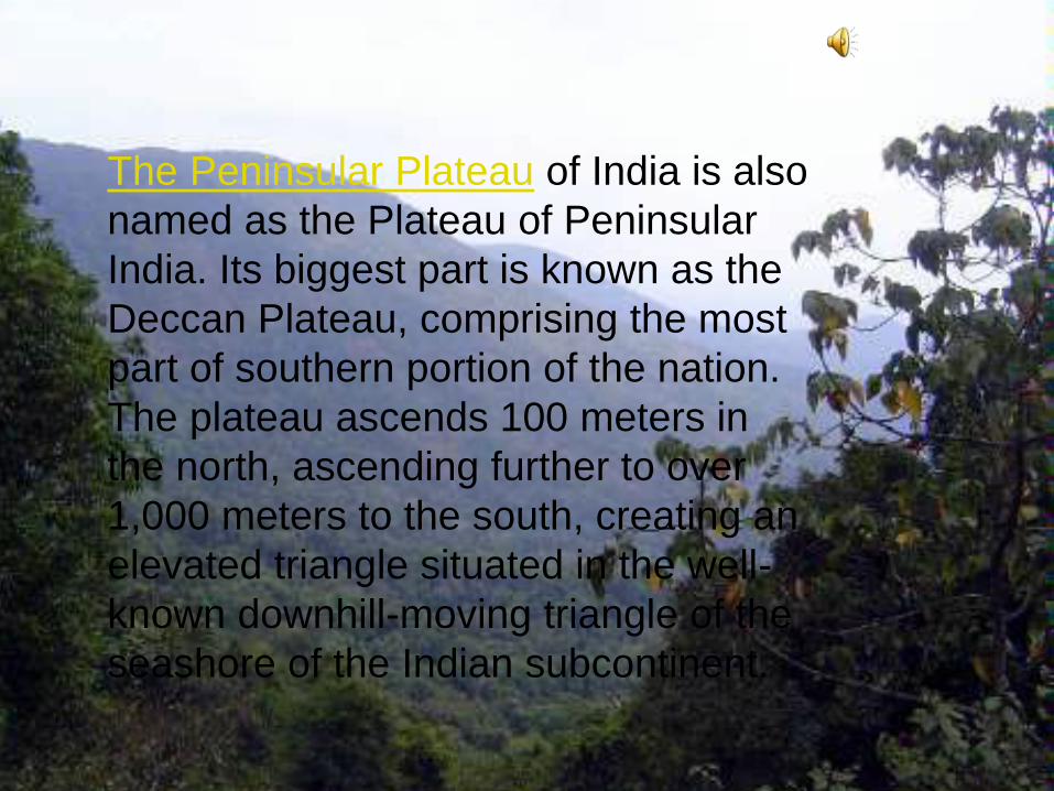
The Peninsular Plateau of India is also
named as the Plateau of Peninsular
India. Its biggest part is known as the
Deccan Plateau, comprising the most
part of southern portion of the nation.
The plateau ascends 100 meters in
the north, ascending further to over
1,000 meters to the south, creating an
elevated triangle situated in the well-
known downhill-moving triangle of the
seashore of the Indian subcontinent.
Central Highlands
The part of peninsular plateau lying to the north of the narmada river covering a major area of the malwa plateau is known as the central highlands.
The extend of central highlands is from vindhya to aravalli hills.
The slope of central highlands is from south-west to north-east
The rivers chambal,sind,betwa and ken flow are according to the slope of the plateau.
The central highlands are wider in the west and are narrower in the east.
The chotanagpur plateau is the eastward extension of central highlands.
The chotanagpur plateau is drained from damodar river.
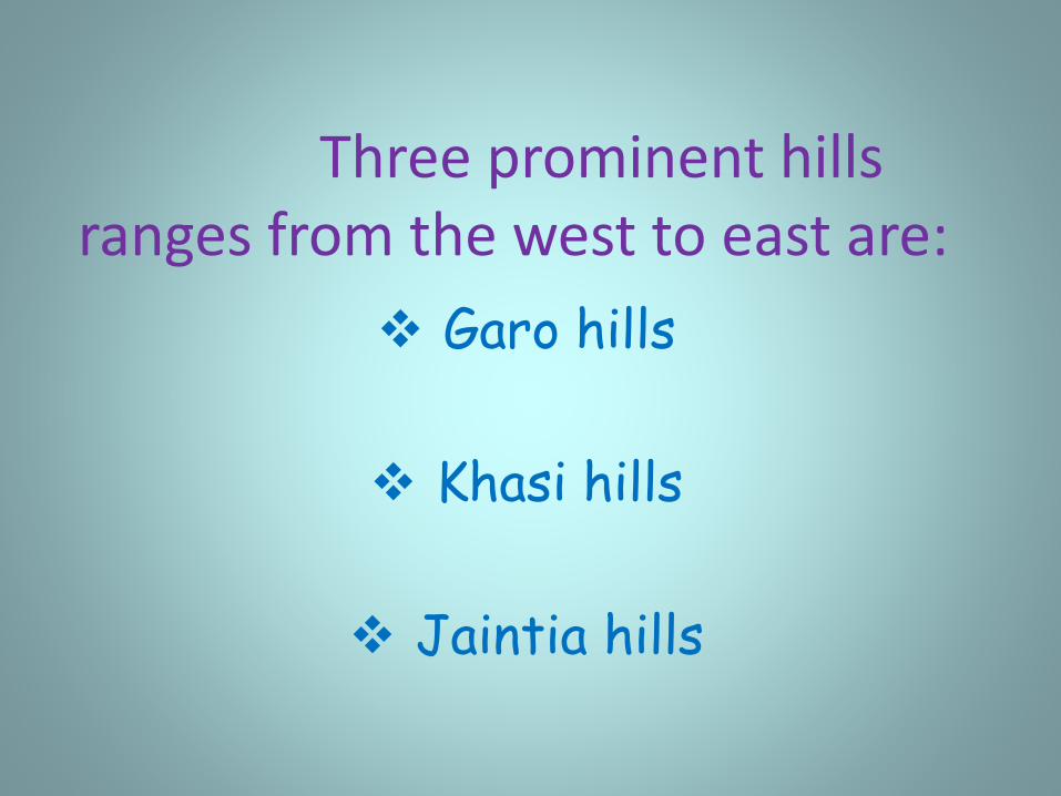
Three prominent hills ranges from the west to east are:
Garo hills
Khasi hills
Jaintia hills
Western Ghats and Eastern Ghats
The western ghats and the eastern ghats mark the western and the eastern edges of the deccan plateau respectively.
Three passes from western ghats are:
1. Thal ghats
2. Bhor ghats
3. Pal ghats
The western ghats are higher than the eastern ghats.
Their average elevation is 900 to 1600m as against 600m of the eastern ghats.
The eastern ghats stretches mahanadi valley to the nilgiri hills in the south.
The eastern ghats are discontinuous and are cut by the rivers.
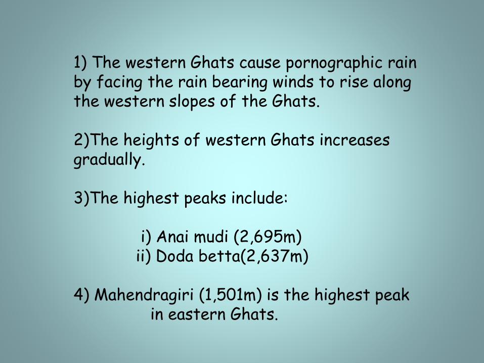
1) The western Ghats cause pornographic rain by facing the rain bearing winds to rise along the western slopes of the Ghats.
2)The heights of western Ghats increases gradually.
3)The highest peaks include:
i) Anai mudi (2,695m)ii) Doda betta(2,637m)
4) Mahendragiri (1,501m) is the highest peak in eastern Ghats.
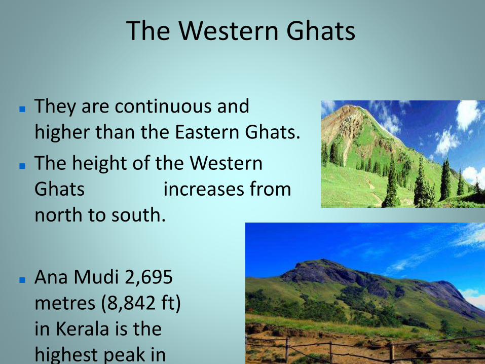
The Western Ghats
They are continuous and higher than the Eastern Ghats.
The height of the Western Ghats increases from north to south.
Ana Mudi 2,695 metres (8,842 ft) in Kerala is the highest peak in Western Ghats.
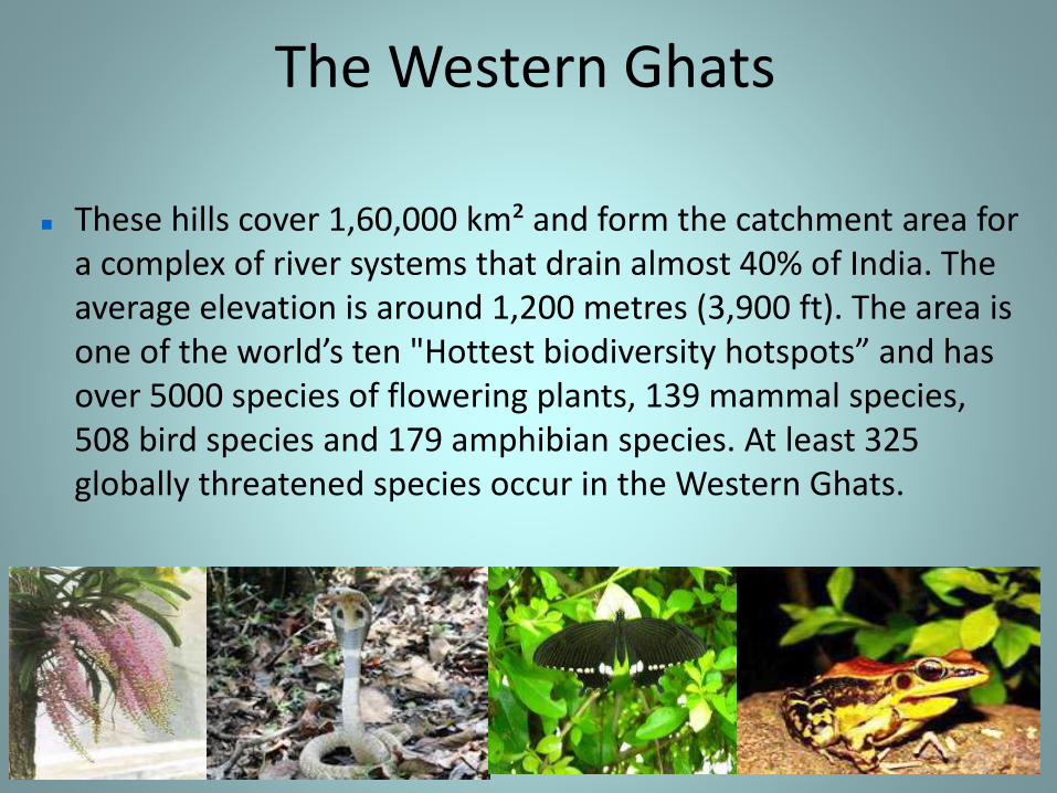
The Western Ghats
These hills cover 1,60,000 km² and form the catchment area for a complex of river systems that drain almost 40% of India. The average elevation is around 1,200 metres (3,900 ft). The area is one of the world’s ten "Hottest biodiversity hotspots” and has over 5000 species of flowering plants, 139 mammal species, 508 bird species and 179 amphibian species. At least 325 globally threatened species occur in the Western Ghats.
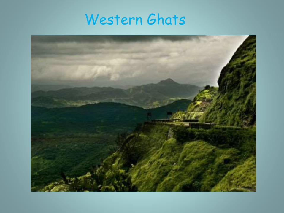
Western Ghats
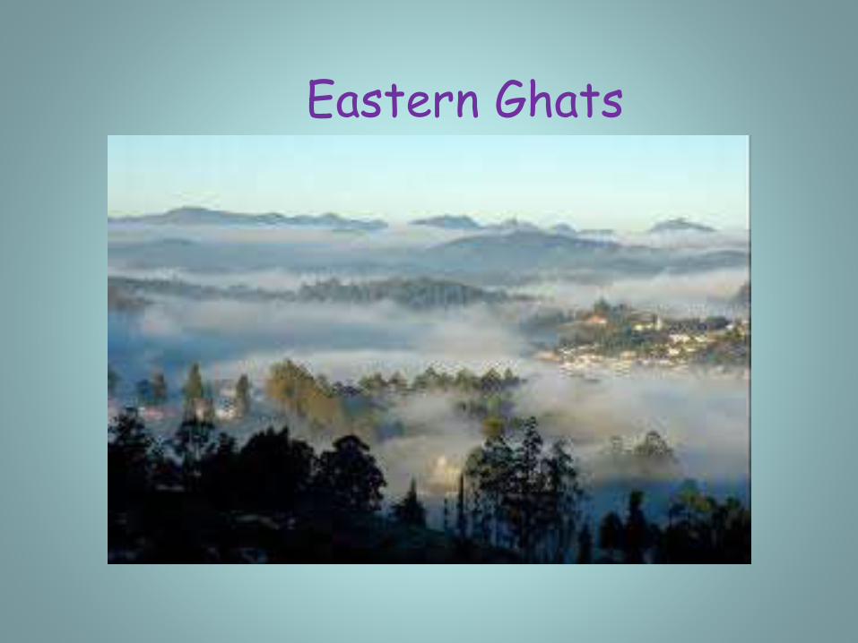
3.The Eastern Ghats
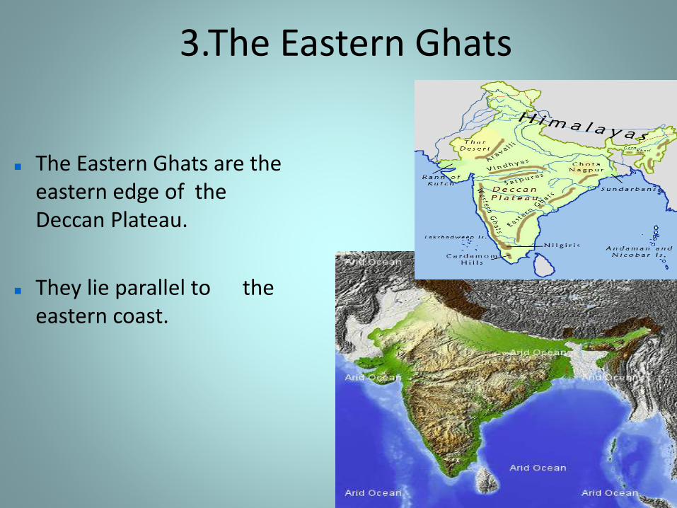
The Eastern Ghats are the eastern edge of the Deccan Plateau.
They lie parallel to the eastern coast.
The Eastern Ghats
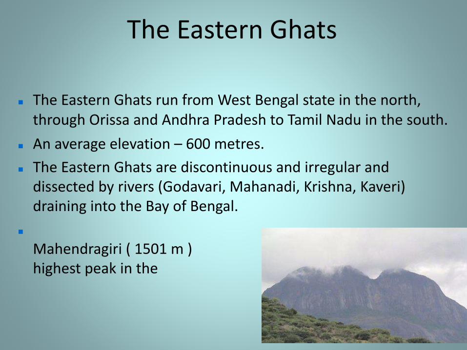
The Eastern Ghats run from West Bengal state in the north, through Orissa and Andhra Pradesh to Tamil Nadu in the south.
An average elevation – 600 metres.
The Eastern Ghats are discontinuous and irregular and dissected by rivers (Godavari, Mahanadi, Krishna, Kaveri) draining into the Bay of Bengal.
Mahendragiri ( 1501 m ) is the highest peak in the Eastern Ghats.
The Eastern Ghats
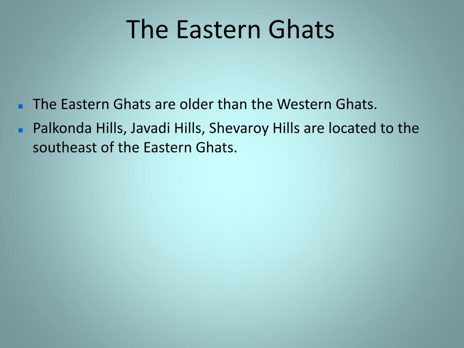
The Eastern Ghats are older than the Western Ghats.
Palkonda Hills, Javadi Hills, Shevaroy Hills are located to the southeast of the Eastern Ghats.
Eastern Ghats

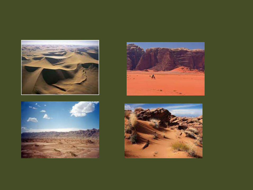
A place that receives less than 10 inches (25
centimeters) of rain per year is considered a desert.
Deserts cover more than one fifth of the Earth's land,
and they are found on every continent.
Deserts are. part of a wider classification of regions
called "dry lands .
These areas exist under a moisture deficit, which
means they can frequently lose more moisture
through evaporation than they receive from annual
precipitation.
The largest hot desert in the world, northern Africa's Sahara,
reaches temperatures of up to 122 degrees Fahrenheit (50 degrees
Celsius) during the day. covering 9 million square kilometers and 12
countries.
Hot deserts usually have a large diurnal and seasonal temperature
range, with high daytime temperatures, and low nighttime
temperatures (due to extremely low humidity).
In hot deserts the temperature in the daytime can reach 45 °C/113
°F or higher in the summer, and dip to 0 °C/32 °F or lower at
nighttime in the winter.
Urban areas in deserts lack large (more than 14 °C/25 °F) daily
temperature variations, partially due to the urban heat island effect.
Many deserts are formed by rain shadows; mountains blocking the
path of precipitation to the desert (on the lee side of the mountain).
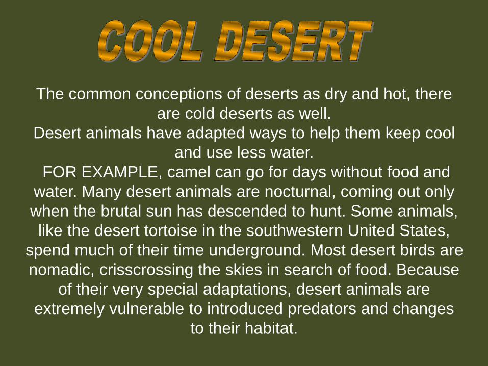
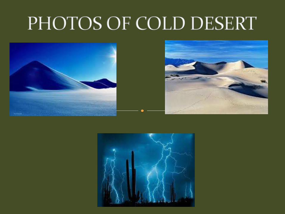
The common conceptions of deserts as dry and hot, there
are cold deserts as well.
Desert animals have adapted ways to help them keep cool
and use less water.
FOR EXAMPLE, camel can go for days without food and
water. Many desert animals are nocturnal, coming out only
when the brutal sun has descended to hunt. Some animals,
like the desert tortoise in the southwestern United States,
spend much of their time underground. Most desert birds are
nomadic, crisscrossing the skies in search of food. Because
of their very special adaptations, desert animals are
extremely vulnerable to introduced predators and changes
to their habitat.

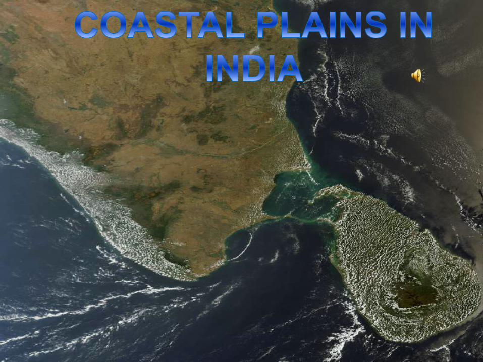
The Costal Plains
THE COASTAL PLAINS
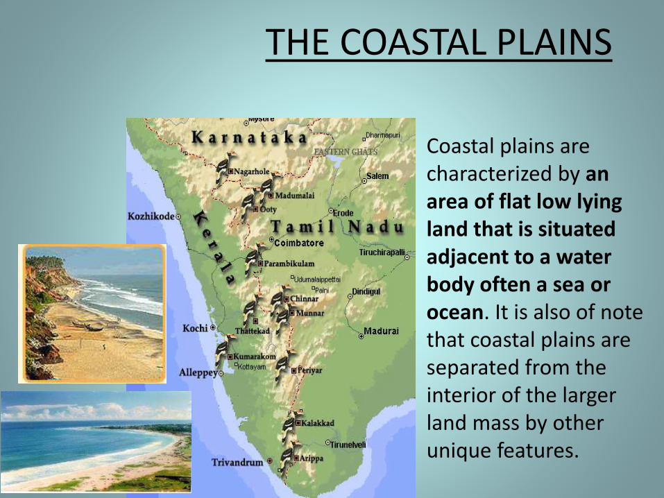
Coastal plains are characterized by an area of flat low lying land that is situated adjacent to a water body often a sea or ocean. It is also of note that coastal plains are separated from the interior of the larger land mass by other unique features.
THE COASTAL PLAINS
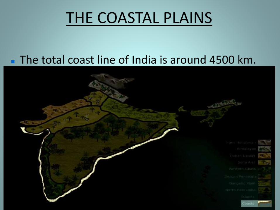
The total coast line of India is around 4500 km.
THE COASTAL PLAINS
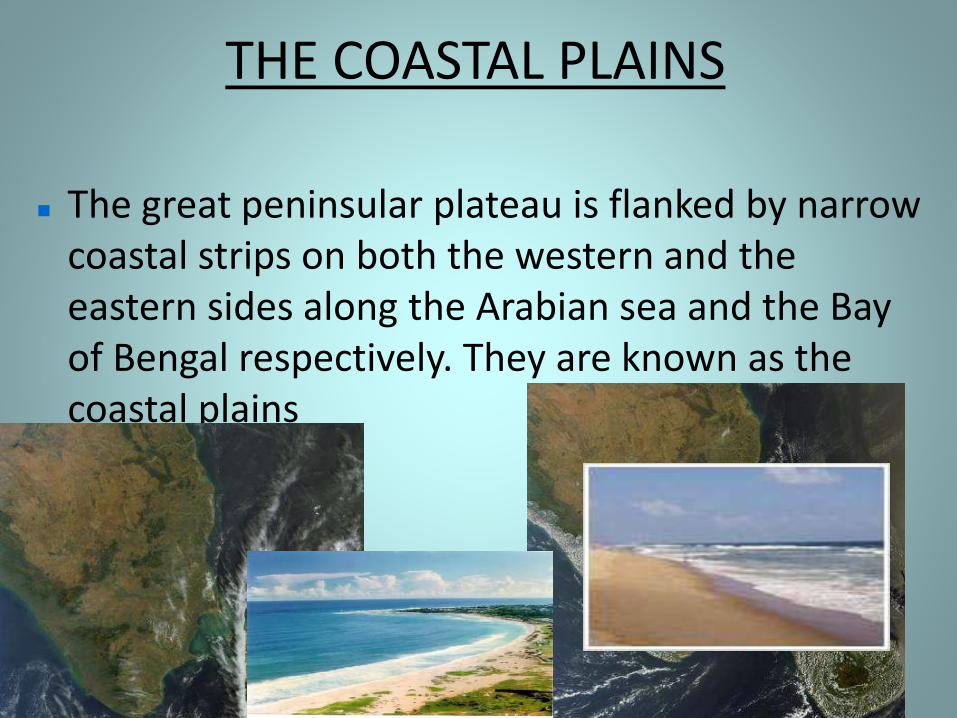
The great peninsular plateau is flanked by narrow coastal strips on both the western and the eastern sides along the Arabian sea and the Bay of Bengal respectively. They are known as the coastal plains
THE COASTAL PLAINS
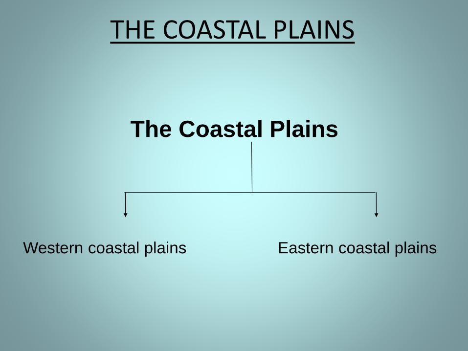
The Coastal Plains
Western coastal plains Eastern coastal plains
THE COASTAL PLAINS
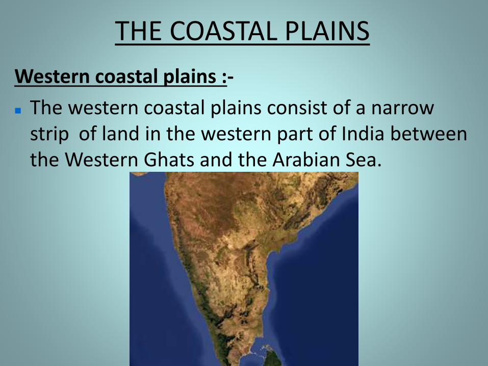
Western coastal plains :-
The western coastal plains consist of a narrow strip of land in the western part of India between the Western Ghats and the Arabian Sea.
The Western Coastal Plains
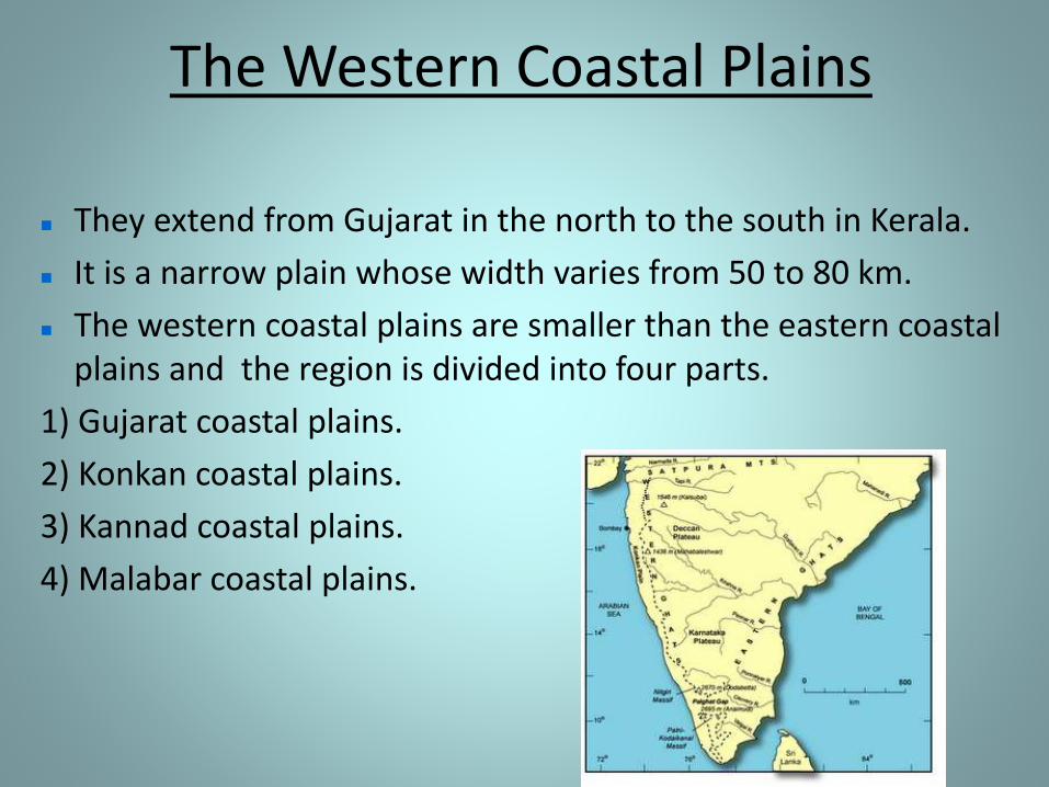
They extend from Gujarat in the north to the south in Kerala.
It is a narrow plain whose width varies from 50 to 80 km.
The western coastal plains are smaller than the eastern coastal plains and the region is divided into four parts.
1) Gujarat coastal plains.
2) Konkan coastal plains.
3) Kannad coastal plains.
4) Malabar coastal plains.
THE COASTAL PLAINS
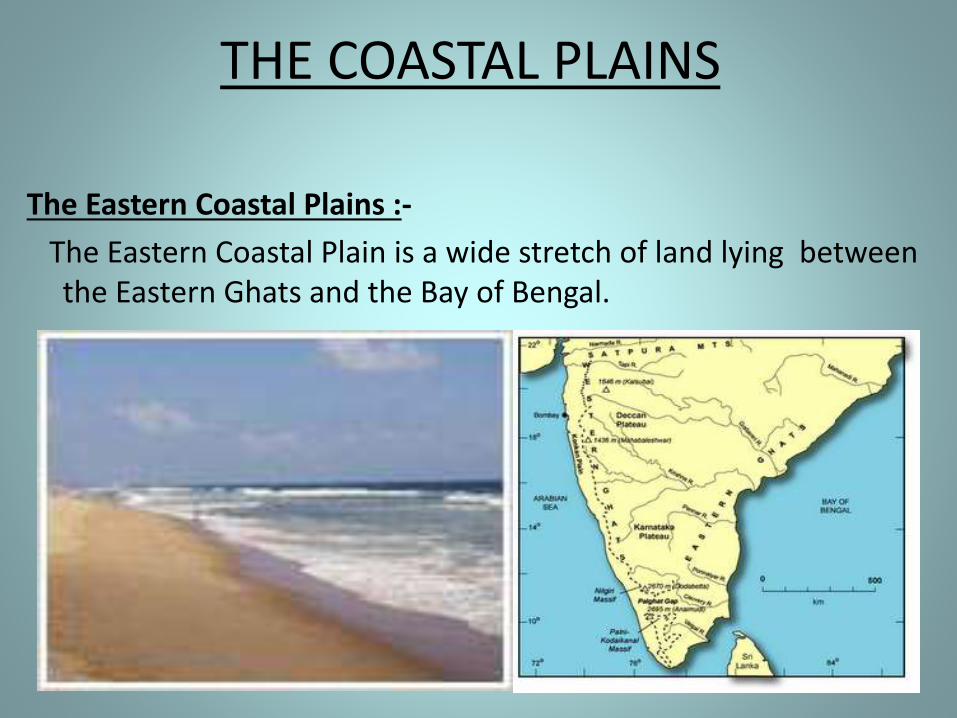
The Eastern Coastal Plains :-
The Eastern Coastal Plain is a wide stretch of land lying between the Eastern Ghats and the Bay of Bengal.
The Eastern Coastal Plains
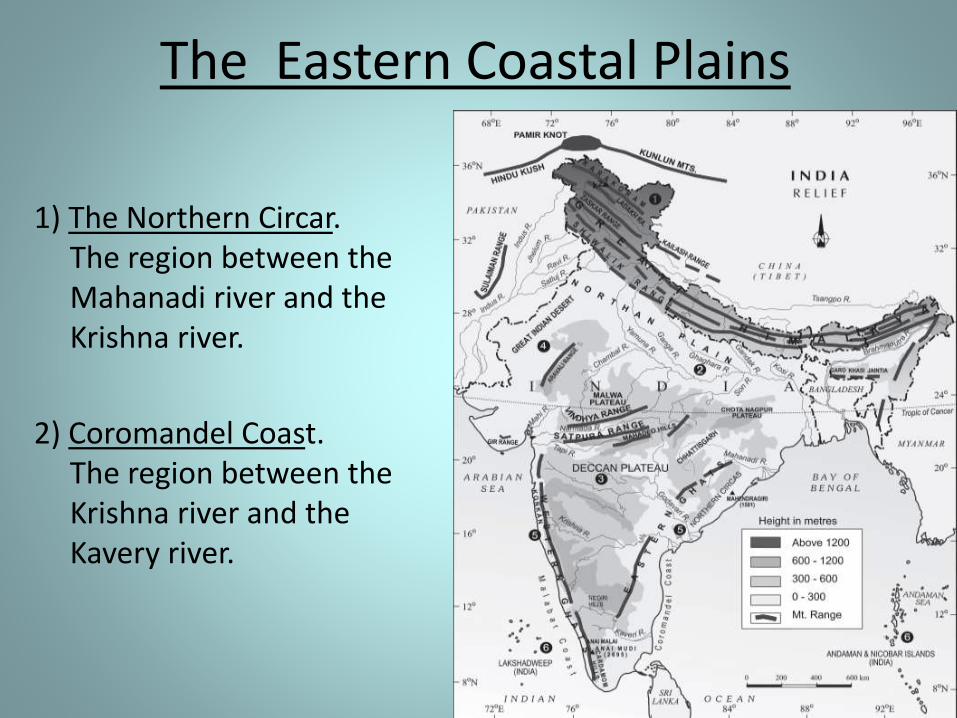
1) The Northern Circar. The region between the Mahanadi river and the Krishna river.
2) Coromandel Coast. The region between the Krishna river and the Kavery river.
The Eastern Coastal Plains
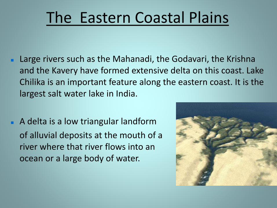
Large rivers such as the Mahanadi, the Godavari, the Krishna and the Kavery have formed extensive delta on this coast. Lake Chilika is an important feature along the eastern coast. It is the largest salt water lake in India.
A delta is a low triangular landform
of alluvial deposits at the mouth of a river where that river flows into an ocean or a large body of water.
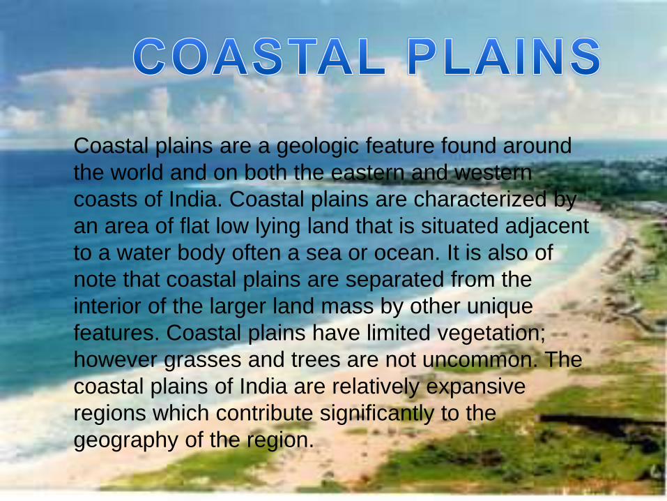
Coastal plains are a geologic feature found around
the world and on both the eastern and western
coasts of India. Coastal plains are characterized by
an area of flat low lying land that is situated adjacent
to a water body often a sea or ocean. It is also of
note that coastal plains are separated from the
interior of the larger land mass by other unique
features. Coastal plains have limited vegetation;
however grasses and trees are not uncommon. The
coastal plains of India are relatively expansive
regions which contribute significantly to the
geography of the region.
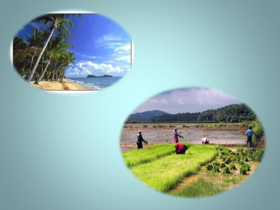
The Island
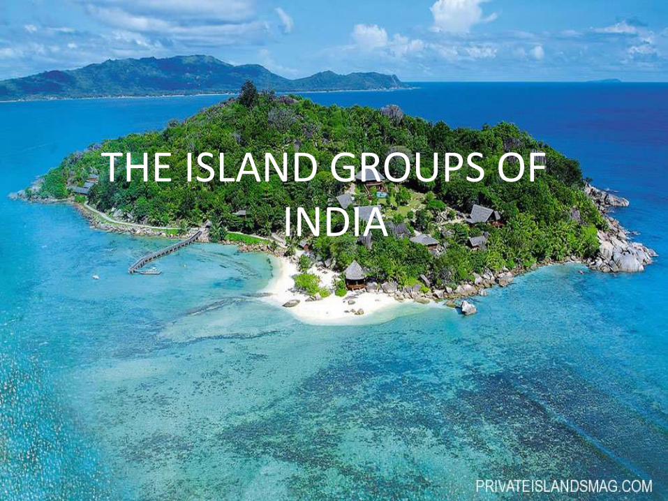
THE ISLAND GROUPS OF INDIA
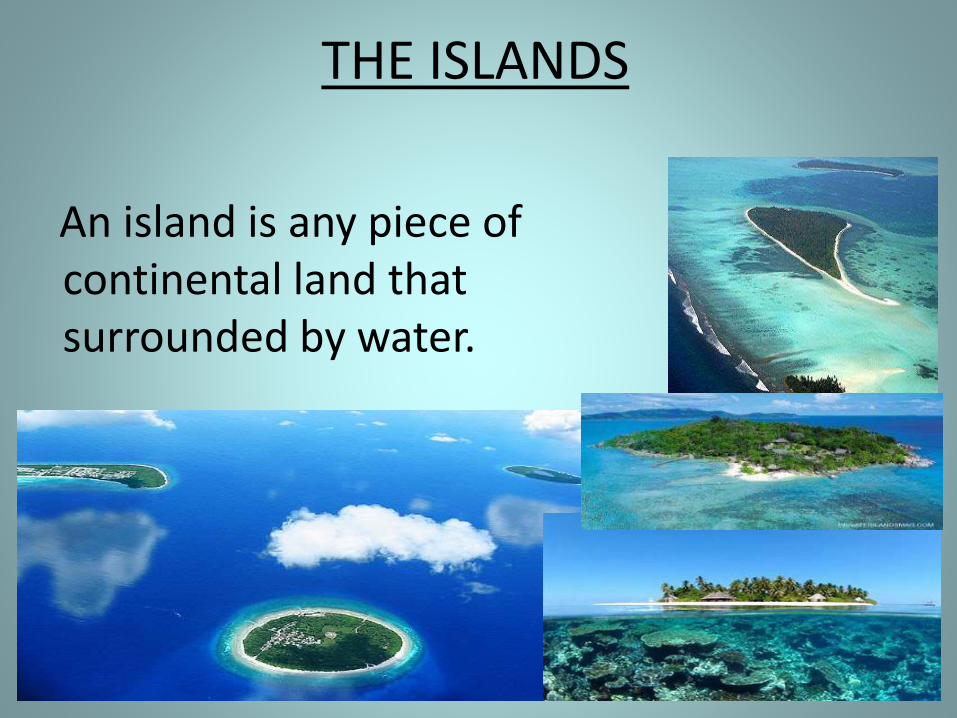
THE ISLANDS
An island is any piece of sub-continental land that is surrounded by water.
THE ISLANDS
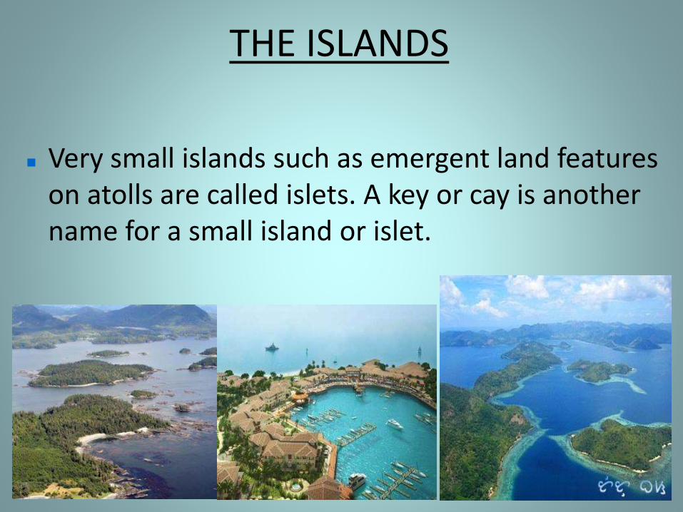
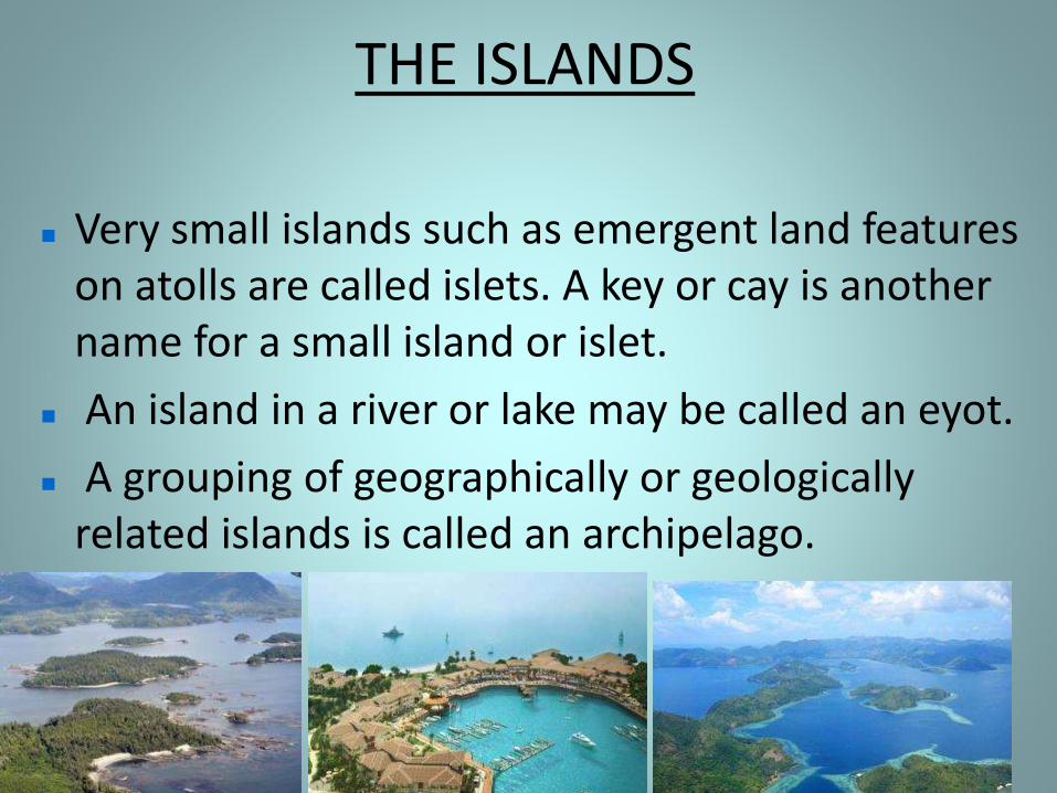
Very small islands such as emergent land features on atolls are called islets. A key or cay is another name for a small island or islet.
THE ISLANDS
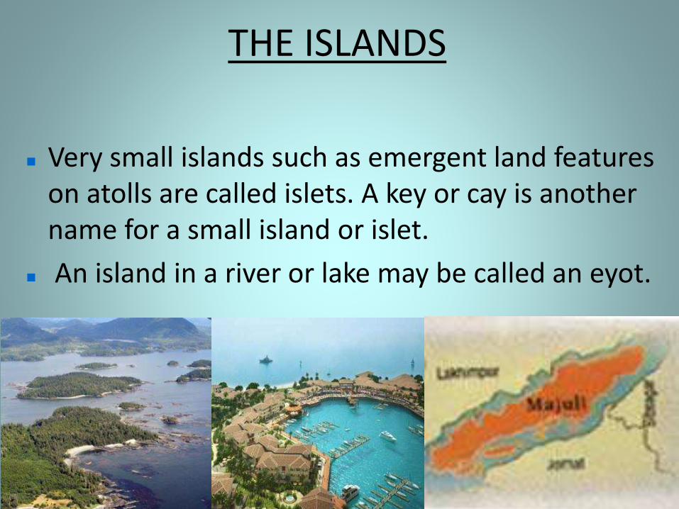
Very small islands such as emergent land features on atolls are called islets. A key or cay is another name for a small island or islet.
An island in a river or lake may be called an eyot.
THE ISLANDS
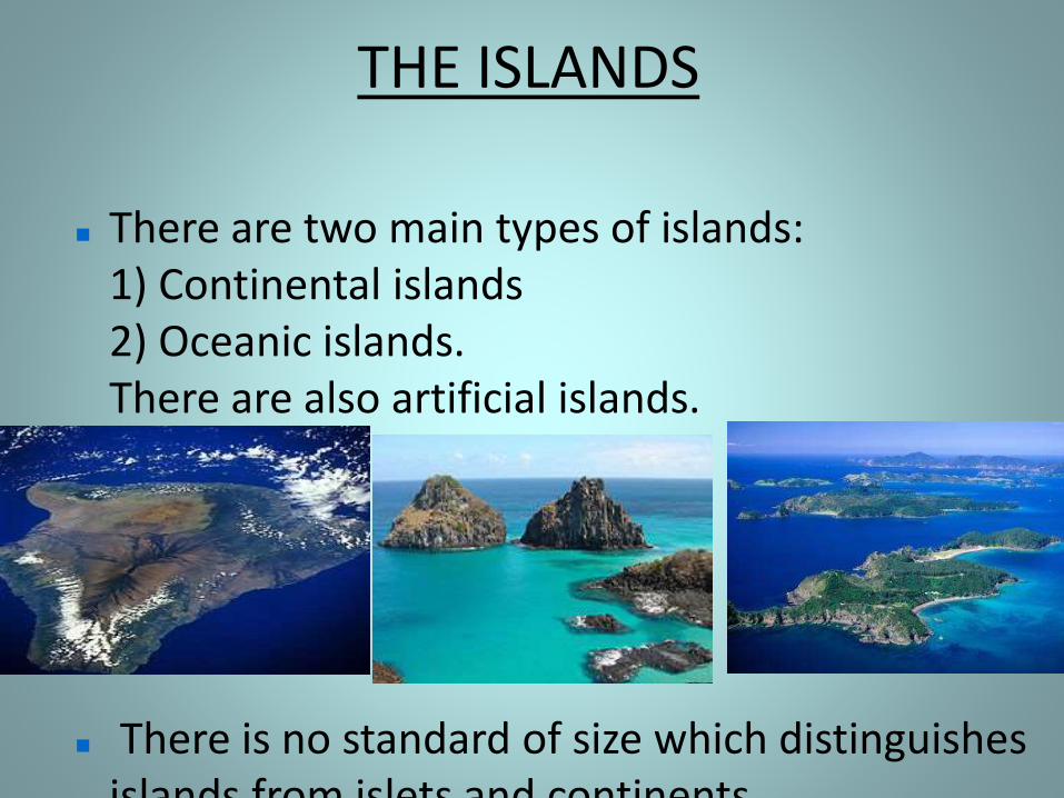
There are two main types of islands: 1) Continental islands 2) Oceanic islands. There are also artificial islands.
There is no standard of size which distinguishes islands from islets and continents.
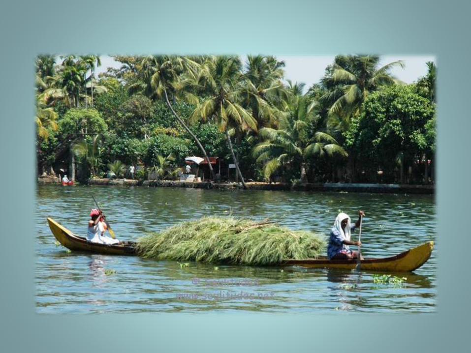
THE ISLAND GROUPS OF INDIA
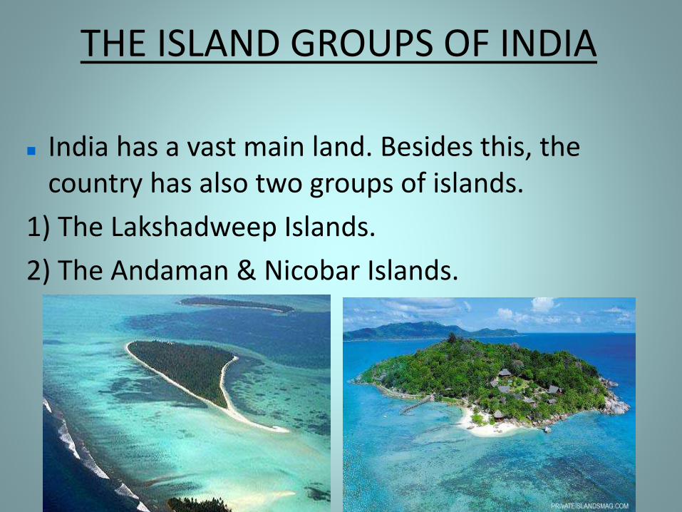
India has a vast main land. Besides this, the country has also two groups of islands.
1) The Lakshadweep Islands.
2) The Andaman & Nicobar Islands.
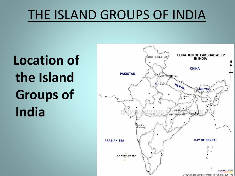
THE ISLAND GROUPS OF INDIA
Location of the Island Groups of India
THE ISLANDS
Very small islands such as emergent land features on atolls are called islets. A key or cay is another name for a small island or islet.
An island in a river or lake may be called an eyot.
A grouping of geographically or geologically related islands is called an archipelago.
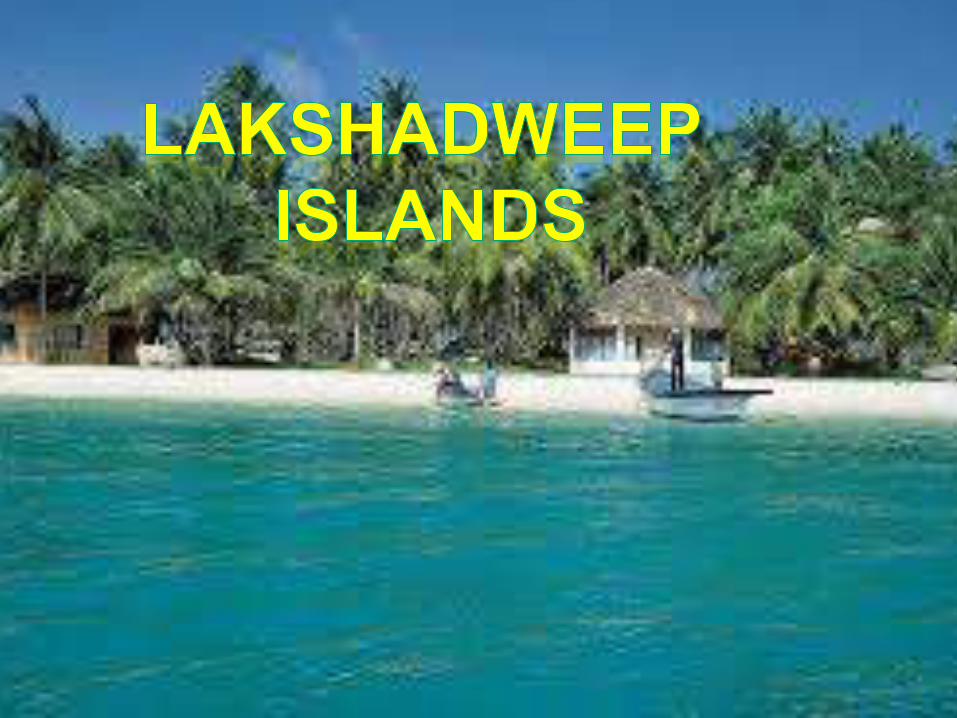
Lakshadweep Islands
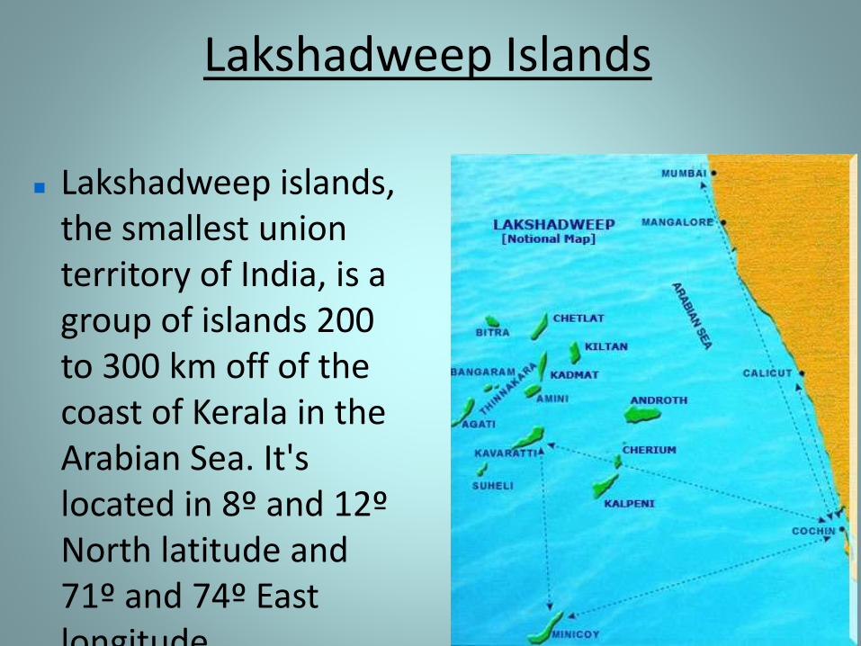
Lakshadweep islands, the smallest union territory of India, is a group of islands 200 to 300 km off of the coast of Kerala in the Arabian Sea. It's located in 8º and 12º North latitude and 71º and 74º East longitude.

Lakshadweep Islands
There are 36 coral islands that constitute Lakshadweep islands, only 10 are inhabited and only six have been opened for tourism.
Their total land area is 32 km².
These islands, formed of coral deposits, are called atolls. Atolls are circular or horse shoe shaped coral reefs.
Lakshadweep Islands
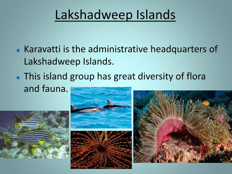
Karavatti is the administrative headquarters of Lakshadweep Islands.
This island group has great diversity of flora and fauna.

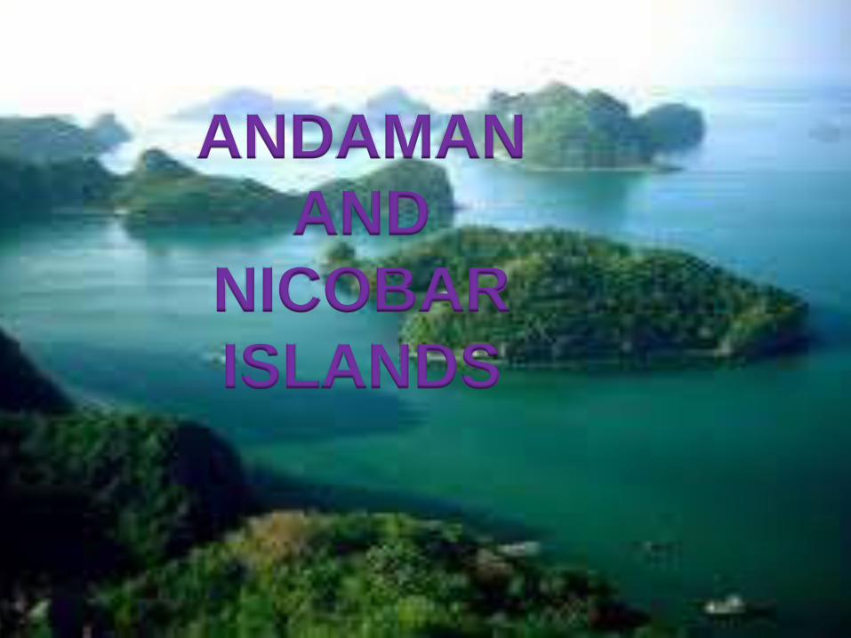
Andaman & Nicobar Islands
The Andaman and Nicobar Islands are located between 6o and 14o North latitude and 92o and 94o East
longitude in the Bay of Bengal near
the Myanmar coast. It is located
1255 km from Kolkata and 193 km
from Cape Negrais in Myanmar.
Andaman & Nicobar Islands
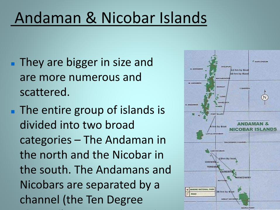
They are bigger in size and are more numerous and scattered.
The entire group of islands is divided into two broad categories – The Andaman in the north and the Nicobar in the south. The Andamans and Nicobars are separated by a channel (the Ten Degree Channel) some 150 km wide.
Andaman & Nicobar Islands
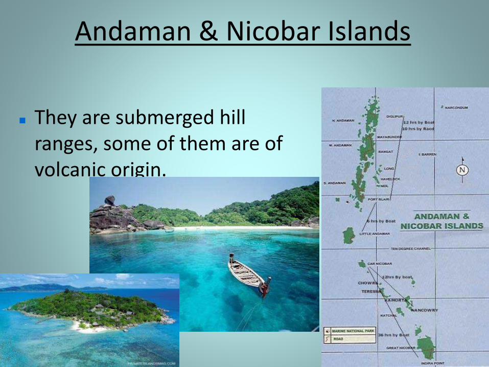
They are submerged hill ranges, some of them are of volcanic origin.
Andaman & Nicobar Islands
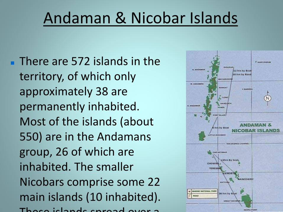
There are 572 islands in the territory, of which only approximately 38 are permanently inhabited. Most of the islands (about 550) are in the Andamans group, 26 of which are inhabited. The smaller Nicobars comprise some 22 main islands (10 inhabited). These islands spread over a
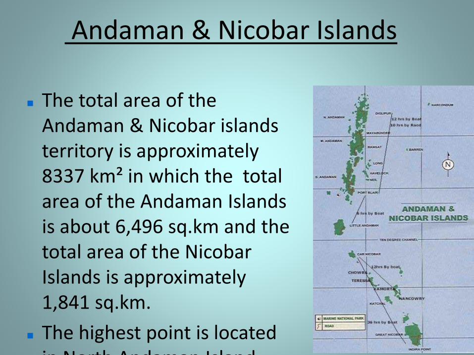
Andaman & Nicobar Islands
The total area of the Andaman & Nicobar islands territory is approximately 8337 km² in which the total area of the Andaman Islands is about 6,496 sq.km and the total area of the Nicobar Islands is approximately 1,841 sq.km.
The highest point is located in North Andaman Island
Andaman & Nicobar Islands
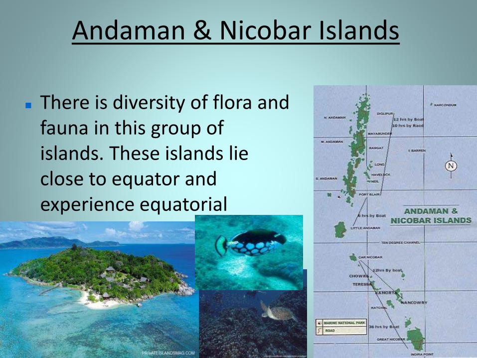
There is diversity of flora and fauna in this group of islands. These islands lie close to equator and experience equatorial climate and has thick forest cover.
Andaman & Nicobar Islands
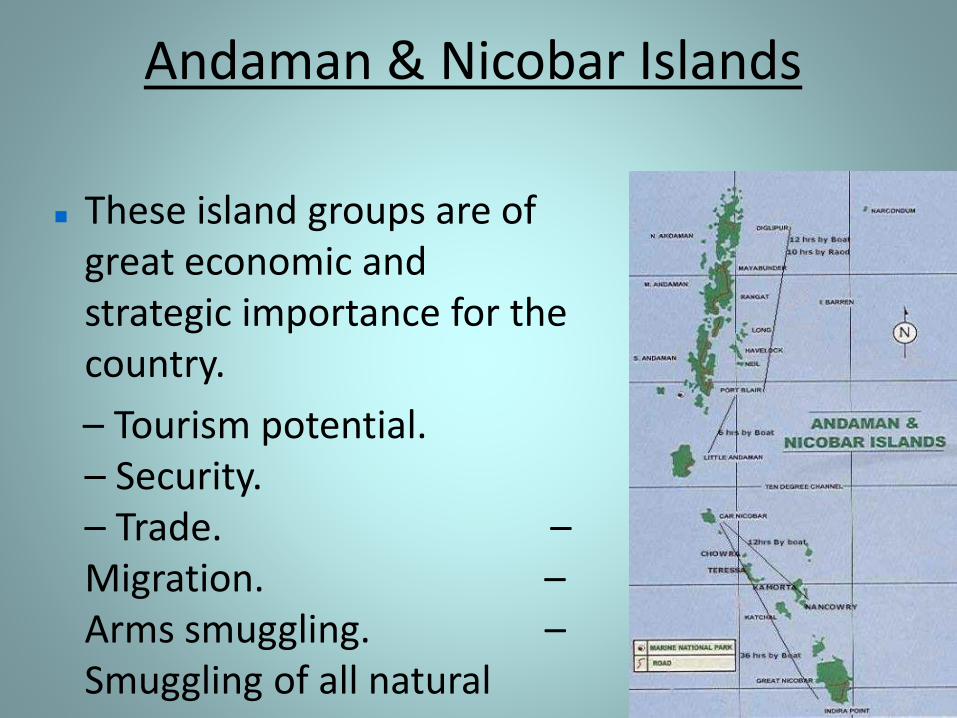
These island groups are of great economic and strategic importance for the country.
– Tourism potential. – Security. – Trade. –Migration. –Arms smuggling. –Smuggling of all natural
resources
Andaman & Nicobar Islands
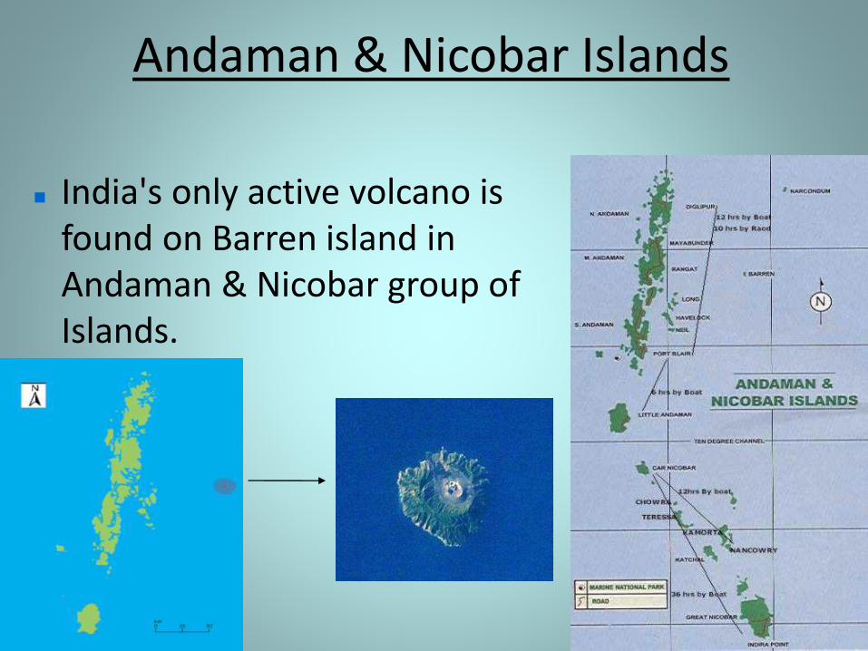
India's only active volcano is found on Barren island in Andaman & Nicobar group of Islands.
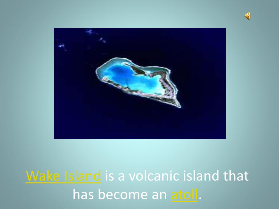
Wake Island is a volcanic island that has become an atoll.
LAKSHADWEEP ISLANDS
ANDAMAN
AND
NICOBAR
ISLANDS

MADE
BY
AMAL KRISHNA
V.B