Embed Size (px)
Citation preview
Copernicus EU CopernicusEU www.copernicus.eu
Follow us on:
Space
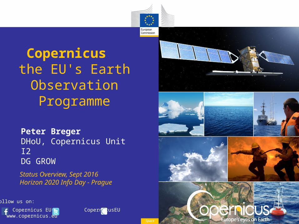
Copernicus the EU's Earth Observation Programme
Peter BregerDHoU, Copernicus Unit I2DG GROWStatus Overview, Sept 2016Horizon 2020 Info Day - Prague
Space
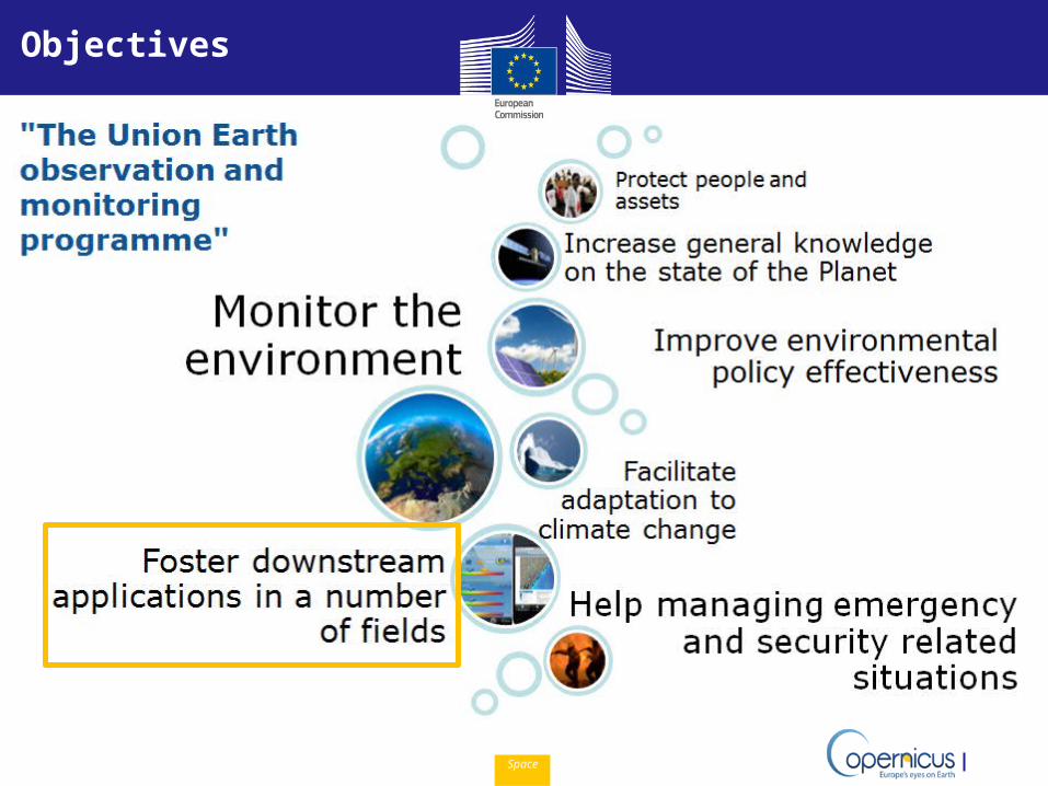
Objectives
Space
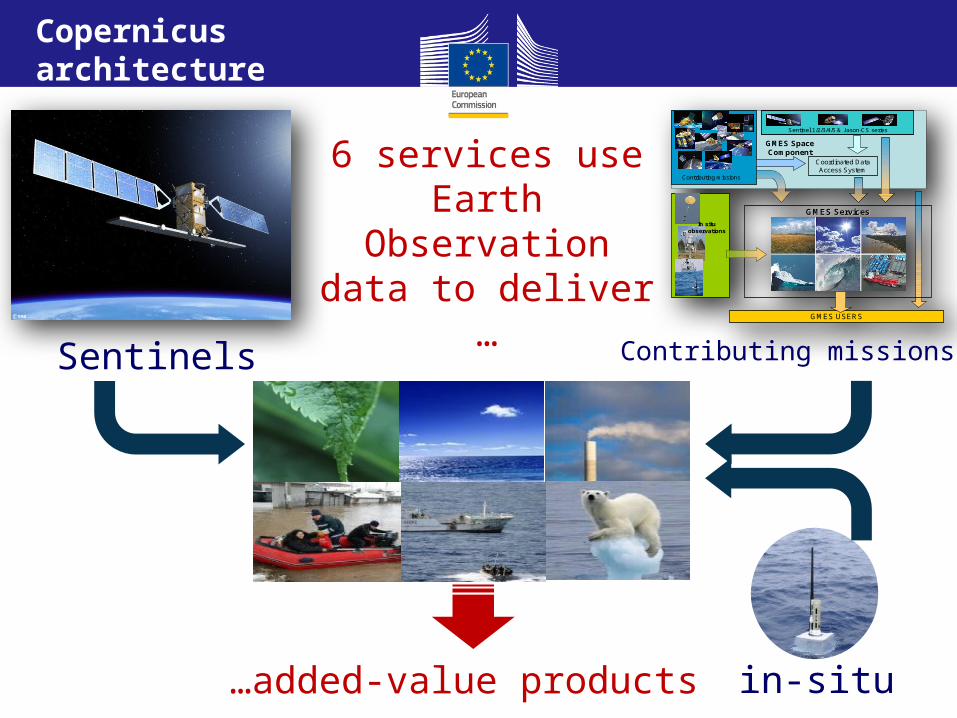
6 services use Earth Observation data to deliver …
SentinelsGMES USERS
Coordinated Data Access System
GMES ServicesGMES Services
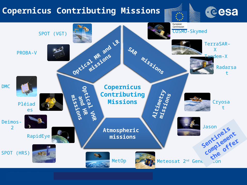
Contributing missions
In situ observations
Sentinel 1/2/3/4/5 & Jason-CS seriesSentinel 1/2/3/4/5 & Jason-CS series
GMES Space Component
Contributing missions
in-situ…added-value products
Copernicus architecture
Space
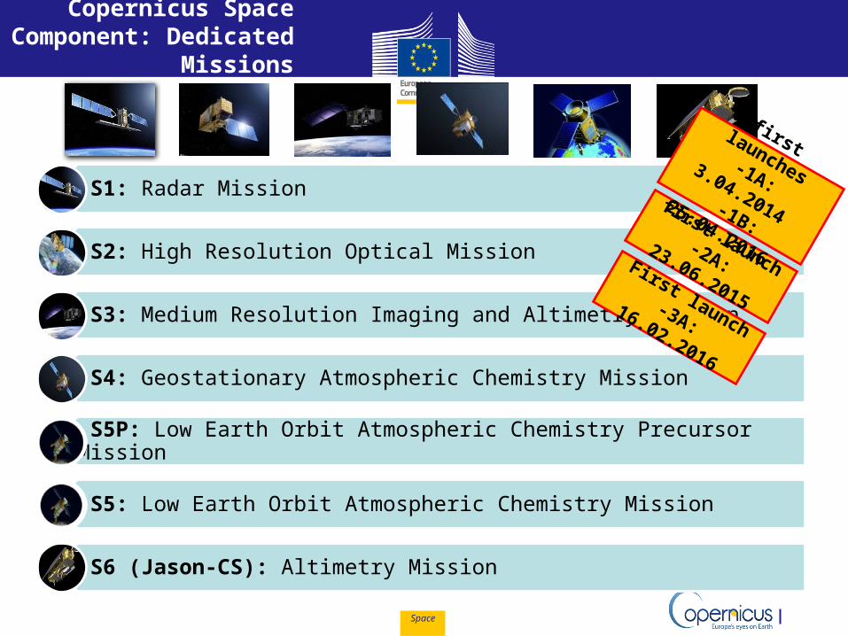
S1: Radar Mission
S2: High Resolution Optical Mission
S3: Medium Resolution Imaging and Altimetry Mission
S4: Geostationary Atmospheric Chemistry Mission
S5P: Low Earth Orbit Atmospheric Chemistry Precursor Mission
S5: Low Earth Orbit Atmospheric Chemistry Mission
S6 (Jason-CS): Altimetry Mission
Copernicus Space Component: Dedicated
Missions
first launch-2A: 23.06.2015
First launch-3A:
16.02.2016
first launches-1A:
3.04.2014 -1B:
25.04.2016
Space
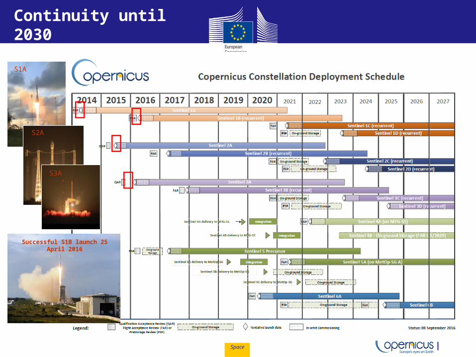
Successful S1B launch 25 April 2016
S1A
S2A
S3A
Continuity until 2030
Space 6
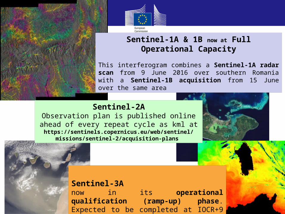
Sentinel-3Anow in its operational qualification (ramp-up) phase. Expected to be completed at IOCR+9 months, i.e. spring 2017
Sentinel-2AObservation plan is published online ahead of every
repeat cycle as kml at https://sentinels.copernicus.eu/web/sentinel/missions/sentinel-2/
acquisition-plans
Sentinel-1A & 1B now at Full Operational Capacity
This interferogram combines a Sentinel-1A radar scan from 9 June 2016 over southern Romania with a Sentinel-1B acquisition from 15 June over the same area
December 2015
Optical M
R and LR
missions
Copernicus Contributing
Missions
Optical VHR
and HR
missions
SAR missions
Altim
etry
m
issi
ons
Atmospheric missions
PROBA-V
SPOT (VGT)
MetOp Meteosat 2nd Generation
Cryosat
Jason
DMC
Deimos-2
Pléiades
RapidEye
SPOT (HRS)
COSMO-Skymed
Radarsat
TerraSAR–XTandem-X
Sentinels
complement the
offer
Copernicus Contributing Missions
Space
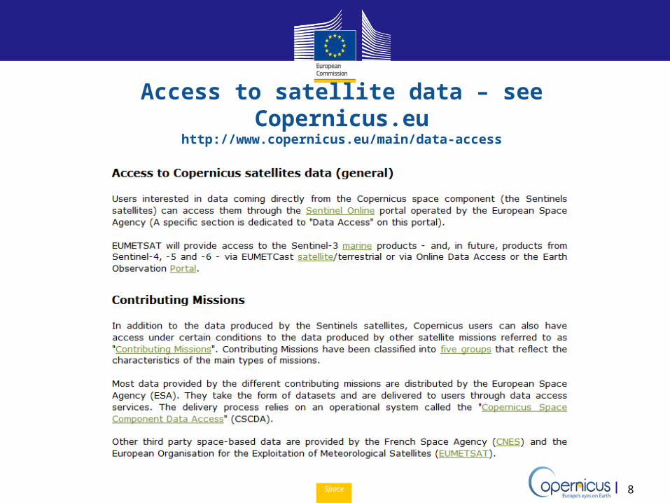
Access to satellite data – see Copernicus.euhttp://www.copernicus.eu/main/data-access
8
Space
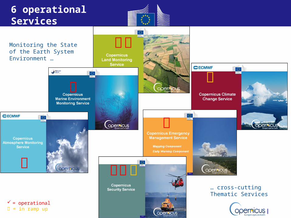
6 operational Services
Monitoring the State of the Earth System Environment …
… cross-cutting Thematic Services
= operational = in ramp up
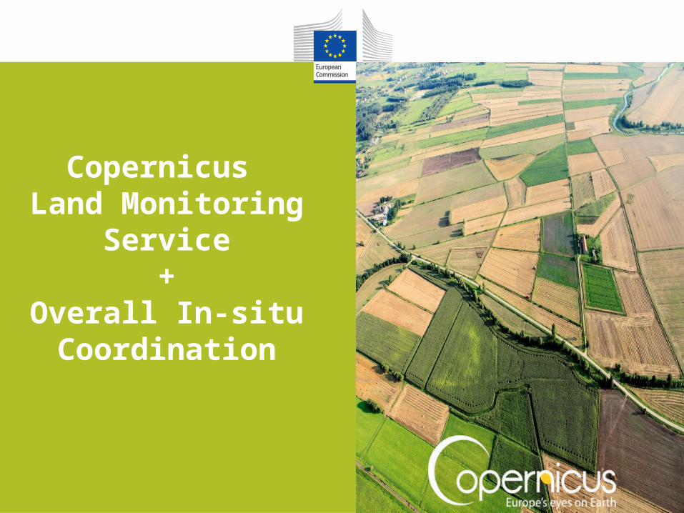
Copernicus Land Monitoring
Service+
Overall In-situ Coordination
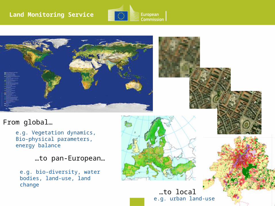
From global…
…to pan-European…
…to local
e.g. Vegetation dynamics, Bio-physical parameters, energy balance
e.g. bio-diversity, water bodies, land-use, land change
e.g. urban land-use
Land Monitoring Service
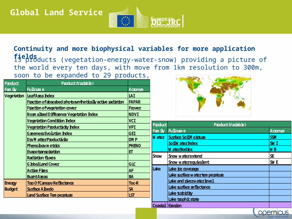
Global Land Service DG JRC
Product (Variable)Full name AcronymLeaf Area Index LAIFraction of absorbed photosynthetically active radiation FAPARFraction of vegetation cover FcoverNormalized Difference Vegetation Index NDVIVegetation Condition Index VCIVegetation Productivity Index VPIGreeness Evolution Index GEIDry Matter Productivity DMPPhenology metrics PHENOEvapotranspiration ETRadiation fluxesGlobal Land Cover GLCActive Fires AFBurnt Areas BATop Of Canopy Reflectance Toc-RSurface Albedo SALand Surface Temperature LST
Energy Budget
Product FamilyVegetation
Full name AcronymSurface Soil Moisture SSMSoil Water Index SWIWater Bodies WB
Snow Snow water extend SESnow water equivalent SWE
Lake Lake ice coverageLake surface water temperatureLake and river water levelLake surface reflectanceLake turbidityLake trophic state
Coastal Erosion
Water
Product Family
Product (Variable)
13 products (vegetation-energy-water-snow) providing a picture of the world every ten days, with move from 1km resolution to 300m, soon to be expanded to 29 products,
Continuity and more biophysical variables for more application fields
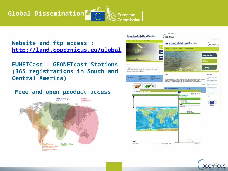
Global Dissemination
Website and ftp access : http://land.copernicus.eu/global
EUMETCast – GEONETcast Stations (365 registrations in South and Central America)
•Free and open product access
Copernicus Marine
Environment Monitoring
Service
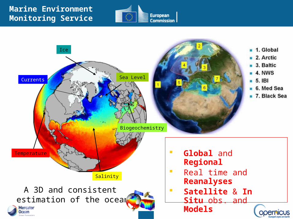
Marine Environment Monitoring Service
Global and Regional Real time and
Reanalyses Satellite & In Situ obs.
and Models
Ice
Temperature
Salinity
Sea Level
A 3D and consistent estimation of the ocean
Currents
Biogeochemistry
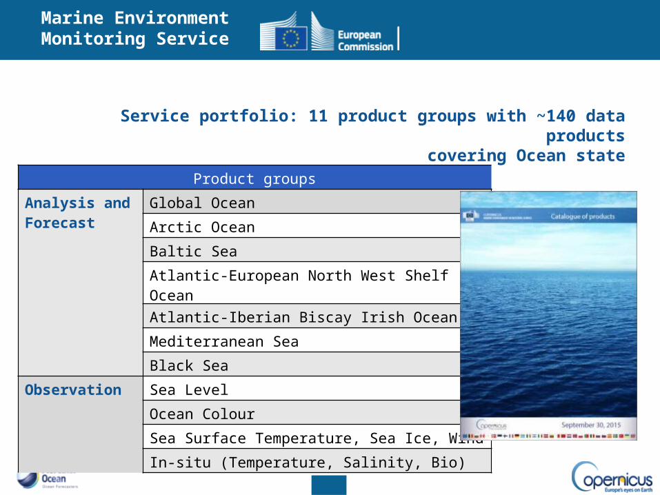
Service portfolio: 11 product groups with ~140 data productscovering Ocean state
Product groups
Analysis and Forecast
Global Ocean
Arctic Ocean
Baltic Sea
Atlantic-European North West Shelf Ocean
Atlantic-Iberian Biscay Irish Ocean
Mediterranean Sea
Black Sea
Observation Sea Level
Ocean Colour
Sea Surface Temperature, Sea Ice, Wind
In-situ (Temperature, Salinity, Bio)
Marine Environment Monitoring Service
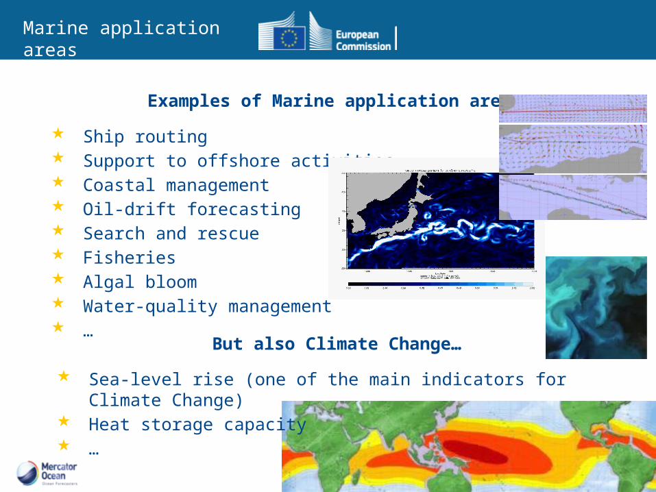
Examples of Marine application areas
Ship routing Support to offshore activities Coastal management Oil-drift forecasting Search and rescue Fisheries Algal bloom Water-quality management …
But also Climate Change…
Sea-level rise (one of the main indicators for Climate Change) Heat storage capacity …
Marine application areas
Copernicus Atmosphere Monitoring
Service
pace 20
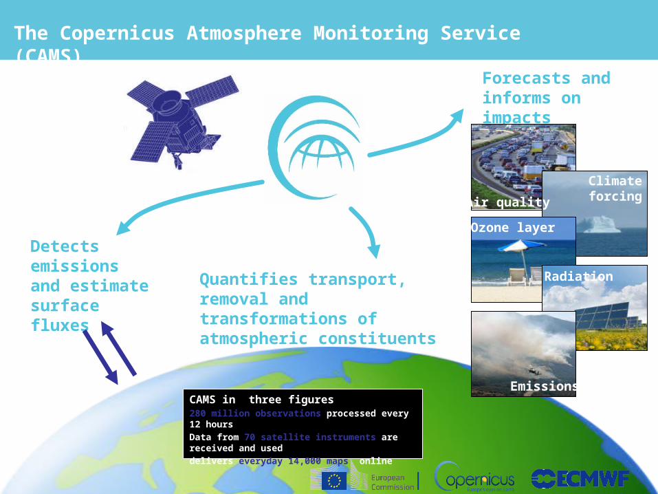
The Copernicus Atmosphere Monitoring Service (CAMS)
Detects emissions and estimate surface fluxes
Quantifies transport, removal and transformations of atmospheric constituents
Forecasts and informs on impacts
Air qualityClimate forcing
Ozone layer
Radiation
EmissionsCAMS in three figures280 million observations processed every 12 hoursData from 70 satellite instruments are received and useddelivers everyday 14,000 maps online
pace 21
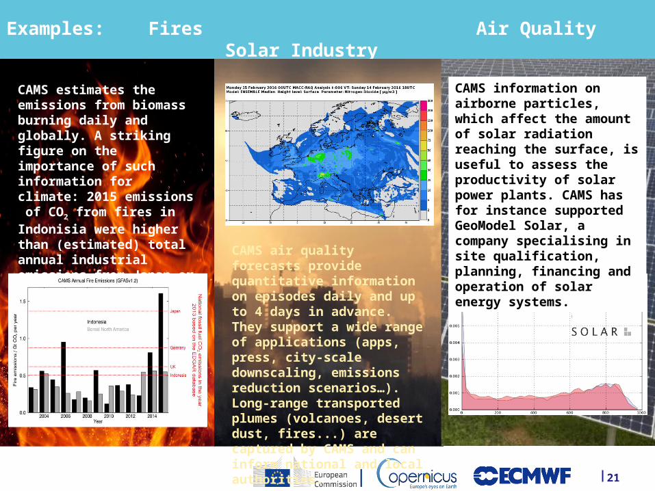
Examples: Fires Air Quality Solar Industry
CAMS estimates the emissions from biomass burning daily and globally. A striking figure on the importance of such information for climate: 2015 emissions of CO2 from fires in Indonisia were higher than (estimated) total annual industrial emissions from Japan or Germany. CAMS air quality forecasts
provide quantitative information on episodes daily and up to 4 days in advance. They support a wide range of applications (apps, press, city-scale downscaling, emissions reduction scenarios…). Long-range transported plumes (volcanoes, desert dust, fires...) are captured by CAMS and can inform national and local authorities.
CAMS information on airborne particles, which affect the amount of solar radiation reaching the surface, is useful to assess the productivity of solar power plants. CAMS has for instance supported GeoModel Solar, a company specialising in site qualification, planning, financing and operation of solar energy systems.
Copernicus Climate Change
Service
Space 23
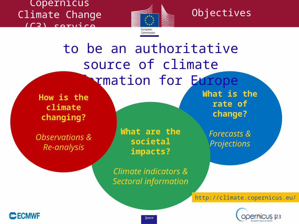
Copernicus Climate Change (C3) service
What is the rate of
change?
Forecasts &Projections
What are the societal impacts?
Climate indicators &
Sectoral information
to be an authoritative source of climate information for Europe
Objectives
How is the climate
changing?
Observations &Re-analysis
http://climate.copernicus.eu/
Space
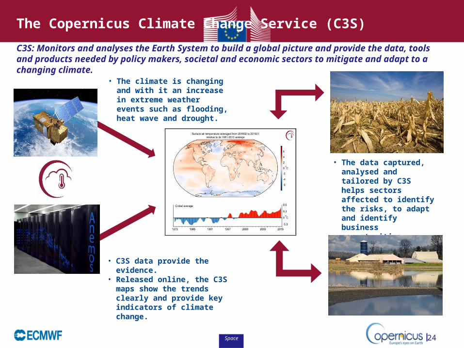
C3S: Monitors and analyses the Earth System to build a global picture and provide the data, tools and products needed by policy makers, societal and economic sectors to mitigate and adapt to a changing climate.
24
• The climate is changing and with it an increase in extreme weather events such as flooding, heat wave and drought.
• The data captured, analysed and tailored by C3S helps sectors affected to identify the risks, to adapt and identify business opportunities.
• C3S data provide the evidence.• Released online, the C3S maps
show the trends clearly and provide key indicators of climate change.
The Copernicus Climate Change Service (C3S)
Space
Copernicus Emergency
Management Service
Mapping ComponentEarly Warning Component
Space 27
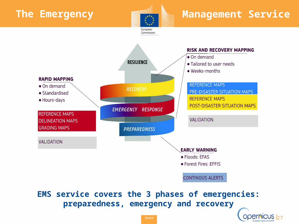
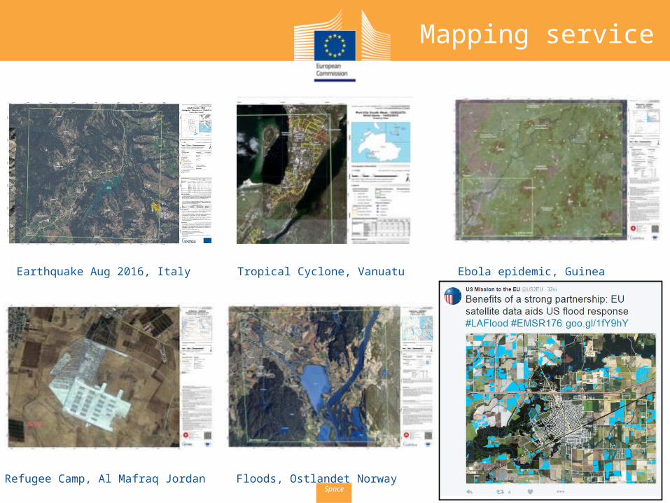
The Emergency Management Service
EMS service covers the 3 phases of emergencies: preparedness, emergency and recovery
Space
Emergency Management
service
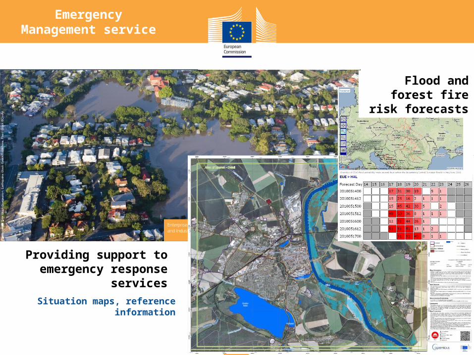
Providing support to emergency response
servicesSituation maps, reference
information
Flood and forest fire risk
forecasts
Space
Tropical Cyclone, Vanuatu
Refugee Camp, Al Mafraq Jordan
Ebola epidemic, Guinea
Floods, Ostlandet Norway
Earthquake Aug 2016, Italy
Mapping service
Space
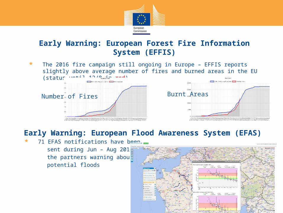
Early Warning: European Forest Fire Information System (EFFIS)
The 2016 fire campaign still ongoing in Europe – EFFIS reports slightly above average number of fires and burned areas in the EU (status until 12/8 in red)
Burnt AreasNumber of Fires
Early Warning: European Flood Awareness System (EFAS) 71 EFAS notifications have been sent during Jun – Aug 2016 to the partners warning about potential floods
Space
Copernicus Security Service
Space
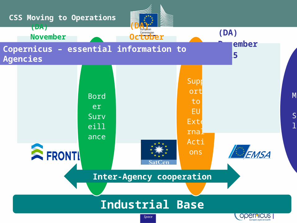
Operators (plan)
Industrial Base
(DA) November 2015
Border
Surveillan
ce
(DA) October 2016
Support to
EU External
Actions
(DA) December 2015
Maritime
Surveillance
Copernicus – essential information to Agencies
Inter-Agency cooperation
CSS Moving to Operations
Space
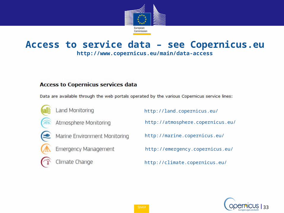
Access to service data – see Copernicus.euhttp://www.copernicus.eu/main/data-access
33
http://land.copernicus.eu/
http://atmosphere.copernicus.eu/
http://marine.copernicus.eu/
http://emergency.copernicus.eu/
http://climate.copernicus.eu/
Space
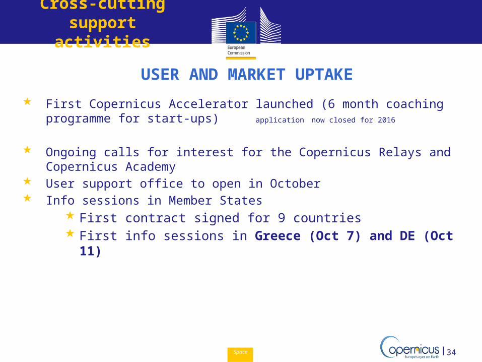
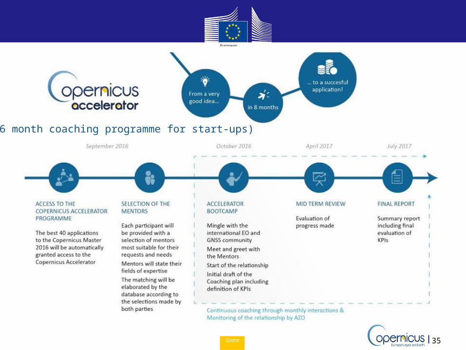
USER AND MARKET UPTAKE First Copernicus Accelerator launched (6 month coaching
programme for start-ups) application now closed for 2016
Ongoing calls for interest for the Copernicus Relays and Copernicus Academy
User support office to open in October Info sessions in Member States
First contract signed for 9 countries First info sessions in Greece (Oct 7) and DE (Oct 11)
34
Cross-cutting support activities
Space 35
(6 month coaching programme for start-ups)
Space 36
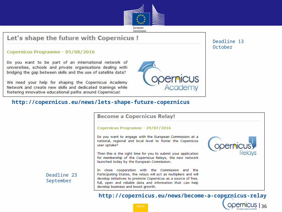
http://copernicus.eu/news/become-a-copernicus-relay
http://copernicus.eu/news/lets-shape-future-copernicus
Deadline 13 October
Deadline 23 September
Space 37
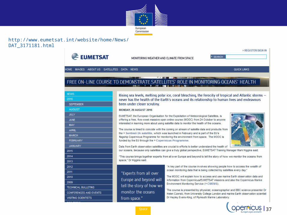
http://www.eumetsat.int/website/home/News/DAT_3171181.html
Space
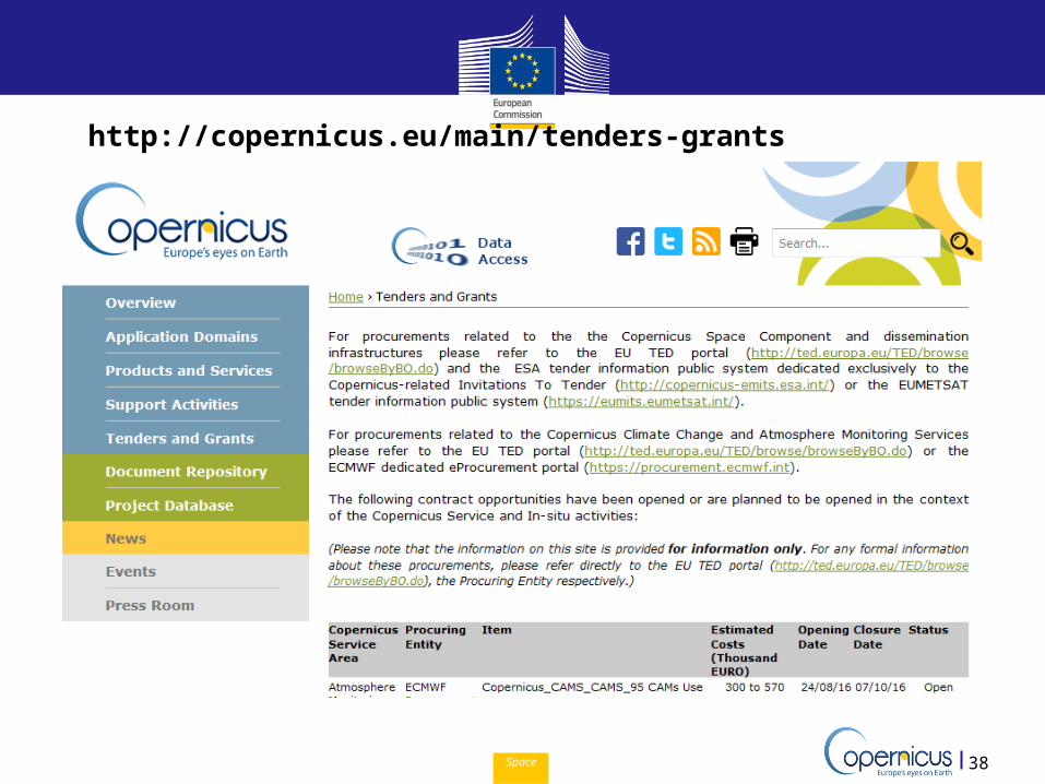
http://copernicus.eu/main/tenders-grants
38
Copernicus EU CopernicusEU www.copernicus.eu
Follow us on:
Space
Thank you for your attention!
http://www.copernicus.eu/