Embed Size (px)
Citation preview
Scientific work related to water
, May 2012 Augusta
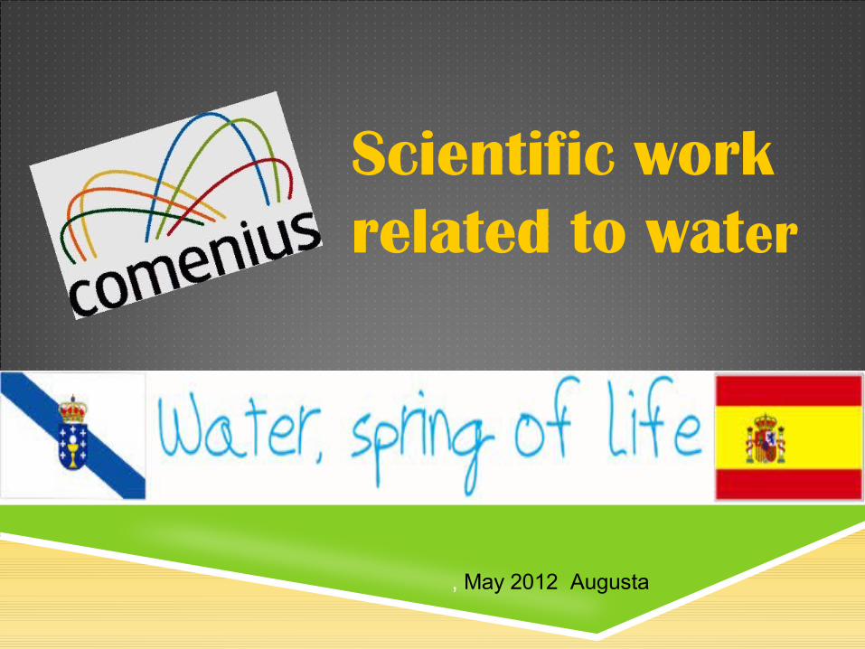
How we did the work We studied two rivers (Belelle and Mandeo) and two
intertidal zones (Ortigueira’s ria and Cobas beach). Dates: November and March Students involved: 1st ESO (12-13 year-olds), 2nd ESO
(12-13 year-olds), 3rd ESO (14-15 year-olds), 4th ESO (15-16 year-olds) and 1st Bach (16-17 year-olds)
Subjects: Biology, Chemistry and Science for the Contemporary World
We worked on the field, in the lab and in class. We organised some conferences about these subjects.
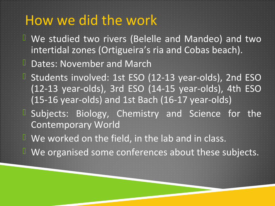
Belelle and Mandeo river
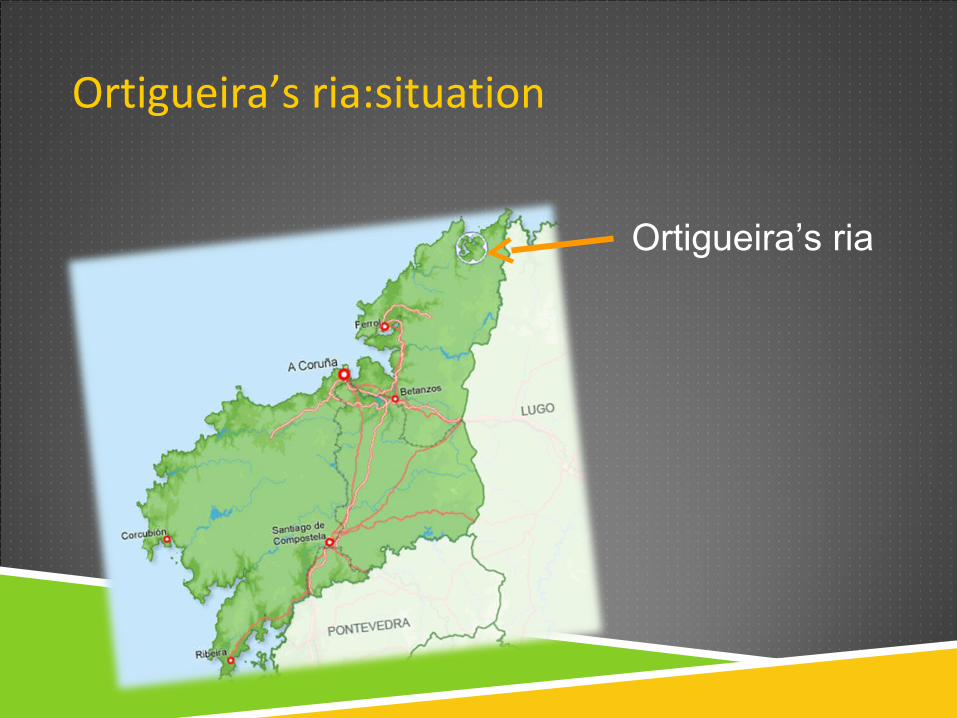
Ortigueira’s ria:situation
Ortigueira’s ria
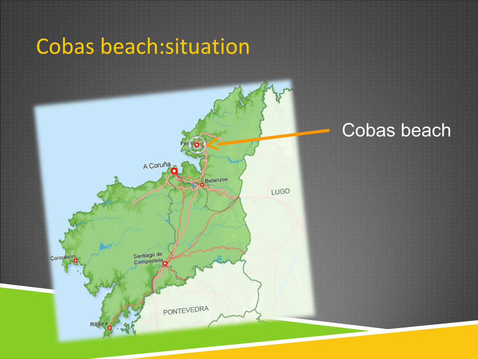
Cobas beach:situation
Cobas beach
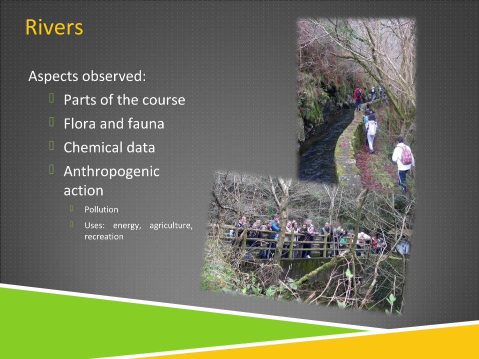
Rivers
Aspects observed: Parts of the course Flora and fauna Chemical data Anthropogenic
action Pollution
Uses: energy, agriculture, recreation
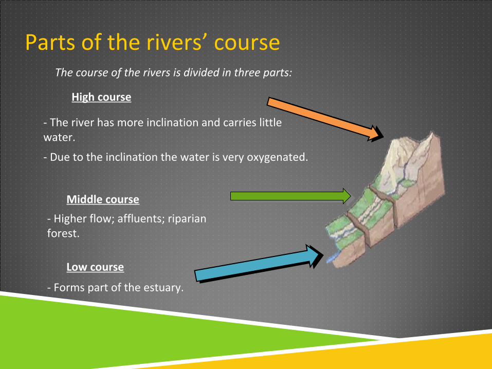
Parts of the rivers’ course
High course
- The river has more inclination and carries little water.
- Due to the inclination the water is very oxygenated.
Middle course
- Higher flow; affluents; riparian forest.
Low course
- Forms part of the estuary.
The course of the rivers is divided in three parts:
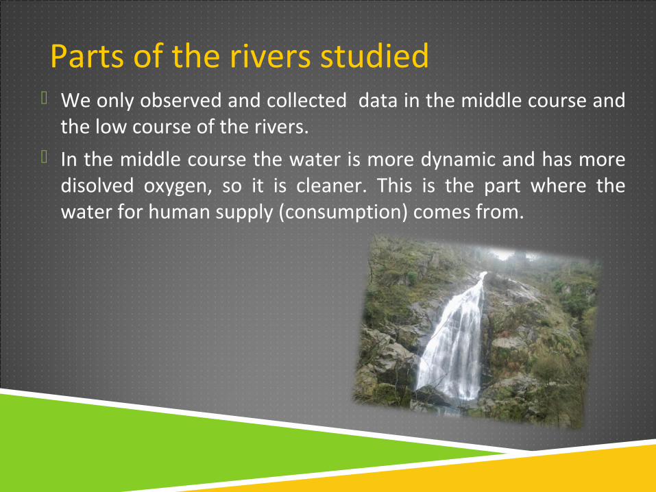
Parts of the rivers studied We only observed and collected data in the middle course and
the low course of the rivers. In the middle course the water is more dynamic and has more
disolved oxygen, so it is cleaner. This is the part where the water for human supply (consumption) comes from.
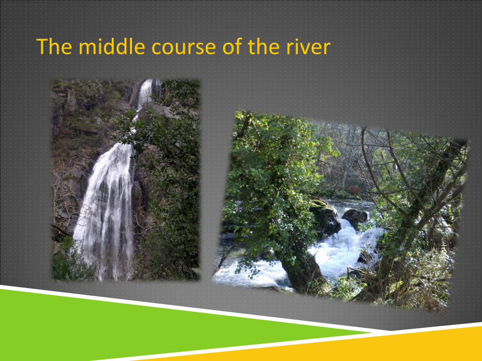
The middle course of the river
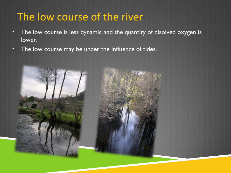
The low course of the river• The low course is less dynamic and the quantity of disolved oxygen is
lower.• The low course may be under the influence of tides.
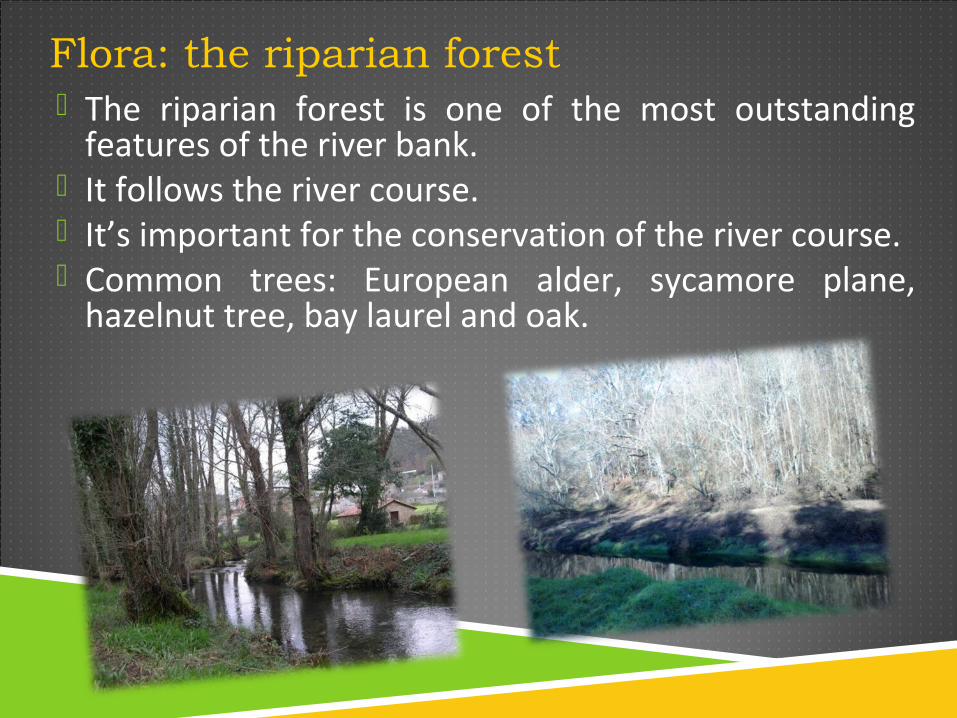
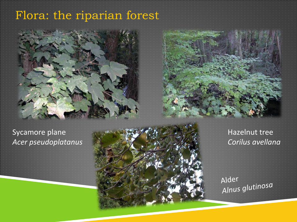
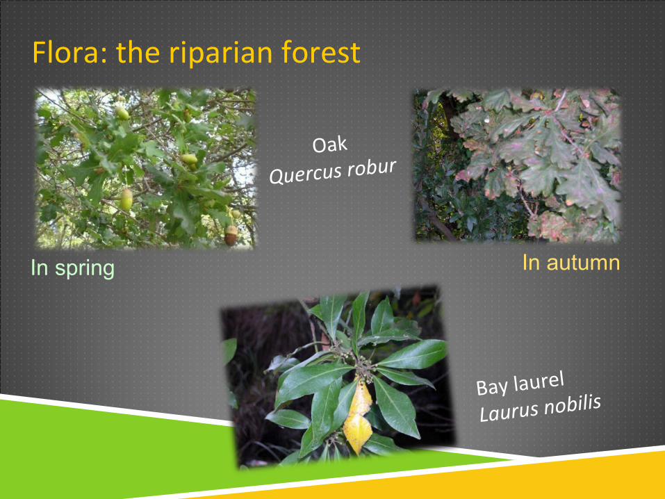
Flora: the riparian forest The riparian forest is one of the most outstanding
features of the river bank. It follows the river course. It’s important for the conservation of the river course. Common trees: European alder, sycamore plane,
hazelnut tree, bay laurel and oak.
Flora: the riparian forest
Sycamore plane Acer pseudoplatanus
Hazelnut treeCorilus avellana
Alder Alnus glutinosa
Flora: the riparian forest
Bay laurel
Laurus nobilis
Oak
Quercus robur
In spring In autumn
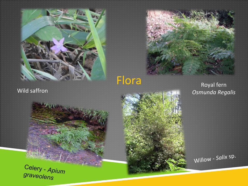
FloraWild saffron
Royal fernOsmunda Regalis
Willow - Salix sp.
Celery - Apium graveolens
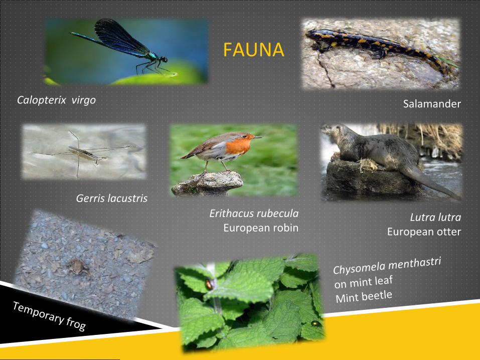
FAUNA
Chysomela menthastri
on mint leaf
Mint beetleTemporary frog
Calopterix virgo Salamander
Erithacus rubeculaEuropean robin
Lutra lutraEuropean otter
Gerris lacustris
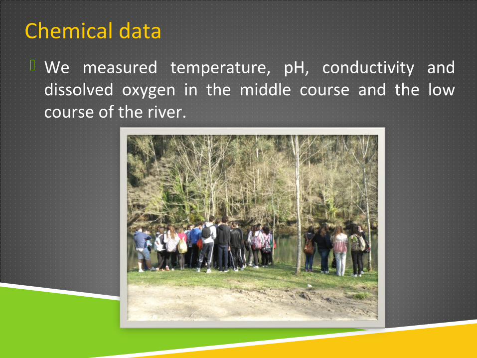
Chemical data We measured temperature, pH, conductivity and
dissolved oxygen in the middle course and the low course of the river.
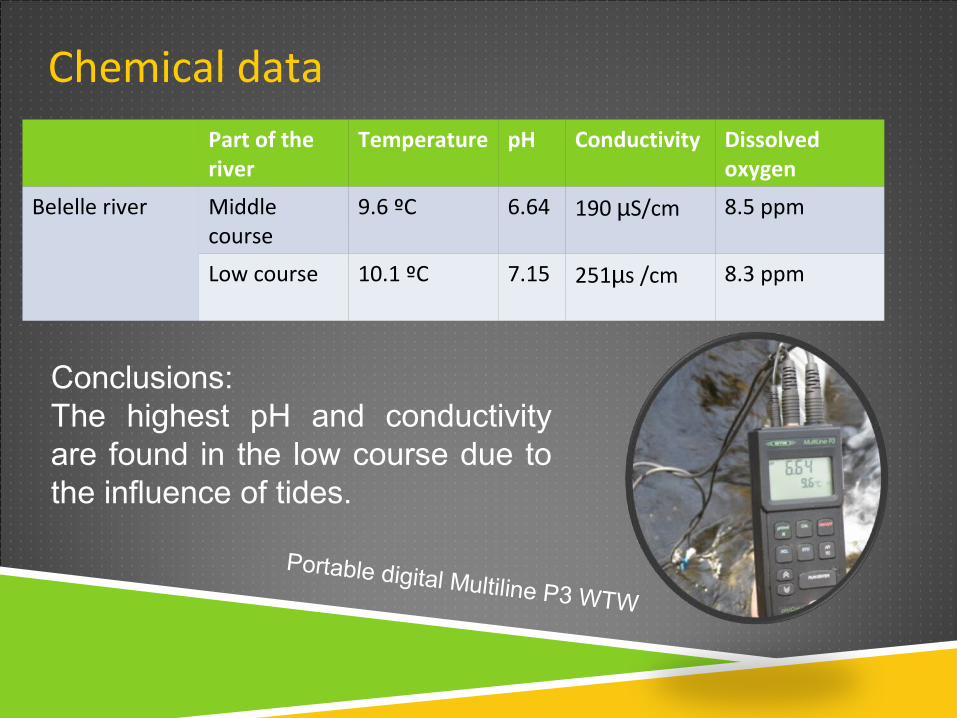
Chemical dataPart of the river
Temperature pH Conductivity Dissolved oxygen
Belelle river Middle course
9.6 ºC 6.64 190 µS/cm 8.5 ppm
Low course 10.1 ºC 7.15 251µs /cm 8.3 ppm
Conclusions: The highest pH and conductivity are found in the low course due to the influence of tides.
Portable digital Multiline P3 WTW
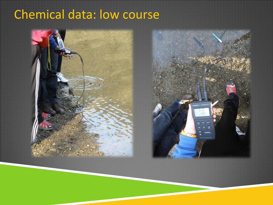
Chemical data: low course
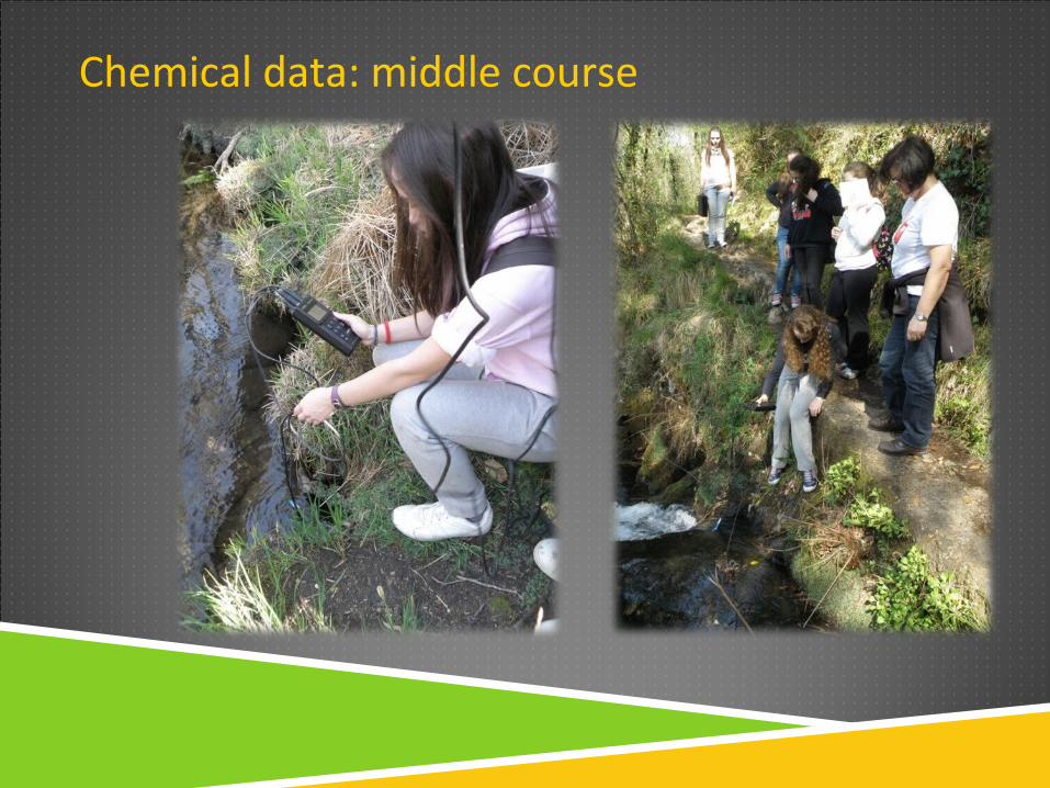
Chemical data: middle course
Anthropogenic action
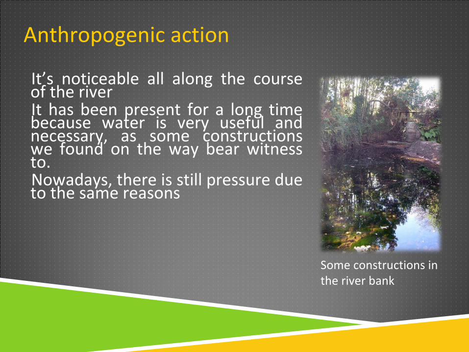
It’s noticeable all along the course of the riverIt has been present for a long time because water is very useful and necessary, as some constructions we found on the way bear witness to. Nowadays, there is still pressure due to the same reasons
Some constructions in the river bank
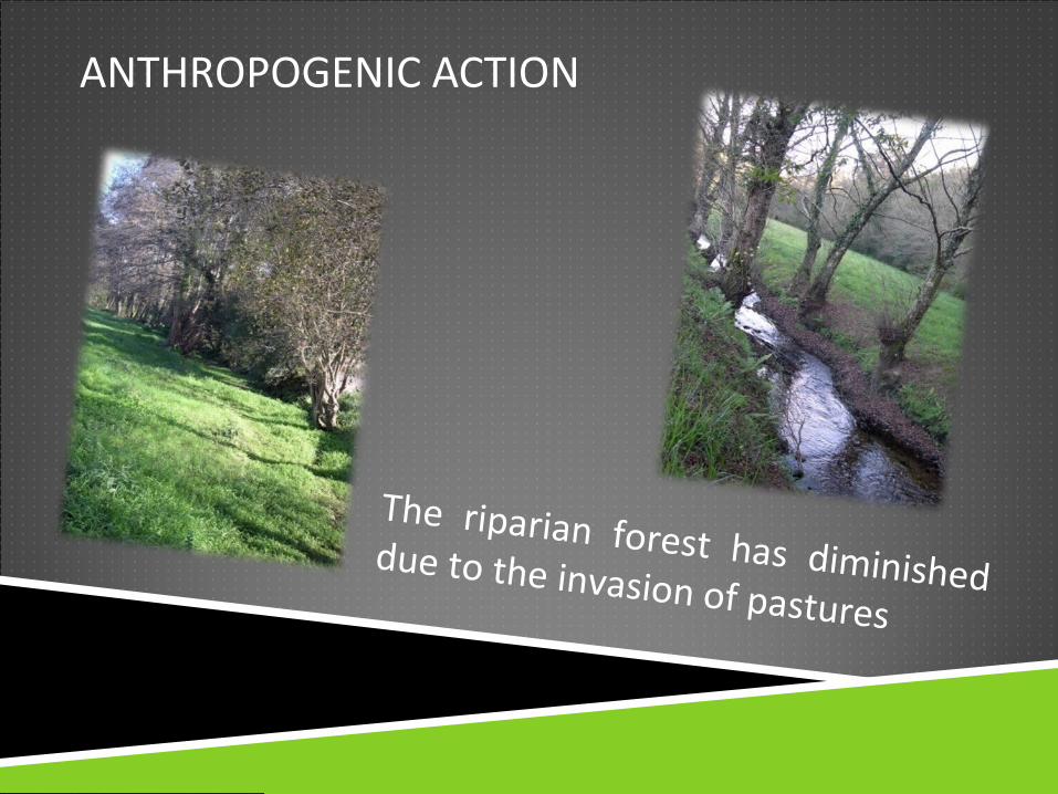
ANTHROPOGENIC ACTION
The riparian forest has diminished due to the invasion of pastures
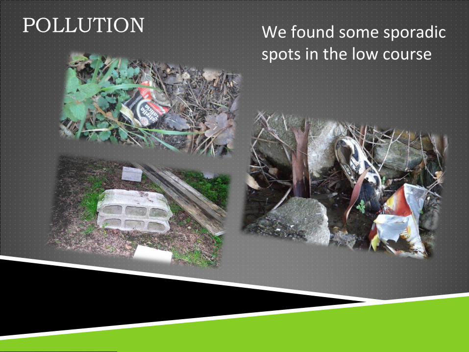
POLLUTION We found some sporadic spots in the low course
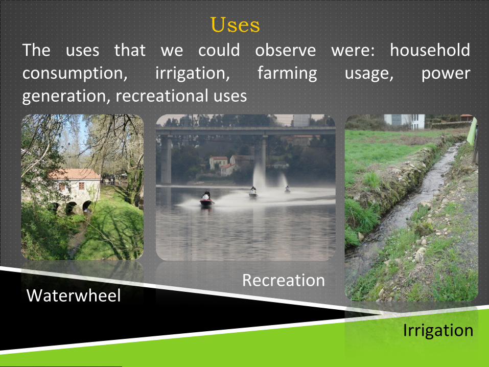
UsesThe uses that we could observe were: household consumption, irrigation, farming usage, power generation, recreational uses
Waterwheel
Irrigation
Recreation
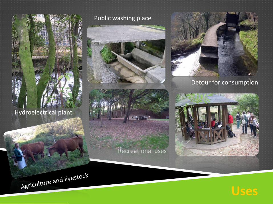
Uses
Hydroelectrical plant
Public washing place
Detour for consumption
Recreational uses
Agriculture and livestock
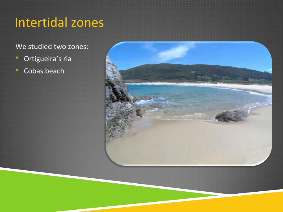
Intertidal zones
We studied two zones: Ortigueira’s ria Cobas beach
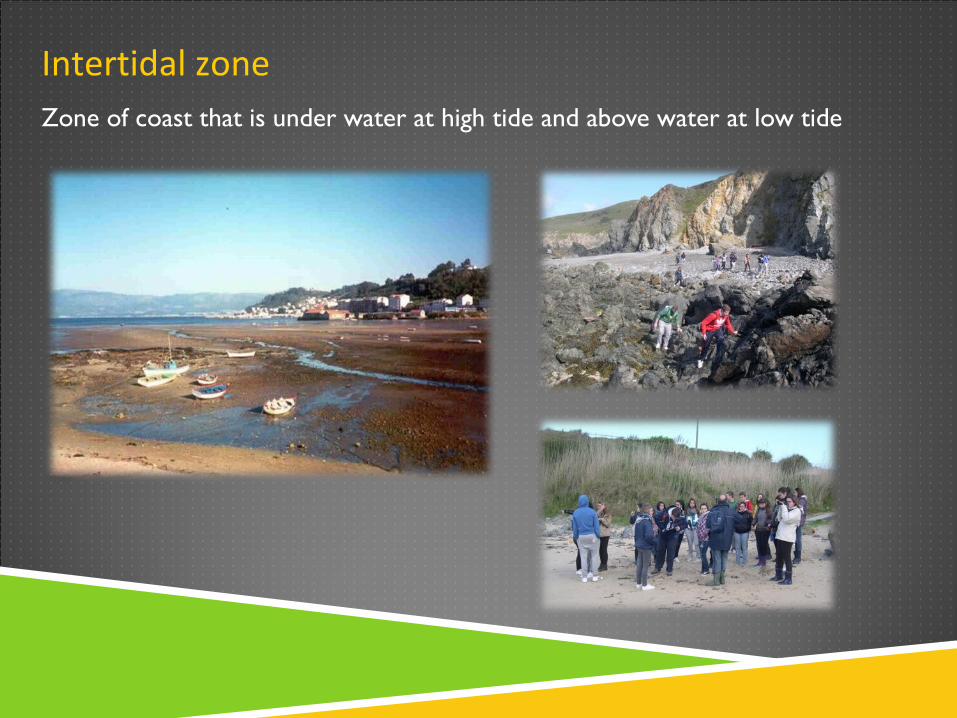
Intertidal zoneZone of coast that is under water at high tide and above water at low tide
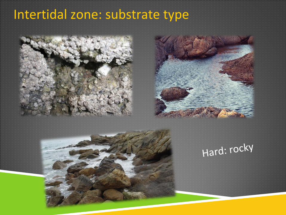
Intertidal zone: substrate type
Hard: rocky
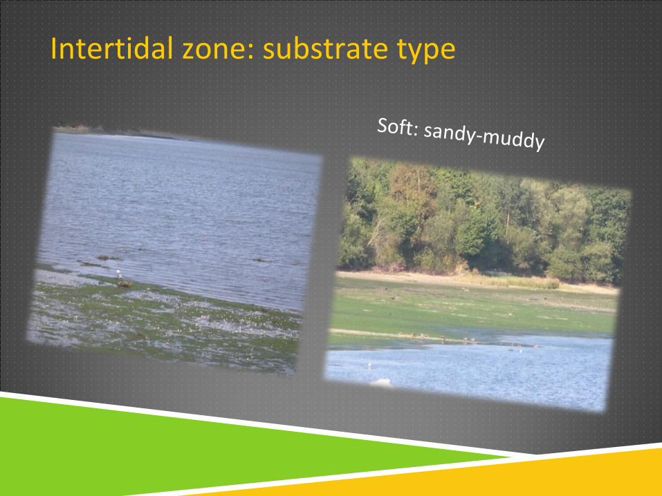
Intertidal zone: substrate type
Soft: sandy-muddy
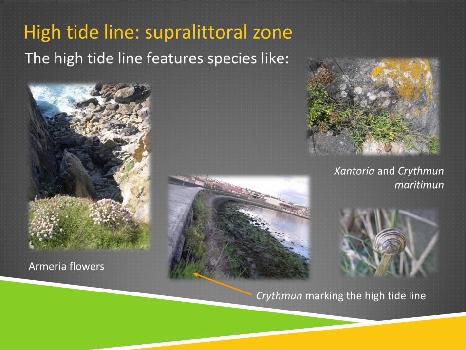
High tide line: supralittoral zoneThe high tide line features species like:
Armeria flowers
Xantoria and Crythmun maritimun
Crythmun marking the high tide line
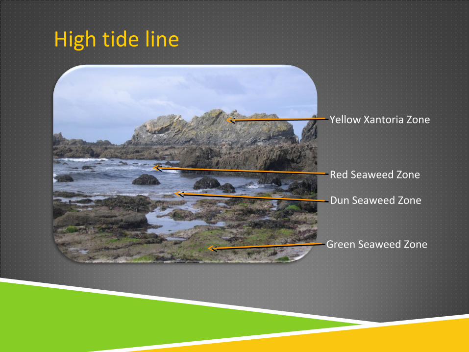
High tide line
Yellow Xantoria Zone
Green Seaweed Zone
Dun Seaweed Zone
Red Seaweed Zone
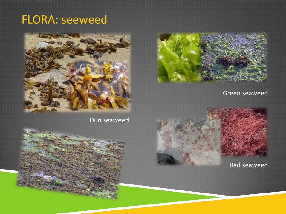
FLORA: seeweed
Dun seaweed
Green seaweed
Red seaweed
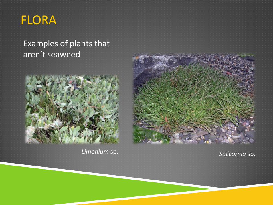
FLORA
Salicornia sp.Limonium sp.
Examples of plants that aren’t seaweed
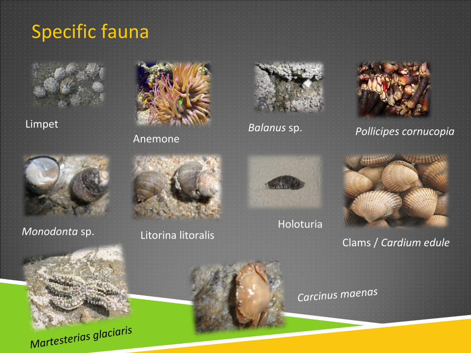
Specific fauna
LimpetAnemone
Balanus sp.
Monodonta sp. Litorina litoralis
Carcinus maenas
Pollicipes cornucopia
Clams / Cardium edule
Martesterias glaciaris
Holoturia
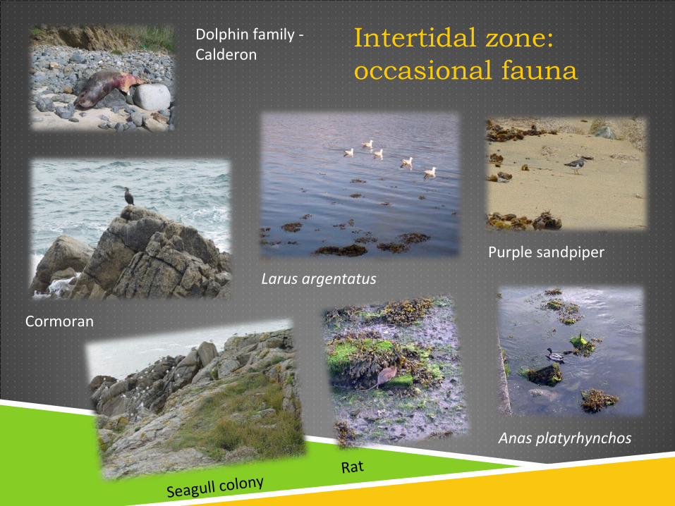
Intertidal zone: occasional fauna
Cormoran
Seagull colony
Purple sandpiper
Rat
Anas platyrhynchos
Larus argentatus
Dolphin family - Calderon
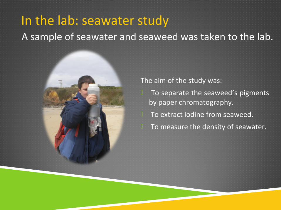
In the lab: seawater study
The aim of the study was:
To separate the seaweed’s pigments by paper chromatography.
To extract iodine from seaweed.
To measure the density of seawater.
A sample of seawater and seaweed was taken to the lab.
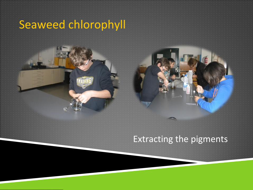
Seaweed chlorophyll
Extracting the pigments
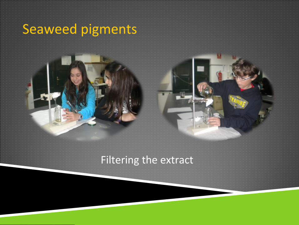
Seaweed pigments
Filtering the extract
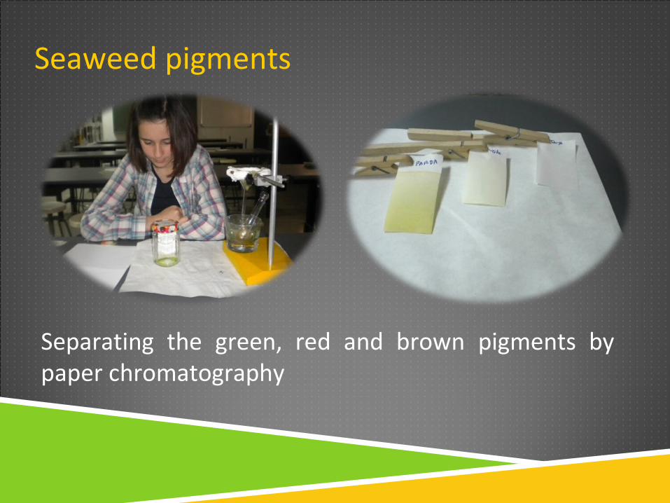
Seaweed pigments
Separating the green, red and brown pigments by paper chromatography
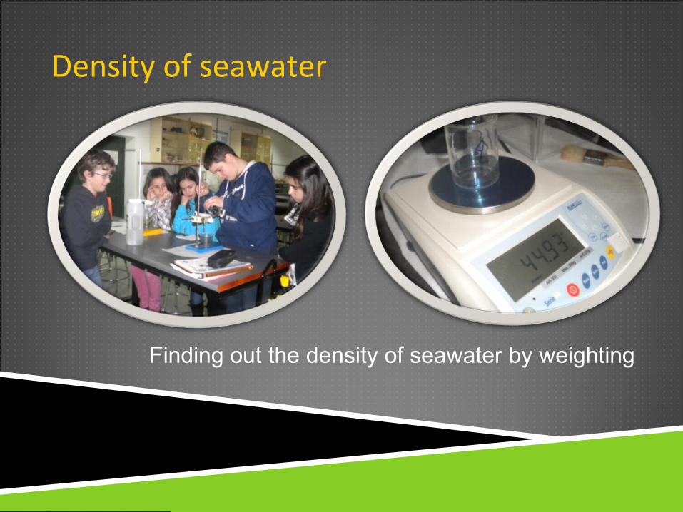
Density of seawater
Finding out the density of seawater by weighting
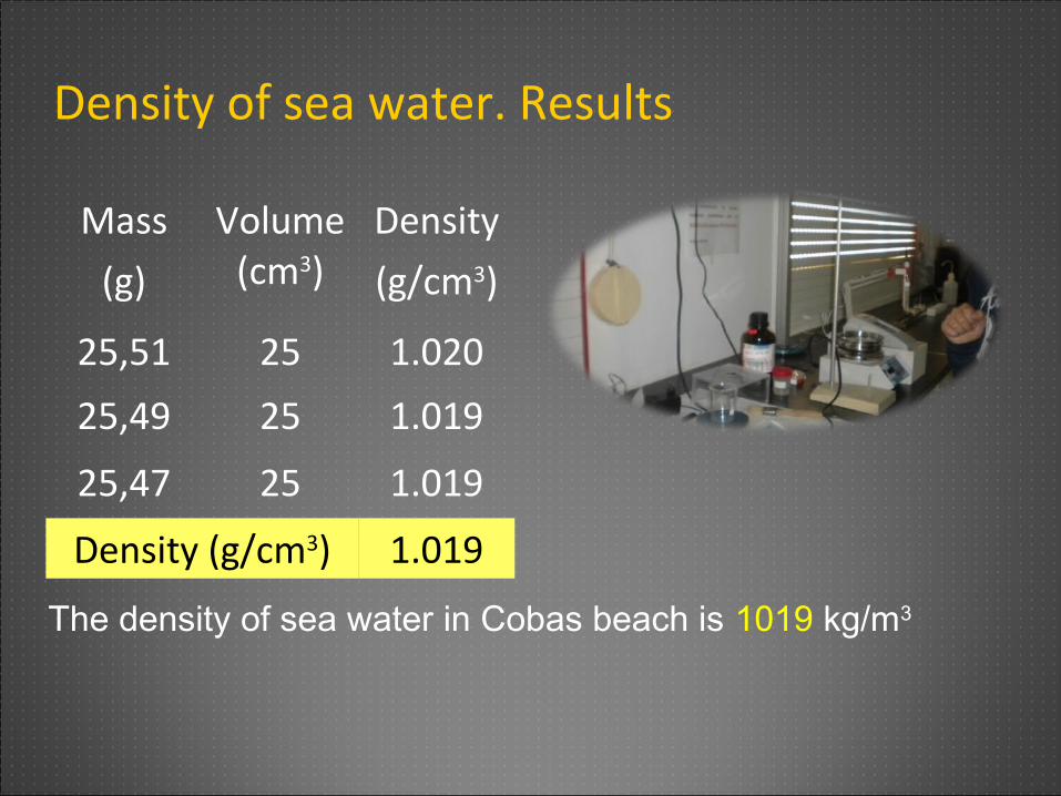
Density of sea water. Results
Mass
(g)
Volume(cm3)
Density
(g/cm3)
25,51 25 1.020
25,49 25 1.019
25,47 25 1.019
Density (g/cm3) 1.019
The density of sea water in Cobas beach is 1019 kg/m3
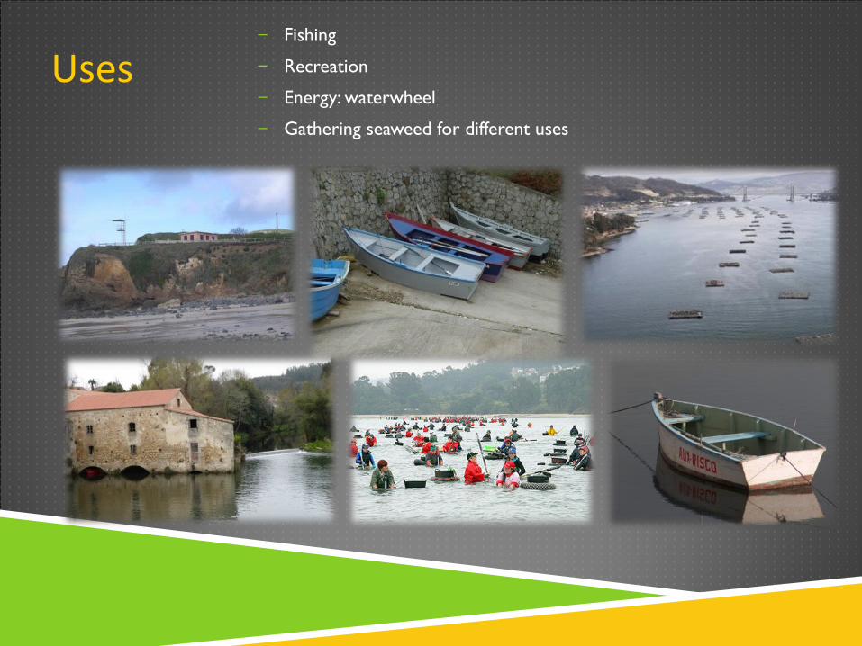
Uses– Fishing
– Recreation
– Energy: waterwheel
– Gathering seaweed for different uses
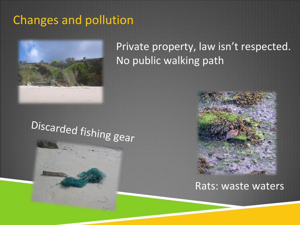
Changes and pollution
Private property, law isn’t respected. No public walking path
Rats: waste waters
Discarded fishing gear

THANK YOU VERY MUCH FOR YOUR ATTENTION