Embed Size (px)
Citation preview
Michael Hadi Associates Ltd
First Floor 14-18 Old Street London EC1V 9BH t 02073756340 www.mha-consult.co.uk
Registered in England & Wales Company No. 04718155
Consulting Structural Engineers
17038/114a Pentonville Road.
August 2017/Basement Structural Method Statement
Prepared by: Christian Knight MEng (Hons), Mak Saati BEng MSc
Authorised by: Michael Hadi BEng (Hons) CEng MIStructE
Issued by: Christian Knight MEng (Hons)
Non-Technical Summary
This note forms a Basement Construction Method Statement, as set out by Islington Council’s Basement Development Supplementary Planning Document dated January 2016.
The existing building has three storeys, including a basement. The proposed works include the extension of the existing basement to the full length of the rear yard and extension of the ground floor partially across the rear yard.
The construction of the basement is feasible and will not have a negligible impact on flooding, surface flow, groundwater flow, ground stability or adjacent structures.
A safe method and sequence of construction utilising traditional underpinning and bored piles has been identified and is presented in this document.
Rev Description Date
- For Information 31 August 2017
17038/114a Pentonville Road. 1
Contents
1. Introduction, Proposed Development & Experience 2
2. The existing site and structure 2
3. Nearby Structures 3
4. Geology, Hydrogeology & Contamination 3
5. Site Hydrology 4
6. The proposed development and basement construction sequence 4
7. Effects of the proposed basement on neighbouring structures and trees 5
8. Construction Monitoring 5
Appendix
Appendix A Suggested Basement Construction Sequence
Appendix B Proposed Structural Layouts
Appendix C Movement and Damage Assessment
Appendix D Extracts from British Geological Survey Data
Appendix E Hydrology and Hydrogeology Maps
Appendix F Extract from LCC Bomb Damage Map
Appendix G Listed Buildings & Conservation Area CA33
17038/114a Pentonville Road. 2
1. Introduction, Proposed Development & Experience
114a Pentonville Road is an existing three-storey mid terrace property located in the CA33 Chapel Market/Penton Street Conservation area. It is assumed the building was likely built in the mid to late 19th century. The properties along the terrace vary in construction style, suggesting the terrace was developed over several years. The property has an existing basement that includes a light-well/court yard to the rear.
The proposed development consists of an extension to the existing basement, the creation of a new light well, and the construction of a 2 storey structure to the rear yard to provide a larger living space, as shown on Spaced Out Ltd’s drawings.
The information contained in this note is based on:
• British Geological Survey Maps and Borehole Logs • Nicholas Barton’s book, The Lost Rivers of London • LCC Bomb Damage Maps, 1939-1945 • Islington’s Basement Development Supplementary Planning Document – January 2016 • Halcrow’s Preliminary Flood Risk Assessment for Islington – April 2011 • Mouchel’s North London Strategic Flood Risk Assessment – August 2008
This Report has been prepared for the benefit of the Client and others can take no reliance without written agreement from Michael Hadi Associates Ltd.
Michael Hadi Associates was formed in 1998 and have undertaken numerous basement projects, including in the London Borough of Islington.
2. The existing site and structure
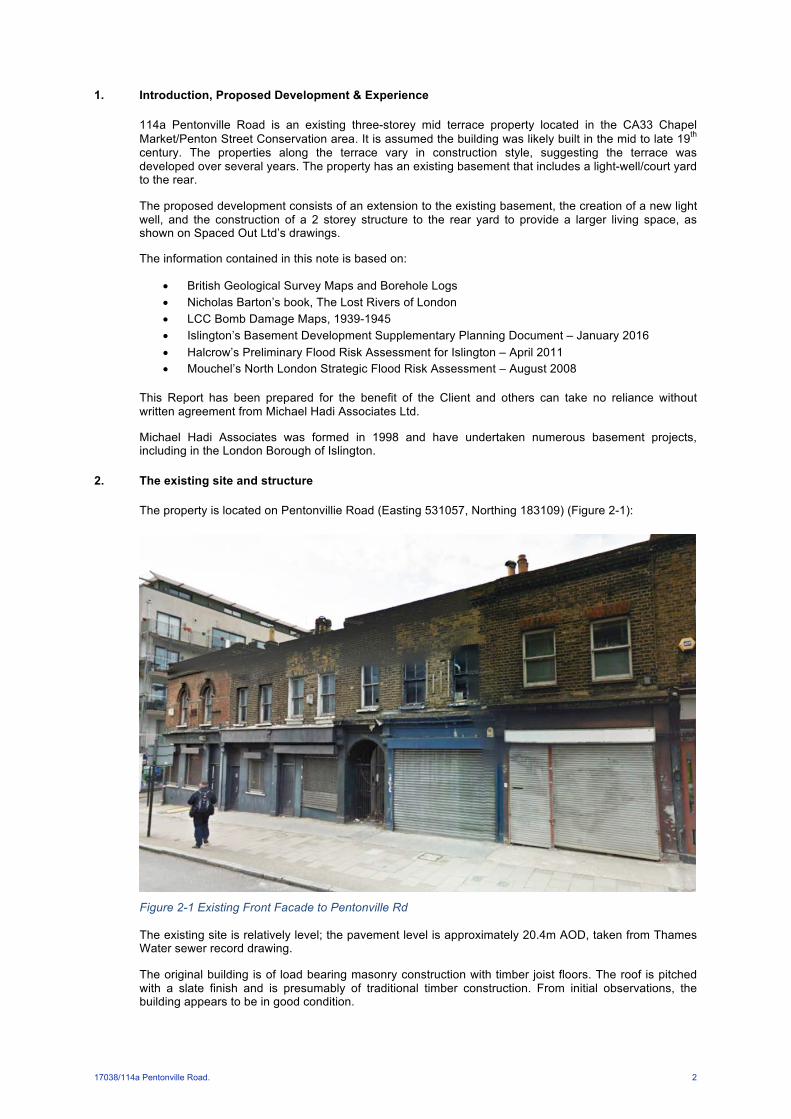
The property is located on Pentonvillie Road (Easting 531057, Northing 183109) (Figure 2-1):
Figure 2-1 Existing Front Facade to Pentonville Rd
The existing site is relatively level; the pavement level is approximately 20.4m AOD, taken from Thames Water sewer record drawing.
The original building is of load bearing masonry construction with timber joist floors. The roof is pitched with a slate finish and is presumably of traditional timber construction. From initial observations, the building appears to be in good condition.
17038/114a Pentonville Road. 3
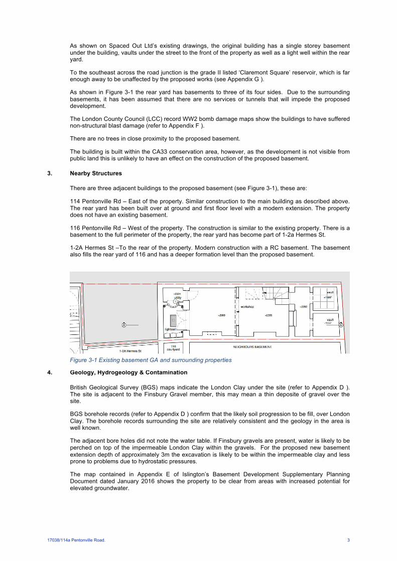
As shown on Spaced Out Ltd’s existing drawings, the original building has a single storey basement under the building, vaults under the street to the front of the property as well as a light well within the rear yard.
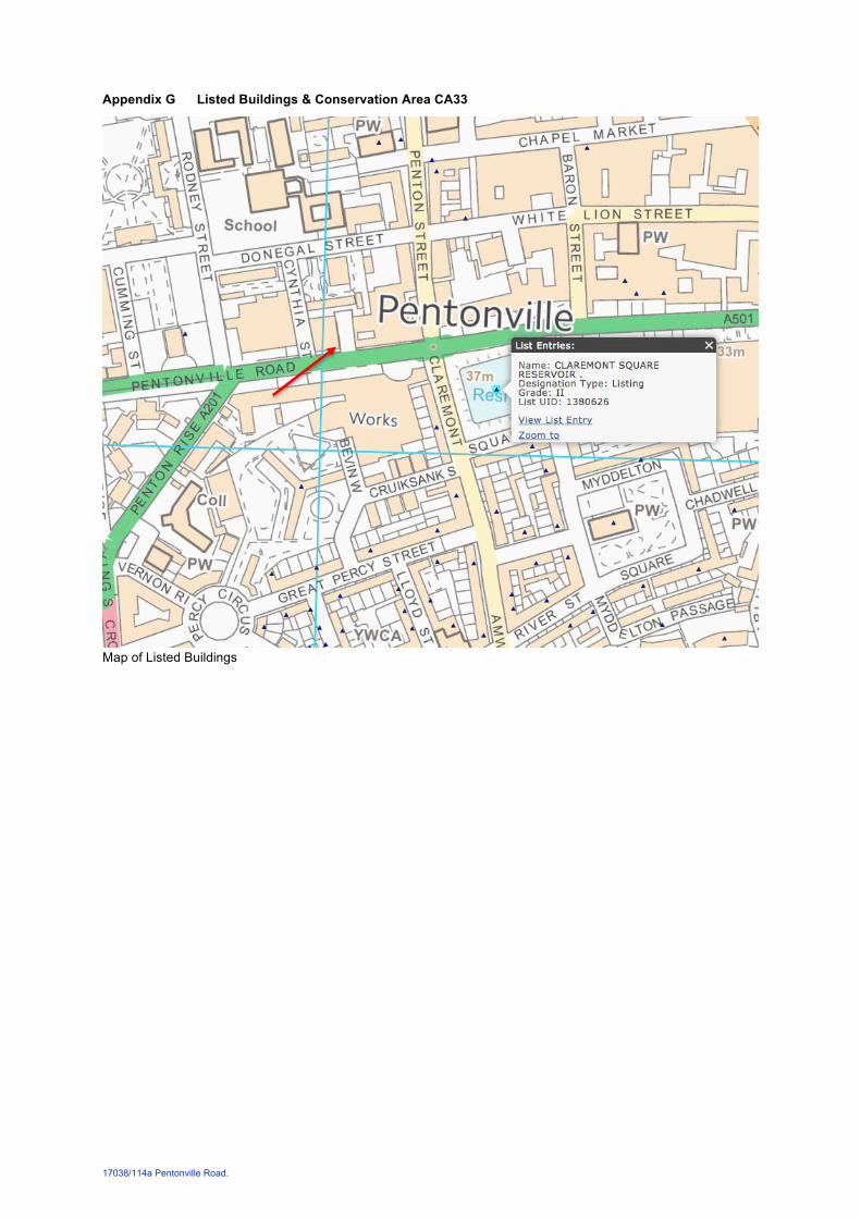
To the southeast across the road junction is the grade II listed ‘Claremont Square’ reservoir, which is far enough away to be unaffected by the proposed works (see Appendix G ).
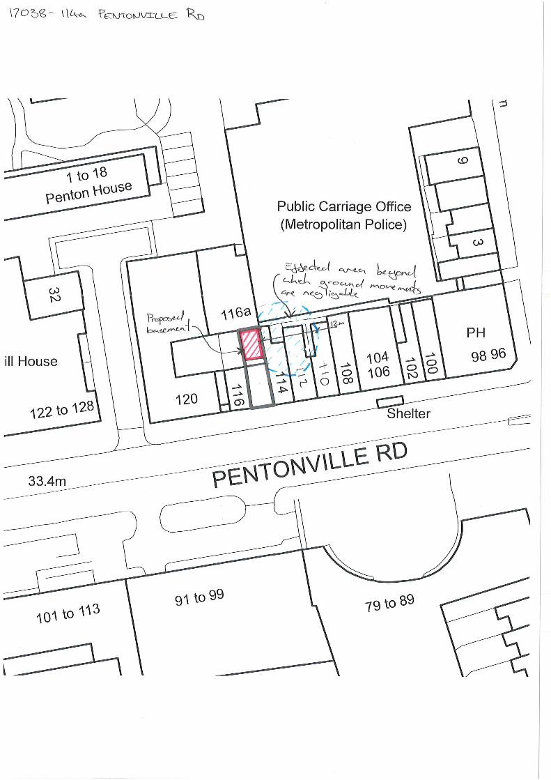
As shown in Figure 3-1 the rear yard has basements to three of its four sides. Due to the surrounding basements, it has been assumed that there are no services or tunnels that will impede the proposed development.
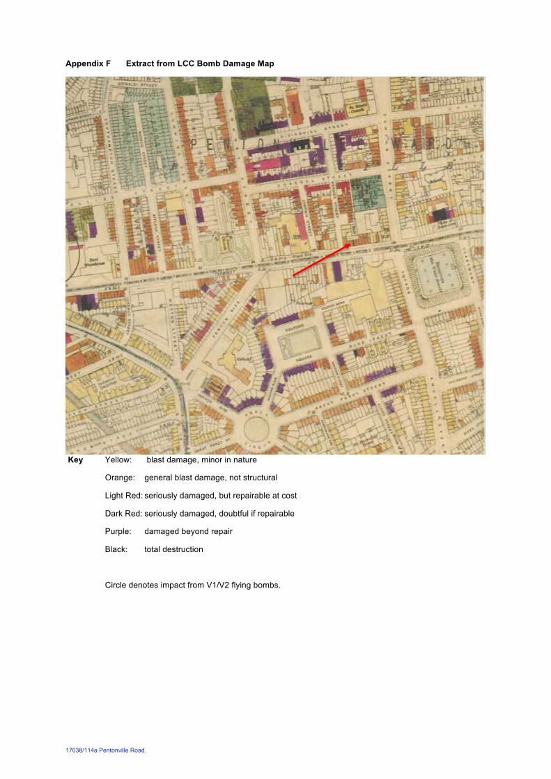
The London County Council (LCC) record WW2 bomb damage maps show the buildings to have suffered non-structural blast damage (refer to Appendix F ).
There are no trees in close proximity to the proposed basement.
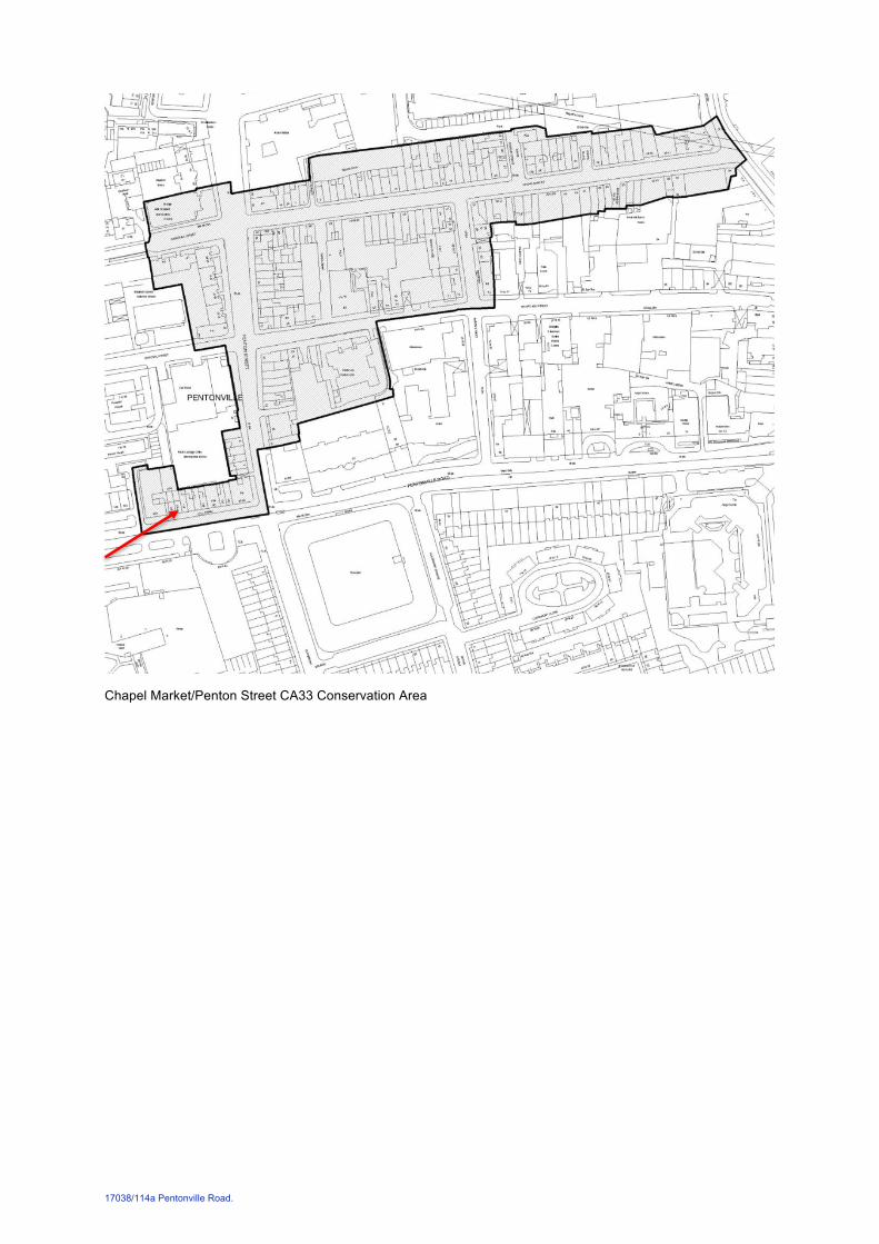
The building is built within the CA33 conservation area, however, as the development is not visible from public land this is unlikely to have an effect on the construction of the proposed basement.
3. Nearby Structures
There are three adjacent buildings to the proposed basement (see Figure 3-1), these are:
114 Pentonville Rd – East of the property. Similar construction to the main building as described above. The rear yard has been built over at ground and first floor level with a modern extension. The property does not have an existing basement.
116 Pentonville Rd – West of the property. The construction is similar to the existing property. There is a basement to the full perimeter of the property, the rear yard has become part of 1-2a Hermes St.
1-2A Hermes St –To the rear of the property. Modern construction with a RC basement. The basement also fills the rear yard of 116 and has a deeper formation level than the proposed basement.
4. Geology, Hydrogeology & Contamination
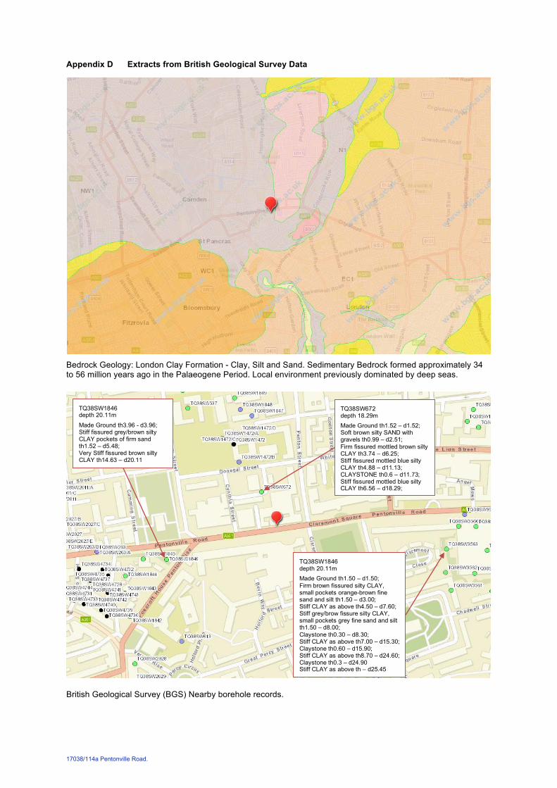
British Geological Survey (BGS) maps indicate the London Clay under the site (refer to Appendix D ). The site is adjacent to the Finsbury Gravel member, this may mean a thin deposite of gravel over the site.
BGS borehole records (refer to Appendix D ) confirm that the likely soil progression to be fill, over London Clay. The borehole records surrounding the site are relatively consistent and the geology in the area is well known.
The adjacent bore holes did not note the water table. If Finsbury gravels are present, water is likely to be perched on top of the impermeable London Clay within the gravels. For the proposed new basement extension depth of approximately 3m the excavation is likely to be within the impermeable clay and less prone to problems due to hydrostatic pressures.
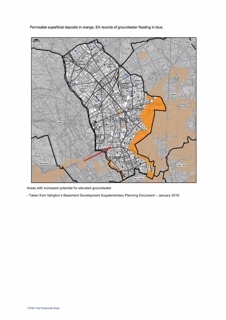
The map contained in Appendix E of Islington’s Basement Development Supplementary Planning Document dated January 2016 shows the property to be clear from areas with increased potential for elevated groundwater.
Figure 3-1 Existing basement GA and surrounding properties
17038/114a Pentonville Road. 4
5. Site Hydrology
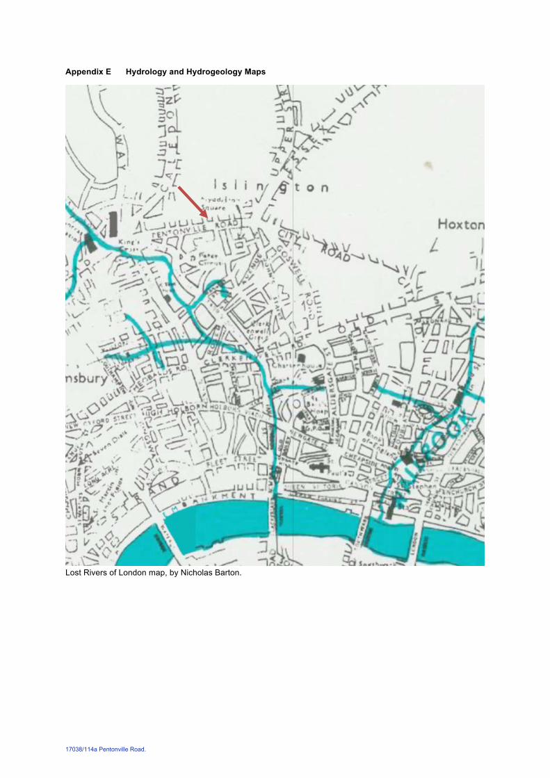
Nicholas Barton’s Lost Rivers of London map (in Appendix E ) shows the site to be some distance from the last known course of a tributary of the River Fleet.
The proposed basement extension will not result in a change in the area of impermeable surface finishes within the site, as the existing site surface is all hardstandings, and therefore it is not anticipated that the works will affect the risk of surface water flooding.
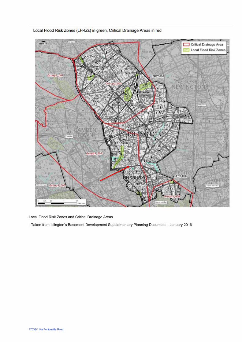
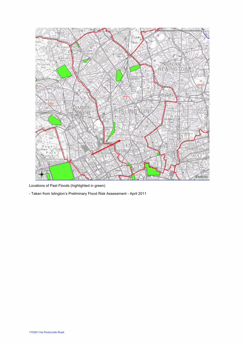
The map contained in appendix D of Islington’s Basement Development Supplementary Planning Document dated January 2016 shows the property to be clear from local flood risk zones and critical drainage areas. This correlates with figure 1.1 of Islington’s Preliminary Flood Risk Assessment, showing the site to be clear form locations of past floods (copies of both maps in Appendix E of this report).
The site is located within the Environment Agency (EA) Flood Zone 1 defined as land assessed as having a less than 1 in 1,000 annual probability of river or sea flooding (<0.1%). The EA exception test is therefore not appropriate and the Planning Practice Guidance (Table 3 Flood Risk Vulnerability and Flood Zone ‘compatibility’) designates the site as being appropriate to contain a basement.
6. The proposed development and basement construction sequence
Proposed basement:
The proposed basement extension is to occupy an area of approximately 20m2.
Detail design and setting out is yet to be developed but structural slab level to the new basement is to be approximately 2.6m below existing ground level, indicating a maximum excavation depth of approximately 3m.
It is proposed that the basement structure is formed with reinforced concrete underpins. If gravels are encountered it may be necessary to shore up excavations for individual pins in order to maintain the temporary stability of the excavation.
The depth of the water table is to be confirmed by intrusive investigations. If it is found to be within the excavation zone, pumping and/or grouting may be necessary.
Suggested construction sequence:
The proposed construction sequence has been carefully considered to minimise disturbance to adjoining structures.
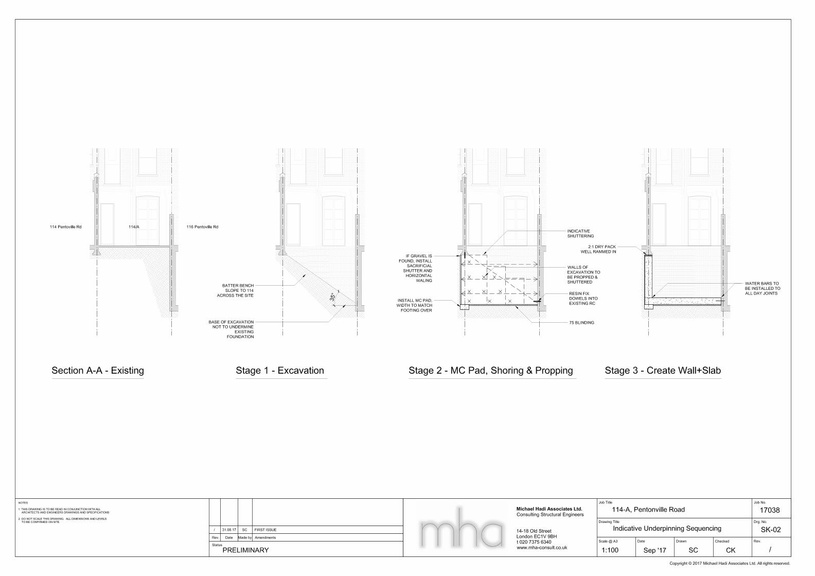
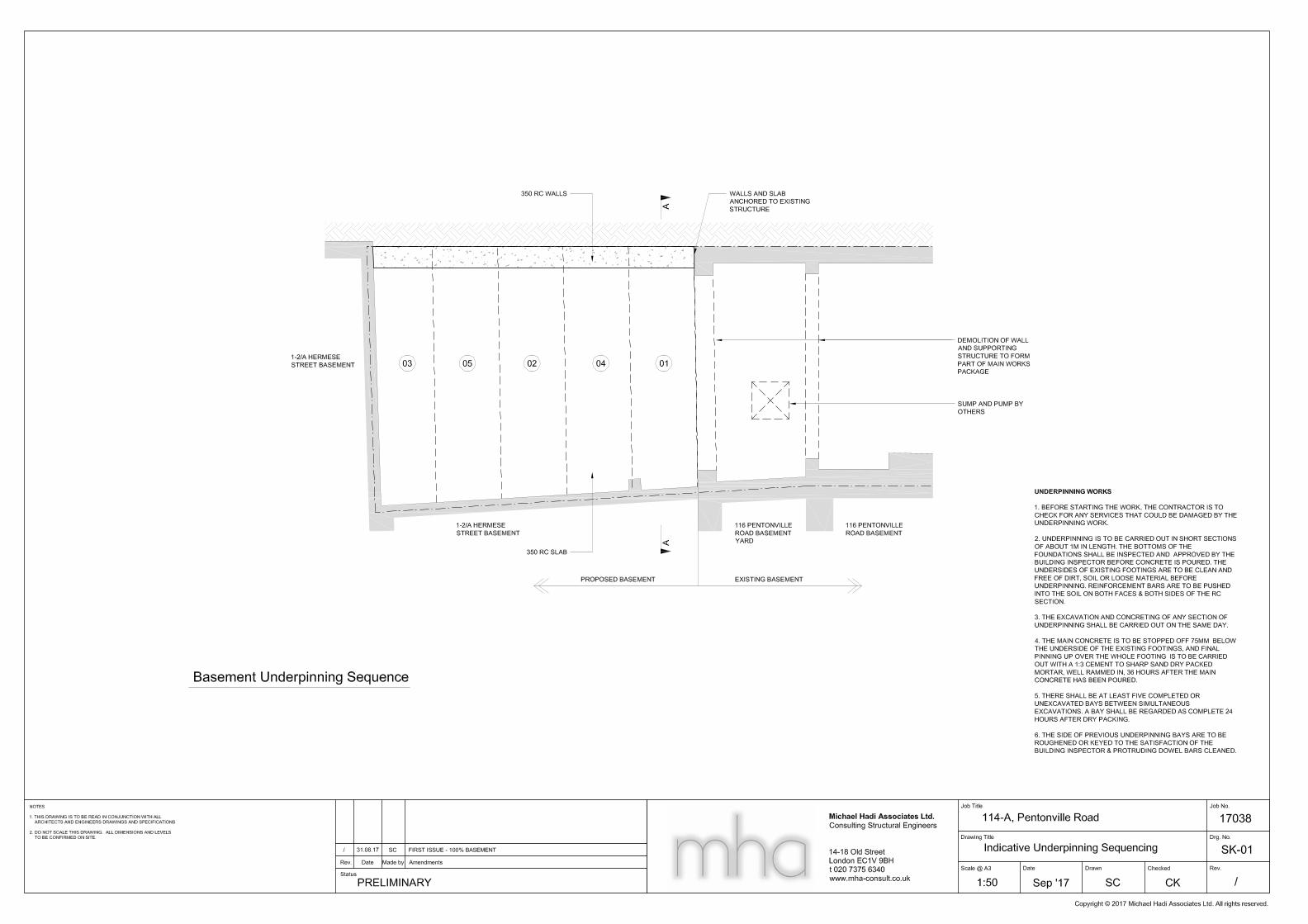
The sequence suggested below is to be read in conjunction with sketch SK-01 in Appendix A . Stage numbering corresponds to that used on the sketch.
Alterations to the upper floors and existing building should be carried out after the basement works are complete.
1. Excavate across the site to the depth of the existing basement battering back the excavation at a 45o angle to 114 Pentonville road; 35o angle if gravel encountered.
2. Excavate first underpin to 114 Pentonville road, shoring and propping the excavation as required. Pour the mass concrete pad footing to the width of the existing footing over and blind the base of the excavation.
3. Construct underpin within the excavation and dry pack to base of existing footing. All pins are to be tied together by hammering reinforcement for laps into the ground either side of the pin being built. In this way the rigidity of the basement walls structure will be maximised. Pins are to be resin dowelled into existing basement walls and slabs. Spoil from each pin should be carted off site at the earliest opportunity. There is little room to store spoil on site so it will be in the contractor’s interest to dispose of it promptly.
4. Continue to excavate and construct pins in the sequence shown. A bay shall be regarded as complete 24hours after dry packing.
The above sequence illustrates a safe and practical way of constructing the proposed basement. Groundworks contractors would be required to develop this in more detail and submit comprehensive method statements and work sequences prior to commencement of the works.
17038/114a Pentonville Road. 5
7. Effects of the proposed basement on neighbouring structures and trees
Ground surface movements due to basement construction can depend on a number of factors. Assuming workmanship of a reasonable standard, CIRIA C580 ‘Embedded retaining walls – guidance for economic design’, estimates that they are negligible at a distance of approximately four times the excavation depth from the works.
With a distance of greater than 12m from all of the nearby trees to the proposed basement extension the root protection zone of these trees and their crowns will not be effected by the proposed development.
Vertical and lateral ground movements due to installation:
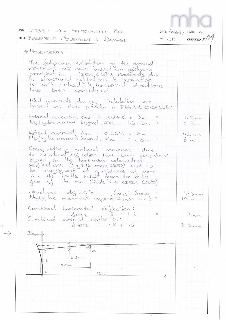
For underpins of a normal width it is anticipated that the movements required to induce soil arching are virtually negligible. The pin width is to be no more than 1.0m in order to minimise these movements. For the purpose of the ground movement and damage assessment in Appendix C , and based on empirical experience and engineering judgment, vertical and horizontal movements occurring during the underpinning works are assumed to be 1.5mm and 1.2mm respectively.
It should be noted that the underpins will in fact tend to transfer the foundation loads from less competent to more competent soils, increasing foundation strength and stability.
Vertical and lateral ground movements due to deflection of new retaining structures:
Ground movements due to elastic deformation of the new underpins is to be minimised by designing them to be as adequately rigid and making use of continuity with and lateral restraint from return walls wherever available.
The figures in the ground movement and damage assessment conservatively assume no such continuity and restraint, so self evidently, the basement envelope will perform better in service than indicated by the simplistic theoretical model.
Combined effects:
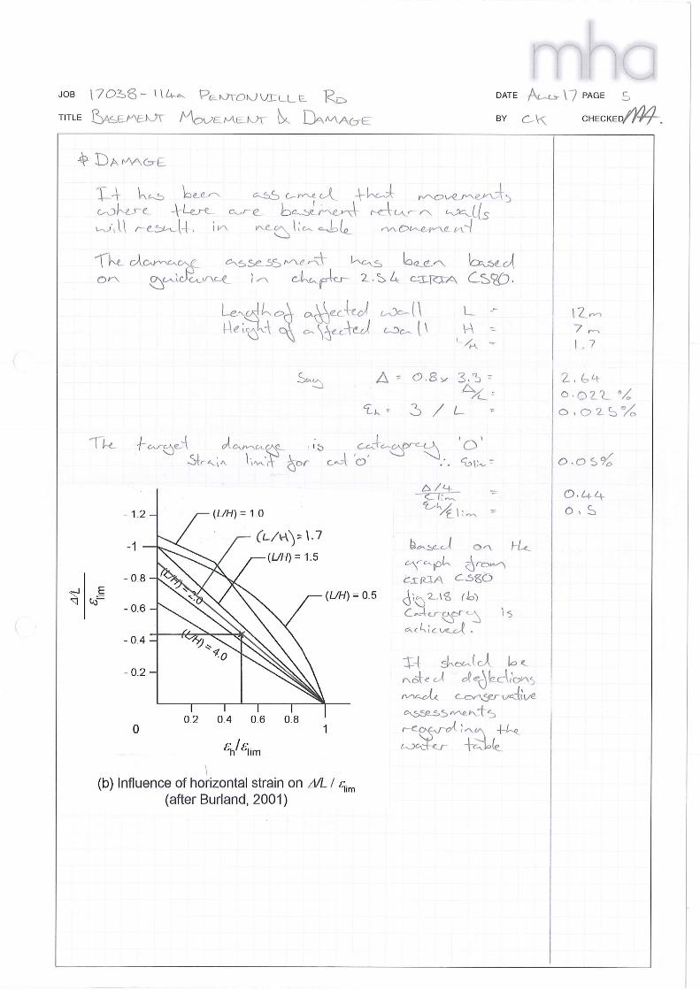
An assessment of the sensitivity of the adjacent properties to the proposed works in accordance with Burland et al. (1977, 2001), CIRIA C580 suggests that the interaction of the calculated horizontal strains and vertical settlements would result in Category 0 – ‘Negligible’ damage (analysis provided in Appendix C ). This is well within the acceptable limits stipulated by the Supplementary Planning Document and will be further dealt with under the provisions of the Party Wall Act 1996.
It is therefore concluded that the proposed works will have no significant adverse effect on the structural integrity and stability of adjacent structures and that whatever effects are experienced are within acceptable limits.
8. Construction Monitoring
It is anticipated that the proposed construction of the basement will be carried out under a traditional building contract with Michael Hadi Associates being retained as structural engineers through Technical Design to Construction. The proposed basement works will be adjusted if site findings suggest any of the structural proposals become inappropriate. During the construction period site visits will be undertaken at key stages of construction, especially at the beginning of the basement construction works, to monitor the contractor’s compliance with the structural designs.

17038/114a Pentonville Road.
Appendix A Suggested Basement Construction Sequence

17038/114a Pentonville Road.
Appendix B Proposed Structural Layouts

17038/114a Pentonville Road.
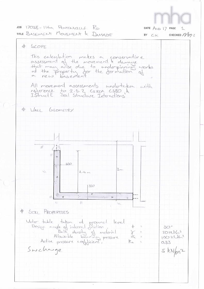
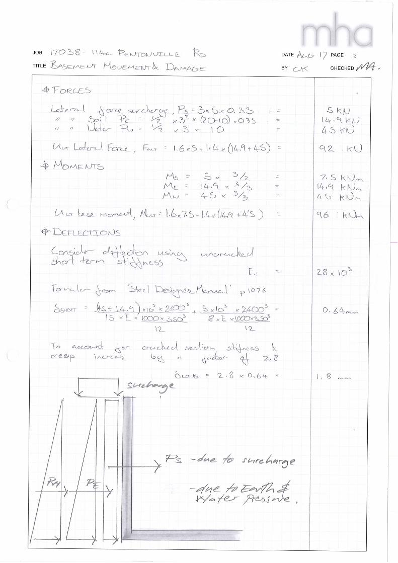
Appendix C Movement and Damage Assessment
17038/114a Pentonville Road.
Appendix D Extracts from British Geological Survey Data
Bedrock Geology: London Clay Formation - Clay, Silt and Sand. Sedimentary Bedrock formed approximately 34 to 56 million years ago in the Palaeogene Period. Local environment previously dominated by deep seas.
British Geological Survey (BGS) Nearby borehole records.
TQ38SW1846 depth 20.11m Made Ground th3.96 - d3.96; Stiff fissured grey/brown silty CLAY pockets of firm sand th1.52 – d5.48; Very Stiff fissured brown silty CLAY th14.63 – d20.11
TQ38SW672 depth 18.29m Made Ground th1.52 – d1.52; Soft brown silty SAND with gravels th0.99 – d2.51; Firm fissured mottled brown silty CLAY th3.74 – d6.25; Stiff fissured mottled blue silty CLAY th4.88 – d11.13; CLAYSTONE th0.6 – d11.73; Stiff fissured mottled blue silty CLAY th6.56 – d18.29;
TQ38SW1846 depth 20.11m Made Ground th1.50 – d1.50; Firm brown fissured silty CLAY, small pockets orange-brown fine sand and silt th1.50 – d3.00; Stiff CLAY as above th4.50 – d7.60; Stiff grey/brow fissure silty CLAY, small pockets grey fine sand and silt th1.50 – d8.00; Claystone th0.30 – d8.30; Stiff CLAY as above th7.00 – d15.30; Claystone th0.60 – d15.90; Stiff CLAY as above th8.70 – d24.60; Claystone th0.3 – d24.90 Stiff CLAY as above th – d25.45
17038/114a Pentonville Road.
Appendix E Hydrology and Hydrogeology Maps
Lost Rivers of London map, by Nicholas Barton.
17038/114a Pentonville Road.
Local Flood Risk Zones and Critical Drainage Areas
- Taken from Islington’s Basement Development Supplementary Planning Document – January 2016
17038/114a Pentonville Road.
Areas with increased potential for elevated groundwater
- Taken from Islington’s Basement Development Supplementary Planning Document – January 2016
17038/114a Pentonville Road.
Locations of Past Floods (highlighted in green)
- Taken from Islington’s Preliminary Flood Risk Assessment - April 2011
17038/114a Pentonville Road.
Appendix F Extract from LCC Bomb Damage Map
Key Yellow: blast damage, minor in nature
Orange: general blast damage, not structural
Light Red: seriously damaged, but repairable at cost
Dark Red: seriously damaged, doubtful if repairable
Purple: damaged beyond repair
Black: total destruction
Circle denotes impact from V1/V2 flying bombs.
17038/114a Pentonville Road.
Appendix G Listed Buildings & Conservation Area CA33
Map of Listed Buildings
17038/114a Pentonville Road.
Chapel Market/Penton Street CA33 Conservation Area


