Embed Size (px)
Citation preview

A Description of Spatial Data Infrastructure Stakeholders in Ghana Using the ICA Model
Wiafe Owusu-‐Banahene1&2, Foster Mensah3, Serena Coetzee1, Antony K Cooper1&4, Victoria Rautenbach1, Kisco
M Sinvula1, Emma Nangolo5 and Martin Hippondoka6
1 Centre for Geoinformation Science, University of Pretoria, Pretoria, 0002, South Africa
2 Department of Computer Engineering, University of Ghana, Legon, PMB, Legon Accra, Ghana
3 Centre for Remote Sensing and Geographic Information Services, University of Ghana, Legon, PMB 17, Legon, Accra, Ghana
4 Built Environment, CSIR, PO Box 395, Pretoria 0001, South Africa
5 Independent Researcher, Windhoek, Namibia
6 Department of Geography, History and Environmental Studies, University of Namibia, Namibia.
[email protected]; [email protected]; [email protected]; [email protected]; [email protected]; [email protected]; [email protected]; [email protected]
Abstract The National Framework for Geospatial Information Management (NAFGIM) was a spatial data infrastructure (SDI) initiative in Ghana which started around the year 2000. NAFGIM was developed as an integral part of a national effort to manage spatial data pertaining to the environment and natural resources. It sought to bring together technology, policies, institutional resources and standards to enhance the production, storage, access and utilization of geographic data and information. NAFGIM is no longer functional but Ghana is again embarking on another SDI initiative. This precipitated key diagnostic questions, such as: what led to NAFGIM’s decline and how can lessons learnt from NAFGIM inform current SDI developments in Ghana? The International Cartographic Association (ICA) has developed formal models of an SDI, including identifying six types of SDI stakeholders and their specializations. The ICA model has been applied to describe the Namibian SDI (NamSDI). In this chapter, we follow this work and use the ICA model to describe the types of stakeholders in NAFGIM, their contributions, roles and impact. Current SDI developments in Ghana can benefit from this stakeholder analysis, because most of the NAFGIM stakeholders are still relevant in current SDI developments as part of the ongoing Land Administration Project. Research results confirm the value of modeling stakeholders of an SDI: Stakeholders are identified and their roles assigned, potential conflicts are identified and can be pro-‐actively mitigated, facilitating harmonized stakeholder participation. The results also contribute to understanding commonalities between stakeholders in different SDIs generally. This is important because SDIs provide access to the geographic information that is essential for sustainable development and for advancing science. KEYWORDS: spatial data infrastructure (SDI), Ghana, stakeholder, NAFGIM, ICA model
1. Introduction A spatial data infrastructure (SDI) refers to the infrastructure, i.e. the basic physical and organizational structures required to facilitate and coordinate the efficient and effective discovery and use of spatial data

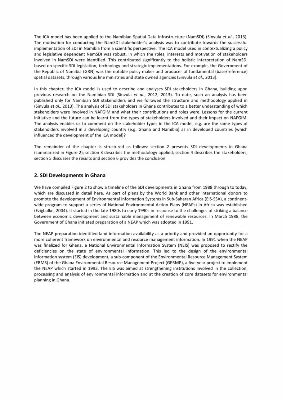
(Rajabifard et al., 2006; Jackson and Gardner, 2011). The concept of an SDI has been around for two decades and the definitions are still evolving. Georgiadou et al., (2005) defined an SDI as a combination of technology, systems, standards, networks, people, policies, organizational aspects, geo-‐referenced data, and delivery mechanisms to end users. Ghana is a sub-‐saharan African country (shown in Figure 1) with a land surface area of 239,460km2, a population of 24.66 million (Ghana Statistical Service, 2010) and a Gross Domestic Product (GDP) of GHS 73,101.9 million1 (Ghana Statistical Service (2013). Ghana came close to the establishment of a legally mandated SDI through efforts by the government, the World Bank and other donors to respond to the challenges of striking a balance between economic development and sustainable management of renewable resources. Through these efforts the National Framework for Geospatial Information Management (NAFGIM) was started in 2000 and later became the de facto SDI. Indeed, Masser (2005) highlights NAFGIM as one of the early SDIs in Africa. Currently, NAFGIM is no longer functional but Ghana is again embarking on an SDI initiative. What led to the failure of NAFGIM? How can lessons learnt from NAFGIM inform current SDI developments in Ghana? The Commission on Geoinformation Infrastructures and Standards of the International Cartographic Association (ICA) has been using the Reference Model for Open Distributed Processing (RM-‐ODP) (ISO/IEC 10746-‐1:1998) to develop formal models of an SDI from the enterprise and information viewpoints of RM ODP (Hjelmager et al., 2008), and from the computational viewpoint (Cooper et al., 2013). These viewpoints contribute toward a more holistic interpretation of an SDI, independent of specific SDI legislation, technology and implementations (Cooper et al., 2013). Specifically, the enterprise viewpoint describes the purpose, scope and policies for an SDI, and the relationship of an SDI to its environment, its role and the associated policies (Hjelmager et al., 2008). A key part of the enterprise viewpoint analysis was to identify the general roles of stakeholders within and around an SDI: Policy Maker, Producer, Provider, Broker, Value-‐added Reseller (VAR) and End User (Hjelmager et al., 2008). The Commission also identified 37 special cases of these general roles (Cooper et al., 2011), which were used as the template to clarify the different stakeholders for this investigation of NAFGIM and are included in Tables 1 and 2. While Cooper et al., (2011) is readily available online, we have included the descriptions of all 37 special cases in an annex. Further, it was beyond the scope of our research described here to interrogate or test the model in detail. Nevertheless, while we did find the model to be robust and useful, we have identified some issues with the model, as outlined below in Section 4 that we will take forward in further research.
Figure 1. Location of Ghana in Africa
1 Equivalent to USD 36.5 Billion at the time of writing this chapter.
The ICA model has been applied to the Namibian Spatial Data Infrastructure (NamSDI) (Sinvula et al., 2013). The motivation for conducting the NamSDI stakeholder’s analysis was to contribute towards the successful implementation of SDI in Namibia from a scientific perspective. The ICA model used in contextualizing a policy and legislative dependent NamSDI was robust, in which the roles, interests and motivation of stakeholders involved in NamSDI were identified. This contributed significantly to the holistic interpretation of NamSDI based on specific SDI legislation, technology and strategic implementations. For example, the Government of the Republic of Namibia (GRN) was the notable policy maker and producer of fundamental (base/reference) spatial datasets, through various line ministries and state owned agencies (Sinvula et al., 2013). In this chapter, the ICA model is used to describe and analyses SDI stakeholders in Ghana, building upon previous research on the Namibian SDI (Sinvula et al., 2012, 2013). To date, such an analysis has been published only for Namibian SDI stakeholders and we followed the structure and methodology applied in (Sinvula et al., 2013). The analysis of SDI stakeholders in Ghana contributes to a better understanding of which stakeholders were involved in NAFGIM and what their contributions and roles were. Lessons for the current initiative and the future can be learnt from the types of stakeholders involved and their impact on NAFGIM. The analysis enables us to comment on the stakeholder types in the ICA model, e.g. are the same types of stakeholders involved in a developing country (e.g. Ghana and Namibia) as in developed countries (which influenced the development of the ICA model)? The remainder of the chapter is structured as follows: section 2 presents SDI developments in Ghana (summarized in Figure 2); section 3 describes the methodology applied; section 4 describes the stakeholders; section 5 discusses the results and section 6 provides the conclusion.
2. SDI Developments in Ghana We have compiled Figure 2 to show a timeline of the SDI developments in Ghana from 1988 through to today, which are discussed in detail here. As part of plans by the World Bank and other international donors to promote the development of Environmental Information Systems in Sub-‐Saharan Africa (EIS-‐SSA), a continent-‐wide program to support a series of National Environmental Action Plans (NEAPs) in Africa was established (Ezigbalke, 2004). It started in the late 1980s to early 1990s in response to the challenges of striking a balance between economic development and sustainable management of renewable resources. In March 1988, the Government of Ghana initiated preparation of a NEAP which was adopted in 1991. The NEAP preparation identified land information availability as a priority and provided an opportunity for a more coherent framework on environmental and resource management information. In 1991 when the NEAP was finalized for Ghana, a National Environmental Information System (NEIS) was proposed to rectify the deficiencies on the state of environmental information. This led to the design of the environmental information system (EIS) development, a sub-‐component of the Environmental Resource Management System (ERMS) of the Ghana Environmental Resource Management Project (GERMP), a five-‐year project to implement the NEAP which started in 1993. The EIS was aimed at strengthening institutions involved in the collection, processing and analysis of environmental information and at the creation of core datasets for environmental planning in Ghana.

Figure 2. SDI developments in Ghana from 1988 until today The Survey Department, the Lands Commission, the Soil Research Institute, the Meteorological Services Department, and the Centre for Remote Sensing and Geographic Information Services (CERSGIS) were identified to produce and collate the relevant land-‐related datasets for the project, under the sponsorship of the Government of Ghana, the World Bank and the Danish International Development Agency (DANIDA). As the project proceeded, the participating institutions felt the need for, and initiated the creation of, a framework for sharing data and for coordinating the production and harmonization of their spatial data products. This initiative led to the birth of NAFGIM. NAFGIM’s implementation started in April 2000 with a secretariat, a steering committee and an inter-‐agency forum. The secretariat, comprising a secretary, technical staff and a coordinator, was located at the Environmental Protection Agency (EPA). The steering committee constituted the policy-‐making body, while the inter-‐agency forum constituted a loose configuration of geospatial data producers and users that established mechanisms for the harmonized exchange of inter-‐sectoral information. NAFGIM worked through technical workgroups that dealt with broad thematic areas. NAFGIM evolved to become the de facto SDI of Ghana (Ezigbalike, 2004; EPA, 2005; Cooper and Gavin, 2005; UNEP, 2010) and presented an opportunity for the establishment of a legally mandated SDI in Ghana. Between 2000 and 2005, Crompvoets and Bregt (2007) periodically conducted surveys, taking inventory of national clearinghouses on the Web by measuring eleven characteristics of a clearinghouse, such as the number of data suppliers, the number of datasets available and the number of monthly visitors. From these characteristics a clearinghouse suitability index was calculated from 2002 to 2005. The index showed that NAFGIM was declining: in 2005 it scored 21, 14 points lower than in 2002. Currently, NAFGIM is no longer functional (Karikari, 2006; Yawson et al., 2010). In 2003, the Land Administration Project (LAP-‐1) was launched as a long term (15-‐25 years) Land Administration Program to implement policy actions recommended in the National Land Policy document of June 1999 (Ministry of Lands and Forestry, 1999). The programme appraisal recognized the need for up to date maps to support critical on-‐going land administration operations in support of agriculture, forestry, environmental management, urban and regional planning, mining, municipal services, storm water and sewerage, property tax, building permits, valuation systems, titling and deeds registration, infrastructure systems such as electricity, telecommunications, water, gas and real property maps, all potentially supporting land markets and national development. In 2010, the programme therefore identified as part of LAP-‐2, the development of a surveying and mapping policy, a geodetic reference network, continuously operating reference stations, a national spatial data infrastructure, production of digitized base maps and the establishment of a street addressing system as important activities for consolidating, regulating and strengthening land administration and management systems in Ghana (Ministry of Lands and Natural Resources, 2011). This presented another opportunity for the establishment of a legally mandated SDI in Ghana, after the demise of NAFGIM.
Today, a consultant has been engaged and consultations are currently ongoing to develop the National SDI (NSDI) vision, mission statements and objectives for Ghana. These NSDI guiding principles to build NSDI partnerships, to ensure the creation of adequate capacity to empower the NSDI, to raise awareness and to communicate in the most effective ways to ensure that NSDI objectives are met, and to develop a technological framework to enhance access to spatial data, its use and sharing. In this chapter we use GERMP and NAFGIM as examples to describe SDI stakeholders in Ghana.
3. Methodology Hjelmager et al., (2008) identified and described six stakeholders in the enterprise viewpoint of an SDI using Unified Modeling Language (UML) case diagrams and recognized that an individual stakeholder can execute different roles. For example, an organization can act as a policy maker, who sets out rules and policies for an SDI, and at the same time, be a producer of data and services required in an SDI. Cooper et al., (2011) took this further by identifying various special cases of these general roles which they termed ‘sub-‐types’ and ‘sub-‐sub types’. The ICA’s model describes the characteristics of an SDI at a high level of abstraction. The objective here is to model SDI stakeholders in Ghana as sub-‐types of the ICA’s model stakeholders. Such a modeling exercise improves the understanding of stakeholders. Completion of the exercise also allows one to comment on the behavior and applicability of the abstract ICA model to a specific SDI instance, even though this exercise was not meant to be an examination of the model. The stakeholder types and sub-‐types in the SDI in Ghana were described by associating ICA stakeholder types with NAFGIM stakeholders in Ghana and the roles they played in NAFGIM when it was functional. The identification of stakeholders was done based on direct observations in the form of personal involvement and experiences, impressions and literature (refer to Table 2). In the discussion, the current developments and stakeholders of LAP-‐2 are discussed and compared to NAFGIM’s stakeholders. The end result is an identification and discussion of past and potential future stakeholders and their roles in an SDI in Ghana.
4. Stakeholders in SDI in Ghana In this section, we describe according to the ICA model, the stakeholders that participated in NAFGIM. Table 1 shows the description of the six stakeholders in the ICA model. Table 2 shows ICA stakeholder types, stakeholder sub-‐types and stakeholder sub-‐sub-‐types with examples identified from NAFGIM. We describe the individual stakeholder types in NAFGIM in sub-‐section 4.1 through to sub-‐section 4.6. The identification of stakeholders was done based on direct observations in the form of personal involvement and experiences, impressions and literature such as Environmental Protection Agency (EPA) (2005); Ezigbalike (2004); Lance and Bassolé (2006); Ministry of Lands and Forestry, (1999); Cooper and Gavin (2005); United Nations Environment Programme (UNEP) Report (2010) and Yawson et al., (2010).
Stakeholder Description
Policy maker A stakeholder who sets the policy pursued by an SDI and all its stakeholders
Producer A stakeholder who produces SDI data or services
Provider A stakeholder who provides data or services to users through an SDI
Broker A stakeholder who brings users and providers together and assists in the negotiation of contracts between them
Value-‐added reseller (VAR)
A stakeholder who adds some new feature to an existing product or group of products, and then makes it available as a new product
End user A stakeholder who uses the SDI for its intended purpose
Table 1. Types of stakeholders in the ICA model (Hjelmager et al., 2008)

4.1 Policy Maker NAFGIM was established through the implementation of NEAPs and EIS in Ghana. In March 1988 the Government of Ghana initiated the NEAP which was adopted in 1991. The Government of Ghana is therefore the policy maker. Ghana currently has no SDI Act but Parliament is the legislator that is expected to pass bills into acts. The decision maker in NAFGIM was a steering committee which acted as the policy-‐making body. NAFGIM had a secretariat comprising a secretary, technical staff and a coordinator who was located at the EPA. The Government of Ghana, the World Bank and DANIDA were the champions of NAFGIM, as can be seen from Table 2. They were motivated by the necessity to promote sustainable development in the country.
4.2 Producer Under the GERMP, which was part of the EIS-‐SSA, the major official data producers were the Survey Department, the Lands Commission, the Soil Research Institute, the Meteorological Services Department, and CERSGIS, who were brought together to produce and collate the relevant land-‐related datasets for the project. The Survey Department is responsible for producing the geodetic framework, aerial photographs and digital elevation model (with the Soil Research Institute). It also produces international, national, regional, district, metropolitan, municipal and town boundaries. Additional public data-‐producing institutions participated in NAFGIM, including the EPA, were the Department of Feeder Roads, the Water Research Institute, the Forestry Commission, the Soil Research Institute, the Ghana Statistical Service, the Electoral Commission and the Ghana Meteorological Services Department. Some private companies, such as Rudan Engineering and GeoTech, were involved in NAFGIM as contractors or agents who worked for the Survey Department. As shown in Table 2, CTK Network Aviation Ltd was a commercial mapping agency that invested in the production of data for NAFGIM, hoping to get a return on investment from the government in future. No Community Interest and Crowd Sourced producers were identified for NAFGIM. We identified CERSGIS as a stakeholder motivated by special interest, as it produced maps of the social infrastructure for local communities. The production of flood hazard maps for the Western region of the country made CERSGIS perform the role of a stakeholder motivated by process. No passive producer was identified. The NAFGIM Secretariat received revision notices and also acted as database administrator. We identified interested amateur, expert amateur and expert professional producers for NAFGIM, as shown in Table 2, but not any neophyte and interested amateur producers. 4.3 Provider All the official data producers were identified as stakeholders of NAFGIM as they provided data and services for their own use and for the use by others. EPA was a distributor of data packaged by CERSGIS, as shown in Table 2. For example, CERSGIS packaged the datasets developed under GERMP according to districts and regions through District and Regional Information Systems, referred to as 'Regional and District Packaging'. These datasets included topographical data, land cover/land use data, soil and land suitability data, land ownership data and meteorological data and were packaged on CD-‐ROMs for distribution by the EPA. ‘Ghana country at a glance’ was distributed freely on CD-‐ROM and via a website (which is not functional any more). The NAFGIM Secretariat acted as a data arbiter. We did not identify a service distributor or service arbiter in NAFGIM.
4.4 Broker No crowdsourcing facilitator was identified. Private companies, such as Rudan Engineering, CTK Network Aviation Ltd and GeoTech acted as clients/users finders, providers finders and négociants, as presented in Table 2. The NAFGIM Secretariat played the role of both cataloguer and harvester.

4.5 Value-‐Added Reseller CERSGIS was a publisher of satellite imagery. Satellite imageries were processed by CERSGIS into products such as satellite images of Ghana from 1990 to 2000 and AVHRR data were re-‐sampled and geo-‐rectified. We did not identify any service integrator. Data and metadata aggregator/integrator value-‐added resellers included EPA, CERSGIS, the Soil Research Institute, the Meteorological Services Department, the Survey Department (now the Survey and Mapping Division of the Lands Commission) and the Lands Commission, as indicated in Table 2. Examples of data that were aggregated and/or integrated were a land cover atlas for Ghana – 1998, a land cover/land use data – 2003, and a land suitability atlas and bulletins. 4.6 End User Citizens, visitors, government employees, consultants and private companies were identified as naïve consumers (when using whatever is available with limited ability to determine the quality of the data or services (Cooper et al., 2011)) or advanced users. These are shown in Table 2.
Stakeholder type Stakeholder sub-‐type
Stakeholder sub-‐ type
Examples
Legislator Parliament of Ghana Decision maker NAFGIM steering committee
Secretariat NAFGIM Secretariat within EPA
Policy Maker
Champion
Government of Ghana, DANIDA, World Bank Official mapping agency
• Survey Department • Lands Commission • Soil Research Institute • Meteorological Services Department • CERSGIS • EPA • Department of Feeder Roads • Additional public institutions that
participated in NAFGIM Commercial mapping agency
CTK Network Aviation Ltd
Community interest None
Status
Crowd source None Motivation
Special interest CERSGIS (e.g. community-‐based social infrastructure mapping)
Economic All of the data producers
Process CERSGIS (e.g. flood hazard and health risk maps for selected districts of Ghana)
Role Captor of raw data All of the data producers Submitter of revision notice
Submitted to the NAFGIM Secretariat
Passive producer None
Database administrator
NAFGIM Secretariat
Neophyte Unlikely Interested amateur Unlikely Expert amateur Special interest data and rainfall data Expert professional Many examples
Producer
Skill
Expert authority Many examples
Provider
Data provider A producer that is its own data
• Survey Department • Lands Commission

Table 2. Stakeholder types and sub-‐types in the SDI in Ghana
5. Discussion The modeling of SDI stakeholders in GERMP and NAFGIM remains relevant today. The current SDI developments in Ghana under LAP-‐2 are expected to introduce some new SDI stakeholders, though many of the stakeholders identified under NAFGIM will maintain their roles. For example, regarding policy makers, the
A producer that is its own data provider
• Survey Department • Lands Commission • Soil Research Institute • Meteorological Services Department • CERSGIS • EPA • Department of Feeder Roads Additional public institutions that participated in NAFGIM
Data distributor EPA: CERSGIS packaged datasets for EPA to distribute e.g. • 'Regional and District Packaging' of GERMP
data on CD-‐ROM, • ‘Ghana country at a glance’ free data
distribution
Data arbiter NAFGIM Secretariat A producer that is its own service provider
All of the official data producers of NAFGIM
Service distributor None yet
Service provider
Service arbiter None yet Crowd-‐sourcing facilitator
None yet
Clients/users finder Private companies Finder
Providers finder Private companies Harvester NAFGIM Secretariat Cataloger NAFGIM Secretariat
Broker
Négociant • Private companies e.g. Rudan Engineering, CTK Network Aviation Ltd and GeoTech
• Technical advisors in ministries • Public-‐private partnerships (PPP)
Publisher CERSGIS-‐ satellite imageries (image processing)
e.g. satellite images of Ghana 1990 and 2000, Advanced Very High Resolution Radiometer (AVHRR) data re-‐sampled and geo-‐rectified
Service integrator None
Value-‐added reseller (VAR)
Aggregator/ integrator Data and metadata
aggregator/ integrator
• EPA • CERSGIS • Soil Research Institute • Meteorological Services Department • Survey Department (now Survey and
Mapping Division of Lands Commission) • Lands Commission Examples of data aggregated/integrated: - Land cover atlas for Ghana –1998 - Land cover/land use data –2003 - Land suitability atlas and bulletins
Naive consumer Citizens and visitors, government employees,
consultants and private companies
End user
Advanced user Citizens and visitors, government employees, consultants and private companies

legislator is still the Parliament of Ghana, but the LAP Secretariat is now the stakeholder in the role of decision maker and secretariat under LAP-‐2. The champions are the Government of Ghana and the World Bank. DANIDA is no longer playing the role of a champion as it did under NAFGIM. On the producer side, all the official mapping agencies identified under NAFGIM will maintain their roles. However, the Survey Department under NAFGIM is the Survey and Mapping Division of the Lands Commission. In NAFGIM, CTK was a commercial mapping agency, but there is no such agency under LAP-‐2. Furthermore, potential passive producers, neophyte and interested amateur stakeholders are expected to participate in the current SDI developments in Ghana. An example is the Google platform introduced in Ghana recently. Users of GPS and mobile devices are also expected to contribute data to the SDI in Ghana. The collective knowledge of the participants in the modelling exercise contributes to the completeness of the model and provides a snapshot of their collective knowledge about SDI stakeholders. Nevertheless, one has to assume that unless there is an official SDI with clear delineation of what is ‘within’ and what is ‘outside’ the SDI, there could be additional stakeholders and SDI-‐related activities that are not yet represented in the model. This confirms that SDI-‐related activities exist independently of an official SDI but that there is a need for a coordinating role, for example, to provide a central point of access to metadata about available datasets. In the case of Ghana, the LAP-‐2 work aims to provide such a technological framework which will enhance access to spatial data, its use and sharing. The ICA model failed to take into account the level of geographical information systems, historical initiatives of national SDIs and developmental contexts of countries. It is more at an abstract level and more applicable to the developed and industrialized nations, for example, as many end users in developing countries are naïve in terms of spatial data and ICT. The stakeholder roles and interests were more subjective and to some extent not factual. Furthermore, some stakeholders and sub-‐types are not included in the ICA model. For example, the stakeholder producer does not include sub-‐type services, even though the definition included the production of services. Thus the producer of services is not included in the ICA model. Suppliers of hardware and software were also excluded from the model. Moreover, some of the definitions such as community interest and crowd sourcing are so close to each other and should therefore be re-‐examined. For instance, should community interest and crowd source be combined as NGO/not for profit? A source of ambiguity we encountered was the fact that stakeholder sub-‐types are not mutually exclusive, e.g. status, motivation and role describe different aspects of a stakeholder, but do not represent a sub-‐classification (tree) under the producer stakeholder type (as we had initially understood). The analysis of the SDI stakeholders in Ghana revealed that data sharing, collection and distribution activities can be coordinated without a legal mandate, as long as projects continue and funds are available, because NAFGIM did not have a legal mandate, but functioned effectively for some years. Coordinated data production and sharing took place in Ghana in the 1990s under GERMP and spawned the development of the NAFGIM framework focusing on environmental and sustainable development information. When GERMP and related projects ended, funds, motivation and the imperative to sustain NAFGIM faded. The question is whether LAP with its planned legal mandate and inclusion of all kinds of spatial data will succeed in the future. Society requires SDI and data for sustainable development and science cannot progress without SDI and data. In these aspects, this research contributes to understanding SDI stakeholders and their commonalities. It helps identify stakeholder participation upfront. The modeling exercise can be used to avoid repeating past mistakes (e.g. when drafting policies) and to minimize stakeholder conflict.
6. Conclusion Our experiences show that there is value in modeling the stakeholders in an SDI: It clarifies who the stakeholders are and what their roles and contributions are or could be in the SDI of the country. In the case of Ghana, current SDI developments can benefit from the stakeholder analysis of NAFGIM presented in this chapter. The project determination that led to the deterioration of NAFGIM has already informed policies and
strategies of current SDI developments. The current SDI developments in Ghana can also benefit from a comparison of SDI stakeholders in different countries which we seek to do in future studies. The modeling exercise described in this chapter not only improves the understanding of stakeholders in Ghana, it also serves to test the behavior and applicability of the abstract ICA model to a specific SDI instance. In future, we aim to compare the results of applying the ICA model to SDIs in Namibia, Ghana and other countries to further identify key aspects of SDIs, to improve the understanding of SDI stakeholders and to make recommendations for the improvement of the ICA model, such as to deal with the issues we identified here.
Acknowledgements We acknowledge with gratitude funding received through the Joint Research Grant under the SA-‐Namibia Research Partnership Programme towards this study. The map in Figure 1 was produced by Yvette Bevis of the Centre for Geoinformation Science, University of Pretoria, South Africa. We would also like to thank the anonymous referees for their useful comments.
References Allotey, J.A., (1999), Developing A National Framework for Geo-‐Spatial Information in Ghana Report on First
Meeting of the Committee on Development Information (CODI) 28 June-‐2 July 1999, Addis Ababa, Ethiopia.
Coleman, D.J., Georgiadou, Y. and Labonte, J., (2009), Volunteered Geographic Information: The Nature and
Motivation of Producers. International Journal of Spatial Data Infrastructures Research, Special Issue on GSDI-‐11, 4.
Cooper, A.K. and Gavin, E.J.O., (2005), Spatial Metadata in Africa and the Middle East, in Moellering, H.,
Aalders, H.J.G. and Crane, A. (Eds) World Spatial Metadata Standards. Amsterdam: Elsevier. Cooper, A.K., Moellering, H., Hjelmager, J., Rapant, P., Delgado, T., Laurent, D., Coetzee, S., Danko, D. M.,
Düren, U., Iwaniak, A., Brodeur, J., Abad, P., Huet, M. and Rajabifard, A., (2013), A Spatial Data Infrastructure Model from the Computational Viewpoint, International Journal of Geographical Information Science, in Press.
Cooper, A.K., Rapant, P., Hjelmager, J., Laurent, D., Iwaniak, A., Coetzee, S., Moellering, H. and Düren, U.,
(2011), Extending the Formal Model of a Spatial Data Infrastructure to Include Volunteered Geographical Information, 25th International Cartographic Conference (ICC), Paris, France, 4-‐8 July 2011.
Crompvoets, J. and Bregt, A., (2007), National Spatial Data Clearinghouses, 2000-‐2005’,in Onsrud, H. (Ed.)
Research and Theory in Advancing Spatial Data Infrastructure Concepts, ESRI Press, pp. 133-‐146. Engelhardt, F., (2012), Creating an Environmental Geographic Information System for the City of Kumasi,
Ghana. Master Thesis in Sustainable Development at Uppsala University. Environmental Protection Agency (EPA), (2005), Country Paper – GHANA, Environmental Statistics in
Perspective. Proceedings of Workshop on Environmental Statistics for the ECOWAS Region, 28 February-‐4 March, 2005, Dakar – Senegal, Available from http://unstats.un.org/unsd/environment/ ghana.pdf [Accessed 8 April 2013].
Ezigbalike, D., (2004), Advances In SDI Development In Africa, Proceedings 7th GISDECO, 10-‐12 May 2004,
Johor, Malaysia, Available from http://www.gisdevelopment.net/proceedings/gisdeco/2004/keynote/ezipf.htm [Accessed 8 April 2013].

Georgiadou, Y., Puri, S.K. and Sahay, S., (2005), Towards a Potential Research Agenda to Guide the
Implementation of Spatial Data Infrastructures – A Case Study from India. International Journal of Geographical Information Science, 19(10): 1113-‐1130.
Ghana Statistical Service (2013), Revised Gross Domestic Product 2012, Ghana Statistical Service (April 2013),
Available from http://www.statsghana.gov.gh/ docfiles/GDP/revised_gdp_2012.pdf [Accesed 14 May 2013].
Ghana Statistical Service (2010), Population and Housing Census. Population by Region, District, Age Groups
and Sex, 2010, Ghana Statistical Service, Available from http://www.statsghana.gov.gh/docfiles/pop_by_region_ district_age_groups_and_sex_2010.pdf [Accesed 14 May 2013].
Hjelmager, J., Moellering, H., Cooper, A.K., Delgado, T., Rajabifard, A., Rapant P., Danko, D., Huet, M., Laurent,
D., Aalders, H.J.G.L., Iwaniak, A., Abad, P., Düren, U. and Martynenko, A., (2008), An initial formal model for spatial data infrastructures. International Journal of Geographical Information Science 22(11&12): 1295-‐1309.
ISO/IEC 10746-‐1:1998, Information Technology – Open Distributed Processing – Reference Model: Overview,
International Organization for Standardization (ISO), Geneva, Switzerland. Jackson, M.J. and Gardner, Z., (2011), World Bank SDI Report, World Bank, Available from
http://lgosmgb2.nottingham.ac.uk/elogeowiki/index.php/World_Bank_ SDI_Report [Accessed 11 May 2013].
Karikari, I.B., (2006), Ghana’s Land Administration Project (LAP) and Land Information Systems (LIS)
Implementation: The Issues. Article of the Month, International Federation of Surveyors, Available from http://www.fig.net/pub/ monthly_articles/february_2006/karikari_february_2006.pdf [Accessed: 9 May 2013].
Karikari, I., Stillwell, J. and Carver , S., (2005), The Application of GIS in the Lands Sector of a Developing
Country: Challenges Facing Land Administrators in Ghana. International Journal of Geographical Information Science, 19(3): 343-‐362.
Lance, K. and Bassolé, A., (2006), SDI and National Information and Communication Infrastructure (NICI)
Integration in Africa. Information Technology for Development, 12(4): 333-‐338. Masser, I., (2005), GIS Worlds: Creating Spatial Data Infrastructures. ESRI Press, Redlands CA, ISBN 1-‐58948-‐
11-‐4. Ministry of Lands and Forestry (1999), Land Policy Document. Ministry of Lands and Forestry. Ministry of Lands and Natural Resources (2011), Land Administration Project – Phase Two. Project
Implementation Manual. Nebert, D., (2004), Developing Spatial data Infrastructures: The SDI Cookbook. GSDI, Available from
http://www.gsdi.org/docs2004/Cookbook/cookbookV2.0.pdf [Accessed 10 May 2013]. Rajabifard A., Feeney, M. and Williamson, I.P., (2006), Directions for the Future of SDI development.
International Journal of Applied Earth Observation and Geoinformation, 4: 11-‐22. Sinvula, K.M., Coetzee, S., Cooper, A.K. and Hipondoka, M., (2012), Exploring the Potential Suitability of an SDI
Model in Context of the National Spatial Data Infrastructure (NamSDI) of Namibia, GISSA Ukubuzana 2012 Conference, Ekurhuleni, South Africa, 2-‐4 October 2012.

Sinvula, K.M., Coetzee, S., Cooper, A.K., Nangolo, E., Owusu-‐Banahene, W., Rautenbach, V. and Hipondoka, M., (2013), A Contextual ICA Stakeholder Model Approach for the Namibian Spatial Data Infrastructure (NamSDI). 26th International Cartographic Conference (ICC), August 25-‐30, Dresden, Germany.
United Nations Environment Programme (UNEP) Report (2010), Best Practices and Lessons Learnt from the
Implementation of Africa Environment Information Network, Available from http://www.unep.org/dewa/africa/docs/en /Best_Practices_and_Lessons_Learnt_from_the_Implementation_of_AEIN.pdf [Accessed 8 April 2013].
Yawson, D.O., Armah F.A. and Dadzie S.K.N., (2010), Ghana’s Right To Information Bill: Opportunity For SDI as
a Technical Infrastructure. International Journal of Spatial Data Infrastructures Research, 5: 326-‐346.

Annex 1. The Types and Sub-‐types of Stakeholders in an SDI, Taken verbatim from Cooper et al., (2011).
Stakeholder type
Stakeholder sub-‐type
Stakeholder sub-‐ sub-‐ type
Description
Policy Maker A stakeholder who sets the policy pursued by an SDI and all its stakeholders, such as developing policies for VGI, soliciting for VGI, acceptance criteria, quality assurance (e.g. verification against other, independent VGI), etc.
Legislator An ‘external’ authority (not obviously perceived as being part of the SDI, but in practice, a key stakeholder) that determines the framework within which the SDI has to exist, but the Legislator does not necessarily understand anything about the SDI. For INSPIRE, this would be the European Parliament.
Decision maker
A participant in the SDI who makes policies (including initiating the SDI) and who understands geospatial data and the applications, constraints, etc. The Decision Maker is often a committee of representatives of stakeholder communities. For INSPIRE, this would be the INSPIRE Committee (IC).
Secretariat The 'glue' of the SDI keeping it all together. The Secretariat is often a department in government with the mandate and budget to support the SDI, and that can contract out services. Especially for an SDI of VGI, the Secretariat can start informally and then crystallize once funding is available to pay for participation (as happened with OpenStreetMap, for example, which only received core funding in its second year of operations [OpenStreetMap 2010]). For INSPIRE at the European level, this would be the Joint Research Centre (JRC), as the overall technical coordinator, and Eurostat, as the overall implementation coordinator. Specific roles of the Secretariat include:
• Supporting and monitoring the implementation of policies, etc.
• Facilitating communication between stakeholders, particularly to provide feedback (e.g. quality or popularity of a data set, viability of a data product specification, responses to draft policies).
• Building the actual SDI (generally through contractors). • Ensuring the smooth running of processes. • Classification of stakeholders.
Champion Promotes the SDI, such as encouraging citizens to contribute VGI. The Champion does not necessarily have a mandate, but could be motivated by the need to promote social justice, by environmental awareness, or by commercial interest. The Champion could be the initiator of the SDI.
Producer A stakeholder who produces SDI data or services, such as a lay person who generates VGI.
Status Official
mapping agency
An organization with the budget, resources, expertise and mandate to perform mass data production across the whole of the area of interest, normally to a consistent specification across the whole area. These include topographical, cadastral, hydrographic, meteorological, geological, hydrological, social statistical, environmental and other mapping agencies. These are at all levels of government (local, provincial, national, regional and global).
Commercial mapping agency
A for-‐profit organization producing data and products for its identified markets.
Community interest
Produce general base data or specialized data with broad or narrow coverage, especially as VGI. Exhibits the ‘long tail’, with many contributors of small data sets and few contributors of most of the

data. There will be many more End Users than Producers. Crowd source Issue an open call for data to anyone (the crowd), often according
to a specification and often with a reward (not necessarily financial). This includes citizen science projects.
Motivation Special
interest Produce data for their local area and/or for a narrow interest, such as to protect the environment, empower a community (e.g. asset-‐based community development) or counteract bias in official sources of data.
Economic Produce data for economic or financial reasons, such as for direct financial reward (e.g. as an employee, on contract or to sell), promoting awareness of a business (locations, products, services, special offers and opening hours), and End Users unwilling to pay for institutional data.
Process Produce data because of particular interest in the data capture processes per se, such as training for students (as a way to motivate them), or the mapping parties that combine data capture with social events.
Role Captor of raw
data Produce data such as locations measured by GPS or drawn from background images, categorization and description of features, photos and images.
Submitter of revision notice
Submit a notice to revise or correct data in an SDI, performed most often by citizens to improve the data of their immediate environment. An example is swisstopo (Guélat 2009). This would comprise many contributors of very small data sets.
Passive producer
Produce data through their mobile devices being tracked by a service provider, such as cellular telephones or in-‐car navigation devices, to monitor traffic flows, assess telecommunication network congestion, or for other purposes. Clearly, this raises ethical issues concerning informed consent, uninformed consent, surreptitious tracking and privacy.
Data base administrator
Ensure that the database specifications are respected (e.g. by providing rules to integrate data in the database and by checking these rules are respected, by ensuring consistency checks, etc.).
Skill Coleman et al [2009] categorize the skill levels of users that are producers (which they identify with the neologism, producers), as (in their ordering):
Neophyte No formal background in a subject, but with the interest, time and willingness to offer opinions or data.
Interested amateur
‘Discovered’ an interest in a subject and begun reading background literature, consulting colleagues and experts, experimenting with applications and gaining experience in appreciating the subject.
Expert amateur
May know a great deal about a subject and practice it with passion on occasion, but does not rely on it for a living.
Expert professional
Studied and practices the subject, relying on that knowledge for a living, and may be sued if their products, opinions and/or recommendations are proven inadequate, incorrect or libelous.
Expert authority
Widely studied and long practiced a subject and now recognized to possess an established record of providing high-‐quality products and services and/or well-‐informed opinions – and stands to lose that reputation and perhaps their livelihood if that credibility is lost, even temporarily.
Provider A stakeholder who provides data or services, produced by others or itself, to users through an SDI. Examples include an aggregator of VGI, such as Ushahidi, and the provider of the infrastructure for collecting VGI, such as OpenStreetMap.
Data provider A producer
that is its own data provider
This is the classical model used by a national mapping agency.
Data Holds the catalogs and data of Producers, to take the administrative

distributor burden away from the Producers in dealing with users. The Distributor does not assess the data they are redistributing; they are merely an agent for the Producer. This would include dissemination through a website or on CD-‐ROM, etc.
Data arbiter Selects datasets from Producers according their published criteria (i.e. performing quality assurance and even certification), but does not add value in any other way.
Service provider
A producer that is its own service provider
This is the typical model used by a location-‐based service (LBS) provider (e.g. find a service or facility available where I am now).
Service distributor
Makes services available through their website or runs the services internally for clients. The cloud-‐computing model is typical.
Service arbiter Selects services from Producers according their published criteria (i.e. performing quality assurance and even certification) and provides them through their website, but does not add value in any other way.
Broker A stakeholder who brings End Users and Providers together and assists in the negotiation of contracts between them. They are specialized publishers and can maintain metadata records on behalf of an owner of a product. Their functions include harvesting metadata from Producers and Providers, creating catalogs, and providing services based on these catalogs. An example for VGI is a community-‐based organization that enables the members of its community to provide updates and corrections to the published information of their local authority, such as addresses.
Crowd-‐sourcing facilitator
Such as Amazon Mechanical Turk, which allows businesses to access an on-‐demand, scalable work force by advertising small “human intelligence tasks” to be completed [Amazon 2010].
Finder Clients/users
finder Promotes and sells a portfolio of data and services from Producers, Providers and VARs, to End Users.
Providers finder
Sources data or services for an SDI. In South Africa, for example, the State Information Technology Agency (SITA) has a mandate to procure services for government departments, providing tender evaluation and management, etc.
Harvester Harvests metadata on data and services and integrates them. Cataloguer Builds and maintains a catalog. Négociant A stakeholder who brings End Users and Providers together and
assists in the negotiation of contracts between them. They are specialized publishers and can maintain metadata records on behalf of an owner of a product. Their functions include harvesting metadata from Producers and Providers, creating catalogs and providing services based on these catalogs. A VGI example is a community-‐based organization that enables the members of its community to provide updates and corrections to the published information of their local authority.
Value-‐added reseller (VAR)
A stakeholder who adds some new feature to an existing product or group of products, and then makes it available as a new product. An example is searching for, evaluating and integrating VGI (possibly also with official information), to create a new data set or product. It is important to realize that a VAR does not necessarily sell its products, but could generate its income from other sources (e.g. support services).
Publisher Takes data from various sources, and integrates and edits them to produce a new product, such as an atlas or a location-‐based service (LBS). A Publisher could add some of its own data.
Aggregator/ integrator
Service Chains services together. Would often reside in the cloud.

integrator Data and
metadata aggregator/ integrator
Selects, edits, enhances and combines data into a new offering: • Conflation of datasets (selecting the ‘best’ versions of
features and attributes from across several data sets). • Aggregation of metadata (more complex to do for VGI
because of the multitude of Producers and the patchwork nature of their contributions).
• Integration of different data sets and their metadata. End user A stakeholder who uses the SDI for its intended purpose. Many End
Users cannot differentiate between VGI and official information, unless they are told explicitly, and hence would use VGI transparently. End Users tend to use VGI for ‘quick and dirty’ purposes, such as navigation, because there are no issues of copyright or liability.
Naive consumer
Uses whatever is available with limited ability to determine the quality of the data or services.
Advanced user
Has expert domain and/or geospatial expertise and hence can make informed decisions about the data and services to use and can provide informed, technical criticism of the data and services. They often use a GIS or other advanced software.
This work is licensed under the Creative Commons Attribution 3.0 License. To view a copy of this license,
visit http://creativecommons.org/licenses/by/3.0/legalcode


