Embed Size (px)
Citation preview
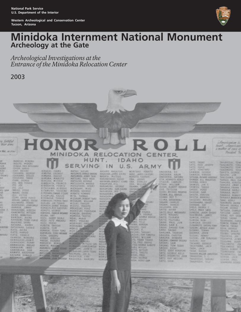
Minidoka Internment National MonumentArcheology at the Gate
Archeological Investigations at theEntrance of the Minidoka Relocation Center
2003
National Park ServiceU.S. Department of the Interior
Western Archeological and Conservation CenterTucson, Arizona
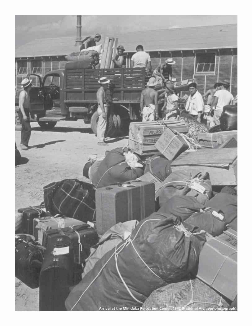
Arrival at the Minidoka Relocation Center, 1942 (National Archives photograph).
Minidoka Internment National MonumentArcheology at the Gate
Archeological Investigations at theEntrance of the Minidoka Relocation Center
Jeffery F. BurtonLaura S. Bergstresser
Western Archeological and Conservation CenterTucson, Arizona
Anna H. Tamura
Columbia Cascades Support OfficeSeattle, Washington
National Park ServiceU.S. Department of the Interior
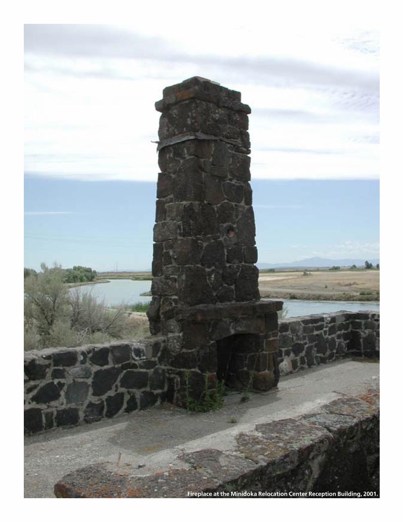
Fireplace at the Minidoka Relocation Center Reception Building, 2001..
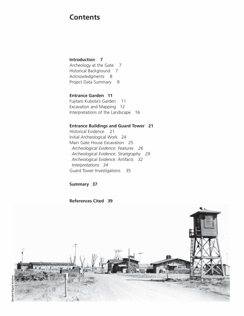
Contents
Introduction 7Archeology at the Gate 7Historical Background 7Acknowledgments 8Project Data Summary 9
Entrance Garden 11Fujitaro Kubota’s Garden 11Excavation and Mapping 12Interpretations of the Landscape 16
Entrance Buildings and Guard Tower 21Historical Evidence 21Initial Archeological Work 24Main Gate House Excavation 25Archeological Evidence: Features 26Archeological Evidence: Stratigraphy 29Archeological Evidence: Artifacts 32Interpretations 34
Guard Tower Investigations 35
Summary 37
References Cited 39
Den
sho
Dig
ital
Arc
hiv
e
6 Minidoka Internment National Monument
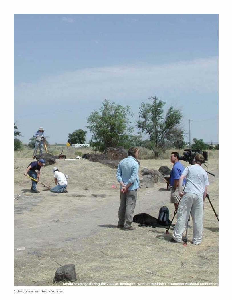
Media coverage during the 2002 archeological work at Minidoka Internment National Monument.
National Park Service 7
Introduction
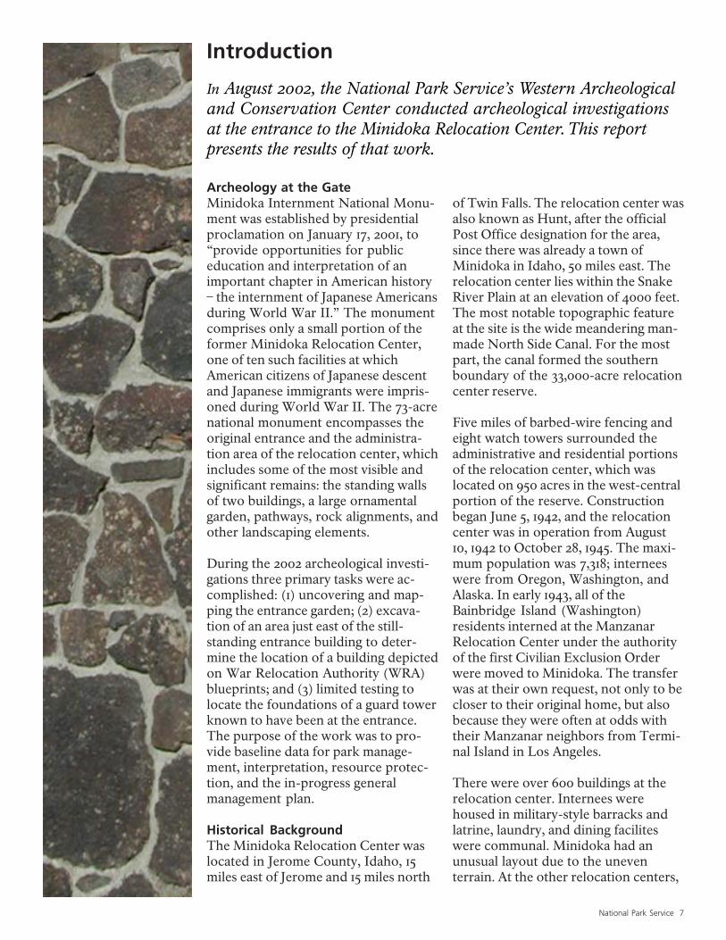
In August 2002, the National Park Service’s Western Archeologicaland Conservation Center conducted archeological investigationsat the entrance to the Minidoka Relocation Center. This reportpresents the results of that work.
Archeology at the GateMinidoka Internment National Monu-ment was established by presidentialproclamation on January 17, 2001, to“provide opportunities for publiceducation and interpretation of animportant chapter in American history– the internment of Japanese Americansduring World War II.” The monumentcomprises only a small portion of theformer Minidoka Relocation Center,one of ten such facilities at whichAmerican citizens of Japanese descentand Japanese immigrants were impris-oned during World War II. The 73-acrenational monument encompasses theoriginal entrance and the administra-tion area of the relocation center, whichincludes some of the most visible andsignificant remains: the standing wallsof two buildings, a large ornamentalgarden, pathways, rock alignments, andother landscaping elements.
During the 2002 archeological investi-gations three primary tasks were ac-complished: (1) uncovering and map-ping the entrance garden; (2) excava-tion of an area just east of the still-standing entrance building to deter-mine the location of a building depictedon War Relocation Authority (WRA)blueprints; and (3) limited testing tolocate the foundations of a guard towerknown to have been at the entrance.The purpose of the work was to pro-vide baseline data for park manage-ment, interpretation, resource protec-tion, and the in-progress generalmanagement plan.
Historical BackgroundThe Minidoka Relocation Center waslocated in Jerome County, Idaho, 15miles east of Jerome and 15 miles north
of Twin Falls. The relocation center wasalso known as Hunt, after the officialPost Office designation for the area,since there was already a town ofMinidoka in Idaho, 50 miles east. Therelocation center lies within the SnakeRiver Plain at an elevation of 4000 feet.The most notable topographic featureat the site is the wide meandering man-made North Side Canal. For the mostpart, the canal formed the southernboundary of the 33,000-acre relocationcenter reserve.
Five miles of barbed-wire fencing andeight watch towers surrounded theadministrative and residential portionsof the relocation center, which waslocated on 950 acres in the west-centralportion of the reserve. Constructionbegan June 5, 1942, and the relocationcenter was in operation from August10, 1942 to October 28, 1945. The maxi-mum population was 7,318; interneeswere from Oregon, Washington, andAlaska. In early 1943, all of theBainbridge Island (Washington)residents interned at the ManzanarRelocation Center under the authorityof the first Civilian Exclusion Orderwere moved to Minidoka. The transferwas at their own request, not only to becloser to their original home, but alsobecause they were often at odds withtheir Manzanar neighbors from Termi-nal Island in Los Angeles.
There were over 600 buildings at therelocation center. Internees werehoused in military-style barracks andlatrine, laundry, and dining faciliteswere communal. Minidoka had anunusual layout due to the uneventerrain. At the other relocation centers,
8 Minidoka Internment National Monument
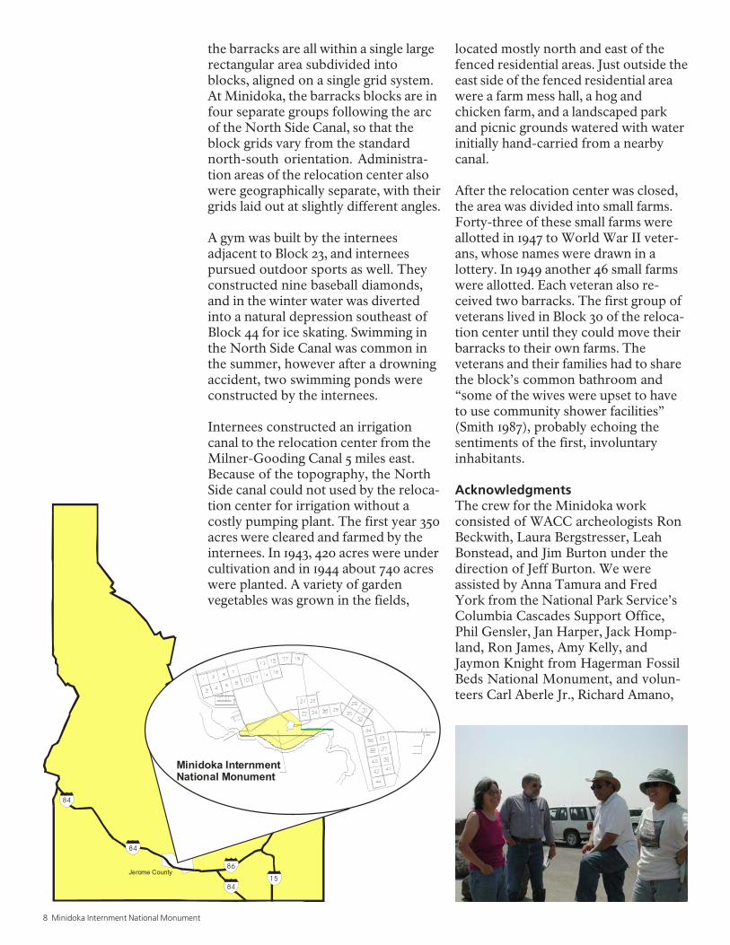
the barracks are all within a single largerectangular area subdivided intoblocks, aligned on a single grid system.At Minidoka, the barracks blocks are infour separate groups following the arcof the North Side Canal, so that theblock grids vary from the standardnorth-south orientation. Administra-tion areas of the relocation center alsowere geographically separate, with theirgrids laid out at slightly different angles.
A gym was built by the interneesadjacent to Block 23, and interneespursued outdoor sports as well. Theyconstructed nine baseball diamonds,and in the winter water was divertedinto a natural depression southeast ofBlock 44 for ice skating. Swimming inthe North Side Canal was common inthe summer, however after a drowningaccident, two swimming ponds wereconstructed by the internees.
Internees constructed an irrigationcanal to the relocation center from theMilner-Gooding Canal 5 miles east.Because of the topography, the NorthSide canal could not used by the reloca-tion center for irrigation without acostly pumping plant. The first year 350acres were cleared and farmed by theinternees. In 1943, 420 acres were undercultivation and in 1944 about 740 acreswere planted. A variety of gardenvegetables was grown in the fields,
located mostly north and east of thefenced residential areas. Just outside theeast side of the fenced residential areawere a farm mess hall, a hog andchicken farm, and a landscaped parkand picnic grounds watered with waterinitially hand-carried from a nearbycanal.
After the relocation center was closed,the area was divided into small farms.Forty-three of these small farms wereallotted in 1947 to World War II veter-ans, whose names were drawn in alottery. In 1949 another 46 small farmswere allotted. Each veteran also re-ceived two barracks. The first group ofveterans lived in Block 30 of the reloca-tion center until they could move theirbarracks to their own farms. Theveterans and their families had to sharethe block’s common bathroom and“some of the wives were upset to haveto use community shower facilities”(Smith 1987), probably echoing thesentiments of the first, involuntaryinhabitants.
AcknowledgmentsThe crew for the Minidoka workconsisted of WACC archeologists RonBeckwith, Laura Bergstresser, LeahBonstead, and Jim Burton under thedirection of Jeff Burton. We wereassisted by Anna Tamura and FredYork from the National Park Service’sColumbia Cascades Support Office,Phil Gensler, Jan Harper, Jack Homp-land, Ron James, Amy Kelly, andJaymon Knight from Hagerman FossilBeds National Monument, and volun-teers Carl Aberle Jr., Richard Amano,
84
1584
86
84
Minidoka InternmentNational Monument
Jerome County
National Park Service 9
Dick Lord, Clarinda McBurney, EmilyMomohara, Jan Rean, and TheresaTamura.
Special recognition should be given toRichard Amano, who traveled fromChicago to join in the work and assuredthat no one went hungry. Internation-ally recognized artist Roger Shimomurafrom Kansas also spent a day at the sitesharing with us his unique perspectives.The hospitality of adjacent landownersCarl Aberle Sr. and John P. Hermannwas greatly appreciated. Superinten-dent Neil King and the rest of the staffat Hagerman Fossil Beds providedexcellent support. Ron Beckwithconducted the field mapping and
drafted the maps herein. Mary Farrelledited the report and Jeff Burton didthe design and layout.
We were visited in the field by reportersfrom three television stations and threenewspapers. The publicity resulted in asteady stream of visitors, includingformer internees, local residents, andpassing vacationers, as well as senateand congressional staff. Anna Tamura,Ron James, Maya Hata Lemmon(Friends of Minidoka), and Neil Kingtook the lead in providing informationand tours to the public, allowing us toconcentrate on the archeology. Annaalso arranged to have the excavationfeatured in Archaeology magazine.
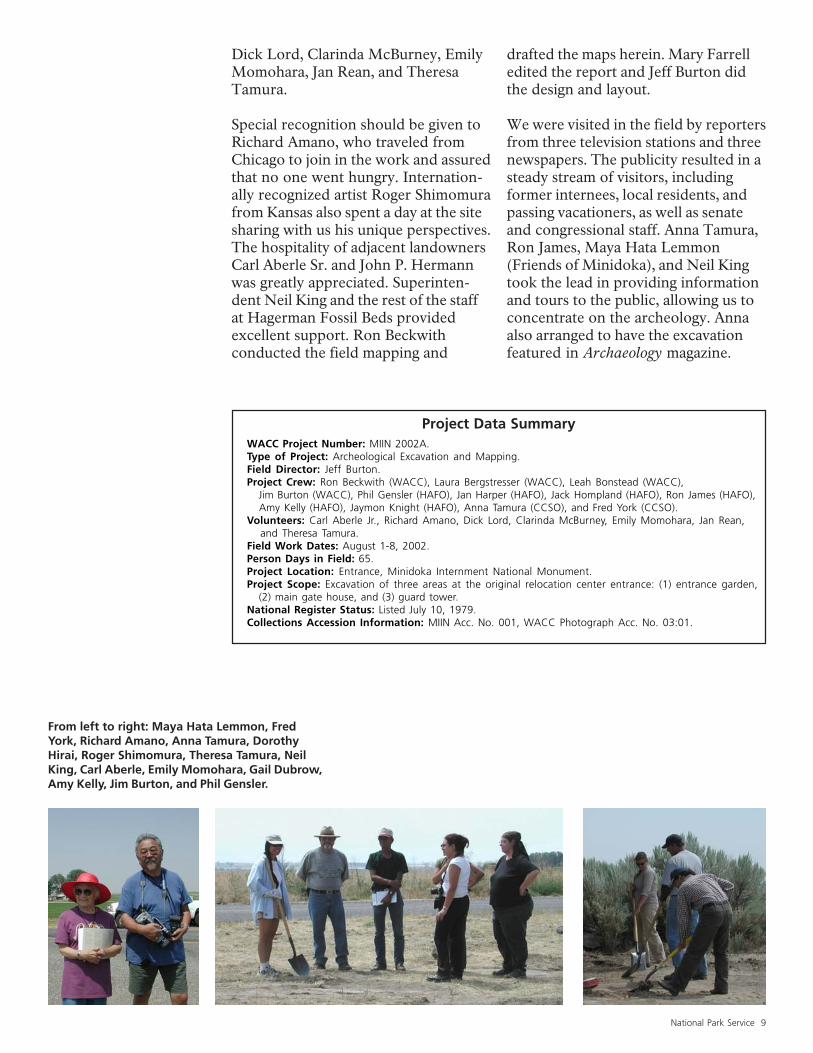
From left to right: Maya Hata Lemmon, FredYork, Richard Amano, Anna Tamura, DorothyHirai, Roger Shimomura, Theresa Tamura, NeilKing, Carl Aberle, Emily Momohara, Gail Dubrow,Amy Kelly, Jim Burton, and Phil Gensler.
Project Data SummaryWACC Project Number: MIIN 2002A.Type of Project: Archeological Excavation and Mapping.Field Director: Jeff Burton.Project Crew: Ron Beckwith (WACC), Laura Bergstresser (WACC), Leah Bonstead (WACC), Jim Burton (WACC), Phil Gensler (HAFO), Jan Harper (HAFO), Jack Hompland (HAFO), Ron James (HAFO), Amy Kelly (HAFO), Jaymon Knight (HAFO), Anna Tamura (CCSO), and Fred York (CCSO).Volunteers: Carl Aberle Jr., Richard Amano, Dick Lord, Clarinda McBurney, Emily Momohara, Jan Rean, and Theresa Tamura.Field Work Dates: August 1-8, 2002.Person Days in Field: 65.Project Location: Entrance, Minidoka Internment National Monument.Project Scope: Excavation of three areas at the original relocation center entrance: (1) entrance garden, (2) main gate house, and (3) guard tower.National Register Status: Listed July 10, 1979.Collections Accession Information: MIIN Acc. No. 001, WACC Photograph Acc. No. 03:01.
10 Minidoka Internment National Monument
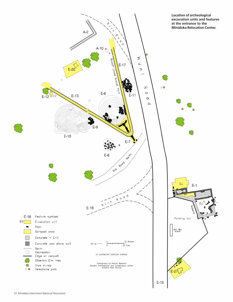
Location of archeologicalexcavation units and featuresat the entrance to theMinidoka Relocation Center.
National Park Service 11
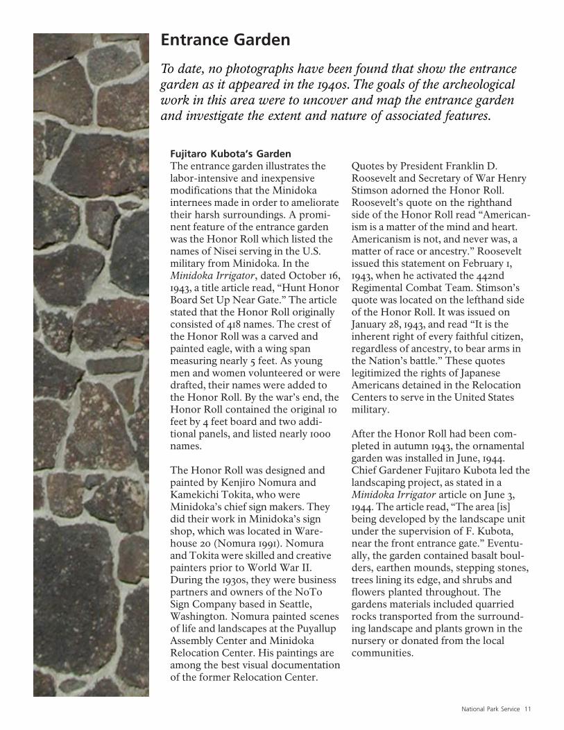
Entrance Garden
To date, no photographs have been found that show the entrancegarden as it appeared in the 1940s. The goals of the archeologicalwork in this area were to uncover and map the entrance gardenand investigate the extent and nature of associated features.
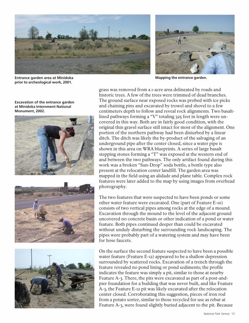
Fujitaro Kubota’s GardenThe entrance garden illustrates thelabor-intensive and inexpensivemodifications that the Minidokainternees made in order to amelioratetheir harsh surroundings. A promi-nent feature of the entrance gardenwas the Honor Roll which listed thenames of Nisei serving in the U.S.military from Minidoka. In theMinidoka Irrigator, dated October 16,1943, a title article read, “Hunt HonorBoard Set Up Near Gate.” The articlestated that the Honor Roll originallyconsisted of 418 names. The crest ofthe Honor Roll was a carved andpainted eagle, with a wing spanmeasuring nearly 5 feet. As youngmen and women volunteered or weredrafted, their names were added tothe Honor Roll. By the war’s end, theHonor Roll contained the original 10feet by 4 feet board and two addi-tional panels, and listed nearly 1000names.
The Honor Roll was designed andpainted by Kenjiro Nomura andKamekichi Tokita, who wereMinidoka’s chief sign makers. Theydid their work in Minidoka’s signshop, which was located in Ware-house 20 (Nomura 1991). Nomuraand Tokita were skilled and creativepainters prior to World War II.During the 1930s, they were businesspartners and owners of the NoToSign Company based in Seattle,Washington. Nomura painted scenesof life and landscapes at the PuyallupAssembly Center and MinidokaRelocation Center. His paintings areamong the best visual documentationof the former Relocation Center.
Quotes by President Franklin D.Roosevelt and Secretary of War HenryStimson adorned the Honor Roll.Roosevelt’s quote on the righthandside of the Honor Roll read “American-ism is a matter of the mind and heart.Americanism is not, and never was, amatter of race or ancestry.” Rooseveltissued this statement on February 1,1943, when he activated the 442ndRegimental Combat Team. Stimson’squote was located on the lefthand sideof the Honor Roll. It was issued onJanuary 28, 1943, and read “It is theinherent right of every faithful citizen,regardless of ancestry, to bear arms inthe Nation’s battle.” These quoteslegitimized the rights of JapaneseAmericans detained in the RelocationCenters to serve in the United Statesmilitary.
After the Honor Roll had been com-pleted in autumn 1943, the ornamentalgarden was installed in June, 1944.Chief Gardener Fujitaro Kubota led thelandscaping project, as stated in aMinidoka Irrigator article on June 3,1944. The article read, “The area [is]being developed by the landscape unitunder the supervision of F. Kubota,near the front entrance gate.” Eventu-ally, the garden contained basalt boul-ders, earthen mounds, stepping stones,trees lining its edge, and shrubs andflowers planted throughout. Thegardens materials included quarriedrocks transported from the surround-ing landscape and plants grown in thenursery or donated from the localcommunities.
12 Minidoka Internment National Monument
Note the stepping stonesleading up to the three-panelHonor Roll at the MinidokaRelocation Center (MinidokaHigh School Yearbook 1945).
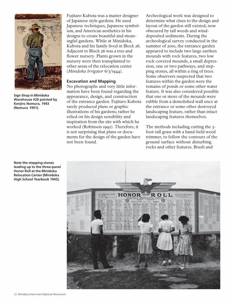
Sign Shop in MinidokaWarehouse #20 painted byKenjiro Nomura, 1943(Nomura 1991).
Fujitaro Kubota was a master designerof Japanese style gardens. He usedJapanese techniques, Japanese symbol-ism, and American aesthetics in hisdesigns to create beautiful and mean-ingful gardens. While at Minidoka,Kubota and his family lived in Block 26.Adjacent to Block 26 was a tree andflower nursery. Plants grown in thenursery were then transplanted toother areas of the relocation center(Minidoka Irrigator 6/3/1944).
Excavation and MappingNo photographs and very little infor-mation have been found regarding theappearance, design, and constructionof the entrance garden. Fujitaro Kubotararely produced plans or graphicillustrations of his gardens; rather herelied on his design sensibility andinspiration from the site with which heworked (Robinson 1992). Therefore, itis not surprising that plans or docu-ments for the design of the garden havenot been found.
Archeological work was designed todetermine what clues to the design andlayout of the garden still existed, nowobscured by tall weeds and wind-deposited sediments. During thearcheological survey conducted in thesummer of 2001, the entrance gardenappeared to include two large earthenmounds with rock features, two lowrock-covered mounds, a small depres-sion, one or two pathways, and step-ping stones, all within a ring of trees.Some observers suspected that twofeatures within the garden were theremains of ponds or some other waterfeature. It was also considered possiblethat one or more of the mounds wererubble from a demolished wall once atthe entrance or some other destroyedlandscaping feature, rather than intactlandscaping features themselves.
The methods including cutting the 3-foot-tall grass with a hand-held weedtrimmer, to follow the contours of theground surface without disturbingrocks and other features. Brush and
National Park Service 13
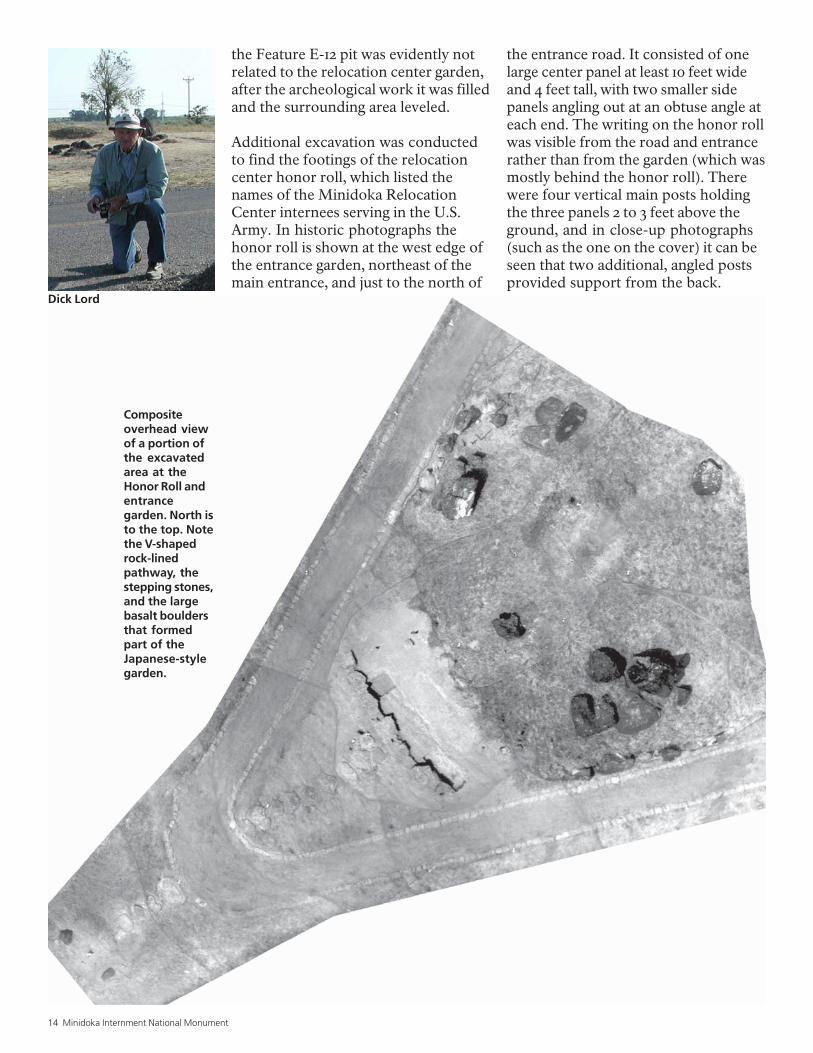
grass was removed from a 1-acre area delineated by roads andhistoric trees. A few of the trees were trimmed of dead branches.The ground surface near exposed rocks was probed with ice picksand chaining pins and excavated by trowel and shovel to a fewcentimeters depth to follow and reveal rock alignments. Two basalt-lined pathways forming a “V” totaling 325 feet in length were un-covered in this way. Both are in fairly good condition, with theoriginal thin gravel surface still intact for most of the alignment. Oneportion of the northern pathway had been disturbed by a linearditch. The ditch was likely the by-product of the salvaging of anunderground pipe after the center closed, since a water pipe isshown in this area on WRA blueprints. A series of large basaltstepping stones forming a “T” was exposed at the western end ofand between the two pathways. The only artifact found during thiswork was a broken “Sun-Drop” soda bottle, a bottle type alsopresent at the relocation center landfill. The garden area wasmapped in the field using an alidade and plane table. Complex rockfeatures were later added to the map by using images from overheadphotography.
The two features that were suspected to have been ponds or someother water feature were excavated. One (part of Feature E-10)consists of two vertical pipes among rocks at the edge of a mound.Excavation through the mound to the level of the adjacent grounduncovered no concrete basin or other indication of a pond or waterfeature. Both pipes continued deeper than could be excavatedwithout unduly disturbing the surrounding rock landscaping. Thepipes were probably part of a watering system and may have beenfor hose faucets.
On the surface the second feature suspected to have been a possiblewater feature (Feature E-12) appeared to be a shallow depressionsurrounded by scattered rocks. Excavation of a trench through thefeature revealed no pond lining or pond sediments; the profileindicates the feature was simply a pit, similar to those at nearbyFeature A-3. There, the pits were excavated as part of a post-and-pier foundation for a building that was never built, and like FeatureA-3, the Feature E-12 pit was likely excavated after the relocationcenter closed. Corroborating this suggestion, pieces of iron rodfrom a potato sorter, similar to those recycled for use as rebar atFeature A-3, were found slightly buried adjacent to the pit. Because
Entrance garden area at Minidokaprior to archeological work, 2001.
Mapping the entrance garden.
Excavation of the entrance gardenat Minidoka Internment NationalMonument, 2002.
14 Minidoka Internment National Monument
the Feature E-12 pit was evidently notrelated to the relocation center garden,after the archeological work it was filledand the surrounding area leveled.
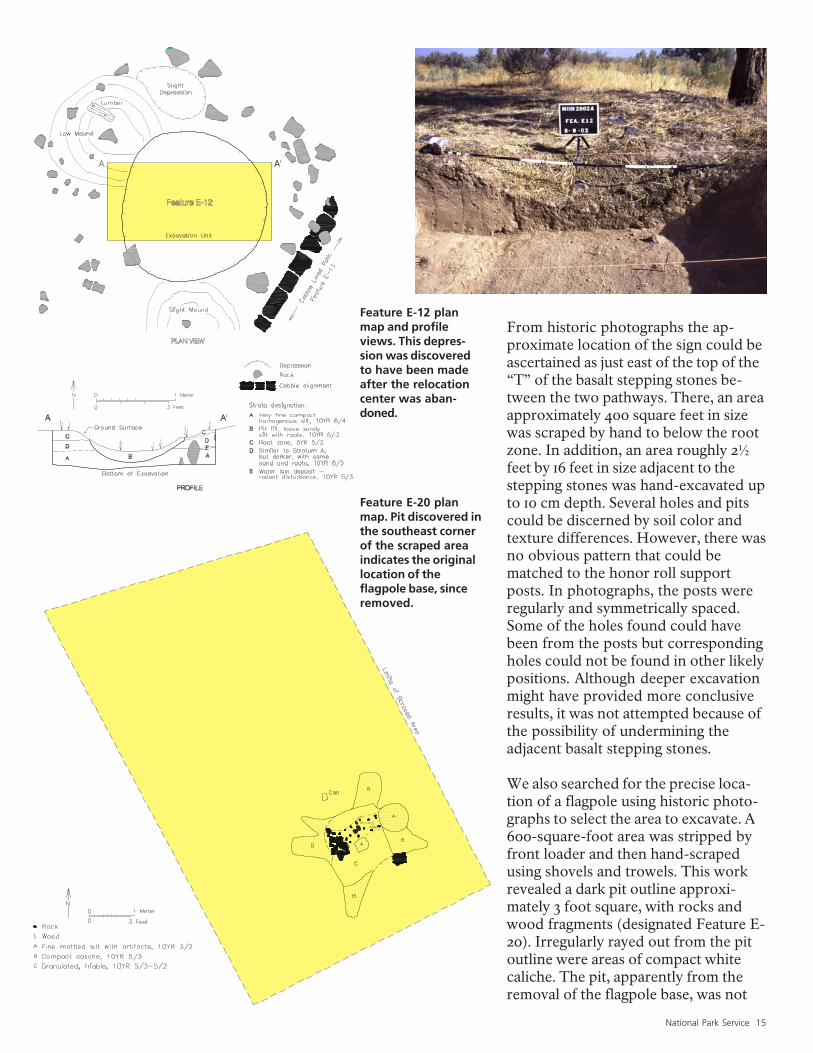
Additional excavation was conductedto find the footings of the relocationcenter honor roll, which listed thenames of the Minidoka RelocationCenter internees serving in the U.S.Army. In historic photographs thehonor roll is shown at the west edge ofthe entrance garden, northeast of themain entrance, and just to the north of
the entrance road. It consisted of onelarge center panel at least 10 feet wideand 4 feet tall, with two smaller sidepanels angling out at an obtuse angle ateach end. The writing on the honor rollwas visible from the road and entrancerather than from the garden (which wasmostly behind the honor roll). Therewere four vertical main posts holdingthe three panels 2 to 3 feet above theground, and in close-up photographs(such as the one on the cover) it can beseen that two additional, angled postsprovided support from the back.
Compositeoverhead viewof a portion ofthe excavatedarea at theHonor Roll andentrancegarden. North isto the top. Notethe V-shapedrock-linedpathway, thestepping stones,and the largebasalt bouldersthat formedpart of theJapanese-stylegarden.
Dick Lord
National Park Service 15
From historic photographs the ap-proximate location of the sign could beascertained as just east of the top of the“T” of the basalt stepping stones be-tween the two pathways. There, an areaapproximately 400 square feet in sizewas scraped by hand to below the rootzone. In addition, an area roughly 2½feet by 16 feet in size adjacent to thestepping stones was hand-excavated upto 10 cm depth. Several holes and pitscould be discerned by soil color andtexture differences. However, there wasno obvious pattern that could bematched to the honor roll supportposts. In photographs, the posts wereregularly and symmetrically spaced.Some of the holes found could havebeen from the posts but correspondingholes could not be found in other likelypositions. Although deeper excavationmight have provided more conclusiveresults, it was not attempted because ofthe possibility of undermining theadjacent basalt stepping stones.
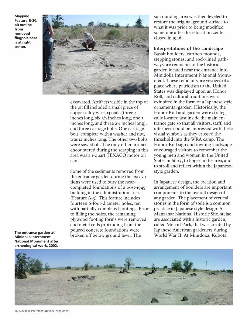
We also searched for the precise loca-tion of a flagpole using historic photo-graphs to select the area to excavate. A600-square-foot area was stripped byfront loader and then hand-scrapedusing shovels and trowels. This workrevealed a dark pit outline approxi-mately 3 foot square, with rocks andwood fragments (designated Feature E-20). Irregularly rayed out from the pitoutline were areas of compact whitecaliche. The pit, apparently from theremoval of the flagpole base, was not
Feature E-12 planmap and profileviews. This depres-sion was discoveredto have been madeafter the relocationcenter was aban-doned.
Feature E-20 planmap. Pit discovered inthe southeast cornerof the scraped areaindicates the originallocation of theflagpole base, sinceremoved.
16 Minidoka Internment National Monument
excavated. Artifacts visible in the top ofthe pit fill included a small piece ofcopper alloy wire, 13 nails (three 4inches long, six 3½ inches long, one 3inches long, and three 2½ inches long),and three carriage bolts. One carriagebolt, complete with a washer and nut,was 12 inches long. The other two boltswere sawed off. The only other artifactencountered during the scraping in thisarea was a 1-quart TEXACO motor oilcan.
Some of the sediments removed fromthe entrance garden during the excava-tions were used to bury the near-completed foundations of a post-1945building in the administration area(Feature A-3). This feature includesfourteen 6-foot-diameter holes, tenwith partially completed footings. Priorto filling the holes, the remainingplywood footing forms were removedand metal rods protruding from thepoured concrete foundations werebroken off below ground level. The
surrounding area was then leveled torestore the original ground surface towhat it was prior to being modifiedsometime after the relocation centerclosed in 1946.
Interpretations of the LandscapeBasalt boulders, earthen mounds,stepping stones, and rock-lined path-ways are remnants of the historicgarden located near the entrance intoMinidoka Internment National Monu-ment. These remnants are vestiges of aplace where patriotism to the UnitedStates was displayed upon an HonorRoll, and cultural traditions wereexhibited in the form of a Japanese styleornamental garden. Historically, theHonor Roll and garden were strategi-cally located just inside the main en-trance gate so that all visitors, staff, andinternees could be impressed with thesevisual symbols as they crossed thethreshold into the WRA camp. TheHonor Roll sign and inviting landscapeencouraged visitors to remember theyoung men and women in the UnitedStates military, to linger in the area, andto stroll and reflect within the Japanese-style garden.
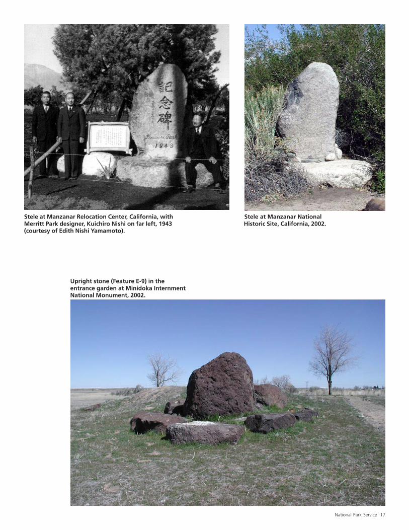
In Japanese design, the location andarrangement of boulders are importantcomponents to the overall design ofany garden. The placement of verticalstones in the form of stele is a commonpractice in Japanese style design. AtManzanar National Historic Site, stelaeare associated with a historic garden,called Merritt Park, that was created byJapanese American gardeners duringWorld War II. At Minidoka, Kubota
The entrance garden atMinidoka InternmentNational Monument afterarcheological work, 2002.
MappingFeature E-20,pit outlinefromremovedflagpole baseis at rightcenter.
National Park Service 17
Stele at Manzanar Relocation Center, California, with Stele at Manzanar NationalMerritt Park designer, Kuichiro Nishi on far left, 1943 Historic Site, California, 2002.(courtesy of Edith Nishi Yamamoto).
Upright stone (Feature E-9) in theentrance garden at Minidoka InternmentNational Monument, 2002.
18 Minidoka Internment National Monument
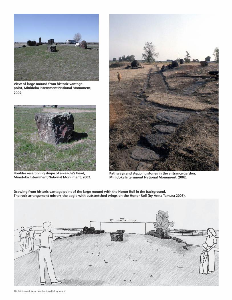
Pathways and stepping stones in the entrance garden,Minidoka Internment National Monument, 2002.
Drawing from historic vantage point of the large mound with the Honor Roll in the background.The rock arrangement mirrors the eagle with outstretched wings on the Honor Roll (by Anna Tamura 2003).
Boulder resembling shape of an eagle’s head,Minidoka Internment National Monument, 2002.
View of large mound from historic vantagepoint, Minidoka Internment National Monument,2002.
National Park Service 19
created an arrangement of boul-ders with the vertical stoneforming its centerpiece.
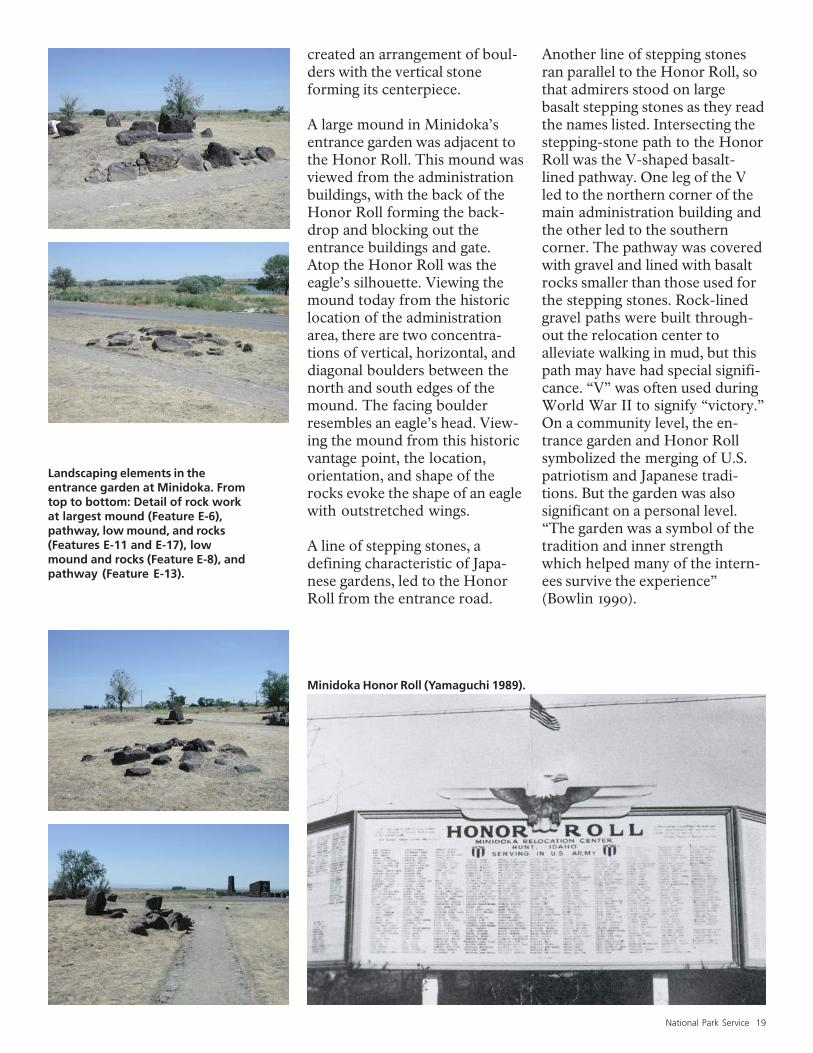
A large mound in Minidoka’sentrance garden was adjacent tothe Honor Roll. This mound wasviewed from the administrationbuildings, with the back of theHonor Roll forming the back-drop and blocking out theentrance buildings and gate.Atop the Honor Roll was theeagle’s silhouette. Viewing themound today from the historiclocation of the administrationarea, there are two concentra-tions of vertical, horizontal, anddiagonal boulders between thenorth and south edges of themound. The facing boulderresembles an eagle’s head. View-ing the mound from this historicvantage point, the location,orientation, and shape of therocks evoke the shape of an eaglewith outstretched wings.
A line of stepping stones, adefining characteristic of Japa-nese gardens, led to the HonorRoll from the entrance road.
Another line of stepping stonesran parallel to the Honor Roll, sothat admirers stood on largebasalt stepping stones as they readthe names listed. Intersecting thestepping-stone path to the HonorRoll was the V-shaped basalt-lined pathway. One leg of the Vled to the northern corner of themain administration building andthe other led to the southerncorner. The pathway was coveredwith gravel and lined with basaltrocks smaller than those used forthe stepping stones. Rock-linedgravel paths were built through-out the relocation center toalleviate walking in mud, but thispath may have had special signifi-cance. “V” was often used duringWorld War II to signify “victory.”On a community level, the en-trance garden and Honor Rollsymbolized the merging of U.S.patriotism and Japanese tradi-tions. But the garden was alsosignificant on a personal level.“The garden was a symbol of thetradition and inner strengthwhich helped many of the intern-ees survive the experience”(Bowlin 1990).
Minidoka Honor Roll (Yamaguchi 1989).
Landscaping elements in theentrance garden at Minidoka. Fromtop to bottom: Detail of rock workat largest mound (Feature E-6),pathway, low mound, and rocks(Features E-11 and E-17), lowmound and rocks (Feature E-8), andpathway (Feature E-13).
20 Minidoka Internment National Monument
MilitaryPolice
Building
ReceptionBuilding
IV
IIIIIIV
IV
IV
II
III
II
a
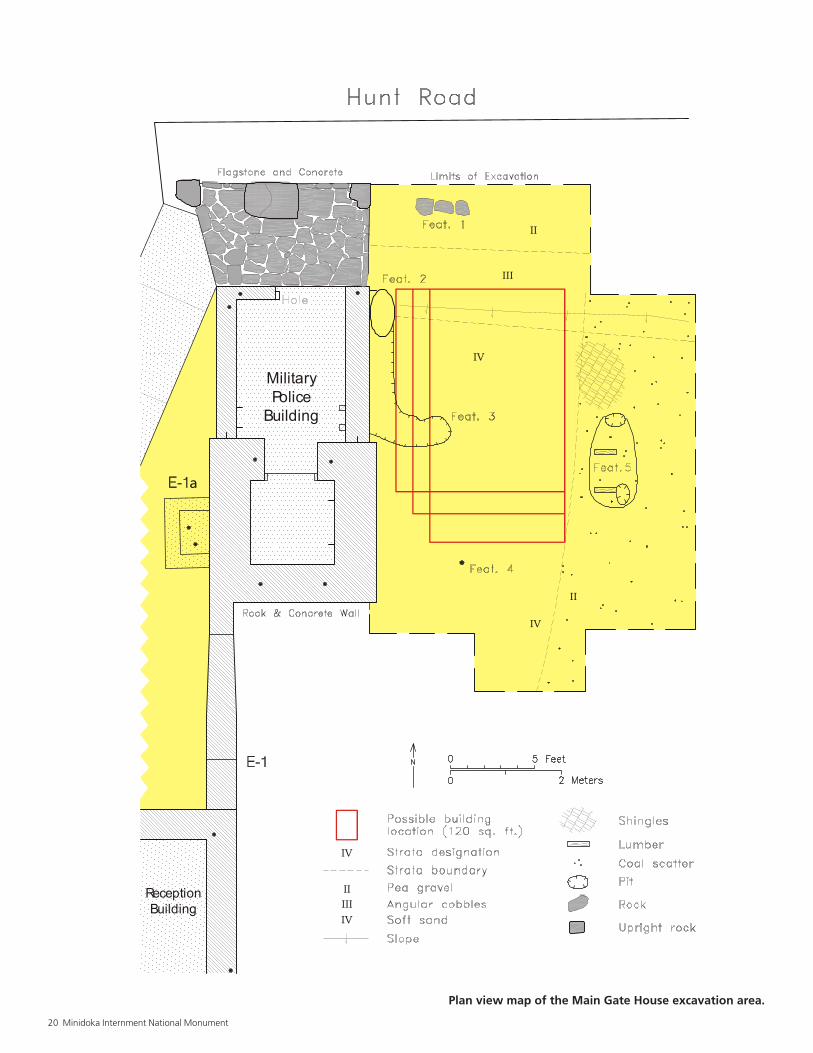
Plan view map of the Main Gate House excavation area.
National Park Service 21
Entrance Buildings
The two buildings currently at the entrance, the “Military PoliceBuilding” and the “Reception Building,” are perhaps the mostsignificant remains at Minidoka. However, a guard tower and twoadditional buildings were also at the entrance during WW II.
Historical EvidenceThe documentary evidence for thebuildings at the entrance area is some-what puzzling, and perhaps contradic-tory. A 1945 War Relocation Authorityblueprint shows a complex of fourbuildings at the entrance labeled Mili-tary Police Building, Reception Build-ing, Main Gate House, and Gate Build-ing. None of these buildings are shownon a 1942 blueprint of the relocationcenter. The still-standing MilitaryPolice Building and the ReceptionBuilding must have been built first,since they appear alone in severalhistorical photographs.
The Reception Building is rectangular,about 14 feet by 31 feet in size. Theremains consist of low walls, about 3feet high, of mortared uncoursed largebasalt rocks. A fireplace and 16-foot-high chimney, both of the same basaltrock construction, are incorporatedinto the east side. An entry is locatedalong the western part of the north end.A concrete slab forms the floor. His-torical photographs depict a modestbuilding with upper walls of board-and-batten construction, and a low-pitched gable roof.
The Military Police Building is 12 feetnorth of the Reception Building; itswest wall is connected to the east wallof the Reception Building by a lowstone wall. The low stone wall is visiblein early photographs taken before thethird and fourth buildings at the en-trance were constructed. In fact, thewall is bonded to the Military PoliceBuilding, indicating it was built at thesame time. The low wall abuts theReception Building, which means thatthe Reception Building was built first,
but the similarities in methods andmaterials suggest there was very littletime gap, perhaps days instead ofweeks, in the construction episodes.Above the low stone wall in historicalphotographs is a fence, apparentlyconstructed of parallel vertically-setlumber capped by a horizontal board.
The Military Police Building consists oftwo rooms. The southernmost, withthick, uncoursed basalt walls up to 10½feet high, measures 9½ by 10 feet on theexterior but only 5 foot square in theinterior. A doorway is centered on thenorth side. With such thick walls andno windows, the southern room ap-pears to have been built for defense orsecurity. This may not indicate particu-lar concern or paranoia about theinternees, however; the building mayhave been constructed following astandard military police plan using localmaterials. The southernmost room wasbuilt first; abutted to its north side arelow walls similar to those of the Recep-tion Building, to form an anteroom thatmeasures 9 feet by 9 feet exterior and 6feet by 8 feet interior. The entrance is onthe east half of the north wall. Thisbuilding also has a concrete slab floor,and flagstone paving at the entrance.Historical photographs show that theupper part of the north room wasconstructed of wood and windows, andthat each room had its own shed roof,with the north room’s draining northand the slightly higher roof of the southroom draining south. A windowedcupola on the roof provided naturallight to the south room.
On the 1945 blueprint the Main GateHouse is east of the Military Police
22 Minidoka Internment National Monument
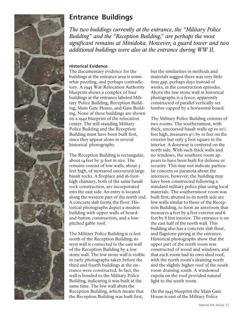
Entrance building in the foreground and the Honor Roll, watertower, and flagpole located inside Minidoka Relocation Center,late 1944 or early 1945 (Wing Luke Asian Museum).
Truck leaving Minidoka (Yamaguchi 1989).
Building; its square footage is listed as120. In one historical photograph (seeContents page), the Main Gate Houseappears to be constructed of woodwith a gable roof and an awning in thefront. The Main Gate House appears toextend out a little from the MilitaryPolice Building, but the photograph isnot very distinct. The pattern of sun-light and shadows suggests that theMain Gate House is at least several feetto the east of the Military Police Build-ing; if not, the Military Police Buildingwould had shaded it from the after-noon sun. Further, the floor sills androof lines of both buildings appear tobe on the same alignment, rather thanoffset as one would expect if the MainGate House was set further north.Therefore, one can conclude that thefront facades of both buildings are onthe same plane, even though the aw-ning of the Main Gate House doesextend out to the north.
Also in the historical photograph, theoutlines of a window and a door of theMain Gate House are faintly visible onthe north wall; the window is on theeast half, the door on the west, closestto the Military Police Building. Theback of the structure is blocked by theMilitary Police Building in the photo-graph, but it is clear that it does notextend beyond this building. It alsoappears that there is a power polelocated at the back of this structure,further delineating its length. Thephotograph indicates that the front ofthe Main Gate House is approximatelyas wide as the front of the MilitaryPolice Building, which is nine feetacross. Another historical photograph(see page 23) shows the east side of theMilitary Police Building prior to theconstruction of the Main Gate House.A power pole, most likely the onevisible behind the Main Gate House inthe other historical photograph, can beseen in this view. Combining evidencefrom the historical photographs, theblueprint location, and the listed size ofthe Main Gate House, its location canbe estimated to within a few yards.
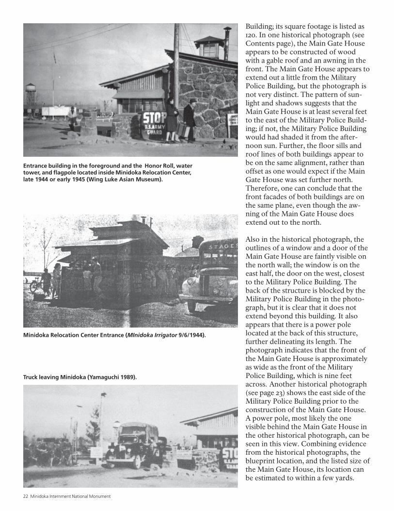
Minidoka Relocation Center Entrance (MInidoka Irrigator 9/6/1944).
National Park Service 23
Minidoka Relocation Center Entrance, from theinside looking out (Minidoka Irrigator 9/19/1944).
Minidoka Relocation Center Entrance,late 1945 (a still frame from a homemovie, Nakamura 1994).
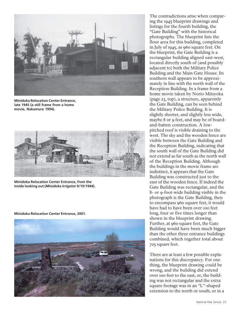
Minidoka Relocation Center Entrance, 2001.
The contradictions arise when compar-ing the 1945 blueprint drawings andlistings for the fourth building, the“Gate Building” with the historicalphotographs. The blueprint lists thefloor area for this building, completedin July of 1945, as 960 square feet. Onthe blueprint, the Gate Building is arectangular building aligned east-west,located directly south of (and possiblyadjacent to) both the Military PoliceBuilding and the Main Gate House. Itssouthern wall appears to be approxi-mately in line with the north wall of theReception Building. In a frame from ahome movie taken by Norio Mitsyoka(page 23, top), a structure, apparentlythe Gate Building, can be seen behindthe Military Police Building. It isslightly shorter, and slightly less wide,maybe 8 or 9 feet, and may be of board-and-batten construction. A low-pitched roof is visible draining to thewest. The sky and the wooden fence arevisible between the Gate Building andthe Reception Building, indicating thatthe south wall of the Gate Building didnot extend as far south as the north wallof the Reception Building. Althoughthe buildings in the movie frame areindistinct, it appears that the GateBuilding was constructed just to theeast of the wooden fence. If indeed theGate Building was rectangular, and the8- or 9-foot-wide building visible in thephotograph is the Gate Building, thento encompass 960 square feet, it wouldhave had to have been over 100 feetlong, four or five times longer thanshown in the blueprint drawing.Further, at 960 square feet, the GateBuilding would have been much biggerthan the other three entrance buildingscombined, which together total about725 square feet.
There are at least a few possible expla-nations for this discrepancy. For onething, the blueprint drawing could bewrong, and the building did extendover 100 feet to the east, or, the build-ing was not rectangular and the extrasquare footage was in an “L”-shapedextension to the north or south, or in a
24 Minidoka Internment National Monument
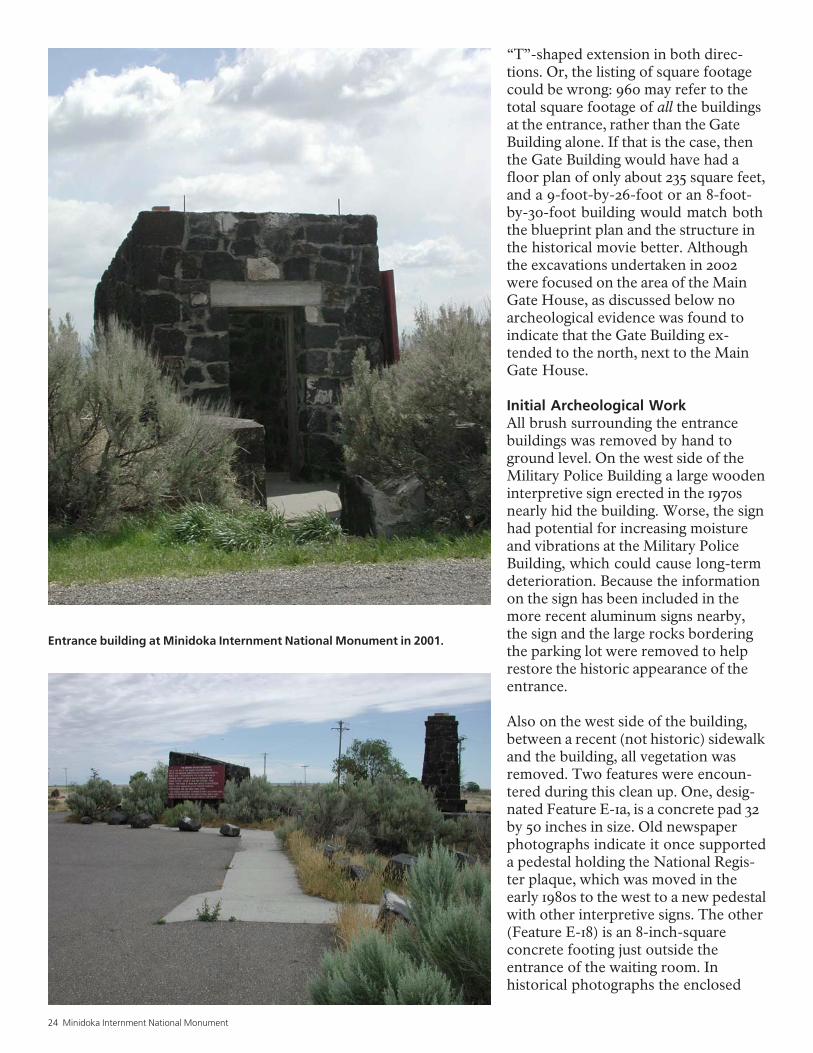
Entrance building at Minidoka Internment National Monument in 2001.
“T”-shaped extension in both direc-tions. Or, the listing of square footagecould be wrong: 960 may refer to thetotal square footage of all the buildingsat the entrance, rather than the GateBuilding alone. If that is the case, thenthe Gate Building would have had afloor plan of only about 235 square feet,and a 9-foot-by-26-foot or an 8-foot-by-30-foot building would match boththe blueprint plan and the structure inthe historical movie better. Althoughthe excavations undertaken in 2002were focused on the area of the MainGate House, as discussed below noarcheological evidence was found toindicate that the Gate Building ex-tended to the north, next to the MainGate House.
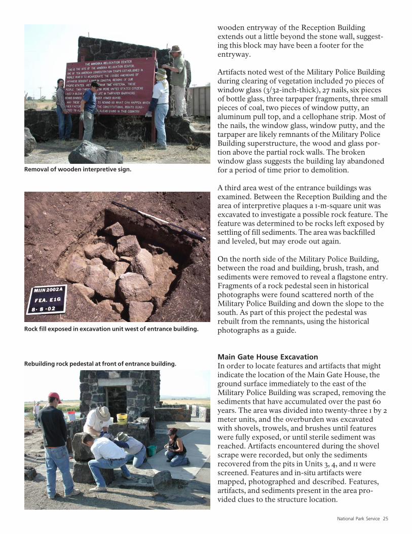
Initial Archeological WorkAll brush surrounding the entrancebuildings was removed by hand toground level. On the west side of theMilitary Police Building a large woodeninterpretive sign erected in the 1970snearly hid the building. Worse, the signhad potential for increasing moistureand vibrations at the Military PoliceBuilding, which could cause long-termdeterioration. Because the informationon the sign has been included in themore recent aluminum signs nearby,the sign and the large rocks borderingthe parking lot were removed to helprestore the historic appearance of theentrance.
Also on the west side of the building,between a recent (not historic) sidewalkand the building, all vegetation wasremoved. Two features were encoun-tered during this clean up. One, desig-nated Feature E-1a, is a concrete pad 32by 50 inches in size. Old newspaperphotographs indicate it once supporteda pedestal holding the National Regis-ter plaque, which was moved in theearly 1980s to the west to a new pedestalwith other interpretive signs. The other(Feature E-18) is an 8-inch-squareconcrete footing just outside theentrance of the waiting room. Inhistorical photographs the enclosed
National Park Service 25
Removal of wooden interpretive sign.
Rock fill exposed in excavation unit west of entrance building.
Rebuilding rock pedestal at front of entrance building.
wooden entryway of the Reception Buildingextends out a little beyond the stone wall, suggest-ing this block may have been a footer for theentryway.
Artifacts noted west of the Military Police Buildingduring clearing of vegetation included 70 pieces ofwindow glass (3/32-inch-thick), 27 nails, six piecesof bottle glass, three tarpaper fragments, three smallpieces of coal, two pieces of window putty, analuminum pull top, and a cellophane strip. Most ofthe nails, the window glass, window putty, and thetarpaper are likely remnants of the Military PoliceBuilding superstructure, the wood and glass por-tion above the partial rock walls. The brokenwindow glass suggests the building lay abandonedfor a period of time prior to demolition.
A third area west of the entrance buildings wasexamined. Between the Reception Building and thearea of interpretive plaques a 1-m-square unit wasexcavated to investigate a possible rock feature. Thefeature was determined to be rocks left exposed bysettling of fill sediments. The area was backfilledand leveled, but may erode out again.
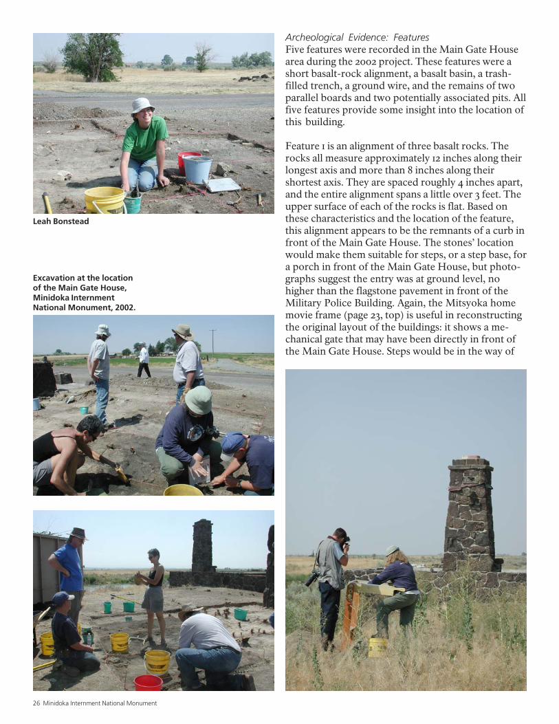
On the north side of the Military Police Building,between the road and building, brush, trash, andsediments were removed to reveal a flagstone entry.Fragments of a rock pedestal seen in historicalphotographs were found scattered north of theMilitary Police Building and down the slope to thesouth. As part of this project the pedestal wasrebuilt from the remnants, using the historicalphotographs as a guide.
Main Gate House ExcavationIn order to locate features and artifacts that mightindicate the location of the Main Gate House, theground surface immediately to the east of theMilitary Police Building was scraped, removing thesediments that have accumulated over the past 60years. The area was divided into twenty-three 1 by 2meter units, and the overburden was excavatedwith shovels, trowels, and brushes until featureswere fully exposed, or until sterile sediment wasreached. Artifacts encountered during the shovelscrape were recorded, but only the sedimentsrecovered from the pits in Units 3, 4, and 11 werescreened. Features and in-situ artifacts weremapped, photographed and described. Features,artifacts, and sediments present in the area pro-vided clues to the structure location.
26 Minidoka Internment National Monument
Excavation at the locationof the Main Gate House,Minidoka InternmentNational Monument, 2002.
Archeological Evidence: FeaturesFive features were recorded in the Main Gate Housearea during the 2002 project. These features were ashort basalt-rock alignment, a basalt basin, a trash-filled trench, a ground wire, and the remains of twoparallel boards and two potentially associated pits. Allfive features provide some insight into the location ofthis building.
Feature 1 is an alignment of three basalt rocks. Therocks all measure approximately 12 inches along theirlongest axis and more than 8 inches along theirshortest axis. They are spaced roughly 4 inches apart,and the entire alignment spans a little over 3 feet. Theupper surface of each of the rocks is flat. Based onthese characteristics and the location of the feature,this alignment appears to be the remnants of a curb infront of the Main Gate House. The stones’ locationwould make them suitable for steps, or a step base, fora porch in front of the Main Gate House, but photo-graphs suggest the entry was at ground level, nohigher than the flagstone pavement in front of theMilitary Police Building. Again, the Mitsyoka homemovie frame (page 23, top) is useful in reconstructingthe original layout of the buildings: it shows a me-chanical gate that may have been directly in front ofthe Main Gate House. Steps would be in the way of
Leah Bonstead
National Park Service 27
Mili
tary
Po
lice
Build
ing
Fea. 1
Fea. 2
Fea. 3
Fea. 4
Fea. 5
1
2
3
4
11
12
13
14
5
6
7
8
15
16
17
18
23
9
10
19
20
21
22
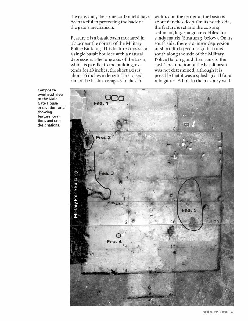
Compositeoverhead viewof the MainGate Houseexcavation areashowingfeature loca-tions and unitdesignations.
the gate, and, the stone curb might havebeen useful in protecting the back ofthe gate’s mechanism.
Feature 2 is a basalt basin mortared inplace near the corner of the MilitaryPolice Building. This feature consists ofa single basalt boulder with a naturaldepression. The long axis of the basin,which is parallel to the building, ex-tends for 28 inches; the short axis isabout 16 inches in length. The raisedrim of the basin averages 2 inches in
width, and the center of the basin isabout 6 inches deep. On its north side,the feature is set into the existingsediment, large, angular cobbles in asandy matrix (Stratum 3, below). On itssouth side, there is a linear depressionor short ditch (Feature 3) that runssouth along the side of the MilitaryPolice Building and then runs to theeast. The function of the basalt basinwas not determined, although it ispossible that it was a splash guard for arain gutter. A bolt in the masonry wall
28 Minidoka Internment National Monument
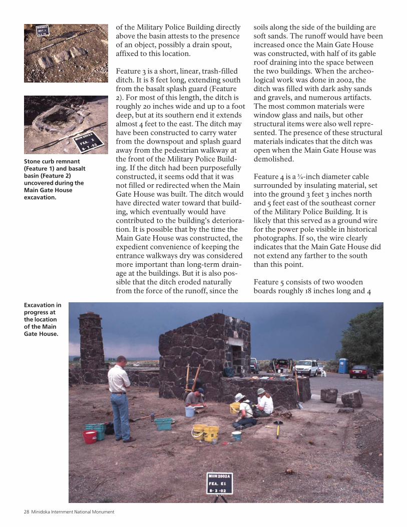
Excavation inprogress atthe locationof the MainGate House.
of the Military Police Building directlyabove the basin attests to the presenceof an object, possibly a drain spout,affixed to this location.
Feature 3 is a short, linear, trash-filledditch. It is 8 feet long, extending southfrom the basalt splash guard (Feature2). For most of this length, the ditch isroughly 20 inches wide and up to a footdeep, but at its southern end it extendsalmost 4 feet to the east. The ditch mayhave been constructed to carry waterfrom the downspout and splash guardaway from the pedestrian walkway atthe front of the Military Police Build-ing. If the ditch had been purposefullyconstructed, it seems odd that it wasnot filled or redirected when the MainGate House was built. The ditch wouldhave directed water toward that build-ing, which eventually would havecontributed to the building’s deteriora-tion. It is possible that by the time theMain Gate House was constructed, theexpedient convenience of keeping theentrance walkways dry was consideredmore important than long-term drain-age at the buildings. But it is also pos-sible that the ditch eroded naturallyfrom the force of the runoff, since the
soils along the side of the building aresoft sands. The runoff would have beenincreased once the Main Gate Housewas constructed, with half of its gableroof draining into the space betweenthe two buildings. When the archeo-logical work was done in 2002, theditch was filled with dark ashy sandsand gravels, and numerous artifacts.The most common materials werewindow glass and nails, but otherstructural items were also well repre-sented. The presence of these structuralmaterials indicates that the ditch wasopen when the Main Gate House wasdemolished.
Feature 4 is a ¾-inch diameter cablesurrounded by insulating material, setinto the ground 3 feet 3 inches northand 5 feet east of the southeast cornerof the Military Police Building. It islikely that this served as a ground wirefor the power pole visible in historicalphotographs. If so, the wire clearlyindicates that the Main Gate House didnot extend any farther to the souththan this point.
Feature 5 consists of two woodenboards roughly 18 inches long and 4
Stone curb remnant(Feature 1) and basaltbasin (Feature 2)uncovered during theMain Gate Houseexcavation.
National Park Service 29
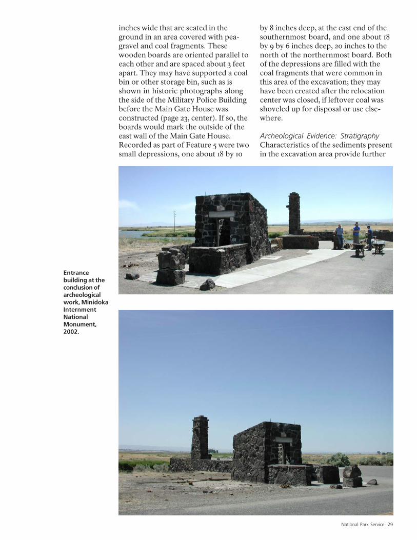
Entrancebuilding at theconclusion ofarcheologicalwork, MinidokaInternmentNationalMonument,2002.
inches wide that are seated in theground in an area covered with pea-gravel and coal fragments. Thesewooden boards are oriented parallel toeach other and are spaced about 3 feetapart. They may have supported a coalbin or other storage bin, such as isshown in historic photographs alongthe side of the Military Police Buildingbefore the Main Gate House wasconstructed (page 23, center). If so, theboards would mark the outside of theeast wall of the Main Gate House.Recorded as part of Feature 5 were twosmall depressions, one about 18 by 10
by 8 inches deep, at the east end of thesouthernmost board, and one about 18by 9 by 6 inches deep, 20 inches to thenorth of the northernmost board. Bothof the depressions are filled with thecoal fragments that were common inthis area of the excavation; they mayhave been created after the relocationcenter was closed, if leftover coal wasshoveled up for disposal or use else-where.
Archeological Evidence: StratigraphyCharacteristics of the sediments presentin the excavation area provide further
30 Minidoka Internment National Monument
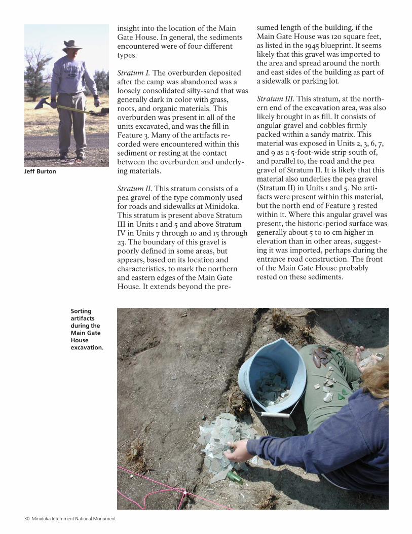
Sortingartifactsduring theMain GateHouseexcavation.
insight into the location of the MainGate House. In general, the sedimentsencountered were of four differenttypes.
Stratum I. The overburden depositedafter the camp was abandoned was aloosely consolidated silty-sand that wasgenerally dark in color with grass,roots, and organic materials. Thisoverburden was present in all of theunits excavated, and was the fill inFeature 3. Many of the artifacts re-corded were encountered within thissediment or resting at the contactbetween the overburden and underly-ing materials.
Stratum II. This stratum consists of apea gravel of the type commonly usedfor roads and sidewalks at Minidoka.This stratum is present above StratumIII in Units 1 and 5 and above StratumIV in Units 7 through 10 and 15 through23. The boundary of this gravel ispoorly defined in some areas, butappears, based on its location andcharacteristics, to mark the northernand eastern edges of the Main GateHouse. It extends beyond the pre-
sumed length of the building, if theMain Gate House was 120 square feet,as listed in the 1945 blueprint. It seemslikely that this gravel was imported tothe area and spread around the northand east sides of the building as part ofa sidewalk or parking lot.
Stratum III. This stratum, at the north-ern end of the excavation area, was alsolikely brought in as fill. It consists ofangular gravel and cobbles firmlypacked within a sandy matrix. Thismaterial was exposed in Units 2, 3, 6, 7,and 9 as a 5-foot-wide strip south of,and parallel to, the road and the peagravel of Stratum II. It is likely that thismaterial also underlies the pea gravel(Stratum II) in Units 1 and 5. No arti-facts were present within this material,but the north end of Feature 3 restedwithin it. Where this angular gravel waspresent, the historic-period surface wasgenerally about 5 to 10 cm higher inelevation than in other areas, suggest-ing it was imported, perhaps during theentrance road construction. The frontof the Main Gate House probablyrested on these sediments.
Jeff Burton
National Park Service 31
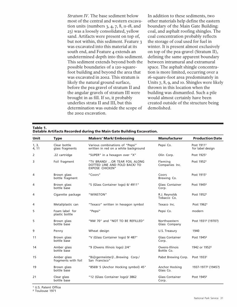
Table 1.Datable Artifacts Recorded during the Main Gate Building Excavation.
Unit Type Makers’ Mark/ Embossing Manufacturer Production Date
1, 3, Clear bottle Various combinations of “Pepsi” Pepsi Co. Post 1911¹4, 11 glass fragments written in red on a white background for label design
2 .22 cartridge “SUPER” in a hexagon over “X” Olin Corp. Post 1925¹
3 Foil fragment “TV BRAND/ …OR TEAR FOIL ALONG Fleming Post 1952¹DOTTED LINE AND FOLD BACK/ TO Companies Inc.EXPOSE CHICKEN”
4 Brown glass “Coors” Coors Post 1915¹bottle fragment Brewing Co.
4 Brown glass “S (Glass Container logo) 6/ 4911" Glass Container Post 1945²bottle base Corp.
4 Cigarette package “WINSTON” R.J. Reynolds Post 1952¹Tobacco Co.
4 Metal/plastic can “Texaco” written in hexagon symbol Texaco Inc. Post 1962¹
5 Foam label for “Pepsi” Pepsi Co. modernplastic bottle
5 Brown glass “NW 70" and “NOT TO BE REFILLED” Northwestern Post 1931² (1970?)bottle base Glass Company
9 Penny Wheat design U.S. Treasury 1940
11 Brown glass “V (Glass Container logo) 9/ 487" Glass Container Post 1945²bottle base Corp.
14 Amber glass “9 (Owens Illinois logo) 2/4" Owens-Illinois 1942 or 1952²bottle base Bottle Co.
15 Amber glass “Bü[rgermeister]/...Brewing Corp./ Pabst Brewing Corp. Post 1933¹fragments with foil San Francisco”
19 Brown glass “8569/ 5 (Anchor Hocking symbol) 45" Anchor Hocking 1937-1977² (1945?)bottle base Glass Co.
21 Clear glass “12 (Glass Container logo)/ 3862 Glass Container Post 1945²bottle base Corp.
¹ U.S. Patent Office² Toulouse 1971
Stratum IV. The base sediment belowmost of the central and western excava-tion units (numbers 3, 4, 7, 8, 11-18, and23) was a loosely consolidated, yellowsand. Artifacts were present on top of,but not within, this sediment. Feature 3was excavated into this material at itssouth end, and Feature 4 extends anundetermined depth into this sediment.This sediment extends beyond both thepossible boundaries of a 120-square-foot building and beyond the area thatwas excavated in 2002. This stratum islikely the natural ground surface,before the pea gravel of stratum II andthe angular gravels of stratum III werebrought in as fill. If so, it probablyunderlies strata II and III, but thisdetermination was outside the scope ofthe 2002 excavation.
In addition to these sediments, twoother materials help define the easternboundary of the Main Gate Building:coal, and asphalt roofing shingles. Thecoal concentration probably reflectsthe storage of coal used for fuel inwinter. It is present almost exclusivelyon top of the pea-gravel (Stratum II),defining the same apparent boundarybetween intramural and extramuralspace. The asphalt shingle concentra-tion is more limited, occurring over a16-square-foot area predominately inUnits 7, 8, 9, and 10. Shingles were likelythrown in this location when thebuilding was dismantled. Such a pilewould almost certainly have beencreated outside of the structure beingdemolished.
32 Minidoka Internment National Monument
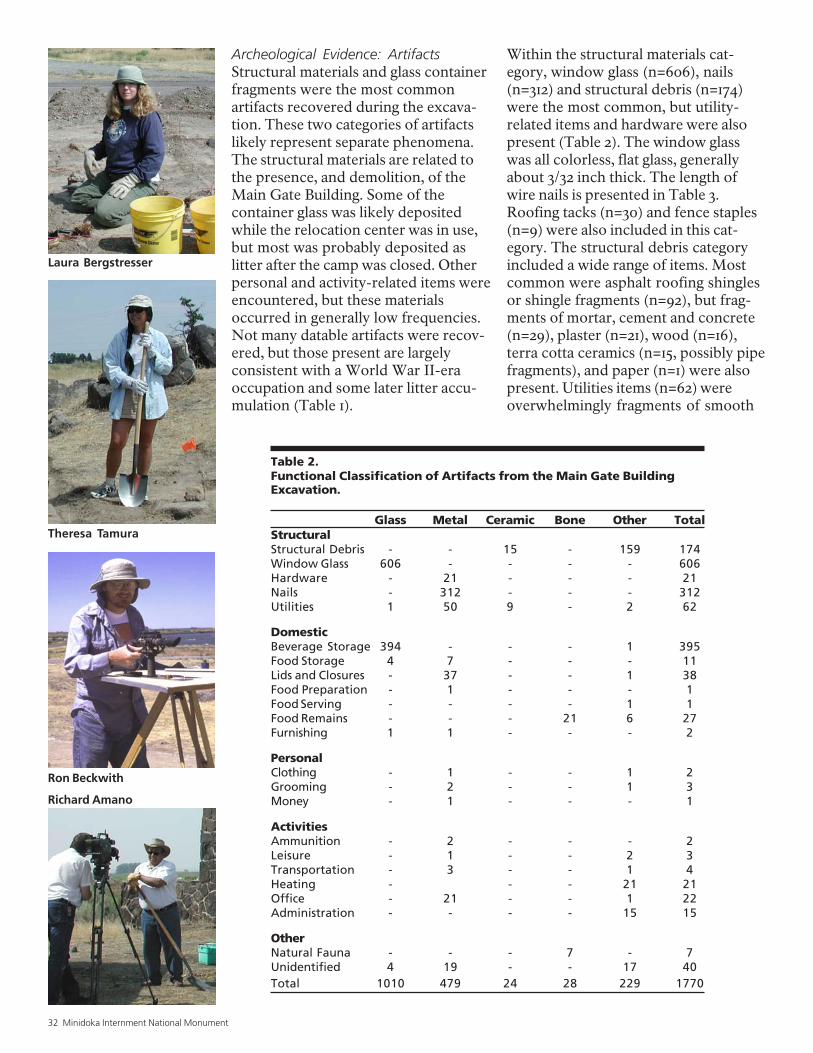
Table 2.Functional Classification of Artifacts from the Main Gate BuildingExcavation.
Glass Metal Ceramic Bone Other TotalStructuralStructural Debris - - 15 - 159 174Window Glass 606 - - - - 606Hardware - 21 - - - 21Nails - 312 - - - 312Utilities 1 50 9 - 2 62
DomesticBeverage Storage 394 - - - 1 395Food Storage 4 7 - - - 11Lids and Closures - 37 - - 1 38Food Preparation - 1 - - - 1Food Serving - - - - 1 1Food Remains - - - 21 6 27Furnishing 1 1 - - - 2
PersonalClothing - 1 - - 1 2Grooming - 2 - - 1 3Money - 1 - - - 1
ActivitiesAmmunition - 2 - - - 2Leisure - 1 - - 2 3Transportation - 3 - - 1 4Heating - - - 21 21Office - 21 - - 1 22Administration - - - - 15 15
OtherNatural Fauna - - - 7 - 7Unidentified 4 19 - - 17 40Total 1010 479 24 28 229 1770
Archeological Evidence: ArtifactsStructural materials and glass containerfragments were the most commonartifacts recovered during the excava-tion. These two categories of artifactslikely represent separate phenomena.The structural materials are related tothe presence, and demolition, of theMain Gate Building. Some of thecontainer glass was likely depositedwhile the relocation center was in use,but most was probably deposited aslitter after the camp was closed. Otherpersonal and activity-related items wereencountered, but these materialsoccurred in generally low frequencies.Not many datable artifacts were recov-ered, but those present are largelyconsistent with a World War II-eraoccupation and some later litter accu-mulation (Table 1).
Within the structural materials cat-egory, window glass (n=606), nails(n=312) and structural debris (n=174)were the most common, but utility-related items and hardware were alsopresent (Table 2). The window glasswas all colorless, flat glass, generallyabout 3/32 inch thick. The length ofwire nails is presented in Table 3.Roofing tacks (n=30) and fence staples(n=9) were also included in this cat-egory. The structural debris categoryincluded a wide range of items. Mostcommon were asphalt roofing shinglesor shingle fragments (n=92), but frag-ments of mortar, cement and concrete(n=29), plaster (n=21), wood (n=16),terra cotta ceramics (n=15, possibly pipefragments), and paper (n=1) were alsopresent. Utilities items (n=62) wereoverwhelmingly fragments of smooth
Laura Bergstresser
Theresa Tamura
Richard Amano
Ron Beckwith
National Park Service 33
Entrance building at MinidokaInternment National Monu-ment after archeological fieldwork, 2002.
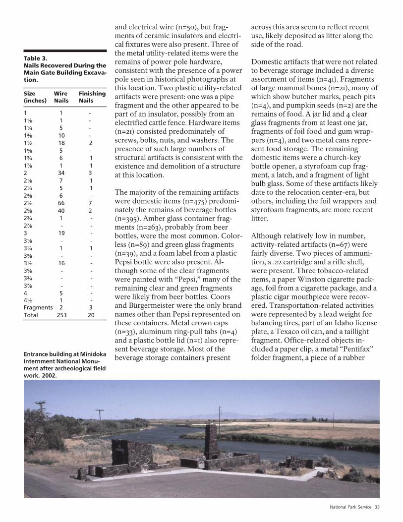
Table 3.Nails Recovered During theMain Gate Building Excava-tion.
Size Wire Finishing(inches) Nails Nails
1 1 -1c 1 -13 5 -1d 10 -12 18 21e 5 -1: 6 11f 1 12 34 32c 7 123 5 12d 6 -22 66 72e 40 22: 1 -2f - -3 19 -3c - -33 1 13d - -32 16 -3e - -3: - -3f - -4 5 -42 1 -Fragments 2 3Total 253 20
across this area seem to reflect recentuse, likely deposited as litter along theside of the road.
Domestic artifacts that were not relatedto beverage storage included a diverseassortment of items (n=41). Fragmentsof large mammal bones (n=21), many ofwhich show butcher marks, peach pits(n=4), and pumpkin seeds (n=2) are theremains of food. A jar lid and 4 clearglass fragments from at least one jar,fragments of foil food and gum wrap-pers (n=4), and two metal cans repre-sent food storage. The remainingdomestic items were a church-keybottle opener, a styrofoam cup frag-ment, a latch, and a fragment of lightbulb glass. Some of these artifacts likelydate to the relocation center-era, butothers, including the foil wrappers andstyrofoam fragments, are more recentlitter.
Although relatively low in number,activity-related artifacts (n=67) werefairly diverse. Two pieces of ammuni-tion, a .22 cartridge and a rifle shell,were present. Three tobacco-relateditems, a paper Winston cigarette pack-age, foil from a cigarette package, and aplastic cigar mouthpiece were recov-ered. Transportation-related activitieswere represented by a lead weight forbalancing tires, part of an Idaho licenseplate, a Texaco oil can, and a taillightfragment. Office-related objects in-cluded a paper clip, a metal “Pentifax”folder fragment, a piece of a rubber
and electrical wire (n=50), but frag-ments of ceramic insulators and electri-cal fixtures were also present. Three ofthe metal utility-related items were theremains of power pole hardware,consistent with the presence of a powerpole seen in historical photographs atthis location. Two plastic utility-relatedartifacts were present: one was a pipefragment and the other appeared to bepart of an insulator, possibly from anelectrified cattle fence. Hardware items(n=21) consisted predominately ofscrews, bolts, nuts, and washers. Thepresence of such large numbers ofstructural artifacts is consistent with theexistence and demolition of a structureat this location.
The majority of the remaining artifactswere domestic items (n=475) predomi-nately the remains of beverage bottles(n=395). Amber glass container frag-ments (n=263), probably from beerbottles, were the most common. Color-less (n=89) and green glass fragments(n=39), and a foam label from a plasticPepsi bottle were also present. Al-though some of the clear fragmentswere painted with “Pepsi,” many of theremaining clear and green fragmentswere likely from beer bottles. Coorsand Bürgermeister were the only brandnames other than Pepsi represented onthese containers. Metal crown caps(n=33), aluminum ring-pull tabs (n=4)and a plastic bottle lid (n=1) also repre-sent beverage storage. Most of thebeverage storage containers present
34 Minidoka Internment National Monument
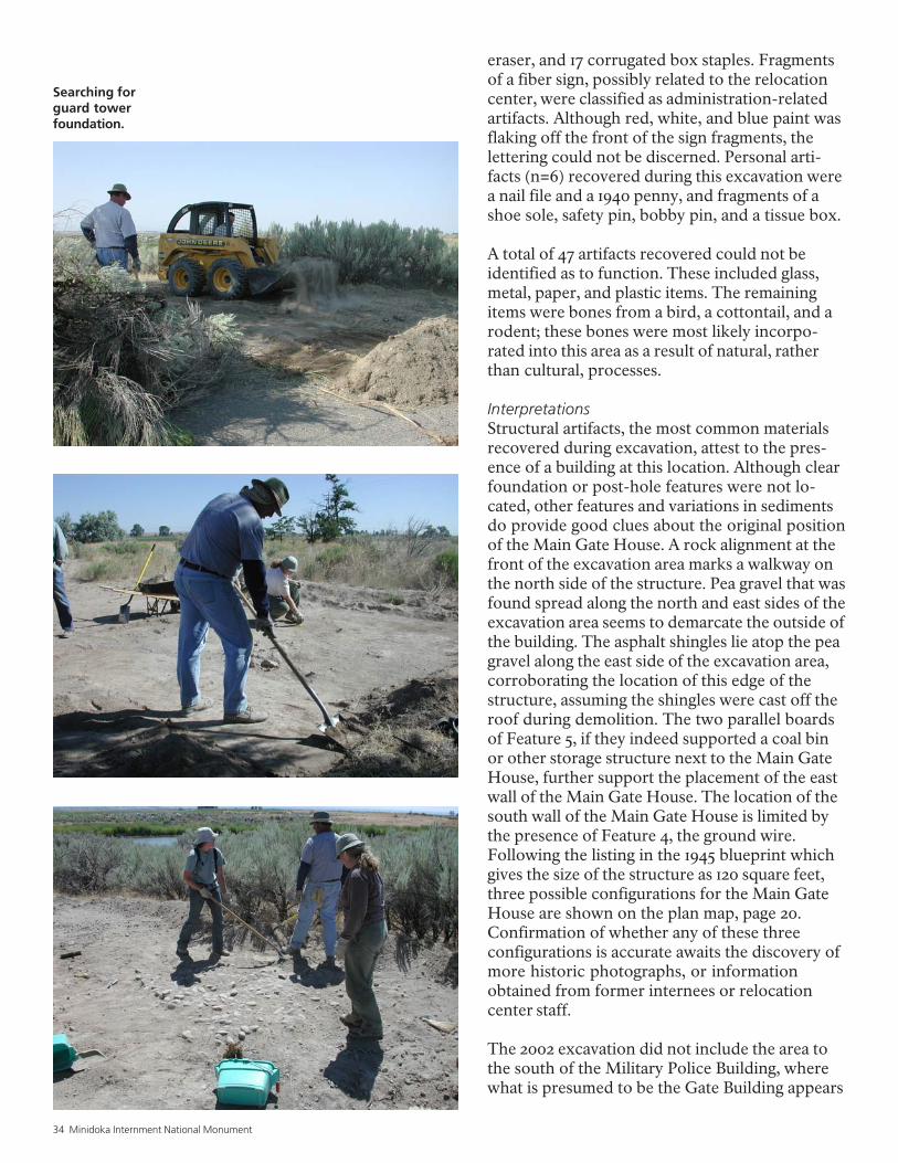
Searching forguard towerfoundation.
eraser, and 17 corrugated box staples. Fragmentsof a fiber sign, possibly related to the relocationcenter, were classified as administration-relatedartifacts. Although red, white, and blue paint wasflaking off the front of the sign fragments, thelettering could not be discerned. Personal arti-facts (n=6) recovered during this excavation werea nail file and a 1940 penny, and fragments of ashoe sole, safety pin, bobby pin, and a tissue box.
A total of 47 artifacts recovered could not beidentified as to function. These included glass,metal, paper, and plastic items. The remainingitems were bones from a bird, a cottontail, and arodent; these bones were most likely incorpo-rated into this area as a result of natural, ratherthan cultural, processes.
InterpretationsStructural artifacts, the most common materialsrecovered during excavation, attest to the pres-ence of a building at this location. Although clearfoundation or post-hole features were not lo-cated, other features and variations in sedimentsdo provide good clues about the original positionof the Main Gate House. A rock alignment at thefront of the excavation area marks a walkway onthe north side of the structure. Pea gravel that wasfound spread along the north and east sides of theexcavation area seems to demarcate the outside ofthe building. The asphalt shingles lie atop the peagravel along the east side of the excavation area,corroborating the location of this edge of thestructure, assuming the shingles were cast off theroof during demolition. The two parallel boardsof Feature 5, if they indeed supported a coal binor other storage structure next to the Main GateHouse, further support the placement of the eastwall of the Main Gate House. The location of thesouth wall of the Main Gate House is limited bythe presence of Feature 4, the ground wire.Following the listing in the 1945 blueprint whichgives the size of the structure as 120 square feet,three possible configurations for the Main GateHouse are shown on the plan map, page 20.Confirmation of whether any of these threeconfigurations is accurate awaits the discovery ofmore historic photographs, or informationobtained from former internees or relocationcenter staff.
The 2002 excavation did not include the area tothe south of the Military Police Building, wherewhat is presumed to be the Gate Building appears
National Park Service 35
in the historical home movie. Never-theless, the excavation results do pointout that the Gate Building did not havea wing that extended northward adja-cent to the Main Gate House, one ofthe alternatives considered to accountfor the Gate Building’s supposed 960square feet. The area east of the MainGate House is clearly exterior space.Further archeological excavations tothe south of the Military Police Build-ing and east of the Reception Buildingmight be able to shed light on the trueconfiguration of the Gate Building.
Guard Tower InvestigationsOral histories, historical photographs,and War Relocation Authority blue-prints indicate that one of the eightguard towers that surrounded theresidential area of the Minidoka Relo-cation Center was located west of the
entrance buildings, south of HuntRoad. No evidence of this guard towerwas found during the 2001 archeologi-cal survey (Burton and Farrell 2001). Atother relocation centers, each guardtower was supported by four largeconcrete footings, one for each of fourcorner posts. Sometimes a fifth con-crete footing was used in the center as abase for a ladder. In many cases thefootings are still present, partiallyburied and visible on the surface, orpulled up and discarded nearby (Bur-ton et al. 2002).
At the edge of the present visitorparking lot at Minidoka, limited exca-vations were conducted to search forevidence of guard tower footings,selecting the most likely area based onWRA blueprints and historical photo-graphs. First, brush was removed byhand, then a small front-end loader wasused to scrape about 5 cm deep in a750-square-foot area, to break throughthe shallow root zone and recentalluvium. Then, sediments were re-moved through hand-scraping foranother 5 to 10 cm depth.
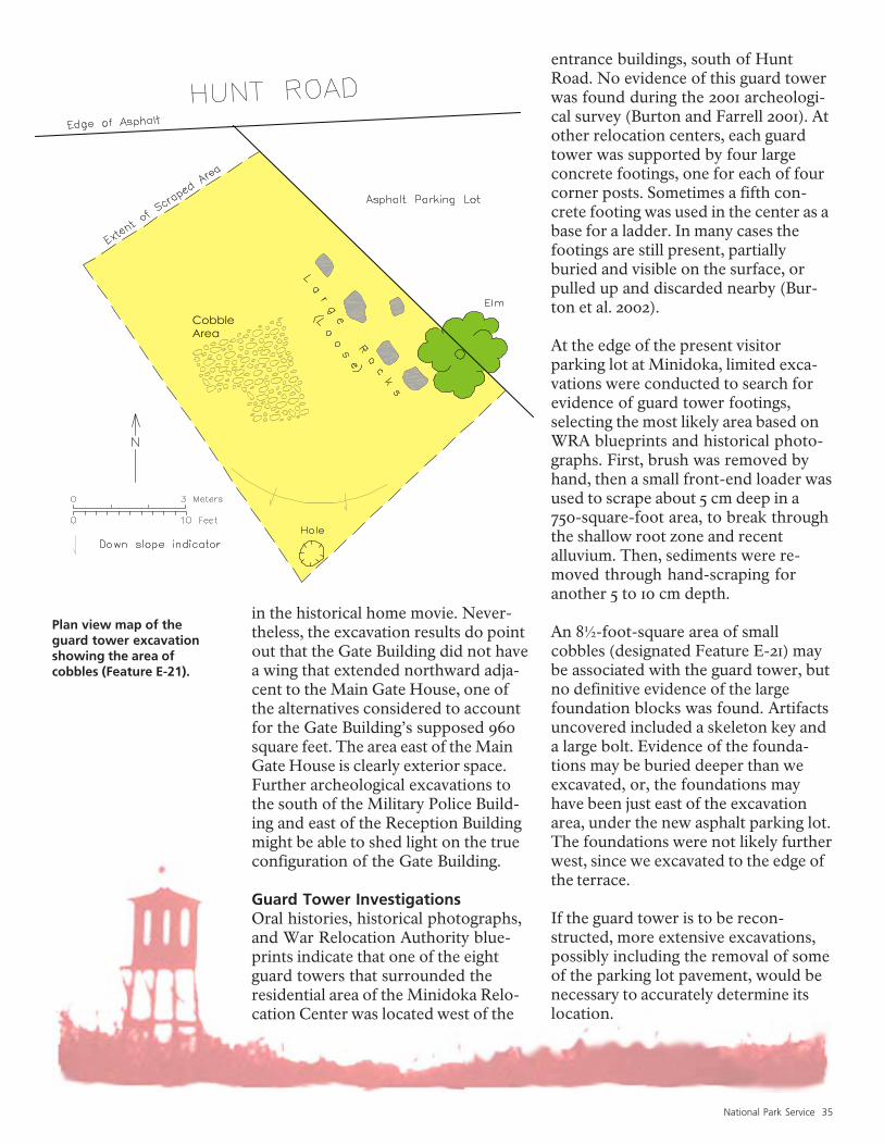
An 8½-foot-square area of smallcobbles (designated Feature E-21) maybe associated with the guard tower, butno definitive evidence of the largefoundation blocks was found. Artifactsuncovered included a skeleton key anda large bolt. Evidence of the founda-tions may be buried deeper than weexcavated, or, the foundations mayhave been just east of the excavationarea, under the new asphalt parking lot.The foundations were not likely furtherwest, since we excavated to the edge ofthe terrace.
If the guard tower is to be recon-structed, more extensive excavations,possibly including the removal of someof the parking lot pavement, would benecessary to accurately determine itslocation.
Plan view map of theguard tower excavationshowing the area ofcobbles (Feature E-21).
CobbleArea
36 Minidoka Internment National Monument
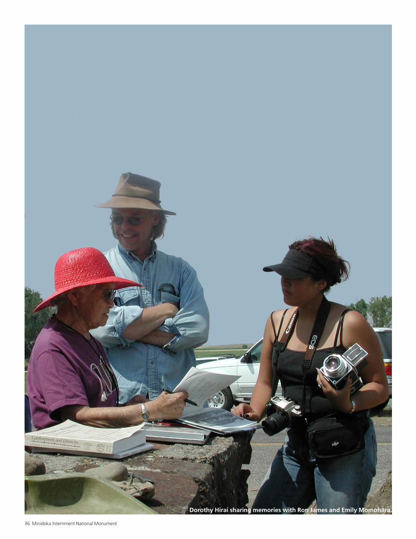
Dorothy Hirai sharing memories with Ron James and Emily Momohara.
National Park Service 37
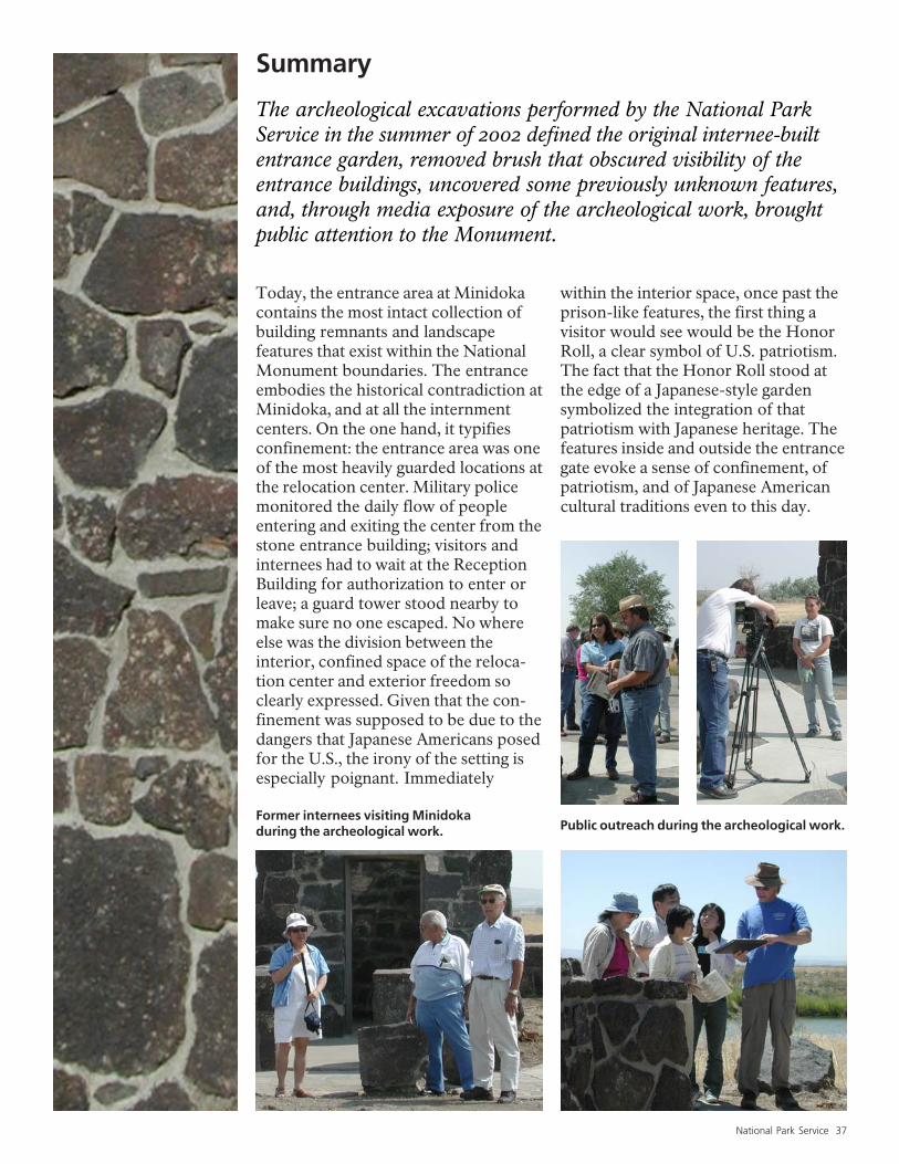
Summary
The archeological excavations performed by the National ParkService in the summer of 2002 defined the original internee-builtentrance garden, removed brush that obscured visibility of theentrance buildings, uncovered some previously unknown features,and, through media exposure of the archeological work, broughtpublic attention to the Monument.
Today, the entrance area at Minidokacontains the most intact collection ofbuilding remnants and landscapefeatures that exist within the NationalMonument boundaries. The entranceembodies the historical contradiction atMinidoka, and at all the internmentcenters. On the one hand, it typifiesconfinement: the entrance area was oneof the most heavily guarded locations atthe relocation center. Military policemonitored the daily flow of peopleentering and exiting the center from thestone entrance building; visitors andinternees had to wait at the ReceptionBuilding for authorization to enter orleave; a guard tower stood nearby tomake sure no one escaped. No whereelse was the division between theinterior, confined space of the reloca-tion center and exterior freedom soclearly expressed. Given that the con-finement was supposed to be due to thedangers that Japanese Americans posedfor the U.S., the irony of the setting isespecially poignant. Immediately
within the interior space, once past theprison-like features, the first thing avisitor would see would be the HonorRoll, a clear symbol of U.S. patriotism.The fact that the Honor Roll stood atthe edge of a Japanese-style gardensymbolized the integration of thatpatriotism with Japanese heritage. Thefeatures inside and outside the entrancegate evoke a sense of confinement, ofpatriotism, and of Japanese Americancultural traditions even to this day.
Public outreach during the archeological work.Former internees visiting Minidokaduring the archeological work.
38 Minidoka Internment National Monument
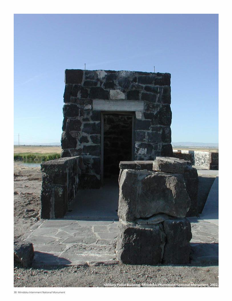
Military Police Building, Minidoka Internment National Monument, 2002.
National Park Service 39
Bowlin, Brad1990 Dust Shrouded Rock Garden Stirs
Memories. Twin Falls Times-News.May 27.
Burton, Jeffery F., and Mary M. Farrell 2001 This is Minidoka: An Archeological
Survey of Minidoka InternmentNational Monument, Idaho. WesternArcheological and Conservation CenterPublications in Anthropology 80.National Park Service, Tucson.
Burton, Jeffery F., Mary M. Farrell, Florence B.Lord, and Richard W. Lord 2002 Confinement and Ethnicity: An
Overview of Japanese AmericanRelocation Sites. University ofWashington Press, Seattle.
Nakamura, Robert A. 1994 Something Strong Within. Japanese
American National Museum, LosAngeles (video).
Nomura, Kenjiro 1991 An Artists View of the Japanese
American Internment. The Georgeand Betty Nomura Collection. WingLuke Asian Museum, Seattle.
Residents of the Minidoka Relocation Center 1943 Minidoka Interlude. Published by the
Residents of the Minidoka RelocationCenter, Hunt, Idaho. Privately reprintedby Thomas Takeuchi, Portland, Oregon,1989.
Robinson, Thomas M. 1992 Traditions in Translation: The
Gardens of Fujitaro Kubota. MAThesis, University of Washington,Seattle.
Smith, Lorayne O. 1987 40 Years Ago Veterans Settled Hunt
Project. Twin Falls Times-News. June 14.
Tamura, Anna H. 2001 Minidoka Internment National
Monument, Jerome County, Idaho,Cultural Landscapes Inventory.National Park Service, Seattle.
2002 Gardens Below the Watchtower:Gardens and Meaning in WWIIJapanese American InternmentCamps. MA Thesis, University ofWashington, Seattle.
Toulouse, Julian Harrison 1971 Bottle Makers and Their Marks.
Thomas Nelson, New York.
U.S. Patent Office 2002 U.S. Patent and Trademarks Office’s
Trademark Electronic Search System.<http://tess.uspto.gov>.
Yamaguchi, Jack 1989 This was Minidoka. Pollard Printing
Group, Tacoma, Washington.
References Cited
Western Archeological and Conservation Center255 N. Commerce Park LoopTucson, Arizona 85745
E X P E R I E N C E Y O U R A M E R I C A
National Park ServiceU.S. Department of the Interior