Embed Size (px)
Citation preview

Death ValleyDeath ValleyA Visitors Guide To
12th Edition
2 Death Valley Vistiors Guide • 12th Edition
Websites:
Armargosa Conservancy, Shoshone,
www.armargosaconservancy.org
Death Valley Chamber of Commerce,
www.deathvalleychamber.org
Death Valley National Park,
www.nps.gov/deva
Shoshone Village, Shoshone,
www.shoshonevillage.com
Stovepipe Wells Village,
www.stovepipewells.com
Panamint Springs Resort,
www.panamintsprings.com
Death Valley Natural History Association,
www.dvnha.org
Death Valley Conservancy,
www.dvconservancy.org Table of Contents
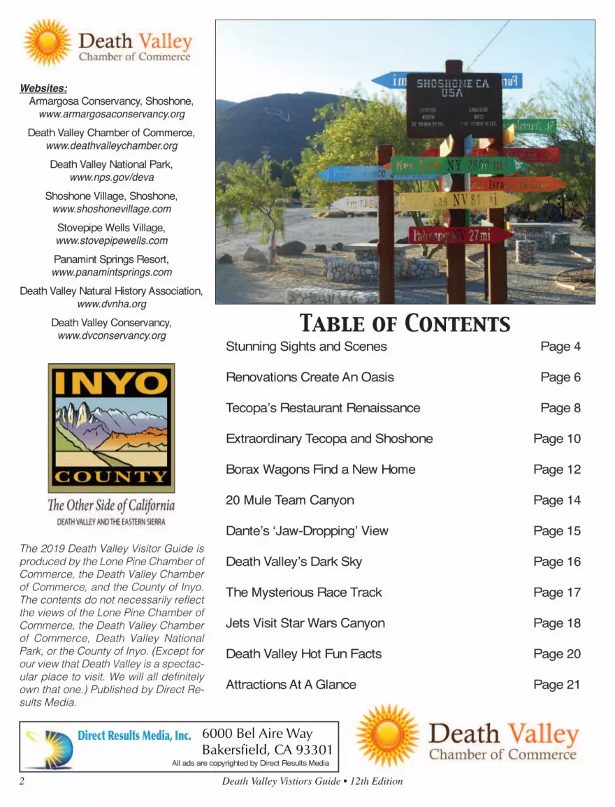
Stunning Sights and Scenes Page 4
Renovations Create An Oasis Page 6
Tecopa’s Restaurant Renaissance Page 8
Extraordinary Tecopa and Shoshone Page 10
Borax Wagons Find a New Home Page 12
20 Mule Team Canyon Page 14
Dante’s ‘Jaw-Dropping’ View Page 15
Death Valley’s Dark Sky Page 16
The Mysterious Race Track Page 17
Jets Visit Star Wars Canyon Page 18
Death Valley Hot Fun Facts Page 20
Attractions At A Glance Page 21
Direct Results Media, Inc.
Jerry ElfordSales Associate
6000 Bel Aire WayBakersfield, CA 93301
Cell: [email protected]
Direct Results Media, Inc.
Rodney PreulSales Associate
6000 Bel Aire WayBakersfield, CA 93301
Cell: [email protected]
Direct Results Media, Inc.
Robert AsianianSales Manager
6000 Bel Aire WayBakersfield, CA 93301
Cell: [email protected]
Direct Results Media, Inc.Business Cards
3.5x2
Direct Results Media, Inc.
Jerry ElfordSales Associate
6000 Bel Aire WayBakersfield, CA 93301
Cell: [email protected]
Direct Results Media, Inc.
Rodney PreulSales Associate
6000 Bel Aire WayBakersfield, CA 93301
Cell: [email protected]
Direct Results Media, Inc.
Robert AsianianSales Manager
6000 Bel Aire WayBakersfield, CA 93301
Cell: [email protected]
Direct Results Media, Inc.Business Cards
3.5x2
The 2019 Death Valley Visitor Guide is
produced by the Lone Pine Chamber of
Commerce, the Death Valley Chamber
of Commerce, and the County of Inyo.
The contents do not necessarily reflect
the views of the Lone Pine Chamber of
Commerce, the Death Valley Chamber
of Commerce, Death Valley National
Park, or the County of Inyo. (Except for
our view that Death Valley is a spectac-
ular place to visit. We will all definitely
own that one.) Published by Direct Re-
sults Media.
All ads are copyrighted by Direct Results Media

Death Valley Vistiors Guide • 12th Edition 3

4 Death Valley Vistiors Guide • 12th Edition
Western Gateway to Death Valley National Park
Family Owned & Operated Since 1957Family Owned & Operated Since 1957Family Owned & Operated Since 1957
Western Gateway to Death Valley National Park
Family Owned & Operated Since 1957Family Owned & Operated Since 1957Family Owned & Operated Since 1957Family Owned & Operated Since 1957Family Owned & Operated Since 1957Family Owned & Operated Since 1957Family Owned & Operated Since 1957
Western Gateway to Death Valley National ParkWestern Gateway to Death Valley National ParkWestern Gateway to Death Valley National ParkWestern Gateway to Death Valley National ParkWestern Gateway to Death Valley National ParkWestern Gateway to Death Valley National ParkWestern Gateway to Death Valley National ParkWestern Gateway to Death Valley National ParkWestern Gateway to Death Valley National ParkWestern Gateway to Death Valley National ParkWestern Gateway to Death Valley National ParkWestern Gateway to Death Valley National ParkWestern Gateway to Death Valley National ParkWestern Gateway to Death Valley National ParkWestern Gateway to Death Valley National ParkWestern Gateway to Death Valley National ParkWestern Gateway to Death Valley National ParkWestern Gateway to Death Valley National ParkWestern Gateway to Death Valley National ParkWestern Gateway to Death Valley National ParkWestern Gateway to Death Valley National ParkWestern Gateway to Death Valley National ParkWestern Gateway to Death Valley National Park
Family Owned & Operated Since 1957Family Owned & Operated Since 1957Family Owned & Operated Since 1957Family Owned & Operated Since 1957Family Owned & Operated Since 1957Family Owned & Operated Since 1957Family Owned & Operated Since 1957Family Owned & Operated Since 1957Family Owned & Operated Since 1957Family Owned & Operated Since 1957Family Owned & Operated Since 1957Family Owned & Operated Since 1957Family Owned & Operated Since 1957Family Owned & Operated Since 1957Family Owned & Operated Since 1957Family Owned & Operated Since 1957Family Owned & Operated Since 1957Family Owned & Operated Since 1957Family Owned & Operated Since 1957Family Owned & Operated Since 1957Family Owned & Operated Since 1957Family Owned & Operated Since 1957Family Owned & Operated Since 1957Family Owned & Operated Since 1957Family Owned & Operated Since 1957Family Owned & Operated Since 1957Family Owned & Operated Since 1957Family Owned & Operated Since 1957Family Owned & Operated Since 1957Family Owned & Operated Since 1957Family Owned & Operated Since 1957Family Owned & Operated Since 1957Family Owned & Operated Since 1957Family Owned & Operated Since 1957Family Owned & Operated Since 1957Family Owned & Operated Since 1957Family Owned & Operated Since 1957Family Owned & Operated Since 1957Family Owned & Operated Since 1957Family Owned & Operated Since 1957Family Owned & Operated Since 1957
Western Gateway to Death Valley National ParkWestern Gateway to Death Valley National ParkWestern Gateway to Death Valley National ParkWestern Gateway to Death Valley National ParkWestern Gateway to Death Valley National ParkWestern Gateway to Death Valley National ParkWestern Gateway to Death Valley National ParkWestern Gateway to Death Valley National ParkWestern Gateway to Death Valley National ParkWestern Gateway to Death Valley National ParkWestern Gateway to Death Valley National ParkWestern Gateway to Death Valley National ParkWestern Gateway to Death Valley National ParkWestern Gateway to Death Valley National ParkWestern Gateway to Death Valley National ParkWestern Gateway to Death Valley National ParkWestern Gateway to Death Valley National ParkWestern Gateway to Death Valley National ParkWestern Gateway to Death Valley National ParkWestern Gateway to Death Valley National ParkWestern Gateway to Death Valley National ParkWestern Gateway to Death Valley National ParkWestern Gateway to Death Valley National Park
310 South Main StreetLone Pine, CA
Three Diamond
Award
Death Valley contains millions of acres of wild andscenic land. Tucked into that sprawling landscapeare more than a few truly stunning sights, as out-
lined below.
Badwater Basin Badwater is the site of the lowest place onland in North America, at 282 feet below sea level. Thescene is much more than an elevation marker. Seeps createsmall pools of water that dramatically reflect the nearbyblack mountains. Telescope Peak, the highest point in DeathValley looms majestically, 11,000 feet above and across thevalley. Located 17 miles south of Furnace Creek.
Dantes View Located at an elevation of 5,758 feet directlyabove the Badwater Basin is Dante’s View. This extremelyscenic view spot provides vistas of almost all of Death Valley.One can look straight down to the Badwater Basin anddirectly across to the Panamint Mountains and TelescopePeak. Far off to the west, are seen the Sierra NevadaMountains, and to the east, numerous desert mountainranges of Nevada. Located 25 miles east and south ofFurnace Creek. The last few miles of roadway are steep andnarrow.
Zabriskie Point This viewpoint is accessed by a short driveand a steep short walk on a paved trail. The scene overlooksthe beautifully eroded and colorful hills referred to as thebadlands. Telescope Peak can be seen in the distance as wellas the soaring peaks of the Funeral Range. Zabriskie Point isa favorite of photographers, providing perfect opportunitiesat sunrise and sunset. Located 2 ½ miles east FurnaceCreek.
Golden Canyon Penetrating deep into Death Valley’s Black
Stunning Sights and Scenes in Death Valley
Badwater Basin is the lowest spot in North America, resting at282 feet below sea level. DEATH VALLEY NATIONAL PARK PHOTO CONTINUED ON PAGE 5

Death Valley Vistiors Guide • 12th Edition 5
Stunning Sights and Scenes in Death Valley
Mountains is aptly named GoldenCanyon. Especially in the morninglight, the canyon walls glow magicallywith a flaxen hue. Golden Canyon is ahike, but one can get an intimate feelfor it by walking just a few feet past itsmouth. More adventurous trekkers canchoose among a number of longerhikes. Located two miles south ofFurnace Creek.
Salt Creek One of the few places onthe actual floor of Death Valley wherewater flows, Salt Creek meanders alongthe surface on and off for several miles.This unique environment also provideshabitat for Death Valley’s only nativespecies of fish, the Desert Pupfish.Visitors can follow a woodenboardwalk along the banks of thisdesert treasure on a self-guided .halfmile nature walk. Located 13 ½ milesnorth of Furnace Creek, then a onemile graded dirt road.
Mesquite Sand Dunes Just a fewmiles west of Stovepipe Wells Villagelay one of Death Valley’s most popularattractions, the Mesquite Sand Dunes.Covering over 14 square miles, thedunes provide some of the mostdramatic scenery in the Park. Sunriseand sunset are both great time to catchjust the right shot. Watch for thesigned turnout about 23 miles northand west of Furnace Creek.
Ubehebe Crater Most visitors aretaken aback when they approach theyawning expanse of Ubehebe Crater forthe first time. This “Maar” Volcano wascreated by a steam explosion as recentas only 300 years ago. 600’ deep andover a half mile across, visitors can takea steep path to the bottom (and backup), walk around its rim and simplystand at the edge of the parking areaand take in the overwhelming scene.Located 57 miles north of FurnaceCreek. The last five miles are on anarrow roadway.
Wildrose Charcoal Kilns The DeathValley area has a rich mining history.Silver, gold, borax and talc are justcome of the minerals that have beenmined here. The ten Wildrose CharcoalKilns are located at 7000 feet high upin the Panamint Mountains in a PinionPine Forest. These nearly perfect piecesof architecture were built in 1877 toproduce charcoal for nearby silversmelters. About 62 miles from FurnaceCreek, the last three miles on a gradeddirt road.
Artist Drive This scenic one0way,semi-loop paved road twists, winds,climbs and dips its way through someof the most colorful scenery in DeathValley. Highlight of the nine mile trip isthe Artist Pallate, where hues ofgreens, purples, oranges, browns andyellows blend together in akaleidoscope of color. Entrance toArtist Drive is located about 10 milessouth of Furnace Creek
Golden Canyon lives up to its name. Shown is the hiking trail through the canyon and Manley Beacon. DEATH VALLEY NATIONAL PARK PHOTO
CONTINUED FROM PAGE 4
6 Death Valley Vistiors Guide • 12th Edition
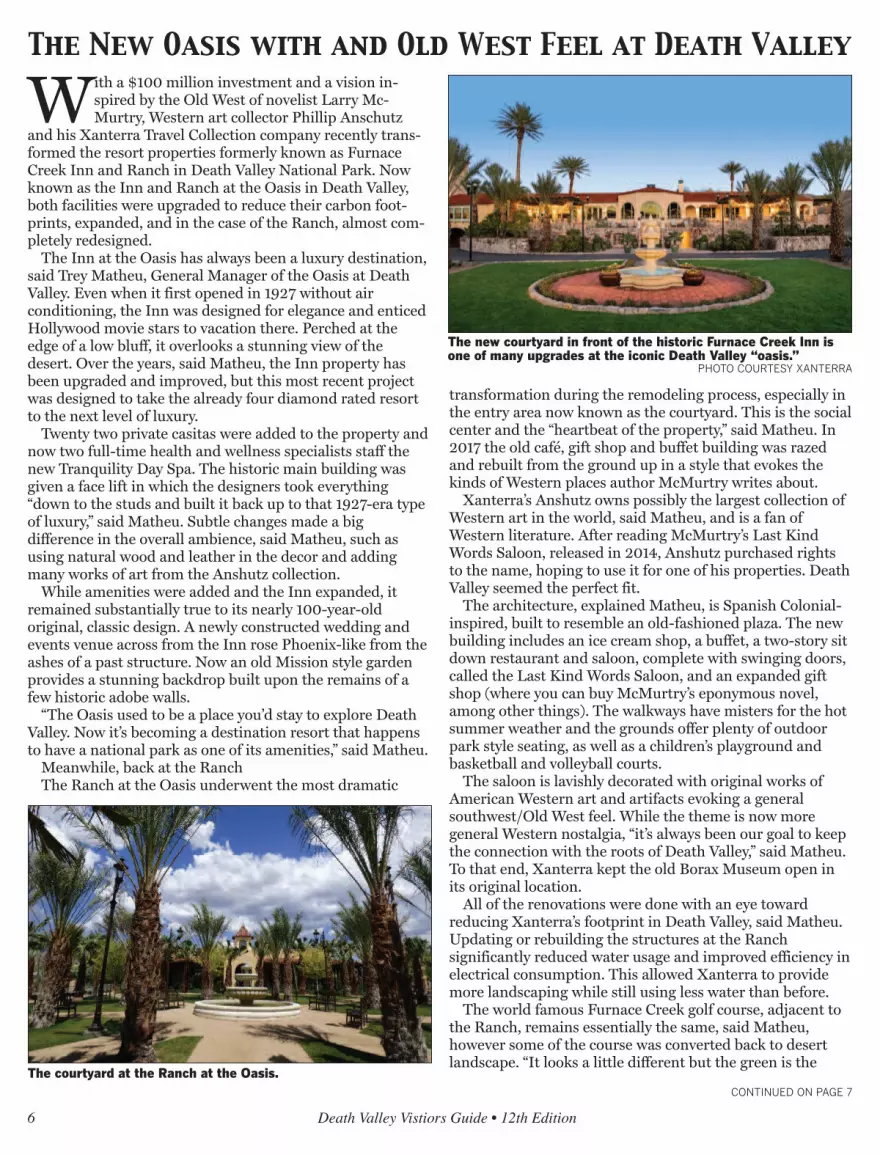
With a $100 million investment and a vision in-spired by the Old West of novelist Larry Mc-Murtry, Western art collector Phillip Anschutz
and his Xanterra Travel Collection company recently trans-formed the resort properties formerly known as FurnaceCreek Inn and Ranch in Death Valley National Park. Nowknown as the Inn and Ranch at the Oasis in Death Valley,both facilities were upgraded to reduce their carbon foot-prints, expanded, and in the case of the Ranch, almost com-pletely redesigned.
The Inn at the Oasis has always been a luxury destination,said Trey Matheu, General Manager of the Oasis at DeathValley. Even when it first opened in 1927 without airconditioning, the Inn was designed for elegance and enticedHollywood movie stars to vacation there. Perched at theedge of a low bluff, it overlooks a stunning view of thedesert. Over the years, said Matheu, the Inn property hasbeen upgraded and improved, but this most recent projectwas designed to take the already four diamond rated resortto the next level of luxury.
Twenty two private casitas were added to the property andnow two full-time health and wellness specialists staff thenew Tranquility Day Spa. The historic main building wasgiven a face lift in which the designers took everything“down to the studs and built it back up to that 1927-era typeof luxury,” said Matheu. Subtle changes made a bigdifference in the overall ambience, said Matheu, such asusing natural wood and leather in the decor and addingmany works of art from the Anshutz collection.
While amenities were added and the Inn expanded, itremained substantially true to its nearly 100-year-oldoriginal, classic design. A newly constructed wedding andevents venue across from the Inn rose Phoenix-like from theashes of a past structure. Now an old Mission style gardenprovides a stunning backdrop built upon the remains of afew historic adobe walls.
“The Oasis used to be a place you’d stay to explore DeathValley. Now it’s becoming a destination resort that happensto have a national park as one of its amenities,” said Matheu.
Meanwhile, back at the RanchThe Ranch at the Oasis underwent the most dramatic
transformation during the remodeling process, especially inthe entry area now known as the courtyard. This is the socialcenter and the “heartbeat of the property,” said Matheu. In2017 the old café, gift shop and buffet building was razedand rebuilt from the ground up in a style that evokes thekinds of Western places author McMurtry writes about.
Xanterra’s Anshutz owns possibly the largest collection ofWestern art in the world, said Matheu, and is a fan ofWestern literature. After reading McMurtry’s Last KindWords Saloon, released in 2014, Anshutz purchased rightsto the name, hoping to use it for one of his properties. DeathValley seemed the perfect fit.
The architecture, explained Matheu, is Spanish Colonial-inspired, built to resemble an old-fashioned plaza. The newbuilding includes an ice cream shop, a buffet, a two-story sitdown restaurant and saloon, complete with swinging doors,called the Last Kind Words Saloon, and an expanded giftshop (where you can buy McMurtry’s eponymous novel,among other things). The walkways have misters for the hotsummer weather and the grounds offer plenty of outdoorpark style seating, as well as a children’s playground andbasketball and volleyball courts.
The saloon is lavishly decorated with original works ofAmerican Western art and artifacts evoking a generalsouthwest/Old West feel. While the theme is now moregeneral Western nostalgia, “it’s always been our goal to keepthe connection with the roots of Death Valley,” said Matheu.To that end, Xanterra kept the old Borax Museum open inits original location.
All of the renovations were done with an eye towardreducing Xanterra’s footprint in Death Valley, said Matheu.Updating or rebuilding the structures at the Ranchsignificantly reduced water usage and improved efficiency inelectrical consumption. This allowed Xanterra to providemore landscaping while still using less water than before.
The world famous Furnace Creek golf course, adjacent tothe Ranch, remains essentially the same, said Matheu,however some of the course was converted back to desertlandscape. “It looks a little different but the green is the
The New Oasis with and Old West Feel at Death Valley
CONTINUED ON PAGE 7
The new courtyard in front of the historic Furnace Creek Inn isone of many upgrades at the iconic Death Valley “oasis.”
PHOTO COURTESY XANTERRA
The courtyard at the Ranch at the Oasis.

same experience,” said Matheu. The popular 19th Holerestaurant was able to double its seating and add somecovered patio space with an unobstructed view of the desert.
The Ranch’s 224 guest rooms were given fresh paint andnew carpeting and Matheu said Xanterra plans to add moreguest cabins to the property by 2020.
Along with the new look come new options forentertainment at the Oasis, said Matheu. Xanterra is excitedto offer weekly night sky viewing presentations on the golfcourse. They will continue to offer old favorites such ashorseback and carriage rides from the Furnace Creekstables, “dive in” movies at the Ranch swimming pool, andsimple pleasures such as corn hole and horseshoes.
And of course, access to hiking and exploring theextraordinary desert.
Matheu highly recommends visitors make reservations fora stay at the Oasis. Visitation has increased since thefacilities reopened in 2018, with growing numbers of
international tourists coming to catch a glimpse of thehistoric American West.
For more information, visit OasisatDeathValley.com
Death Valley Vistiors Guide • 12th Edition 7
SSttoovveeppiippee WWeellllss VViillllaaggeeThe Authentic Death Valley ExperienceLodging • Camping • Dining • Saloon • Gift Shop • Gas
776600--778866--22338877 •• wwwwww..ddeeaatthhvvaalllleeyyhhootteellss..ccoommAn authorized concessioner of Death Valley National Park
CONTINUED FROM PAGE 6
The entrance to the Ranch at the Oasis is one of several new buildings at the historic location.
The western themed Last Kind Word Saloon at the Ranch at theOasis

8 Death Valley Vistiors Guide • 12th Edition
The Tecopa Bistro is the longest runningeatery in town.
PHOTO BY ROBIN FLINCHUM
The recently expanded space at DeathValley Brewing.
PHOTO BY ROBIN FLINCHUM
A Las Vegas chef runs Steaks and Beerwith attention to detail and quality.
PHOTO BY ROBIN FLINCHUM
The Tecopa Bistro, is focusing on “Food asArt” for the coming year.
PHOTO BY ROBIN FLINCHUM
The tiny town of Tecopa, on thesoutheastern edge of Death Val-ley National Park, may possibly
be home to more restaurants per capitathan any city in the US. With fourrestaurants and an official populationof 150, Tecopa beats by more than halfthe average of larger cities that makethis claim. Front runner Durango, Col-orado, calculated its average in 2018 asone restaurant per every 88 residents.In Tecopa, it’s one per every 37. Two ofthose four establishments also includeonsite brew pubs, likely to be the high-est number of pubs per capita com-pared to any city in the country at oneper every 75 inhabitants.
Of course, the Tecopa restaurateursdepend on more than local residents tokeep their kitchens busy and theyemploy a variety of creative strategiesto attract visitors to their tables. Usingas many locally grown ingredients as
possible, relying on family recipes andthe genius of visiting chefs, playing livemusic or brewing “weird beer” theseeateries offer an eclectic array ofchoices.
Steaks and Beer, located in the“downtown” area of Tecopa, is apopular hole in the wall with a tinydining room and spacious patio seatingarea built over a fish pond. Owner andchef Eric Scott learned his craft on theLas Vegas Strip and has a gift forpreparing steak, as well as a humblecharm that makes eating at hisrestaurant like stopping by the house ofa friend. He’s been cooking here forover three years, most of the time as aone-man operation, though hesometimes hires an assistant whenthings are especially busy.
Scott’s menu includes steak, of
Unique Dining Options
in Tiny Tecopa
CONTINUED ON PAGE 9

course, and options such as a fivecourse meal for two, gluten freevegetarian pasta and a miso bone brothwith seafood and udon noodles. For thebeer end of things, Scott relies on theDeath Valley Brewing Company nextdoor.
Death Valley Brewing is entering itssixth year as a brew pub with an everchanging and always inventive beermenu. Owner Jon Zellhoefer andmanager Dan Leesburg are bothpassionate about the craft of brewingand, while they will keep a few regularfavorites on tap, they are always excitedto try the next new recipe. The pubrecently expanded its kitchen andserves pizza with a variety of toppingoptions for its patrons, as well as softpretzels.
Death Valley Brewing also offersunusual premiums to their loyal
customers, such as the crystal skullmugs sold the first year the pub was inbusiness. This year, they are offeringsteins as a premium for membership inthe brew club, which includesdiscounts on beer purchases, t-shirtsand more. The pub also has a largerecreation room with a billiards table,an unusual desert disc golf course outback, and they recently began sellingCalifornia lottery tickets for visitorswho are feeling lucky.
On the other end of town is theTecopa Brewing Company and BBQrestaurant, on the grounds of Delight’sHot Springs Resort. Going into itsfourth season, the restaurant caters tothe resort’s overnight guests, as well astravelers passing through. It’s openseven days a week and offers breakfast(weekends only) and lunch as well asthe traditional BBQ dinners. This year,the restaurant hired a new chef trained
in classical French cuisine, said ownerCourtney McNeal, and they’ll beoffering weekend specials paired withone of their craft beers. With the newchef of board, brewer Wes McNeal willhave time to focus on crafting newlager and ale recipes for the pub.
The Tecopa Brewing Company alsooften hosts live music and other eventson weekends.
In between the two pubs, in the heartof Tecopa Hot Springs, is the TecopaBistro, the longest running of all thelocal eateries, opening its doors on thegrounds of the Tecopa Hot SpringsResort over ten years ago. The Bistrochanged ownership since then andunderwent renovations to upgrade itskitchen to industry standards. Thiscozy, quirky eatery offers Americanfusion fare and is focusing on Food asArt in the 2019-2020 season, saidowner Ryan Thomas. “It’s theequivalent of an art gallery for peoplewho cook.” The Bistro invites guestchefs who have a specialty dish toshare. On the regular menu Thomasuses herbs, veggies and even meatgrown on his own small farm inTecopa.
Thomas and his business partnerPaul Barnes are both musicians andplay live with their house band everyweekend on an outdoor stage next doorto the restaurant. With lots of patioseating, the Bistro patrons can enjoythe music and the fresh desert air.
Death Valley Vistiors Guide • 12th Edition 9
The Tecopa Brewing Company is a family operation featuring BBQ and locally crafted beer.PHOTO BY ROBIN FLINCHUM
CONTINUED FROM PAGE 8

Reinvention, renovation and anemphasis on the natural worldaround them are continuing
themes for the entrepreneurs runninghospitality businesses on the south-eastern edge of Death Valley NationalPark. In Tecopa, Shoshone and DeathValley Junction hotel proprietors arefocusing on their unique geography,history and eco-biology to offer visitorsan unusual desert experience.
Delight’s Hot Springs Resort is oneof the oldest continually runningbusinesses in the small town of Tecopawith four individual, private hotmineral water pools that have been theheart of its existence for decades. Thepools are sheltered within a courtyard,protected from the wind and sun. Now,for visitors who want to experience thehot springs waters out in the freshdesert air, owners Wes and CourtneyMcNeal designed and built a largeoutdoor soaking pool.
The elegant new feature is made upof several smaller, hotter pools flowinginto a central pool maintained at or alittle below 100 degrees and has a
lovely, unobstructed desert view. Whilethe private pools at Delight’s areclothing optional, the outdoor pool issuits required.
Delight’s offers six historic adobecabins and three studio rooms. Theproperty includes an RV park and anonsite BBQ restaurant and brew pub.
The Tecopa Hot Springs Resortfound its niche bringing music outside.It’s home to an outdoor stage where alive house band plays every weekendthrough the cool weather season andother bands perform at special events.The Tecopa Take Over, held every yearin November, is a growing desert musicfestival held on the grounds.
The Resort offers 16 motel rooms, 4cabins with kitchenettes, tent campingand RV spaces. Also on site is theTecopa Bistro, an American fusionrestaurant featuring farm to tableingredients grown in Tecopa, and anart gallery in the Resort office.
Across the street from the Resort, theTecopa Hot Springs Campgroundoffers tent camping, RV spaces and twocamping cabins with comfortable beds
and air conditioning. It also hosts acouple of colorful vintage trailersbookable through Air B-and-B.
Also in the heart of Tecopa, theTecopa Palms RV Resort is open for RVparking and social activities in the clubhouse this season, while pools aretemporarily closed. Call for moreinformation.
Out on the edge of Tecopa, VillaAnita is an immersive art and lodgingexperience. It is a combination B-and-B, performance piece, and living workof art. The proprietors, artist DavidAaron Smith and photographer CarloRoncancio, and their partners live andwork at the Villa along with guests,volunteers, interns and other artists.
The sometimes gothic, sometimesearthy, sometimes startling and alwayscreatively original architecture anddécor draw artists, film makers,adventure seekers and even weddingplanners from all over the world. Thestructure is an ever expanding maze ofart piece rooms constructed of manyfound objects, including vintage
10 Death Valley Vistiors Guide • 12th Edition
Tecopa has four hot springs resorts offer-ing a variety of rejuvenating experiences.
PHOTO BY BILL NEIL
The recently remodeled Shoshone Inn of-fers a touch of comfort in the desert.
PHOTO BY ROBIN FLINCHUM
The newest soaking pool at Delight’s HotSprings Resort.
PHOTO BY ROBIN FLINCHUM
Visitors toVilla Anitaget aunique, im-mersivedesert artexperi-ence.
PHOTOCOURTESY
VILLA ANITA
Quirky, Comfy Lodging Brings the Outdoors In and Vice Versa
CONTINUED ON PAGE 11

Death Valley Vistiors Guide • 12th Edition 11
Cynthia’s Safaris helps visitors explore the desert. PHOTO COURTESY CYNTHIA’S SAFARIS
trailers.Cynthia’s Safaris in Tecopa is shifting
focus, said owner Cynthia Keinitz,from individual lodging to groupevents, especially intensive retreats.Former interior designer Keinitz’sunusual B-and-B is simple on theoutside, blending into the landscapeshe loves. Inside it is designed toalways emphasize the outside world, toprovide easy comfort and incredibleviews, a draw to explore the desert anda good night’s sleep in elegant comfortat the end of a day well spent.
Cynthia’s offers off-road tours and aneclectic variety of experiences for groupvisits. The lodging facilities includeremodeled trailers and tipis and a stayusually includes meals prepared withlocal farm to table ingredients.
In Shoshone, town proprietor anddesert advocate Susan Sorrells isadding to the lodging opportunitiesavailable with a few stand aloneproperties. In addition to the ShoshoneInn, which offers 17 upscale rooms,guests can now book though Air B-and-B for a remodeled vintage trailercalled Dutch’s Retreat, a historic cabincalled Black Rock, or the MojaveBunkhouse, designed for group stays.
The Shoshone RV Park also offers tentcamping and all guests in Shoshonehave access to the town’s delightfulwarm springs swimming pool. Mealscan be had all day and evening at theCrowbar Café and saloon, offeringtraditional diner and Tex-Mex fare.
Shoshone keeps a naturalist on staffto help visitors to this eco-village findtheir passion. Options includeenvironmentally responsible off-roadtours, wildlife viewing at the PupfishPond natural area, dark night skies,bird watching and plenty of hiking.
New in Shoshone this season isKarin Pine’s TransformationalBodywork Clinic. In her wellestablished former practice, TecopaHot Springs Massage, Pine developed“a very effective and unique form ofhealing massage as part of the healingexperience of visiting the desert.”
Out in Death Valley Junction theAmargosa Hotel is continuallyupgrading in small ways. The nonprofitAmargosa Opera House foundationthat runs the facility is careful not todisturb the historic character of thehotel while working to make its 16rooms as comfortable as possible formodern day visitors. Guests experiencethe real history of the place, saysmanager Bobbi Fabian, enhanced by
understated details, such as new beds,fluffy pillows, fresh paint and friendlyservice. To encourage immersion in thedesert silence and enjoyment of thetruly dark night skies, there are no TVsin the rooms. An on-site restaurantserves California cuisine style breakfastand lunch in a historic setting withwindows onto the desert.
Marta Becket’s Amargosa OperaHouse lost its famed founder in 2017but continues to offer a wide variety orquirky, clever, and unusualentertainment to its fans and visitors.From original interactive murdermystery plays to unusual opera,ragtime and the Nutcracker ballet atChristmas, the venue seeks to honorBecket’s legacy of promoting the arts.
Tecopa is also rich in hikingopportunities, most notably theGrimshaw Lake Natural Area andwatchable wildlife site, and theAmargosa Canyon. Accessing theextraordinary desert vistas of theAmargosa Canyon is easy now that anofficial trail head, with picnic ramadasand a pit toilet, exists at the edge of theparking lot of the China Ranch DateFarm. Stop here to see a working farmin a desert oasis, stock up on localdates and a trail guide at the gift shop.
CONTINUED FROM PAGE 10

The instantly recognizable Borax20-Mule Team Wagons took abit of a roundabout route to
their new home in an impressive,brand new barn at the Laws RailroadMuseum and Historic Village.
The first leg of that journey involvednearly a decade of research and workand fundraising that eventuallyresulted in the construction of thehuge, historically accurate wagons andthe gear needed to hitch 20 mules tothe two big freight wagons and thewater tank rolling behind them.
Once the wagons were ready to rollin 2016, they were re-introduced to thepublic by rolling down some prettyimpressive boulevards. First came thePasadena Rose Parade, a CaliforniaNew Year’s Day tradition knownaround the world. Then the wagonsand mules ventured throughWashington, D.C. to help celebrateIndependence Day on the National
Mall in the nation’s capital. While those parades have their fans
and carry a tad of prestige in theworld’s eyes, in the Eastern Sierra thecrowning achievement of the 20-MuleTeam Borax Wagons came when thewhole outfit starred as one of thecrowd favorites during several tripsdown Bishop’s Main Street during theannual Mule Days Parade.
The local pride came from twosources. First was the familiar face oflongtime Eastern Sierra packer andteamster Bobby Tanner who helpedbring the wagons back to life andpersonally maneuvers the huge wagonspulled by 20 mules, working twoabreast, down the parade route.Second, the 20-Mule Team and Boraxare both local products and locallegends that contributed mightily tothe notoriety and ongoing mystique ofthe Death Valley region, Inyo County’spremiere tourist attraction.
Finally, after dazzling yet anotherMule Days crowd this year, the wagonsheaded for their new permanent home.On Memorial Day, May 28, a crowd ofabout 100 came to Laws to helpdedicate the new, Borax 20-Mule TeamWagon Barn.
The big wagons were in the barnand, even without a cadre of mules,dazzled the crowd. The big, backwheels are 7-feet high. The wagon boxtowers above the big wheels. Thewagons are made of a beautiful, lightlystained wood. In contrast, dozens ofblack bolts dot the wagon boxes in atestament to the authentic wagon-building trades that created the rollinghistorical replicas. The barn itself isfirst-class. The skylights in the roofsend splashes of sunshine on thewagons. Long, white walls awaitadditional photos and explanatory text.Those final touches will be added as
12 Death Valley Vistiors Guide • 12th Edition
Shoshone VillageShoshoneVillageWhere the Adventure BeginsWhere the Adventure Begins
Shoshone DevelopmentShoshone DevelopmentP.O. Box 76 • State Highway 127P.O. Box 76 • State Highway 127
Shoshone, CA 92384Shoshone, CA 92384760-852-4224 • Fax: 760-852-4250760-852-4224 • Fax: 760-852-4250
[email protected] • [email protected] • shoshonevillage.com
Shoshone VillageWhere the Adventure Begins
Shoshone DevelopmentP.O. Box 76 • State Highway 127
Shoshone, CA 92384760-852-4224 • Fax: 760-852-4250
[email protected] • shoshonevillage.com
The two,huge Borax20-MuleTeam Wag-ons andtrailingwater tankat the newwagonbarn at theLaws Rail-road Mu-seum.
CONTINUED ON PAGE 13
After a roundabout trip,
the Borax Wagons are Home at Laws

time goes on, thanks to a collaborationbetween Laws and the Bishop-basedAmerican Mule Museum.
Besides those two local groups, thenon-profit Death Valley Conservancyand Rio Tinto Borates (formerly PacificCoast Borax), also played critical rolesin bringing the 20-Mule Team backhome to Inyo County.
Tanner addressed the crowd andrecalled how, about 10 years ago, hecontacted Howard Holland, thetalented exhibit designer and boardmember of Laws Museum, with whatTanner called “a scheme” to buildreplica borax wagons. And now, afteryears of work and even more“scheming,” the wagons and their newhome at Laws are a reality.
While touring the country with thewagons, Tanner said the real “eyeopener” was that so many people,whether in Kansas, Ohio or Maryland,recognized the 20 mule team andwagons. Especially those from farmfamilies or those who were familiarwith mules, “knew exactly what theywere looking at” when they approachedthe huge wagons. Part of the reason forthe wagons’ notoriety, he added, camefrom “Ron Reagan” who hosted the TVshow “Death Valley Days,” sponsoredby Borax and featuring the wagons. Ofcourse, “Ron” is also known as theformer governor of California,president of the United States and,most importantly, one-time GrandMarshall of the Mule Days Parade.
While the 20-mule team can seemlike “a local thing,” Tanner assured thecrowd that “this is a significant deal,”and the Borax wagons and the 20-muleteam is still “an American icon.”
Tanner then recalled how one man
had an out-sized impact on the wagonproject. In 1999, Rose Parade officialscontacted Borax and asked if thecompany could bring the famedwagons and mules to the parade. Thecompany had marketed “20-MuleTeam Borax” from 1906 to1950. Butmost company officers did not want torevive the wagons.
But one corporate officer turned thatthinking around and started theprocess to bring the wagons back,Tanner said as a way to introducePreston Chiaro. He was managing theBoron mine at the time, and knew theEastern Sierra. More important, heknew the Tanner family as the packersat Red’s Meadow.
He got the wagon idea turnedaround in the corporate offices. Thenhe was able to see the project throughto completion since he eventuallybecame president of US Borax, whichwas owned by Rio Tinto at the time –the most recent name for the BoraxCompany, which was known as PacificCoast Borax when it built the firstborax wagons to haul the mineral outof its Death Valley mines.
“These wagons have a real power,”Chiaro told the crowd. “It’s the power
of an idea, and that idea is thedevelopment of the West.”
Chiaro noted that Rio Tinto put up a$150,000 challenge grant that madethe fabrication of the wagons possible,along with the outpouring of supportand donations from individuals andorganizations. Another, even tougherobstacle was who could manage themules and wagons. “Driving a 20-muleteam was a lost art,” he said. EnterBobby Tanner and his crew. Then cameyears of painstaking research followedby exacting construction andfabrication using 19th and early 20thcentury wagon-building skills and“technology.”
Once completed and rolling, Chiaronoted that a special aspect of the sightof the wagons in action is that “there isa beauty about it,” as 20 mules work inunison and respond to the commandsof the teamsters. After watching themules and wagons perform in paradeslarge and small, Chiaro said it is easy tosee the “magic” created by theimposing, vintage vehicles. “It sparkspeoples’ imagination.”
And now, people can visit the wagonsin their new, home barn at Laws, andlet their imagination run wild.
Death Valley Vistiors Guide • 12th Edition 13
Bobby Tanner and his crew bring Borax 20-Mule Team Wagons down the Mule Days Pa-rade Route in 2017.
CONTINUED FROM PAGE 12

In the fall of 1926, the Pacific CoastBorax Company (Borax Company)was nearing completion of its first
hotel in Death Valley, the FurnaceCreek Inn. At this time, Death Valleyenjoyed no protective status as a Na-tional Monument or National Park. Infact, the very few roads that existed inthe Death Valley region had all beenbuilt as part of the Borax Company’smining operations.
Long-time Borax Company employeeand Land Superintendant HarryGower had been assigned the task ofoverseeing construction of the newhotel. The details involved in itsconstruction along with the horrificconstruction schedule demanded bythe Borax Company executives hadconsumed Harry and his staff. As theconstruction work was winding downand the opening of the hotel was just afew weeks away, it occurred to Harrythat the arriving tourists would want toenjoy some scenic views and have somehistoric points to visit while staying at“the Inn.”
Thus, the race was on it not only todevelop a few of these points ofinterest, but to name them as well.
The name Death Valley alreadyconjured up an image among theAmerican public of fear, morbidity anda land inhabited by reddish ghoulswith pointed ears, tails and pitchforks.Harry and the Borax Company thoughtit a wise marketing strategy tocontinue with this association. DevilsGolf Course, Funeral Mountains,Badwater and many moreDante/Inferno-type names soonappeared on maps as “must see” placesfor the Death Valley visitor.
But Harry Gower also understoodthe huge marketing potential if theycould promote the use of its magic soapproduct Twenty Mule Team Boraxthrough the appeal and romanticism ofsoon to be opened Death Valley. Namesthat would help the traveling public toeasily associate with their “white gold”(which was readily available at the localgrocers back home) were also chosenfor some of the tourist sites.
Four miles east of the Furnace CreeInn lay a twisting and colorful canyonjust south of the main thoroughfarethrough Furnace Creek Wash. Harry(or perhaps someone on his staff )suggested naming this beautiful spotTwenty Mule Team Canyon. Theydidn’t seem to mind that the famedTwenty Mule Teams never traveledthrough here. The canyon was sonarrow and twisting in places, that ateam of two horses would havedifficulty navigating through parts of it.But all of the arriving tourists to thesoon to open Inn would have to travelright past this spot, and see its sign. Amore innocuous form of using nature
to help market a product may havenever been devised!
The short 2.5 mile drive throughTwenty Mule Team Canyon providesvisitors with beautiful and scenic vistasalong with many hiking opportunities.Twisted, eroded and eerie formationsabound. There are significant boraxdeposits found in the hills andmountains here and though the BoraxCompany never actively mined thislocation, it did carry out extensivedevelopment work to establish thevalue of their deposits. Hikers canexplore the area but for their safety,should never enter any old mine.
14 Death Valley Vistiors Guide • 12th Edition
417. Main St. Beatty, NV 89003 (775) 553-2303 www.beattymuseum.org
Open 7 Days A Week From 10am to 3pm
How ‘White Gold’ led to naming
Twenty Mule Team Canyon
20 Mule team Canyon: Instead of yet another Devil-related name, the scenic canyonbehind the Furnace Creek Inn was named 20 Mule Team Canyon to link it with theBorax Company’s famous, widely recognized soap products, even though Borax was notmined in the canyon, and the 20 Mule Teams never visited.
DEATH VALLEY NATIONAL PARK PHOTO

Death Valley Vistiors Guide • 12th Edition 15
In the fall of 1926, the Borax Com-pany was nearing completion of itsnew hotel, the Furnace Creek Inn
in Death Valley. Knowing they wouldneed scenic points of interests for theirguests to visit when they arrived, hotelexecutives asked residents in nearbytowns if they knew of a particular “jaw-dropping” viewpoint.
More specifically, the miningexecutives were looking for anaccessible view point that wouldprovide not only sweeping vistas of theValley, but of far off Mt. Whitney aswell. This would give tourists the thrillof seeing both the lowest and highestpoints in the contiguous United Statesfrom the same spot.
Businessmen in the gateway town ofBeatty, Nevada tried to promote anearby area known as Chloride Cliffswhich they fittingly renamed “the Rimof Hell.” They convinced Nevadagovernor James Srugham to fund the
widening and improving of a road tothe point through Nevada, and on intoCalifornia as well! When the BoraxCompany and their railroad partnerscame out to take a look, they agreedthat this might just be the view spotthey were looking for.
But as the group was returning toLos Angles, they stopped in the smalltown of Shoshone and asked long timelocal Charles Brown if he knew of abetter spot. “I don’t pay much attentionto scenery,” said Charles. “But I knowone view that made me stop and look.”When he took the party to it, theyimmediately agreed. Far below lie theshimmering salt flats of Badwater, at282 feet below sea level, while in thefar off distance glimmered the SierraCrest just north of Mt Whitney. A roadwas quickly graded and a small six-sided glassed in observatory waserected at the top.
The name of the viewpoint was said
to have been inspired by Dante’sdescription of Purgatory.
Today, a well-designed paved roadswinds its way to the parking area atDante’s View. Located about a 30minute drive from Furnace Creek, theviews from the top are truly stunningand breathtaking. Not only can one seethe two aforementioned spots, but amultitude of others as well. TelescopePeak, rising two miles about the greatValley’s floor looms grandly to the west.The views up and down the Valley offervistas so vast and “other worldly” thatthey were used as a backdrop in theoriginal Star Wars movie. To the East ismajestic Mt. Charleston, home to theLas Vegas area’s only ski resort.Straight down, cars crawl their wayalong the Park’s road like ants.
The view from Dante’s view isspectacular no matter what time of dayyou make it there. But should timeallow, arriving in the early morningand watching the desert sky pass frominky black through indigo, deep purple,violet, red, orange, yellow and on tobright white, is an experience one willnever forget. And watching the sun godown and the lights go out on the greatValley at sunset is an experience thatwill rival that of sunrise.
There are short hikes that lead northand south of the parking area. There isno longer an observatory but primitiverestrooms are located at a switchbackabout 1/4 mile before the top. Take ajacket, pack a snack or a meal, andspend some time at this magical DeathValley spot. You’ll find the time youspend here very well worth it.
The “jaw-dropping” vista Dante’s View
Dante’s View overlooks Badwater Basin, the lowest elevation spot in North America. NATIONAL PARK SERVICE PHOTO.

Death Valley National Park har-bors some of the darkest nightskies in the United States. That
dark sky is key to its certification as thethird International Dark Sky Park inthe U.S. National Park System.
“Death Valley is a place to gaze inawe at the expanse of the Milky Way,follow a lunar eclipse, track a meteorshower, or simply reflect on your placein the universe,” said National ParkService Director Jonathan B. Jarviswhen the certification was announcedin 2013. “We greatly appreciatethe International Dark-SkyAssociation certification. It illustratesthe park’s commitment to protectnatural darkness and supports thewider mission to protect nightscapes inthe entire National Park System.”
“As the world becomes moreurbanized,” Jarvis added, “the value ofa starry sky only increases and ourability to offer visitors these incredibleexperiences is an integral part of theNational Park Service mission topreserve our nation’s most cherishedplaces for this and future generations.”
Death Valley’s natural darkness,along with National Park Serviceactions to reduce excessive outdoorlighting, led the International Dark-Sky Association to designate the parkas the third and largest InternationalDark Sky Park.
“The Dark Sky Park designationrepresents not only the efforts of thepark and its partners, but thededication of avid amateurastronomers who have sought thepark’s world-class starry skies fordecades,” said Dan Duriscoe, of theNational Park Service’s Natural Soundsand Night Skies Division.
To qualify for the dark skydesignation, the park improvedexternal lighting at facilities in theFurnace Creek and Stovepipe Wellsareas, reducing energy consumption,sky glow, and glare. The designationrequires the park to sustain its effortsto protect night sky resources andvisitor education. Implementation ofthe park’s lighting guidelines willimprove the natural character of thenight and leave the stars untarnishedin other areas of the park.
“At Death Valley the sky literally
begins at your feet,” said TylerNordgren, Associate Professor ofPhysics at the University of Redlands(Calif.) and International Dark-SkyAssociation board member. “When mystudents and I look up at night fromour southern California campus, wecan usually count 12 stars in the sky.However, less than a five hour drivefrom Los Angeles there’s a place whereanyone can look up and see theuniverse the way everyone could 100years ago.”
Tips for viewing and photographingthe night sky in Death Valley:
Visit during the new moon — this iswhen the moon is not visible whichmeans the sky will be darker and youcan see more stars.
Know what to look for — check outthe night sky almanac to right to get anidea of what might be visible andwhere.
Stay out long enough — it takesabout 30 minutes for your eyes toadjust to the night sky to see the moststars.
Use a red light —or put a piece of redcellophane on your flashlight. This willminimize the effect of the light on youradjusting eyes.
Look at the horizon — Death Valleyhas large, towering mountains. If youpick a low place to view the night sky,like Badwater Basin, some of the starscould be blocked by the mountainranges. Pick a large open area withsome elevation to see the most stars.
Bring binoculars — a simple pair ofbinoculars can be a great way to get acloser look!
Where To GoHarmony Borax Works is located
close to the Furnace Creek VisitorCenter and provides a great place tosee the stars with little obstructionfrom the mountains. There are alsohistoric buildings and a mule cart fornight photography, which will make foran interesting foreground.
Mesquite Flat Sand Dunes is locatedclose to Stovepipe Wells and is a greatspot for seeing A LOT of sky.Unobstructed views can be found here,but the close proximity to the highwaymeans the potential for light pollutionfrom headlights.
Badwater Basin is located 17 milessouth on Badwater Road. Milky Wayviewing can be somewhat obstructedfrom the mountains, but seeing thenight sky from the salt flats is a unique,other-worldly experience! Not tomention that the salt flats are great forthe foreground of a night shot.
16 Death Valley Vistiors Guide • 12th Edition
����������������� �������������
��������������" ��"������������� �$������###���!"#�!"� �����
��������$��������������
FRONTIERMOTEL
Stars put on a spectacular show every night in Death Valley
The bright night sky and the Milky Wayshines above the Harmony Borax Works.
PHOTO BY WESTON KESSLER

Famed naturalist John Muir oncesaid, “Everybody needs beauty aswell as bread, places to play in
and pray in, where nature may healand give strength to body and soul.”Nature has many such temples. A placewhere one may visit and feel the powerof the natural scene fill them withstrength and renewed enthusiasm forlife. Where the magic of the settingbrings forth the very best in us all.
Death Valley National Park is aland of extremes, oddities and mystery.Tucked away in a remote corner of thisexpansive wilderness, lies a very specialplace. A place of great beauty, of greatmystery and of much magic.
The Racetrack Playa lies at anelevation of 3,608 feet. The Playa is adry lake bed, about 3 miles long and 11/2 miles wide. The surreal setting isstunning. The exceptionally flat playglistens creamy white is the desert sun,and is surrounded by dark, broodingand barren mountains. About 1/3 ofthe way down the playa, a small islandof dark rocks thrusts dozens of feet into
the desert sky. Walking on the Playa is an
experience in itself. The vastness of thislandscape becomes intensified thefurther you walk on to this old dry lakebed. As you travel toward thesouthwest corner, you begin to noticethe Playa has become littered withdozens of rocks. And the unusual thingabout these rocks is that many of themhave a distinct trail furrowed into theplaya surface trailing from the rock asif to indicate the direction the rockshave come from. Some of these trailsare straight, most are zig-zagged, manyare curved and even some make 360-degree loops.
These are the famous Moving Rocksof the Racetrack Playa. The Rocks havebeen studied by scientists for decades.No one knows for sure exactly howthese rocks “move” though there is amost widely accepted (but not the only)theory.
During winter rains, enough watermay fall to form a shallow lake over theplaya. As the water begins to evaporate,a thin layer of soft slick mud will formon the playa surface. At this high of anelevation, freezing nights and evendays are not uncommon during thewinter months, freezing the slipperyslick mud. Like many desert basins, thewinds blow often...and often they blowwith exceptional velocity. Strong windswill literally push the rocks across thepartially frozen and slippery mudplaya. As the winds change directions,so does the course of the rocks.
The power of the scene will bring themost jaded urban dweller to theirknees in this holiest of nature’s temple.The stark and vast beauty combinesperfectly with natures “magic” of themoving rocks.
The Playa is located 27 miles north ofUbehebe Crater on a fair dirt road.Depending on recent weather, the roadcan be quite rough and is notrecommended for ordinary passengercars. Check with the Rangers forcurrent road conditions before headingout. Be considerate of others and donot walk on the play if it has rainedrecently. Footprints will be left in thesoft mud that will last until the next bigrain. Walk onto the play only duringdry conditions.
Death Valley Vistiors Guide • 12th Edition 17
China Wok
Open 7 Days A WeekMon.-Sat. 11am-9:30pm, Sun. 11am-9pm
775-727-9988580 S. HWY 160 - Pahrump, NV 89048
China WokBuffet & Grill
Best Buffet In Pahrump!
Asian Cuisine • Habachi • Steak • SushiAsian Cuisine • Habachi • Steak • Sushi
The Racetrack Playa and the ‘magic’ moving rocks
This rock leaves its trail across the Race-track Playa.
DEATH VALLEY NATIONAL PARK PHOTO
The famed “moving rocks” dot the Race-track Playa.
DEATH VALLEY NATIONAL PARK PHOTO

18 Death Valley Vistiors Guide • 12th Edition
Star Wars Canyon has become ofthe premier “bird watching” sitesin Inyo County.
But the falcons, eagles andnighthawks flying through the canyonare not your standard featheredfriends. As the canyon’s name implies,these “birds” and the rest of their flockare high tech fliers that roar thoughtthe canyon at up to 500 miles per hour.These birds are combat jets andmilitary aircraft that scream down andthrough this narrow canyon at the edgeof Death Valley National Park in ablink of an eye. Or the blink of acamera shutter.
The canyon, officially namedRainbow Canyon is located just below
Crowley Overlook off of Highway 190on the west side of Death ValleyNational Park.
The overlook honors Father JohnCrowley, the “desert padre” who servedand promoted Inyo County and DeathValley in the 1920s and ‘30s. That pieceof history is not what draws the jet setfolks to the overlook and the edge ofthe canyon. They come to waitsometimes hours and sometimes daysto catch a glimpse and a photo of themilitary jets that race through thecanyons on training missions.
The canyon is about 5,000 feet wideand about 5 miles long. That’s enoughroom for jet jockeys to put on a show.Sometimes the jets come screeching
over the canyon rim and then “burnand turn” to give their fans a greatscene. Sometimes the jets just blastthrough the desert air, focused on theirmission.
The Air Force and Navy have beenusing Death Valley, Star Wars Canyonand much of southern Inyo County as atraining area since World War II. Thecanyon is part of a restricted militaryairspace that is used for air-combattraining, supersonic test flights andother training and flight operations.
The rise of social media has fueledthe fame of Star Wars Canyon amongaviation photographers and enthusiastswho enjoy the thrill of witnessing amodern flying machine moving andmaneuvering at the speed of sound.
The region’s numerous military basesprovide a steady flow of jets. Theaircraft cruising Star Wars Canyon cancome from Naval Weapons StationChina Lake, Naval Air StationLemoore, Edwards Air Force Base,Fresno Air National Guard Base, andNevada’s Nellis Air Force Base. Planesfrom foreign allies also are known touse the canyon for training.
Patience and some luck top the list ofrequirements for those seeking a peekat the military jets. The Air Force andNavy do not provide any indication ofwhen their planes will be in thecanyon. It is not uncommon for plane-watchers to spend the day atop thecanyon and not see a single plane. But
‘Bird Watching’ in Death Valley’s
Star Wars Canyon
CONTINUED ON PAGE 19
A fighter jet roars over the sand dunes after coming out of Death Valley’s Star WarsCanyon.
PHOTO BY JON CASSELL/PANAMINT SPRINGS RESORT

Death Valley Vistiors Guide • 12th Edition 19
then there are days when what seemsto be a steady stream of jets come over,through and around.
Besides the Crowley Overlook, thereare two other nearby viewing points.Plus, Panamint Springs Resort is at theend of the canyon, which makes itanother spot for plane-spotting.
The Air Force acknowledges thecanyon’s link to the iconic Star Warsmovie franchise by calling the canyon
“Jedi Transition.” But almost everyoneelse calls it Star Wars Canyon. Thecanyon is on the other side of DeathValley National Park from wherescenes from the first Star Wars moviewere shot that portray the Skywalkerfamily’s desert planet, Tatoonie.Instead, there is another, more specificreason pilots and plane spotters linkthis particular canyon to the first StarWars movie.
The most cited reference to the
movie is the final sequence when LukeSkywalker and his fellow X-Wing pilotsdrop into the trench of the Empire’sDeath Star and maneuver through thenarrow “canyon.”
Regardless of what plane spottersand the military call the canyon, thesight of a war plane twisting andturning through Star Wars canyon isan extraordinary, otherworldlyexperience.
CONTINUED FROM PAGE 18
A jet fighter on a training run with the mountains of Death Valley’s Star Wars Canyon in the background. PHOTO BY JON CASSELL/PANAMINT SPRINGS RESORT

20 Death Valley Vistiors Guide • 12th Edition
Inyo County is home to the highest pointin the contiguous 48 states, Mt. Whitney,at 14, 508 feet above sea level, and thelowest spot in the western hemisphere,Badwater, at 282 feet below sea level.
In July of 1913, Death Valley was in themidst of a particularly brutal heat wave.On July 10, Furnace Creek Ranch foremanOscar Denton recorded an air temperatureof 134°F, which today, is still consideredthe hottest temperature ever recorded anda world record.
Death Valley also possesses a long list oflesser known weather extreme andrecords. The greatest number ofconsecutive days with a maximumtemperature of 100 °F or above was 154days in the summer of 2001. The summerof 1996 had 40 days over 120 °F and 105days over 110 °F. The summer of 1917 had52 days where the temperature reached120 °F. On July 12, 2012, the day’s lowtemperature was 107 °F tying the recordfor the world’s hottest low temperatureever recorded. On the same day, theaverage temperature was 117.5 °F, which isthe world’s hottest temperature averagedover 24 hours on record.
The weather station at Furnace Creekrecords an average of 1.5 inches of rain ayear making it the driest spot in NorthAmerica. Three times in the past 85 years,no measureable precipitation wasrecorded for an entire year. From 1931 to1934 only 0.64 inches of rain fell over a40-month period.
The largest escarpment in the U.S. risesfrom the floor of Death Valley to the top ofTelescope Peak in the Panamint Range.
Death Valley National Park, in Inyo
County, is the largestnational park in the lower 48at 3.3 million acres.
Inyo County has the lowestcensus-designated area inthe U.S., Furnace Creekwhich is 179 feet below sealevel.
The lowest golf course in the nation islocated in Inyo County. The FurnaceCreek Golf Course is 214 ft below sea level.
A castle built based on lies betweenfriends is located in Death Valley.
Death Valley got its name after a child,in an ill-fated party of settlers, died. Thesettlers escaped a grim fate and as they leftthe valley, one turned and said, “Good bye,Death Valley,” so naming it.
The first European to enter Inyo Countyis believed to have been Antonio Armijowho in the spring of 1830 tread the “OldSpanish Trail” between Santa Fe, NM andSpanish settlements in California.
Legendary frontiersmen, John C.Frémont and Kit Carson passed throughInyo County on the Old Spanish Trail.
Death Valley prospector andbusinessman, Dad Fairbanks, foundedShoshone and is credited with havingrescued 50 people from Death Valley.
Death Valley is 5,268 square milesmaking it larger than three US states and33 countries! Its dimensions roughlyequate to Santa Clarita to the Mexicanborder in length and from Santa Monicato Riverside, California in width. And with91% of the Park designated as wilderness,a visitor to Death Valley is almost assuredof a wild and un-crowded experience.
Enjoy The Heat Death Valley is the hottest place on Earth.
In the summer months (May-September)temperatures average over 100°F (38°C),and often exceed 120°F (49°C). The world’shottest temperature, 134 °F was recordedhere in 1913.
Death Valley National Park, however, isperfectly safe to visit in the summer withsome caution.
Drink and carry plenty of water: Carrywith you and drink at least one gallon (4liters) of water per day to replace loss fromsweat, and drink more if you are active.Fluid and electroyte levels must be balanced,so have salty foods or sports drinks too.
Travel prepared to survive: Stay on pavedroads in summer. If your car breaks down,stay with it until help comes. Carry extradrinking water in your car in case ofemergency.
Watch for signs of trouble: If you feeldizzy, nauseous, or get a headache, get out ofthe sun immediately and drink water orsports drinks. Dampen clothing to lowerbody temperature. Be alert for symptoms inothers. Heat illness can be severe and evendeadly.
Most visitors in the summer choosemostly to tour by car. The main pointsremain open, but it is highly recommendedto stay on paved roads and close to your
vehicle.
Fast Fun Facts about
Death Valley
The temperature sign at the Fur-nace Creek Visitor Center con-firms that “it’s hot in DeathValley.”
PHOTO BY DEATH VALLEY NATIONAL PARK
Inyo County is “The Other Side ofCalifornia,” a vast expanse along the easternedge of California that covers 10,000square miles (16,000 sq. Km), an areagreater than six U.S. states (VT, NH, NJ,CT, DL and RI).
Inyo County is a land of extremes. Itclaims the highest and lowest points in the48-contiguous states, and the oldest treesin the world. You’ll find hot and cold, wetand dry, barren and lush, refined andcommon at different times and in differentparts of the county.
The two most distinct aspects of InyoCounty are Death Valley and the EasternSierra. Within these destinations are suchnatural wonders as Death Valley NationalPark, the Ancient Bristlecone Pine Forest,the Palisade Glacier, Mt. Whitney, RockCreek Canyon, the High Sierra and a classicwestern landscape that has been seen incountless motion pictures. With six millionacres (2.4 million hectares) of public land,Inyo County offers numerous opportunitiesto explore, recreate and be amazed.
Here is a brief rundown of what makesDeath Valley and Inyo County so alluring:
DEATH VALLEY
In 1849, a party of pioneers nearlyperished while attempting to cross thisdesert valley. Upon being rescued, oneturned and exclaimed, “Goodbye, DeathValley,” so naming it. Today, a millionpeople say hello to Death Valley NationalPark, each year. The national park is the
largest in the lower 48 states at 3.3 millionacres (1.3 million hectares), and with thesoutheastern corner of Inyo County,comprises more than half the landmass ofthe county.
Death Valley attracts photographers, rockhounds, hikers and geologists to itsfascinating and austere landscape.
Favorite sights include the nine-mile,looping Artist’s Drive with its many-coloredrock formations. Popular trails passthrough the Golden Canyon, MosaicCanyon and Wildrose Peak trail. Each ofthese leads to amazing views and other-worldly formations. The Badwater Basinsalt pan is the lowest point in NorthAmerica -- 282 ft/86 m -- below sea level,and the highest point in the national park isTelescope Peak at 11,049 ft./3,315 m.
Death Valley has more than its share ofintimidating places: the FuneralMountains, Rhyolite Ghost Town,Badwater, Stovepipe Wells, Salt Creek andFurnace Creek, among them. Yet, despitethese notorious-sounding names, severalspecies of wildlife inhabit the park and it’sso popular that for much of the year (latefall to late spring) available rooms andcampsites are far and few between.
Park lodging centers at the Oasis(formerly Furnace Creek Resort) whosefamous Inn was opened in 1927 by thePacific Coast Borax Company of 20 MuleTeam fame. The Furnace Creek Inn wasmeant to save the company’s failingrailroad. As the value of mining faded, sodid the railroad, but the Furnace Creek Innthrived. It is today among the most highlysought and refined oasis to be found withinthe National Park System. Nearby TheRanch is a popular destination for familiesand RV campers. The park’s visitor centeris located here and the Borax Museumdisplays artifacts, Borax wagons and otherhistoric equipment from the park’s past.
Each season in Death Valley has itsattraction. In winter, snowflakes tumble
until they evaporate near the valley floor;near the end of winter, showy blooms ofwildflowers appear; and in summer,temperatures often reach 120° F/49° C.
Stovepipe Wells – A motel, restaurant,pool, campground with RV sites andconvenience store and gas station arelocated here. Old charcoal kilns and theghost town of Leadfield are worth visiting.
Panamint Springs – They really mean it,when they say “Last Gas” at PanamintSprings at the national park’s westernboundary. You’ll drive 30 miles before youfind the next gas or water. Remember,you’re in Death Valley! Continue east onCA-190 to cross Towne’s Pass into DeathValley, south on CA-178 to Trona and weston CA-190 to Olancha and Lone Pine (CA-136).
Shoshone – This desert town to thesoutheast of the national park was once arailroad center and rest area for localminers. It still serves as a service hub withfood, gas, lodging, supplies and RV sites.
Tecopa – Named after Paiute-ShoshoneIndian chief, Tecopa was a hard-rockmining camp in the late 1800s, thoughtoday, it is best known for its hot springs.Natural hot water is contained in separatebath houses for men and women, with RVsites and a small store. A surprising sightin this desert is Grimshaw Lake, a favoriteof water skiers. Nearby marshes attractmigratory birds and were a stopping pointalong the Old Spanish Trail, a NationalHistoric Trail that passes through Tecopa.A treat five miles south of Tecopa is ChinaRanch where you can buy all kinds of treatsmade from dates… date shakes, date bakedgoods and take your date on a hike besidethe federally recognized Wild and ScenicArmargosa River. At Dumont Dunes, 4-wheelers, dune buggies and dirt bikes getairborne in the dunes and take moreterrestrial tours through scenic canyons.
Death Valley Vistiors Guide • 12th Edition 21
www.RedRoof.com/property/ca/bishop/rri900
Located In TheHeart Of Bishop
Easy Walk To Dining & Shopping
• FREE Continental Breakfast • FREE WiFi• Deluxe Accomodations • Cable• Fish Cleaning & Freezing Facilities w/Large Flatscreens
TURN OFF MAIN STREET AT ELM STREET800-356-3221 • 150 ELM ST, BISHOP • 760-873-3564
Where to explore, recreate and be amazed in Death Valley and Inyo County
CONTINUED ON PAGE 22
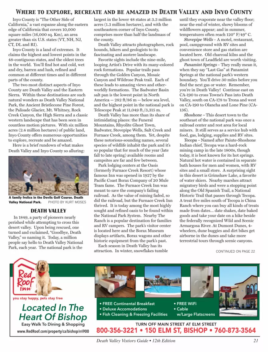
A family frolics in the Devils Golf Course. DeathValley National Park. PHOTO BY KURT MOSES
OWENS VALLEY
One of the earliest American explorersdescribed the Owens Valley as containing"ten thousand acres of fine grass." Today, itis mostly arid. As told in Marc Reisner’sbook, Cadillac Desert this once-fertilefarmland, populated with fruit trees, wasthe victim of California’s Water Wars of the1900s in which water rights to the OwensRiver were obtained by Los Angeles. Today,a third of LA’s water comes from the valleythrough the LA Aqueduct. Court rulingsand actions by the Los Angeles Departmentof Water and Power have helped restorefish habitat along the river, making it againone of the finest fly fishing streams in theWest.
Bishop – Calling itself a Small Town witha Big Backyard, Bishop is the hub forrecreation of all kinds, from rock climbingand bouldering in the famed AlabamaHills, to fishing in the Owens River, BishopCreek Canyon (also a fall colors hotspot)and various local lakes. Bishop is also thejumping off point for hikers seeking thesolitude of the numerous high Sierra trailsthat wander into the unspoiled wildernesswest of town, which also provides dramaticbackdrop and sunsets that cannot beforgotten.
The most populated town in Inyo County,Bishop also has the most number ofaccommodations and services. Bishopbegan as a ranching town. Later, ranchesevolved into pack stations with their sure-footed mules carrying the gear of fishermenand campers back into the Sierra. If anyanimal expresses the heart of Inyo County,it is the hard-working, intelligent, yetstubborn mule, which is honored annuallyduring Bishop’s “Mule Days.”
Long before the ranchers arrived, PaiuteShoshone people lived here. Theirreservation sits northwest of town and thePaiute Palace Casino adds excitement to astay in Bishop. Many of Bishop’s visitorsinclude a stop at the Owens Valley Paiute
Shoshone Cultural Center and Museum tolearn about the first inhabitants of the areaand to enjoy experiencing one of the tribe’scultural events.
Today, Bishop is the center of operationsfor the largest public utility in the nation,the Los Angeles Department of Water andPower, which provides water and power tothe nation’s most populated city andprovides access to the streams it managesfor fishing. Southern California Edison alsogot its start in Bishop, and continues tooperate hydroelectric power plants in theBishop Creek Drainage, and its efforts todam up streams and enlarge natural lakescreated a world-class string of fishing holes.
Big Pine – This small town prides itselfon being a gateway to the majestic SierraNevada and White Mountains. Drive eastand you find the Ancient Bristlecone PineForest. Drive west and you find trailheads
that lead to the Palisade Glacier andEastern Sierra. Outfitters run horsepacking trips to remote alpine lakes.Numerous fishing holes are found alongBig Pine Creek and the Baker Ponds. TheOwens River teems with trout, catfish andbass.
Independence – The county seat since1866, Independence is the center ofregional history with its historiccourthouse; the Edwards House, oldeststructure in the county; the Commander’sHouse, a century-old Victorian home; theMary Austin home (she wrote Land ofLittle Rain); and the Eastern CaliforniaMuseum, with its extensive exhibits,artifacts, photographs, native plant gardenand historic mining and farm equipment.Good fishing is found nearby atIndependence Creek, the Onion Valley and
22 Death Valley Vistiors Guide • 12th Edition
110044 EEaasstt SSyyddnnoorr AAvvee..RRiiddggeeccrreesstt,, CCAA 9933555555((776600)) 444466--11996688
111133 EE SSyyddnnoorr AAvveeRRiiddggeeccrreesstt,, CCAA 9933555555((776600)) 444466--11663300
CAliFONRiAS WESTERN GATEWAy TO DEATH VAllEy - STAy iN GREAT ROOM AT A GREAT PRiCE • ONly 72 MilES TO THE NATiONAl PARk
Stay for the Night • Stay for the WeekStay as long as you need.
We welcome all!
C o m e S t a y Wi t h Us • O v e r 1 0 0 RV H o o k u p s
520 S. Richmond Rd., Ridgecrest • (760) 375-8000
CONTINUED ON PAGE 23
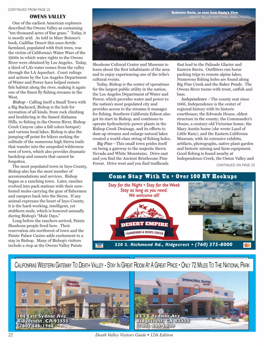
CONTINUED FROM PAGE 21Badwater Basin, as seen from Dante’s View.
DEATH VALLEY NATIONAL PARK PHOTO

along the Owens River. With a name likeIndependence, it’s understandable why thetown has one of the best Independence Dayparades with traditional early morning flagraising, pancake breakfast, fun run/walk,small-town parade, homemade ice creamand pie social, kids’ games, an arts andcrafts show, deep-pit barbecue and sunsetfireworks show.
Lone Pine – One of the most filmed andphotographed landscapes in the county isfound surrounding Lone Pine. West oftown are the Alabama Hills, named bylocals who were Southern sympathizersduring the American Civil War. Thiscollection of irregular, ruddy, windsweptboulders backed by a horizon of Sierrapeaks, has been the backdrop for about 400Hollywood films from “Gunga Din,” to“Gladiator,” to “Rawhide,” to “Iron Man.”It’s where Roy Rogers first mountedTrigger, where Tom Mix rode to the rescueand where Robert Downey Jr. got blownup. Lone Pine has been seen in so manymovies, that it has commemorated its fameby hosting the annual Lone Pine FilmFestival. The Lone Pine Museum ofWestern Film History preserves the motionpicture history of Inyo County with filmmemorabilia, cars, western carriages andan 84-seat theater.
Manzanar National Historic Site –During World War II, about 10,000 peopleof Japanese ancestry, about 60 percentbeing American citizens, were brought hereto the Manzanar War Relocation Center aspart of the “war hysteria” and racism thatswept America after the bombing of PearlHarbor. Manzanar was one of 10Relocation Centers that eventually heldabout 120,000 people of all ages ofJapanese descent for the duration of WWII. Finally, in the 1980s, the US governmentformally apologized to the internees fortheir imprisonment without charges. Thesite in now in the hands of the NationalPark Service. An interpretive center is
located in the camp’s former auditorium, anumber of replica barracks and buildingsoffer insights into camp life and a self-guided auto tours is offered.
EASTERN SIERRA
Mt. Whitney – On the east side of theGreat Western Divide, Mt. Whitney stands14,508 ft., the tallest mountain in thecontiguous United States. Hikers reach thesummit through Whitney Portal, 13 mileswest of Lone Pine. It’s a 10.7 mile hike andrequires planning, a wilderness permit andcareful attention to advisories regarding theprecautions of hiking at high altitudes,obtained within the Eastern SierraInterAgency Visitor’s Center, south of LonePine.
Palisade Glacier – The southernmostglacier in the U.S. and the largest in theSierra Nevada is located west of Big Pineand is visible from U.S. 395. The glaciersits at the base of Palisade Crest in theNorth Fork Basin. The scenery attractshikers to trails that follow the ancientglacier.
Rock Creek Canyon – Between Bishopand Mammoth Lakes is picture-perfectRock Creek Canyon. Rugged EasternSierra sawtooth peaks rise above emeraldmeadows, populated with fluttering aspensand cut my meandering clear streams.
Inyo National Forest and the John MuirWilderness – For complete retreat,backpack or take a mule pack trip to thehigh country, to dozens upon dozens ofremote glassine lakes with romantic nameslike Lake Helen of Troy, Elinore Lake,Moonlight Lake and the Treasure Lakes.You will understand why John Muir wrote,“Climb the mountains, and get their goodtidings.” Few experiences are asemotionally satiating as being in therarified air of the Eastern High Sierra insettings whose beauty defy description.
Sierra Bighorn Sheep - Three subspeciesof bighorn sheep live in the United States.You can see two of them within minutes of
one another in Inyo County, California.Sierra Bighorn can be seen in EasternSierra canyons. From U.S. 395, north ofBishop, follow Pine Creek Road throughRound Valley. In the last couple of milesbefore the road ends, look up to the northto see the buff-colored coats of the SierraBighorn Sheep as they graze among pinesand brush. You will be surprised how wellthey blend into the landscape and howdifficult it is, at first, to see them. Withpractice, it becomes easier. There are noformal tours to see the bighorn, howeverthe Bishop office of the CaliforniaDepartment of Fish and Game can explainhow best to see the elusive bighorns. Sometips: the Bighorn will not let you get closerthan a couple of hundred yards, so bringpowerful binoculars or a camera with atelephoto lens and enjoy seeing them froma distance.
WHITE MOUNTAINS
Ancient Bristlecone Forest – Thirty-sixmiles east of Big Pine in the WhiteMountains at elevations over 9,000 ft growthe oldest living trees. The oldest of them,Mehtuselah, is estimated to be nearly 4,800years old. Several groves of the venerabletrees can be seen. Exhibits at the visitorcenter at Schulman Grove describe thetrees. From Big Pine, travel east on CA-168to the Ancient Bristlecone Pine ForestScenic Byway.
Death Valley Vistiors Guide • 12th Edition 23
CONTINUED FROM PAGE 22
It’s always a good idea to take water and friendswhen hiking in Death Valley.
DEATH VALLEY NATIONAL PARK PHOTO

Your Oasis in the Desert


