Embed Size (px)
Citation preview
Journal of Heuristics, 7: 533–549, 2001c© 2001 Kluwer Academic Publishers. Manufactured in The Netherlands.
Effective Heuristics for the GPS Survey Networkof Malta: Simulated Annealing and TabuSearch Techniques
HUSSAIN AZIZ SALEHInstitut de Recherches Interdisciplinaires et de Developpements en Intelligence Artificielle, IRIDIA, CP 194/6,Universite’ Libre de Bruxelles, Avenue Franklin Roosevelt 50, 1050 Bruxelles, Belgiumemail: [email protected], http://iridia.ulb.ac.be
PETER DAREGeodetic Research Laboratory, Department of Geodesy and Geomatics Engineering, University of New Brunswick,Post Office Box 4400, Fredericton, New Brunswick, Canada, E3B 5A3email: [email protected], http://www.unb.ca/GGE/
Abstract
A GPS network can be defined as a set of stations, co-ordinated by a series of sessions formed by placing receiverson the stations. This paper shows how to search for the best order in which to observe these sessions givingthe cheapest schedule. The complexity of observing GPS networks increases with their size and become highlydifficult to solve effectively. To obtain good methods to solve this problem a new area of research is implemented.This area is based on developed heuristic techniques that provide an optimal or near optimal solution for largenetworks. Comparing their outcome in terms of solution quality and computational effort proves the performanceof the developed techniques.
Key Words: combinatorial optimisation problem (COP), global positioning system (GPS), heuristic, simulatedannealing (SA) and tabu search (TS)
1. Introduction
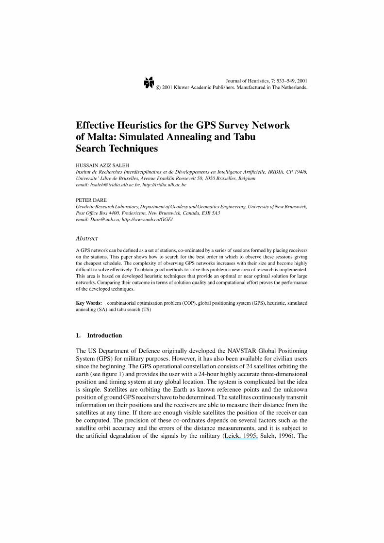
The US Department of Defence originally developed the NAVSTAR Global PositioningSystem (GPS) for military purposes. However, it has also been available for civilian userssince the beginning. The GPS operational constellation consists of 24 satellites orbiting theearth (see figure 1) and provides the user with a 24-hour highly accurate three-dimensionalposition and timing system at any global location. The system is complicated but the ideais simple. Satellites are orbiting the Earth as known reference points and the unknownposition of ground GPS receivers have to be determined. The satellites continuously transmitinformation on their positions and the receivers are able to measure their distance from thesatellites at any time. If there are enough visible satellites the position of the receiver canbe computed. The precision of these co-ordinates depends on several factors such as thesatellite orbit accuracy and the errors of the distance measurements, and it is subject tothe artificial degradation of the signals by the military (Leick, 1995; Saleh, 1996). The
534 SALEH AND DARE
Figure 1. GPS satellite constellation (from Elliott, 1996).
above processes, which are involved in GPS surveying, provide unprecedented accuracyat an economical rate compared to other surveying techniques. On the other hand, usingthe GPS technique is highly expensive and this becomes crucial as the amount of workincreases for large networks. To maximise the benefit of using this system, a new area ofresearch that tries to provide near-optimal solutions for large networks within an acceptableamount of computational effort has been implemented. This research is based on heuristictechniques within the field of Operational Research (OR) (Saleh and Dare, 1997a, 1997b;Dare and Saleh, 1997). These techniques have been developed to allow the formulation ofa strategy for designing GPS networks, which maximise the GPS technology benefit byreducing the total cost of carrying out the work.
This paper modifies and applies new heuristic techniques and investigates their perfor-mance to the GPS surveying problem. Section 2 describes the GPS problem as a Com-binatorial Optimisation Problem (COP). Section 3 reviews the relevant literature of exactalgorithms applied to GPS surveying networks. In Section 4 the new Simulated Anneal-ing (SA) and Tabu Search (TS) methods are discussed and their basic structures for aGPS surveying network are formulated. Testing of the developed algorithms takes placein Section 5 by comparing their performances with results obtained using exact methods.Also in Section 5 comparisons of the heuristic solutions are presented. The paper endswith conclusions and some remarks. Also for future work, another heuristic algorithms arerecommended on the basis of the performance comparison.
2. The formulation of the GPS survey network problem
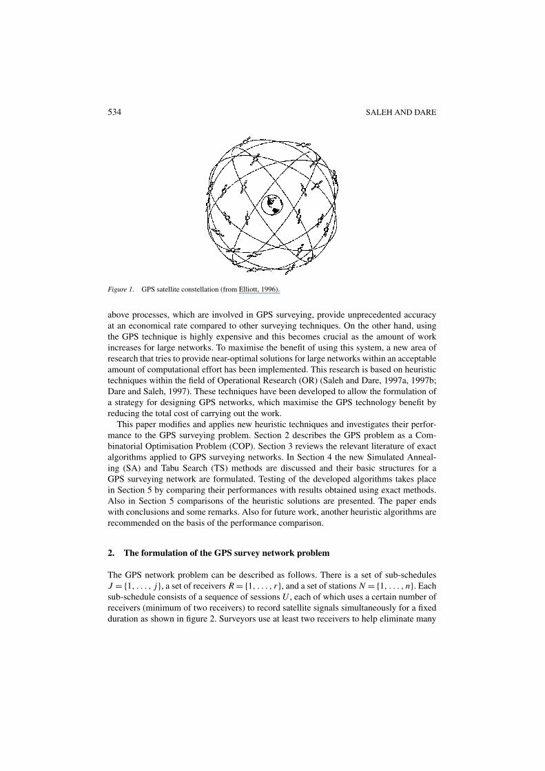
The GPS network problem can be described as follows. There is a set of sub-schedulesJ = {1, . . . , j}, a set of receivers R = {1, . . . , r}, and a set of stations N = {1, . . . , n}. Eachsub-schedule consists of a sequence of sessions U , each of which uses a certain number ofreceivers (minimum of two receivers) to record satellite signals simultaneously for a fixedduration as shown in figure 2. Surveyors use at least two receivers to help eliminate many
EFFECTIVE HEURISTICS FOR THE GPS SURVEY NETWORK OF MALTA 535
Figure 2. Observation of Sessions using GPS receivers.
536 SALEH AND DARE
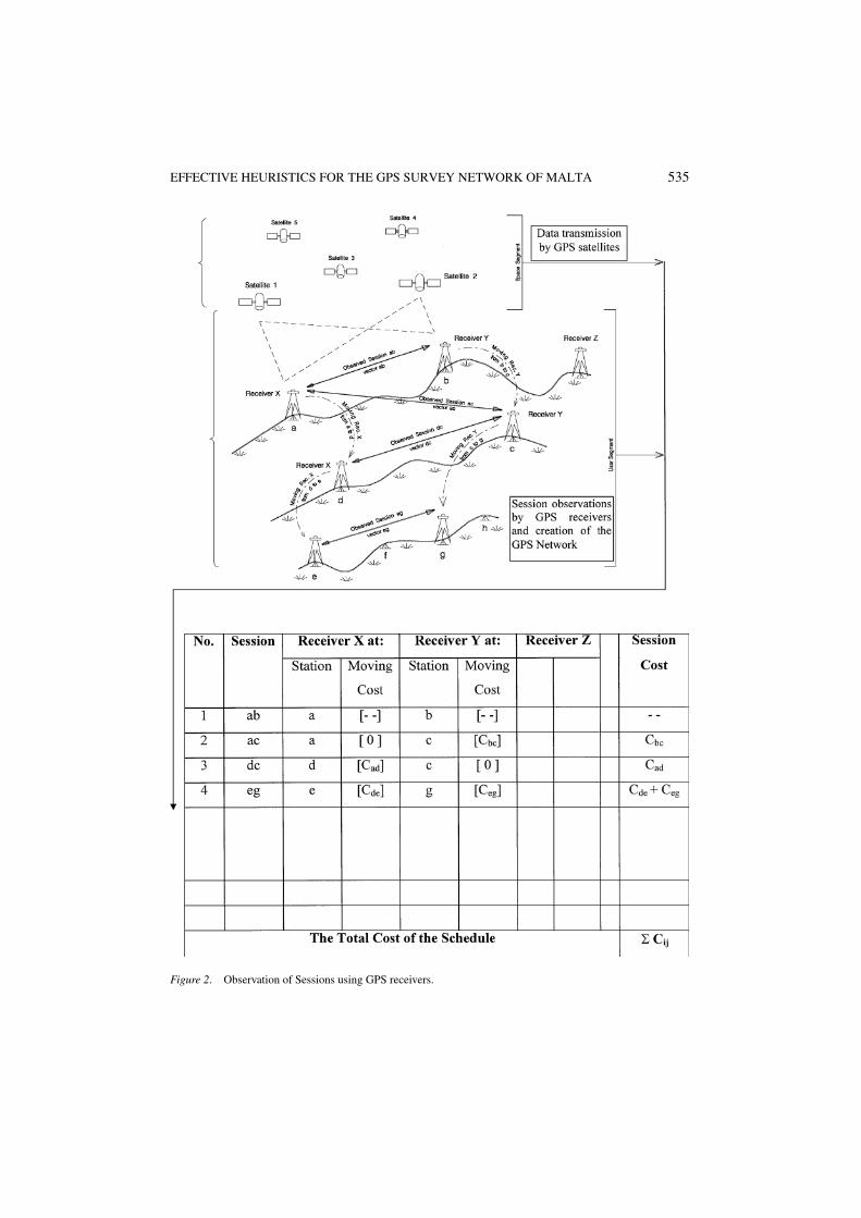
Figure 3. The Wild GPS System 200 receiver.
sources of errors (Teunissen and Kleusberg, 1998). Each receiver (X, Y, Z, etc.) can observeat most one station (a, b, c, d, e, f, etc.) at a time. A typical GPS receiver for such use is theWild GPS System 200 receiver as shown in figure 3.
Given that a schedule is an ordered list of sessions, the problem addressed is to search forthe best order in which these sessions can be organised—this gives the schedule of minimalcost to complete all the sessions. In practice this means determining how each GPS receivershould be moved between stations to be surveyed in an efficient manner taking into accountimportant factors such as time, cost etc. To represent the GPS surveying problem within theframe of heuristics, the following notations are used:
J : the set of sub-schedules J = {1, . . . , j};N : the set of stations N = {1, . . . , n};n: the number of stations;
EFFECTIVE HEURISTICS FOR THE GPS SURVEY NETWORK OF MALTA 537
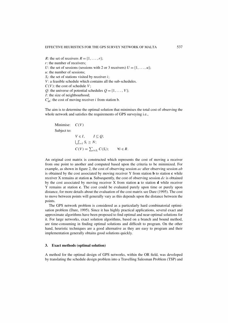
R: the set of receivers R = {1, . . . , r};r : the number of receivers;U : the set of sessions (sessions with 2 or 3 receivers) U = {1, . . . , u};u: the number of sessions;Si : the set of stations visited by receiver i ;V : a feasible schedule which contains all the sub-schedules.C(V ): the cost of schedule V ;Q: the universe of potential schedules Q = {1, . . . , V };I : the size of neighbourhood;Ci
ab: the cost of moving receiver i from station b.
The aim is to determine the optimal solution that minimises the total cost of observing thewhole network and satisfies the requirements of GPS surveying i.e.,
Minimise: C(V )
Subject to:
V ∈ I, I ⊆ Q;⋃ri=1 Si ≥ N ;
C(V ) = ∑i∈Si
C(Si ); ∀i ∈ R.
An original cost matrix is constructed which represents the cost of moving a receiverfrom one point to another and computed based upon the criteria to be minimized. Forexample, as shown in figure 2, the cost of observing session ac after observing session abis obtained by the cost associated by moving receiver Y from station b to station c whilereceiver X remains at station a. Subsequently, the cost of observing session dc is obtainedby the cost associated by moving receiver X from station a to station d while receiverY remains at station c. The cost could be evaluated purely upon time or purely upondistance, for more details about the evaluation of the cost matrix see Dare (1995). The costto move between points will generally vary as this depends upon the distance between thepoints.
The GPS network problem is considered as a particularly hard combinatorial optimi-sation problem (Dare, 1995). Since it has highly practical applications, several exact andapproximate algorithms have been proposed to find optimal and near-optimal solutions forit. For large networks, exact solution algorithms, based on a branch and bound method,are time-consuming in finding optimal solutions and difficult to program. On the otherhand, heuristic techniques are a good alternative as they are easy to program and theirimplementation generally obtains good solutions quickly.
3. Exact methods (optimal solution)
A method for the optimal design of GPS networks, within the OR field, was developedby translating the schedule design problem into a Travelling Salesman Problem (TSP) and
538 SALEH AND DARE
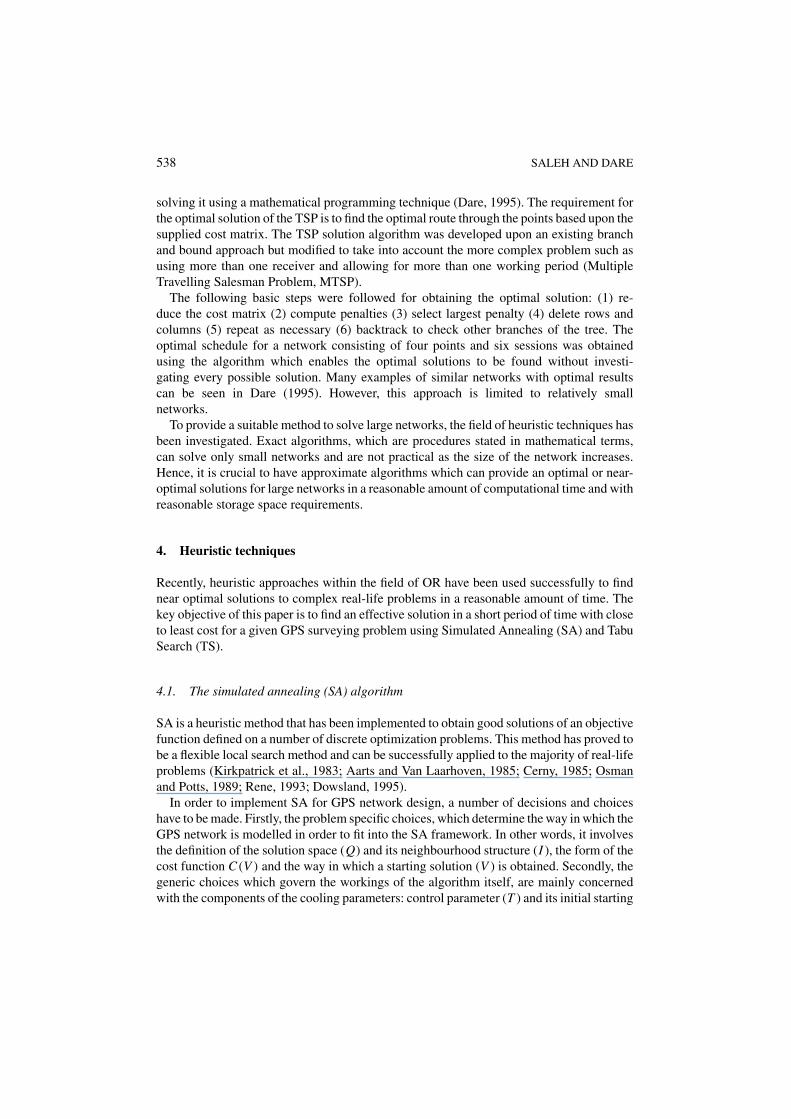
solving it using a mathematical programming technique (Dare, 1995). The requirement forthe optimal solution of the TSP is to find the optimal route through the points based upon thesupplied cost matrix. The TSP solution algorithm was developed upon an existing branchand bound approach but modified to take into account the more complex problem such asusing more than one receiver and allowing for more than one working period (MultipleTravelling Salesman Problem, MTSP).
The following basic steps were followed for obtaining the optimal solution: (1) re-duce the cost matrix (2) compute penalties (3) select largest penalty (4) delete rows andcolumns (5) repeat as necessary (6) backtrack to check other branches of the tree. Theoptimal schedule for a network consisting of four points and six sessions was obtainedusing the algorithm which enables the optimal solutions to be found without investi-gating every possible solution. Many examples of similar networks with optimal resultscan be seen in Dare (1995). However, this approach is limited to relatively smallnetworks.
To provide a suitable method to solve large networks, the field of heuristic techniques hasbeen investigated. Exact algorithms, which are procedures stated in mathematical terms,can solve only small networks and are not practical as the size of the network increases.Hence, it is crucial to have approximate algorithms which can provide an optimal or near-optimal solutions for large networks in a reasonable amount of computational time and withreasonable storage space requirements.
4. Heuristic techniques
Recently, heuristic approaches within the field of OR have been used successfully to findnear optimal solutions to complex real-life problems in a reasonable amount of time. Thekey objective of this paper is to find an effective solution in a short period of time with closeto least cost for a given GPS surveying problem using Simulated Annealing (SA) and TabuSearch (TS).
4.1. The simulated annealing (SA) algorithm
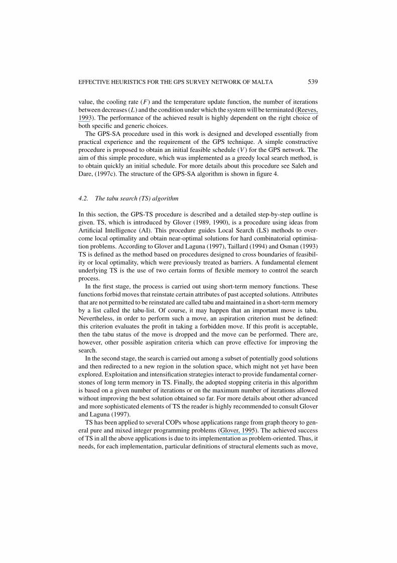
SA is a heuristic method that has been implemented to obtain good solutions of an objectivefunction defined on a number of discrete optimization problems. This method has proved tobe a flexible local search method and can be successfully applied to the majority of real-lifeproblems (Kirkpatrick et al., 1983; Aarts and Van Laarhoven, 1985; Cerny, 1985; Osmanand Potts, 1989; Rene, 1993; Dowsland, 1995).
In order to implement SA for GPS network design, a number of decisions and choiceshave to be made. Firstly, the problem specific choices, which determine the way in which theGPS network is modelled in order to fit into the SA framework. In other words, it involvesthe definition of the solution space (Q) and its neighbourhood structure (I ), the form of thecost function C(V ) and the way in which a starting solution (V ) is obtained. Secondly, thegeneric choices which govern the workings of the algorithm itself, are mainly concernedwith the components of the cooling parameters: control parameter (T ) and its initial starting
EFFECTIVE HEURISTICS FOR THE GPS SURVEY NETWORK OF MALTA 539
value, the cooling rate (F) and the temperature update function, the number of iterationsbetween decreases (L) and the condition under which the system will be terminated (Reeves,1993). The performance of the achieved result is highly dependent on the right choice ofboth specific and generic choices.
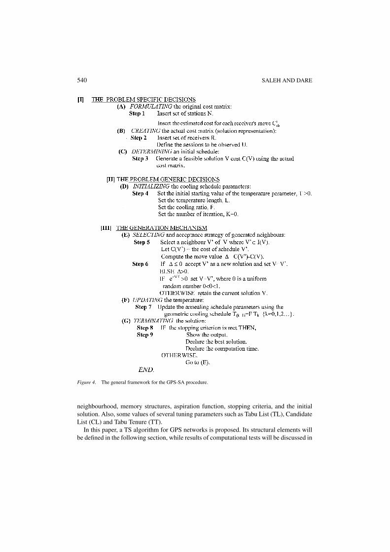
The GPS-SA procedure used in this work is designed and developed essentially frompractical experience and the requirement of the GPS technique. A simple constructiveprocedure is proposed to obtain an initial feasible schedule (V ) for the GPS network. Theaim of this simple procedure, which was implemented as a greedy local search method, isto obtain quickly an initial schedule. For more details about this procedure see Saleh andDare, (1997c). The structure of the GPS-SA algorithm is shown in figure 4.
4.2. The tabu search (TS) algorithm
In this section, the GPS-TS procedure is described and a detailed step-by-step outline isgiven. TS, which is introduced by Glover (1989, 1990), is a procedure using ideas fromArtificial Intelligence (AI). This procedure guides Local Search (LS) methods to over-come local optimality and obtain near-optimal solutions for hard combinatorial optimisa-tion problems. According to Glover and Laguna (1997), Taillard (1994) and Osman (1993)TS is defined as the method based on procedures designed to cross boundaries of feasibil-ity or local optimality, which were previously treated as barriers. A fundamental elementunderlying TS is the use of two certain forms of flexible memory to control the searchprocess.
In the first stage, the process is carried out using short-term memory functions. Thesefunctions forbid moves that reinstate certain attributes of past accepted solutions. Attributesthat are not permitted to be reinstated are called tabu and maintained in a short-term memoryby a list called the tabu-list. Of course, it may happen that an important move is tabu.Nevertheless, in order to perform such a move, an aspiration criterion must be defined:this criterion evaluates the profit in taking a forbidden move. If this profit is acceptable,then the tabu status of the move is dropped and the move can be performed. There are,however, other possible aspiration criteria which can prove effective for improving thesearch.
In the second stage, the search is carried out among a subset of potentially good solutionsand then redirected to a new region in the solution space, which might not yet have beenexplored. Exploitation and intensification strategies interact to provide fundamental corner-stones of long term memory in TS. Finally, the adopted stopping criteria in this algorithmis based on a given number of iterations or on the maximum number of iterations allowedwithout improving the best solution obtained so far. For more details about other advancedand more sophisticated elements of TS the reader is highly recommended to consult Gloverand Laguna (1997).
TS has been applied to several COPs whose applications range from graph theory to gen-eral pure and mixed integer programming problems (Glover, 1995). The achieved successof TS in all the above applications is due to its implementation as problem-oriented. Thus, itneeds, for each implementation, particular definitions of structural elements such as move,
540 SALEH AND DARE
Figure 4. The general framework for the GPS-SA procedure.
neighbourhood, memory structures, aspiration function, stopping criteria, and the initialsolution. Also, some values of several tuning parameters such as Tabu List (TL), CandidateList (CL) and Tabu Tenure (TT).
In this paper, a TS algorithm for GPS networks is proposed. Its structural elements willbe defined in the following section, while results of computational tests will be discussed in
EFFECTIVE HEURISTICS FOR THE GPS SURVEY NETWORK OF MALTA 541
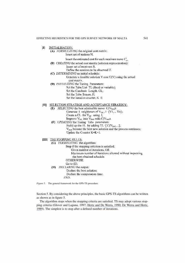
Figure 5. The general framework for the GPS-TS procedure.
Section 5. By considering the above principles, the basic GPS-TS algorithms can be writtenas shown as in figure 5.
The algorithm stops when the stopping criteria are satisfied. TS may adopt various stop-ping criteria (Glover and Laguna, 1997; Hertz and De Werra, 1990; De Werra and Hertz,1989). The simplest is to stop after a defined number of iterations.
542 SALEH AND DARE
5. Computational results
It is most desirable to test and evaluate the proposed heuristic algorithms by comparisonswith optimal solutions in respect to the solution quality and computational effort. The bestknown solutions obtained for the GPS surveying problem were those determined using amodified TSP algorithm and therefore computing the optimal value (Dare, 1995). A commonmeasure to decide on the quality of a heuristic solution Vheur is the relative percentagedeviation from the optimal solution Vbest. The Relative Percentage Deviation (RPD), whichis taken as performance measure, is computed as follows:
RPD = 100 ×{
Vheur−Vbest
Vbest
}
The near-optimal schedules obtained using GPS-SA and GPS-TS heuristic techniqueshad the same result as the known optimal solutions (Saleh and Dare, 1997c, 1998a, 1998c)giving an RPD of zero.
The neighbourhood sequential search structure for generating new schedules as describedby Lin (1965) has been adopted. In this structure, which is based on sessions-interchange,the potential pair-swaps are examined in the order (1, 2), (1, 3), . . . , (1, n), (2, 3), . . . ,(n − 1, n), (1, 2), etc. The change in cost is computed and the swap is accepted or rejectedaccording to the acceptance strategy of the implemented GPS-heuristics techniques. Thisstrategy examines the schedules in the generated neighbourhood of the current scheduleand accepts the best one according to a given acceptance criterion. Both the GPS-SA andGPS-TS techniques were tested on hypothetical and actual GPS networks with knownoptimal schedules obtained using the MTSP (Dare, 1995). From the above, the ability ofthe developed GPS-heuristic techniques to generate, rapidly, high-quality schedules fordesigning the GPS networks can be seen.
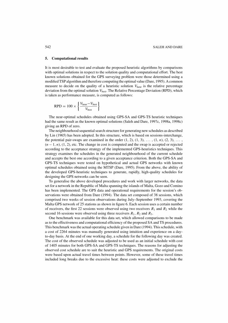
To generalise the above developed procedures and work with larger networks, the dataset for a network in the Republic of Malta spanning the islands of Malta, Gozo and Cominohas been implemented. The GPS data and operational requirements for the session’s ob-servations were obtained from Dare (1994). The data set composed of 38 sessions, whichcomprised two weeks of session observations during July–September 1993, covering theMalta GPS network of 25 stations as shown in figure 6. Each session uses a certain numberof receivers, the first 22 sessions were observed using two receivers R1 and R2 while thesecond 16 sessions were observed using three receivers R1, R2 and R3.
One benchmark was available for this data set, which allowed comparisons to be madeas to the effectiveness and computational efficiency of the proposed SA and TS procedures.This benchmark was the actual operating schedule given in Dare (1994). This schedule, witha cost of 2264 minutes was manually generated using intuition and experience on a day-to-day basis. At the end of one working day, a schedule for the following day was created.The cost of the observed schedule was adjusted to be used as an initial schedule with costof 1405 minutes for both GPS-SA and GPS-TS techniques. The reasons for adjusting theobserved cost schedule are to suit the heuristic and GPS requirements. The original costswere based upon actual travel times between points. However, some of these travel timesincluded long breaks due to the excessive heat: these costs were adjusted to exclude the
EFFECTIVE HEURISTICS FOR THE GPS SURVEY NETWORK OF MALTA 543
Figure 6. Malta GPS survey network (from Dare, 1994).
stops by simple subtraction. Without this subtraction, some cheap session changes would beexcluded from the solution due to the apparently high cost. A further adjustment was madeaccording to the GPS requirement to differentiate between sessions with two receivers andsessions with three receivers. They were arranged into sub-schedules. Thus effectively, thesessions have been partitioned into two distinct types.
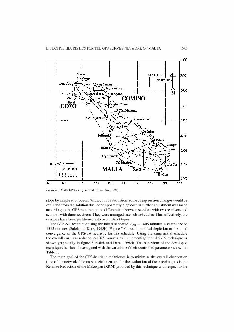
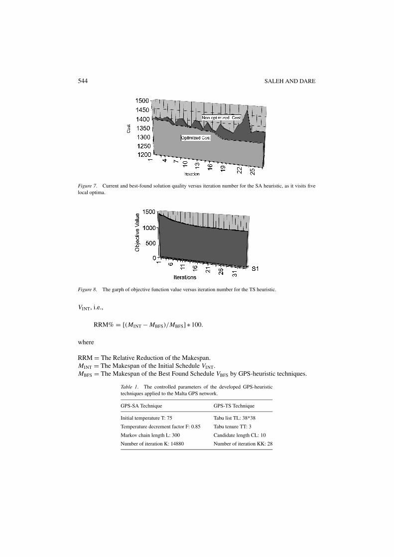
The GPS-SA technique using the initial schedule VINT = 1405 minutes was reduced to1325 minutes (Saleh and Dare, 1998b). Figure 7 shows a graphical depiction of the rapidconvergence of the GPS-SA heuristic for this schedule. Using the same initial schedulethe overall cost was reduced to 1075 minutes by implementing the GPS-TS technique asshown graphically in figure 8 (Saleh and Dare, 1998d). The behaviour of the developedtechniques has been investigated with the variation of their controlled parameters shown inTable 1.
The main goal of the GPS-heuristic techniques is to minimise the overall observationtime of the network. The most useful measure for the evaluation of these techniques is theRelative Reduction of the Makespan (RRM) provided by this technique with respect to the
544 SALEH AND DARE
Figure 7. Current and best-found solution quality versus iteration number for the SA heuristic, as it visits fivelocal optima.
Figure 8. The garph of objective function value versus iteration number for the TS heuristic.
VINT, i.e.,
RRM% = [(MINT − MBFS)/MBFS] ∗ 100.
where
RRM = The Relative Reduction of the Makespan.MINT = The Makespan of the Initial Schedule VINT.MBFS = The Makespan of the Best Found Schedule VBFS by GPS-heuristic techniques.
Table 1. The controlled parameters of the developed GPS-heuristictechniques applied to the Malta GPS network.
GPS-SA Technique GPS-TS Technique
Initial temperature T: 75 Tabu list TL: 38*38
Temperature decrement factor F: 0.85 Tabu tenure TT: 3
Markov chain length L: 300 Candidate length CL: 10
Number of iteration K: 14880 Number of iteration KK: 28
EFFECTIVE HEURISTICS FOR THE GPS SURVEY NETWORK OF MALTA 545
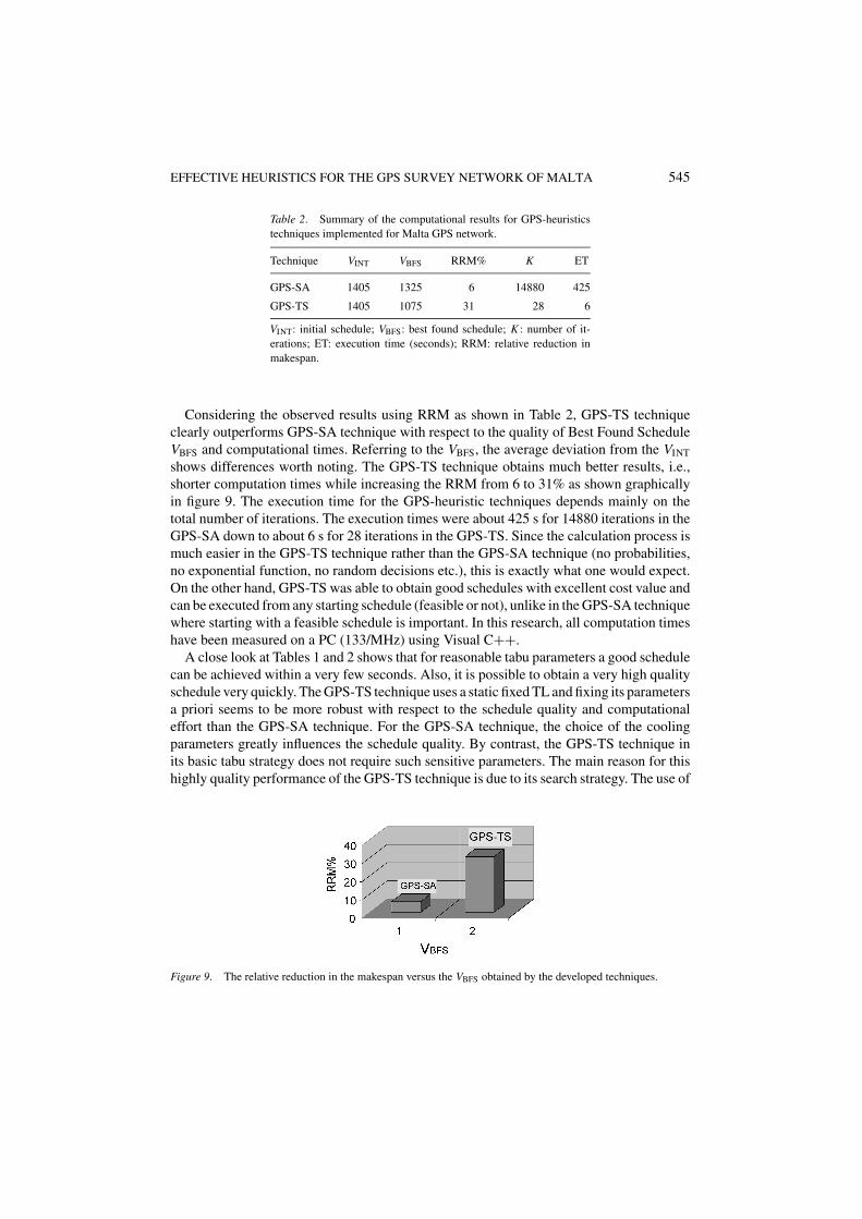
Table 2. Summary of the computational results for GPS-heuristicstechniques implemented for Malta GPS network.
Technique VINT VBFS RRM% K ET
GPS-SA 1405 1325 6 14880 425
GPS-TS 1405 1075 31 28 6
VINT: initial schedule; VBFS: best found schedule; K : number of it-erations; ET: execution time (seconds); RRM: relative reduction inmakespan.
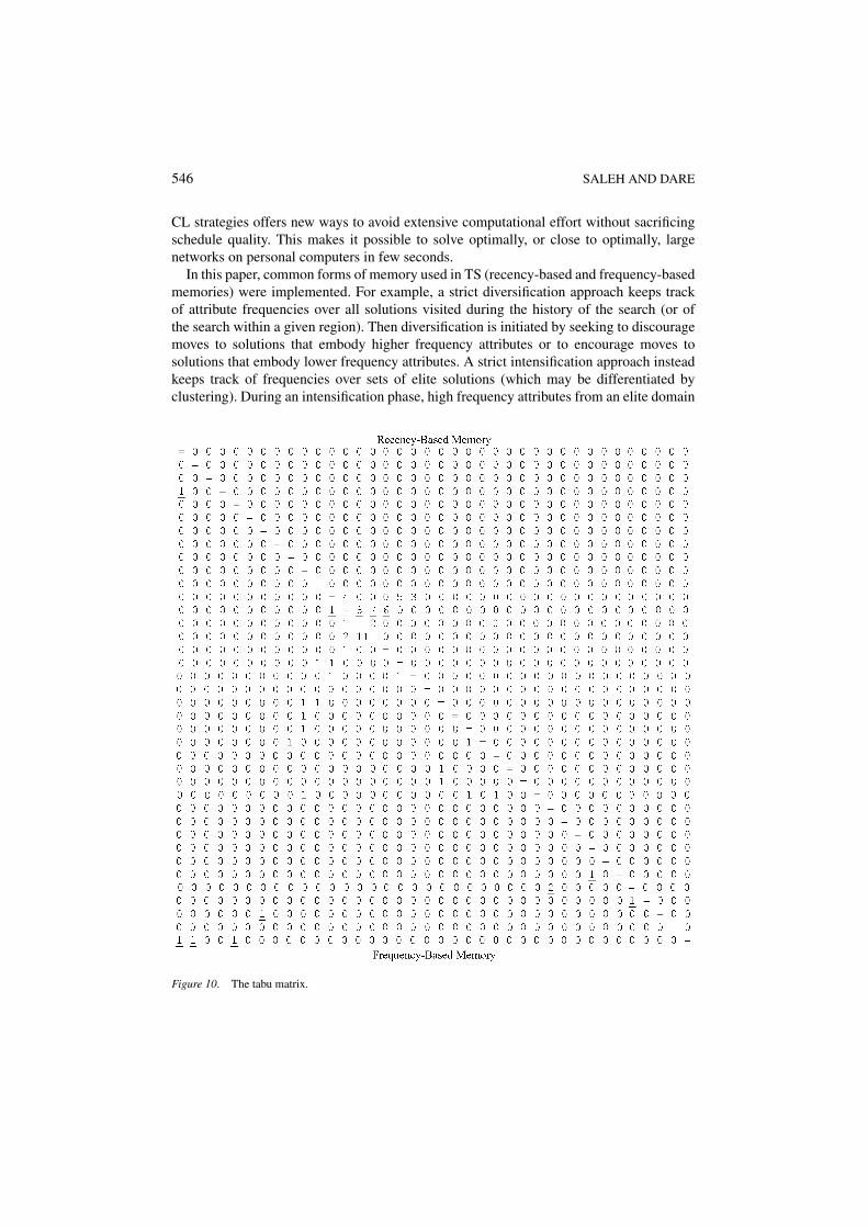
Considering the observed results using RRM as shown in Table 2, GPS-TS techniqueclearly outperforms GPS-SA technique with respect to the quality of Best Found ScheduleVBFS and computational times. Referring to the VBFS, the average deviation from the VINT
shows differences worth noting. The GPS-TS technique obtains much better results, i.e.,shorter computation times while increasing the RRM from 6 to 31% as shown graphicallyin figure 9. The execution time for the GPS-heuristic techniques depends mainly on thetotal number of iterations. The execution times were about 425 s for 14880 iterations in theGPS-SA down to about 6 s for 28 iterations in the GPS-TS. Since the calculation process ismuch easier in the GPS-TS technique rather than the GPS-SA technique (no probabilities,no exponential function, no random decisions etc.), this is exactly what one would expect.On the other hand, GPS-TS was able to obtain good schedules with excellent cost value andcan be executed from any starting schedule (feasible or not), unlike in the GPS-SA techniquewhere starting with a feasible schedule is important. In this research, all computation timeshave been measured on a PC (133/MHz) using Visual C++.
A close look at Tables 1 and 2 shows that for reasonable tabu parameters a good schedulecan be achieved within a very few seconds. Also, it is possible to obtain a very high qualityschedule very quickly. The GPS-TS technique uses a static fixed TL and fixing its parametersa priori seems to be more robust with respect to the schedule quality and computationaleffort than the GPS-SA technique. For the GPS-SA technique, the choice of the coolingparameters greatly influences the schedule quality. By contrast, the GPS-TS technique inits basic tabu strategy does not require such sensitive parameters. The main reason for thishighly quality performance of the GPS-TS technique is due to its search strategy. The use of
Figure 9. The relative reduction in the makespan versus the VBFS obtained by the developed techniques.
546 SALEH AND DARE
CL strategies offers new ways to avoid extensive computational effort without sacrificingschedule quality. This makes it possible to solve optimally, or close to optimally, largenetworks on personal computers in few seconds.
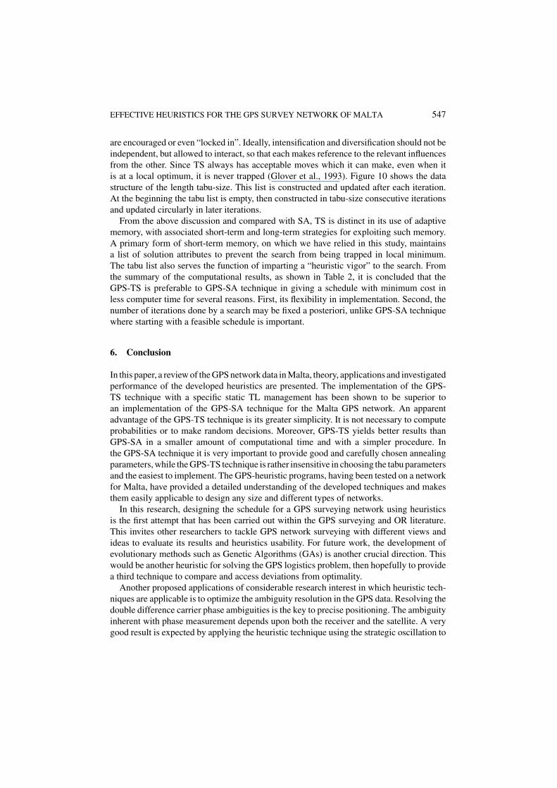
In this paper, common forms of memory used in TS (recency-based and frequency-basedmemories) were implemented. For example, a strict diversification approach keeps trackof attribute frequencies over all solutions visited during the history of the search (or ofthe search within a given region). Then diversification is initiated by seeking to discouragemoves to solutions that embody higher frequency attributes or to encourage moves tosolutions that embody lower frequency attributes. A strict intensification approach insteadkeeps track of frequencies over sets of elite solutions (which may be differentiated byclustering). During an intensification phase, high frequency attributes from an elite domain
Figure 10. The tabu matrix.
EFFECTIVE HEURISTICS FOR THE GPS SURVEY NETWORK OF MALTA 547
are encouraged or even “locked in”. Ideally, intensification and diversification should not beindependent, but allowed to interact, so that each makes reference to the relevant influencesfrom the other. Since TS always has acceptable moves which it can make, even when itis at a local optimum, it is never trapped (Glover et al., 1993). Figure 10 shows the datastructure of the length tabu-size. This list is constructed and updated after each iteration.At the beginning the tabu list is empty, then constructed in tabu-size consecutive iterationsand updated circularly in later iterations.
From the above discussion and compared with SA, TS is distinct in its use of adaptivememory, with associated short-term and long-term strategies for exploiting such memory.A primary form of short-term memory, on which we have relied in this study, maintainsa list of solution attributes to prevent the search from being trapped in local minimum.The tabu list also serves the function of imparting a “heuristic vigor” to the search. Fromthe summary of the computational results, as shown in Table 2, it is concluded that theGPS-TS is preferable to GPS-SA technique in giving a schedule with minimum cost inless computer time for several reasons. First, its flexibility in implementation. Second, thenumber of iterations done by a search may be fixed a posteriori, unlike GPS-SA techniquewhere starting with a feasible schedule is important.
6. Conclusion
In this paper, a review of the GPS network data in Malta, theory, applications and investigatedperformance of the developed heuristics are presented. The implementation of the GPS-TS technique with a specific static TL management has been shown to be superior toan implementation of the GPS-SA technique for the Malta GPS network. An apparentadvantage of the GPS-TS technique is its greater simplicity. It is not necessary to computeprobabilities or to make random decisions. Moreover, GPS-TS yields better results thanGPS-SA in a smaller amount of computational time and with a simpler procedure. Inthe GPS-SA technique it is very important to provide good and carefully chosen annealingparameters, while the GPS-TS technique is rather insensitive in choosing the tabu parametersand the easiest to implement. The GPS-heuristic programs, having been tested on a networkfor Malta, have provided a detailed understanding of the developed techniques and makesthem easily applicable to design any size and different types of networks.
In this research, designing the schedule for a GPS surveying network using heuristicsis the first attempt that has been carried out within the GPS surveying and OR literature.This invites other researchers to tackle GPS network surveying with different views andideas to evaluate its results and heuristics usability. For future work, the development ofevolutionary methods such as Genetic Algorithms (GAs) is another crucial direction. Thiswould be another heuristic for solving the GPS logistics problem, then hopefully to providea third technique to compare and access deviations from optimality.
Another proposed applications of considerable research interest in which heuristic tech-niques are applicable is to optimize the ambiguity resolution in the GPS data. Resolving thedouble difference carrier phase ambiguities is the key to precise positioning. The ambiguityinherent with phase measurement depends upon both the receiver and the satellite. A verygood result is expected by applying the heuristic technique using the strategic oscillation to
548 SALEH AND DARE
locate a high quality and feasible solution to resolve the ambiguity (Kelly et al., 1993) and(Dammeyer and Voss, 1993). The dynamic nature of the heuristic techniques such as in theTS suits the nature of resolving the ambiguity in real time.
Acknowledgments
This research was supported by both the Ministry of Higher Education, Syria and by a MarieCurie Fellowship awarded to Hussain Saleh (CEC-IHP Contract N. HpmFCT-2000-00494).We thank Dr Brian Whiting for his help in C++ programming, Dr Michael Peel for hisadvice and Richard Latham for preparing figure 2; all are at the University of East London.We also wish to acknowledge the helpful advice and comments of Mr. E.J. Board.
Disclaimer: The information provided in this paper is the sole responsibility of the authorsand does not reflect the European Commission’s opinion. The Commission is not responsiblefor any use that might be made of data appearing in this publication.
References
Aarts, E. and P. Van Laarhoven. (1985). “Statistical Cooling: A General Approach to Combinatorial OptimizationProblems.” Philips Journal of Research 40, 193–226.
Cerny, V. (1985). “A Thermodynamical Approach to the Travelling Salesman Problem: An Efficient SimulatedAnnealing Algorithm.” Journal of Optimization Theory and Applications 45, 41–51.
Dammeyer, F. and S. Voss. (1993). “Dynamic Tabu List Management Using the Reverse Elimination Method.”Annals of Operations Research 41, 31–46.
Dare, P.J. (1994). “Project Malta’ 93: The Establishment of a New Primary Network for the Republic of Malta byUse of the Global Positioning System.” Report for Mapping Unit, Planning Directorate, Floriana, Malta.
Dare, P.J. (1995). “Optimal Design of GPS Networks: Operational Procedures.” Ph.D. Thesis, School of Surveying,University of East London, UK.
Dare, P. and H. Saleh. (1998). “The Use of Heuristics in the Design of GPS Networks.” In F. Brunner (ed.),Advances in Positioning and Reference Frames, Proceedings of the Scientific Assembly of the InternationalAssociation of Geodesy, Rio de Janeiro, Brazil, September 8, 1997. New York: Springer Verlag, pp. 120–124.
De Werra, D. and A. Hertz. (1989). TS Techniques: A Tutorial and an Application to Neural Networks, ORSpektrum, Vol. 11. Berlin: Springer-Verlag, pp. 131–141.
Dowsland, K. (1995). “Variants of Simulated Annealing for Practical Problem Solving.” In V. Rayward-Smith(ed.), Applications of Modern Heuristic Methods. Henley-on-Thames: Alfred Waller Ltd., in association withUNICOM.
Elliott, D. (1996). Understanding GPS: Principles & Applications. Boston; Artech House.Glover, F. (1989). “Tabu Search Part I.” ORAS J. Comput. 1(3), 190–206.Glover, F. (1990). “Tabu Search Part II.” ORAS J. Comput. 2(1), 4–32.Glover, F. (1995). “Tabu Search Fundamentals and Uses.” Technical Report, Graduate School of Business,
University of Colorado, Boulder.Glover, F. and M. Laguna. (1997). Tabu Search. Norwell, MA: Kluwer Academic Publishers.Glover, F., E. Taillard, and D. de Werra. (1993). “A Users Guide to Tabu Search.” Annals of Operations Research
41, 3–28.Hertz, A. and D. De Werra. (1990). “The Tabu Search Meta-heuristic: How We Used It.” Annals of Mathematics
and Artificial Intelligence 1, 111–121.Kelly, J., B. Golden, and A. Assad. (1993). “Large-Scale Controlled Rounding using TS with Strategic Oscillation.”
Annals of OR 41, 69–84.
EFFECTIVE HEURISTICS FOR THE GPS SURVEY NETWORK OF MALTA 549
Kirkpatrick, S., C.D. Gelatt, and P.M. Vecchi. (1983). “Optimization by Simulated Annealing.” Science 220,671–680.
Leick, A. (1995). GPS Satellite Surveying, 2nd ed. Chichester. England: Wiley.Lin, S. (1965). “Computer Solutions of the Travelling Salesman Problem.” Bell System Technical Journal 44,
2245–2269.Osman, I.H. (1993). “Metastrategy Simulated Annealing and Tabu Search Algorithm for the Vehicle Routing
Problem.” Annals of OR 41, 421–451.Osman, I.H. and C.N. Potts. (1989). “Simulated Annealing for Permutation Flow-Shop Scheduling.” Omega 17,
551–557.Reeves, C.R. (ed.). (1993). Modern Heuristic Techniques for Combinatorial Problems. Oxford, England: Blackwell
Scientific Publications.Rene, V.V. Vidal. (1993). Applied Simulated Annealing. Berlin: Springer-Verlag.Saleh, H.A. (1996). “Improvements to The GPSdemoUCL Simulation Software.” MSc. Dissertation in Surveying,
Department of Geomatic Engineering, University College London, London, UK.Saleh, H.A. and P.J. Dare. (1997a). “A Heuristic Approach to the Design of GPS Networks.” Paper presented at
Untied Kingdom Geophysical Assembly-21, University of Southampton, UK, 2–4 April 1997.Saleh, H.A. and P.J. Dare. (1997b). “The Design of GPS Networks using the Heuristic Techniques.” Paper presented
at Young Researchers Forum in Operational Research and Management Science, University of Southampton,UK, and 17–18 April 1997.
Saleh, H.A. and P.J. Dare. (1997c). “A Simulated Annealing Approach for Designing a GPS surveying Net-work.” Paper presented at 2nd Meta-Heuristic International Conference (MIC’97), Sophia-Antipolis, France,21–24 July 1997.
Saleh, H.A. and P.J. Dare. (1998a). “Efficient Simulated Annealing Heuristic Techniques for Designing GPSSurveying Networks.” Paper presented at Young OR10 Conference, University of Surrey, Guildford, UK,31 March to 2 April 1998.
Saleh, H.A. and P.J. Dare. (1998b). “GPS Network Design An Application of The Simulated Annealing HeuristicTechnique.” Paper presented at International Conference on Combinatorial and Global Optimization, Chania,Crete, Greece, 25–29, May 1998.
Saleh, H.A. and P.J. Dare. (1998c). “Heuristic Techniques for GPS Surveying.” Paper presented at UEL Postgrad-uate Conference, University of East London, Startford, UK, 5 June 1998.
Saleh, H.A. and P.J. Dare. (1998d). “A Tabu Search Approach for Designing a GPS Surveying Network for theRepublic of Malta.” Paper presented at 16th European Conference on Operational Research, Brussels, Belguim,12–15 July 1998.
Taillard, E. (1994). “Parallel Taboo Search Techniques for the Job Shop Scheduling Problem.” ORSA, Journal onComputing 6, 108–117.
Teunissen, P. and A. Kleusberg. (1998). GPS for Geodesy, 2nd ed. Berlin: Springer-Verlag.


